

Cliffs, Castles and Cork
Es war ein schönes Erwachen, so nahe an der Klippe und am Meer zu sein. Der Wind wehte ziemlich zügig in der Nacht, ansonsten war es ruhig. An diesem Tag fuhren wir aber...
Veröffentlicht: 22.05.2023



Seit dem letzten Eintrag sind wieder ein paar Tage vergangen und es gibt einiges zu erzählen. Deswegen gibt es eine Kurzfassung und eine lange Version für die, die es detaillierter mögen.
«Kurz»:
Bei unserer Ankunft in Killarney haben wir uns entschieden, eine Tagestour über einen Tourenanbieter zu buchen. Dieser bestand daraus, erst mit dem Boot vom Ross Castle eine Stunde lang über zwei Seen und zwei Flüsse zu fahren, danach entweder mit Pony und Kutsche über den Pass Gap of Dunloe zu fahren oder die 2.5 Stunden darüber zu laufen. Wir haben uns fürs Laufen entschieden. Anschliessend konnte man sich am Ziel mit Kaffee und Kuchen stärken, danach wurden wird mit dem kleinen Bus abgeholt und zurück nach Killarney gefahren.
Zurück auf dem Camping kochten wir unser zNacht und frisch geduscht gingen wir noch ins Städtchen in ein Pub mit Live-Musik.
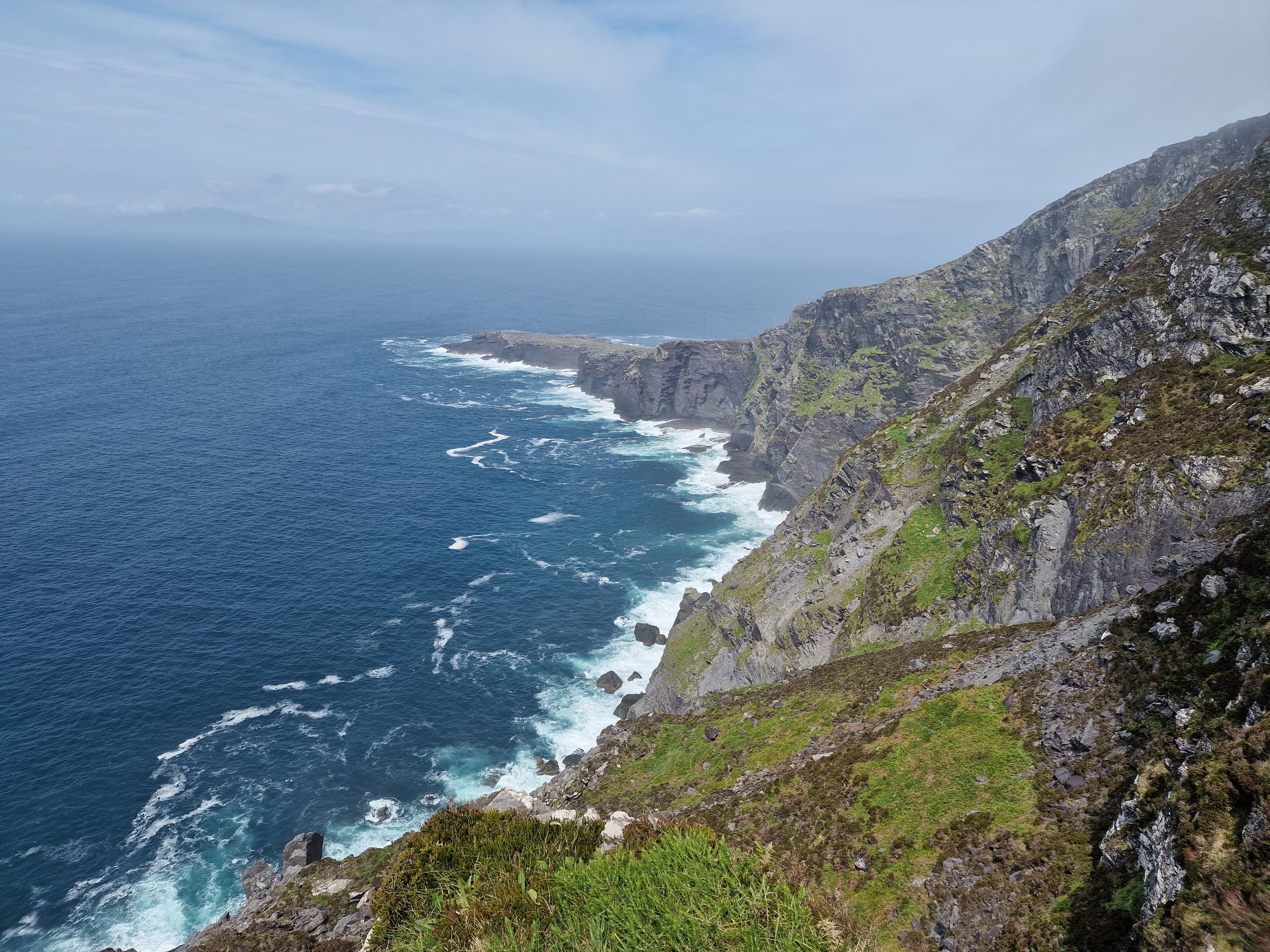
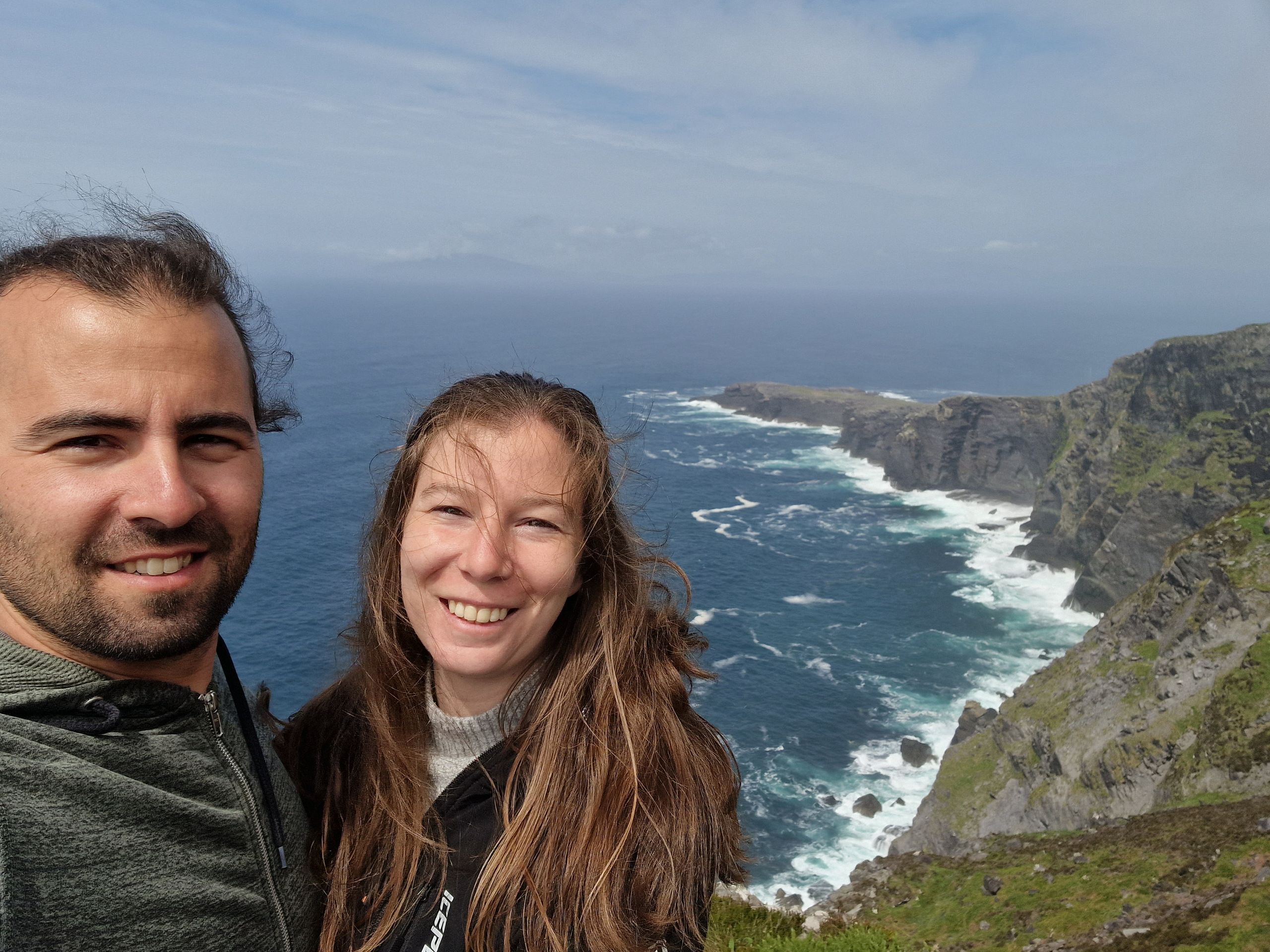
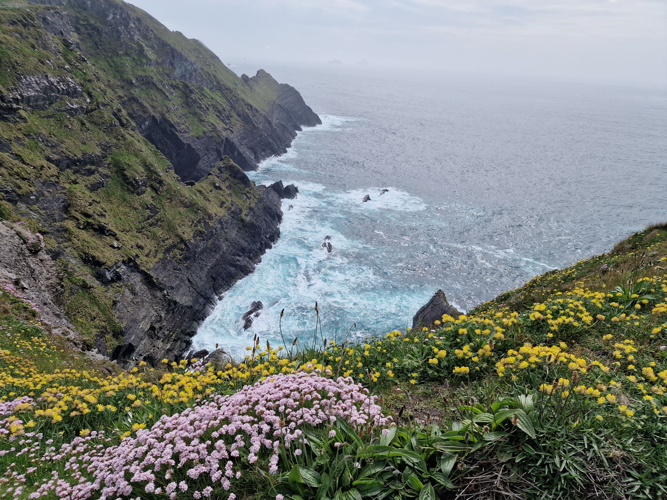
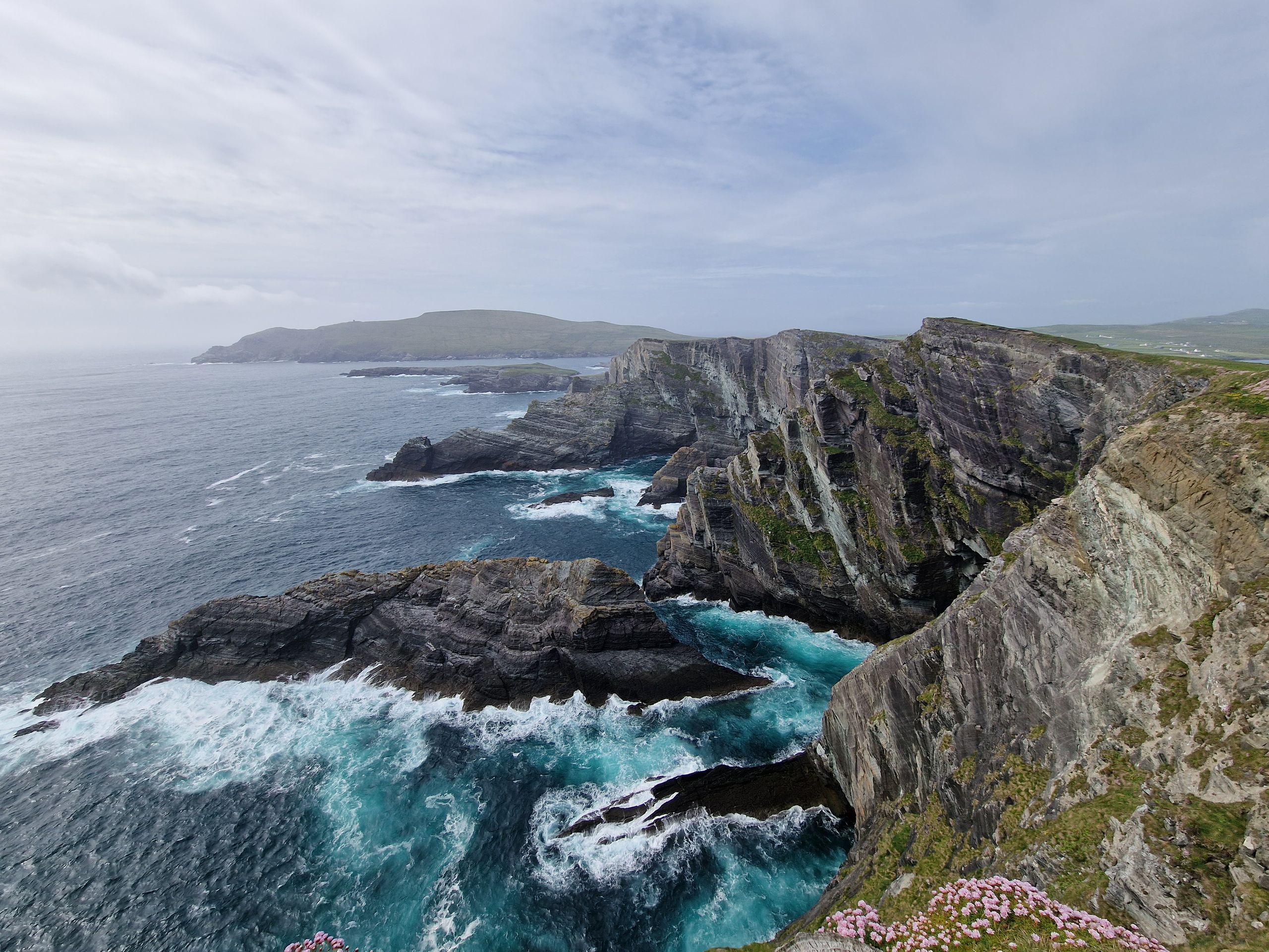
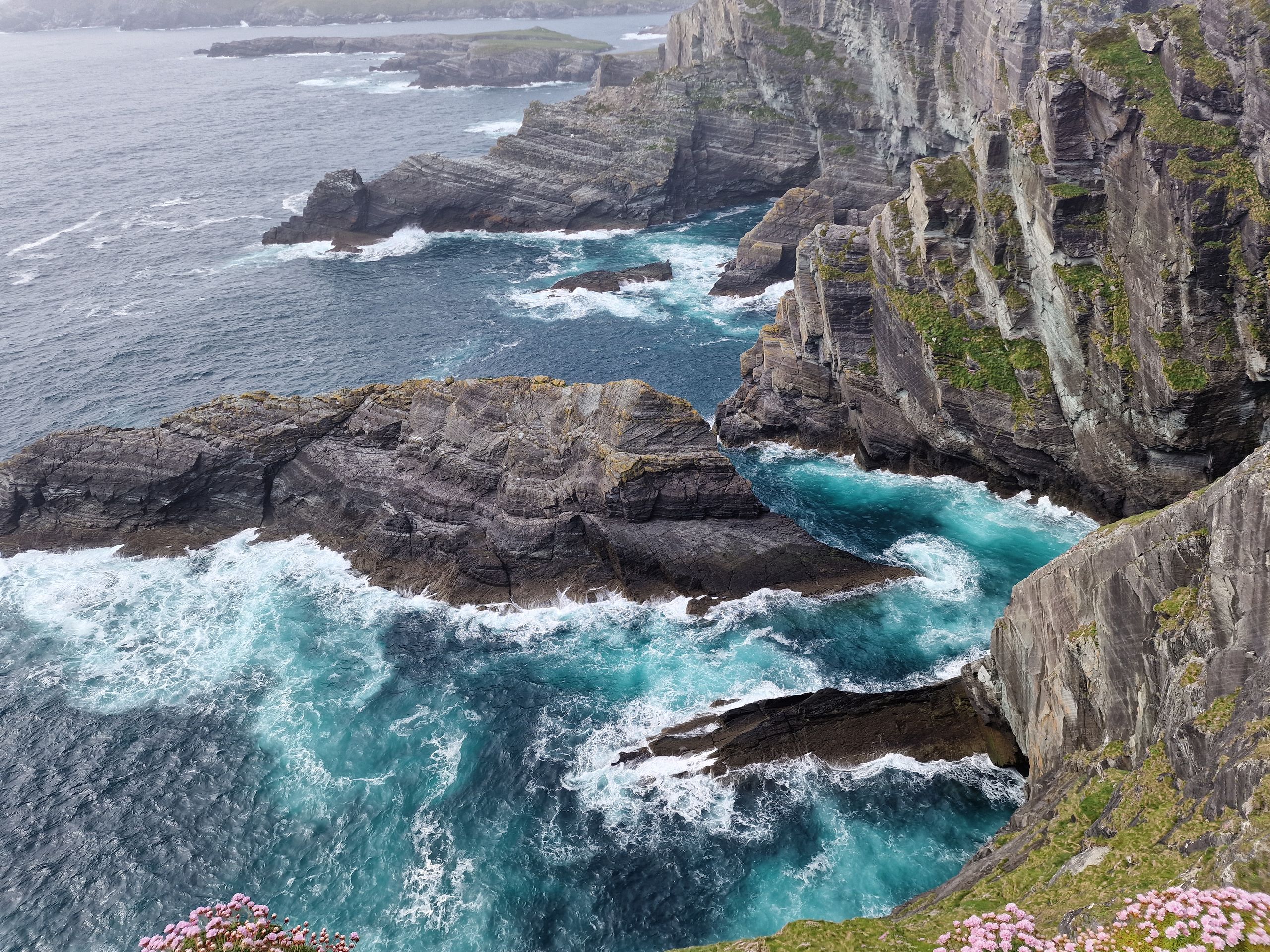
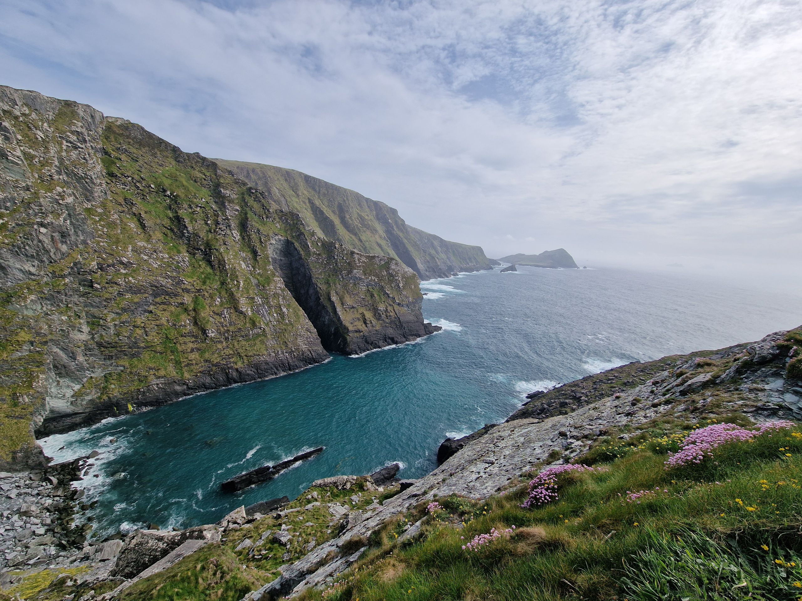
Am nächsten Tag war unser Plan, den bekannten Ring of Kerry abzufahren. Eine sehr touristische Strecke auf dem Wild Atlantic Way. Wir fuhren also rund eine Stunde erst auf die Valentia Island, gingen dort auf einen Aussichtspunkt und danach weiter Richtung der Klippen, den Kerry Cliffs. Auf privatem Grund befindet sich dort die etwas grössere Aussichtsplattform, die sich direkt oberhalb der Klippen befindet. Ein wahnsinnig eindrücklicher Ausblick! Und dann sahen wir, dass der Privatgrundbesitzer tatsächlich anbietet, dass man dort oben campen darf! Für 20 Euro die Nacht haben wir uns das natürlich nicht nehmen lassen, an so einem spektakulären Ort zu schlafen.
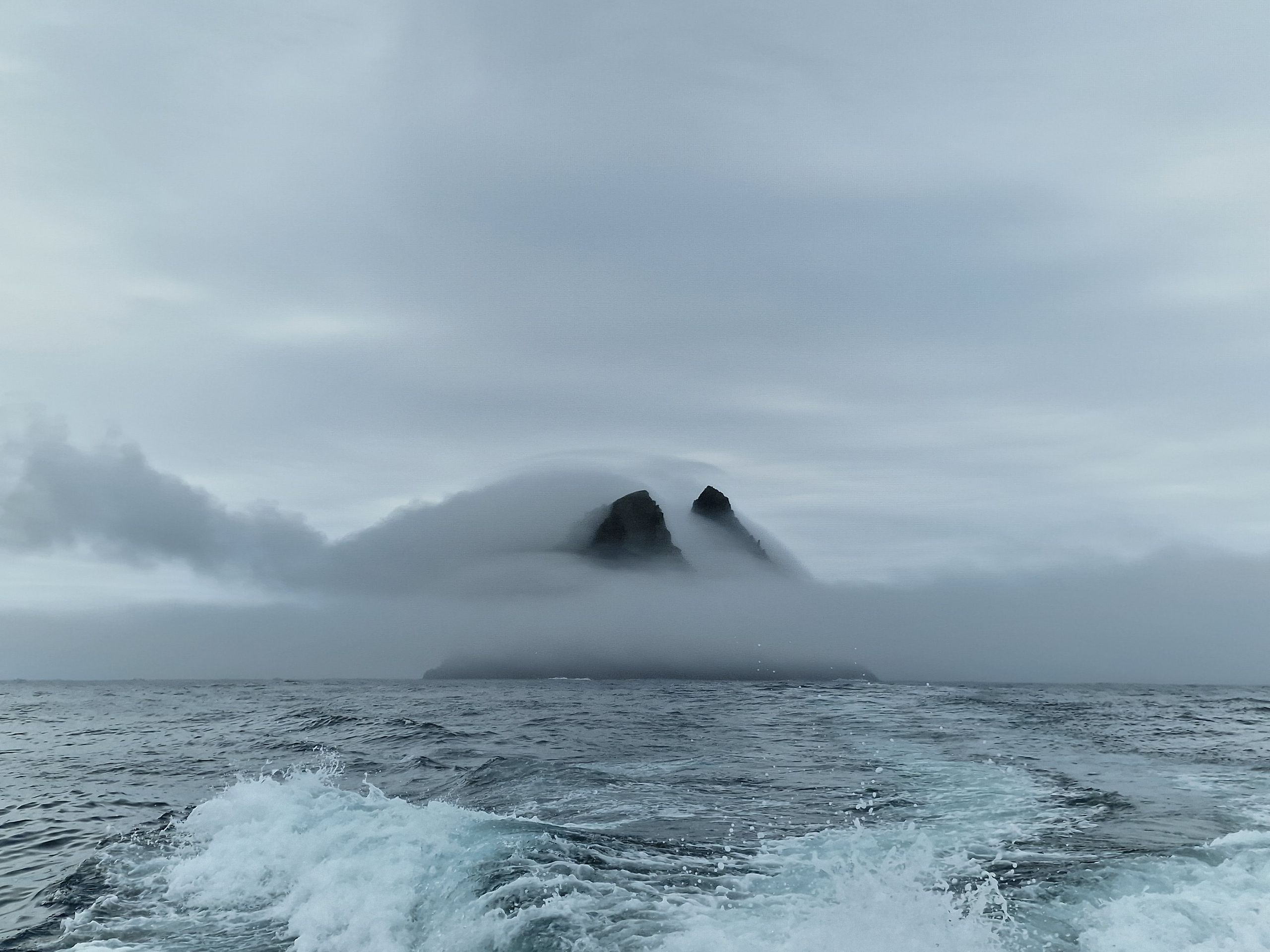
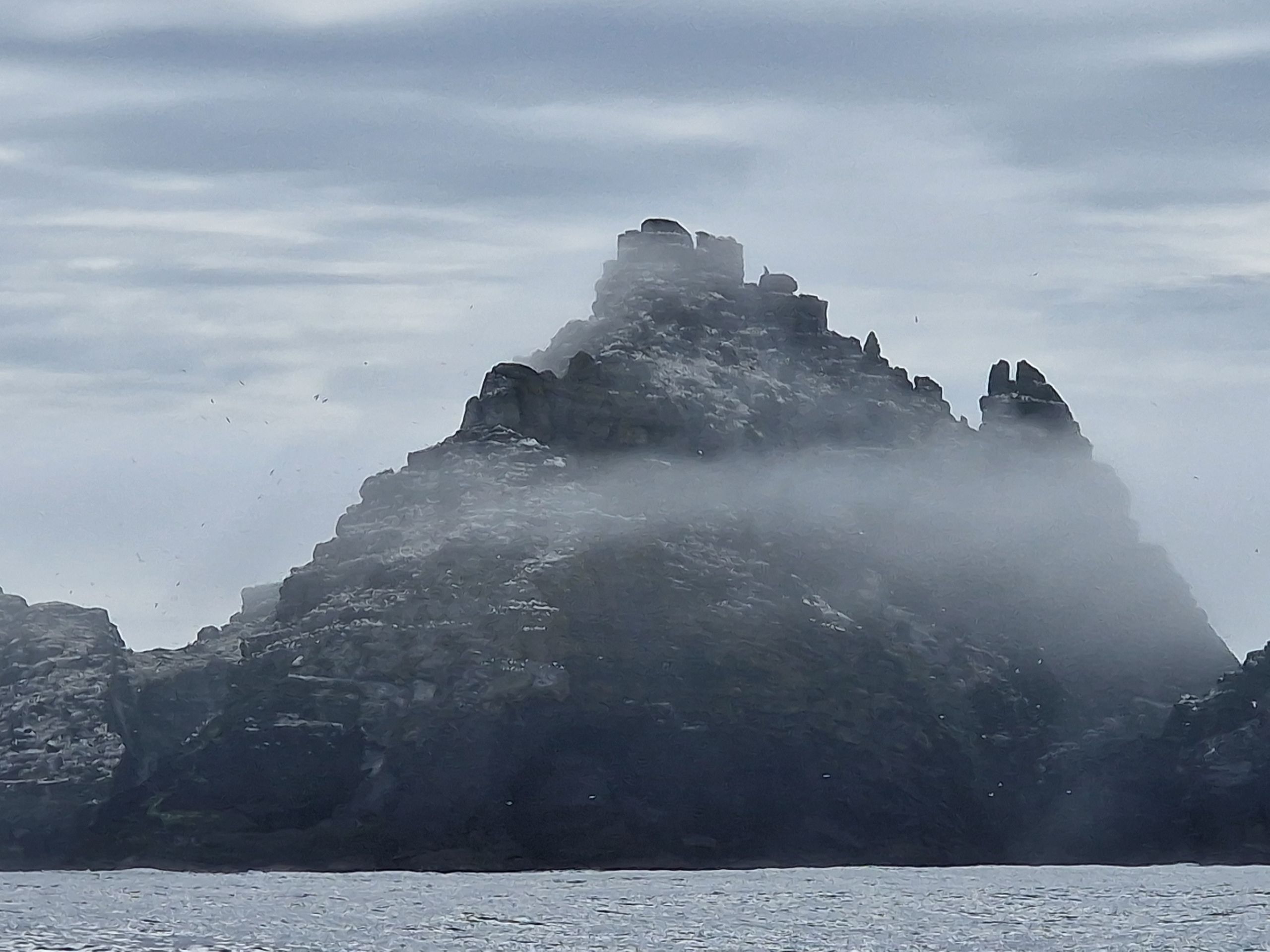
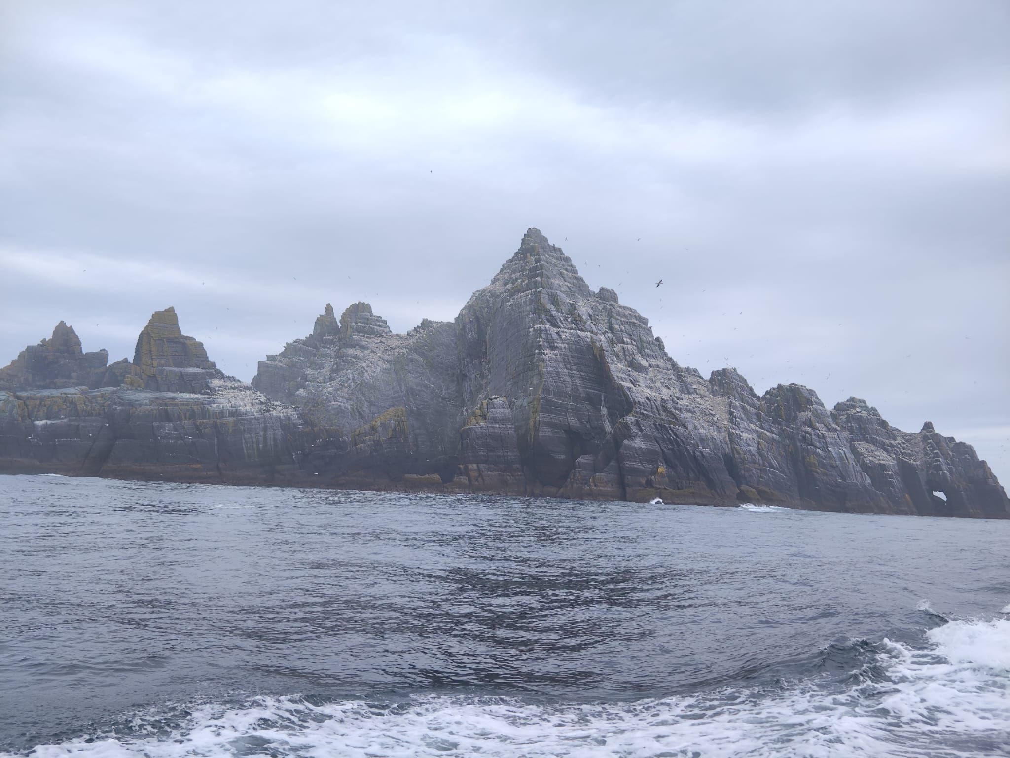
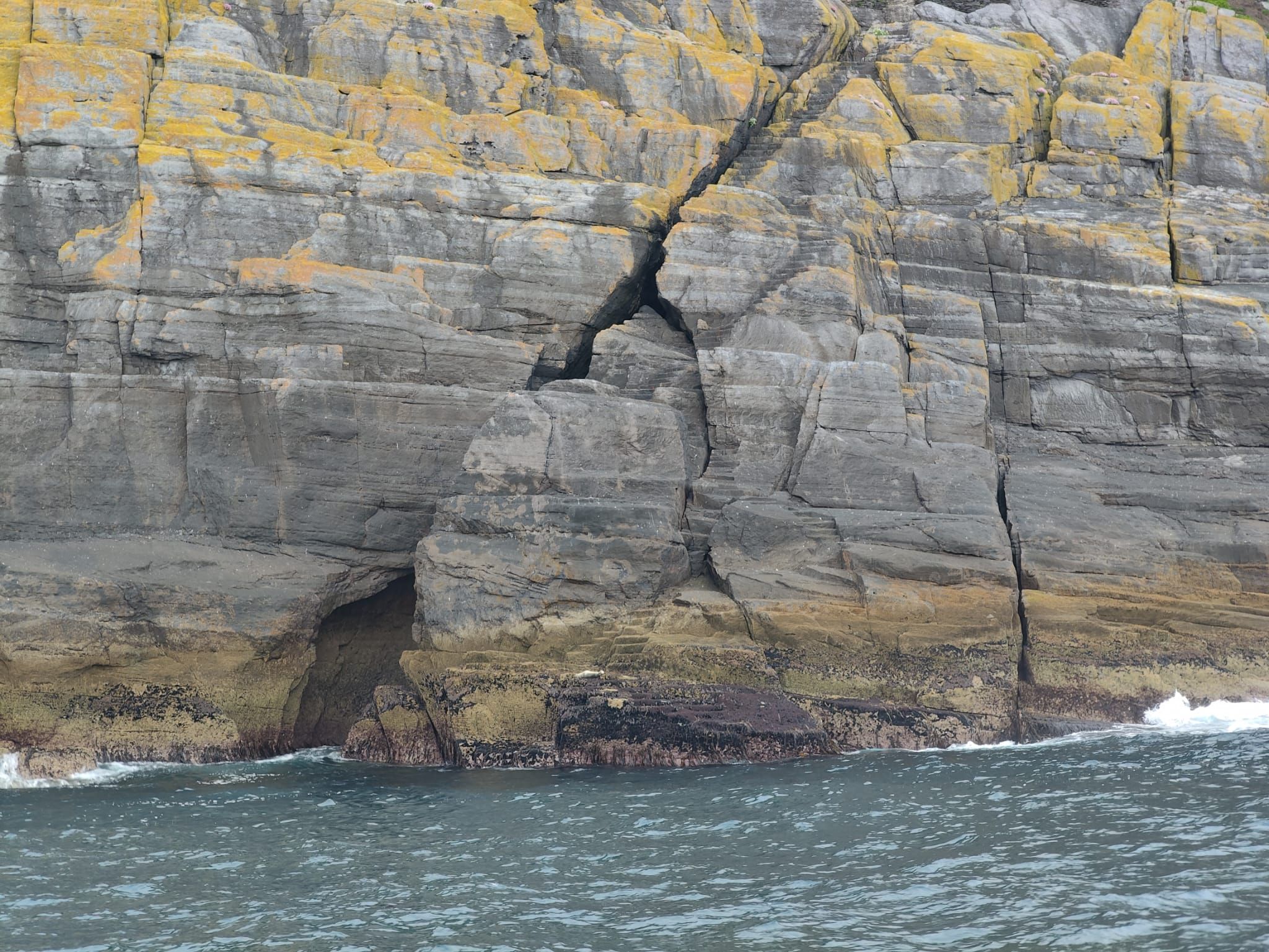
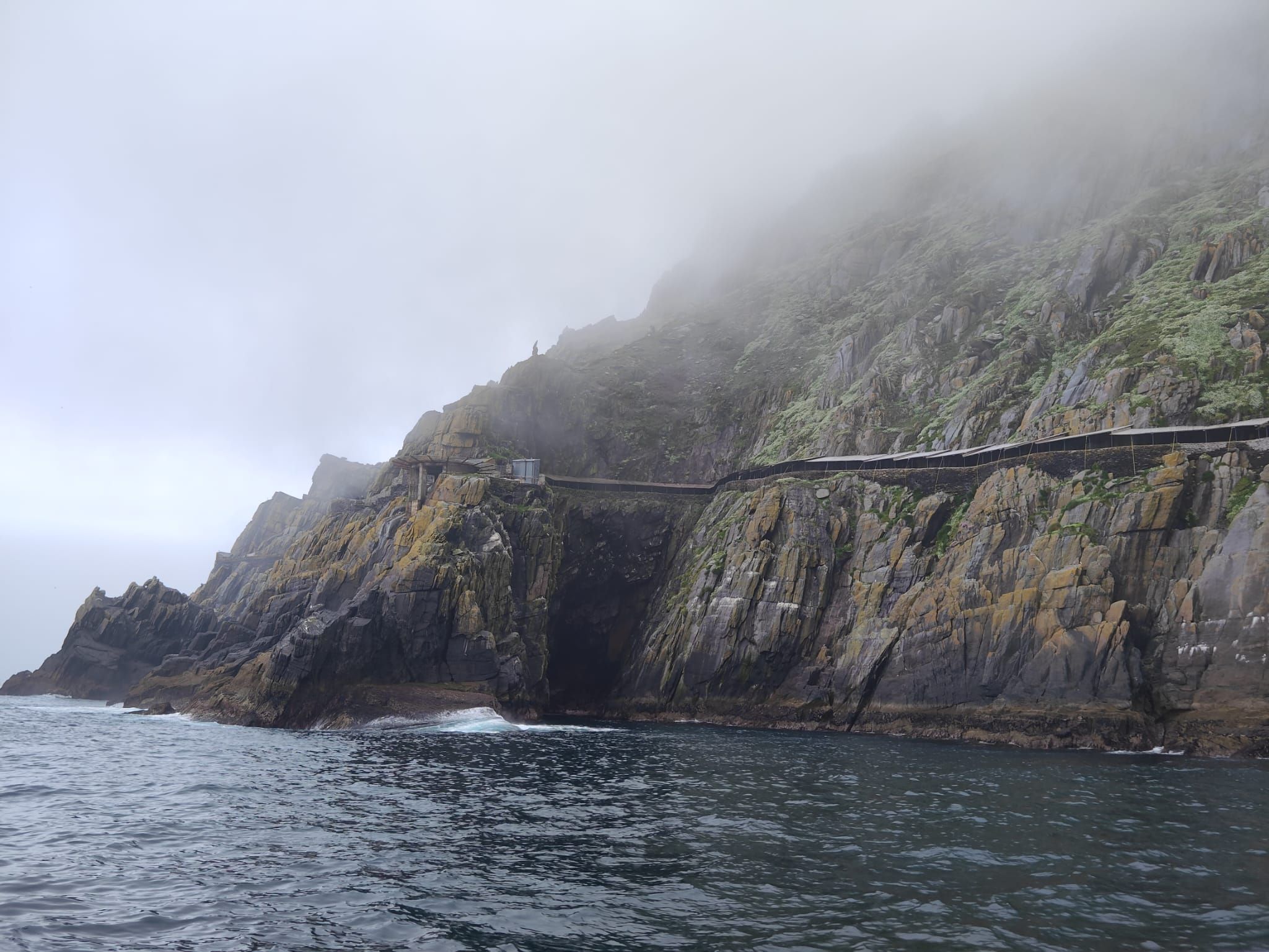
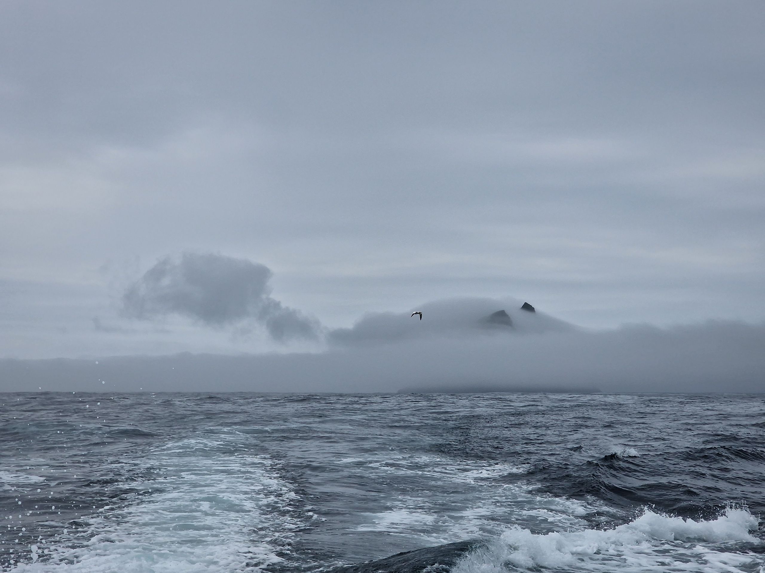
Am Samstagmorgen versuchten wir unser Glück bei den Bootstouren für die Insel Skellig Michael, eine der zwei UNESCO-Welterben in Irland, für welche der Zutritt strikt limitiert ist. Wir hofften darauf, dass zwei gebuchte Passagiere nicht auftauchen, damit wir ihre Plätze erben könnten. Doch heute sind alle erschienen, also entschieden wir uns für eine Bootstour, die die Inseln nur umkreist und man nicht an Land gehen darf. Die See war etwas holprig, für Lukas kein Problem, für Sarah schon. Beeindruckend war nicht nur die Hauptinsel, sondern auch eine kleinere Insel davor, die von weitem aussah, als ob sie schneebedeckt war. Dabei war die Insel einfach voller Vögel. Ganze 70'000 Nester, also wohl doppelt so viel Vögel, wenn nicht mehr.
Zurück an Land gab es erst mal ein Magen-beruhigendes zMittag, danach fuhren wir den Ring of Kerry in südlicher Richtung fertig. Dort angekommen, gönnten wir uns etwas Süsses und fuhren dann auf einem weiteren, sehr schmalen Pass nach Norden. Unterwegs hätten wir einen Blick auf den höchsten Berg Irlands (Carrantuohill, 1'038 M.ü.M) erhaschen können, doch er steckte im Nebel fest. Wir hatten es uns kurz überlegt, den Berg hochzugehen, aber die Wettervorhersage für Sonntag sagte nichts Gutes voraus, also liessen wir es bleiben.
Nun sind wir in der Nähe von Dingle auf einem abgelegenen Parkplatz direkt am Meer mit zwei anderen uns unbekannten Campern und verbringen die Nacht hier.
Lang:
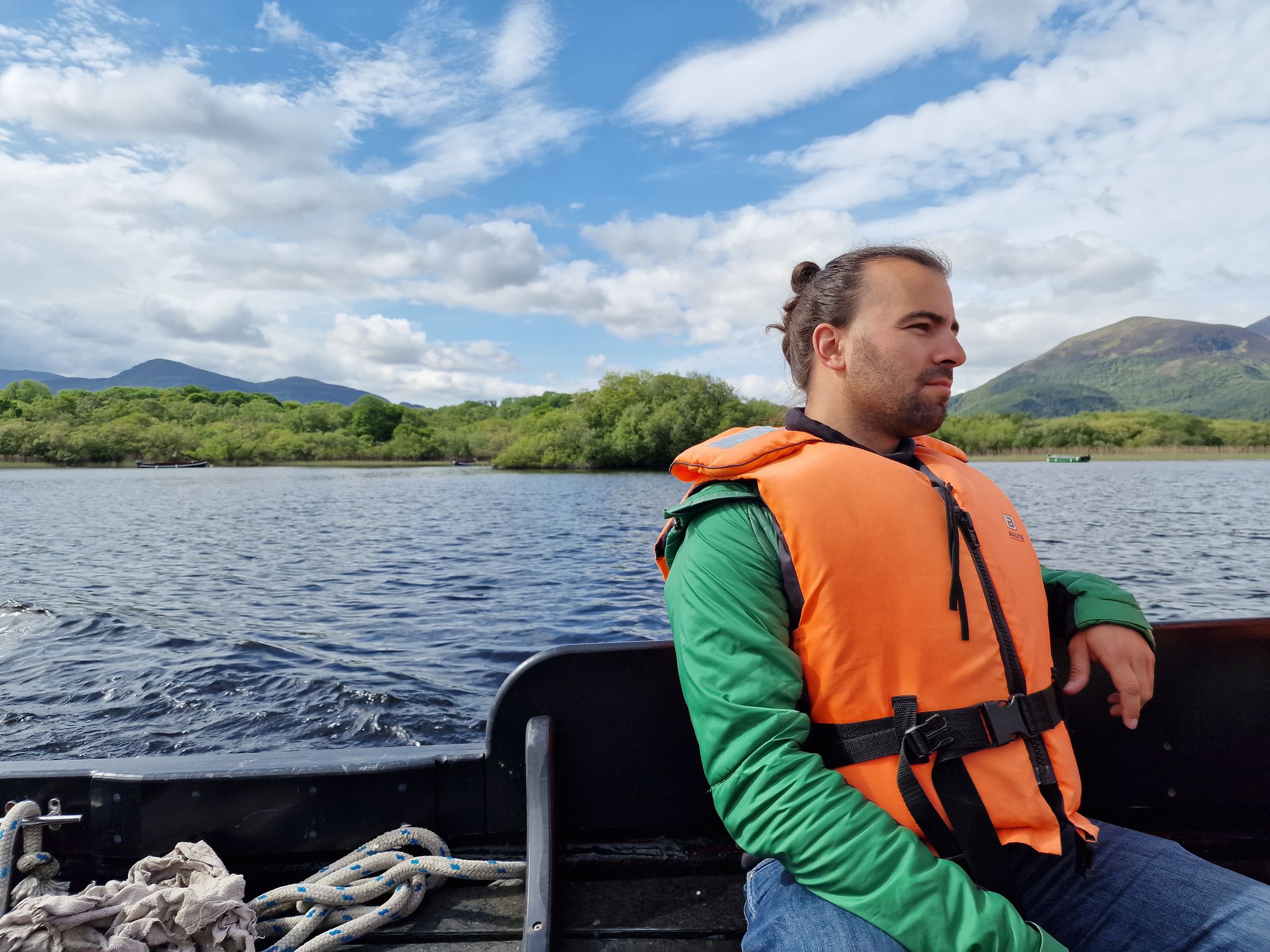
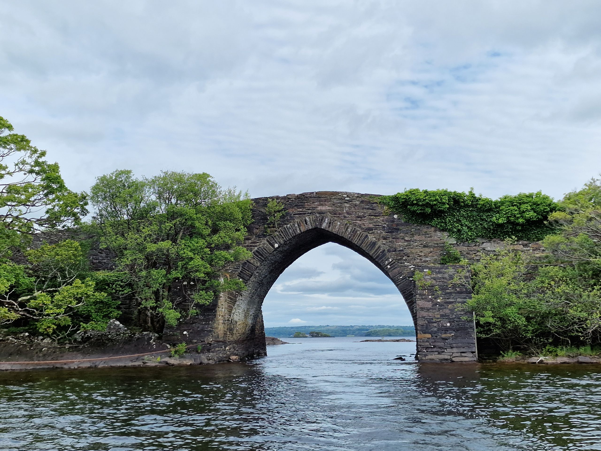
Bei unserer Ankunft in Killarney haben wir uns entschieden, eine Tagestour über den Tourenanbieter Dero’s zu buchen. Diese bestand daraus, erst mit dem Reisebus von Killarney nach Dunloe Upper zu fahren, dem Anfangspunkt des Passes «Gap of Dunloe». Dort konnte man sich vor Ort entscheiden, ob man den Pass laufen will, oder mit Pony und Kutsche gemütlich drüberfahren will. Anschliessend war eine etwas über 1 stündige Bootstour vom Upper Lake durch zwei Flüsse in die grösseren Seen zurück ans Festland geplant. Wir sollten uns am morgen um 10.00 Uhr beim Schloss Ross Castle einfinden, wo wir mit dem Bus abgeholt würden. Wir waren vorzeitig dort, um uns das Schloss noch von aussen anzuschauen, da rief uns der Tourguide an und sagte, dass die Tour wegen dem zu niedrigen Wasserlevel umgedreht werden muss. Sprich, erst die Bootstour, danach den Rest. Also bestiegen wir beim Schloss direkt die Boote. Der Bootskapitän war ein älterer Mann namens Robbie. Robbie erzählte uns auf den Seen viele interessante Sachen. Der erste See, der Lough Leane, ist der grösste und gleichzeitig mit 60 Metern der tiefste See des Nationalparks. Vor etwa drei Jahren brannte hier leider ein Mann-gemachtes Riesenfeuer, was wir bei der Durchfahrt auf dem Fluss zum nächsten See gut erkennen konnten. Viele Sträucher und Bäume waren geschwärzt und tot, fast bis zum Anfang des nächsten Sees, dem Upper Lake. Das Feuer brannte eine ganze Woche lang. Was uns am meisten erstaunte war, dass obwohl wir uns in einem Nationalpark befanden, hier wohl sehr viel erlaubt ist. Nebst sportlichen Aktivitäten fanden eben Bootstouren statt, auf den Seen gehen Berufsfischer ihrer Tätigkeit nach und, was wir nicht ganz verstanden, Jagen ist auch erlaubt, einfach schiessen nicht.
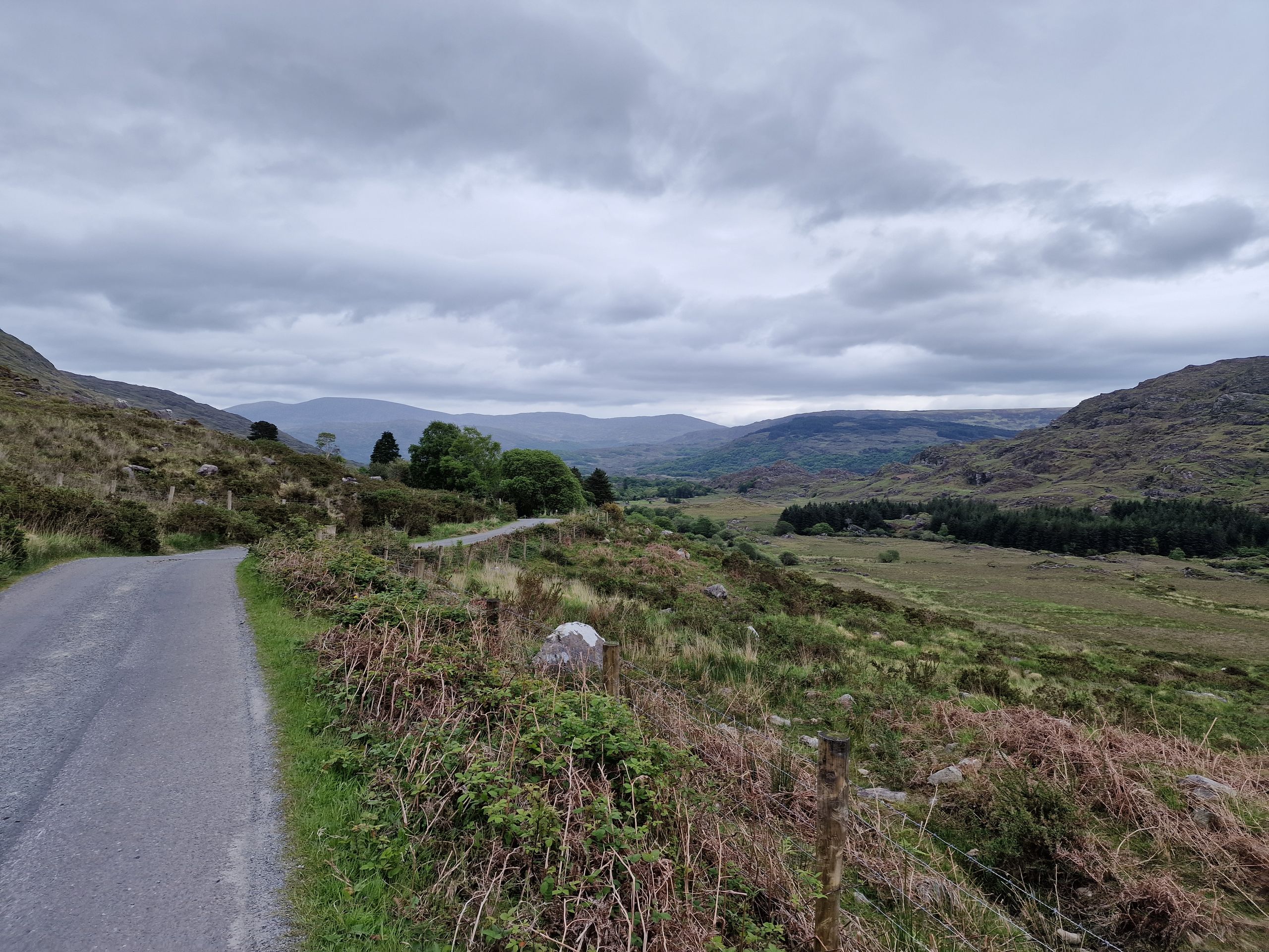
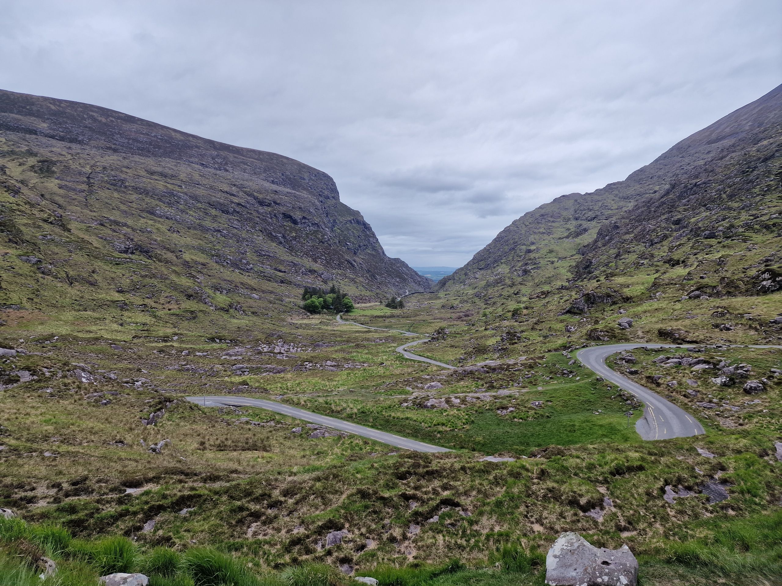
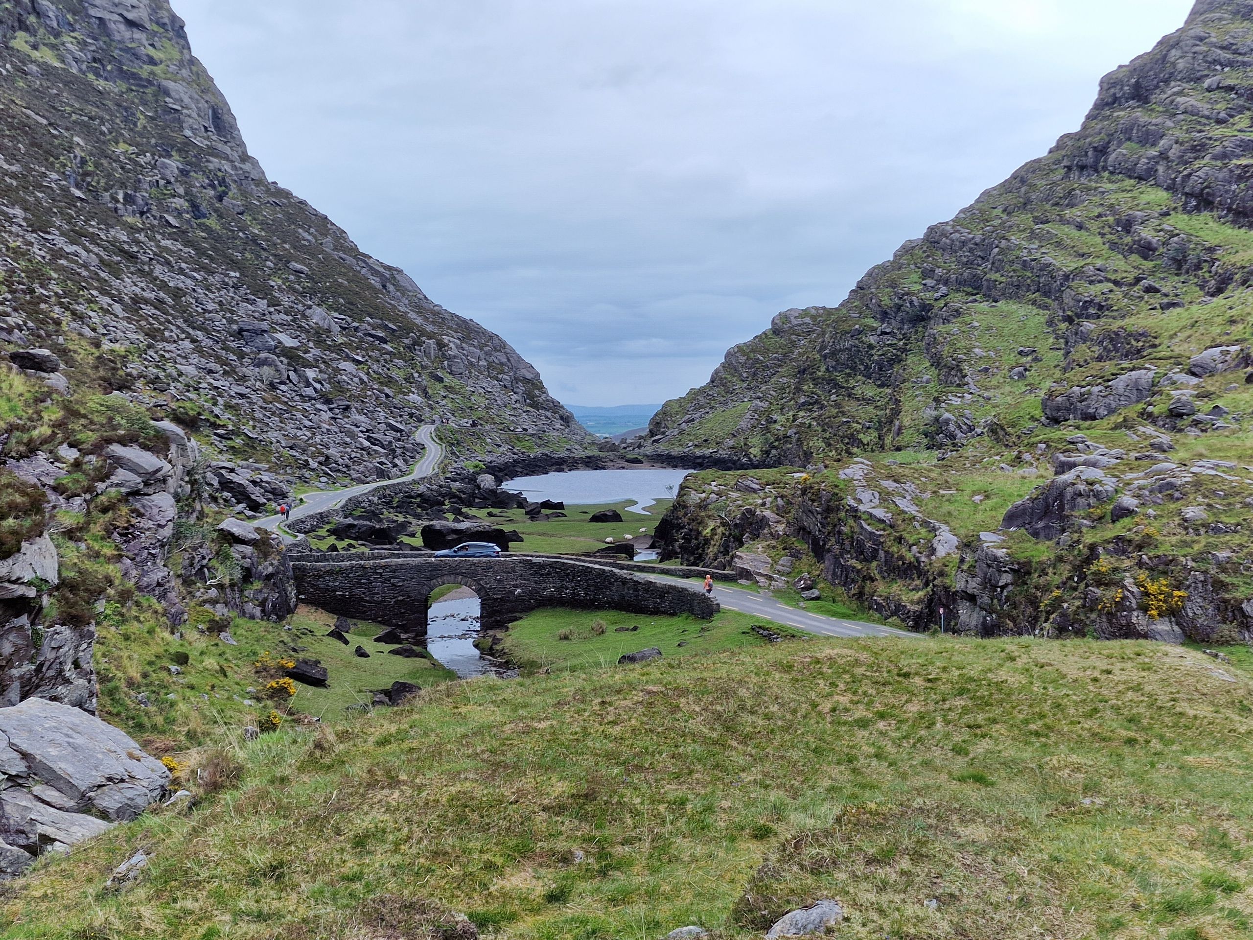
Als wir am Ende des Upper Lakes ankamen, stärkten wir uns beim Hüttchen mit Suppe und Brötchen und starteten dann unseren Spaziergang über den Pass Gap of Dunloe. Den Weg zu laufen dauert rund 2.5 Stunden und bietet wirklich wunderbare Aussichten auf eine wilde und karge Landschaft. Wir wurden einige male von Kutschen überholt, die teils trotz flottem Trab eine Kolonne von Autos hinter sich herzog. Die Strasse war sehr schmal, die Fahrzeuge mussten manchmal wieder rückwärtsfahren um sich kreuzen zu können. Wir wollen uns das Chaos aus Wanderern, Kutschen und Wohnmobilen in der Hochsaison nicht vorstellen. Nach etwa der Hälfte der Zeit erreichten wir die «Passhöhe» auf 241 M.ü.M., aber sie bot eine schöne Aussicht auf das, was dahinter zum Vorschein kam. Viele Schafe grasten hier frei und meistens nicht eingezäunt mit ihren Lämmern, teils standen sie auch auf der Strasse. Pünktlich, oder eher vorzeitig, trafen wir an unserem Zielort in Dunloe Upper ein, und tranken in einem der zwei Cafés eben einen Kaffee und warteten auf unseren Chauffeur. Dieser war auch pünktlich da, aber einige andere Wanderer nicht. Wir warteten etwa 10 Minuten auf eine Dreier-Gruppe (die aber vorbildlich unterwegs angerufen haben, dass sie sich verspäten) und vier weitere Wanderer. Nun ja, diese vier überliessen wir wohl ihrem Schicksal…
Zurück auf dem Camping kochten wir unser zNacht und frisch geduscht gingen wir noch ins Städtchen Killarney ins O’Connors Traditional Pub. Während wir unser Bier tranken und die Live-Musik genossen, schielten wir immer wieder auf das Handy um zu schauen, wie sich die Schweizer Hockey-Nati an der WM schlägt.
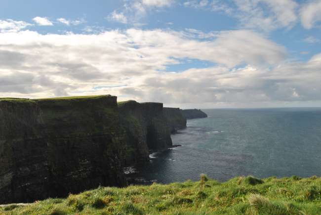
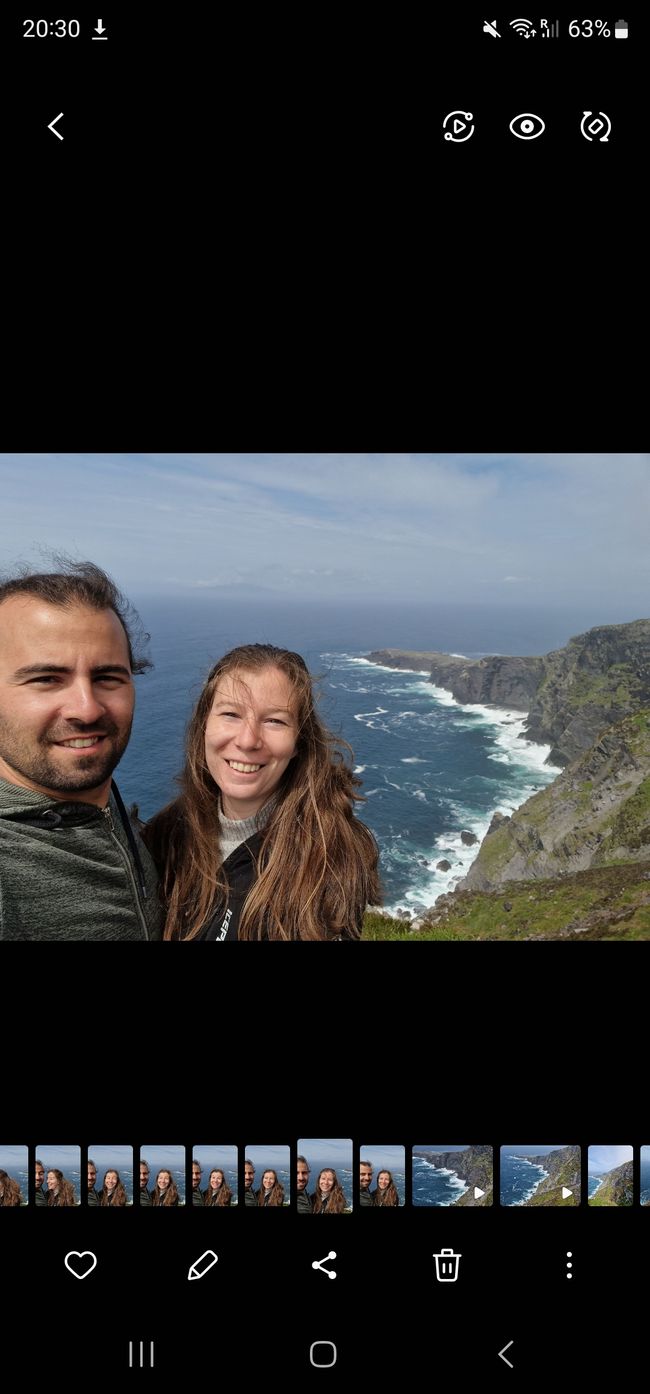
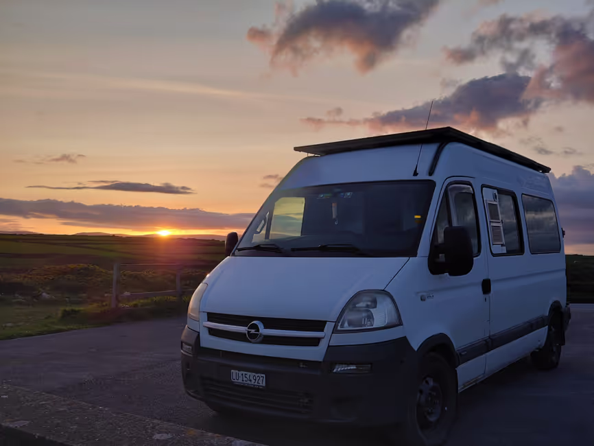
Am nächsten Tag war unser Plan, den bekannten Ring of Kerry abzufahren. Eine sehr touristische Strecke auf dem Wild Atlantic Way. Von Sarah’s Onkel erhielten wir den Tipp, die Halbinsel gegen den Uhrzeigersinn zu befahren, damit wir mit den ganzen Reisecars in die gleiche Richtung fahren, da sonst die Kreuzerei auf gewissen Strassen ziemlich mühsam wird (Danke für den Tipp!). Wir fuhren also rund eine Stunde erst auf die Valentia Island und liefen auf einen Aussichtspunkt. Dort lernten wir vom «achten Weltwunder». Vom Insel-Hauptort Knightstown wurde im Jahr 1858 das erste transatlantische Telegrafkabel nach Neufundland gezogen. Nach der Insel fuhren wir weiter zu den Kerry Cliffs, den spektakulärsten Klippen des County Kerry. Die zugänglichen Aussichtsplattformen befinden sich auf privatem Grund und der Bauer dort bietet den Besuchern für 5 Euro einen Wahnsinnsausblick an. Besonders Sarah war vom Anblick der steilen Klippen mit den Wellen, die an den Felsen zerschellen, total überwältigt. Die Natur ist wohl einfach immer noch das Mächtigste auf der Erde und wir sind gut dran, sie zu zerstören. Kleiner Reminder an uns alle, wir sollten schon etwas mehr Sorge tragen, es ginge auch ohne Kleber. Dann sahen wir, dass der Privatgrundbesitzer tatsächlich erlaubt, dass man hier oben campen darf. Und für 20 Euro die Nacht liessen wir es uns nicht nehmen, an einem so spektakulären Ort zu schlafen! Abgesehen von uns war noch ein weiterer Camper da, ein australisches Ehepaar, welches seit gut 2 Jahren auf Reisen ist. Wir hofften auf einen typisch kitschigen Sonnenuntergang, aber der blieb uns wegen den vielen niedrigen Wolken leider verwehrt.
Am Samstagmorgen standen wir früh auf. Unsere Idee war es, zurück zum Bootshafen in Portmagee zu fahren, von wo viele Boote auf die Insel Skellig Michael fahren. Diese Insel ist eine der nur zwei UNESCO Welterben Irlands. Ab dem 6. Jahrhundert lebten nicht weniger als 12 Mönche auf dieser eigentlich unwirtlichen kleinen Insel. Ihre Hütten, Beehive Huts genannt, waren komplett aus Stein und so gebaut, dass kein Tropfen Wasser eindringen konnte. Sie befanden sich auf dem Nordgipfel der Insel auf rund 180 M.ü.M. anders gesagt: ganze 618 steinerne Treppenstufen vom Meer bis zu den Hütten. Stellt euch vor, jeden Tag hoch und runter für frischen Fisch. Die Mönche lebten eben von Fisch, Eiern aus den Vogelnestern und von Gemüse, welches sie auf der Insel selber anbauten. Wir haben gehört, dass aufgrund der ganzen Lage auf der Insel in Bezug auf Sonne, Wind und Boden, das Gemüse dort doppelt so schnell wuchs wie auf dem Festland. Im Jahr 823 wurde die Insel von Wikinger angegriffen. Etwa um 1100 gaben die Mönche Michael Skellig auf und zogen ans Festland. Danach wurde sie zum Wallfahrtsort und in modernen Zeiten zum Drehort von einem Star Wars-Film. Dies führte leider auch dazu, dass die Insel von Touristen total überrannt wurde und besonders die Fauna stark darunter litt. Deswegen wurde die Anzahl Besucher stark beschränkt und soweit wir verstanden haben, darf das Land nur noch morgens betreten werden.
Da sie eben so stark eingeschränkt ist für Besucher, waren natürlich alle Boote ausgebucht. Wir sollen unser Glück aber dennoch direkt vor Ort versuchen, sagten sie uns. Es könnte ja sein, dass gewisse Passagiere nicht auftauchen, und wir ihre Sitze erben könnten. Wir warteten zwei Umläufe ohne Glück und entschieden uns deshalb für 50 Euro eine Bootstour zu buchen, welche die Insel nur umrundet, aber man sie nicht betritt. Die sogenannte Landing-Tour hätte übrigens stolze 120 Euro pro Person gekostet. Sarah findet das ehrlich gesagt aber auch richtig. Wir Menschen müssen nicht das Gefühl haben, unseren grossen Zeh immer und überall reinstecken zu müssen. Vielleicht etwas widersprüchlich, versuchten wir gerade eine UNESCO-Stätte zu besuchen.
Die See war etwas holprig, für Lukas kein Problem, für Sarah schon, Details ersparen wir euch auch in der langen Version. Beeindruckend war nicht nur die Hauptinsel, sondern eine kleinere Insel davor, Little Skellig, die von weitem aussah, als ob sie schneebedeckt war. Dabei war die Insel einfach voller Vögel. Ganze 70'000 Nester, also wohl doppelt so viel Vögel, wenn nicht mehr. Die kleineren dieser Tiere, auf Deutsch «Lunde» genannt, klingen auf Englisch so süss wie sie auch sind, nämlich Puffins. Googlet mal ihre Bilder, sie sind wirklich härzig.
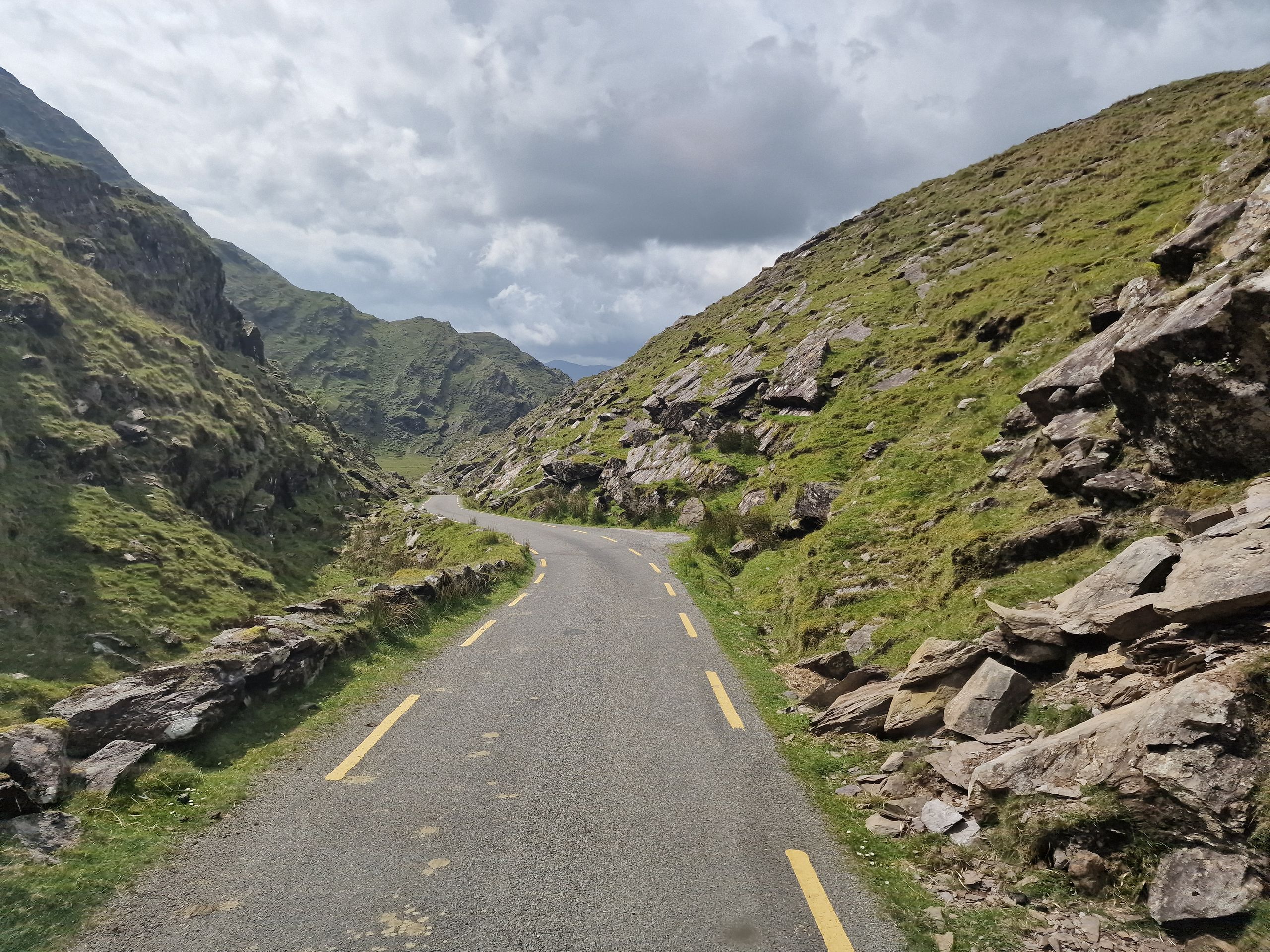
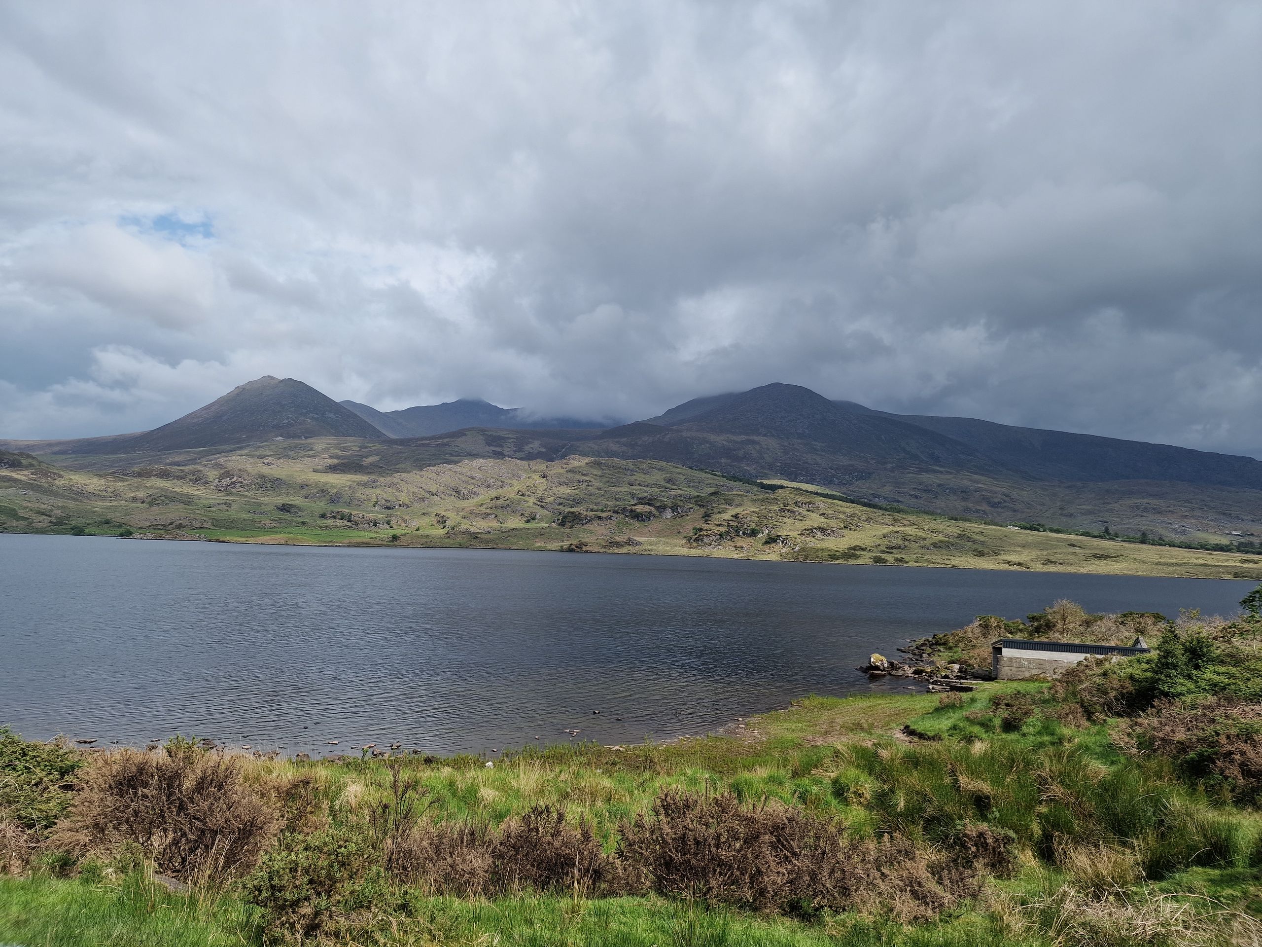
Zurück an Land gab es erst mal ein Magen-beruhigendes zMittag, danach fuhren wir den Ring of Kerry in südlicher Richtung fertig. Wir hielten nur ein zwei Mal um ein schönes Foto vom Meer und weiteren kleineren Klippen zu machen. In der Ortschaft Kenmare angekommen, gönnten wir uns etwas Süsses und fuhren dann auf einem weiteren, sehr schmalen Pass namens Ballaghbeama Gap nach Norden. Auch hier bevorzugten es die Schafe, am Strassenrand zu liegen und zu grasen. Die Strasse sah auch aus, als ob sie für Autorennen benützt wird, wir konnten im Internet dazu aber keine Informationen finden. Was nicht heisst, dass keine (nächtlichen?) Rennen stattfinden. Unterwegs hätten wir einen Blick auf den höchsten Berg Irlands (Carrantuohill, 1'038 M.ü.M) erhaschen können, doch er steckte im Nebel fest. Wir hatten es uns kurz überlegt, den Berg hochzugehen, aber die Wettervorhersage für Sonntag sagte nichts Gutes voraus, also liessen wir es bleiben.
Nun sind wir in der Nähe von Dingle auf einem abgelegenen Parkplatz direkt am Meer mit zwei anderen uns unbekannten Campern und verbringen die Nacht hier. Solche Parkplätze finden wir übrigens mit der App Park4Night. Sie gibt gute Informationen über den Zustand, die Anfahrt etc. und auch erfährt man ziemlich schnell, ob von einer Saison zur nächsten ein Parkverbot hingestellt wurde. Ab Sonntag werden wir bei wohl weniger gutem Wetter die Dingle-Halbinsel abfahren und dann geht es langsam dem Atlantik lang Richtung Norden.
It's been a few days since the last entry and there's a lot to tell. So, there's a short version and a longer version for those who like it in more detail.
'Short':
When we arrived in Killarney, we decided to book a day tour through a tour operator. The tour consisted of a one-hour boat ride from Ross Castle across two lakes and two rivers, then either a pony and carriage ride across the Gap of Dunloe Pass or a 2.5 hour walk over it. We decided to walk. Afterwards we refreshed ourselves with coffee and cake, then we were picked up by the small bus and driven back to Killarney.
Back at the campsite we cooked our dinner and freshly showered we went into the town to a pub with live music.
The next day our plan was to drive along the famous Ring of Kerry. A very touristy route on the Wild Atlantic Way. So first, we drove about an hour to Valentia Island, went to a lookout point and then continued towards the cliffs, the Kerry Cliffs. On private land there is a larger viewing platform, which is located directly above the cliffs. An insanely impressive view! And then we saw that the private landowner actually offers to camp up there! For 20 euros a night, we surely did not want to miss the opportunity to sleep in such a spectacular place.
On Saturday morning we tried our luck with the boat tours to Skellig Michael Island, one of the two UNESCO World Heritage Sites in Ireland, to which access is strictly limited. We hoped that two booked passengers would not show up so that we could inherit their seats. But today everyone showed up, so we decided to go on a boat tour that only circled the islands and you were not allowed to go ashore. The sea was a bit bumpy, for Lukas no problem, for Sarah it was. Not only the main island was impressive, but also a smaller island in front of it, which looked from far away as if it was covered with snow. But the island was just full of birds. Seventy thousand nests, so probably twice as many birds, if not more.
Back on shore we had a stomach-soothing lunch, then we finished the Ring of Kerry in southern direction. Once there, we treated ourselves to something sweet and then drove on another, very narrow pass to the north. On the way we could have caught a glimpse of Ireland's highest mountain (Carrantuohill, 1'038 m a.s.l.), but it was stuck in the fog. We had thought about going up the mountain, but the weather forecast for Sunday didn't bode well, so we decided not to.
Now we are near Dingle in a secluded parking lot by the sea with two other unknown campers and spend the night here.
Long:
When we arrived in Killarney, we decided to book a day tour through Dero's, a tour operator that consisted of taking the coach from Killarney to Dunloe Upper, the starting point of the Gap of Dunloe Pass. There you could decide on the spot whether you wanted to walk the pass, or whether you wanted to ride comfortably over it with a pony and carriage. Afterwards a little over 1-hour boat trip from the Upper Lake through two rivers into the larger lakes back to the mainland was planned. We were supposed to arrive at Ross Castle in the morning at 10am, where we would be picked up by bus. We were there early to look at the castle from the outside, when the tour guide called us and said that the tour had to be reversed because of the low water level. That is, first the boat tour, then the rest. So, we boarded the boats right at the castle. The captain of the boat was an older man named Robbie. Robbie told us a lot of interesting things on the lakes. The first lake, Lough Leane, is the largest lake in the national park and at the same time, at 60 meters, the deepest lake. About three years ago, unfortunately, there was a huge man-made wildfire burning here, which we could easily see as we crossed the river to the next lake. Many bushes and trees were blackened and dead, almost up to the beginning of the next lake, the Upper Lake. The fire burned for a whole week. What surprised us most was that, although we were in a national park, many things are allowed here. In addition to sporting activities, boat tours were also held, professional fishermen were doing their jobs on the lakes and, what we didn't quite understand, hunting is also allowed, just not shooting.
When we arrived at the end of the Upper Lake, we refreshed ourselves with soup and rolls at the cabin and then started our walk over the Gap of Dunloe Pass. The walk takes about 2.5 hours and offers really wonderful views of wild and barren scenery. We were overtaken a few times by carriages, some of whom pulled a queue of cars behind them despite a brisk trot. The road was very narrow, the vehicles sometimes had to reserve in order to cross each other. We do not want to imagine the chaos of hikers, carriages and motorhomes in the high season. After about half the time we reached the "pass summit" at 241 m.a.s.l., but it offered a nice view of what could be seen behind it. Many sheep grazed mostly unfenced with their lambs, sometimes they were also standing on the road. On time, or rather early, we arrived at our destination in Dunloe Upper and had a coffee in one of the two cafes and waited for our chauffeur. He was there on time, but some other hikers were not. We waited about 10 minutes for a group of three (but they called on the way that they were late) and four other hikers. Well, we left those four to their fate…
Back at the campsite we cooked our dinner and freshly showered we went to the town of Killarney to the O'Connor’s Traditional Pub. While we drank our beer and enjoyed the live music, we kept looking at the mobile phone to see how the Swiss Ice hockey Team is doing at the World Cup.
The next day we planned to drive down the famous Ring of Kerry. A very touristic route on the Wild Atlantic Way. From Philip we received the tip, to drive the peninsula counter clockwise, so that we drive with all the coaches in the same direction, otherwise the passing on certain roads becomes quite tedious (thank you for the tip!). So, we drove about an hour to the Valentia Island and walked to a lookout point. There, we learned from the "Eighth Wonder of the World". From the island's main town of Knightstown, the first transatlantic telegraph cable was pulled to Newfoundland in 1858. After the island, we continued to the Kerry Cliffs, the most spectacular cliffs in County Kerry. The accessible viewing platforms are on private land and the farmer there offers the visitors an amazing view for 5 euros. Sarah in particular was totally overwhelmed by the sight of the steep cliffs with the waves crashing against the rocks. Nature is probably still the most powerful thing on Earth, and we're good at destroying it. Little reminder to all of us, we should be a little bit more concerned, and it’s possible without glue. Then we saw that the private landowner actually allows you to camp up here. And for 20 Euros a night we couldn't miss it, to sleep in such a spectacular place! Apart from us there was another camper, an Australian couple, which has been travelling for 2 years now. We hoped for a typical cheesy sunset, but unfortunately it didn’t happen because of the many low clouds.
We got up early on Saturday morning. Our idea was to go back to Portmagee's marina, where many boats sail to the island of Skellig Michael. This island is one of only two UNESCO World Heritage Sites in Ireland. From the sixth century onwards, there were at least 12 monks living on this seemingly inhospitable little island. Their huts, called the Beehive Huts, were made entirely of stone and built in such a way that not a drop of water could penetrate. They were on the northern tip of the island at about 180 meters above sea level, in other words, a total of 618 stone steps from the sea to the huts. Imagine going up and down every day for fresh fish. The monks lived on fish, eggs from the bird's nests and vegetables that they grew on the island itself. We've heard that because of the location on the island in terms of sun, wind and soil, the vegetables grew twice as fast as they did on the mainland. In 823 the island was attacked by Vikings. Around 1100, the monks gave up Michael Skellig and moved to the mainland. After that, it became a place of pilgrimage and, in modern times, a filming location for a Star Wars movie. Unfortunately, this also led to the island being completely overrun by tourists and particularly the fauna suffering greatly as a result. This is why the number of visitors has been severely restricted and, as far as we understood, the island can only be entered in the morning.
Since it is so restricted to visitors, of course all the boats were fully booked. But we should try our luck on the spot, they told us. It could be that some passengers do not show up and we could inherit their seats. We waited two rounds without luck and therefore decided to book a boat tour for 50 Euros, which only circumnavigates the island, but you do not land it. The so-called landing tour would have cost a proud 120 Euros per person. Sarah honestly thinks that’s absolutely right. We humans don't have to feel like we need to set our foot on every place everywhere and all the. Perhaps somewhat contradictory, as we were just trying to visit a UNESCO site.
The sea was a bit bumpy, for Lukas no problem, for Sarah it was, we will spare you the details even in the long version. Impressive was not only the main island, but also a smaller island in front of it, Little Skellig, which looked from far away as if it was covered with snow. But the island was just full of birds. Seventy thousand nests, which is probably twice as many birds, if not more. The smaller ones of these animals, called "Lunde" in German, sound as sweet as they are in English, namely puffins. Google their pictures, they are really sweet.
Back on shore we had a stomach-soothing lunch, then we finished the Ring of Kerry in southern direction. We stopped only twice to take nice pictures of the sea and other smaller cliffs. Arriving in the village of Kenmare, we treated ourselves to something sweet and then drove north on another, very narrow pass called Ballaghbeama Gap. Here, too, the sheep preferred to lie on the side of the road and graze. The road also looked like it was used for car racing, but we couldn't find any information about it on the internet. Which doesn't mean that there are no (nightly?) races. On the way we could have caught a glimpse of Ireland's highest mountain (Carrantuohill, 1038m a.s.l.) but it was stuck in the fog. We had briefly thought about going up the mountain, but the weather forecast for Sunday didn't bode well, so we decided not to.
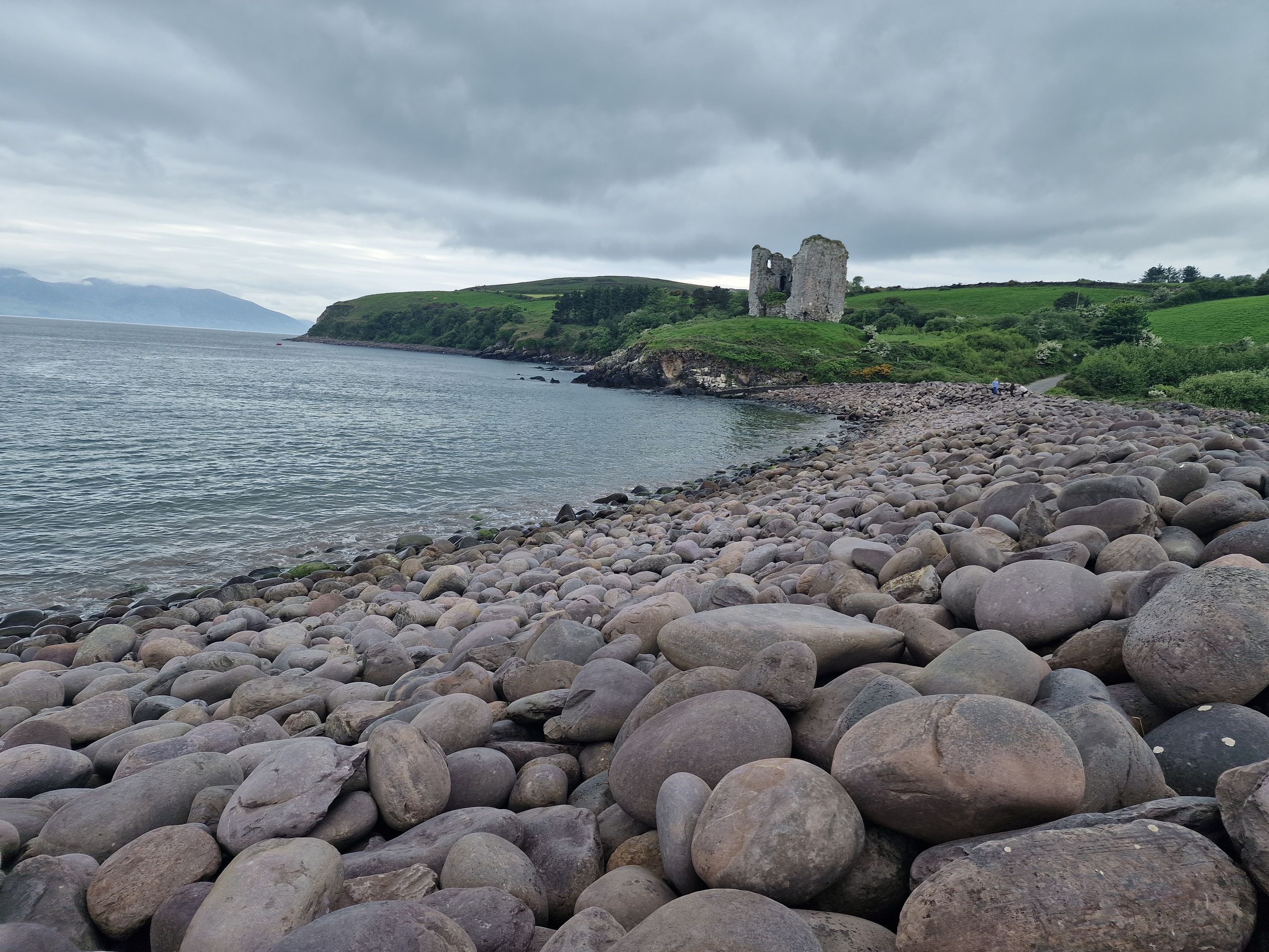
Now we are near Dingle in a secluded parking lot by the sea with two other unknown campers and spend the night here. By the way, we find such parking spaces with the app Park4Night, which gives good information about the condition, the directions etc. and also you can find out pretty quickly whether there has been a parking ban from one season to the next. From Sunday on we will drive along the Dingle Peninsula in less favourable weather and then we will slowly head north along the Atlantic Ocean.