
Syri i Kaltër 2024.09.28 and to Greece
Published: 01.10.2024
Subscribe to Newsletter
The last days in Albania are starting. I've calculated: about 10 days to Florina or 11 to Thessaloniki
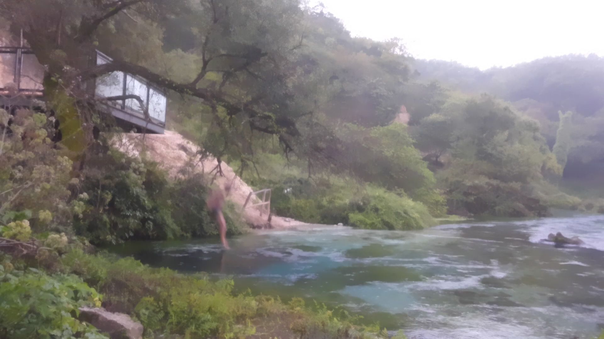
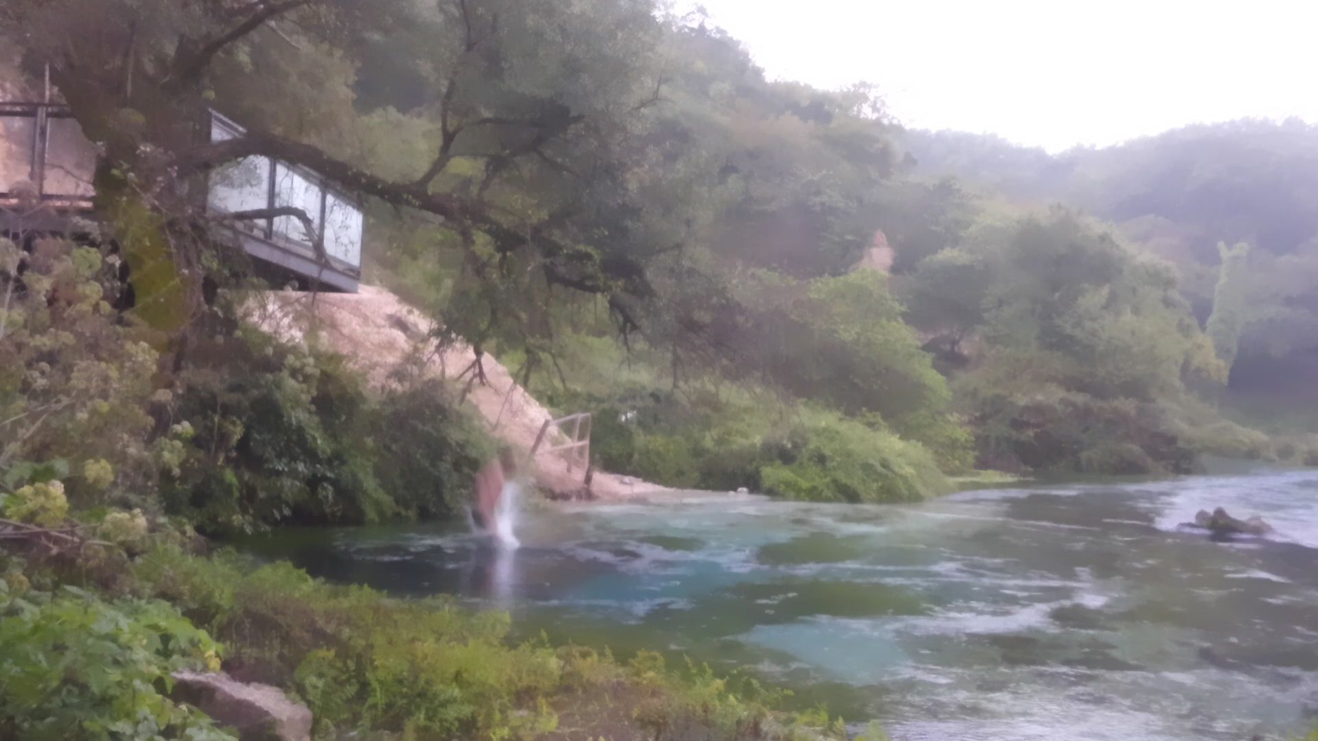
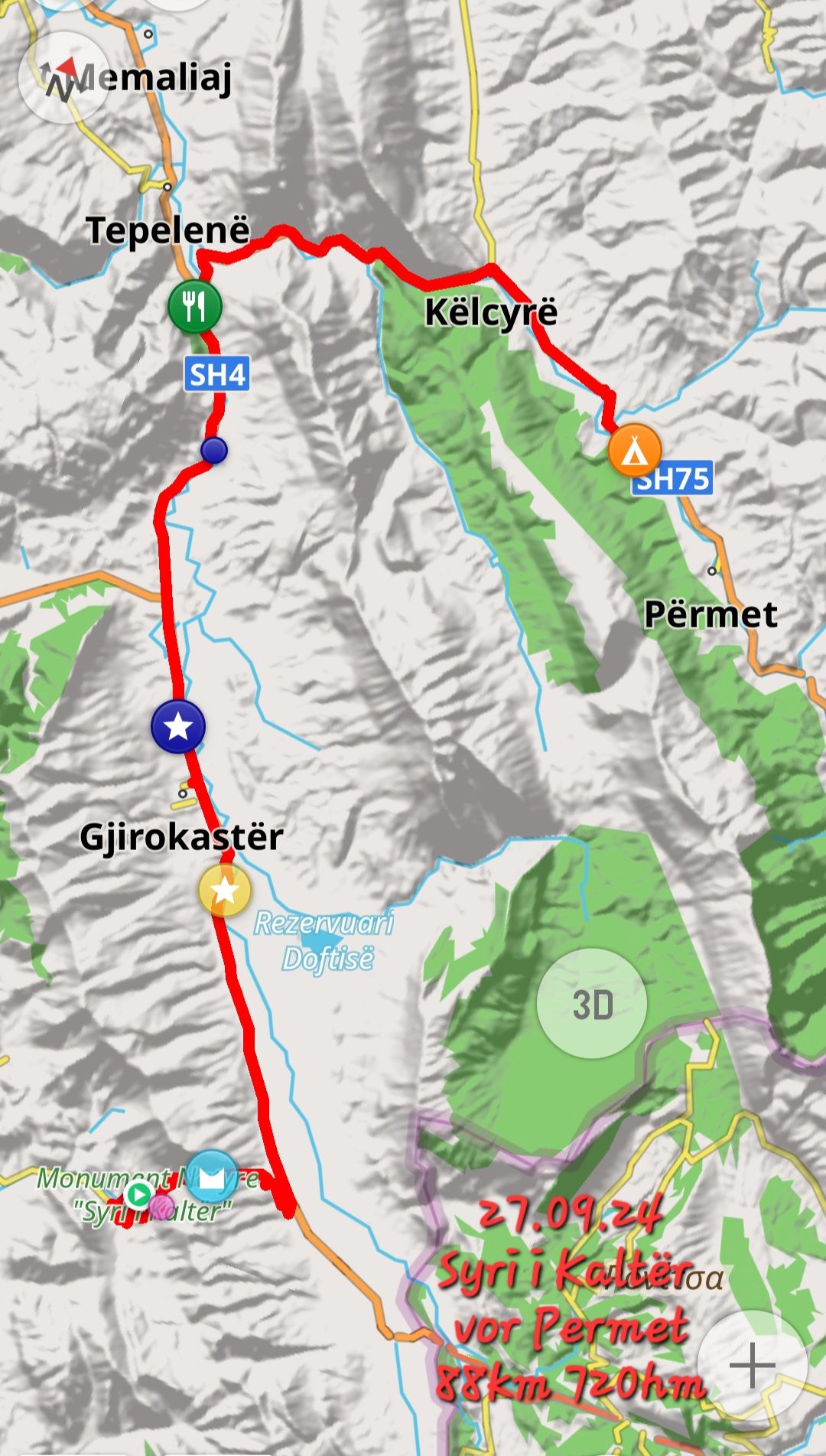
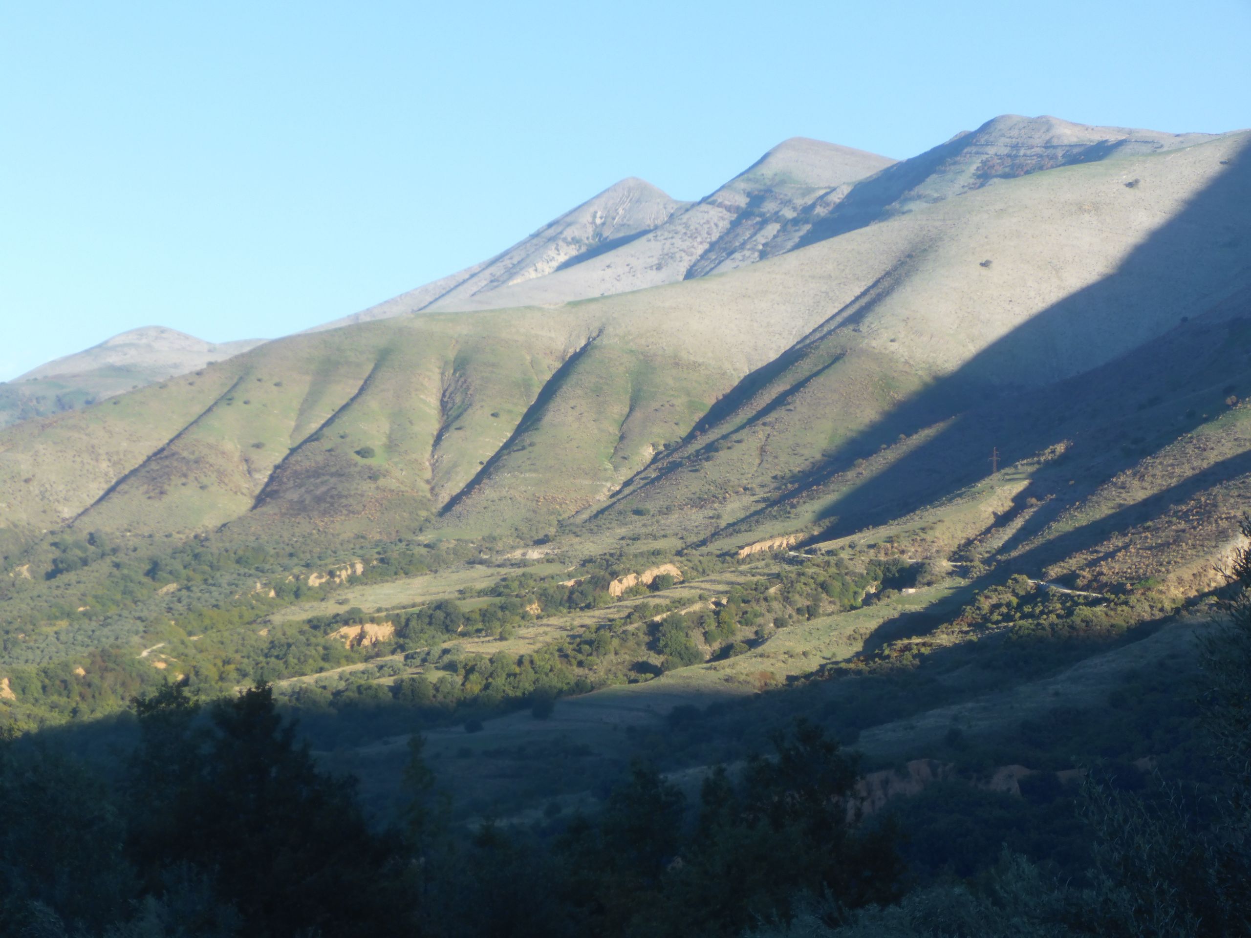
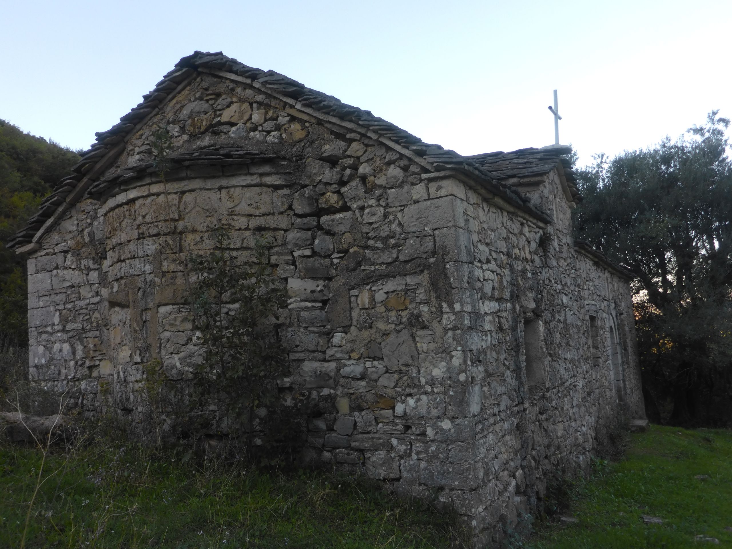
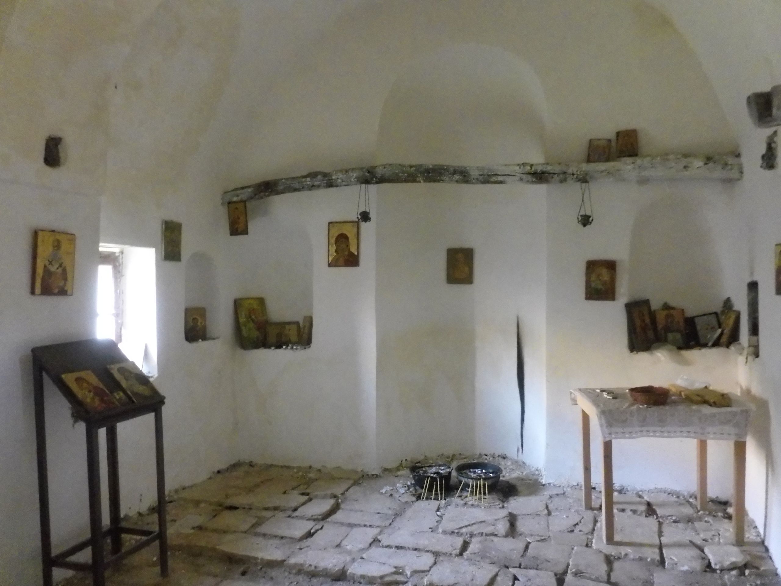
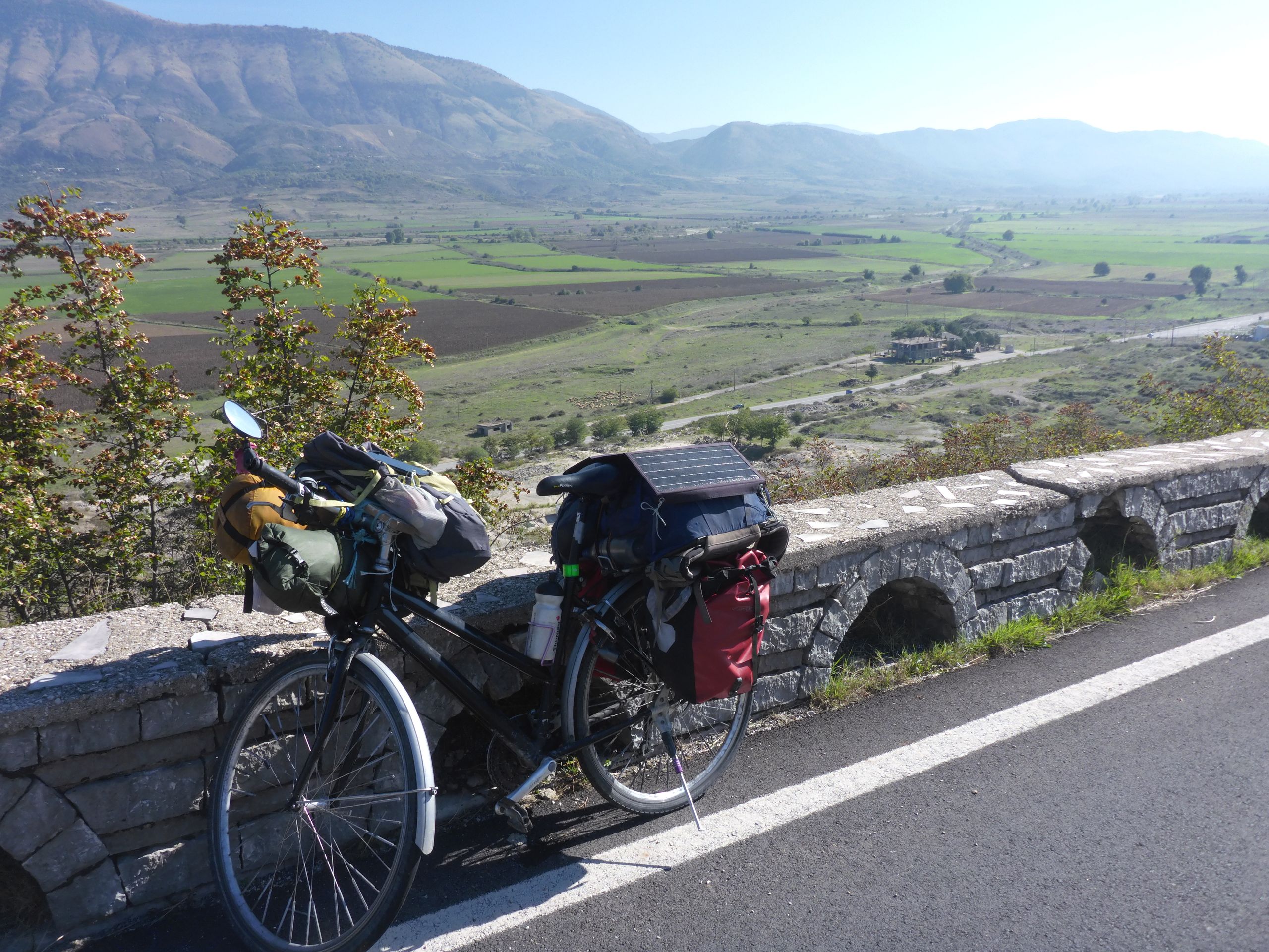
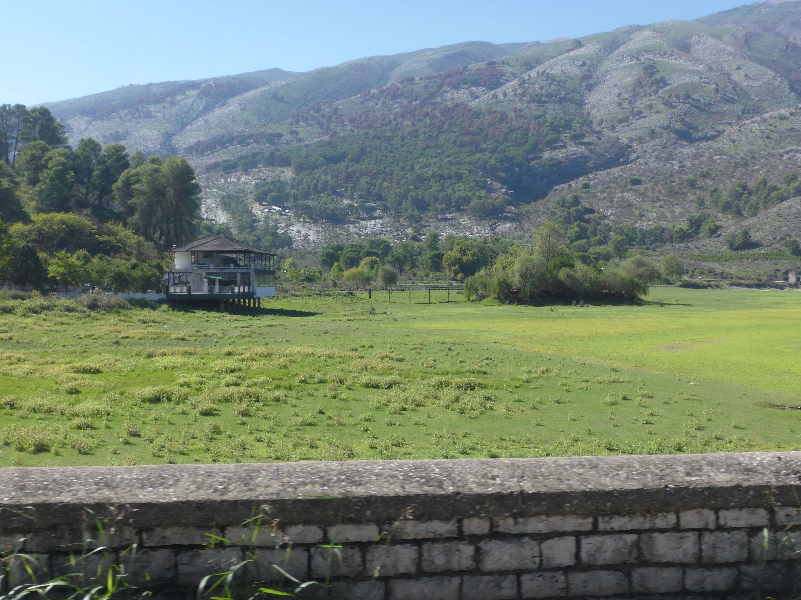
28. 8. 2024 Syri i Kaltër-> before Përmet, 88km 720hm. Just before 4 a.m., I am already awake and despite relaxation music, I can't fall back asleep. Thoughts occupy my mind. What of my luggage do I need in Nepal, India, and New Zealand? Can I send something home, leave a bit for vacation, or just give it away? And then I am a bit excited because I want to jump from the observation deck into the bubbling spring. With the first light, I go to the spring. Three other tents have found a spot for me. I position the camera and climb along the platform outside. This is going more smoothly than I expected. I wonder if the splash will wake the campers. The jump goes well, and the water pressure brings me straight back to the surface and pushes me into the river. That went well. When I am dressed again, one person stands before the tents but says nothing further. I roll along the promenade path of the dam. Here, all stalls are still closed. The ascent to the Muzines Pass, 570m, can begin. Only 25 cars get up to there, and I can completely drive in the shade. I make a stop at the small rubble stone church. It is even well-kept inside; apparently, people come to pray here every now and then, even though there are no pews. I have breakfast a bit below the pass because there are several curious dogs up top. Behind me, I can hear a shepherd calling and the ringing of bells but cannot see anyone. The descent takes me into the wide valley of the Lumi Drinos. Just before the end of the descent, my bike starts to swim, so I have my seventh flat. Once again, it's a thorn that I probably picked up at the roadside. On the straight, wide, and flat main road to Gjirokastër, I can, for the first time, ride for over two hours at an average speed of over 20 km/h. At a bridge, the water looks good. I dare to go for a swim. So far, the rivers I have seen were always very polluted. But the Drinos is fine. In Gjirokastër, the big church catches my eye. But it is closed. When I take a quick look at the shopping street, I don't discover anything special. A lake just behind it, where I would have liked to take a break, is completely dried up and covered with green grass. So, I first take a break at a small restaurant at the junction to SH 78. Another guest has good-looking goulash. I order that too. It only costs 500 Lek. I use the WiFi. After a turn for the road into a narrow valley. A bright blue river comes more towards me. The road leads with short steep inclines with moderate gradients along the slope. I repeatedly have great views of the river. Behind Këlcyrë, where the mini-markets have already closed, and I can't buy beer, I find a nice spot by the river. The rocks are a conglomerate of stones that look like concrete. Between rocks and deposits, I can go swimming. I have to be careful that the current doesn't sweep me past the entry point. Until sunset, I sort pictures and eat the granola that I had actually prepared for lunch.
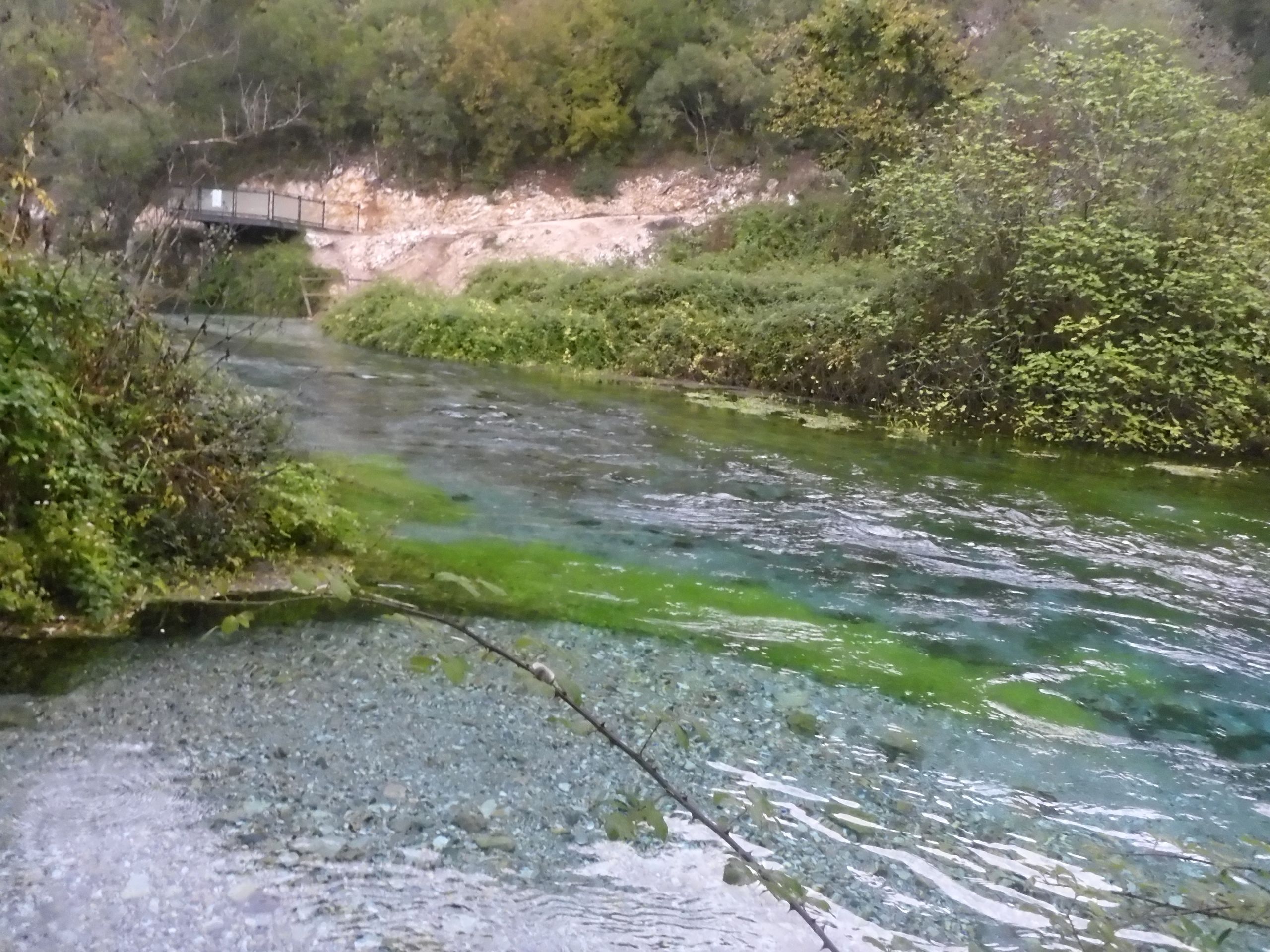
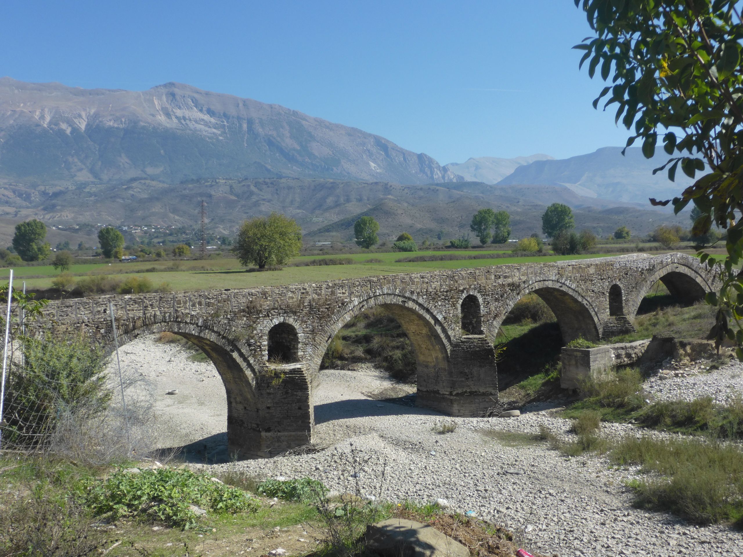
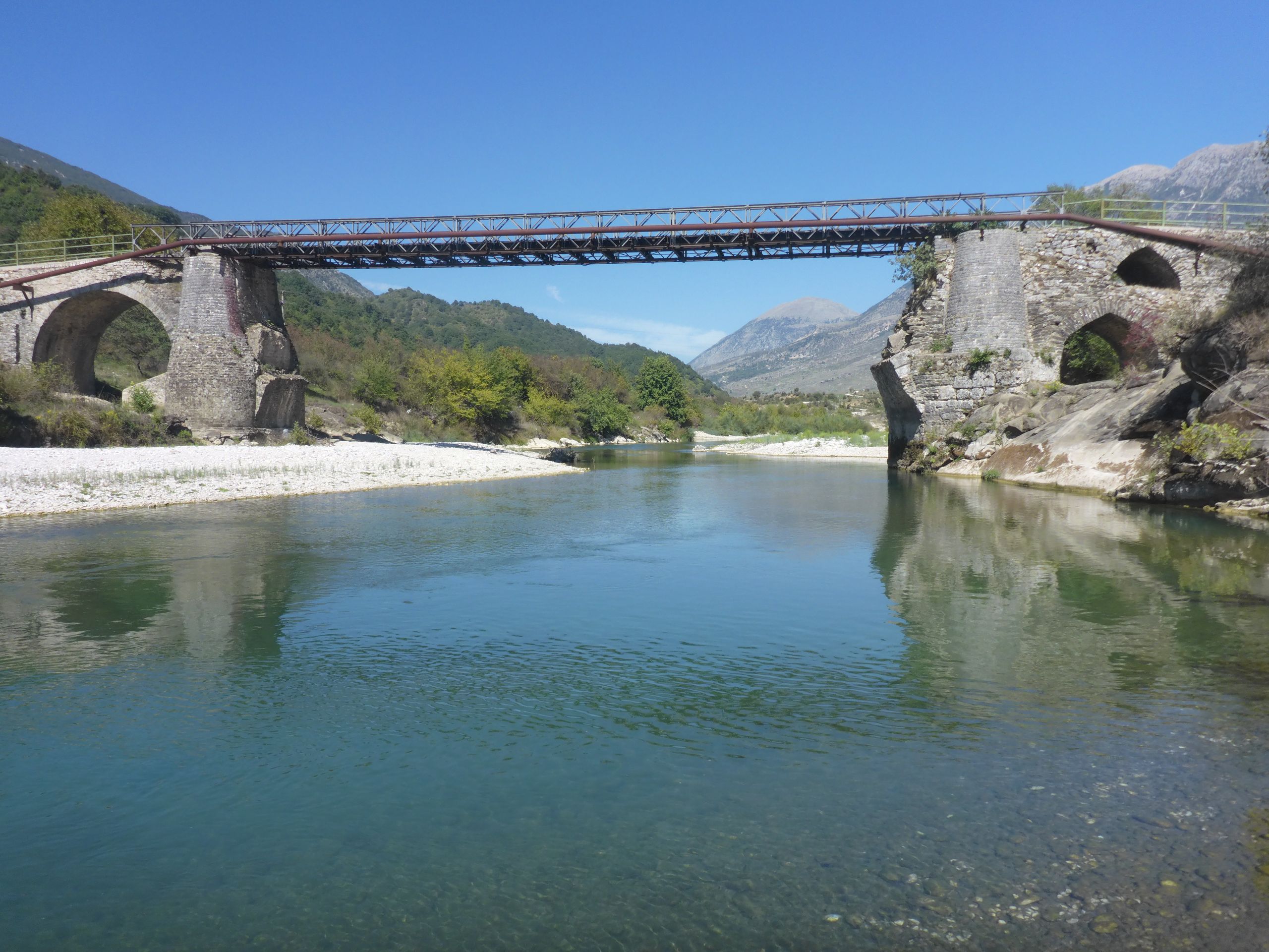
29.9.2024 Piskove -> Lengarica Canyon, 20km 190hm + hike around the Lengarica Canyon, 14 km 670 hm. I stay in the tent until the rain stops. Përmet is already a larger town. There is a small park and a shopping street. Here, the buses to Tirana also start. I just can't find the water tap in the park, but I can shop well. I stay on the left bank of the Vjosa and drive the gravel road to the next bridge. Here, there is water. At the junction to the canyon, I take a breakfast break. The small road behind me is surprisingly busy; many people want to go to the canyon. I set up the tent in the parking lot behind the seating area. Of course, now a few raindrops have to fall, but the sun shines right again and will dry everything. Behind the pointed stone bridge, there are several baths with hot springs. I save those for after the hike. I climb up to the viewpoint on the northern bank. In two places, the path is not well marked, and I use the GPS. The view is already great. The sun moves over the canyon and lights up various spots. The path rises further, leading through a beech forest back to the edge of the canyon. Here is the narrowest point, but there is no bridge. On the way to the bridge before the dam, I am surprised by a shower. I don't have a poncho with me, so I quickly take off my clothes and pack everything in my backpack so it doesn't get wet. At the bridge is the turnaround point. I had thought this bridge would also be a curved stone bridge, but it is a one-lane steel construction without a railing. The way back along the southern bank starts and ends over a roadway, while the middle part is a footpath. The most beautiful spot is again at the bottleneck of the canyon. Here, I eat my granola and take a nap. For the hike, I go to the biggest basin until the sun disappears behind the mountain. While I cook at the seating area, I can charge my phone using the mobile charger of a couple from Schleie in Schleswig. They invite me for a wine in their camper and tell me about how they met at travel school in Africa.
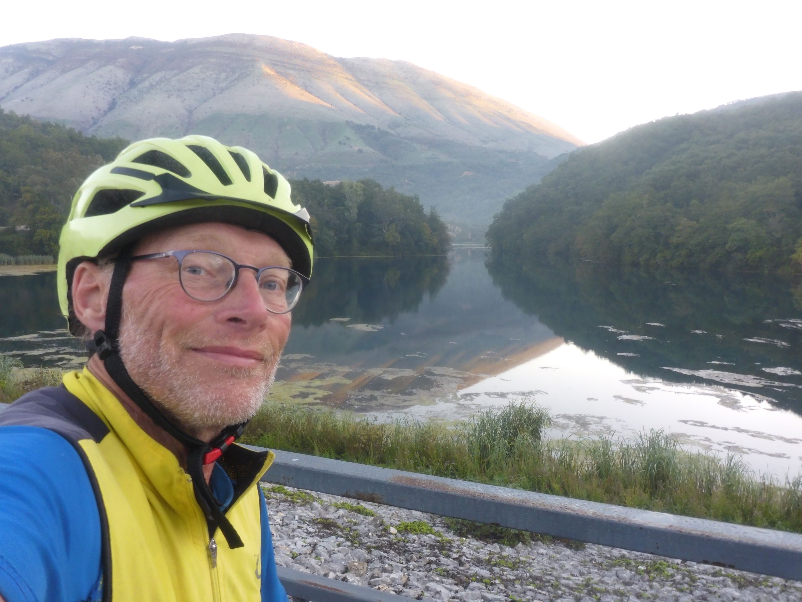
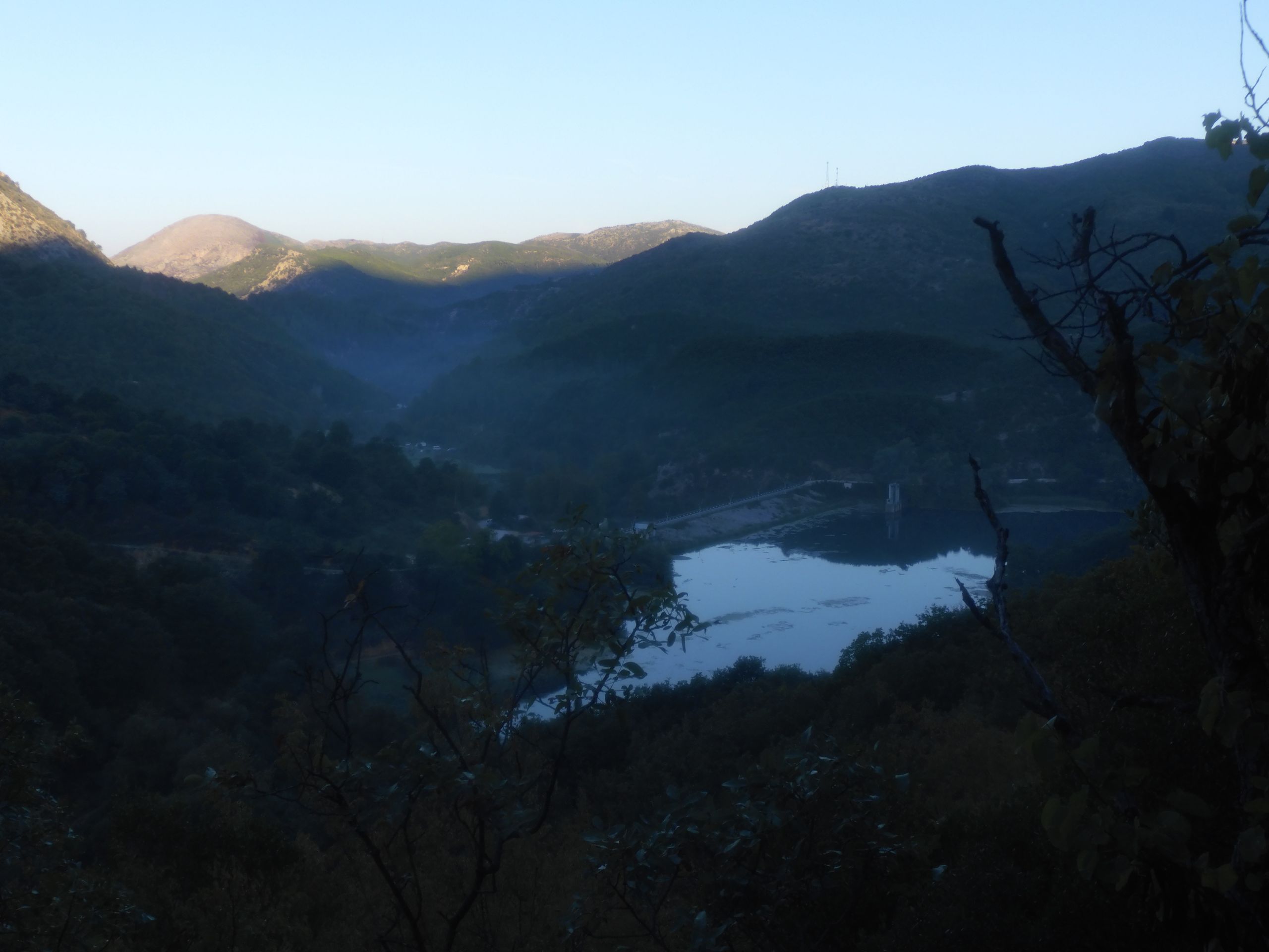
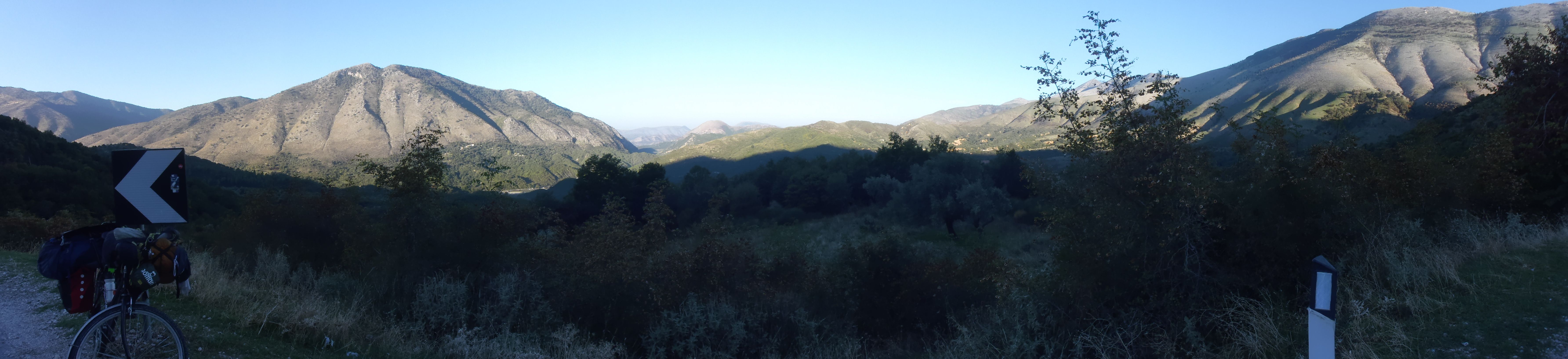
30. 09. 2024 Lengarica Canyon crossing 14 km + -> Çarçovë, 28 km 340 hm. To get straight to the point, I would do it differently next time. Namely, I would start the hike on the northern bank above the canyon and return through the canyon. Behind it, one is always wiser. So, I begin at 7 a.m. at 11°C with the crossing of the canyon upstream. At first, it is only ankle-deep through the water, and there are many dry areas to walk. Just before the middle of the canyon, I have to walk through a meter-deep water. The ground is muddy silt that pulls hard on the sandals. The water gets deeper in the upper area. I have to take everything off and carry the backpack on my head. The water is up to my neck. Once, I slip and almost fall into the stream. I freeze and am hungry. In a place where sunlight has probably never reached, I have breakfast while trembling. I hope that I can get out of the canyon river upstream and do not have to turn back. Indeed, I could have had breakfast 50 meters further in the sun. Now the river rises a bit steeper, and there are no deeper spots anymore. Below the dam, I can conveniently reach the hiking trail on the northern side via a rocky ledge. I already know the way back. At the viewpoint in the middle of the canyon, I meet two German couples. I proudly tell them about my adventure. For 20 minutes, I lie in the small basin right by the bridge. Then I tighten the broken spot on the luggage rack and take down the tent. I cycle out of the valley again and continue along the Vjosa to the east. Today, I have a strong tailwind, so I manage the climbs to Çarçovë quite easily. The small shop here has little to offer, and the restaurant where I refill my water would have liked to host me as a guest. Theoretically, I could have even pitched the tent against it, but I want to make use of the last daylight and find a nice spot at a river bend to camp. A motorhome from the Czech Republic is already there. I ask them for salt because mine is used up. But they can't help me. So I spice the noodles with broth instead. I add canned meat; unfortunately, there are no vegetables today. But with the liter of beer, it suffices, and for dessert, there are biscuit cakes.
Subscribe to Newsletter
Answer
Travel reports Albania