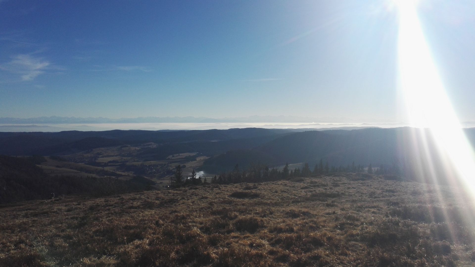
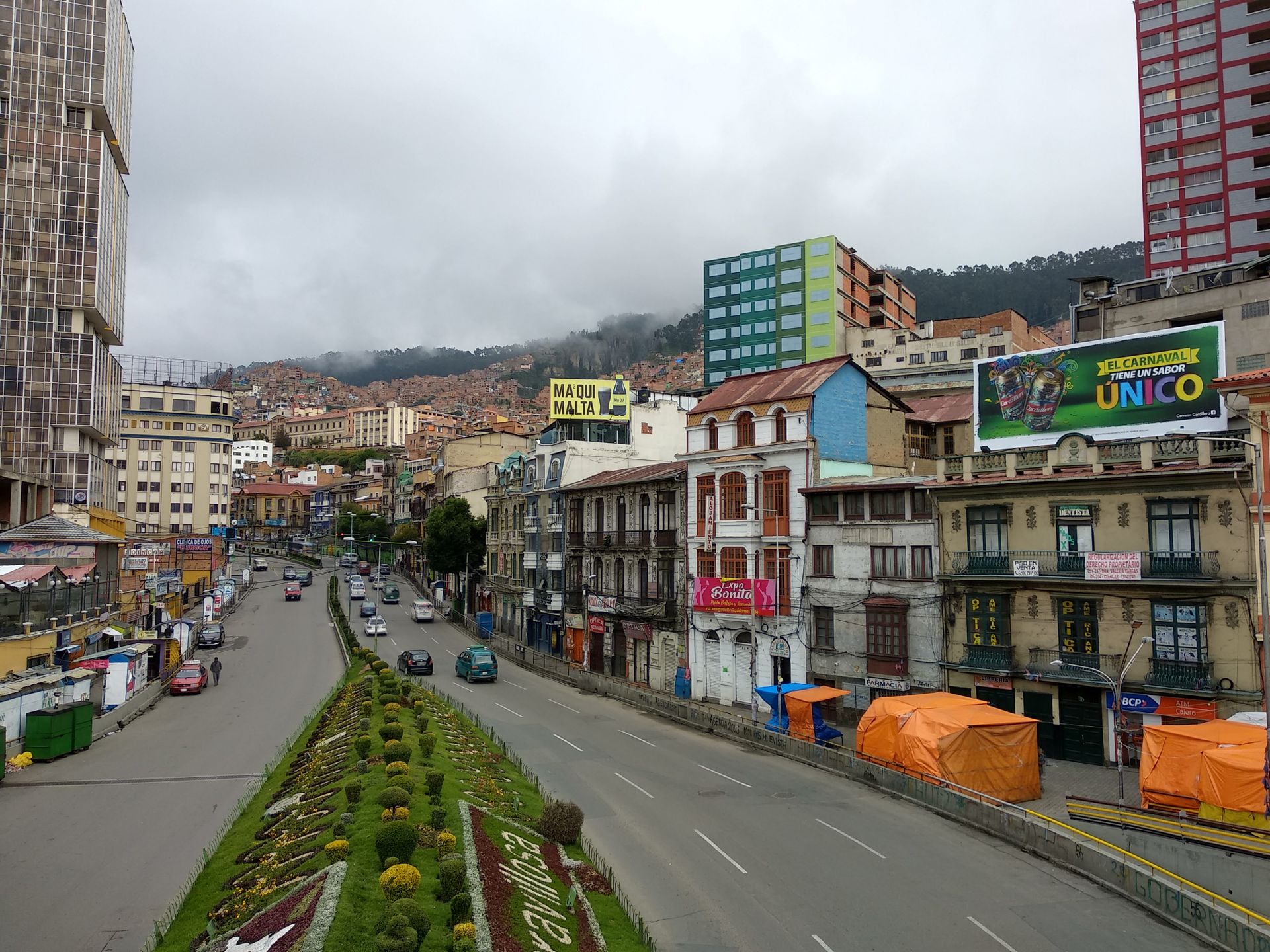
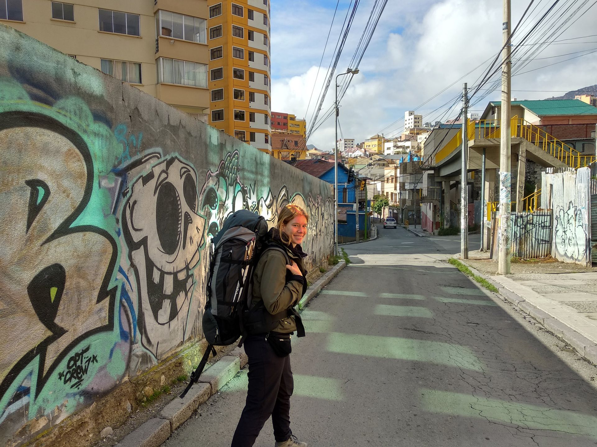
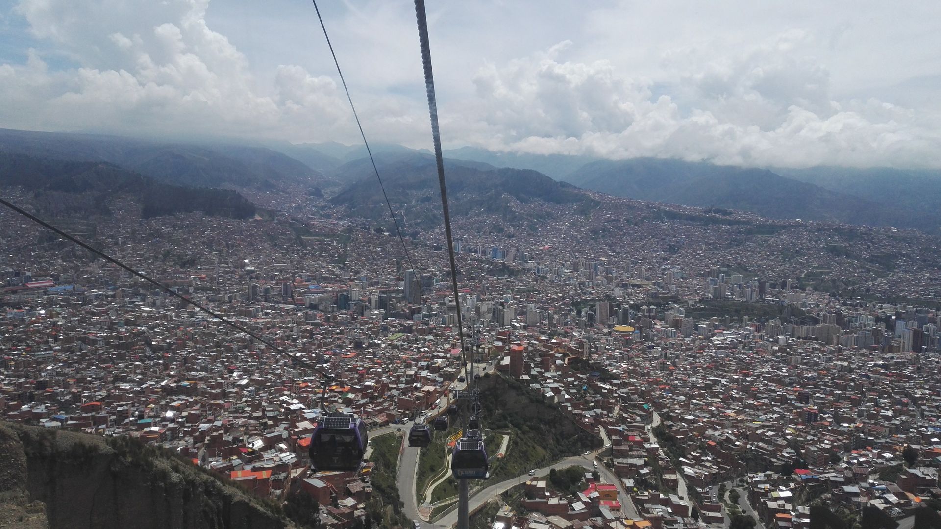
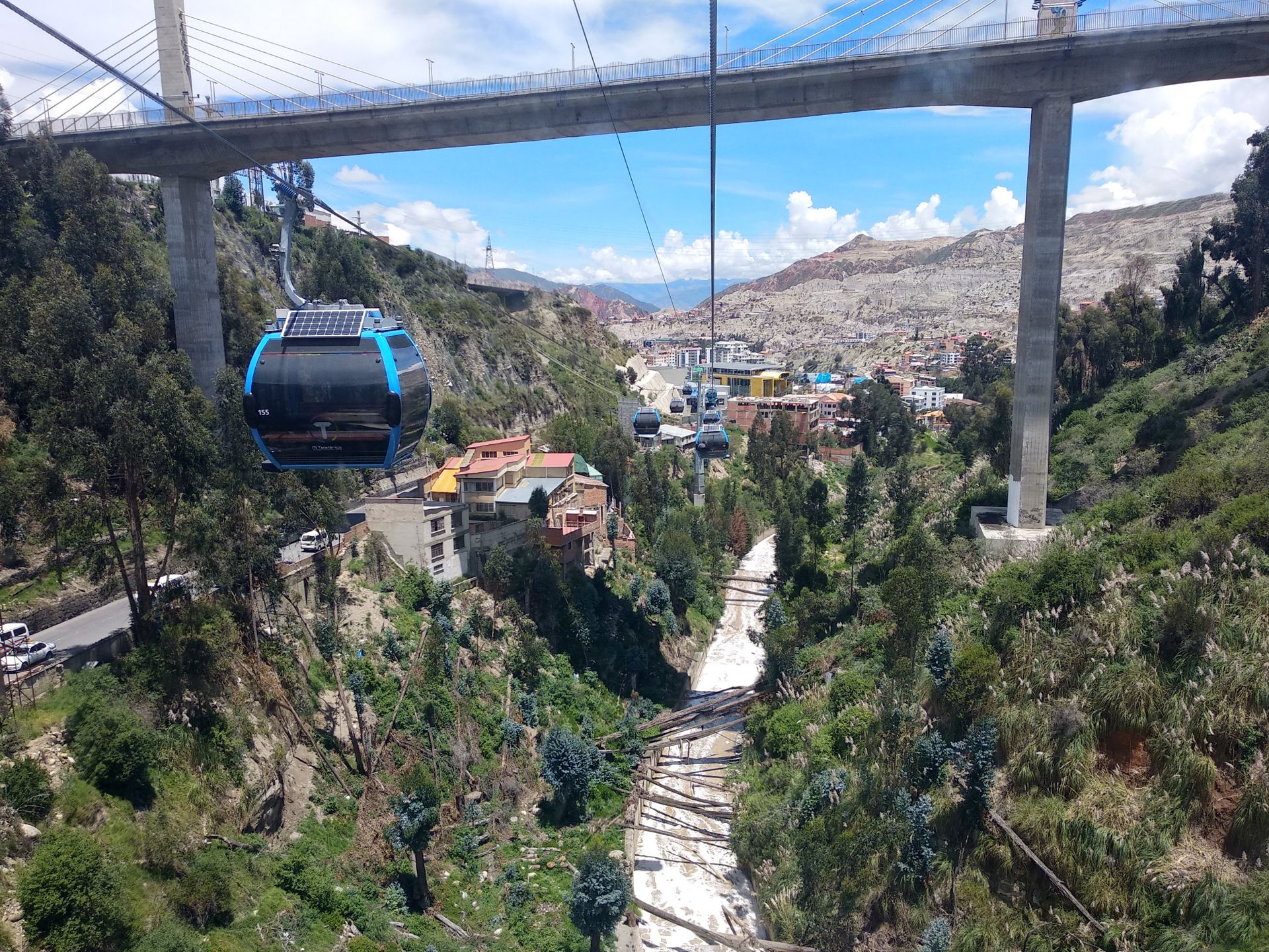
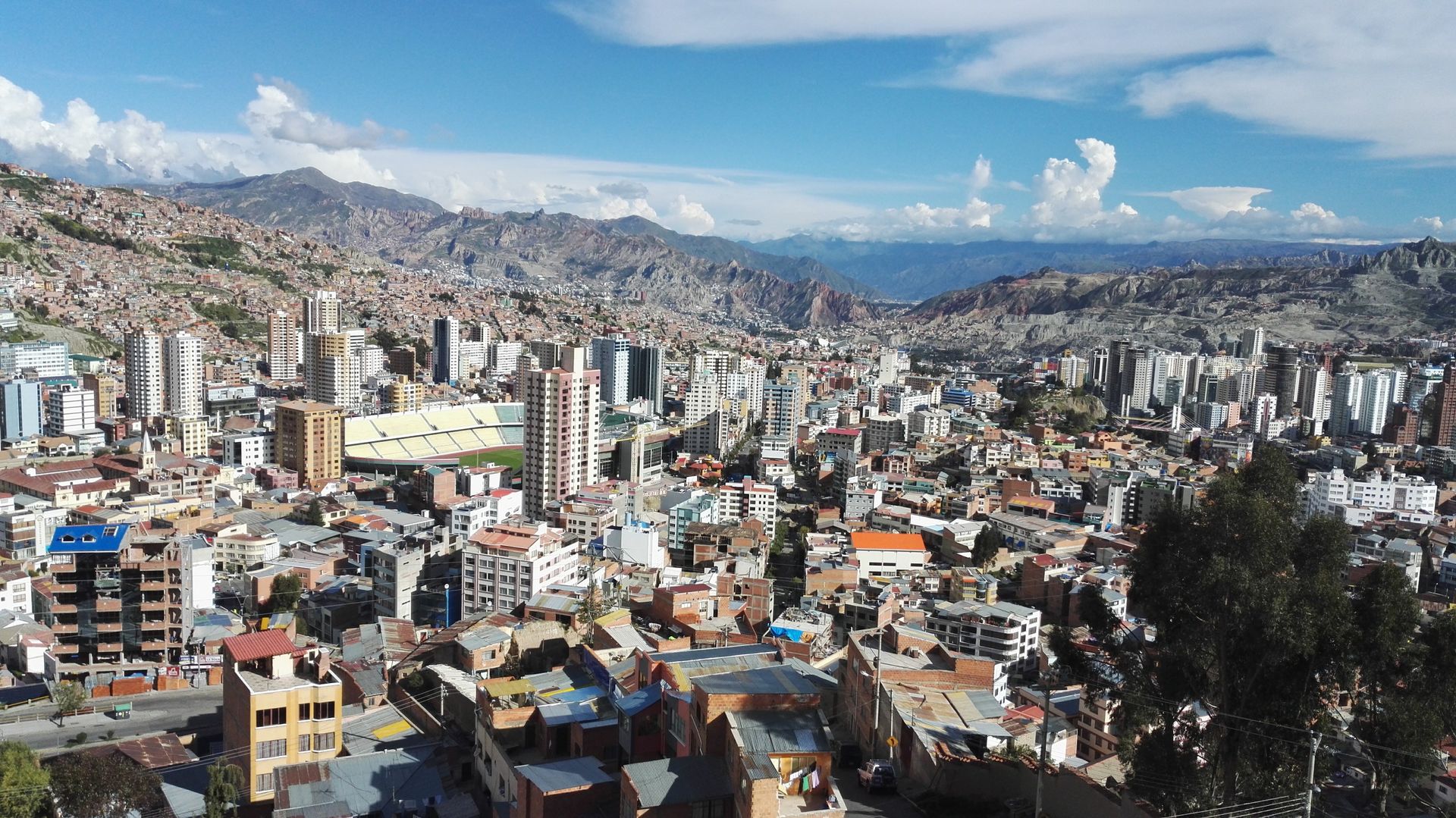
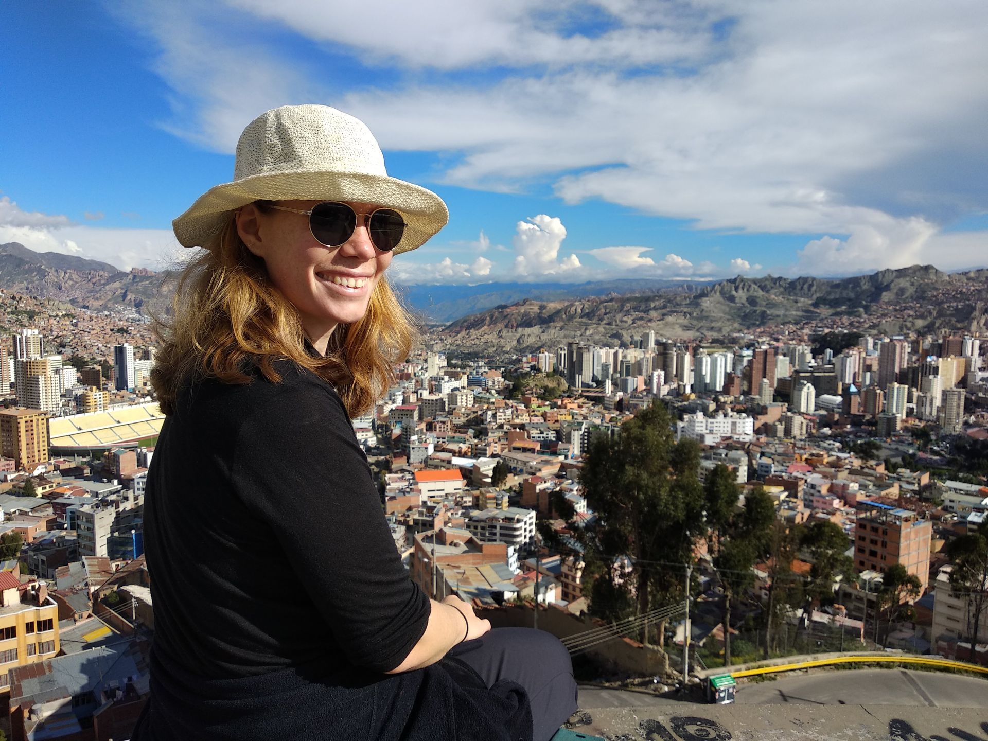
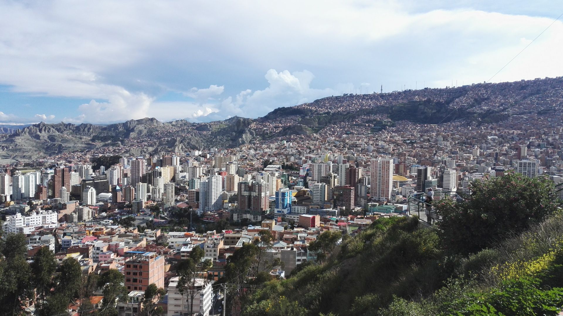
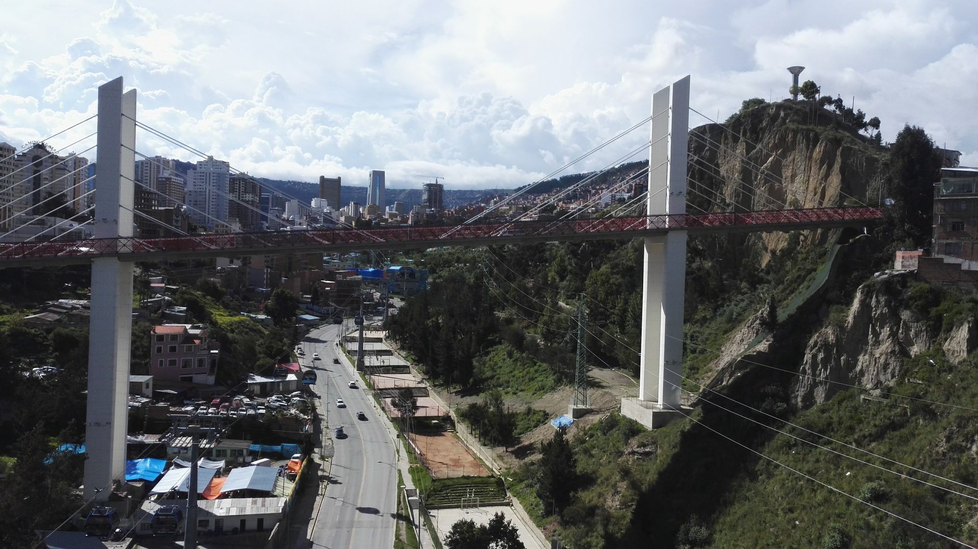
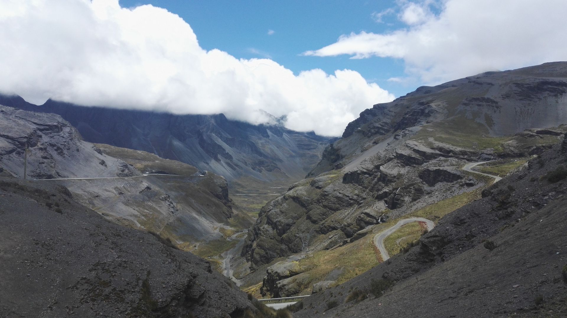
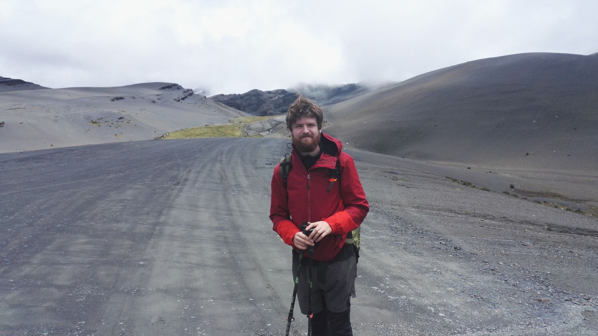
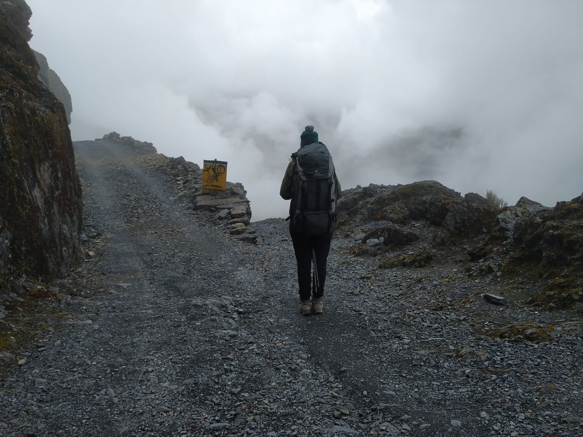
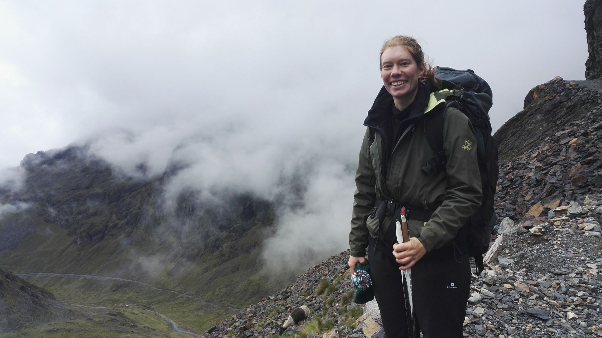
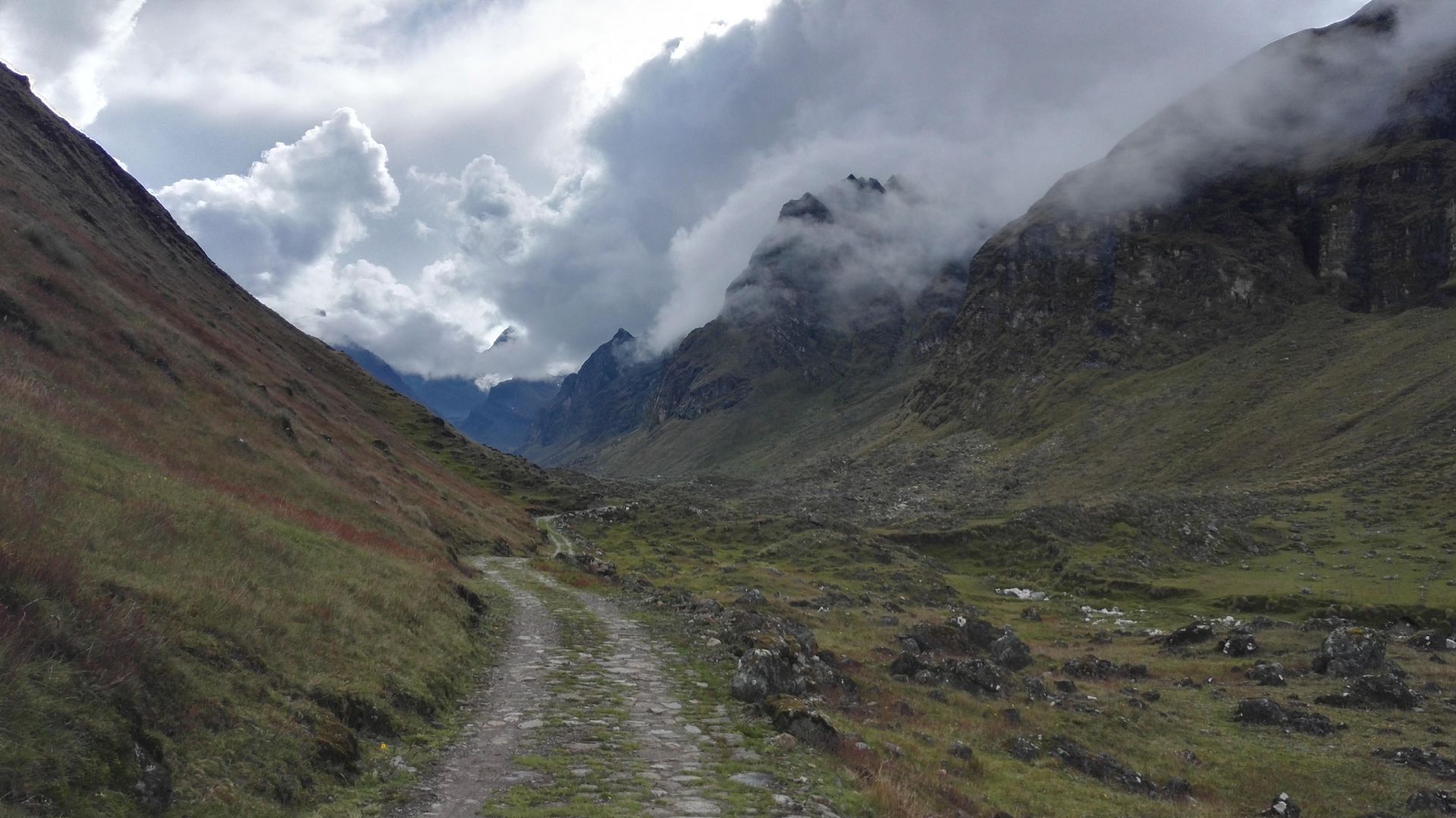
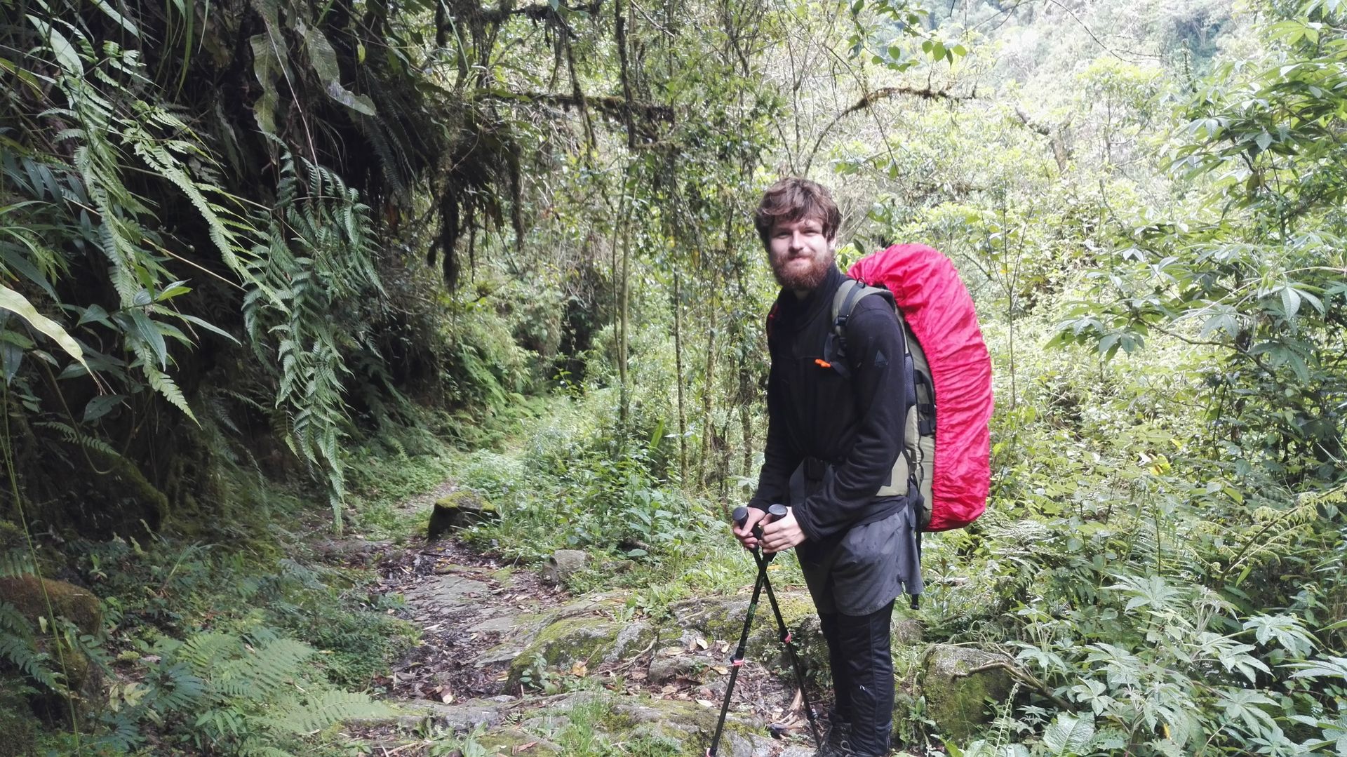
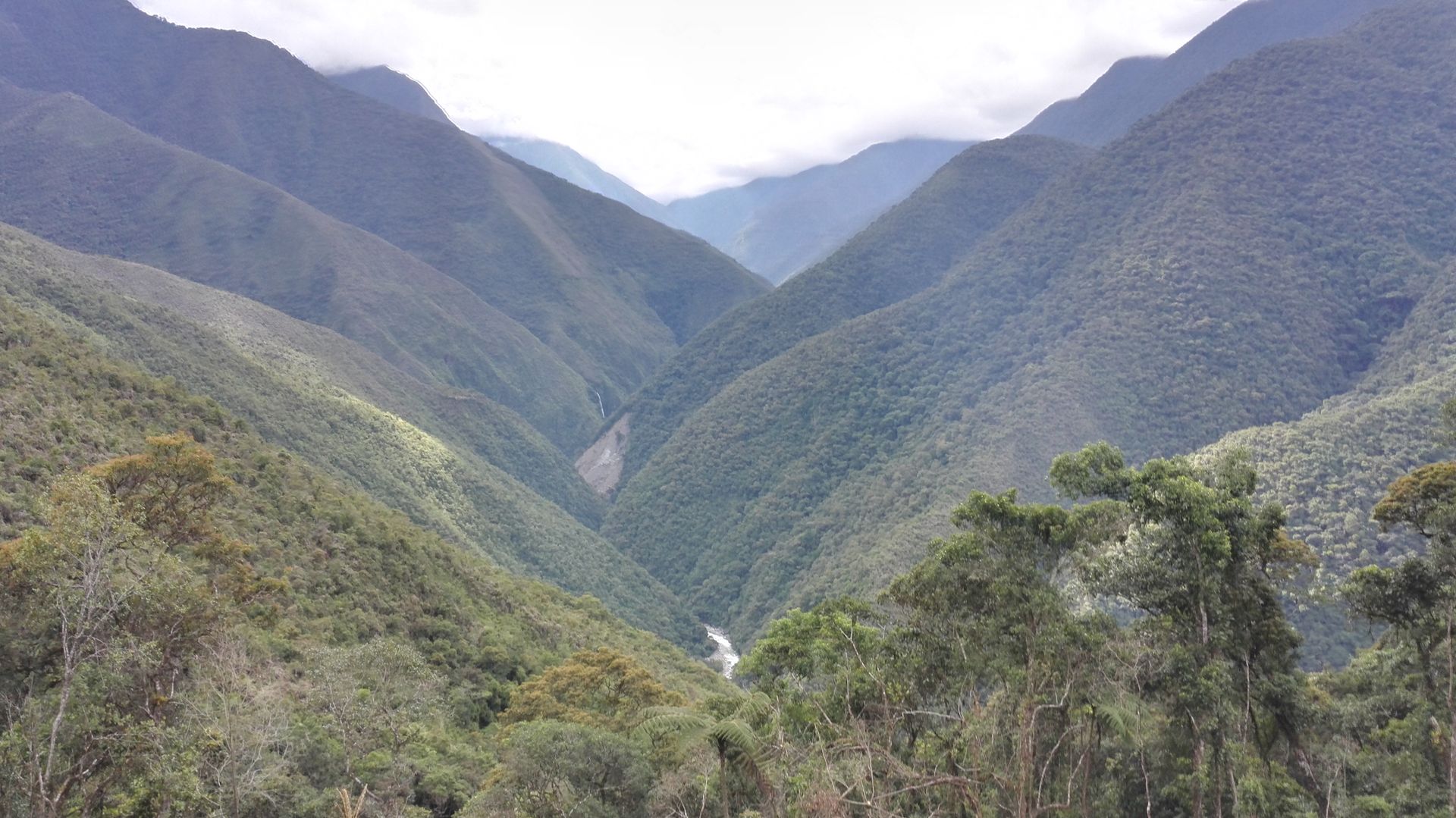
As we slowly drive into La Paz on the night bus from Sucre, it is early in the morning and cloudy. Suddenly, the sun comes out and we realize that we are in the middle of the clouds, as La Paz is located 4,000 meters above sea level. The city is located in a long canyon and everywhere you can see small red houses clinging to the mountain slopes. The higher the houses are on the hillside or on the mountain plateau, the poorer the people are. In the Sunday morning atmosphere, we walk from the bus station straight through the city to our hostel and still see some drunk people who are on their way home from their night of partying on Saturday. We unintentionally stay in the hostel for 4 nights, the reason why it became one night longer than planned will be shown below. There are a total of 8 cable cars in La Paz, which serve as a replacement for the subway and cost about 50 cents depending on the distance. We have a lot of fun randomly riding the cable cars, enjoying the view, and getting off at some corners to let ourselves be carried through the city. There are not many special sights, it is more about the feeling that the city conveys. We eat the best avocado sandwich, enjoy a lot of freshly squeezed orange juice and find delicious street food noodles with egg. We walk up to a great viewpoint and go to a nearby park. The peace and clean air in the park are very good, because La Paz surpasses all other cities in terms of traffic chaos and smog. Miriam even feels sick now when she inhales too much exhaust fumes. We realize it's time for us to escape into nature again and we plan to hike the Choro Trail, which takes three days from the Andes to the Yungas Mountains and starts behind La Paz. Equipped with plenty of food, we first take the cable car to the bus station, where we want to take a minibus to the starting point of the trail. We have to transfer to the terminal and squeeze ourselves with the backpacks into a white collectivo. We are about to get on the minibus to the starting point of the trail when Jakob realizes that his phone is missing. It must have fallen out of the bag in the white collectivo and we didn't notice it because of the heavy luggage. Immediately, we turn around and stand by the road to find the white collectivo again. A completely pointless undertaking, because there are so many minibuses on the road and most of them are white! We try to locate and call the phone, but in vain. Disappointed, we return to the hostel in the afternoon to find a solution somehow. Unfortunately, there is none and Jakob's phone is gone. The next day, the same game as the day before: first cable car, then collectivo to the bus station, only this time we check 10 times if we have everything. The Choro Trail is 53 km long, runs from La Cumbre to Chairo and crosses several climatic zones. In total, it descends 3,000 meters from the Andes to the Yungas Mountains, with some steep ascents in between. At the beginning, we reach a height of 4,800 meters, where we notice the low oxygen content and it is relatively cool. We are looking forward to the view from the summit over the Andes, but unfortunately it is very foggy and we can't see anything.
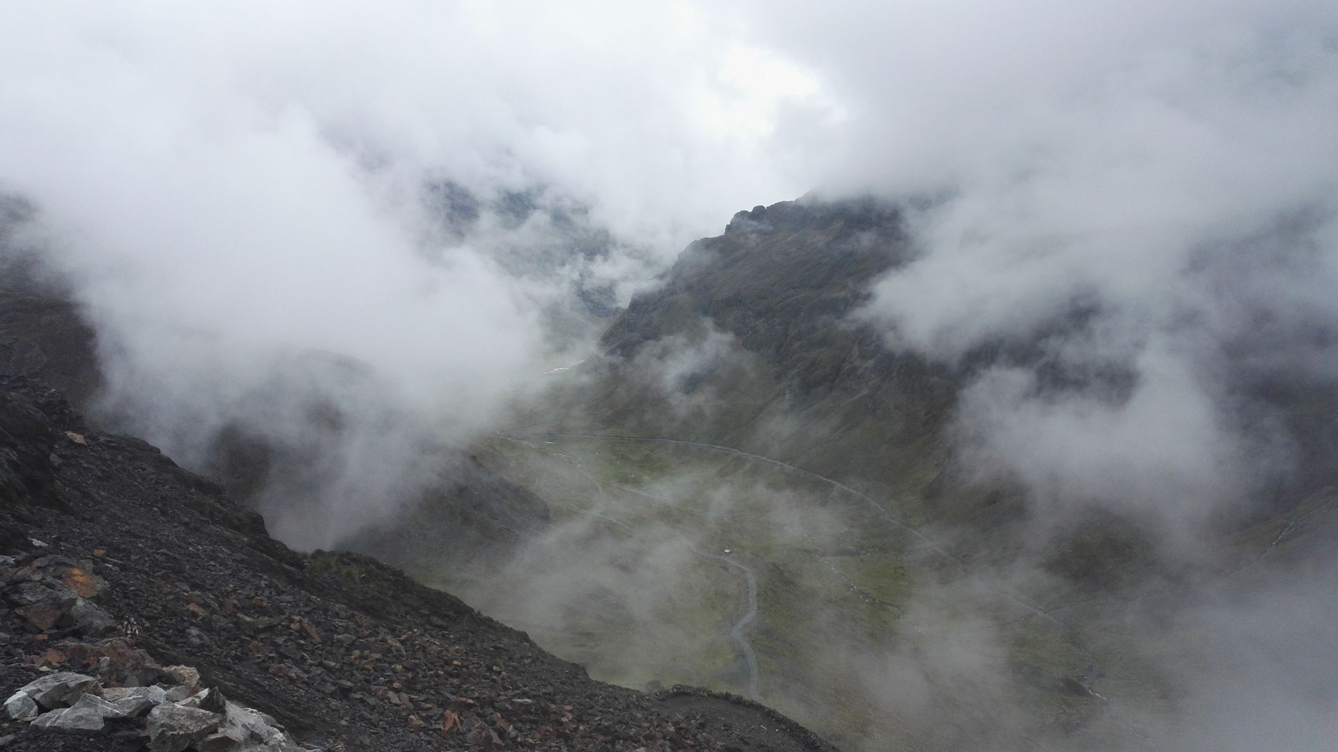
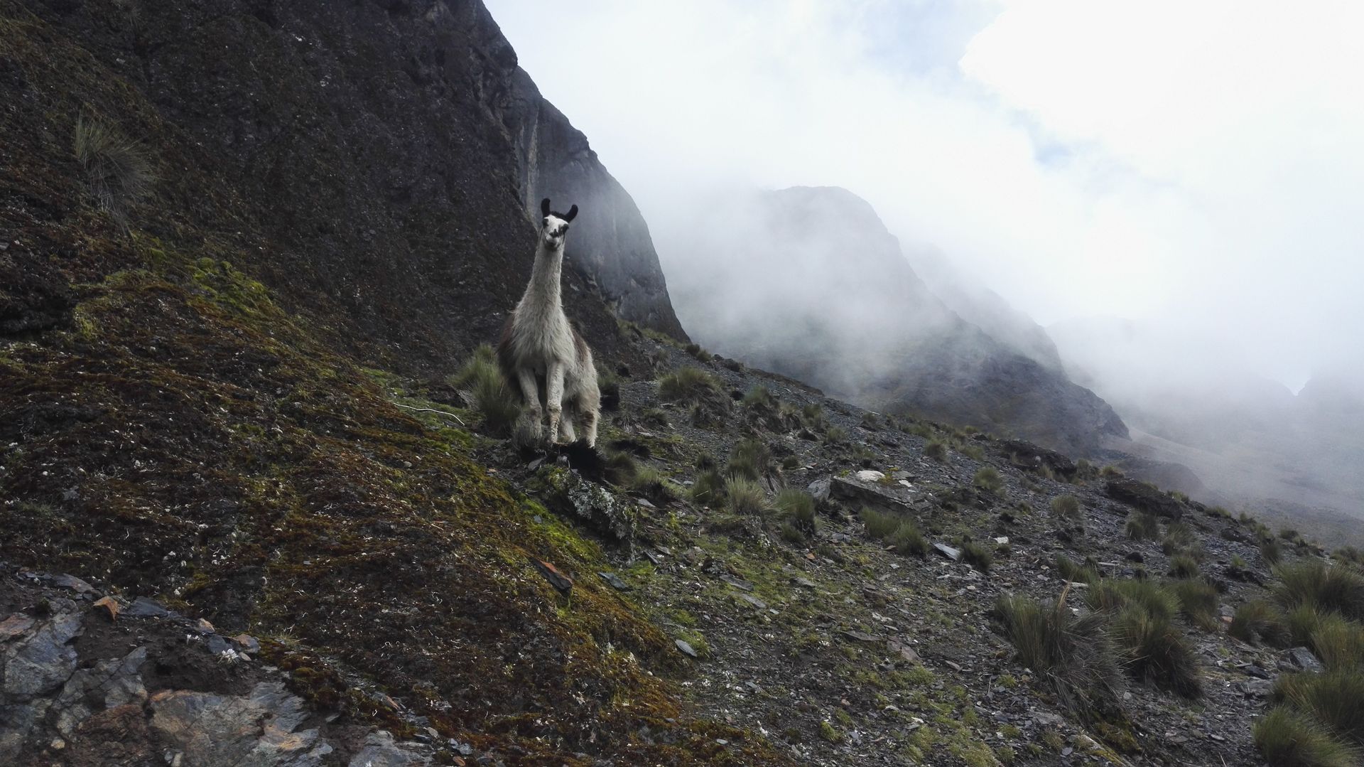
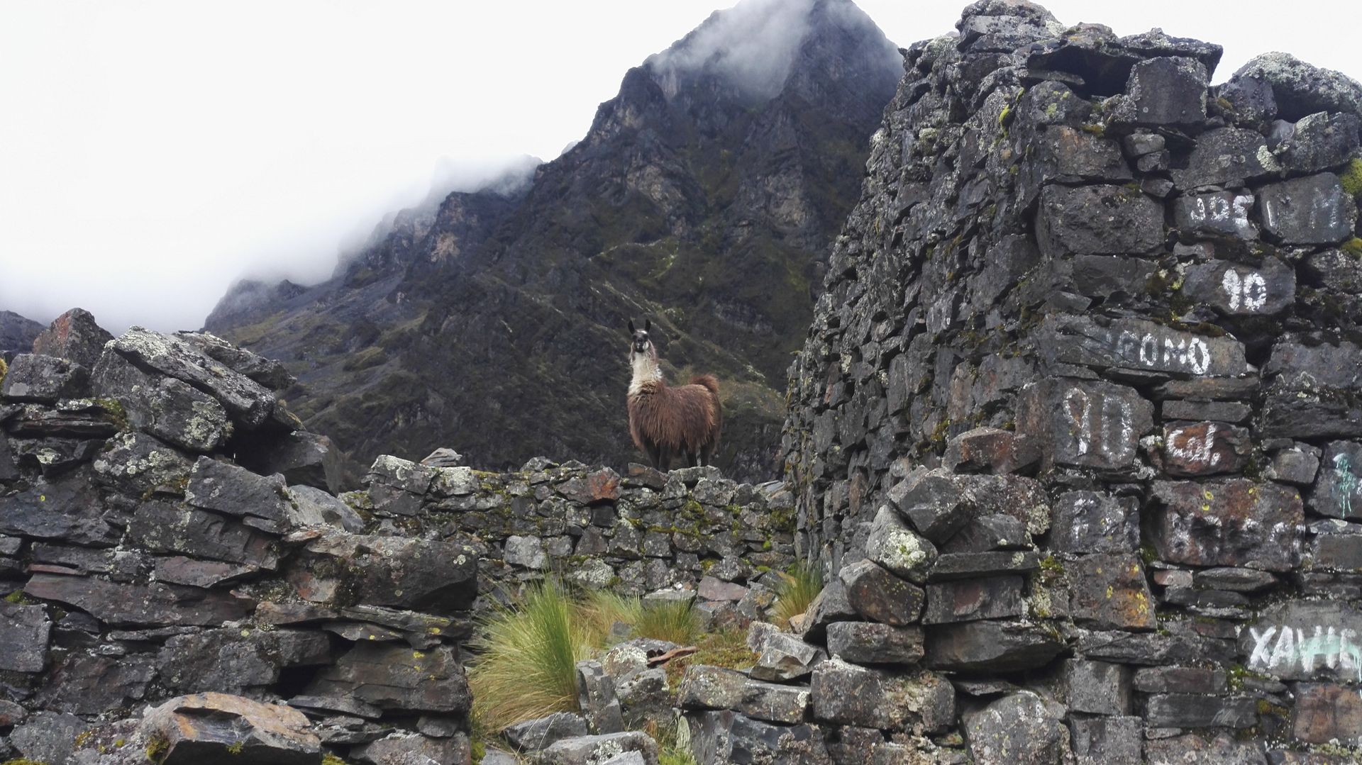
Then we descend and keep going down until suddenly the clouds move aside and a green valley appears. Horses and llamas graze on it, blocking our way. We are unsure if they will spit at us if we pass so close to them. Nevertheless, Miriam in particular is very happy to finally see the animals up close.
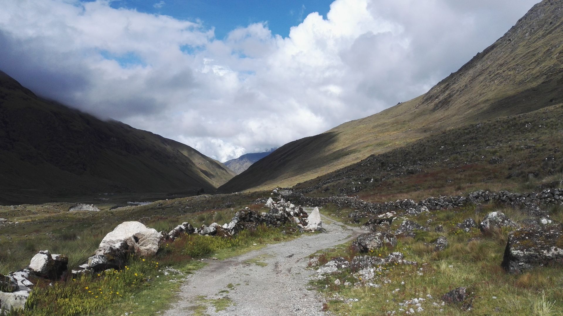
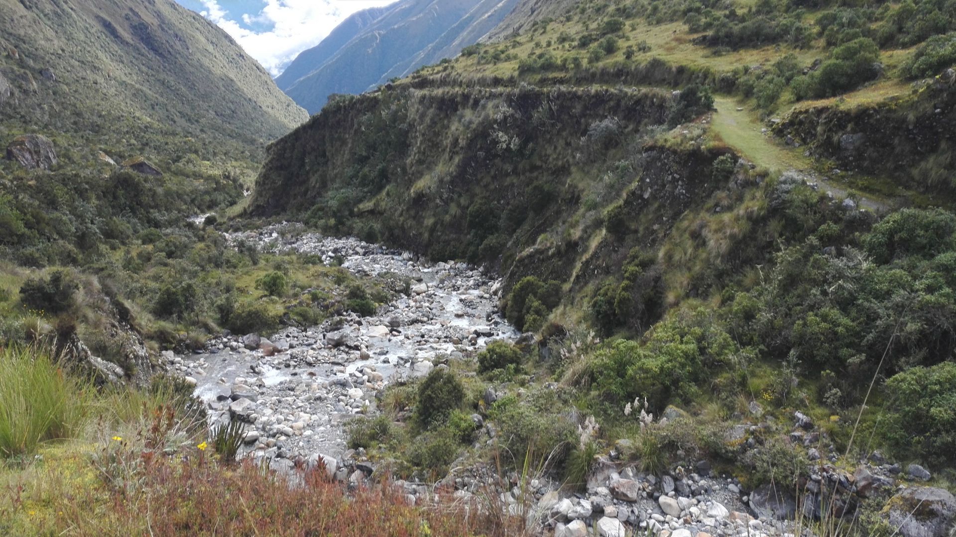
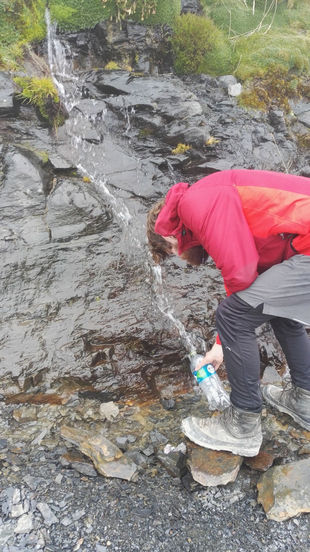
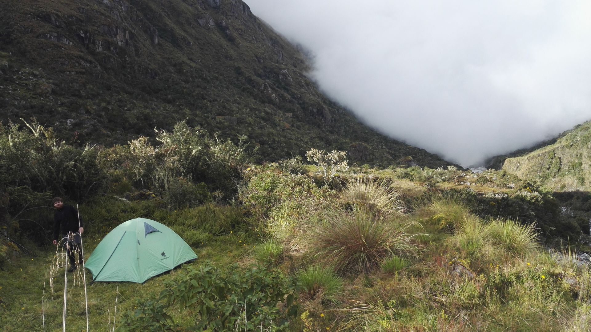
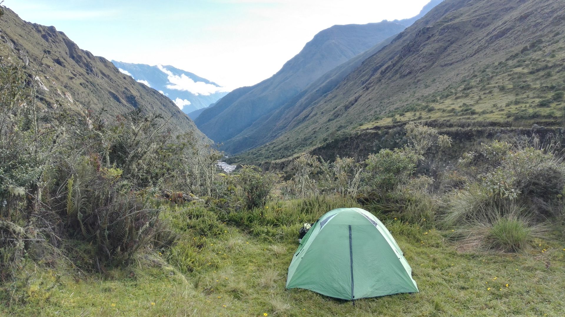
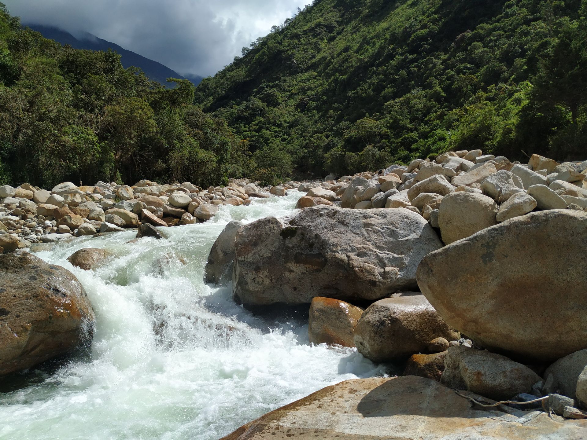
We are accompanied throughout the entire hike by a river that provides us with fresh water and later becomes a big problem for us. The water is so clean and tastes so fresh that we drink it without water purification tablets. For the first night, we find a beautiful hidden campsite with a great view of the valley.
Campsite number 1
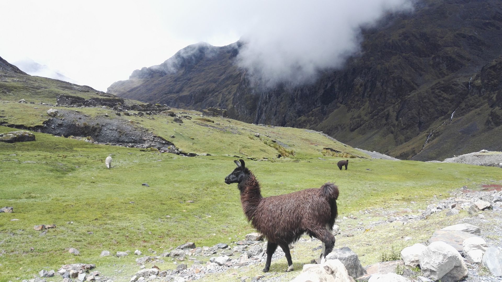
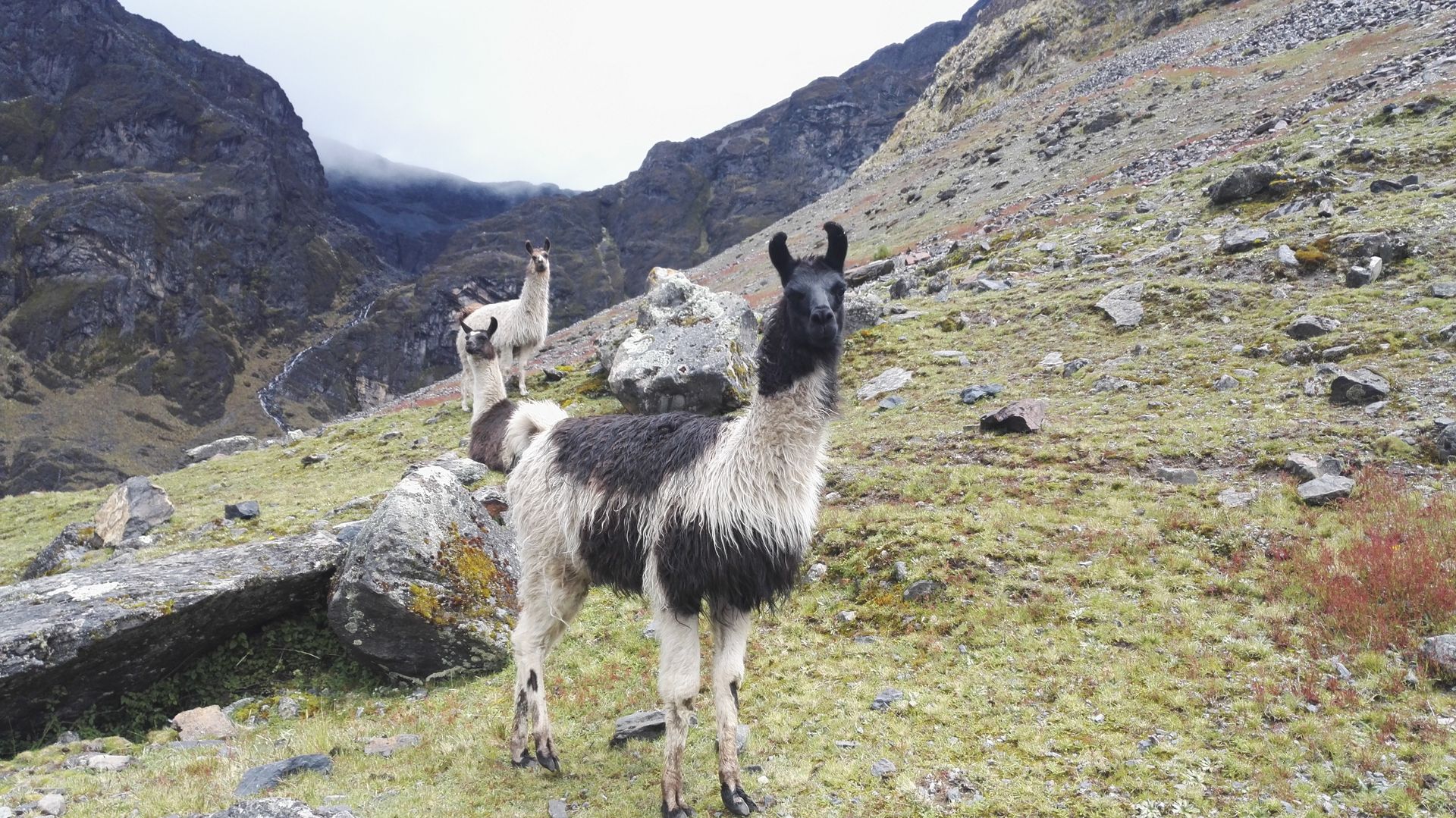
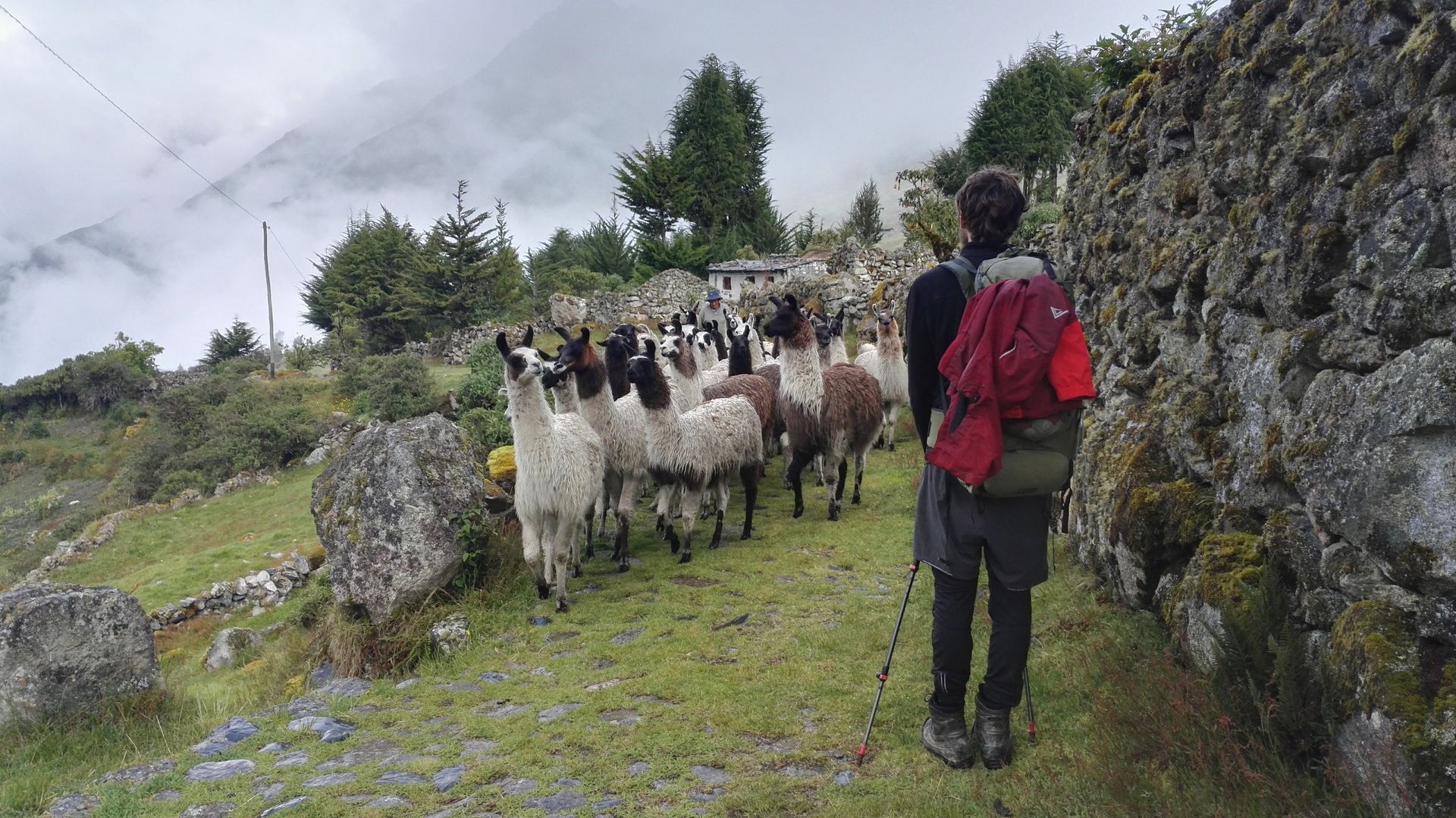
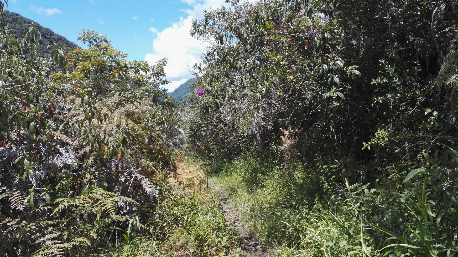
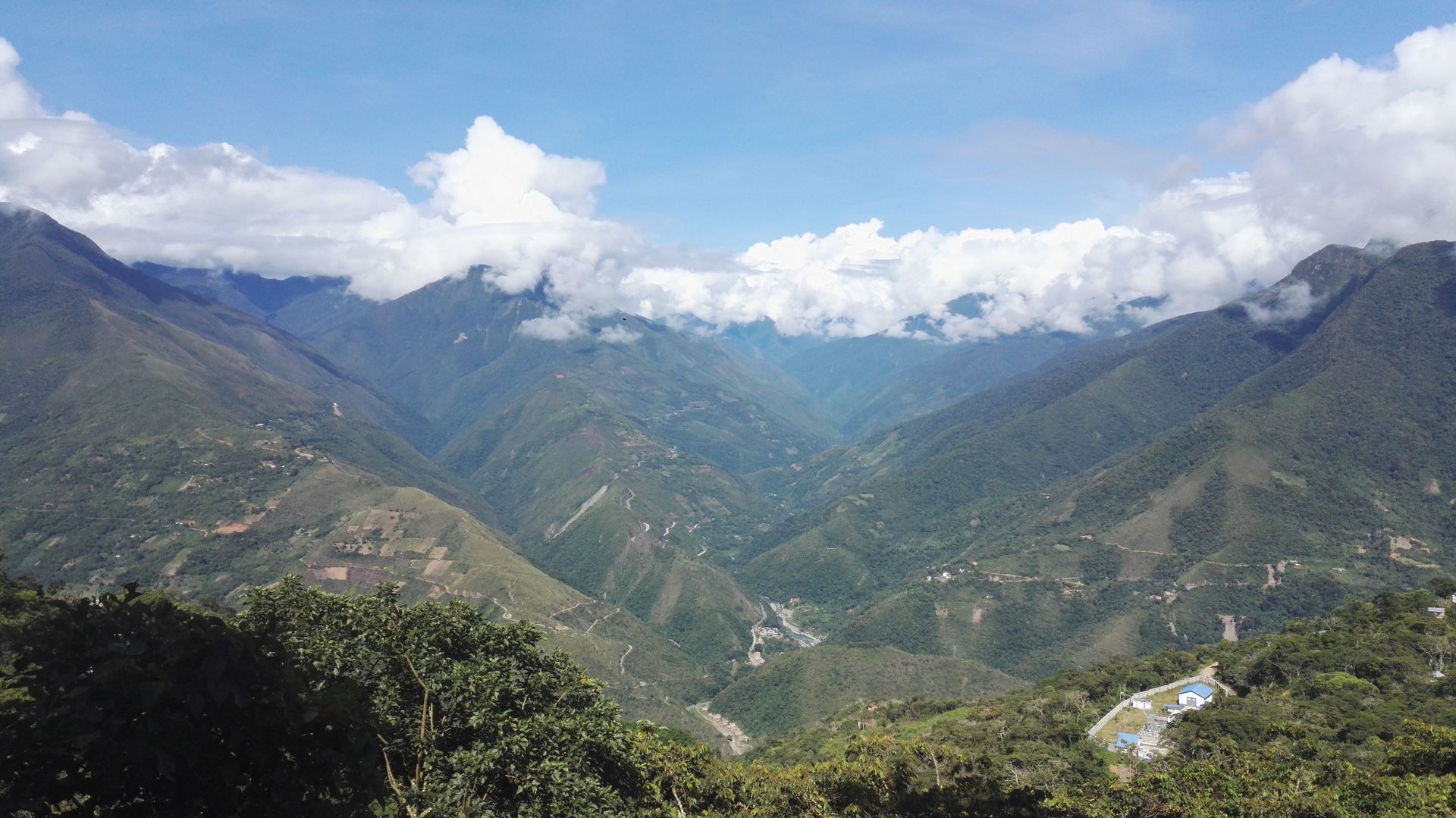
For dinner, we cook noodles with tomato sauce and peas. We are a bit confused when a farmer tells us that the bridge is broken and we should turn around and walk back to La Paz. The next day, it's all downhill. The path is not very enjoyable as it consists of slippery river stones and we often fall. The landscape becomes greener, it gets warmer, flowers start to bloom, and trees appear. So far, we haven't encountered any other hikers and we enjoy our time together. We pass through a village where a farmer drives a herd of llamas past us, and we realize that llamas can be pretty skittish.
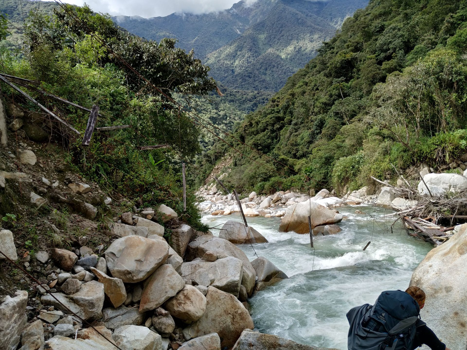
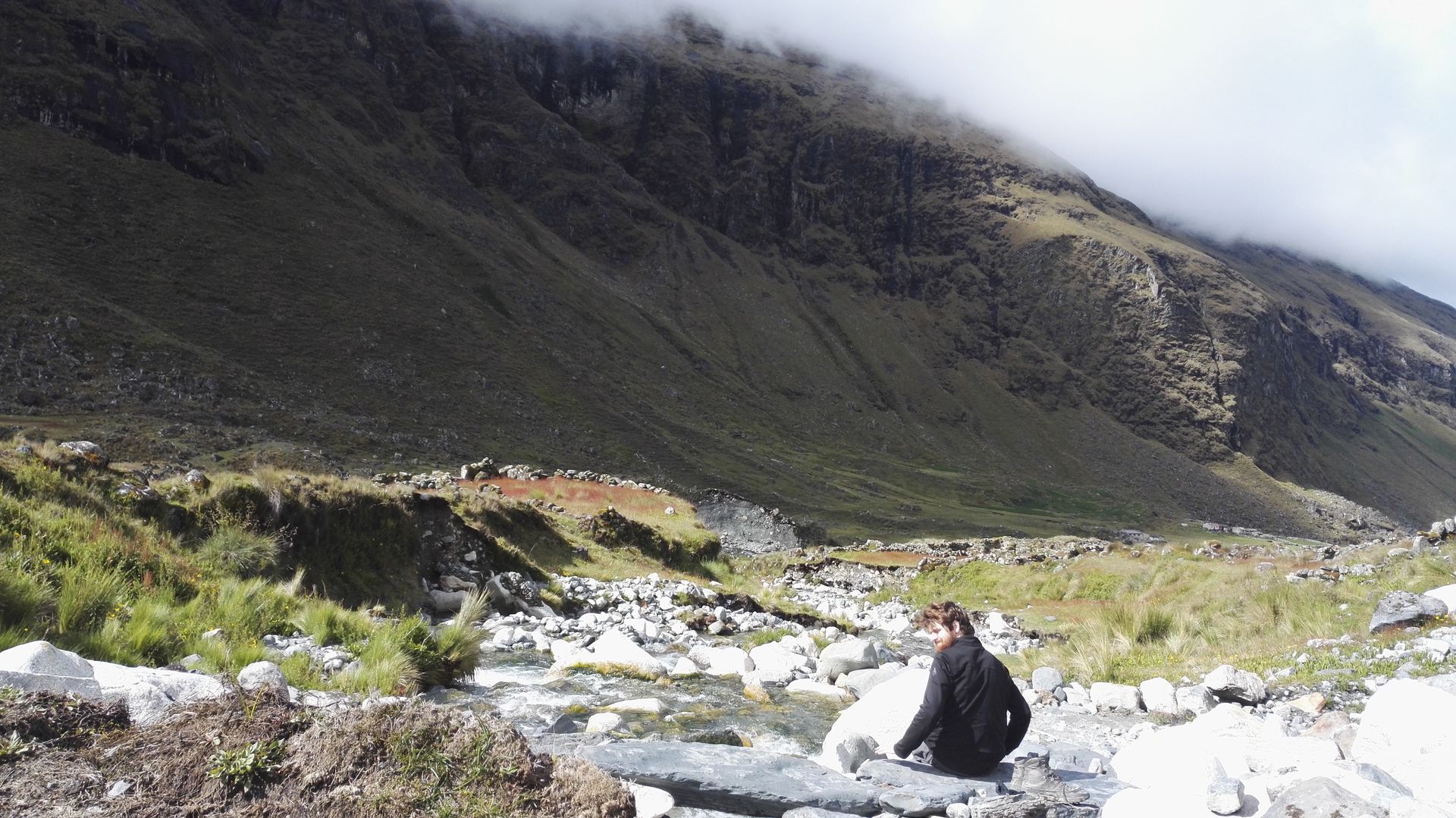
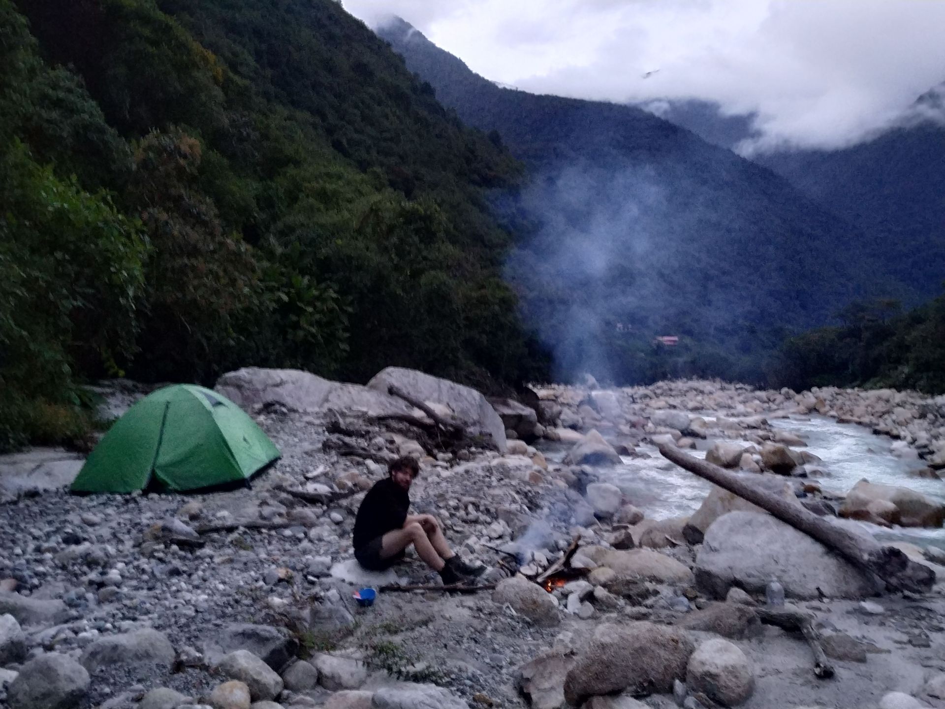
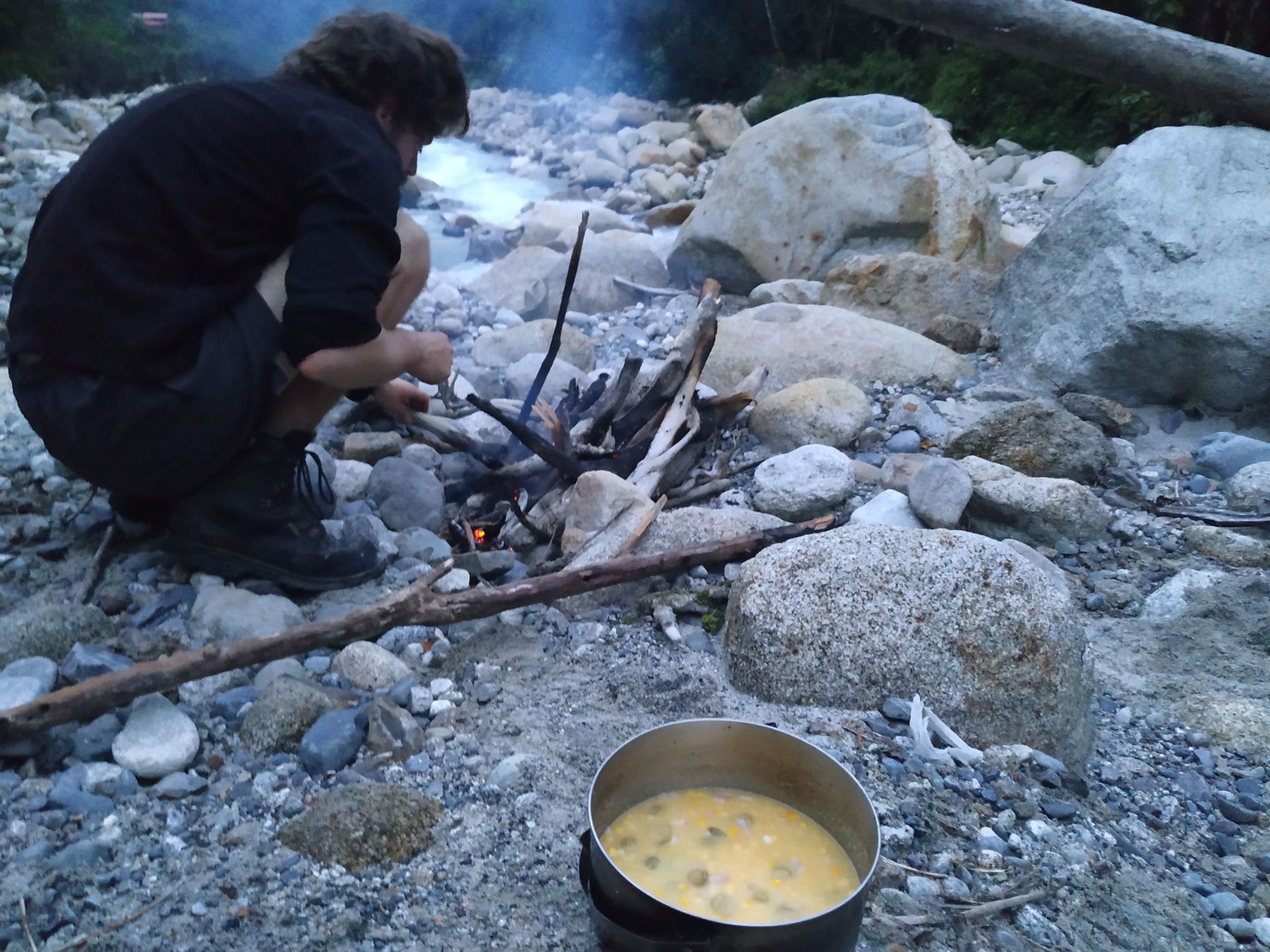
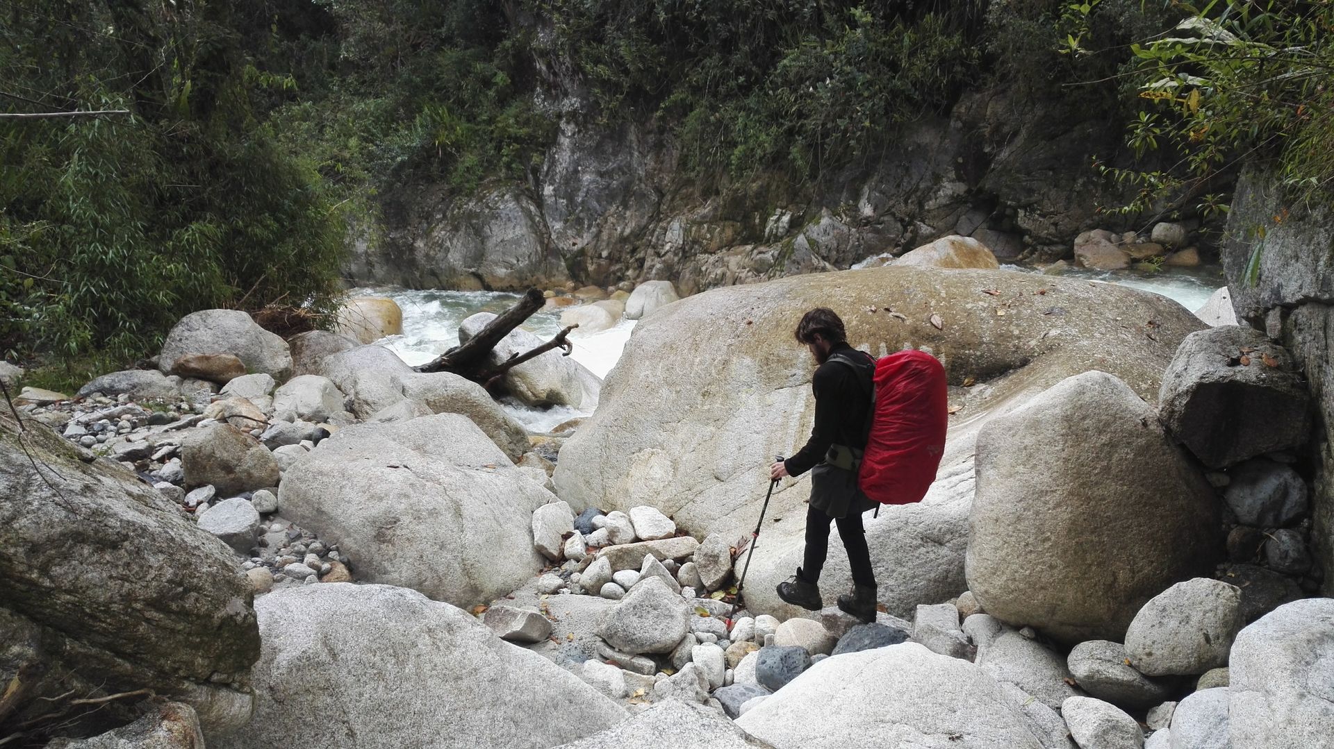
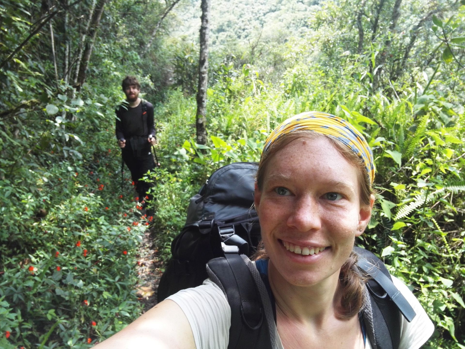
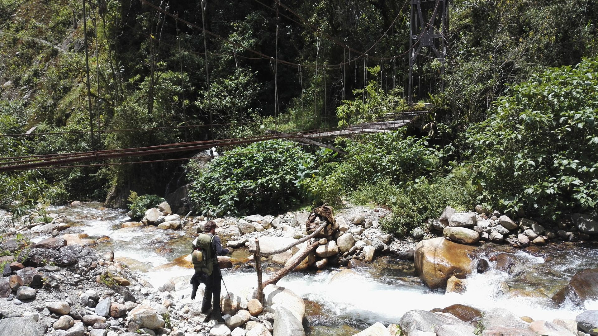
Then we come to a large river where we briefly lose our way. Our GPS data shows that the bridge is 200 meters further down and we climb along the riverbed. It's a bit like a river hike that doesn't end quickly. When we turn the corner, we see what the farmer meant: the bridge is completely broken, only loose steel cables and a few wooden planks are sadly dangling in the wind. We are not so worried yet, the river doesn't look so wide and we want to try to wade through. However, three hours later we have a different opinion. We have climbed up and down the riverbed in search of a narrow passage, but we have to admit that the current is too strong and the water is too deep to be able to walk through. At the end of our ideas, we are about to go back to the next village to ask for help when another tourist appears. It is actually the Czech guy we hiked with in Potosí. What a coincidence in the middle of nowhere! Unfortunately, he also has no further ideas, it is already evening, and we decide to continue the search the next day. on the edge of the riverbed, we clear the stones out of the way and set up our tent, it is not as uncomfortable to sleep as we thought. Jakob makes a campfire and we cook our polenta with corn, onions, and olives over the fire. It is pitch dark at night, it rains occasionally, but a firefly loyal to our tent flashes.
Campsite number 2
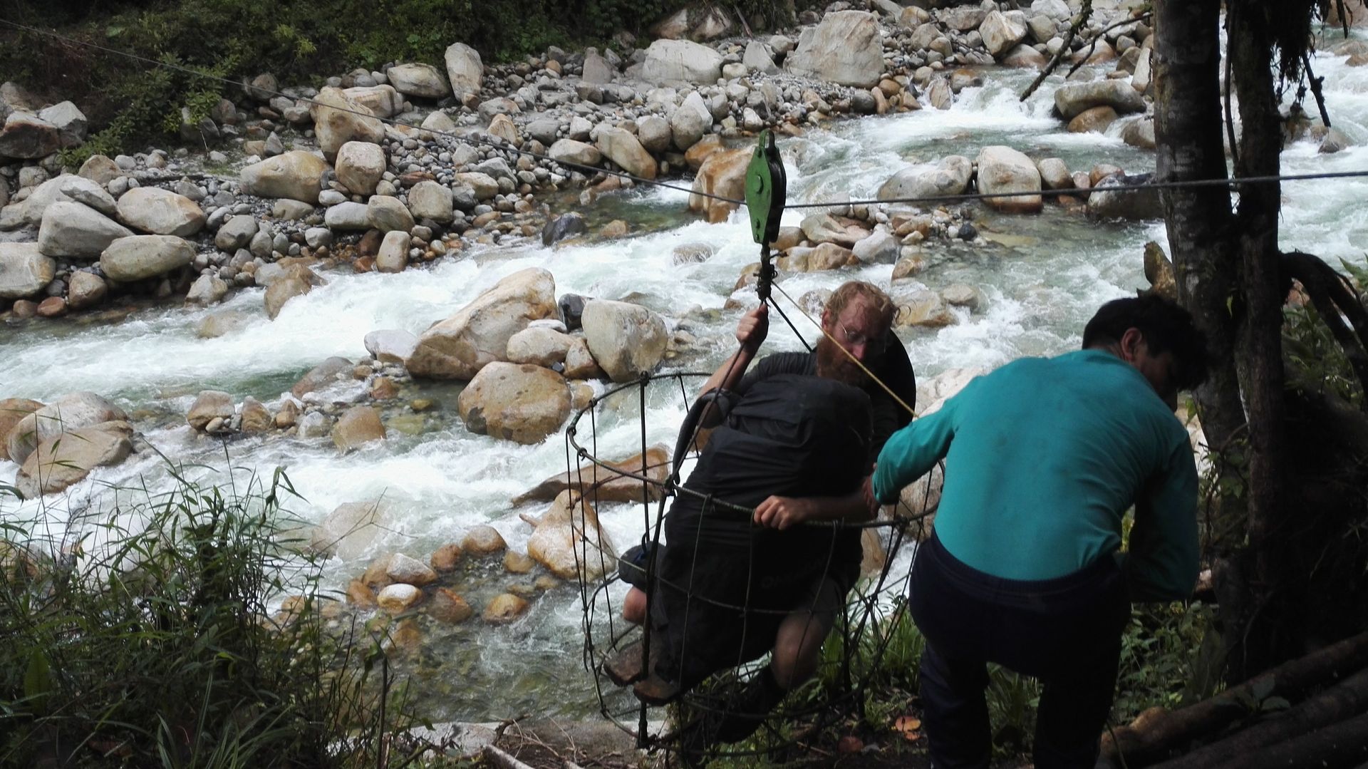
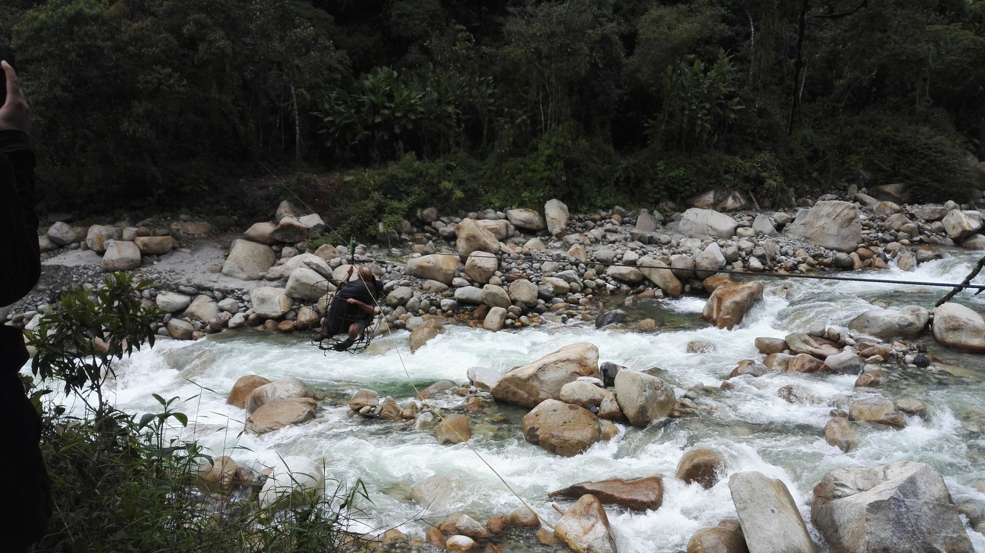
We wake up very early to have enough time to find a solution to the nonexistent bridge. If we can't cross the river, we have to go back to La Paz and hike back up 2,000 meters, for which we don't have enough food. In addition, we have a reservation in Coroico that we have to pay for if we don't show up on that day. Together with the Czech guy, we walk the riverbed again, test the strength of the water, consider building a bridge or swimming across, and still make no progress. Suddenly, we spot a Bolivian in the distance and run towards him. He actually has the solution for us: a steel cable is stretched across the river and a makeshift basket made of steel straps is hung from a carabiner hook, in which you zip across the river. It's a bit like in an adventure park where people pay a lot of money for the fun, but there are more safety precautions. The man asks everyone for only 1.20€, he could have easily demanded more, as it is our only option. (For all those who want to hike the Choro Trail: ask for the man at the Villa Loba campsite.) We are a bit scared, but see for yourself.
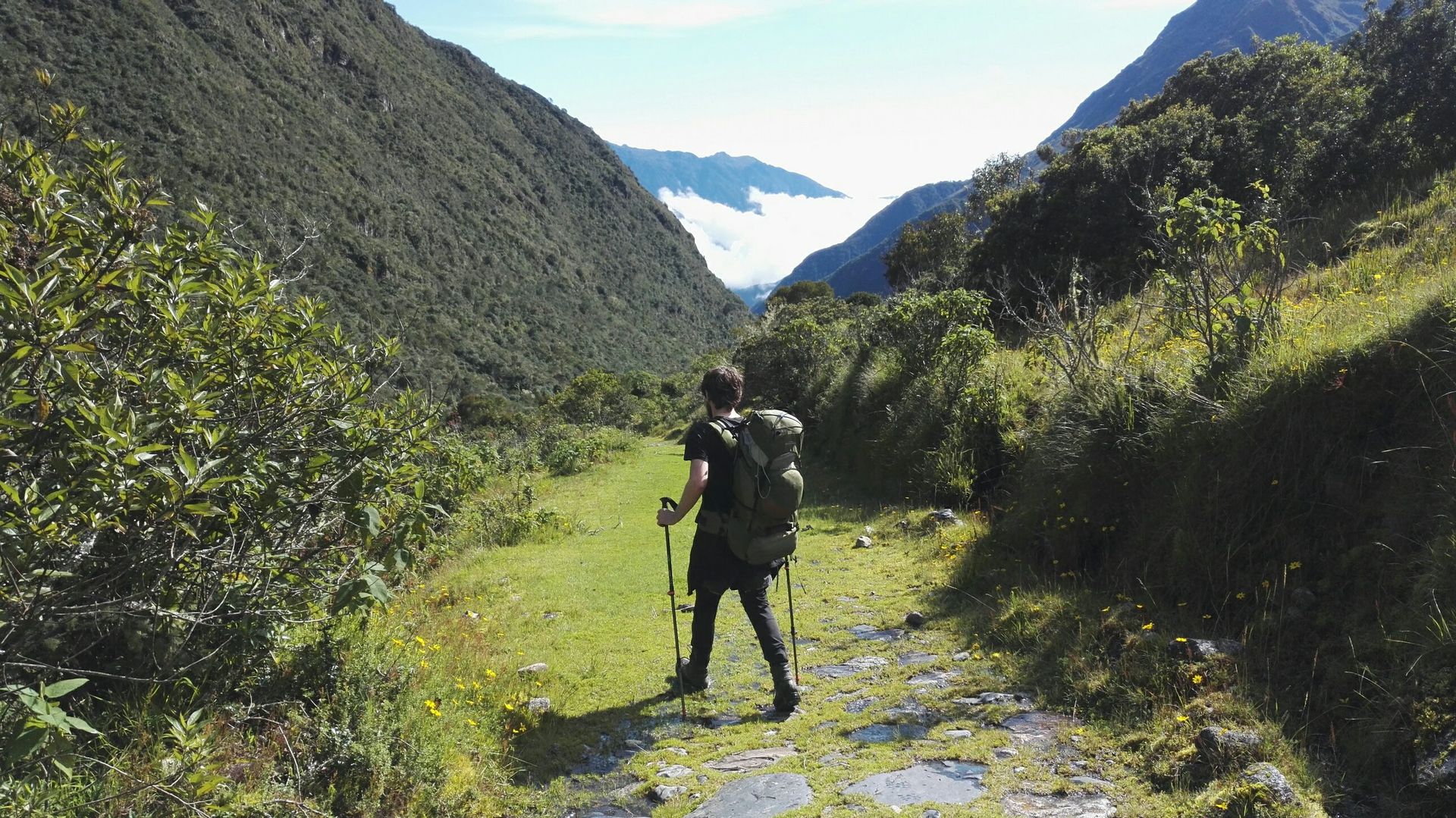
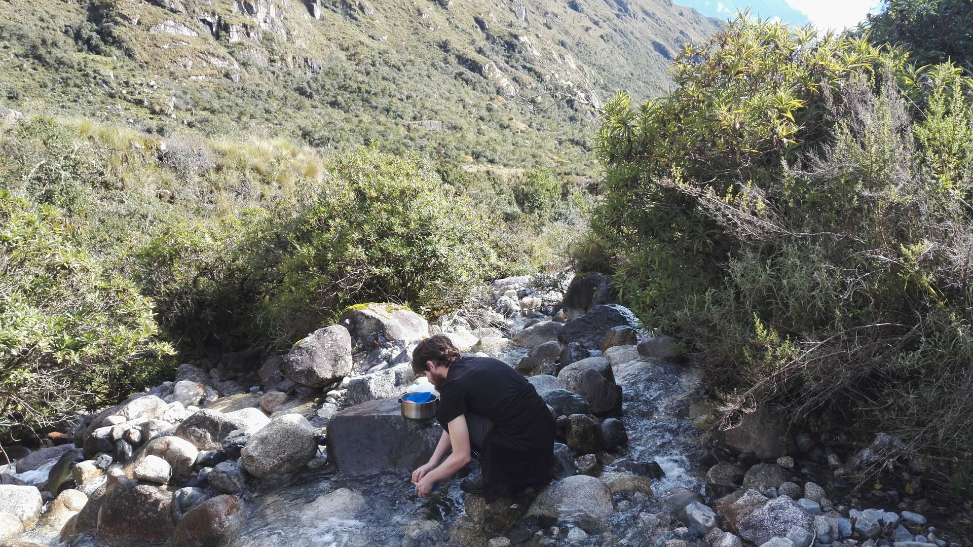
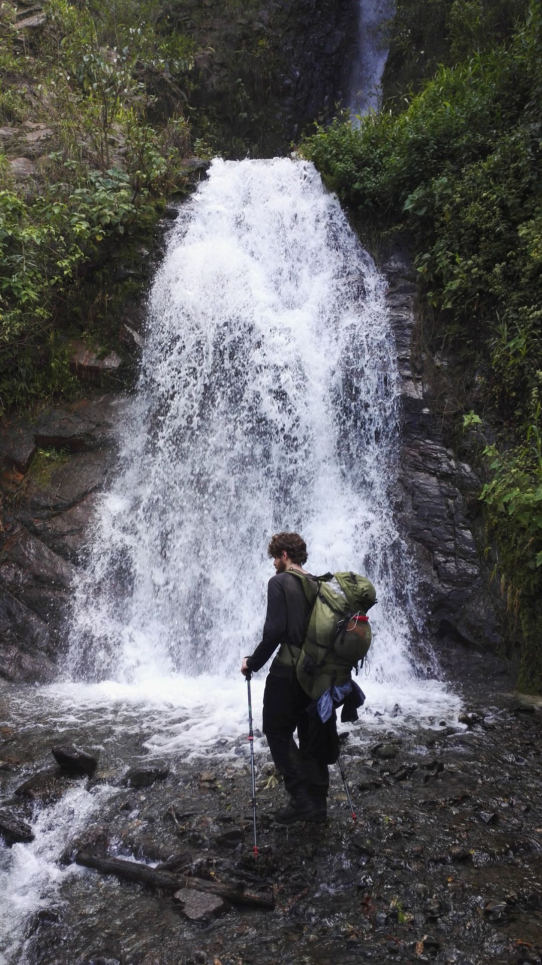
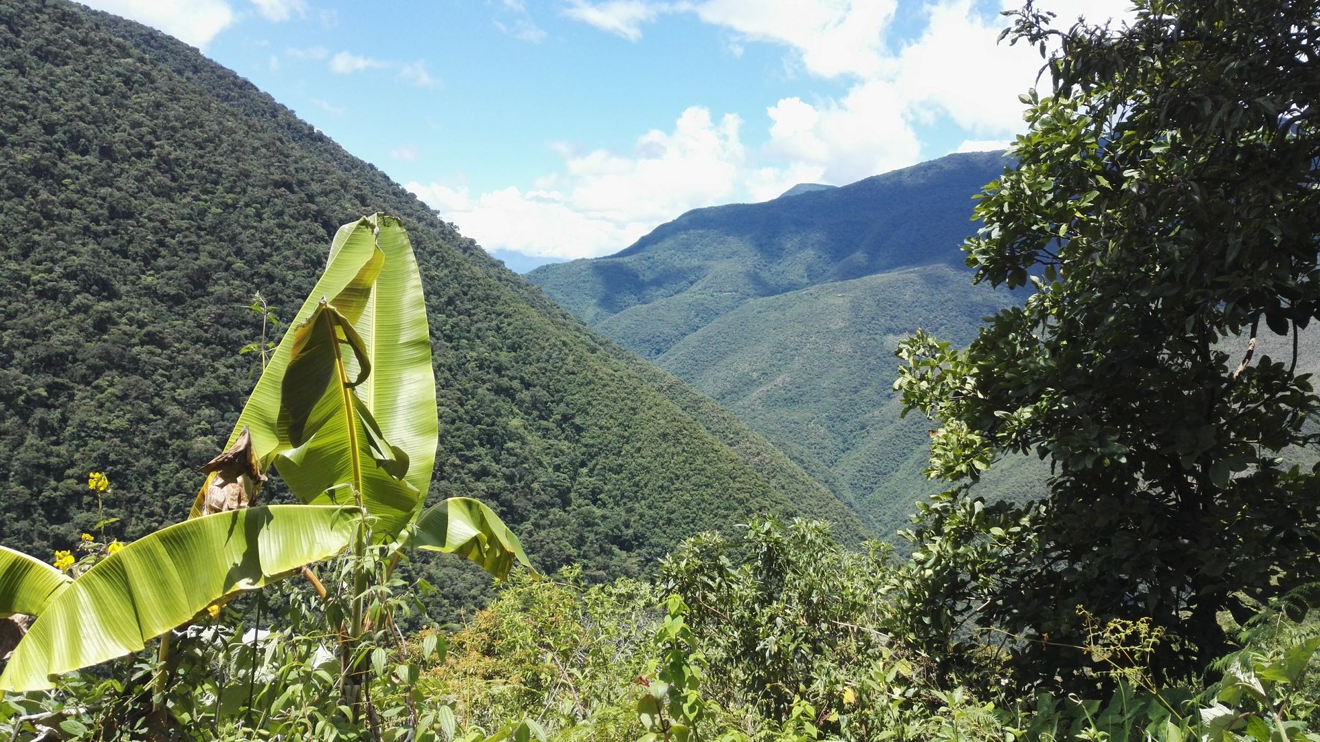
Actually, it was a lot of fun to zoom across the river and our relief on the other side is huge. However, now we have a long stage of 28 km ahead of us, as the river thwarted our plans the day before and we don't want to lose or have to pay for our reservation. It is already 10 o'clock. We walk through the Yungas Mountains at a brisk pace, the Czech guy is not in such a hurry and so our paths separate again. It is hot, we pass many waterfalls, and we circumnavigate countless ridges on narrow green paths. Many butterflies flutter around, we startle parrots and discover centipedes. We see many banana trees, with lilianas hanging down from above - the Yungas Mountains have clear jungle characteristics. However, the kilometers decrease only slowly, the backpack weighs heavily on our backs, and it gets later and later. Only once do we stop at a waterfall to cook noodles with tomato sauce. For the last 4 kilometers, we have to gather our last bit of strength, we march in quick time along the path while dusk sets in. At the end, we are almost running and can hardly make out the path. When we reach the village of Chairo, it is dark. The villagers are surprised to see hikers coming out of the forest at this time and we first have a cold orange lemonade. We still have to go further to Coroico (20 km away), there is no bus and the only option is a taxi. So we find ourselves in a hopeless situation and the 17€ we have to pay for the taxi hurts. Finally, when we arrive at the hostel, we enjoy dumplings filled with potatoes and eggs, served with salsa and peanut sauce. We wash off the dirt of the last three days and are left with scratches, mosquito and bee bites, and very heavy legs. The Choro Trail is very interesting in terms of landscape, the peace, the movement, and the fresh air have done us good and we are richer in experience.