Day 9 - Continuing to the northeast
Pubblicato: 06.08.2018


Iscriviti alla Newsletter
Today we leave the Hardangerfjord behind. There is so much more to see and so many hikes to conquer, but on a four-week trip to the far north, one should not expect to see everything - which is not possible anyway given the multitude of natural and cultural attractions. The decision to come back at a later time and focus on a specific, manageable area in southern Norway has already been made.
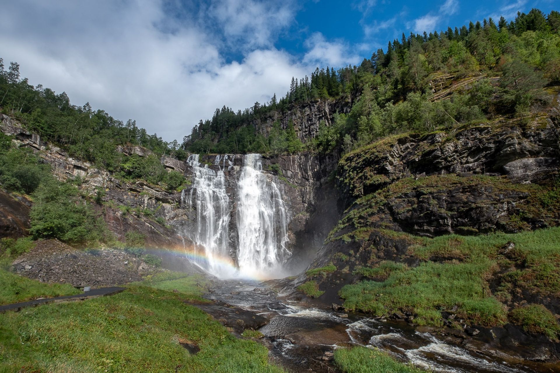
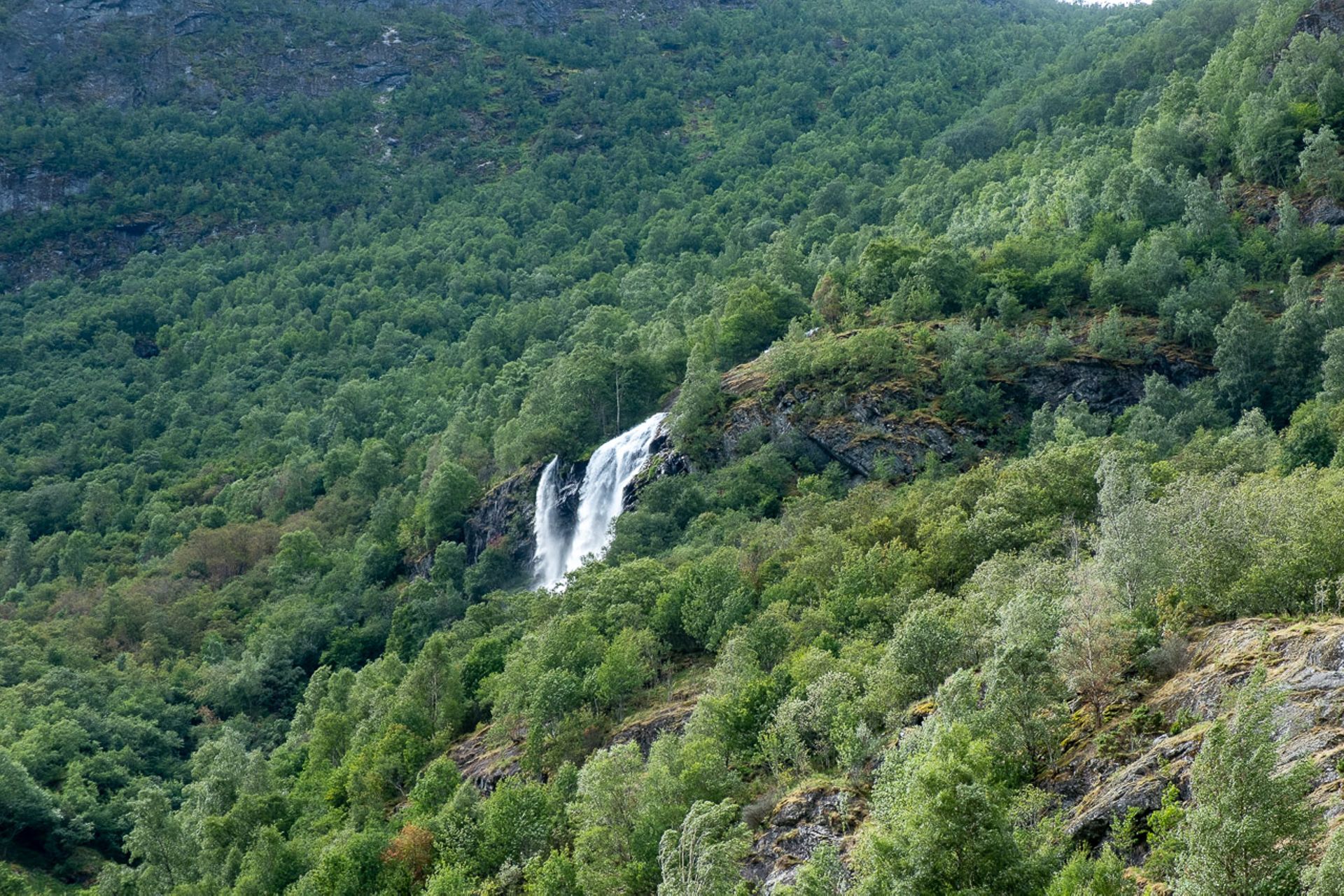
We leave Kinsarvik and drive back across the Hardanger Bridge towards Voss and Sognefjord. The goal of today's stage is a campsite near Jotunheimen and Rondane National Parks, where we have planned a few more hikes. First, we take the E13 to Voss. Here, we stumble upon Skjervsfossen, another beautiful waterfall in Norway, which is located right next to the road. After Voss, we take the E16 towards Oslo. This mostly well-developed main road has some highlights to offer. Shortly after Oppheim, which is located by a picturesque lake, it passes through a gorge with impressive, almost vertical walls, from which waterfalls cascade down. At times, the wind sprays the falling water, which, combined with the finally reappearing sun, looks almost magical. After Gudvangen, we enter the Flenjatunnel, which has a relatively steep gradient and is 5 km long. After this tunnel, we have a view of an extremely picturesque valley at the end of the Aurlandsfjord. We pass by the town of Flåm at the end of the fjord and temporarily leave the E16 to visit Brekkefossen. On the way there, we meet a very nice American couple, with whom we strike up a conversation on the way to the waterfall. The two are taking a trip through Europe with their savings and plan to settle in Sweden afterwards, where his ancestors came from two generations ago, who left the country due to the famine at that time. We wish them good luck and say goodbye for the journey ahead.
At Aurlandsvangen, we enter the Lærdal Tunnel, the longest road tunnel in the world, measuring 24.51 km. The passage is a certain mental challenge due to its duration and the monotony of the bare rock walls, although the builders have at least incorporated a few caverns that are supposed to provide some variety with their extravagant, colorful lighting.
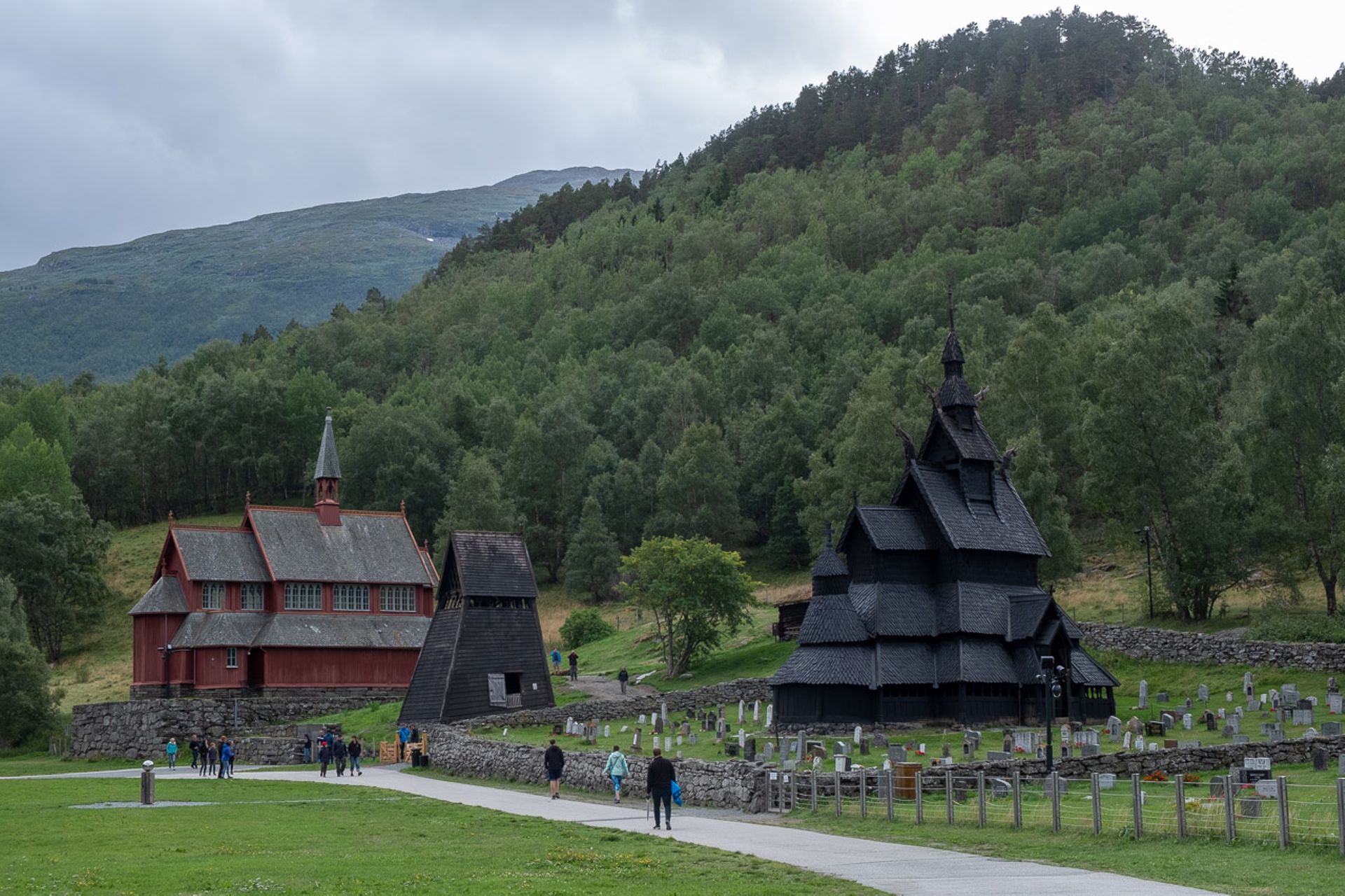
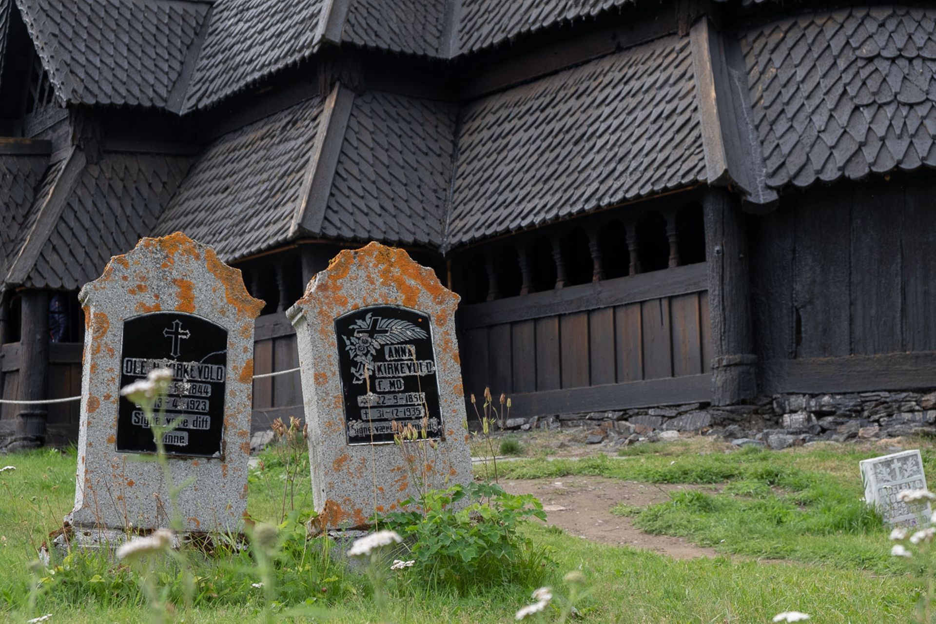
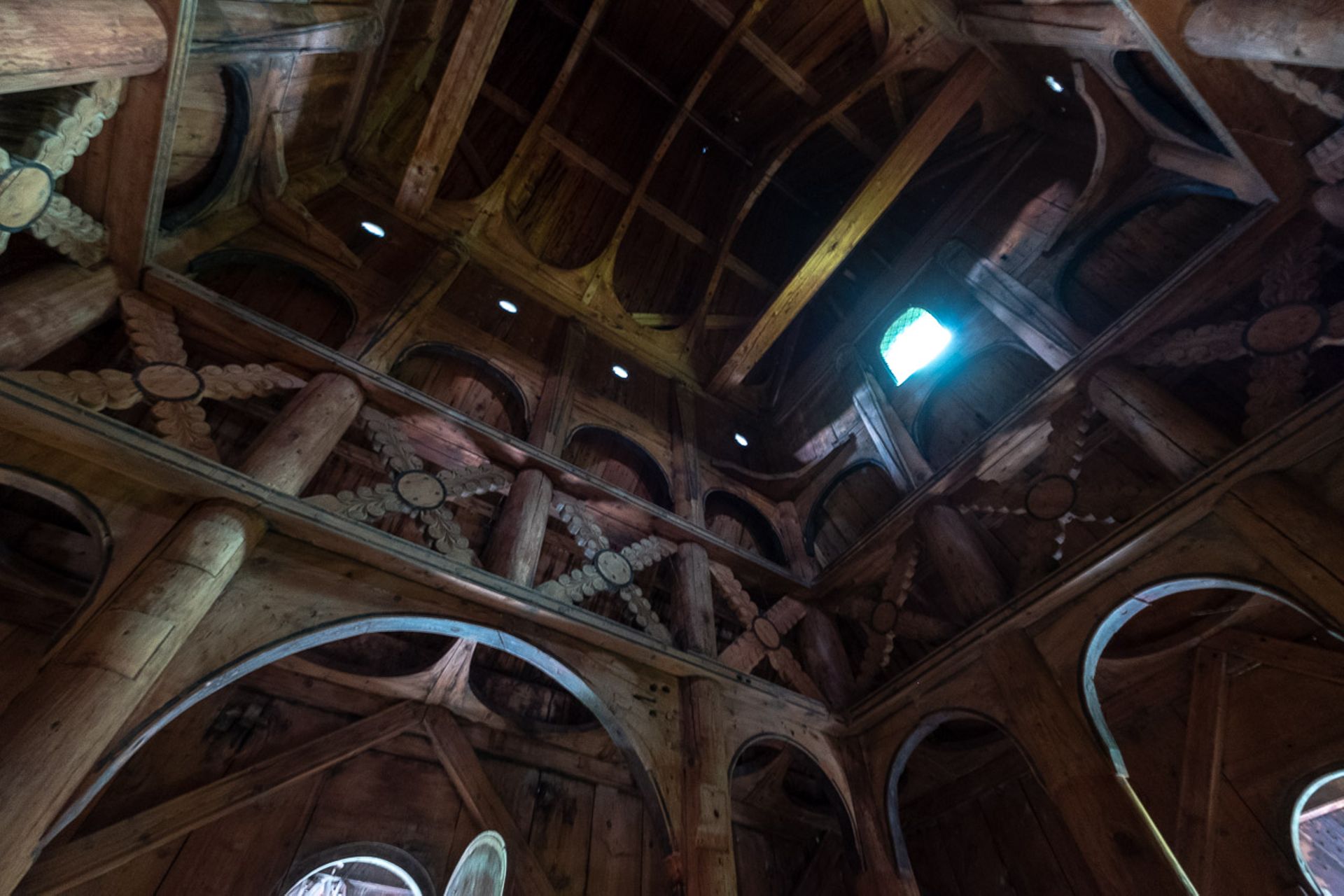
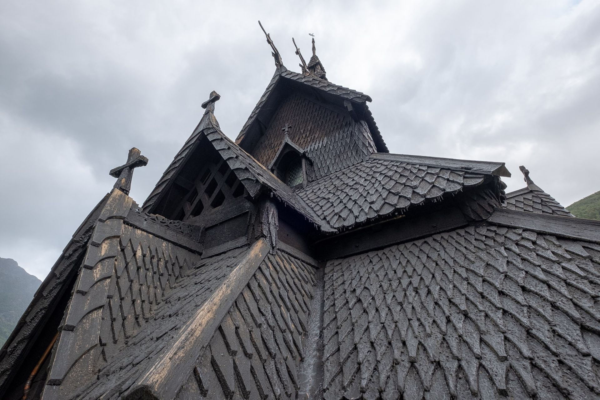
The next stop is Borgund, where a well-preserved and stately stave church can be visited. It is believed to date from the late 12th century. The architecture strongly resembles Viking shipbuilding - at the ends of the roof gables are wooden dragon heads facing east and west, and the roof shingles resemble fish scales. Similarly, the carved ornaments and symbolism on the facade reflect the coexistence of the still strongly existing "heathen" belief and the relatively young Christianity in Norway at that time.
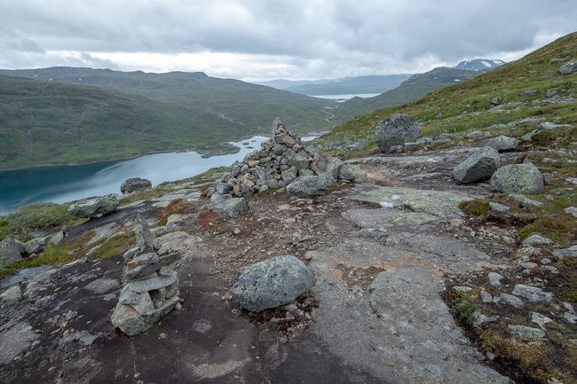
Shortly after Borgund, the landscape changes and becomes more alpine - Jotunheimen is getting closer. I can't stop looking, beautiful landscape on both sides, a wild mountain stream flows on the left through a gorge parallel to the road. It seems that the old King's Road also runs in stages along this route.
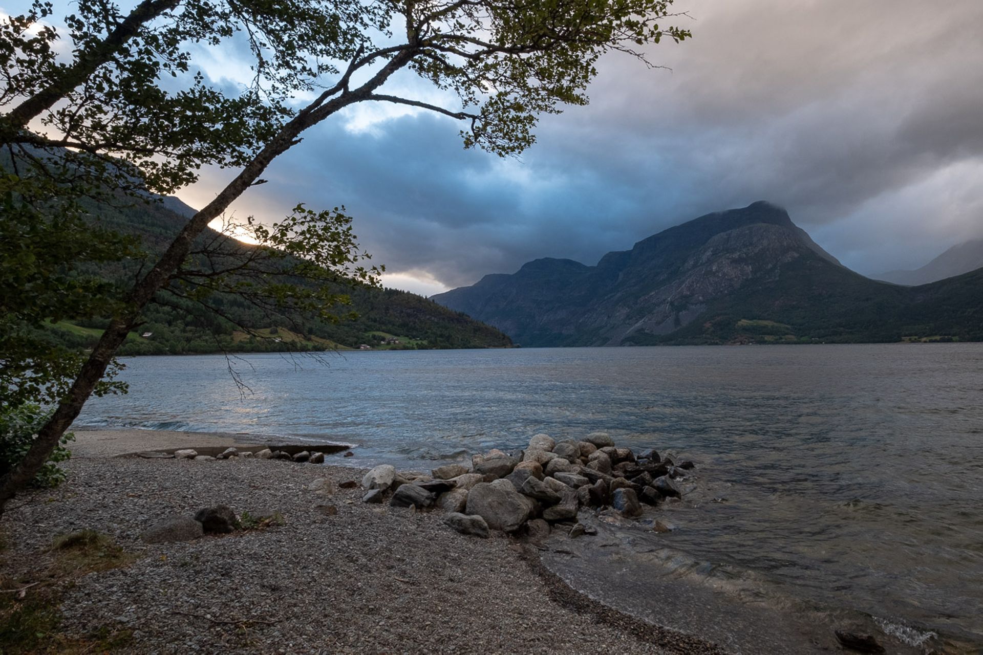
After a while of climbing, we go back down into a valley with a long lake called Vangsmjøse, on whose shore our next campsite is located.
In the evening, strong winds come up, causing the water on the lake to create waves with white crests and bringing a significant drop in temperature. To be able to sit outside comfortably, you would already have to wear winter clothing.
I freeze in my sleeping bag tonight, and I firmly believed it would be enough for Norway in August.
Iscriviti alla Newsletter
Risposta (2)
Bernhard
tolle Bilder und sehr neugierig machende EindrückeBernhard
tolle Bilder und neugierig machende Eindrücke