
Neuseeland: 8000km solo durch das schönste Ende der Welt
vakantio.de/8000km_durch_neuseeland
Day 29 - Catlins & Slope Point: The South Pole is closer than the equator
Published: 08.08.2019


Subscribe to Newsletter
12.01.2015
The sun is shining on my little balcony, but having breakfast there is only possible if the sun is not hiding behind clouds and the wind blows less. However, the view of the bay is fantastic.
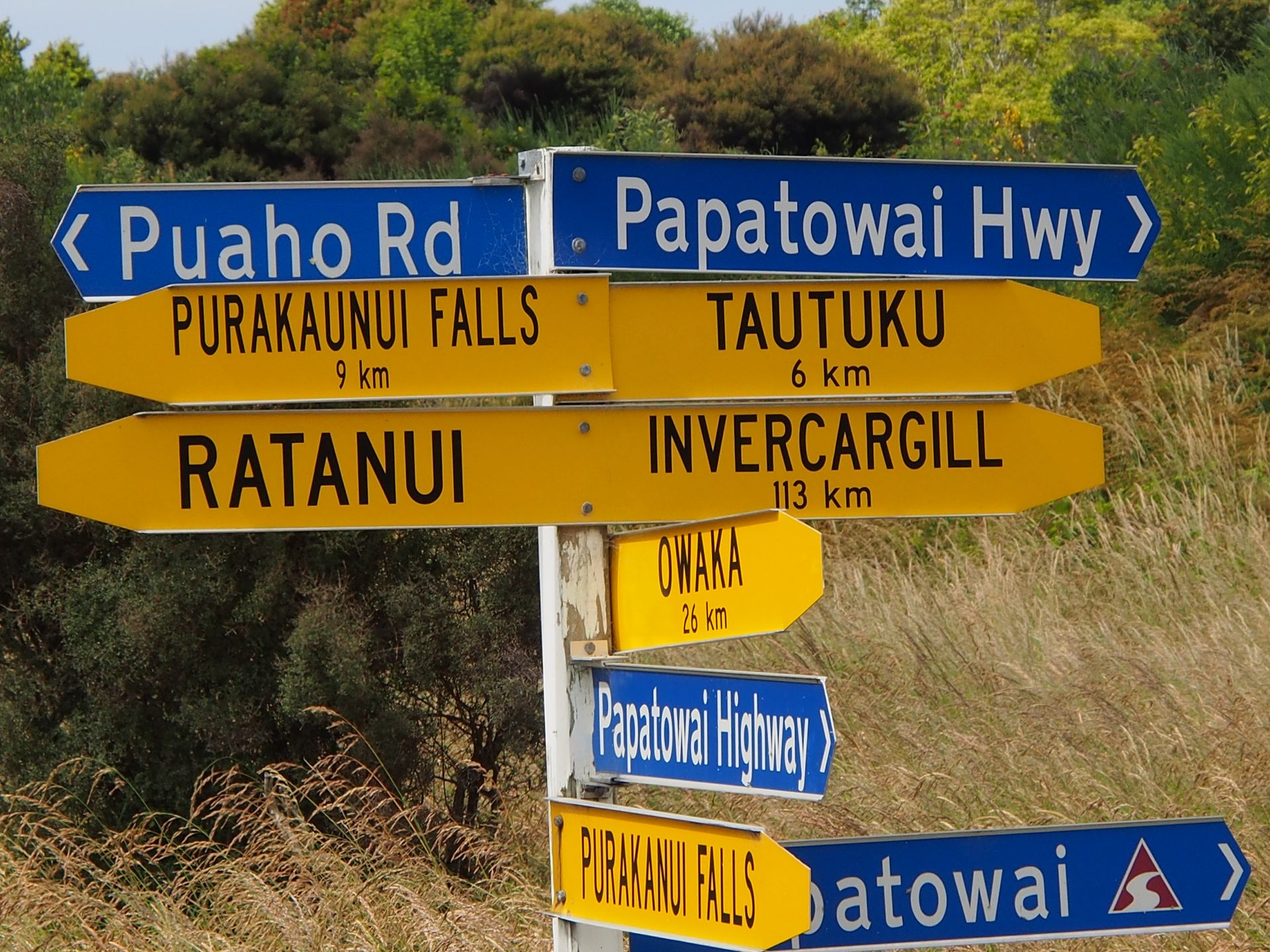
I wander back and forth between indoors and outdoors with my English muffin and a coffee about three times, until I only have to wash up and leave. But calmly. Today, I don't have to check out at 10:00 AM, but I want to drive the Catlins Coastal Heritage Trail today, which branches off from the Southern Scenic Road. My destination today is Curio Bay, where the petrified forest is visible only at low tide. The hotel man also recommended Cathedral Caves to me, which can also be visited for an hour only at low tide. Low tide is at 2:00 PM.
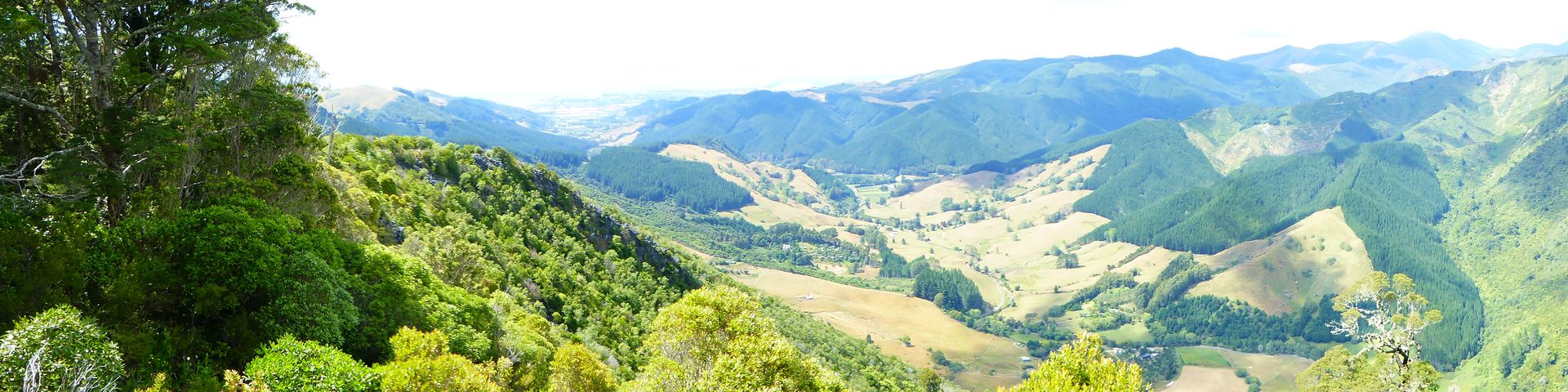
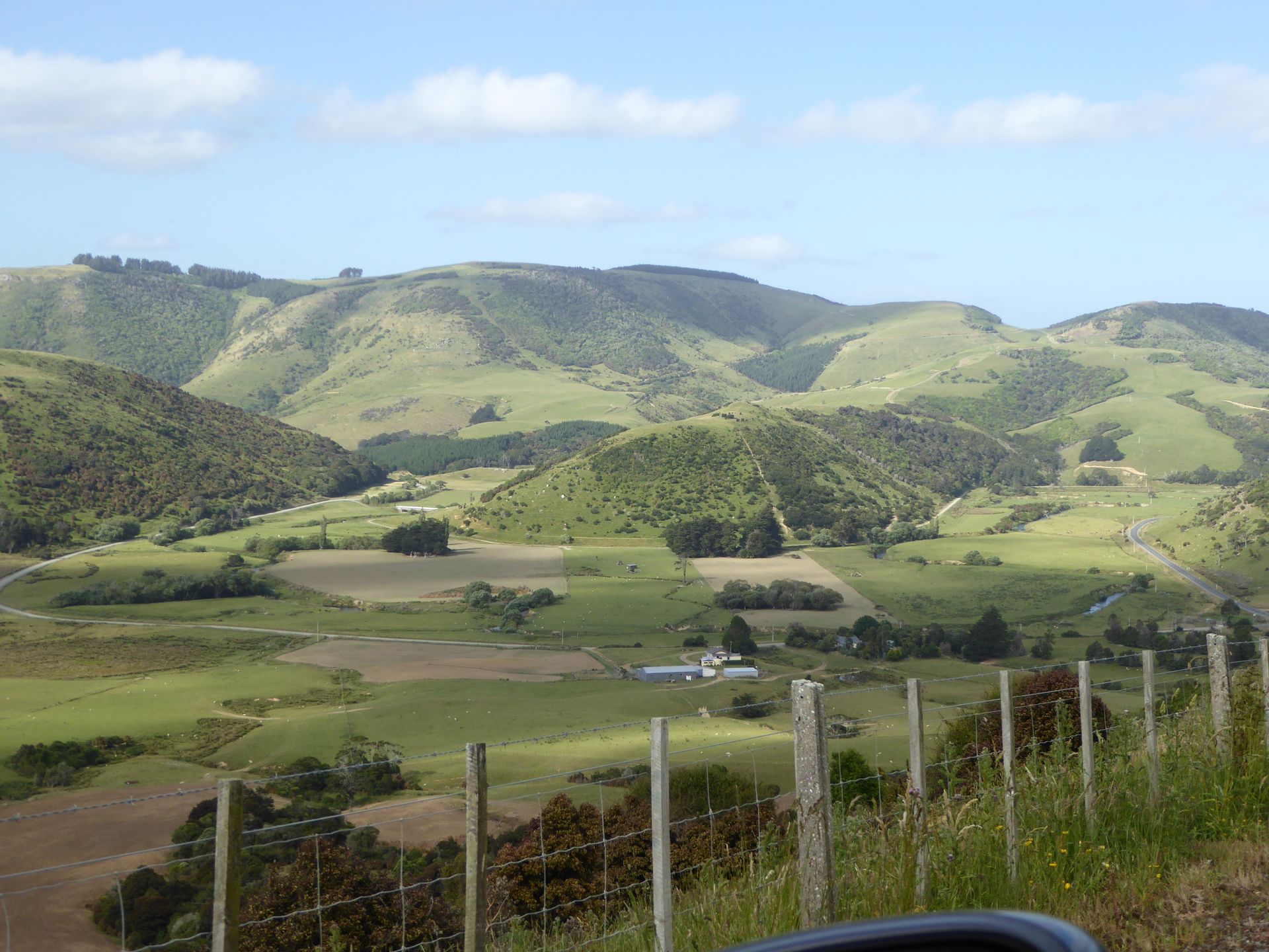
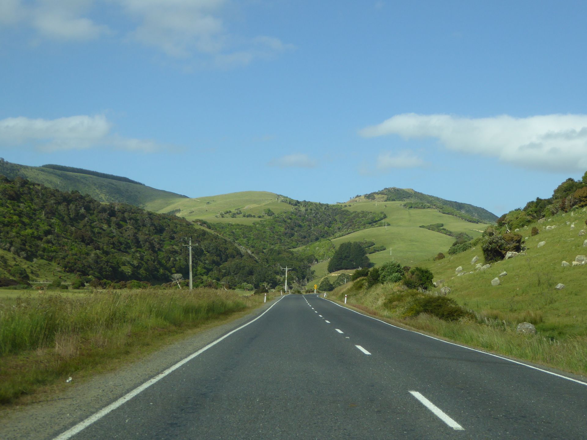
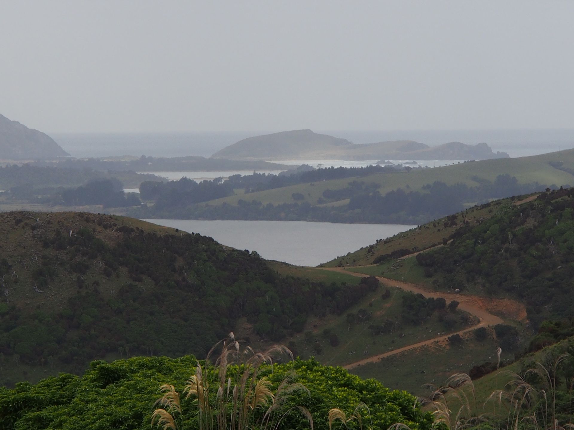
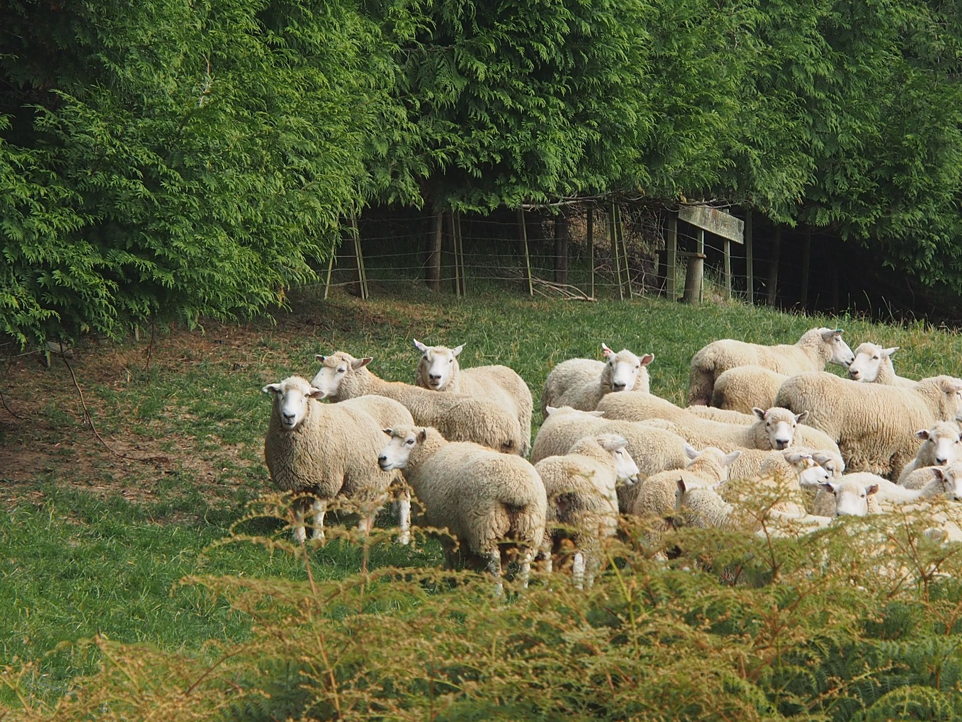
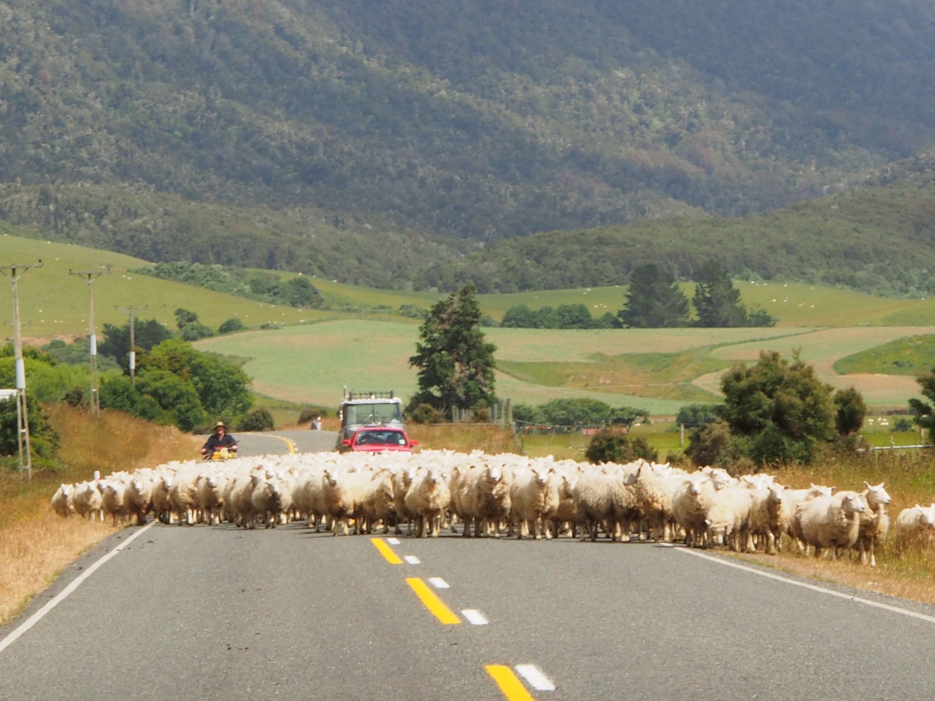
I set off at half past ten and soon roll through a fantastic, almost untouched landscape, if it weren't for the many sheep and field boundaries that are visible. Here in the Catlins, in the southern corner of the country, it is clearly noticeable that two-thirds of the 4 million New Zealanders live on the North Island. The South Island is more original and emptier, but it is even less populated in the Catlins.
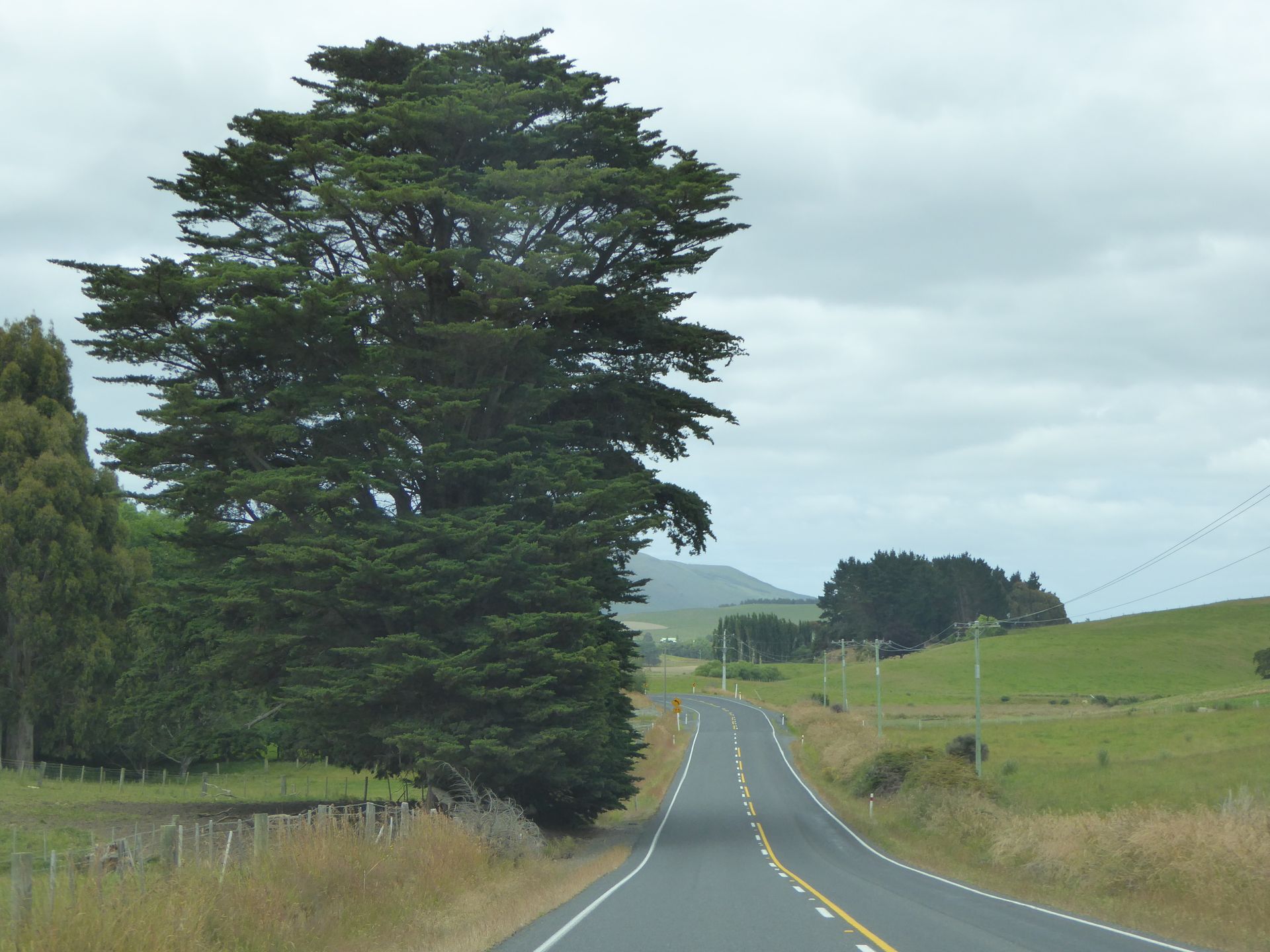
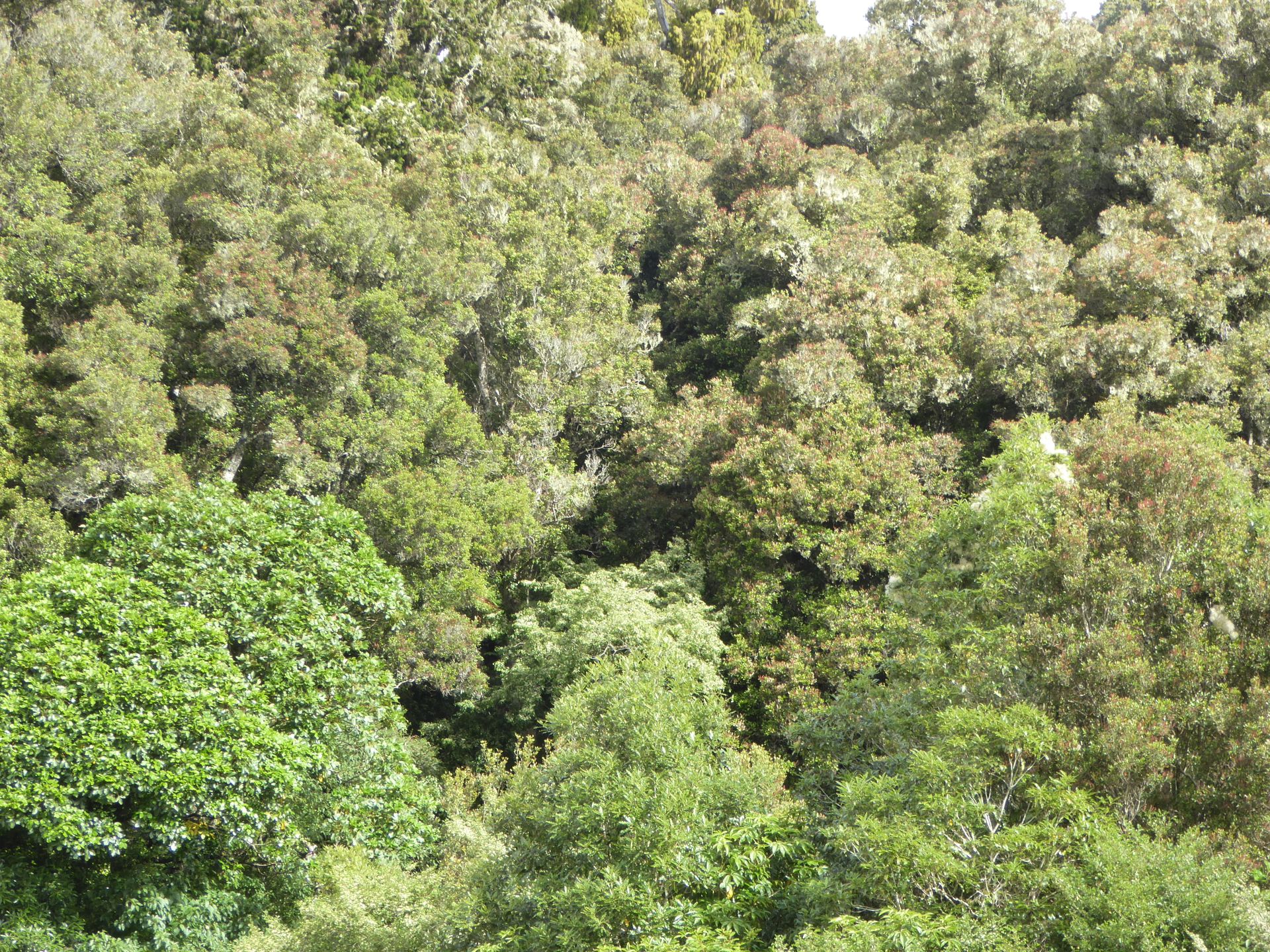
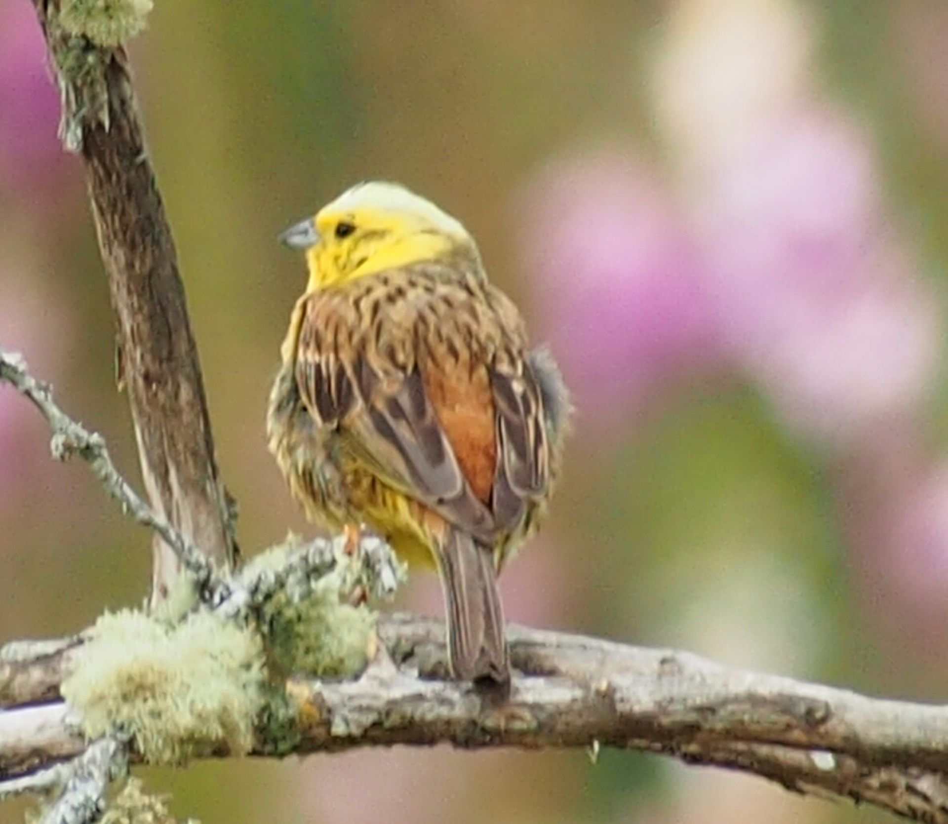
A beautiful hilly landscape reveals itself, on top of which there are often tall podocarp trees, these typical long, tall New Zealand trees with many branches. The kauri trees find it too cold down here, although they are also a type of podocarp. In New Zealand, the original primeval forest from the times of Gondwana, when New Zealand was connected to Australia and also to South America and South Africa, is only visible in a few places. Here in this southeastern corner of the country, there are still some beautiful areas of this forest, which also includes other bushes and trees, so that these primeval forests from a distance always look like cauliflower or broccoli. I notice a small yellow bird and later I see a tui, which I have never been able to photograph before.
While it is only 15 degrees Celsius, a wild wind blows through the sun, almost blowing the car door out of my hand when I get out. Somewhere on the side of the road, above an amazing view of endless cliffs with wild surf, I take off my shorts and put on long pants. The sandals go into the trunk and the hiking shoes come into use - it's just too cold. A sign at a viewpoint tells me that the average annual temperature here is 11 degrees Celsius. So today, with 15 degrees, I have a hot day!
After about an hour, I pass Cathedral Caves, but this 180 million-year-old forest is simply more important to me, so I drive past the caves, especially since low tide is still two hours away and you can only go down there in an hour.
I turn off the Southern Scenic Route to the south, passing through Niagara and Waikawa, before the road ends at a small parking lot in Curio Bay. This petrified forest is well visible from an observation platform, but even when you walk around the area, you can see the petrified tree trunks lying elongated and the tree stumps, making it clear that this was indeed a real forest. Apparently, there were several forests here one after the other. This site is one of the best-preserved petrified forests in the world and is 180 million years old. Currently, only a very small part can be entered, as yellow-eyed penguins nest here and they should not be disturbed.
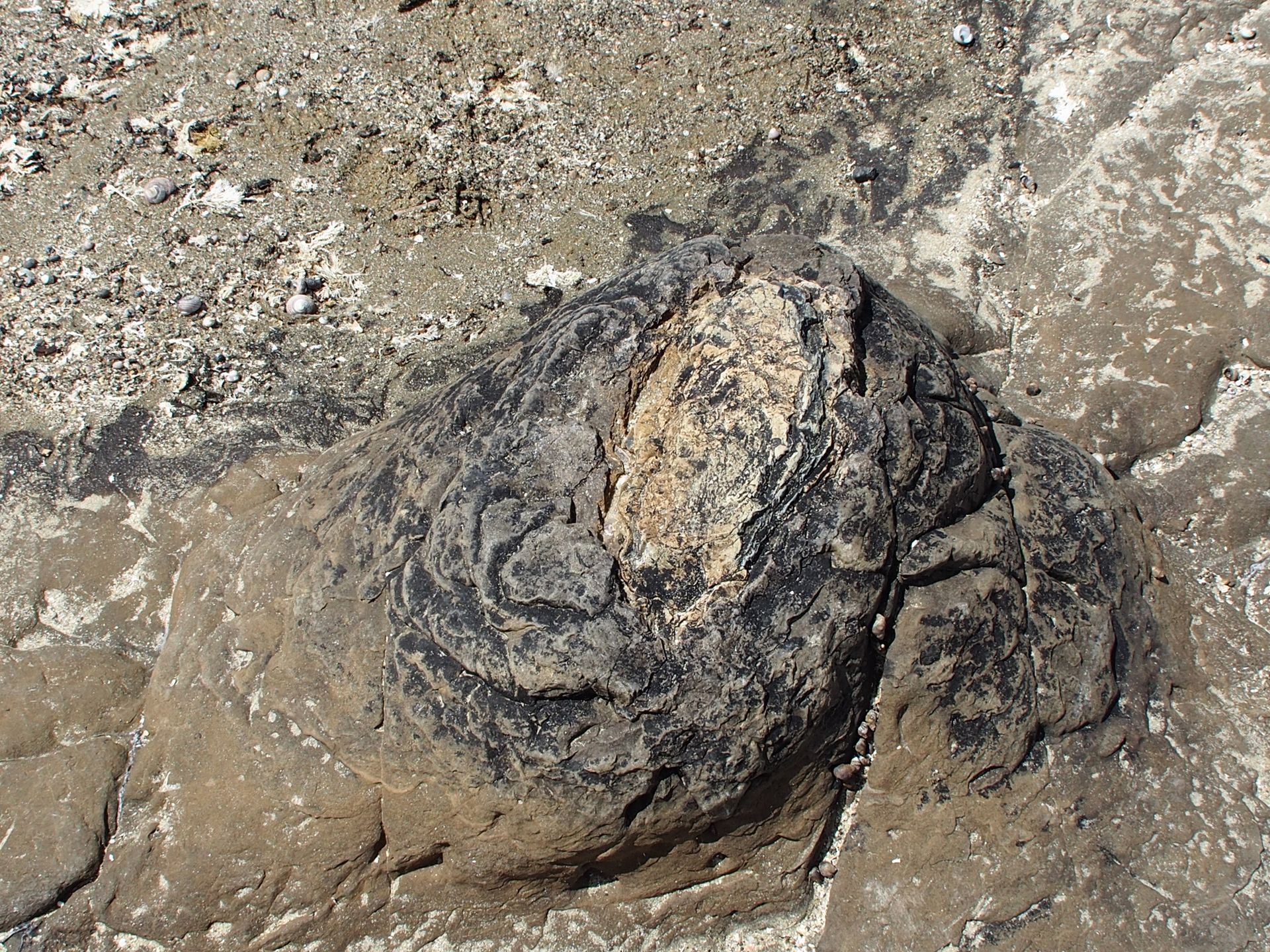
petrified tree stump

petrified tree trunks
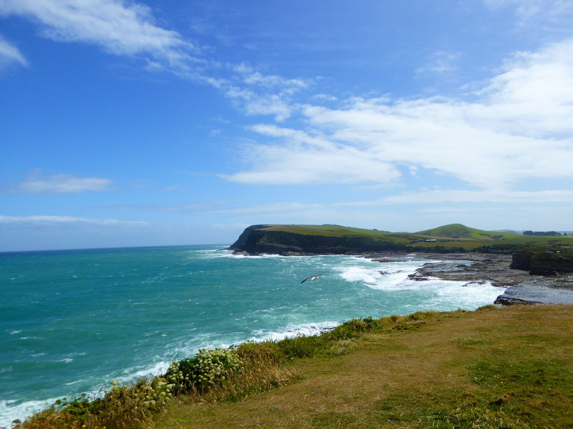
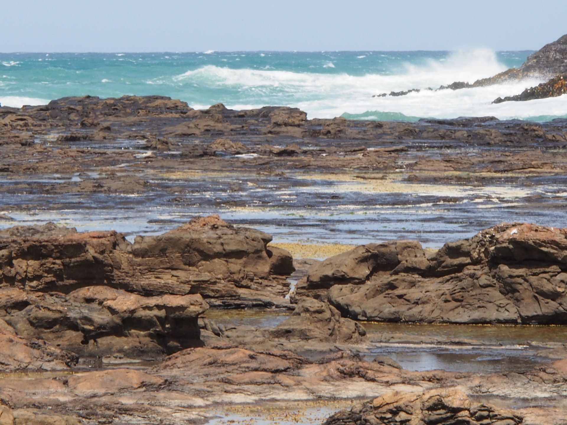
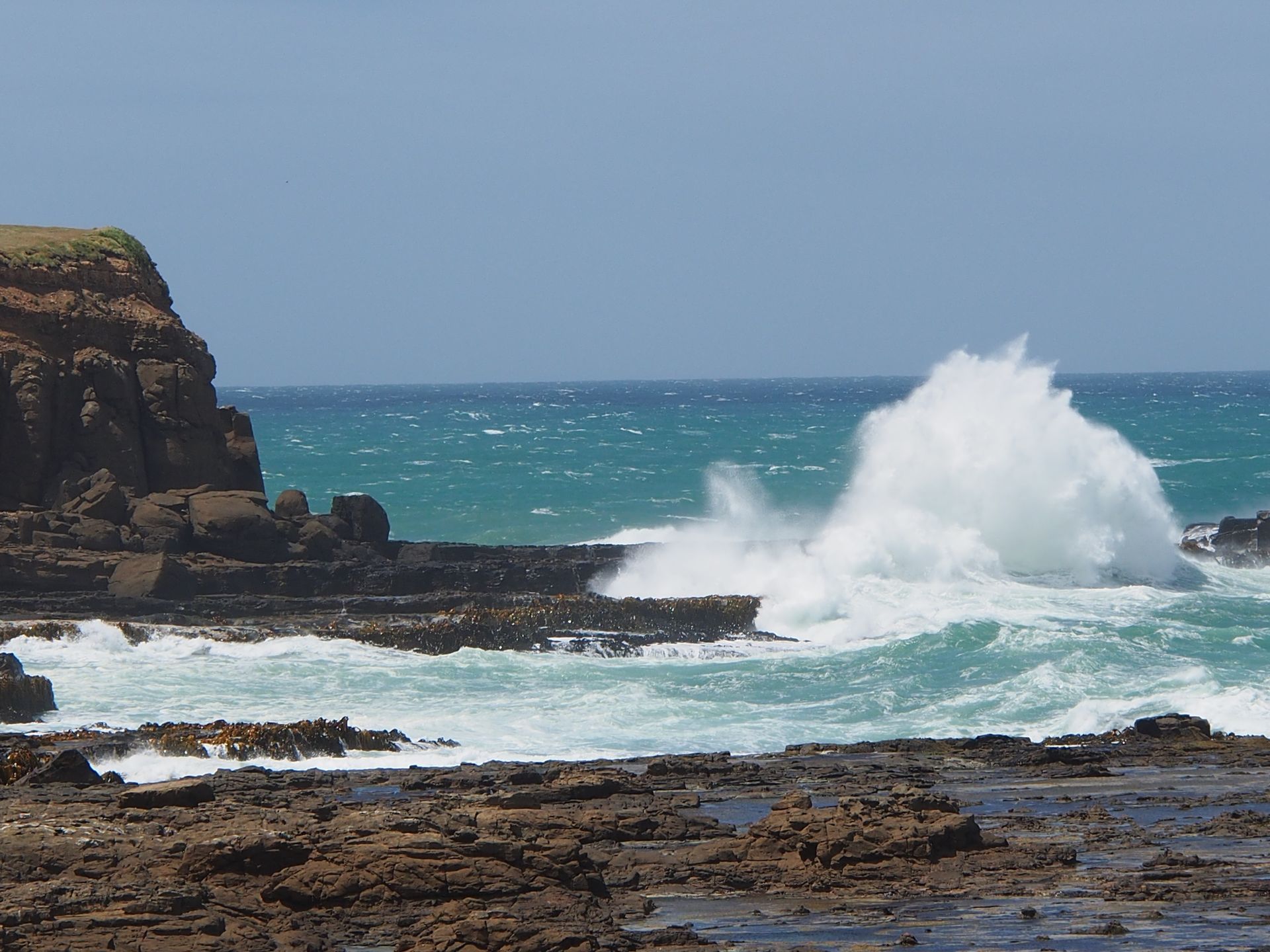
I stand there in the cold wind, with a fleece jacket and a hood on my head, trying to keep the camera steady in the gusts. Not far away, huge waves crash onto the cliffs on the left and right at the end of the bay. The water is turquoise blue and the sun is shining - an incredible play of colors.
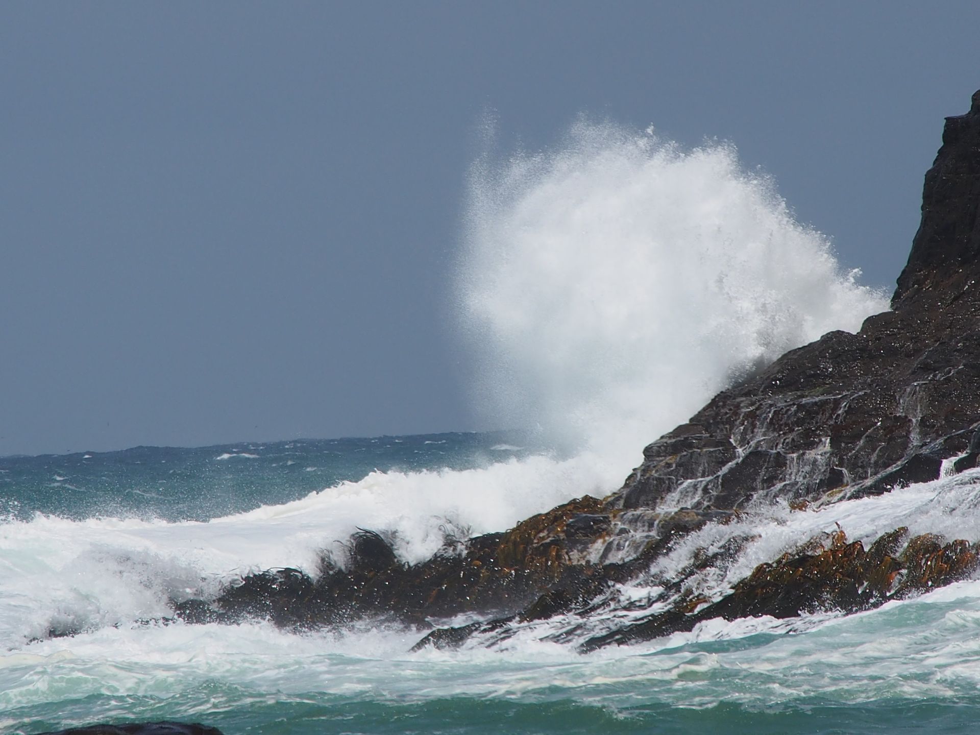
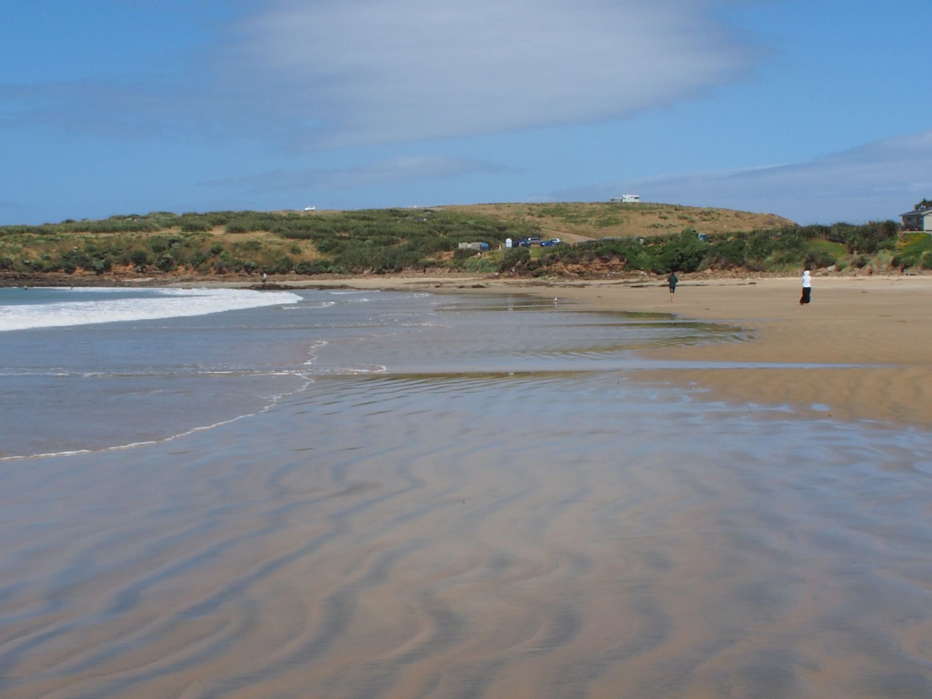
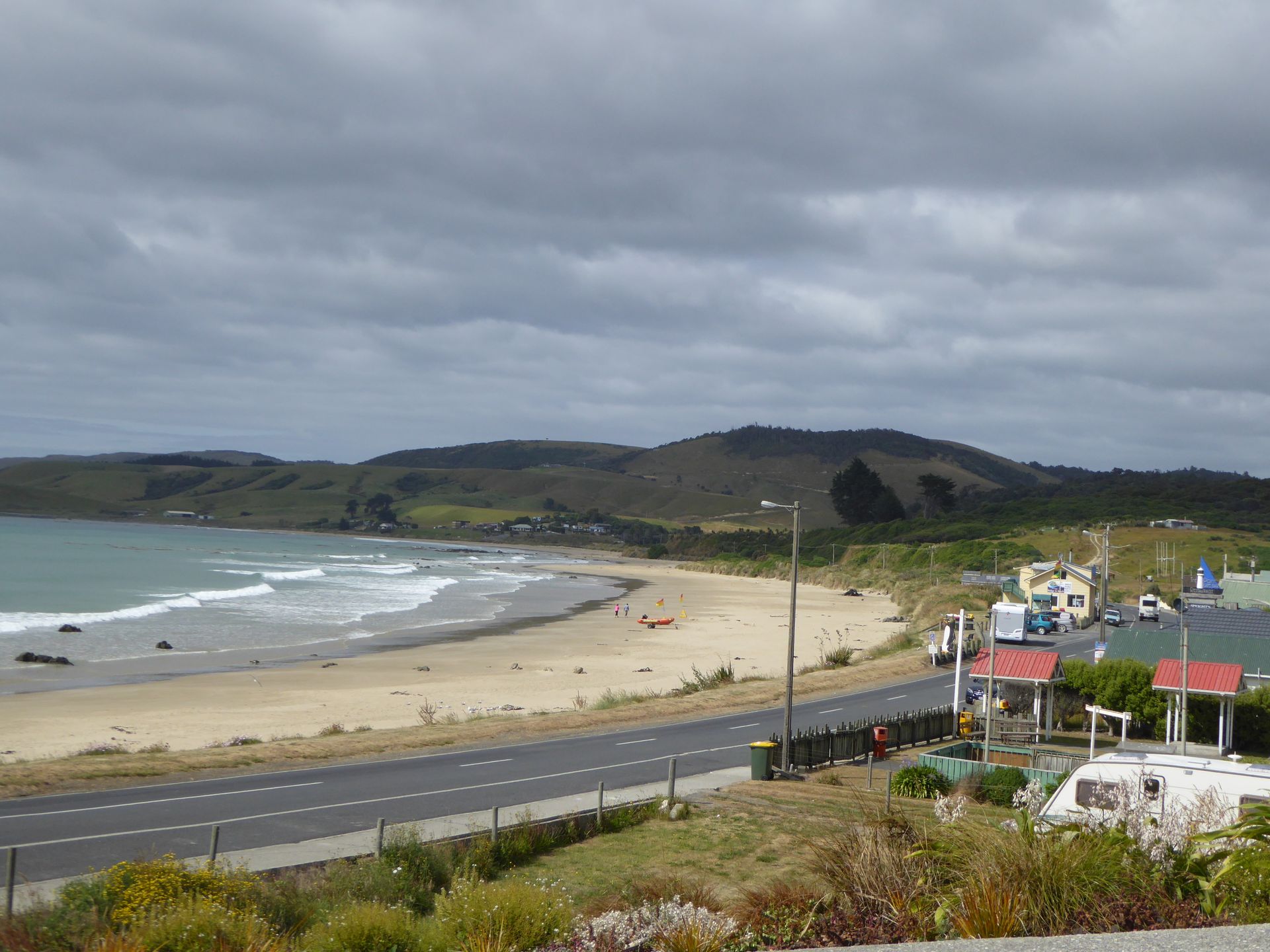
Just 400m further is the next bay, protected by a rocky promontory, where the breakers crash. Nevertheless, Porpoise Bay has quite decent surf and the wind is also quite strong here.
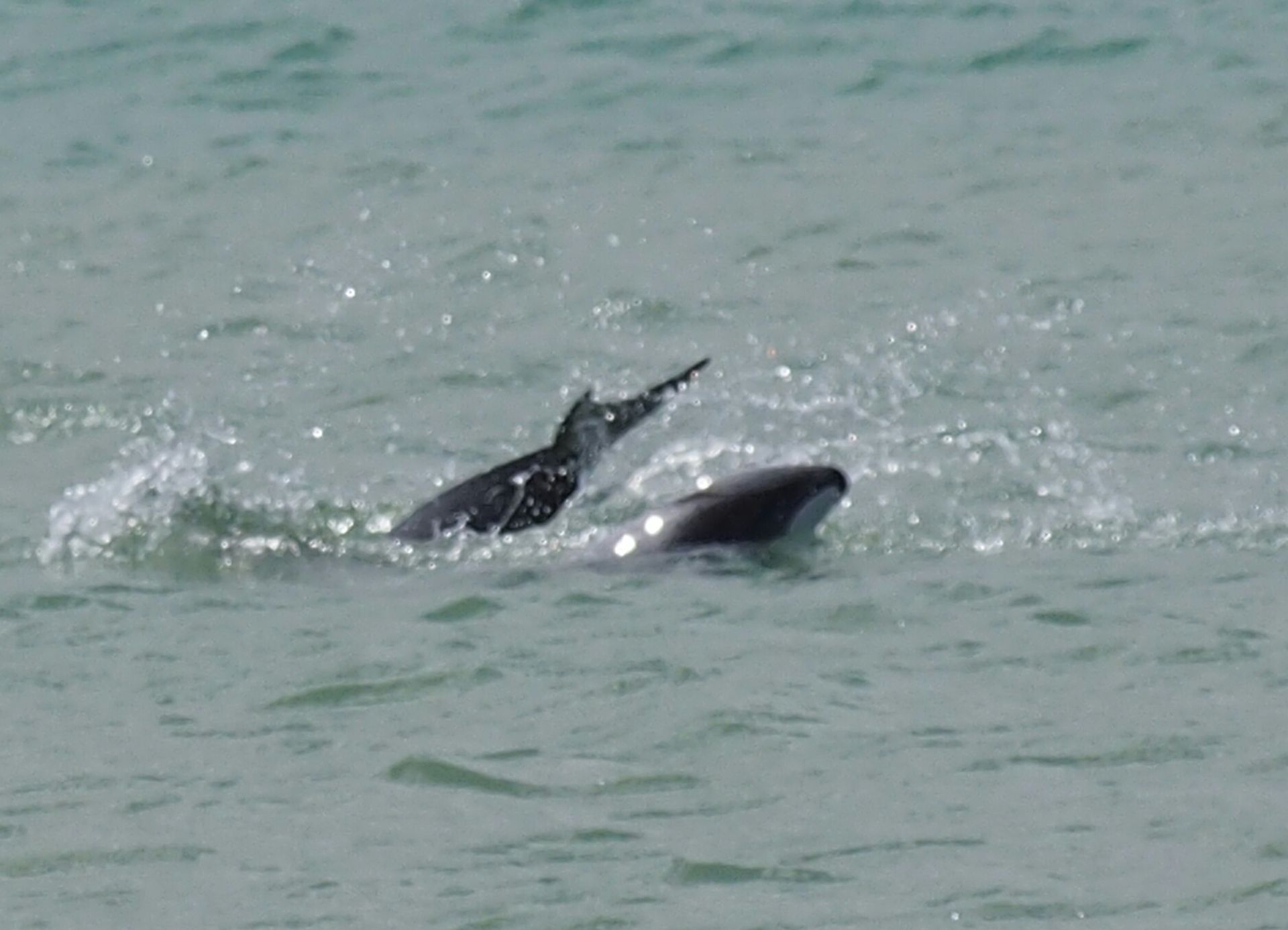
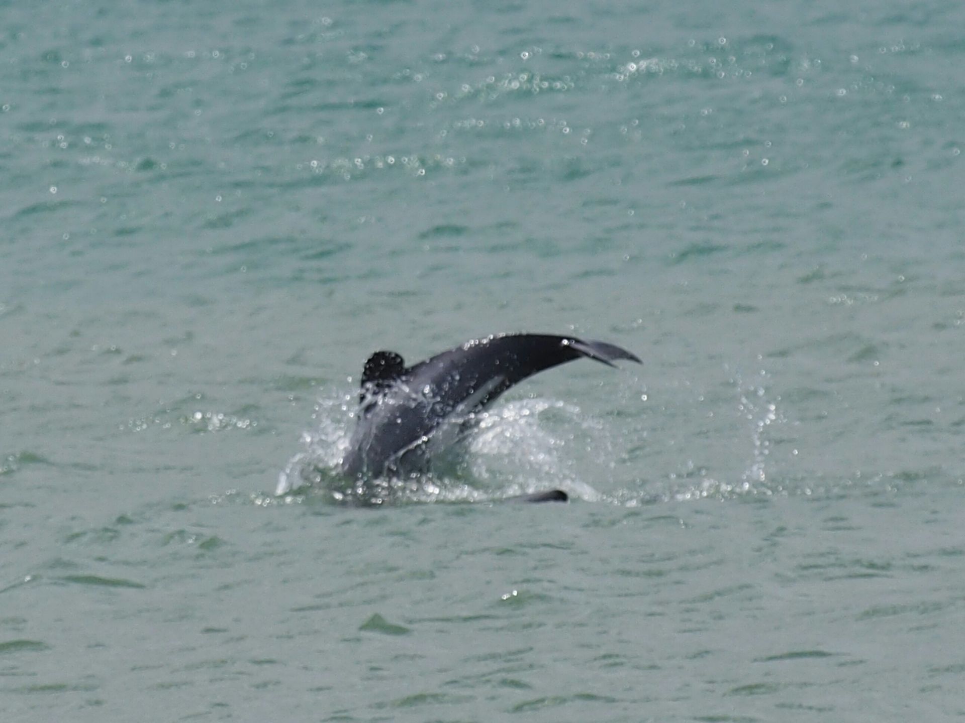
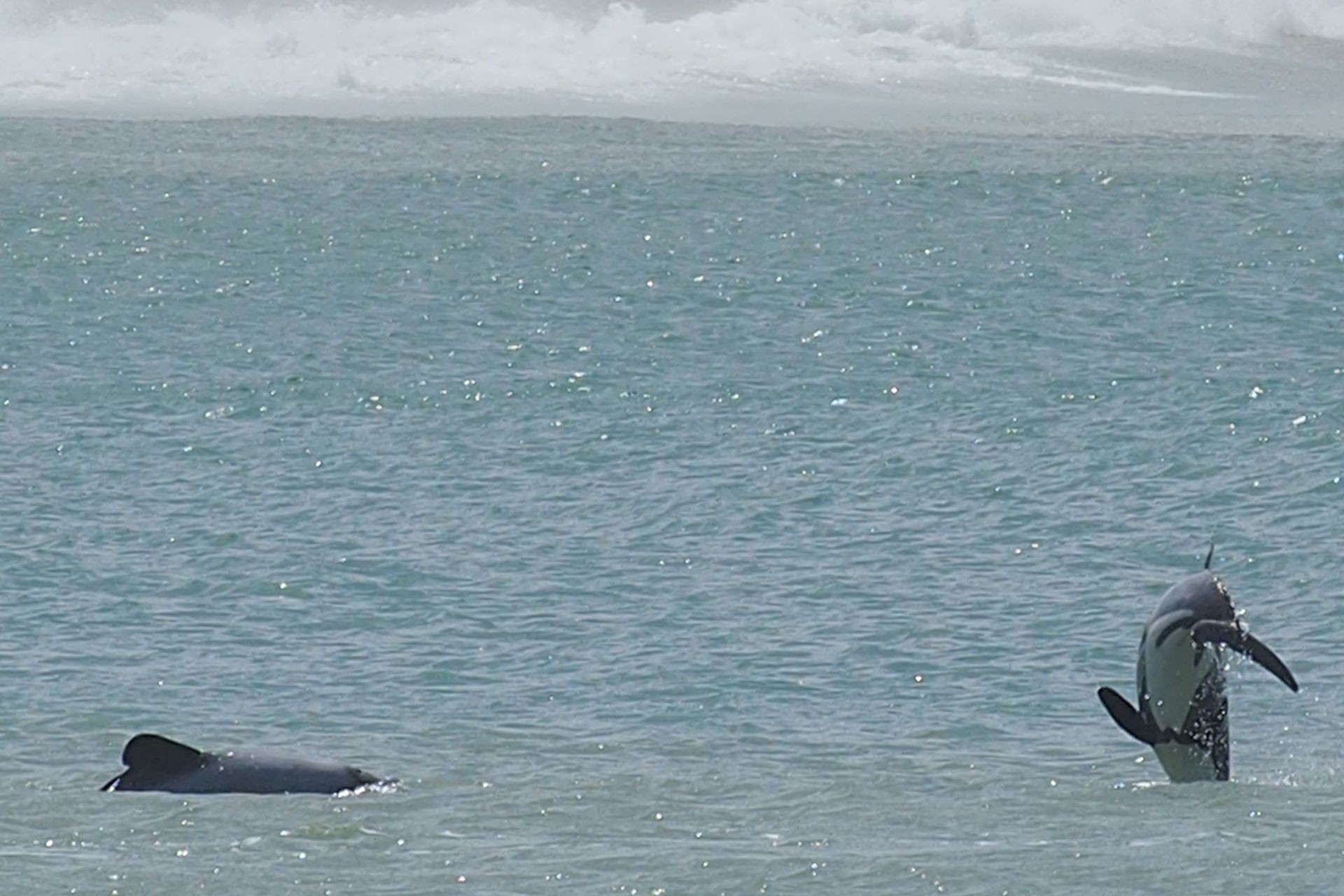
There is a campground up here - what a fantastic place! However, you really have to tie everything down here, including small children. Sitting outside and eating is difficult here, as the food would probably fly off the plate. I get an ice cream from the small store and while I still enjoy the view of the expansive, almost deserted bay, I see the first dolphins fins.
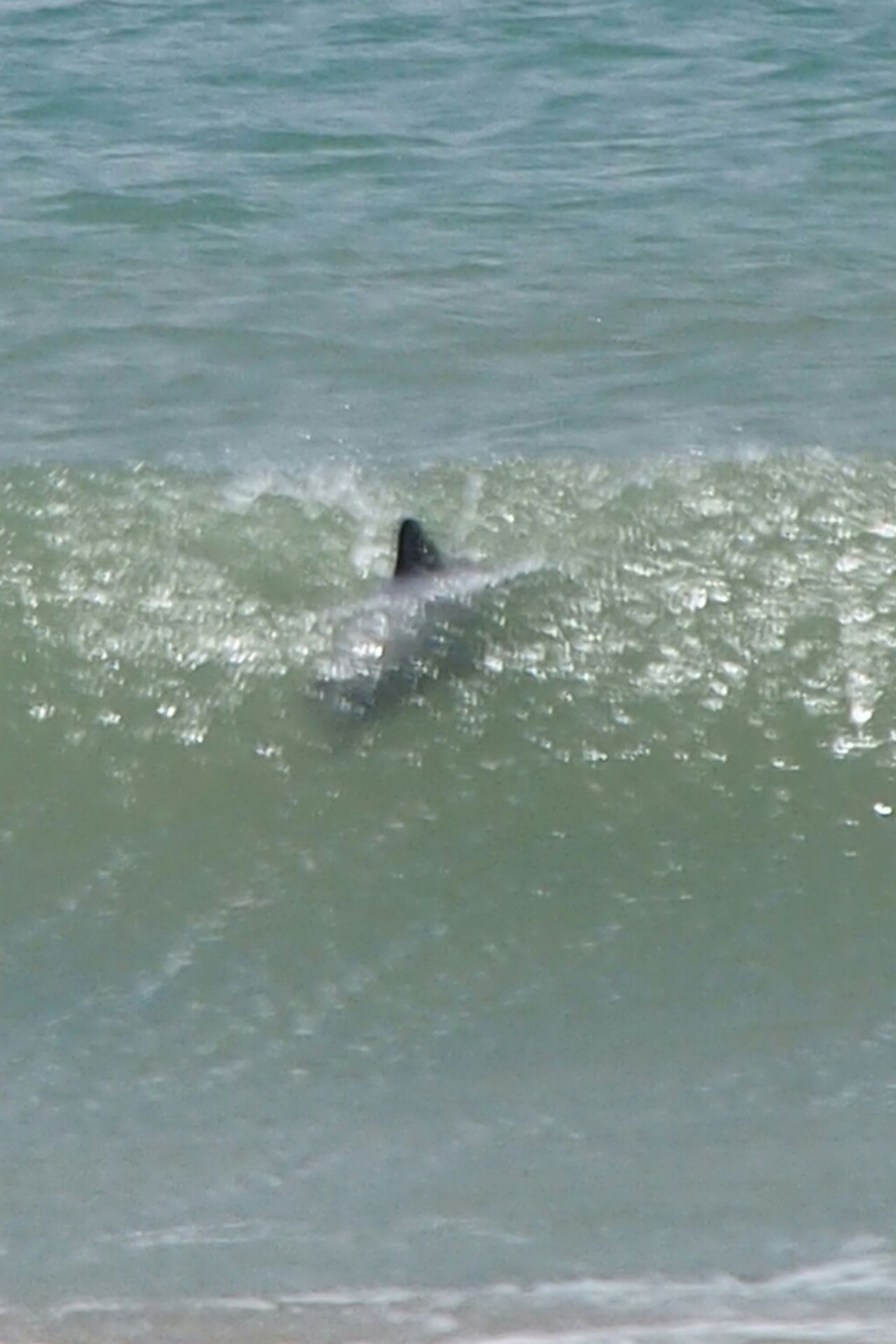
Black, small, round - those are Hector's dolphins! The smallest dolphins in the world, with a population of less than 10,000 worldwide, they are one of the many endangered species that are almost only found here in New Zealand. I see three dolphins swimming around playfully close to the beach and they also like to jump high. So I walk down to the beach and spend the next hour and a half watching them. Taking photos is difficult, the animals are quite fast and most of the time you only get the splashing water in the picture and the dolphin is already back in the water. But this bay is a dream.

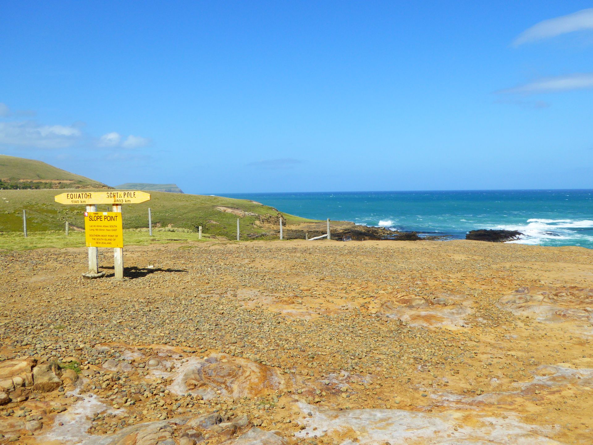
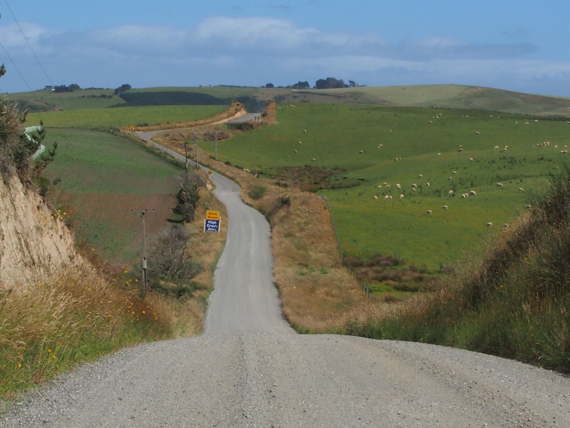
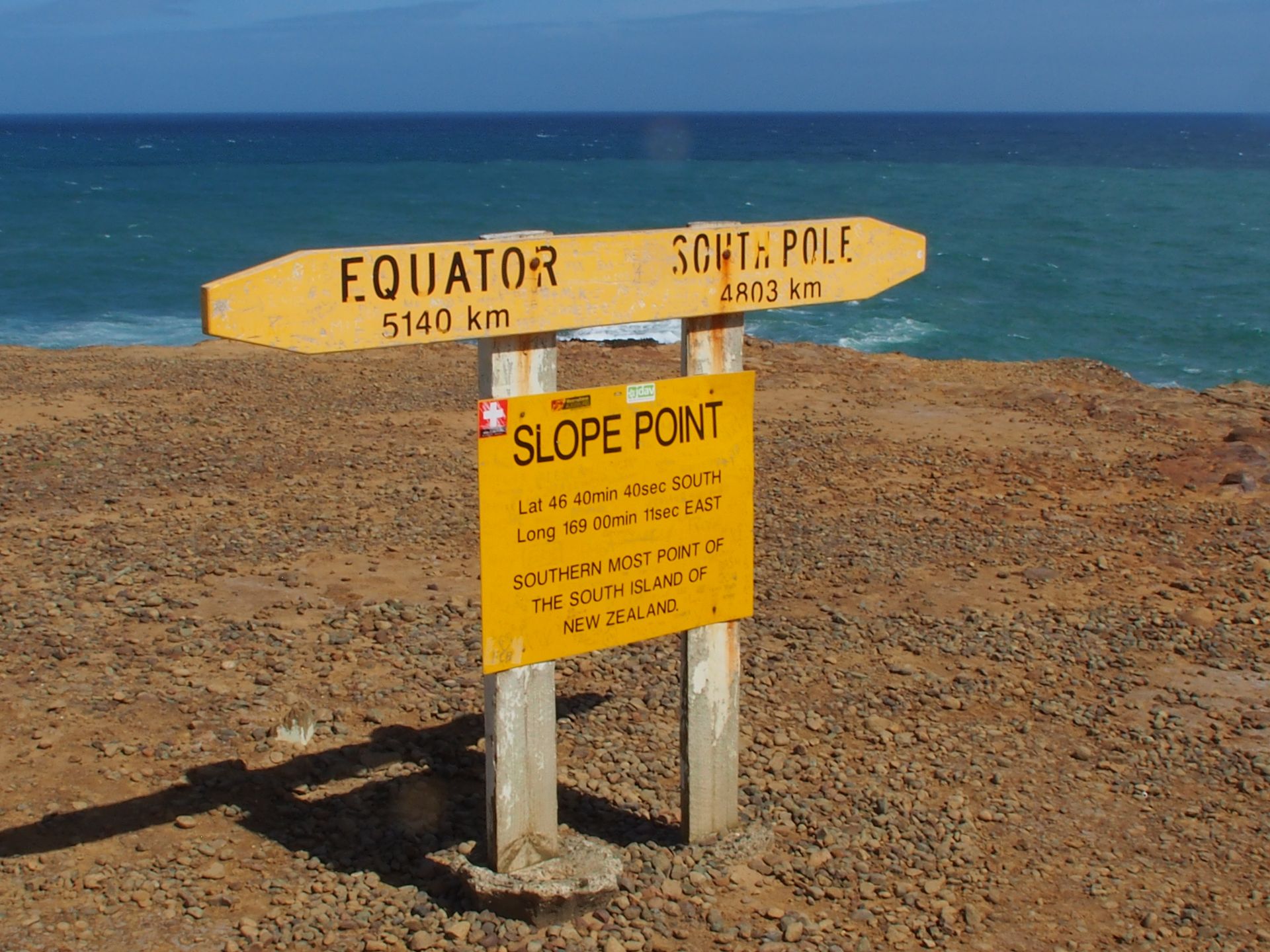
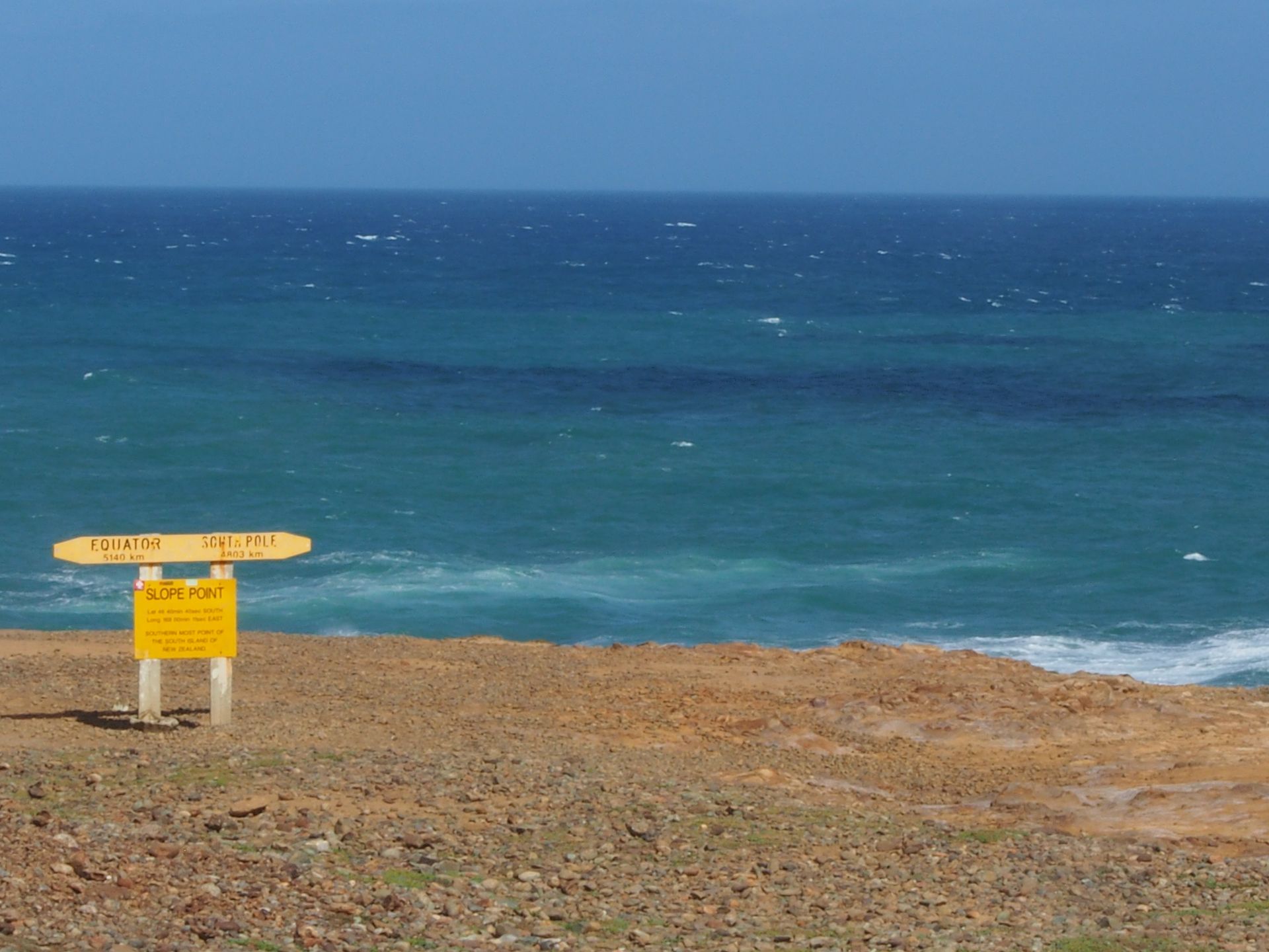
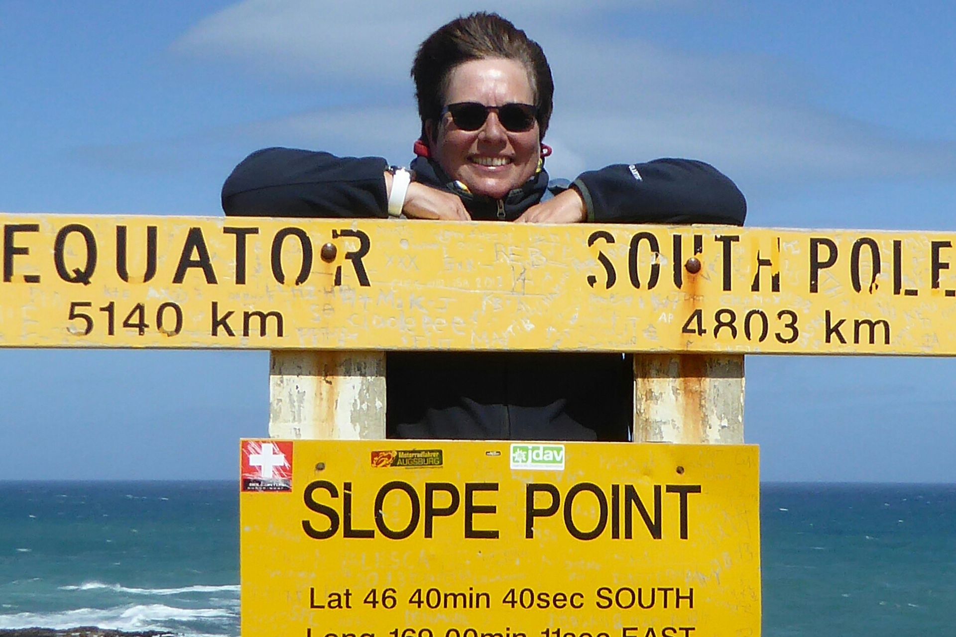
When I start again, it's half past three and I still want to go to Slope Point, the southernmost point of the New Zealand South Island - the South Pole is closer here than the equator! The road leads 15km from the Heritage Trail to the south, but it is also part of the Heritage Trail. 13km are gravel road, but easy to drive. In the end, you practically stand in a field. Here, a gate is secured with a hook, which you open and close yourself, and you walk through the field, then around the corner, along a fence, until you stand on a cliff, where it goes straight down into the roaring ocean. No fence, no barrier - but a nice sign indicating the distance to the equator and the South Pole. I take pictures of a German family and they take pictures of me - so I have a special photo document from my trip. Have I ever been further away from home? Maybe back then in Tierra del Fuego?
Towards Slope Point
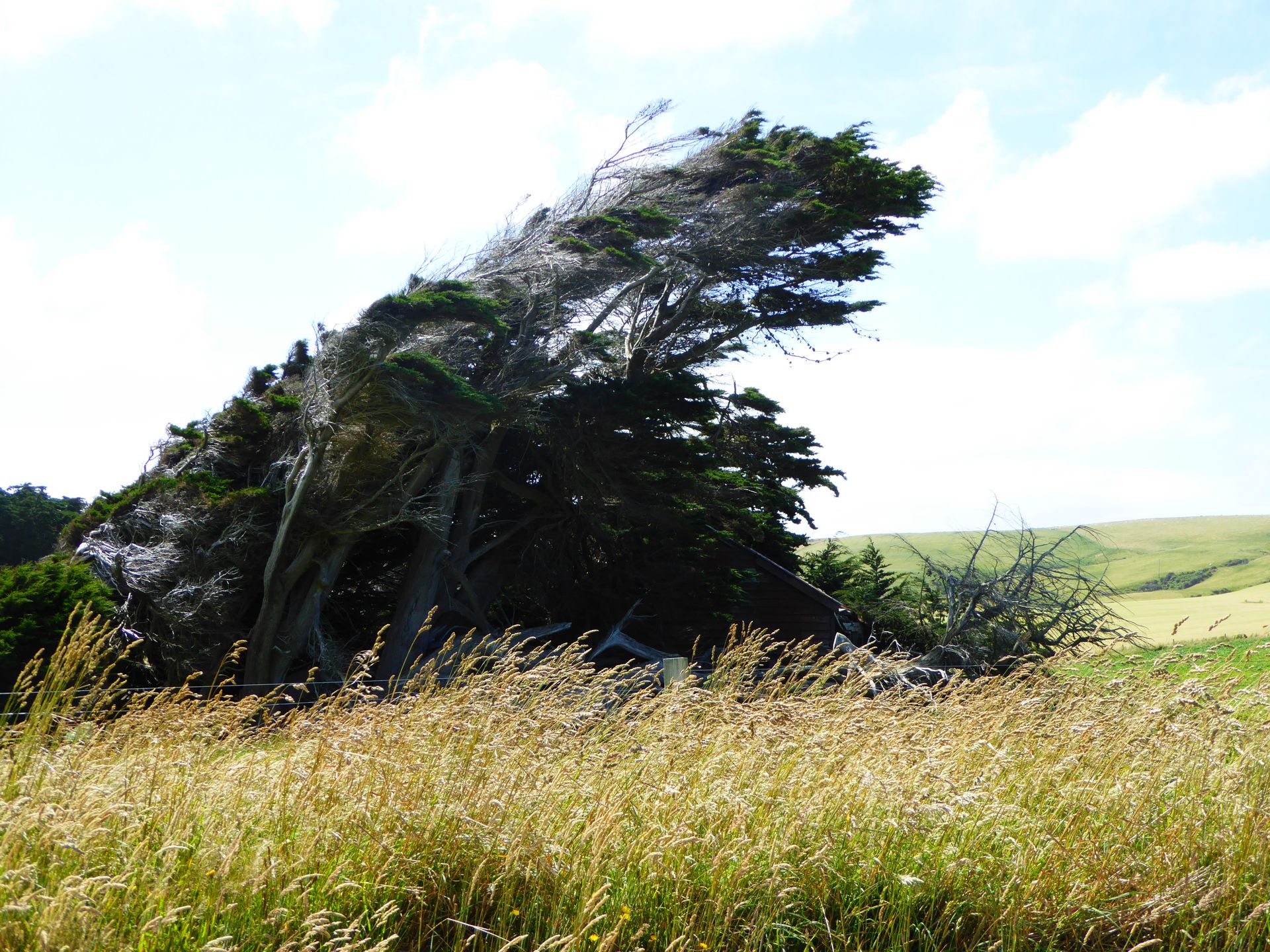
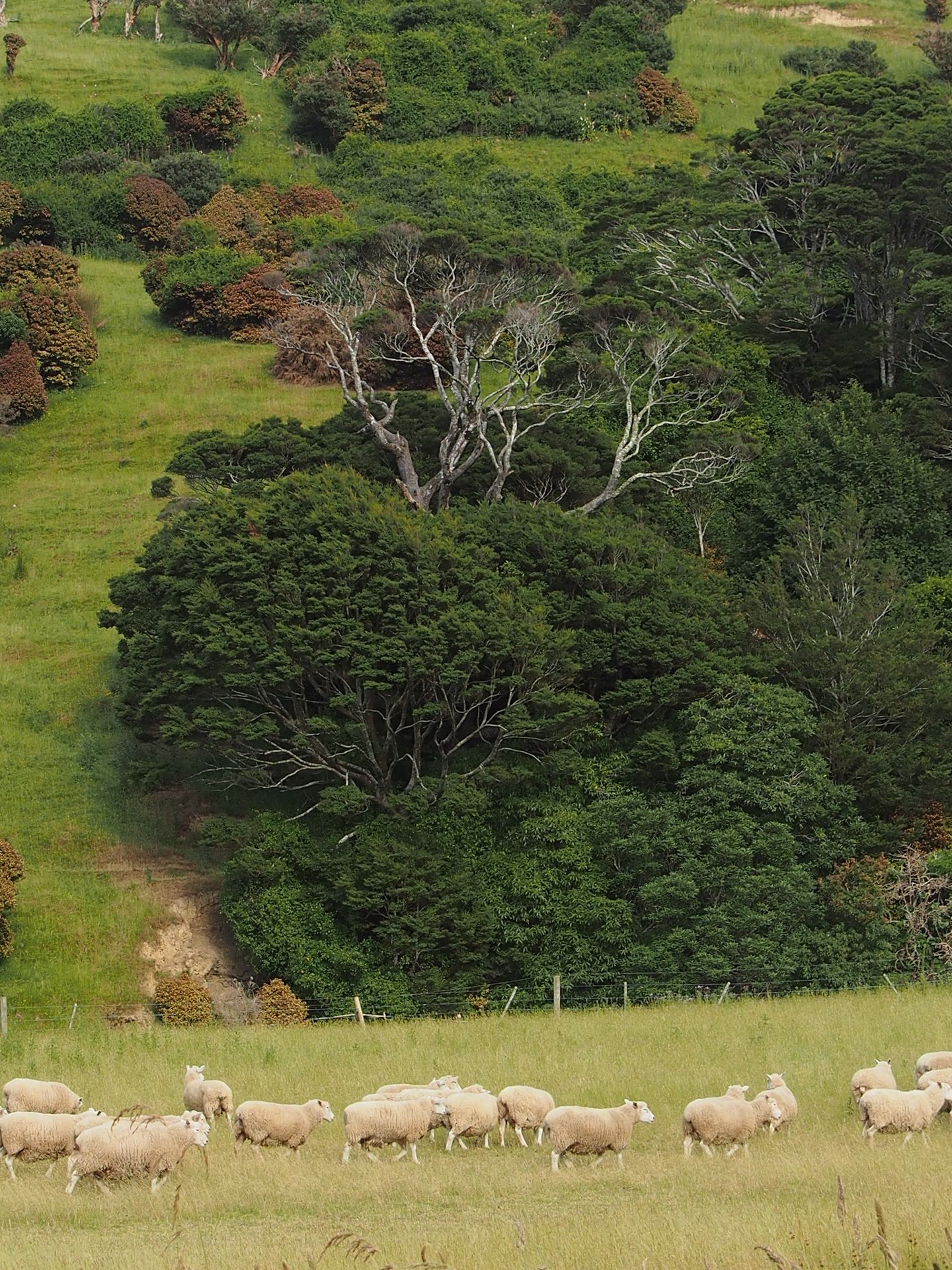
While I take a few more pictures, suddenly four or five more people come down here and I make my way back to the car (about a 15-minute walk). Up here, there are several of these podocarp trees, all leaning as evidence of the constant wind from the sea. They remind me of divi-divi trees on Aruba, which also grow in only one direction because the wind shapes them that way. It's just before 5:00 PM when I drive away from here and the return trip is almost 100km. The caves are now out of the question. The tide has long been in and they are already closed.
A large flock of sheep crosses my path. Everyone has time. Me too. Wonderful.
I enjoy the trees, the primeval forest, ferns, and palm trees on the way back, the incredible views of the cliffs on my right side, and I rush along because there is hardly any traffic here. Just before Kaka Point, I decide to drive up to Nugget Point to see the lighthouse.
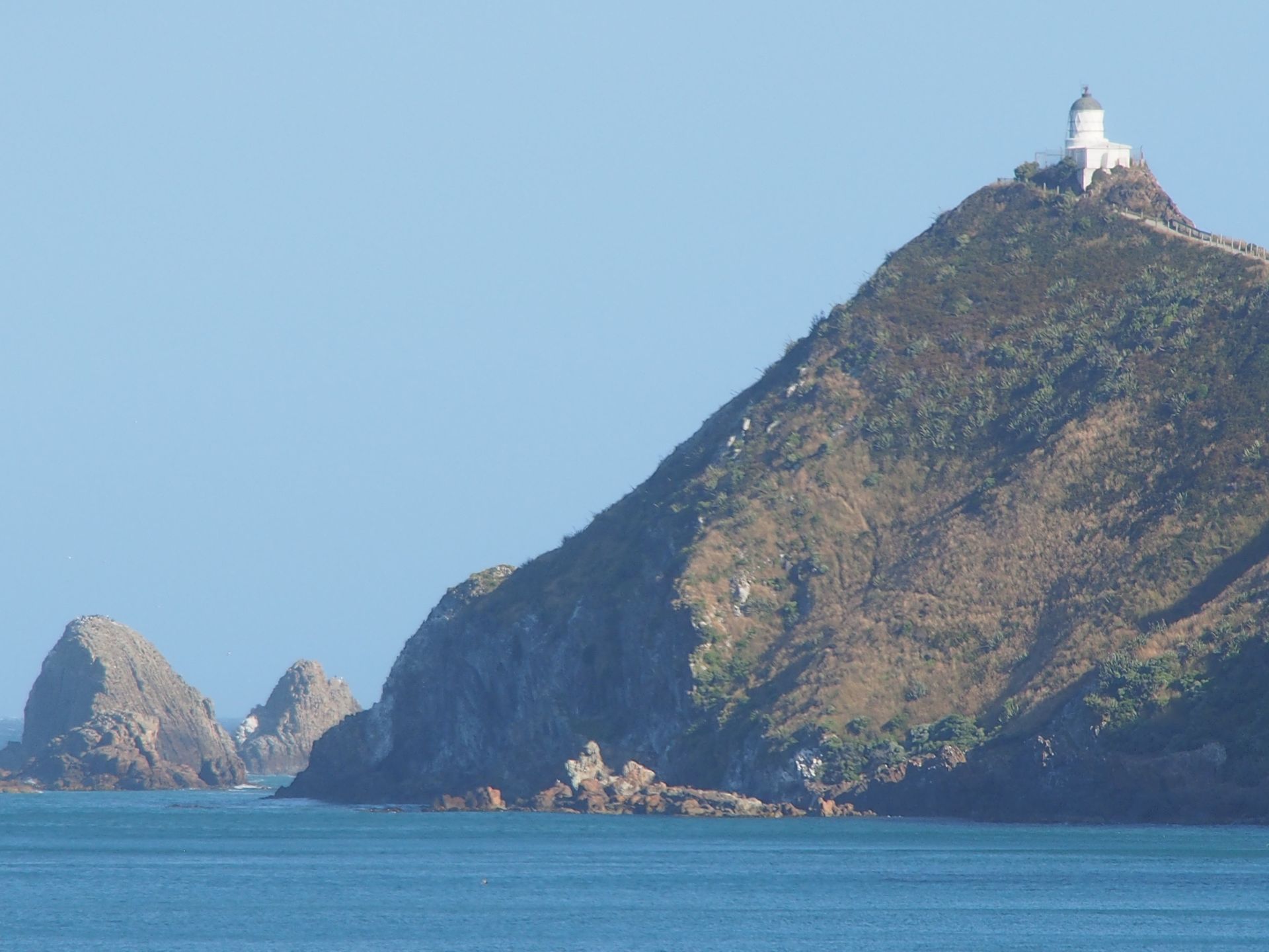
The weather is really nice, the sun is shining, and if you are not standing in the brutal wind, you might think it's 30 degrees outside. Since it is already 7:00 PM and the road to the lighthouse at the end of the road is just under 1 km, I content myself with a view of the cliffs and the seals and sea lions on them, and continue on to my accommodation. Since breakfast, I have only had an ice cream and now I'm hungry. I put my last bell peppers, tomatoes, and an English muffin in the toaster and dinner is ready, which strongly resembles the usual breakfast combinations.
I am now considering intensively how I should spend the next 10 days on the South Island and where I should book hotels now. Actually, I wanted to go to Invercargill tomorrow and from there to Wanaka. But the German family advised me against both Invercargill and Bluff, saying that both are quite stupid, so theoretically I have gained some time by skipping that. Milford Sound still tempts me in the back of my mind. The drive there in January 2014 was in fog and drizzle and the weather forecast for the next few days predicts plenty of sunshine and temperatures over 20 degrees there... I look up the distance to Te Anau and am surprised that it is only 226 km. I find a hotel online, book it for 2 nights, and therefore tomorrow I will head towards Milford Sound. Hooray!
Distance today: 216km
Subscribe to Newsletter
Answer

Travel reports New Zealand