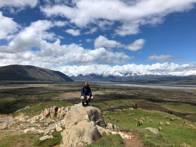
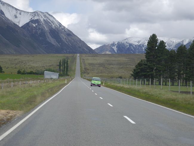
17 percent gradient
Naipablaak: 22.11.2018
Agsubscribe iti Newsletter
Day 50
Somewhere in the middle of nowhere. That could also be the title of this entry. Since the last time I checked in, a lot has happened and we have come a long way. Through mountains and valleys, over rough terrain. Yes, we somehow made it. Even though it cost us nerves and sweat, we traveled from the West Coast to the East Coast.
Greymouth. That's where our trip started. The gold mining town located pretty much in the middle of the South Island on the East Coast didn't have much to offer for us. The place we were staying at was basically another desolate tin hut town, so we spent the whole afternoon at the library where we had free Wi-Fi and drinking water, and we could charge our devices. A paradise for backpackers. The mood was good despite the cloudy sky, but tense. The calm before the storm. Because ahead of us was the Arthurs Pass, which I quote from a travel guide, "the steepest east-west connection on the South Island". But at the same time, it was the only one that was suitable for both of us, as the Lewis Pass to the north was too far north and the route from Haast in the south was too far south, so not feasible for us in terms of time. The sky was gray, the library gloomy, and ahead of us was the Arthurs Pass, which we had to conquer the next day. "Steep" was not good. Because we had already had problems climbing some hills with our almost old-timer car, and we had sworn not to risk it with the car. So we started Googling. Can we do it? The internet is of course the best place to get trustworthy, reliable information or answers to such a question, so we scrolled through countless websites that made us even more panicked. It said there, that one should do it once, as such an adventure is rarely experienced (we didn't really need an adventure). Or we saw pictures of collapsed roads, with someone asking if they could be traveled on again. On another site, there was talk of the most difficult roads in New Zealand, which needed daily maintenance and work. When we then checked our weather app and noticed that it was currently snowing at the pass, it was finally over. The plan was actually to spend a night at Arthurs Pass, so we wouldn't have to drive so much every day. But that was done with the fact that it would be -3 degrees at night.
Both of us were once again puzzled. Linus then went to the local AA and the police station to ask about the current situation there, whether we could drive with a very old car on the road and whether it would snow tomorrow. The police said it wouldn't be a big problem and the AA gave us a number to call tomorrow for the weather.
So we went back to the campground, where we spent our last night on the West Coast. The next day we called the given number and learned that it wouldn't snow today, but we should expect longer delays on the road. We decided to just start driving, as we didn't really have many alternatives. The first 40 km were a normal country road, without snow, without fear of curvy, steep gravel roads. There was a calm nervousness in the air again, because we knew that the later the steep section would come, the steeper it had to be.
At some point, we came across a sign that said "Viaduct". "Here we go," Linus said dryly, because he had read about it. The sign announced the steepest section of the Arthurs Pass. Shortly after, another sign appeared. "17%" was written on it. And that with our (run-down would be too harsh) but very old and definitely underpowered 1992 Toyota. But we were motivated and Linus gave it full throttle. It didn't take long for him to have to shift from fourth to third gear. It didn't keep us there for long and the second gear was in. Come on. Just a little bit more. Those were the thoughts as we couldn't go higher than 9 km/h with the gas pedal fully pressed in second gear. So into first gear. A line of cars behind us. Just a few meters in front of us until we climbed the mountain. The engine stalled.
When the revs went back up and we could shift back into second gear and finally into third, we knew we had made it. I won't deny it, we couldn't suppress a little cheer.
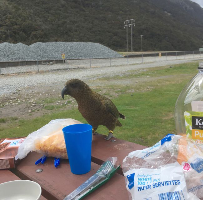
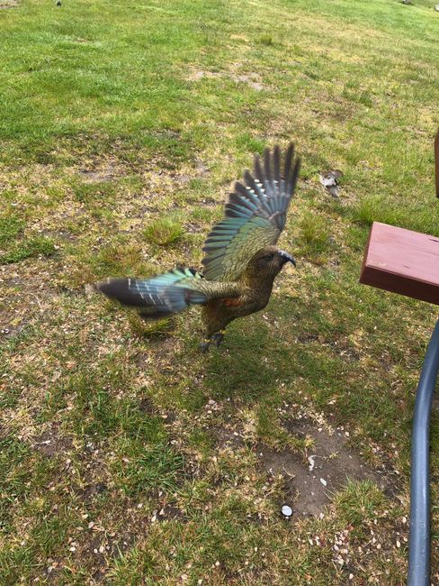
And when we eventually realized that we had made it, the overwhelming alpine landscape caught up with us and as we continued to drive on the now flat stretch, we couldn't stop marveling. Huge snow-covered mountains on the left and right, a clear blue sky above. We drove a little further to the next town. There we had breakfast and silently enjoyed the surroundings. We sat in our jackets at a picnic table, it was about 8 degrees, and mountains all around us. This wonderful idyll couldn't be topped. Almost. Because as we sat there feasting, suddenly a Kea sat on our table. The only alpine parrot species in the world, of which there are only 5000 left in the world and which is endangered. The birds were quite beautiful. But also quite cheeky. Captivated by our admiration, the parrot poked around in my cereal bowl and later snatched my toast to fly away with it. Well, I can do without that.
We finished eating, continued driving, later went on a short hike, and then made our way to the next campground east of Arthurs Pass. After the viaduct, the stretch was actually quite straight, so we could simply follow a wonderfully flat road at an altitude of 900 meters, surrounded by mountains, until it eventually went downhill and we arrived in Springfield near Christchurch.
In retrospect, we shouldn't have let ourselves get worked up. The route was well-developed, not curvy at all, and really steep only at one or two places. Even though at times we didn't know if we would make it and had to struggle in first gear, it was an extremely beautiful experience, especially in terms of the view up there, the clear air, and the proximity to the New Zealand Alps. In the future, we won't put our car under such strain if it can be avoided, but the route from west to east will surely stay in our memories.
In the end, there's really only one thing to say: Arthurs Pass - check!
Agsubscribe iti Newsletter
Sungbat (1)
Holger
16% Steigung, da müsstet ihr euch ja wie im Flieger beim Start vorgekommen sein, der Startwinkel eines Fliegers soll ja bei ca. 18 Grad liegen.... ciao
Dagiti report ti panagbiahe Baro a Selanda
