Our way to Machu Picchu
Argitaratu: 20.11.2018


Harpidetu Buletinera
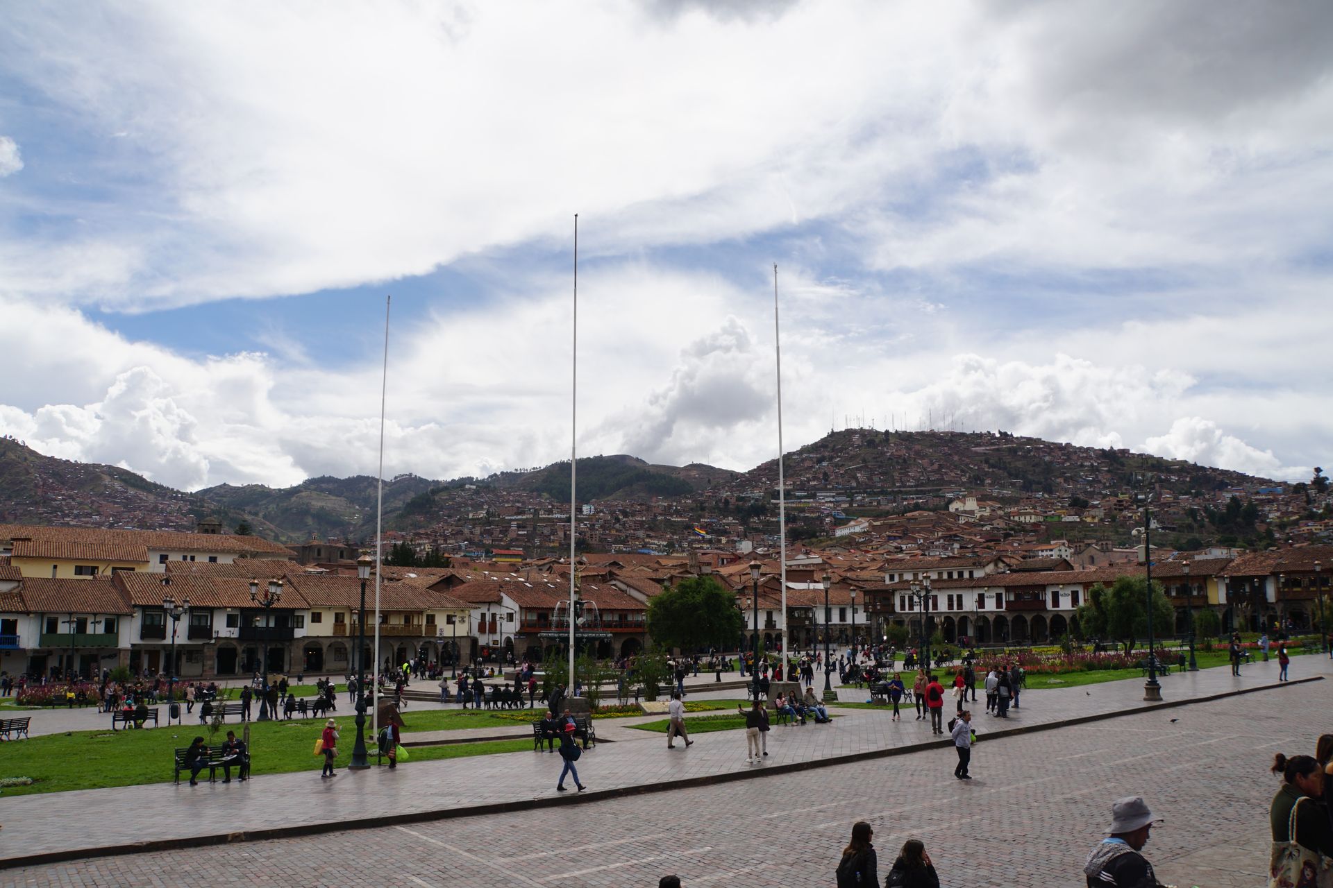
Probably at some point every traveler to Peru is drawn to Cusco, after all, the city located at an altitude of 3,430m is the starting point for visiting Machu Picchu and various other attractions nearby, such as the Rainbow Mountains, the sacred Urubamba Valley, and much more.
Cusco itself also has a lot to offer and is certainly one of Peru's most beautiful cities. Geographically located in the center of the Inca Empire, Cusco was also the cultural center and the seat of the Inca, the ruler of the nearly 1 million km² empire.
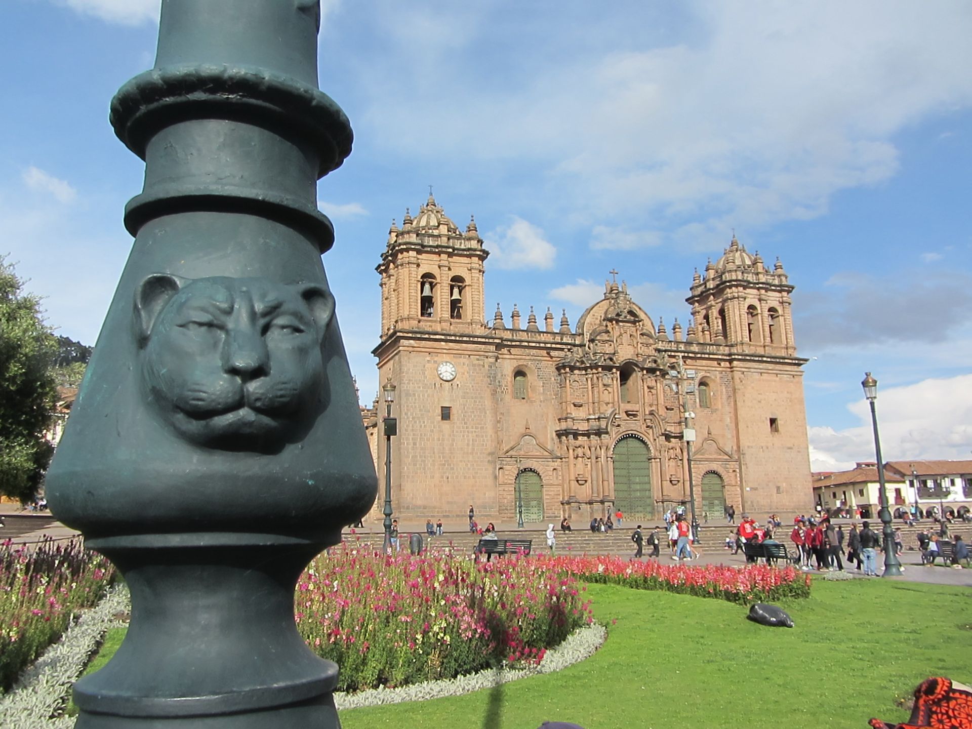
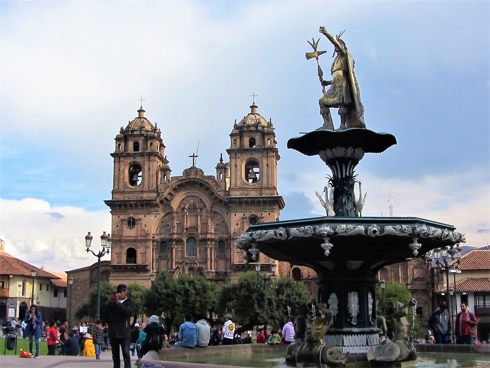
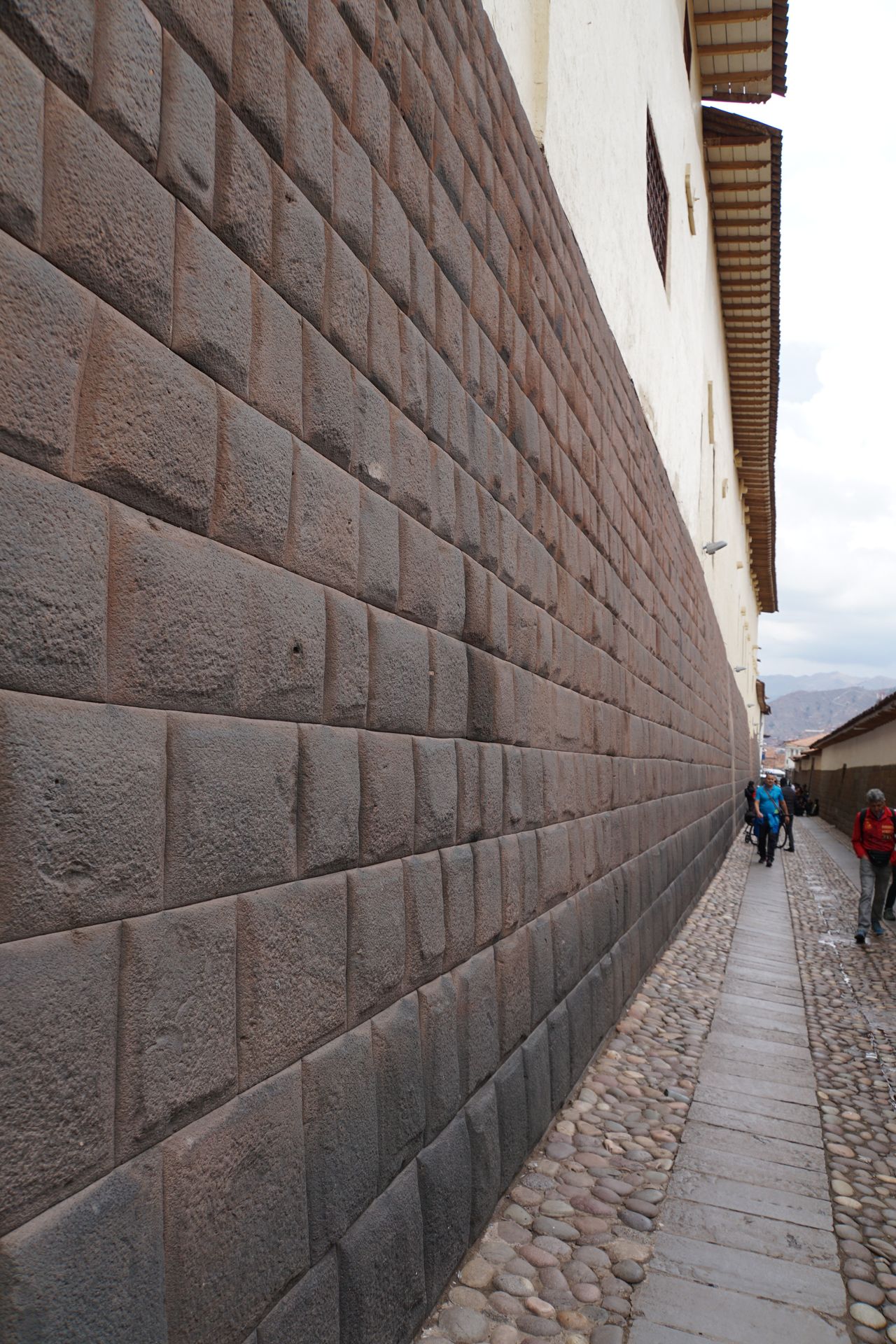
The former Inca capital, where up to 20,000 people are said to have lived at the time, was laid out in the shape of a puma and housed all the important temples and palaces. The Spaniards, who entered the city under Pizarro in November 1533, must have been presented with a truly fantastic sight, as many of the temples were adorned with pure gold and the main square of the city, where the four most important roads in the country converged, was covered with pearl-white Pacific sand. Relentlessly, the Spaniards leveled all temple complexes and used the Inca buildings as quarries. They built churches on the most important palaces. Many of the Spanish buildings collapsed repeatedly in the following years, as Cusco is frequently hit by earthquakes. The foundations of the Inca builders have so far withstood all of this, which is why many Inca walls are still preserved in the cityscape today.
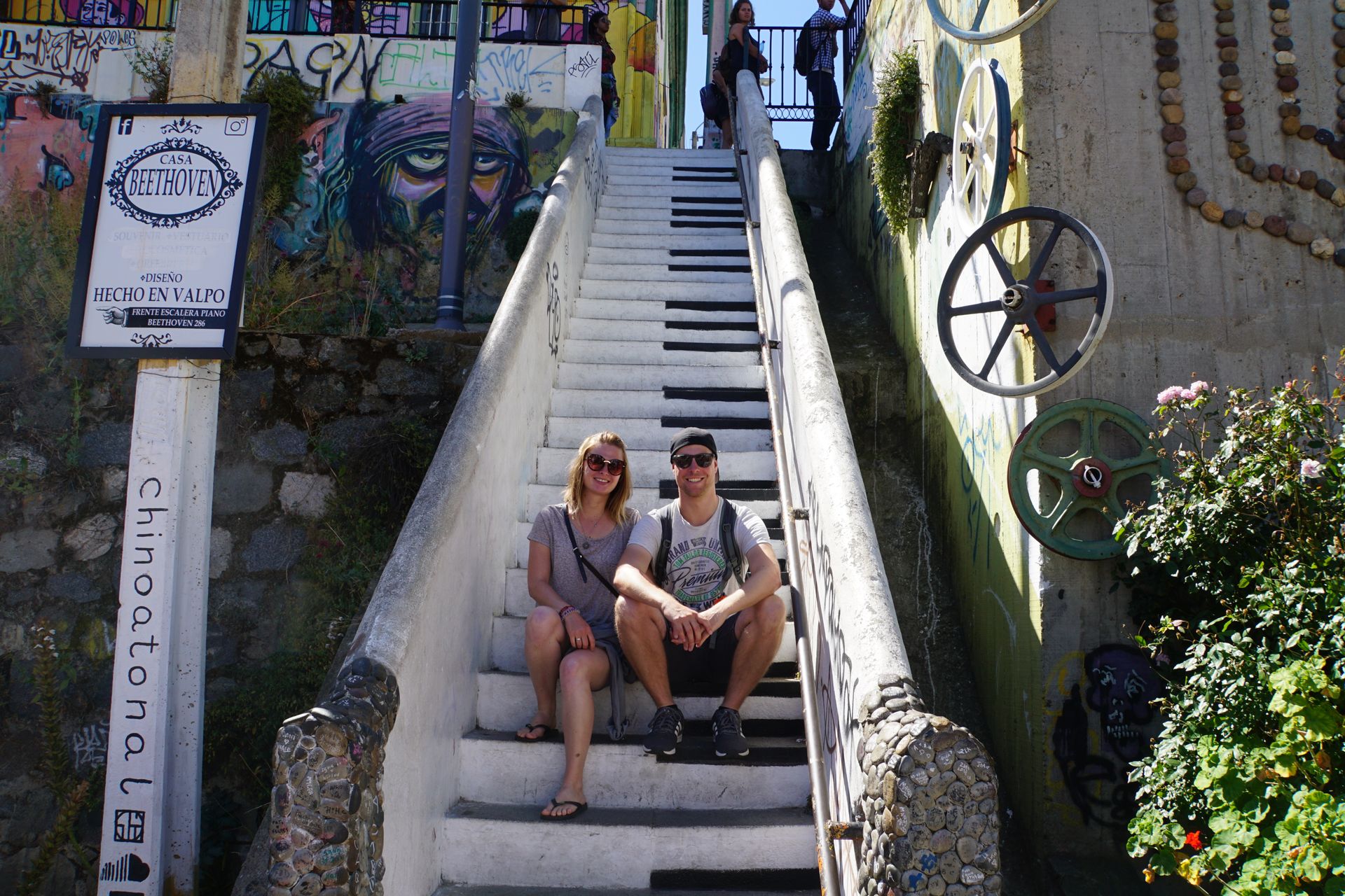
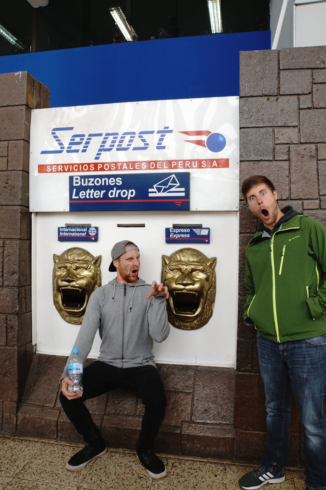
Unfortunately, we don't have as much time in Cusco. Of the two days we have left, most of the time is spent organizing our trek. Apart from a city tour, we don't have much time left before our Machu Picchu adventure. However, after our return, we treat ourselves to a special dinner at one of the better restaurants, where the guys actually try Cuy, the roasted guinea pig. I am more than satisfied with my lamb ragout ;-)
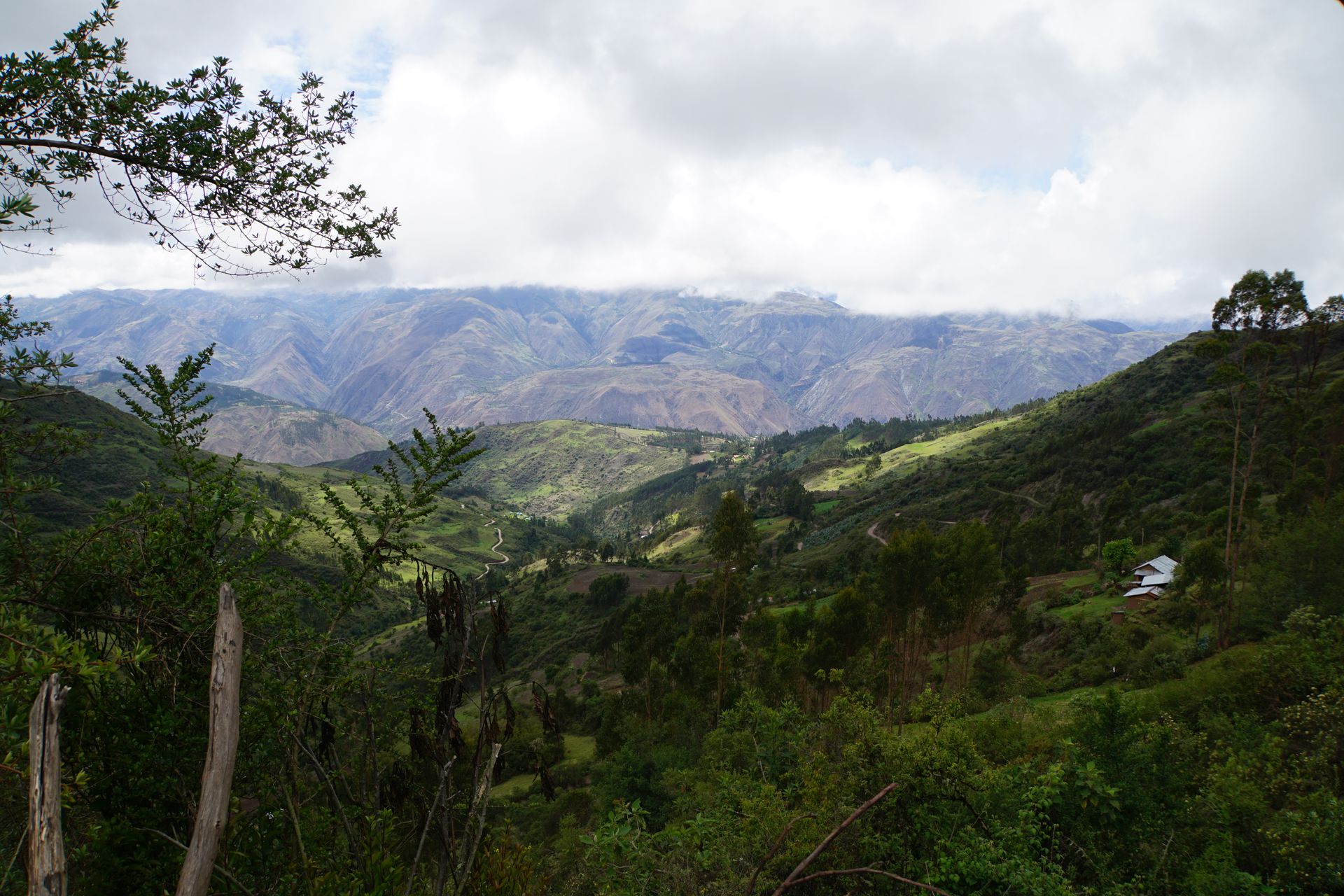
Finally, we start our adventure to Machu Picchu, the legendary Inca city in the middle of the Andean jungle. Early in the morning at 4 o'clock, we take the Colectivo to Mollepata, our starting point for the Salkantay Trek. At least it should start at 4 o'clock. Peruvians are not so strict with the time. We are still waiting for various co-passengers until the car is full. Finally, at 4:45, we finally leave. The radio is playing Radio Rithmo Romantico, so the day can start well. We try to catch up on some sleep, but are abruptly awoken when our driver overlooks a significant speed bump and we lift about 30cm with the seat (Juli even hit his head on the ceiling of the van). We continue towards the Urubamba Valley. After about 3 hours of driving, we reach our destination. First, we strengthen ourselves with breakfast at one of the numerous restaurants on the main square of the town. Then we set off on the Salkantay Trek with the goal of Machu Picchu. We ask some helpful villagers for the starting point and are promptly led to the entrance. That was easy.
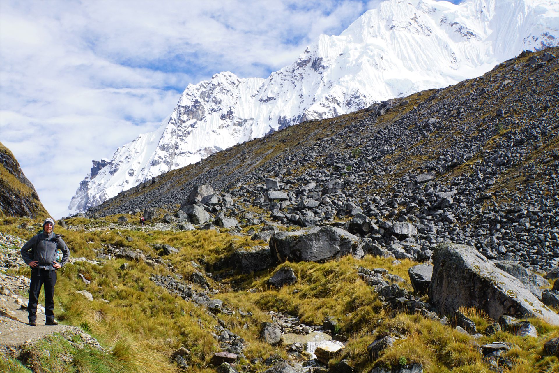
The path initially leads steeply uphill until noon and requires a lot from us. It starts raining around 1 o'clock, so we have to put our rain jackets and ponchos to the test. It continues to rain for about 2 hours before it starts going slightly downhill and the rain stops.
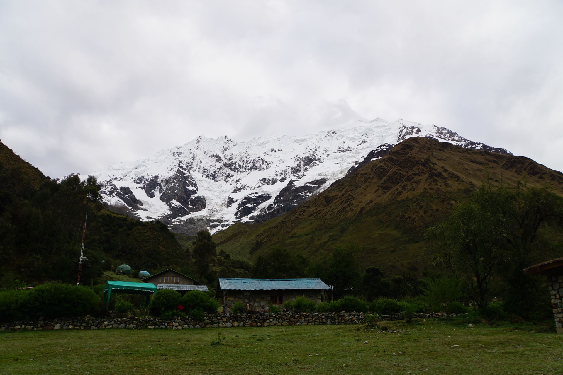
We come across a road that leads us to our first campground in Soraypampa. Just before it gets dark, before we reach the actual camping spot, we are intercepted by a little boy who offers us to spend the night at the family-owned 'campground'. Gratefully and tired, we accept the offer as we can save ourselves another 100m uphill. We also have the luck that we can set up our tent under a shelter.
So at least the tent stays dry on the first night. We wash ourselves, cook a small dinner, and then go to sleep quickly because we want to leave early the next morning, after all, the Salkantay Pass has to be conquered!
The next morning we wake up to a breathtaking view. Still fully motivated, we pack our things together and decide to have breakfast along the way.
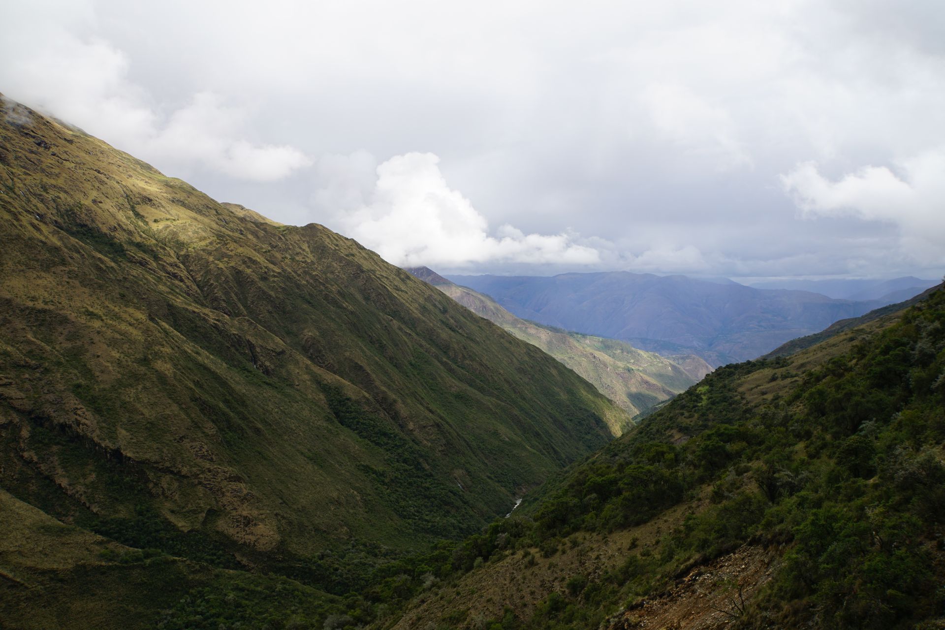
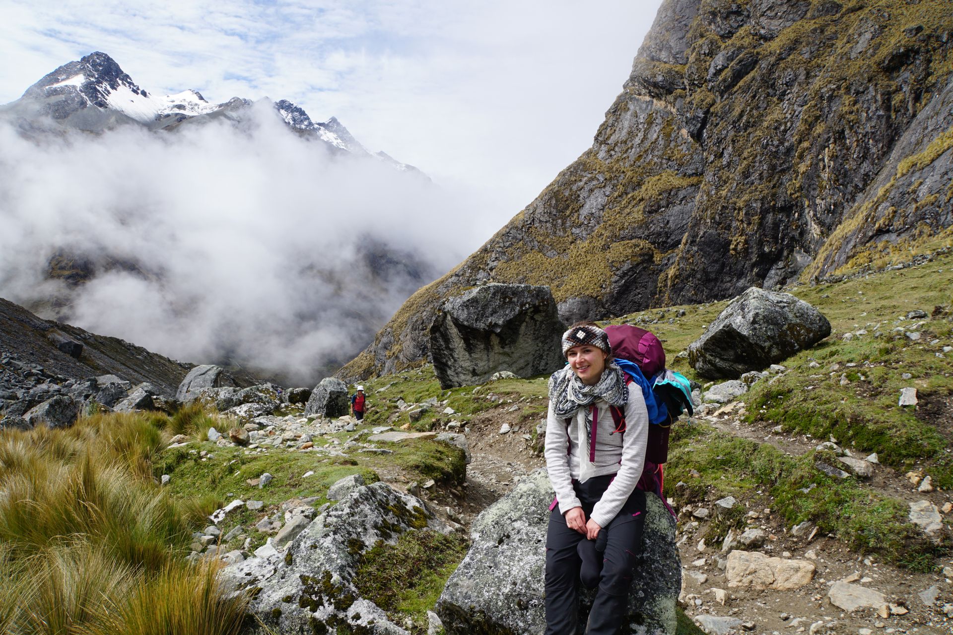
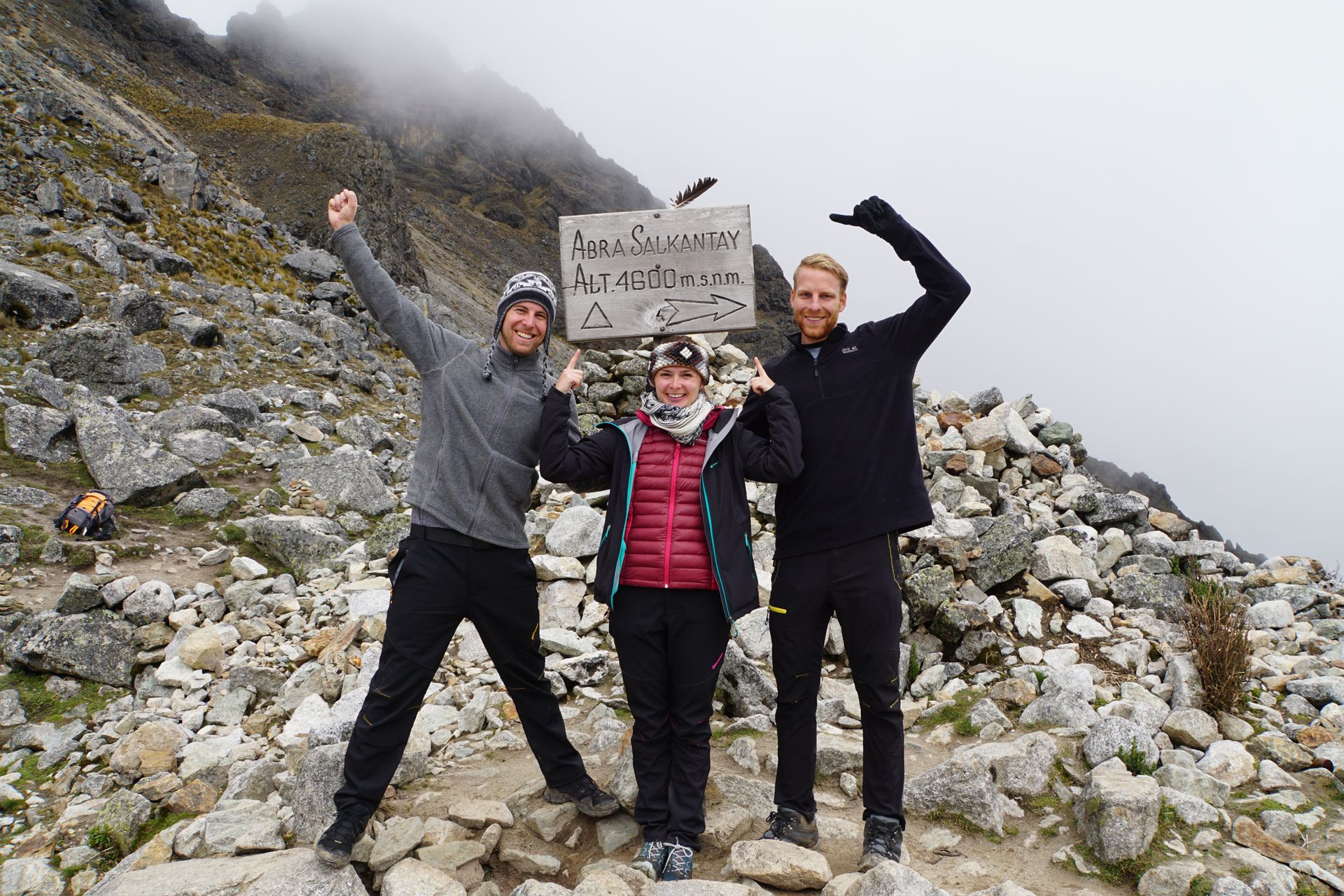
The path to an altitude of 4,600 meters is challenging - not least because of the very thin air! We drag ourselves up the mountain meter by meter. We are constantly overtaken by lazy people on donkeys and mules. If it's not four-legged animals, then people with daypacks pass us by, who let their equipment (tent, sleeping bags, etc.) be carried by four-legged animals - of course! Juli, the fittest of our small group by far, is of course ahead and is not as hindered by the mountain as Laura and I.
We reach a beautiful high plateau about 200m before the pass, which is perfect for having breakfast. Unfortunately, dark clouds are rising behind us, so we decide to postpone breakfast a little further back. The last meters up to the pass cost us the last bit of energy. Especially Laura fights/pulls herself up the mountain every 20m. Done! We are finally up on the pass and relieved, as we will only have to go downhill for the rest of the day.
Due to the rain starting, breakfast turns into lunch. We have oatmeal with nuts and dried fruits. My (Markus) mood reaches a low point as the place where we stop for lunch smells wonderfully of fried meat and soup. After all, the tour tourists get cooked... Well. After about 4 hours of downhill hiking, we reach Chaullay, our second overnight station. We are happy because here we can buy fresh eggs and for dinner, we have a luxurious scrambled egg with quinoa and tuna-tomato sauce. To celebrate the day, we treat ourselves to a hot shower and two beers (Cusqueña Negra is a really tasty drink).
The next day, we have breakfast along the way, and this time it works. The travel guide stated that there are fruit and vegetable plantations along the way, where you can buy avocado sandwiches inexpensively. So our breakfast consists of avocado sandwiches and porridge with dried fruit and nuts. We also try a fruit called Granadilla, which we have never heard of before but tastes unbelievably good.
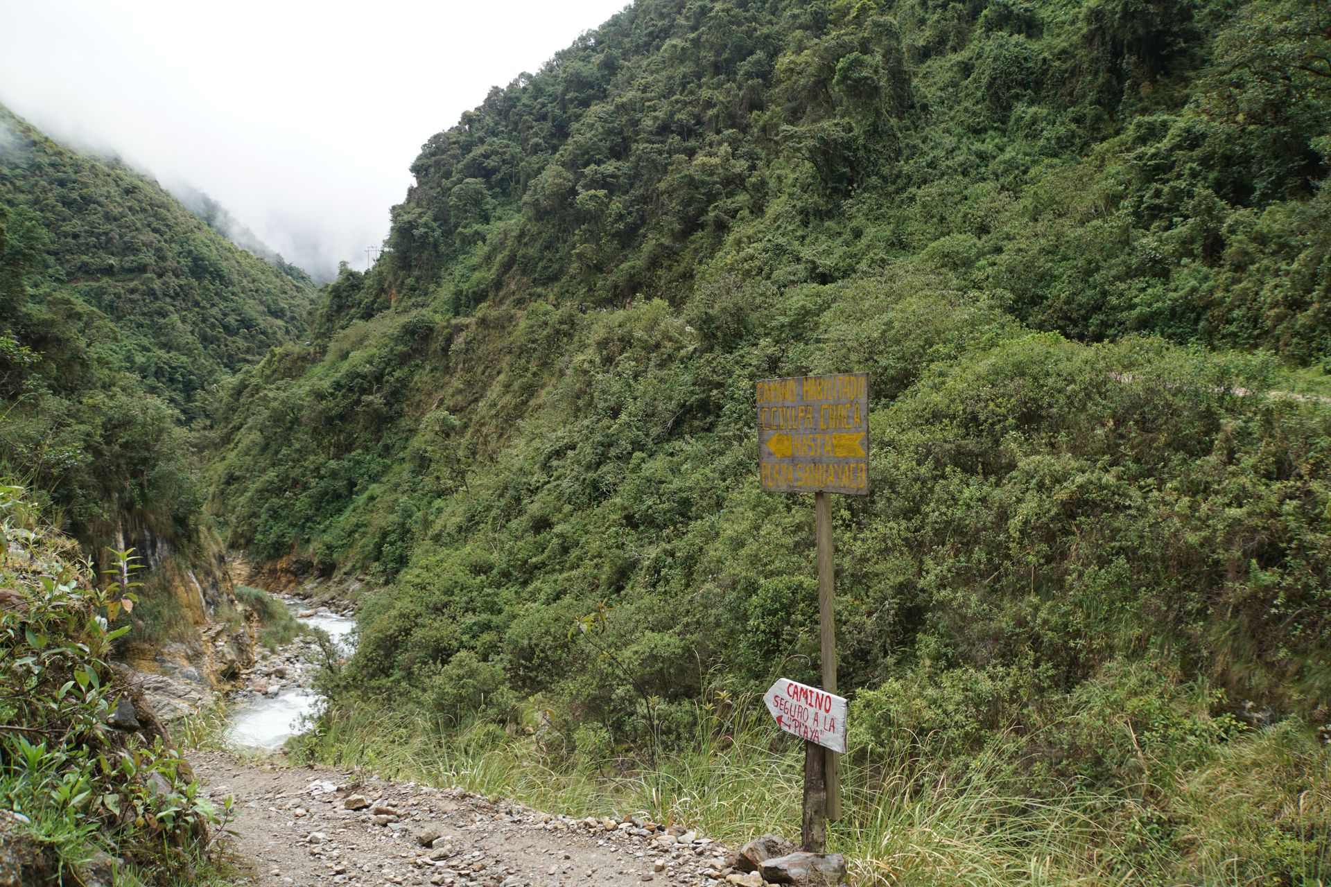
We continue along the hiking trail. In the morning, we decided not to walk along the road like all the tour groups, but to follow a small inconspicuous path on the other side of the valley. After all, there was a small wooden sign with the inscription 'Camino Seguro'... if that's not promising!
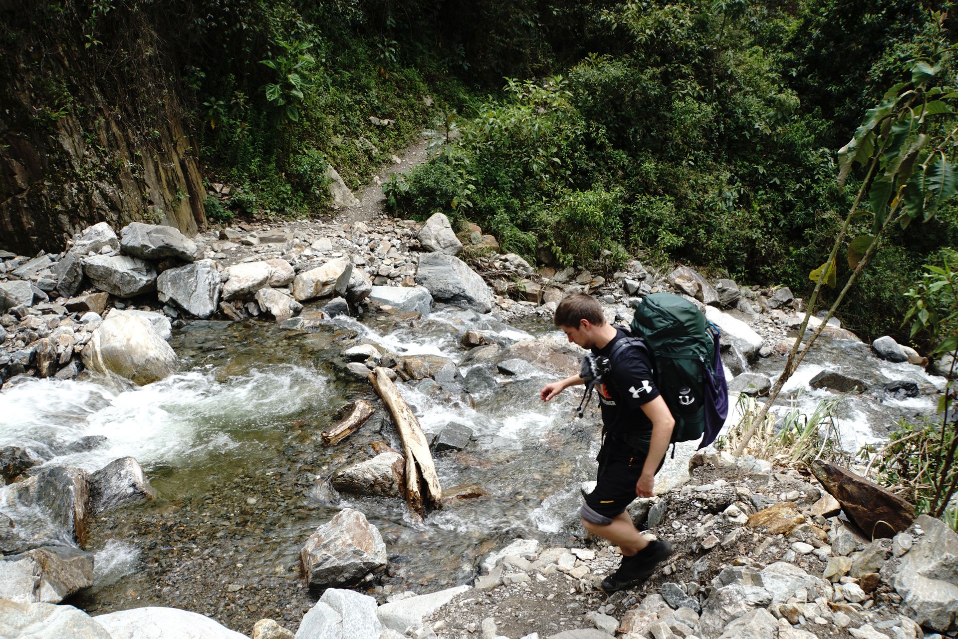
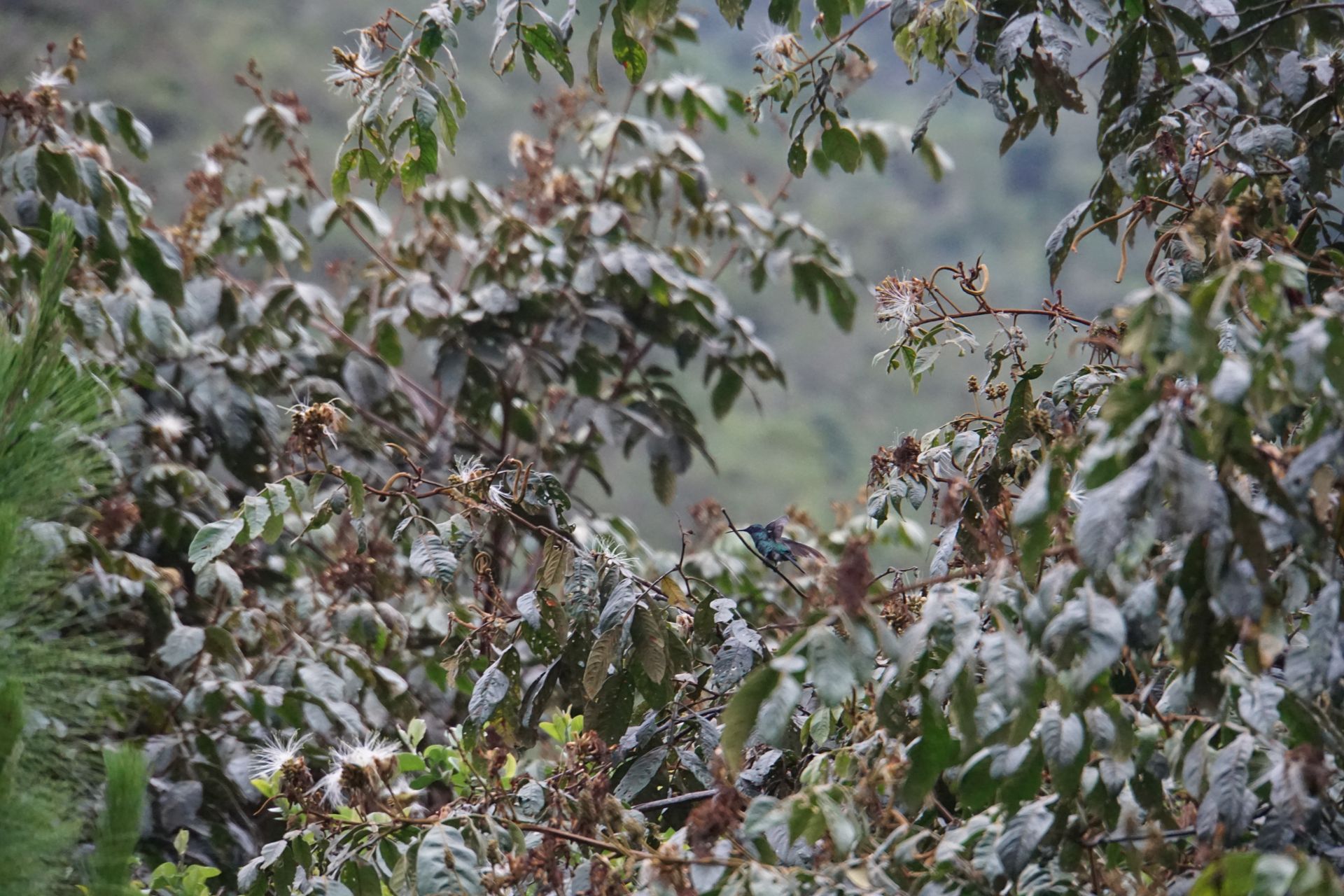
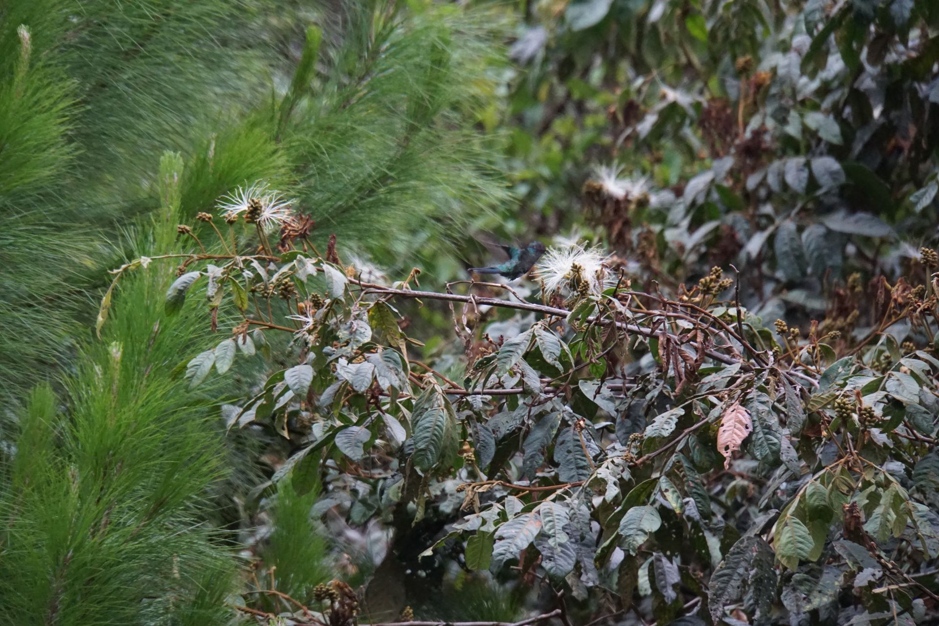
Actually, our decision pays off: we pass numerous waterfalls, have to cross small bridges, and on the sides of the path, there are banana and avocado trees, and even coffee plants.
At noon, we take a break in a small village to try the fresh coffee. It doesn't taste bad, although it's different from what we're used to in Germany. The coffee is served as a concentrate and then diluted with hot water. After the break, we continue for about 2 hours to our campsite, which is part of a coffee plantation. The owners are very friendly, and since we are the only guests, we can sleep in the covered communal kitchen. After setting up the tent and taking a hot shower, we try the homegrown coffee as well as coffee liqueur and honey. Coffee liqueur (we lovingly named the bottle Señor Sanchez) and honey end up in our backpacks and will accompany us from now on. Quickly prepare dinner and off to bed, tomorrow is the last big stage.
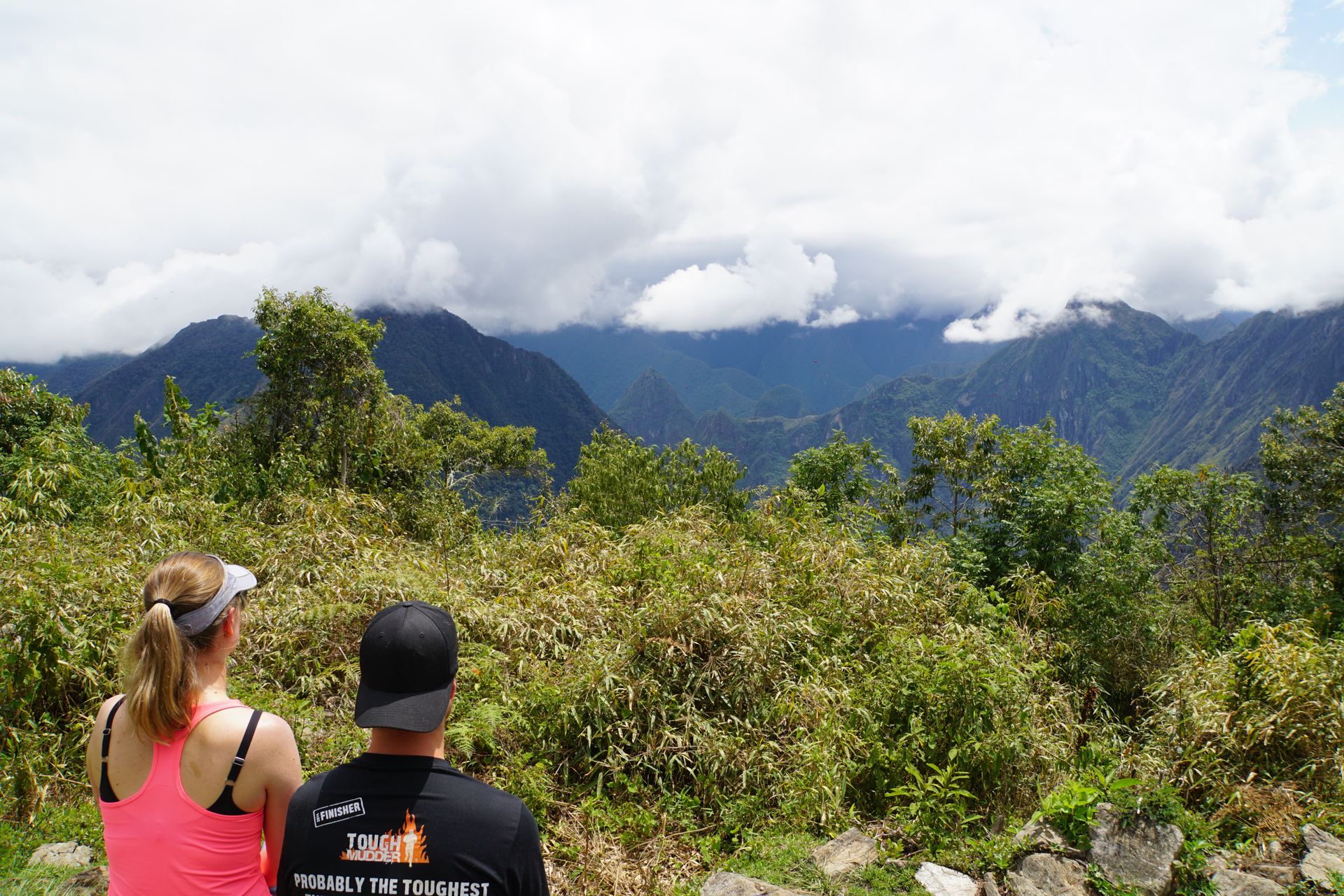
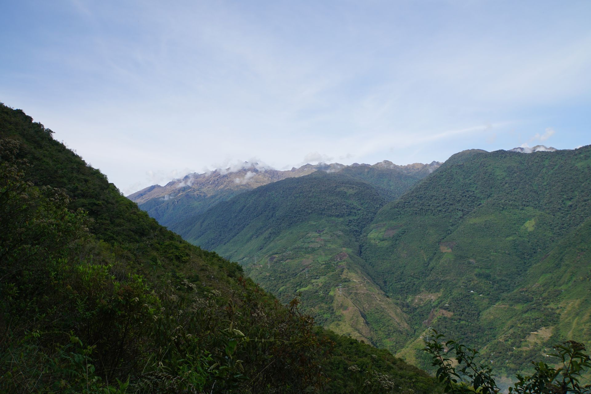
The last day begins with a steep climb of about 2 hours. 'You guys are beasts!' This quote from an admirer from a tour group saves Laura quite a bit over the day ;-). When we finally arrive at the top, there is fortunately a small hut where we can buy a huge avocado and bread rolls. After a hearty breakfast, we continue. After about 10 minutes of walking, we reach an old Inca ruin. Only at second glance do we realize that we can see Machu Picchu directly behind the ruin. An incredible view!
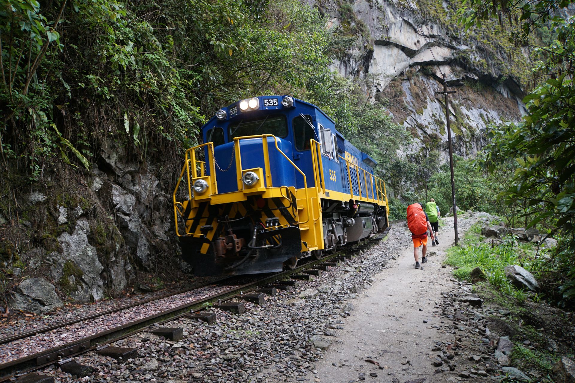
Then it goes downhill to Hidroeléctrica. From there, only the train goes to Aguas Calientes, the starting point to reach Machu Picchu. Alternatively, you can walk the 12km to Aguas Calientes along the train tracks.
The path is not very nice to walk on as there is a lot of rubble on and next to the tracks and the knees and ankles are heavily strained as a result. Eventually, we still manage to reach Aguas Calientes and only have a small meal because tomorrow at 4 o'clock the alarm clock will ring again to climb up to Machu Picchu.
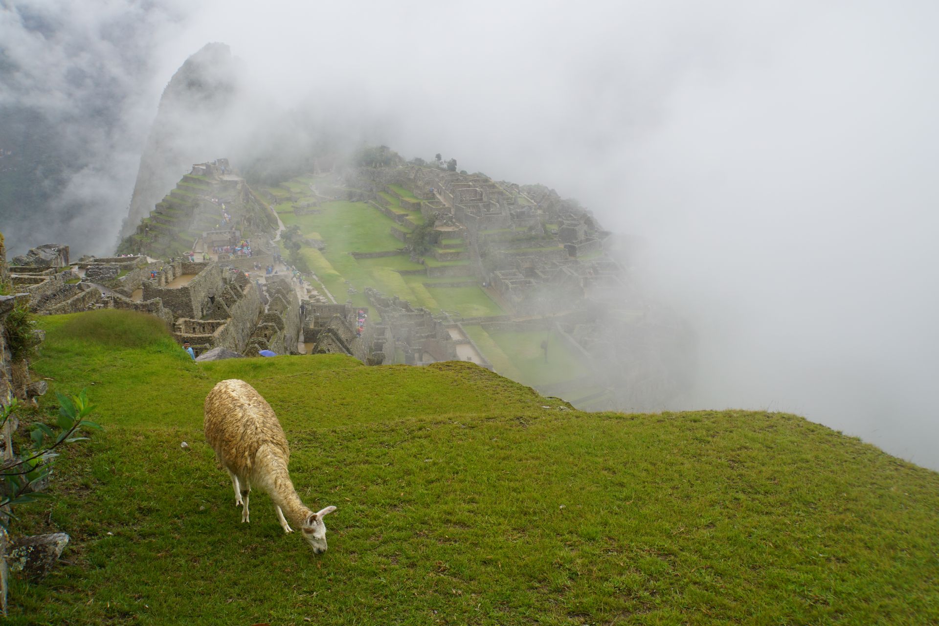
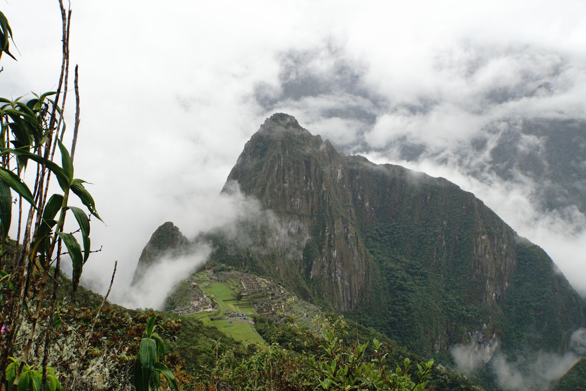
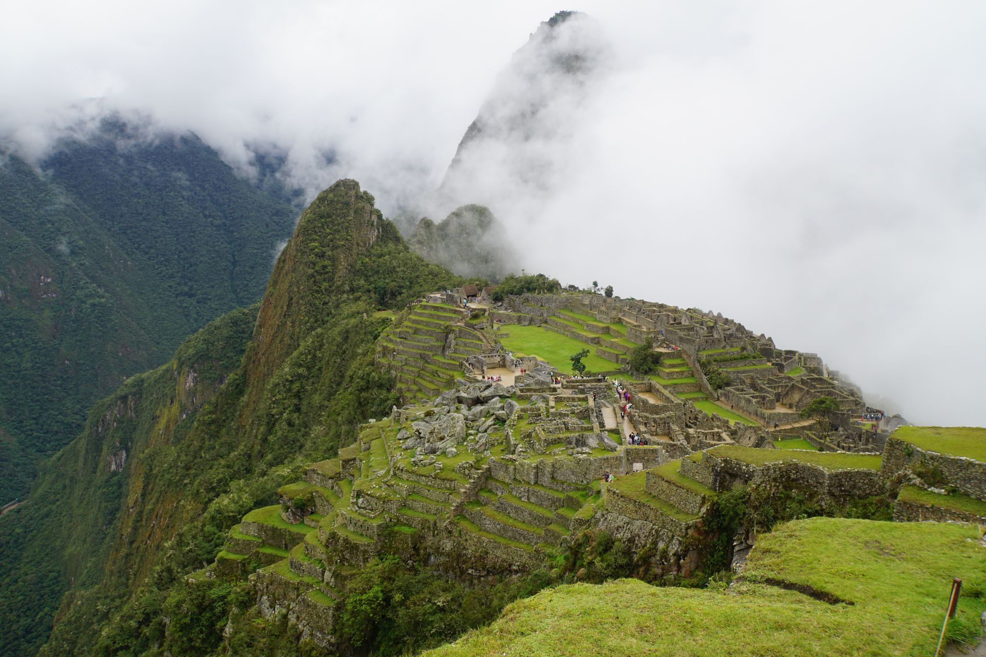
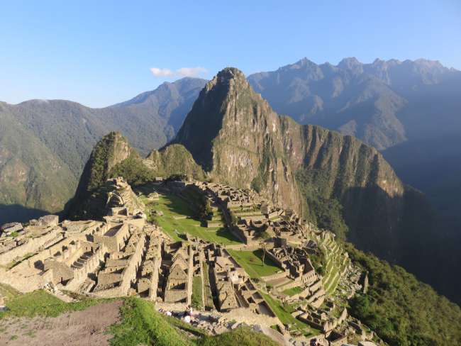
The final day - today we finally visit the ruins of Machu Picchu. The most famous of all Inca sites is located at an altitude of 2,400 meters amidst the flora- and fauna-rich Andean forest. Since 1983, the ruins as well as the entire Inca Trail (the alternative trek to ours) have been listed as a UNESCO World Heritage Site. Since it was probably abandoned before the Spanish invasion, the city remained undiscovered until its rediscovery by the US history professor Hiram Bingham in 1911 and thus escaped destruction by the Spanish conquistadors. However, little is known today about the purpose and meaning of this city. It is likely that Machu Picchu was a sacred center of the Inca. Theories that the city was a retreat for the legendary Sun Virgins who cared for the noble mummies or an astronomical center cannot be proven. What is certain, however, is that this city was built in a strategically favorable location. The inhabitants had enough drinking water, which supplied the whole city through a sophisticated canal system and was even used for irrigation of the fields. The countless terraces still testify to the agricultural art of the Inca, after all, the stair structure creates different climatic zones. The temperatures of the individual terrace levels differ by up to five degrees, and the moisture of the earth is also different. This creates ideal conditions for a variety of crops.
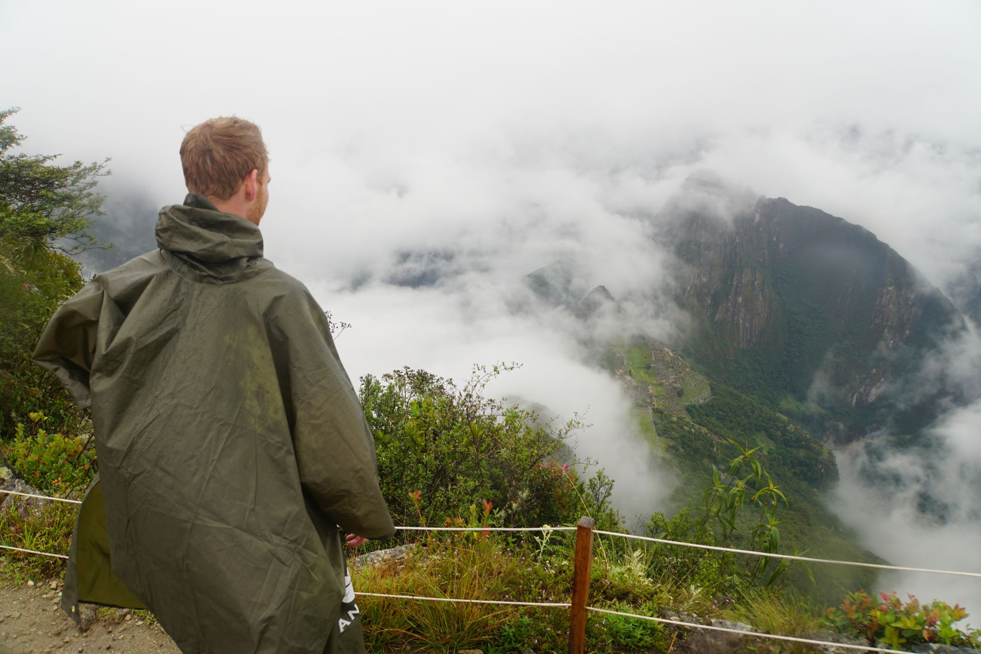
We are in the first round, so for us, the climb to the mountain starts shortly before 5 o'clock (it should be noted that due to the high number of visitors allowed to visit Machu Picchu per day, which has been limited to just under 6000, only 400 are allowed to climb the Machu Picchu Mountain). We climb about 500 meters in the form of steps. Shortly before 6, we stand in front of the entrance gates. The weather, to put it politely, is not good. You can hardly see 20 meters ahead because of so much fog.
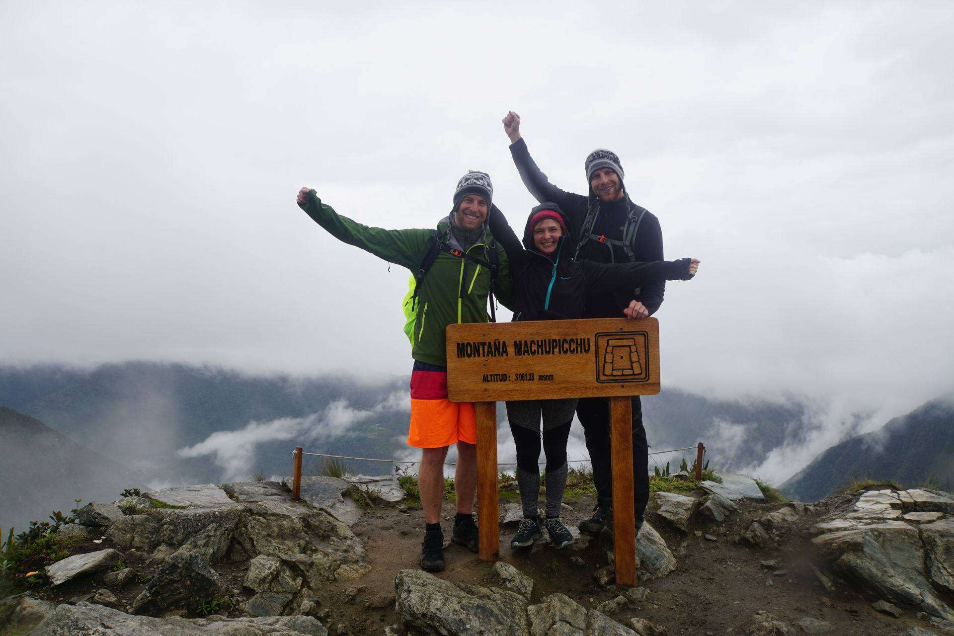
Well, it will probably get better later, we think, and luckily we are right. The fog clears and the clouds loosen up a bit. We continue to climb because we have bought an additional ticket to climb Montaña Picchu. This means another 2 hours of climbing steps (allegedly 2585). Here too, we are lucky because a hole always opens in the clouds when we have a view of the ruins.
When we come back down, it starts raining again. Luckily not for too long. Actually, the weather clears up a bit around noon, so we can walk through the ruins with dry feet. Towards the end, the sun even comes out.
Although it would have been more pleasant in sunshine and blue skies, the fog, the low clouds drifting past us, and also the rain have contributed to an unforgettable Machu Picchu experience. The wet, dangling branches over the paths, wet roots still clinging to the stones, the shiny, deep blue stone of some of the steps, and even the ruins that threaten to disappear in the fog give the place something magical. We begin to understand why the Inca chose this inaccessible spot of earth for their city back then and also get a little bit caught up in the spirit of exploration. This must have been how Hiram Bingham felt when he accidentally stumbled upon the ruins in 1911.
Back in Aguas Calientes, we treat ourselves to a burger and go to bed with a slight muscle ache from all the stair climbing. The next day, we make the return journey on foot to Hidroeléctrica and from there 6 hours back to Cusco by Colectivo.
Harpidetu Buletinera
Erantzun
Bidaien txostenak Peru