...I'm off now... Annapurna Trek - Nepal (Stage 4)
Publicado: 24.03.2019


Suscríbete al boletín
The Annapurna National Park is a protected area designated in 1992 and located in the center of Nepal. It was named after the tenth highest mountain in the world: Annapurna Himal with its 8,091 meters. The Annapurna Massif includes the peaks of Annapurna II to IV and Gangapurnas. Furthermore, the national park is situated between the western Dhaulagiri (8,172 m) and the eastern Manaslu (8,163 m) - a world of superlatives!
In the mountain regions, you can experience not only the giants of the Earth but also the diverse cultural ways of life of the inhabitants, as well as the ever-changing landscape with its manifold beauties.
An unforgettable trekking tour awaits me...
Day 1: from Besisahar via Khasur to Ngadi Bazar
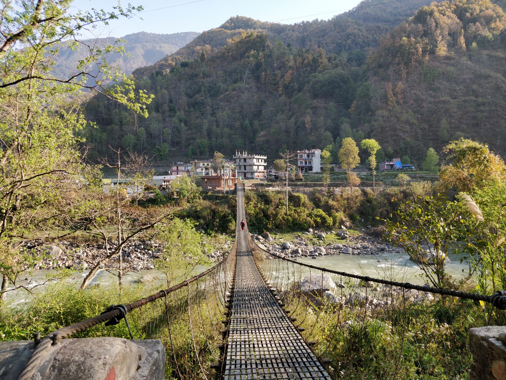
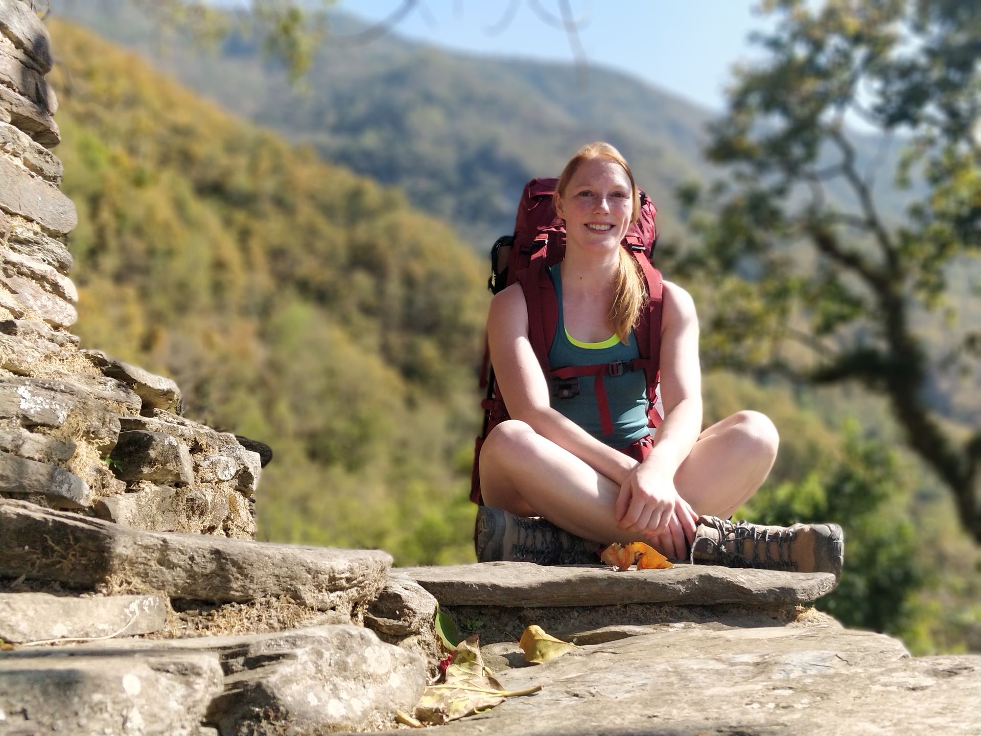
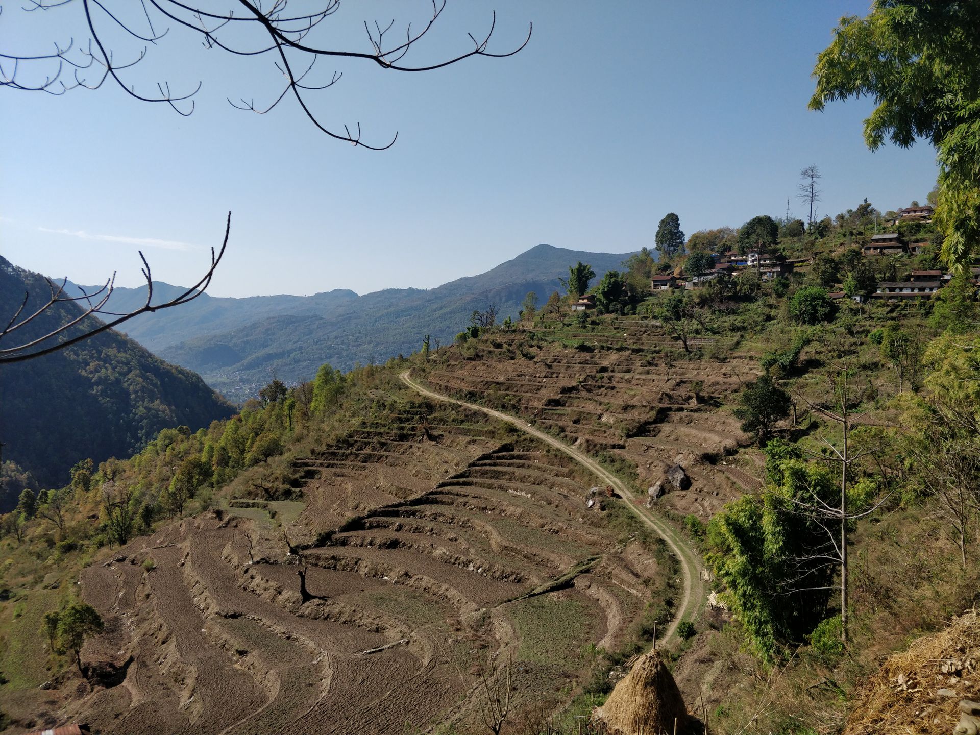
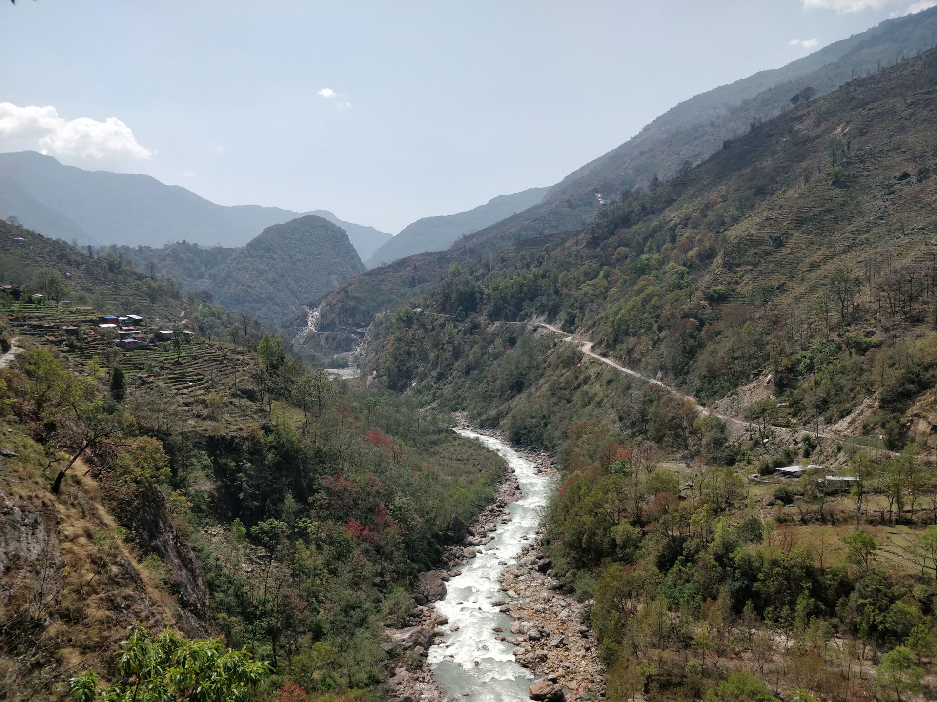
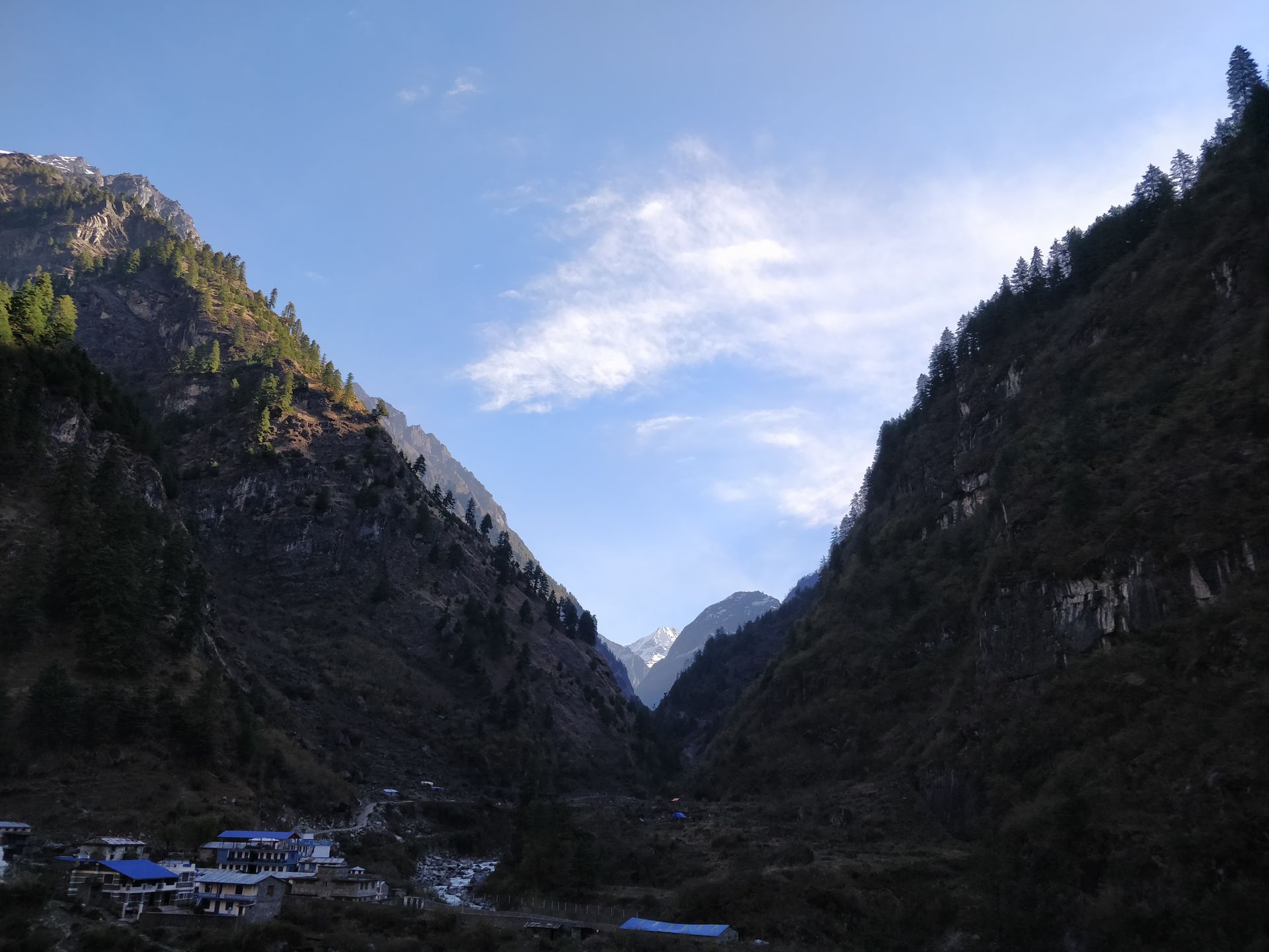
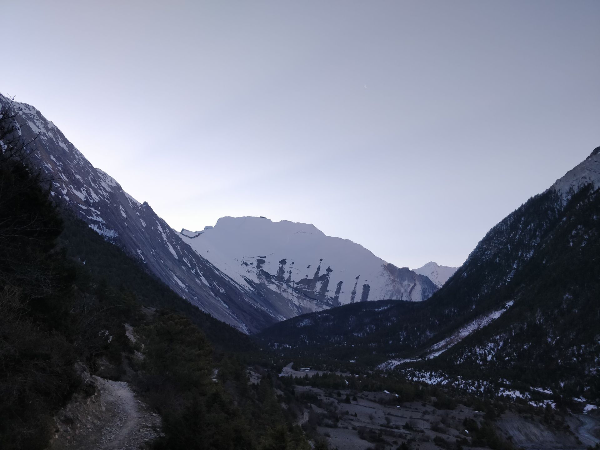
I started very early in the morning and had a bright blue sky on my first trekking route. Since the initial route follows the gravel jeep track to Manang, and I wanted to avoid the sand-whirling vehicles, I crossed a suspension bridge over the Marsyangdi River in Besisahar. From there, I went uphill to the small village of Khasur. This alternative route was the best decision. I was the only trekker on the trail and enjoyed the silence and beauty of the vast mountains. There was no trace of the bustle of the cities and tourism in the small settlements. Time seemed to stand still here: women working in the garden or cleaning laundry, men tending their livestock and cultivating fields, and children leisurely heading to school. Everything seemed leisurely and filled with relaxed tranquility. I now climbed up to the highest point of Khasur (1,025 m) on self-made stone steps. Before the ascent, I took a short break at a place called Chautara.
Chautaras are stone platforms located at convenient points along the trail to unload luggage and take a break after a long hike or carrying heavy loads. They are often found at steep sections, intersections, or village entrances. In the middle of the platform, there is either a taller masonry or a tree providing shade. The perfect resting place!
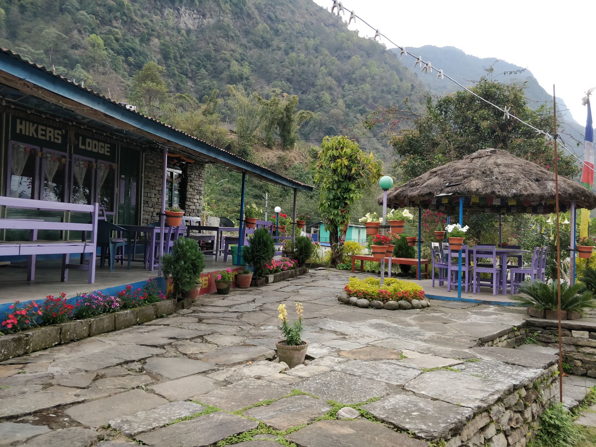
Once I reached the top, I had a wonderful view of the towering high mountains in the distance. I descended again via a stone staircase and reached the village of Bhulbhule after a few hours, where I stopped at a small restaurant. After enjoying some "momos" (filled dumplings), I continued my journey feeling refreshed. When I arrived in the village of Ngadi Bazar, it started thundering and drizzling lightly. On the right side of the road, I immediately noticed the beautifully landscaped garden of the "Hikers Lodge" and my first thought was to stop here! After 15 km of trekking uphill and downhill with a 12-kilo backpack, my feet hurt, and the thunder indicated that bad weather was approaching. As I made myself comfortable under the garden pavilion, it started pouring... I made the right decision!
Day 2: from Ngadi Bazar to Ghermu
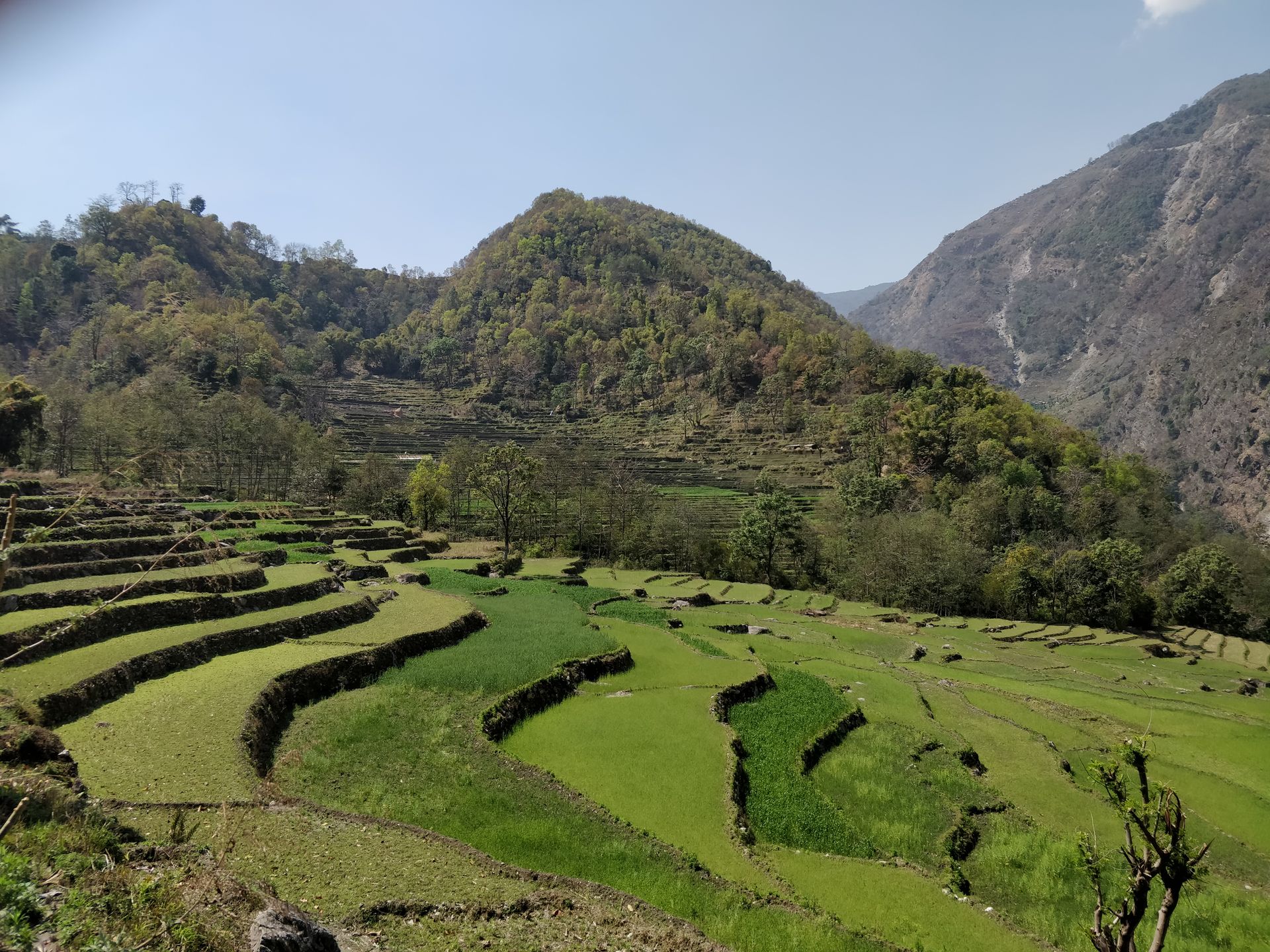
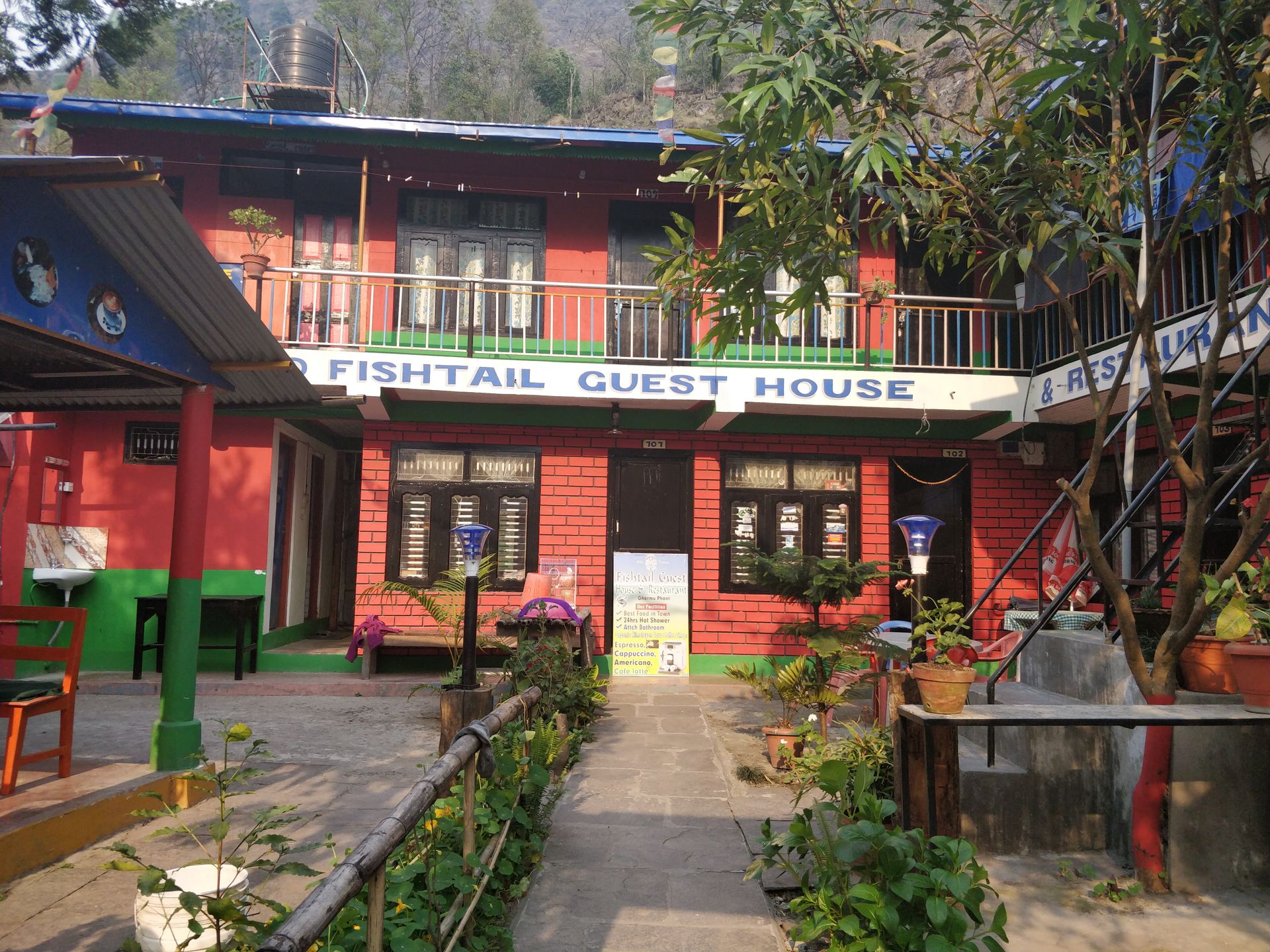
In the morning, we were greeted by the sun and a beautiful blue sky, and another beautiful hike awaited us. Passing the village of Lampata, we reached a suspension bridge along a small waterfall. Then it was time to climb stairs again. As exhausting as the ascent to Bahundanda was, the views were even more wonderful from this place. We passed green rice fields and blooming rhododendrons. The views of the mountains and the Marsyangdi River valley made us stop and forget everything around us. After a short descent and a well-maintained trail on the mountainside, I reached the village of Ghermu. In 4 hours, I covered 10 km and noticed that my energy was dwindling. I stopped at the "Fishtail Guest House" restaurant to have a meal. Just as I sat down in the garden, it started to storm and rain even more than yesterday. I decided to stay here and take a room. It would have taken me another 3 hours to reach the nearest village, Jagat, and I was glad to have stayed here.
Unfortunately, due to illness, I had to spend 5 nights in Ghermu. The owners of the "Fishtail Guest House" Lodge were very helpful and took care of me until I recovered. During my stay, I met many hikers from all over the world: France, the Netherlands, England, Croatia, USA (New York), Australia. The lodge was declared a "hospital" as most people met here with injuries or illnesses :-) Playing cards together made the time pass a bit better.
As the 6th day passed, I had to admit that I had to put my goal of circumnavigating Annapurna on ice. There had been a lot of snow above 3000 meters in the past few days, causing the Thorung La Pass to be closed and an encirclement impossible. When I was stuck in Ghermu, some trekkers from Pisang (3200 m) or Manang (3540 m) were already on their way back. Moreover, the weather forecast for the following days was not promising. Hence, this stage of my journey is called "Annapurna Trek" instead of "Annapurna Circuit" for some.
Together with a Dutch family (Marike, Rule, Ruben, and Marius) and a father and his daughter from Croatia (Bruno and Ana), we planned a new itinerary for the rest of the trek. I met both families at the accommodation in Ghermu since they were also forced to take a longer break due to injuries.
Now, dear readers, you probably want to know how it continues... just follow me these next days in Nepal ;-)
Day 7: from Ghermu to Chyamche
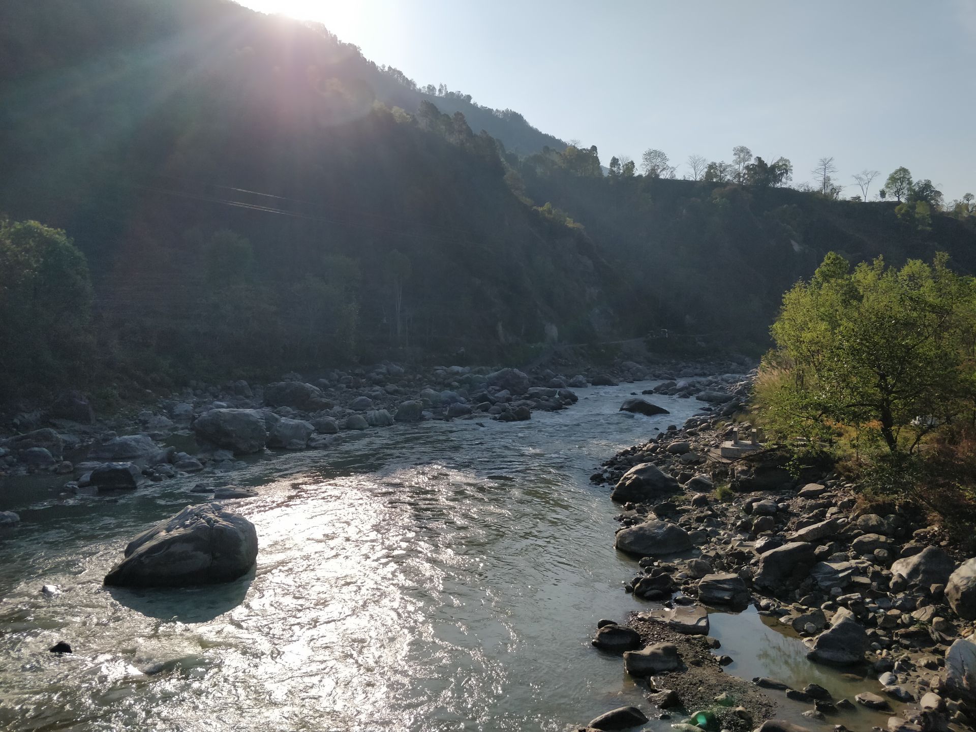
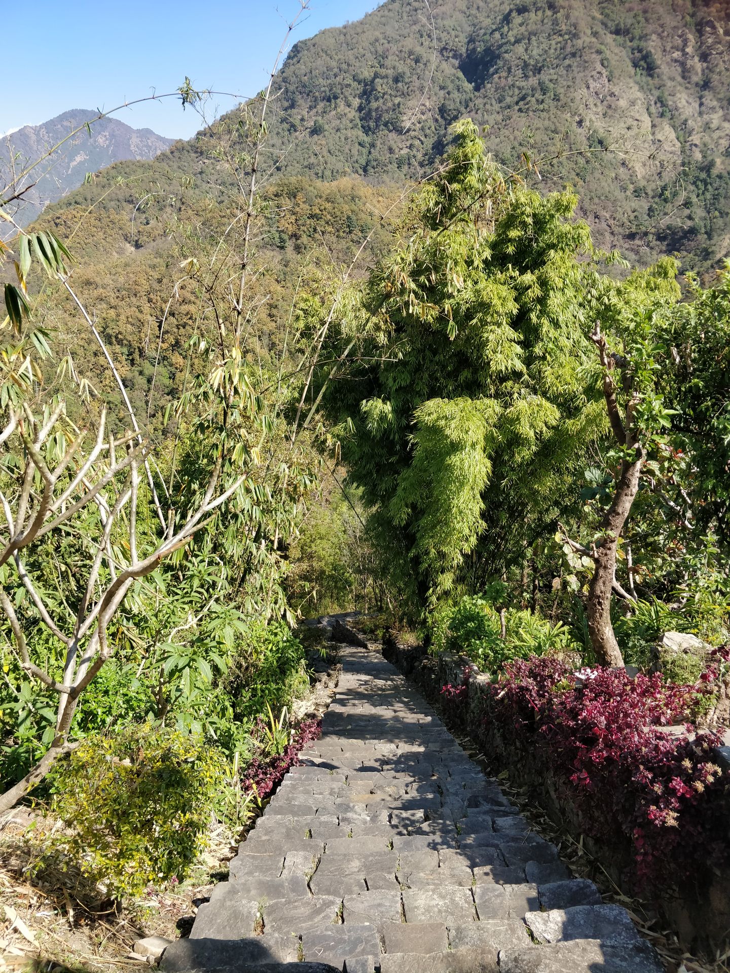
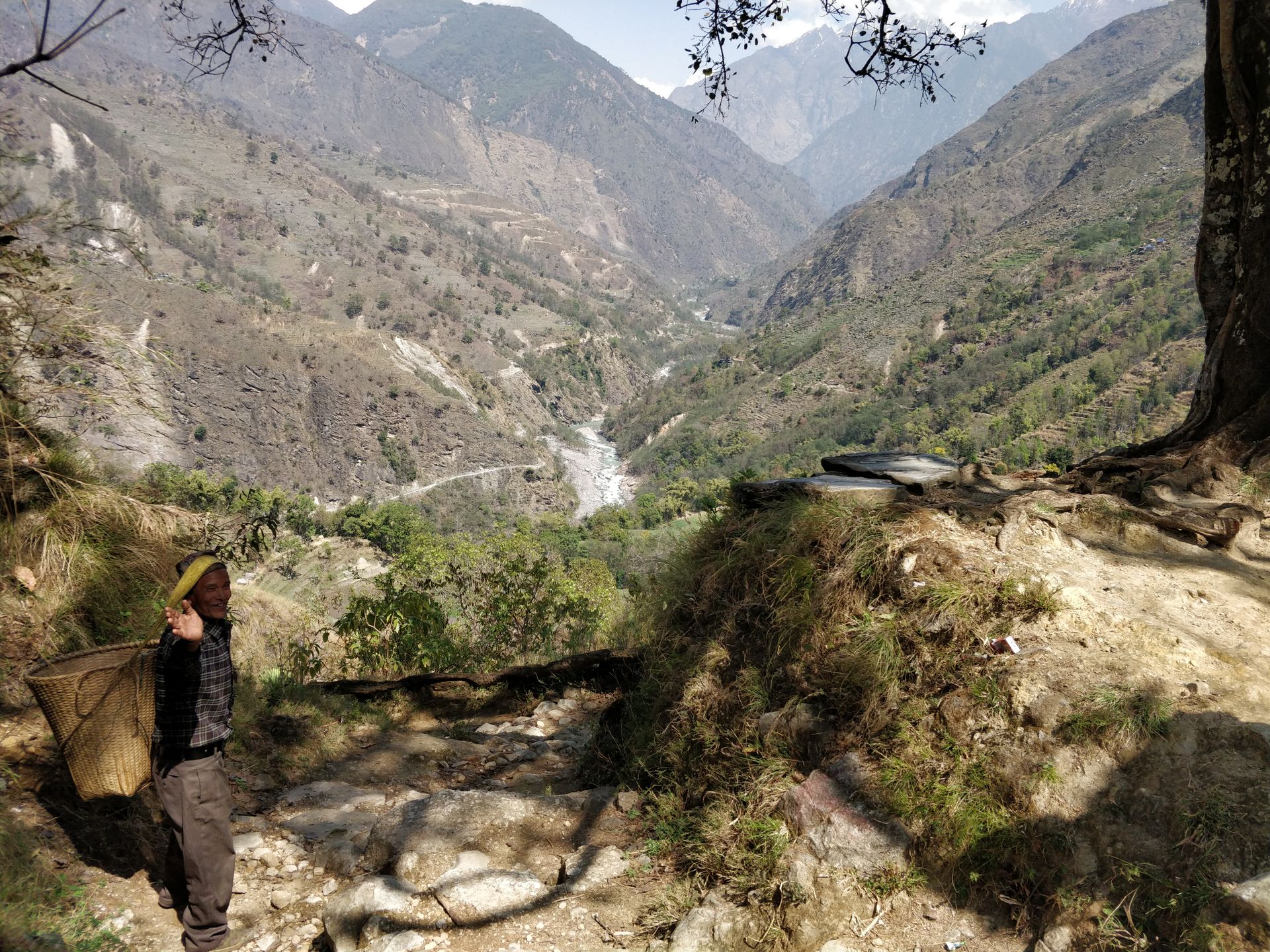
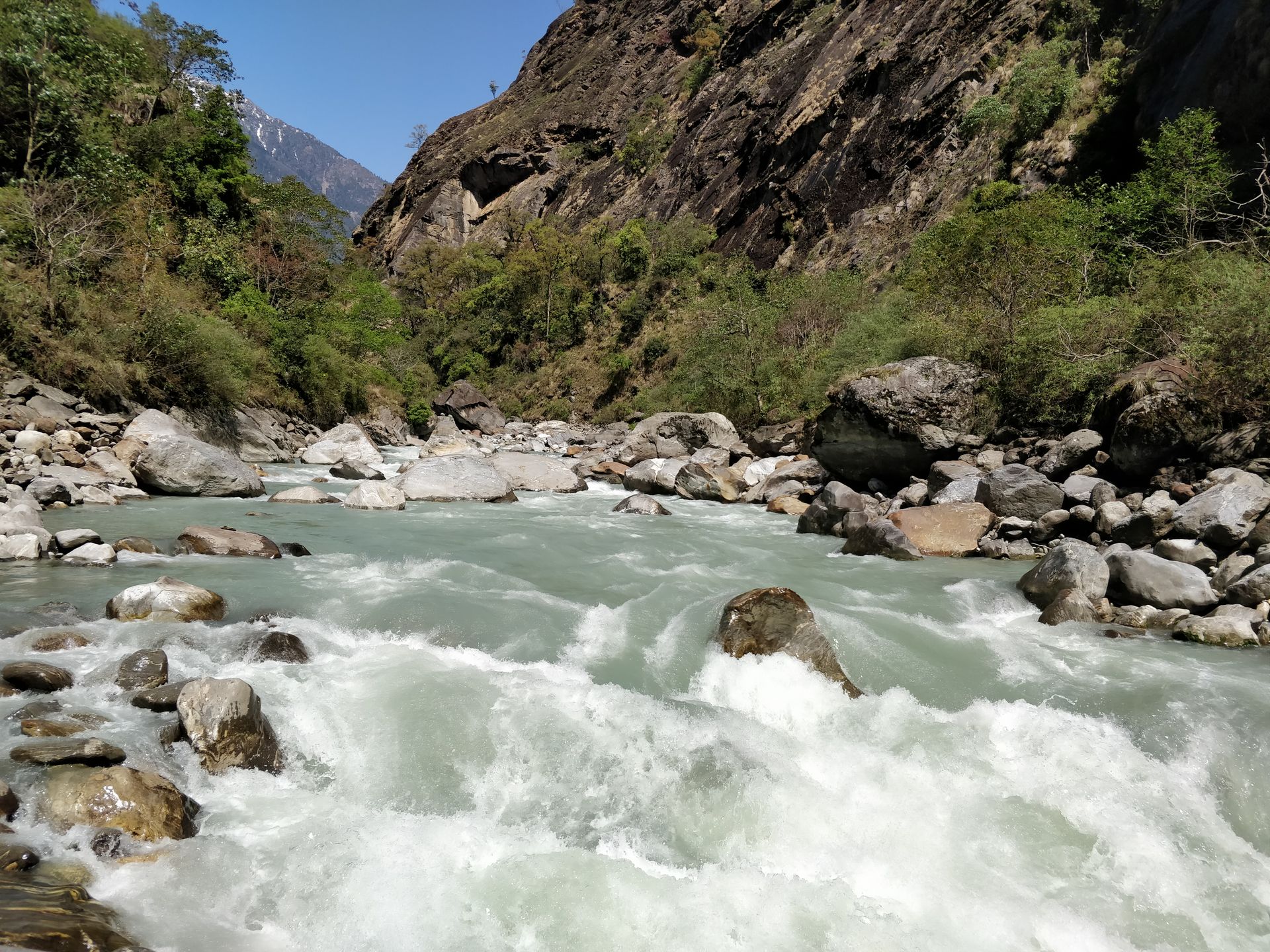
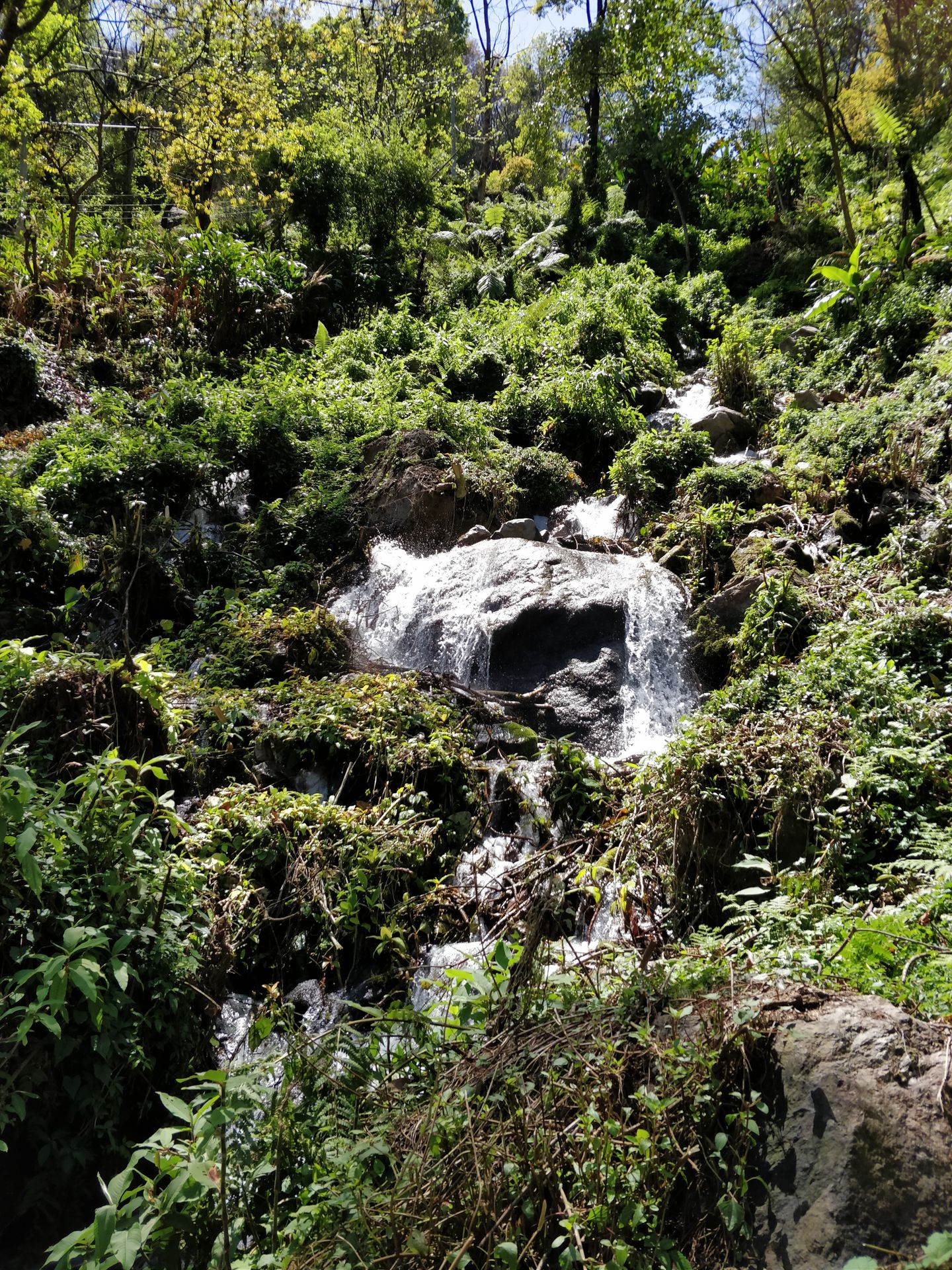
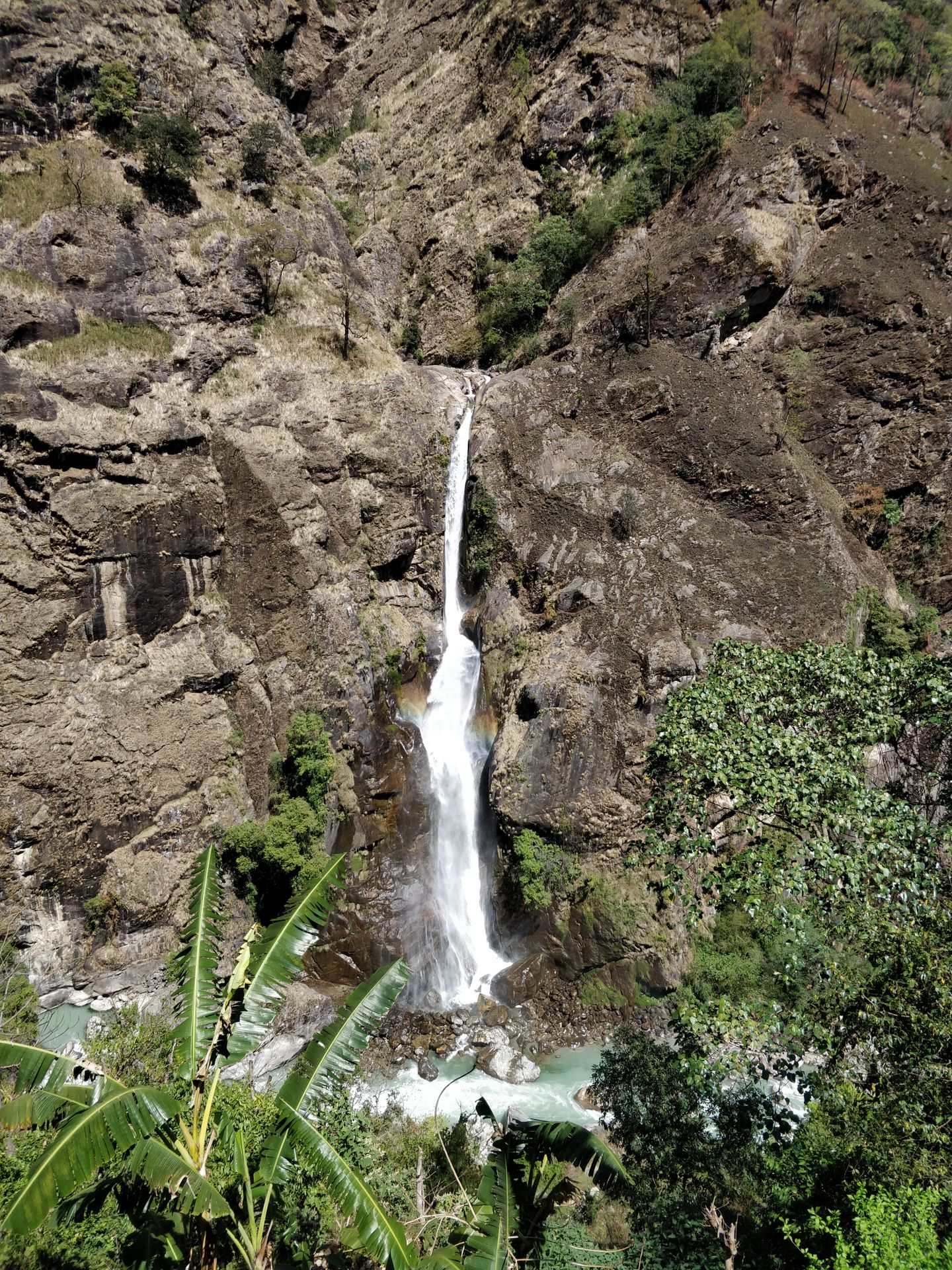
The next 3 days, the sun is still on our side. So we decided to continue our hike in the Annapurna area and go as high as possible. For breakfast, Bruno made super delicious Croatian salami and bacon! In Nepal, you won't find such delicious homemade meat. On the way from Ghermu to Chyamche, we took a detour and reached a signposted hot natural spring. It was located just behind the village of Jagat. The spring was not necessarily a highlight and looked rather bleak and dirty, but we were right next to the Marsyangdi River and could observe the wild flow on the huge rocks. The trail mostly followed the jeep track. Just before Chyamche, we left the track and walked through green surroundings, past small waterfalls and lots of stone steps uphill. After 8.5 km of walking, we decided to stop at the lodge opposite the "Rainbow Waterfall." When the sun shines on the waterfall, you can see a little rainbow.
Day 8: from Chyamche to Dharapani
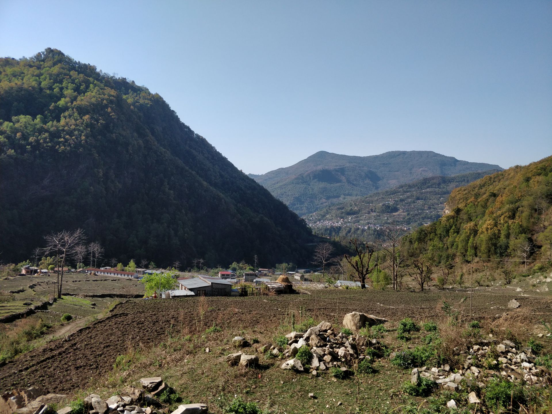
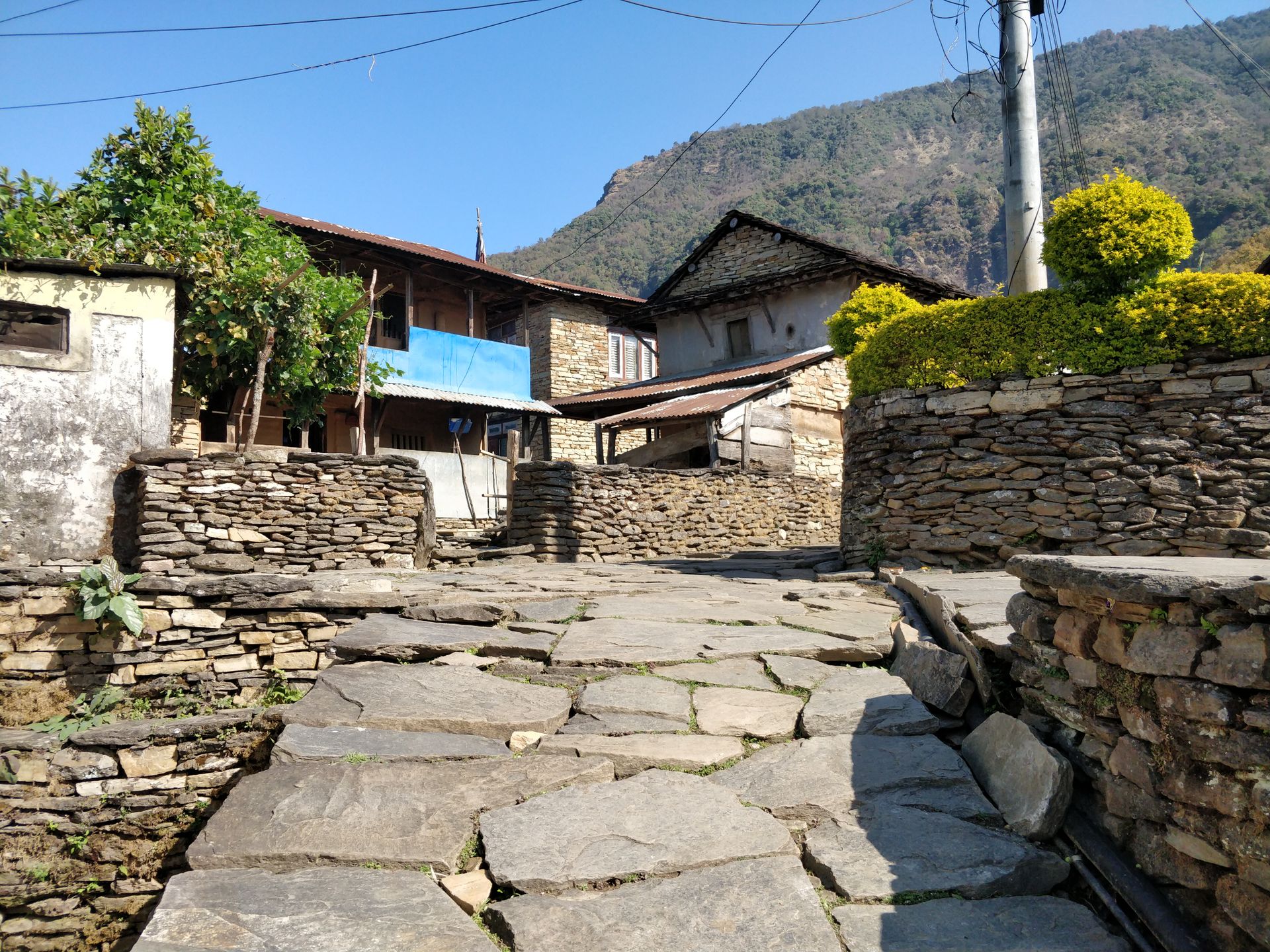
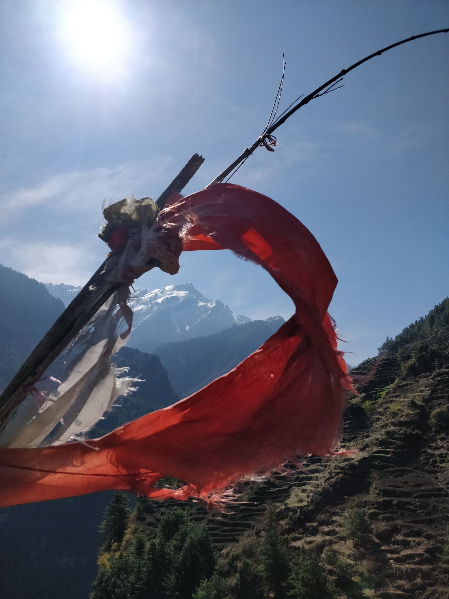
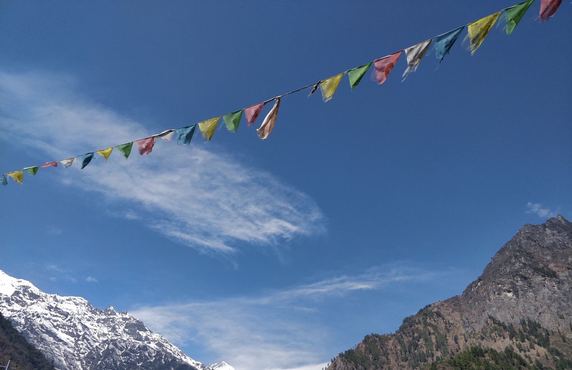
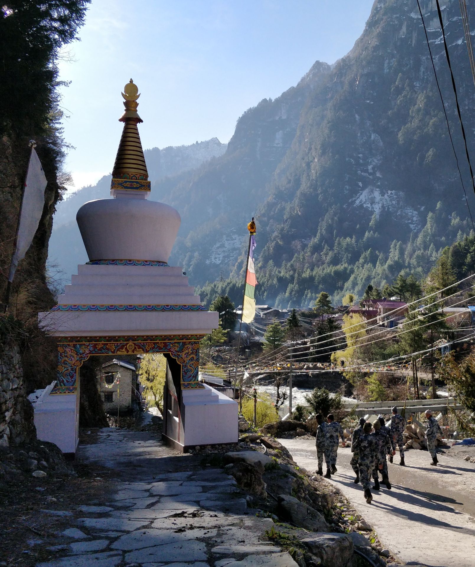
For us, it was a 12 km journey up and down, up and down. But the scenery rewarded us with a wonderful and diverse landscape. When we reached the village of Tal, we crossed a gate at the village entrance and went from the mountainous region of Lamjung into the more Buddhist-influenced region of Manang. The fluttering Tibetan prayer flags and the many small chortens and prayer wheels along the way upward made the difference tangible.
Chortens are Buddhist monuments that originally served as graves and were later built as religious symbols to worship saints at special places. They are always to be circumambulated clockwise along the path.
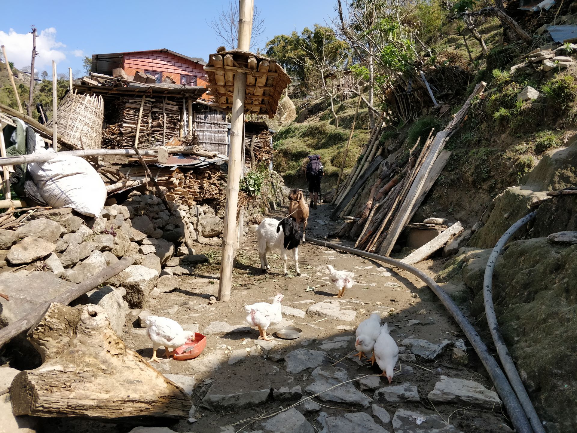
We moved more than 500 meters higher and looked down into the gorge to the wild Marsyangdi. We passed many small huts located in the middle of the mountains, and their animals lingered on the trekking route, unaffected by the passing trekkers. In the distance, we saw the mighty snow-covered peaks and wondered how high they reached. After 8 hours, tired and hungry, we arrived in Dharapani. But every step was worth it, and we were happy to be here.
Day 9: from Dharapani via Odar to Timang
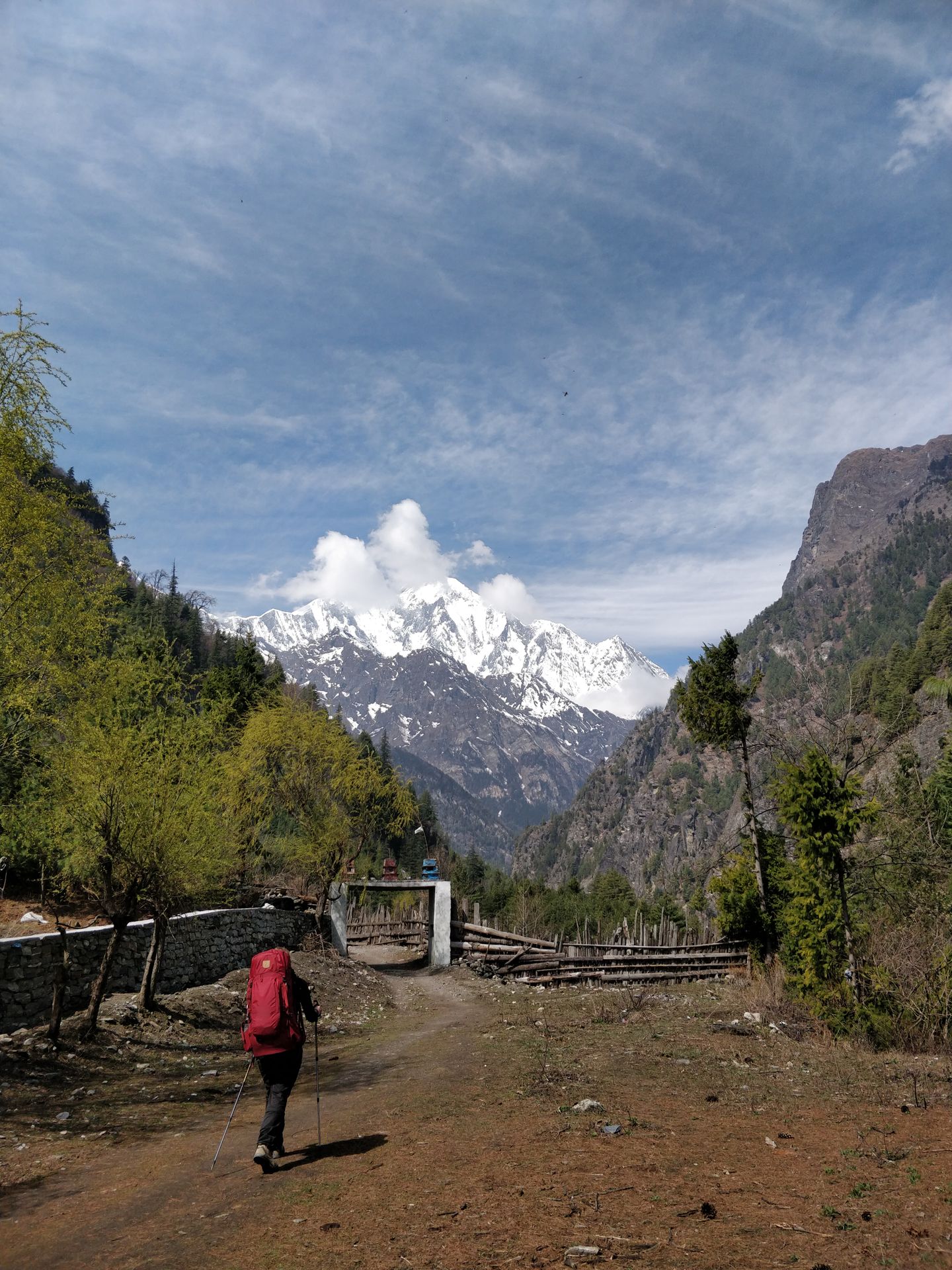
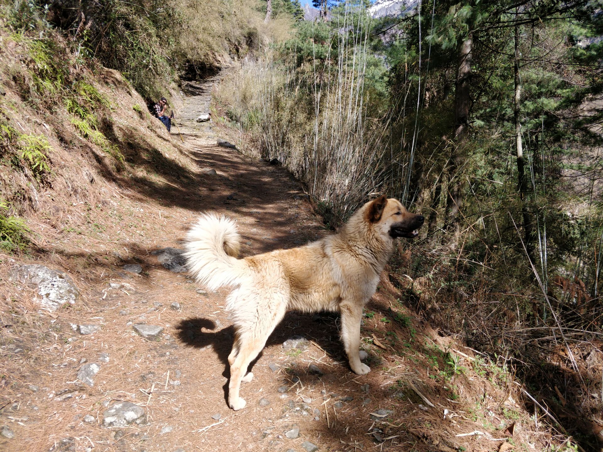
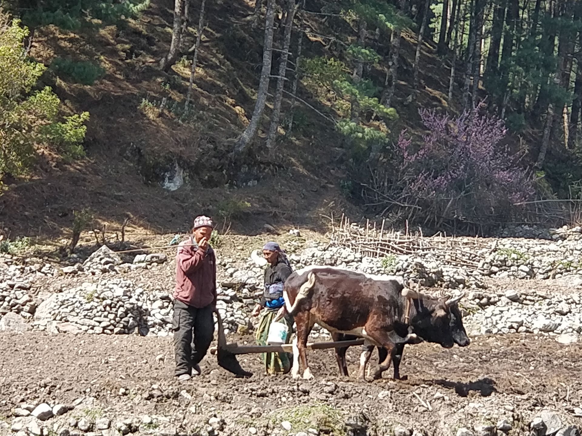
We set off with new energy to climb 800 meters in 8 km. However, that wasn't enough for us, so we veered off the main trail shortly after Dharapani and went up 200 meters step by step to the village of Odar. But before that, we admired the mighty Manaslu, the eighth highest mountain in the world, rising above a few mountains. Unimaginable to be so close to the sky on a mountain... On the way up, a dog from the village of Dharapani accompanied us faithfully. It seemed to have found its new family in us as it stayed by our side all the time. Odar looked peaceful and secluded from the hustle and bustle, much like the village of Khasur. Here, you could observe the natural village life and get a glimpse of the cultural life of the ethnic Gurung people.
Especially in Odar, but also in the many small villages in the mountains, you had the feeling of being transported back in time. Comparing the way of life of the Nepalese mountain people with that of the people living in the Alpine regions 70 years ago, you could find some parallels.
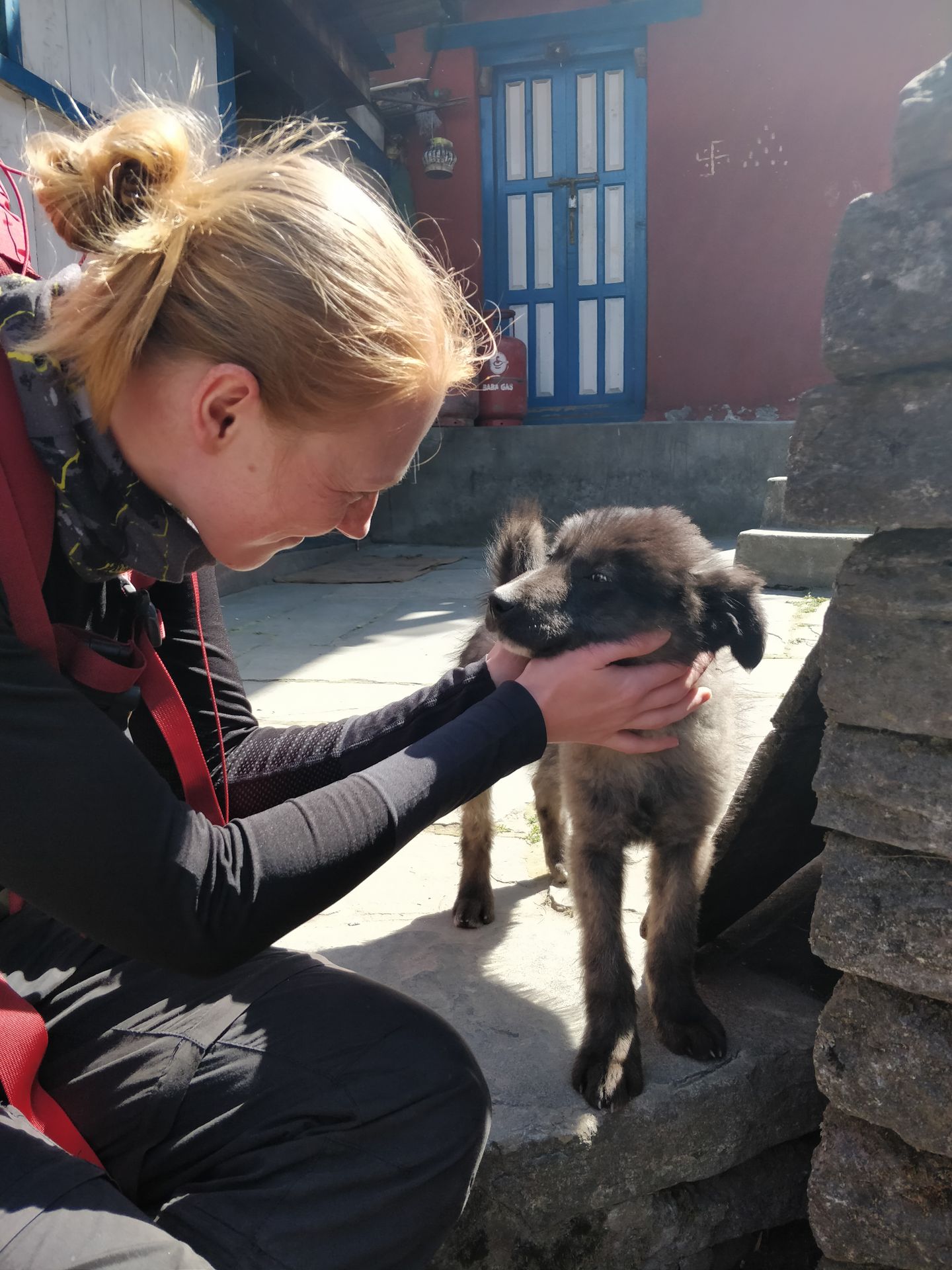
In the village, we climbed a steep iron staircase to a small viewpoint and could already see Annapurna II (7,937 m) and other snow-white giants in the distance. Unfortunately, we had to prevent the dog from following us on the iron staircase (it was too steep), so it left in a huff... What a pity, it would have been nice if it could have continued to accompany us :-) Many dogs roam freely in the villages. They are very friendly towards passing trekkers and enjoy every stroke.
On the way down, the village of Bagarchhap invited us to take a short break. We then faced a strenuous hike through the monkey forest up to Timang. However, we didn't see any monkeys here. Towards the afternoon, it was already noticeably colder in Timang, and the gloves now served their purpose. After all, we were at an altitude of 2,620 m.
Day 10: from Timang to Chame
In the morning, we were unexpectedly greeted by the sun, and it was clear that we would take advantage of the weather and continue our hike. The day promised to be exhausting and breathtaking as we had to ascend to an altitude of over 3,000 m.
Day 11: from Chame to Upper Pisang
Jippieh! The sun is shining! Good conditions for our destination today: Upper Pisang. I continued with Bruno and Ana to the higher villages. The Dutch family stayed in Chame to rest.
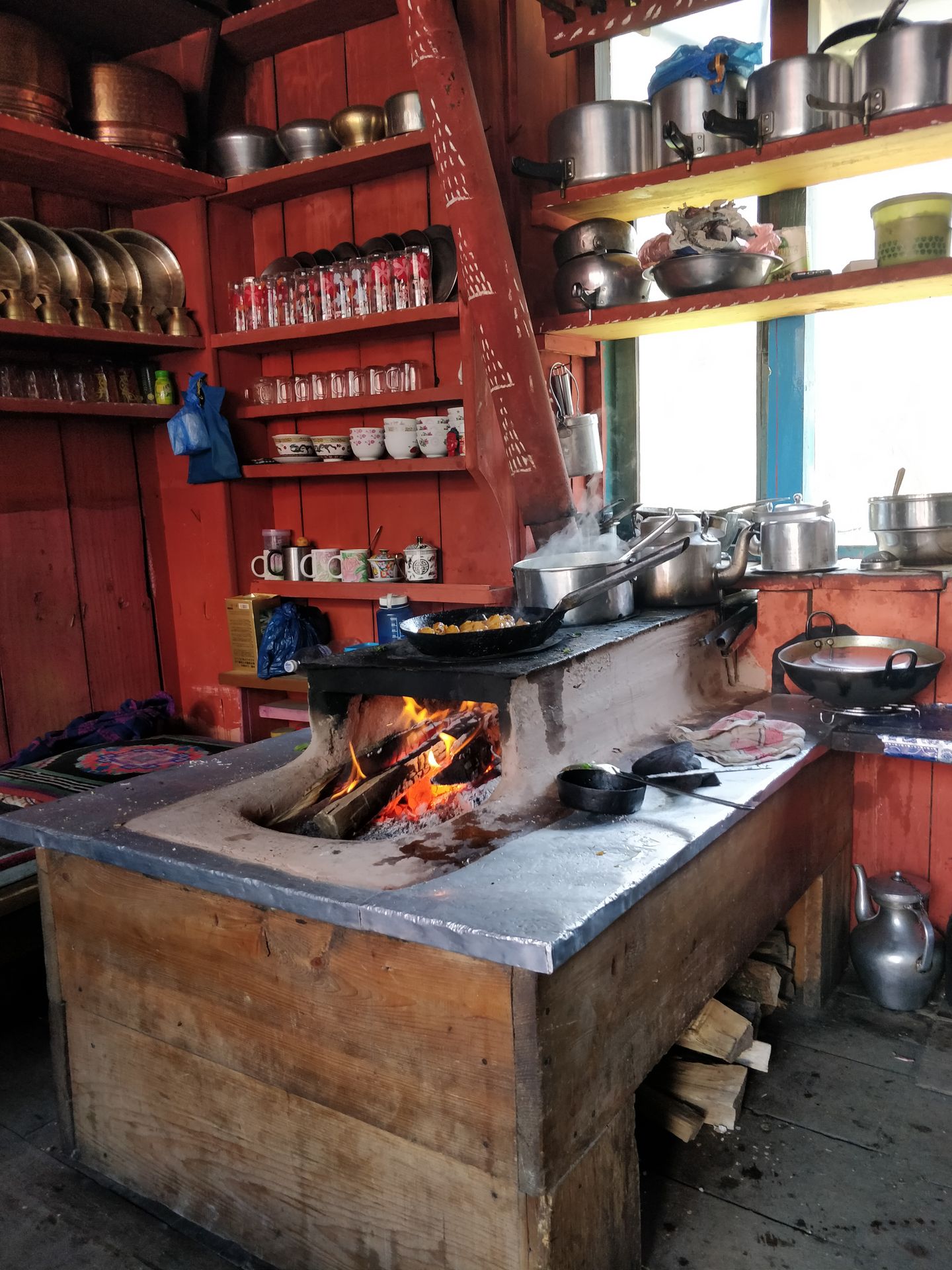
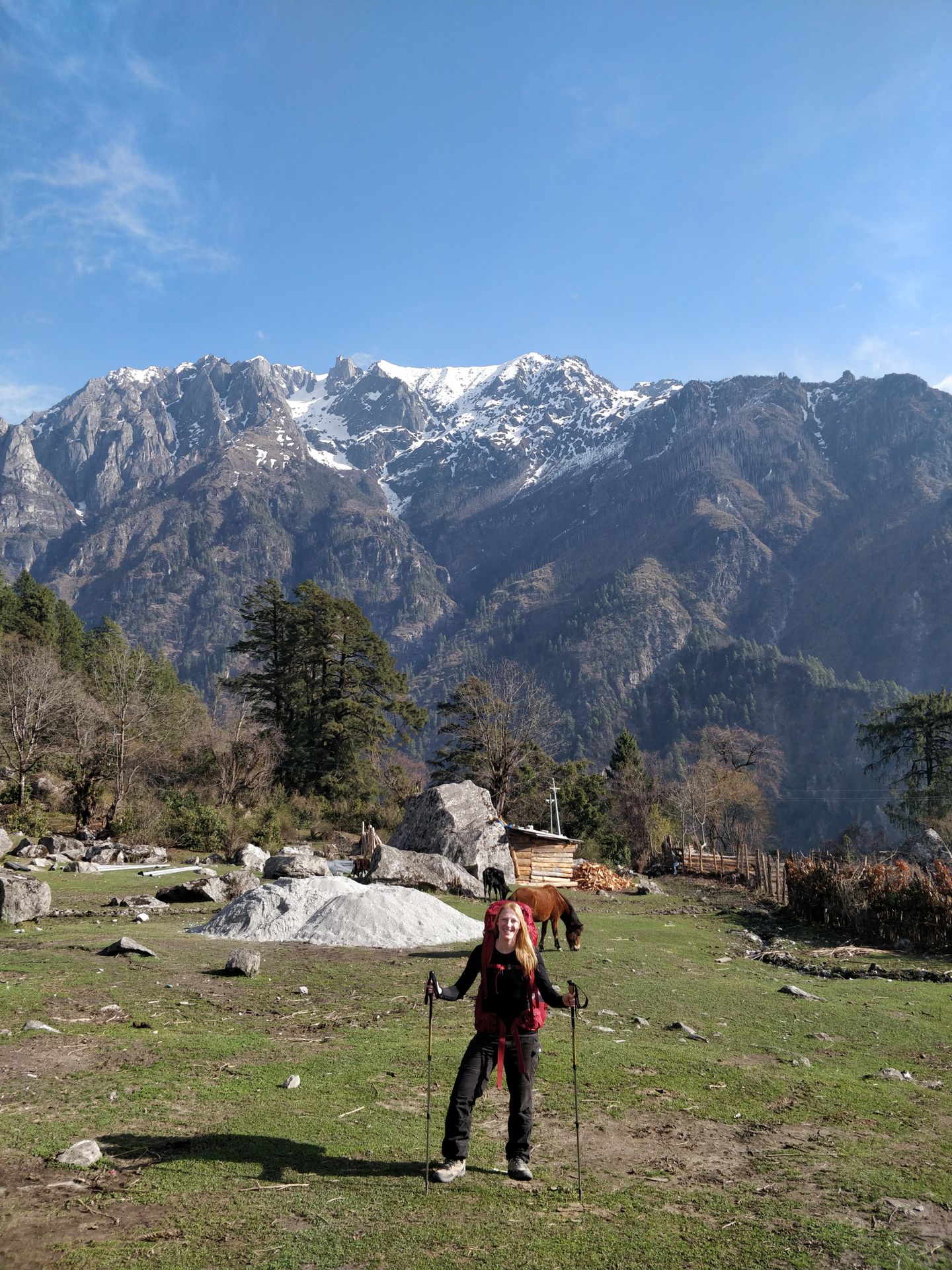
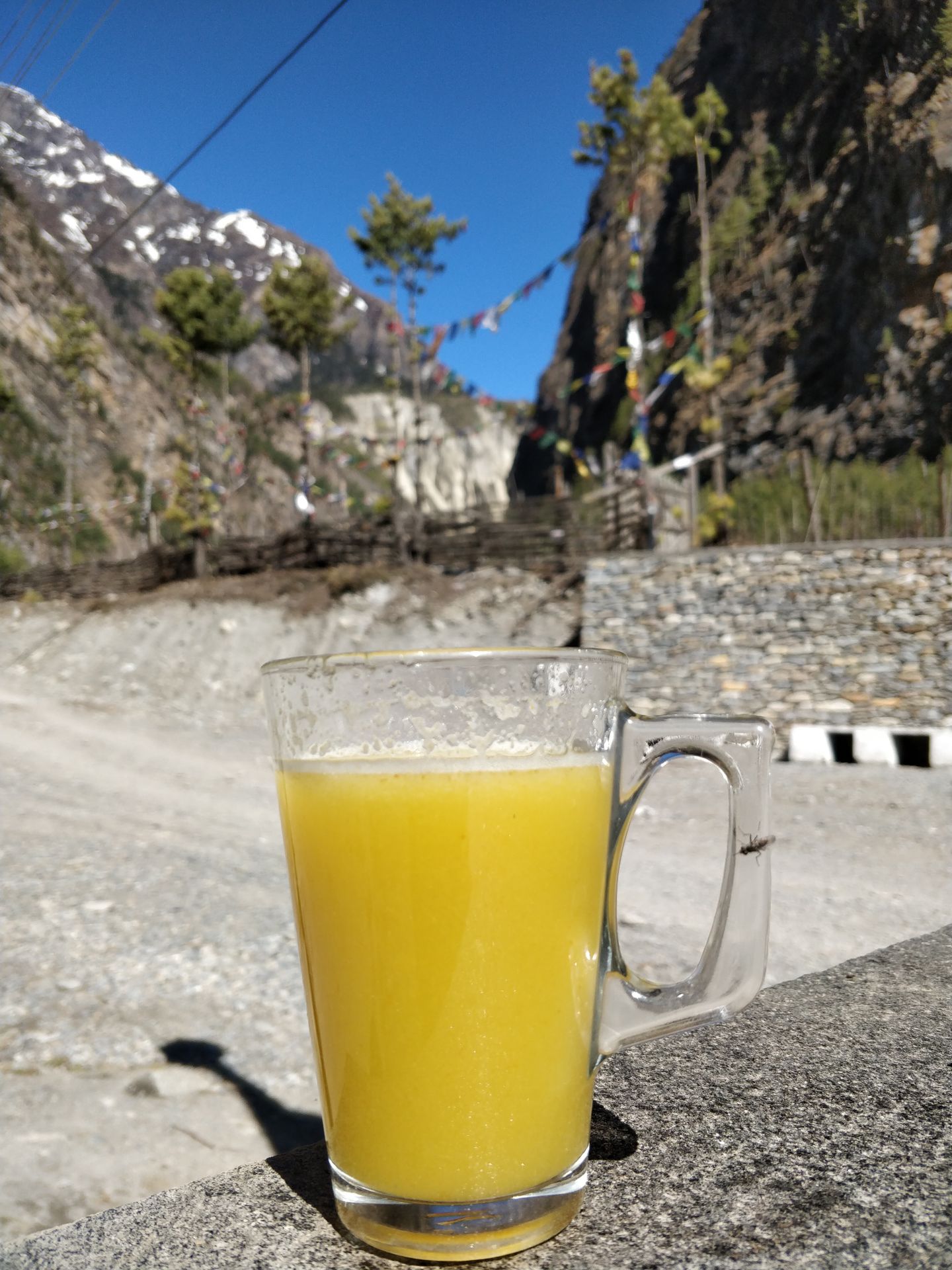
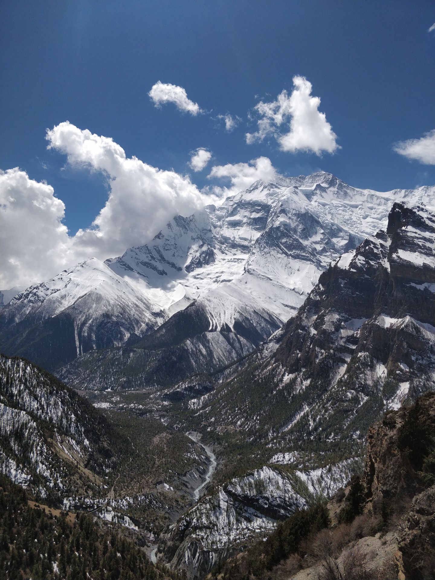
We had to cover 14 km, and our motivation propelled us with quick steps uphill. The landscape continuously changed, and ahead of us, the barren expanse of the high mountains unfolded more and more. In Bhratang, we were only 140 m below 3,000 m, and the remnants of past huge snow masses were slowly melting along the trail. If you want to treat yourself to a bit more luxury after the spartan lodges so far, you should definitely settle down in Bhratang at the "Farmhouse." The café in front offered very delicious cappuccino and freshly squeezed apple juice. It's hard to find such an offering in the mountains of Annapurna. So definitely take a break here ;-)
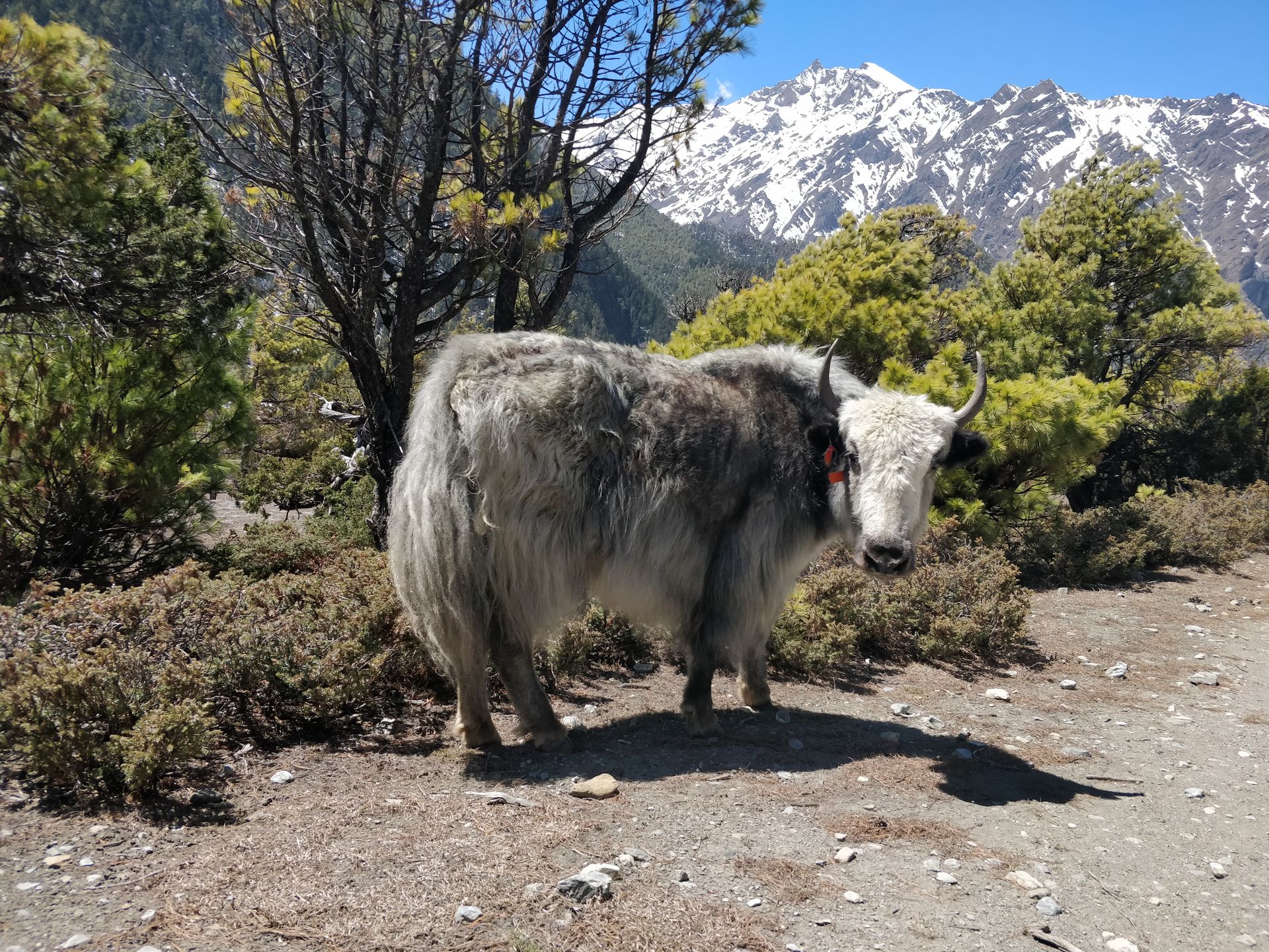
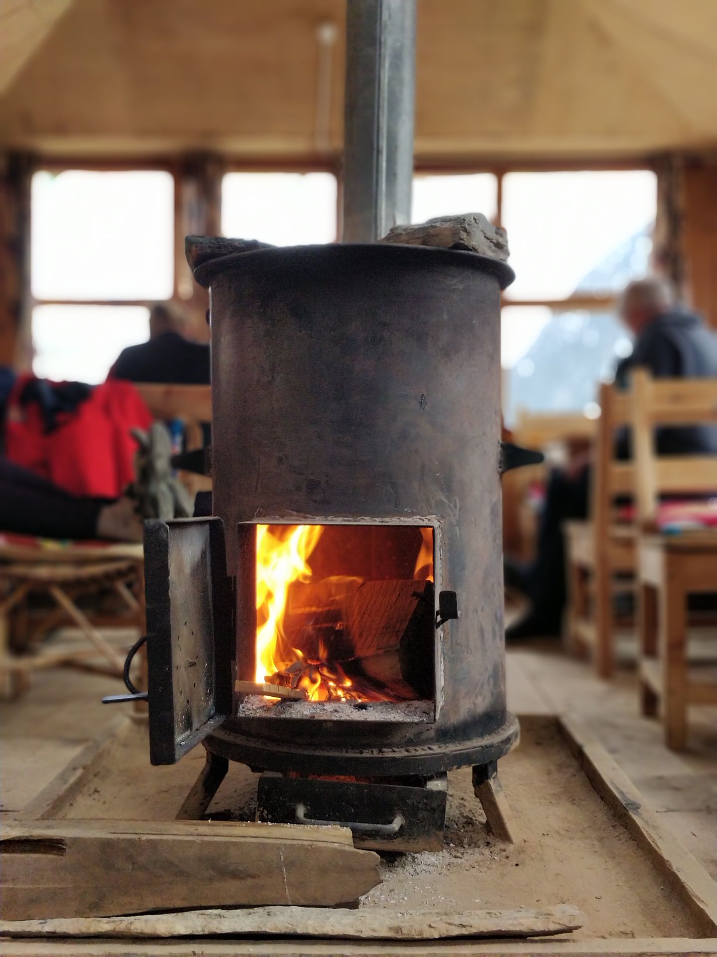
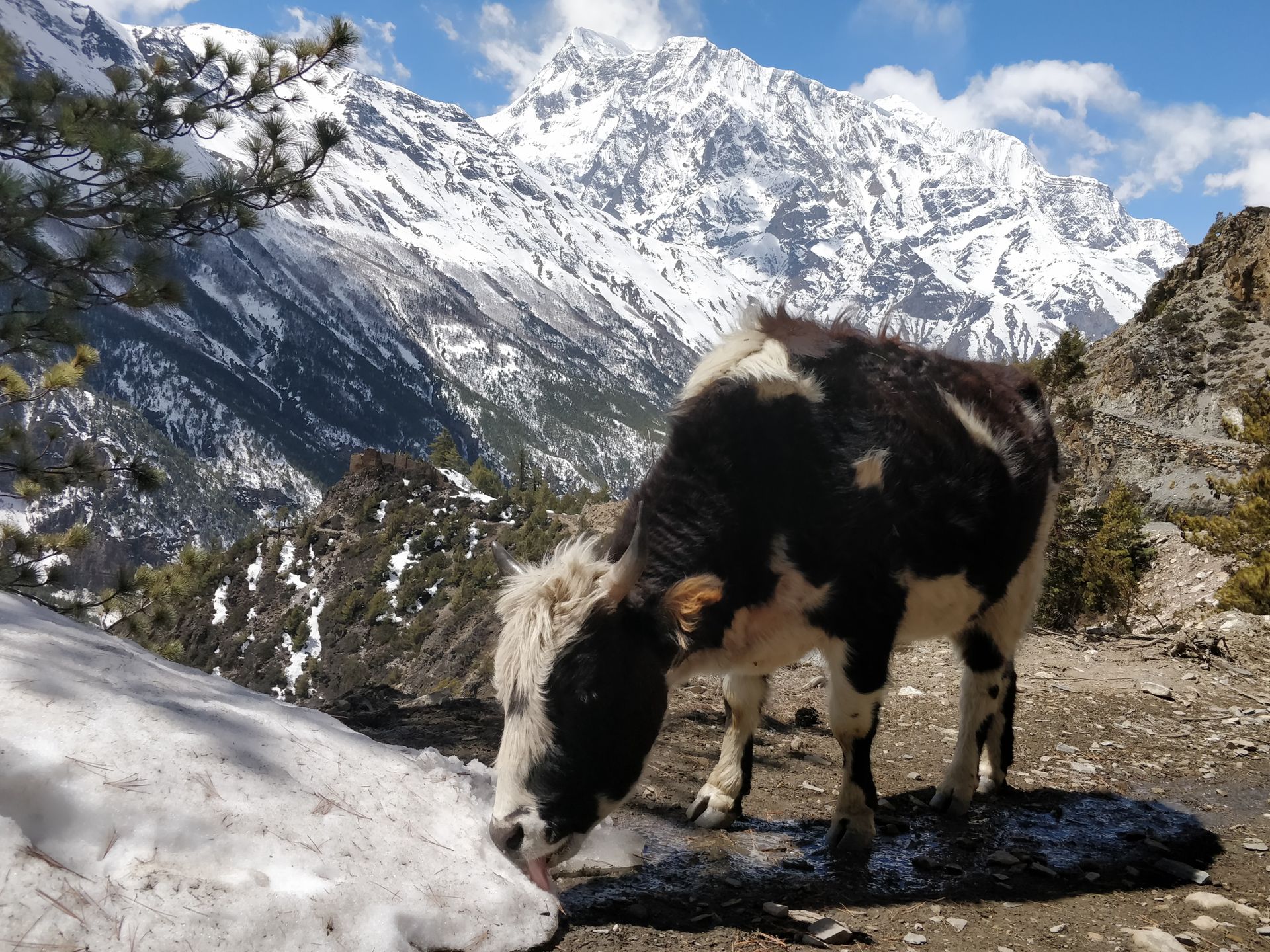
After a short rest, we gathered all our energy and steadily ascended, sometimes trudging through ice, zigzagging around the cows on the trail, which didn't move an inch and stared at us unimpressed, trying to capture the impressions of the wonderful mountain landscape and the sacred mountain Swargadwari while keeping an eye on the path to avoid stumbling over numerous stones and small rocks or sinking our hiking shoes into thick piles of animal dung. Finally, after a total of 5 hours of eventful hiking, we arrived in Upper Pisang at an altitude of 3,300 m. Right at the entrance of the village, there is the beautifully landscaped "Hotel Norbulinka" with a magnificent view of Annapurna II. The nights were getting colder, and to our delight, the hotel restaurant had a wood-burning stove, which we would have loved to have in our rooms as well.
Day 12: from Upper Pisang through Ghyaru and Ngwal to Manang
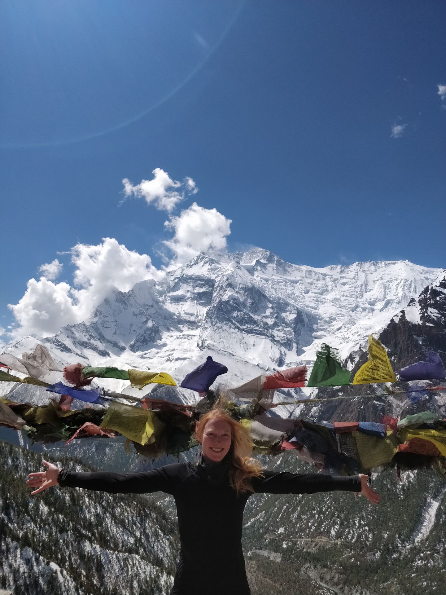
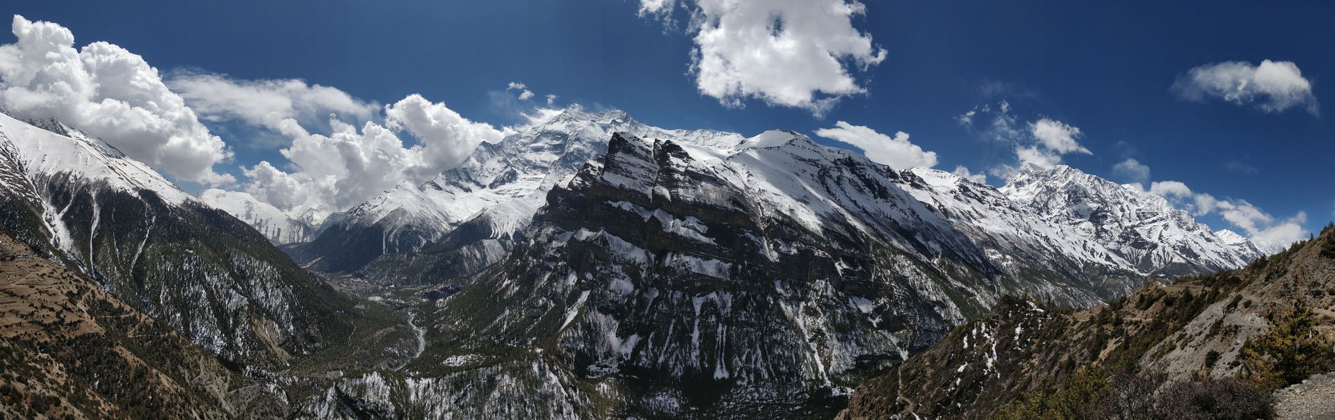
Today was the final sprint! From Manang, we would take a jeep back to Besisahar. Ahead of us were 19 km with a very steep ascent to the village of Ghyaru. The morning had a bright blue sky, and the day promised to be both exhausting and breathtaking.
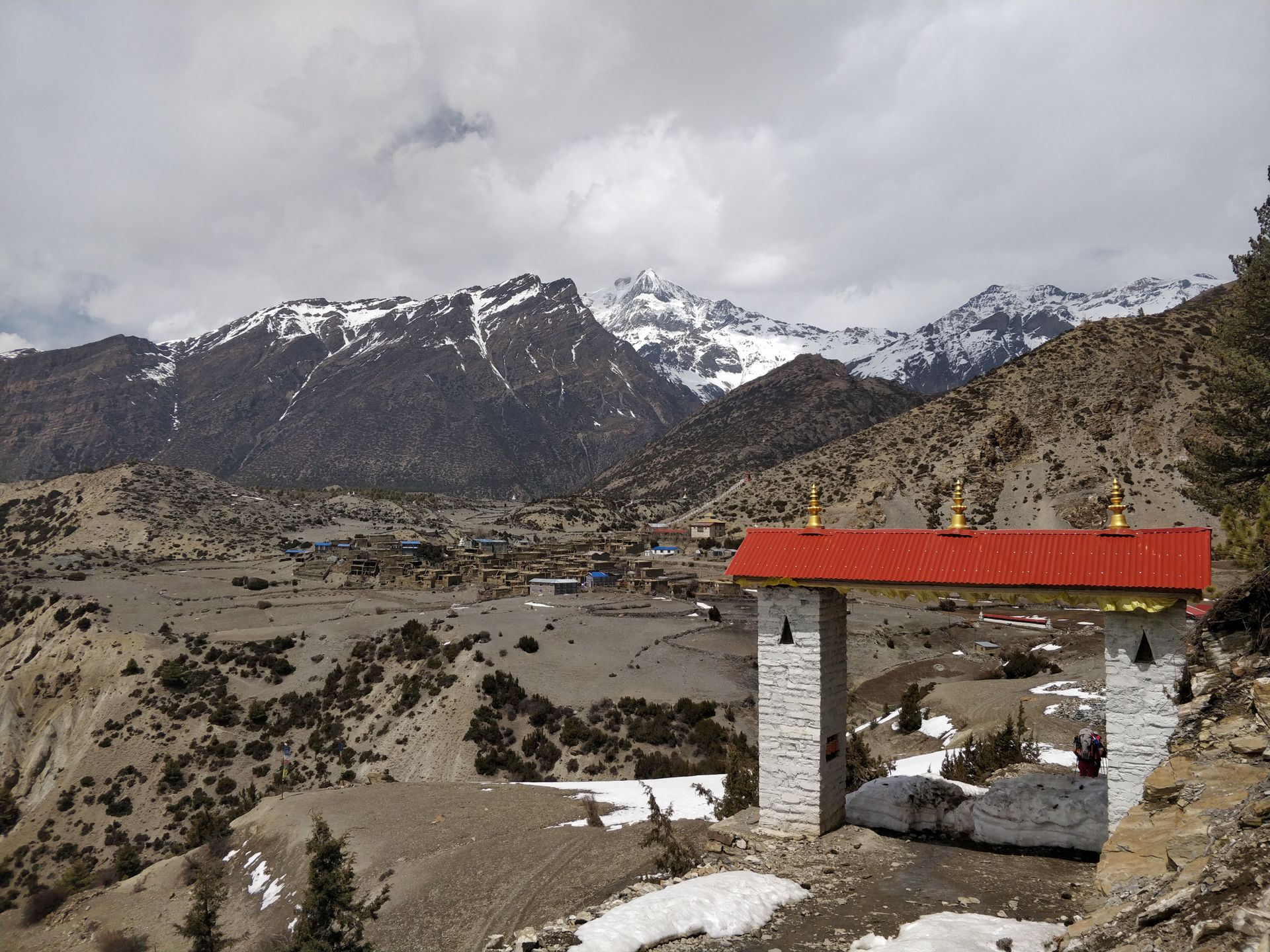
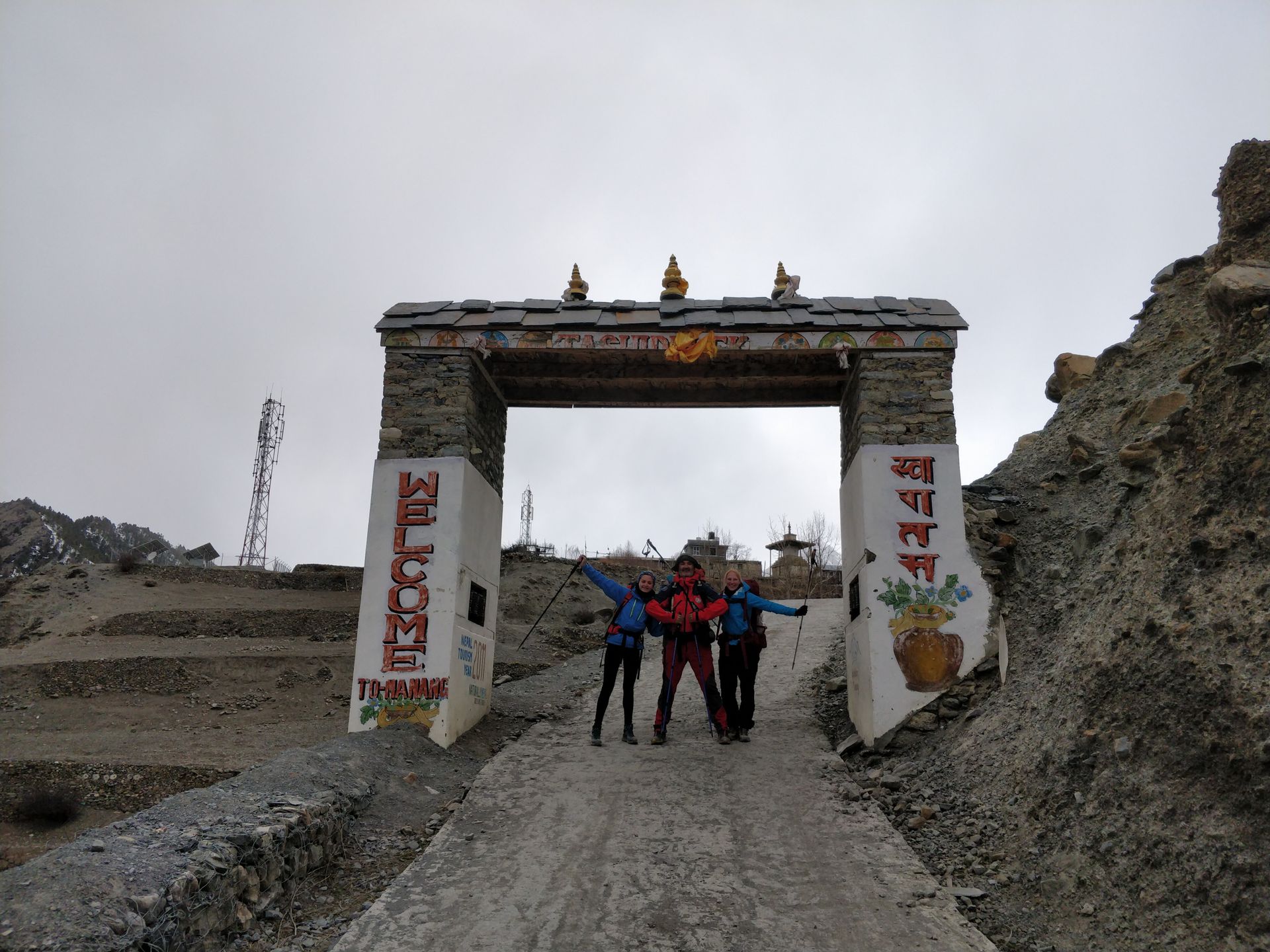
As expected, we climbed step by step with very slow steps to an altitude of 3,670 m. Again and again, we looked back at Pisang and Annapurna II. The air became thinner, and every step made itself felt. Once at the top, we treated ourselves to a well-deserved apple pastry and fresh peppermint tea. We were greeted by a wonderful panorama of Annapurna II to Annapurna III (7,555 m). From Ghyaru, we walked along a mountain path to Ngwal. On the way, we reached an elevation of 3,780 m, the highest point of our Annapurna Trek. When we arrived in Ngwal (3,657 m), I experienced my first bout of altitude sickness and got severe headaches. We still had 9 km ahead of us, and despite descending to 3,540 m, the pressure did not dissipate. So I fought my way through the last kilometers and was incredibly happy when we finally reached our destination and stood under the gate of the village of Manang. To celebrate the day, I took an Ibu 600 :-D
Day 13: Return from Manang to Besisahar
News from the Thorung La Pass confirmed that we made the right decision to interrupt the originally planned Annapurna circuit and return. We didn't have enough time and equipment to cross the pass. So we traveled back to Besisahar in a jeep, enduring the extremely bumpy gravel road for 7 hours.
Looking back at the mountains, I knew that I had gathered incredibly beautiful impressions during my 12-day trek and experienced every facet of the diverse landscapes, mountains, and village life in the Nepalese Himalayas. The most important thing I learned on this trekking tour in Nepal should be noted:
Always carry a roll of toilet paper with you!
Despite the fascinating impressions in the vast surroundings, never lose sight of the path ahead and below! There might be big rocks, cows, dung piles, goats, Nepalese children, donkeys, or sleeping dogs on the way... :-)
With this knowledge and experiences, I went to the city of Pokhara together with Bruno and Ana for a few days, my last destination in Nepal.
Suscríbete al boletín
Respuesta (2)
Gudrun
Vielen Dank für Deinen Reisebericht. Ich wünsche Dir weiterhin ganz viel schöne Erlebnisse, die Du mitteilen kannst. Bleib gesund und munter. In Erwartung auf die nächsten Berichte. Michael
Wieder echt toll beschrieben diese Etappen. Und sehr schöne Fotos, die wahrscheinlich nicht mal ansatzweise das wiedergeben können, was man dort zu sehen bekommt.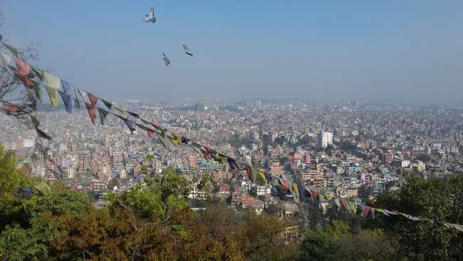
Informes de viaje Nepal