
Natural phenomena in Albania
פֿאַרעפֿנטלעכט: 09.09.2021


אַבאָנירן צו נעווסלעטטער
Part three of the trip to Albania took us to the middle of Albania. For our car, it was not a good idea at all. The roads in Albania are already bad on the coast, in the hinterland you can be lucky if you have asphalt under your tires instead of just gravel or stones. What we saw was still impressive.
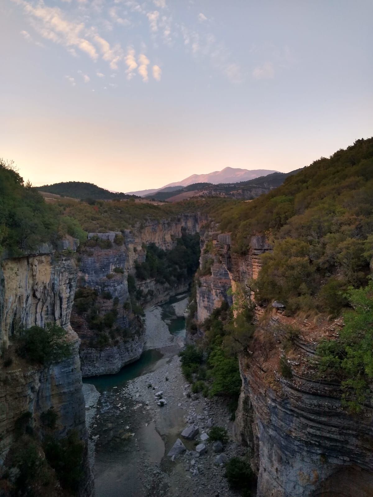
Two of the four people we met told us enthusiastically about the canyon in the middle of Albania, so we became curious. So we spontaneously followed suit. The journey was already spectacular. A wooden bridge led over the Osum Canyon to the spot that Matthias and Stina had already scouted out. Close your eyes and go was the motto.
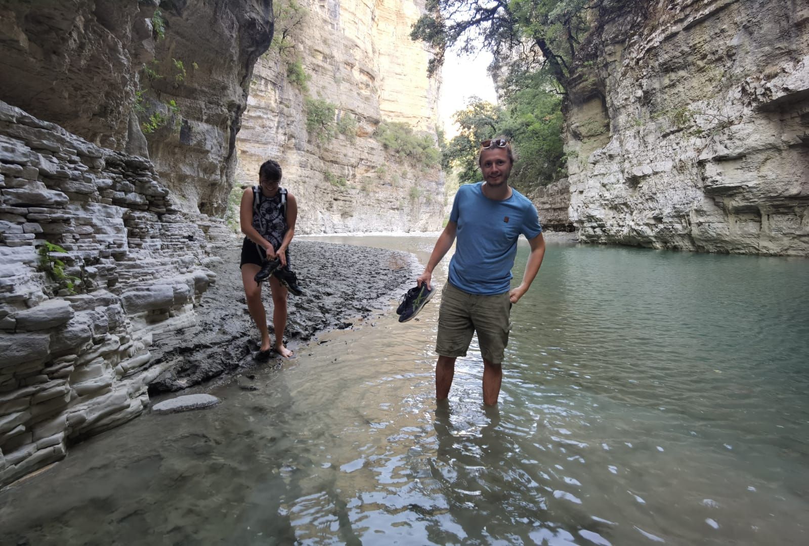
The selected sleeping place was the upper level of a dried up waterfall, which is only filled with water in the spring. The four of us set off on a "small" hike again. The goal was to see the canyon from below. After about 20 minutes of walking, we reached the river below and were offered clear turquoise water, surrounded by impressive rock formations. After enjoying the scenery for a short time, we decided to walk a little further. Somehow, we couldn't get enough and ventured deeper and deeper. Initially a bit shy when crossing water spots (shoes were taken off/put on), we ended up standing waist-deep in the water after a few turns, as there was no longer a way on the left and right. The two boys already carried the backpacks with electronic devices above their heads, while Stina and I slowly waded through the water, testing how deep the individual spots were.
On the left and right, dry waterfalls could be seen again and again, and since the rock was quite grippy, we had the (grandiose) idea to climb out of the canyon over a waterfall. Previously, I mentioned that I go bouldering in Bamberg, so I was allowed to climb ahead directly at this point. It went well until the first basin of the waterfall and then we couldn't go any further. As they say, what goes up must come down. Nevertheless, I was a little uneasy. But all's well that ends well. Canyons eventually come to an end and the impressive rock walls become smaller.
Here's a tip:
In the last post, I already mentioned that Google Maps is often overwhelmed with Albania. That was also the case in this area. Albania's roads are only developed in the tourist areas and at the borders. We were already used to a lot, but the route shown to us was almost impassable. After about 6 km (out of 21), a farmer who was just taking his cow for a walk (?!) waved us back frantically. We had to accept that we had to use the same way back. So almost back to Durrës, our starting point. So, time should be planned for excursions in the Corovoda area, because it is an almost 6-hour detour, probably the reason why tourists prefer to stay away. But don't trust the shortest route on Google Maps!
A second natural phenomenon is a highly touristy highlight, which is why I am uploading the photos, but I would only partially recommend the spot. The Blue Eye (Syri i Kalter) near Saranda is a 12-degree cold mountain spring that meanders through a river in impressive colors. There, the tourists flock who want to jump into the 60-meter deep spring.
אַבאָנירן צו נעווסלעטטער
ענטפער (1)
Georg
Das hört sich alles so toll an. Ihr seid ganz schön mutig! Ob ich das mit meinem Citroen Ami 8 von 1977 mit 32 PS wohl auch geschafft hätte? Na ja ... Ich bin jetzt wieder zu Hause und darf von meinen Erinnerungen träumen. Auch gut.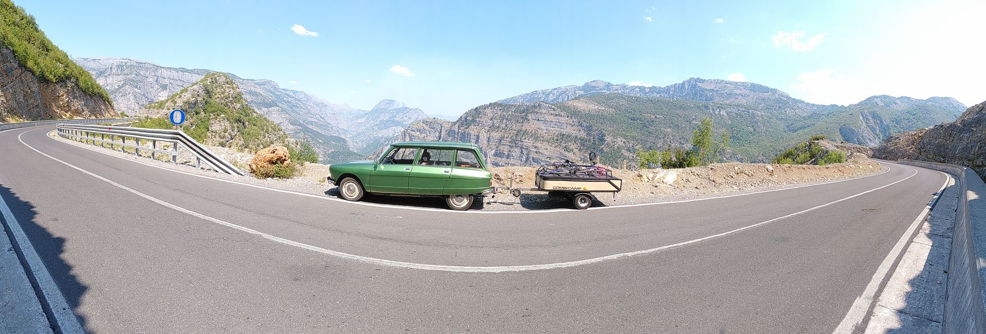
רייזע ריפּאָרץ אַלבאַניאַ