Day 21: Crater Lake
شائع شدہ: 24.06.2018


خبری مکتوب کے لیے درخواست دیں
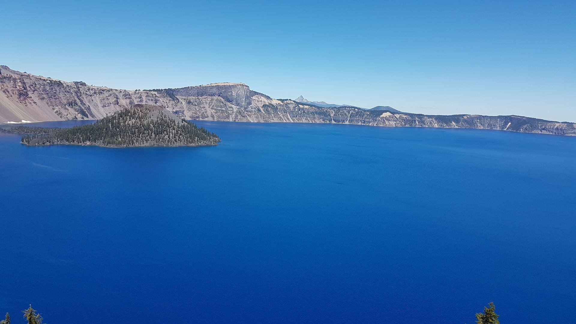
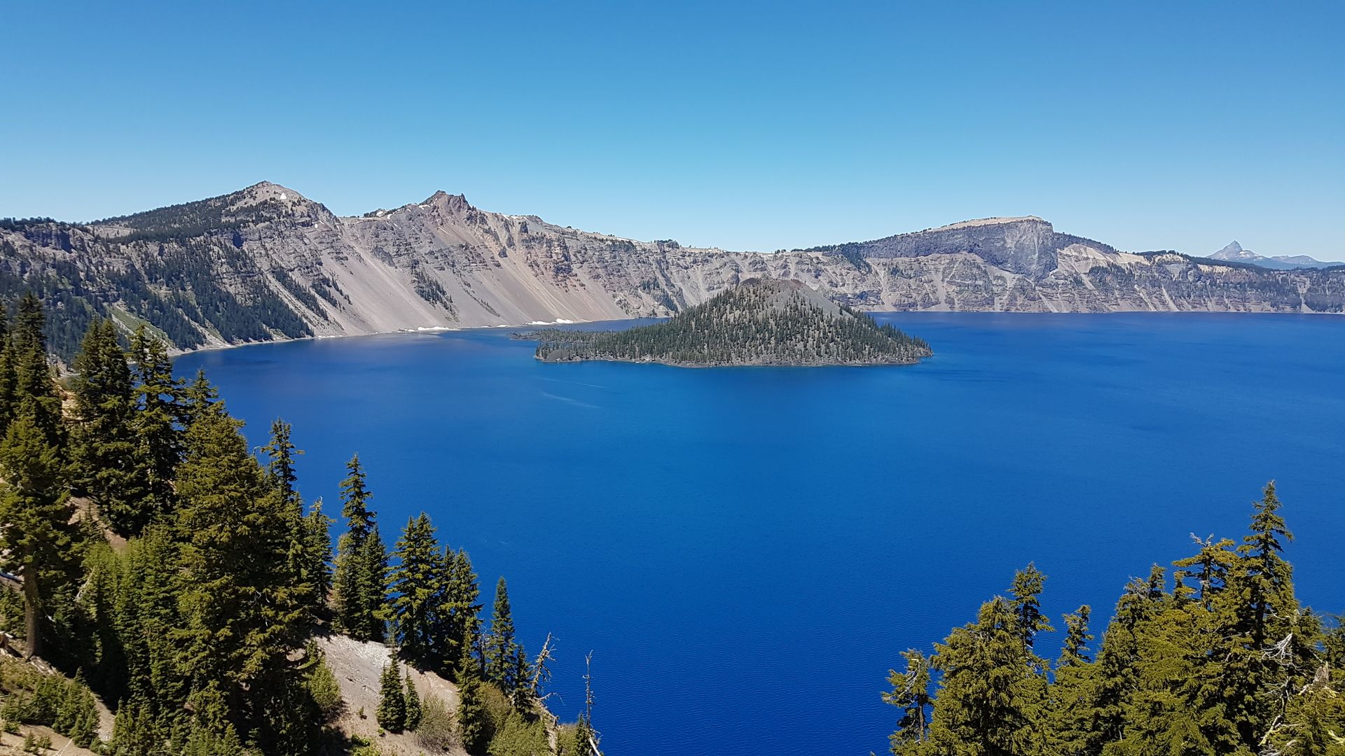
Our day starts with a walk to the Deschutes River. The river flows around Bend and runs through LaPine State Park. The giant Ponderosa Pines are just a few meters away. It is 500 years old and stands magnificently at 60 meters high and 2.50 meters in diameter. After that, we leave the state park. Our route takes us straight through pine forests for 1 1/2 hours. Then we arrive at the north entrance of Crater Lake National Park. There is a wait at the entrance as many visitors want to enter the park with us. Afterwards, the road leads to the edge of the lake and goes around it once. It is noon and we drive straight to Rim Village. I would have liked to have a glimpse of the lake earlier, but sometimes it's not possible. Rene is tense, the road is narrow, and it goes steeply downhill right next to it. There are no barriers. Plus, there is oncoming traffic. After what feels like an eternity, we finally reach our destination. There are RV and bus parking spaces available, but unfortunately, the car drivers are ignorant and occupy the few spaces. It's frustrating because there are enough regular spaces available, but they are too small for us. We now take the second round around the park. Two families with regular cars occupy a large space and have their lunch there. I get out and ask them to vacate the spaces. They understand and finish eating before driving away. I stand at the spot and wait for Rene to drive around, as two more cars want to take the space. But not with me. I block the entrance and inform them about the other spaces. Then we can finally eat and explore the surroundings. We are at the rim of Crater Lake. This is where a 3,500-meter-high volcano erupted about 7,700 years ago and then the magma chamber collapsed. The lake was formed by water and snow. There is a small volcano in the lake that can erupt in the future. It is the small island in the lake. The volcanic activity in the region is very high, so further eruptions are possible in the coming years.
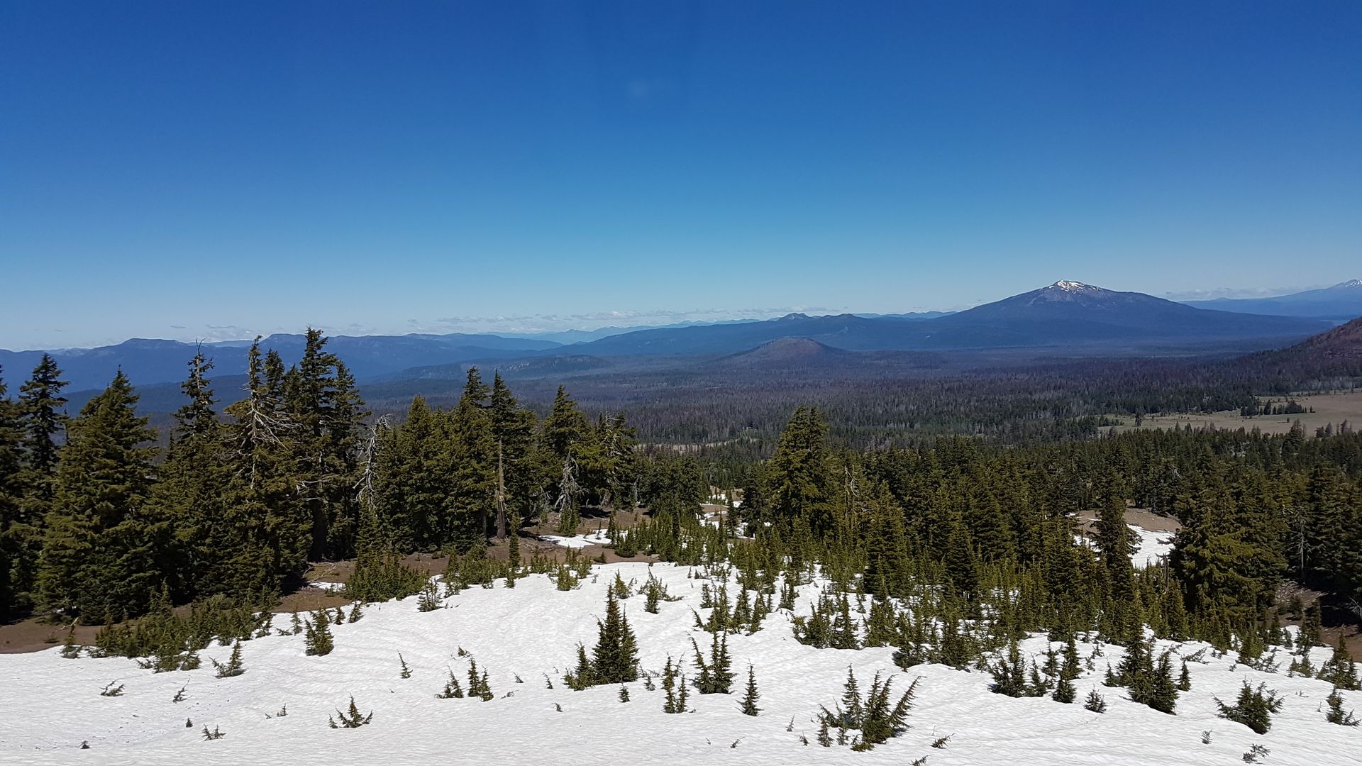
The water of the lake is deep blue and very clear. It is located 1,882 meters above sea level and has a diameter of 8 kilometers. Its deepest point is 589 meters. The slope goes steeply down and there is only one way to access the lake. It is a steep descent and ascent with a length of 3.5 kilometers as a circular path. Too much for us. We stroll along the edge and enjoy the weather. It's cooler, but the sun is shining and there is not a cloud in the sky. There is still some scattered snow. The road around the lake can only be driven in the summer, usually from June onwards. Erik plays in the snow and is happy. At 2:30 pm, the Junior Park Ranger program begins. To receive the patch, Erik just has to participate without filling out a booklet. The task is to design a map of what he has seen. Erik draws the map with a little help from me and is proud of his result. As a reward, he receives his patch and is proud. Then we continue our journey and complete the circuit around the lake and leave the park again to the north. It is after 4 pm and we still don't have a place for the night. Nearby is Diamant Lake. There is a large campground owned by the Forest Service. We choose an available spot surrounded by trees. It is not too close to the neighbors and the sun is still warming nicely. Erik is exhausted. He falls asleep during the drive and doesn't mind when we stop. He wakes up occasionally and cries for no reason. I put him to bed and he falls back asleep. He wakes up again around 7 pm and still plays outside. The camp host, the caretaker of the campground, warns every guest in the park that bear tracks of a black bear have been sighted and that we should take everything into the camper. Erik is now scared. We pack everything up and go to bed at 9:30 pm. The mosquitoes are so persistent that we are already bitten despite mosquito repellent and a campfire.
خبری مکتوب کے لیے درخواست دیں
جواب دیں۔