Chapter X - West Coast × Glaciers
Нашр шудааст: 12.11.2017


Ба бюллетен обуна шавед
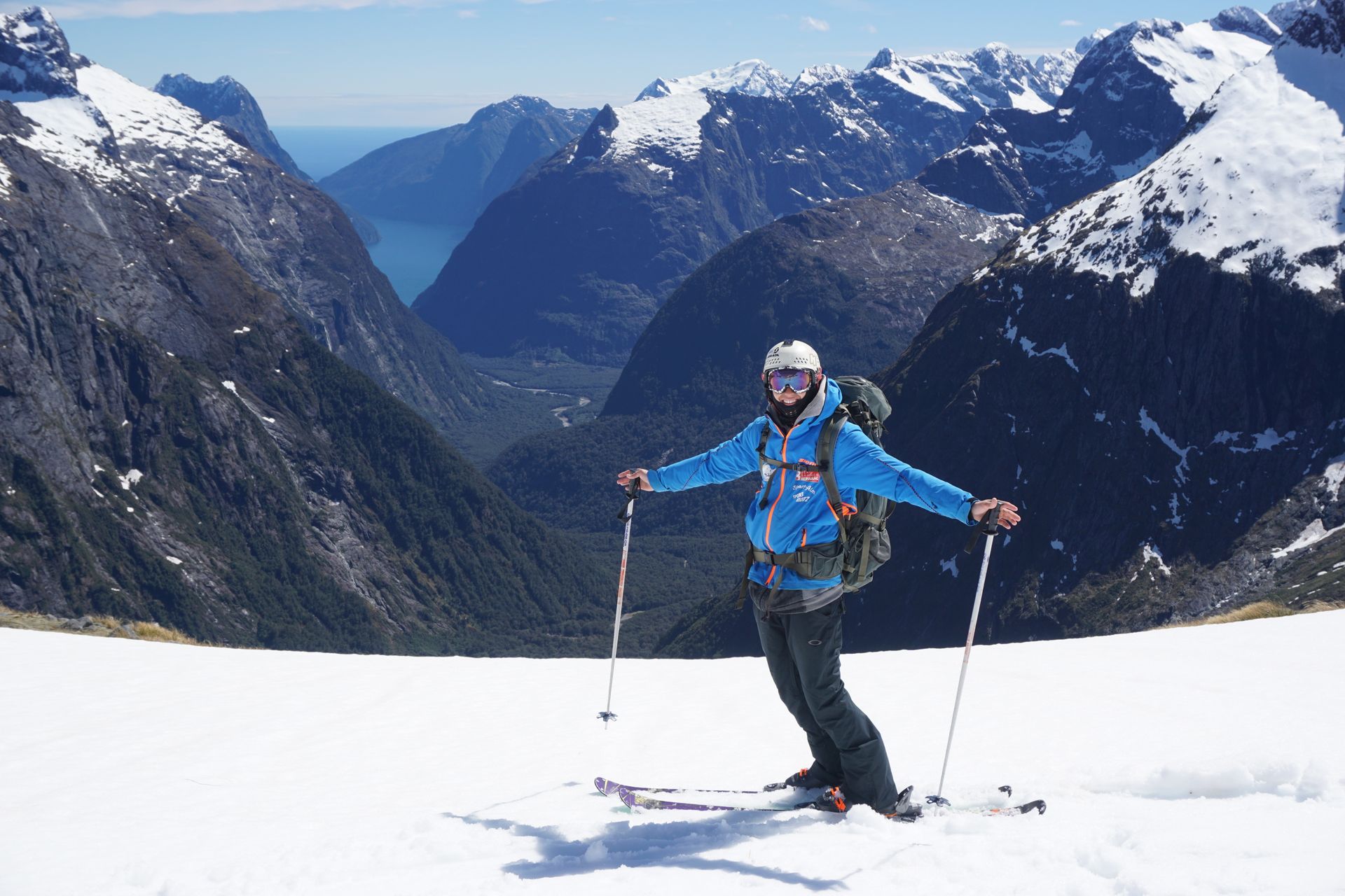
From Te Anau our route leads back through Queenstown and Wanaka, but this time we turn right towards the West Coast.
'The Kneck ' is worth a short stop on the way to enjoy the view. On one side is Lake Wanaka, and on the other side is Lake Hawea. These lakes have very different characters, even though they are almost right next to each other.
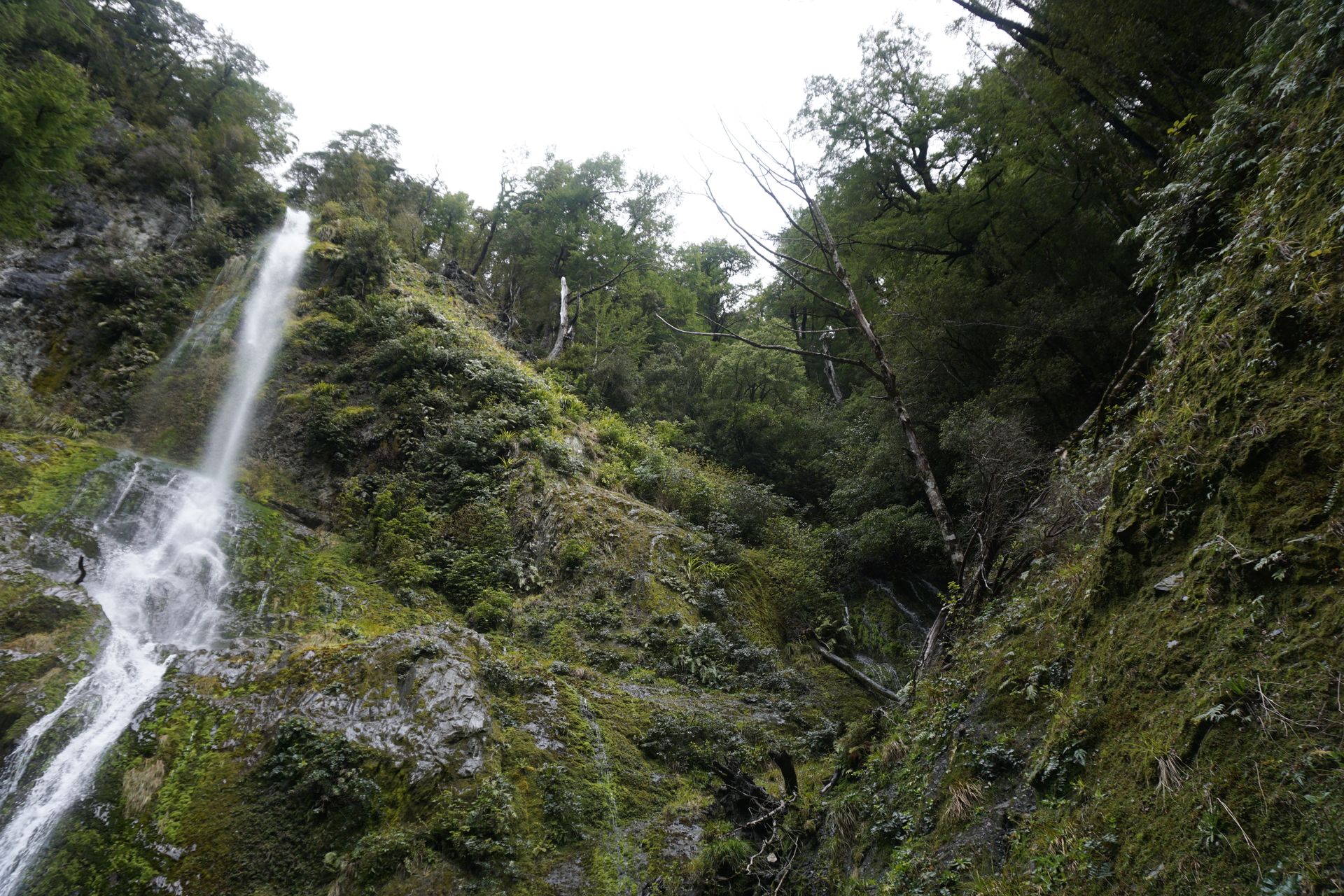
After that, we continue over the Haast Pass, where there are also several stops along the way. The signs on this busy pass point to one waterfall after another. On the internet, the community argues about which one is the most beautiful and worthwhile. We make our stop at the Thunder Creek Falls, which are not far from the road. After a short walk through the forest from the parking lot, you will reach the river with the waterfall. Here, the water falls 20 meters into the depths and then disappears with the river.
This section of the pass is particularly winding, and in some sections, it is really steep downhill. The pass ends in the town of Haast. Of course, the tank of every car passing through here is almost empty, and everyone actually has to refuel here because the next gas station is about 100 kilometers north near the glaciers. Accordingly, the gas station owner can almost determine the price alone, depending on his mood. This is clearly evident in the fuel prices, because the gas station here is even more expensive than in Wanaka.
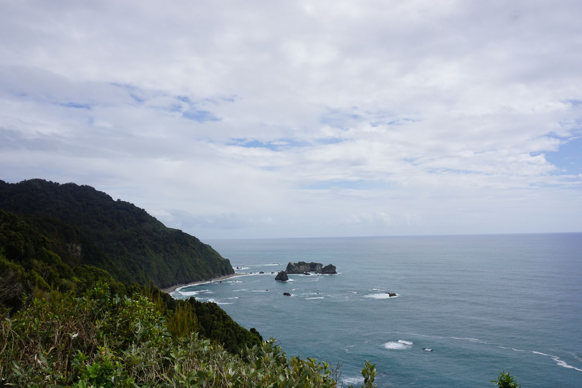
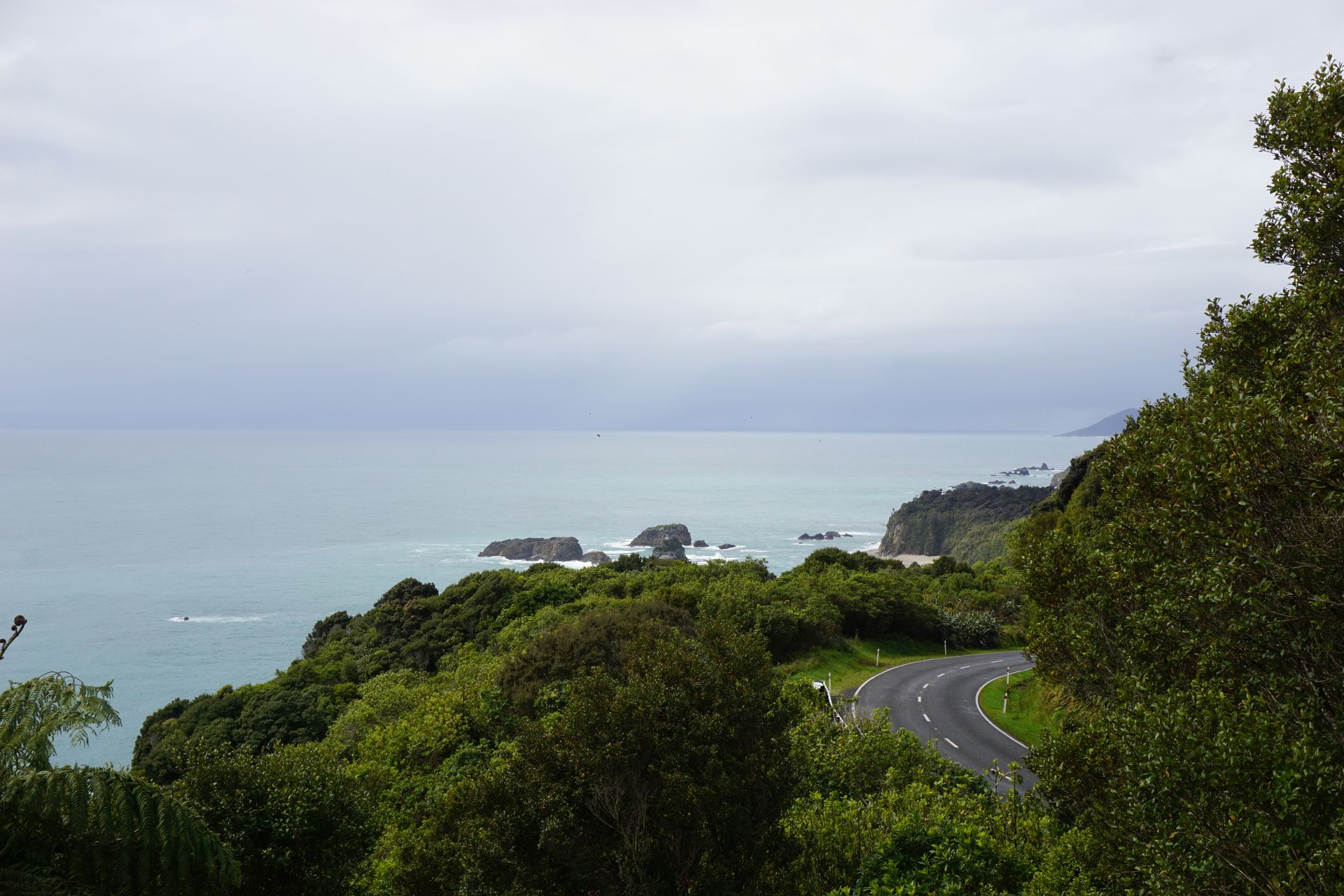
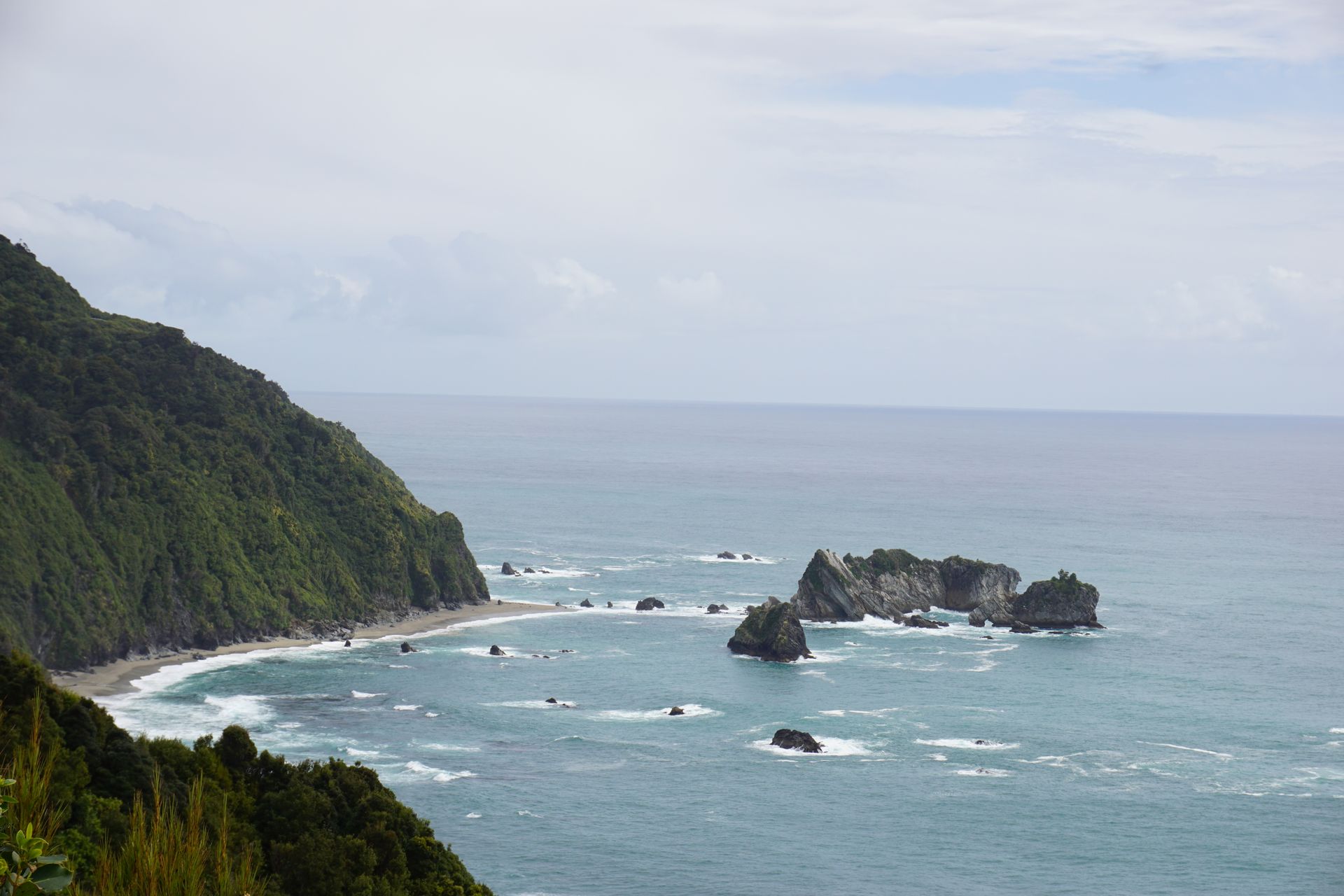
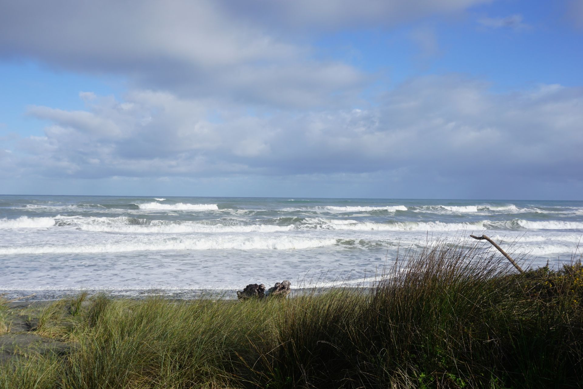
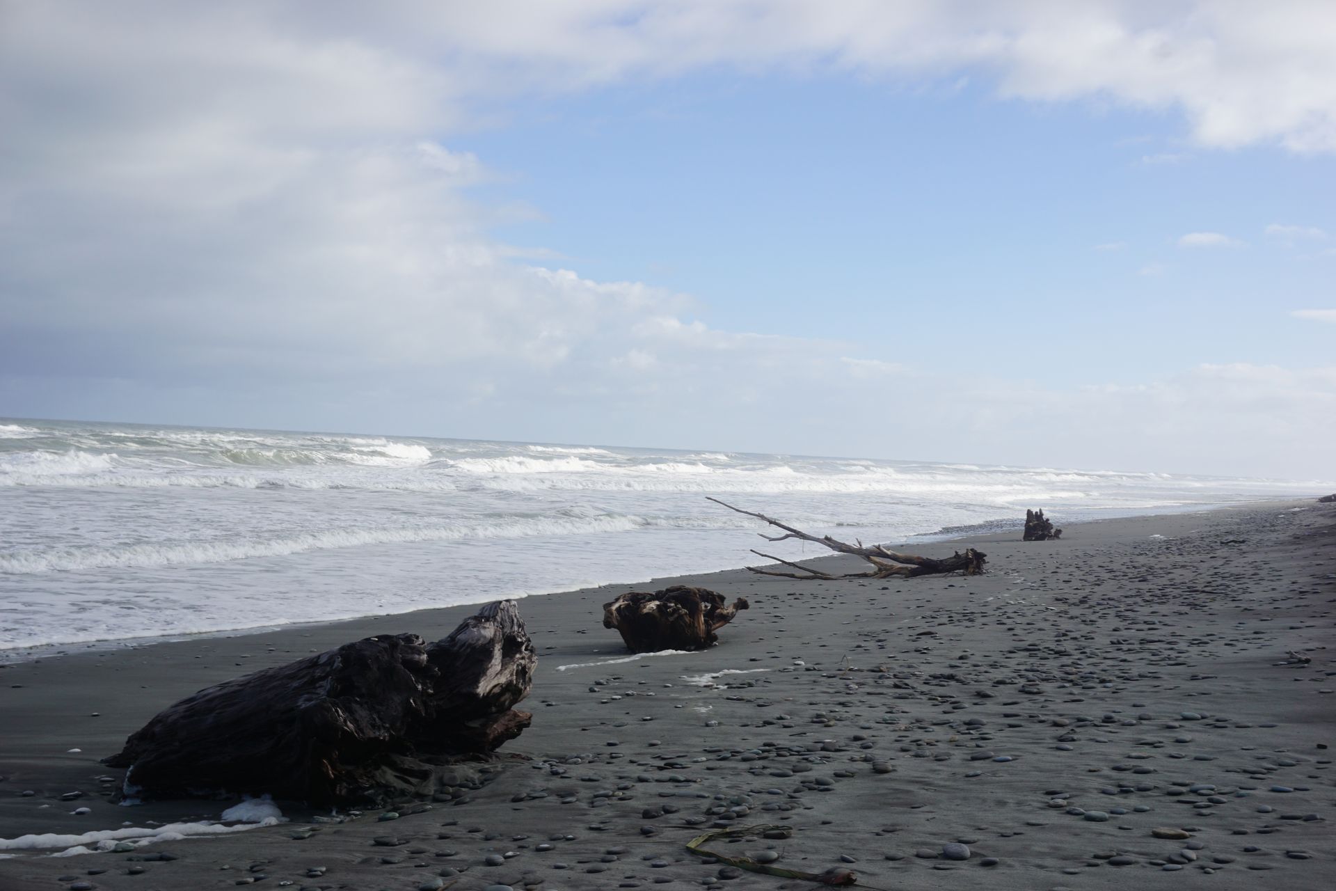
We now continue along the coast to the famous Knights Point, where all buses on their way to the glaciers take a break. From the viewpoint with picnic opportunities, you can see the steep coast and have a good overview of the landscape. You can also get a glimpse of the glaciers behind the peaks. After a short café break in the surfer's paradise Bruce Bay, we finally arrive at the first glacier, the Fox Glacier.
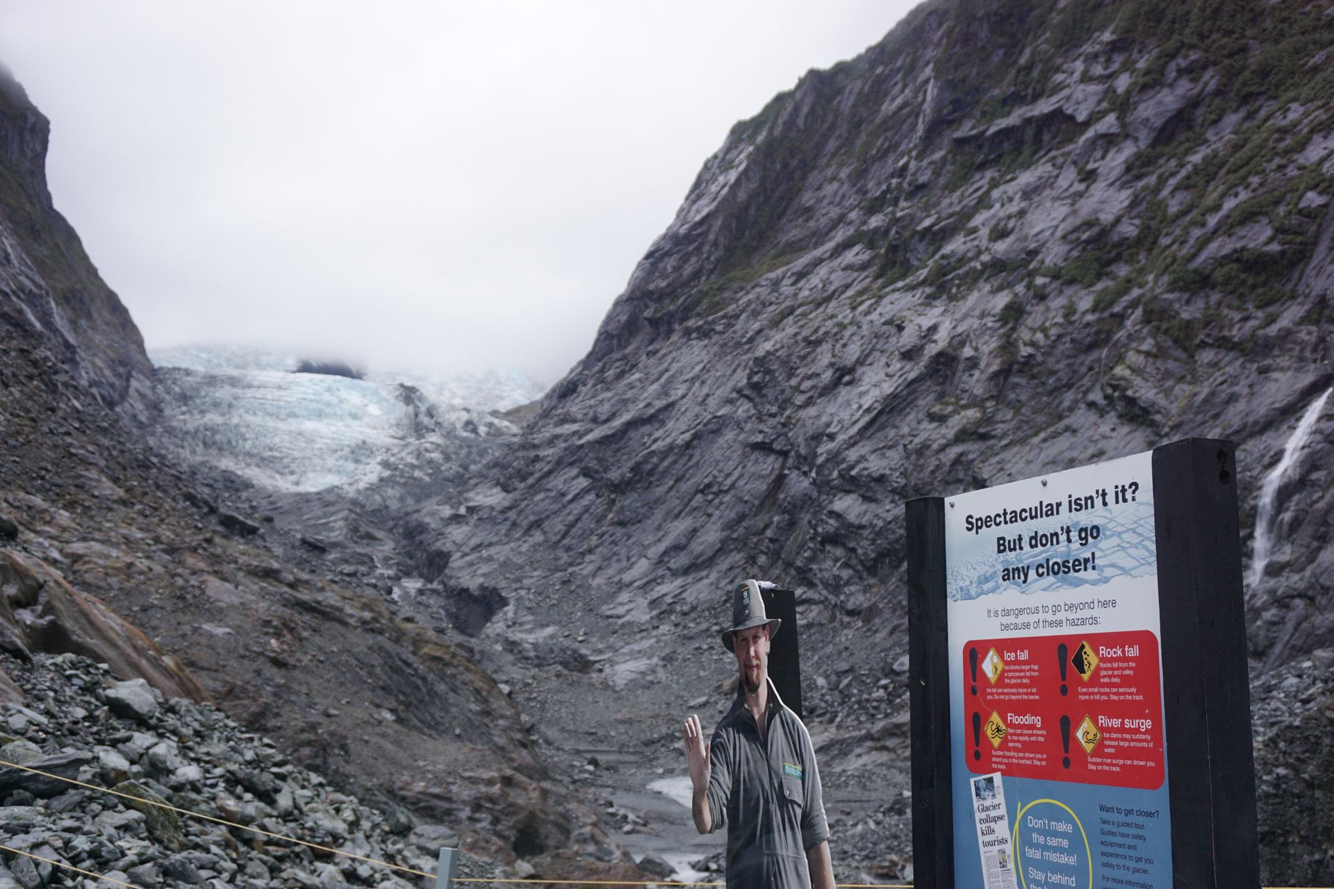
At the turnoff into the valley of the glacier, the nature and especially the forest strongly reminds me of a kind of jungle. Everything is very green, there are many trees and bushes, and there is high humidity. The access road leads almost directly from the sea to the current terminus of the glacier. However, just a few years ago, the glacier tongue was several meters, if not kilometers, further forward, right to the beach. Markings next to the road remind us of this and document exactly when the glacier stopped at which point in time. It is really dramatic to see the ice melt over a relatively short period of time and how far the glacier has already retreated. Our generation can probably consider themselves lucky and be among the last to witness these natural wonders in New Zealand. Because in the worst case, the Fox Glacier could possibly no longer exist in a few years. Unfortunately, there are no giant foils to protect against the melting ice, as you can find on the glaciers in Austria, for example.
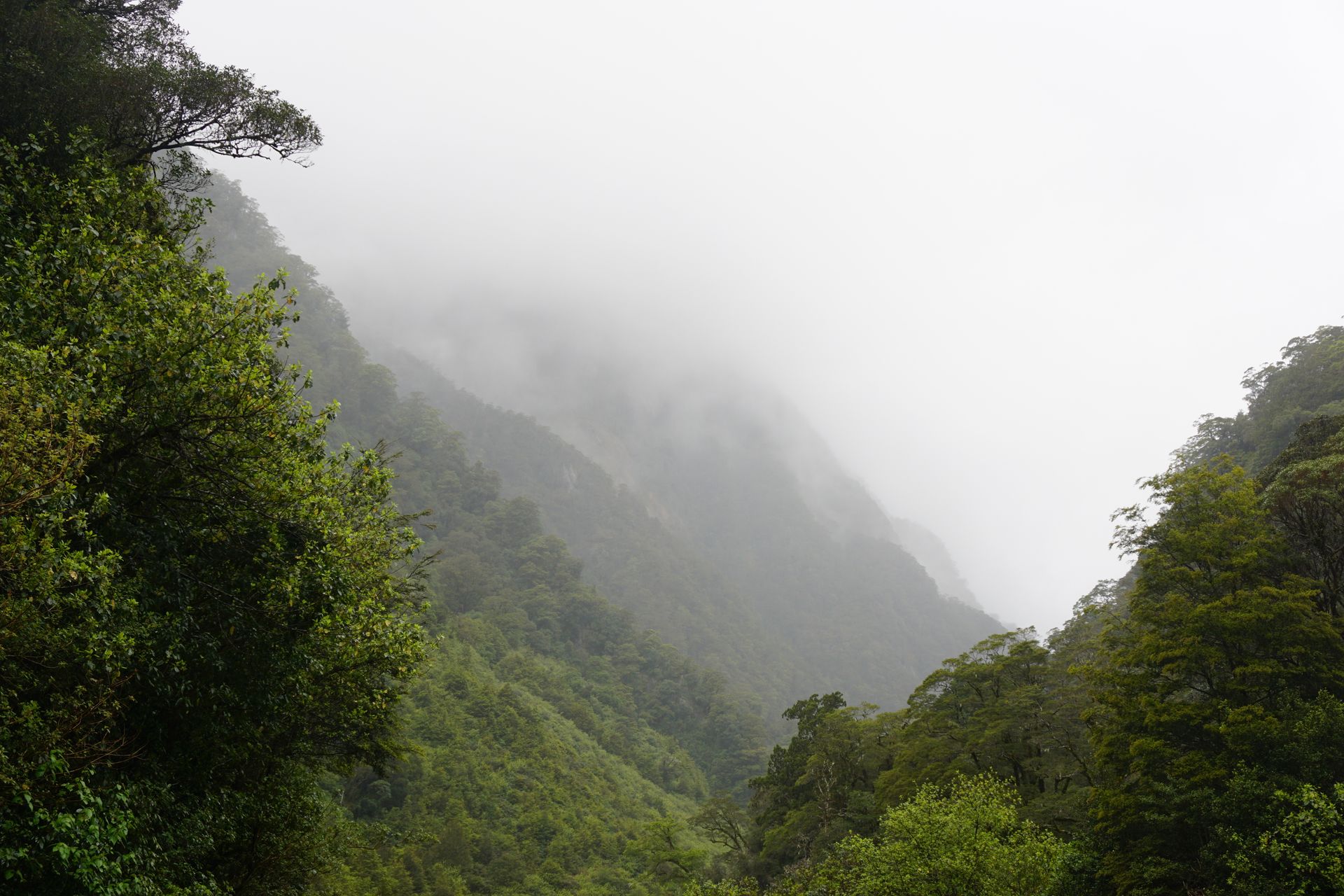
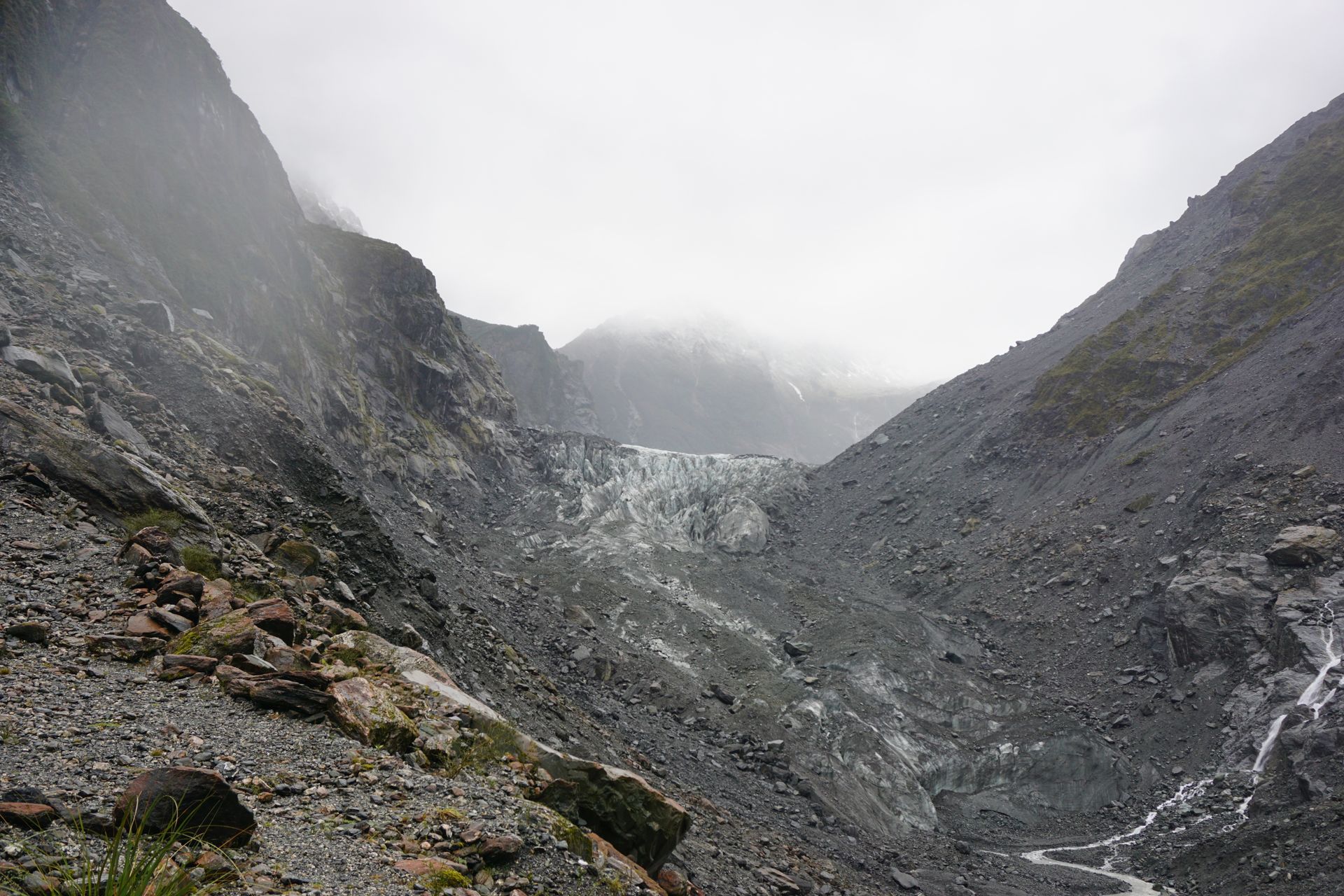
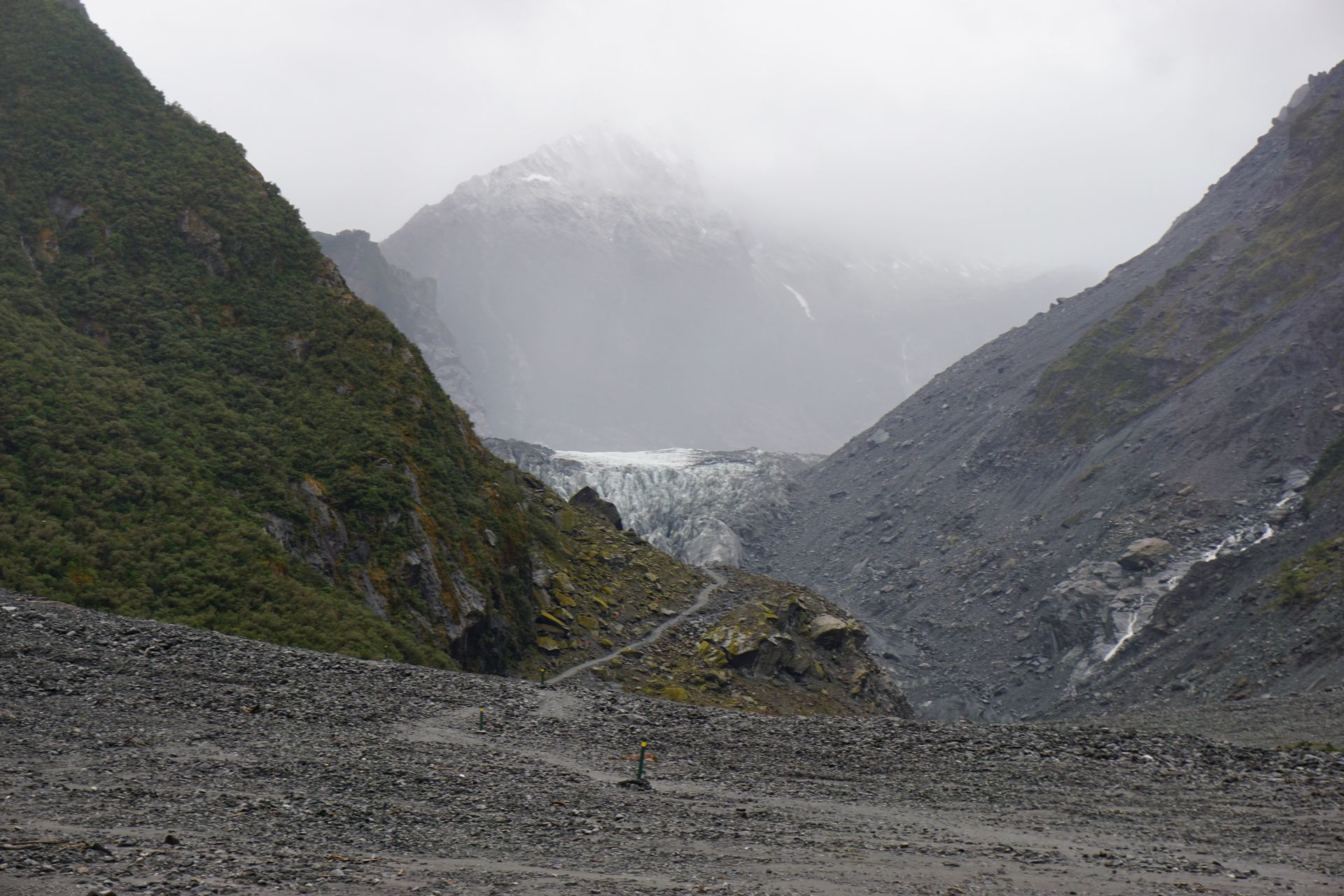
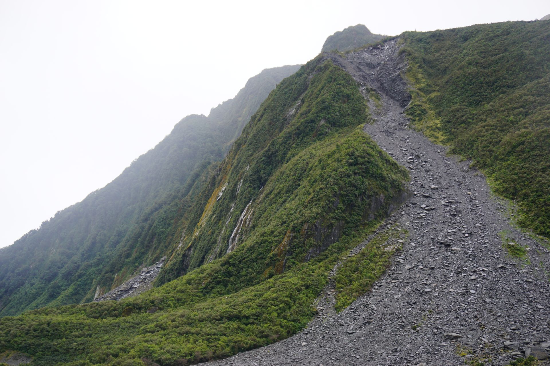
In recent years, the visitor parking lot has been moved further back, also due to the melting. Today, it takes about 10 minutes to drive from the sea into the valley through which the glacier tongue once flowed. From the parking lot, there are various tramping options. Unfortunately, the exciting tracks are all currently closed as there is a high risk of rockfalls or some of them need to be rebuilt after the winter. The problem is that the whole landscape is changing here with the melting ice (so the hiking trails can also be destroyed), and the mountains are constantly moving or growing due to plate tectonics. So we are left with the 'mainstream' track along the river for now. Fortunately, there is currently no flooding on this track, because the West Coast received a lot of rain last week (for which it is also known), and unfortunately, we have bad weather again today.
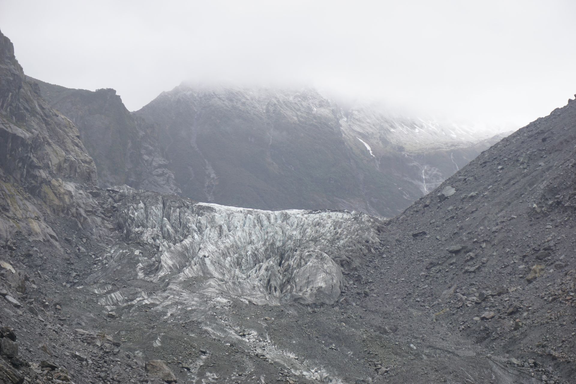
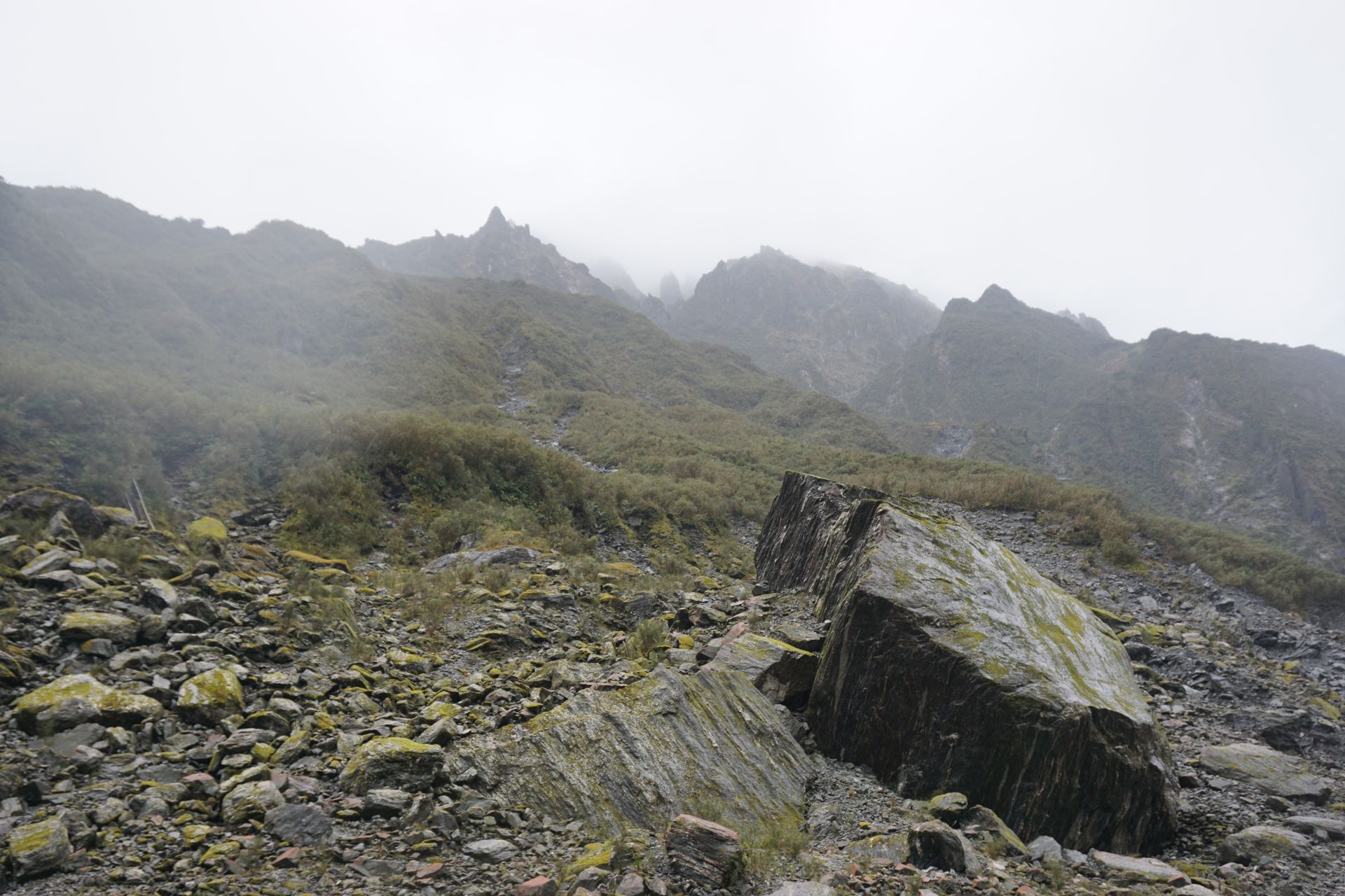
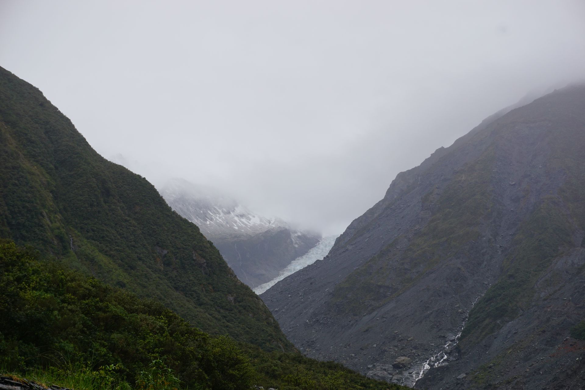
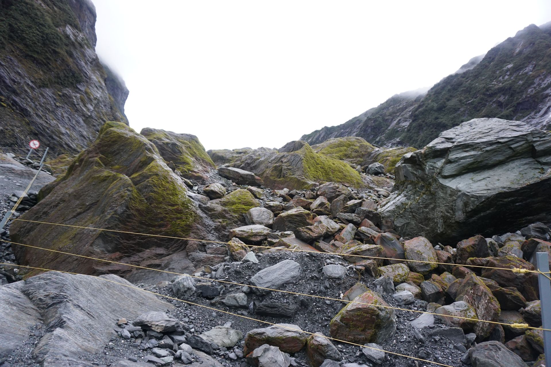
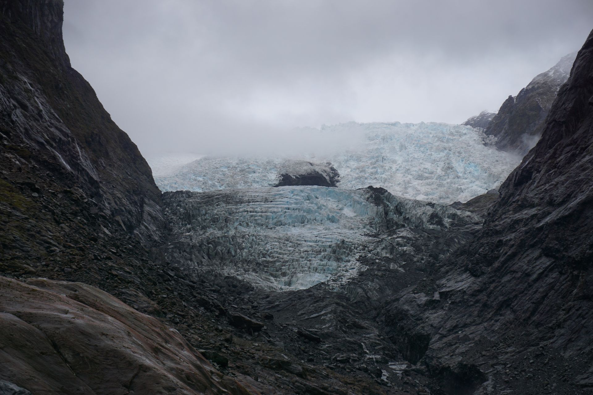
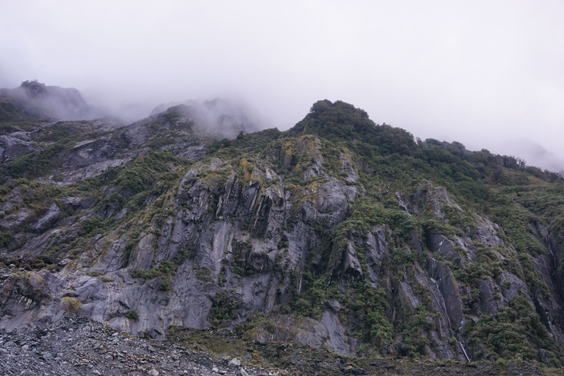
The landscape in the entire valley, where the glacier tongue once meandered along, is truly impressive. From the hiking trail, you can see exactly where it ran and how high the ice was at the beginning. On the way, you pass some large boulders that have fallen from the surrounding peaks at some point. After a good half an hour in the rain, we can finally admire the remaining ice. At first glance, it looks very dirty, but on closer inspection, that's just the snow that is still there from winter. Underneath, the bluish ice appears, and in some places, it looks very sharp and folded. We go a little higher, but 200 meters before reaching the ice, it's over - according to the many warning signs for 'your own safety'. The viewing platform is enclosed by several fences and depending on the situation and conditions, it is moved further up or down. The glacier river also plays a big role; if it has high water, the lookout point is also closed. Beyond this point, you can only go with a guide or by helicopter. Signs everywhere warn of the dangers that exist here, and in my opinion, not without reason. From the designated viewpoint, we also have a great view and it is very suitable for taking beautiful photos. However, from down there, you can only capture 3/4 of the entire glacier in a photo, as the last quarter is hidden behind the adjacent mountain - unfortunately, you will probably have to take the helicopter for that.
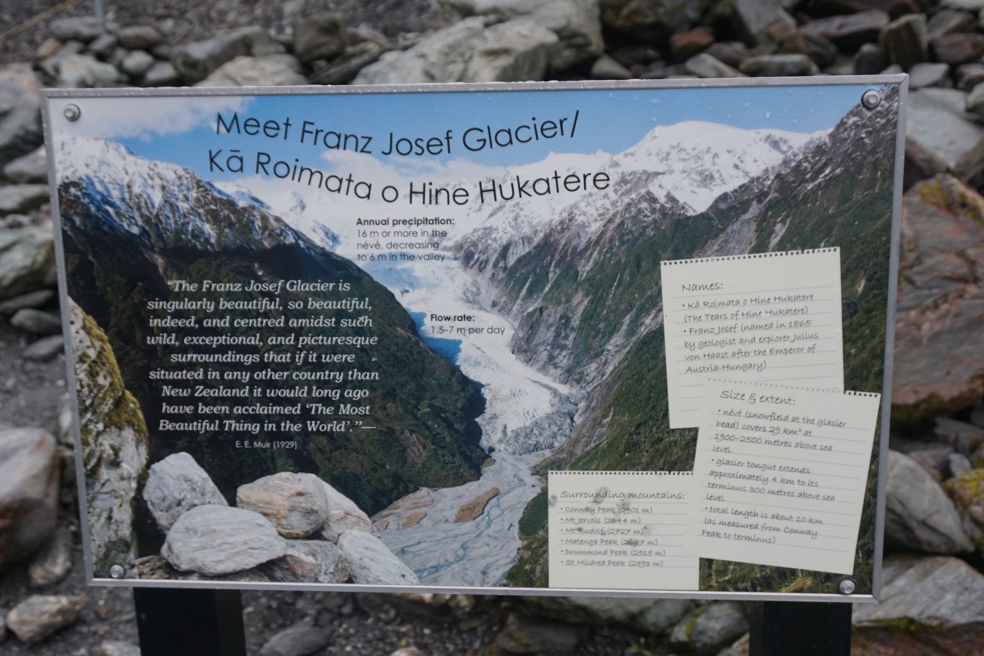
After the Fox Glacier, we continue straight to the second glacier, the Franz Josef Glacier. The two are only just over half an hour apart, and for helicopters, even less, which is why both are often flown on tours. Most of the time, you can also get a glimpse of the back of Mt. Cook, which rises exactly between the two glaciers on the backside. The Franz Josef Glacier also has a small village at the bottom with many hotels and motels, restaurants, a supermarket, and a gas station. The access road also leads through the former valley of the glacier tongue to the parking lot. However, it is much further ahead than at Fox Glacier. Here, too, we face the same problem that most tramping tracks are still closed due to the same problems that occur every year in spring at the neighboring glacier. But the path to the general viewing platform is already more demanding here, and you have to cross the river, which may come directly from the ice, a few times. The path first leads through the primeval forest, and after half an hour, you can finally see part of the glacier. After the glacier tongue has already retreated here as well, it has left behind a huge field of debris, with some very large boulders that you have to cross. When you reach the platform at the top, the rest of the glacier reveals itself in full glory. In addition to the glacier itself, I am also very impressed by the structures and traces that the already melted ice leaves behind in the valley and how it looks without ice now.
In my eyes, the overall impression of Franz Josef is significantly more interesting than that of Fox Glacier, which may be because the latter has already become much smaller or is more affected by climate change due to its location and height. In the end, both glaciers are a must-do and they were definitely worth a visit! I will definitely drive by again on my journey, just to see them in good weather or maybe even take a helicopter ride.
After a cozy evening down in the village, the trip over the South Island is almost over and we head back to Kaikoura, where I started out after arriving in Christchurch. The trip was truly unforgettable, and we saw and experienced a lot. Of course, there are still parts of the South Island missing, such as the north, but I still have some time, and I will definitely come back to some places again.
Ба бюллетен обуна шавед
Ҷавоб

Ҳисоботи сафар Зеландияи Нав