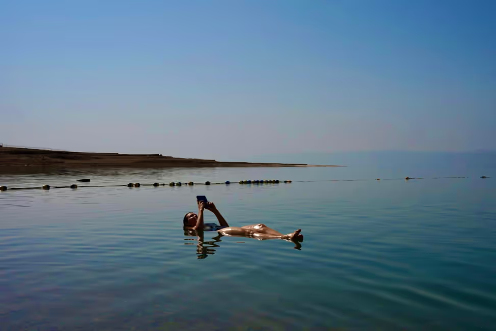

Survived
Нашр шудааст: 17.05.2024


Ба бюллетен обуна шавед
After many overnight buses, long nights, and illnesses, I can't remember which night I actually got seven hours of sleep. So the 5 o'clock alarm doesn't hurt as much as it sounds. While I'm getting ready in the tent, I'm already being handed a cup of coca tea - after all, today we're going to the highest point of the trail. Yesterday counted as a "training day", today we are demanded a lot. We start in Ayapata at 3,300 meters, cross the Warmiwañuska at 4,215 meters, then descend again to 3,650 meters, then walk up the Runccurakay Pass at about 3,950 meters, and then descend again to our camp at 3,600 meters. In total, we will cover 16 km and about 1,300 meters of altitude today.
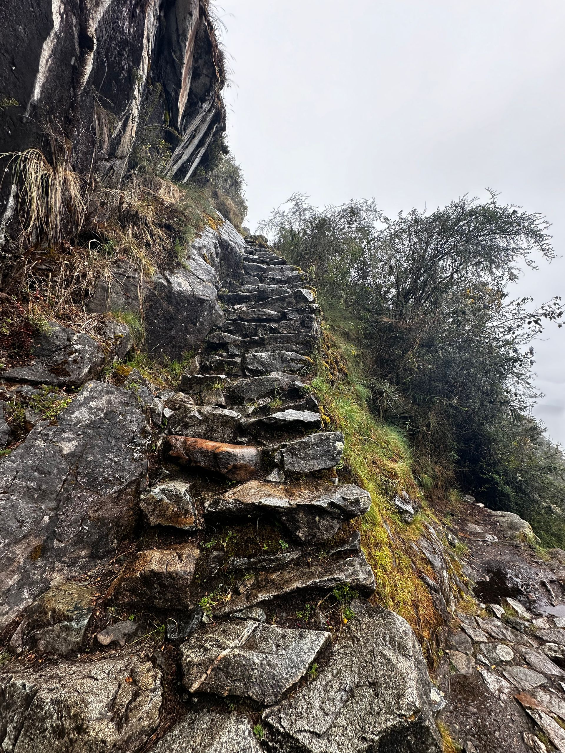
After breakfast, we set our trekking poles to "ascend" and off we go. By 8 o'clock we've already climbed 500 meters to 3,800 meters. From here, it's another 400 meters to the Warmiwañuska. We take a break at a wonderful viewpoint and see behind us the path we came from and already see the highest point of the pass. I can't say if I've had a chocolate bar before 8 o'clock today, but after two hours of hiking at over 3,000 meters altitude, I think it's okay. We can all make the rest of the climb to the pass at our own pace, until we finally reach the top at Warmiwañuska. The name means "Dead Woman's Pass", which I probably shouldn't have mentioned to my family beforehand. But I can give reassurance: The name fortunately does not derive from past accidents, but from the formation of the peak at the pass. From the viewpoint where we took a break in the morning, you can see that the mountain has the shape of a lying woman's chest - a dead woman, in fact. That's how the name came about, and now there is confirmation that I have survived the pass. Since we still have such a clear view of the Andes during the break, all the surrounding mountains are covered in clouds. After the break, there is nothing left for us to do but adjust our trekking poles to the descent and hike down about 600 meters into the Pacaymayo Alto Valley, where lunch awaits us. But before we start the descent, it starts to drizzle. Since the weather can change quickly here, I'm already preparing with my rain jacket and poncho. We are also allowed to do the descent at our own pace, and I appreciate that! On the Inca Trail, it is not actually allowed to walk without a tour guide, but Abelardo trusts us and has the opportunity to look after the slower ones in our group without holding up the rest of us. During the descent, the rain starts to pour and I'm glad to have my poncho and trekking poles. Steep, high, and wet stairs are exactly why I borrowed the poles, and I have escaped a scare several times today. Just five minutes after arriving at the lunch spot, the sky opens up even more and it rains buckets. It's a good thing I'm already in the tent by now. It's still cold and wet, but luckily I don't have to hike in this weather - I think. The rain continues, no matter how long we try to delay our departure. We seem to have caught one of the two rainy days in May announced on the internet.
All bundled up (long-sleeved shirt, fleece sweater, rain jacket, scarf over my ears, cap, hood, and rain poncho), we reluctantly start the second part of the day. To sum it up: 300 meters of ascent in pouring rain and then 300 meters of descent in pouring rain. As our tour guide summarizes the weather: "It couldn't have been worse for us." He's right about that, but we try to take it with humor, we're prepared for the weather, and we hope that the second rainy day of the month won't be the day after tomorrow when we're at Machu Picchu. We pass signposted viewpoints and terraces again and again and are happy each time about the spectacular view, which unfortunately only extends 50 meters into the cloud cover. That's just the way it is: I wanted an adventure and I'm getting the full program!
In the afternoon, we pass three more archaeological sites: Runccurakay, Sayacmarca, and Chaquicocha. The latter is also the name of our camp, where we will sleep tonight at 3,600 meters. We get another bowl of warm water to wash ourselves and meet for tea, hot chocolate, and cheese crackers before having dinner together. Tired and at the same time satisfied, we sit together at the table and review the day: many meters of altitude, stairs, rain, layers of clothing, thin air, gray sky. But we're all doing well and we have overcome all the hurdles of this already difficult day.
After dinner, the cooks and porters come to our tent and we all introduce ourselves. It's truly incredible what these 15 men do for us, so it's nice to spend a few minutes with them and be able to say thank you.
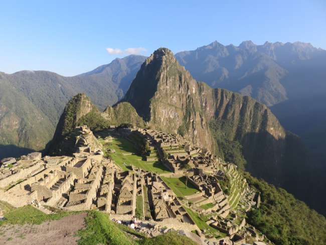
During the briefing for tomorrow, we are very relaxed, what else could happen after today? There will be ups and downs, but tomorrow we will end up at just under 2,650 meters. If it doesn't rain anymore, it will be warmer tomorrow.
The last announcement of the day: We are sleeping on the "wrong" side of the pass, so it will probably get pretty cold tonight - maybe down to 0 degrees. So after dinner it's layering up again: long pants, two pairs of socks, t-shirt, fleece sweater, down jacket, scarf, and hat. Wrapped up, I snuggle into a thin cotton blanket and then into my sleeping bag. I also have the gloves ready if needed.
The activity summary of the day is as follows: walked 16 km, covered 1,300 meters of altitude, were on the road for almost 12 hours, crossed the highest point of the trail at 4,215 meters, and my phone shows 23.6k steps.
Ба бюллетен обуна шавед
Ҷавоб
Ҳисоботи сафар Перу