
The Green Belt - Week 2
E phatlaladitšwe: 25.05.2020


Ingwadiše go Lengwalo la Ditaba
In the evening I took a look around the town and then cooked chili.
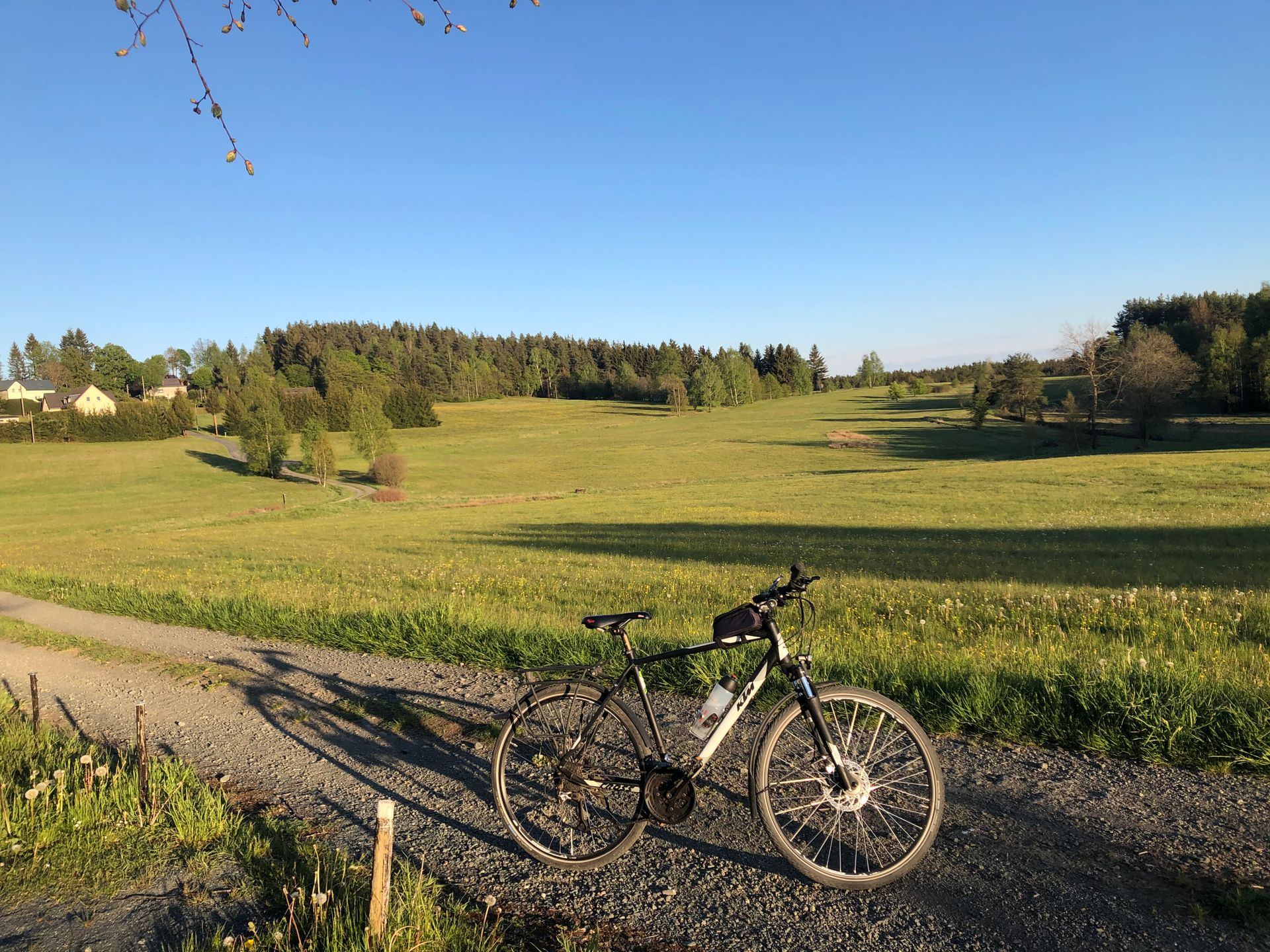
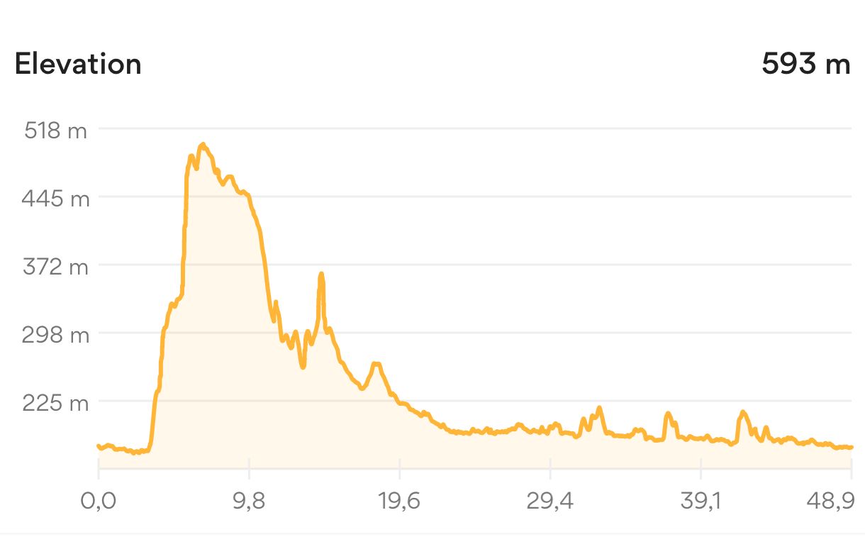
In the morning, I got up early and after a proper breakfast and some provisions, I headed towards Philipsthal. It was quite a long way, farther than I had planned, but the Iron Curtain cycle path, which was now signposted again, led beautifully along the Ulster river via Geisa, Buttlar to Philipsthal.
Nice, always steadily downhill, the entire time on a cycle path and with a tailwind, the most pleasant section so far. And so I reached my destination quite quickly. I hardly took any breaks and was right on time. In Philipsthal, I had my snack in the castle park and then headed back.
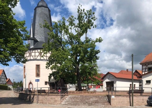
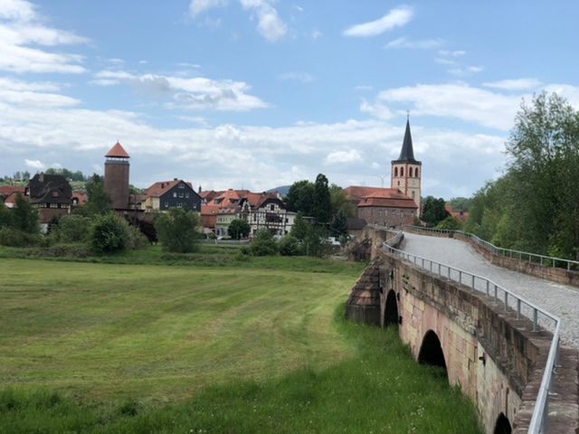
This time, however, not on the old men's cycle path, but on the actual border. I rode along the Werra River to Vacha and crossed the Unity Bridge into Vacha. Another very nice medieval town, beautifully restored.
After Vacha, I rode on the other side of the Werra back to Philipsthal and then tried to follow the border. On the banks of the Ulster, I actually found an old bridge from GDR times, old concrete slabs without railings, but it didn't matter. On the other side, there was no direct path, but a field where I could ride to the main road. Unfortunately, I realized in the middle that the field had just been fertilized with manure, and as a result, the bike looked a mess.
When I was back at the border, I had to realize that the paths were very difficult and poorly signposted and were not designed for cycling tourism. Here I had the steepest climb of the entire trip so far, Kolonnenweg, and also the longest route...
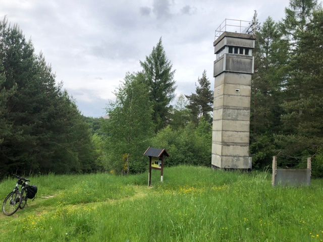
Ending at the 'forgotten border tower'. Yes, of course, it was forgotten up there in the middle of nowhere....
Once again, I took a pointless round in the forest to finally return to my starting point after some difficult ups and downs. But well, that's what I wanted.
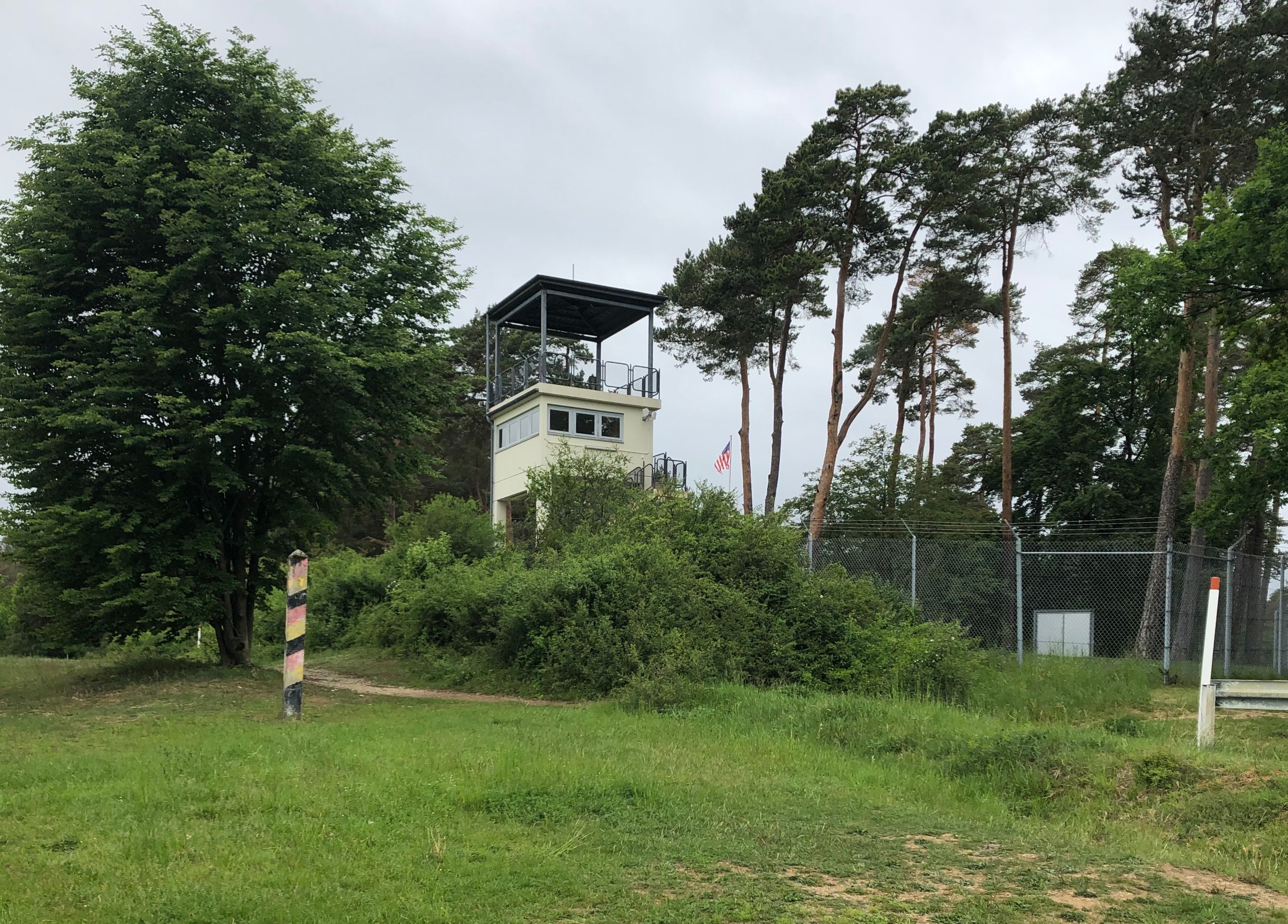
I finally reached my destination, Point Alpha, a US station right on the border, but not without great efforts. The Americans positioned themselves here to have a view of the largest possible area. Just 50 meters away stood a GDR border tower.
As announced, it started raining at 17:00, and the last hour was in the rain.
Back in Tann, I refilled water and immediately left; I didn't want to see the place anymore.
This time, the destination was Dankmarshausen. There I parked in the parking lot of a hotel that was designated as a motorhome parking lot, and I think my €10 were the only income of the day. There was no disposal, but there was electricity.
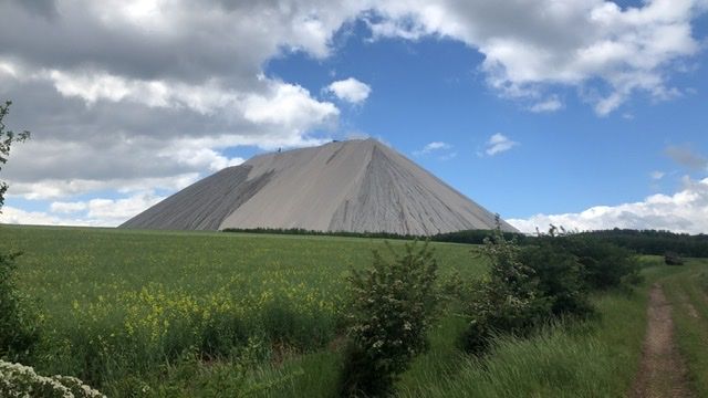
In the morning, I waited for the rain and set off in the late morning. Today's route is an S-shaped path around my parking spot. Simple - you would think. But right at the exit of the town, I took the wrong turn and my path led straight to the ubiquitous Monte Kali. I managed to bypass it quite elegantly, but I had to abandon the path to the excitingly named Witch Dance Square due to it being too steep and wet.
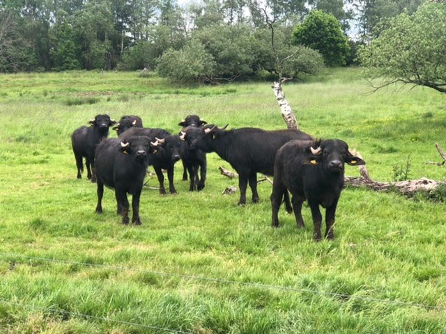
So, alternatively, I went downhill on the slippery Kolonnenweg towards Kleinensee. The path from there to Grossensee would have been quite interesting because the two villages are located right next to each other but were separated by the wall. However, since the border takes a big loop at this point, I decided to follow the border route: the most strenuous decision so far. At the end of Kleinensee, there is another very nice circular path that passes by Seubener Lake with grazing water buffalos.
At the exit of the village, a road continues behind the volunteer fire brigade along the border. The road was not particularly marked. At some point, it was just a path. It became very difficult. And eventually became impassable. A black-red-gold border post confirmed that I was still on the right track, but there was no more way.
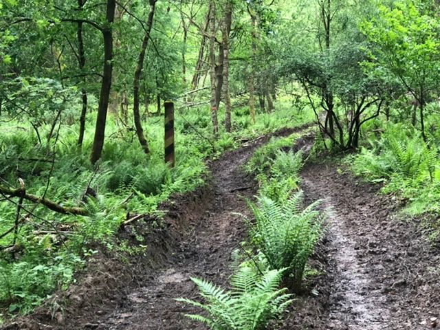
Well, turning back was not an option, so I continued. I knew the next road was not far away, but distance is relative when you're standing in the middle of the forest facing a slope...
After over an hour of maneuvering through the forest, I was finally back in civilization. As a reward, I climbed the Bodesruh observation tower. And the subsequent descent to Honebach was also challenging.
Border or no border, the way back was only on flat ground; all the hilly sections were eliminated, and so I returned to Dankmarshausen.
From there, I set off towards Eisenach, the next town with a laundromat.
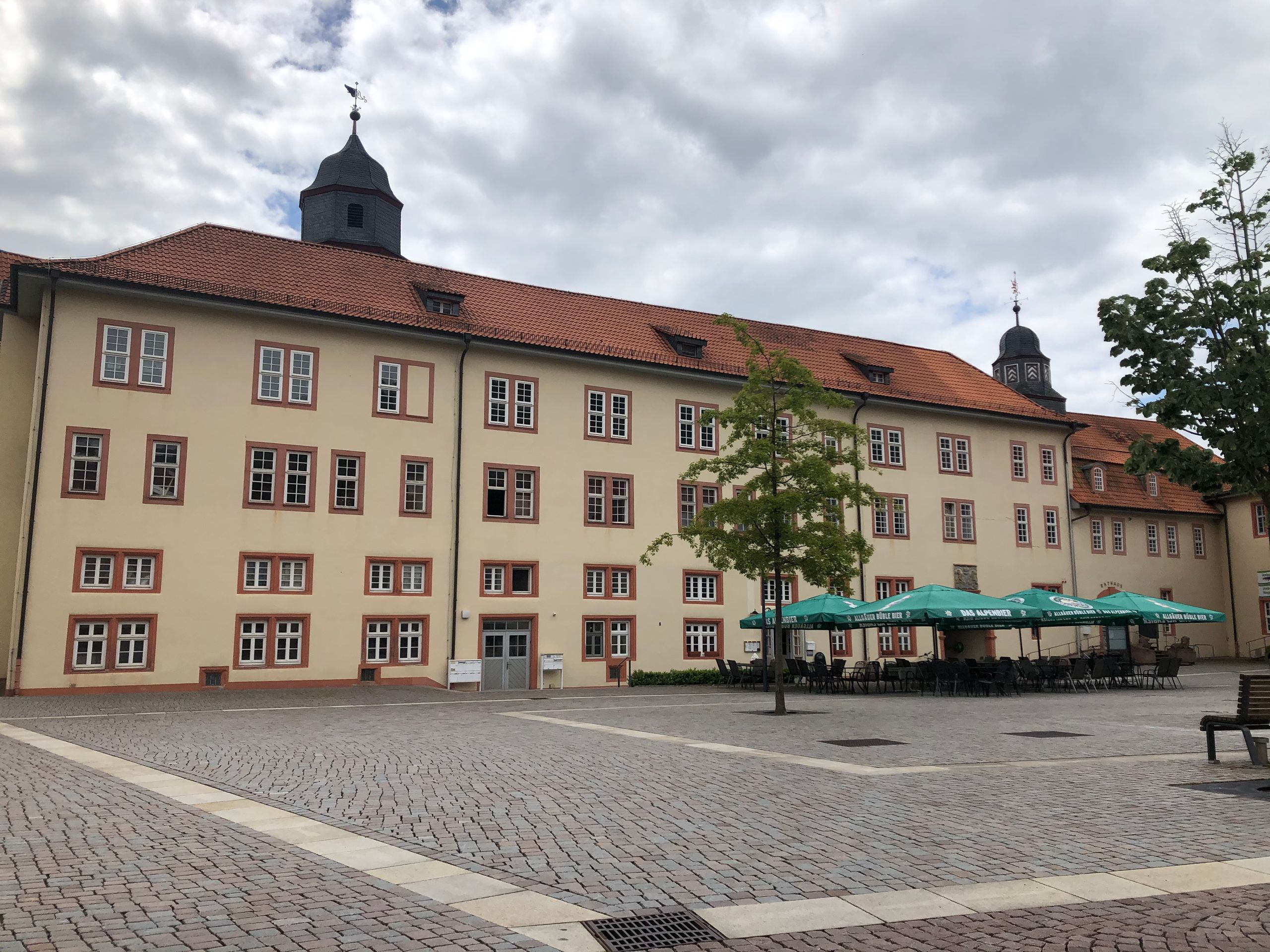
After breakfast at the laundromat and doing laundry, during the waiting time, I went to a barber for the first time in my life: fixing my Corona hairstyle and shaving. The barber fiddled with me as if he had never heard of Corona. Then I unloaded the laundry and bought myself a flask of double grain schnapps with the deposit from the Netto supermarket for disinfection. The cashier didn't bat an eye, but that's how the locals seemed to me as well. Strange town!
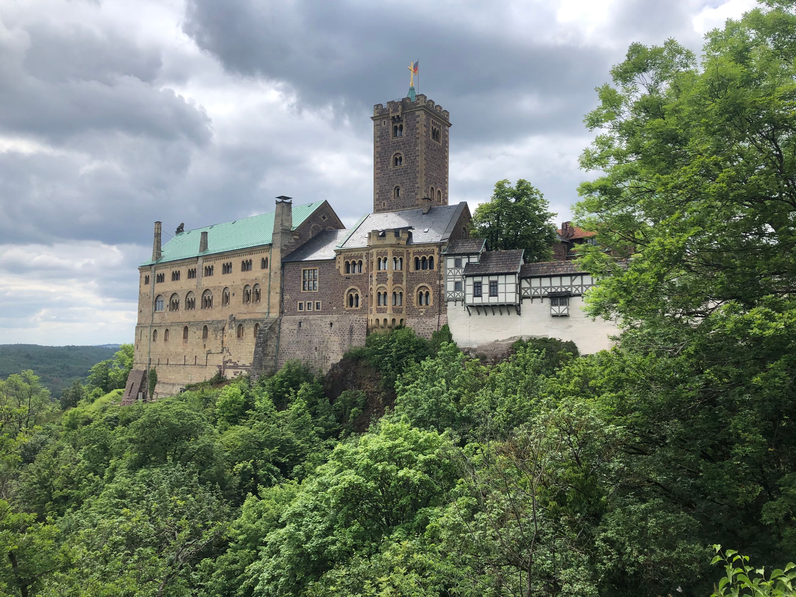
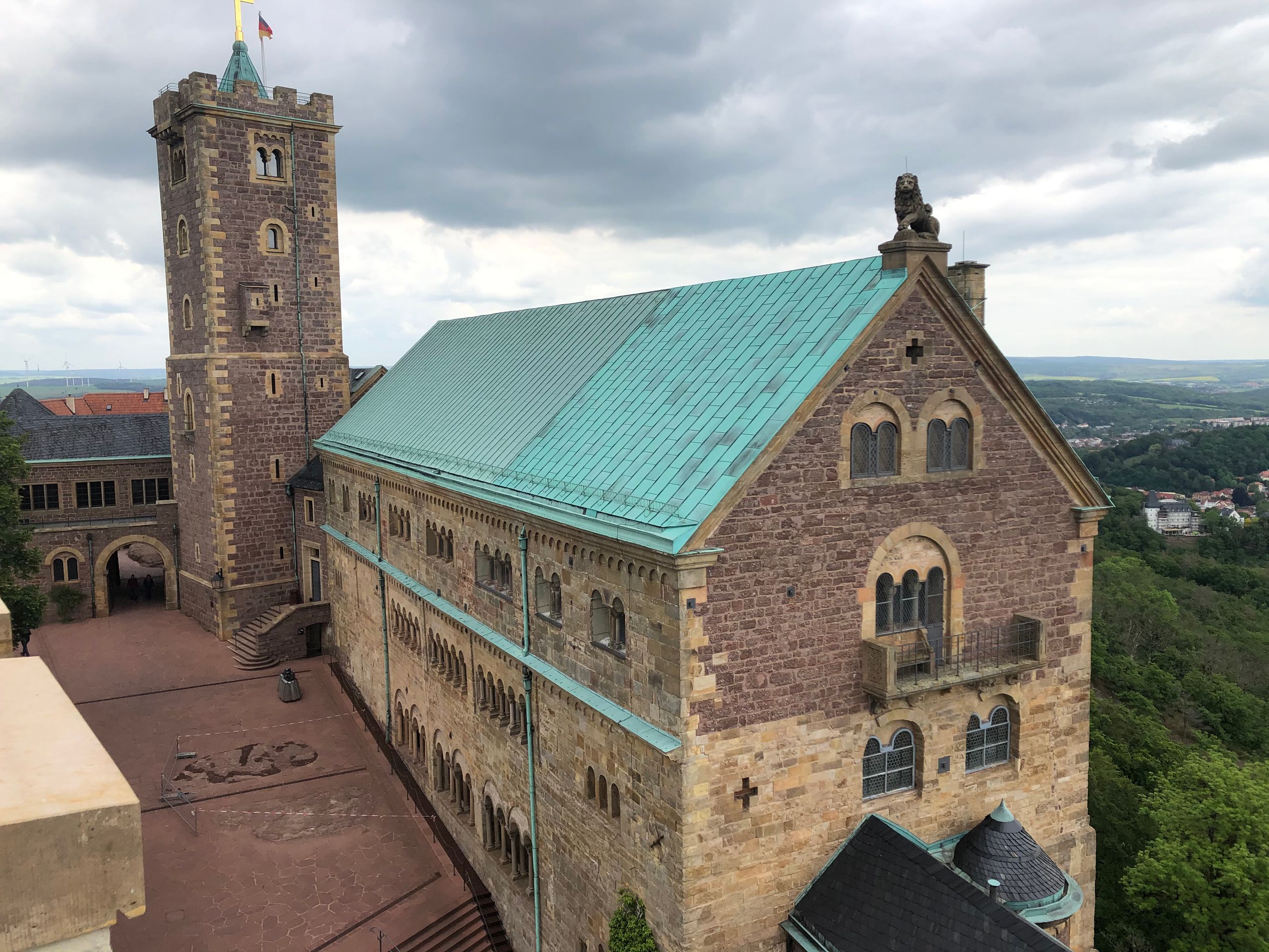
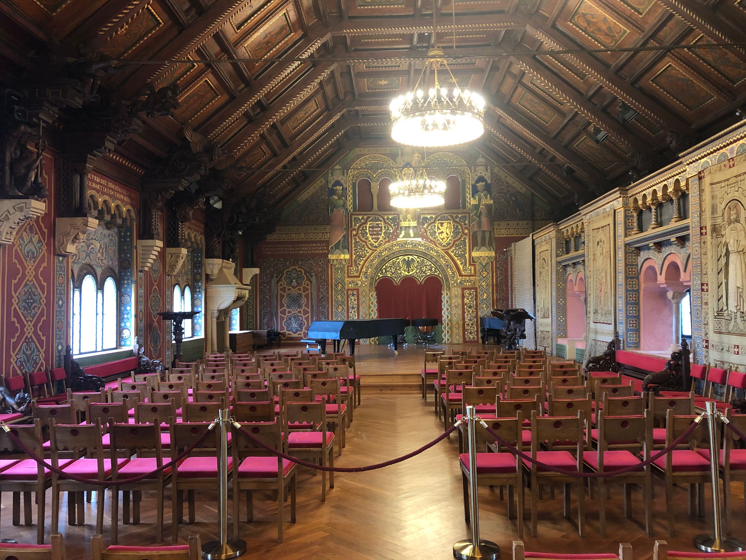
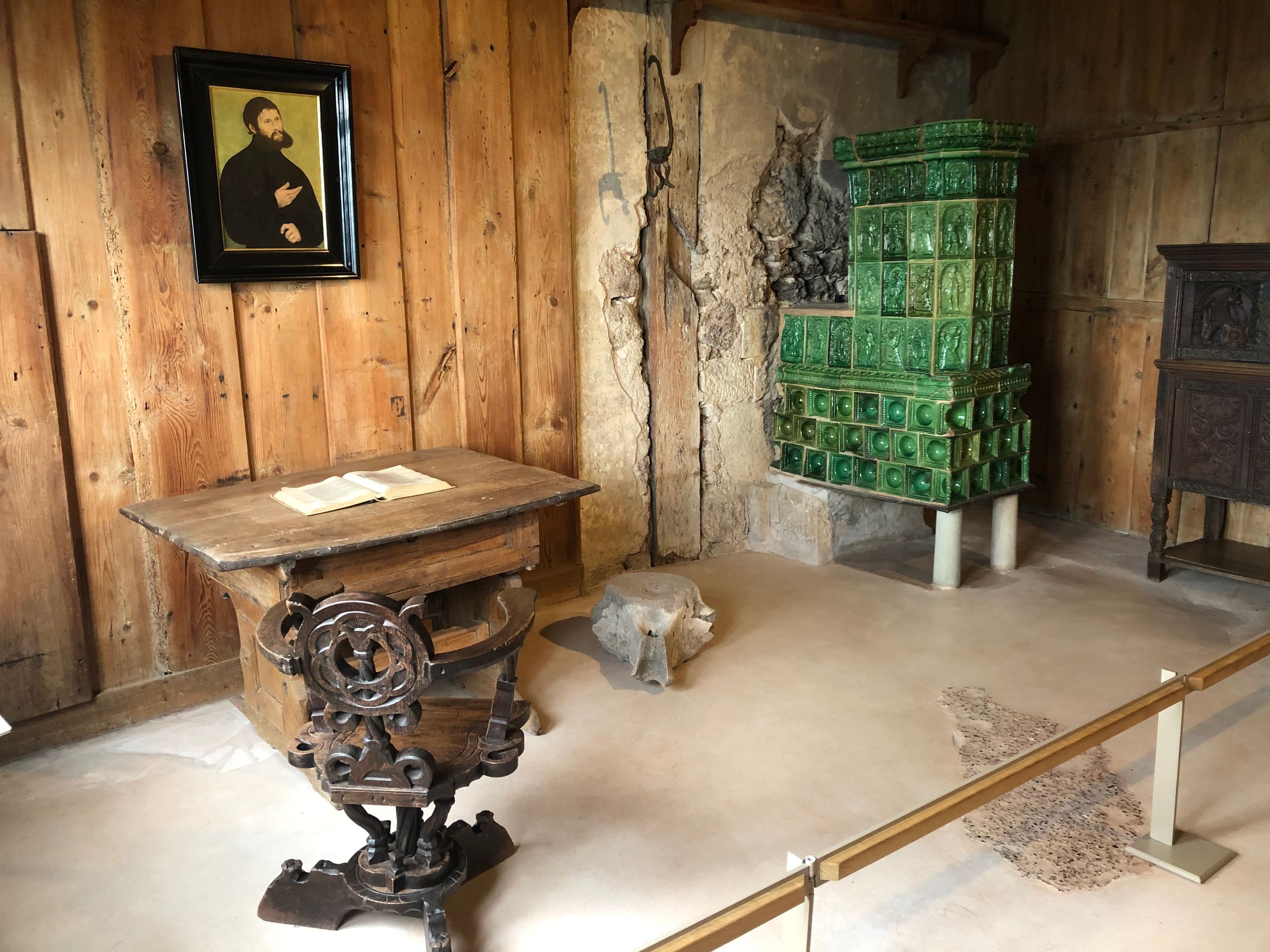
Anyway, up to Wartburg Castle and then into the Dragon Gorge. There is a hiking trail through the forest that has been converted into a one-way street due to Corona.
And off into the boonies again.
Treffurt was the destination on the half-timbered road. The route was the most beautiful of the entire tour, and the parking spot is on a meadow on the banks of the Werra with a view of Normannstein Castle.
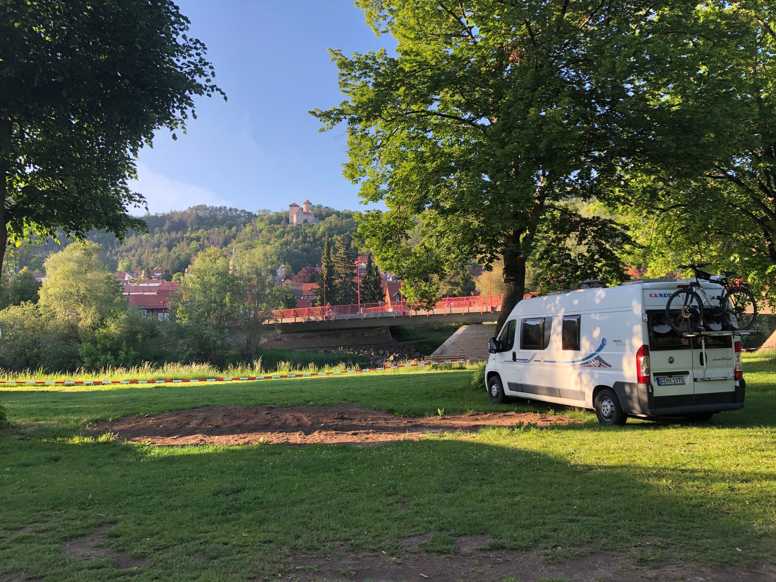
In addition to some other motorhomes, there is also a wandering circus staying here, which has to take a break due to Corona. I'm looking forward to tomorrow's tour through this magnificent area!
Treffurt, May 27th.
After a hearty breakfast, I headed from Treffurt to the border along the Werra.

But instead of following the border in a curve, I turned onto the hiking trail to Hedrastein.
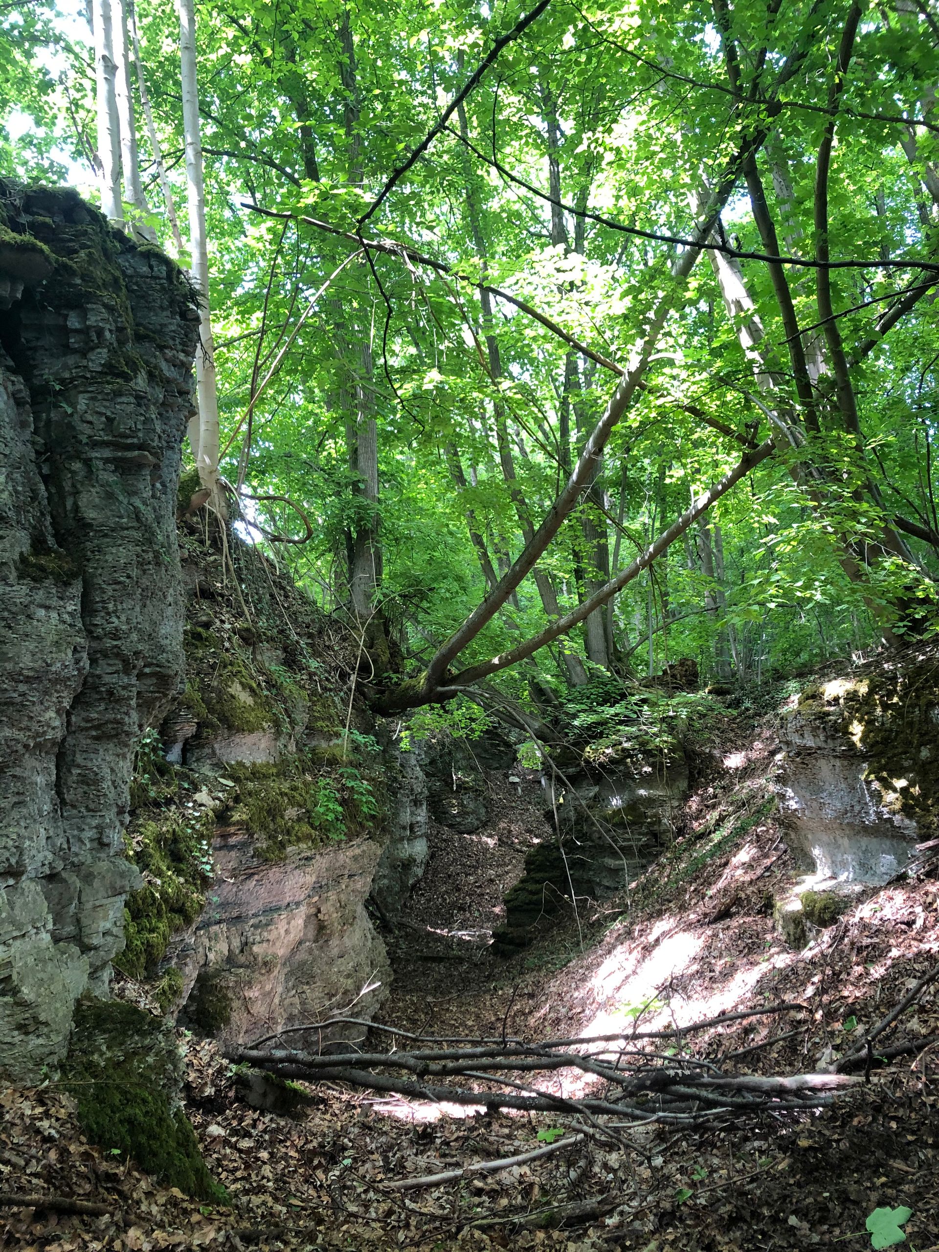
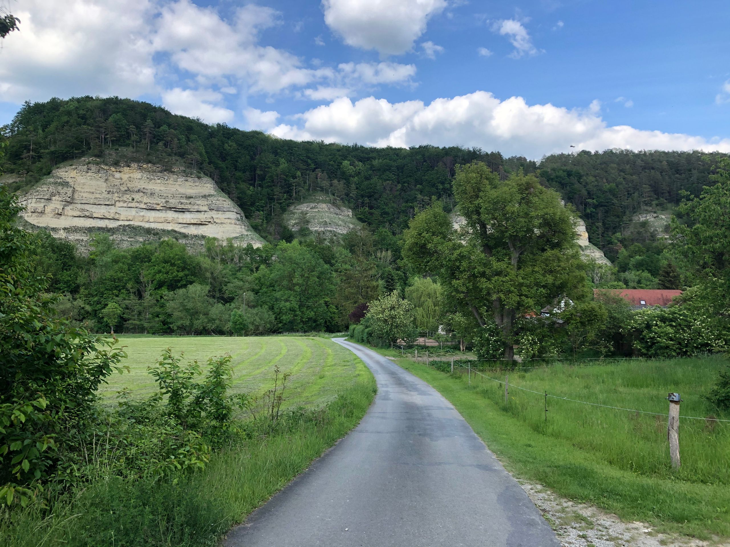
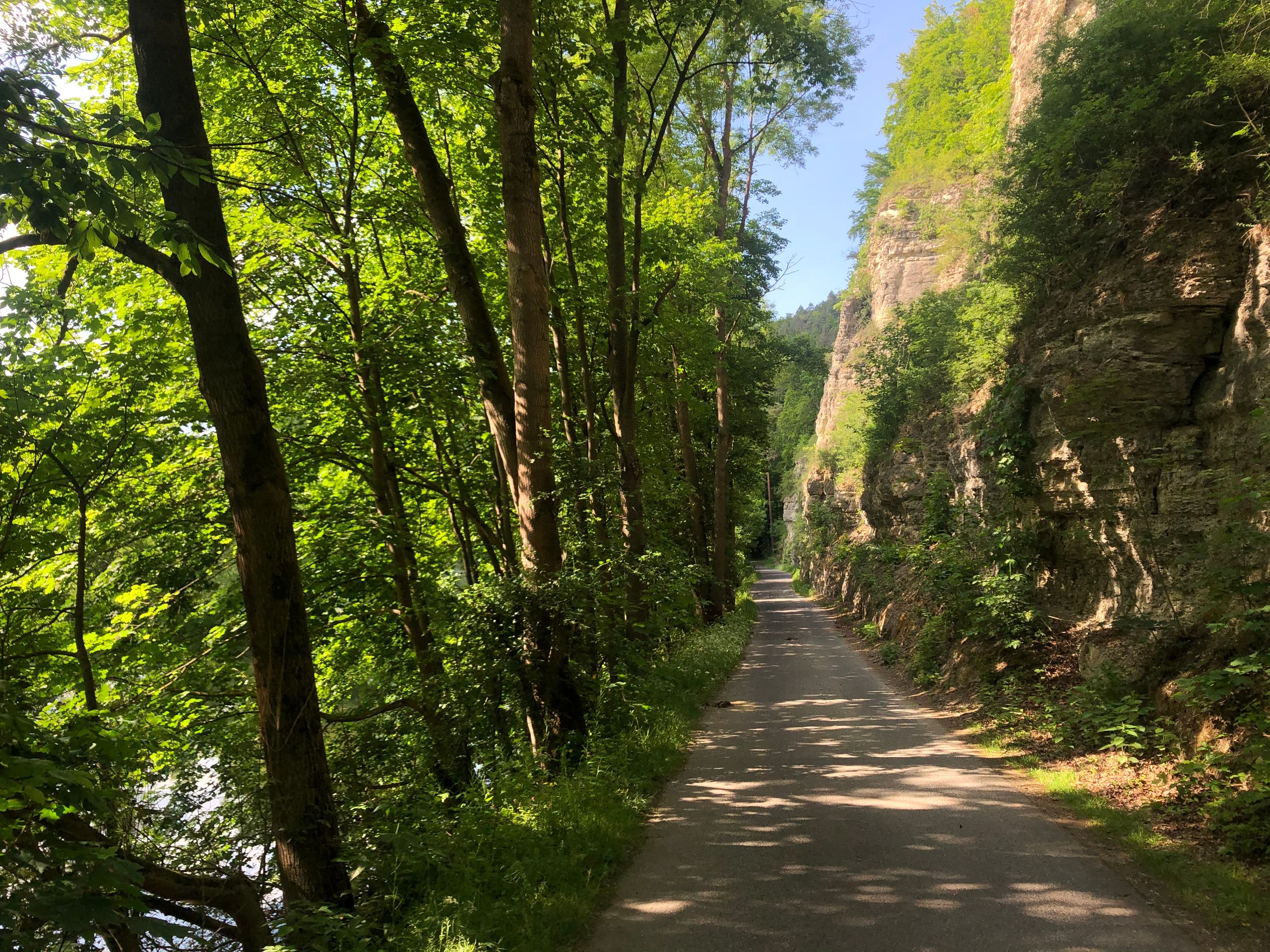
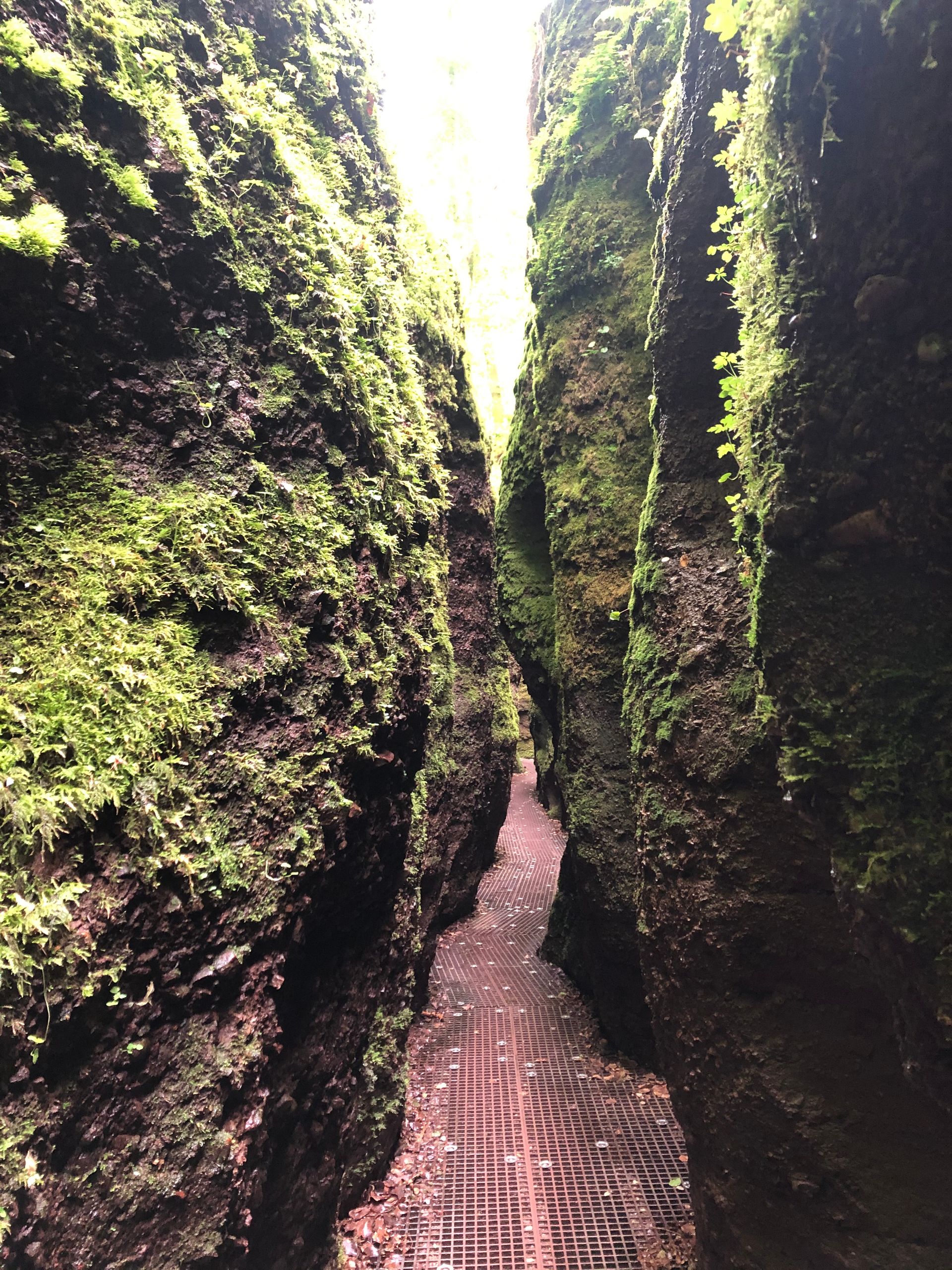
What a climb, and this time not because of the border route but because of the expected view and the special nature of the rock: parts of the mountain keep breaking off, resulting in especially rugged rock edges. During the ascent, I went through real gorges, exhausting but the view was worth it. I also climbed the Unity Tower standing on top: if you go up high, then all the way up!
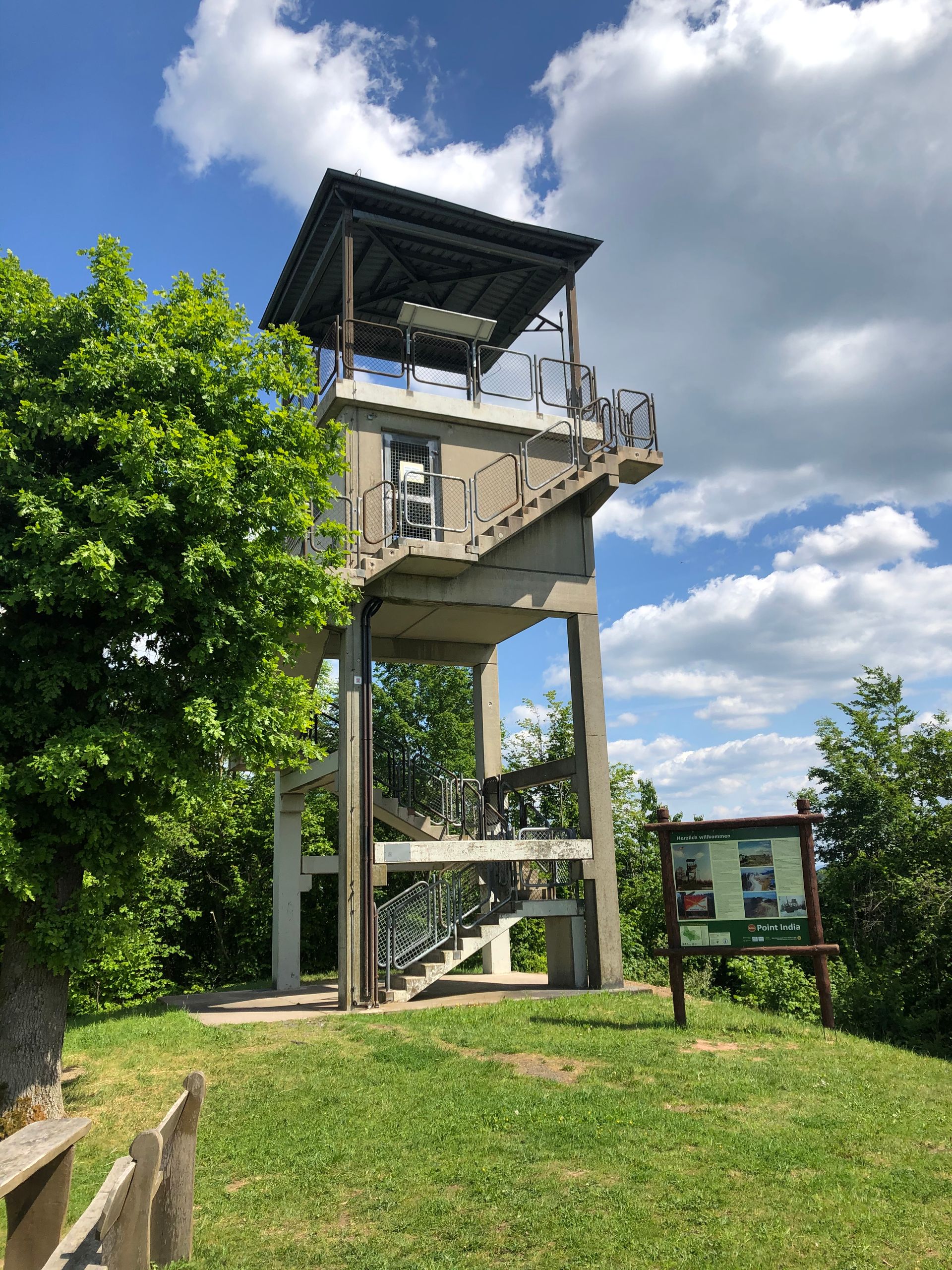
On the descent towards Ifta, I made another stop at one of the 4 American observation posts: Point India. Then on to Ifta, but there I gave up when it started to go steeply uphill towards the border. Instead of continuing to Herleshausen, I took the beautiful Werra Valley cycle path back to Treffurt.
In the evening, I took a detour to Kassel and had a very nice evening at a Spanish restaurant.
Here is the link to the last part of the journey:
https://vakantio.de/das-grune-band/das-grune-band-teil-drei
Ingwadiše go Lengwalo la Ditaba
Karabo