

20.-22.03. - Haines Junction, Yukon
प्रकाशित: 23.03.2023

बातमीपत्राचे सदस्य व्हा
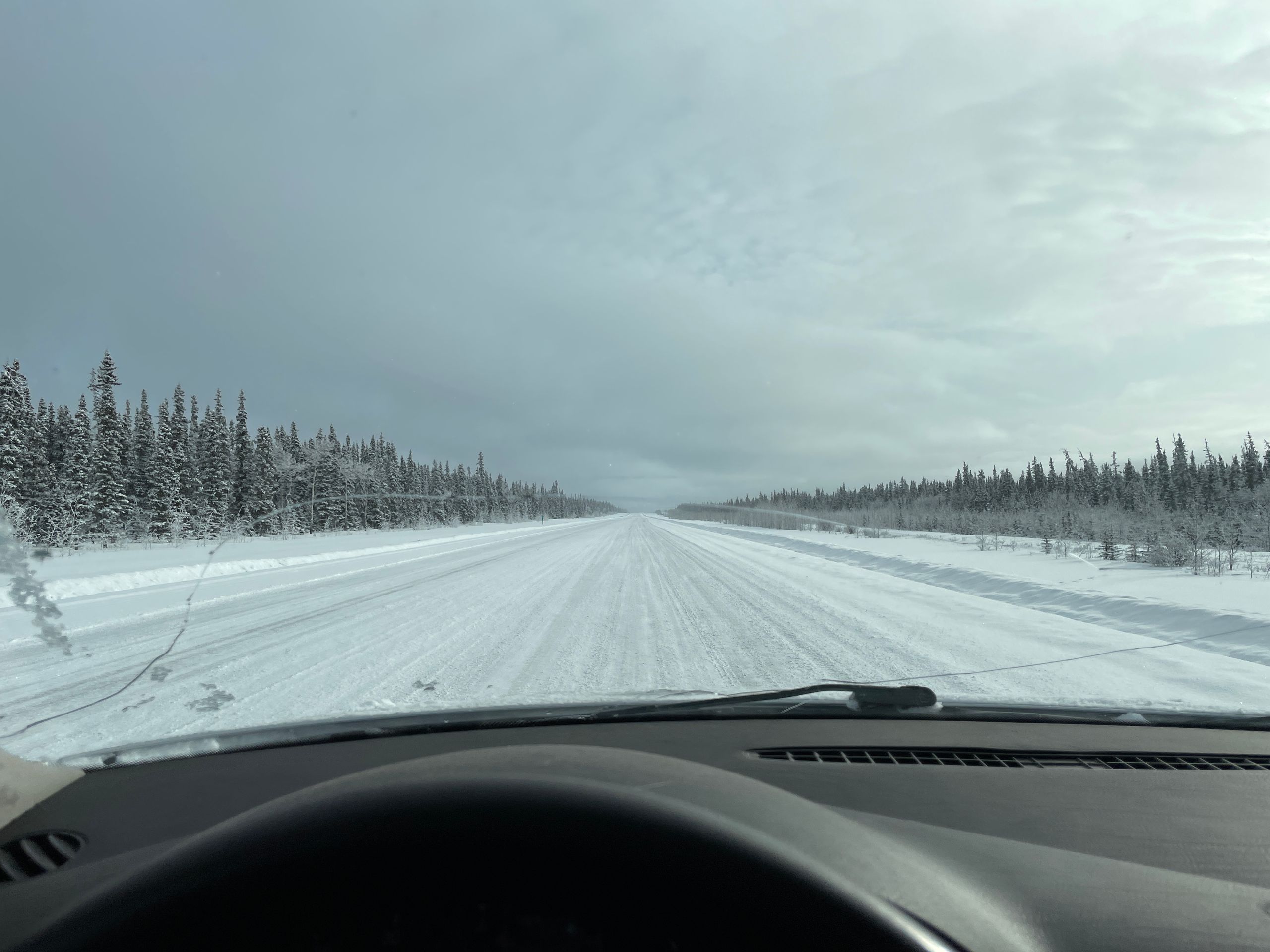
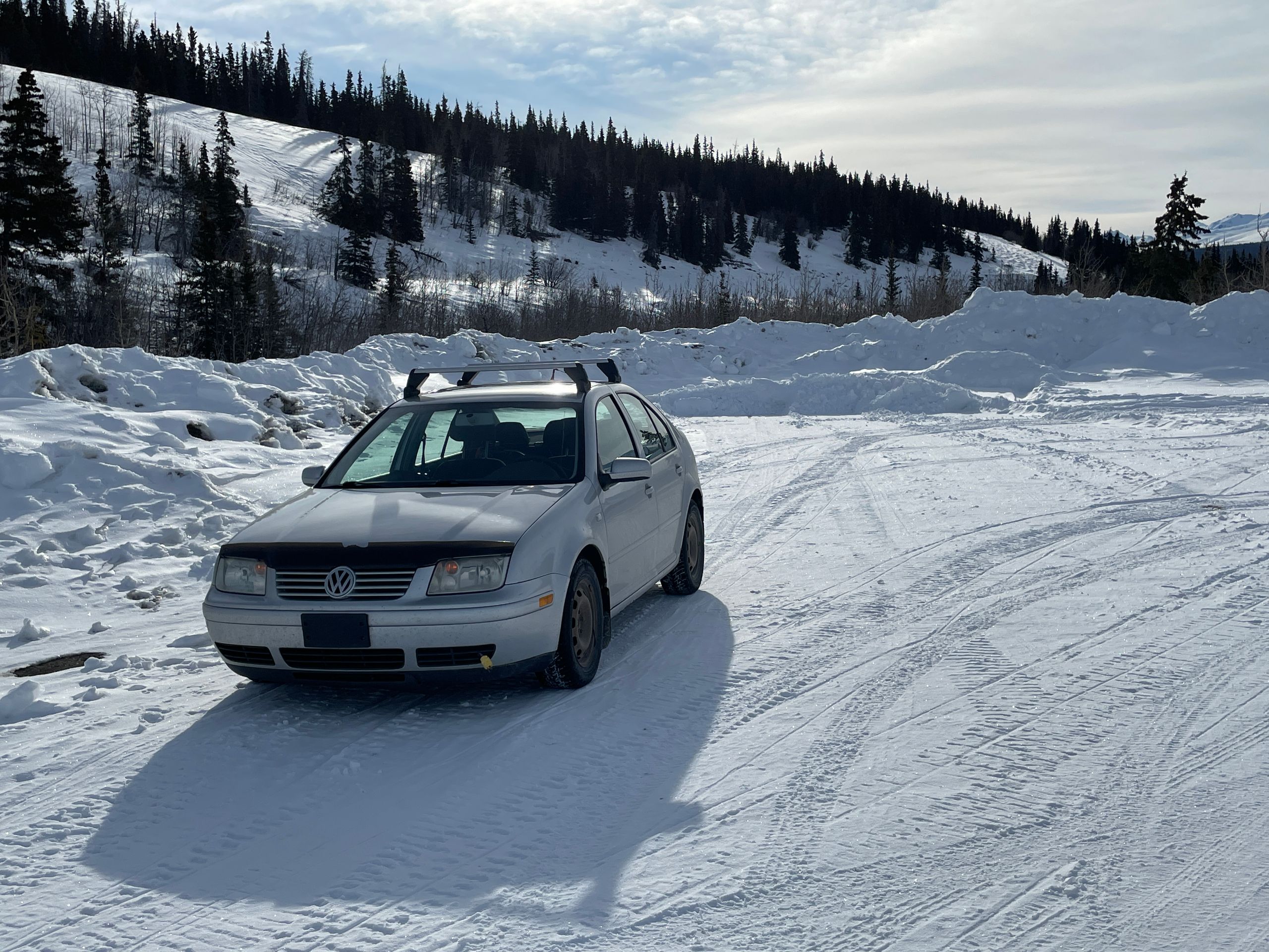
In the following days, we focused on exploring the Yukon. Or at least our immediate surroundings, since the Yukon is almost 130,000 km² larger than Germany in terms of area, but only has about 40,000 inhabitants. Of these 40,000, about 25,000 people live in the capital city of Whitehorse, while the remaining 15,000 live in villages (the largest of which has about 1,300 inhabitants) or simply in the middle of nowhere. This fact makes city sightseeing difficult here (in Haines Junction, where we live, there are about 600 people, a small grocery store, a chapel, a diner, two gas stations, and not much else). In general, this region is very suitable for hiking and mountaineering in the summer (June/July-September). However, due to the current season, this is currently difficult. In winter, you can go cross-country skiing or snowmobiling here. At least, if you have the necessary equipment. We have 3 snowmobiles on our property, but we are not allowed or supposed to ride them. So that's out of the question. Furthermore, we have 2 pairs of cross-country skis, but only one pair of poles of the appropriate size. We have more poles, but they are only suitable for downhill skiing. So only one person can go cross-country skiing at a time. However, we have 2 pairs of snowshoes, actual snowshoes, not skis. So we decide to go snowshoeing for the next 3 days.
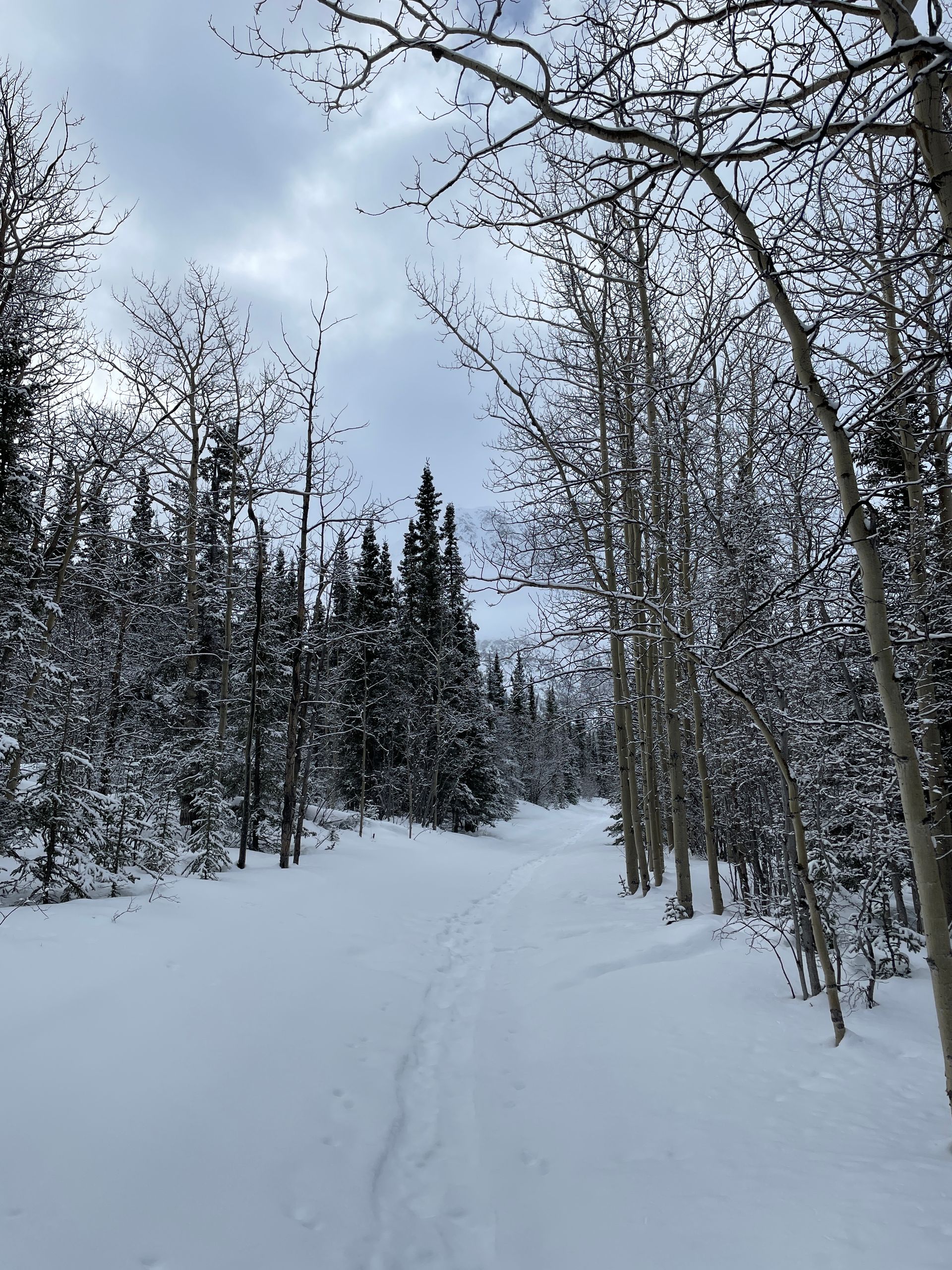
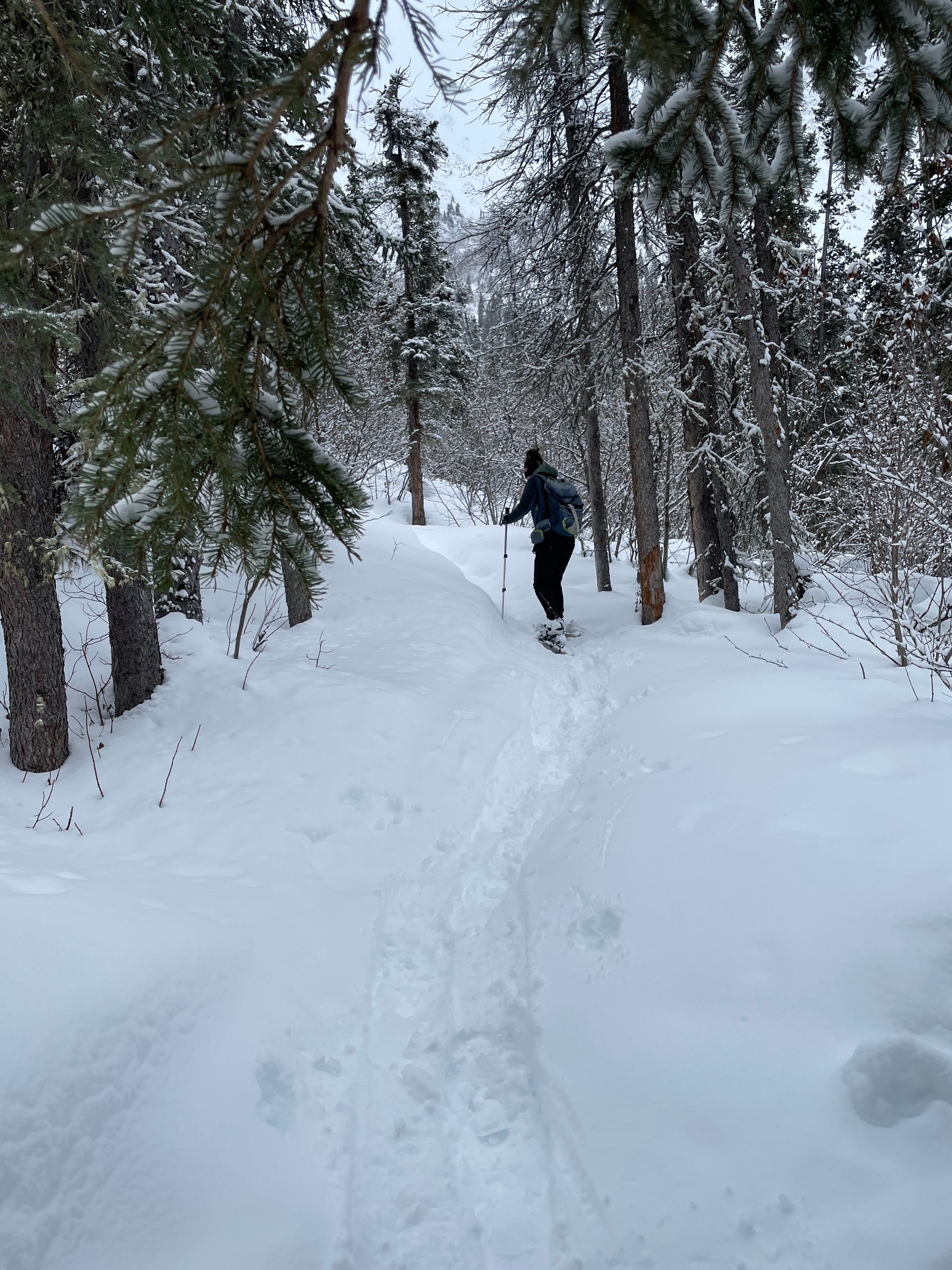
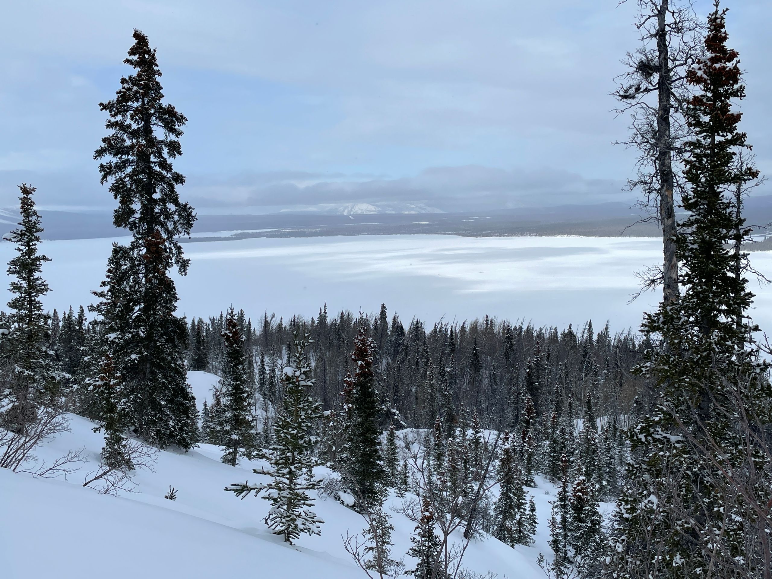
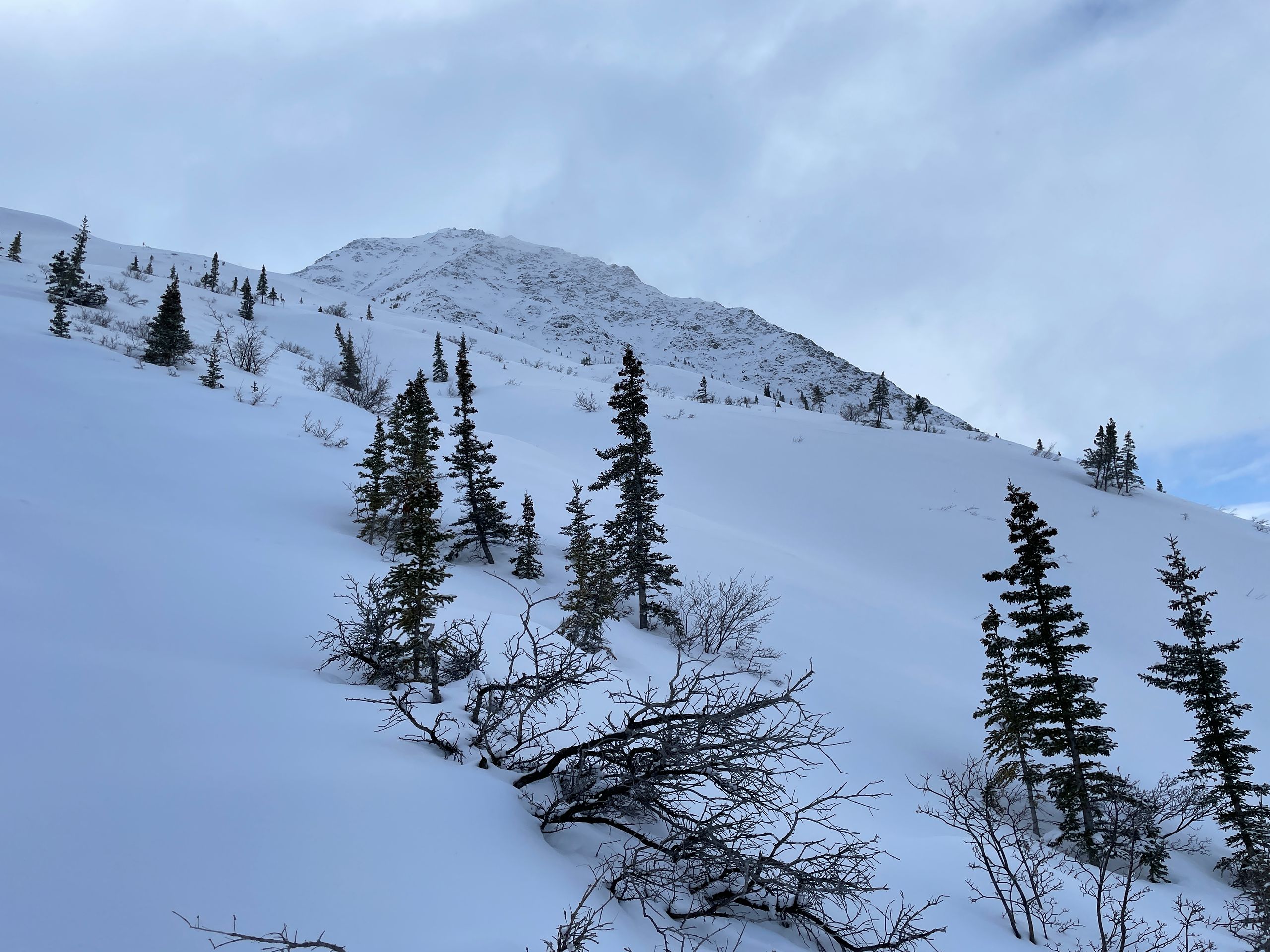
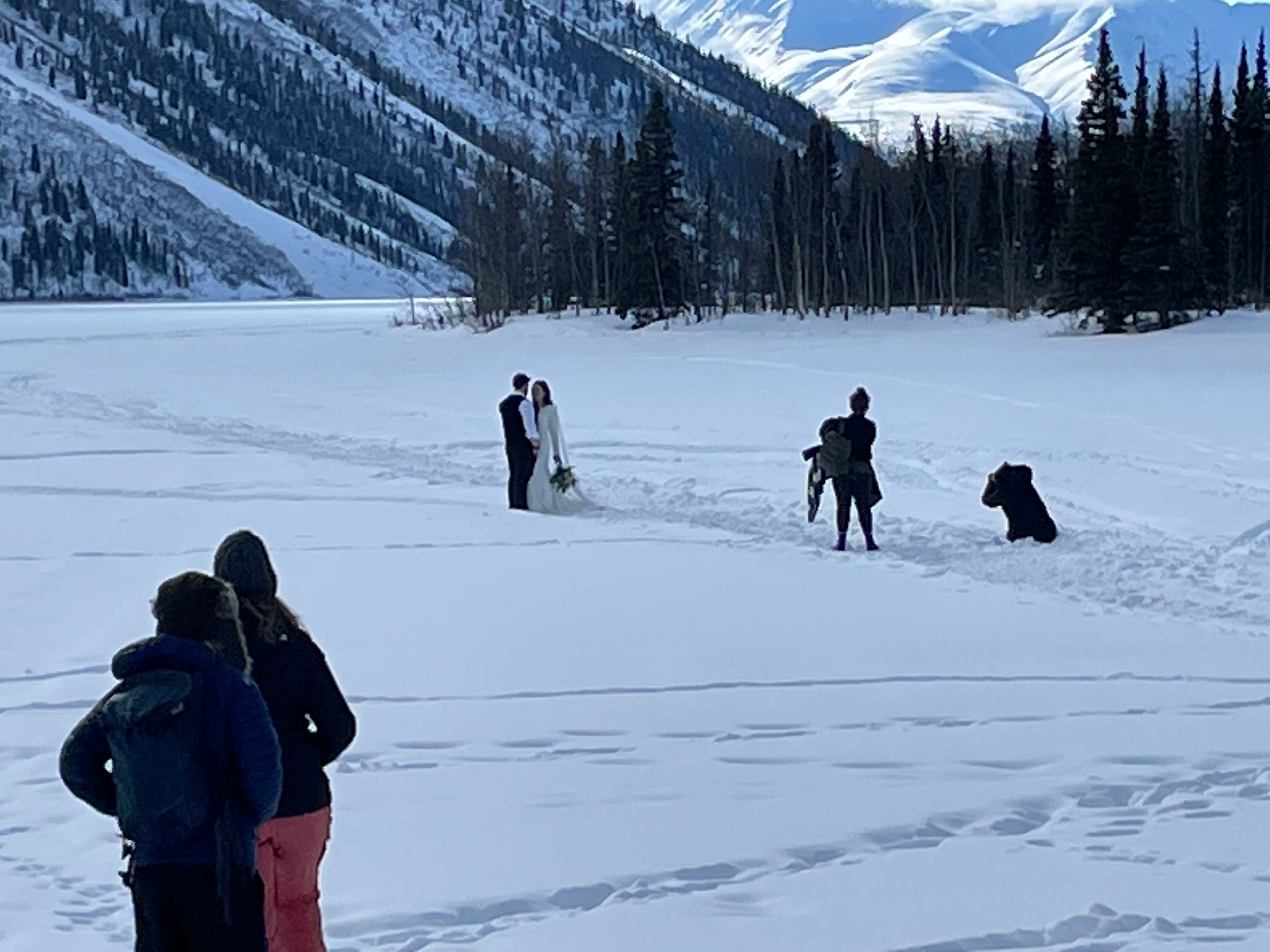
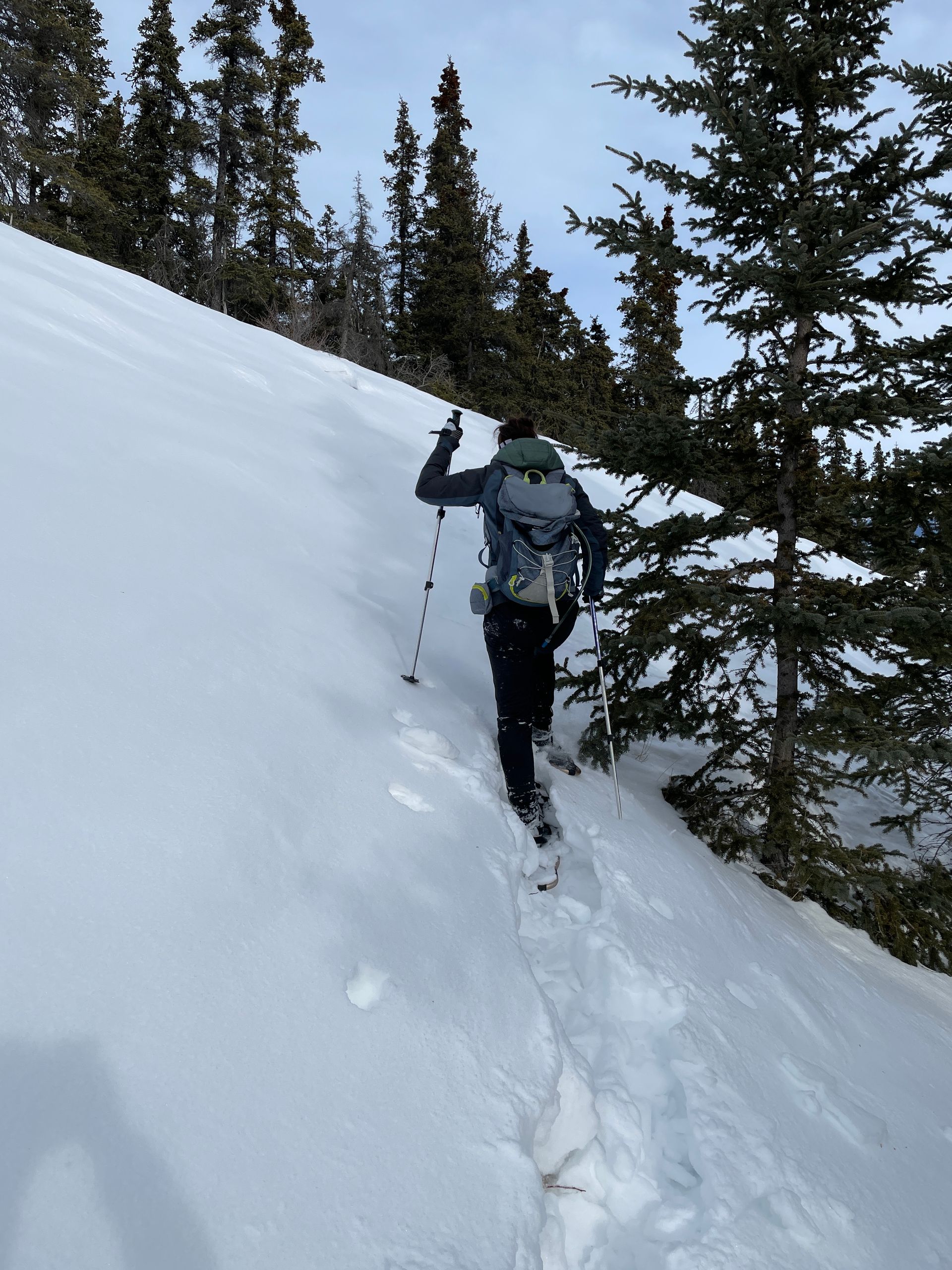
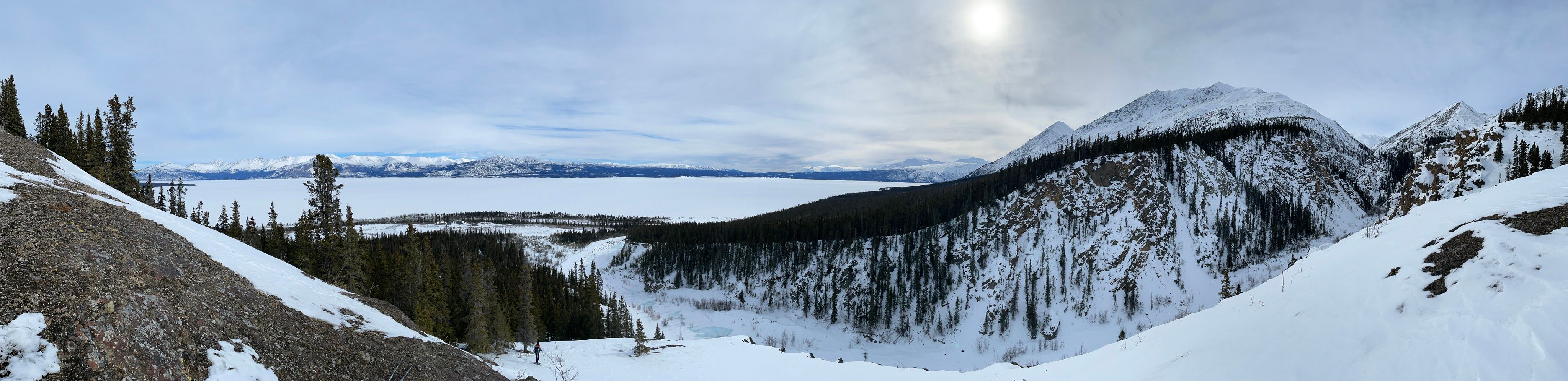
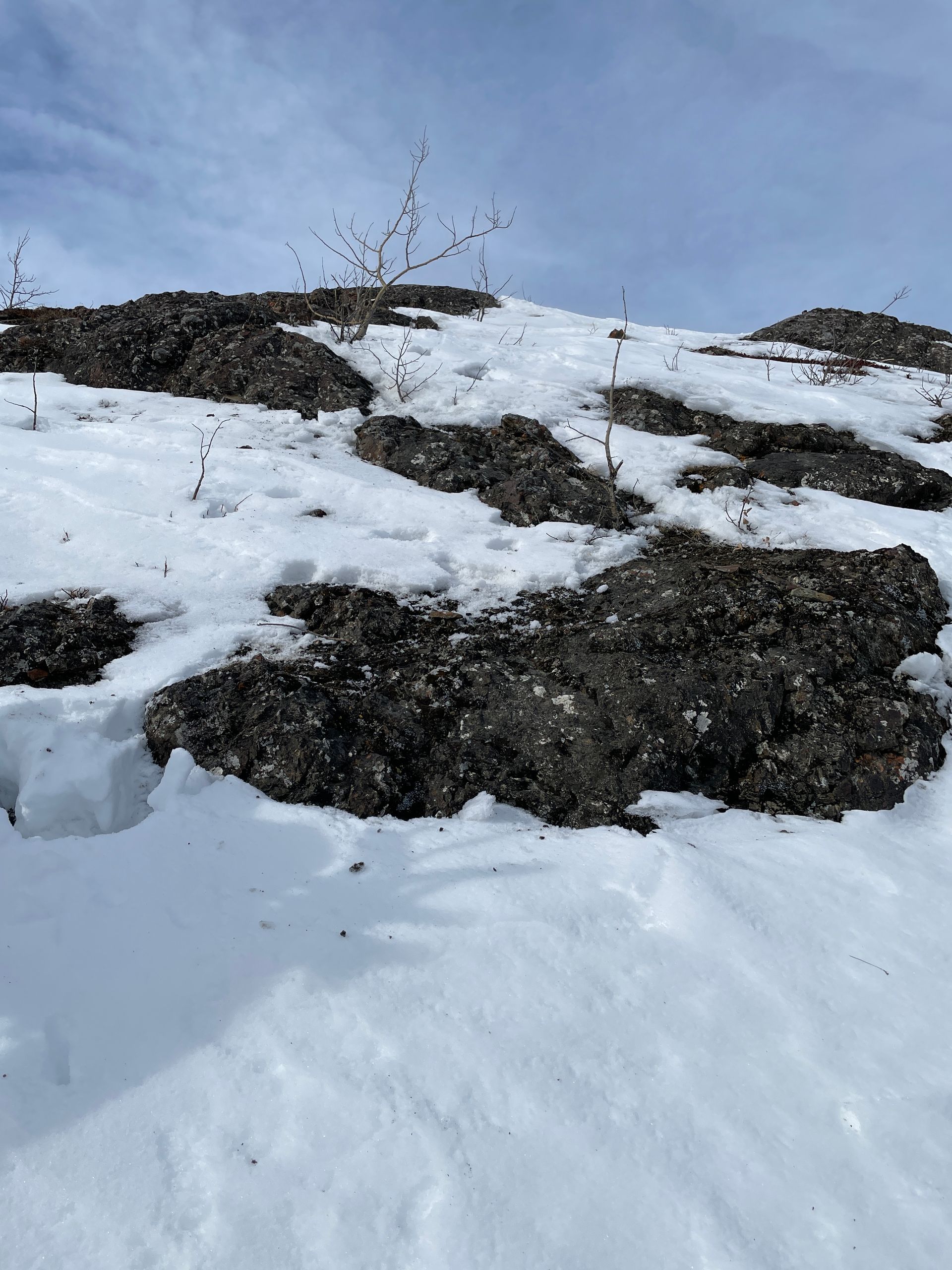
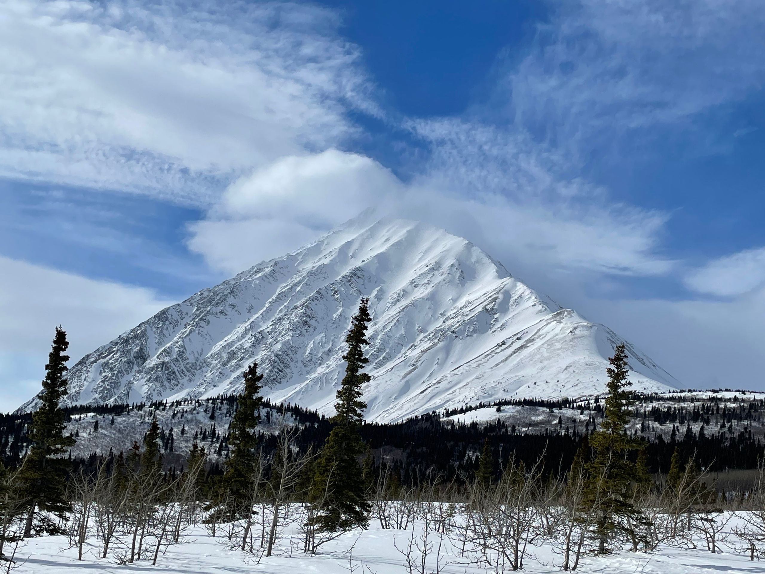
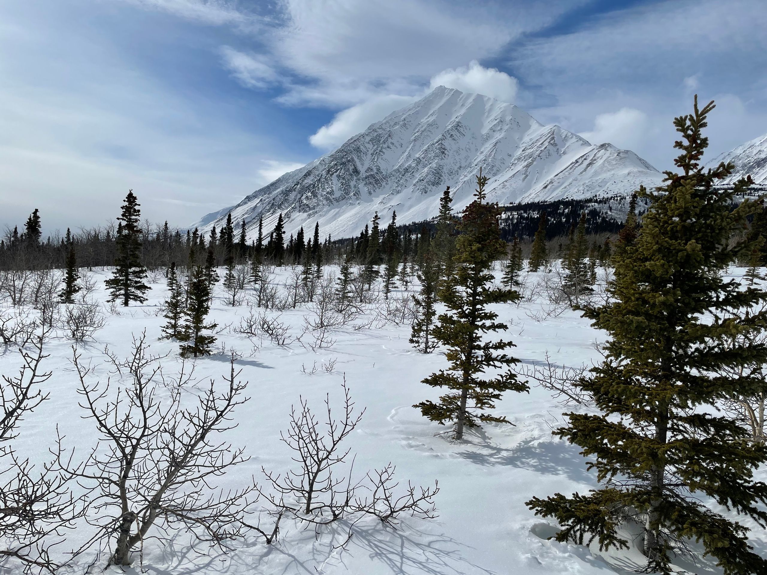
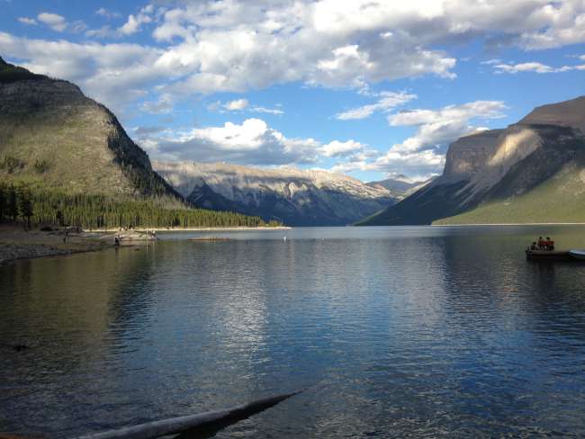
On March 20th, we drive to Kathleen Lake, where there are several trails in the summer that - we hope - can also be done in the winter. We haven't chosen a specific trail and see what we like best. Once we arrive, we notice the King's Throne Trail, which can potentially be extended to the summit of King's Throne. This mountain is almost 2,000 m high, and the lake is at about 750 m, so there are 1,250 meters of elevation gain from the lake to the summit over a distance of about 8 km. The actual trail is about 5.5 km long (one way) and covers almost 1,000 meters of elevation gain. So far, so good. We start in the forest and continue on a fork towards King's Throne (the other way would have been the Cottonwood Trail, which is a total of 85 km long and done in 4-6 stages - in a tent). We walk slowly through deep snow, so it's time to put on the snowshoes. That works and we make good progress. Slowly but steadily, the terrain becomes noticeably steeper, and we can hardly find any traces of previous hikers in the snow. However, we can still make out the trail pretty well, and slowly we enter the tree line and have a fantastic view of Kathleen Lake at our feet. We continue a little further and decide to take a short break in the tree line and eat the sandwiches we brought. Then we continue our tour and have difficulties finding the trail. Normally, the trail should lead up the considerably steep slope in switchbacks, but we sink into the snow up to our knees and hear the alarming sound of "whump" frequently, as if the snow pack beneath us is starting to slide. We study the slope and notice some thin, horizontal cracks in the snow pack (so-called shooting cracks). We continue searching for the trail, but the "whump" sounds don't diminish. We gradually realize that the risk of avalanches should not be underestimated here. So we turn around and start heading back down. On the way down, we take a detour onto the Cottonwood Trail, which is relatively monotonous, and we return to the lake. There is a wedding taking place here, so our planned snowshoe tour across the (approximately) 1.2 m thick frozen lake unfortunately doesn't happen. Back home, we research the avalanche situation on the mountain. Unfortunately, there are no real websites with avalanche forecasts here, and there is no classification into danger levels either. Based on our research, we had a level 3-4 avalanche warning (out of 5), with a slope angle between 30 and 35°. In hindsight, this was a pretty foolish and reckless action, but thankfully it turned out well for us.
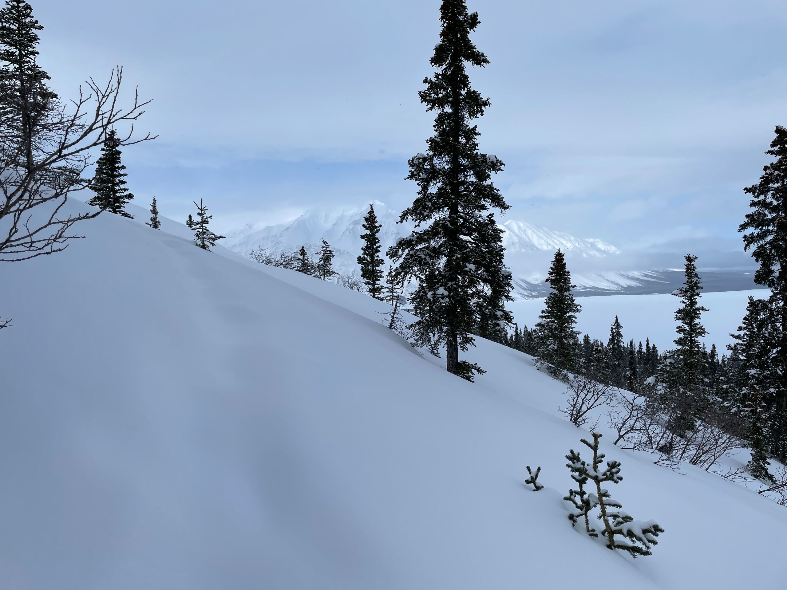
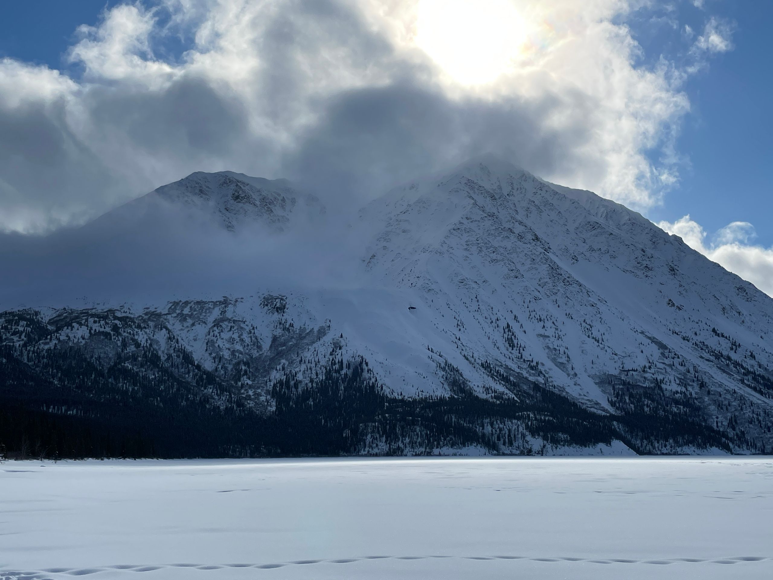
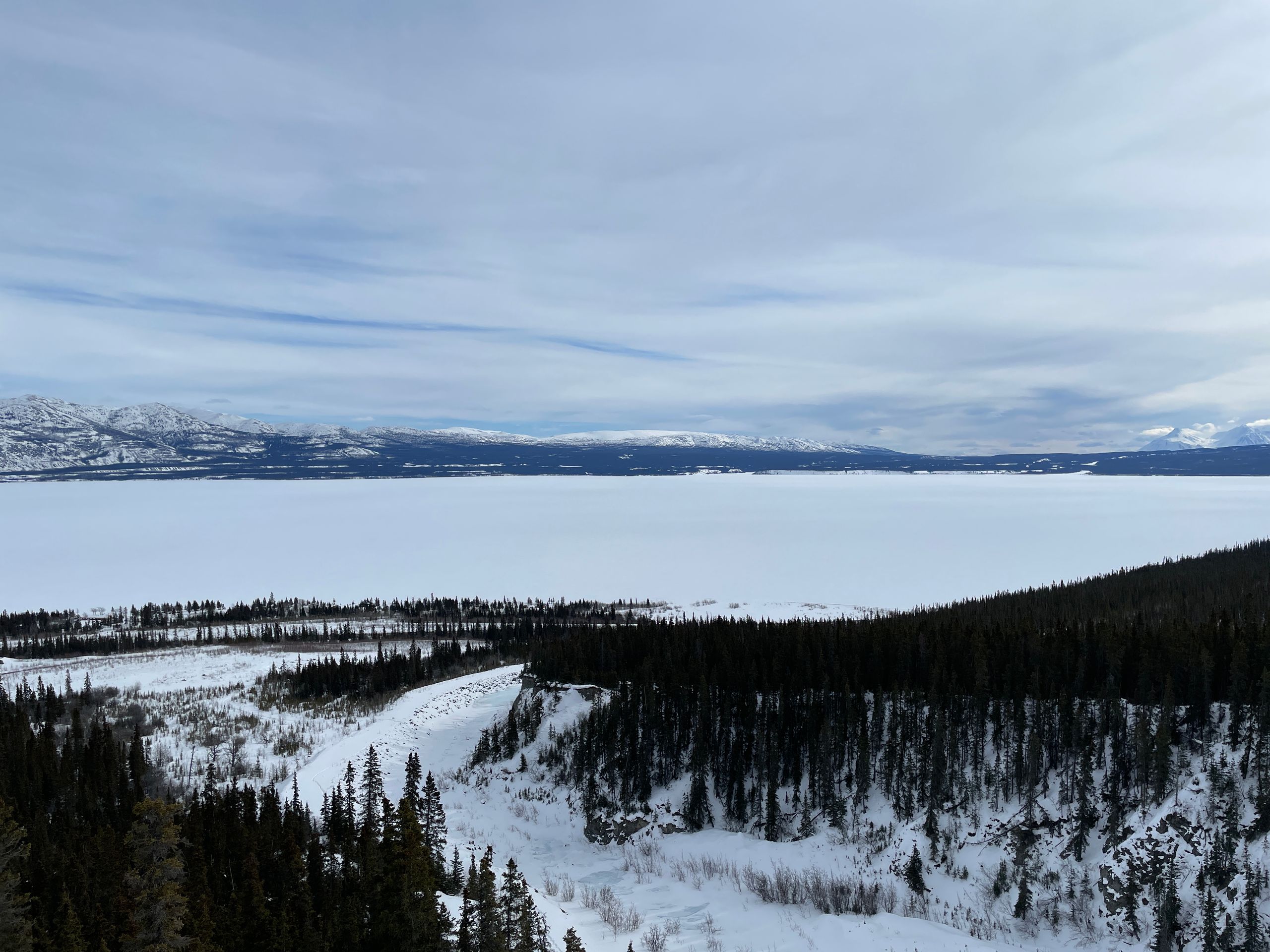
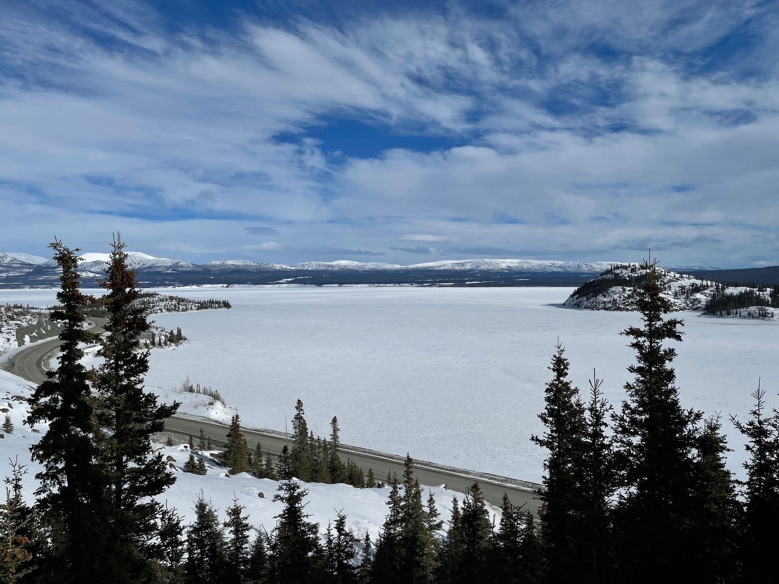
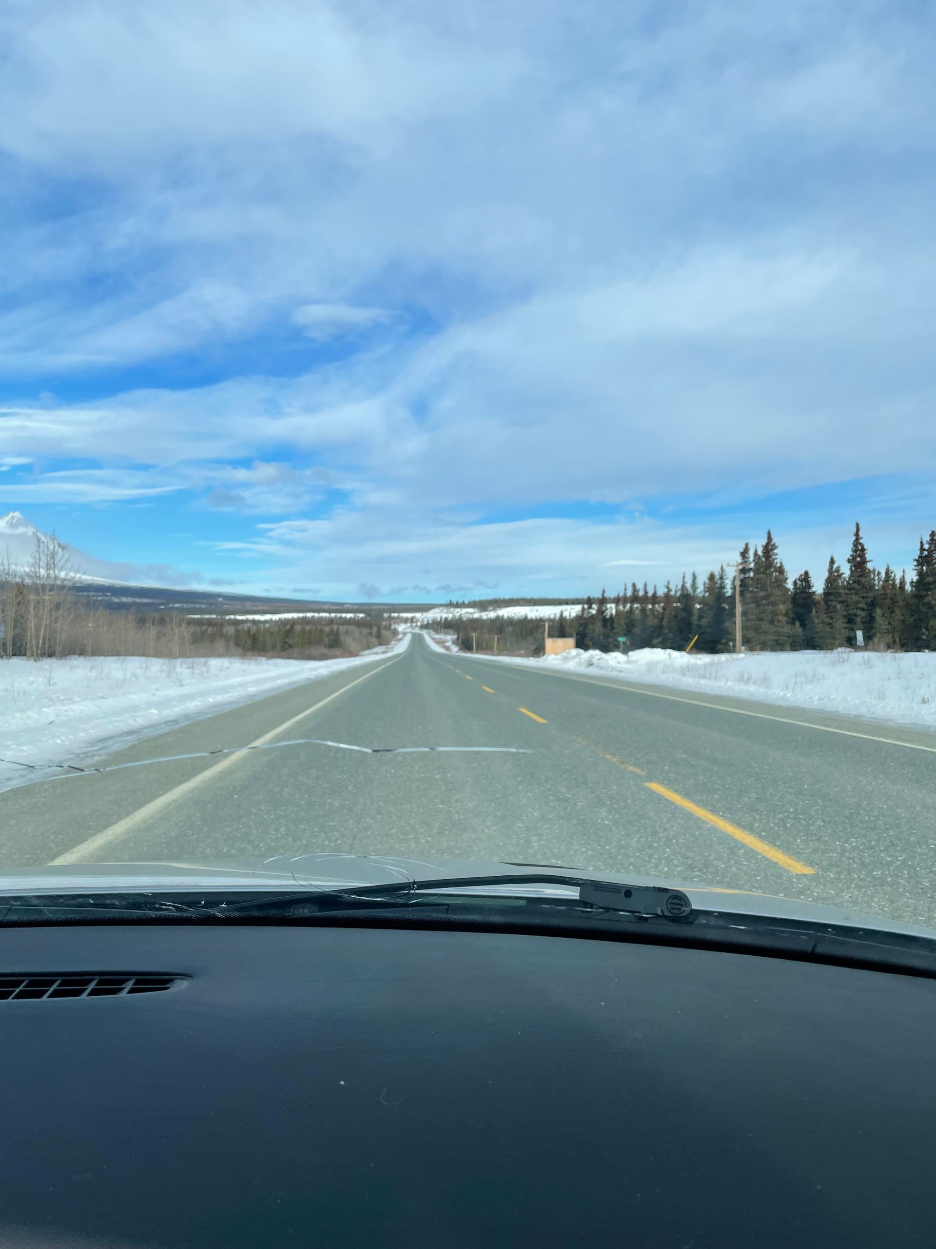
On March 21st, we therefore decided to go on a trail that runs more in the valley and only gains about 200 meters of elevation - the Williscroft Creek Trail. At least, that was the plan. We drove to Kluane Lake, the largest lake in the Yukon at 405 km², and started on the trail located here. There are no tracks here at all, and we have to struggle through knee-deep snow, often even deeper, with our snowshoes. It's quite exhausting. However, since walking uphill is more fun than just walking straight, and the avalanche situation in this area is different due to snow quality and slope characteristics compared to the previous day, we deviate from the trail and hike up some significantly steep slopes. In switchbacks, as it would be too steep to go straight up. In between, there is also a small rock cliff to overcome, for which we take off our snowshoes and climb the rocks. We are rewarded with a breathtaking view of Kluane Lake and the surrounding mountains. Eventually, we can only continue through impenetrable forest, and we cannot go any further. So we start descending. Afterwards, we visit the nearest 'town' (Destruction Bay, 55 inhabitants, a gas station with a restaurant, some cabins, and that's it) and on the way back, we take the Soldier Summit Trail, which only gains 90 meters of elevation and has some information signs about the construction of the Alaska Highway.
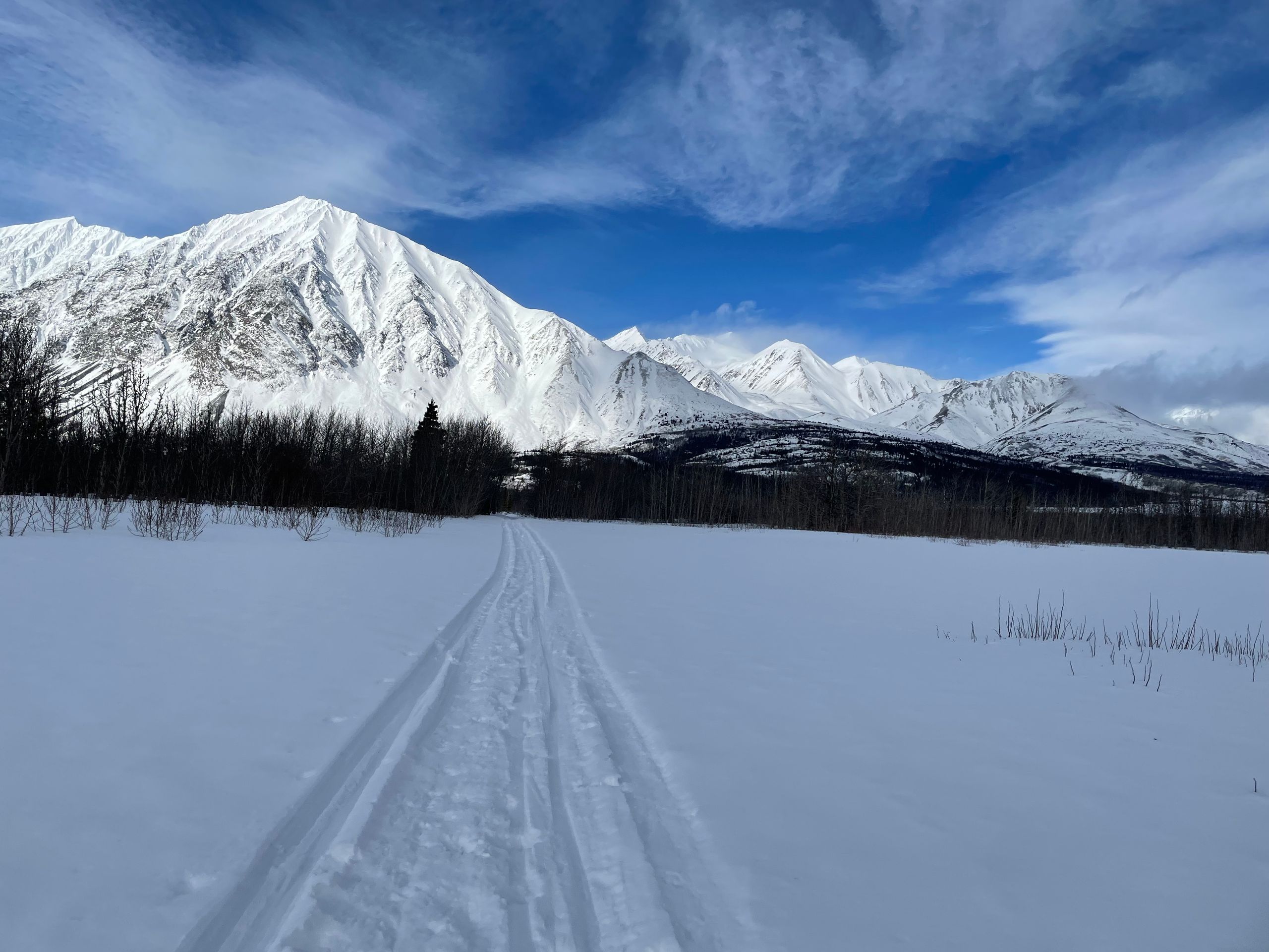
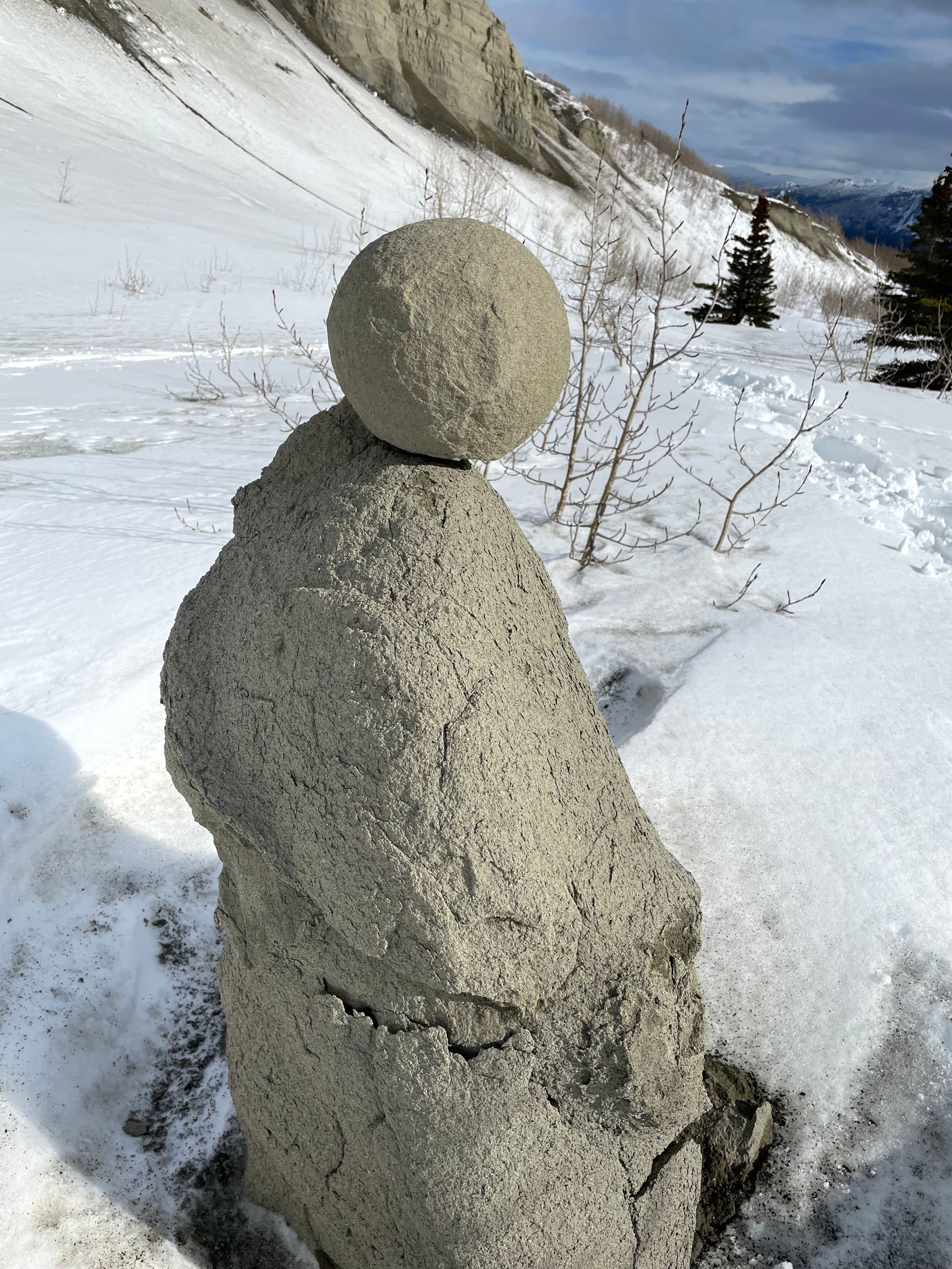
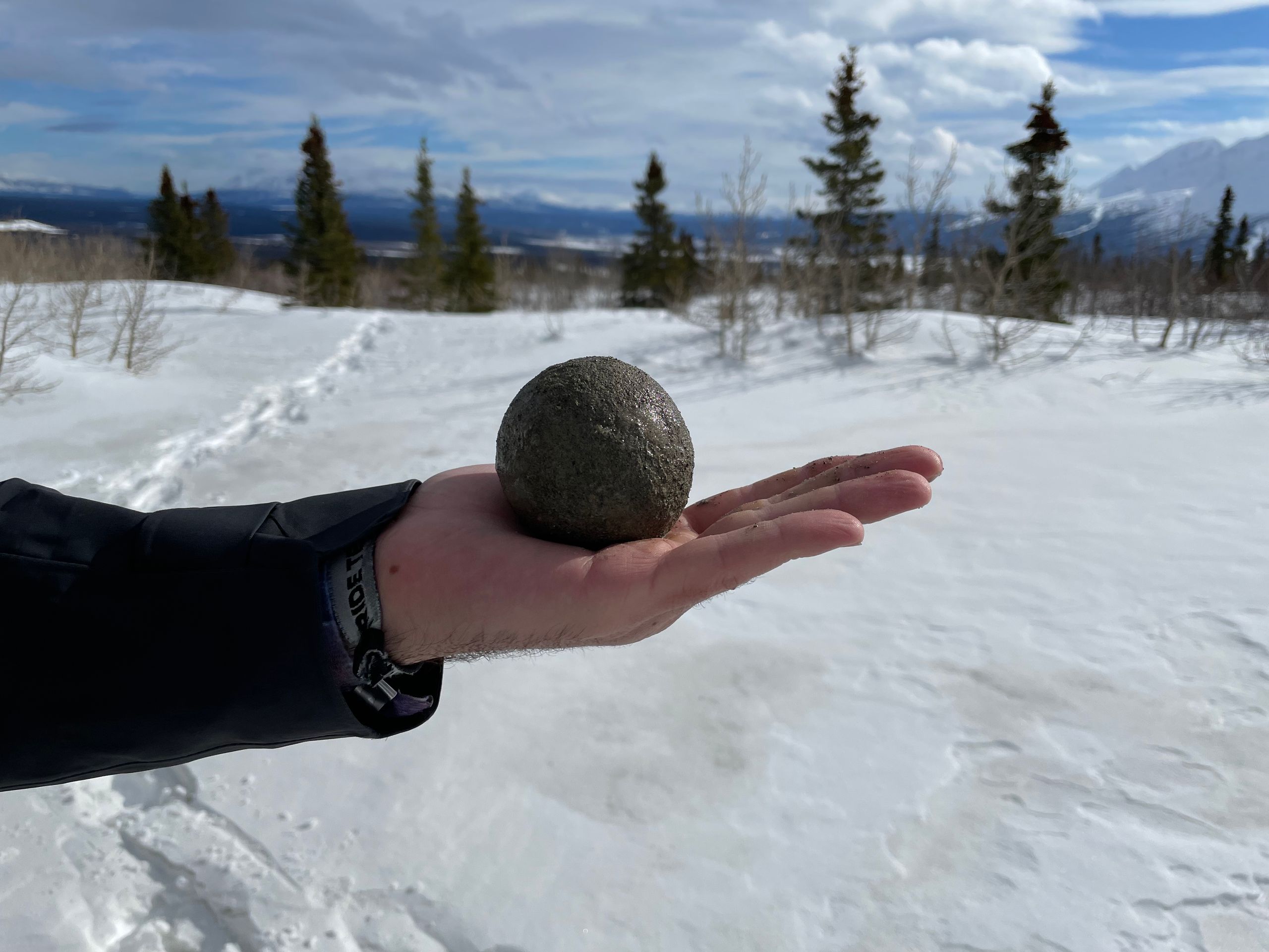
On March 22nd, we chose the Thunderegg Trail, which gains about 200 meters of elevation over a distance of 14 km. The hike gets its name from the so-called 'thundereggs' that can supposedly be found at the destination. The starting point is in the immediate vicinity of Haines Junction, about 15 km away. At the beginning, there are still many snowmobile tracks, so we don't need snowshoes. However, when we later look at the map, we realize that following the snowmobile tracks permanently was not the best idea, and we are quite far off the right path. We decide to cross-country to our trail - with the help of our snowshoes. Here too, we have to struggle through deep snow for a large part of the way, which is extremely exhausting despite the snowshoes. The cross-country march was not our best idea, as we have to struggle through dense Canadian bush forest. It is covered with bushes, small trees, and larger coniferous trees, which makes it quite difficult to make progress. Eventually, we find our trail again, but due to the deep snow and lack of signage, it is very difficult to make out. After a hike of about 2.5 hours (and probably more than 7 km due to the detours), we reach Thunderegg Creek and actually find some thundereggs! We take a short break, eat and drink something, and start the journey back - which also takes us 2.5 hours. All in all, the most challenging of the past three days, but definitely worthwhile in terms of nature and surroundings. We spend the evening cooking, writing blogs, and sorting pictures.
बातमीपत्राचे सदस्य व्हा
उत्तर द्या
प्रवास अहवाल कॅनडा