beckygoesafrica
beckygoesafrica
vakantio.de/beckygoesafrica

An Adventure in Lesotho

Објавено: 28.09.2018

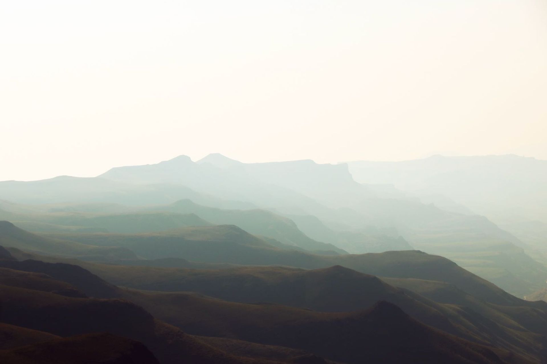
Lesotho. A small kingdom completely surrounded by South Africa. The country is about the same size as Belgium or Israel and has approximately 2 million inhabitants. The lowest point in Lesotho is at 1500 meters, making it the country with the highest lowest point. Almost two-thirds of the country is covered with mountains, ranging from 2200 to 3000 meters high. There is even a small ski resort.

And in this small, interesting country, we spent five days. That was quite a while ago. On Saturday, September 22nd, we met at half past five in the morning and set off in our two huge Toyota SUVs - and they really proved themselves. After eleven hours in the car, we reached the border at the Maseru Bridge - a new stamp in our passports :)

Although Lesotho is located in the middle of South Africa, it is very different. Apart from the few larger cities, the nature is almost untouched. Occasionally, you can see small villages or even individual round stone houses. You see more sheep, cows, and donkeys than people. On the mountains, you can watch the shepherds as they move with their herds, often children.

Many of the men were dressed very strangely, they had blankets draped over them and wore a sort of balaclava that only left their eyes exposed. Later we found out in a travel guide what the blankets are all about. The Basotho blanket is used not only for protection against heat and cold, but is also a status symbol. Boys only receive it after they have been circumcised. Depending on the pattern, it can represent wealth (cabbage head) or fertility (maize cob).

When we passed through the rural areas, we were usually welcomed very friendly. Many people waved and smiled. The children came running. But sometimes, there was also begging. Especially the children seemed to be "trained" to expect something from the white people in the big cars. They often called out "Sweets, Sweets" and held out their open hands.

Our route took us through the whole country. We arrived at the capital Maseru on the west side and left the country again on the east side via the Sani Pass in the Drakensberg Mountains. We took a boat trip on the reservoir at the Katse Dam, the highest dam in Africa. And we visited the Maletsunyane Waterfall, which is 192 meters high.


Actually, the number of kilometers was not that high - but there are hardly any paved roads, so we always took much longer for the distances than Google Maps estimated. Several times, the navigation also let us down and sent us on detours.
As a result, we experienced an adventure on our penultimate day that we didn't expect. We had found a map on which the roads were marked in different colors, depending on the condition of the road. Since we had rented the four-wheel drive cars, we thought we could take a 4x4 route, which should be faster according to Google Maps.
I set off that morning, so I immediately got to enjoy off-roading and it was great fun, even though you had to be very careful about where you were driving. Later, when I wasn't driving anymore, we sometimes walked ahead to clear big rocks from the way.


But at some point, the locals stopped us and told us that the road we were following didn't lead anywhere. So we had to turn around and take a gravel road, which should be more passable. It was at first, a gravel road with many potholes, but it wasn't as rough as before. But that soon changed. We were no longer a hundred percent sure if we were on the right road, we had lost a lot of time with our first detour, it was getting late, the gas tank wasn't as full anymore, and the mood was starting to turn a bit sour. We had to make a decision - do we go back to the better road that we have no idea where it leads or do we continue.

I wanted to continue and luckily, the majority agreed. Nevertheless, there was a tense hour ahead of us as we continued to rumble up the mountain at a snail's pace over rocks, with a mere centimeter separating us from the abyss on the left. Then it started to drizzle and everyone imagined how the water would soon come down in torrents and turn the earth into mud, how we would get stuck without gasoline and food, in the middle of nowhere, without a trace of civilization nearby.
But the rain stopped almost immediately and after a short hail shower, the sun came out again. When we could actually see the city in the distance, where we had originally only planned to refuel but then decided to spend the night there, the mood improved again, almost becoming silly. And when we finally reached a paved road, we all burst into cheers.

In the semi-darkness, we had to look for accommodation that could spontaneously accommodate eleven people. We were actually lucky on the first try.
Now we can proudly call ourselves Survivors of the Roof of Africa, which is the name of the route, as we later found out.


The 'Roof of Africa'...

... and its conquerors :P


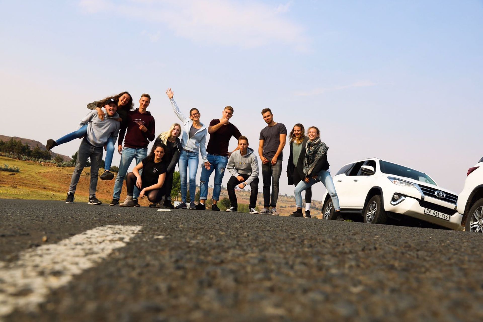
So those were five days where we spent almost all of our time in the car. A little hiking was actually planned, but the roads in Lesotho just didn't cooperate. But it was still worth it. We saw so much. Collected so many impressions. We crossed the whole country and got to know it a little, a country I had absolutely no idea about before. And we grew even closer, had silly and profound moments, silently admired the breathtaking scenery out of the windows, sang along to songs, leaned on each other to try to sleep, endured a tense hour and then experienced an even more relaxed mood afterwards - thank you very much, you were the best fellow adventurers one could wish for.

Одговори (1)

Marion
Ich bin froh, dass ich das alles erst im Nachhinein erfahren habe! Aber auch sehr neidisch auf euch Bezwinger, das war sicher ein sehr beeindruckendes Erlebnis!

Повеќе извештаи за патување