
USA - Der wilde Westen
vakantio.de/usa_der_wilde_westen
Mesa Verde & Monument Valley
Naipablaak: 27.08.2019


Agsubscribe iti Newsletter
May 24, 2011 / Tuesday / Cortez-Mesa Verde-Mexican Hat
We leave the hotel parking lot at 6:45 am. The sun is just rising and a storm is approaching. But as always in Colorado, the weather is very unpredictable and doesn't last long. It takes us about an hour to drive to the meeting point for our guided half-day tour in Mesa Verde. From the highway, we wind our way up through the national park at an altitude of about 9,200 feet (2,800 meters). Although the distance from the highway is only 16 miles, it takes us about half an hour to reach the short distance. It is 39°F (4°C) when we arrive at the parking lot.
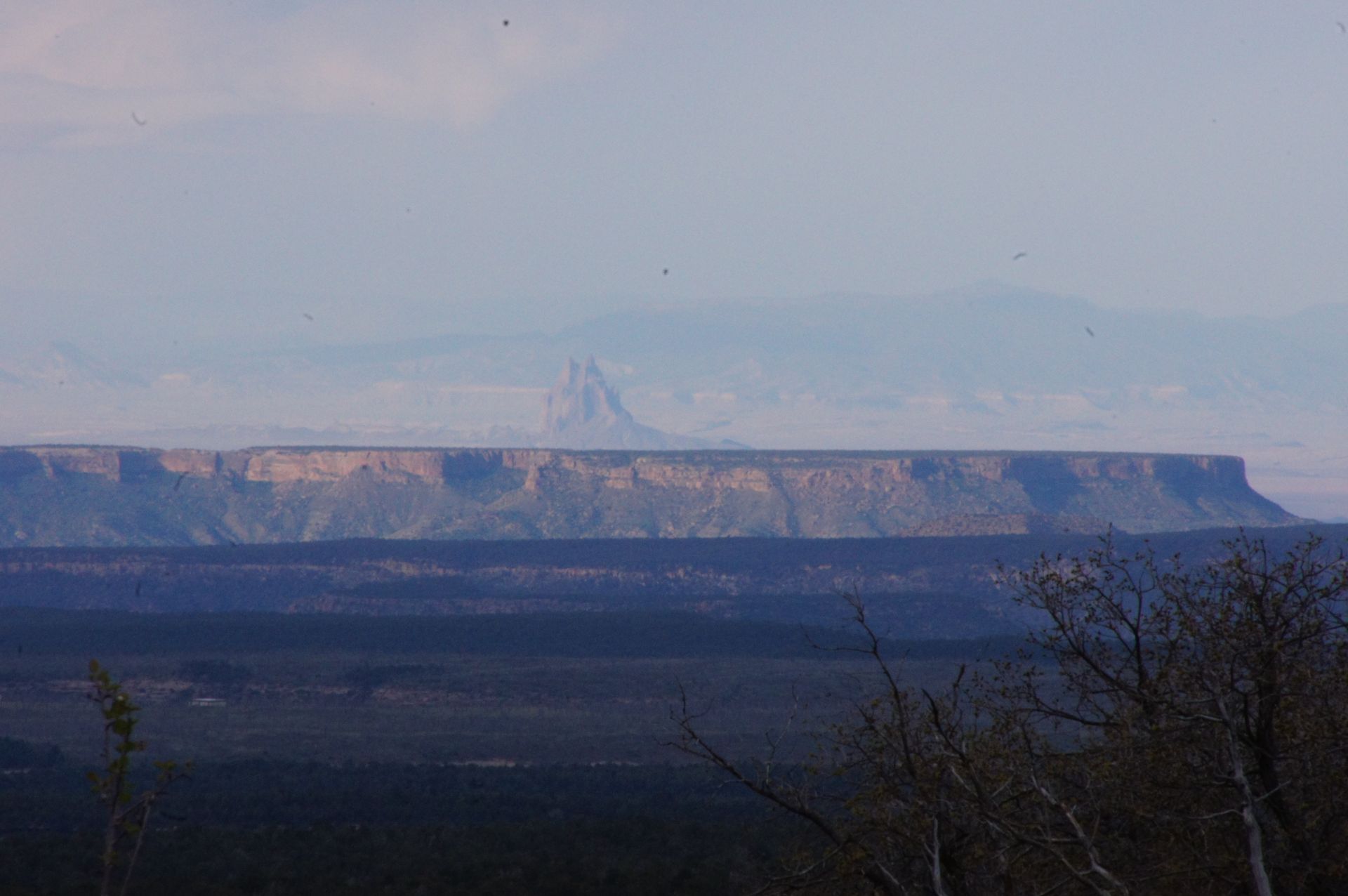
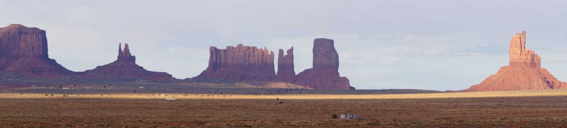
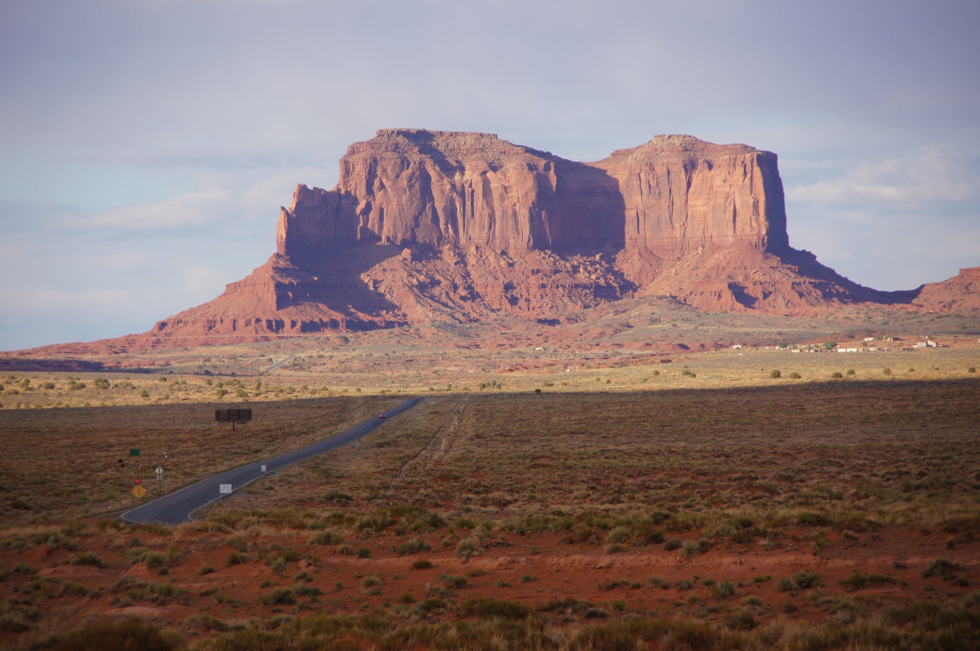
View from the starting point of the Mesa Verde tour to El Capitan in Arizona
The bus arrives at 7:50 am and we set off with 17 people after another stop. Our tour guide, Ranger Peter Newcomb, talks non-stop. Unfortunately, he has a speech impediment, which is a hindrance to his job. Even though I consider myself to understand and speak English well, I have to get used to the pronunciation of "Mace Verd" (pronounced Määäs Wörd) for Mesa Verde. The word "archeology" is especially difficult for him and he often swallows entire syllables.
Mesa Verde, which translates to something like 'green table mountain', was originally an area inhabited by the Anasazi Indians, who settled here as early as the 6th century. At that time, the Indians lived in pit houses, which are what Mesa Verde is more known for among tourists. The cliff dwellings were carved into the rocks about 800 years ago.
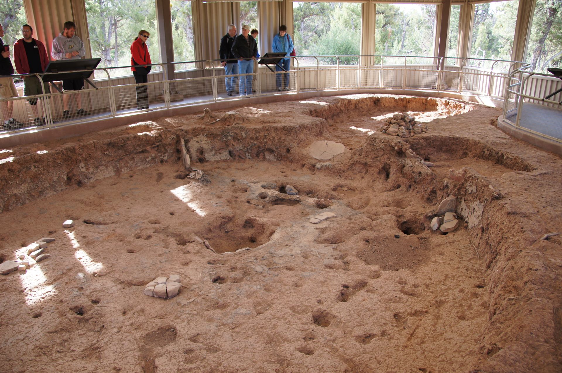
Back then, when they still lived underground, they had built so-called 'kivas', which were communal rooms used for ceremonies. Remains of these can still be seen today.
It was only around the 12th century that multi-story adobe and stone houses were built in the canyons of Mesa Verde. These were only discovered about 400 years later by the Navajo Indians. There is still much to learn about the Anasazi, but it is known that they were skilled potters and basket weavers. There are also some rock paintings that have been preserved. Interestingly, this tribe started building irrigation systems over 1,400 years ago to practice some form of agriculture. Due to the nature of Mesa Verde, it is believed that hunting was very difficult and that is possibly why these dwellings were eventually abandoned. It is also possible, as other research suggests, that climate change or a lack of wood and unpredictable water conditions eventually forced this tribe to move elsewhere.
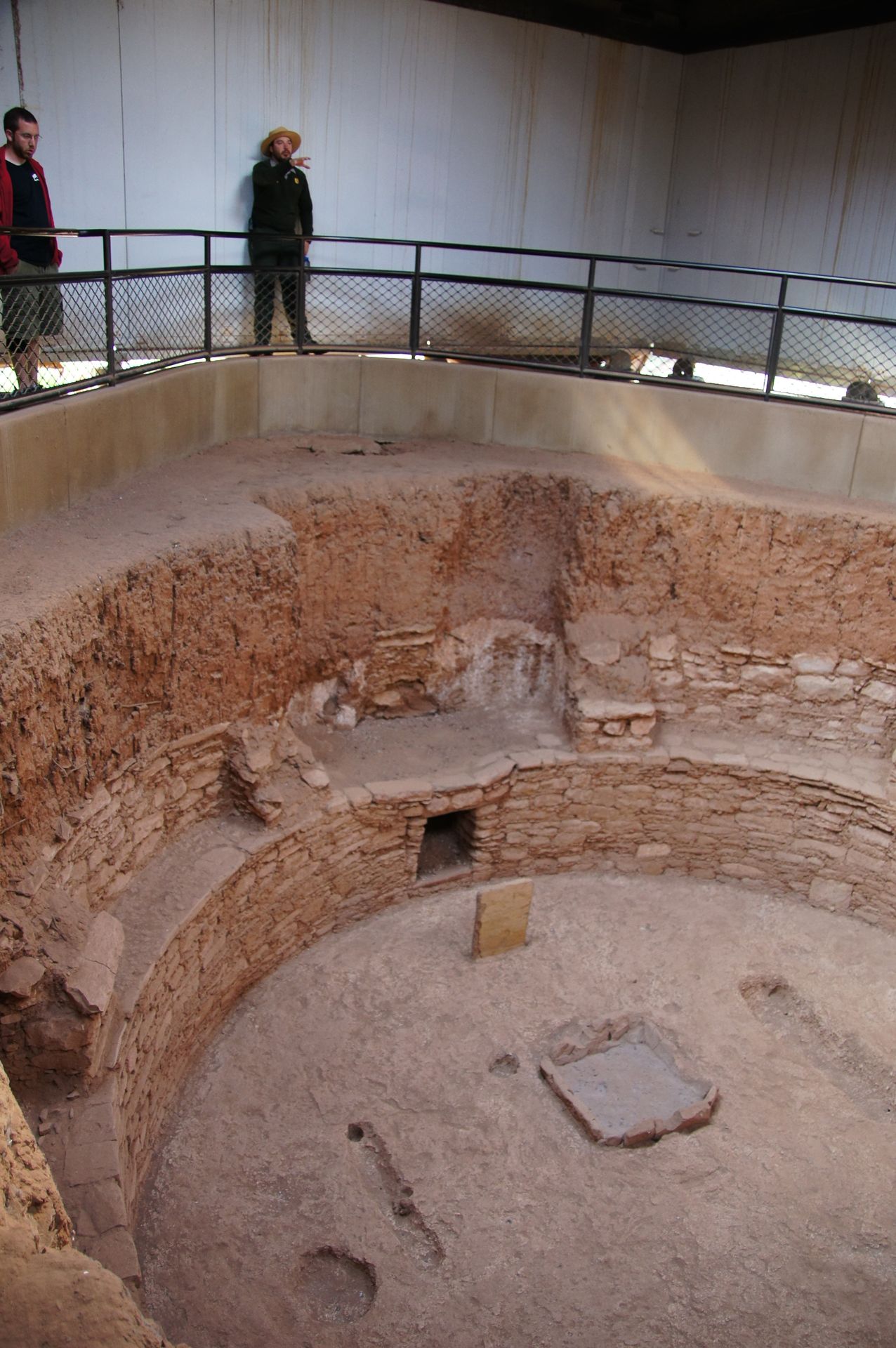

We first visit the pit houses, which are not very comfortable. The ventilation was provided through two holes. The kivas are more sophisticated, taller, and more 'technological': Since the residents always had a fire burning in the center of their houses, which was affected by the draft, the Indians built a wall to prevent this.
Kiva
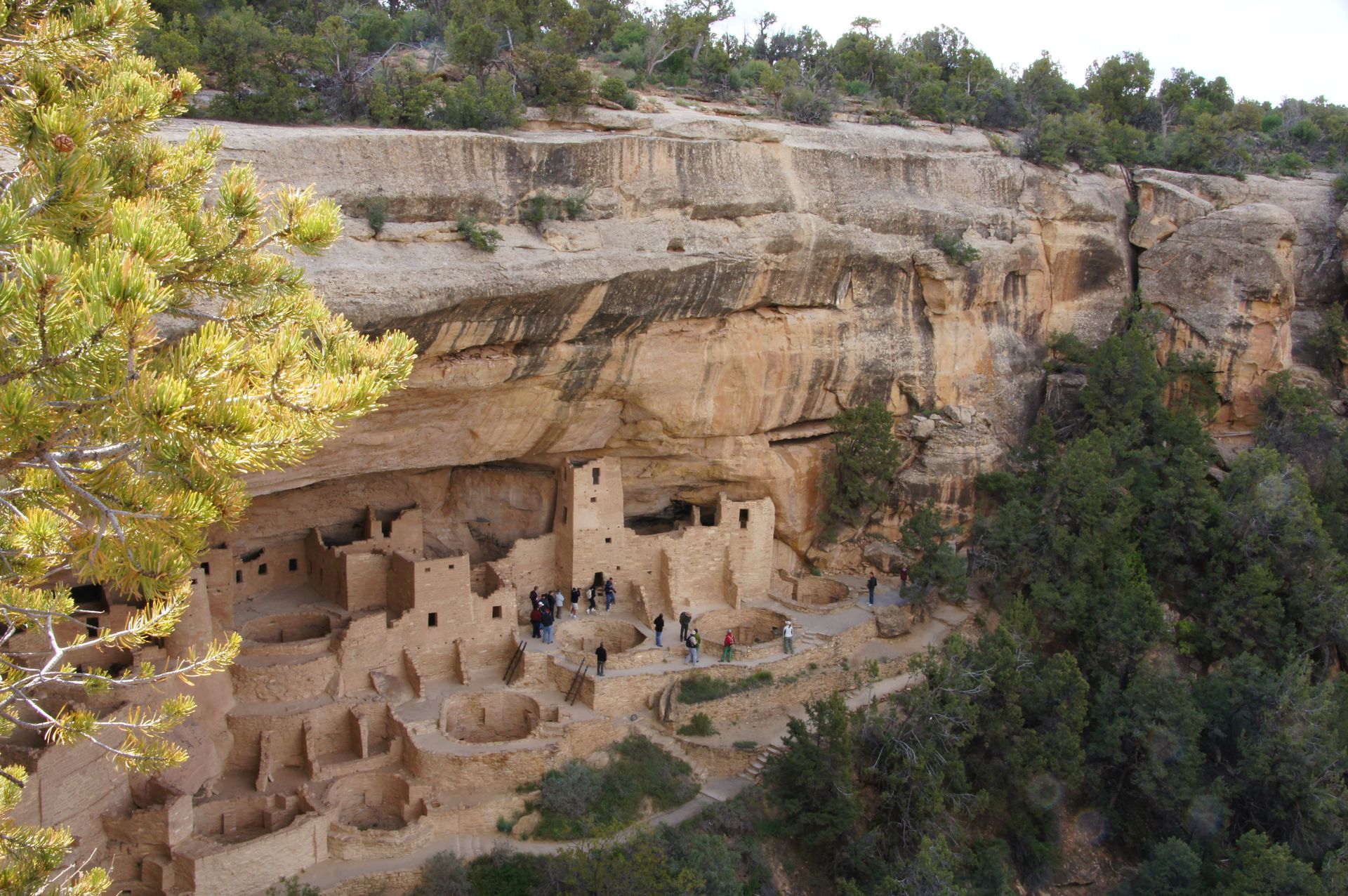
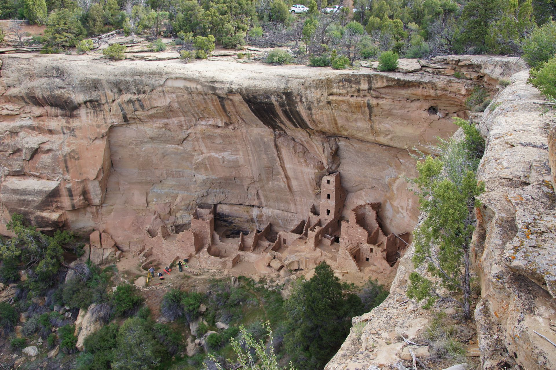
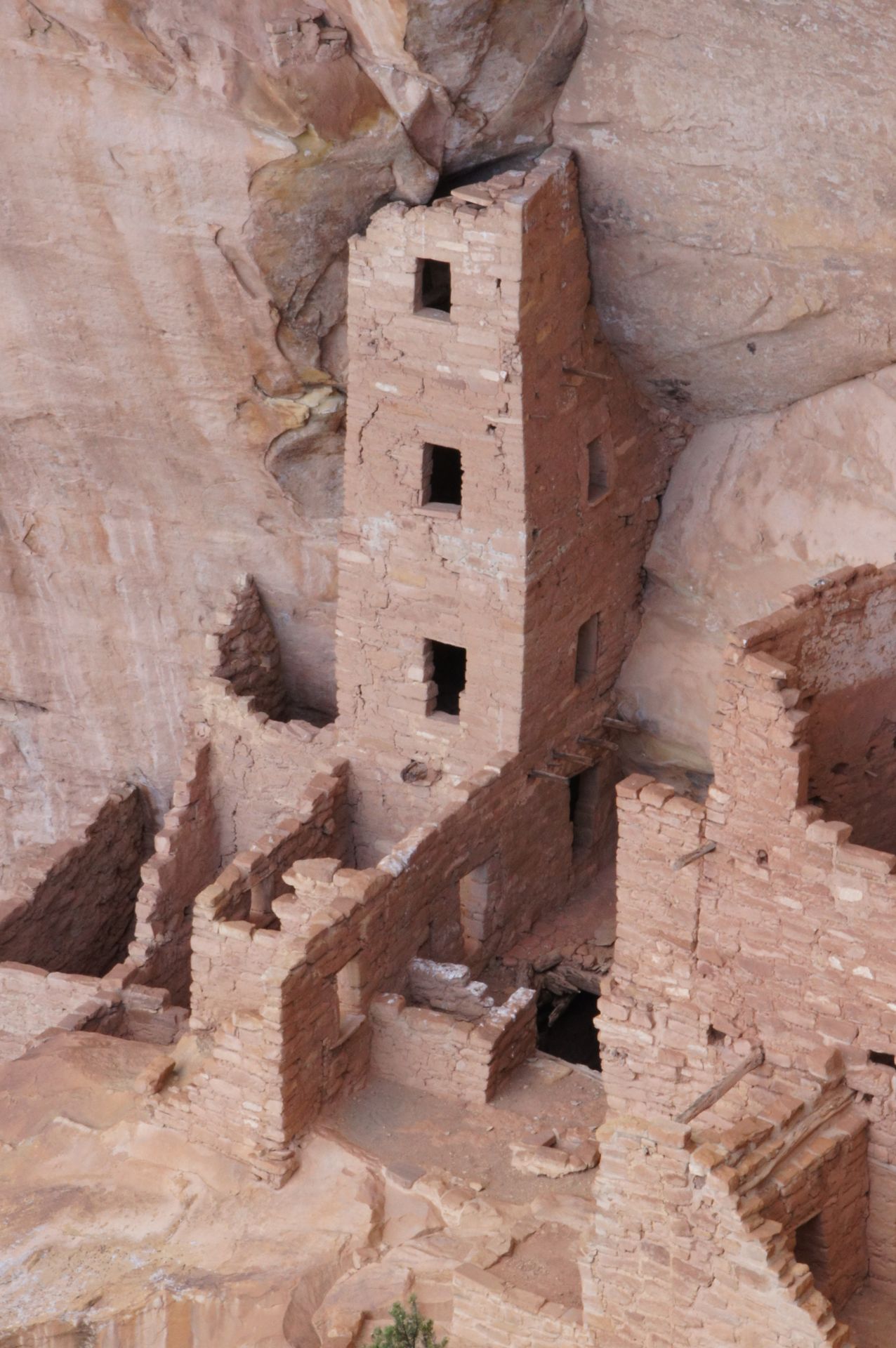
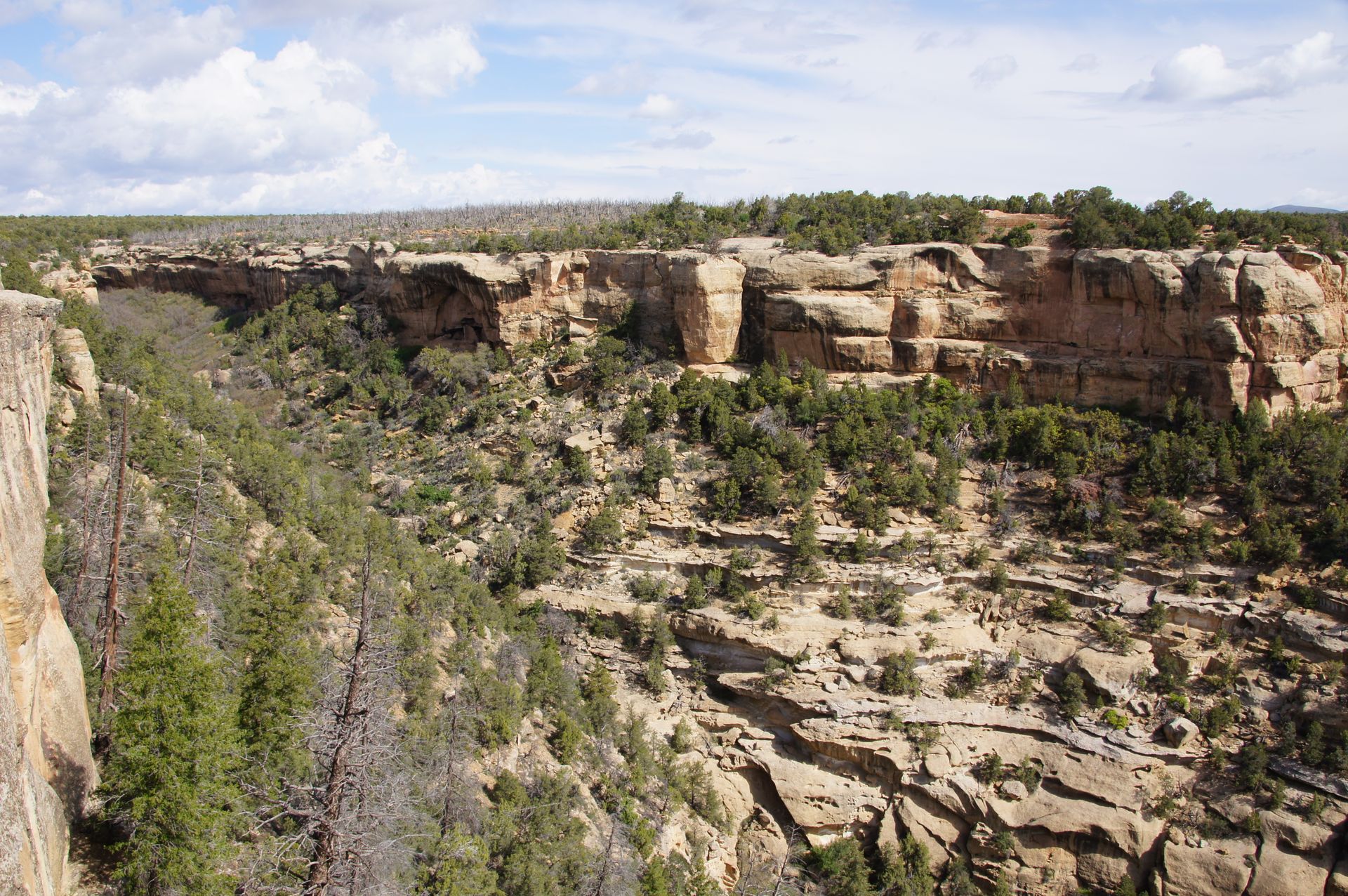
We continue driving on this plateau, which was heavily affected by a fire in 2002, leaving behind a multitude of gray-white tree skeletons. The flora has not yet recovered. At some viewpoints, we are reminded of the Grand Canyon. Around 10:15 am, we reach a viewpoint above Cliff Palace. This village, like other cliffside villages, huddles under an overhang of weathered sandstone.
There are over 150 rooms there. However, the Anasazi only lived here for about 30 years around 700 years ago. On top of the mesa, they cultivated the mentioned crops. They obtained various things and fibers from the yucca palms we see. They used the fibers to make sandals, which they turned into warm shoes in winter with the help of turkey feathers. We find their way of life quite laborious. The idea of having to climb a 30-50 meter high cliff to get to agriculture or animals is not very appealing.
On the other hand, they lived in their rock niches protected from the elements, and fresh water dripped from the overhang, so they didn't need wells or have to go far for water. But if it didn't rain, they were literally left high and dry.
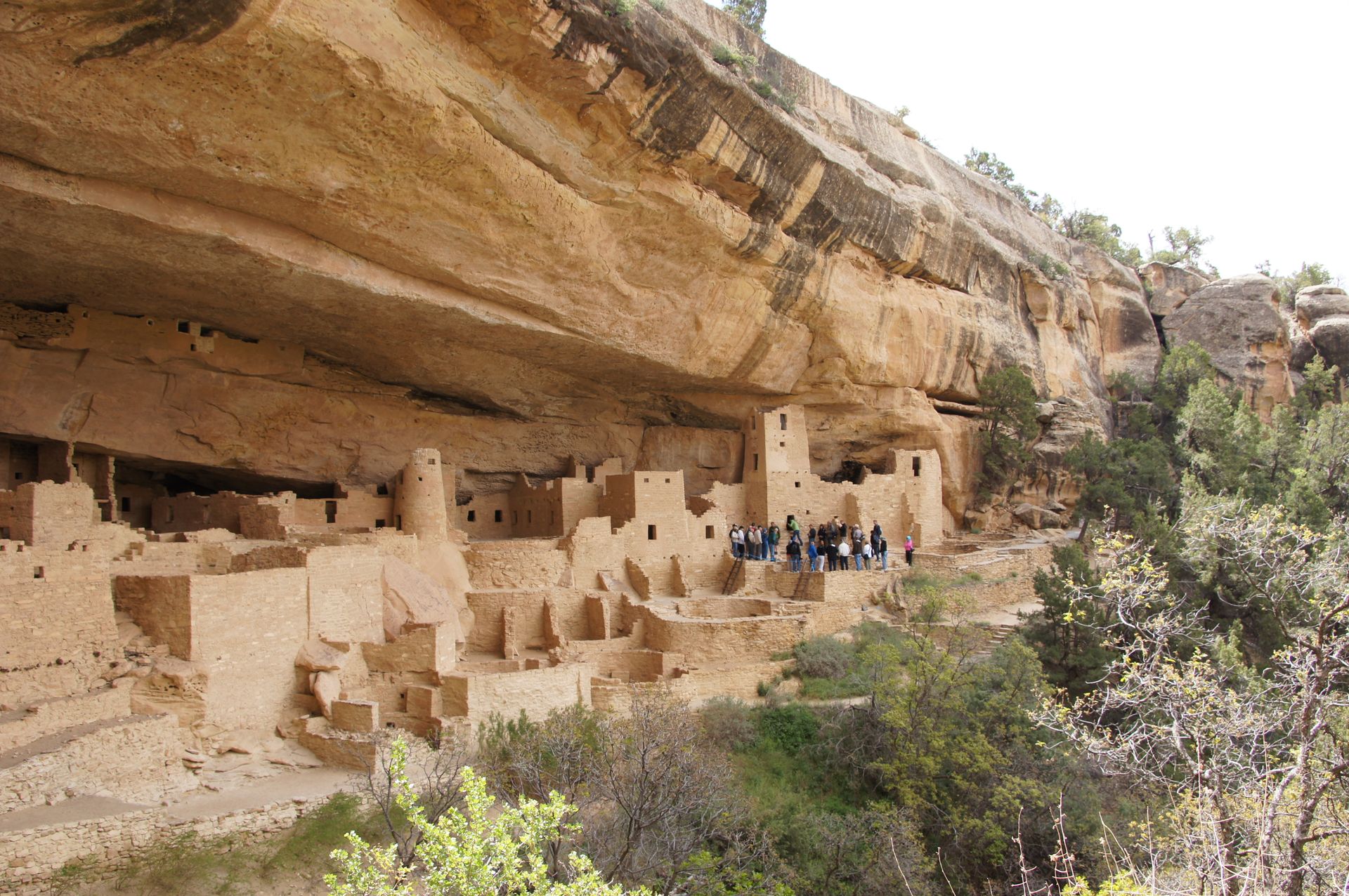
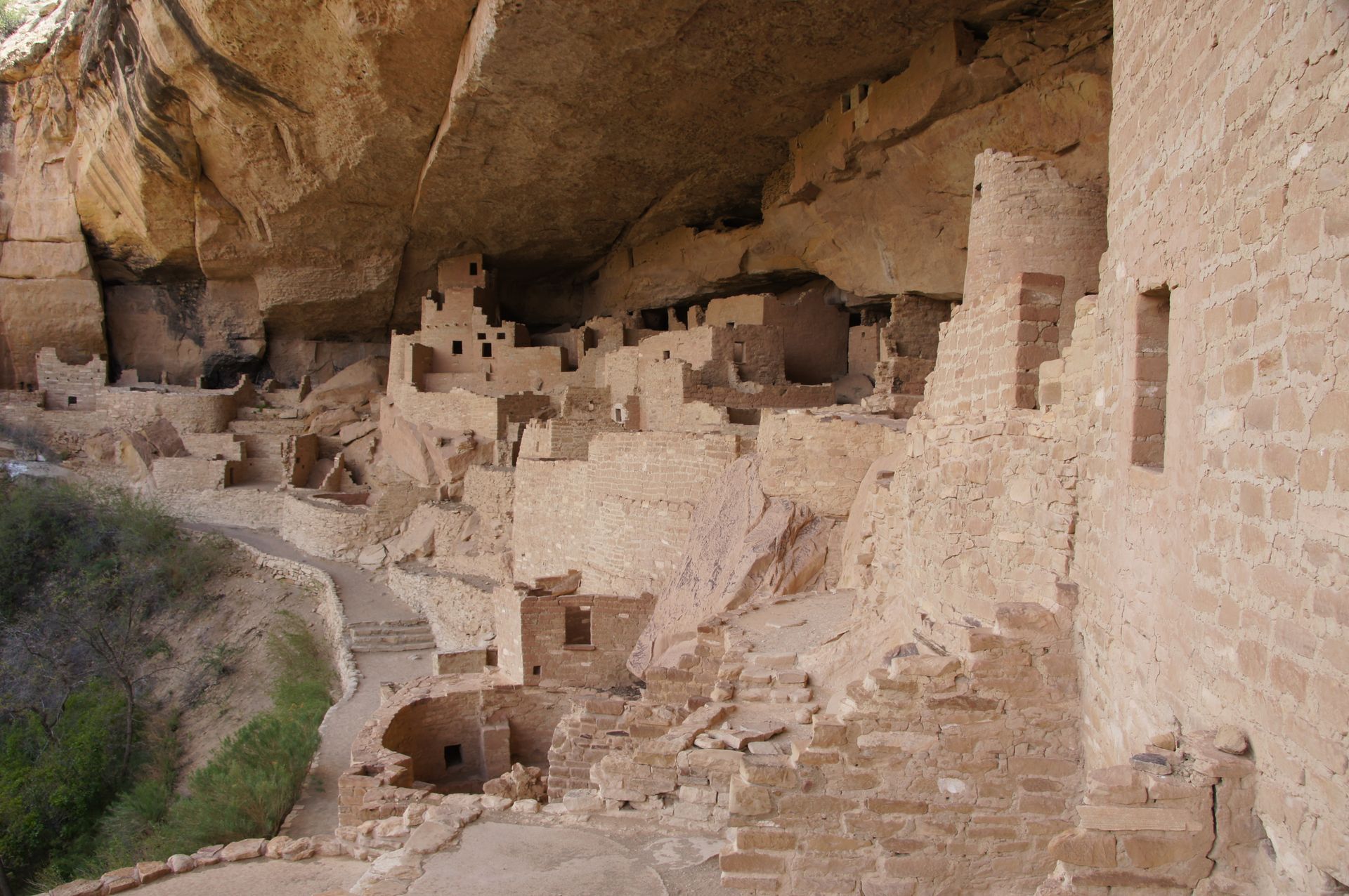
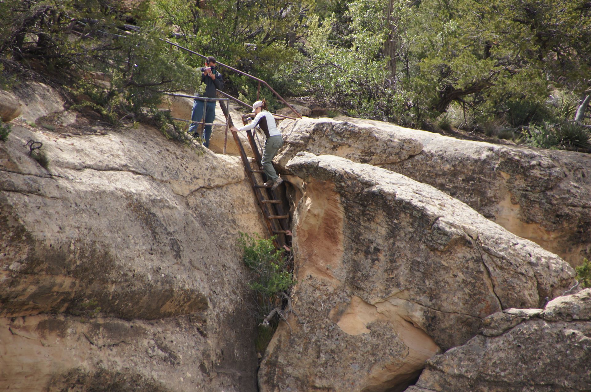
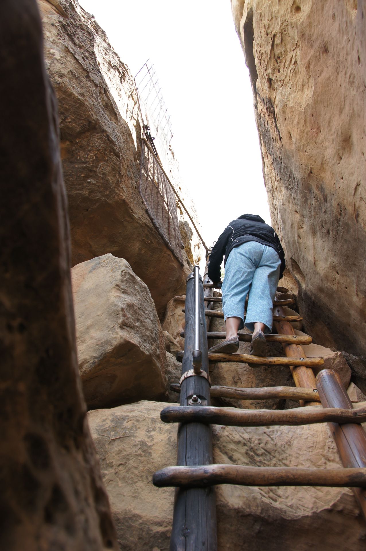
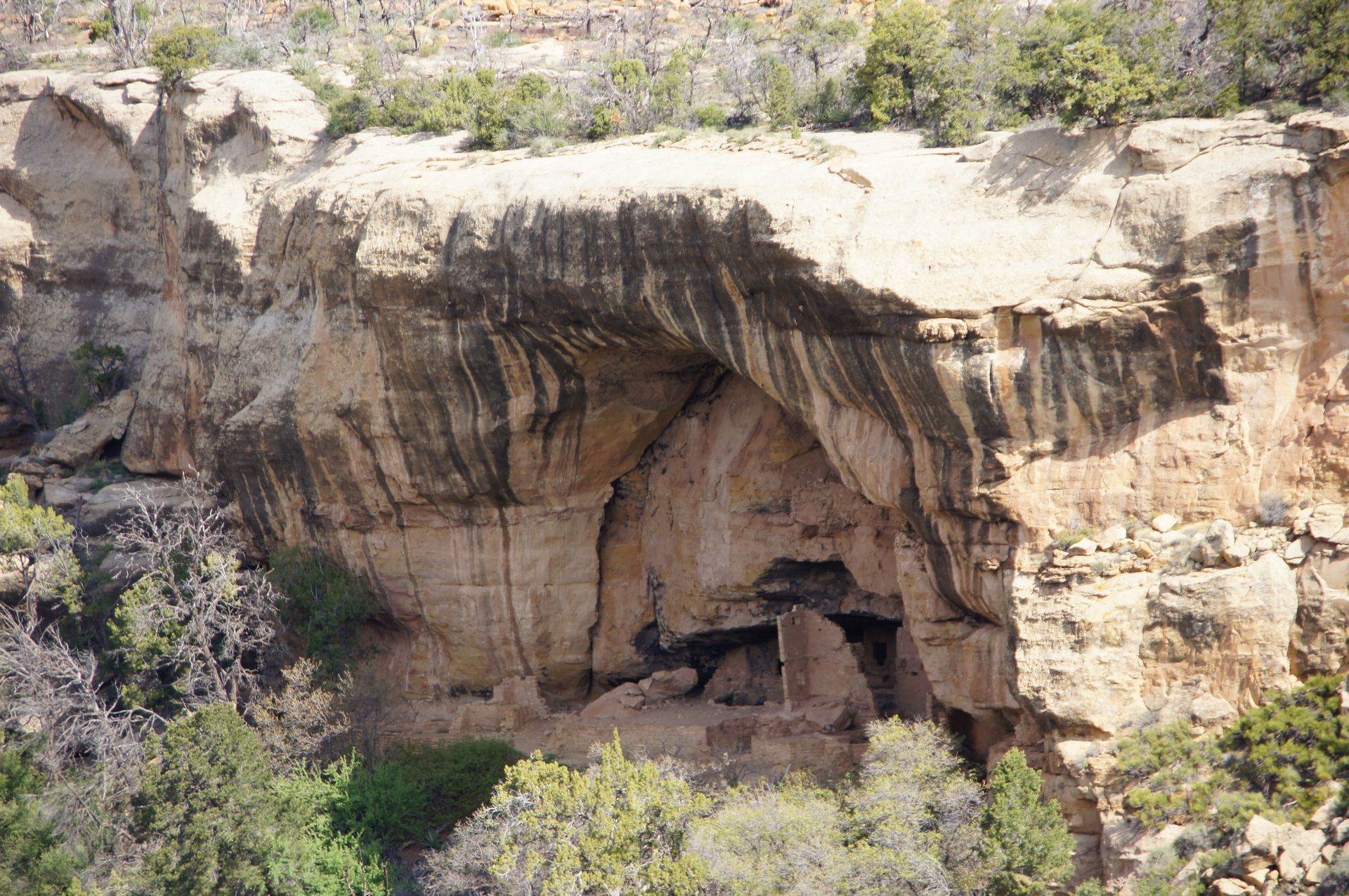
There are several of these rock dwellings in Mesa Verde, some accessible through crawl tunnels. We see the most famous cliffside village, Cliff Palace.
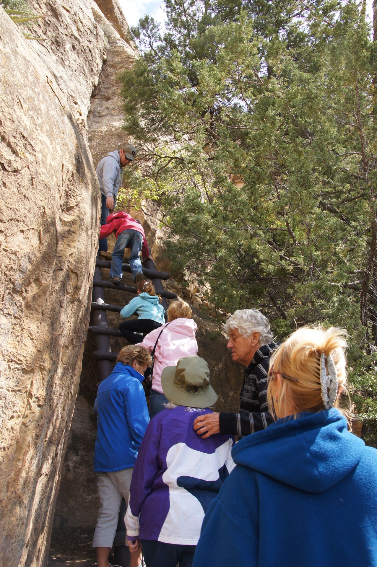
We first descend an uneven type of staircase, then climb a wooden ladder about three meters high. As we wait under an overhang for all participants and the ranger who will guide us through Cliff Palace, a snow shower descends. The wind is blowing fast and it suddenly becomes cold. After a few minutes, it is dry again and the tour continues.
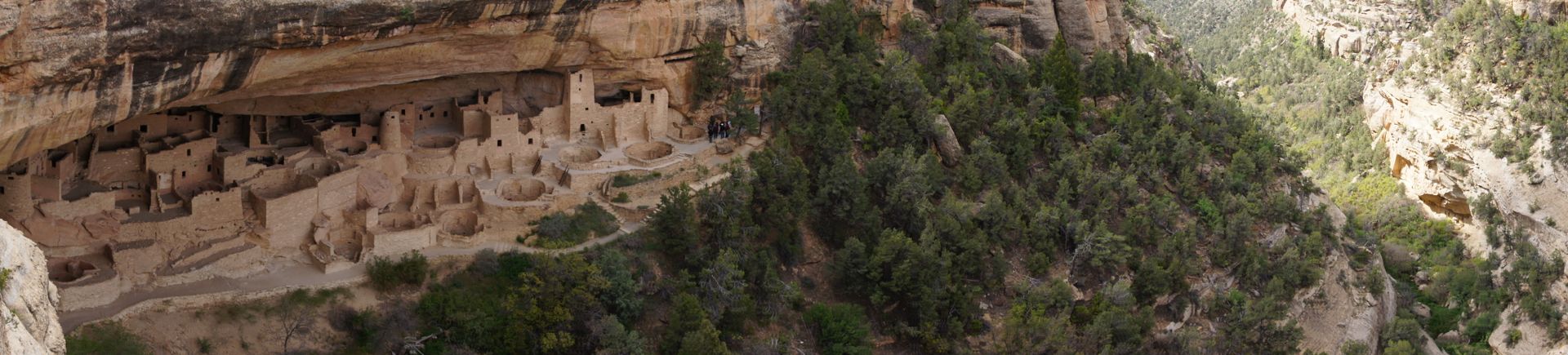
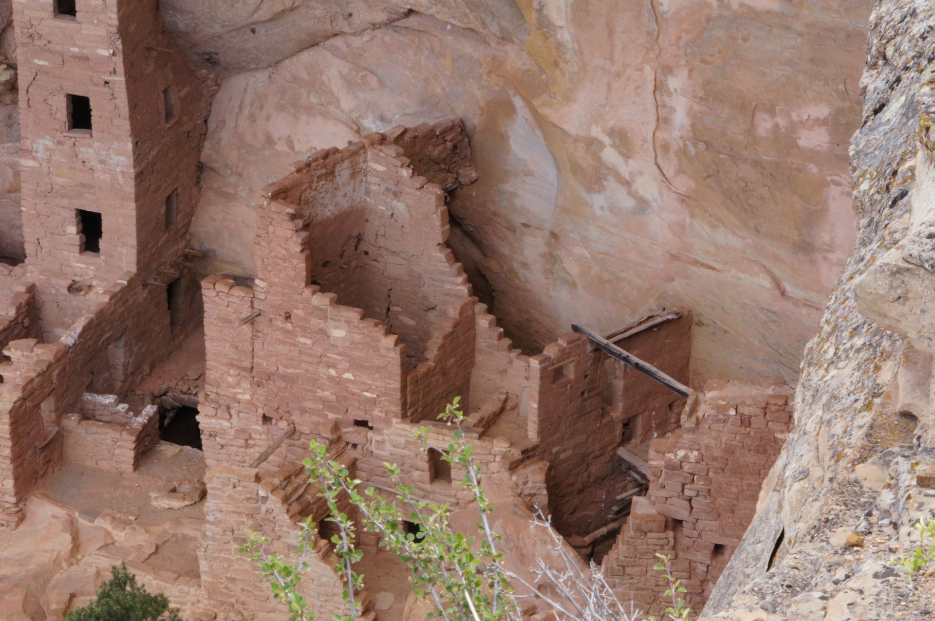
We see towers that may have been watchtowers. There are wall paintings in one house. There are several kivas, and it is amazing to see the skills of the Indians who lived here until around 1270 AD. The houses are incredibly well-preserved, and the tree trunks sticking out of the rock are almost 800 years old.
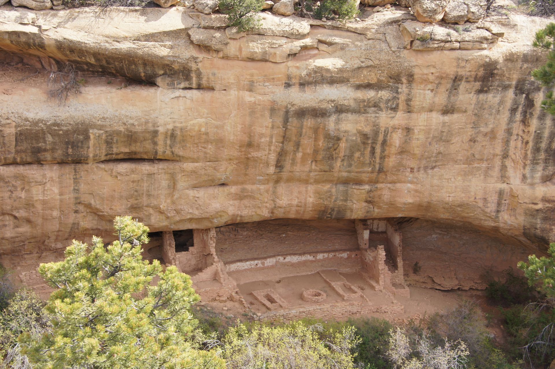
On the other side of the canyon, you can also see such rock dwellings.


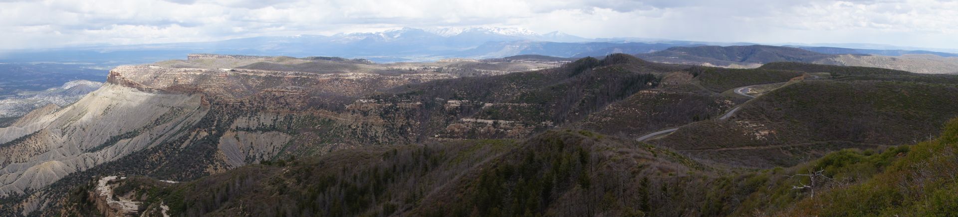
The tour ends at around 12:15 pm. We briefly visit the visitor center and then drive to Park Point, the highest point here. There is only a fire lookout tower of the park administration up here, which provides the best panoramic view and allows early detection of any fires. The view is breathtaking.
 Park Point
A 360-degree panorama of a green valley, hills, snow-capped peaks, and the high plateau of Mesa Verde. Plus, an incredible play of clouds, and from up here, you can see the sun, clouds, rain, and snow all at once in a photo. However, it's very windy, so we retreat to the car and drive back to Cortez. We quickly have a burger at McDonald's (the first of two times in one month in the US). At 2:30 pm, we continue to our next destination.
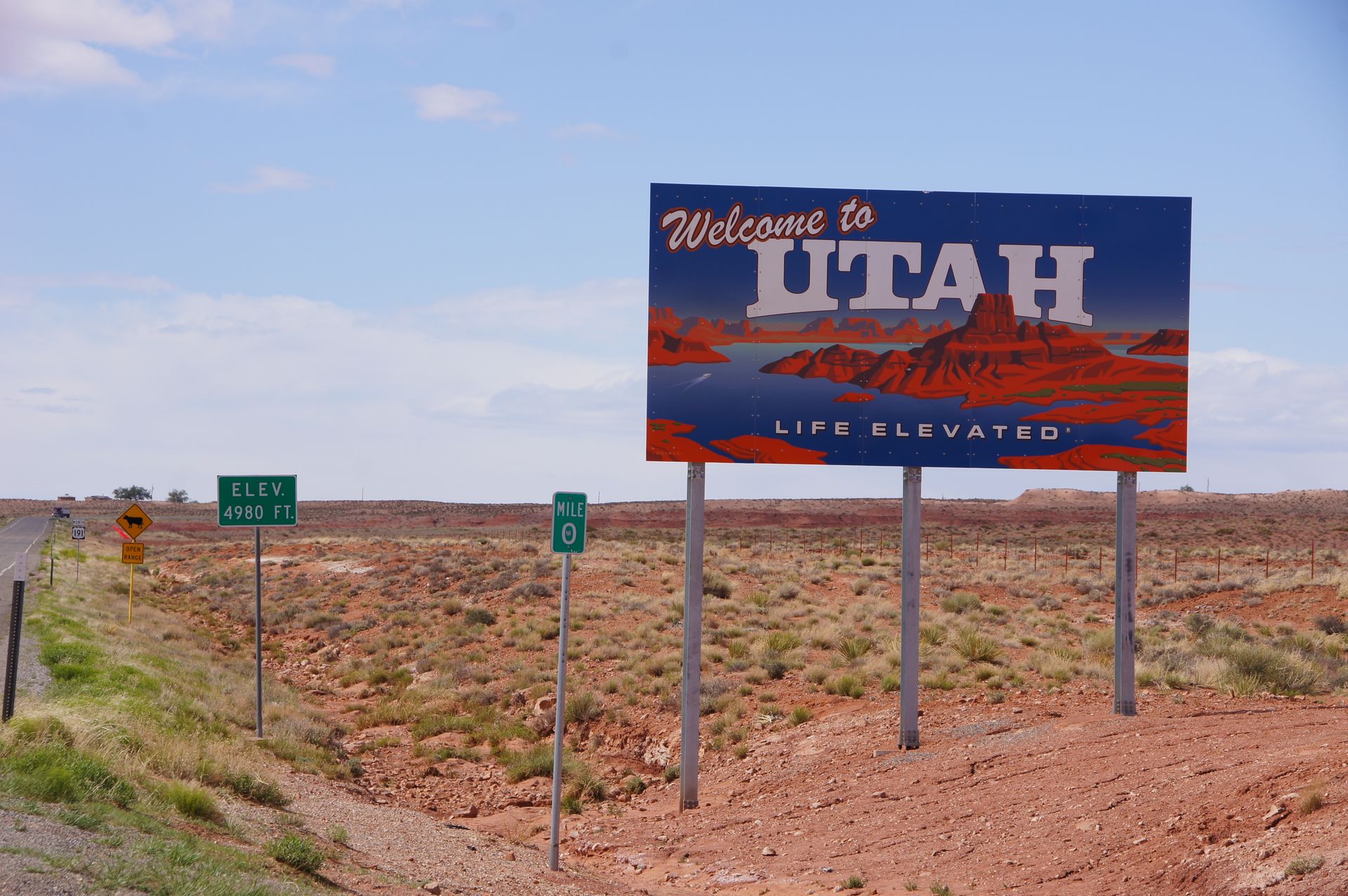
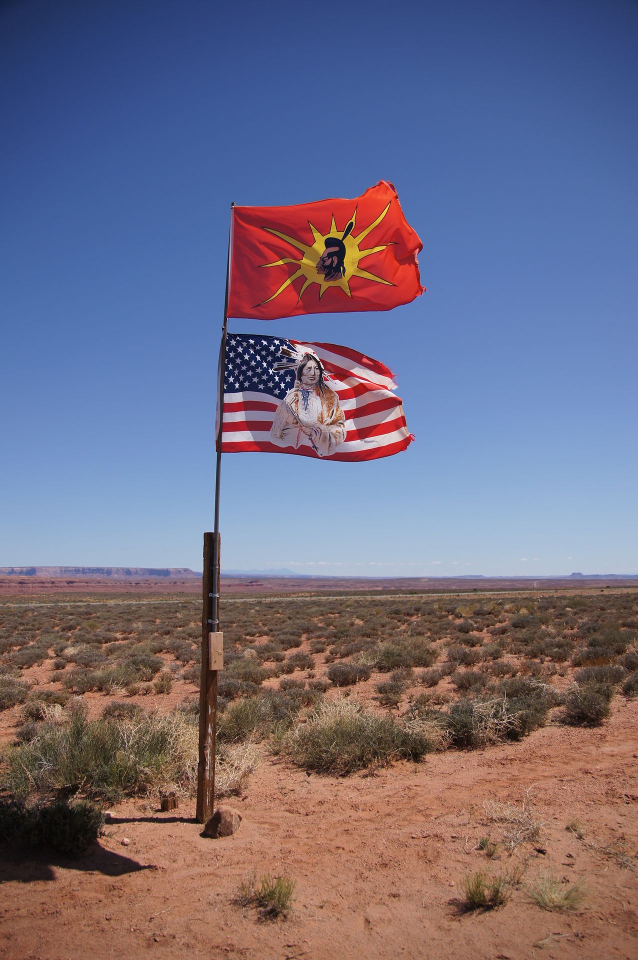
We leave Colorado heading south and drive through a part of New Mexico to the west. Eventually, we reach Four Corners, the point where New Mexico, Colorado, Arizona, and Utah meet.

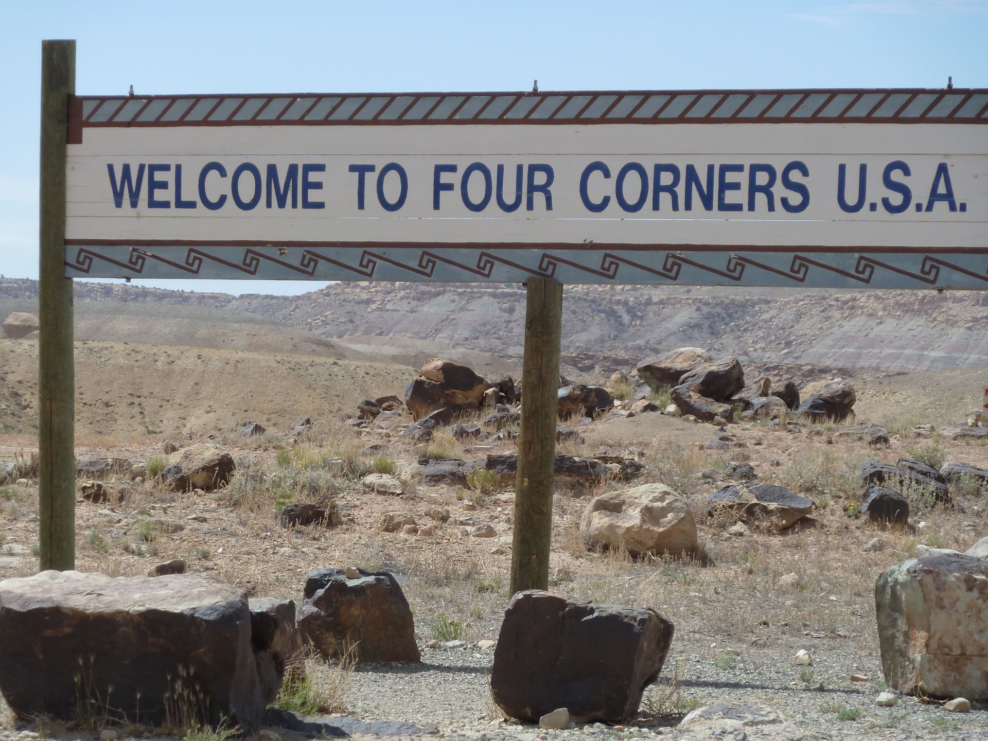
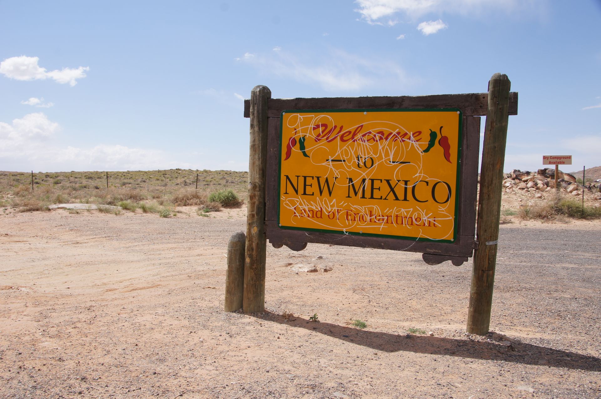
We cross the state borders of all four states here. It is sunny and windy, with mountains behind and in front of us. As this national monument is located on Navajo land and operated by them, there is an entrance fee to the memorial plaque, so we decide not to gain any further knowledge here...
After taking a few photos of the state signs, we continue west through Arizona and then turn north, driving through Utah.
The landscape accompanying us is often moon-like. Red soil, desert-like vegetation. The wind blows dry bushes in clusters (known as tumbleweeds) across the road, and it reminds us of the harmonica from "Once Upon a Time in the West".
However, the weather changes between bright sun and rain. The temperatures are as high as 72°F (22°C) without clouds, and a minute later, it's 59°F (15°C) with clouds.
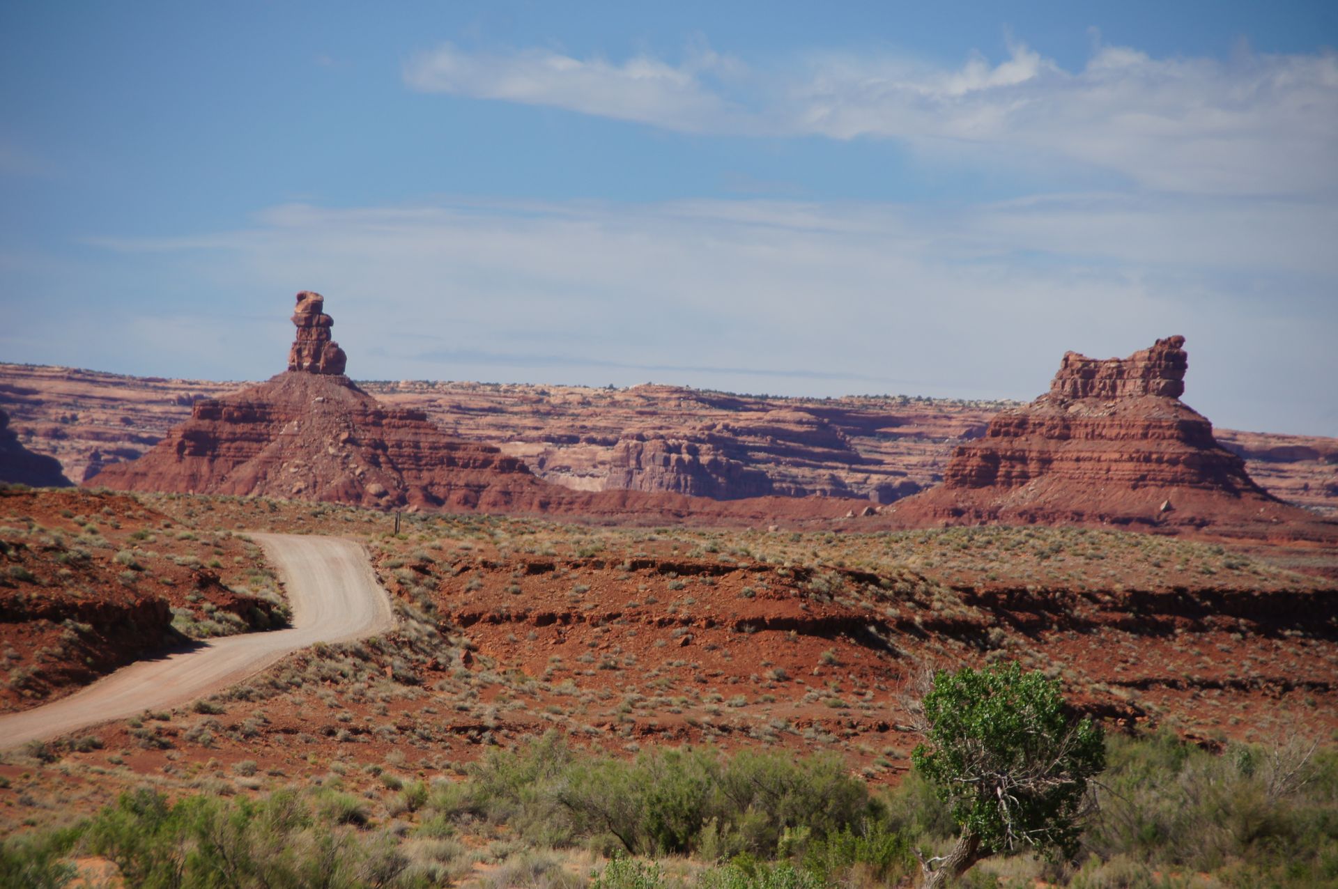
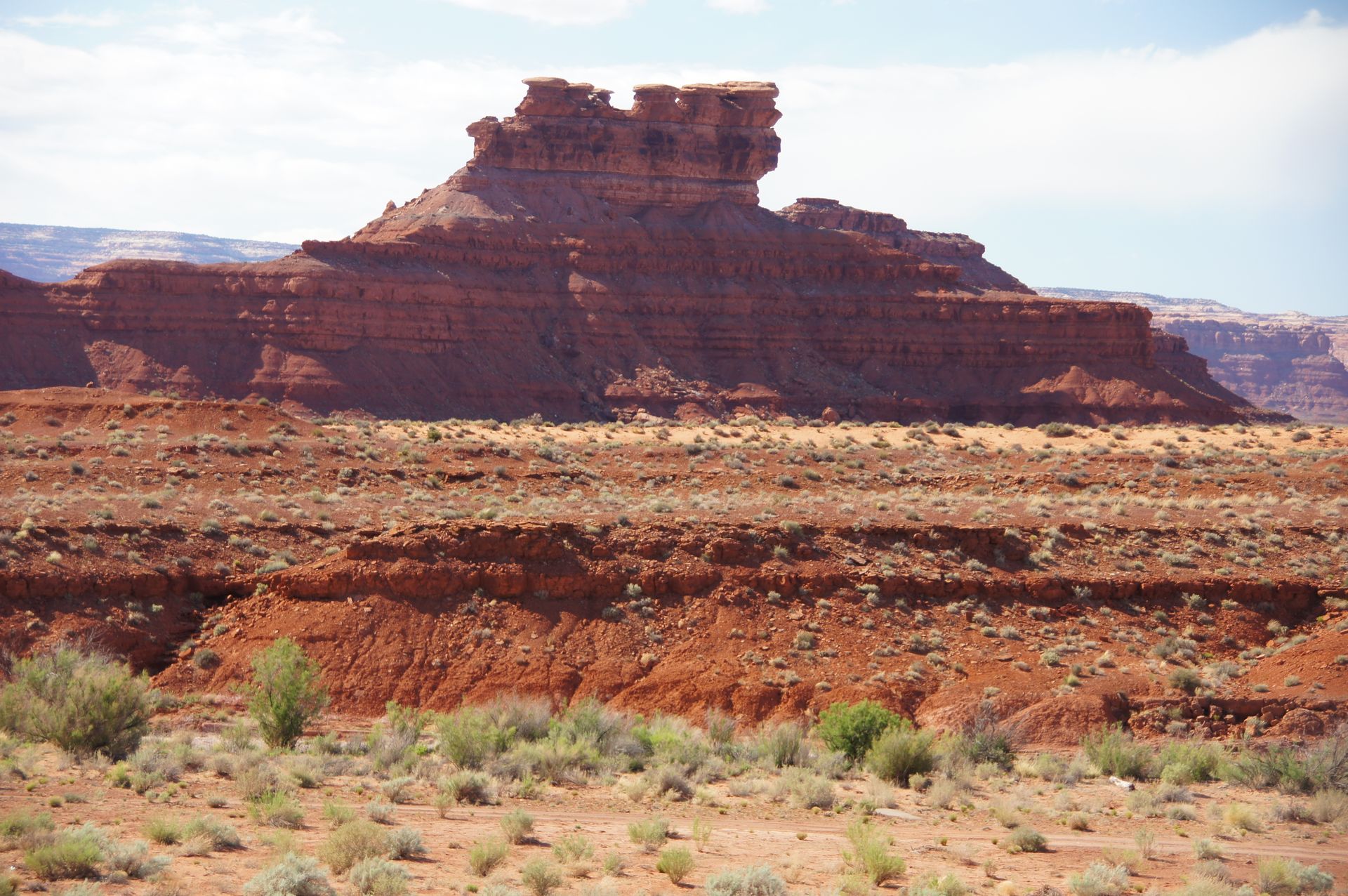
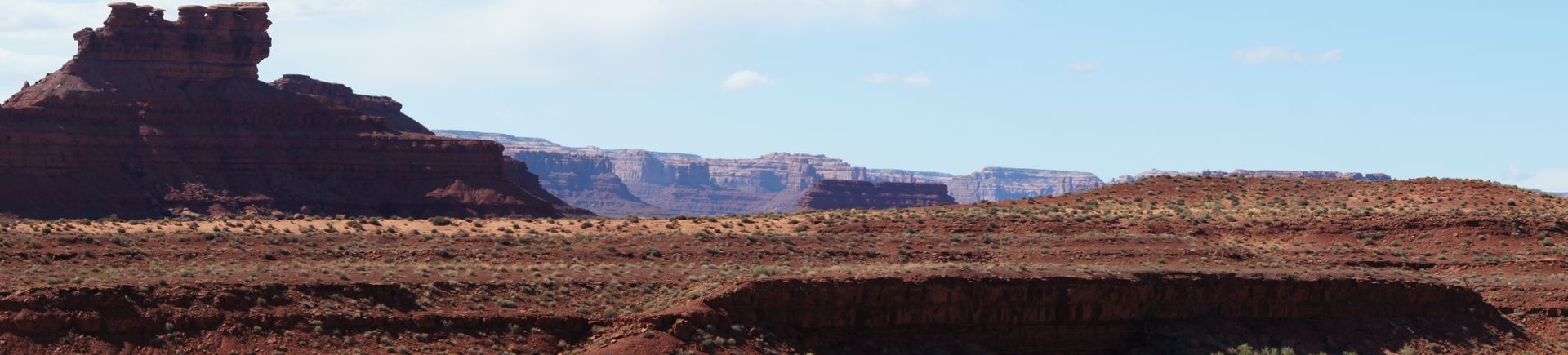
Valley of the Gods
Valley of the Gods
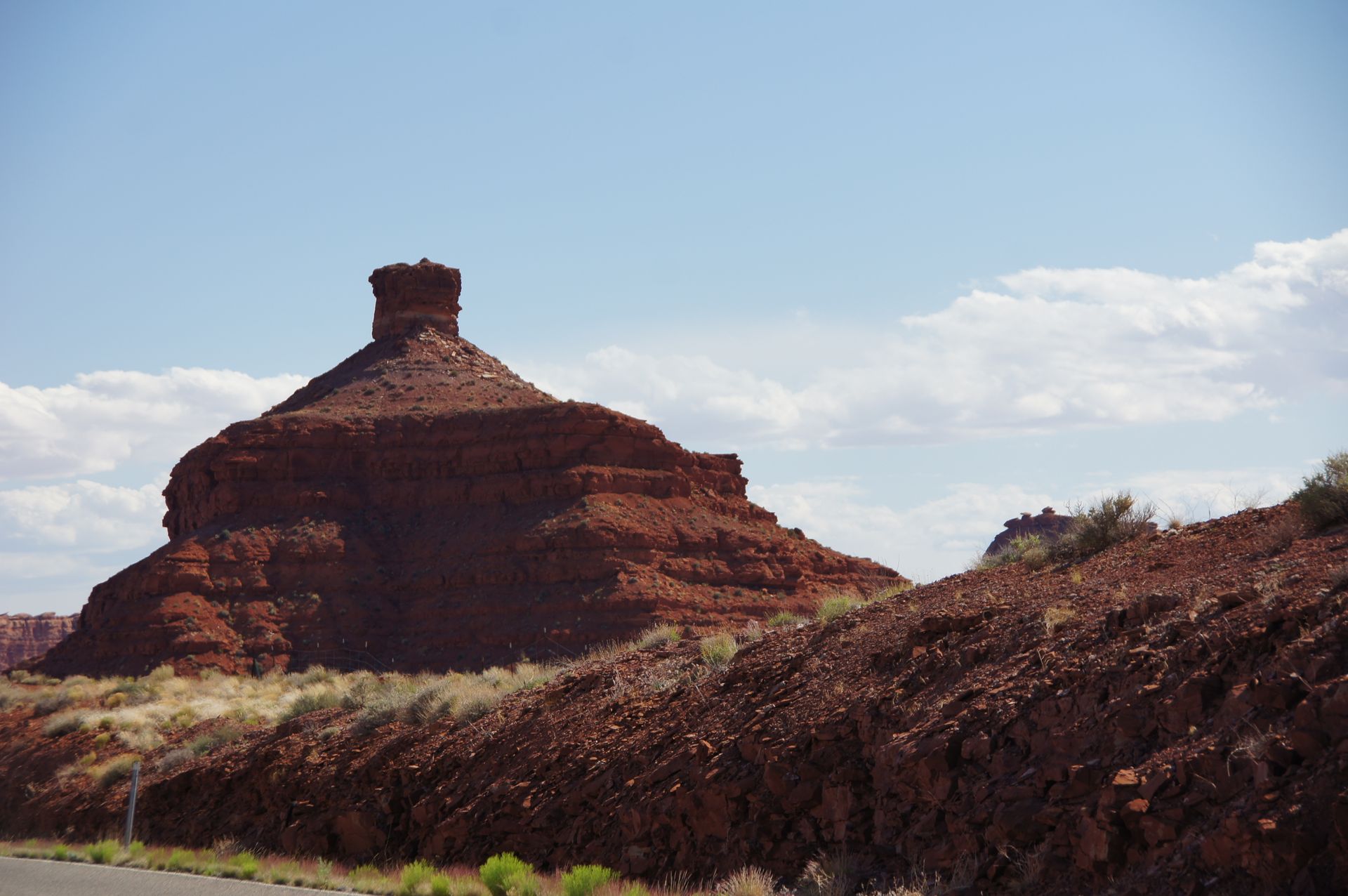
Valley of the Gods
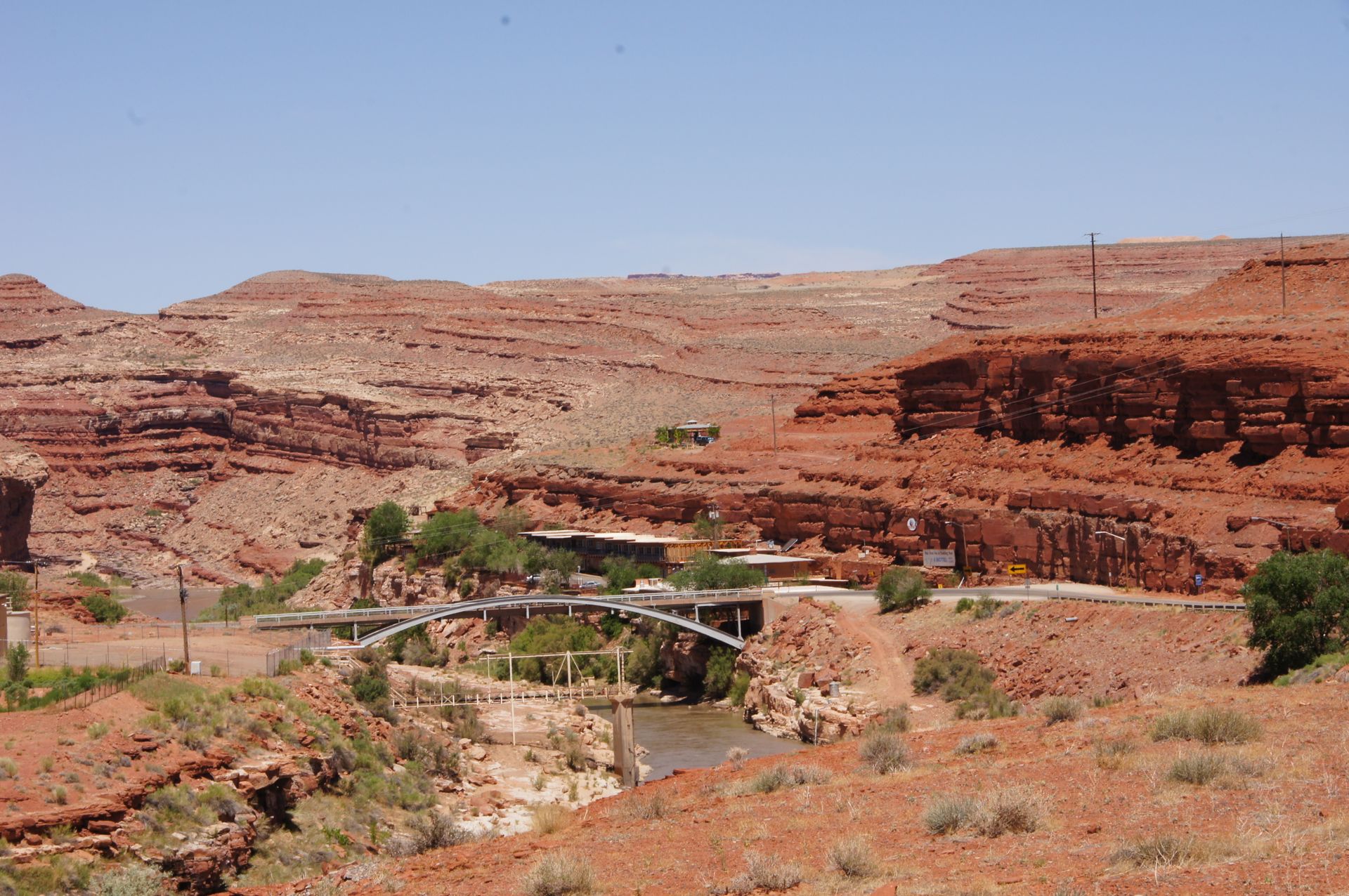
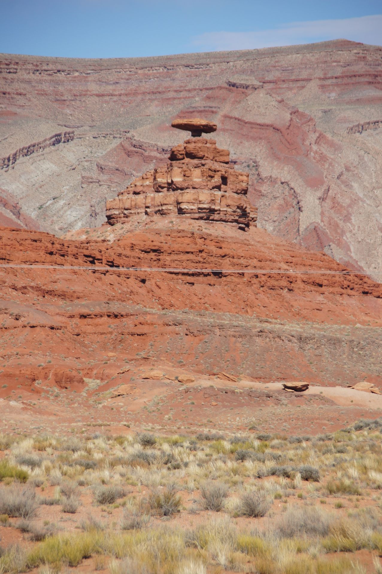
After crossing the Valley of the Gods, which already prepares us for Monument Valley, we reach our destination for today, Mexican Hat. Mexican Hat is a place (if you can call it that, as it only has 88 inhabitants) named after a rock formation resembling a sombrero, located shortly before the town along the road.
Mexican Hat
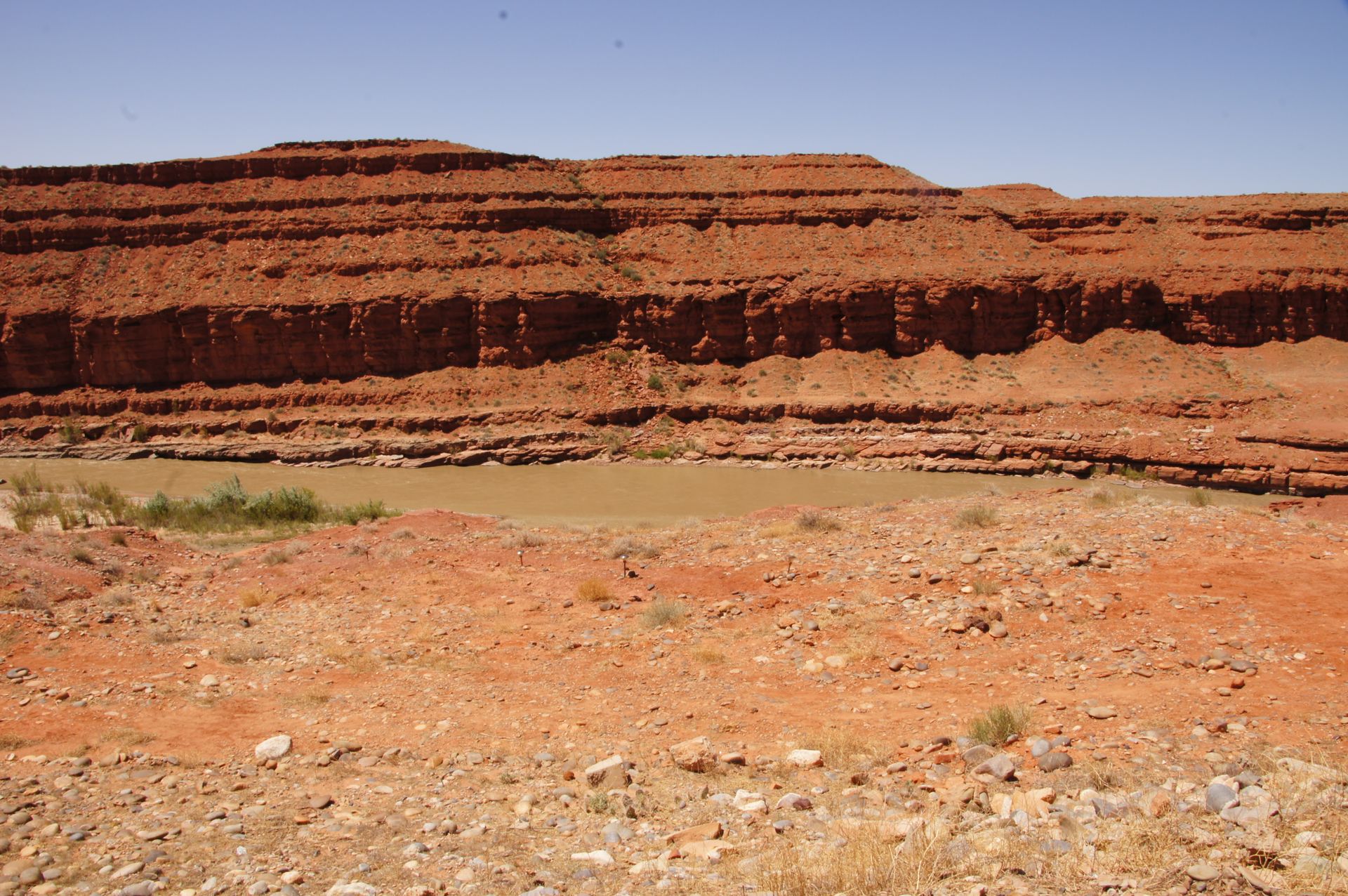
Mexican Hat is located on the San Juan River, which runs through a canyon below our hotel.
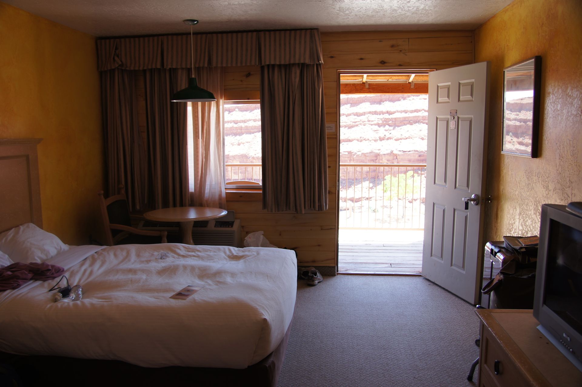
The hotel is a pleasant surprise. We practically overlook the small canyon and can hear the San Juan River rushing.
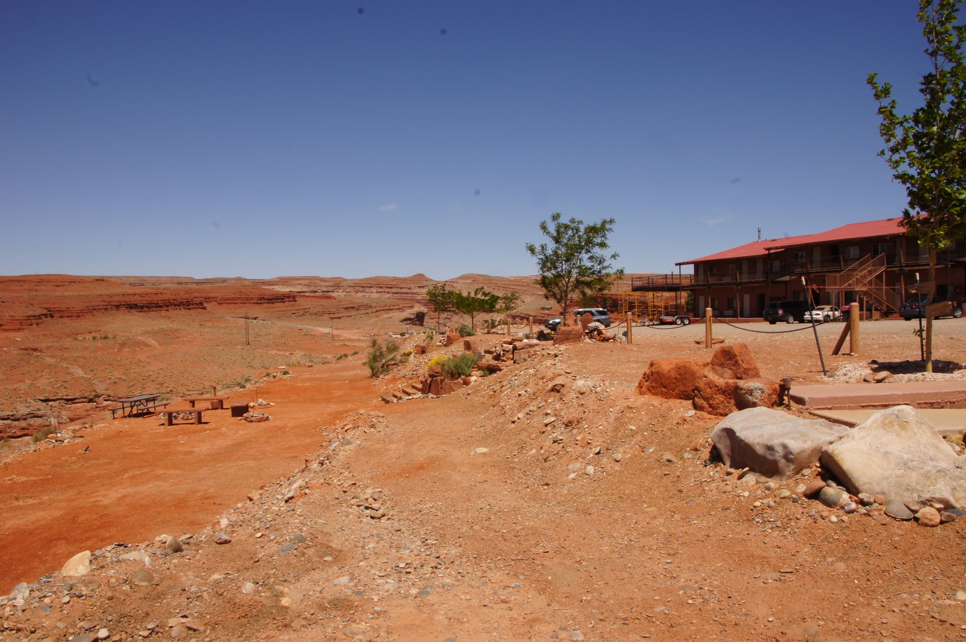
Hotel complex near Monument Valley in Mexican Hat
Mexican Hat Downtown - with the bridge over the San Juan River
The room is nice, and I'm happy that we will be staying here for two nights. We drop off our bags and head straight to the 16 miles distant Monument Valley. This is a gigantic area, but only part of it is the national park, which is also operated by the Navajo tribe. This means that despite possibly having an annual pass for US national parks, the entrance fees have to be paid here because the pass does not apply.
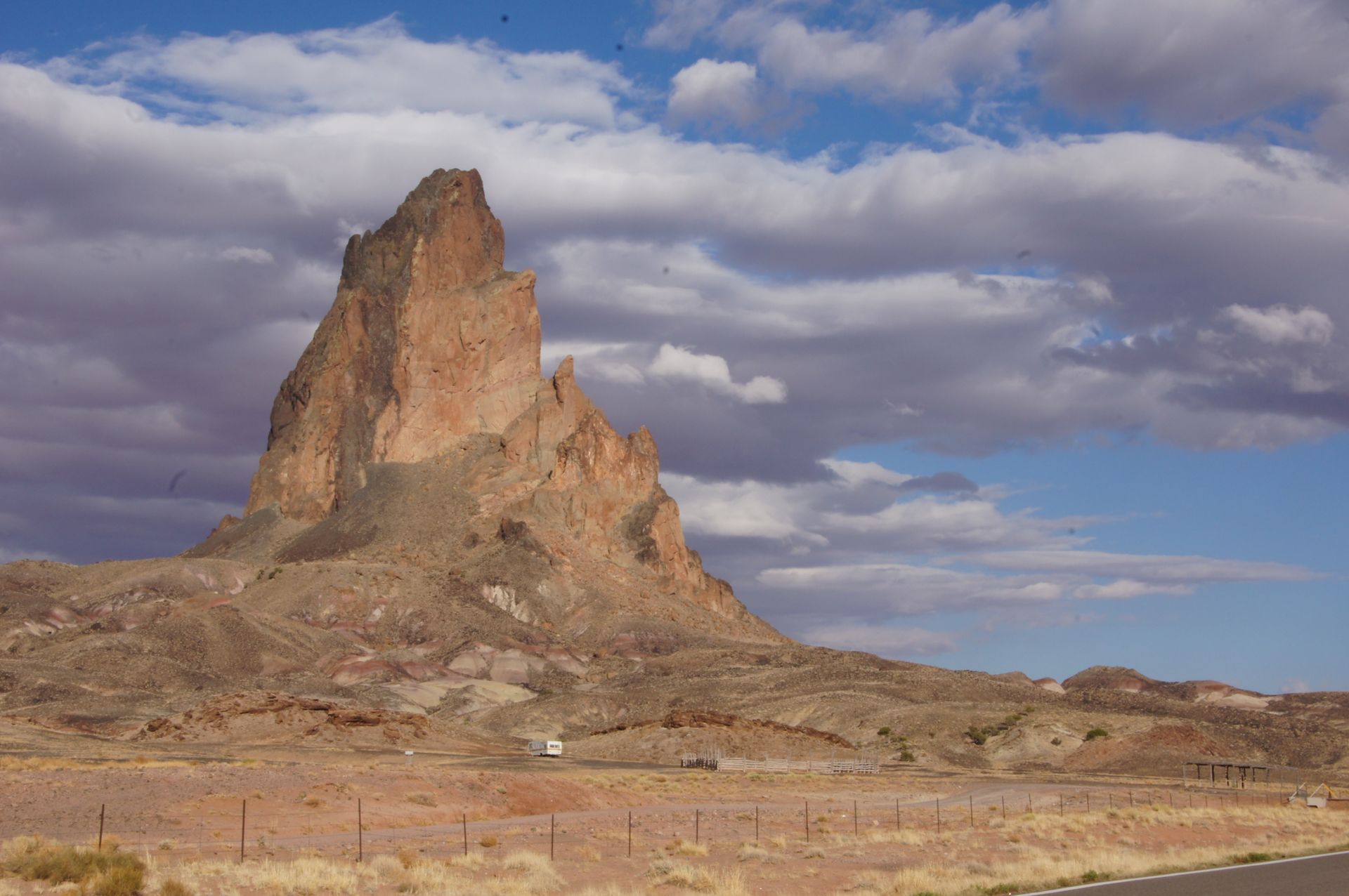
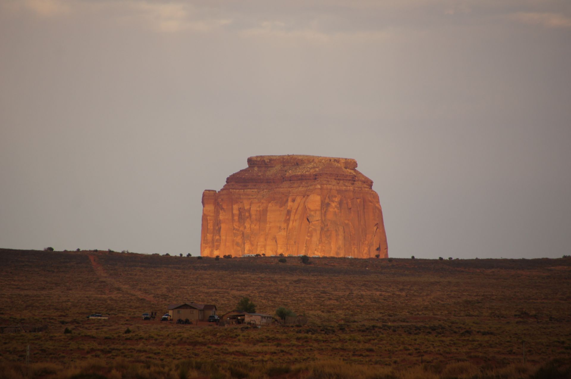
The entrance fee of $5 per person is not much, but since it's already after 6:00 pm, we decide to drive to Kayenta, which is 40 miles south in Arizona and is now in a different time zone. Just before Kayenta, there is the solitary rock formation called "El Capitan" (Agathla Peak) by the roadside. The mountain has a ceremonial meaning for the Navajos, and they call it "The Place Where the Animals Hide". Well, it's actually a volcano, and from its total height of 7,100 feet (2,164 meters), we can only see 1,200 feet (370 meters) here. The rest is underground in the caldera on which we are driving. Whether one should or would actually hide as an animal here - hmm?
El Capitan (Agathia Peak)
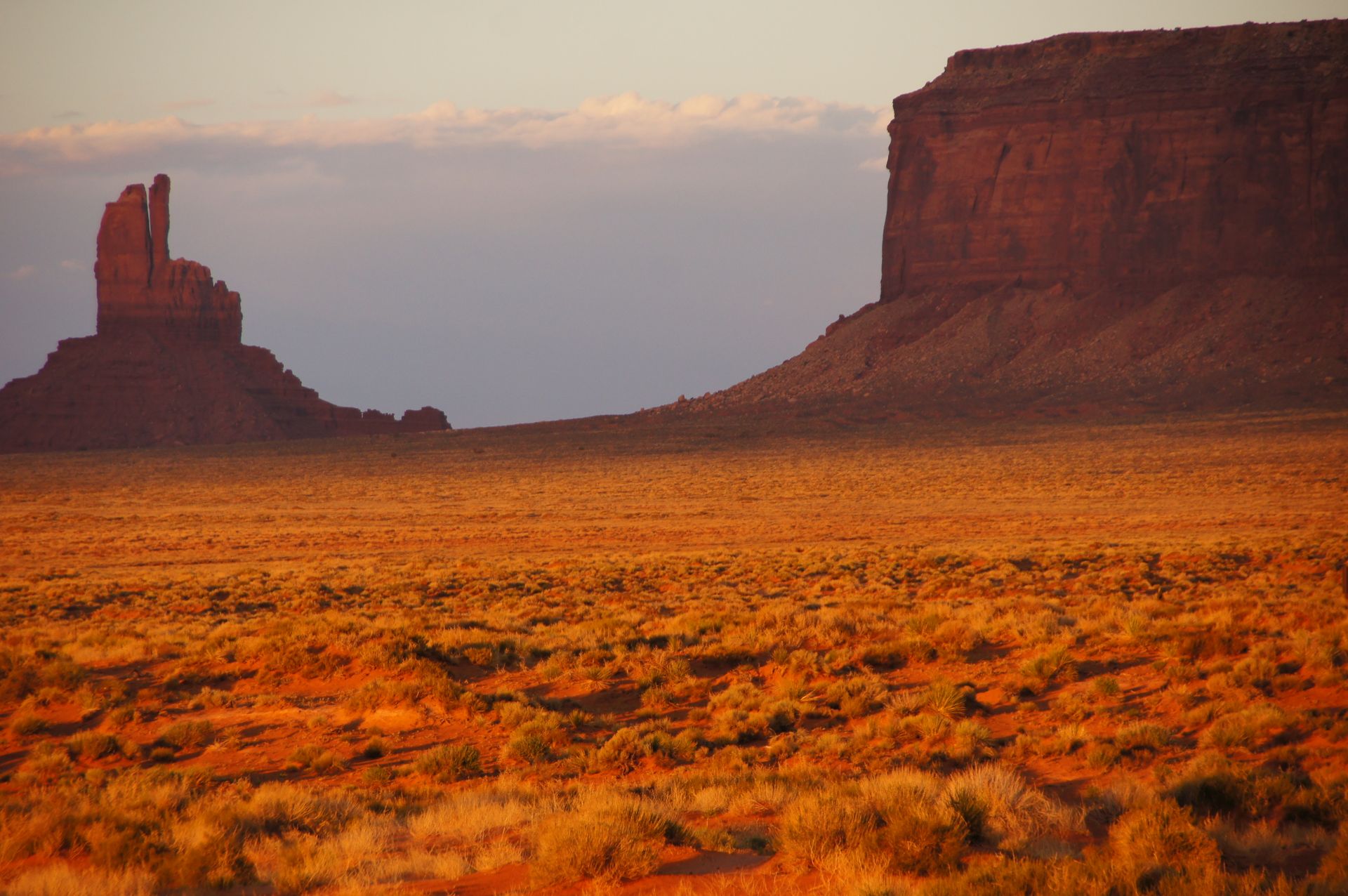
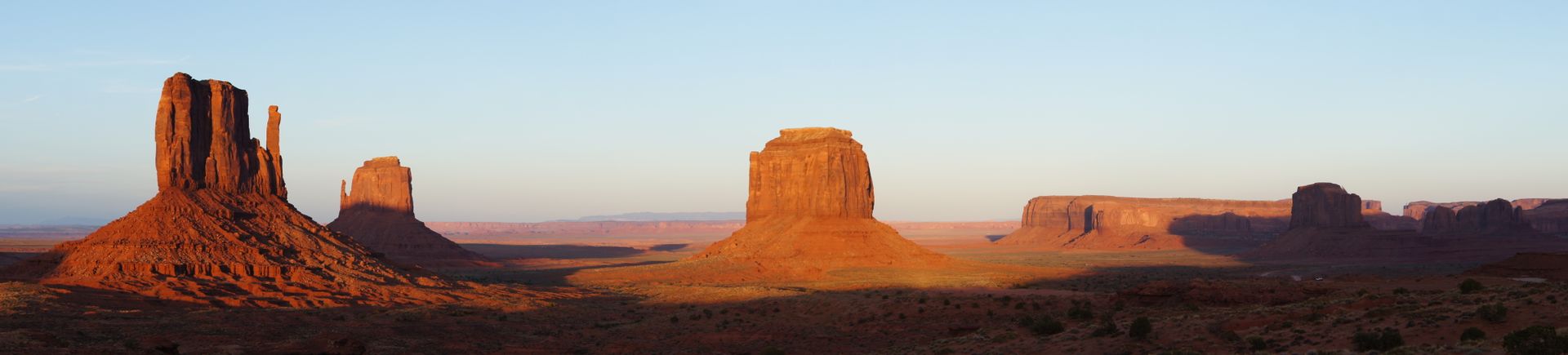
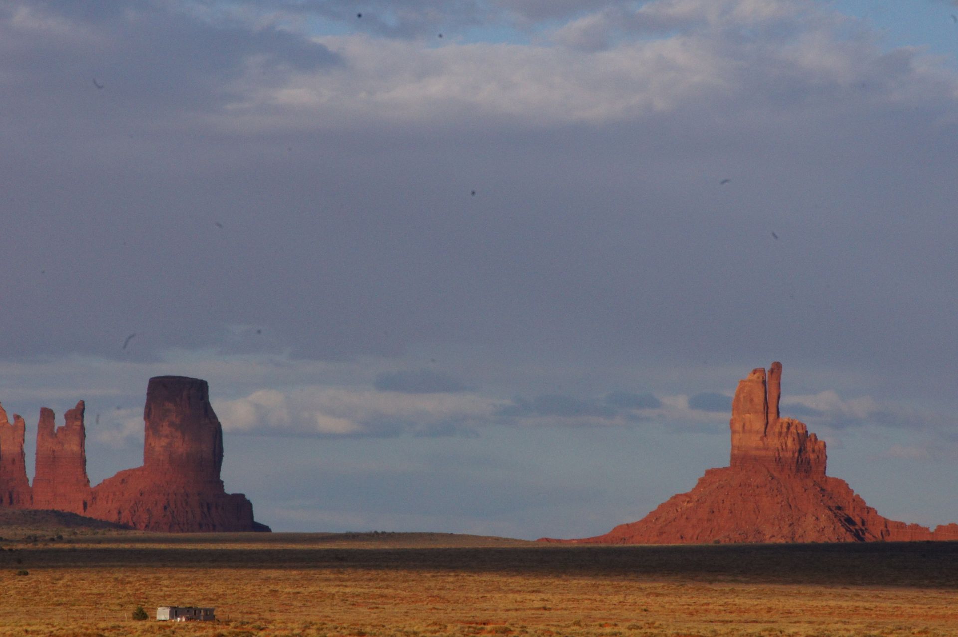
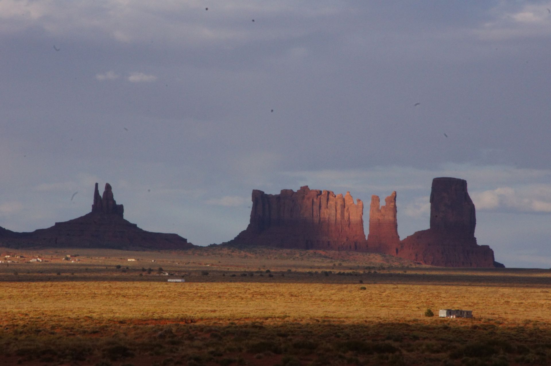
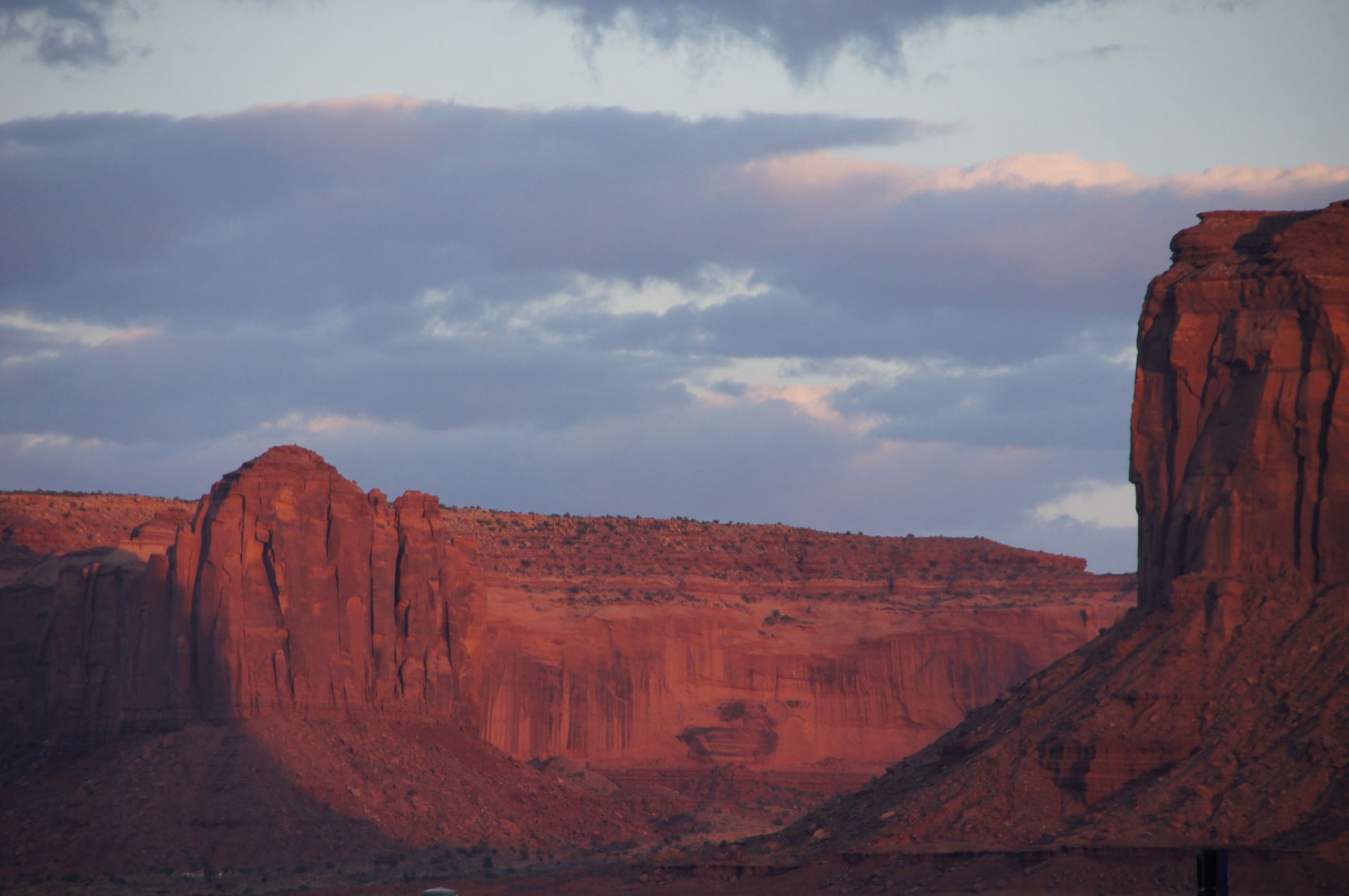
Unfortunately, as a place, Kayenta is not a revelation, just a collection of strange houses and abandoned shops along a four-lane road. We don't see anything nice, no old town - actually, no town at all. We turn around and drive back. We stop at the height of Monument Valley National Park and watch a sunset against the world-famous backdrop of Monument Valley.
It is incredible and breathtaking to see the colors of the rock formations change and glow in the distance. The sun disappears behind the clouds and reappears briefly half an hour before setting. The landscape glows, and so do our cameras.
Road/Cars/Mountain - what a composition!
We drive the 16 miles back to Mexican Hat and have dinner at the only bar (with a hostel) near the bridge over the San Juan River. The restaurant is cozy, and we enjoy a typical Navajo stew and a Budweiser. We are back at the hotel by 10:00 pm. Tomorrow, we plan to wake up at 5:00 am to be at Monument Valley for sunrise.
Agsubscribe iti Newsletter
Sungbat
Dagiti report ti panagbiahe USA