
Rainbow Valley and Uluru
Argitaratu: 26.09.2016


Harpidetu Buletinera
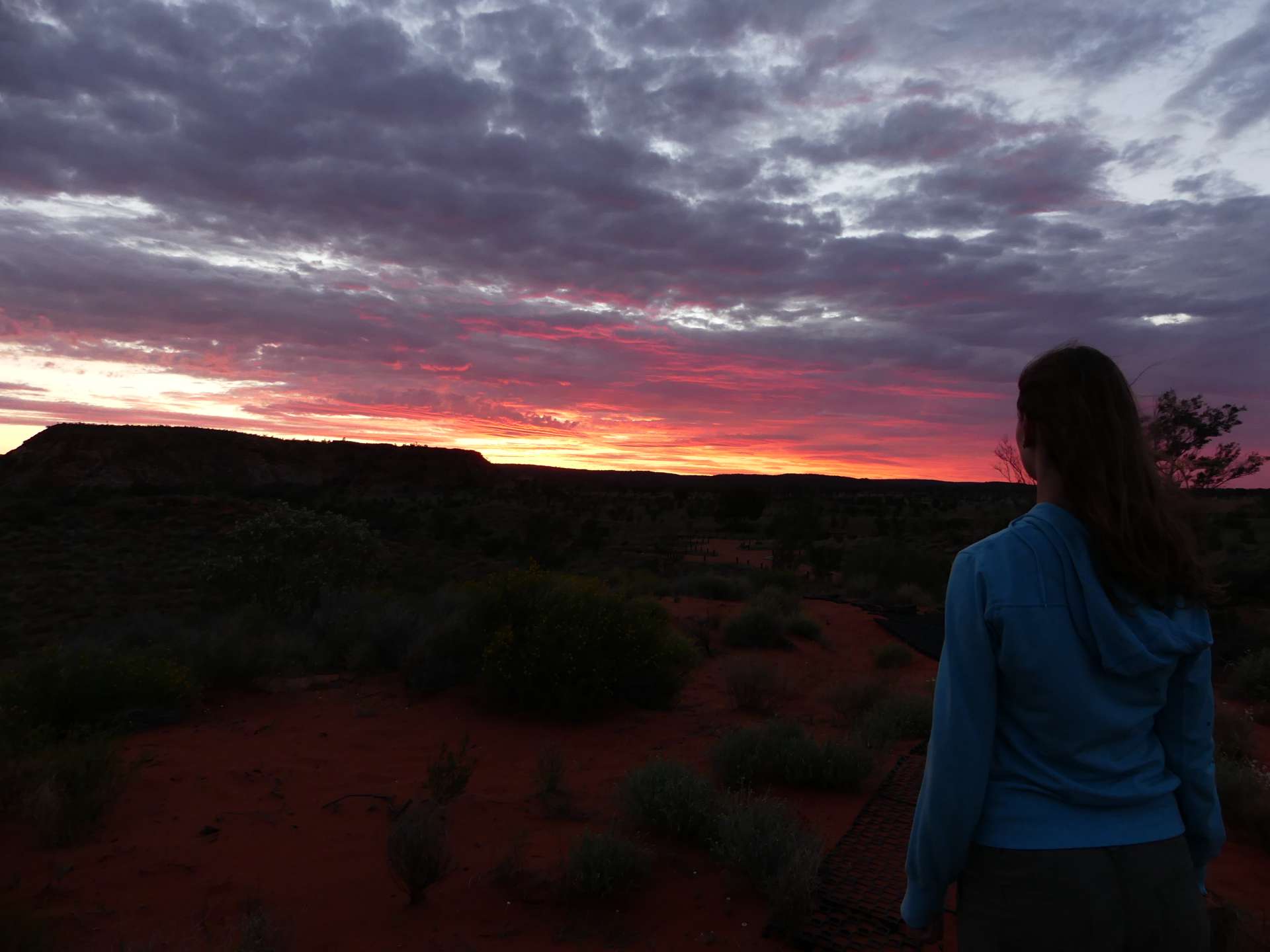
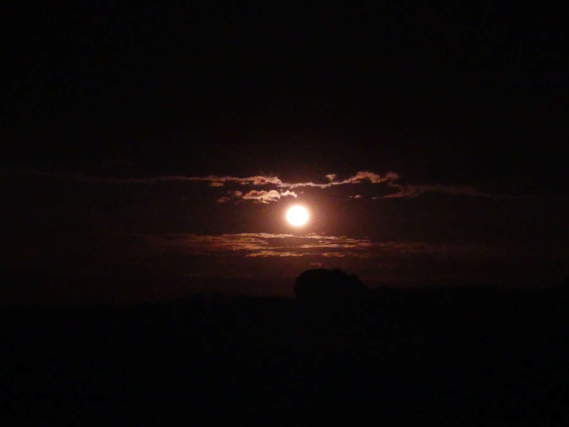
On September 17th, we headed to Uluru. We have already experienced a lot and seen beautiful places. Our planned stop for the night was Rainbow Valley. It is located about 90 km south of Alice Springs and then another 25 km on an unsealed road. We arrived just in time for the sunset, and it was truly beautiful! We could see and enjoy it from a sand dune. When we turned around, a big rock was illuminated in different shades of red and brown, resembling a rainbow. That's why it's called Rainbow Valley. The rock and some others are remnants from a time when the ground was at the height of the mountain tops. Now, you can see the different layers underneath the broken side of the rock. It looked really cool! When it got dark, the moon rose in the east and illuminated everything. We didn't even need a flashlight to go to the bathroom! :D
We went to bed early because it got really cold after sunset. The next morning, before breakfast, we went on a short walk. We ended up taking the Mushroom Walk, which led us to Mushroom Rock. It was really nice, and then we had breakfast. We were accompanied by a medium-sized greenish bird that was after our bread. I threw some crumbs for it, and it quickly ate them. But it seemed that wasn't enough because it also tried to get the bread from our hands. Andi held the bread away from the bird, but suddenly it flew and snatched a bite from his Nutella bread. The bird even had a little Hazelnut Spread on its beak, and Andi looked so surprised. It was really funny! The bird was cute and didn't bother us further.
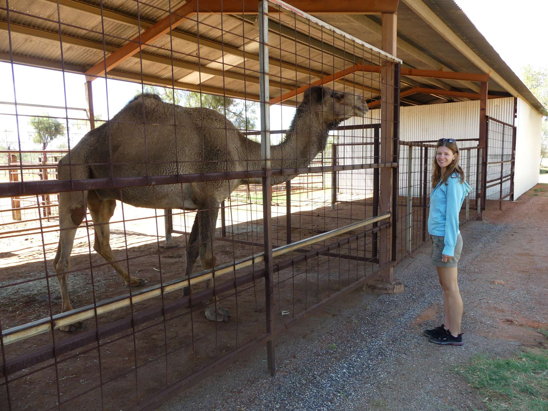
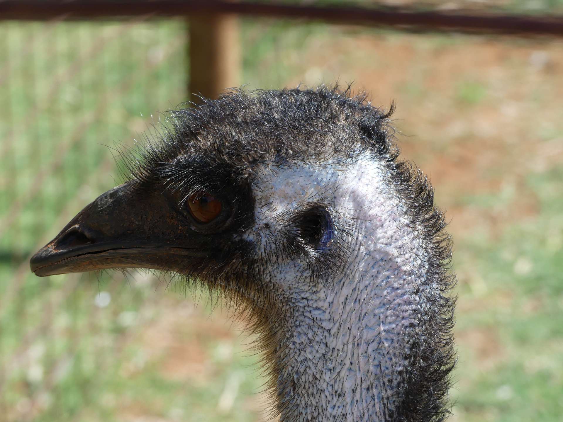
After packing up, we drove back on the unsealed road and then continued on the Stuart Highway towards Uluru. Our next stop was a camel farm where we made a quick stop to see the camels. One of them was really huge! Later, at another stop, we saw emus. Pretty cool! About 45 km after the turnoff to Rainbow Valley, we turned right onto a gravel road that took us 11 km to the Henbury Meteorites Conservation Reserve. There, we did a short walk to the meteorite crater and back. The walk wasn't long, and the crater wasn't as impressive as we expected, but the flies were annoying. So, not the most amazing detour. But the landscape around the crater was beautiful, and it was a nice break from driving.
Then we continued on the highway for another 70 km until we reached Erldunda. There, we turned right onto the Lasseter Highway, which leads directly to the Uluru - Kata Tjuta National Park. After about 60 km, we reached Mount Ebenezer. It is a rest area with an art gallery by the Aboriginal people. You can also stay there, and there is a pub. After using the restroom, we visited the gallery. The artwork was relatively affordable compared to Alice Springs, so we bought a small painting as a souvenir. Right next to the gallery is the studio, where we could watch an artist paint. It was really nice, and we are happy to have such a great souvenir now.
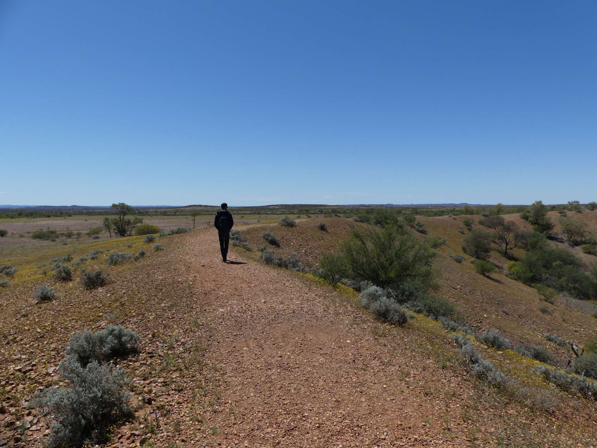
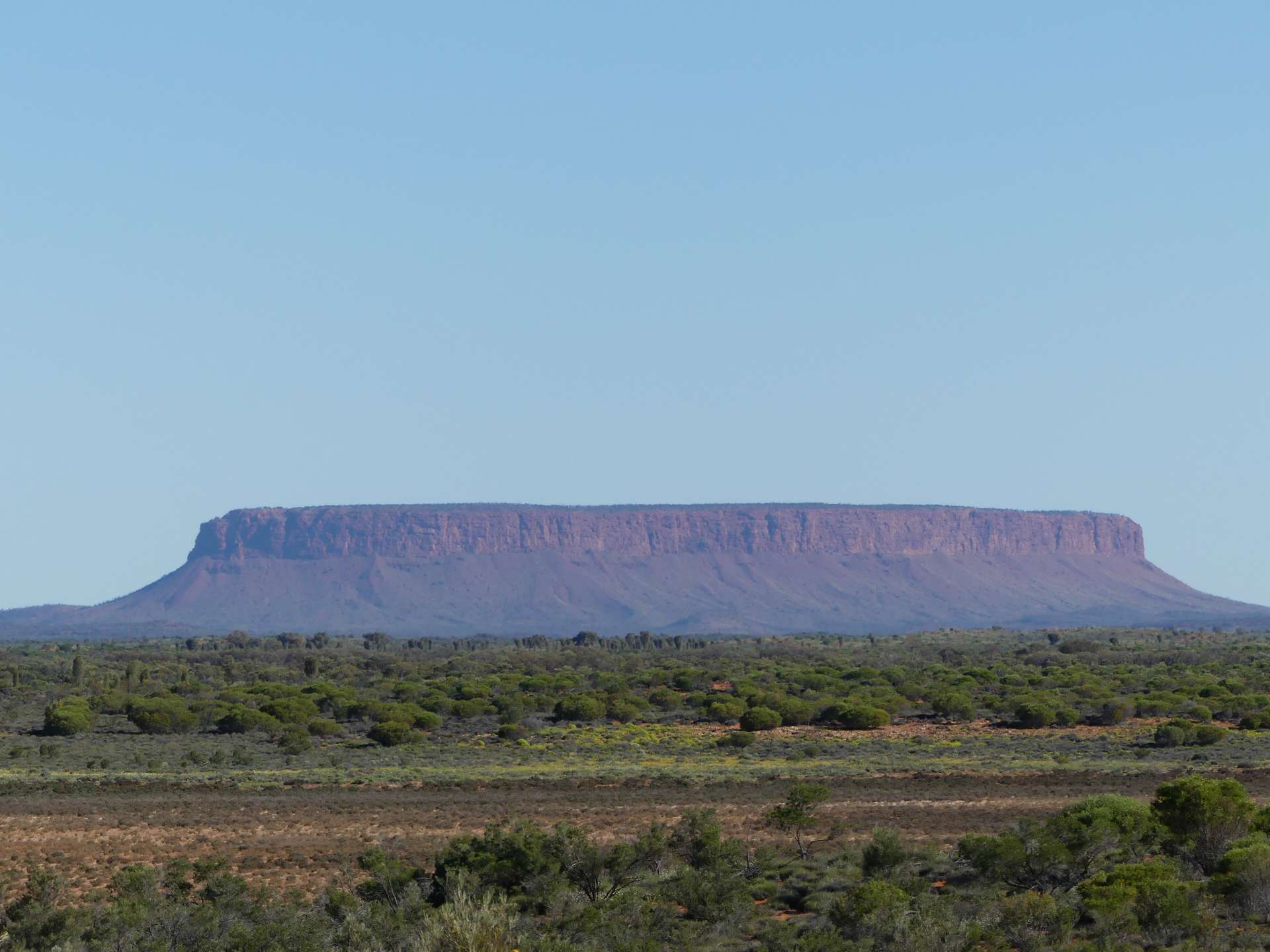
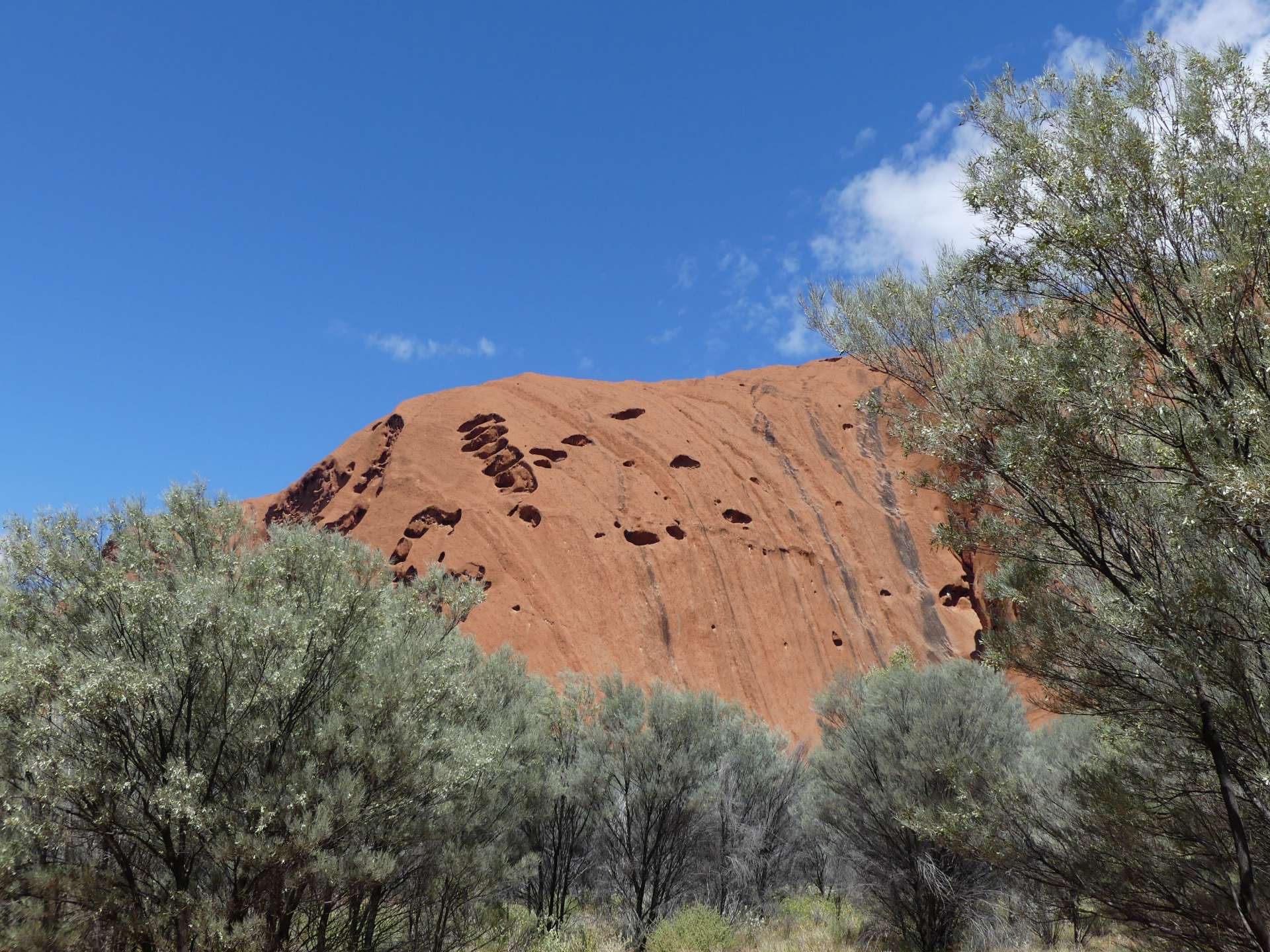
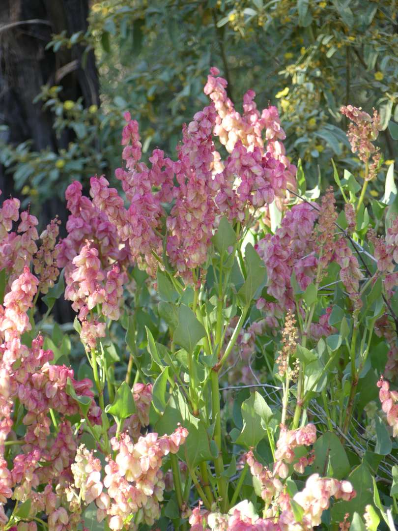
After the stop, we continued to Uluru. About 80 km later, a mountain appeared on the horizon, but it was not Uluru, it was Mount Conner. It also looked impressive, so we made a brief stop at the lookout. The landscape on the entire journey was beautiful because everything was green. We thought that the further we drove into the center or the outback, the more "desert-like" it would become, but it was just green everywhere. The friendly tow truck driver from the previous day told us that Alice Springs and its surroundings had hardly seen any rain in the past 4 years, but since January 2016, they had received as much rainfall as they normally would in 2 years. That's why everything is so green. For us, the Red Centre was everything but red. But this lush vegetation is not normal, and we feel lucky to experience it. We just expected something different :D
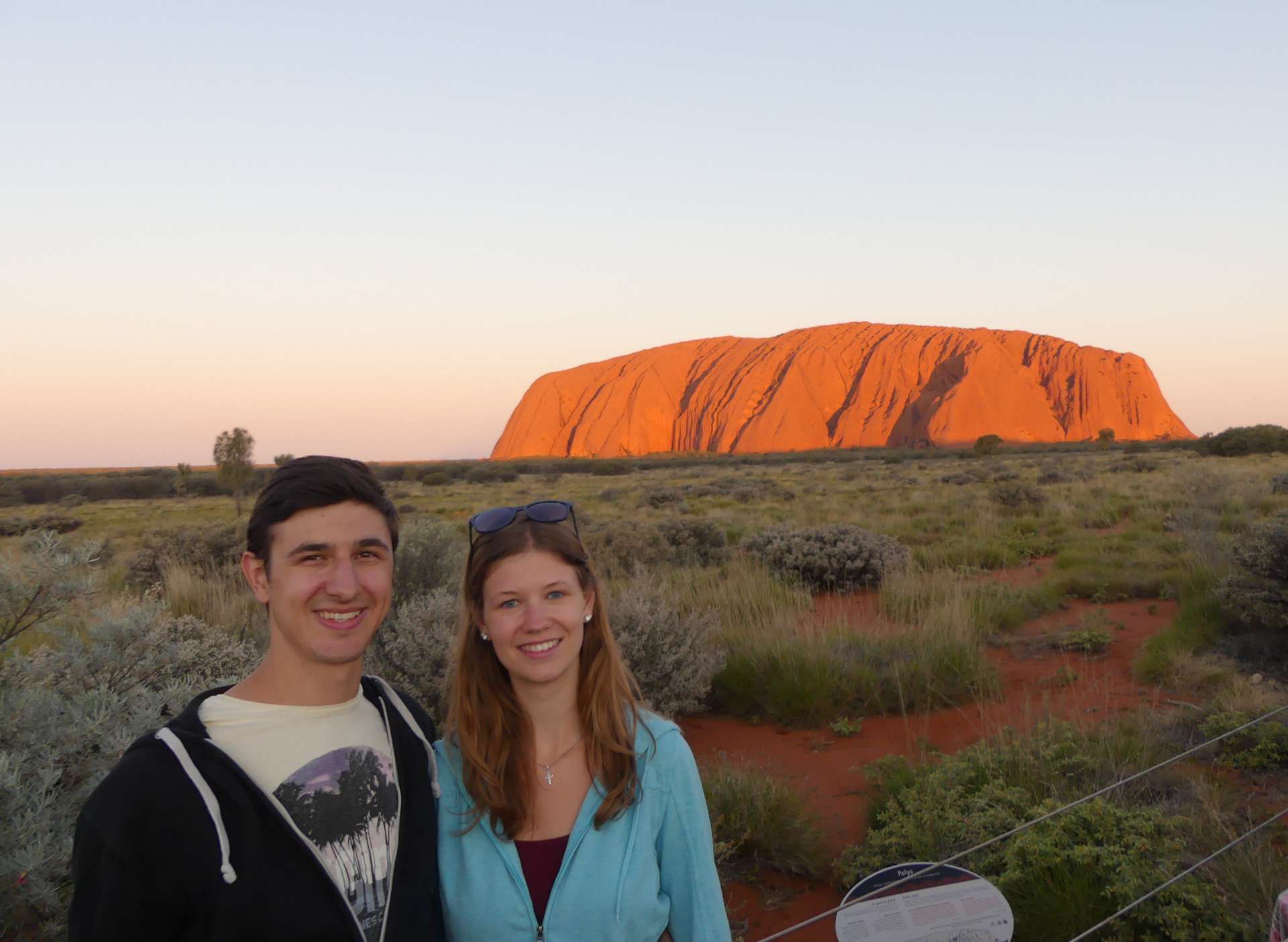
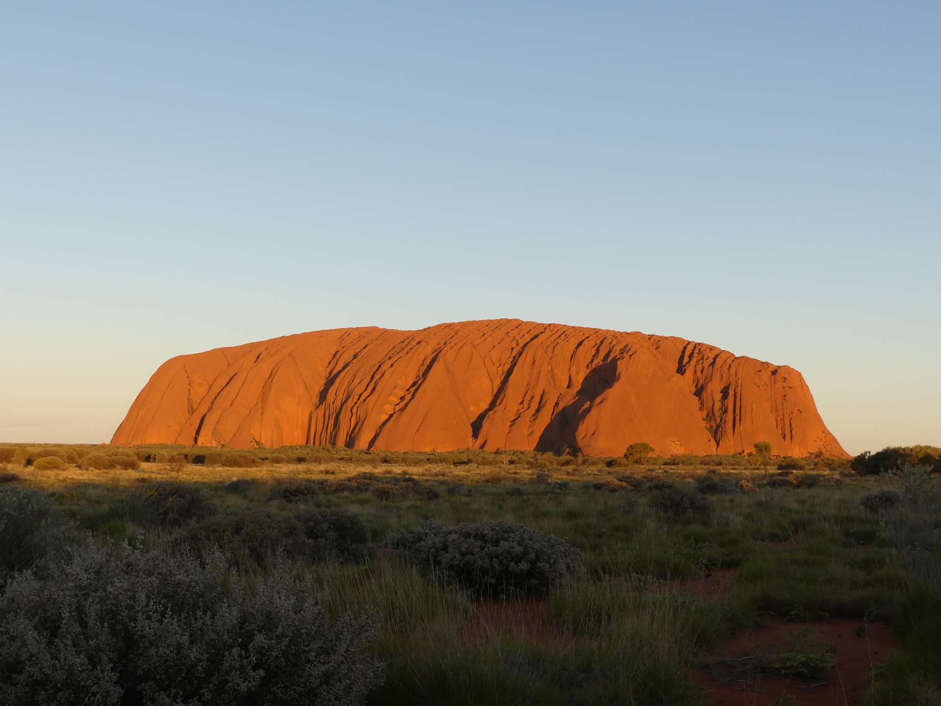
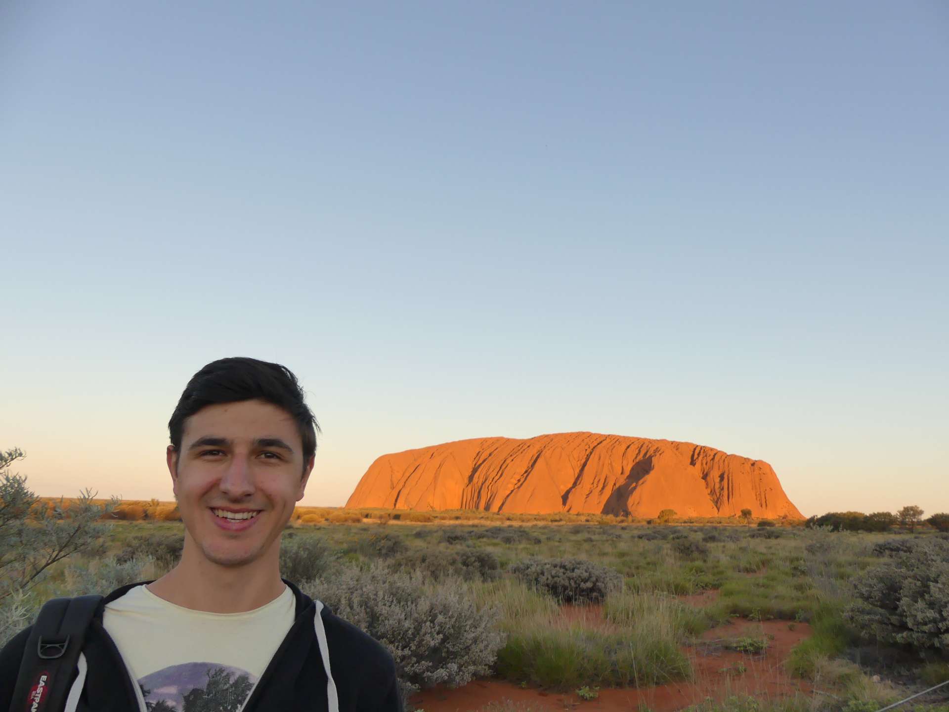
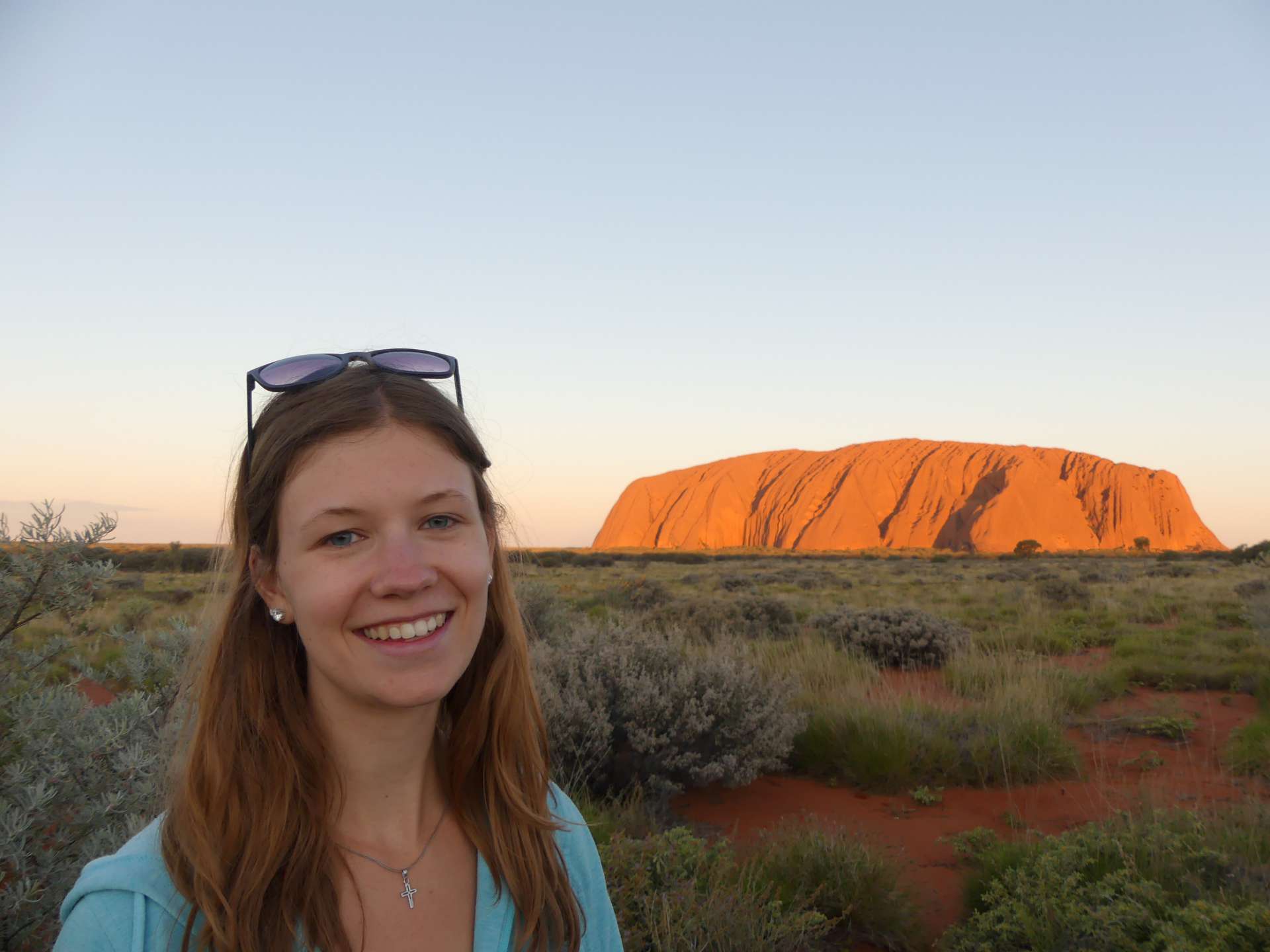
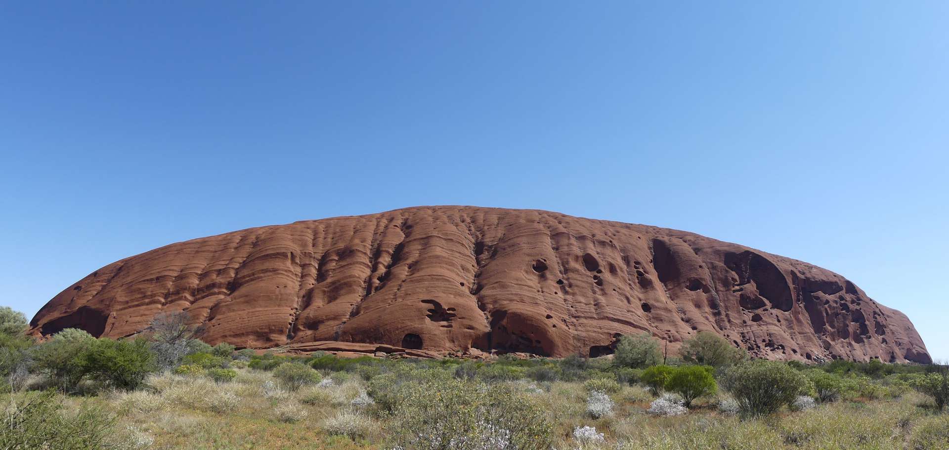
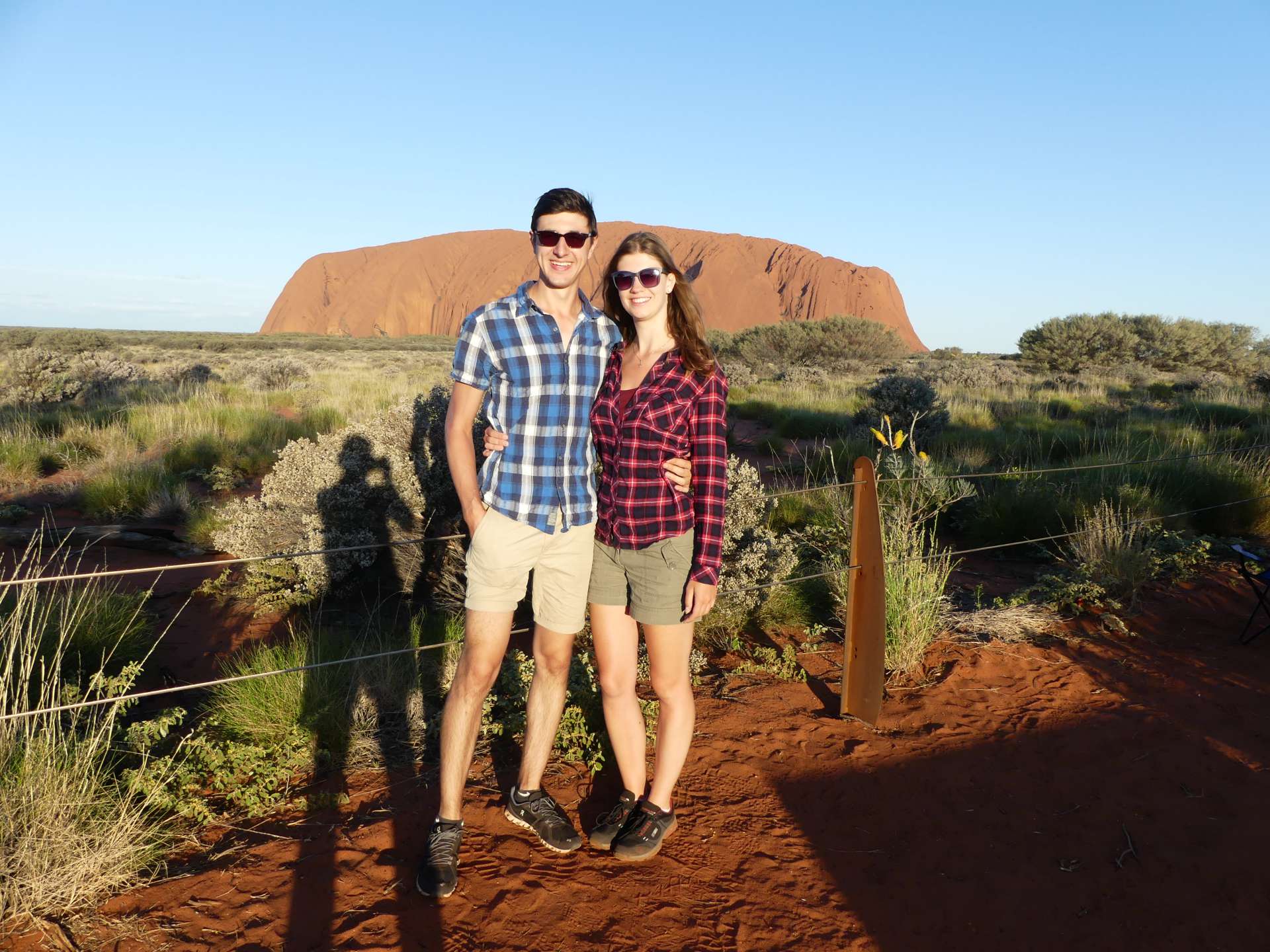
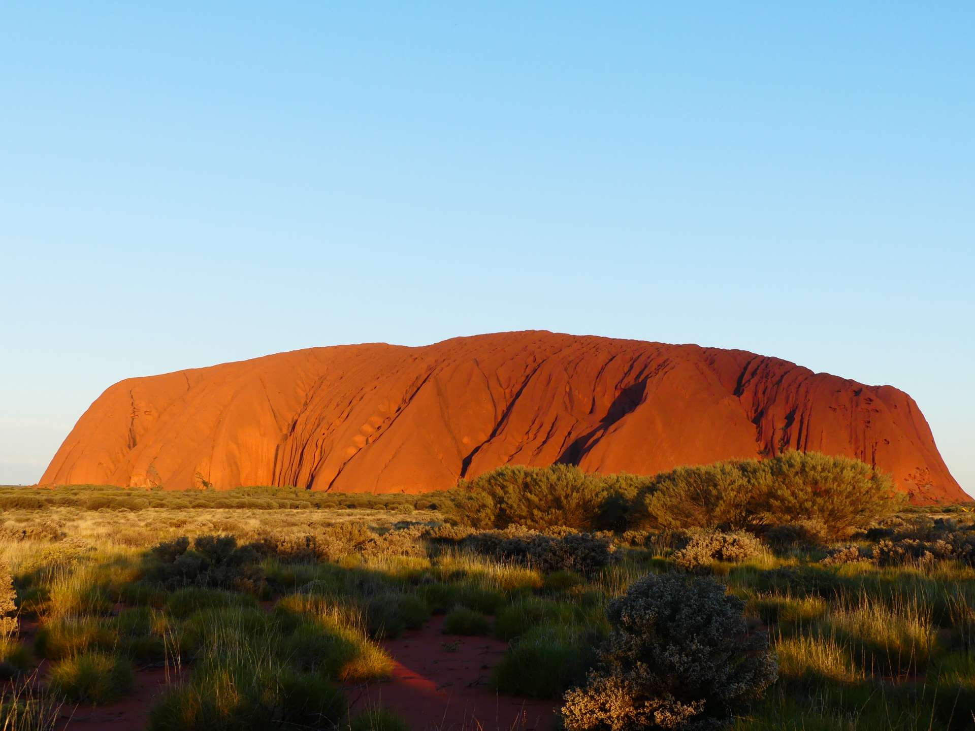
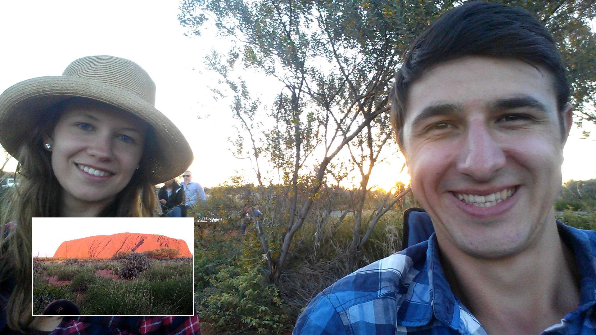
From the Mount Conner lookout, it was another 100 km until we arrived in Yulara, also known as Ayers Rock Resort. The resort was designed by an Australian architect and is mainly powered by solar panels. It includes several hotels, lodges, restaurants, a campground, a town center with a supermarket, post office, information center, bank, and several lookouts. We first looked for the information center (poor signage!) and got some information about the area. We also booked our visit to the Field of Light, as it was very popular and already fully booked for the next 2 days. Afterward, we went straight to Uluru because it was 6 pm, and the sun was setting at 6:40 pm. We could perfectly watch the sunset. The rock is truly impressive! It stands in the flat landscape and shines red. You always think that all the pictures you see of Uluru are photoshopped, but it is really quite red when the sun sets. Very cool! The Sunset Viewing Area was crowded, but that was to be expected. It offers the best view, so there is no point in standing somewhere else. You're not even allowed to randomly park by the road. This is one of the most monitored national parks we have visited. You even have to purchase a ticket at an automated machine and use it to pass through a barrier. The ticket costs 25 AUD per person and is valid for 3 days for unlimited entry.
After sunset, we drove back to the resort. We wanted to camp there, even though it was slightly more expensive at 36 AUD according to the visitor center. We couldn't find the free campgrounds near Uluru that were marked on wikicamps, so we had no other choice. In the end, we only paid 20 AUD per night because the actual campground was full and we were on the overflow area. It's just a large open space adjacent to the campground. The toilets and kitchens were a bit further away, which is probably why it was cheaper. But it suited us just fine. It got dark quickly (half an hour after sunset), and it became really cold. The desert climate hit us hard, and the nights were around 5°C. However, our sleeping setup was already equipped with a thicker blanket and sleeping bags, and we no longer sleep with the trunk open. Nonetheless, we had to layer up in bed. It was quite a contrast to our previous experiences.
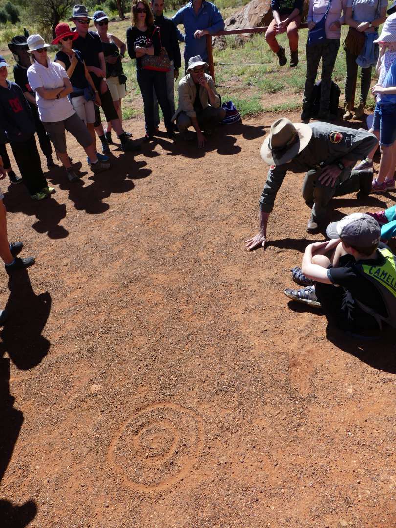
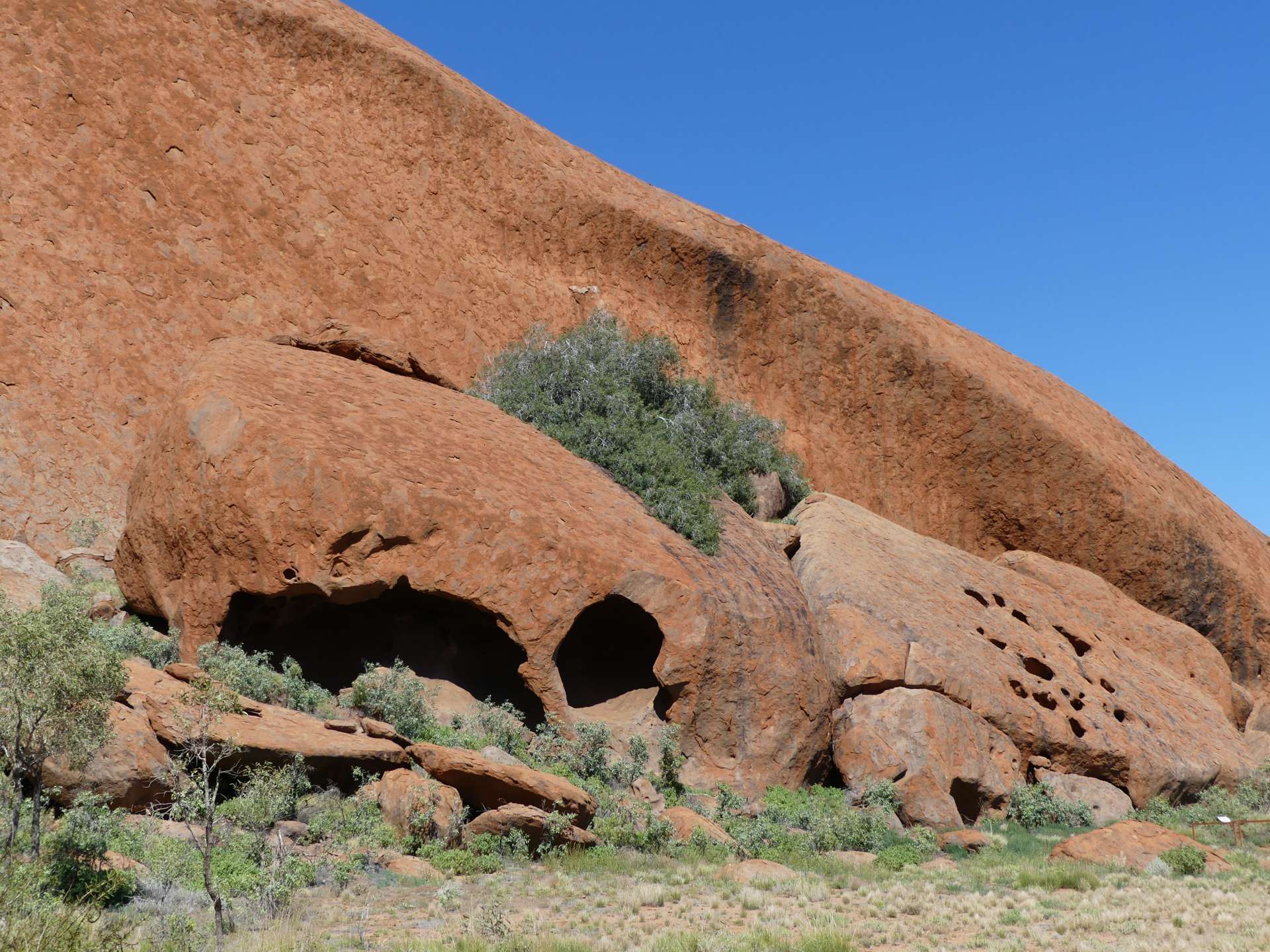
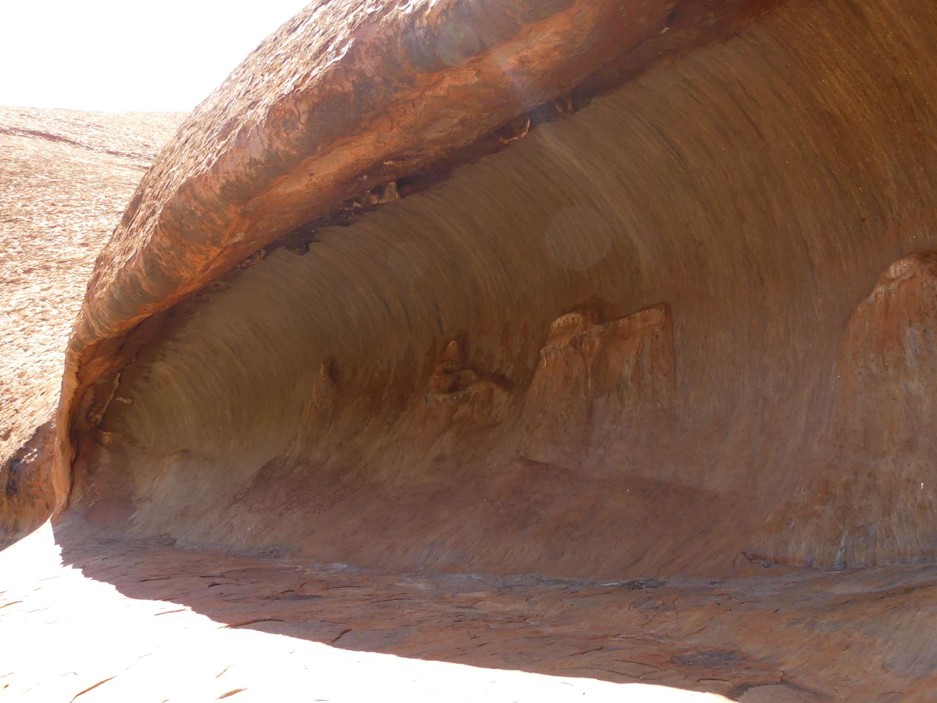
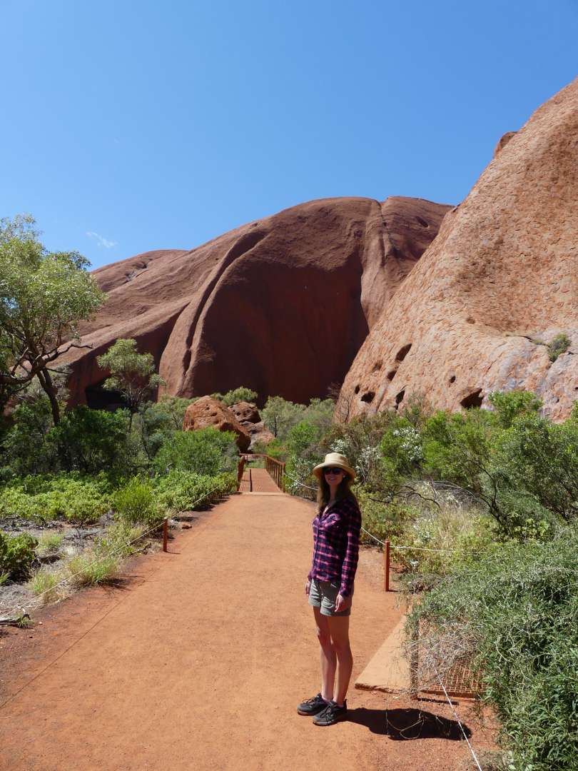
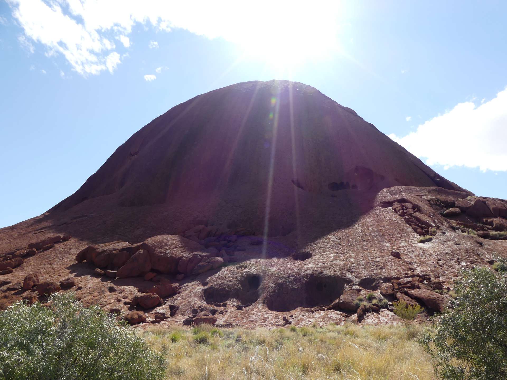
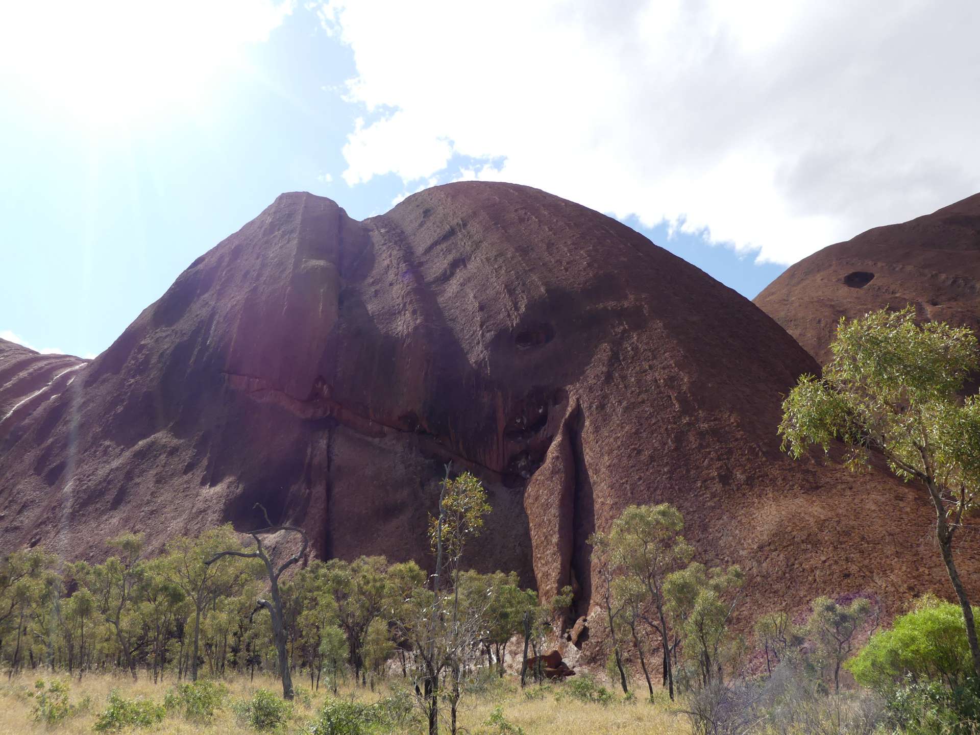
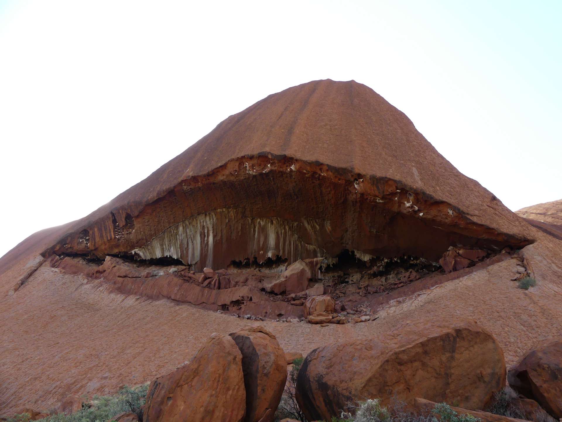
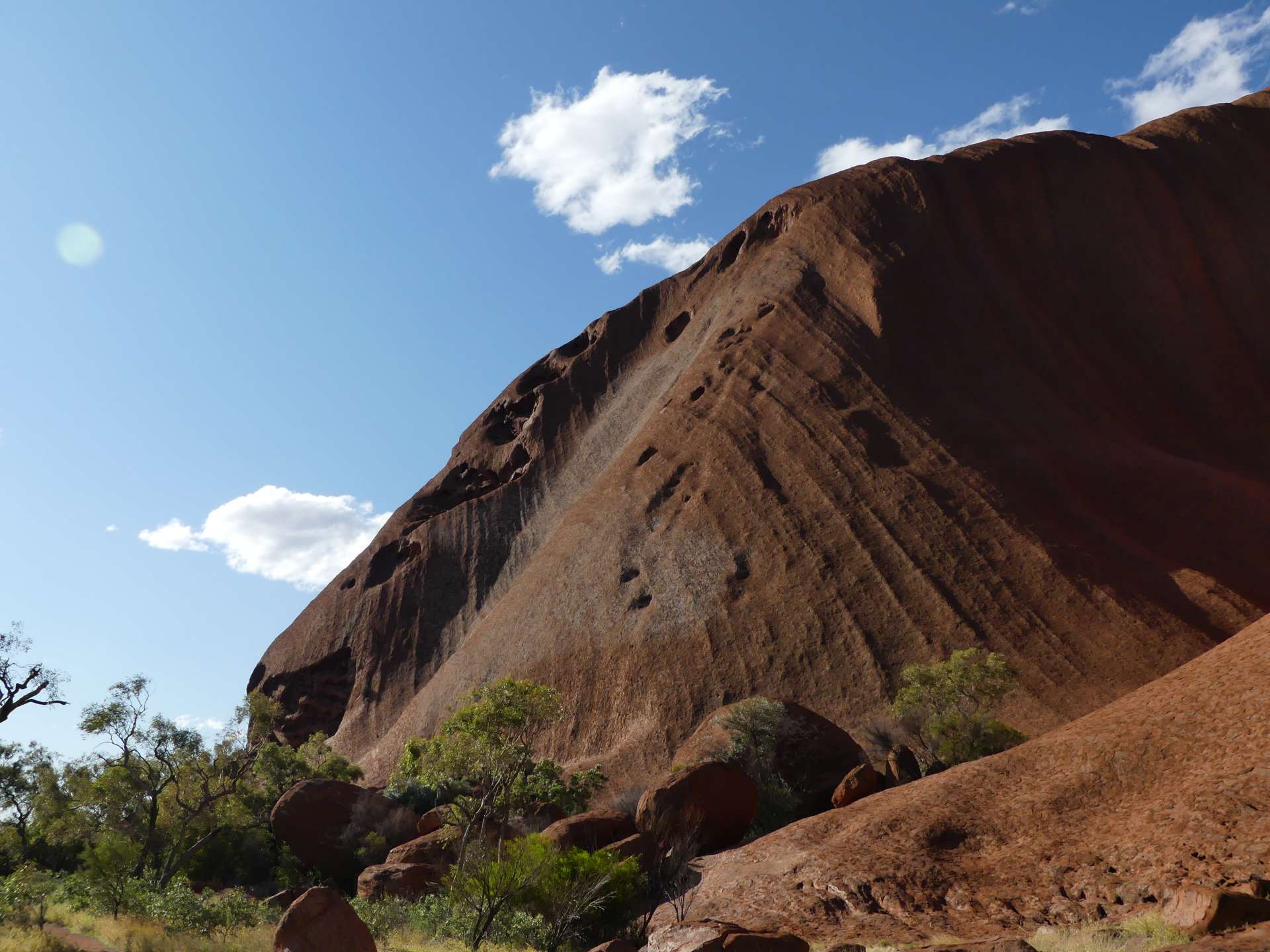
The next day was sunny again, and it quickly became warm. After breakfast, we headed to Uluru to spend the day there. It looked even more impressive up close! Truly a fascinating rock. You can understand why it is such an important site for the Aboriginal people of this region. At 10 am, the Mala Walk (Mala = Wallaby) started. It is a free guided walk where a ranger explains the history of the national park, tells various stories of the Aborigines relating to Uluru, and tries to make visitors understand the significance of the rock in Aboriginal culture. He did a great job. Since many children were present (school holidays in Australia), he focused more on them, asking them questions, etc. It was cute. We went to different spots on the rock, where he explained what traditional practices took place there. For example, there was a cave that only boys were allowed to enter. It was a place where they stayed together overnight and learned. At another spot, the ranger told a story using sand art and explained the symbols used by Aborigines to depict sitting men, mountains, or footprints. It was cool because we had already seen these symbols in Mount Ebenezer's artwork but didn't know what they represented. There was also a kitchen cave where some women (including me) sat at specific spots, placed their hand on the rock, closed their eyes, and imagined how many generations of women had prepared meals there. It was a beautiful experience, and you could somehow feel a connection to the place, even though it's hard to imagine the number of women who actually sat there.
Around Uluru, there are areas where you are not allowed to take photos or videos because they are sacred sites. The ranger explained that these are usually places where only men or women are allowed, but visitors are tolerated. They just ask for respect and aim to prevent pictures of these places from appearing on the internet. However, there are so many beautiful places to photograph that it's not a problem to put the camera away for a while.
There was also a spot near the beginning of the walk where a kind of golden marsupial mole lives in small caves in the rock. The funny thing is, it is not related to the European mole at all, but to the kangaroo! The marsupial mole has a pouch on its belly, but with the opening in the back, so that dirt doesn't get in when it crawls on the ground. Pretty cool :D There were also larger holes in the rock, which were related to an Aboriginal story of Minyma Itjaritjari, a large marsupial mole from the Creation Time.
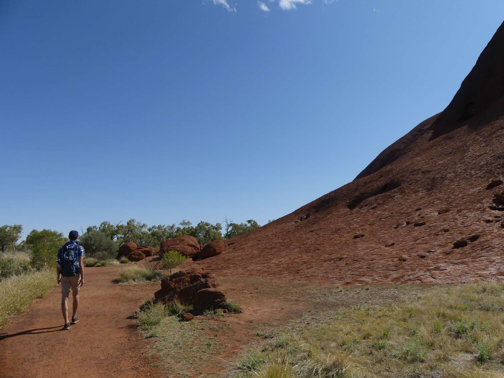
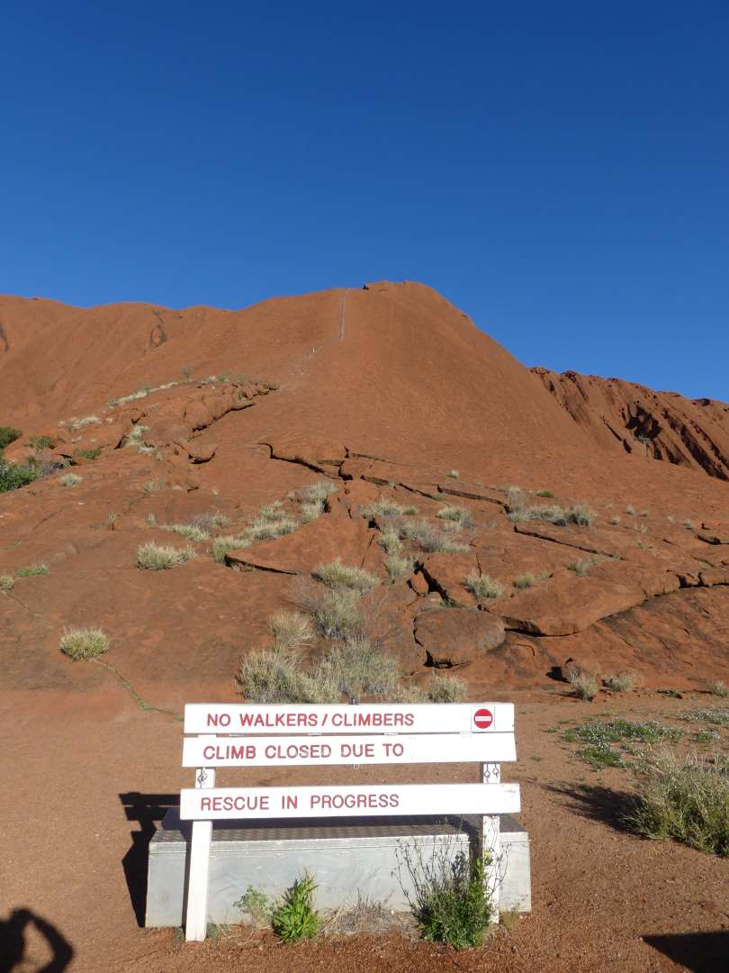
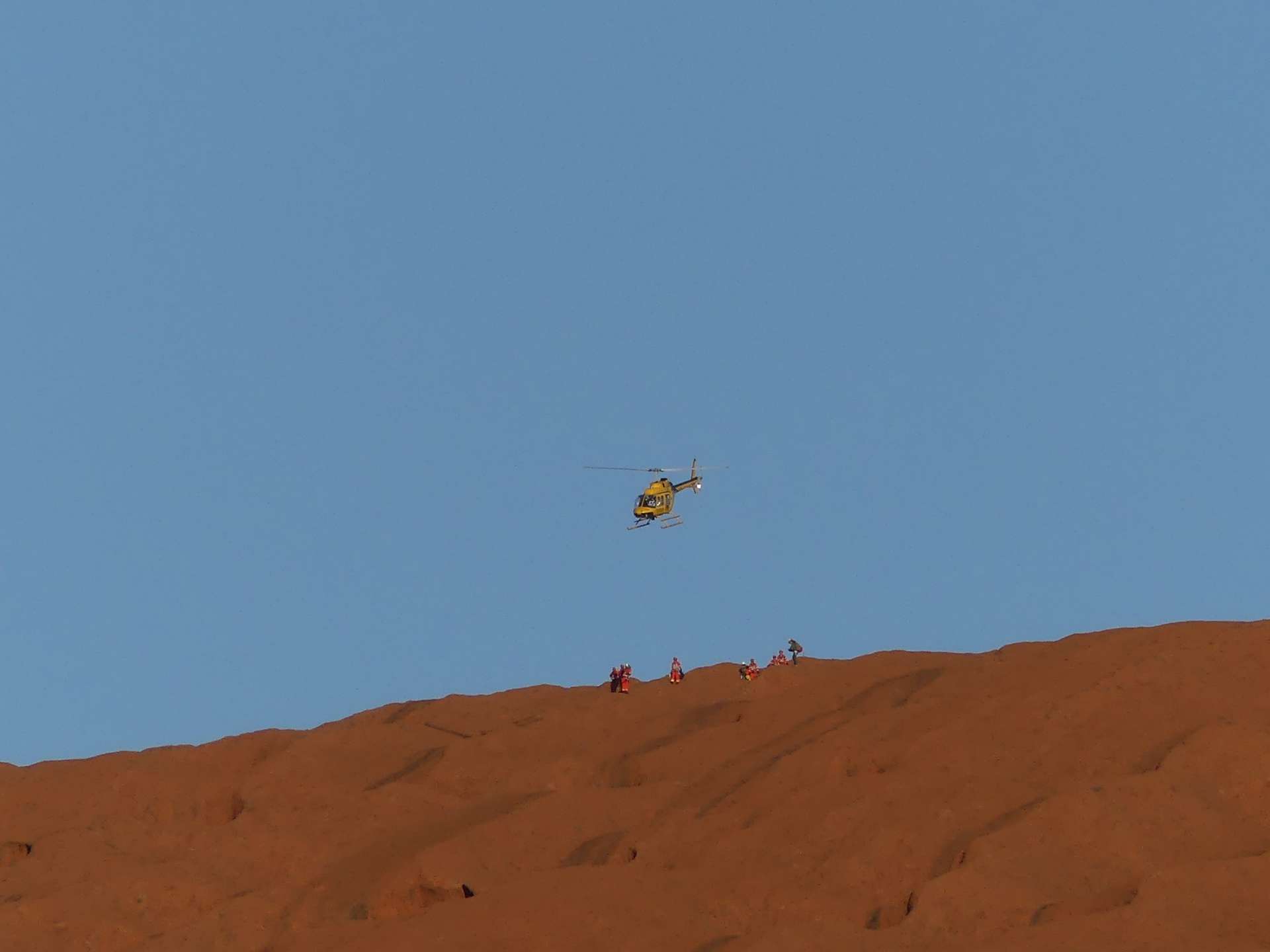
By noon, the walk was over, and Andi and I started the Base Walk. It is a 10.6 km walk around Uluru, with 1 km already covered during the Mala Walk. You can still climb Uluru, which is called The Climb, and we saw many people climbing it. However, the Anangu (the Aboriginal people in the region) do not want people to climb because it is a sacred activity for them and involves important ceremonies. We wanted to respect that and, besides, climbing is not entirely safe. That's why we chose the Base Walk. And it was definitely the right decision because it allowed us to see the rock from all sides, different perspectives, lighting conditions, and the nature surrounding it. It was really great because later in the evening, when we watched the sunset at Uluru again, we saw the rock in a completely different way. We knew what it looked like up close and where each curve was. However, the Base Walk was also quite challenging, so it shouldn't be underestimated. There is not much shade, and it gets tiring towards the end. With breaks, I think we took about 4.5 hours. But it was truly an amazing experience. When we arrived back at the car park, the climb was just closed because there was a rescue operation in progress. The ranger from the morning told us that over 35 people have died at Uluru because they overestimated themselves, fell, or (most of them) didn't drink enough and collapsed. A rescue operation can take hours, and it can also take hours for help to arrive because the helicopters have to come from Alice Springs. So, it's really messed up... There was a sign saying that they are working on permanently closing the climb. I think that's a good idea.
After the exhausting day, we watched the sunset from our camping chairs and drove back slightly earlier so that it wouldn't be pitch dark when we cooked. Luckily, it wasn't as cold that night because the day had been warmer. The next day, we planned to spend at Kata Tjuta, but I will write a separate entry about that. See you then! :)
Harpidetu Buletinera
Erantzun (2)
Dennis
Das ist doch der ayers rock oder? :D Silvia
Ja stimmt ;)
Er wird nur nicht mehr so genannt. Inzwischen tragen eigentlich alle Attraktionen ihren ursprünglichen, indigenen Namen :)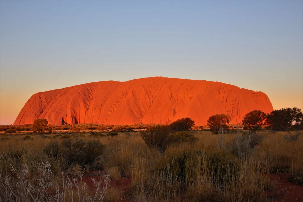
Bidaien txostenak Australia