The Wild Kogel
Wotae: 01.12.2017

Wɔ Nudɔdɔ na Nyadzɔdzɔgbalẽ
Somewhat anxious, I hang on the wall and look down at the snow-covered glacier below me. Phew, better not look down!
Cold wind blows in my face and I pull the collar of my thin jacket tighter. Rico has already climbed several meters further to the next ledge. The height bothers him much less than me. We left the warm bed early in the morning, had a meager breakfast at the Badener Hütte and set off on the multi-hour via ferrata to the Crystal Wall. Right at the start, our skills were put to the test. Only a few iron rungs protrude from the overhanging rock tower. Rico climbs up as if it were a Sunday afternoon stroll. He grins at me from above with joy and waits patiently until my amygdala calms down a bit.
I take a deep breath and dare to take the first step. The narrow metal spike protruding from the wall feels cold and rough in my hand. My foot wobbles uncertainly and finds no secure foothold. Once again, I wonder what on earth drove me here. I feel about as comfortable as a yak in the Arabian Gulf. This thought puts a smile on my face. And I cautiously set one foot in front of the other, one hand after the other, always three points on the rock, as my father taught me...
Finally, I reach the upper edge, swing myself up and catch sight of a breathtaking panorama of the surrounding mountains. Now I remember why I came here!
I continue my journey and follow the narrow ice-free ridge towards the summit. The route is well secured, I just need to clip myself into the steel rope with my carabiner, which is attached to my harness with a sling. Click! With every meter, the fear diminishes, the air is cool and clear.
Hour after hour, we climb over rock towers, hang ourselves along the abyss, and pass through rock crevices. By noon, we have reached the summit ascent. A gentle summit leads the last few meters up. The safety equipment is no longer necessary here. Then we stand at the highest point at over 3,300 m. The east wall descends over 600 m vertically onto the glacier, along whose moraine we ascended the day before. Opposite, there is an unobstructed view of the Grossvenediger, majestically towering into the steel-blue sky. We are surrounded by an incredible silence, interrupted only by the crunching of the rocks under our feet.
While I enjoy the view and the soothing warm sun rays on my face, just thinking about getting out my sandwich, Rico has something else on his mind. With both toes, he stands on the outer edge of the east wall and loudly proclaims his fearlessness of heights. Of course, without any safety precautions. When I shout at him asking if he's out of his mind and what could happen, he just grins at me with his mischievous smile, which under different circumstances I would probably find attractive. Finally, he steps away from the edge and sits down next to me in the sparse grass. Silently, we bite into our sausage sandwiches and once again enjoy the silence and the view.
The descent takes us back the same way. Once again, Rico tries some stunts where he leans out over abysses with maximum acrobatics. I don't know what frightens me more today, the height or the thought of having to rappel down alone. Phew! Mind games.
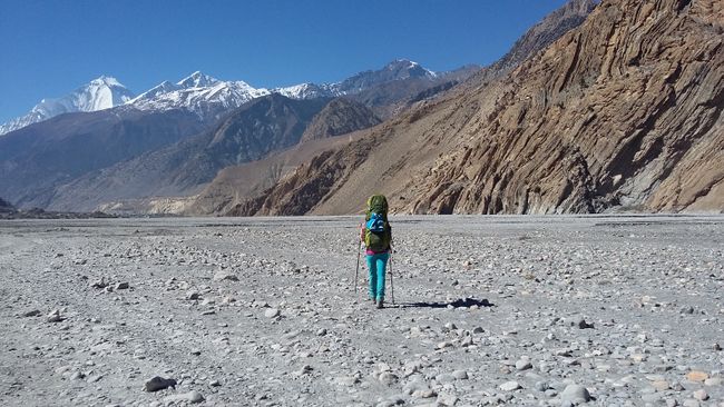
Finally, we made it back to the Badener Hütte without any major incidents. Funny how a single standing hut in the middle of the mountains gives a feeling of safety. Going down to the valley is another day trip. The fat hut owner provides information that another path up to the valley and over another 3,000-meter peak also leads to our starting point. Those who are good on foot can do this in about 5 hours.
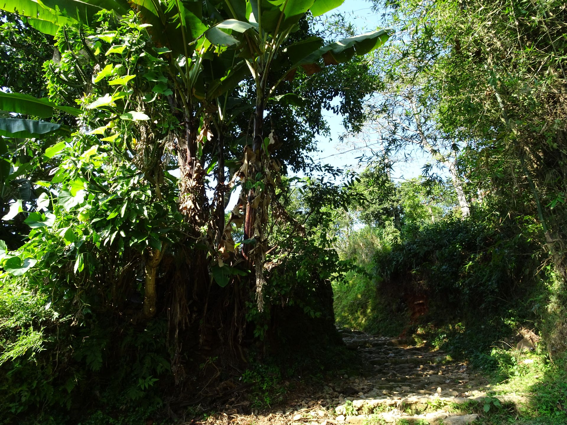
We set off on the beautiful panoramic path up to the valley. Here and there, a cow trudges past us on the meadows or lies lazily sunbathing. We descend at a waterfall, cross a riverbed, and follow the red-white trail markers to the Wildener Kogel. Soon, however, the worn-out path disappears, initially branching out into barely recognizable traces and finally disappearing completely between boulders and grass islands. Stupid. We have been hiking for too long for turning back to be worthwhile.
So take out the map, look for the last trail marker. Aim for a rough direction. Further ahead, we spot the next marker, which leads us over field blocks the size of a small car, which we climb over on all fours. I am overcome by an uneasy feeling again. But why do I always have to be so terribly nervous! A glance at my watch tells me that time is running out. Inversely proportional to the remaining distance. Damn! I really didn't feel like spending a night in the open air.
The next boulder stands between me and the intended direction. It's just impossible to make progress. Carefully, I maneuver along the outer side, past it, and cling to it with both arms. Suddenly, there is a jolt and the thing tilts towards me! With a leap, I save myself onto the next rock, and the stone tilts back into its original position. My heart skips a beat for a moment.
When I catch up with Rico at the end of the scree field, I am as pale as a ghost. At least the path is recognizable again. We are at the foot of the Wildener Kogel - it would be more appropriate to call it Wilder Kogel, as we would soon find out. Initially, it goes up in a leisurely ascent. The sun has now disappeared behind the peaks on the other side of the valley. Before long, it becomes steeper and steeper. Eventually, the path also loses itself here between loose slate scree. Internally, I curse the fat hut owner.
The ground is loose, and our feet keep slipping. According to the map, we are supposed to cross over the mountain and descend on the other side. Since there is no path in sight anyway, we finally take a direct route to the highest point. Here, we move on all fours again. In the meantime, it has become so steep that we are climbing more than walking. Rico pulls out a stone from the wall. The crumbly slate keeps breaking away. Now I'm pretty sure: the fat hut owner has never set foot here in his whole life!
In the twilight, we finally reach the summit. For the second time that day, we stand at over 3,000 m. But unlike in the morning, we can't really enjoy the view that presents itself. The other side slopes even steeper down. We are about 2,000 vertical meters away from our destination. And still no path in sight. If the ascent was already stupid, it is now even worse due to the perspective, as it is difficult to assess the terrain from above. On the map, we identify a crossing that must be further to the west of our current location. From there, a path should be found downwards.
At least this plan works. Relatively quickly, we leave the first meters of descent behind us. It is almost dark now, apart from the faint glow of our headlamps. Further down, we spotted two lakes from the summit, so we follow a watercourse that soon forms a small waterfall on its way down. When attempting to descend along the edge, I slip on the slippery ground and slide down for a few meters. But despite the grotesque situation in which we maneuvered ourselves against our better knowledge, we can only laugh. Rico follows me with not much more elegance.
When we reach the lakes, Rico's headlamp only glows dimly. Of course, the spare batteries are in the tent. So I dim my landing lights, just in case it takes longer. We cross a cow pasture. In the dark, the deep holes in the pasture are not visible. And once again, we lose the path. In total, we spend 20 minutes exploring every white reflective object in the meadow, hoping to find a trail marker. And in doing so, we fall into pretty much every hole. In the end, a small stream saves us once again, fortunately leading us to a wide forest trail and safely through the last steep section down.
At around ten thirty at night, we finally reach our car, on the other side of a barbed wire fence. Rarely have I been so relieved to return to civilization after such an extensive day in nature. The next day, our first action is to buy a bivouac sleeping bag. It has since become an integral part of my equipment. That night, we probably would have survived without it as well, as the thermometer showed +15 degrees Celsius.
Wɔ Nudɔdɔ na Nyadzɔdzɔgbalẽ
Ŋuɖoɖo