Neuseeland/Südinsel & Australien/Victoria
vakantio.de/neuseeland_suedinsel_und_victoria
27.12.18 The Hooker Valley Track
የታተመ: 22.07.2019


ለጋዜጣ ይመዝገቡ
Thursday 27.12.18
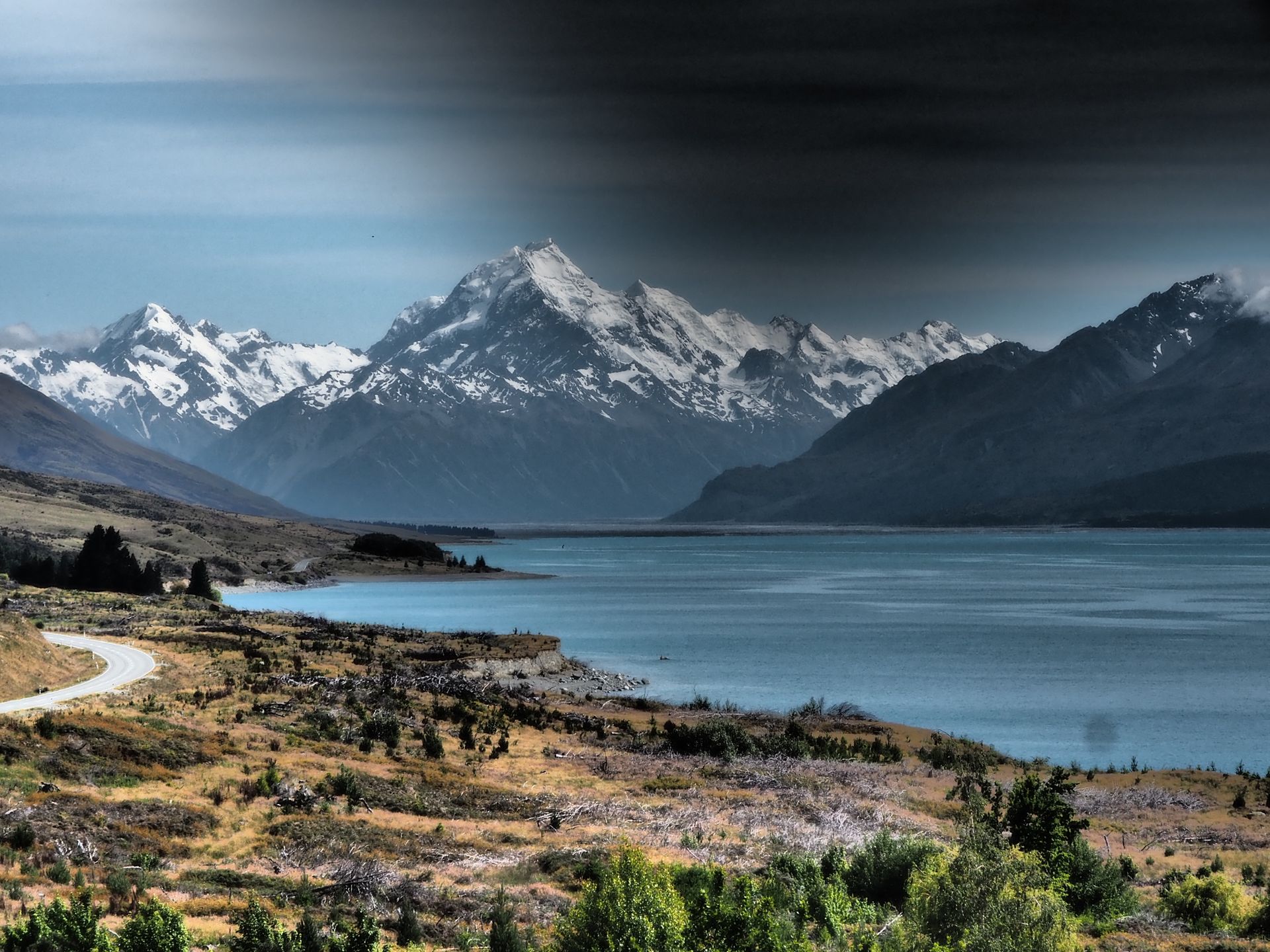
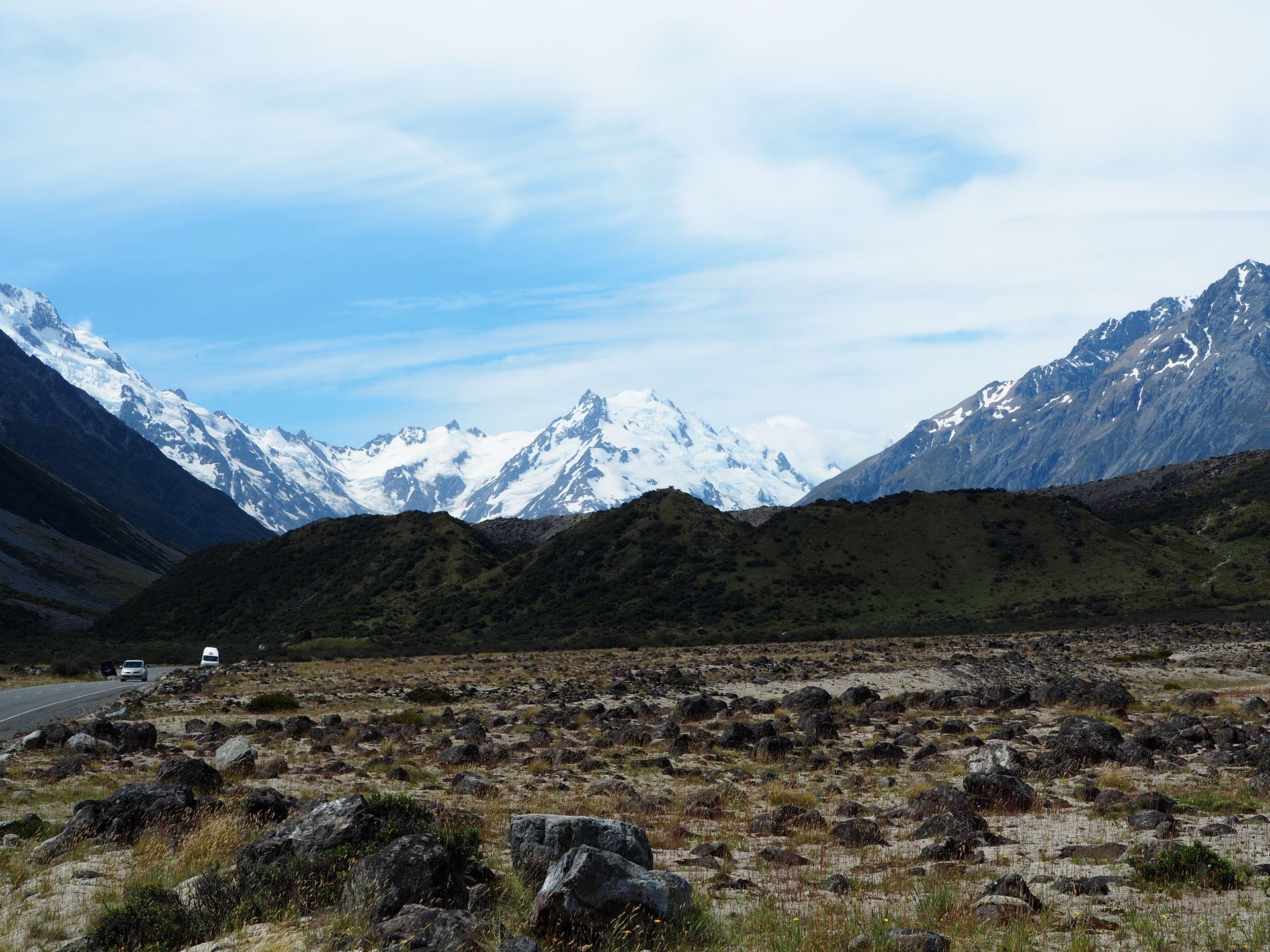
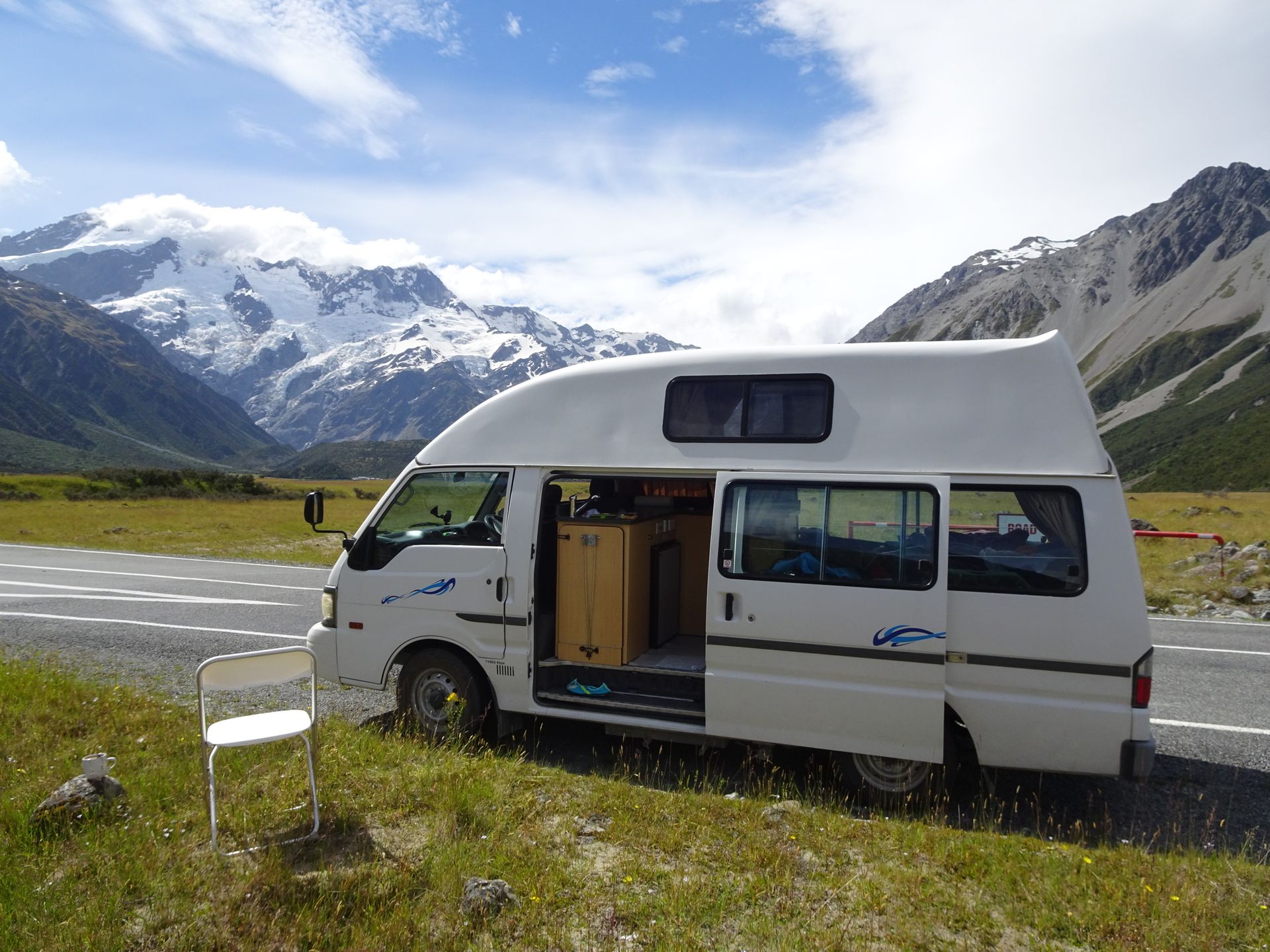
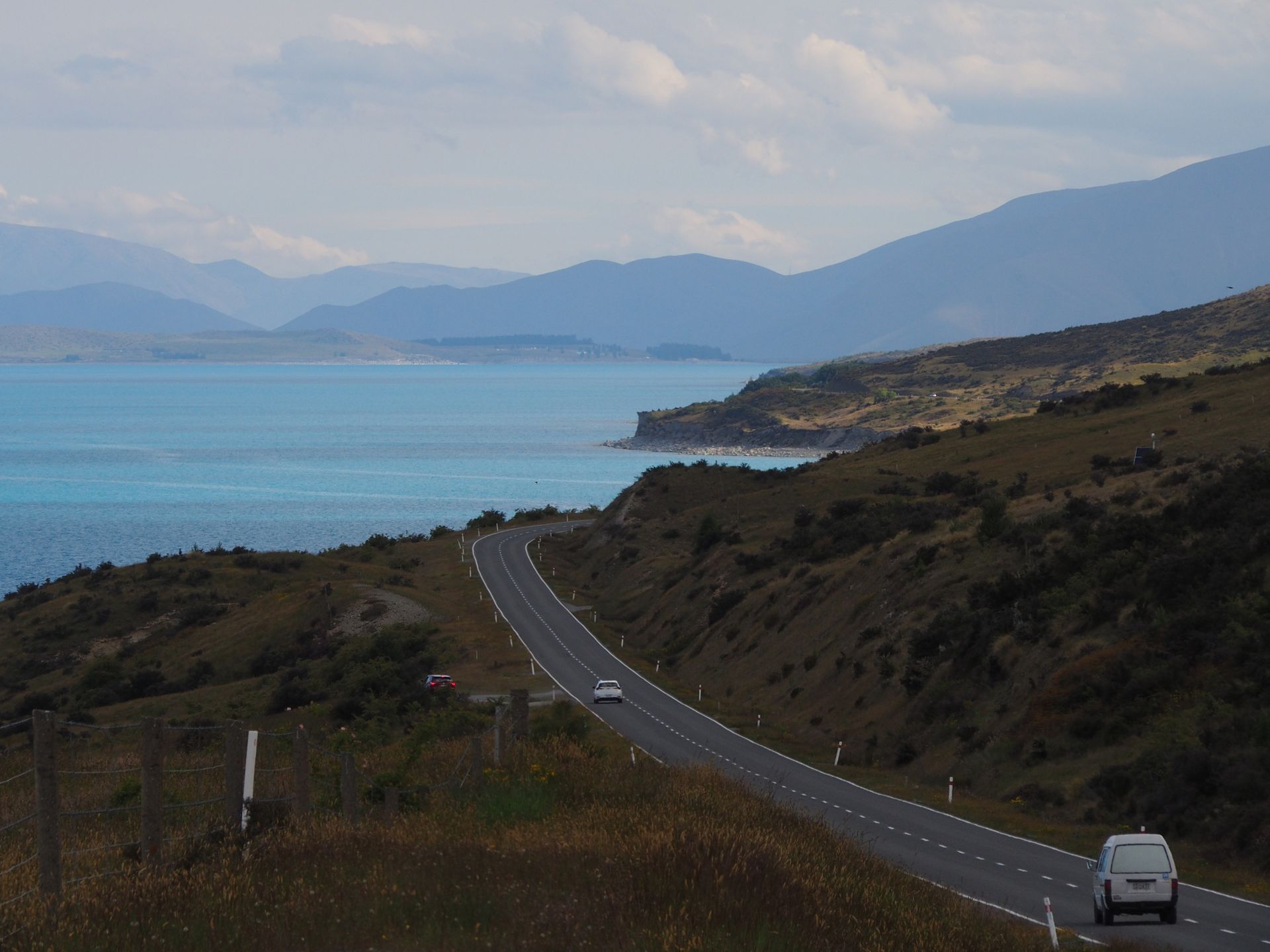
Incredible - the sun is shining when I get up at 8.30am. As usual, it takes me 90 minutes for showering, breakfast, washing up, tidying up, packing everything, rolling up the power cable. Today I want to walk the Hooker Valley Track, for which I have been closely monitoring the weather report for days. It is supposed to be cloudy from noon onwards, so I set off towards Mount Cook Village at 10.00am. The road runs 60km along the southern/left bank of Lake Pukaki, which once again provides breathtaking photo opportunities with its incredible turquoise color, especially with the snow-covered Mount Cook Massif at the end. It takes about 1.5 hours for this distance and I arrive at the parking lot after 11.30am and find roughly the last spot on the grass that is still available. It is busy. Many hiking trails of different durations start here, so people park here for several days or just for a few hours. There are campers, motorhomes, cars. Well. It is peak season and holiday time after all. When I come back in the afternoon, the cars and campers have now filled the street even further and the parking lot is still full.
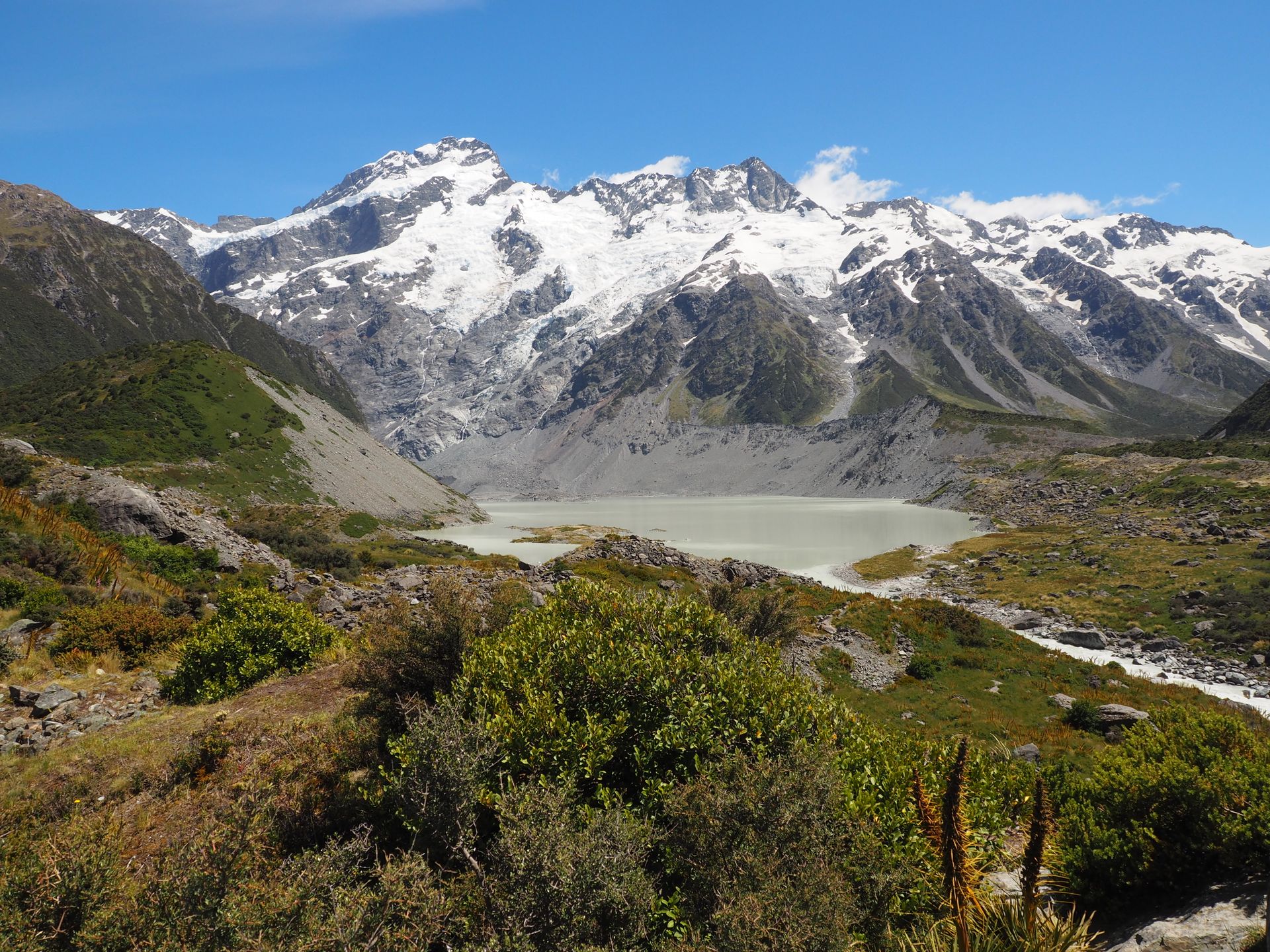
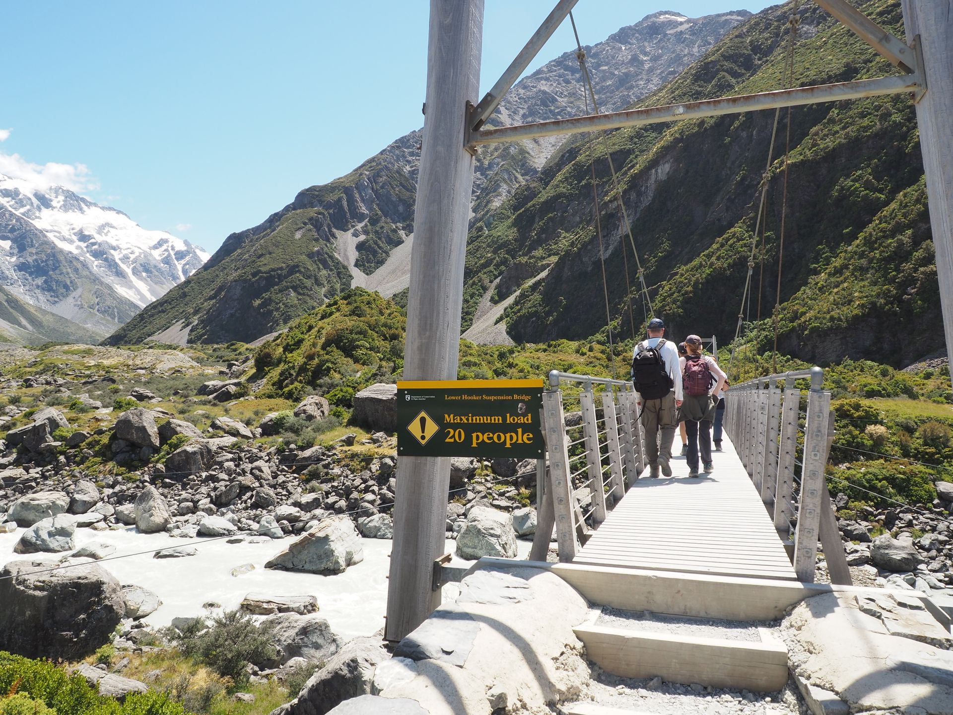
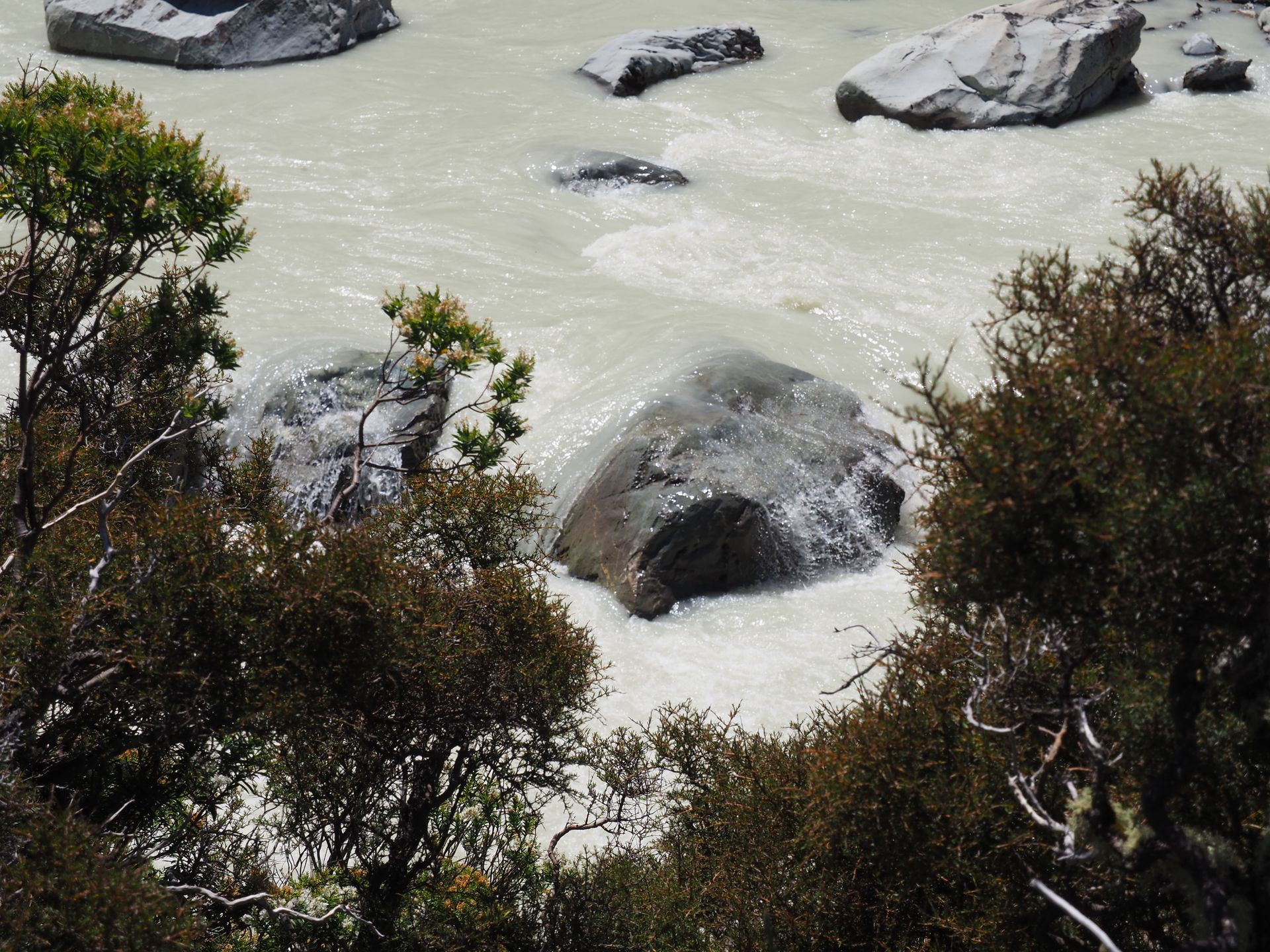
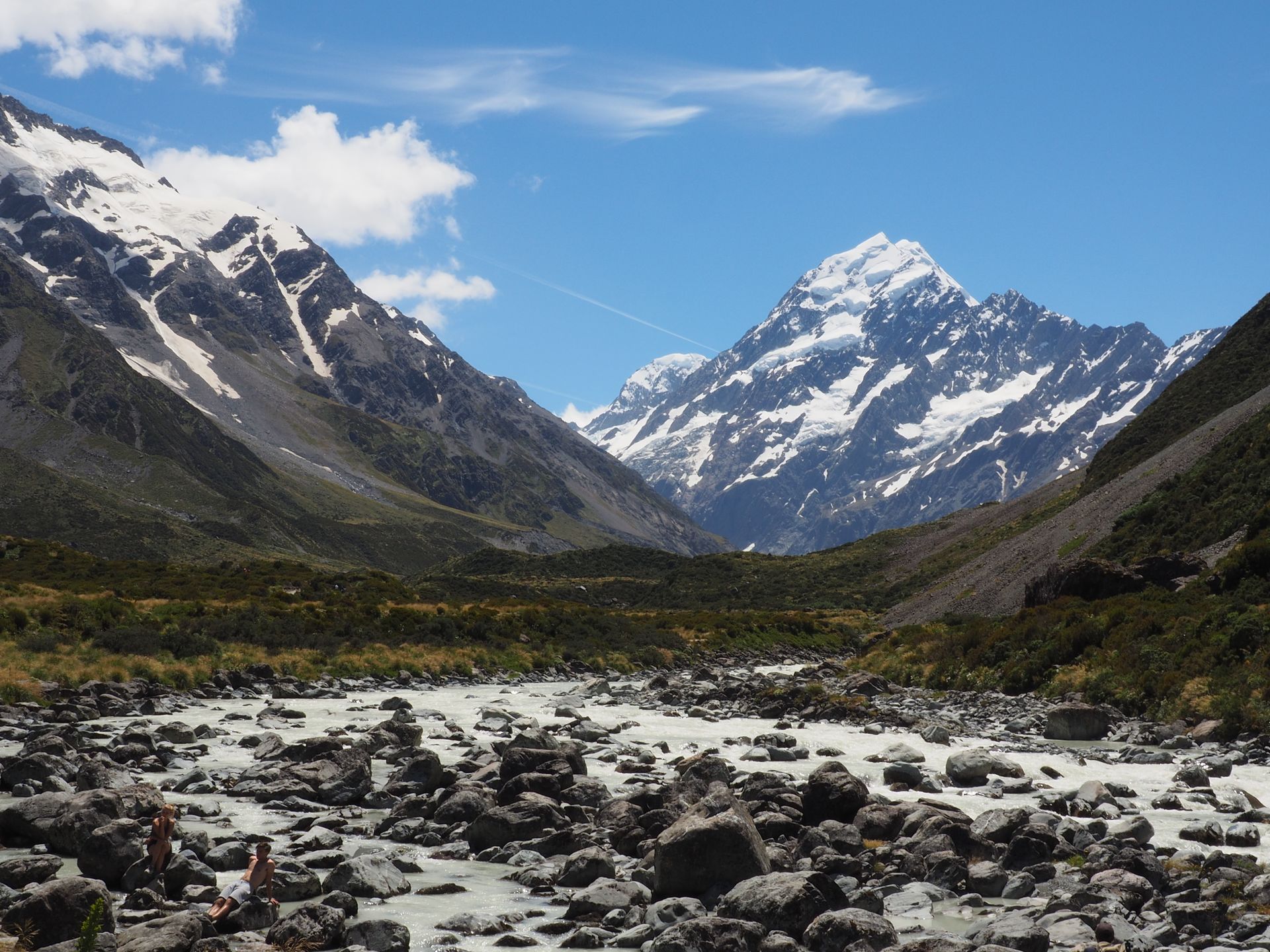
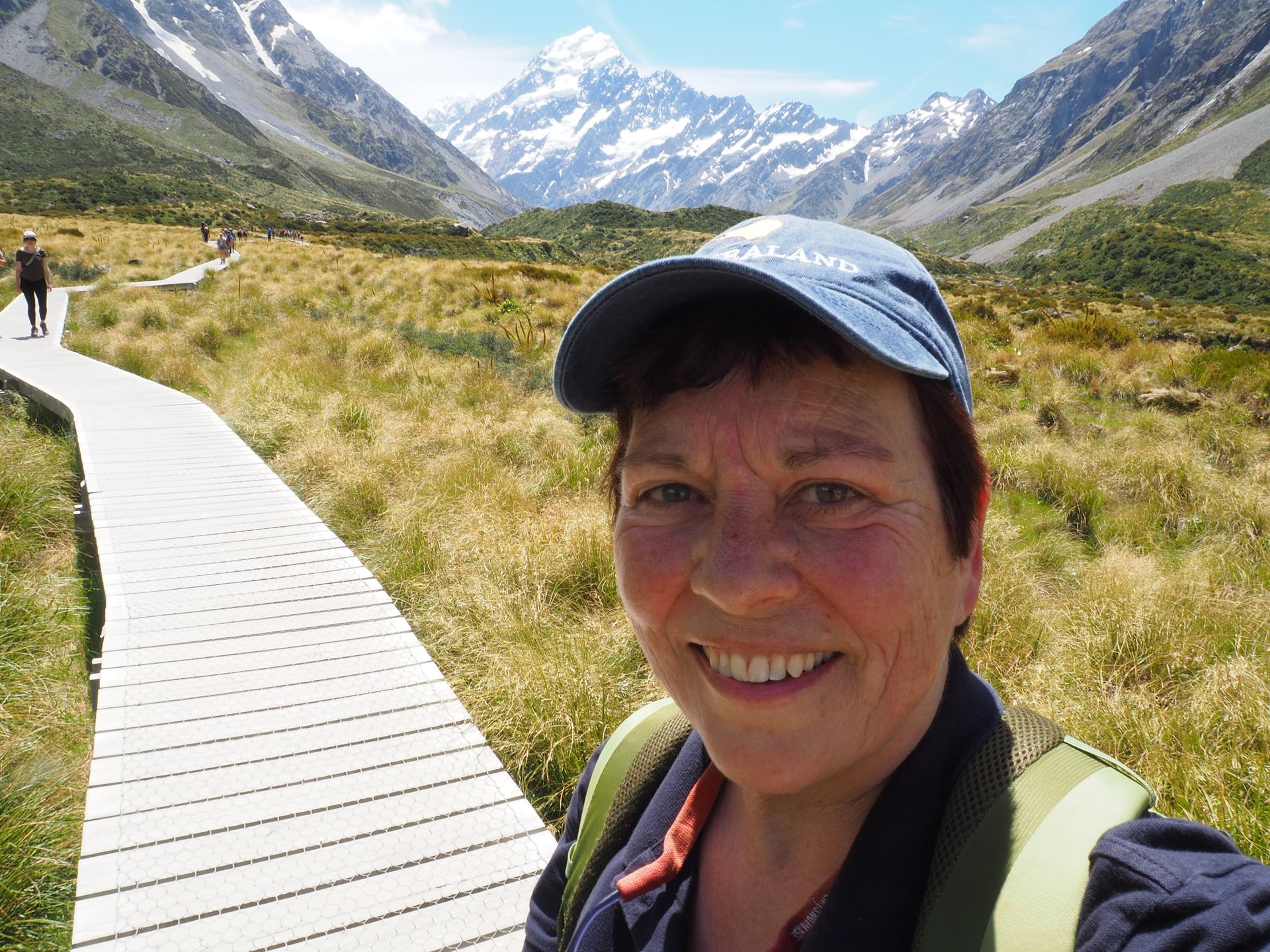
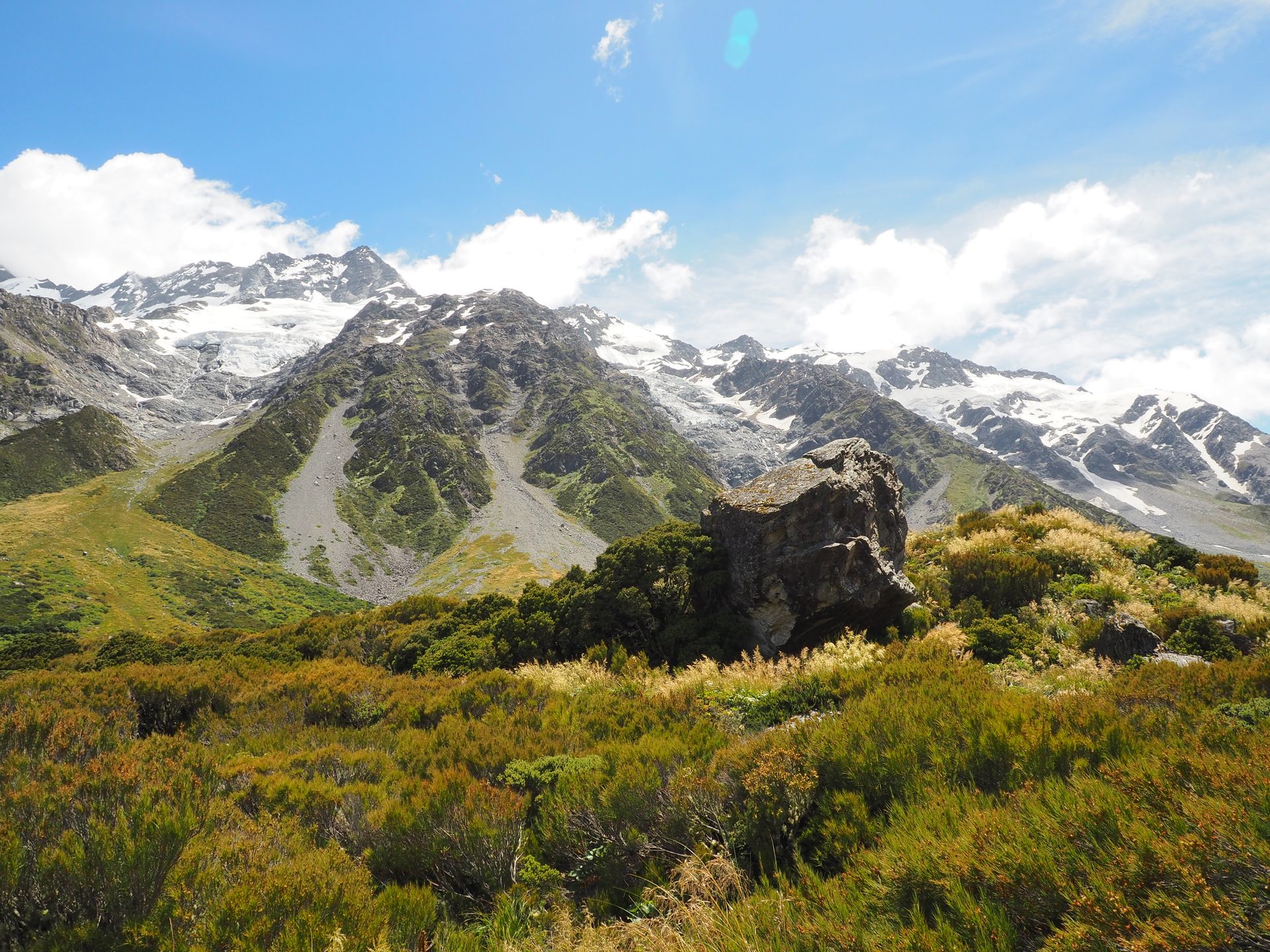
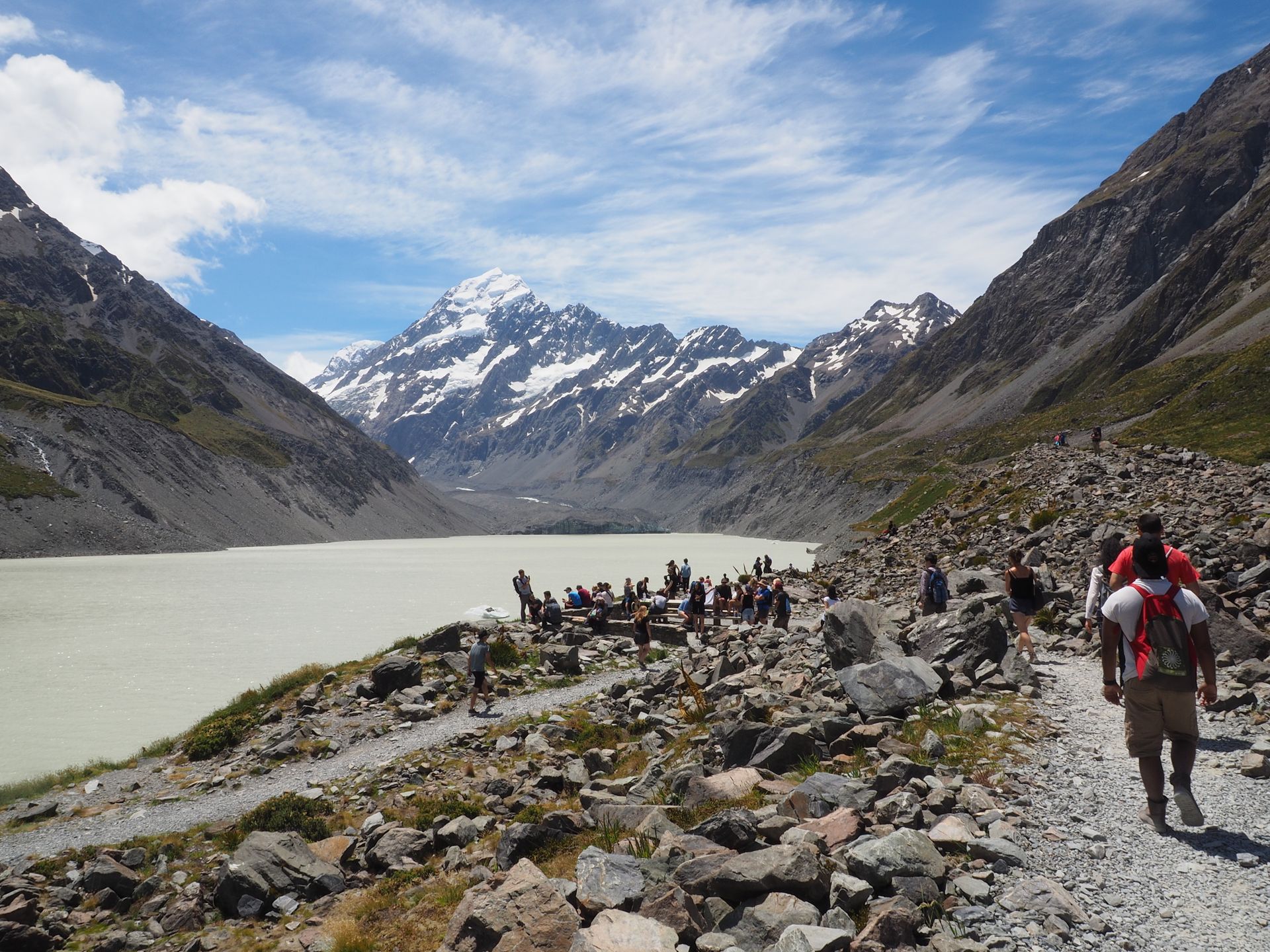
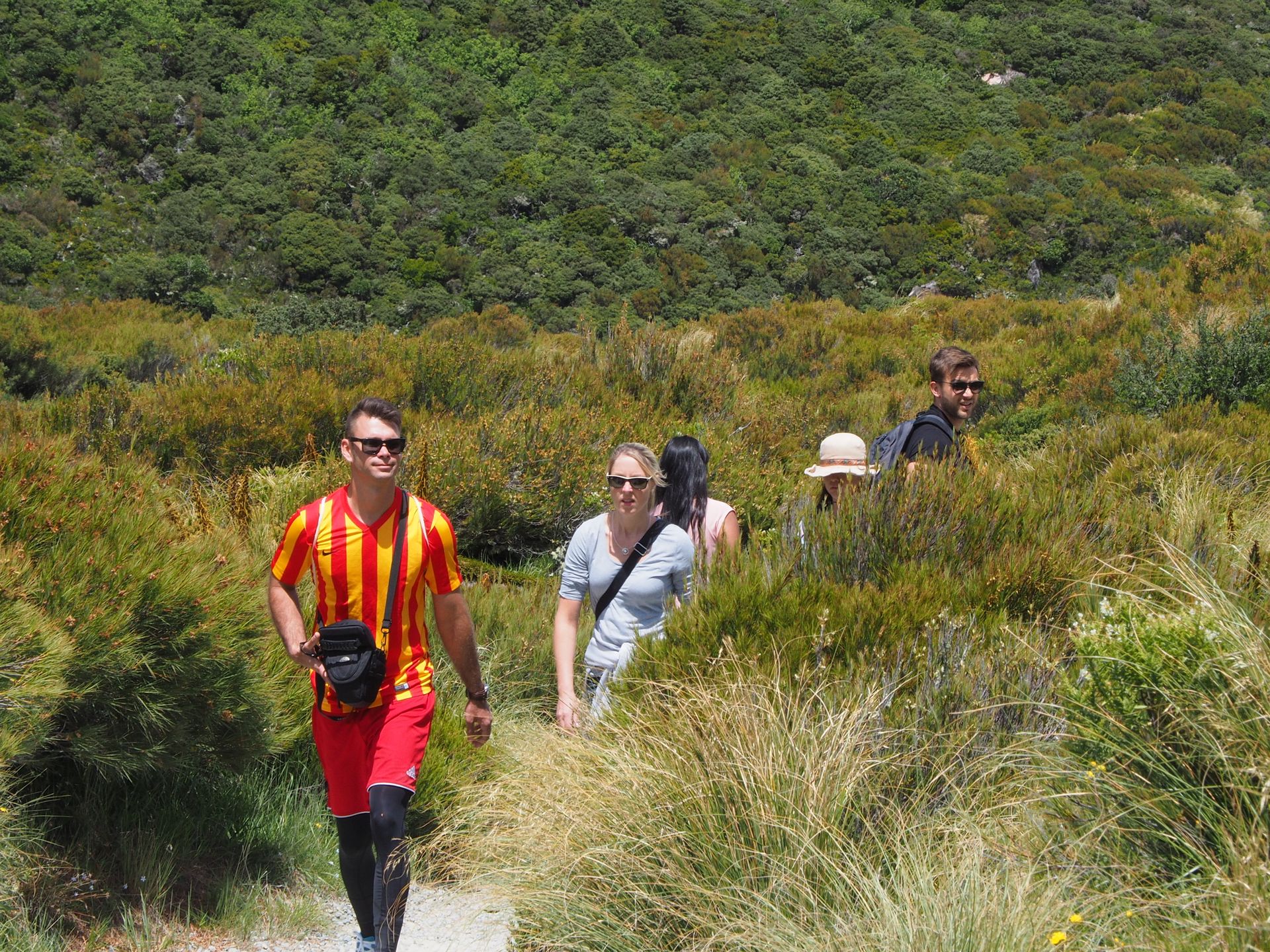
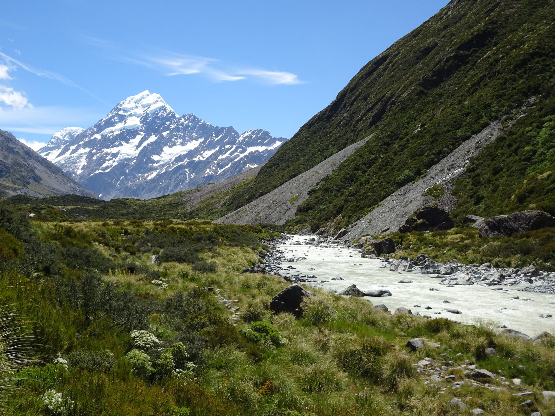
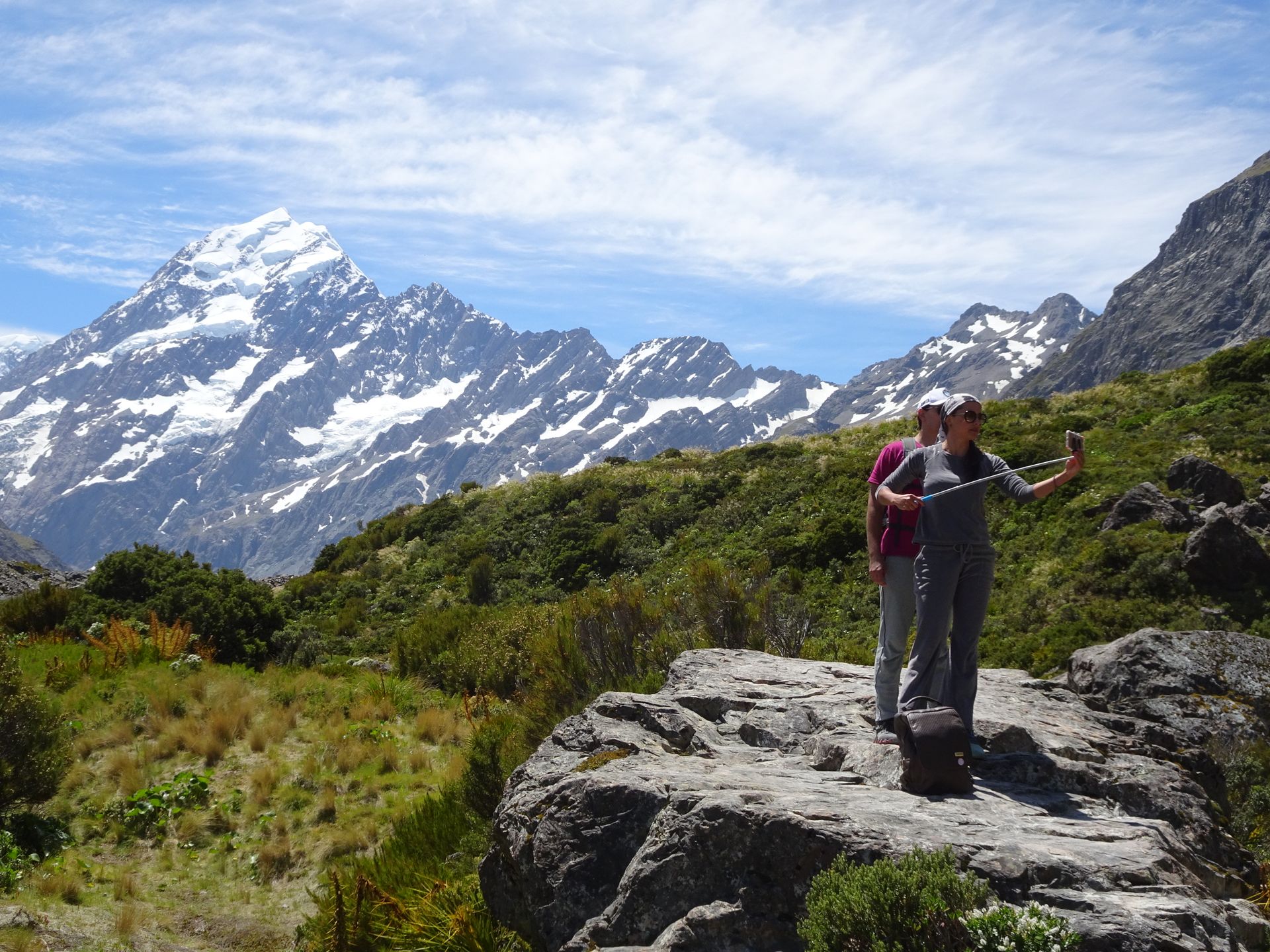
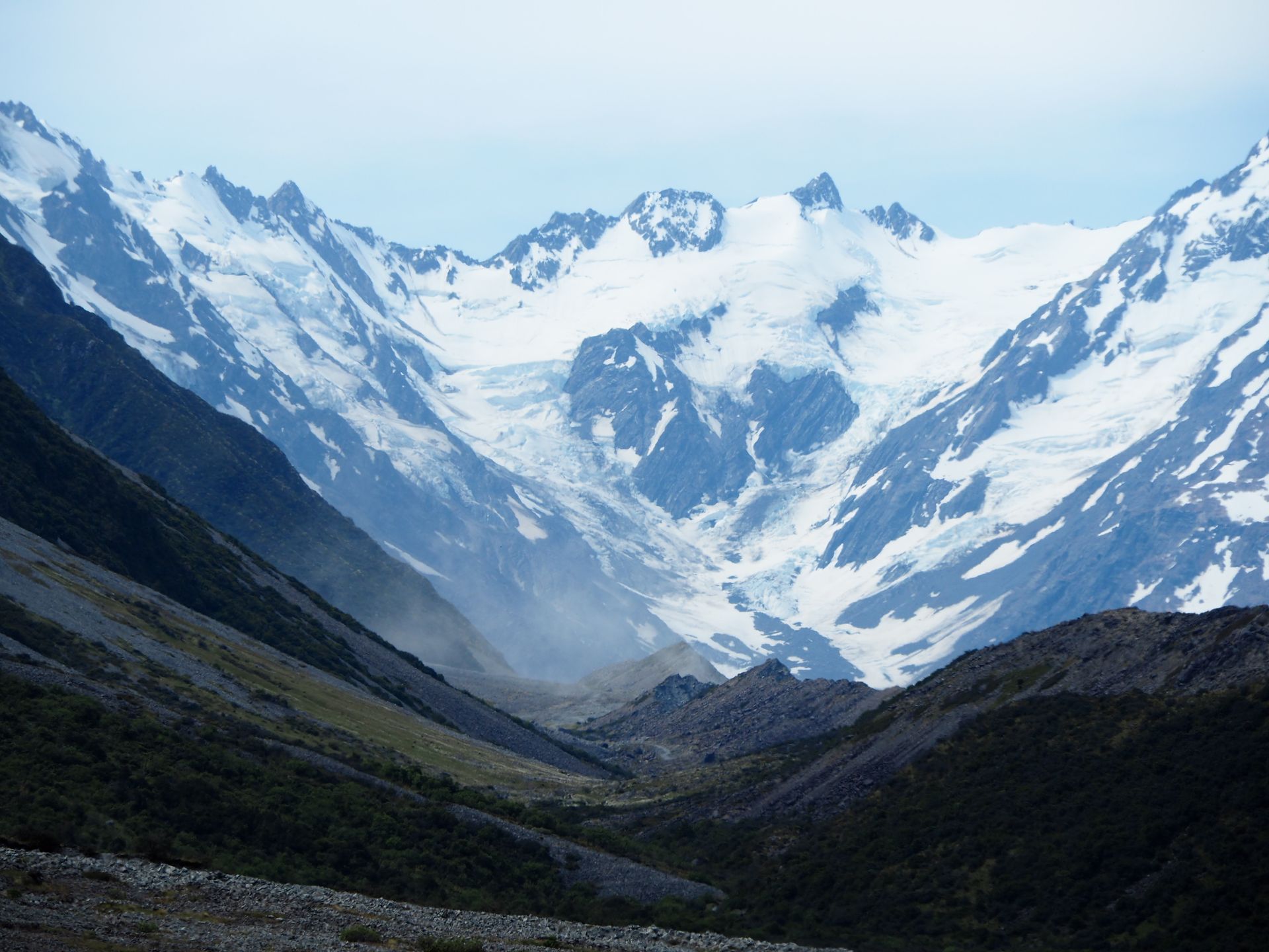
Now I grab water, cameras, hat, sunglasses, and sunscreen and walk towards the Hooker Valley Track. It is now an incredible 20°C and it is the first day that I don't wear a jacket until evening. I am glad that I have my hiking boots on and not just sandals. The walk is a bit rough, although online photos always show people walking on a boardwalk. However, this route has at best 400m of boardwalk. Almost constantly, the Hooker River runs alongside the track, which is fed by the glacier lake and has a gray-green color due to the glacial flour. After crossing the first suspension bridge, there is the large Mueller Glacier Lake on the left - also a glacial lake formed from a 13km long glacier that runs in the Aoraki Massif and flows into this lake. It is framed by huge lateral moraines.
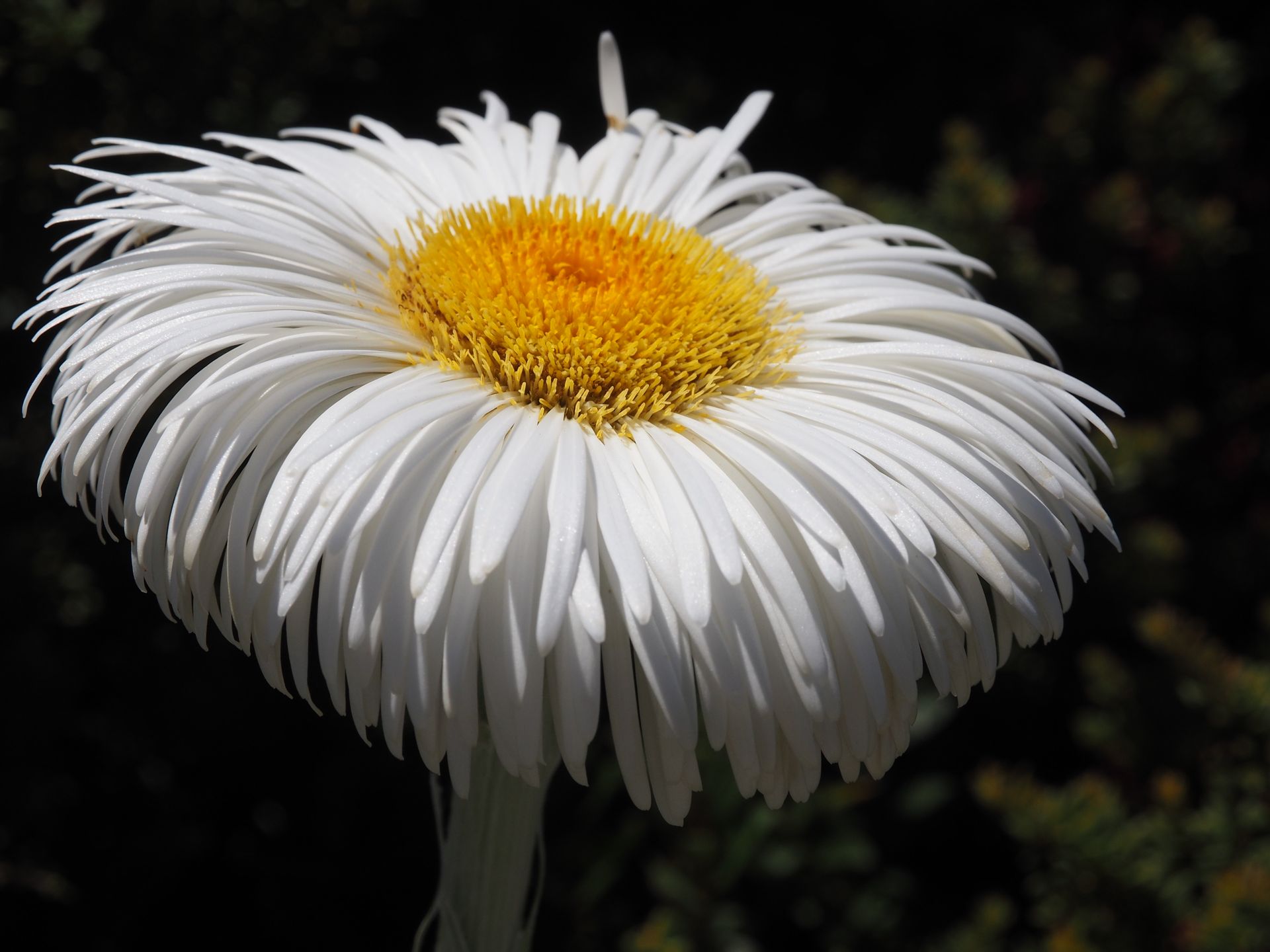
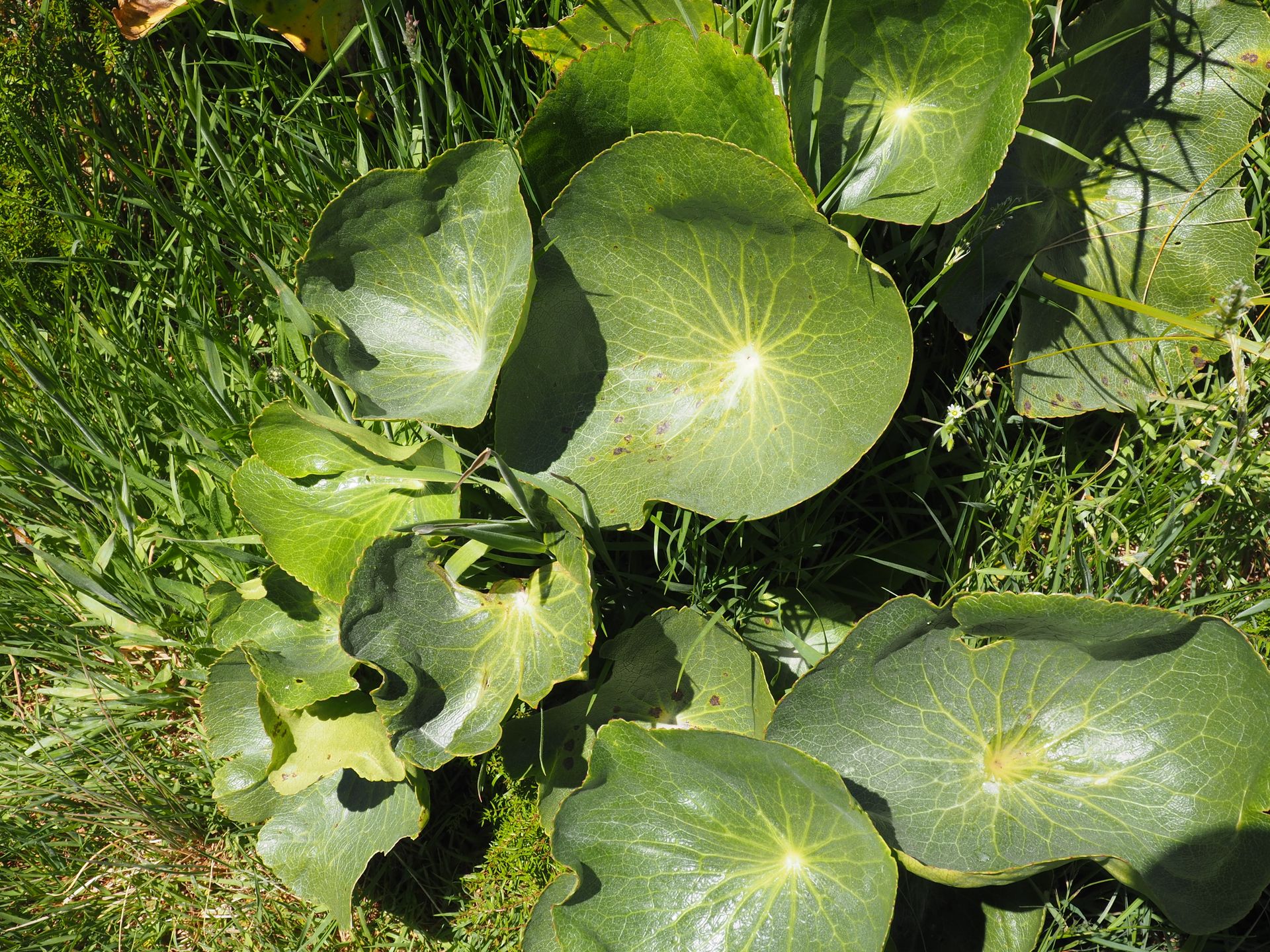
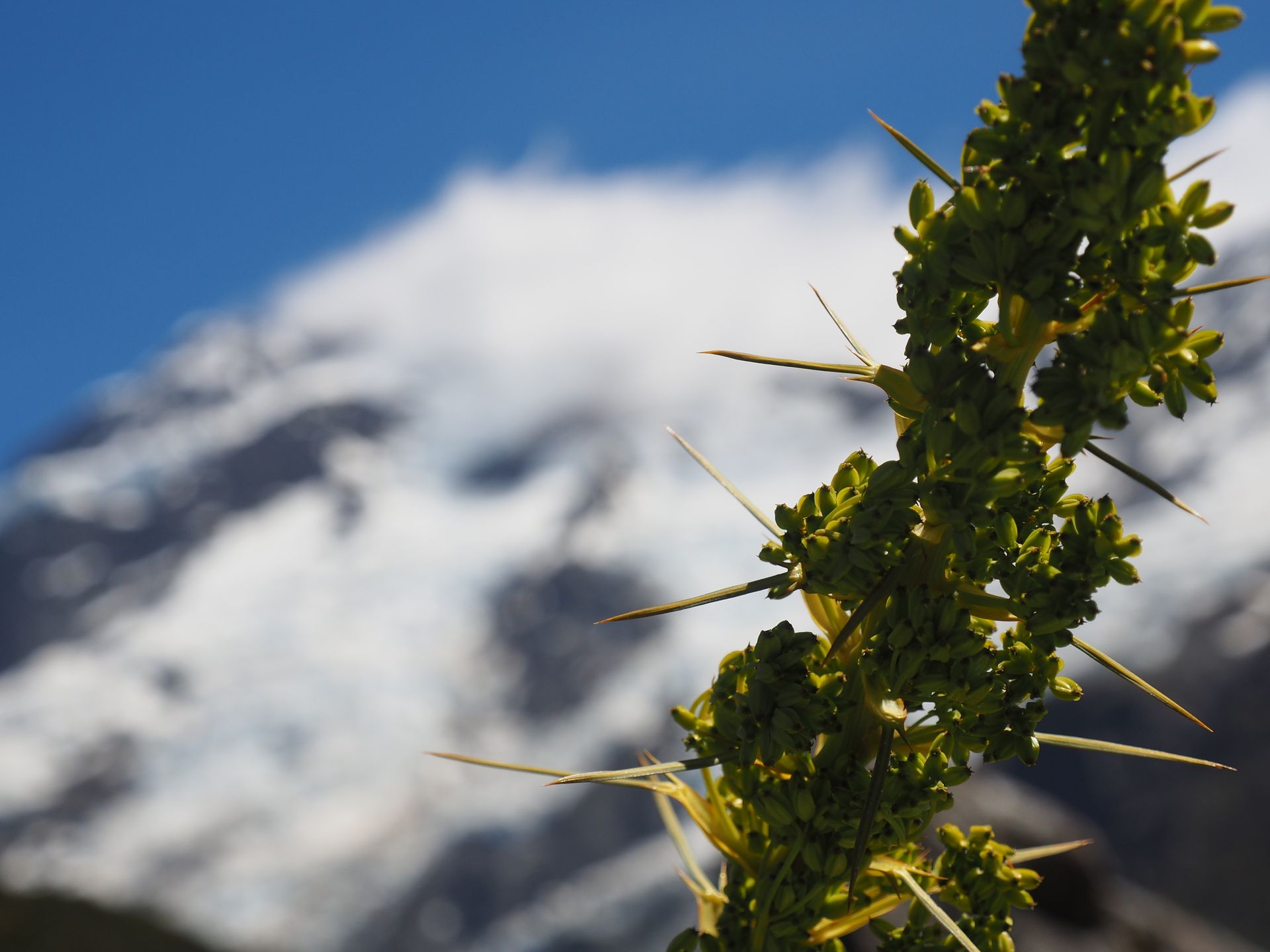
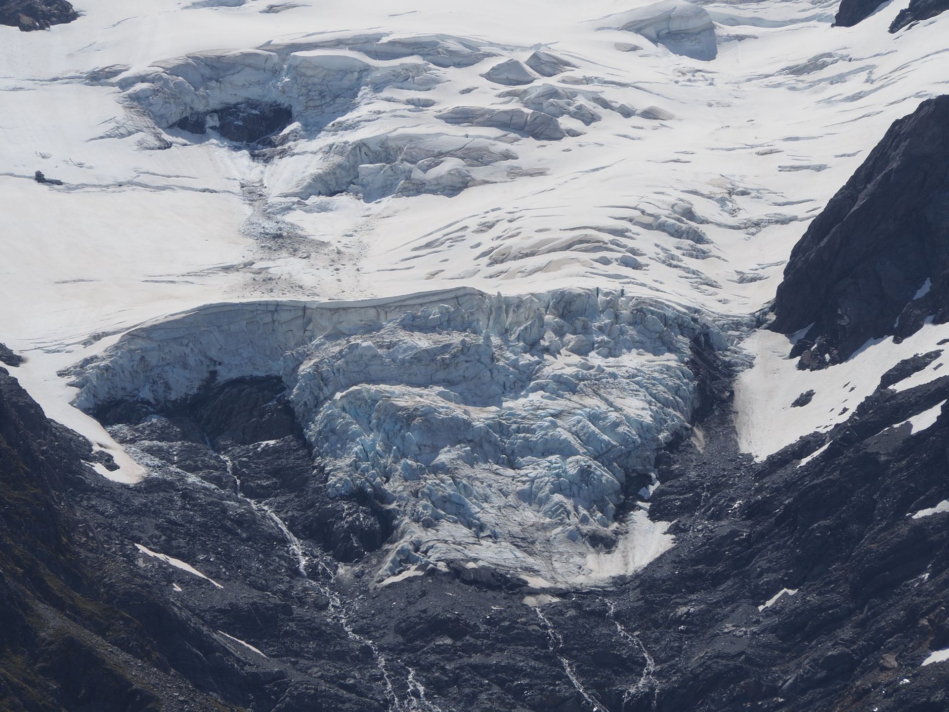
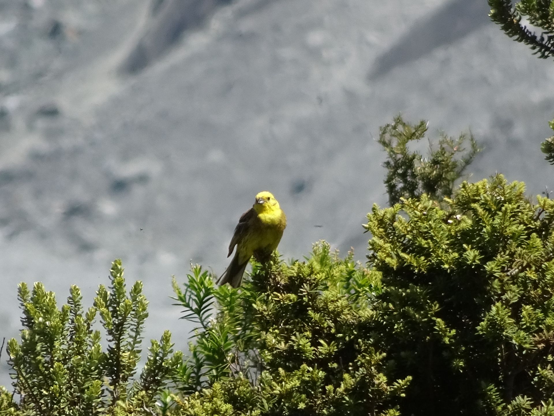
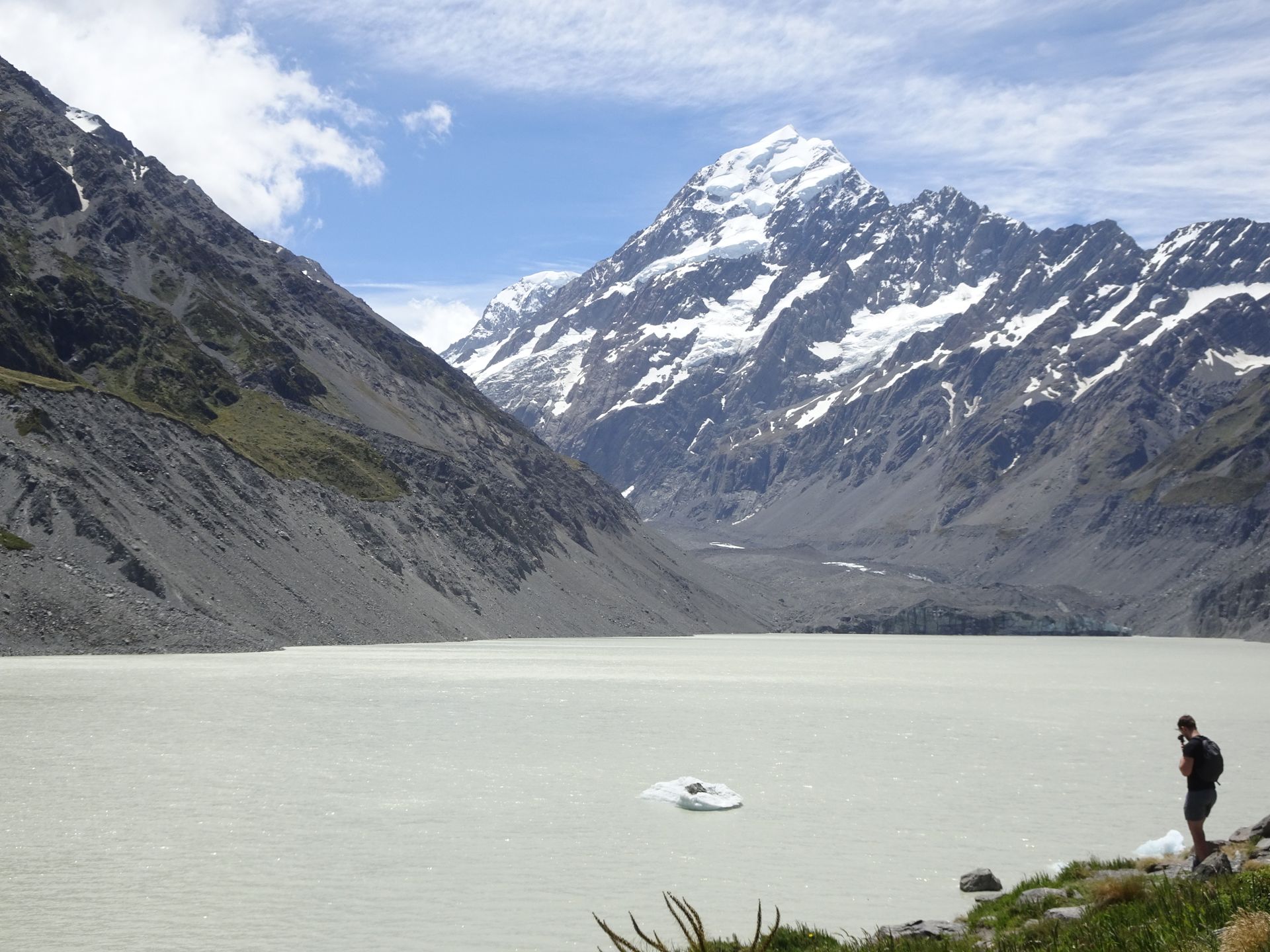
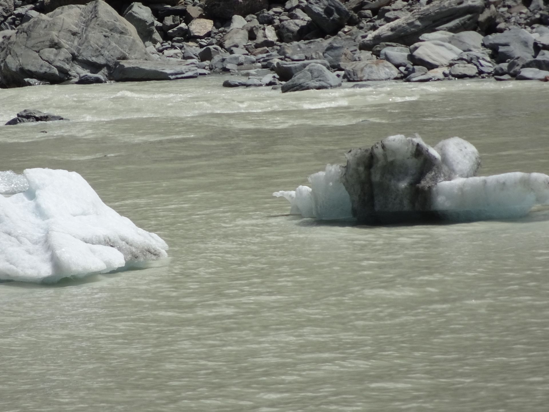
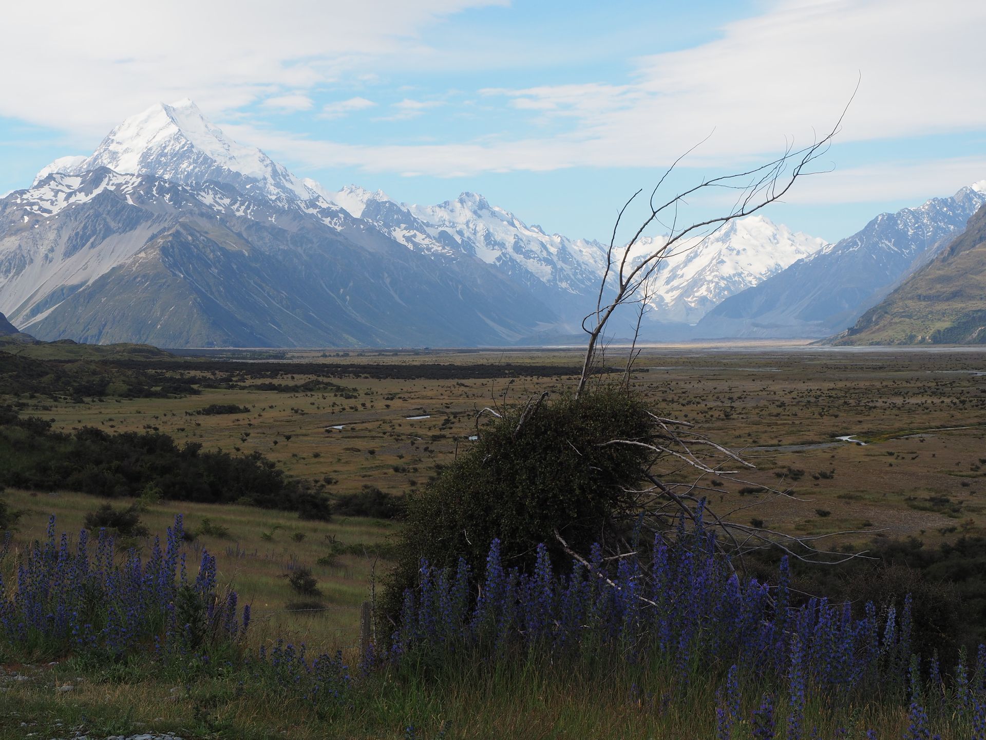
The Hooker Valley Track is about 12km long and mainly follows well-trodden paths, which sometimes lead over a few rough or loose stones and roots. In addition, three suspension bridges are crossed. On the way there, one constantly has the Mount Cook Massif and Mount Cook/Aoraki in front. The path ends at a glacial lake where ice floes float, which come from the clearly visible glacier of Mount Cook. There are blooming flowers, birds, and mosses on both sides of the path - a feast for the eyes! And with the sun - what a gift this great day is! Shortly after 2pm, I reach the glacial lake below Aoraki and take a short break with a view of the lake and Aoraki until some people stand right in front of me without any reflection and have a loud conversation with people next to me. I move around them to the other side so that I can continue to enjoy the view. In the glacial lake, some tourists actually try to swim - brrr! The way back to the parking lot is faster, of course, the view is not so spectacular anymore and I am back at the car around 3.30pm. I turn left shortly after the parking lot towards Tasman Valley, a neighboring valley that looks completely different than "around the corner". Here it looks like the moon. Once around the curve, there are lush green meadows. That's funny. At the end of the road, not far behind a parking lot, there is Tasman Lake. But the parking lot is full, so I turn around since I don't feel like waiting at this time just to start walking. It is getting a bit late and I am starting to feel like having a coffee. So back, across the Hooker River, where someone has put a dead possum on the bridgehead - maybe that warns the other possums not to stay here?
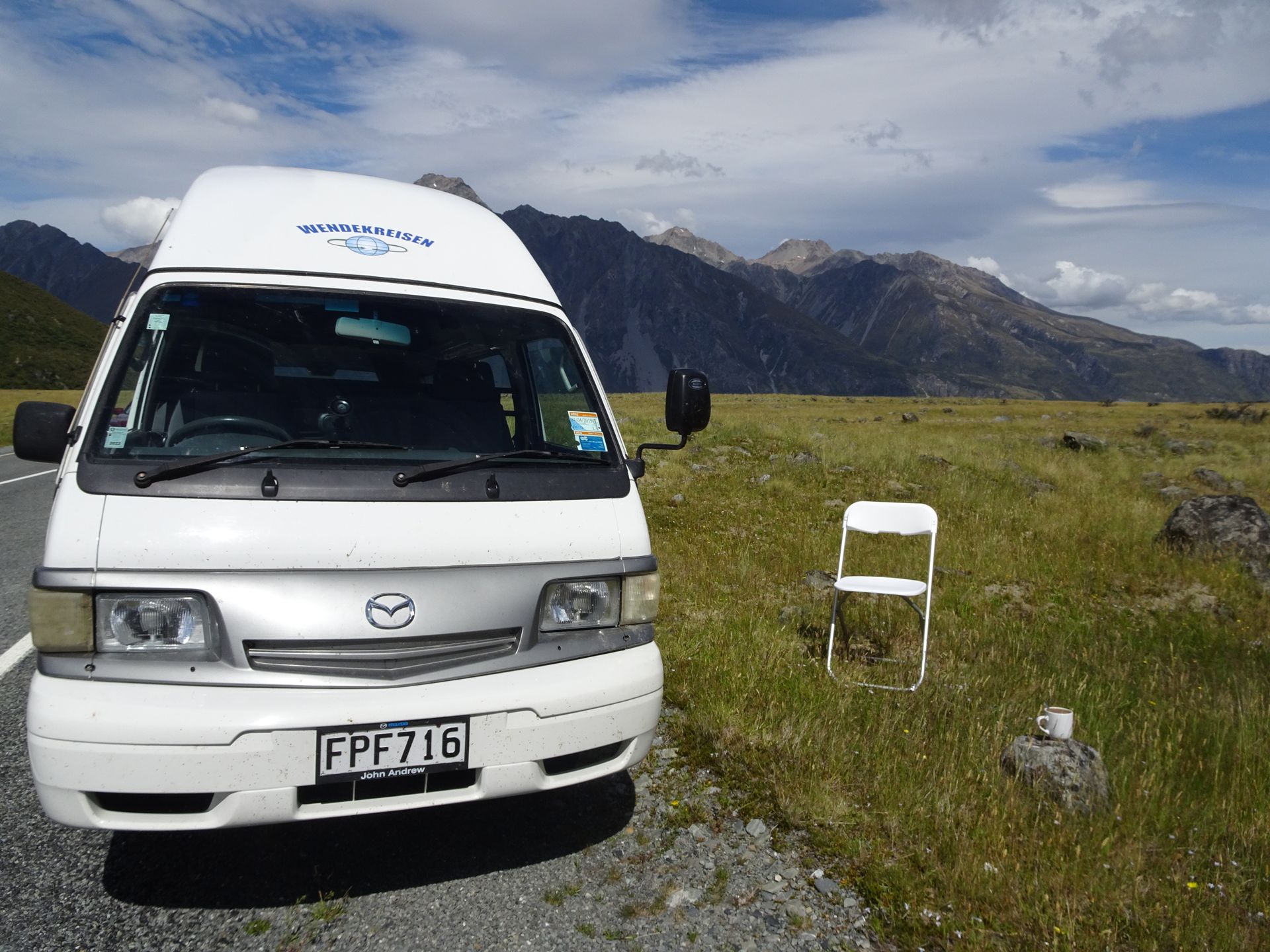
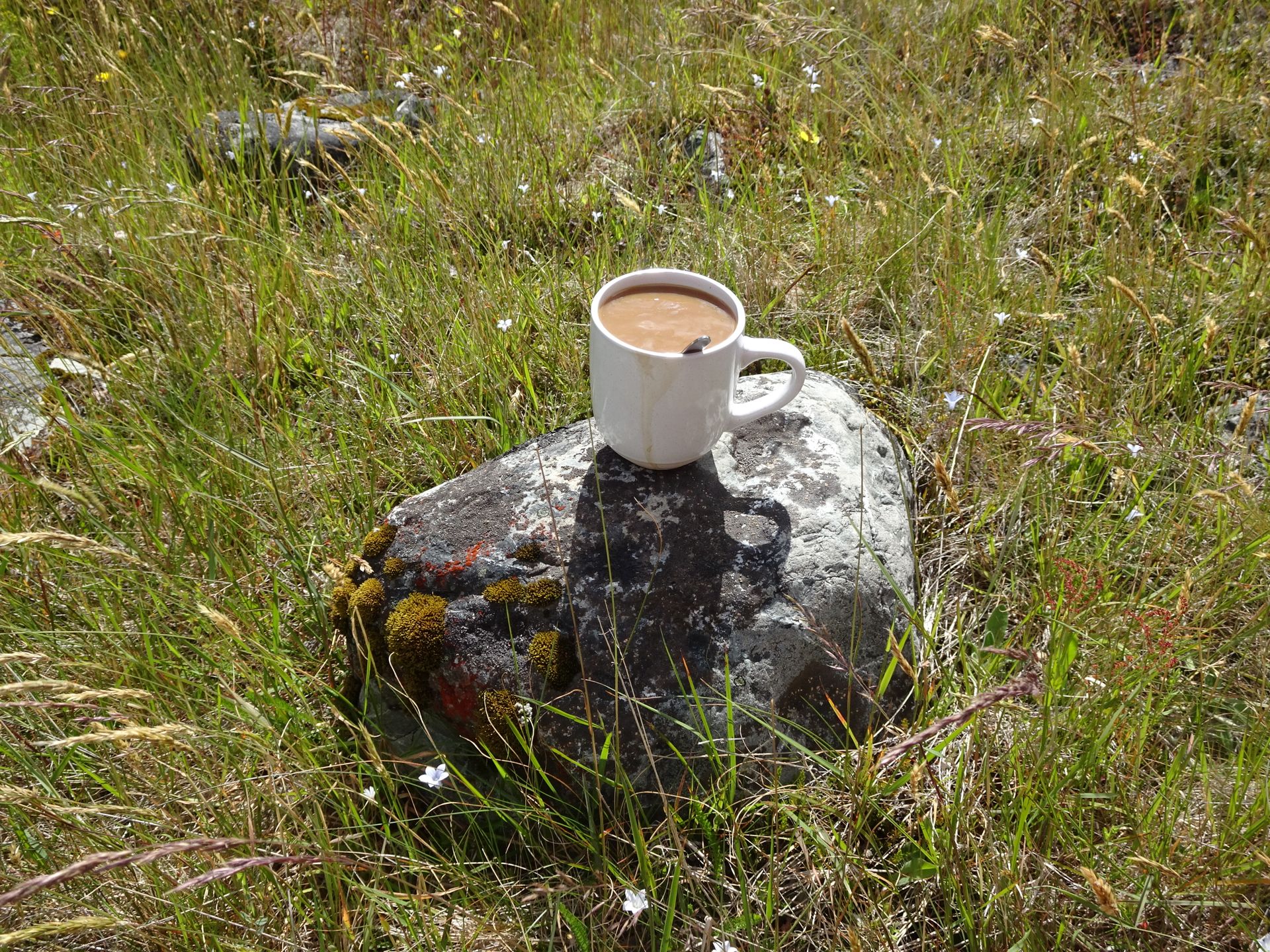
I stop at the roadside overlooking Aoraki and in the other direction at Lake Pukaki, turn on my gas flame, make myself a coffee, take out my chairs, and enjoy two big cups of coffee in the sun in a colorful meadow. Only at 5.30pm, when the sun slowly disappears behind the mountains, I make my way back, completely overwhelmed by this day, which will take about 2 hours. On the way back, I stop again at a gravel parking lot above Lake Pukaki to take a photo of Aoraki in the evening light - and get stuck in the gravel with the camper. The car digs itself into the gravel with the rear wheels and I am stuck. It is already past 6pm and there are no cars coming here. But after about 10 minutes, I see two lights approaching from far away and wave for the people to stop. Initially hesitant, they are willing to push, and with 3 men pushing plus 1 in the car, we get the camper out of the gravel. What a shitty parking lot?!
I drive to the Visitor Center next to Lake Pukaki with a view to experience the evening sun and the expected reflections on the water. But nothing - it starts raining at 6.30pm - what luck I had all day. Even the predicted clouds remained less than expected. I wait a little longer hoping it might get better and start uploading my photos to my tablet. Finally, at 7.50pm, I leave this actually beautiful spot to drive to Twizel, which is about 10km away. I refuel right away so I don't have to do it tomorrow, quickly walk through the Four Square to buy water and yogurt, and arrive at the campground at 8.30pm. I warm up a can and spend the evening catching up on my diary.
ለጋዜጣ ይመዝገቡ
መልስ

የጉዞ ሪፖርቶች ኒውዚላንድ