In Frodo's Footsteps - the Tongariro Crossing
Chop etilgan: 19.12.2018


Axborot byulleteniga obuna bo'ling
Still recovering from yesterday's hike, I dragged myself out of bed at half past four today to catch the shuttle bus to the Tongariro Crossing.
The Crossing is part of a Great Walk in New Zealand and is located in the center of Tongariro National Park, about 100km south of the Great Lake Taupo. You first climb 750 meters in 19.4km and then descend almost 1000 meters.
The hike takes 6-8 hours and is probably the most famous day stage in New Zealand. All those beautiful pictures with the green lakes and - Mordor come from this route.
Yes, the scenes from 'The Lord of the Rings' around Mordor were filmed in this area.
Frodo should have just taken the shuttle bus. I checked: from the Shire (aka Hobbiton) to Mount Doom (aka Tongariro) it only takes 2.5 hours! Easy-peasy.
Of course, the Crossing was also on my list and I had been looking forward to it for a long time. After all, I don't miss any hikes!
Because the weather conditions at the top of the peak have their own mind, it is advised to bring thick rain jackets, sunscreen, and gloves - just in case. And of course, lots of water and food.
When I got off the bus in the parking lot, it was noticeably cooler. But just enough that it becomes pleasant when you move.
What particularly impressed me in this part was the complete silence. No wind, no rustling, no water - nothing.
Except maybe a hundred other tourists, happily chattering as they hiked, but apart from that - nothing.
So there will hardly be a picture where I didn't accidentally immortalize another person. I've seen video recordings where the route was simply overrun, but especially at the beginning today, it already felt like a pilgrimage.
And this is where you get to know very different types of hikers. Just a few examples:
- the professional hiker: knows everything, can do everything, does everything. Recognizable, among other things, by high-tech equipment and a brisk pace. Can't be disturbed by amateurs.
- the wannabe professional: recognizable by the high-tech equipment without the corresponding experience. Complains at the beginning about the lack of challenge, only to gasp for air every five meters during the ascent.
- the tourist: doesn't really know what they've gotten themselves into, but read about it in their travel guide. Improvised equipment (McDonald's), but takes it easy. After all, it's vacation.
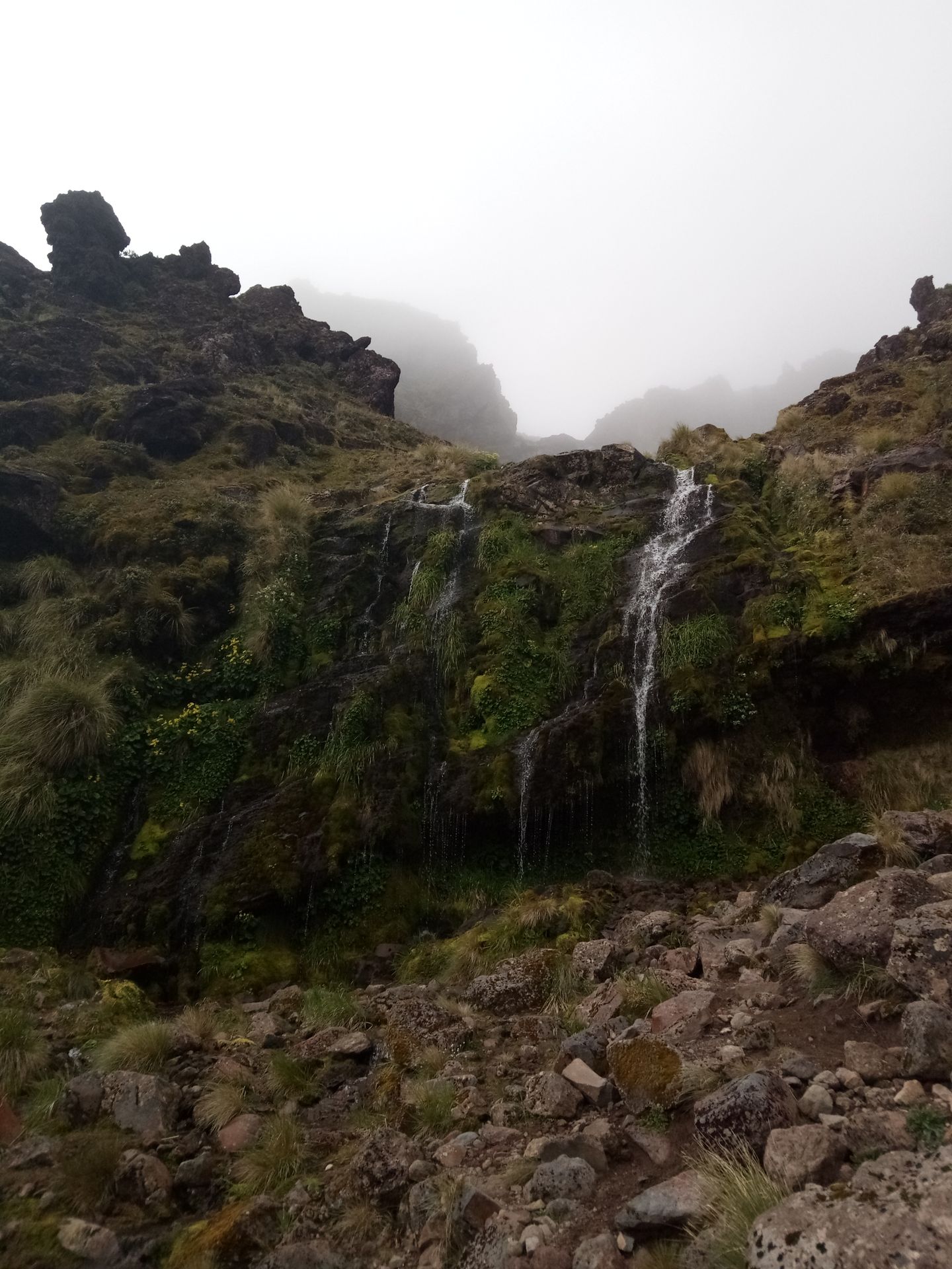
The first 5km were already beautiful from a landscape point of view, but they couldn't hold a candle to what was to come later. But I didn't know that yet and took eager photos.
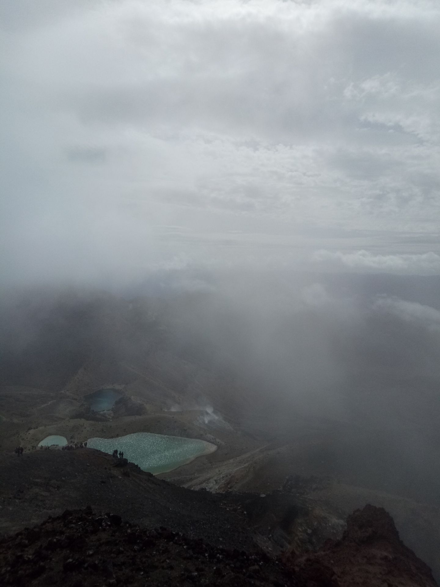
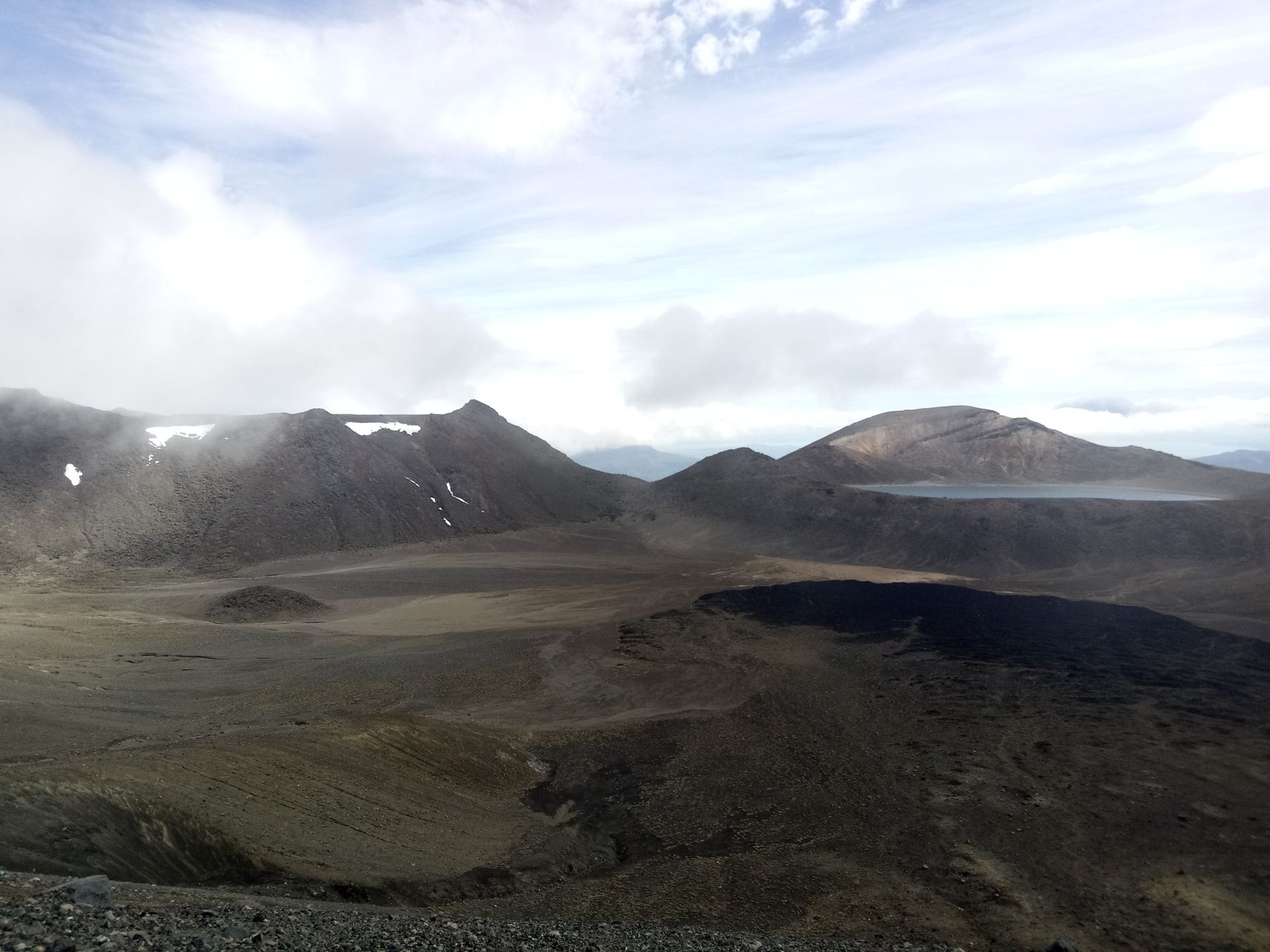
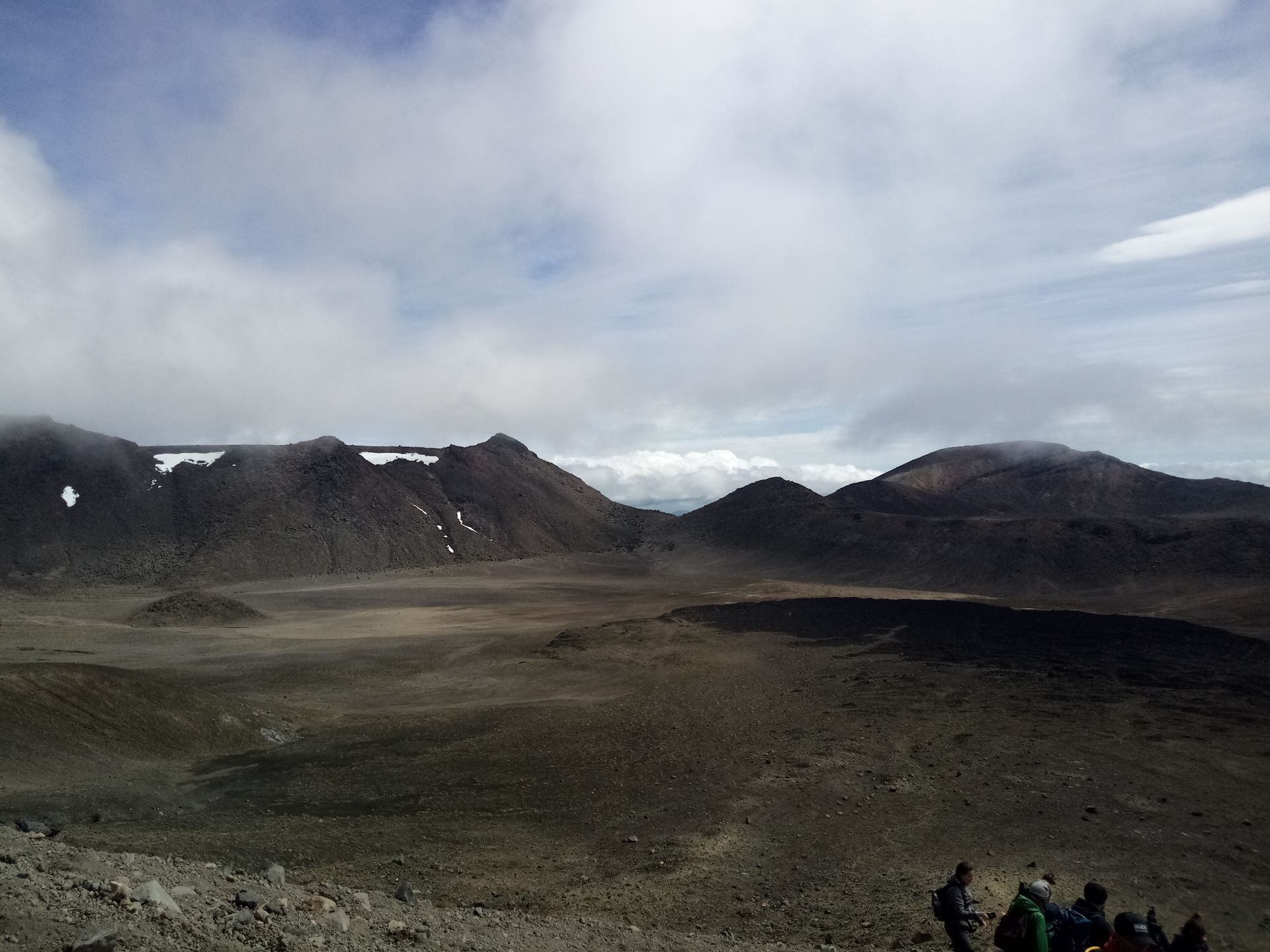
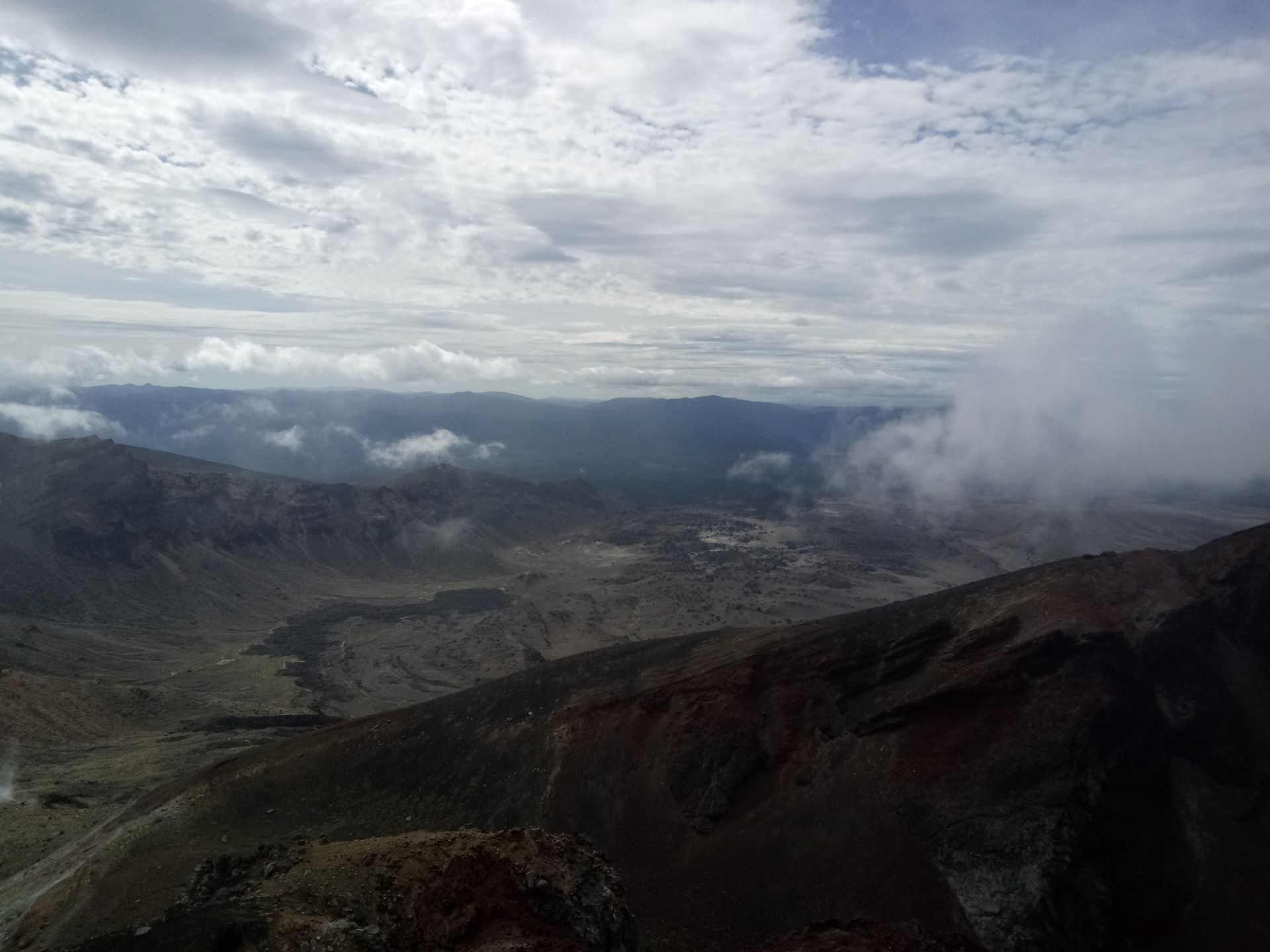
Slowly, we made our way up the mountain (the calves started to burn again!) and the higher we got, the cloudier it became. Or rather, we went into the clouds. This side of the mountain was covered with a thick layer of clouds. It looks very nice from below but significantly spoils the view.
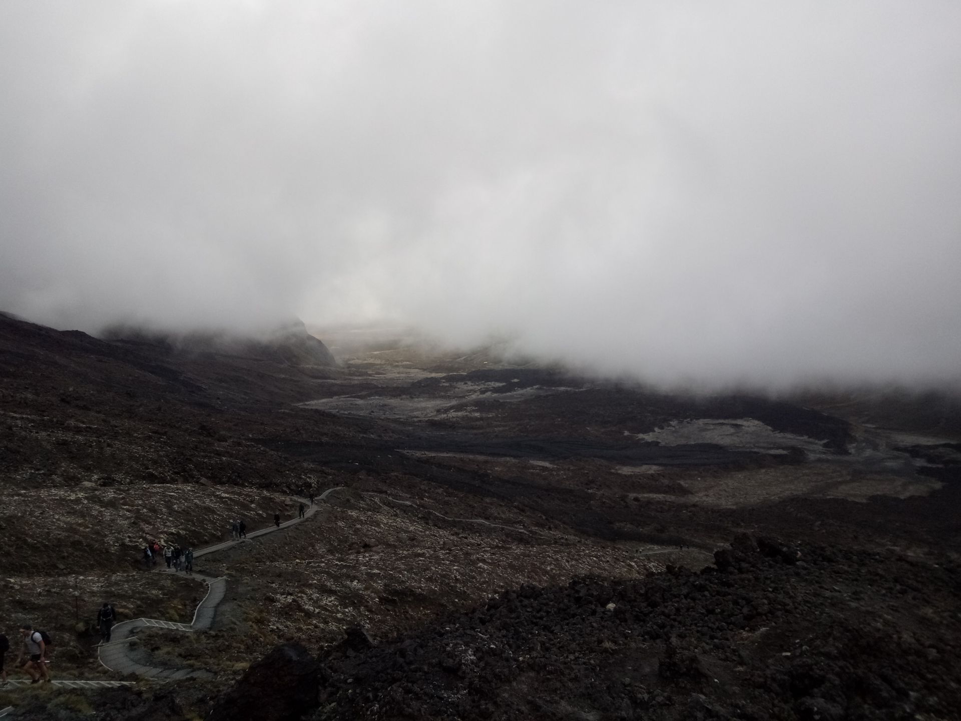
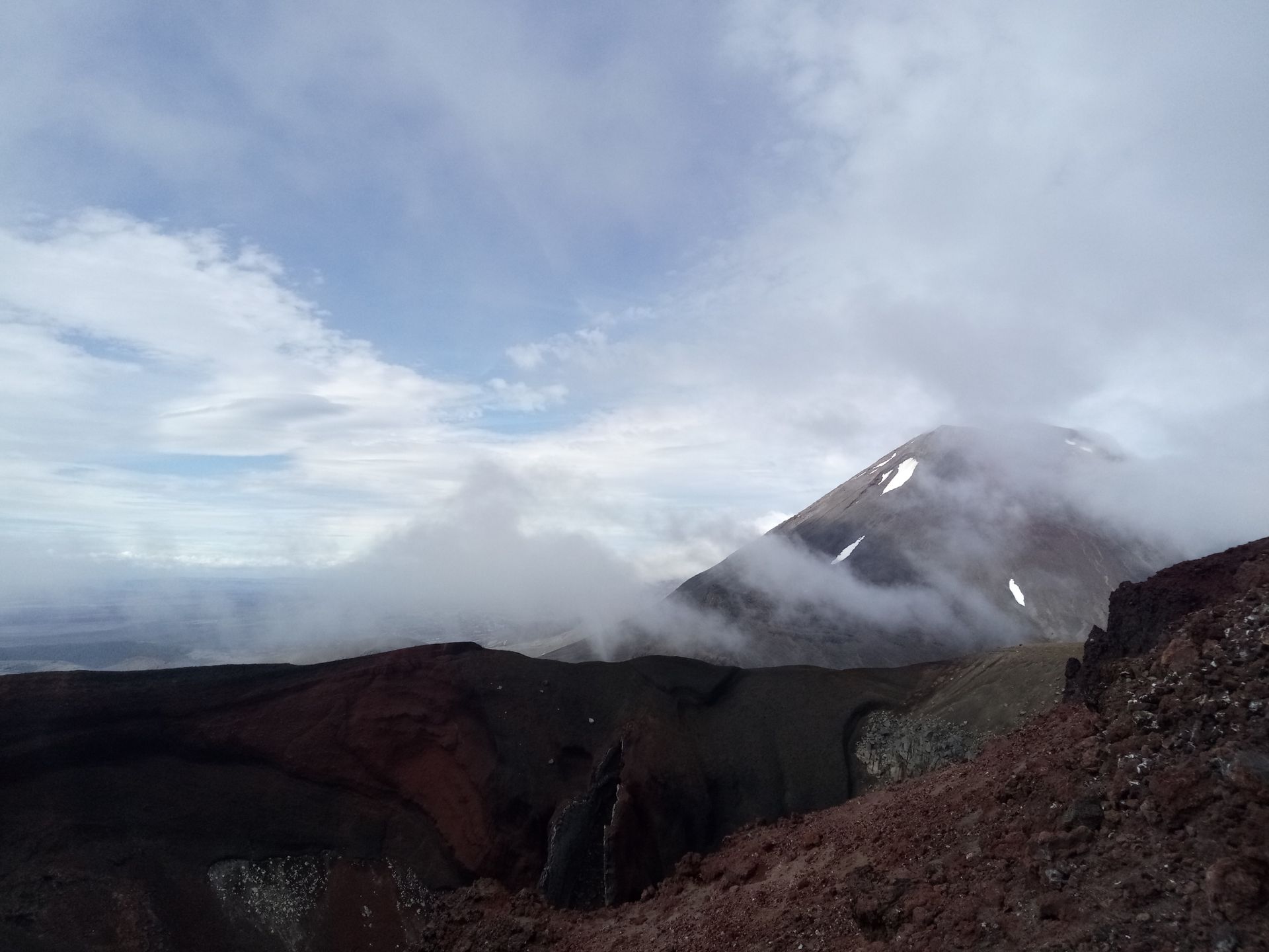
At 1500 meters, the wind joined in. And what wind! You had to really brace yourself. Unfortunately, the really difficult ascent came then. Over scree, in clouds with strong winds, you had to fight your way up the last kilometers to the summit.
I have to admit, I was pretty exhausted when I arrived up there, my heart was pounding and I was breathing heavily. And then there wasn't even a good view!
If you were lucky, there would occasionally be a gust of wind that would clear the clouds. Quickly take a photo, then continue.
Because of the wind, it was also very cold at the top of the peak. I could hardly move my fingers, which significantly affected taking photos.
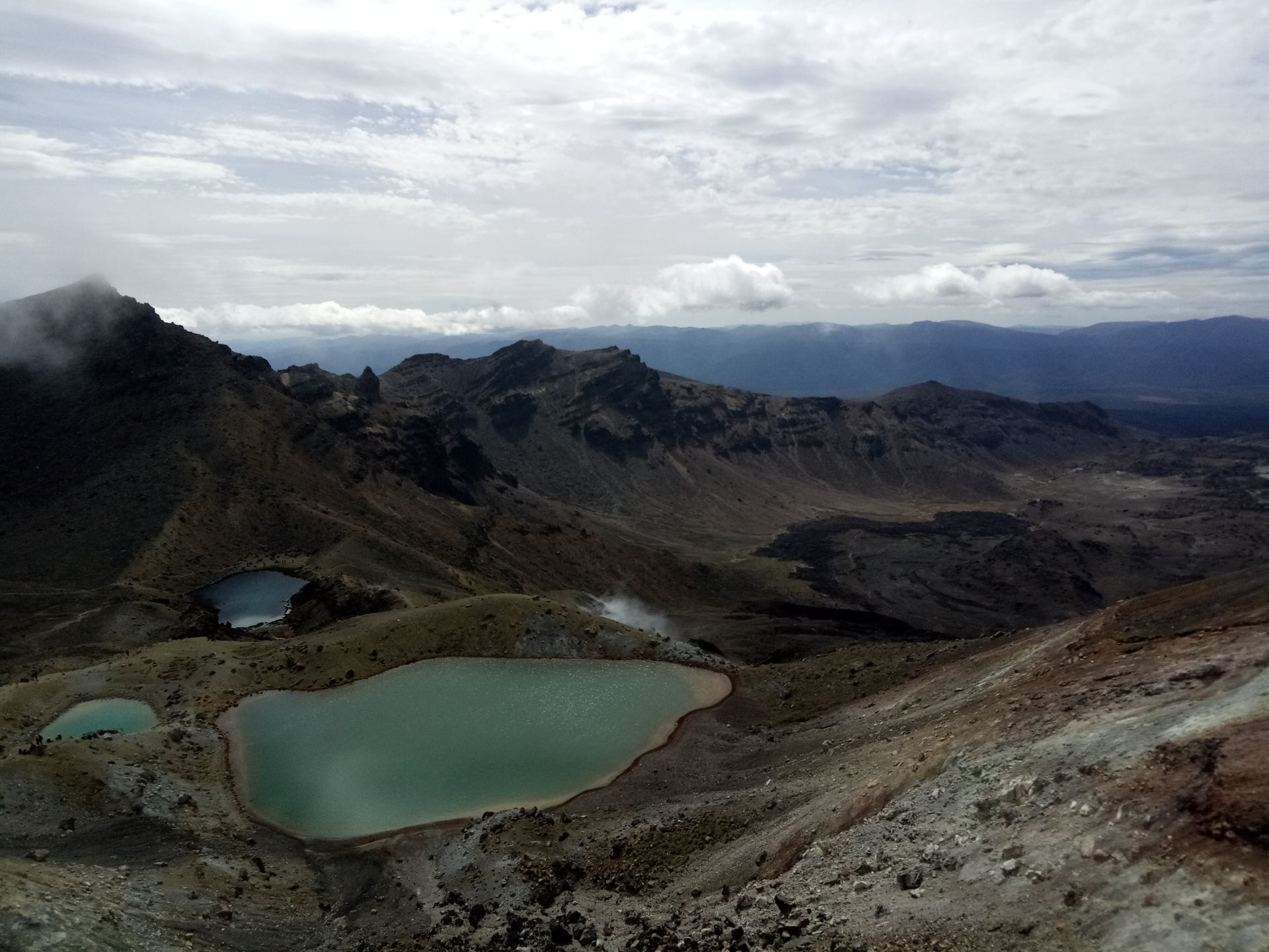
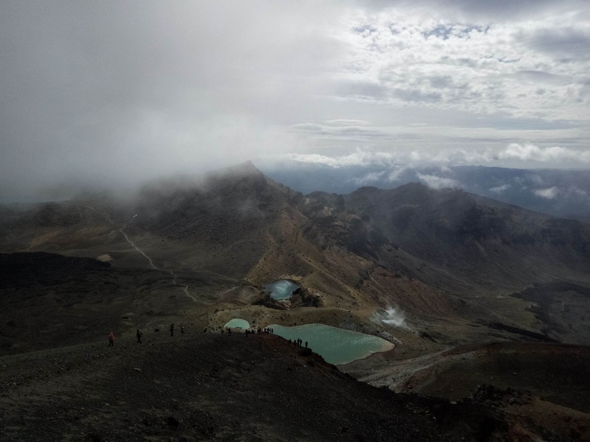
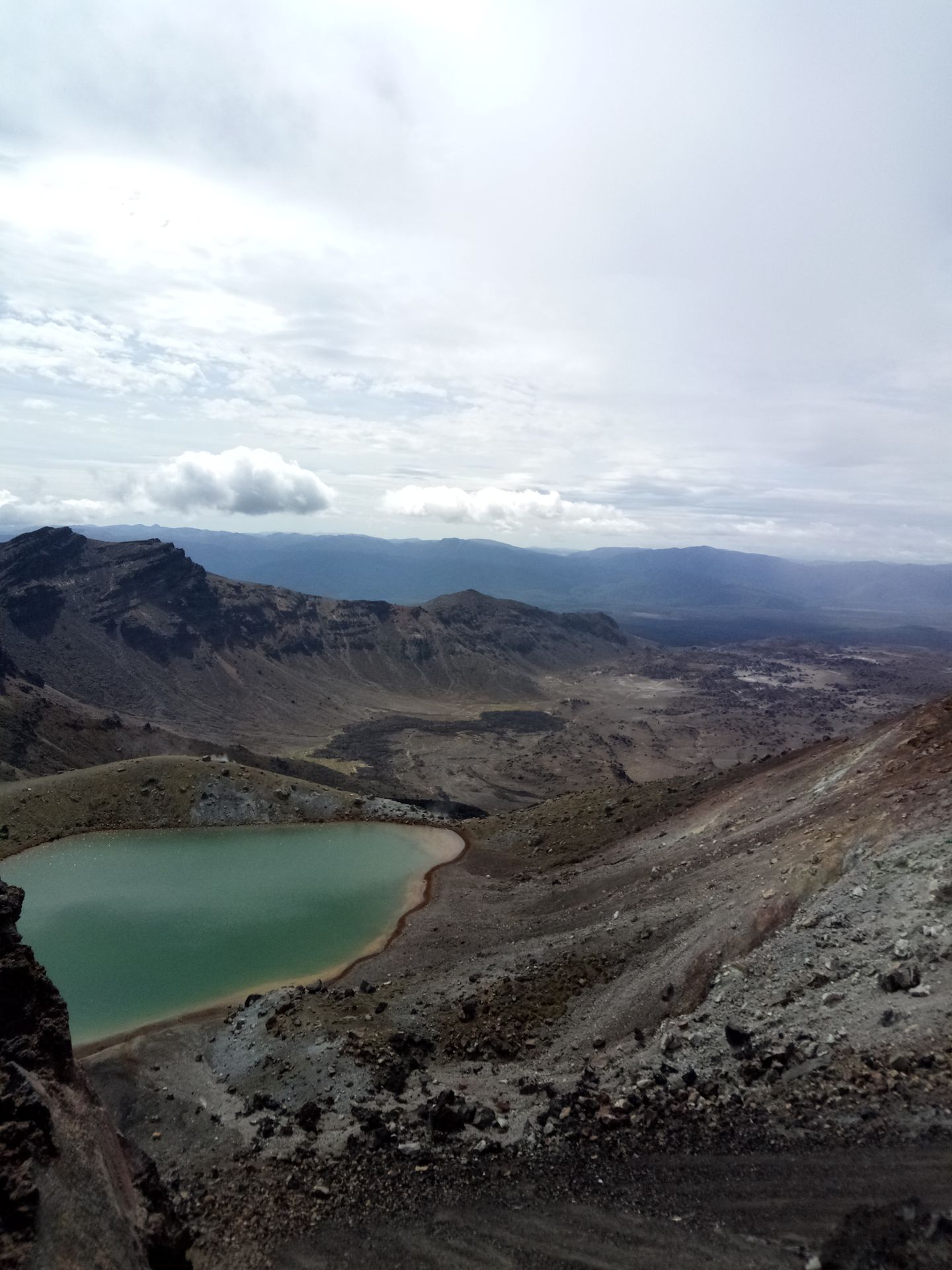
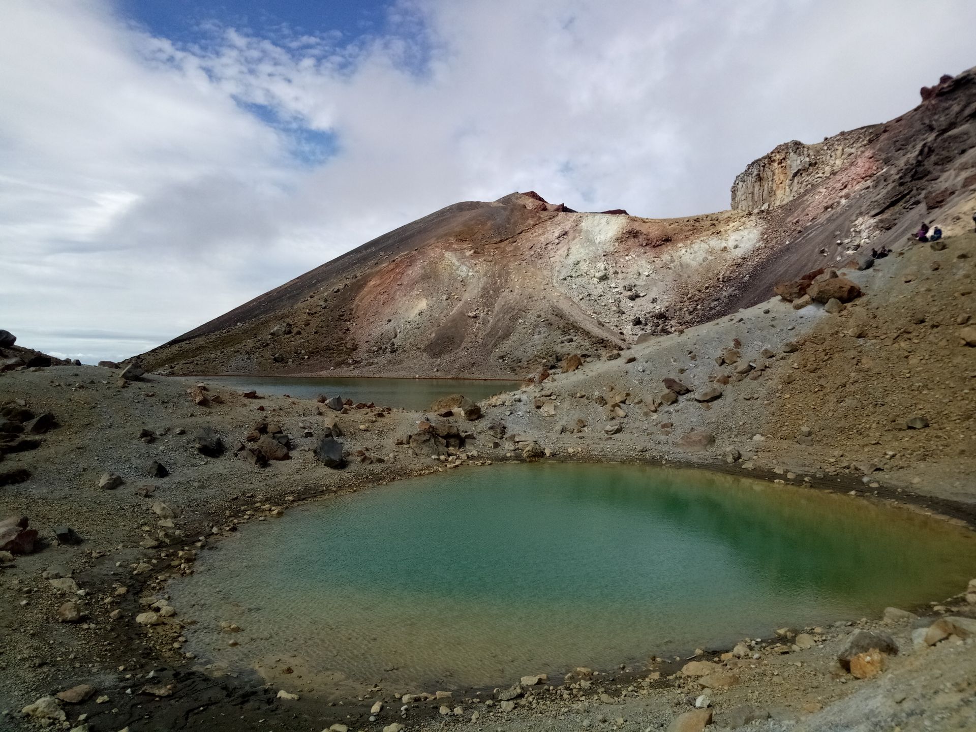
But then, this view!
I still don't have words for it!
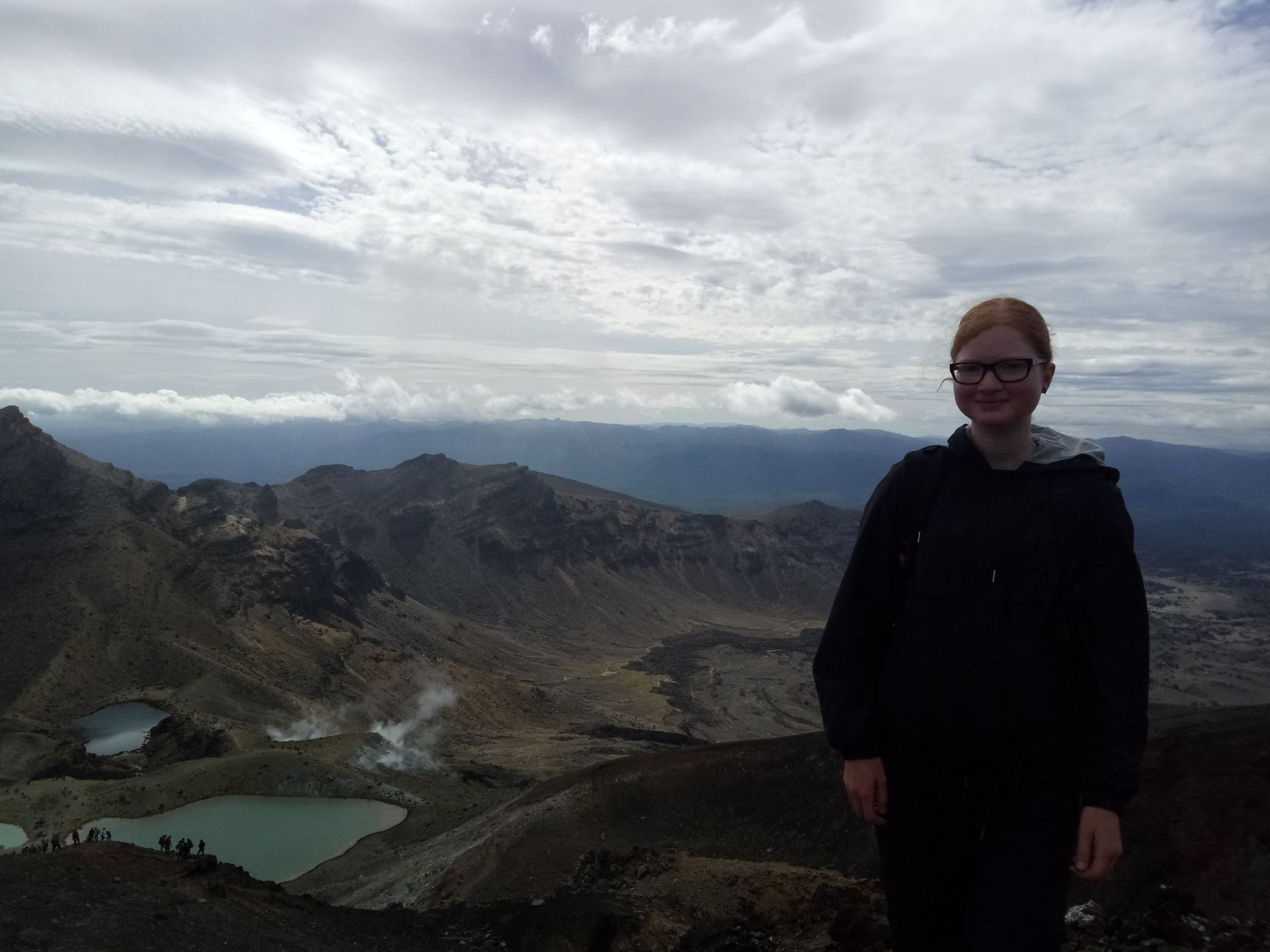
The view of the Emerald Lakes, Mordor, the Tongariro,... Everything! It was perfect!
I must have spent about half an hour up there, taking photos and marveling. Sometimes, the sun even came out!
Simply beautiful!
The descent from the summit was actually worse than the ascent because it went steeply over scree. So you weren't hiking, but sliding. In addition, I swayed from one side to the other to take as many photos as possible.
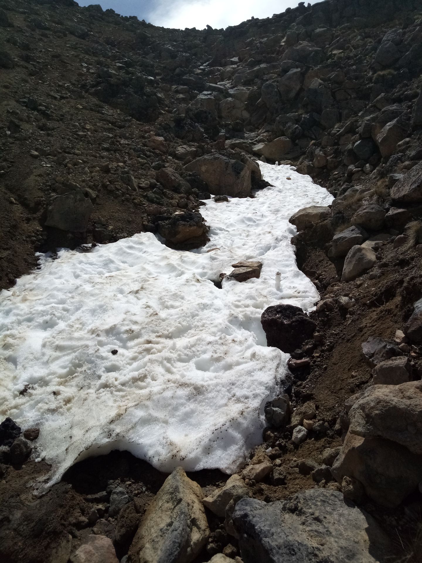
When I reached the lakes, the path improved and after a long way across the plateau, it went uphill again to the Blue Lake. There were even some remnants of snow there and someone built a snowman. Cute.
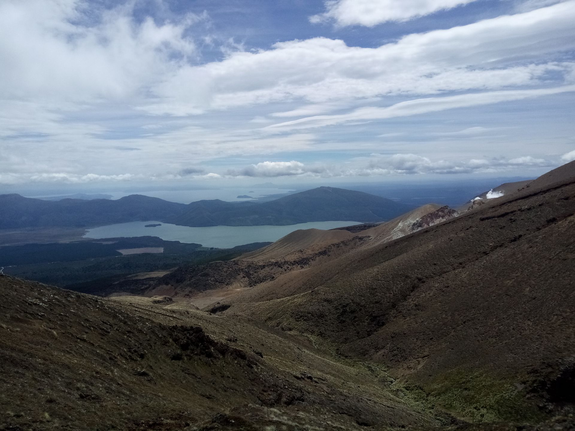
A final look back, then it was time for the looooong descent. It went 850 meters downhill over 11km.
At this point, I just want to emphasize once again that I hiked 30km yesterday and that I have two big blisters under my feet. Just wanted to mention that...
The descent was not fun. It went in switchbacks through an alpine heathland, initially with a view of Lake Taupo, then only more heath.
I was quite slow in this part because every step hurt my feet, especially my blisters. I was constantly being overtaken by other hikers, but let them do it! They probably just sat in a café and ate cake yesterday, or something.
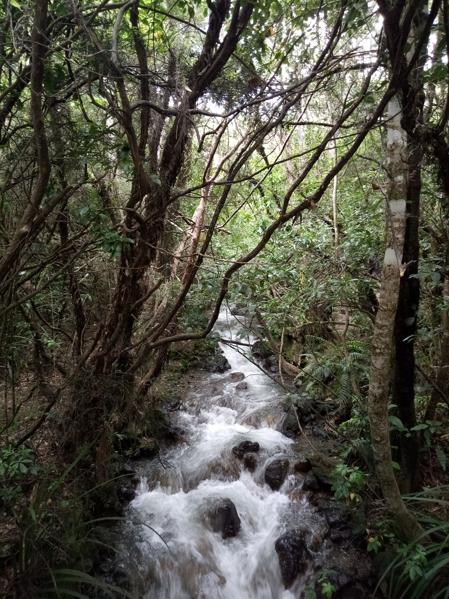
At some point, I crossed the treeline and the path now led through the bush, along a cute little river.
After a total of 2 hours of descent, I reached the end point of the Crossing at 13:30. I took about six hours exactly and was very satisfied with myself.
Several other hikers were already lying around in the parking lot and I joined them after drinking the rest of my water, eating the last granola bars, and stretching a bit. And then I sat there for the next hour until the shuttle bus came back. My feet were really hurting and my calves were throbbing strangely. So tomorrow I would take a break from hiking...
All in all, it was a great day, most of the time hiking was really fun, and for these views, all the effort was definitely worth it!
I took about 100 pictures, and because I couldn't decide, there are disproportionately many pictures for this article. But they actually speak for themselves...
Axborot byulleteniga obuna bo'ling
Javob

Sayohat hisobotlari Yangi Zelandiya