

Island
ئېلان قىلىندى: 10.08.2023


گېزىتلەرگە مۇشتەرى بولۇڭ
Day 27:
Today we drove a beautiful route partly through the national park to the Hraunfossar waterfall. The river comes from the glacier through a canyon and is then fed laterally by seepage water from lava rock.
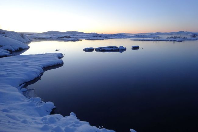
Day 26:
Around the Pingvellir National Park. A new landscape around every corner - fascinating. The combination of green and black is simply incredible, sometimes in the clouds, sometimes illuminated by the sun.
Day 25:
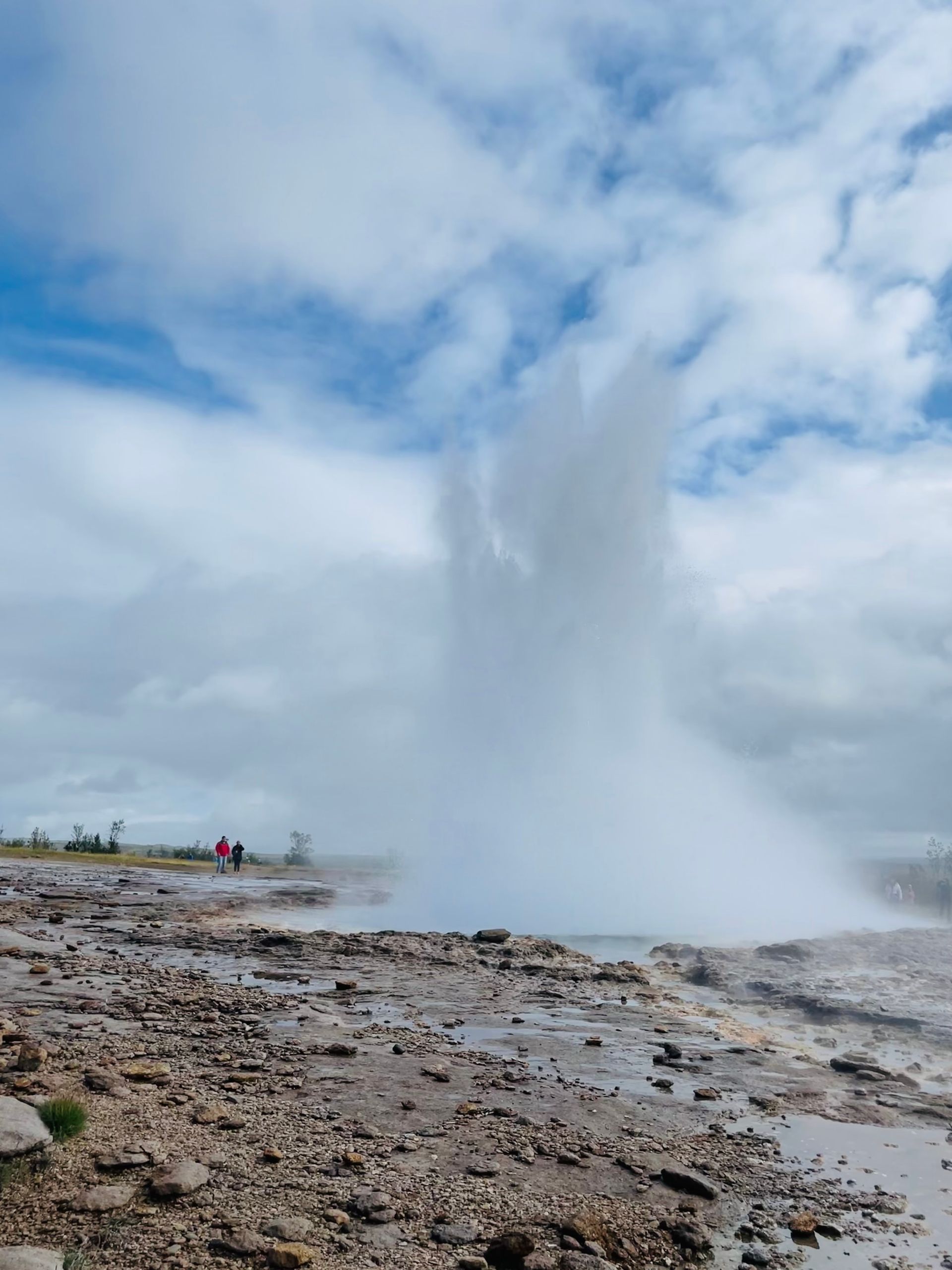
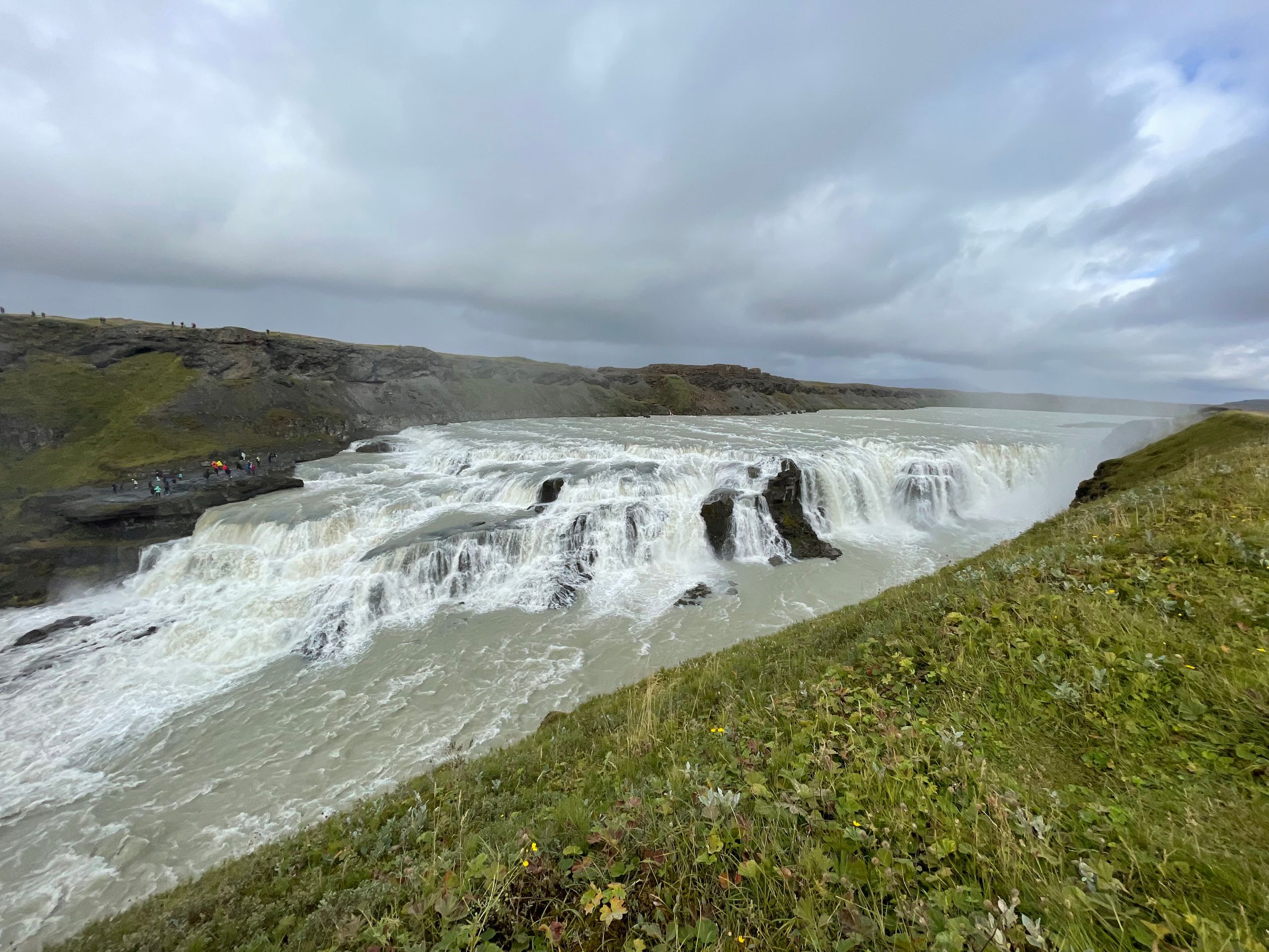
Today we visited the major attractions Geysir and Gullfoss. A lot of other tourists had the same idea :) Luckily, we approached Gullfoss from the other side. We took a half-hour hike to the waterfall and then had it all to ourselves on this side.
Day 24:
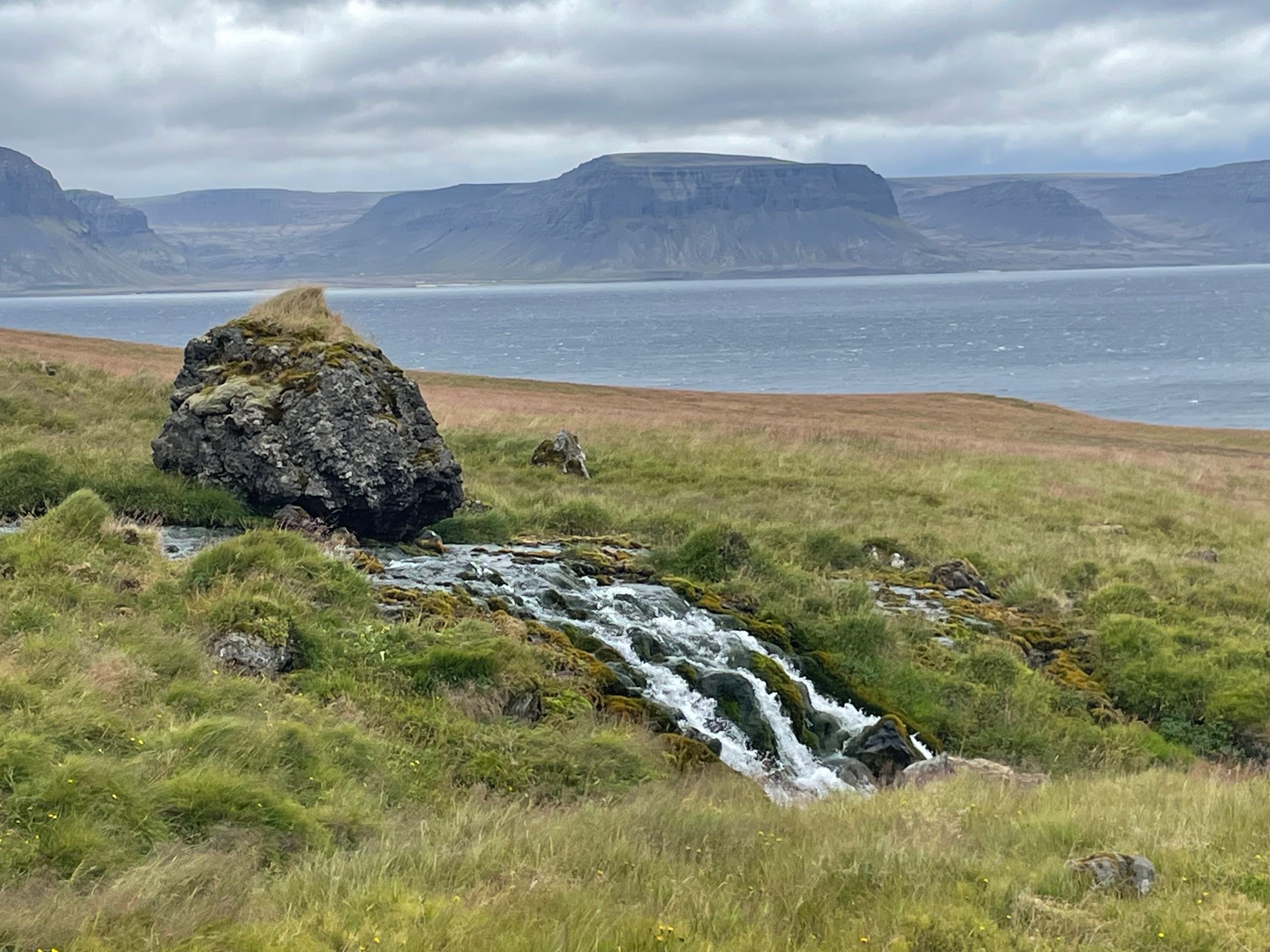
Snæfellsnes is actually like "Miniature Iceland" as described. Everything we saw on a larger scale in the highlands can be found here in a smaller version. The lava fields, the play of colors in the mountains...
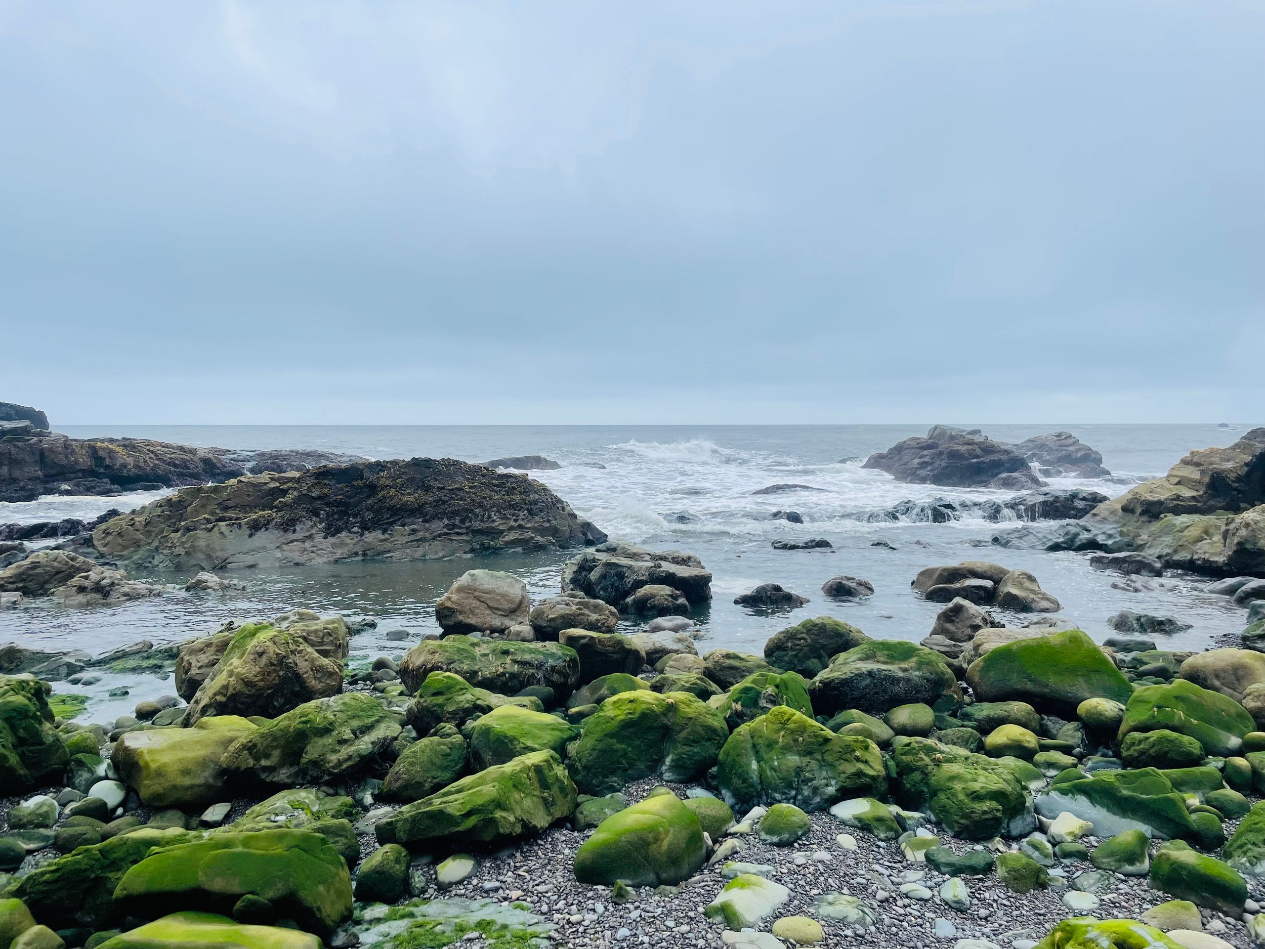
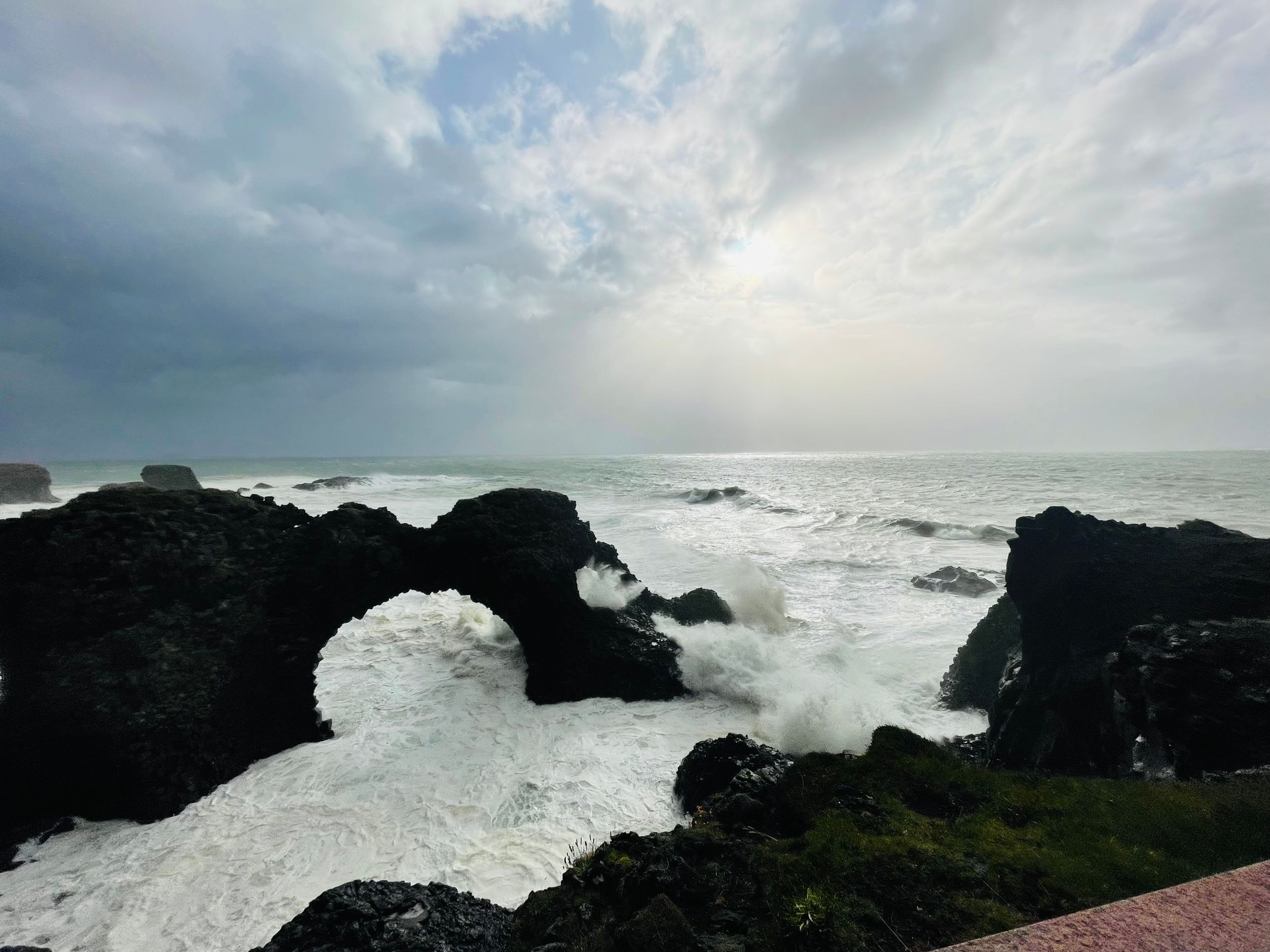
There are also rugged cliffs, for which we had the perfect weather. Storm, whipping the waves against the cliffs and spraying them meters high - simply the raw power of nature.
What the storm prevented us from doing, however, was getting closer to the seal and seal colony. We can only see them lying on the rocks in the distance.
Day 23:
Woke up with the same storm again... and we booked the ferry crossing to the Snaefellsnes Peninsula. Well, we have to go through it - I don't think we'll need a roller coaster ride anytime soon. In Bjarnarhöfn at the Shark Museum, we tried hákarl (fermented shark) as a test for our stomachs. It tastes better than its reputation.
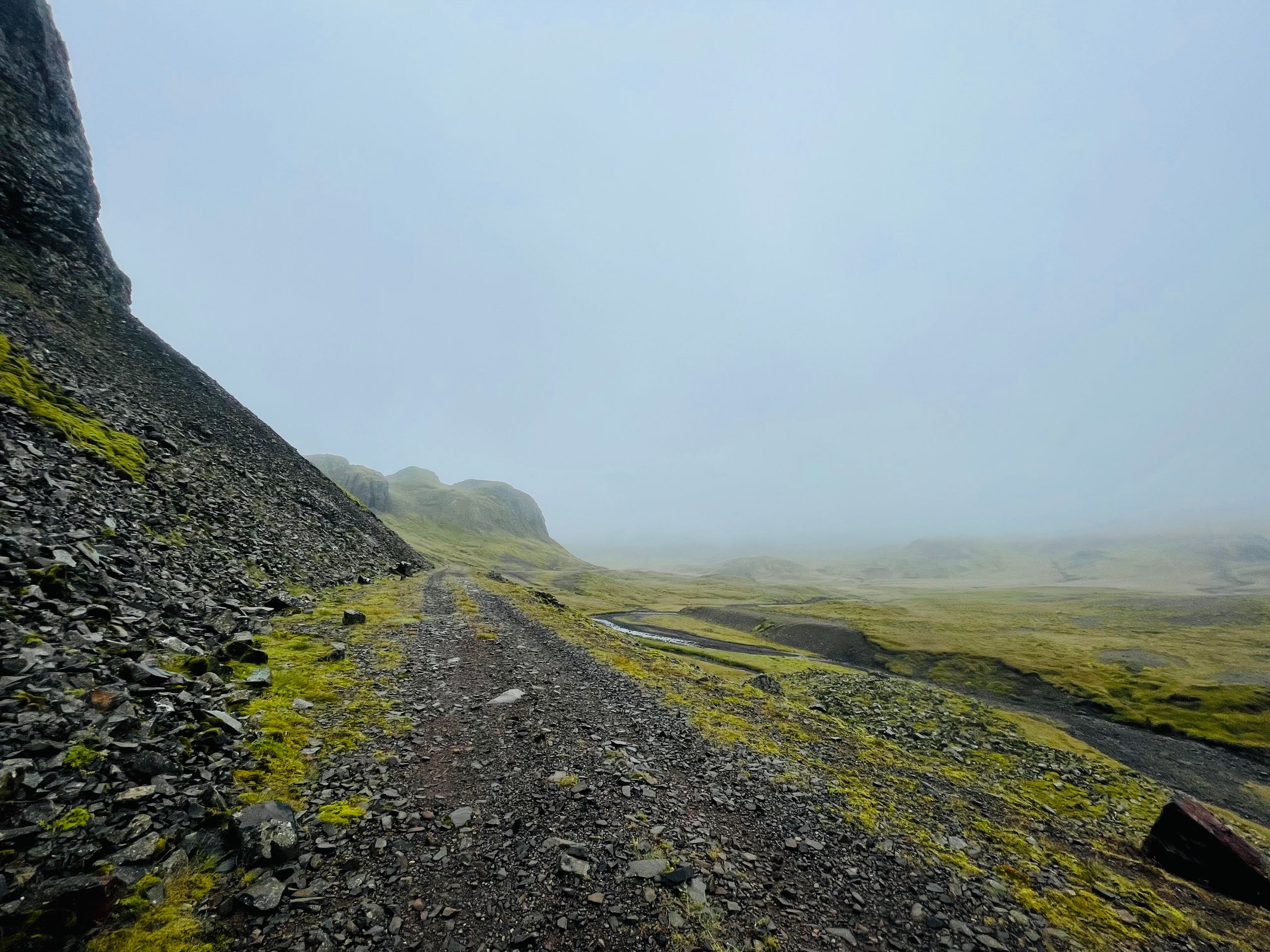
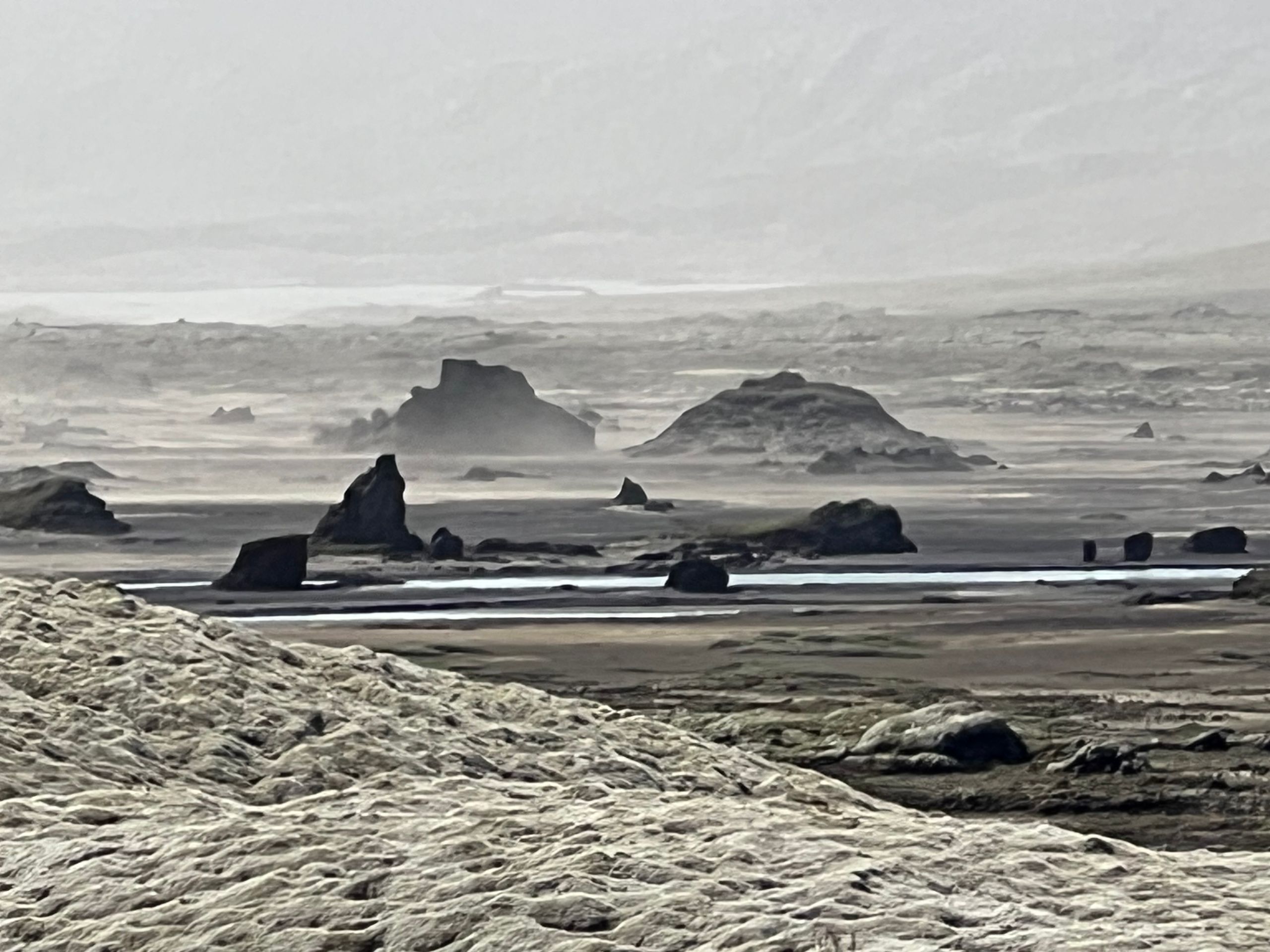
There was an incredibly eerie atmosphere on the drive from Olafsvik to Arnarstapi. It was difficult to drive, lots of fog, rain, and wind that made it difficult to keep the car on the road - but still incredibly beautiful, like being in a movie set.
Day 22:
We were almost disappointed by the Westfjords today. 500 km of paved road, one fjord after another, it slowly became boring, the nature was beautiful but not spectacular. From Isafjordur, we took a shortcut and went directly to Pingeyri, where it looked like a small road runs along the fjord on the map. And indeed, we were fully compensated for driving on paved roads. High cliffs, steeply sloping next to the road, and a section right next to the sea, which you probably have to drive through the water partially at high tide. At the end of the route, there is a waterfall cascading down (Dynjandi). So in the end, another great day, well except for the storm that starts in the evening and forces us to the hotel because 80 km/h for the rooftop tent is a bit too much.
Day 21:
Today we had to take a travel day to get to the Westfjords.
Day 20:
Today we took a boat to the island of Grimsey and crossed the Arctic Circle.
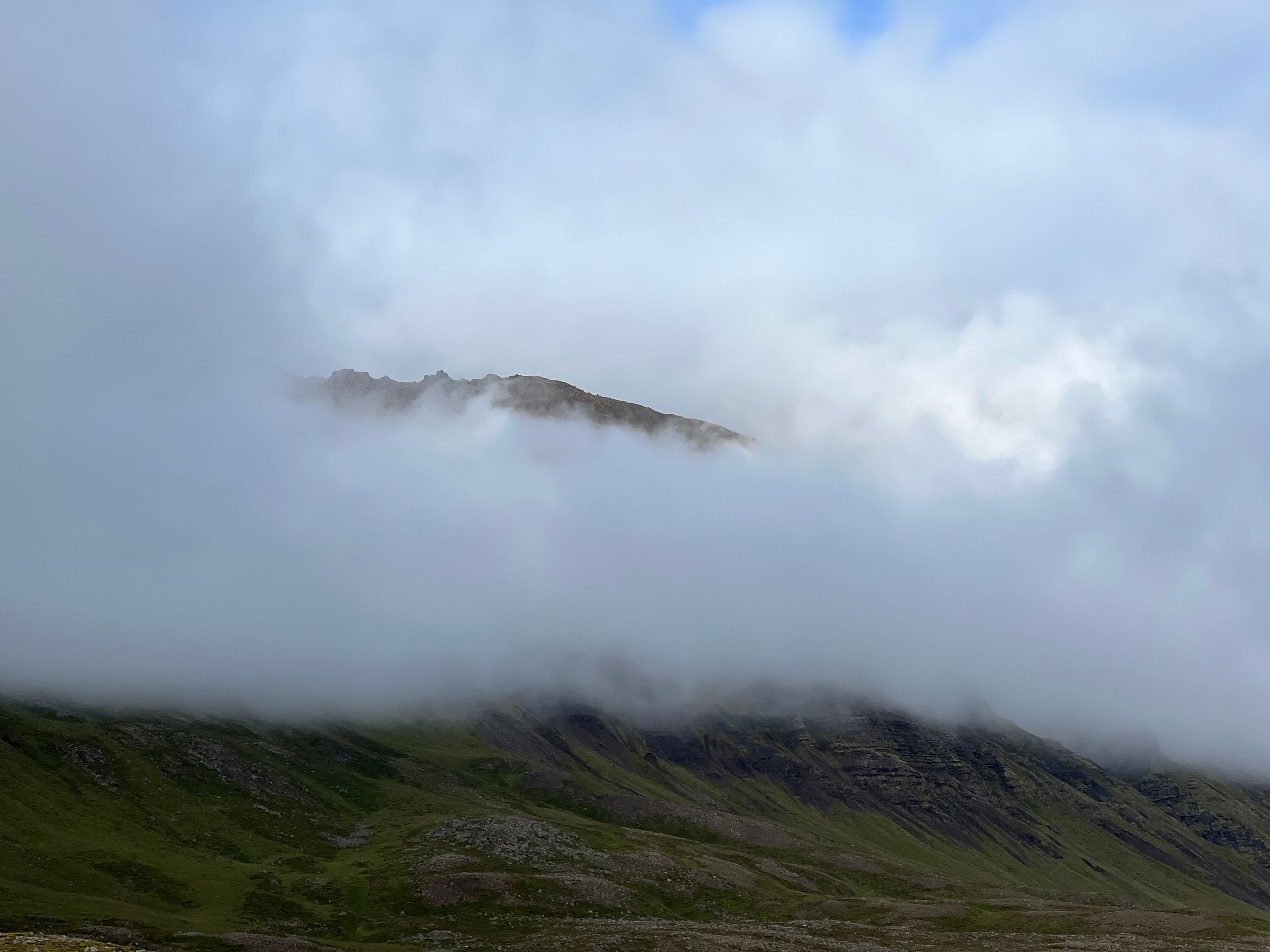
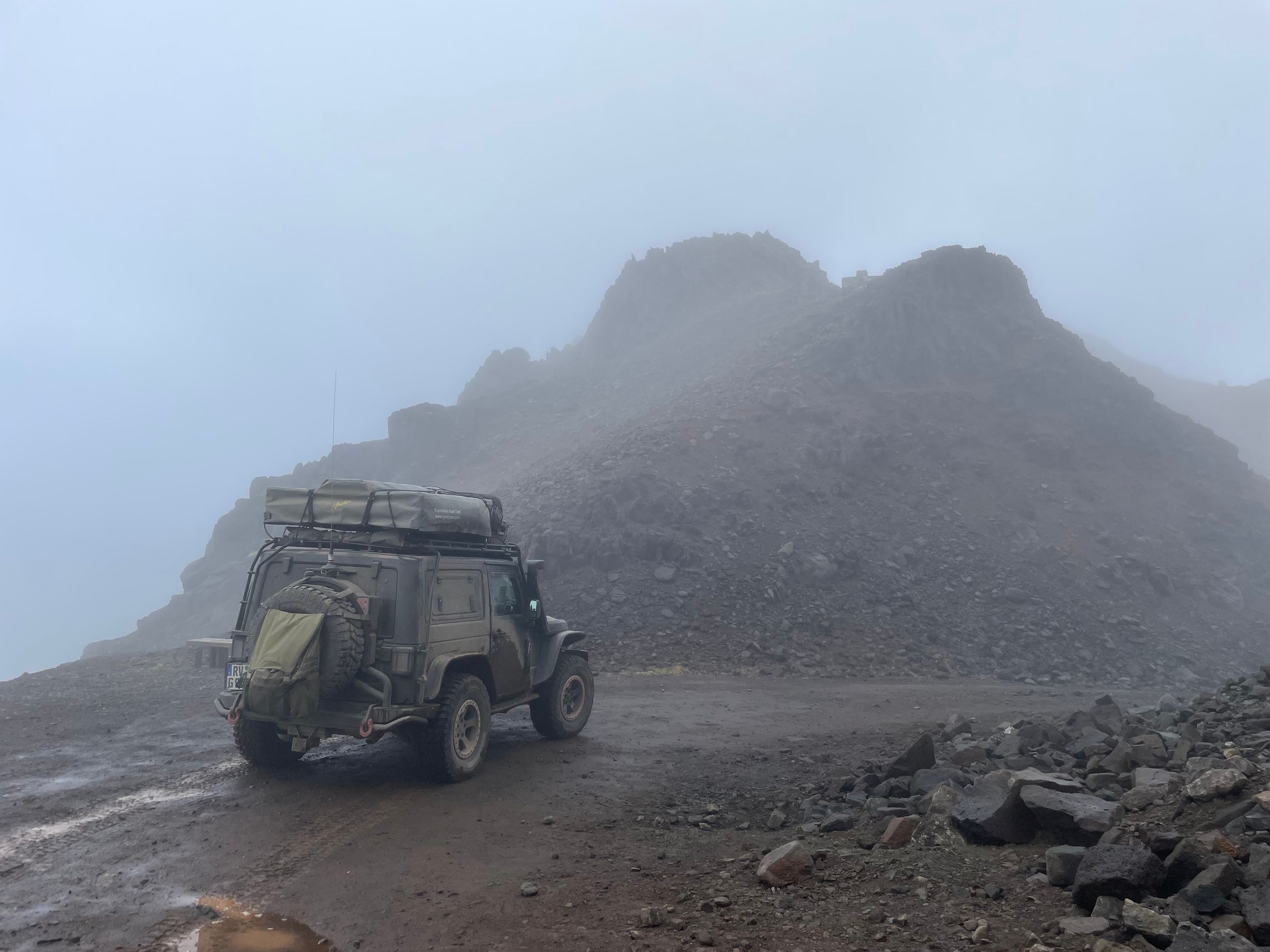
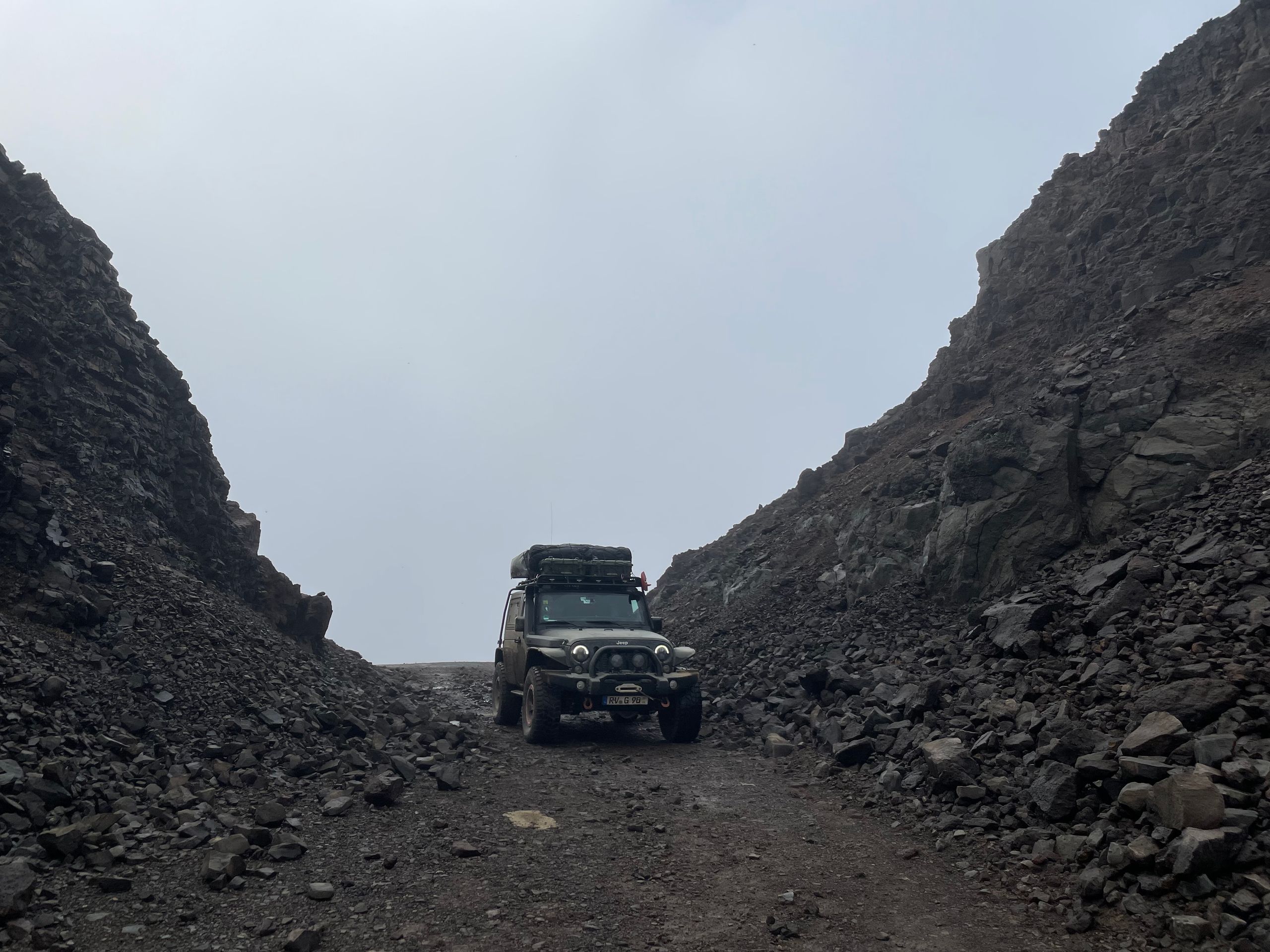
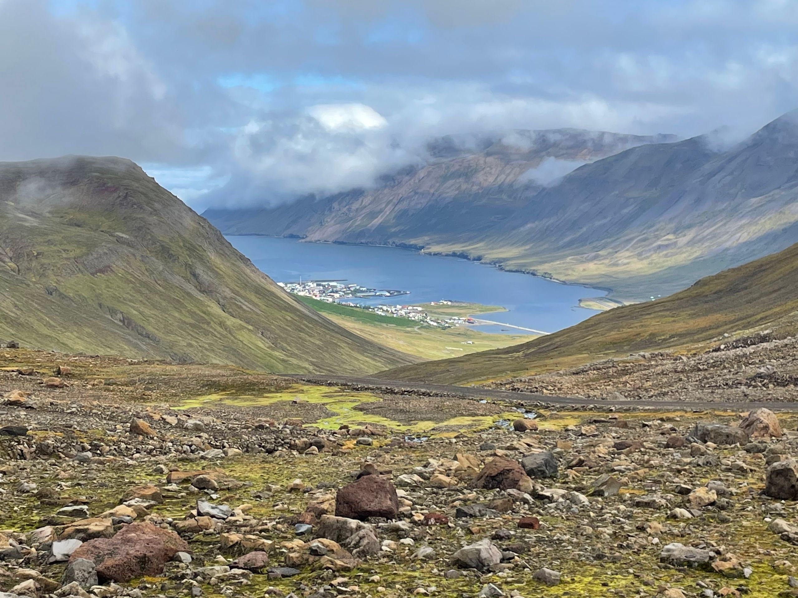
Day 19:
Breakfast by the sea with a fantastic view. Then we drive towards Dalvik, first along the coast, then turn off to cross the fjord for a short distance through the mountains. Fog moves in and gives the landscape a completely different, gloomy, eerie note. The drive is partly spectacular, steep, rocky, narrow, demanding, but beautiful. Especially the descent to Siglufjördur, when the fog clears and reveals the view of the fjord.
Arriving in Dalvik, we enjoy allegedly the best fish soup in Iceland at Gisli Eirikur Helgi.
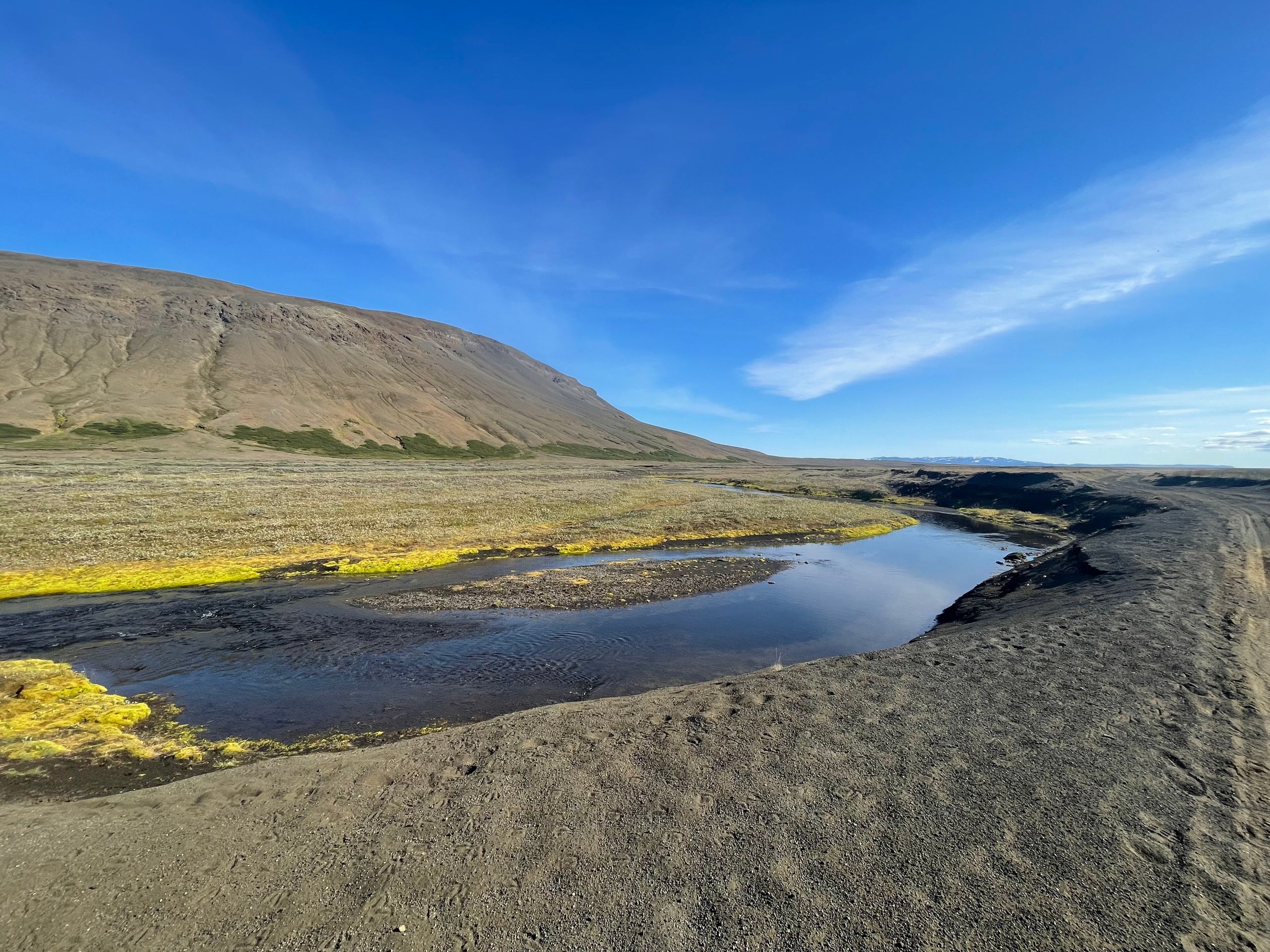
Day 18:
Today was an unspectacular drive north through a tundra area. However, the route was nice to drive, varied, sometimes rocky, bumpy, sometimes through sandy, washed-out paths, in between two glaciers. We spend the evening and the night at the Grettislaug campsite by the sea.
Day 17:
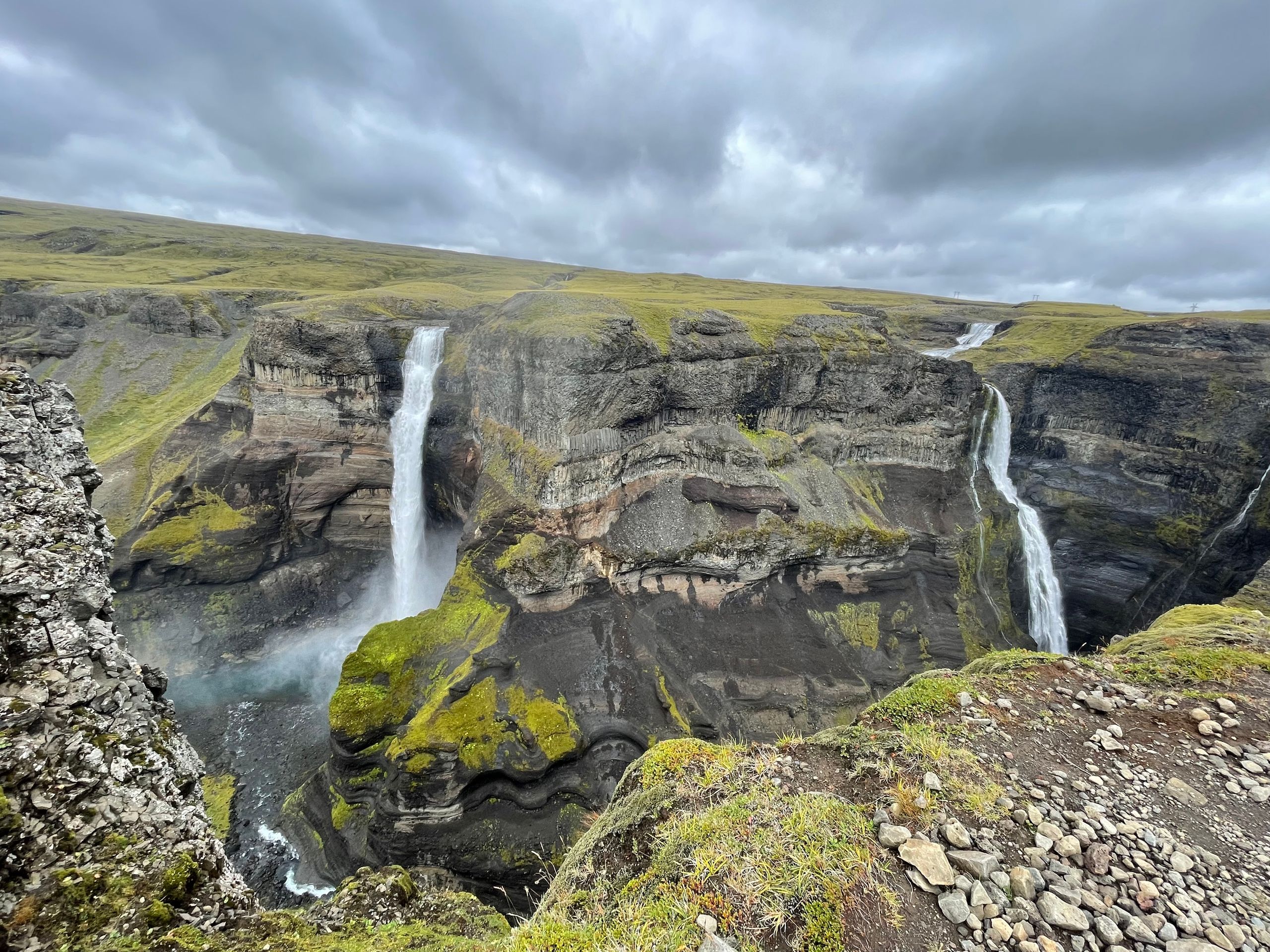
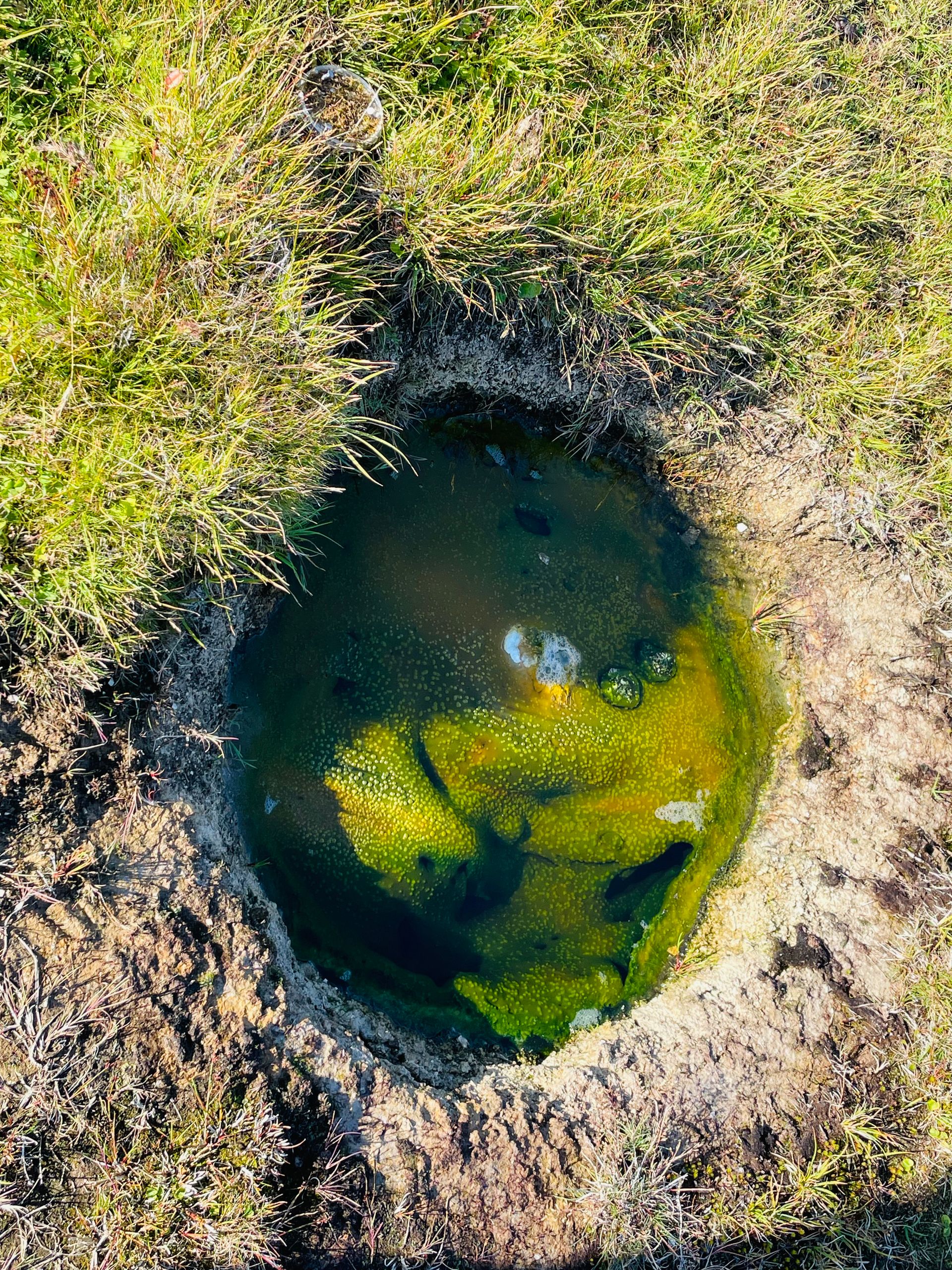
The day starts with a highlight, we take a detour to Haifoss. Then we head north into the highlands. We drive for hours through sand and stone deserts. In the evening, the circle closes again with a great highlight - the campsite is surrounded by a geothermal field. Water bubbles, sprays, and boils in the rock pools everywhere. In one of them, you can warm up wonderfully at 40 degrees on this windy and rainy day.
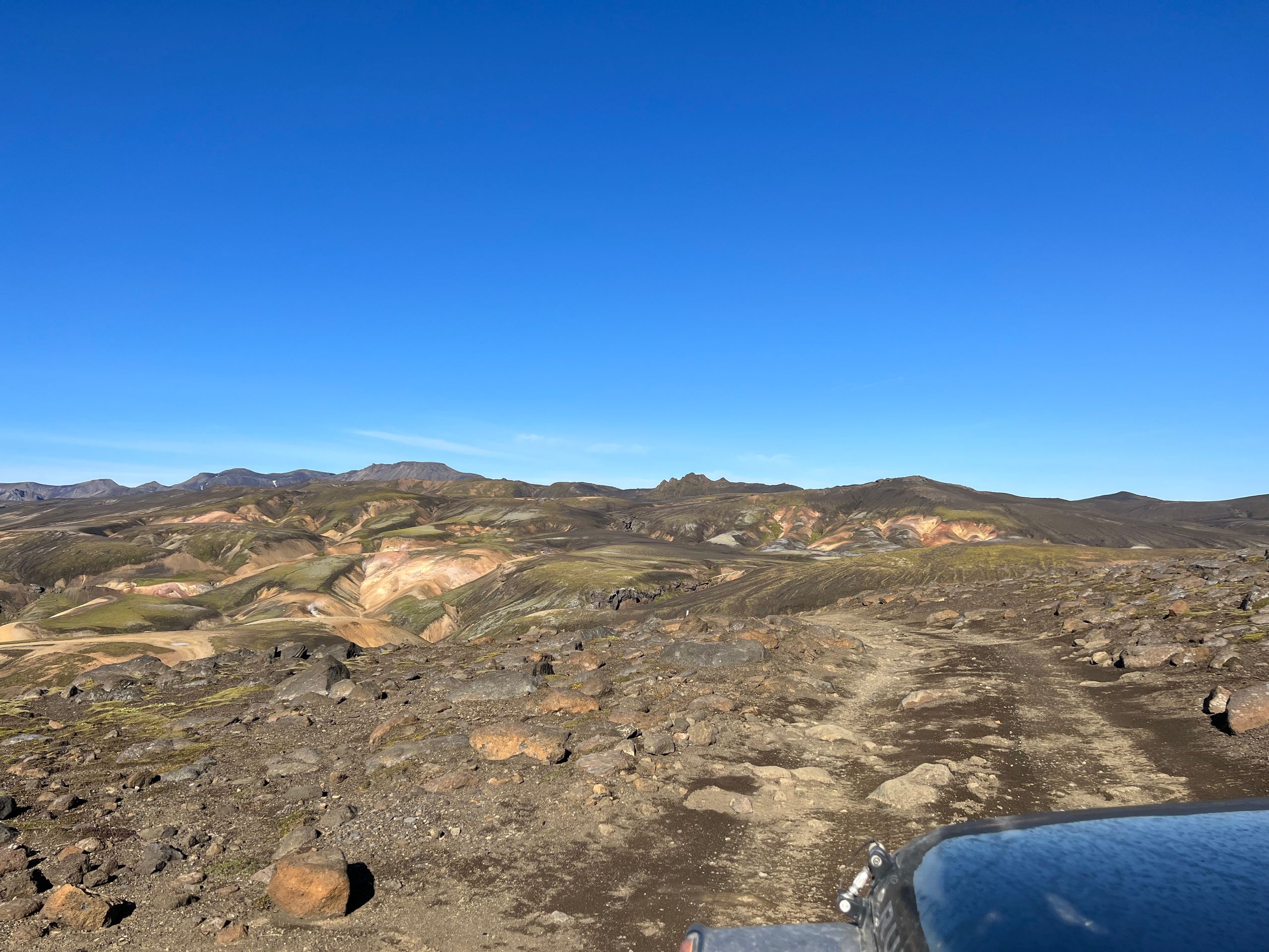
Day 16:
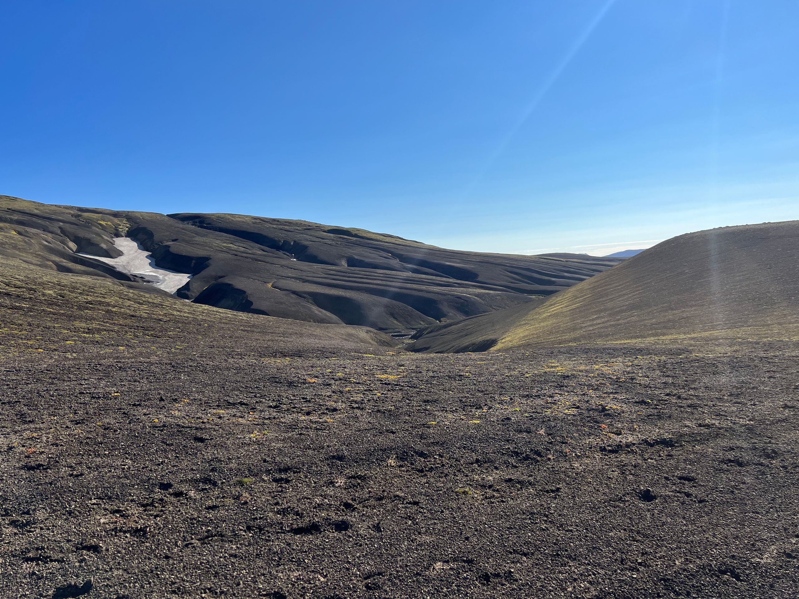
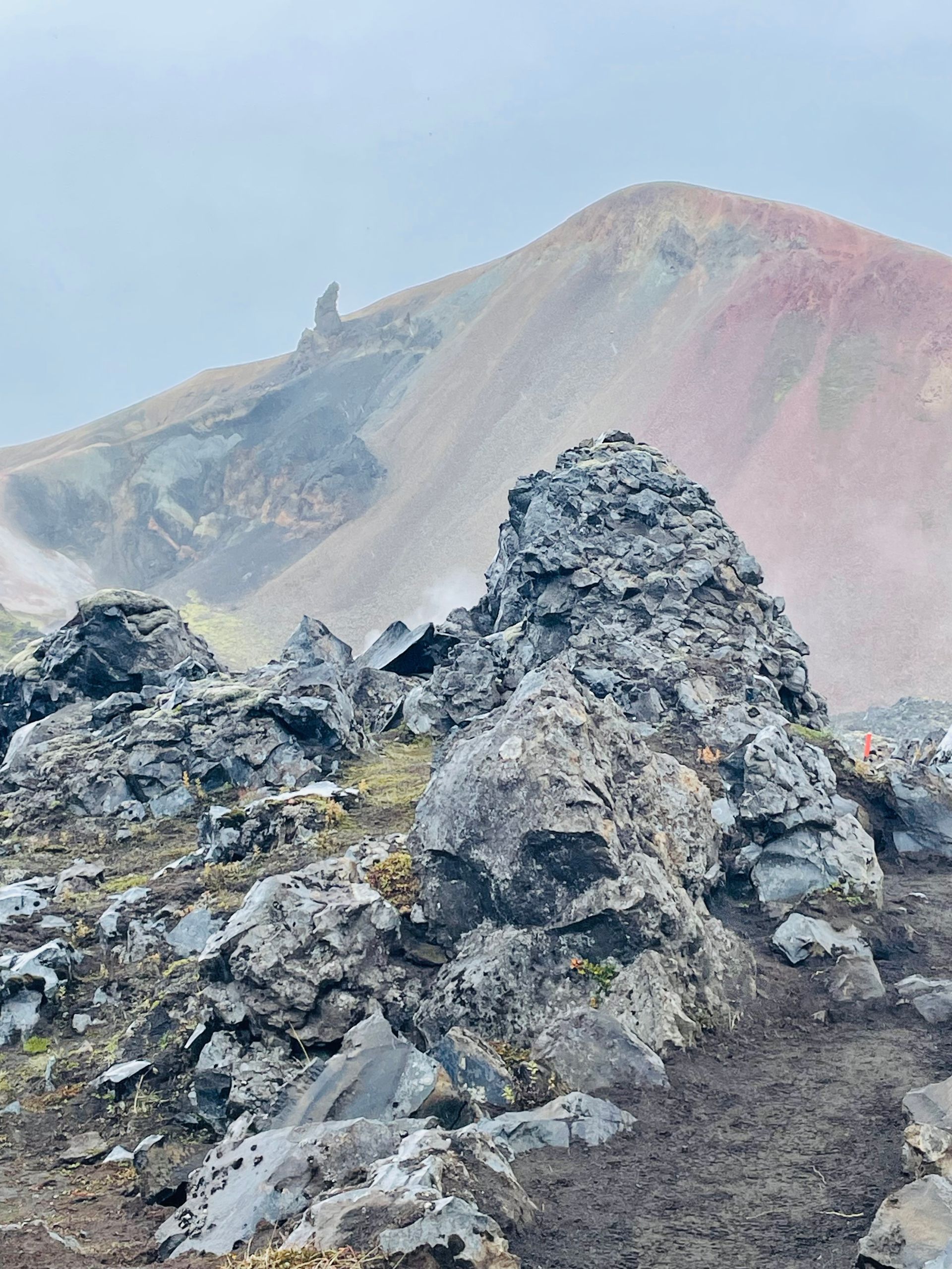
We stay in Landmannalaugar and enjoy the incredible play of colors in the rocks during a circular hike. All shades of yellow, brown, green, gray ... accompanied by wind, rain, and fog.
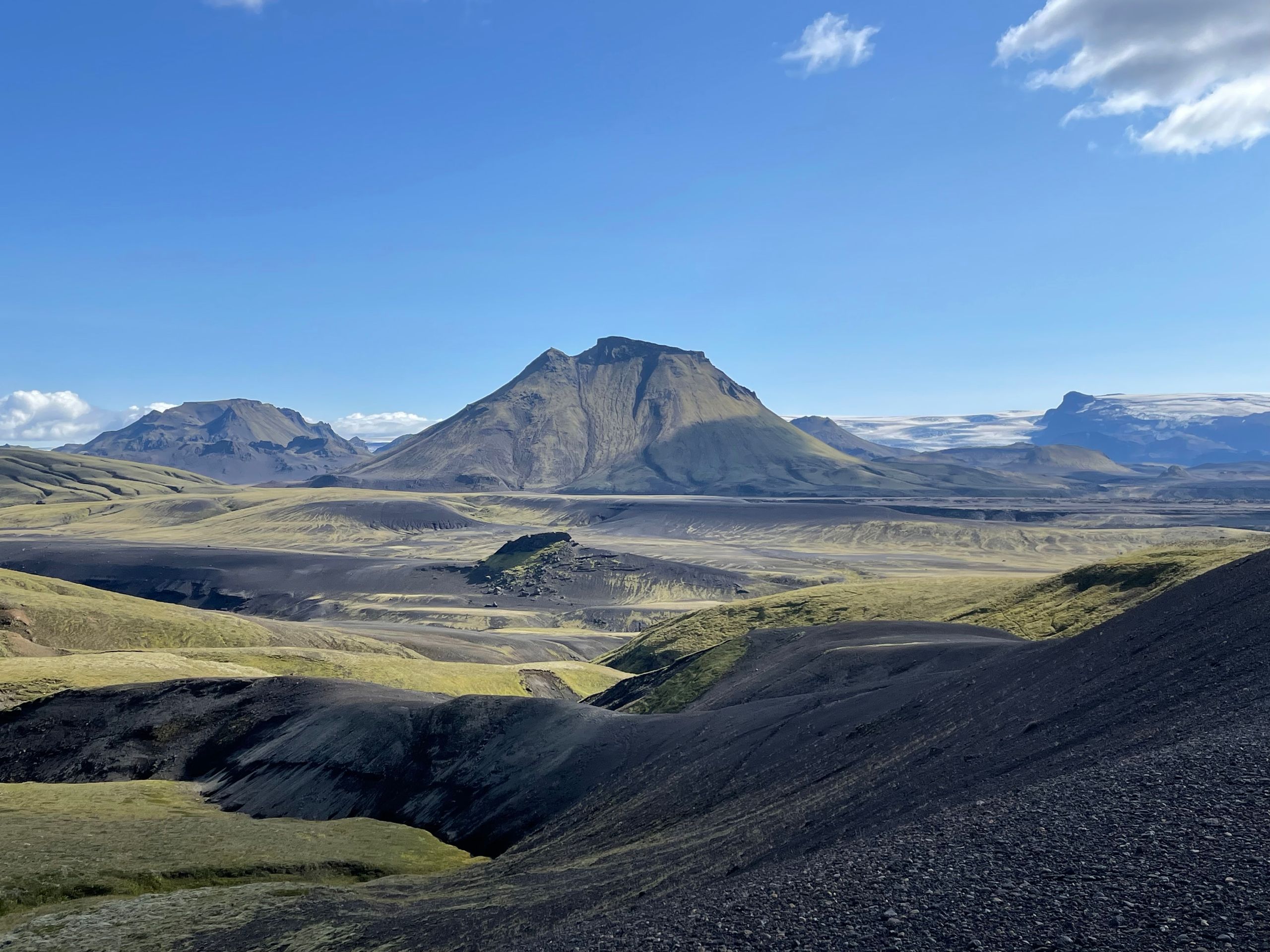
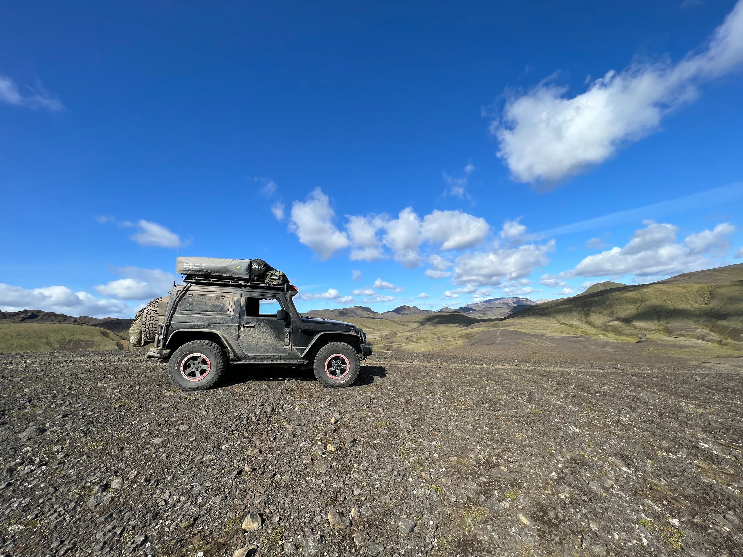
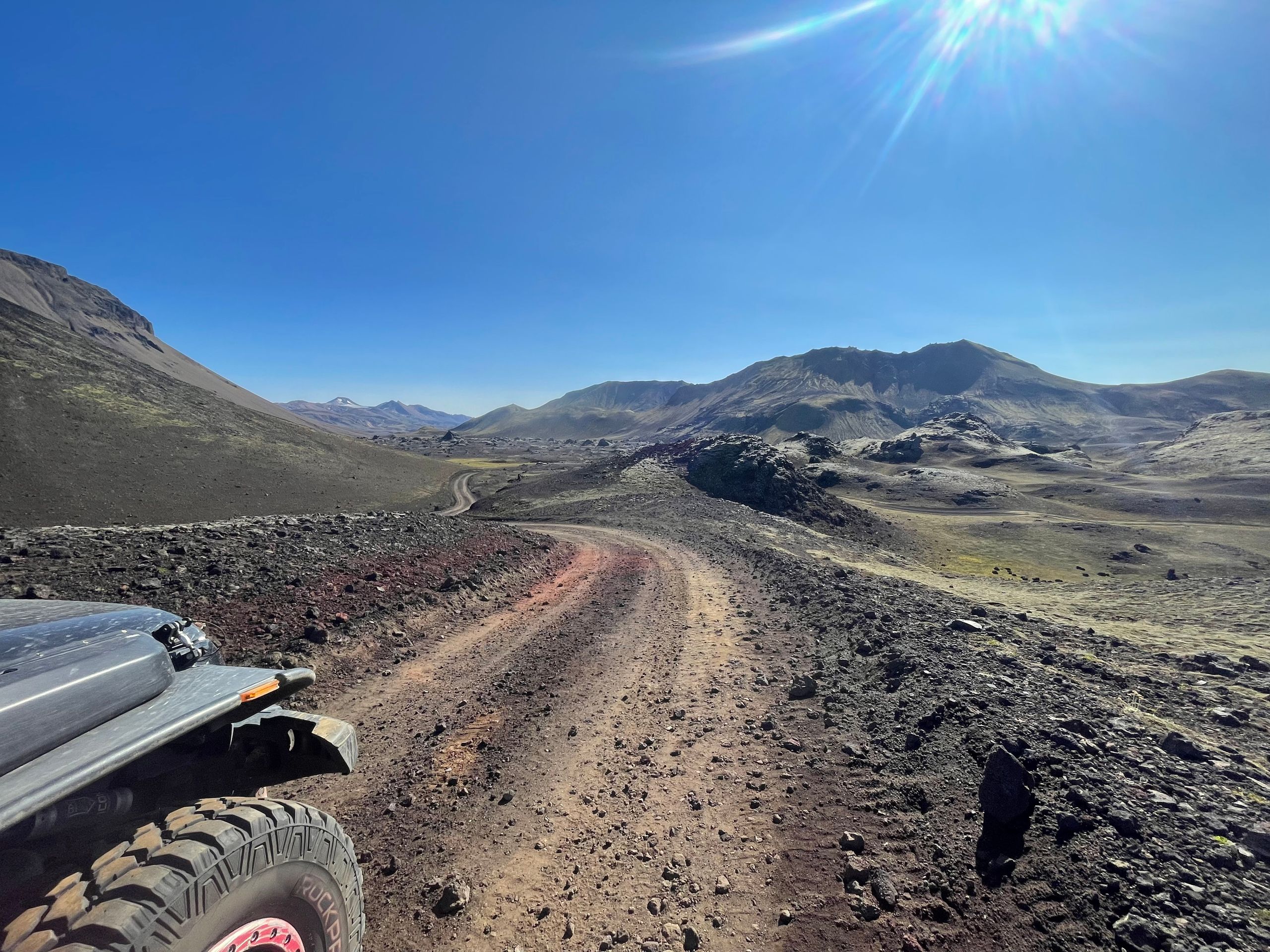
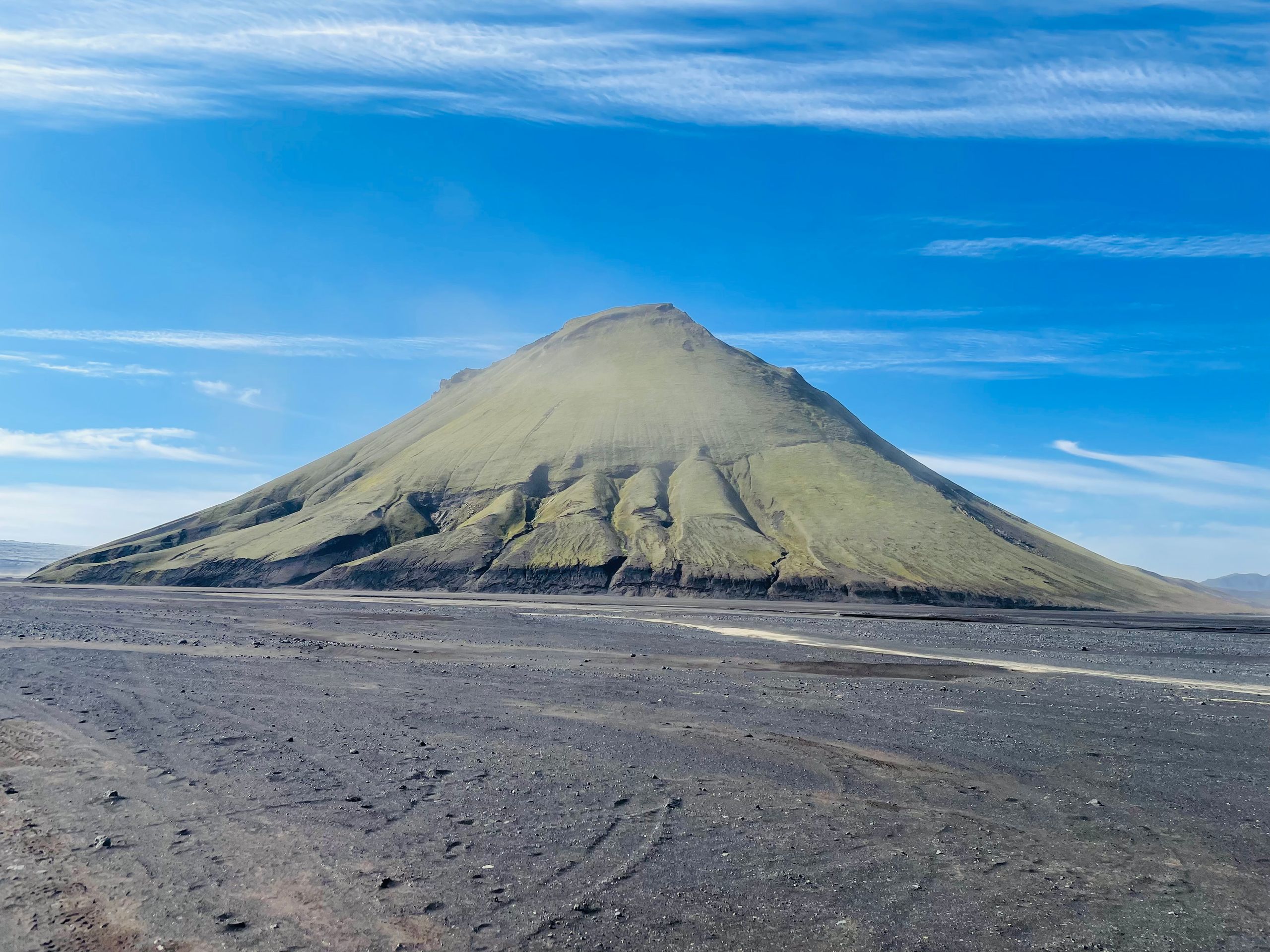
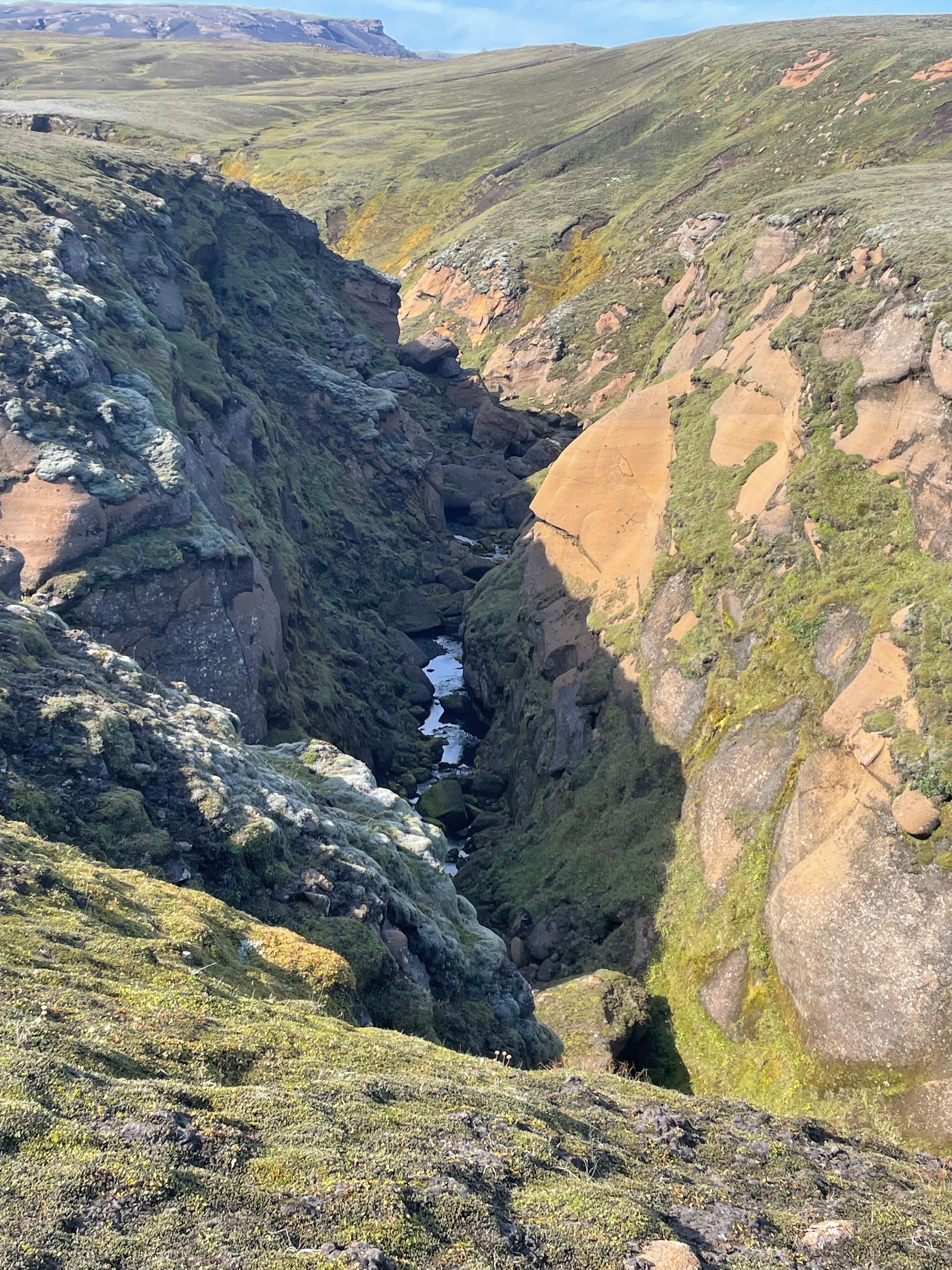
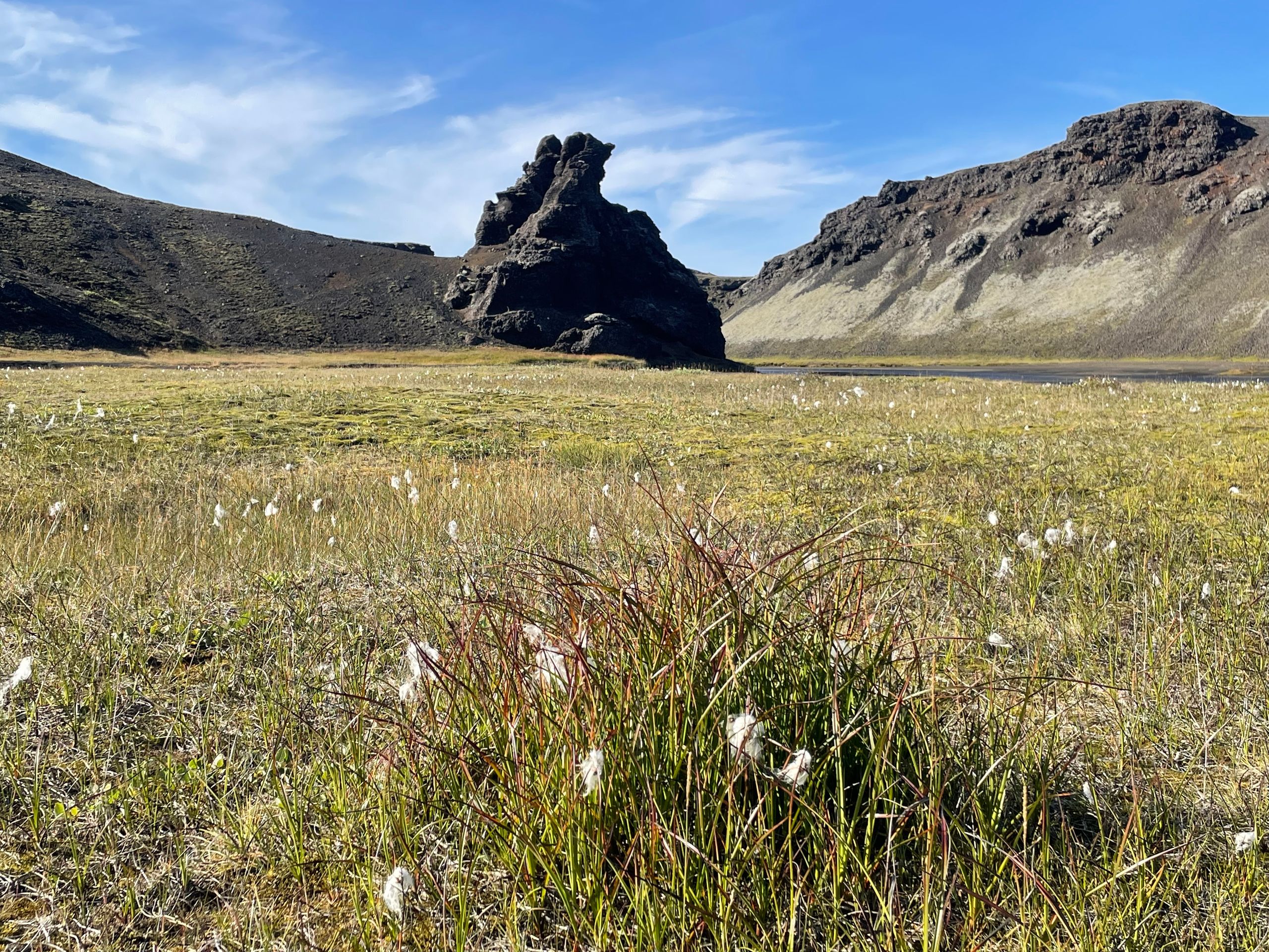
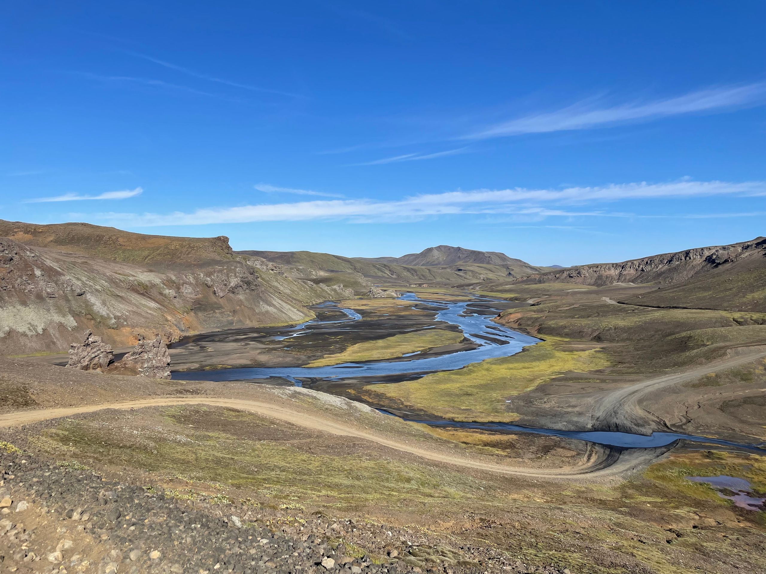
Day 15:
We are heading to Landmannalaugar. Fantastic off-road routes through constantly changing landscapes. Steep uphill and downhill, through rocks, lava, and sand. Until we reach the green mountain Maelifell, rising in the middle of the desert. Then on through the beautiful hiking area in the national park to Landmannalaugar.
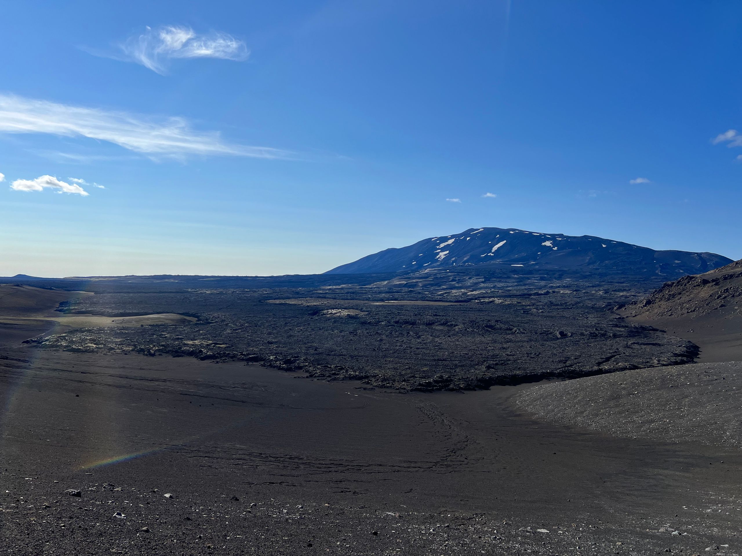
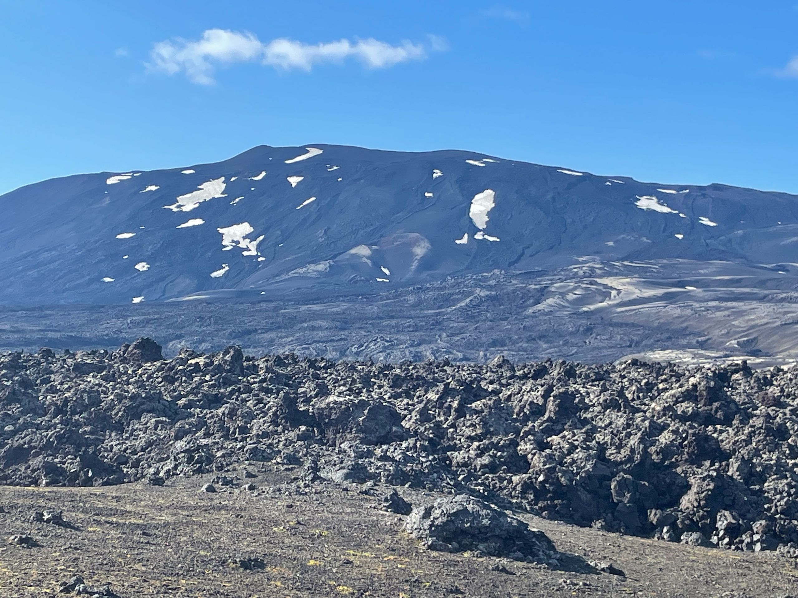
Day 14:
On our way to Hekla today, we first drive through endless expanses, just magnificent landscapes, beautiful canyons - no people in sight. Then the landscapes become more barren, we pass through ash fields, then huge lava fields, meters high until we finally stand in front of it. The most active and dangerous volcano in Iceland. After the eruptions in 1970, 80/81, 91, and 2000, it is actually overdue. The dangerous thing is that before an eruption, according to the warning sign, there is only a warning time of 30-80 minutes. It was a strange feeling to drive past it so close. We then stayed overnight at a safe distance.
Day 13: REST DAY in Porsmörk 😊
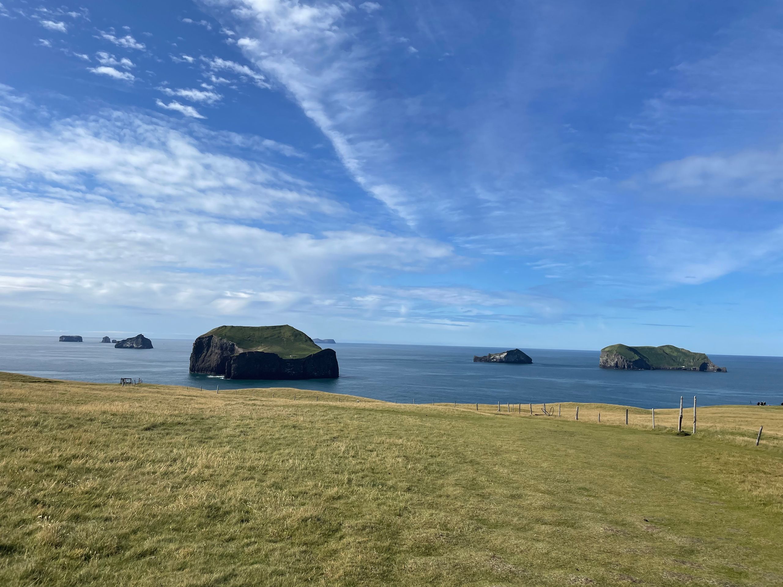
Day 12: On the Vestmann Islands
From the main island, you have a panoramic view of the remaining 13 islands, which are all much smaller. On two of them, we actually discovered a house and sheep on the plateau above the cliffs ... how they got up there is a mystery.
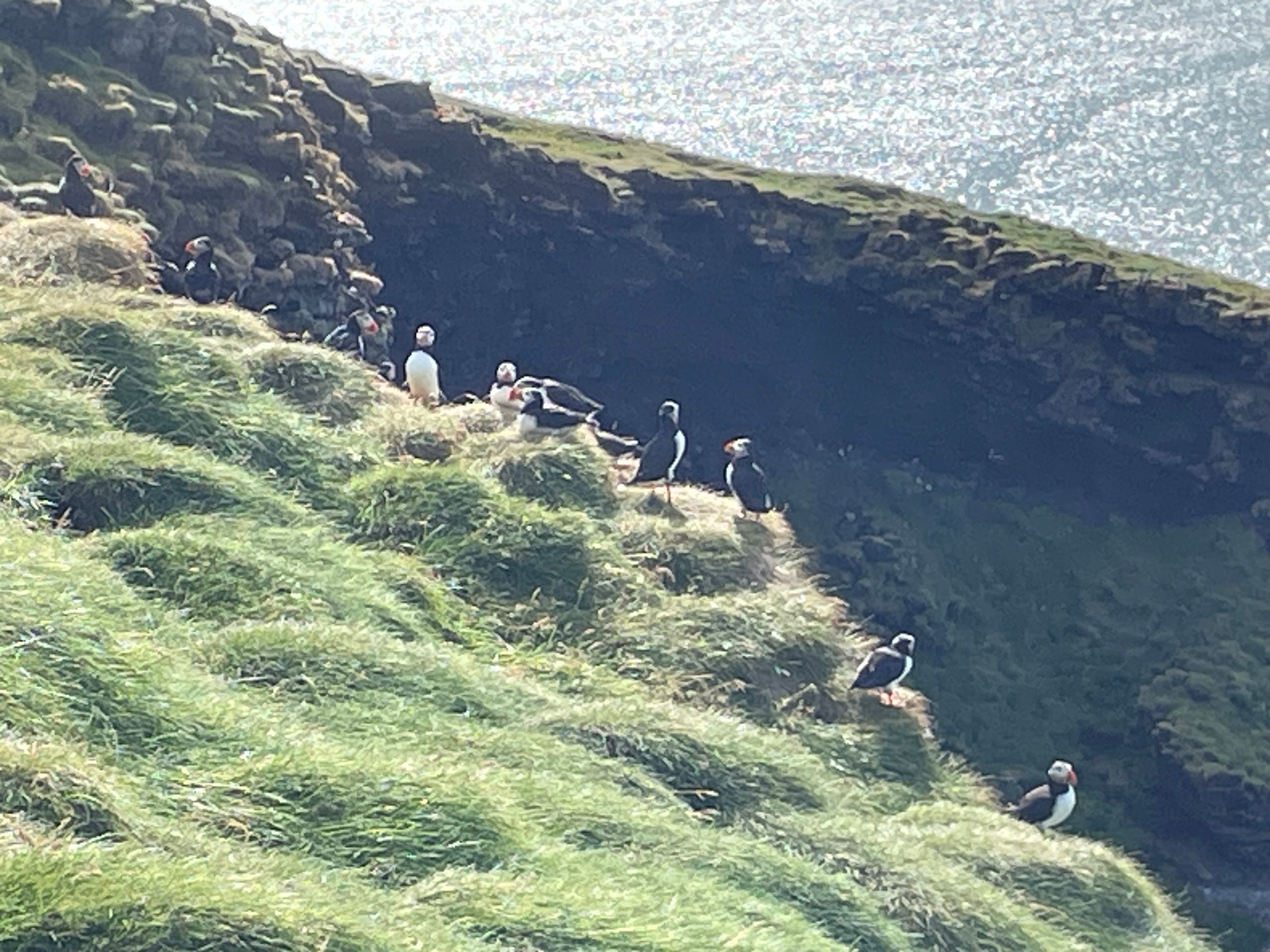
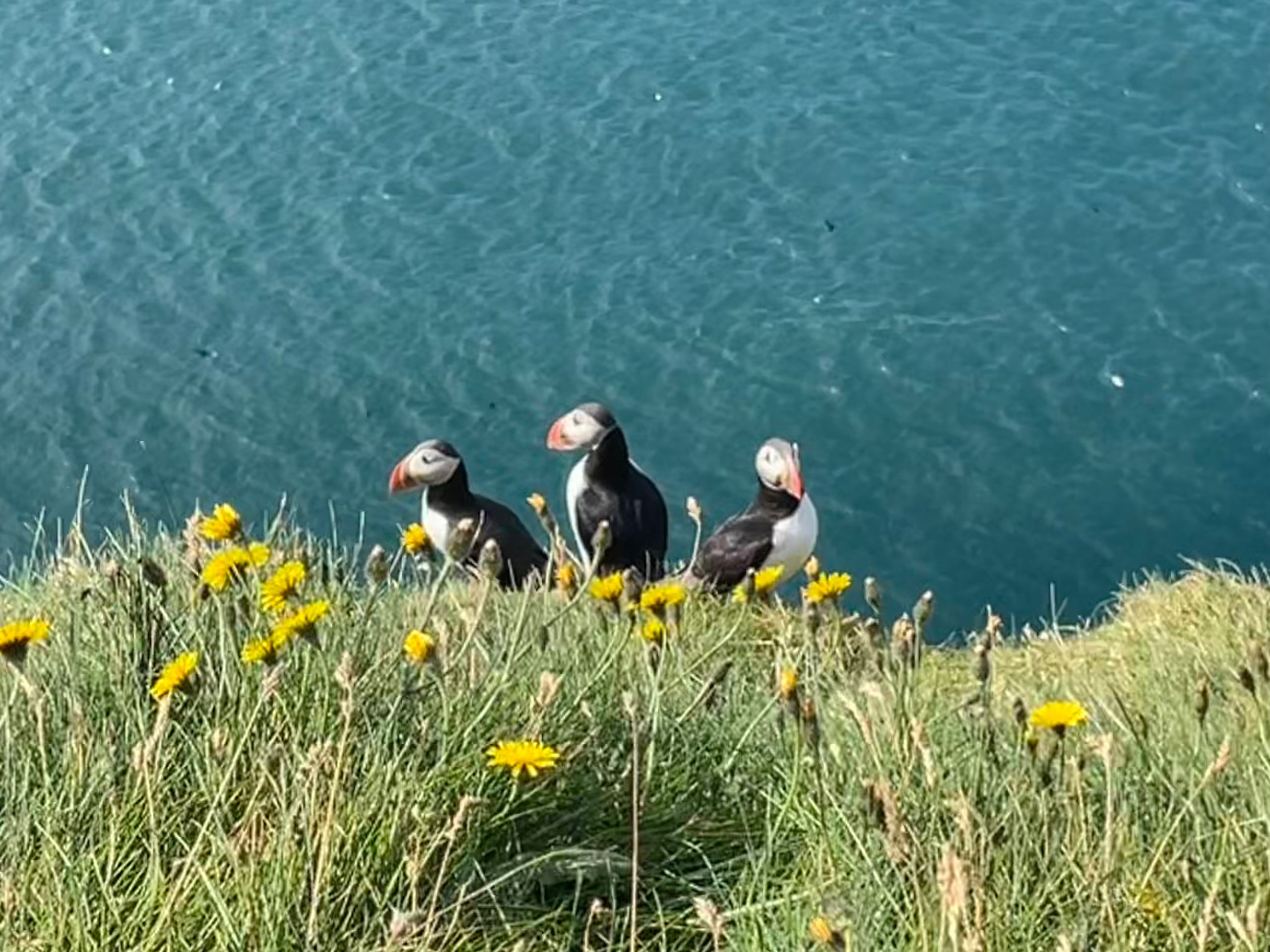
The puffins can reach everywhere on the islands. We saw thousands of these little guys, you could watch them for hours.
In the late afternoon, we left the island again and on the way to the campsite in Porsmörk, we stopped at the Seljalandsfoss waterfall. Just at the right time when the sun cast a rainbow in the foaming spray.
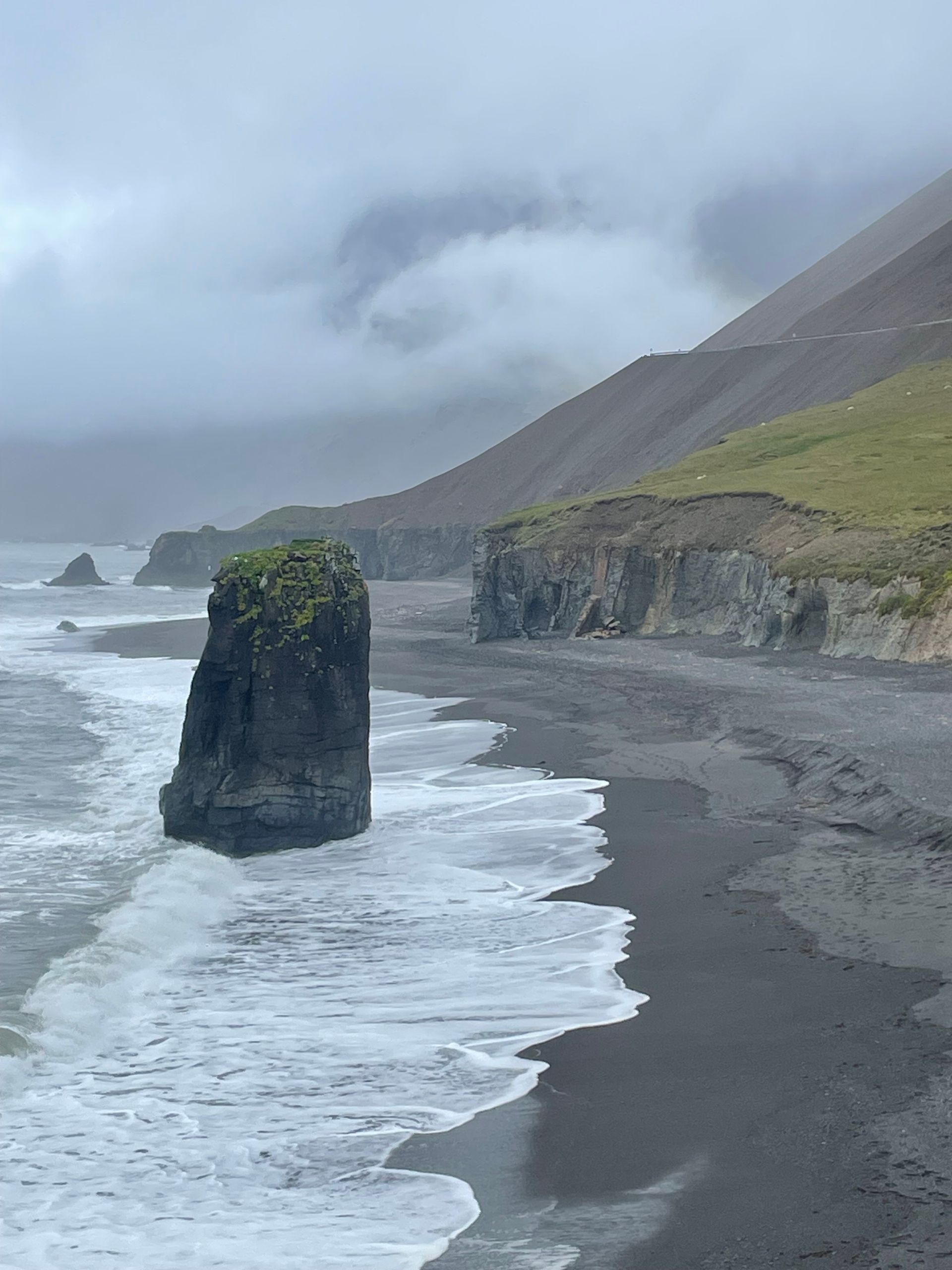
Day 11:
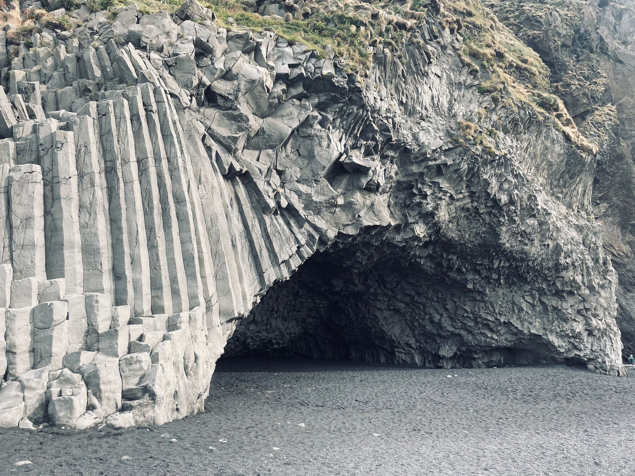
Today starts on the black sand beach of Rejnisfjara, with its basalt columns where countless puffins nest and the rocks that stick out of the sea. According to legend, 2 trolls fought there with a three-masted ship and were petrified by the setting sun.
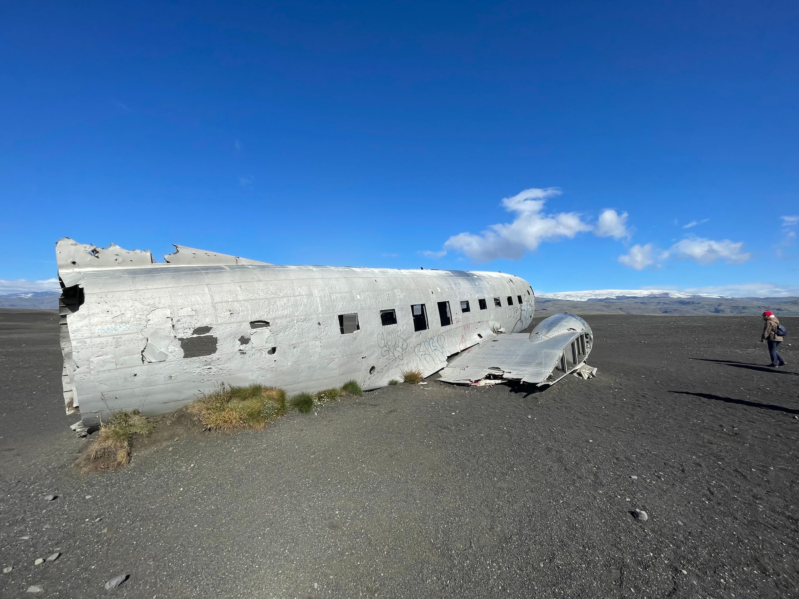
Afterwards, we hiked to the DC-3 that crashed in 1973.
In the afternoon, we took the ferry to the Vestmann Islands.
Day 10:
We stayed overnight at the beautifully situated campsite Pakgil, surrounded by mountains, sacrificing our mobile data network in return. Yesterday, hiking in the Laki National Park was on the program. A beautiful tour through the crater landscape around the Laki volcano. The Laki fires triggered a massive natural catastrophe in 1783. The eruption lasted almost a year, and lava, ash, and poisonous gases spewed out of over 130 craters along a crack in the earth that was over 20 km long. About 25% of the population died, 80% of the sheep, and 50% of the cows. There was a huge famine.
Day 9:
After seeing it from different sides in the past few days, today we are circumnavigating Vatnajökull in the south. The glacier massif is the largest ice mass on Earth after the Arctic. Countless glaciers descend into the valley. We arrive at the glacial lagoon "Jökulsárlón" where the glacier calms into the river and the ice pieces flow directly into the sea. The icebergs on the black sand beach glisten in the sunlight like diamonds.
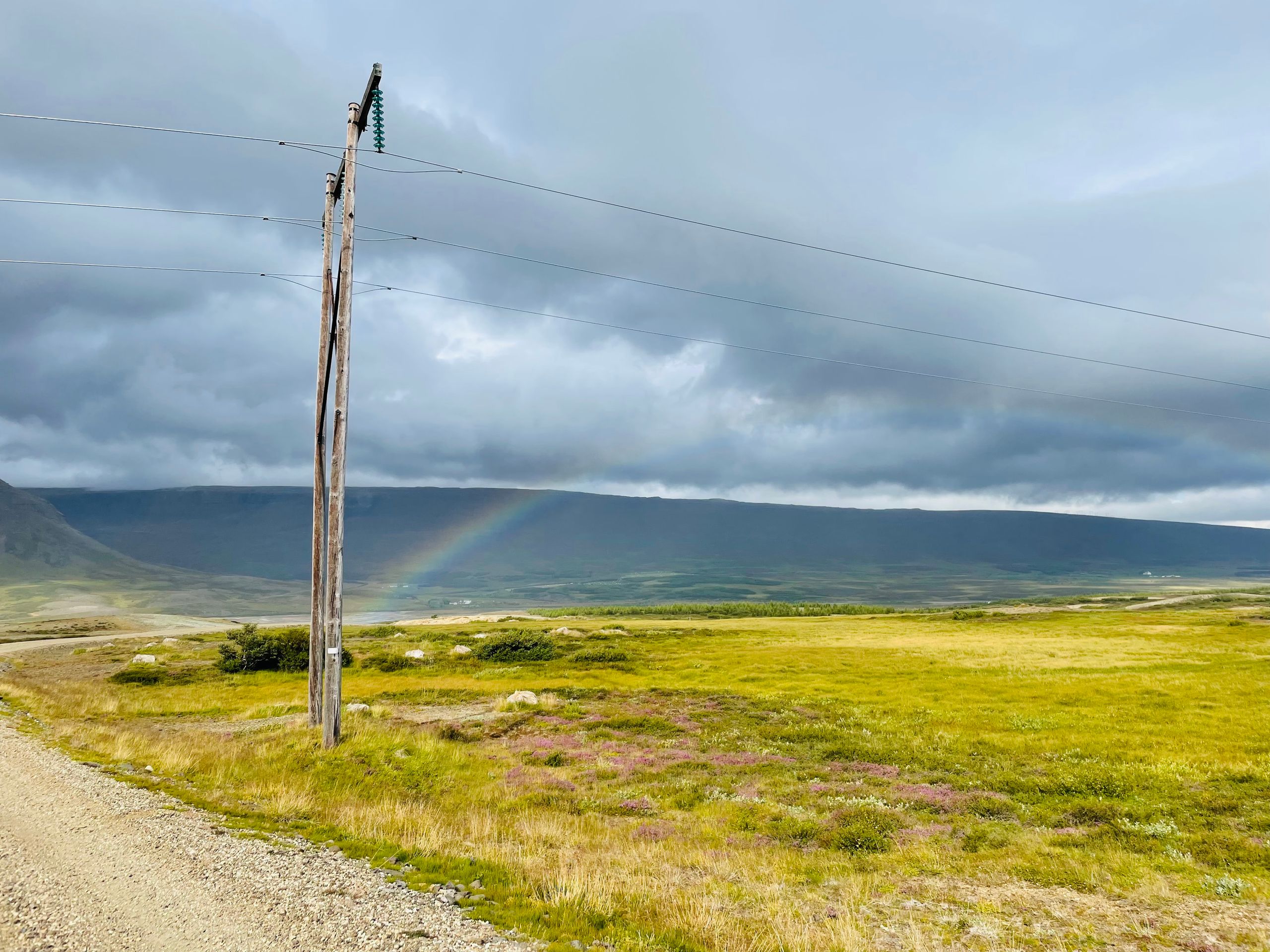
Day 8:
The day started with fog and drizzle - typical Icelandic weather. It could only get better, and it did. We explored the area towards the south in different ways until we reached Höfn. Beautiful landscapes that suddenly open up when you drive around the next corner. A rainbow that suddenly appears above the canyon, of course also the road that ends at the unfortunately too deep river to try it alone. So we drive back through the stunning mountain landscape and enjoy the view from the other direction.
Day 7:
Today, our plan didn't quite work out. We wanted to go south through the mountains and had chosen a nice off-road route so that we wouldn't have to take the route along the paved roads. Unfortunately, after twelve kilometers and an hour and a half of driving, our path ended. The "road" was no longer passable, and we had to turn back. We were compensated with a gigantic view of the Vatnajökull glacier massif, which we were driving towards the whole time. In the evening, we reached a camping spot in Eskifjördur and tomorrow we will head towards Höfn.
Day 6:
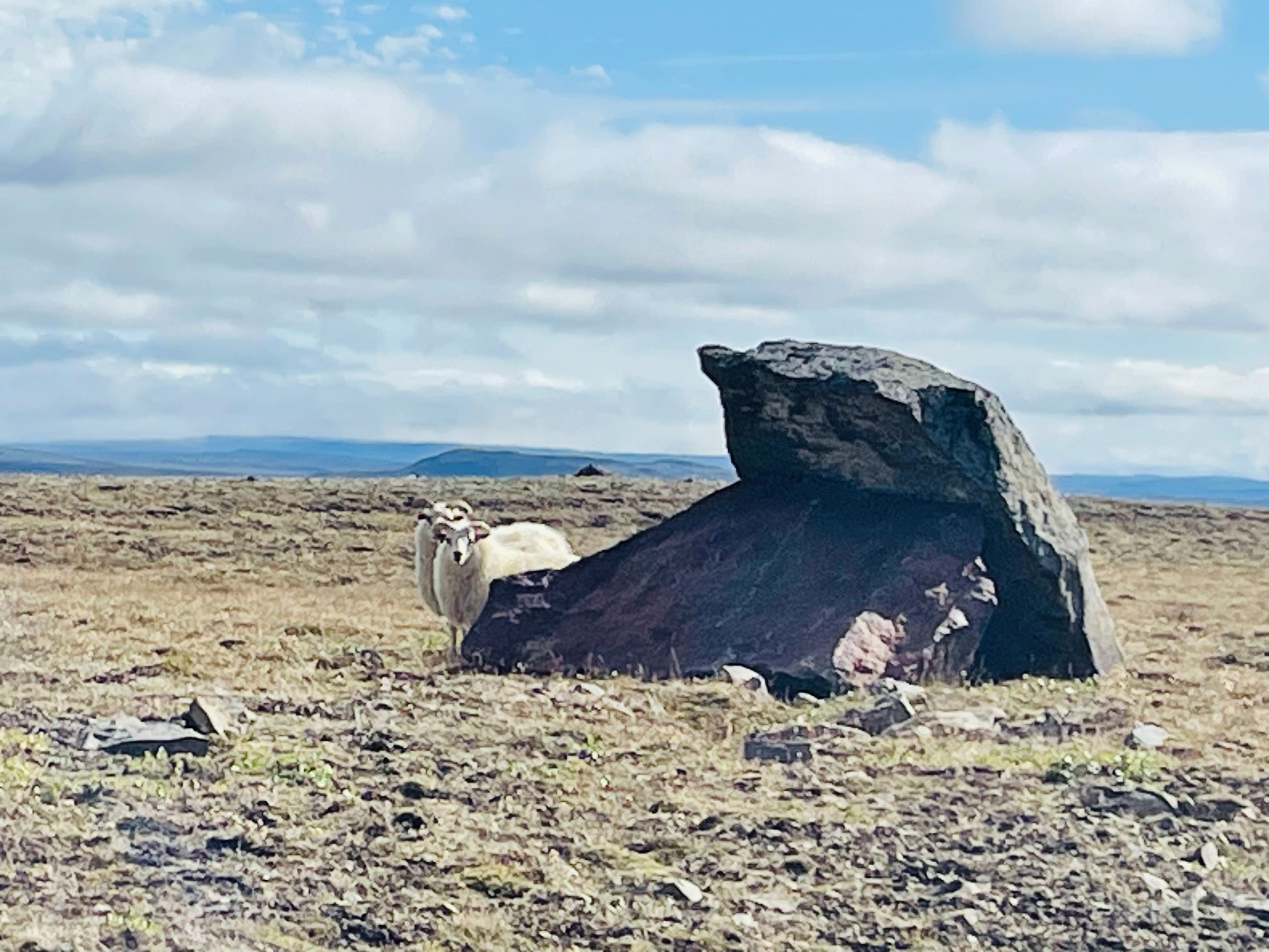
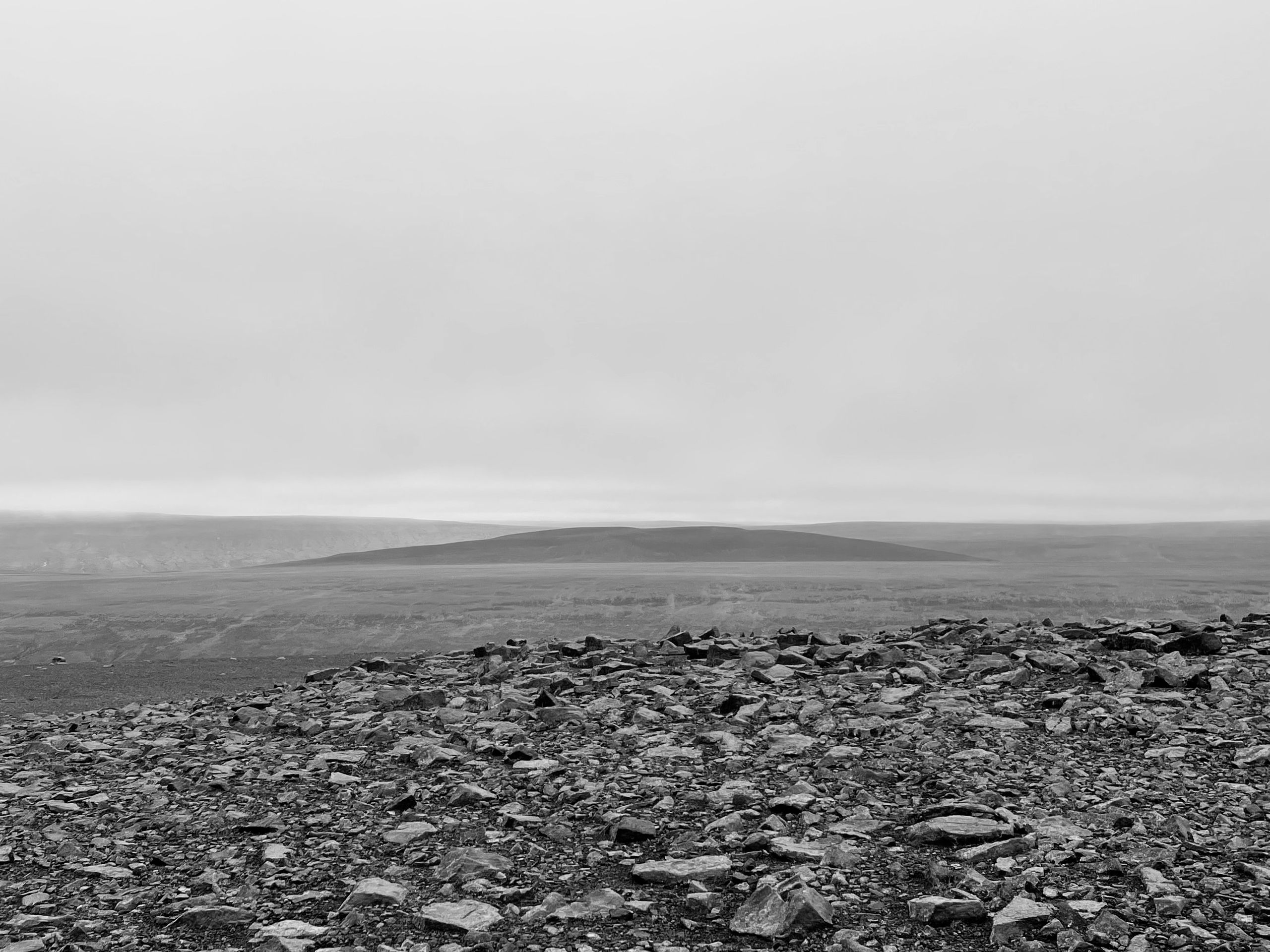
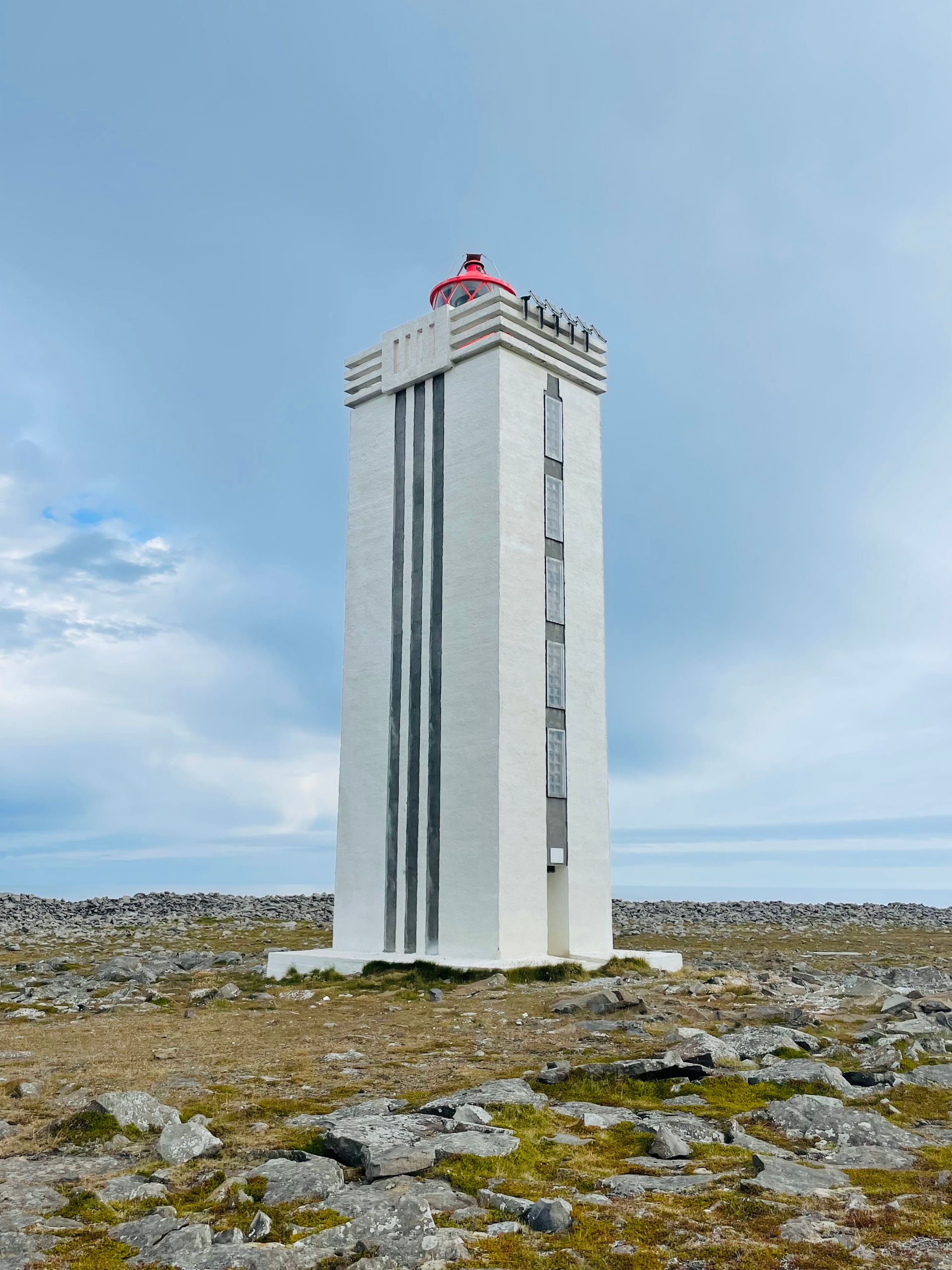
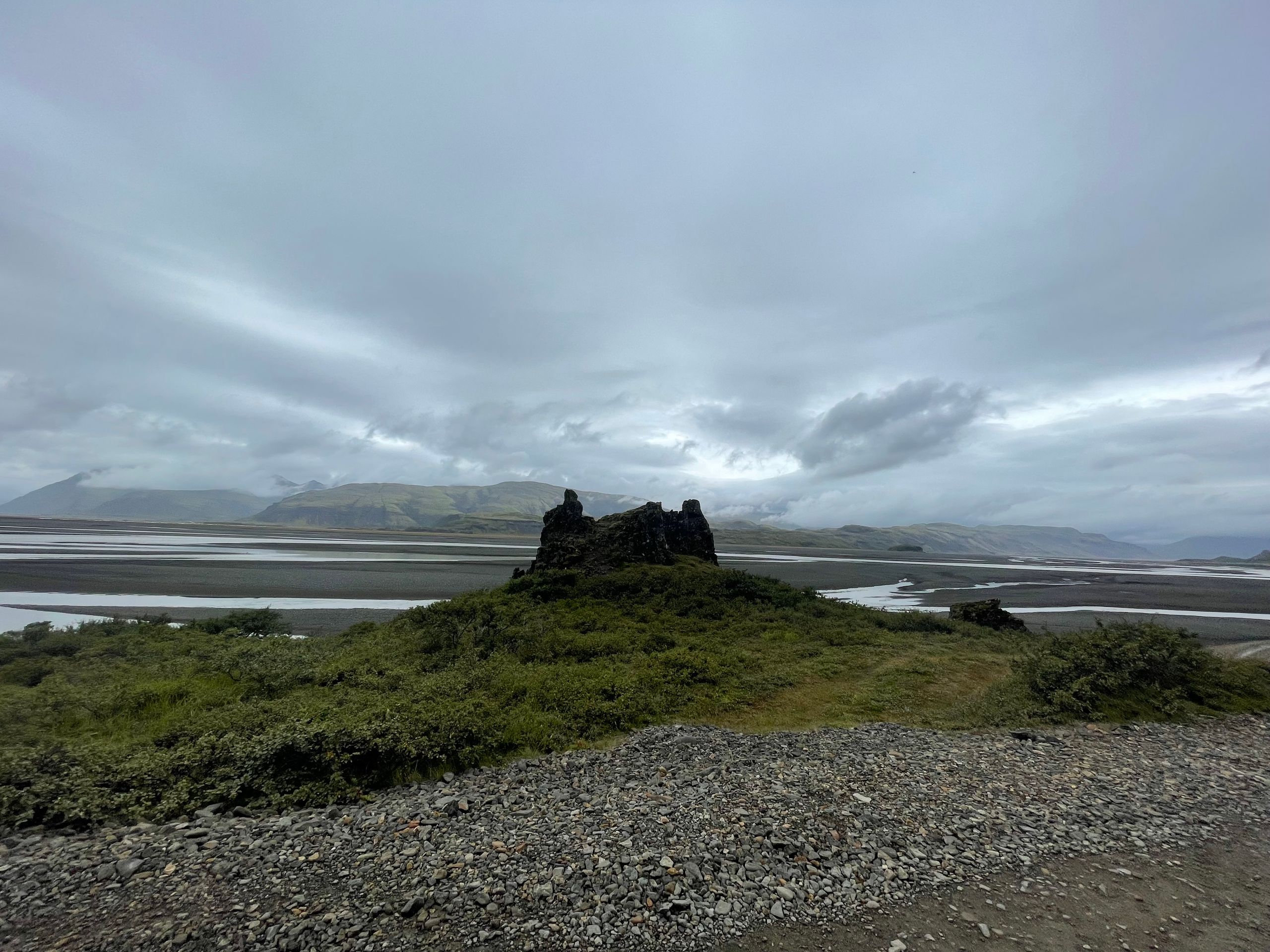
Today we set out to the northernmost lighthouse on the island 'Hraunhafnartangi'. On the way, there were not many spectacular landscapes, barren, flat wasteland. Once we reached our destination, we reached the lighthouse after a half-hour walk, which showed us what humans leave behind in the sea and made it clear that the sea throws everything back. Broken fishing nets in masses, old rubber boots, buoys... it really makes you think.
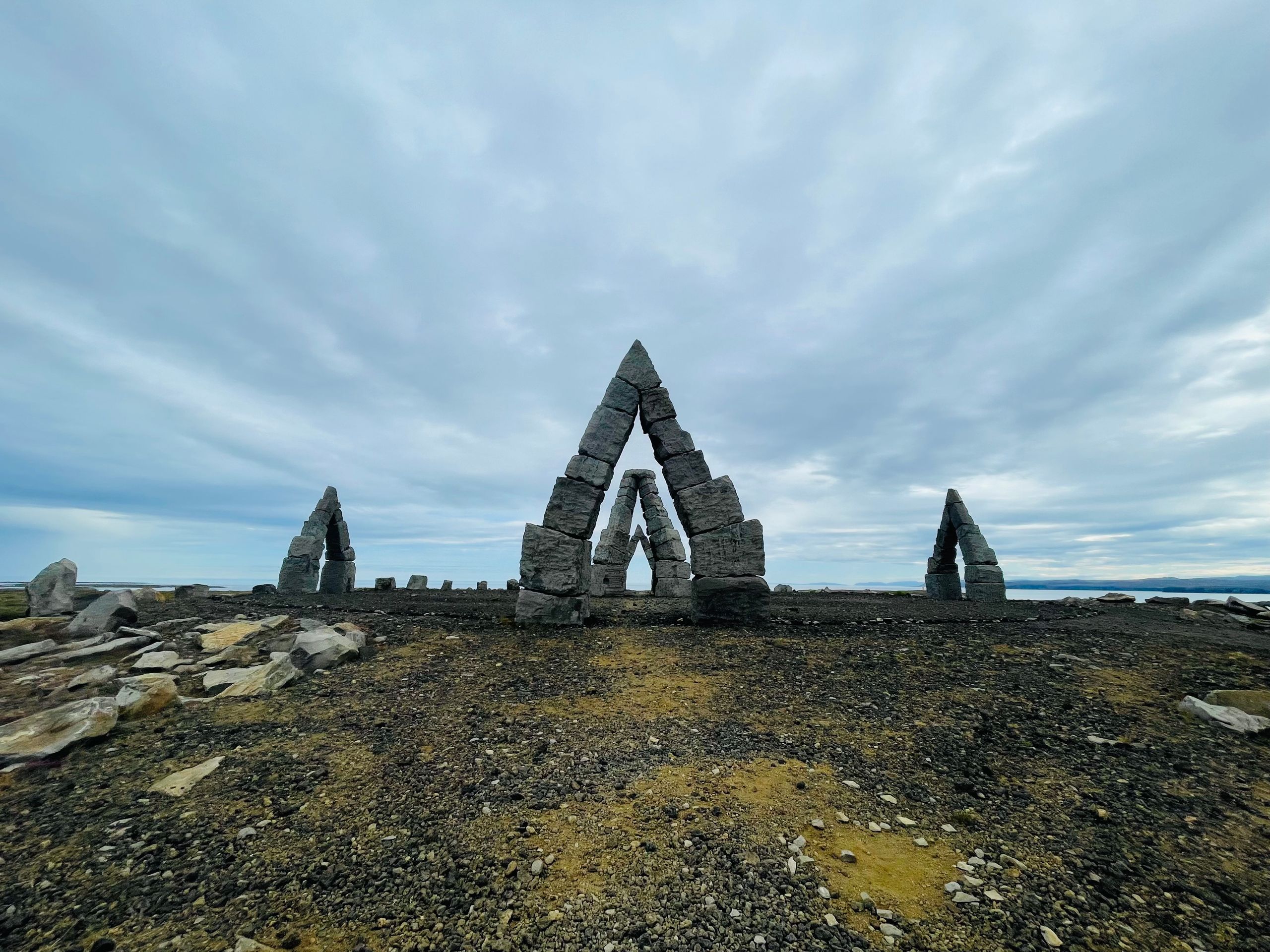
About an hour later, we discovered a stone monument on a mountain that was not on our plan but caught our attention, and since we have time ...
The monument is an unfinished work of art. The plan is explained on the information board. It is supposed to create a circle of polar sun, taking advantage of the infinite expanse of the place so that nothing hinders the horizon and the midnight sun: '[...] including the enumeration of dwarves from the Edda poem Völuspá [...] No one has been able to explain where the dwarves come from and what role they have. All we know is that Austri, Vestri, Nordi, and Sudri hold up the sky. By connecting the names of some dwarves like Bjartur (Bright), Blidur (Mild), and Svasudur (Gentle South) with summer, it was possible to arrange the names of the dwarves into a yearly ring of 72 weeks. In this way, the dwarves' yearly ring becomes a kind of calendar, with 5 days belonging to each dwarf. All dwarves have been given a role, and they have been artistically designed. In this way, the dwarves' birthdays can be assigned, and connection can be made with them. The polar sun circle is being built near Raufarhöfn based on this idea world. It has a diameter of about 50 meters, and the 6-meter-high gates point in the four cardinal directions. [...]'
On our further way, we could see the waterfalls from yesterday again from the other side of the river and finally reached our destination, the Modrudalur-Fjalladyrd campsite.
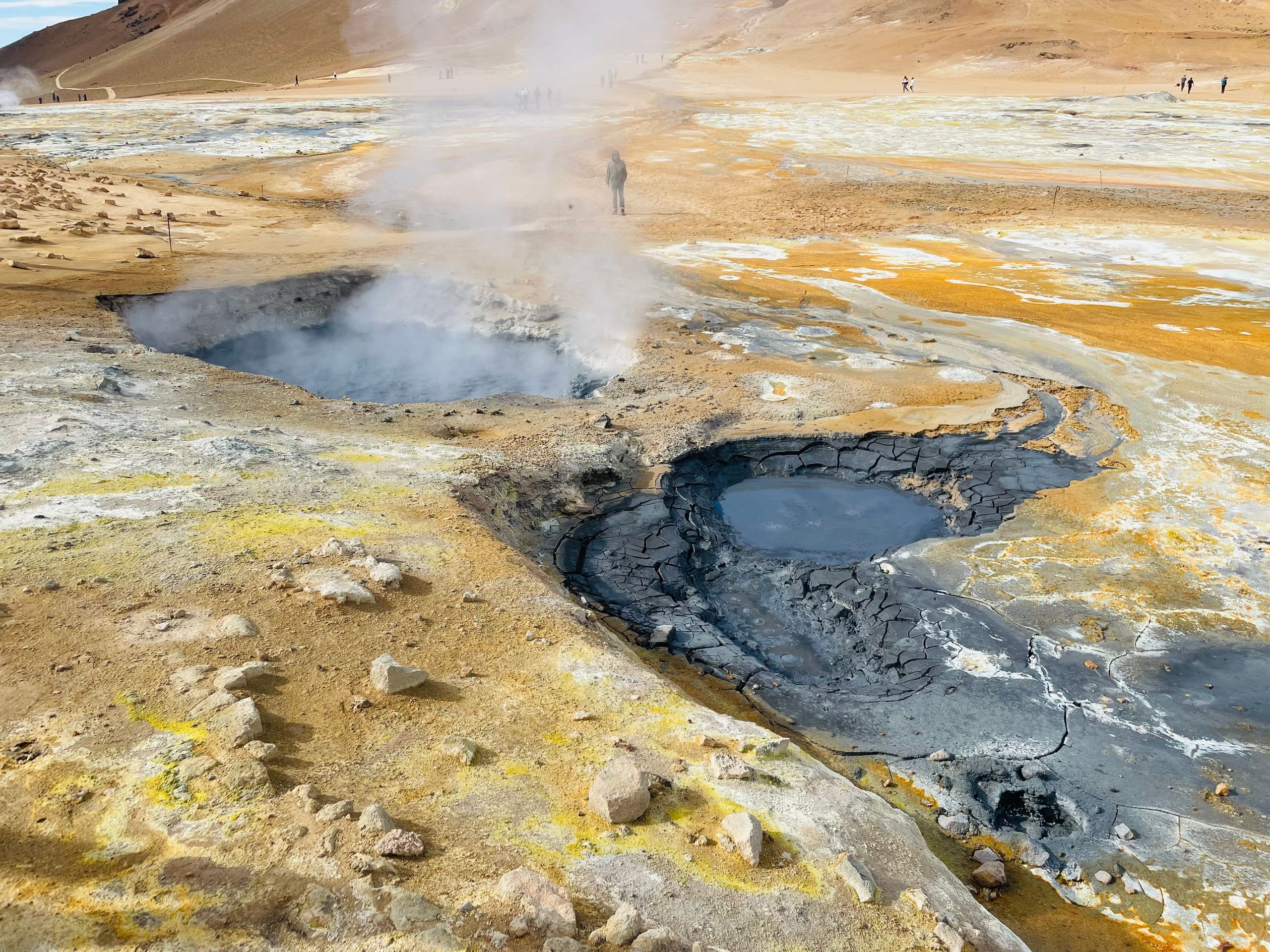
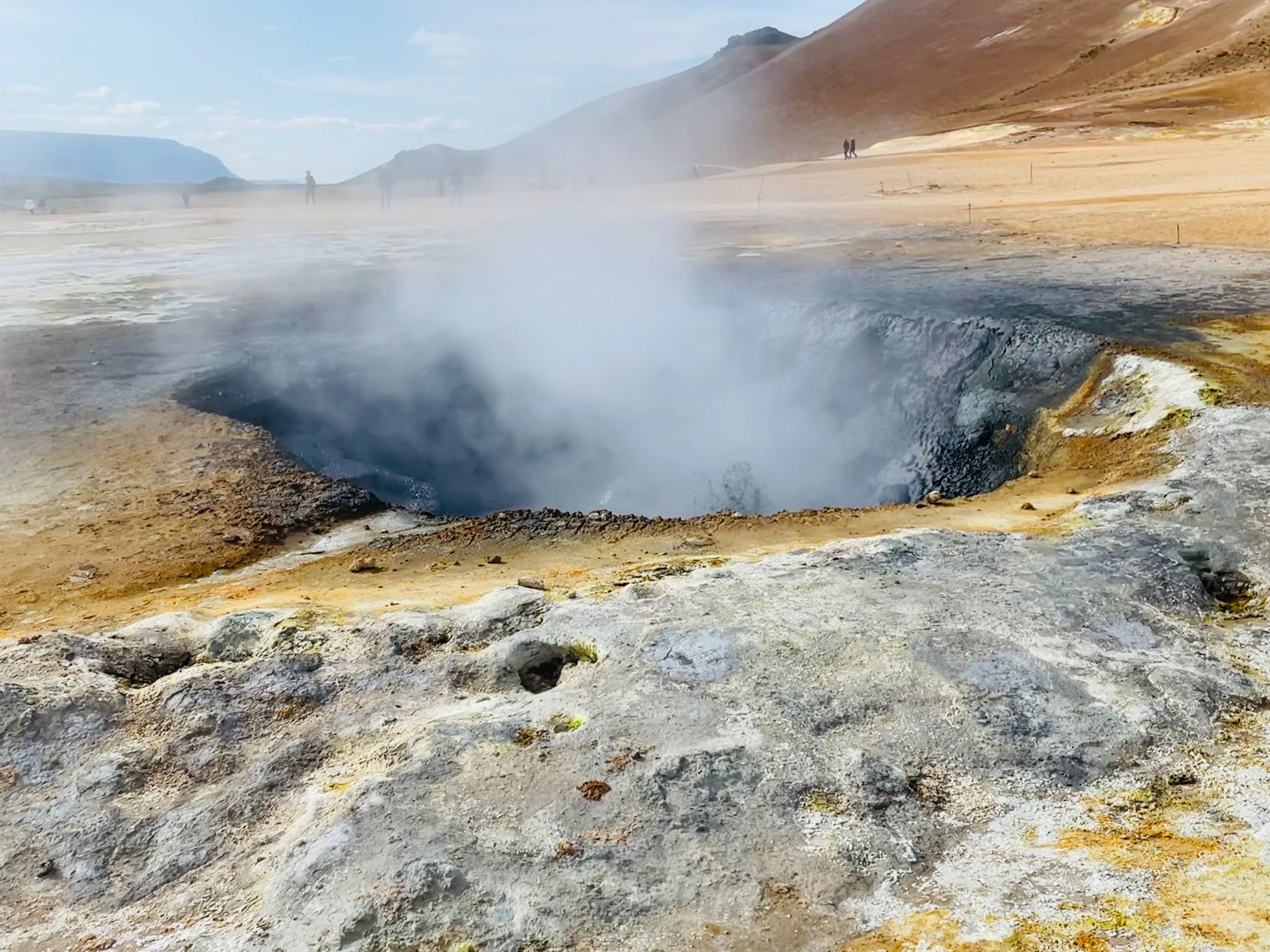
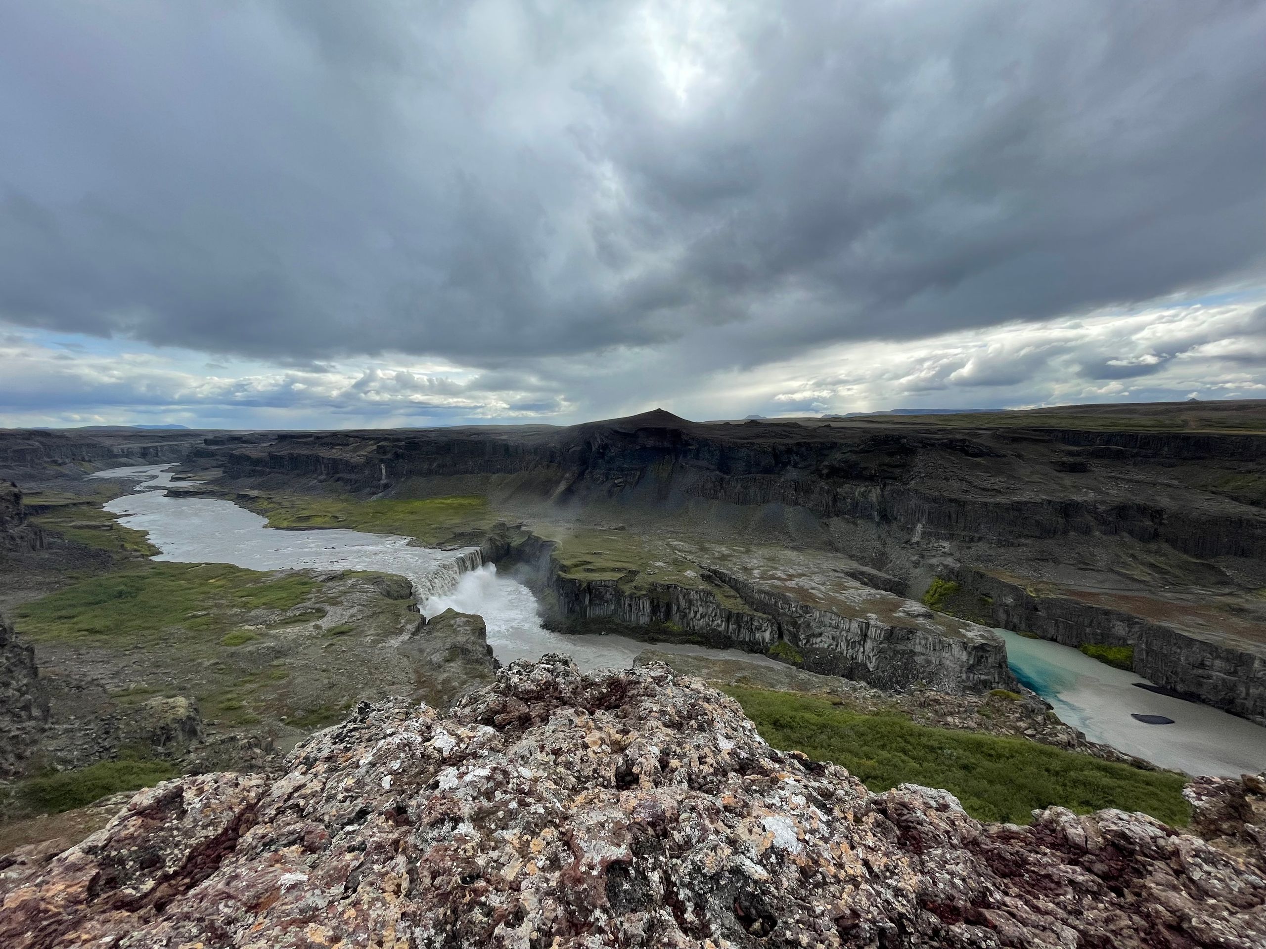
Day 5:
The day today started almost in hell - at least you imagine the smell, the bubbling, the colors to be something similar. We were at the Namafjall sulfur field.
Afterwards, we were able to expand our knowledge of energy generation. We visited the Krafla geothermal power plant. Very interesting, videos and pictures in the visitors' area explain how the heat from the earth is used here. From the volcanic crater, you have a great view of the power plant and the boreholes from which the hot steam is transported to the power plant in pipes.
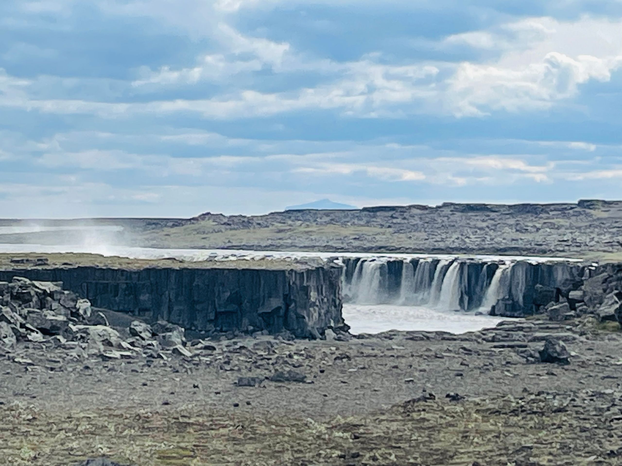
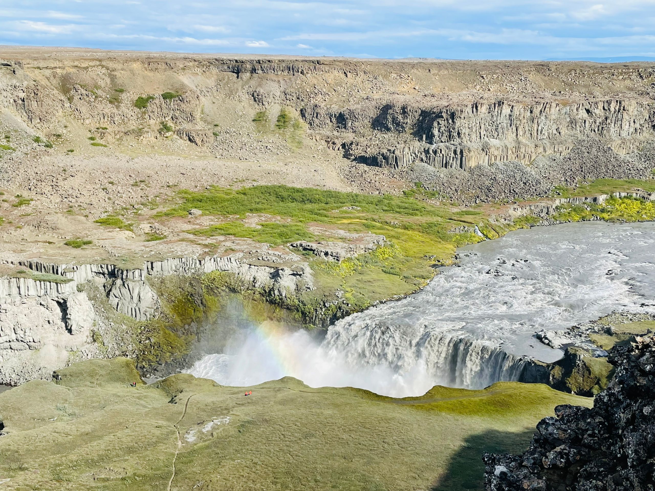
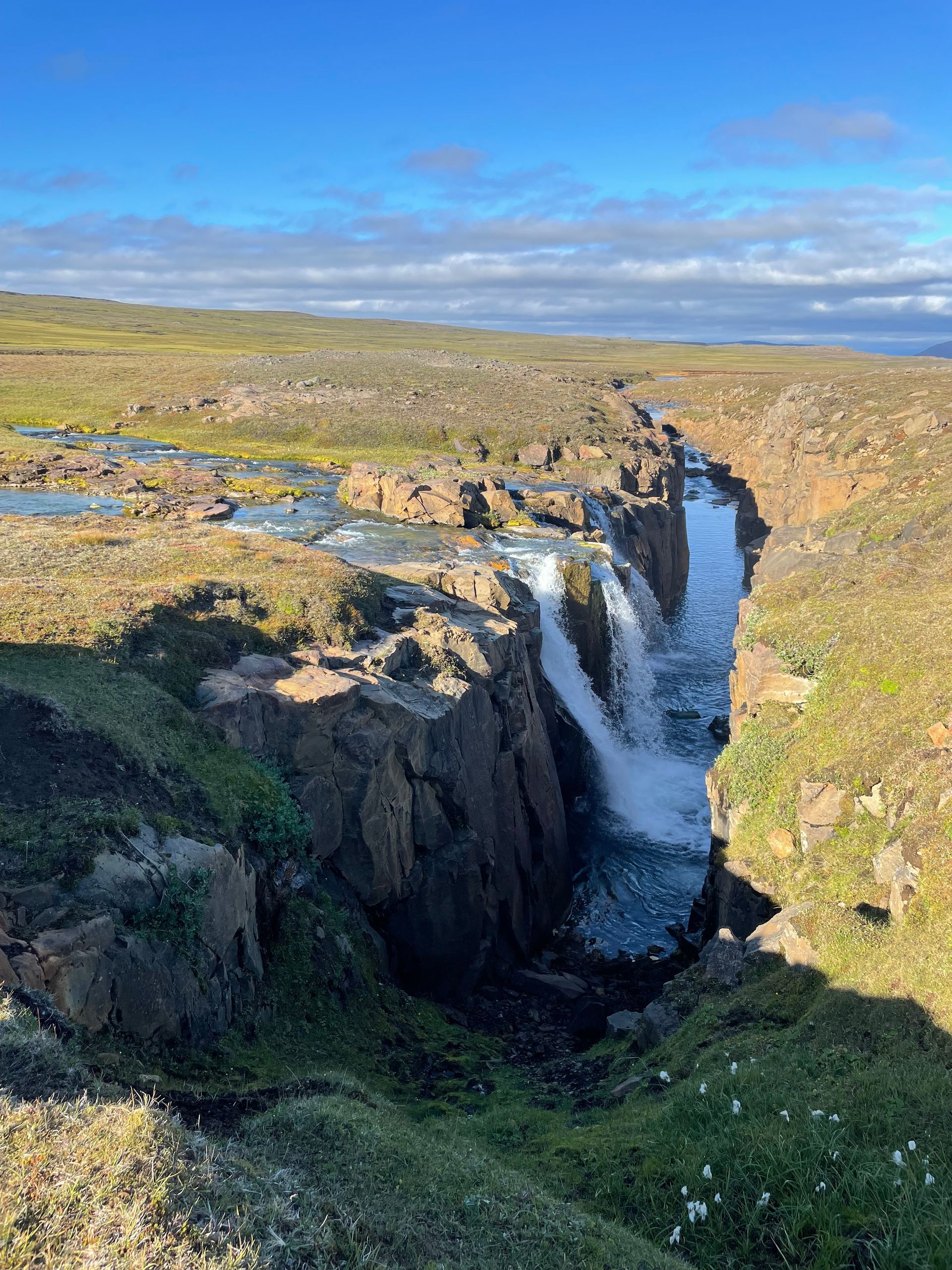
The highlight of the day were the waterfalls Dettifoss, Selfoss, and Hafragilfoss. The first one is surely the most famous, in my opinion, the last one is the most beautiful in terms of the landscape. It opens up the view into a breathtakingly beautiful gorge.
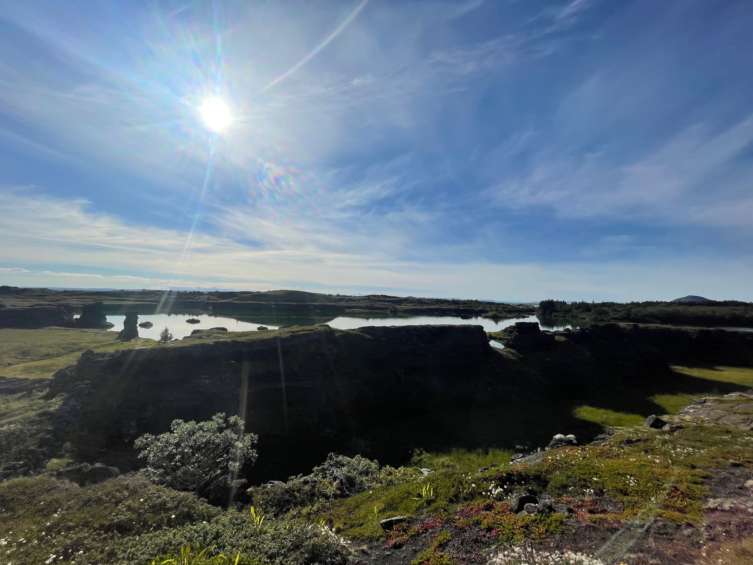
Day 4:
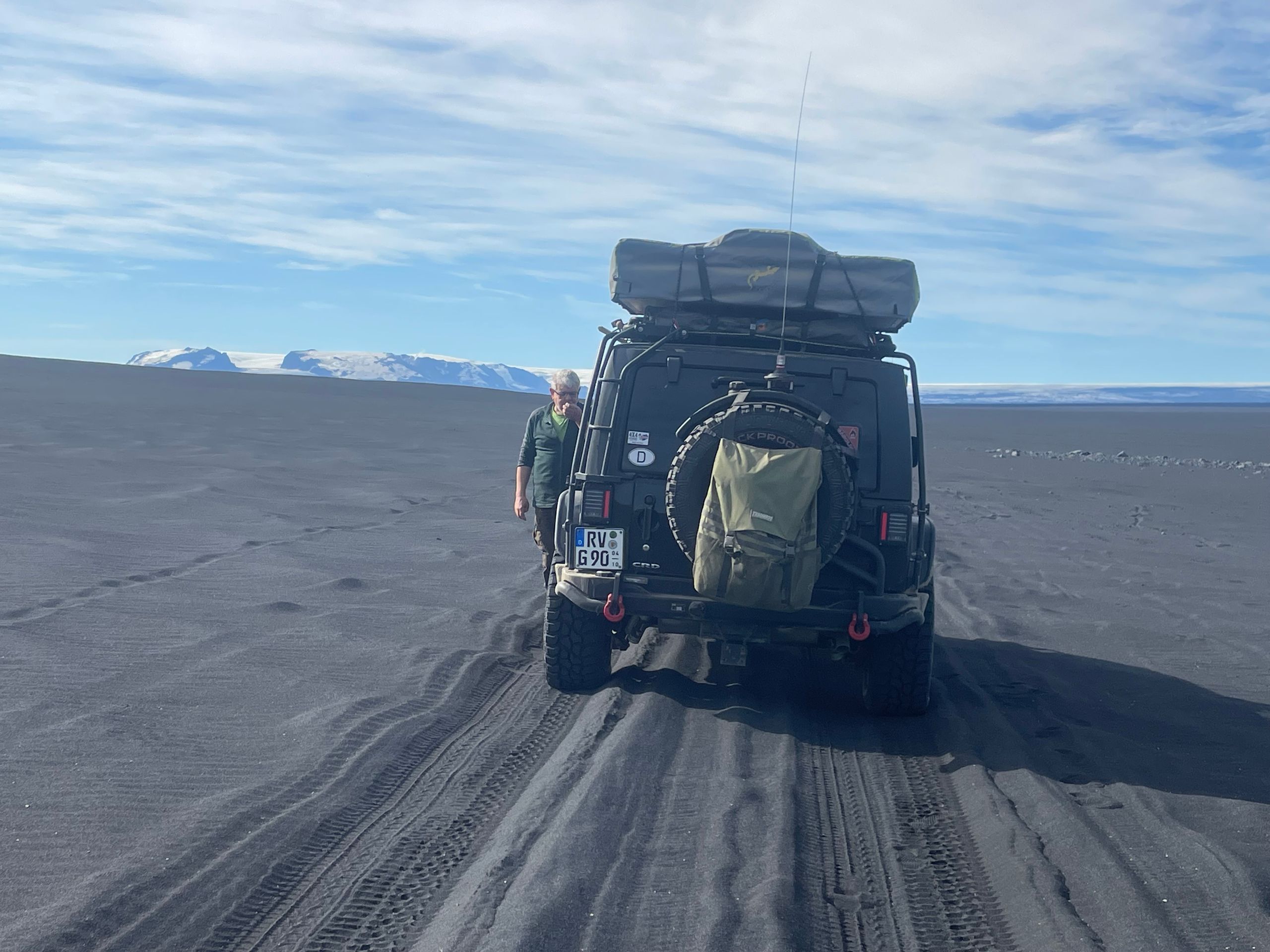
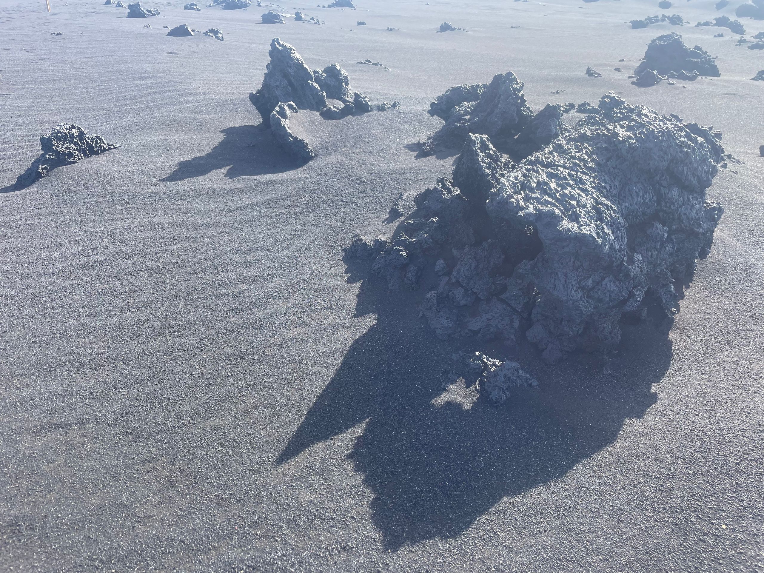
We leave Askja and head towards Myvatn... through the barren rocky desert... then the sand desert of volcanic ash... endless lava fields, you can hardly imagine the extent of the volcanic eruption. After a good six hours of driving, we slowly return to vegetation. Green landscapes along the river and finally all shades of green that you can imagine when we reach the Myvatn lakes.
Day 3:
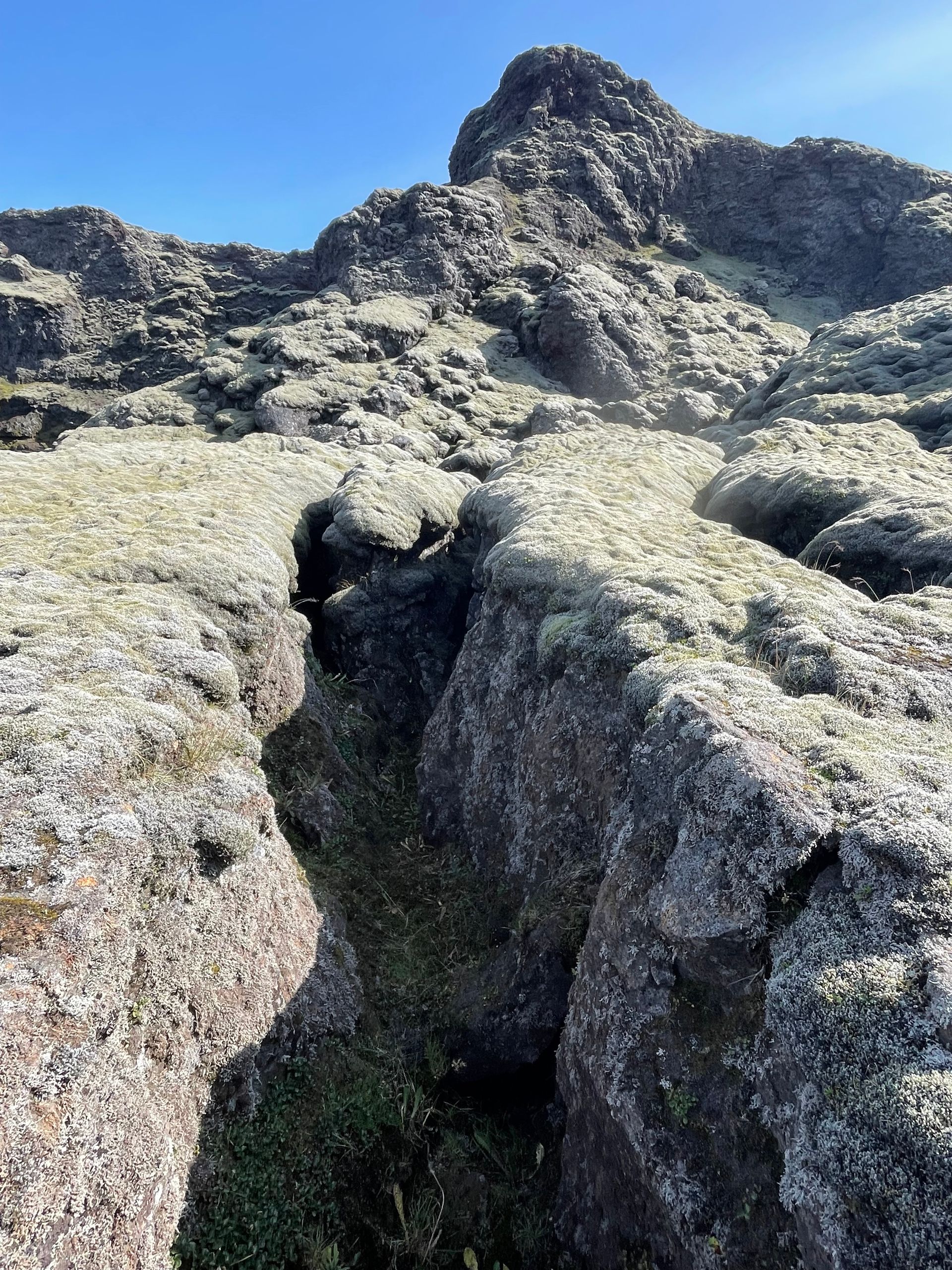
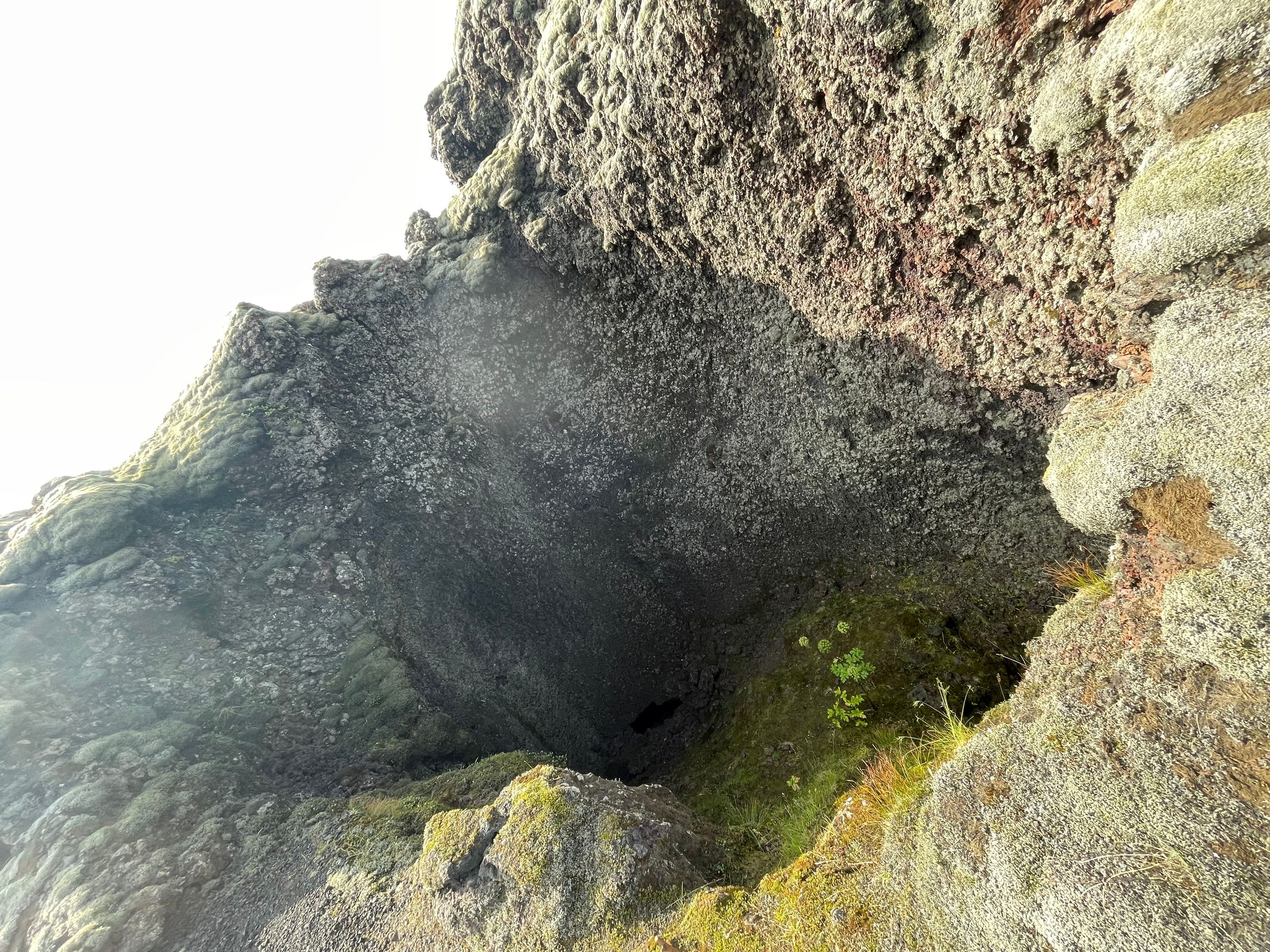
We stayed in Askja and want to go hiking today.
First through the dragon's canyon located right by the campsite. The way in and back reminds a little of Jim Knopf.
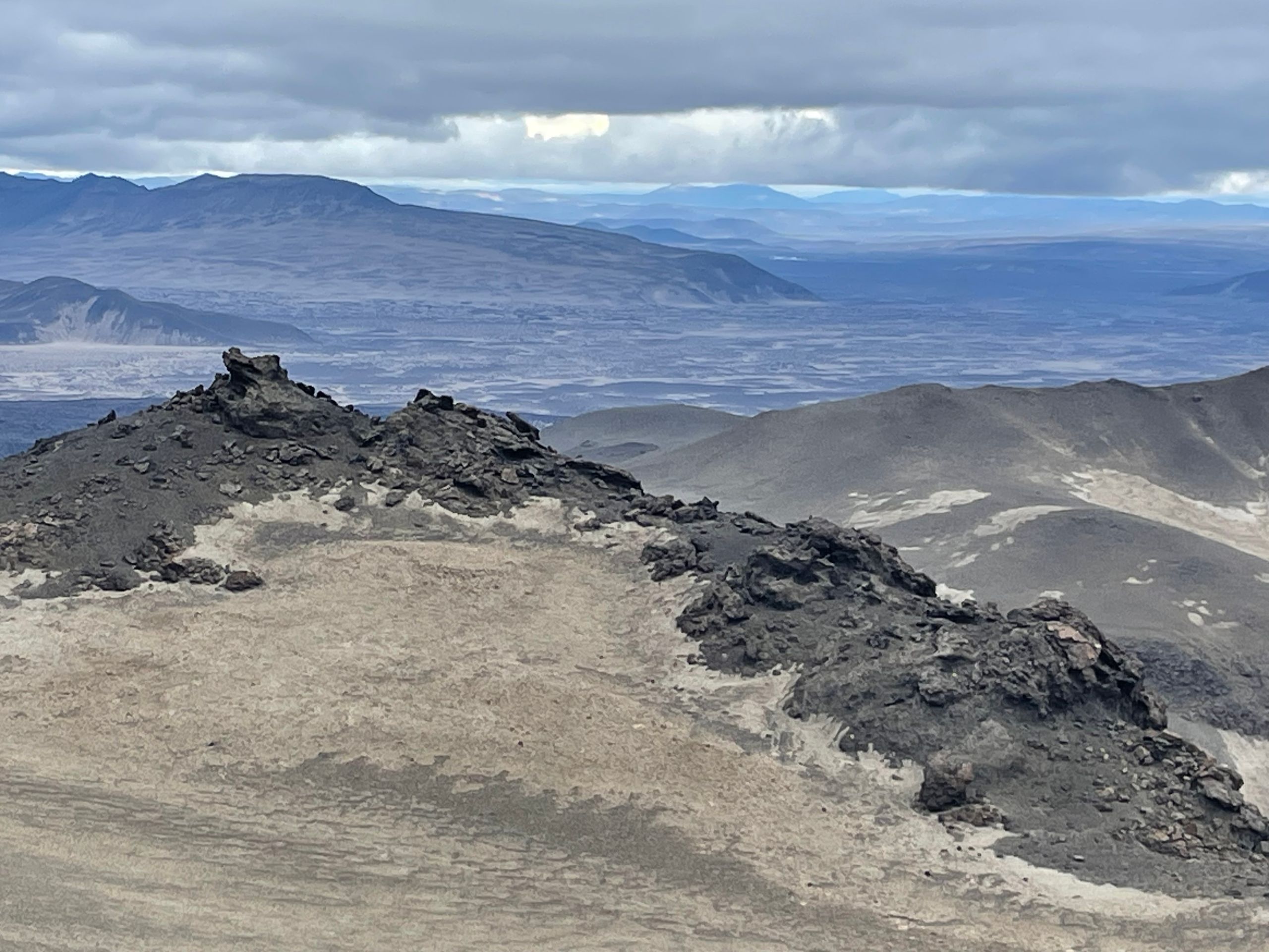
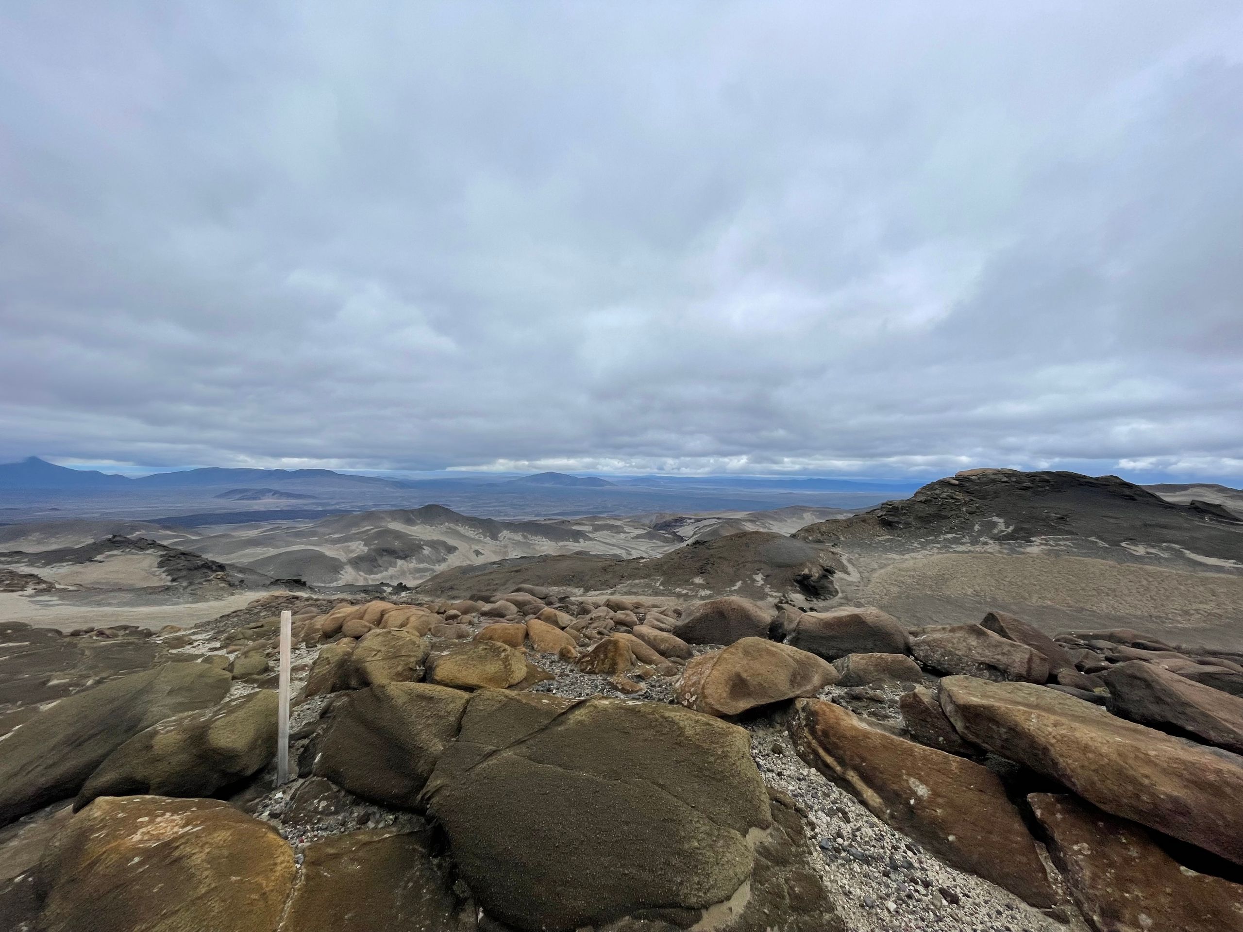
Then it's off to our actual destination - up to Askja. We hike steeply uphill through ash and lava fields, bizarre rock formations that look like fossilized prehistoric creatures. It is foggy and windy. We were already worried if the hike would be worth it... but after 3 hours uphill, the fog suddenly lifts within a short time, and the crater lake lies calmly before us. Yes, the effort was worth it, endless expanses... endless lava fields, and no one in sight. Today, only two hikers crossed our path; otherwise, the bizarre world up there belonged only to us.
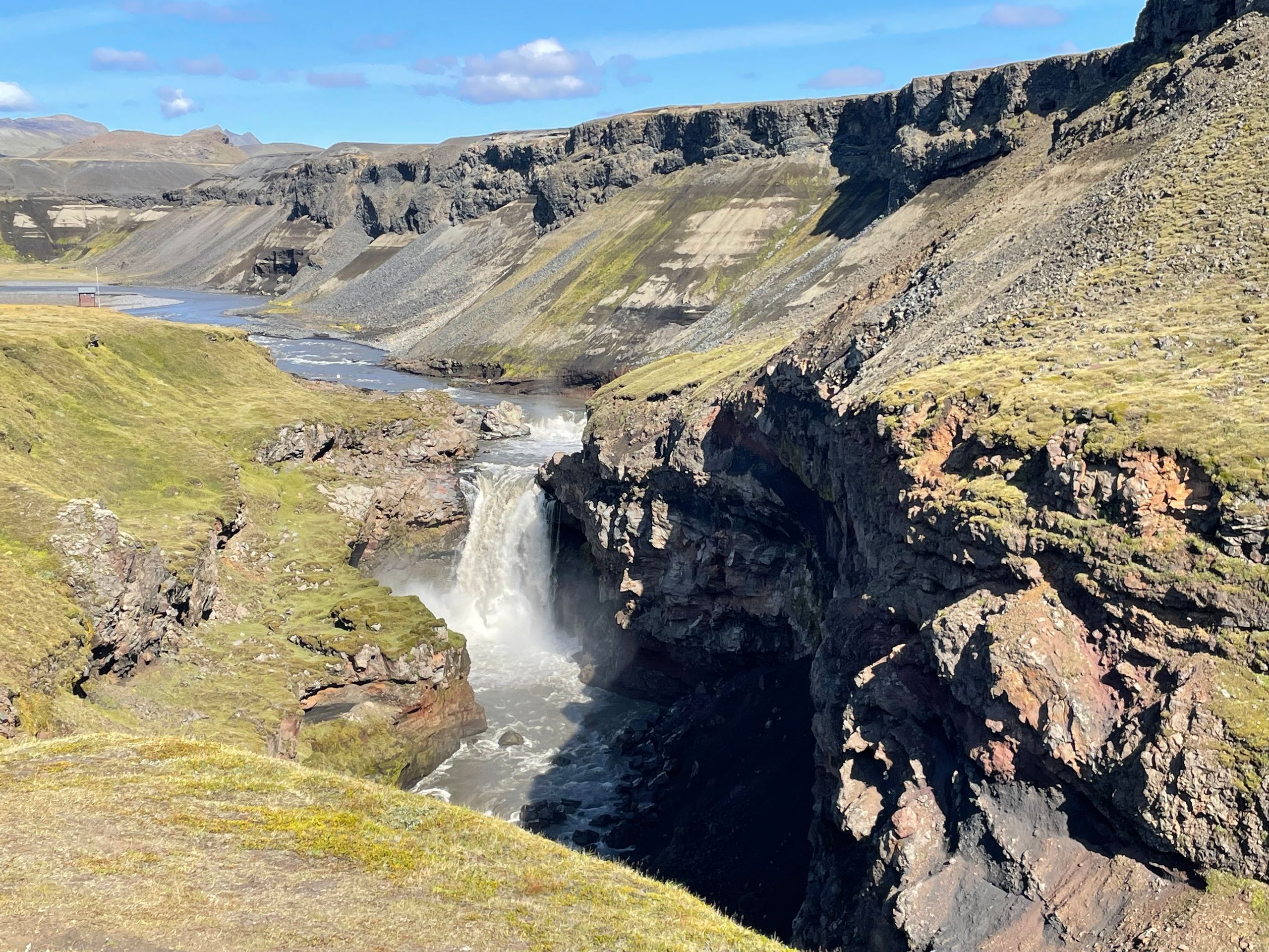
Day 2:
It was cold and drizzly in the morning, and we were frozen. After everything was finally packed, we started our tour for today. First to the 'Jökla' reservoir, where the overflowing water masses rush into the gorge. A tremendous sight that you can't get enough of. But we want to continue... to the hot waterfall 'Laugavallalaug' to warm up again at a pleasant 40 °C. Absolutely fantastic, and we had the waterfall and the whole hot pot to ourselves - finally warm again.
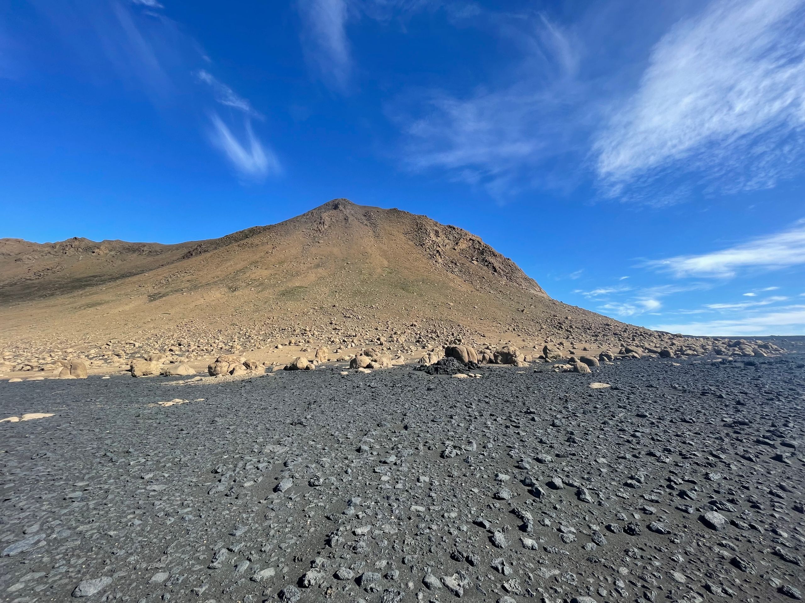
This is how we continue over endless lava fields into the Vatnajökull National Park. The lava fields come from various eruptions of the Askja volcano over thousands of years. Rugged lava stones alternate with sand and ash. Sometimes, the track is hardly visible. We pass the Herdubreid volcano, the 'Queen of the Mountains.'
Now and then, the road ends at the river and continues on the other bank. Most rivers are not deep, and we cross them without any problems. Once it was a bit deeper, and the water dripped a bit into the car through the side door. We reach the foot of Askja in the evening, which we want to climb tomorrow.
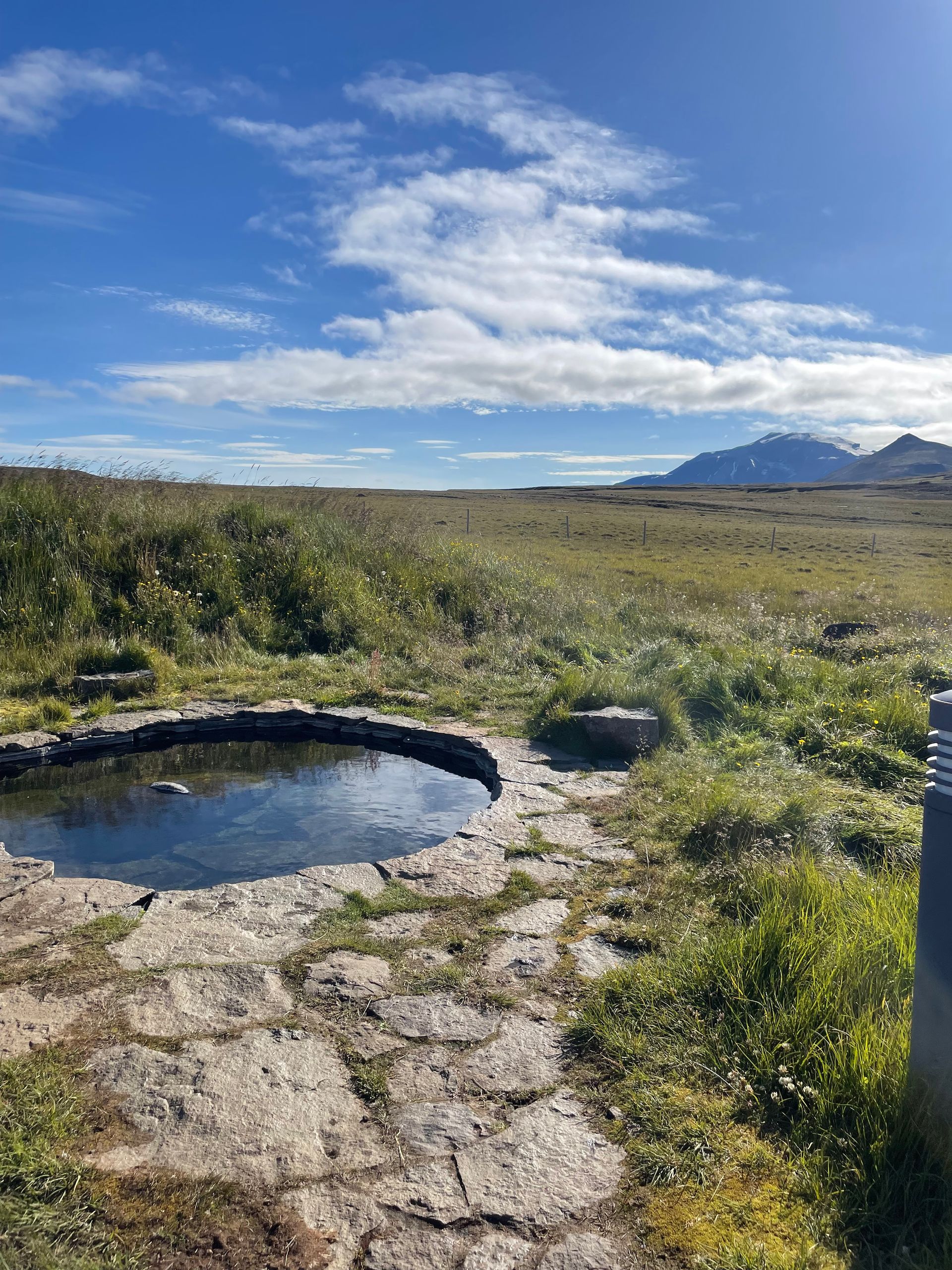
Day 1:
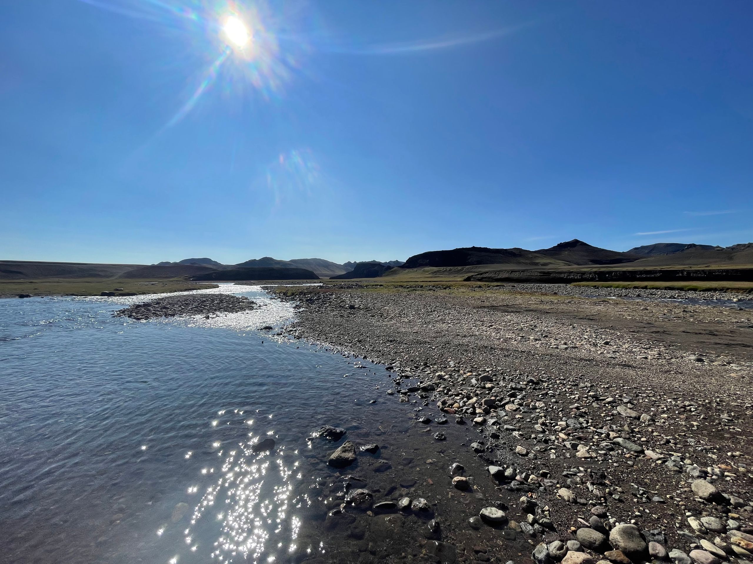
We arrived at the port of Seyðisfjörður at noon. Endless tourists, two cruise ships were docked here. We did our shopping for the next few days and looked for a way to escape the hustle and bustle. Our destination is Laugarfell.
After leaving the tourist hustle and bustle, we had a beautiful day with lots of sun. We enjoyed the afternoon at the perfect campsite with 2 hot pots in a beautiful landscape overlooking the snow-capped mountains. In the evening, we took a short hike along the river, past smaller waterfalls, with the sun low on the horizon. There wasn't enough time today for the entire circular route (8 km).
گېزىتلەرگە مۇشتەرى بولۇڭ
جاۋاب
ساياھەت دوكلاتى ئىسلاندىيە