Neuseeland/Südinsel & Australien/Victoria
vakantio.de/neuseeland_suedinsel_und_victoria
26.12.18 from Fiordland through Lindis Valley to Twizel
Publikovaný: 22.07.2019


Odoberať novinky
Wednesday 26.12.18
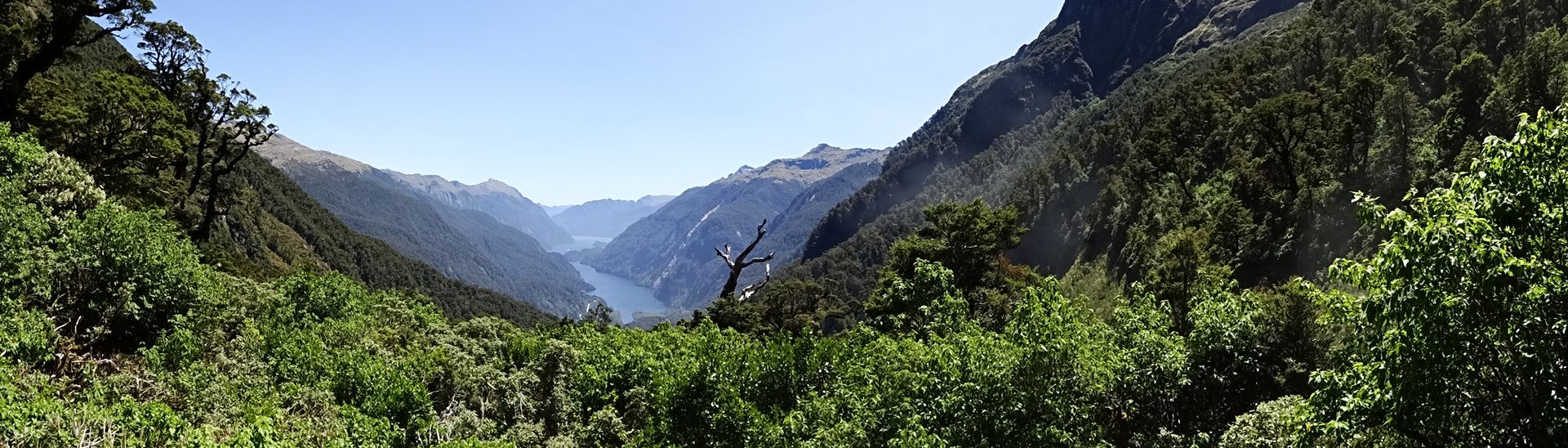
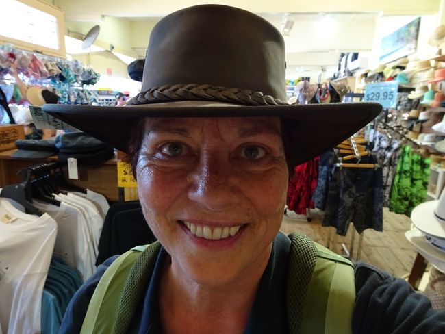
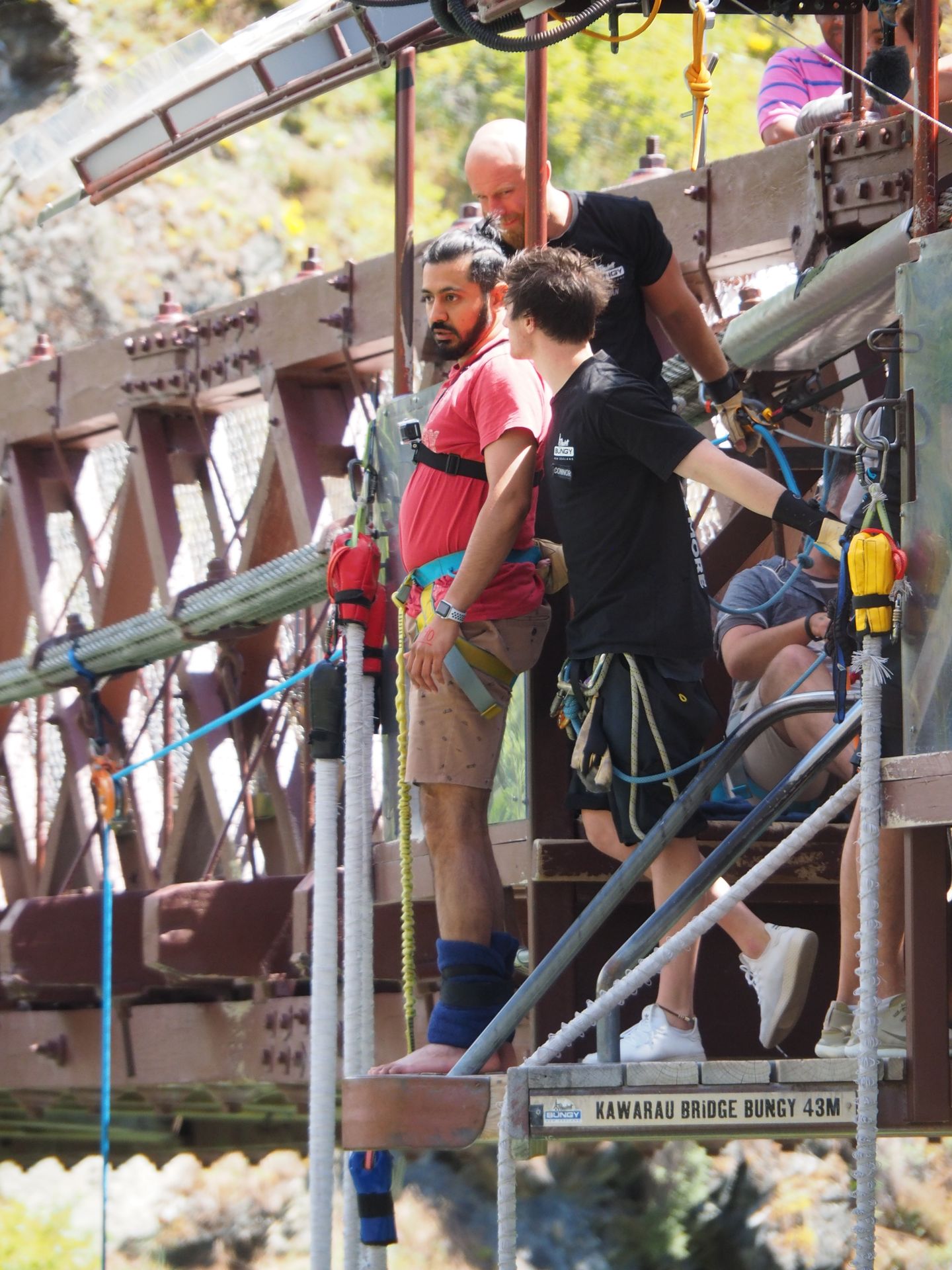
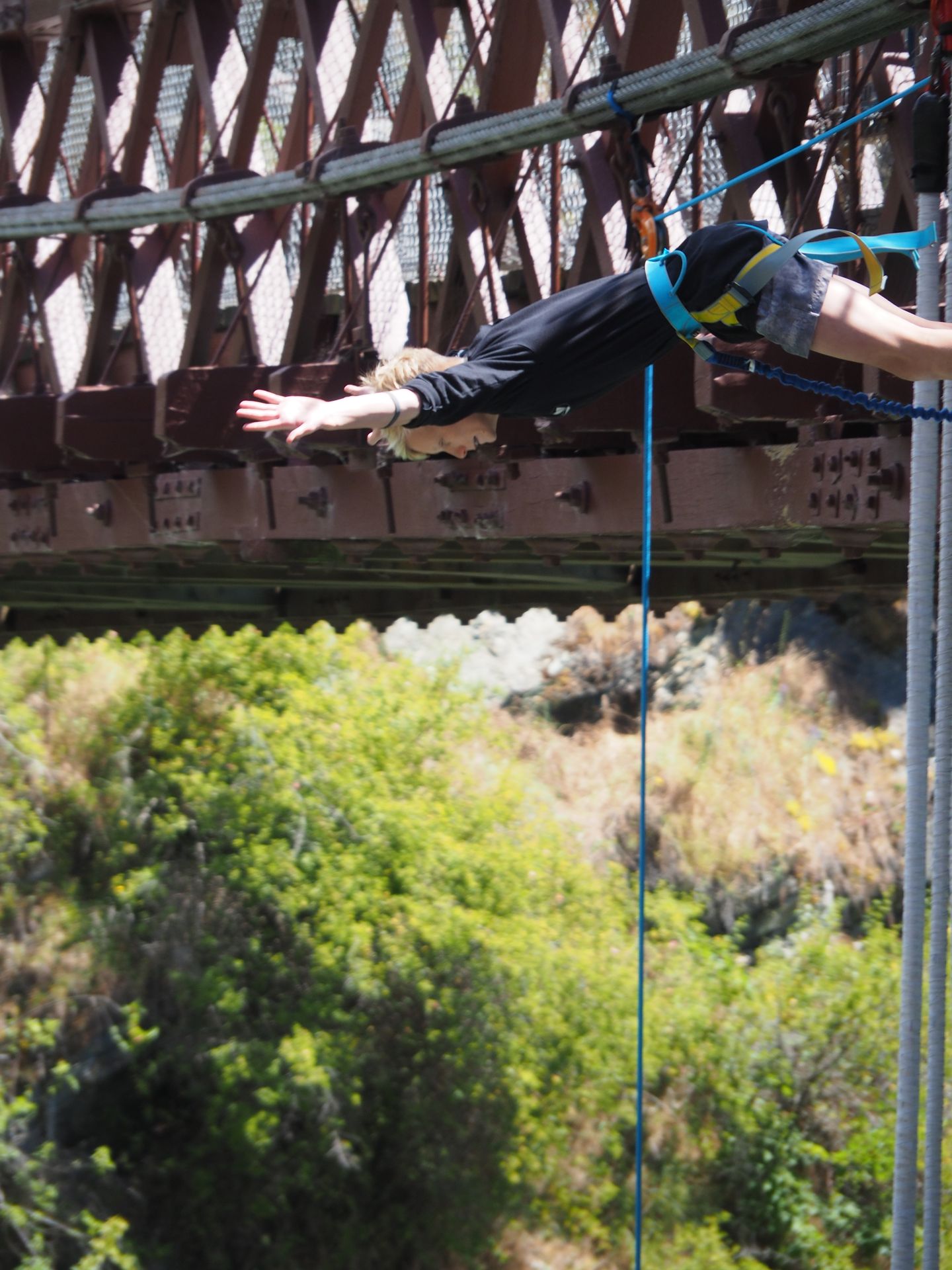
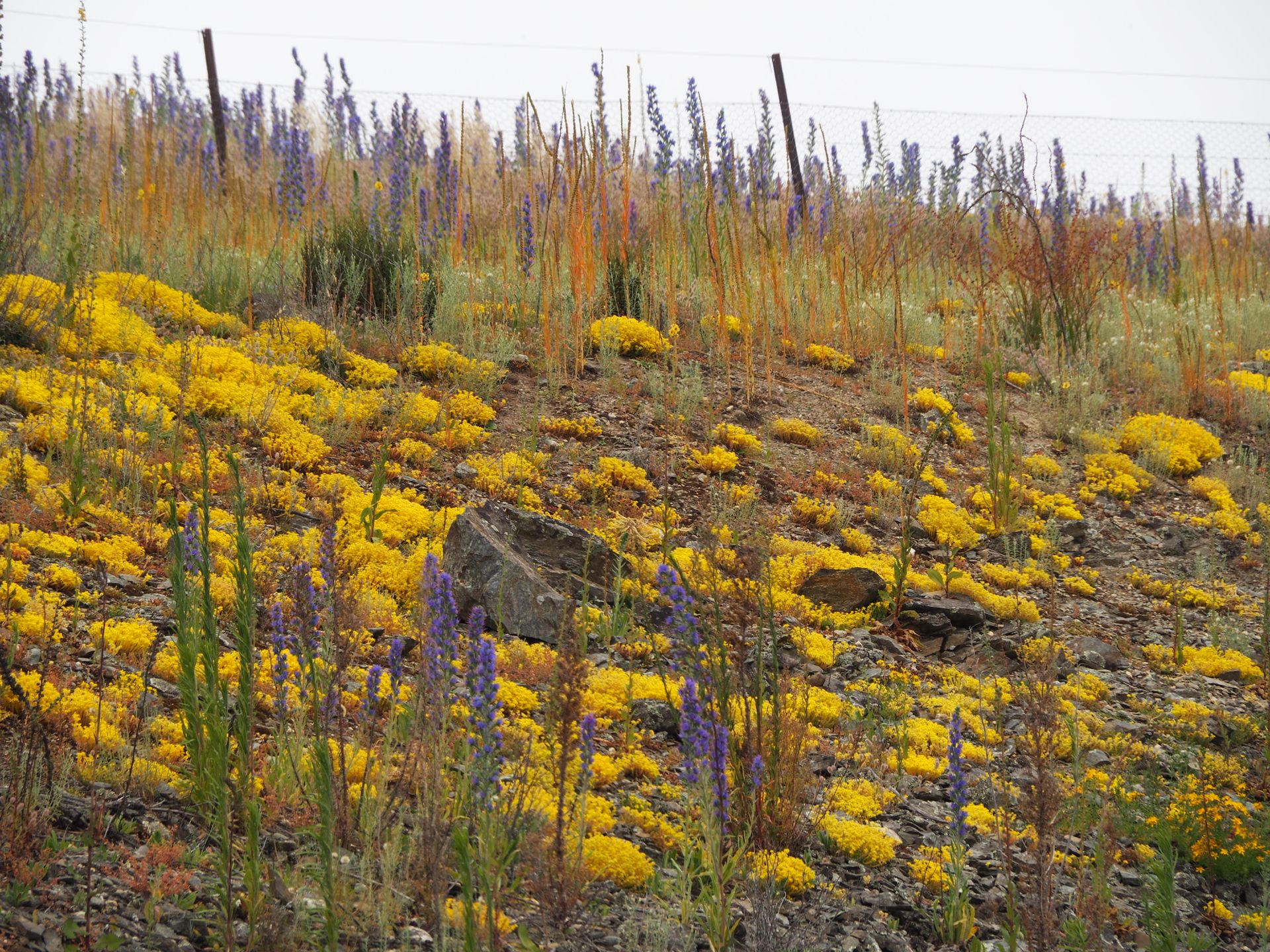
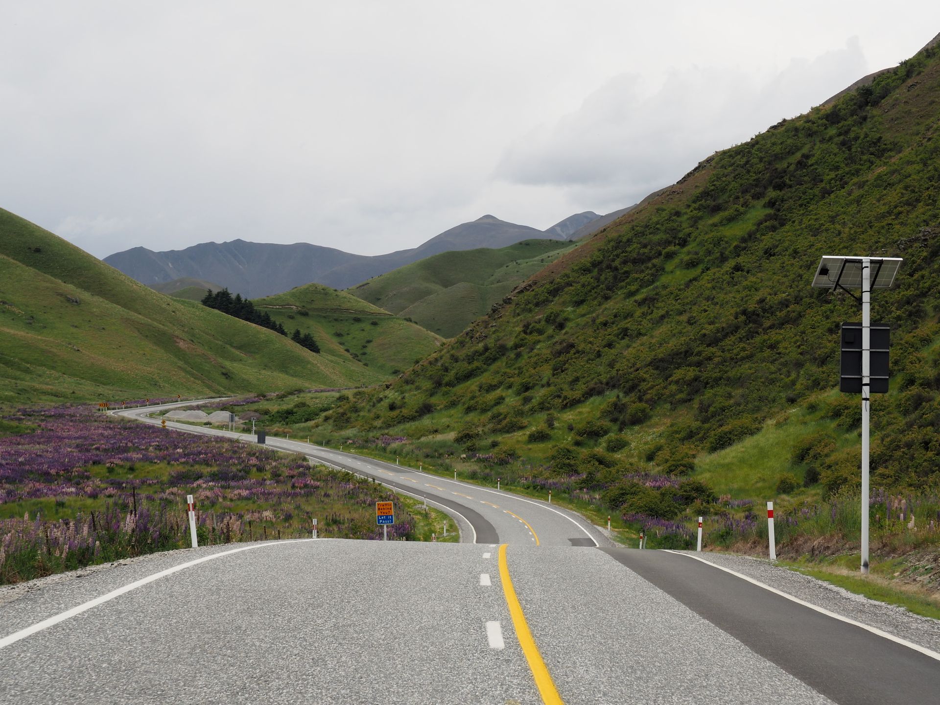
And the alarm goes off early again - it's 6.30 am and I'm proudly sitting in the car at 7.30 am. After 25km I realize that I did wash my dishes, but I don't remember putting them away... I had put them together with my toothbrush and toothpaste somewhere - just where? I stop, search for the things - nothing. So turn around. Just a moment ago, I said goodbye to the beautiful mountains of Fiordland, and now I have them in front of me again. At 8.30 am, I start again from the campground. My things were nicely waiting on a table next to the kitchen... Now I have this very long stretch to Twizel ahead of me and I want to experience Lindis Valley in between - a moon-like landscape that I found so impressive on my first trip to New Zealand five years ago, but I didn't have much time to stop there. The time lost due to my forgetfulness is all the more annoying. But that's just the way it is and I didn't feel like buying cutlery and plates for the camping rental. The route is really beautiful, the sun is shining, but the wind is nasty and I have to hold the steering wheel tightly again to keep the high camper in the lane. Along Lake Wakatipu, it is again incredibly beautiful, and since I'm coming from the south, I'm driving on the right side and can easily pull over at several turnouts. As soon as you open the car door, the wind blows it out of your hand and you stand shivering with goosebumps in the icy wind to take a few pictures. In Frankton, I refuel and at 1:00 pm, I am on my way to the Kawarau Bridge, where I once again watch a few bungee jumps, buy some souvenirs in the shop, and then drive towards Lindis Valley and Lindis Pass. The sky is getting cloudy - that was also the weather forecast and I don't want to have rain in Lindis Valley. So now quickly. In Cromwell, I drive along Lake Dunston again, which I recently approached from the other side, from Clyde, and there I saw the dam. Billions of cute yellow flowers color the slopes on both sides of the lake and shine beautifully.
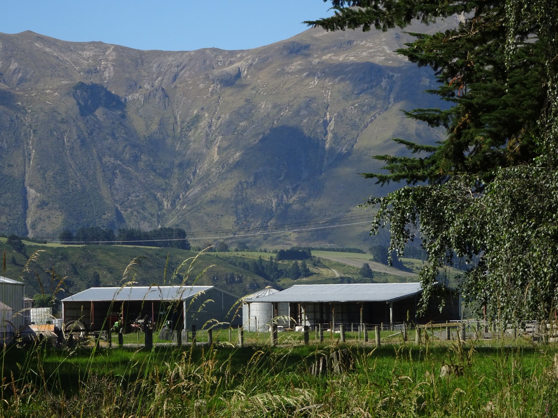
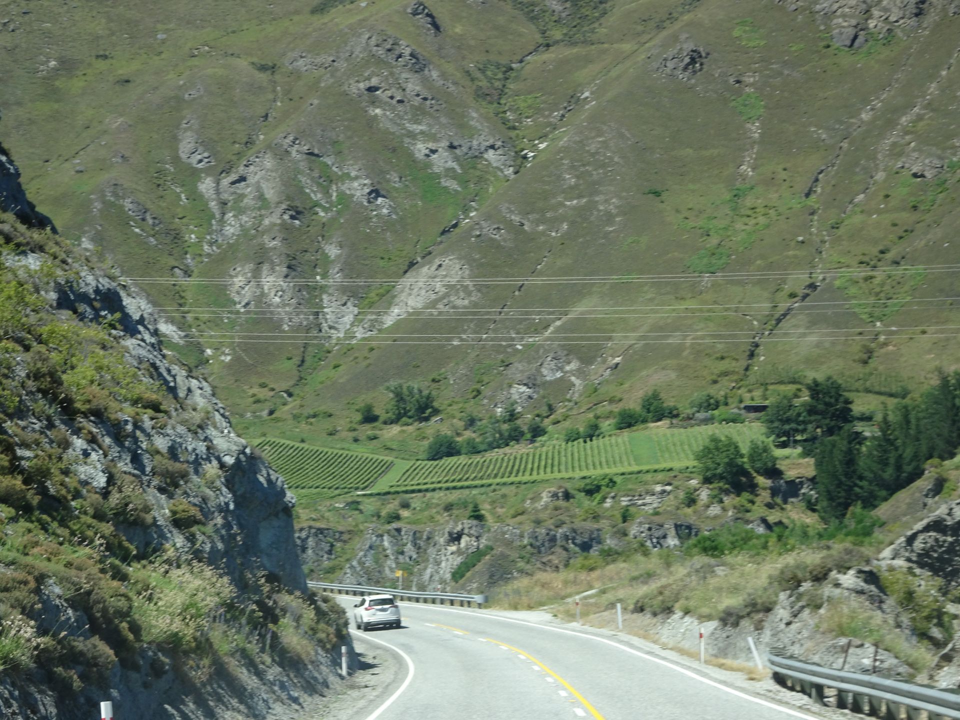
Actually, I wanted to have a coffee in Tarras - a small place consisting of a shop, a café, and an outdoor petrol station - and possibly refuel. But everything here is closed, so I continue without accomplishing anything, because it would be too time-consuming to make myself a coffee now, as I still have a lot ahead of me. In addition, the route is not only winding but also slightly uphill several times, and I have to constantly pull over with this slow camper to let other campers of the same size or larger motorhomes pass, which are much better motorized than this stupid Mazda I'm driving. I crawl up slight inclines at 40km/h and am constantly a hindrance to traffic. Sometimes I really have to pull over every 200-250m and of course, I lose a lot of time with these maneuvers and waiting for the passing vehicles before I can return to the road with a reasonably clear conscience.
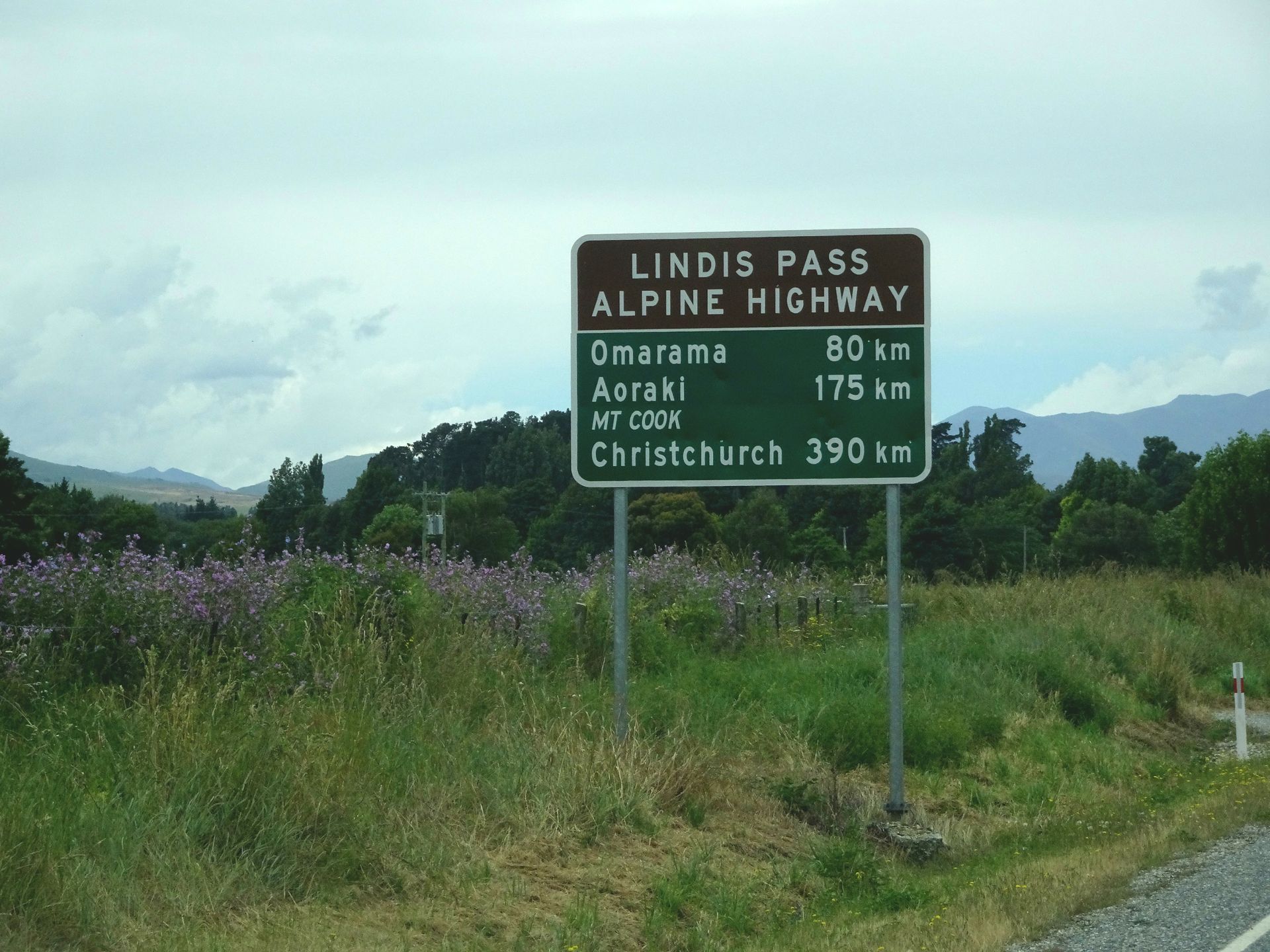
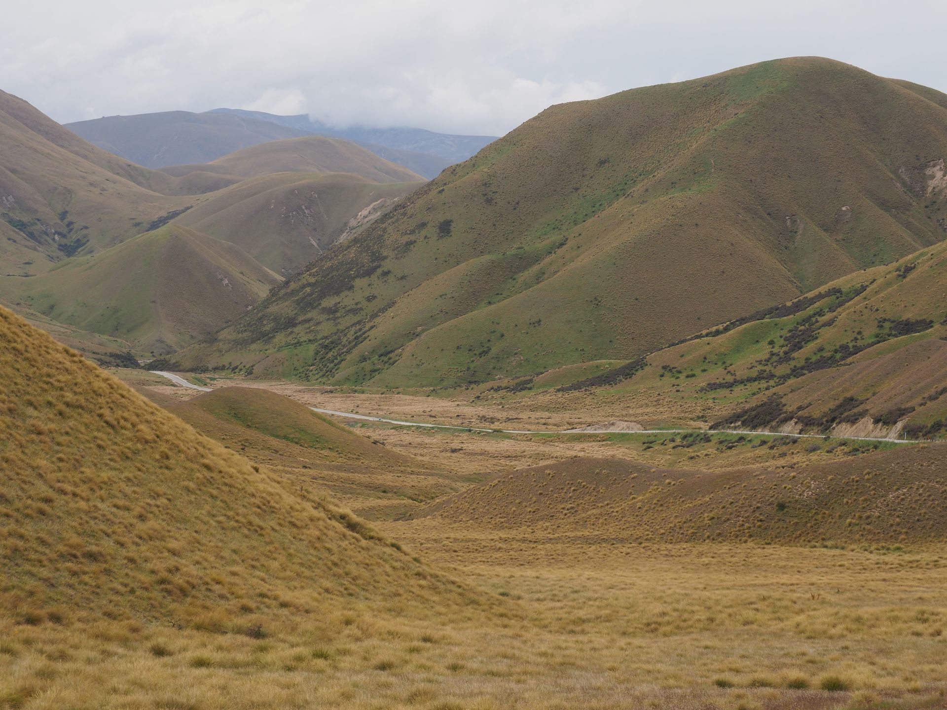
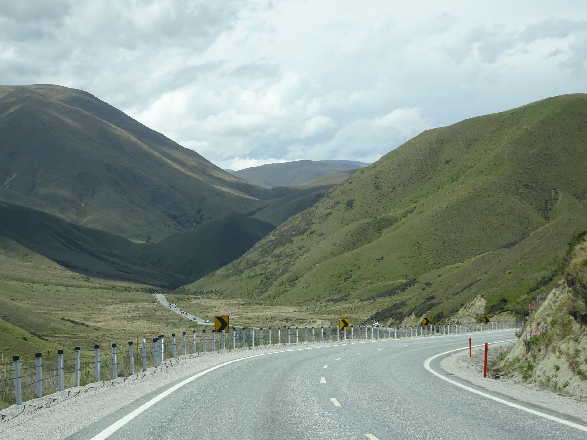
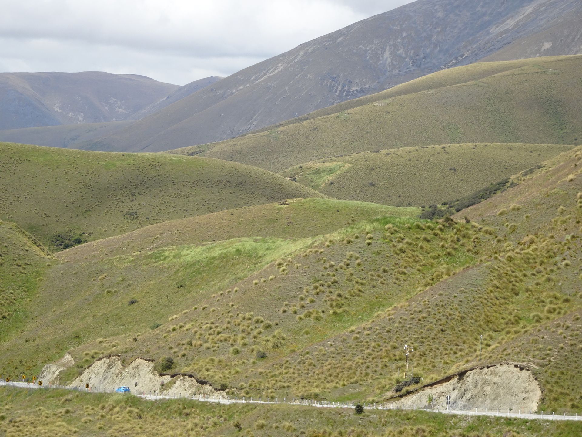
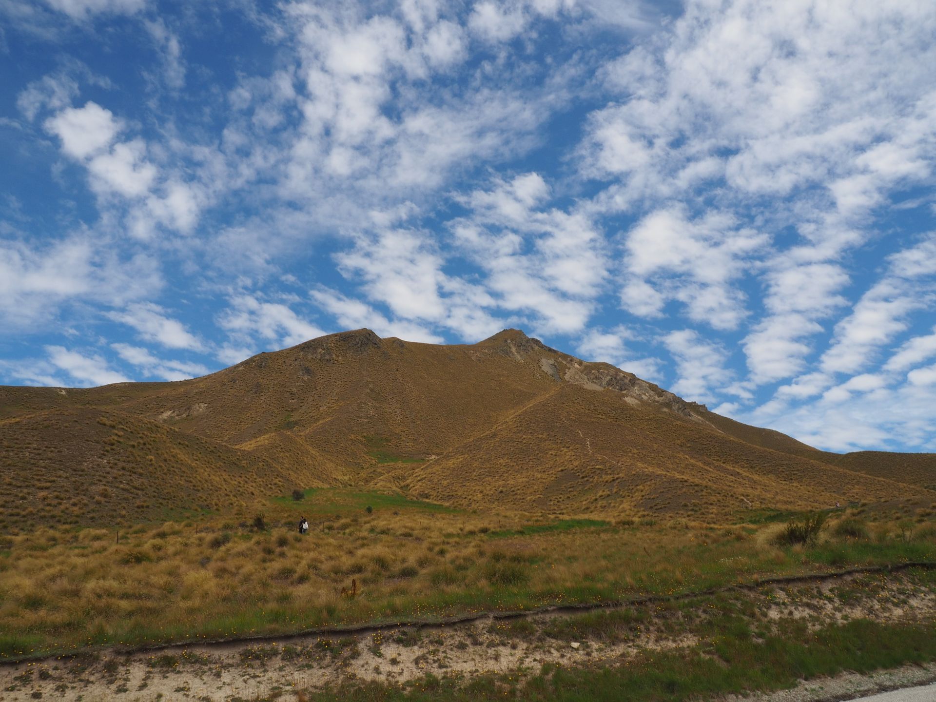
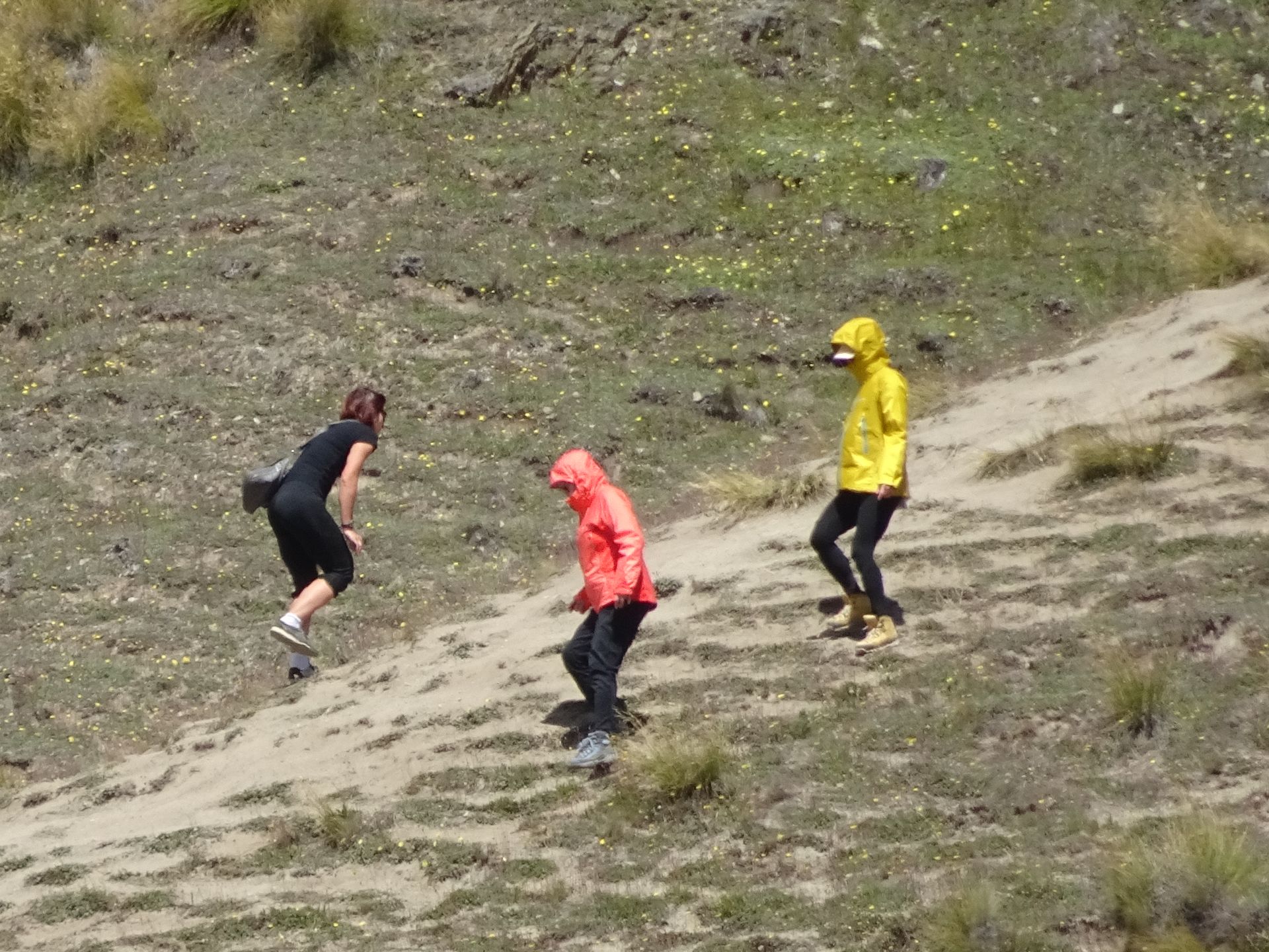
I briefly stop at Lindis Valley and enjoy the view of this incredible vastness, which you can only really grasp when you see the size of the buses and motorhomes in the distance, which look microscopic as they roll along this endless road across this plateau. Next to me, people in flip-flops and light clothing climb up the steep slope to the viewpoint. Some have huge problems coming back down because they are rather coarse stones that make up the path. Entertaining observation with the binoculars from the warmth of my wind-protected car... The barrenness of the valley is actually more of an optical illusion because trees simply don't grow here, mainly tussock grass. This has been a national park for around 40 years now. The SH8 reaches an altitude of 971m here, making it the highest expressway on the South Island and the second-highest in New Zealand.
After about 60km in this landscape, on the other, the northern end, you then reach Omarama, a village that has developed to some extent since I was here five years ago because SH8 intersects here with the road to the east coast to Oamaru. There are now two petrol stations, a few shops, and I refuel first and then continue directly. Twizel is only 20km away and it's not too late yet, so I treat myself to a detour to the Clay Cliffs.
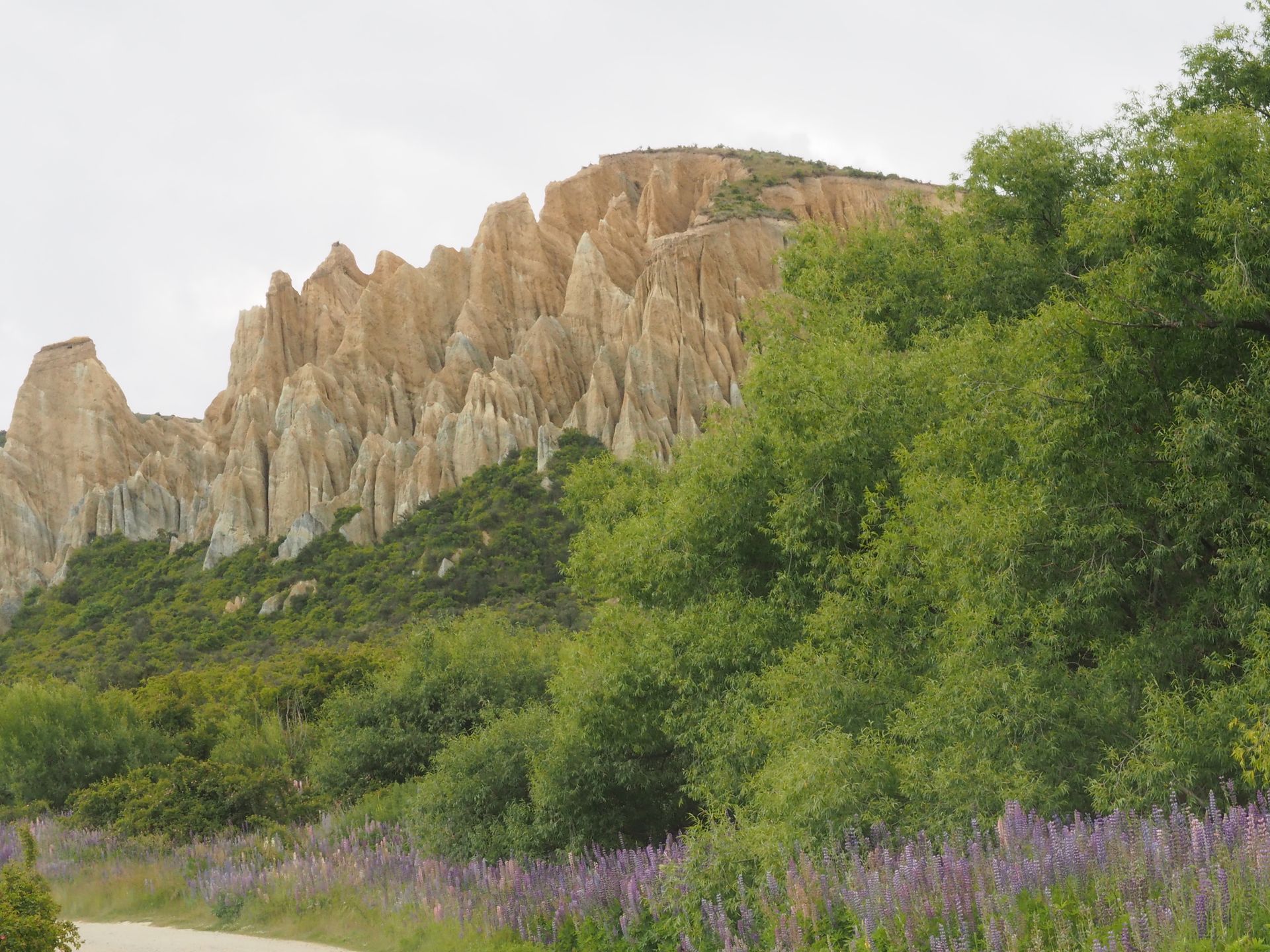
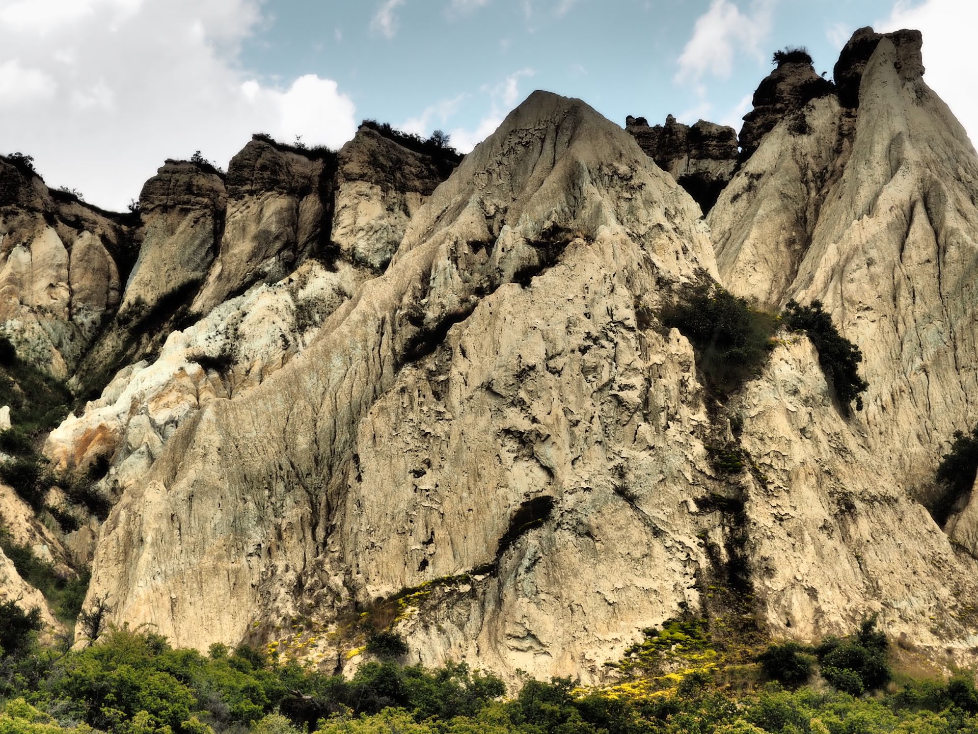
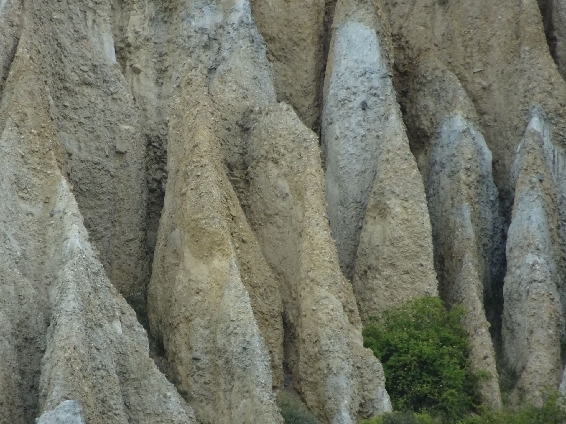
These peculiar sandstone formations, like tall peaks, are located on private land. A bumpy gravel road leads behind a gate to a sandy parking lot below these cliffs. You throw 5$ into a tin can at the gate and close it again. Unfortunately, it starts to rain now and it's only 12°C, so I have to refrain from taking a walk, only taking a few photos out of the car window and then bumping back and driving on to Twizel.
Indeed, the campground is "full" and I'm glad I reserved two nights here. Fortunately, it is true that my online booked price is for 2 people, so I don't have to pay 44$ per night, but only half. There is free Wi-Fi - not bad either. The way to the toilet and kitchen is unfortunately a bit far (I didn't know Akaroa yet...). I quickly eat my salad and after looking at the sky, I pack everything up again, make everything ready for driving and leave for Tekapo - another good 60km one way. I can't leave New Zealand without seeing my place of longing in the evening! The memory of an incredibly beautiful sunset, where the mountain slopes seemed to glow, is still in my head not only because of a large-format photo on a wall at home.
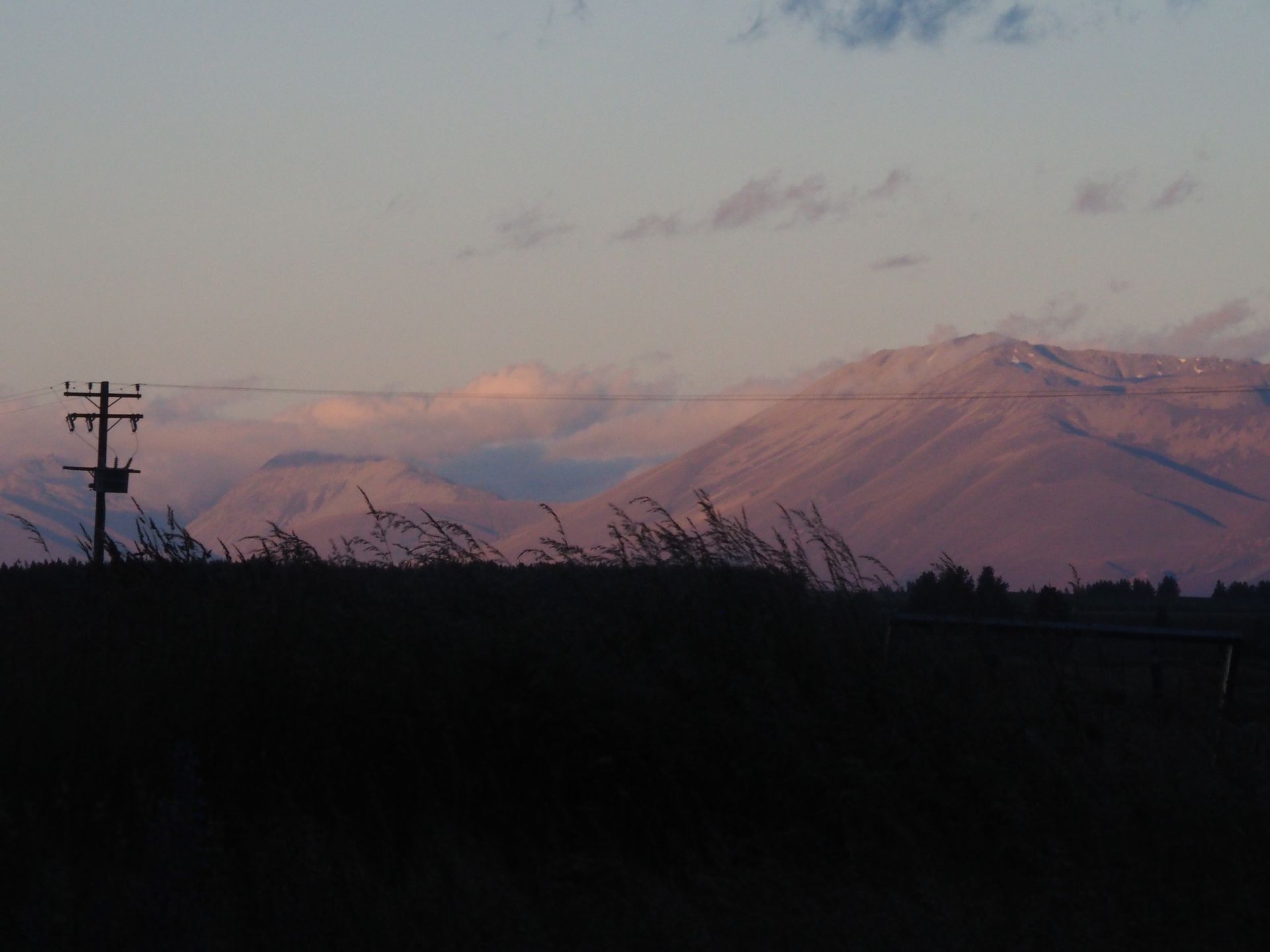
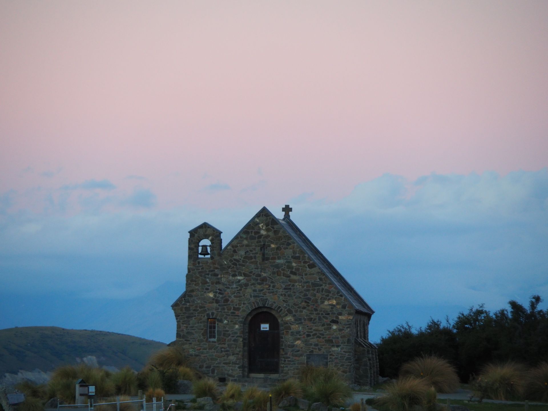
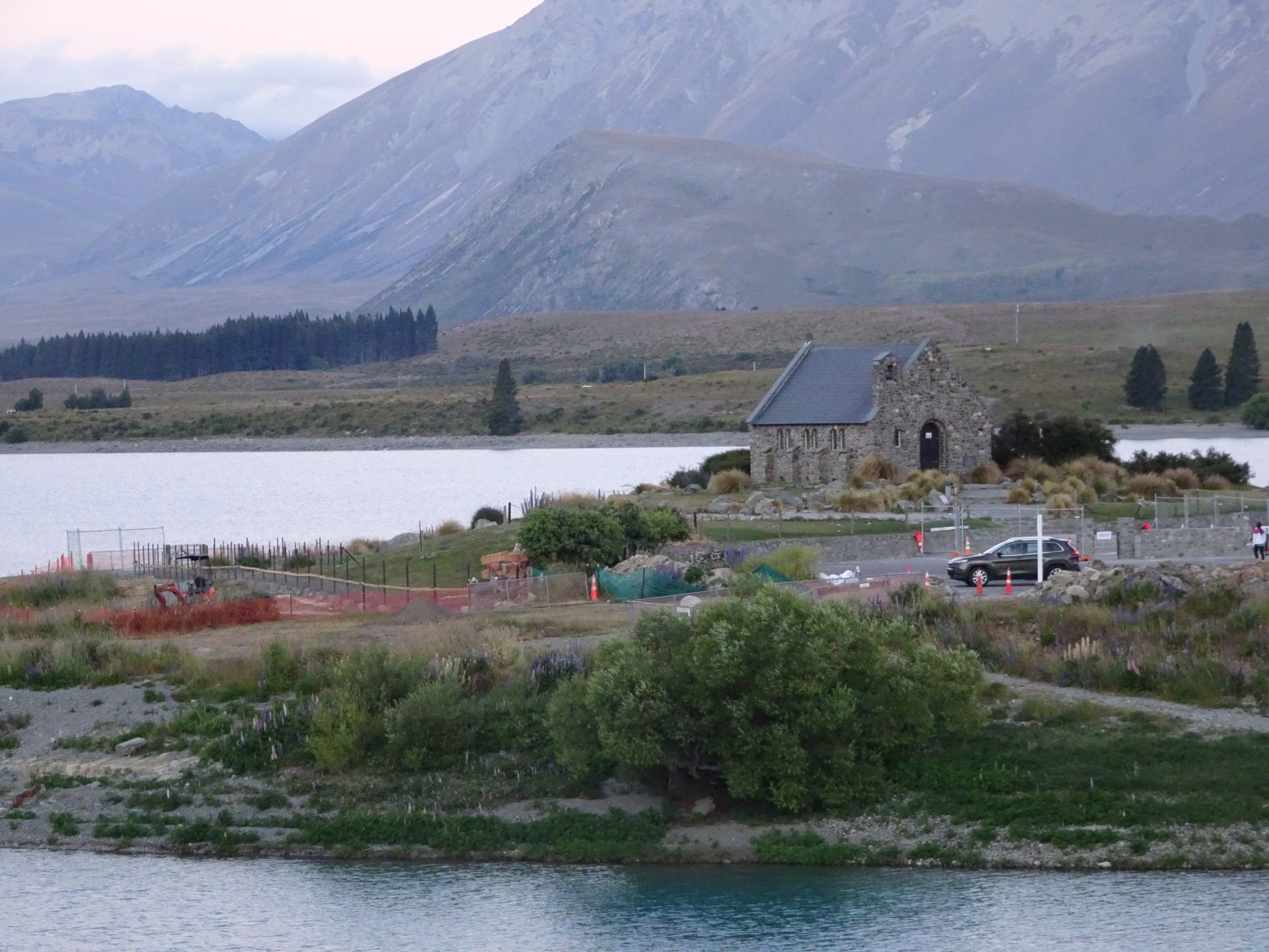
Just after Twizel, you drive along Lake Pukaki and a gigantic sunset at Mount Cook spreads out here, and I stand in awe in an icy wind with fingers frozen to ice and without a scarf, admiring this spectacle. Fortunately, the heater in the camper works well, and I drive with warm feet across the plateau that follows. But I only arrive in Tekapo after sunset. It's a nice dusk, but not comparable to what I saw here four years ago. Overall, a lot has changed here. A shopping center, many construction fences, shops that are only labeled in Chinese - even the Chapel of the Good Shepherd is fenced off by an ugly orange textile fence, which no longer allows beautiful motives on Lake Tekapo. I take a few half-hearted photos and somewhat disillusioned, I quickly retreat back to my camper. Maybe it would have been better not to come here again and keep the memory of how it used to be. I drive quickly in the darkness back to Twizel and once again have to hold the steering wheel with all my strength because a strong wind blows over the plateau. Trucks dazzle from behind. I simply can't drive more than 90-100km/h because the gusts of wind are dangerously strong and I don't want to have another collision with wildlife, because there are definitely possums on the road. I arrive at the dark campground around 11pm and I'm probably the only one still awake. Quickly brushing my teeth and going horizontal to sleep.
Odoberať novinky
Odpoveď

Cestovné prehľady Nový Zéland