the South West of New Zealand
Publikovaný: 18.02.2020


Odoberať novinky
On Monday morning (01.04.) we first went to Cave Stream Scenic Reserve. Here we spent 50 minutes walking through a cave, which was unique because it was entirely submerged in a river. We were almost waist-deep in cold water at the beginning, but luckily it only reached our knees for most of the time. Kenny loved the tour, he was fascinated by the colorful rock formations and erosion. Unfortunately, Krissi couldn't enjoy it as much because of the cold water and feeling claustrophobic. Kenny went into the cave again to take photos and videos. Meanwhile, Krissi stayed outside in the warming sun and was happier the further she got from the cave.
After that, we drove over Arthurs Pass along huge mountain ranges. Our goal was Avalanche Peak, where we planned to hike up and down for 5 hours. Unfortunately, the weather didn't cooperate. Just before reaching the mountain, strong rain started and the peaks were covered in clouds. So, we went to a café at the foot of the mountain instead. Over two Chai Lattes, a brownie, and a carrot cake, our mood improved. In the dry weather, we finally managed to book our accommodations for Bali. In two weeks, we will be staying in four different hotels. We're excited, but our credit card was definitely hot.
After 3 hours in the warm café, we continued towards the West Coast of New Zealand. In Okuku Reserve, we found a sleeping spot for the night on a gravel lot right by the road. It wasn't a spectacular place, but it had clean toilets and a typical New Zealand chicken that entertained all the campers.
On April 2nd, we were still delighted by the cute chicken. Apparently, it wasn't alone, as birds happily explored the cool box of some French people. On our way, we made a short stop at Kapitea Reserve. It was a beautiful, quiet lake. After replenishing our water supplies, we continued the drive to the West Coast. Along the way, we stopped at several lookout points.
However, our destination for the day was Pancake Rocks & Blowholes. By the way, no one knows exactly how these rock formations are created. During a 20-minute circular walk, we saw numerous cliffs and blowholes. At one blowhole, a small rainbow appeared regularly.
For lunch that day, we simply stopped by the coast, right by the road. We cooked delicious scrambled eggs with a view of the ocean. When Kenny wanted to explore the beach more closely and ran up the embankment with momentum, he barely managed to save himself. It turned out that the beach was quite steep and inclined several meters downwards.
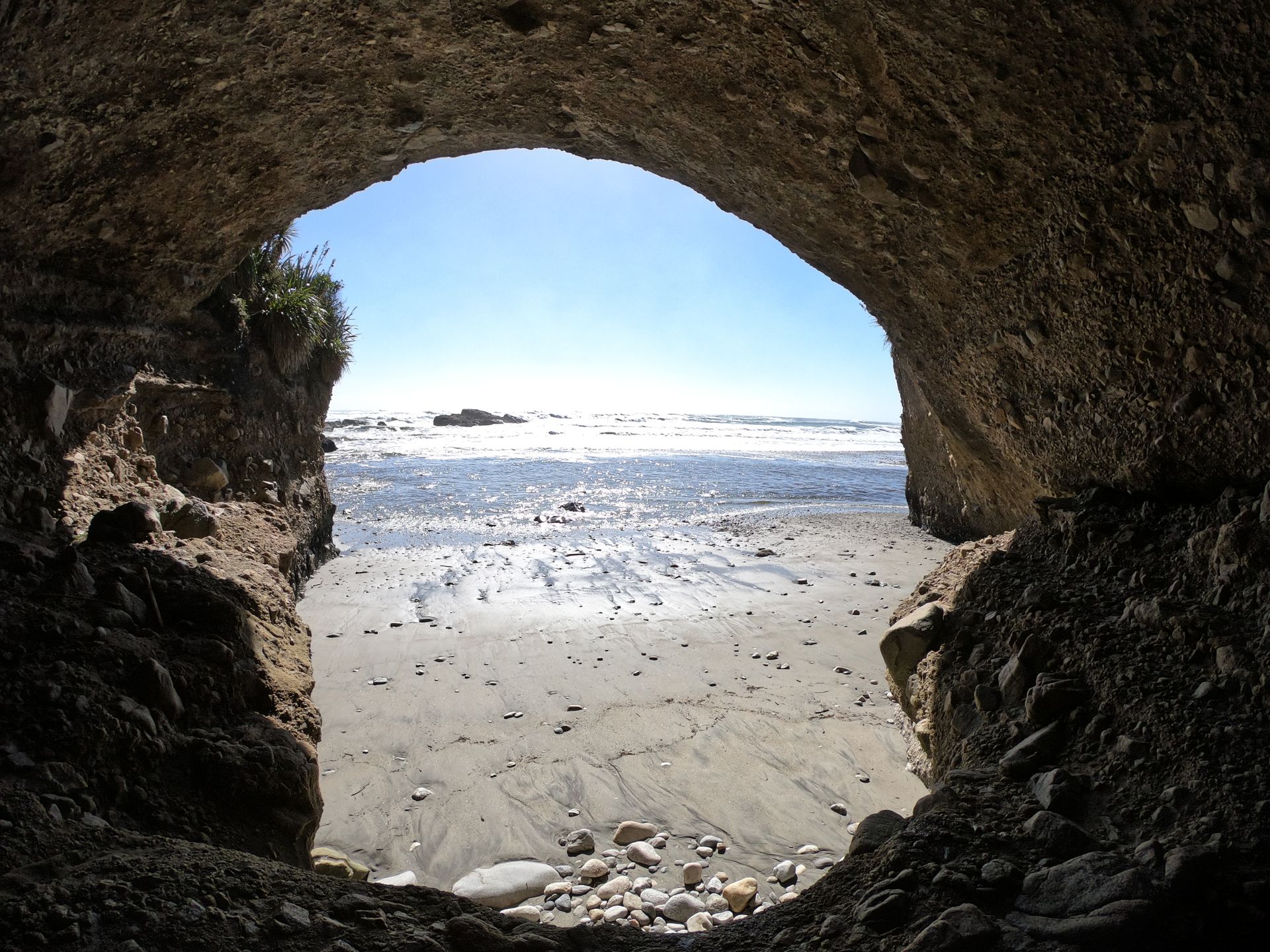
During the drive, we spontaneously stopped at a cave that was formerly used as a shelter by the Maori, the indigenous people. It wasn't particularly exciting, but the cave was very tall and its location right by the beach was quite beautiful.
Our last stop on the West Coast was the Lighthouse in Cape Foulwind. Except for Kenny "chasing" a chicken here, there isn't really anything exciting to report.
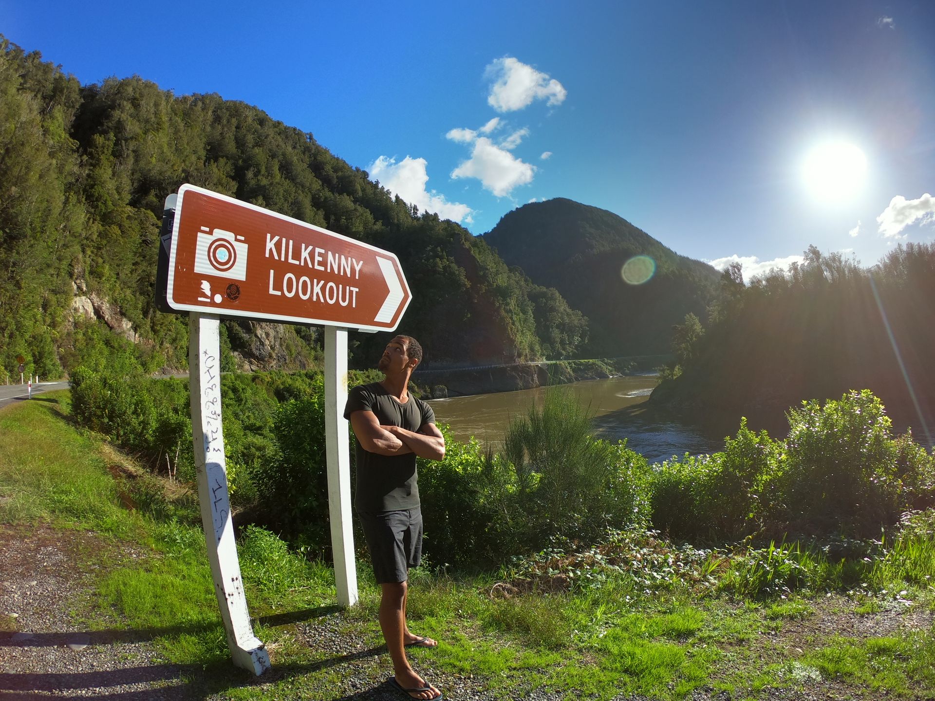
We drove past a tree that was shaped like a dinosaur, hence its name T-Rex Tree, and continued to Kilkenny Lookout. ;)
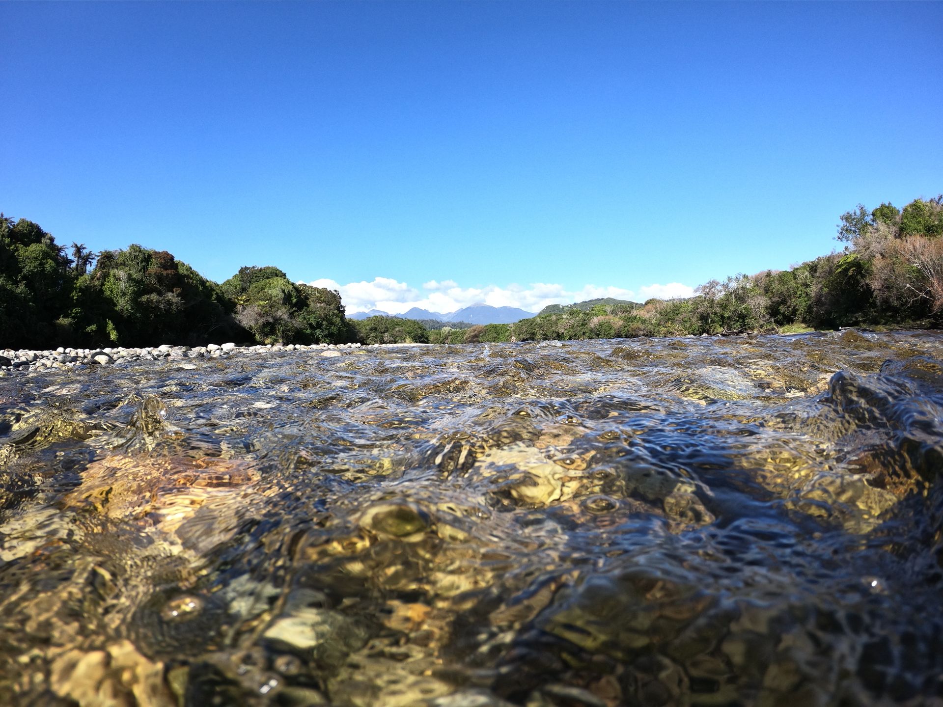
During the last few days in New Zealand, we have been driving a lot. But the roads are well-built and the landscapes are usually beautiful. We drive through valleys between mountains or alongside rivers, so it never gets boring.
We spent the night at the Rest Area Owen Junction. WikiCamps had already scared us with the numerous sandflies, so we had dinner in the back of our car. In the end, it wasn't as bad as we thought. But better safe than sorry. We also found a quite secluded spot to sleep. Up on the road, right by the Day Use Area, there were 2 other cars camping. But we drove a little further down towards the river on a gravel road and had our peace and quiet. ;)
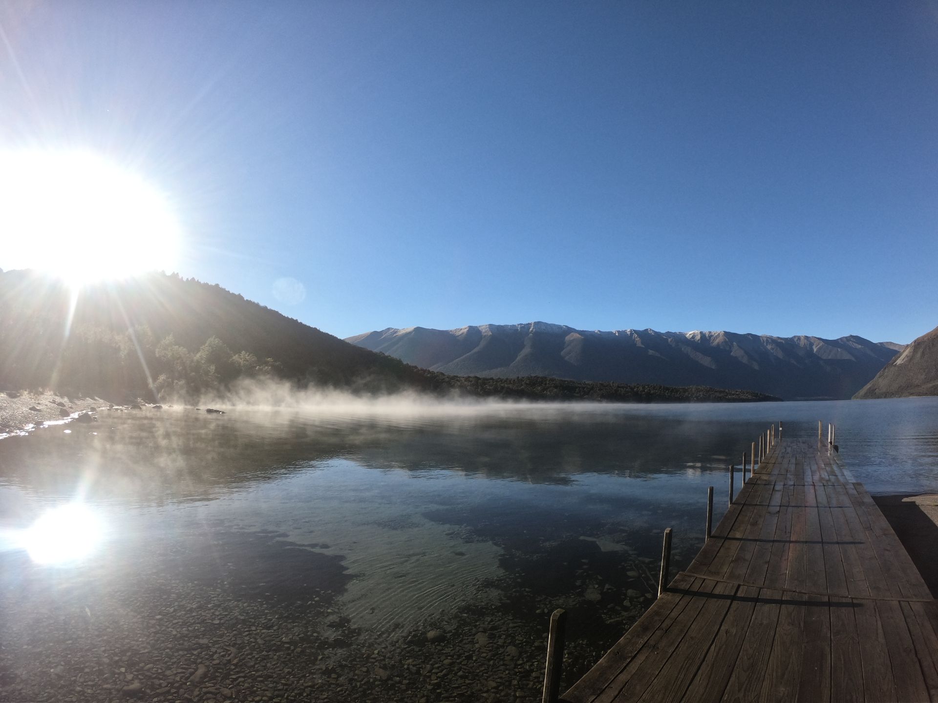
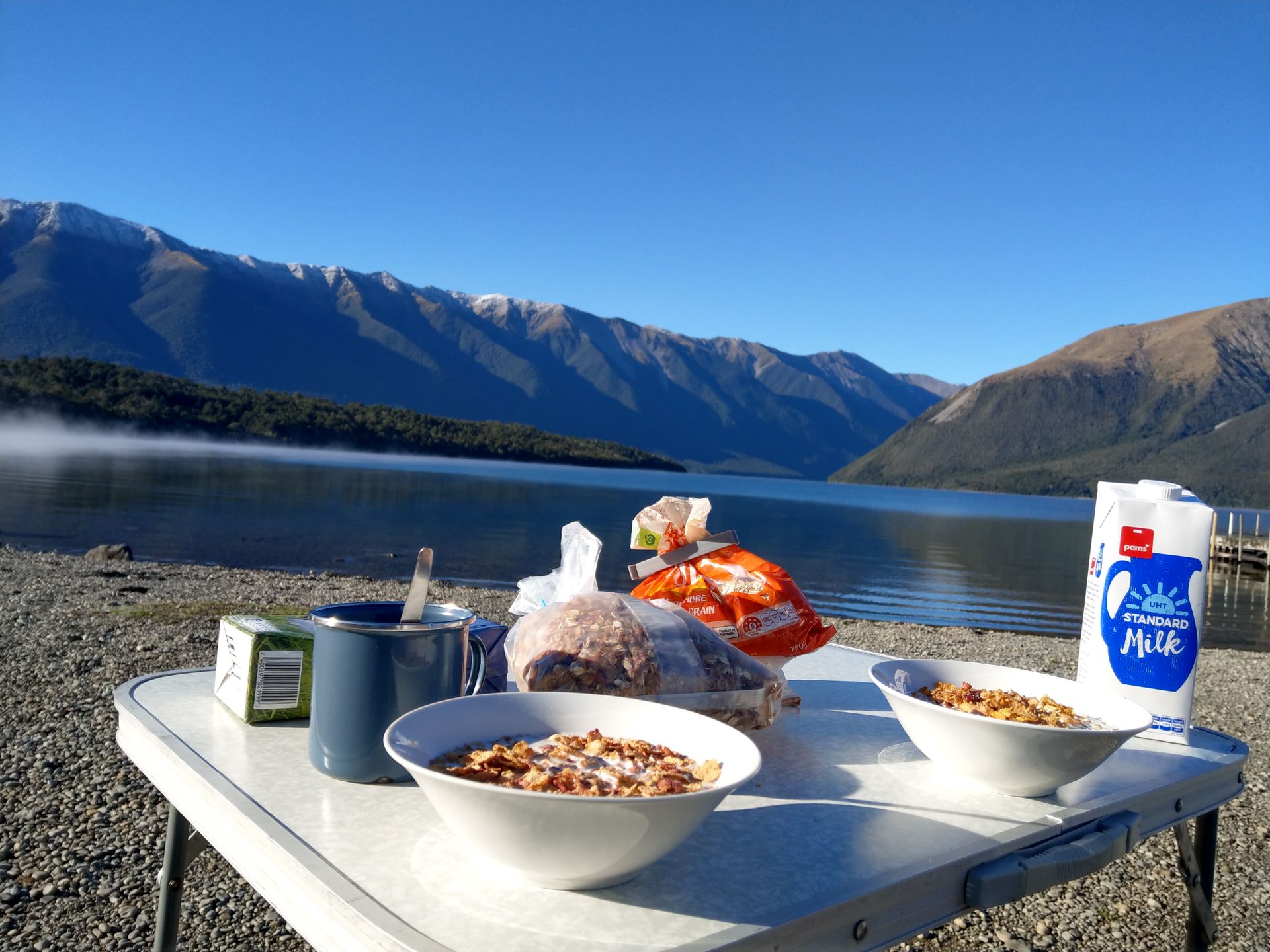
A hare and its offspring woke us up on Wednesday morning as they happily hopped around in front of our car. We decided to leave early to avoid the sandflies and fog in the entire valley. We headed towards the Nelson Lakes, where we planned to go for a hike that day. We were a bit worried about the weather. Hiking up a mountain in fog and low-hanging clouds doesn't make much sense. However, the weather forecast cheered us up, and the closer we got to our destination, the better the weather became. So, we enjoyed our breakfast in the sunshine at Lake Rotoiti.
The lake is surrounded by mountains and forests. It was particularly impressive to see the mist rising from the edge of the lake. It was a stunning scenery, and we couldn't stop taking various photos.
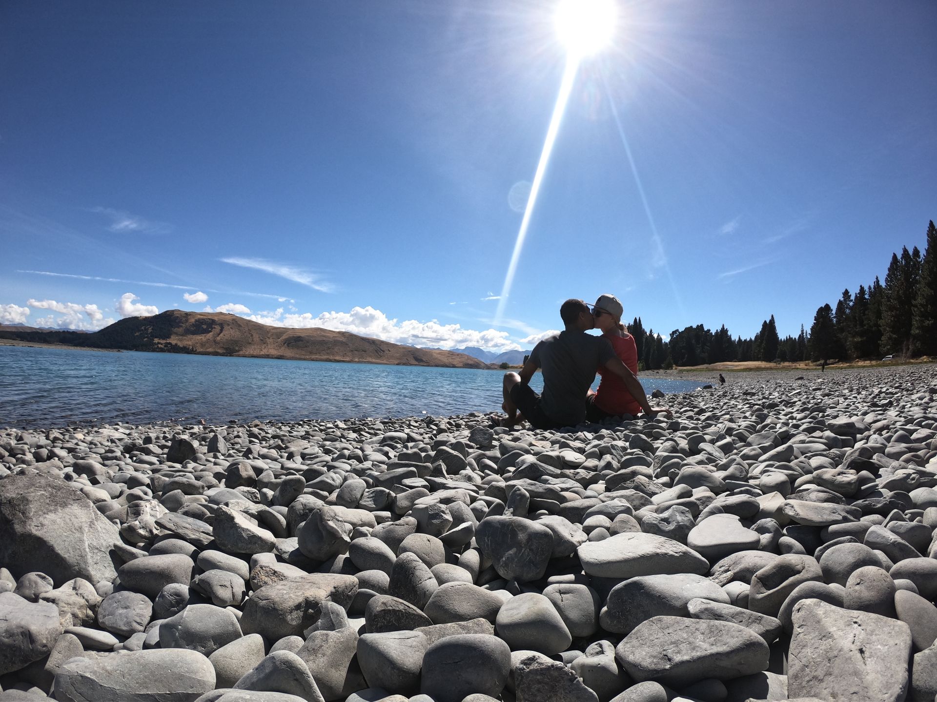
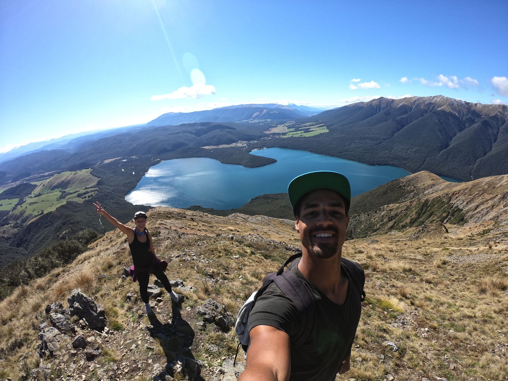
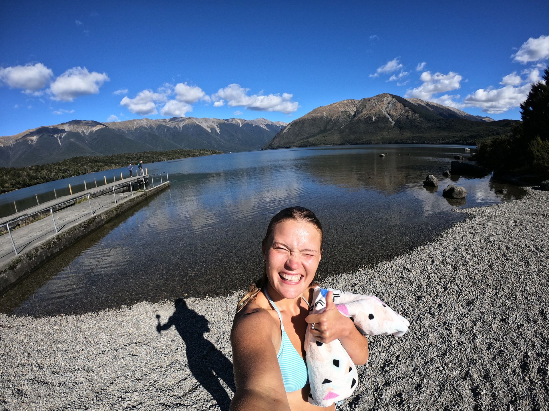
We felt so comfortable there that we only started our hike to Mt. Robert around 11:45 am. We were a bit late again. The round trip was 9.6 km long, and it took us almost 4 hours. We were truly amazed. The sun was shining, making the water beautifully blue. Upon reaching the top, we even ran into 5 Saxons directly. The world is really a small place.
After the descent, Krissi dipped into the ice-cold but clear water for a bit.
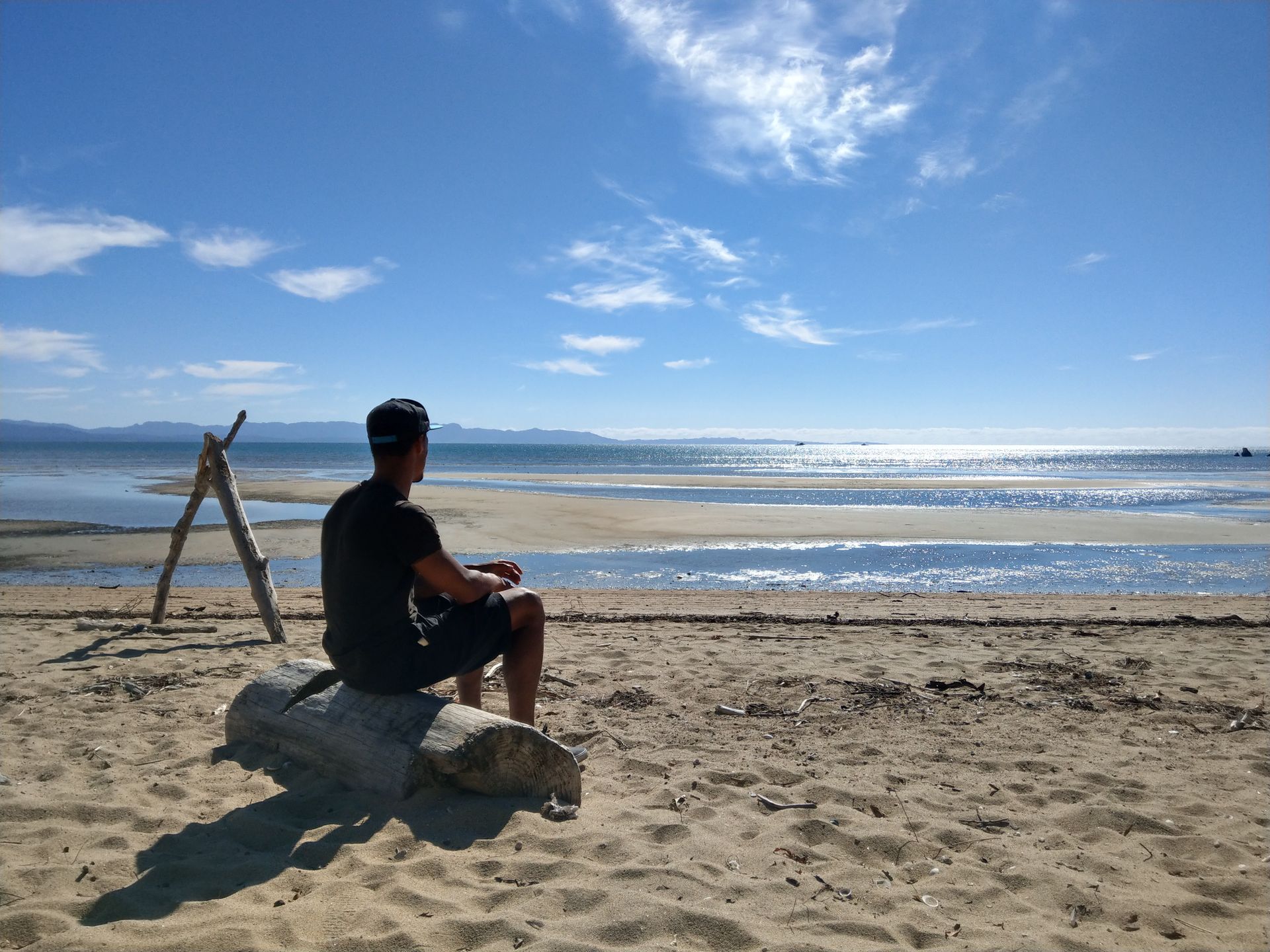
After refueling for $2.27 per liter, we continued towards Abel Tasman National Park. Everyone says that you have to go there, but we somehow didn't really have a plan. Online, we found out that there is a multi-day hike in the park, which is probably why it's so famous. But that's not for us. Besides, we only had one day. We had a few likes on Wikicamps, but we assumed that you go hiking in a national park. We'll see. So, we drove almost to the end of the national park to explore the next day. In the darkness, we arrived at Waitapu River Free Camp. It was so crowded, but at least we had a place to sleep.
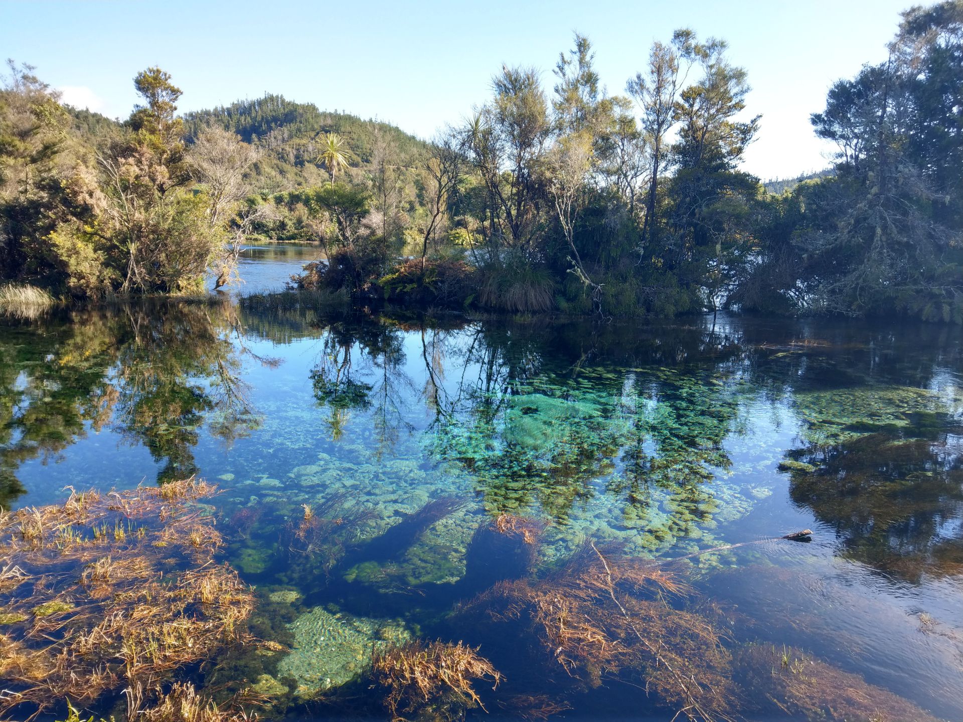
Since our campsite wasn't that nice, we headed straight to our first destination on Thursday morning, Te Waikoropupu Springs. There were a few sunny tables right at the parking lot where we had breakfast. Then we took the approximately 20-minute walk to the springs. After a while, we wondered if we had already missed the springs because we had been walking for a while and were heading back towards the parking lot. But around the next curve, we saw the springs. It was breathtaking.
The water was incredibly clear, and we could see the bottom several meters deep. In some distance, the springs bubbled calmly. There were some disturbances on the surface of the water and only disturbed sand at the bottom. But we couldn't really see where the water came from underground. The water is considered one of the purest in the world because it travels underground for about 100 years before resurfacing. For the Maori, it is a spiritual place, so touching the water is still forbidden. However, there are plans to bottle the water and sell it to China. That would be a shame for this beautiful place. But money has its power. L Around another bend, we saw where the water emerges from the ground based on the disturbed sand underwater. The spring also has the fitting name Dancing Sands.
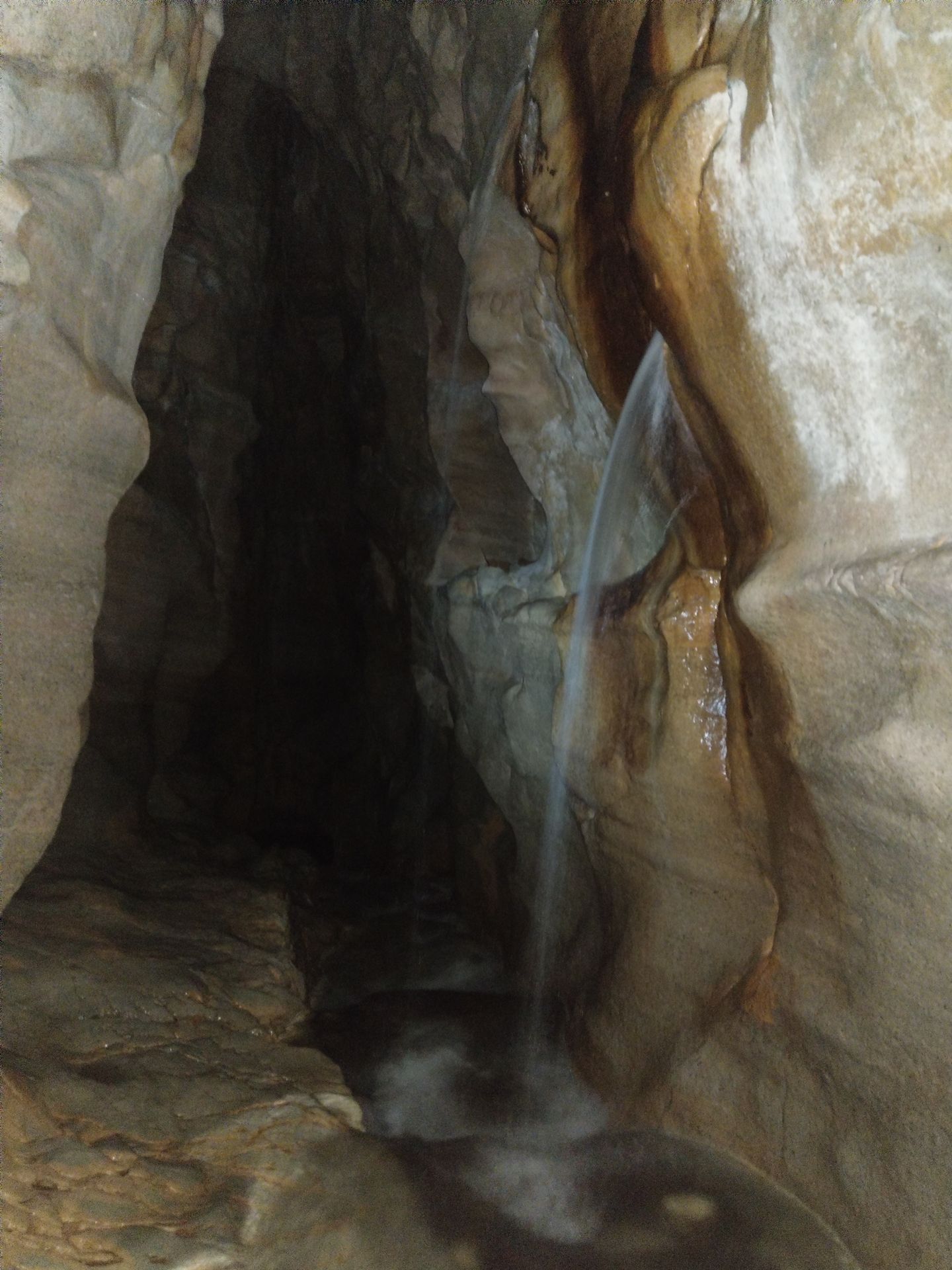
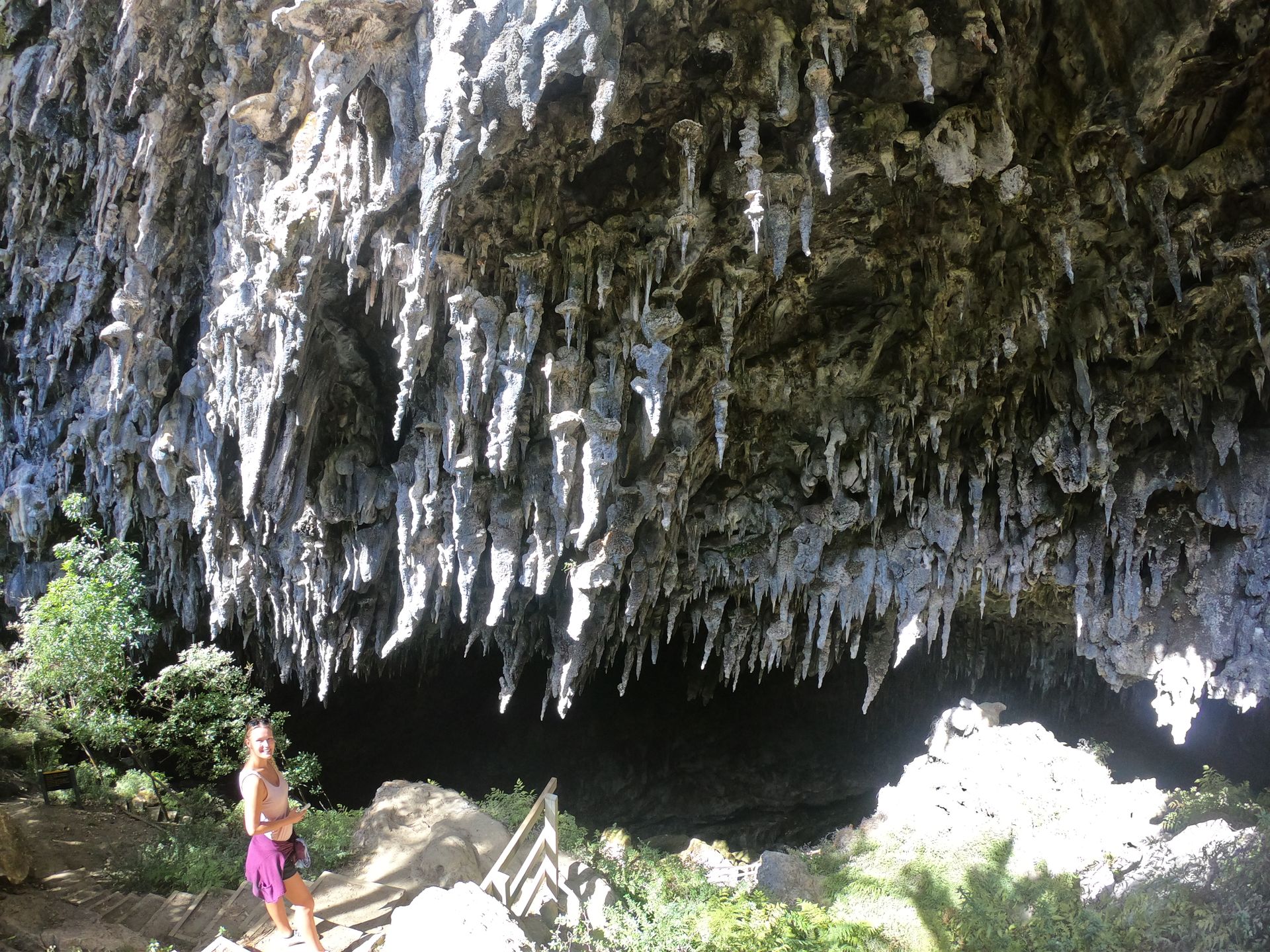
We continued to Rawhiti Caves. This time, no climbing or getting wet. After a steep ascent and a half-hour walk, we reached the huge cave. It was impressive. Numerous stalactites hung from the ceiling, and some were even growing towards the main entrance. This is probably because moss on the stalactites affects the growth towards the light source at the entrance of the cave. And here we thought that stalactites always hang straight down.
We had lunch at Ligar Picknick Bay. After the noodles were cooked, Krissi managed to spill the entire pot on the ground while draining them. We managed to save some noodles and washed them, but we had to start cooking from scratch again. At least our spot was beautiful. With a view of the beach, in the sun and sheltered from the wind, a little mouse enjoyed the noodles. Afterward, we made a short stop at Tata Beach.
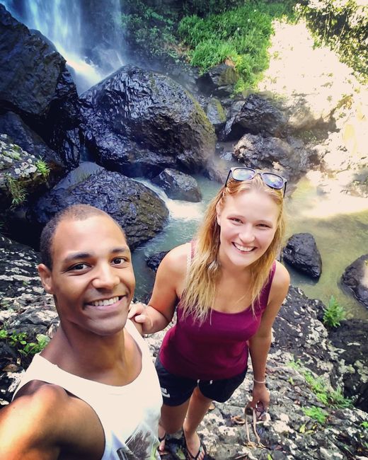
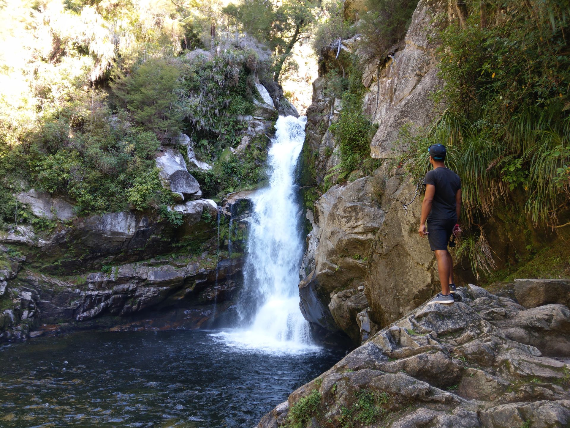
Our last major stop of the day, before we said goodbye to Abel Tasman National Park, were the Wainui Falls. A beautiful path along a river led us 2 km to the waterfalls. Even on the way, we climbed over numerous rocks, and all the water in the river raised our hopes for a great waterfall. And we weren't disappointed. The waterfall was quite tall and had a lot of water. Kenny, of course, climbed around a bit. ;)
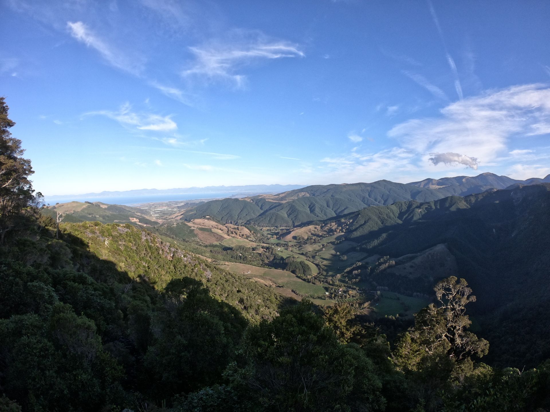
During our drive, we made a short stop at Hawkes Lookout. A 10-minute circular walk showed us some views of the numerous switchbacks and the valleys below. Krissi even found a geocache representing the South Island of New Zealand.
On Friday, 05.04., we fled early again in the hope of finding a nicer place for breakfast. We had time. The only thing on the agenda for the day was the drive to and the ferry ride. We found what we were looking for at Totora Flat Picnic Area, and we didn't have to drive far. We had a nice spot all to ourselves right by the river. We enjoyed coffee and the sun and only set off some time later.
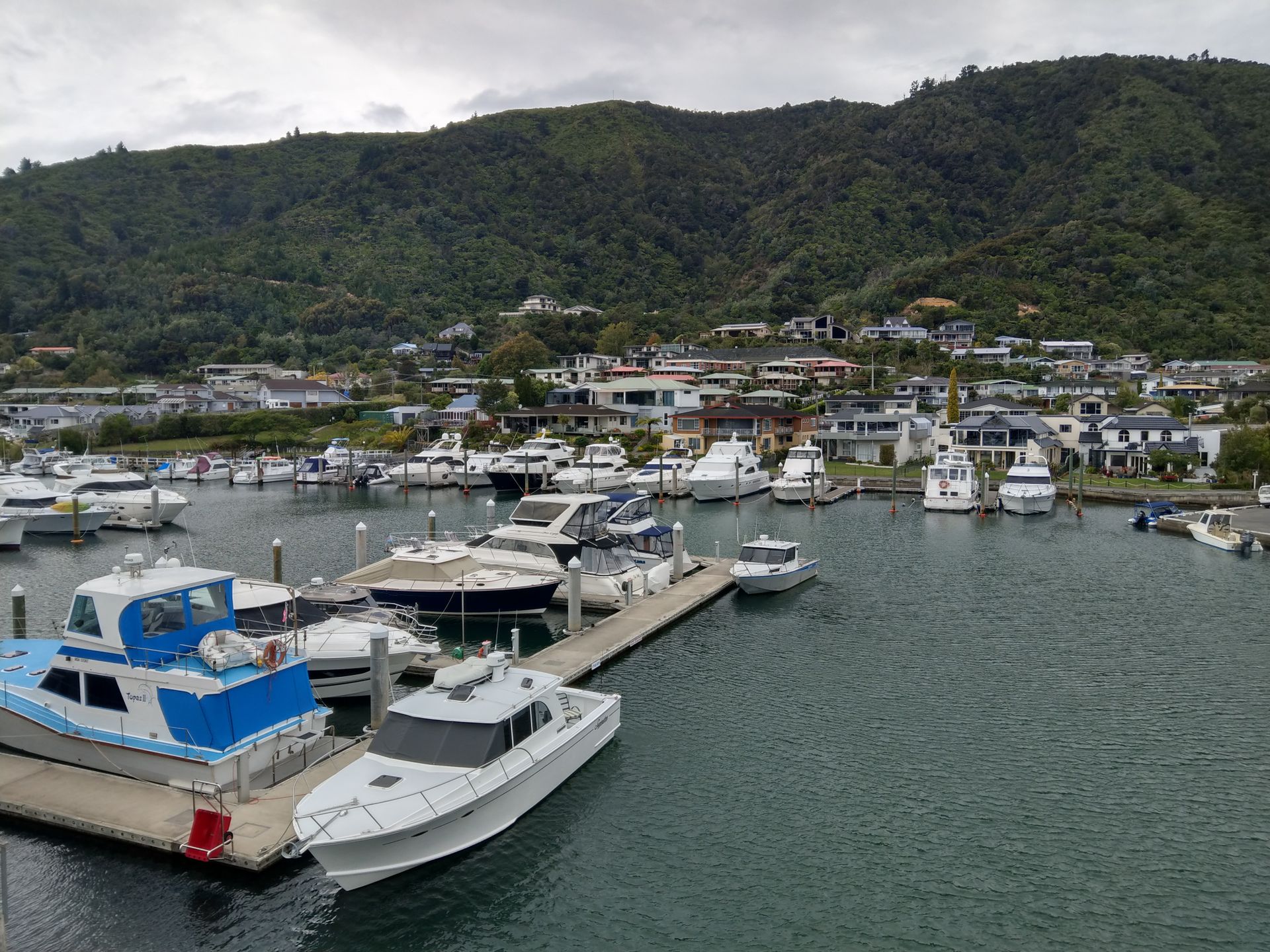
During the long drive, we stopped at Cullen Point Lookout and Groves Arm Jetty. At Picton Lookout, we had lunch and had a direct view of Picton Harbor. This is where our ferry was supposed to depart. After a short time, the Interislander Ferry arrived. It was huge and dirty. It made us feel guilty towards the environment.
We boarded the ship at 1:15 pm and an hour later, the crossing began. The waves were really high, and it felt like half the ship was seasick. The crew even came around with free ice cubes to relieve the nausea. Due to the high waves, we arrived a bit late in Wellington at 5:45 pm, and we still had a lot to do.
Somehow, visiting the city of Wellington wasn't part of the plan, even though it's supposed to be quite nice. Well.. At least we enjoyed a free hot shower in Wellington. After that, we went shopping and drove to the 50 km away Free Camp Motukaraka Point Reserve.
Odoberať novinky
Odpoveď

Cestovné prehľady Nový Zéland