Neuseeland: 8000km solo durch das schönste Ende der Welt
vakantio.de/8000km_durch_neuseeland
Tag 15 - Forgotten World Highway
Опубликовано: 08.08.2019


Подписаться на новостную рассылку
29.12.2014
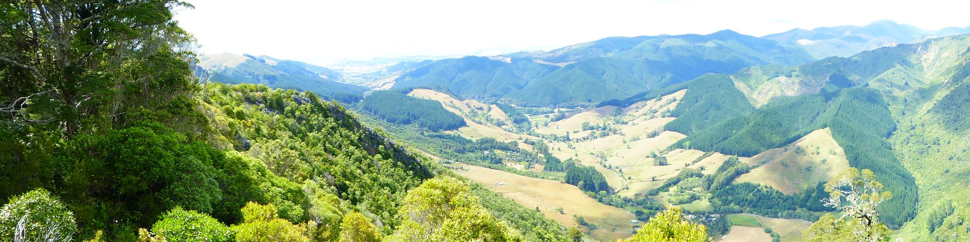
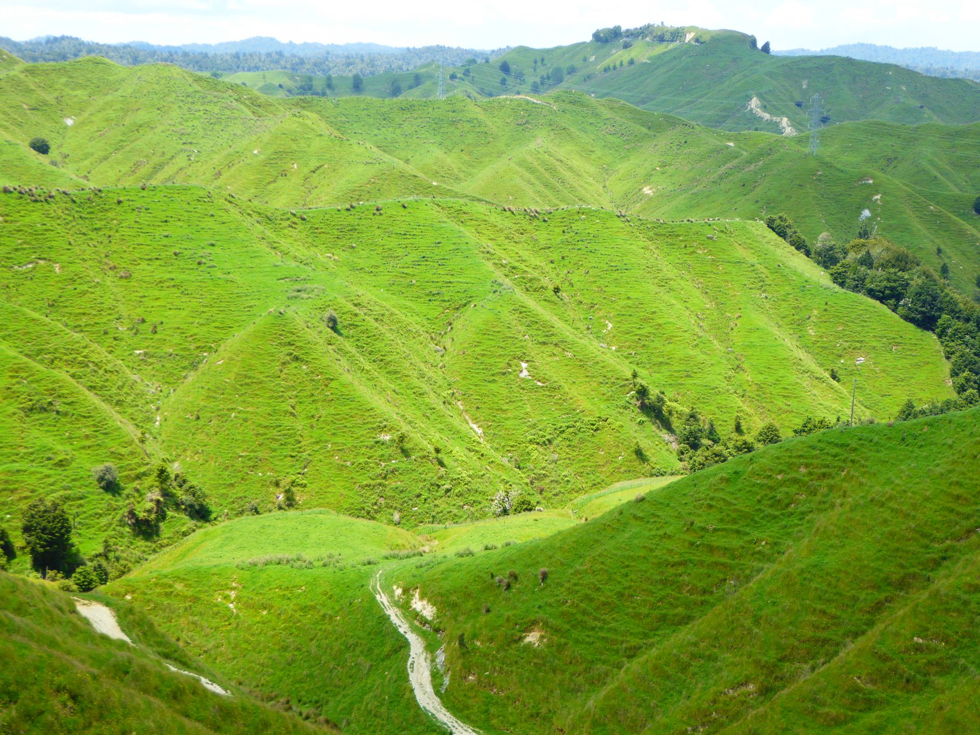
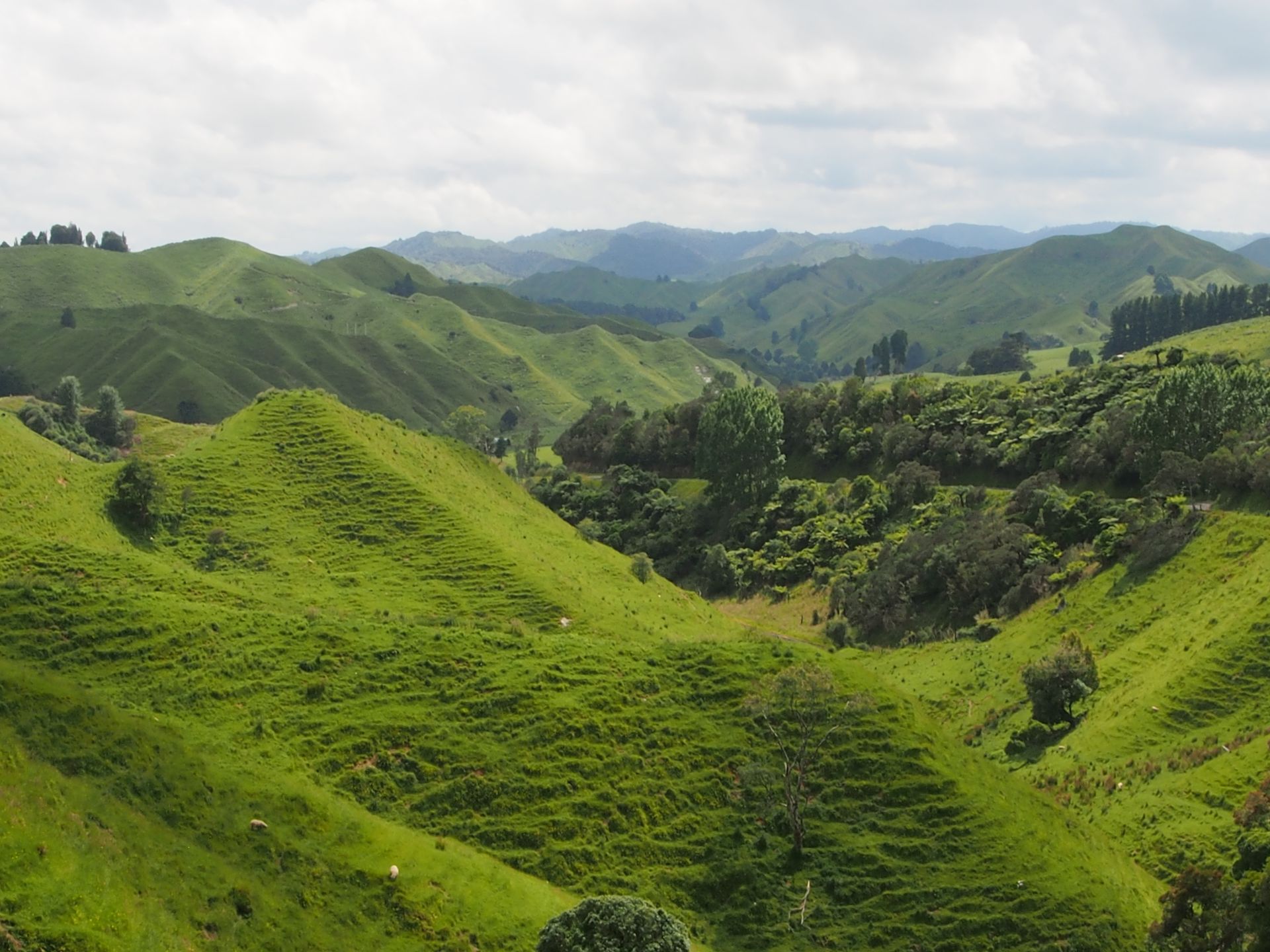
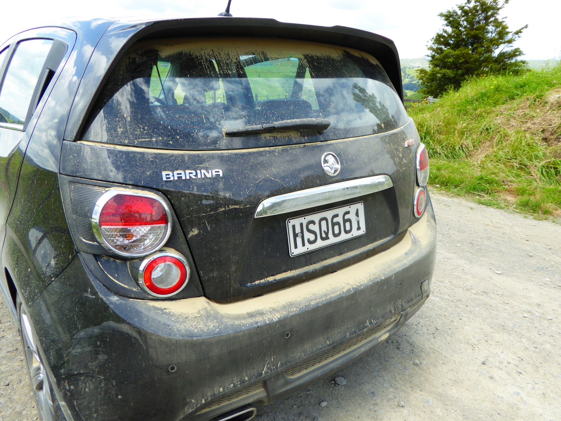
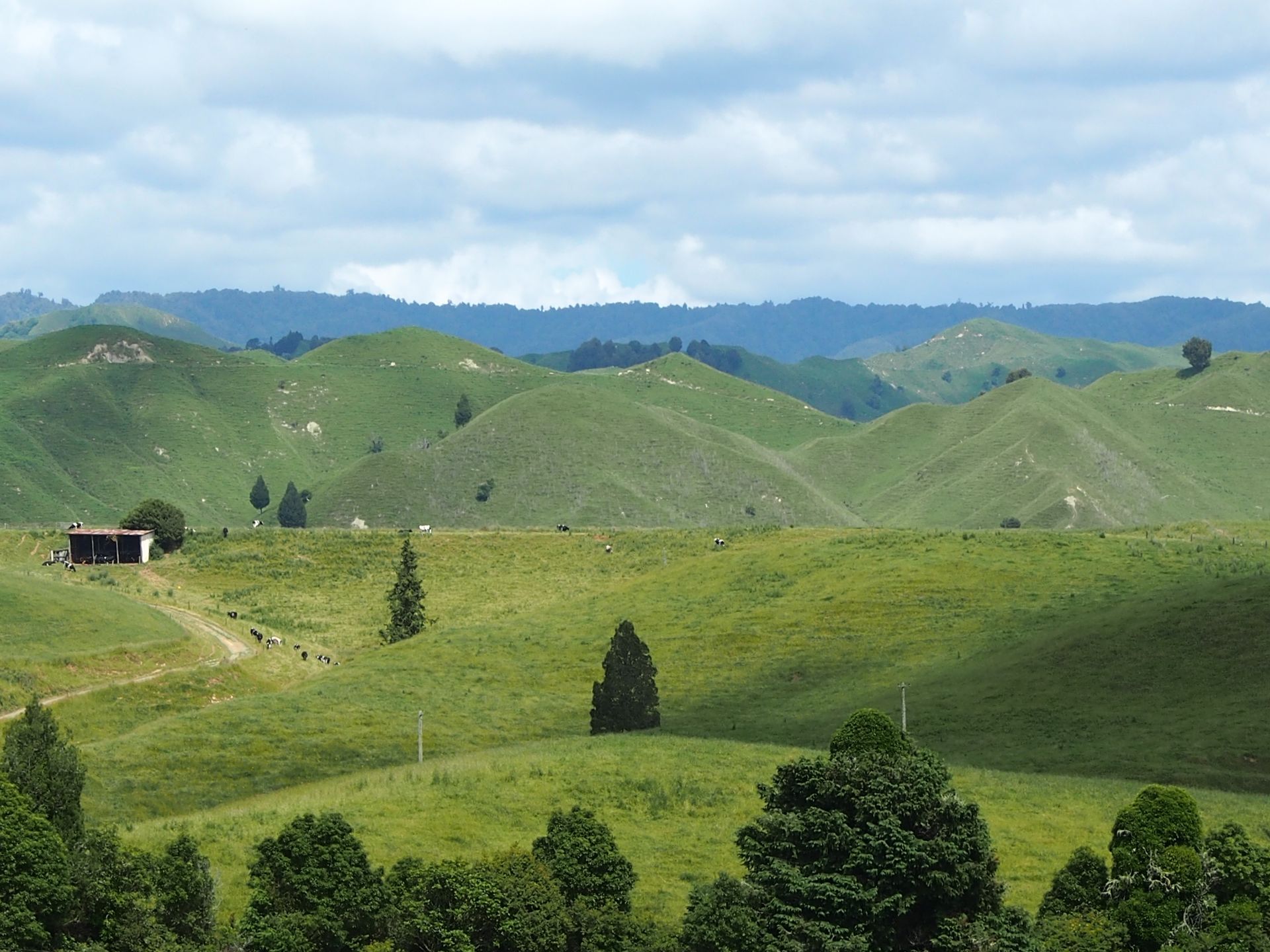
I'm enjoying my toasted English Muffin with Camembert for breakfast and packing the same for the journey. I also have half a yogurt and orange juice. I make myself one of those nice coffees from the small Bodum coffee maker and leave at 10.00am. I need to fill up my tank, clean the windows, and just before half past ten, I start driving on the 155km long Forgotten World Highway. The first sign states that there will be no gas station for 150km. The road is winding and runs through beautiful New Zealand landscapes. It crosses over some passes and if it weren't for the occasional small house, one could feel like being alone in the world - if not for the many sheep that adorn the evergreen hills with white dots. They have infinite space here in the many hills and valleys that have formed here over the past 15-25 million years.
This road follows ancient Maori trade routes as well as paths created by brave pioneers to their remote farms - through untamed bush and breathtaking landscapes. The road runs between my last overnight stay Taumarunui and ends southwest in Stratford.
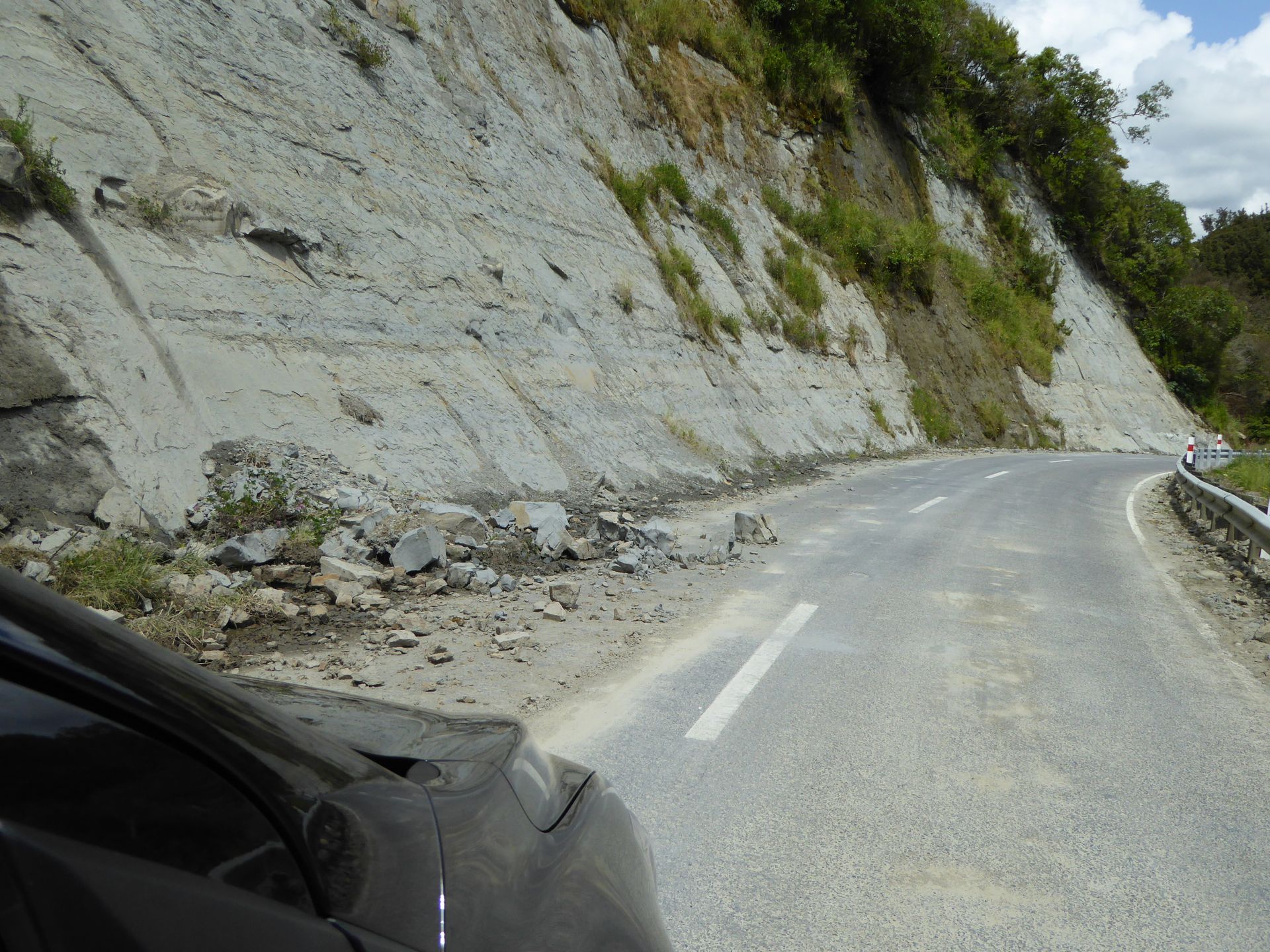
There are a few relics from the old pioneering times to see here along the road and on small, mostly unpaved side roads and some bush walking trails, although not everything is worth it. I enjoy the views of the gentle hills several times, then pass through the bush again and more than once I have to avoid rocks on the road that have washed down from the steep walls that occasionally appear beside me. It's more difficult to drive on the side closer to the wall, as the width of the lane is often so narrow that sometimes I have to honk before particularly tight and completely blind turns because I have to move to the opposite side and don't want to risk a collision.
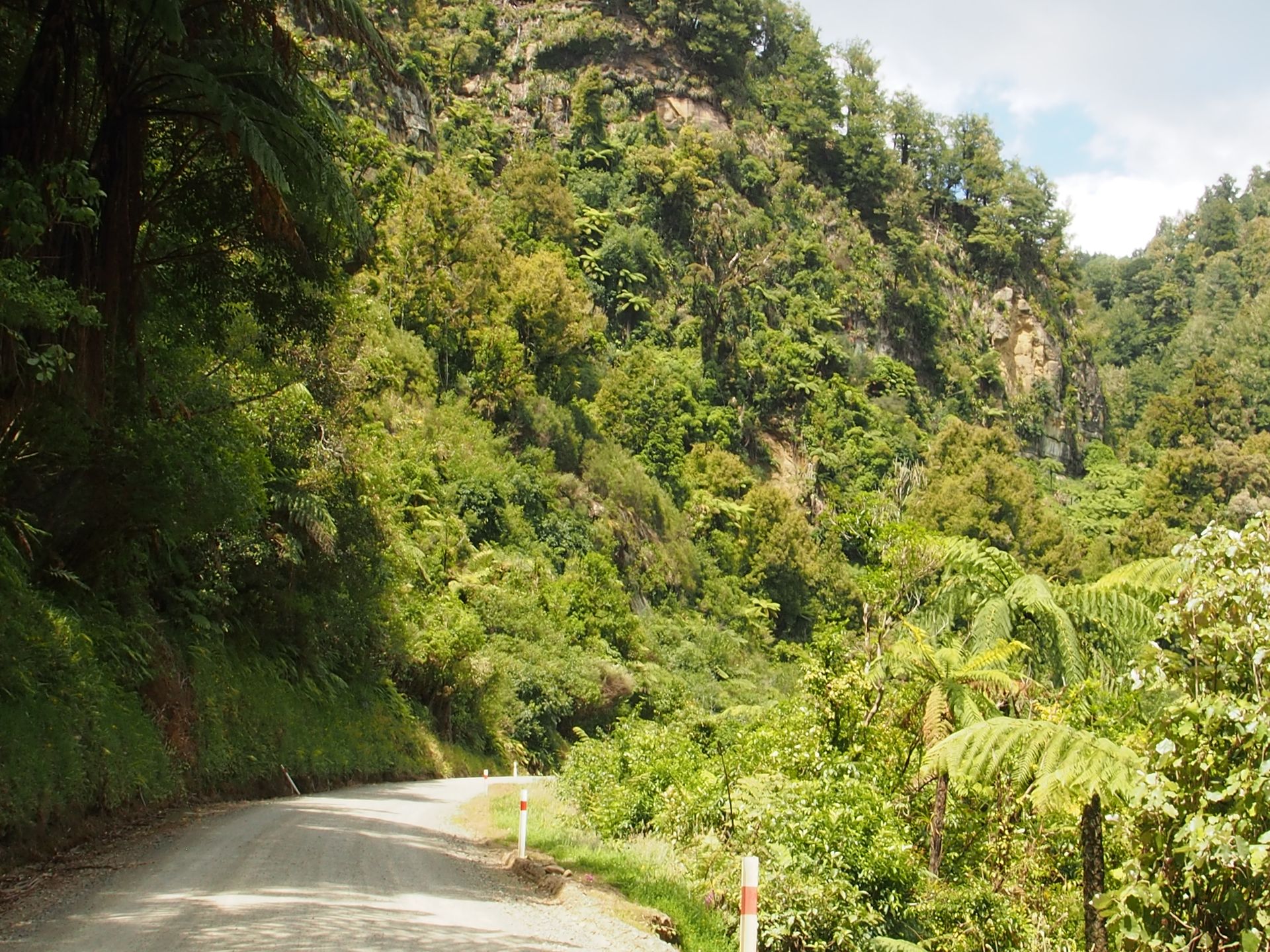
I skip most of the "sights" that are not right next to the road, as their details are not clearly described in my notes. It's no pleasure to drive 10-15km on gravel tracks, especially since 12 kilometers of the Forgotten World Highway are already gravel road.
I make some stops in the sun, which is being good to me today, presumably always with the same impressions - but it really feels like being in the Shire. I climb up to 600 meters and the view extends far into the Central North Island. Shortly afterwards, the 12-kilometer gravel road through the Tangarakau Gorge begins. This gorge is quite high and overgrown with wild Podocarp bushes, while the river flows somewhere invisibly far below. The track is good to drive on, but even here, the left side next to the wall often narrows down to half width because some rocks have slid down from the slope.
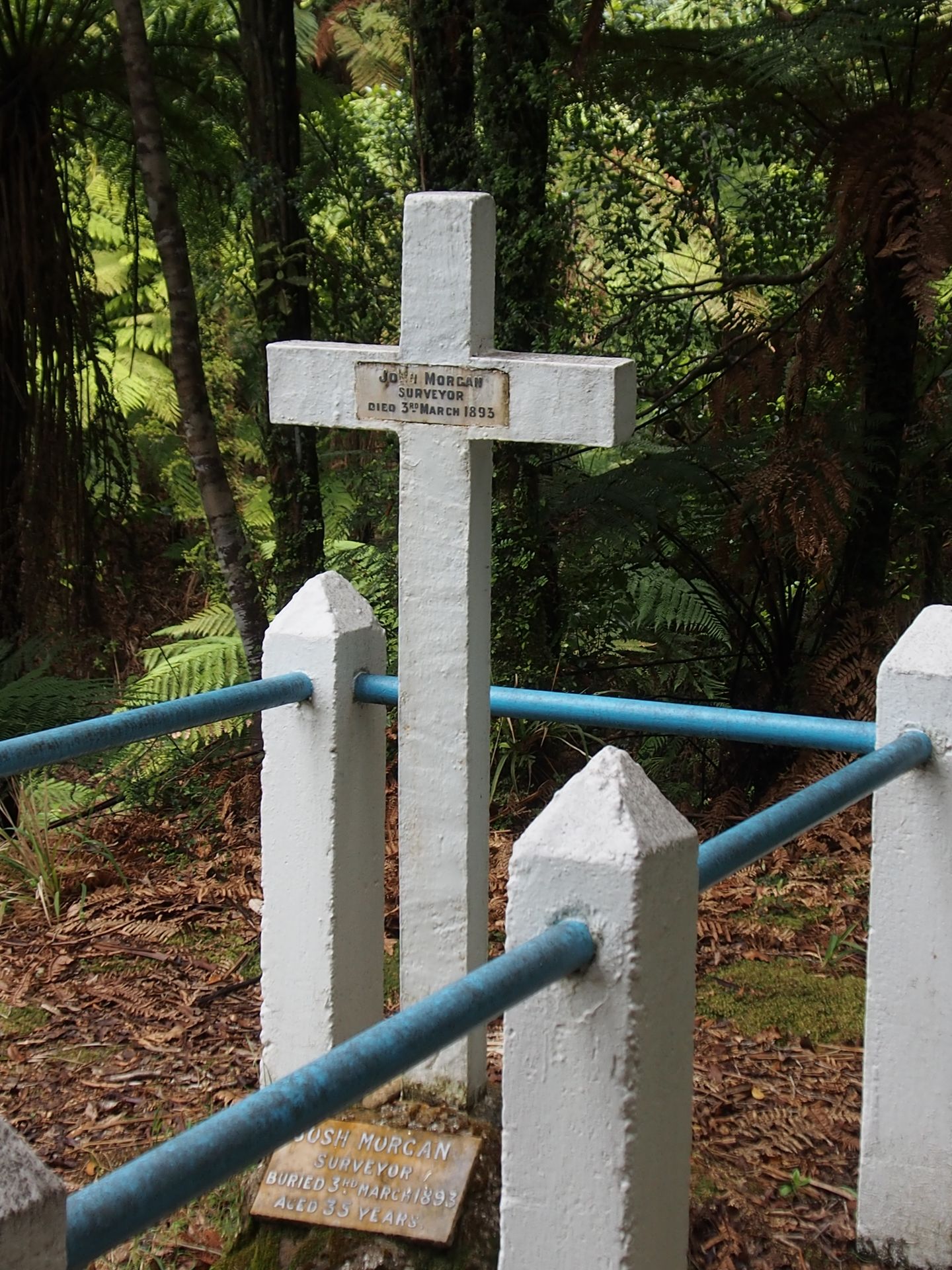
The grave of Joshua Morgan, who died here in the wilderness during the construction of the road and bridges, is located near the road. He fell ill and medicine was brought, but it didn't get better and he died here in the bush in 1893 at the age of only 35 as the leader of this construction crew. His wife, who died 50 years later, chose to be buried here next to him.

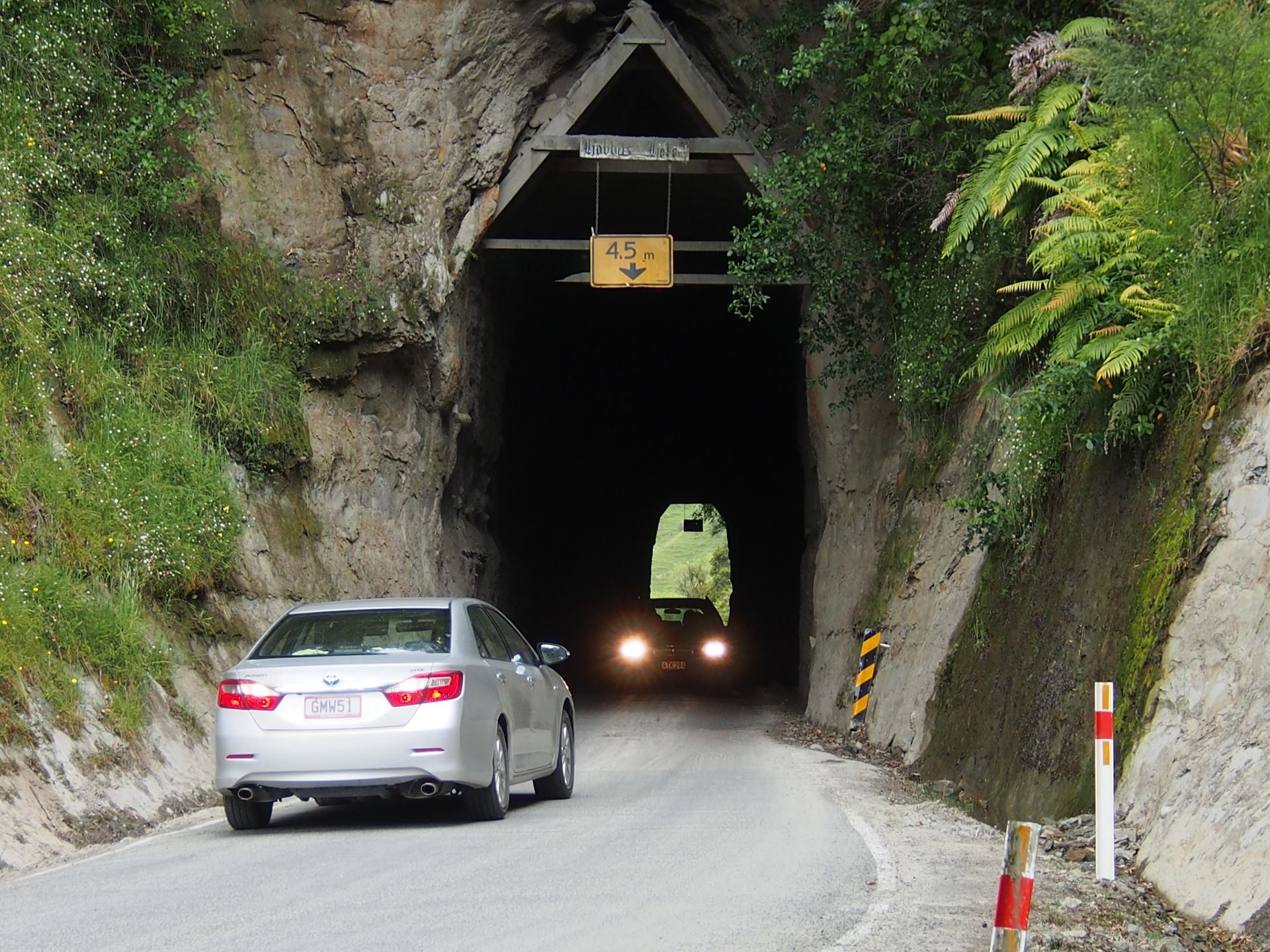
The single-lane Moki Tunnel is a nice photo opportunity for the few tourists traveling here. The right of way is somehow self-regulated. It was carved into a mountain here in 1936 and the walls are still raw rock in which fossils of giant crabs have been found.
I soon turn off towards a ghost town called Tangarakau, which is said to have had 1,200 inhabitants in the past. Another 6.5 km of sandy road, which is so narrow that it clearly only has two tire tracks, and yet one has to be prepared for oncoming traffic - if more tourists have ventured here. A few goats jump across the sandy road and a mini little hare - otherwise I am surrounded by sheep and cattle and some beehives in green meadows. At the end of the quite passable route, there are 2 houses inhabited by some strange figures and I turn around without getting out, as I can't really assess their hospitality. So back again and then on to the highway, which is now asphalted again. After several turns, I reach Whangamomona, the only village that actually has some kind of life. This place has 40 inhabitants, whose cultural center is the Whangamomona Hotel, which is also a restaurant and a pub.
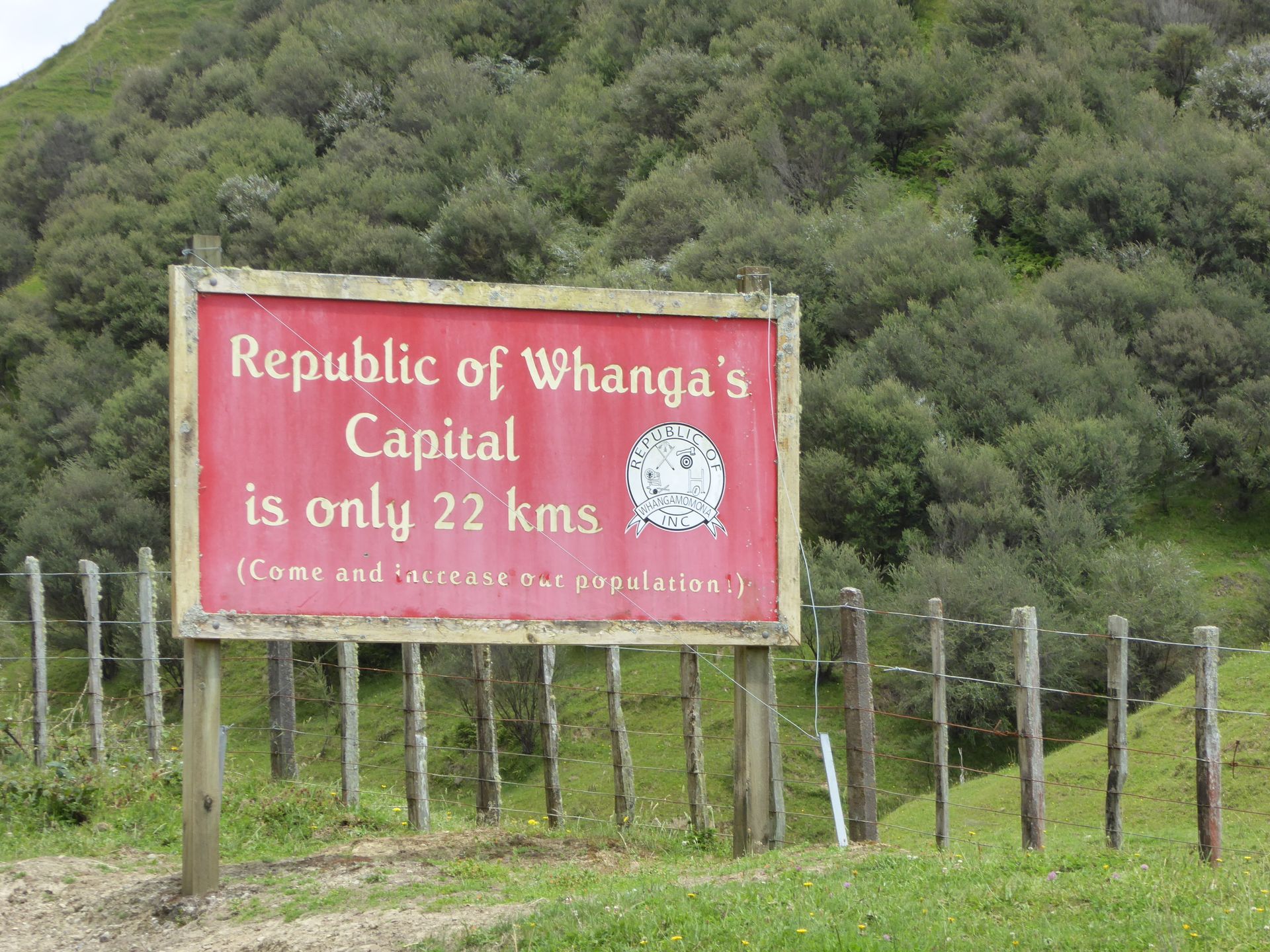
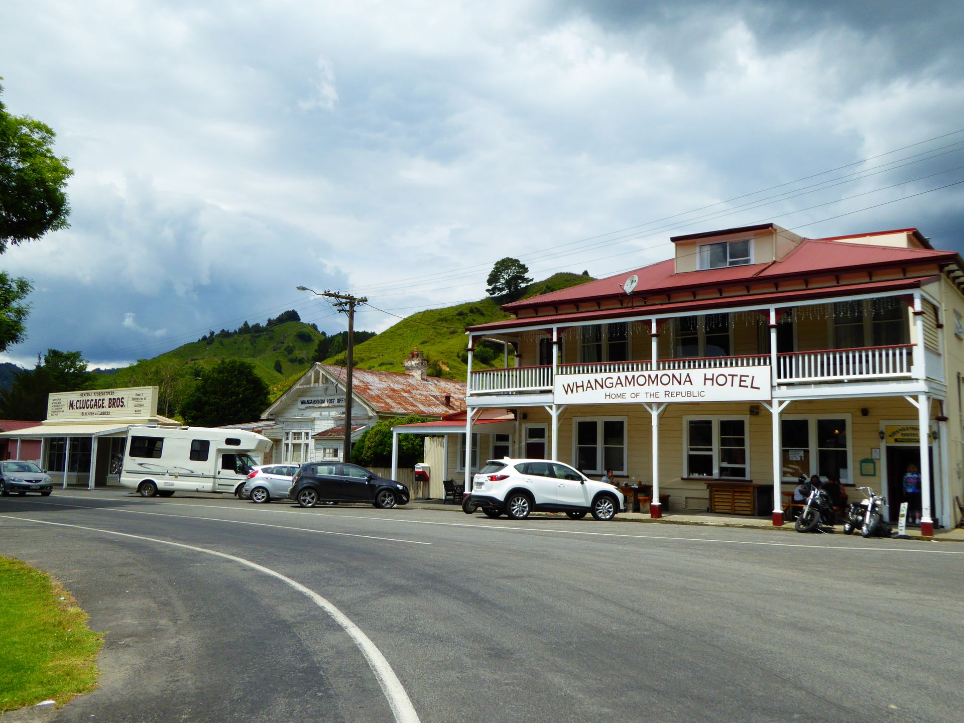
Outside, there are a few tourists sitting - because not many people travel on this route. It is winding and it takes about 3 hours of pure driving time for the 155km (without stops). What is very funny about this place is that in 1989, the residents declared the "Free Republic of Whangamomona" in protest against a territorial reform. They have their own passports and entry stamps, which tourists can buy for a few dollars, and every two years in January they celebrate Republic Day. The sign is already hanging on the fence. On that day, there are all sorts of funny activities and non-residents require a visa. Anyone who wants to participate in events such as cow dung throwing is welcome.
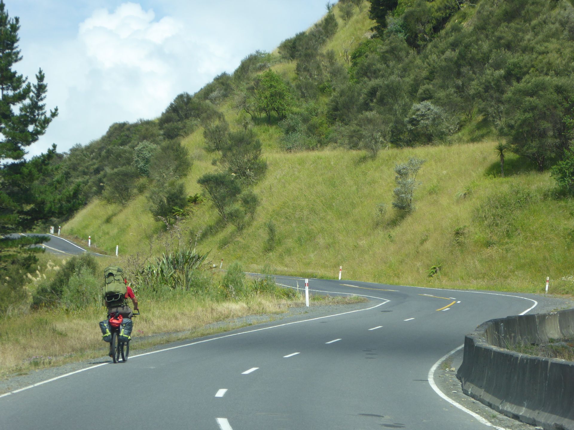
I take some photos of the few very nice old houses (again poorly maintained) and continue driving. The temperature is now 26 degrees! But the joy of the weather doesn't last long. As I climb higher on the road to Tahore Saddle, the sky becomes darker, the temperature drops rapidly, and then such a storm breaks out that I pull over and wait for half an hour, as the winding roads become real slippery slides in these masses of water.

Afterwards, the rain doesn't stop and I continue driving at 35-40km/h. Likewise, my actual highlight of the day, Mount Taranaki, is covered in thick clouds when I reach Stratfort and I should be able to see it on the left. So I keep driving, also because Stratford doesn't have even a fraction of the charm of its British namesake, but is once again one of those ugly roadside villages that unfortunately exist everywhere in New Zealand. Empty shops, rundown stalls, a few shops and residential areas, and boom - you're through.
About half an hour later, in New Plymouth on the west coast, I visit the tourist information, which is still open.
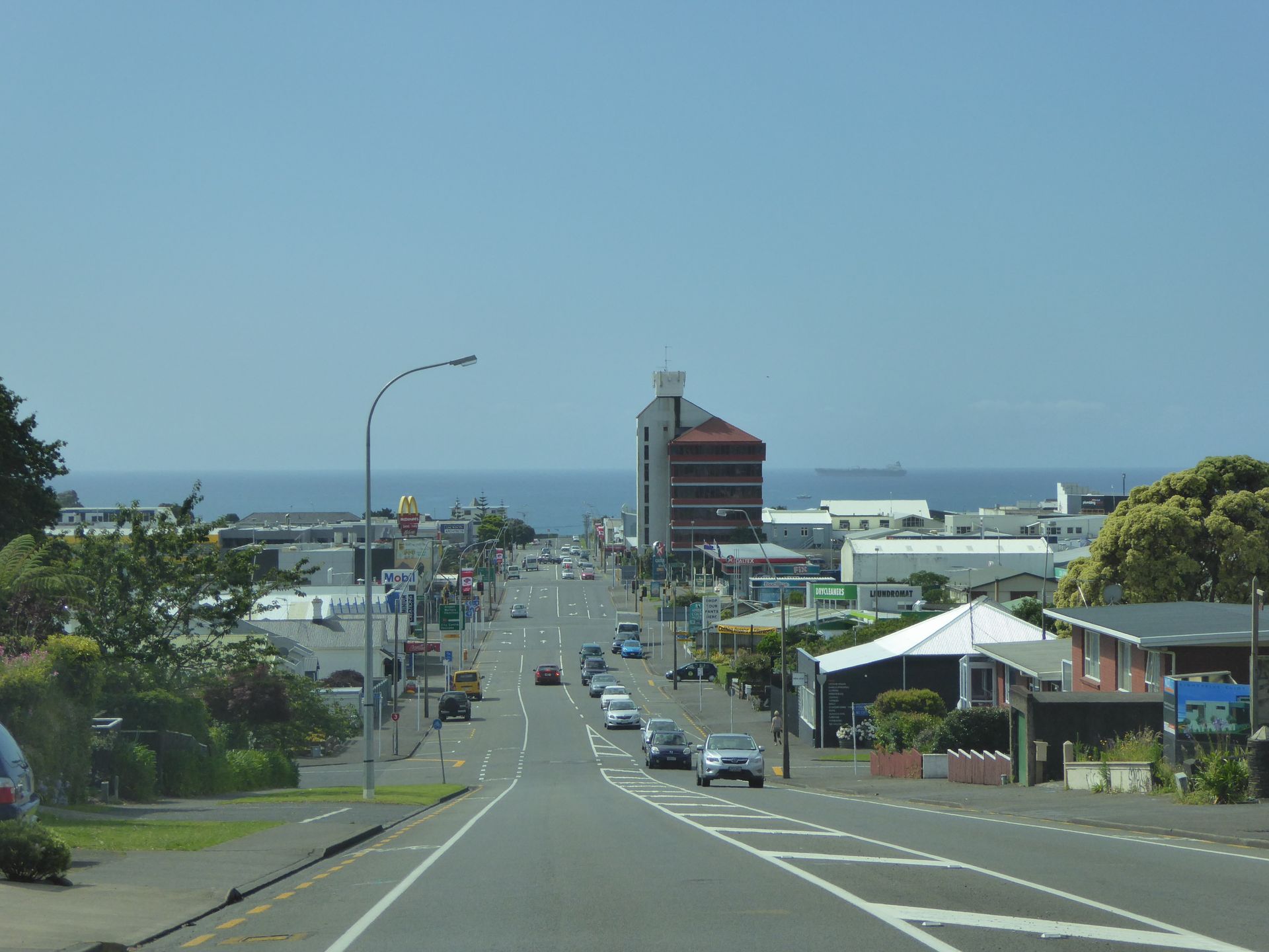
It's 4:30pm and it took me quite a bit longer on the route than expected. The information here isn't really helpful in terms of the view of the summit of Mount Taranaki. So I first look for a motel and decide to stay here for only one night. The Coronation Court Motel is the cheapest I can find at $99, and the room is spacious.
I drive around in search of a good viewpoint and find the city of New Plymouth surprisingly nice. Some restaurants, some more like takeaways, and several closed cafes can be seen. It's surprising for a Monday around 5pm. But the entire city center is pretty deserted because all the shops have closed again, except for two large supermarkets on one of the main roads.
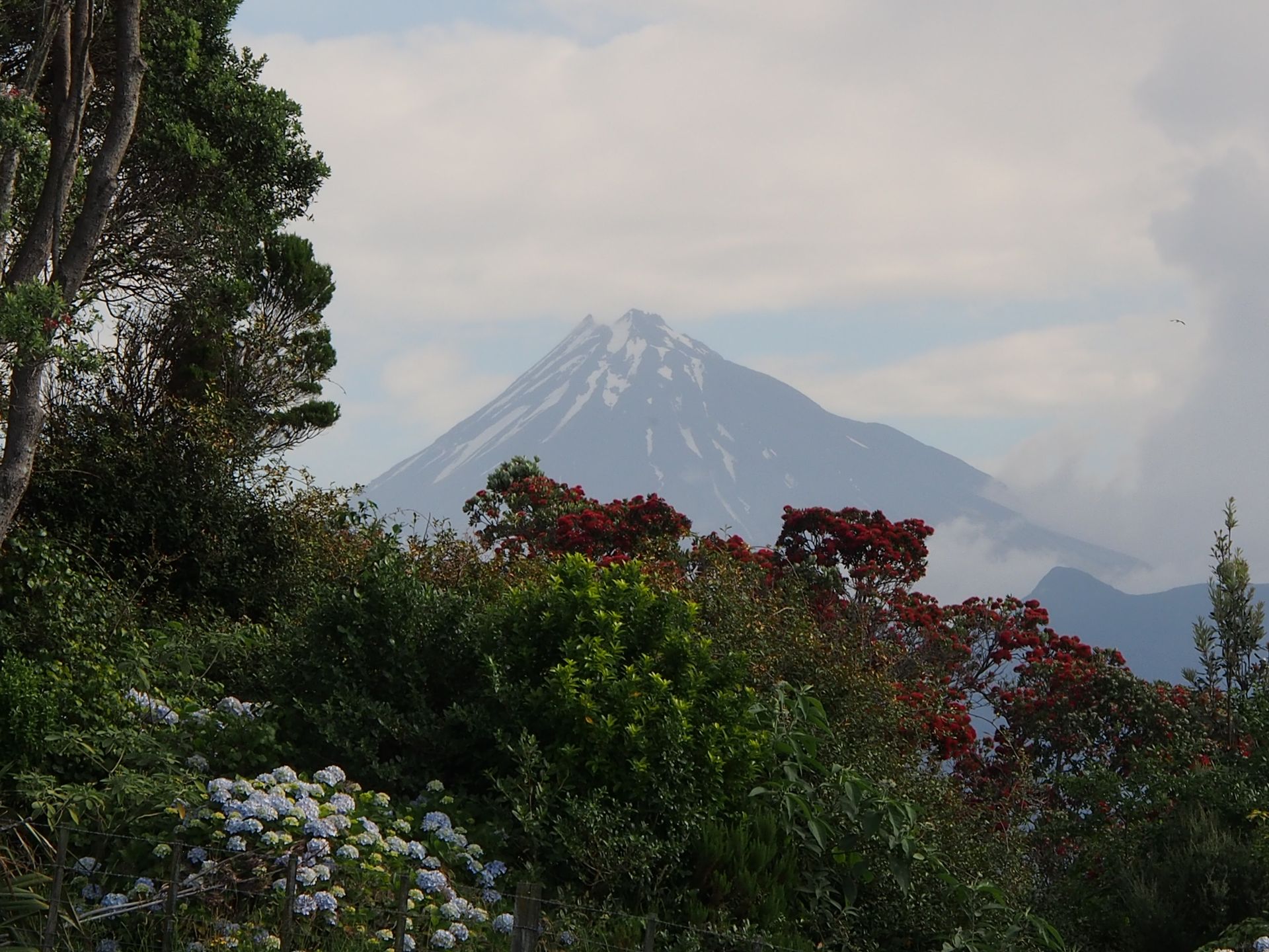
I find a small hill and am thrilled that, of all times, the sky above the summit of Mount Taranaki clears up and I actually get a great unobstructed view of this almost perfectly round volcano, which is considered one of the most beautiful mountains in the world.
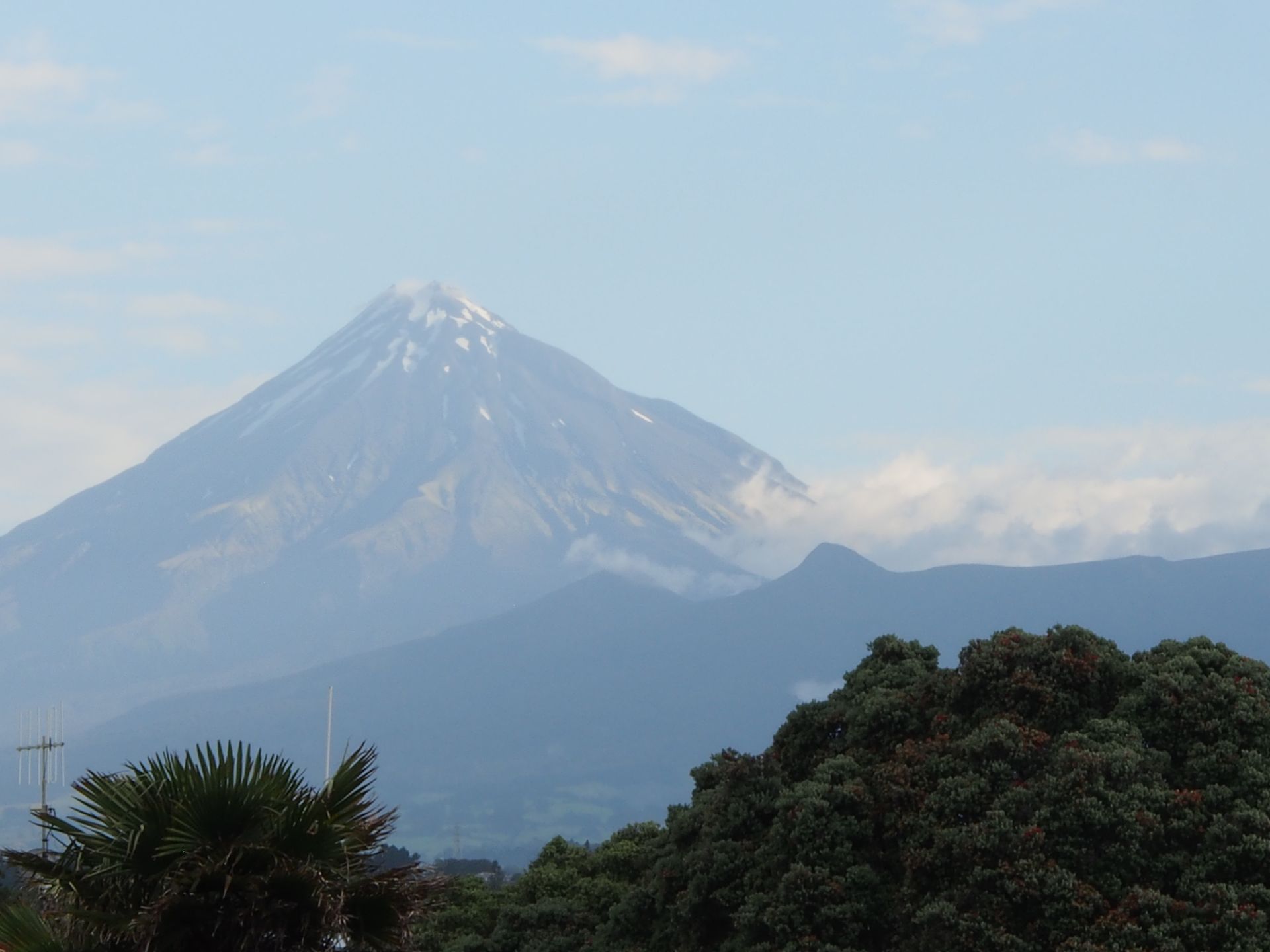
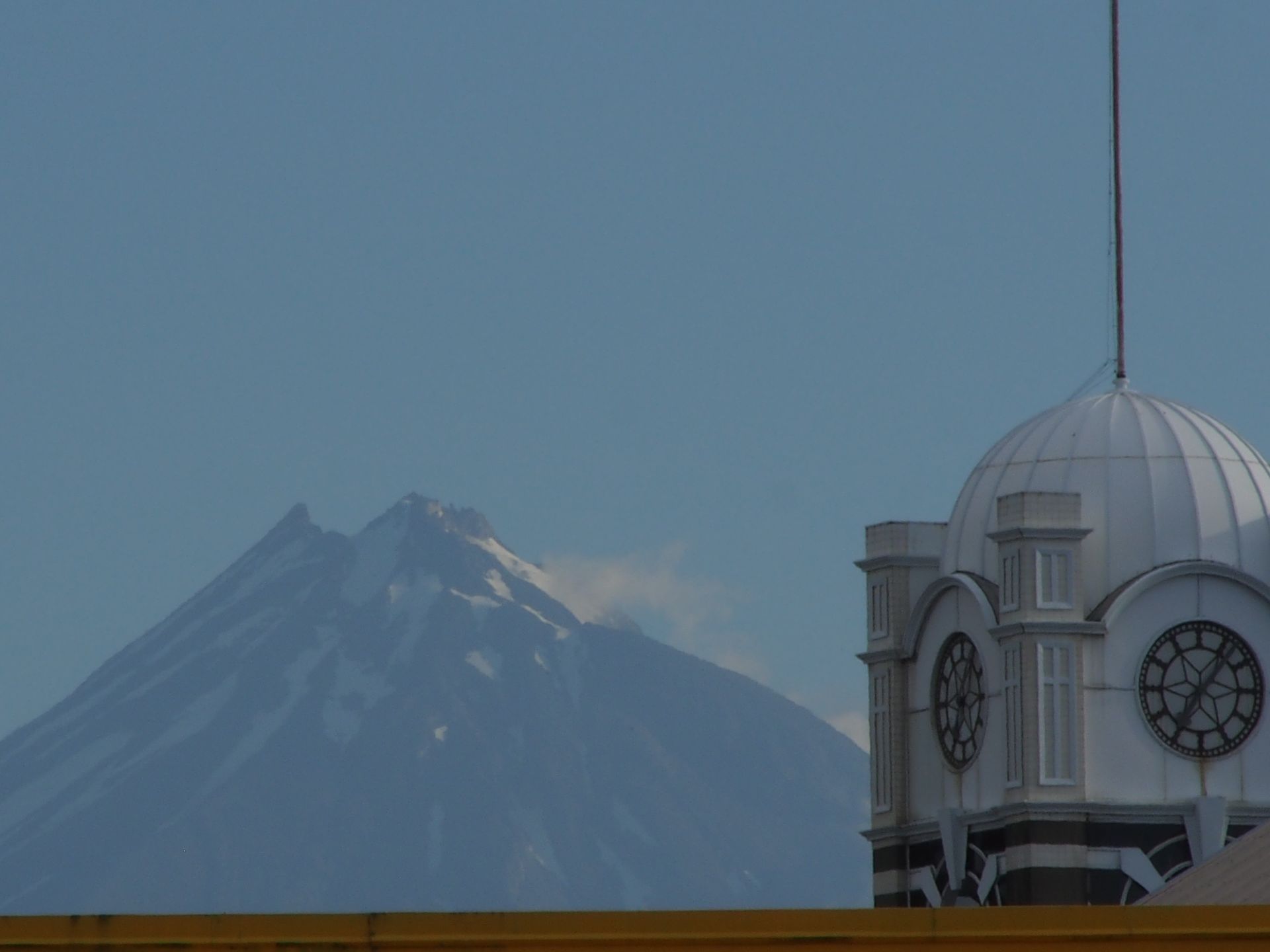
In Maori culture, this mountain also has a story. Originally, Mount Taranaki belonged to the other three volcanoes that I circled yesterday. Somehow, Taranaki approached the wife of the mighty Tongariro and this led to a fierce conflict with eruptions and anger, which ended with Taranaki's defeat and its escape to this bulge in the west of the country. The 2,500-meter-high summit of the volcano is covered with snow - which is not so pronounced in summer. According to legend, the many rivers flowing down the slopes from the summit are tears shed by Taranaki for lost love.
I drive down to the waterfront and enjoy about an hour in beautiful sunshine, until I gradually start to get hungry, even though the view of the Tasman Sea, the almost black sand, and the many moss-covered rocks in the surf is really beautiful.

I go to Countdown, one of the two supermarkets, which has a slightly better selection, and get some spreadable cheese and even some ham that I can put on my precious English Muffins tomorrow. I also buy one of the $5 yogurts and now I have secured breakfast for tomorrow as well as a snack in between. Because at these temperatures, I can't transport anything except cheese spread without refrigeration.
In the hotel, I write my diary until it's already 10pm. Tomorrow I will drive the Surf Highway - along the coast of Taranaki, as this region is called.
Daily distance: 224 km
Подписаться на новостную рассылку
Отвечать

Отчеты о поездках Новая Зеландия