

California's coast between SF and LA
ପ୍ରକାଶିତ |: 08.09.2023


ସମ୍ବାଦପତ୍ରକୁ ସବସ୍କ୍ରାଇବ କରନ୍ତୁ |
We continued south, following as much of the coast as possible. This largely corresponded to US Highway 101, but here in California there is also California State Highway 1, which mostly runs along the coast and often coincides with Highway 101. Our route ultimately consisted of sometimes 101, sometimes (California) 1 and sometimes both at the same time. However, we couldn't drive along the entire route along the coast because part of it is currently closed due to a landslide. We have also found a suitable solution for this situation.
But first we wanted to check the tire pressure in our car at the nearest gas station in San Francisco, because the indicator light was still on. Neither of us have ever owned a car and have only pumped up bicycle tires at a gas station, but we were confident that we could handle the air station at an American gas station. We didn't do that and the driver who was waiting behind us showed us where the air pressure is actually displayed. Then we were able to read a number without a unit, and we didn't yet know whether it was actually given in one of those terrible American units that are often used here for air pressure (PSI = pounds per square inch, so doubly crazy) or something other. We asked at the gas station, but the employees told us that the display was broken and that we should go to another gas station. They probably didn't feel like explaining this to us Europeans, because at the next gas station everything worked the same way and the employee confirmed to us that it was PSI. This made us sure that one of the tires actually had too little air and we were able to inflate it so that the indicator light finally went out.
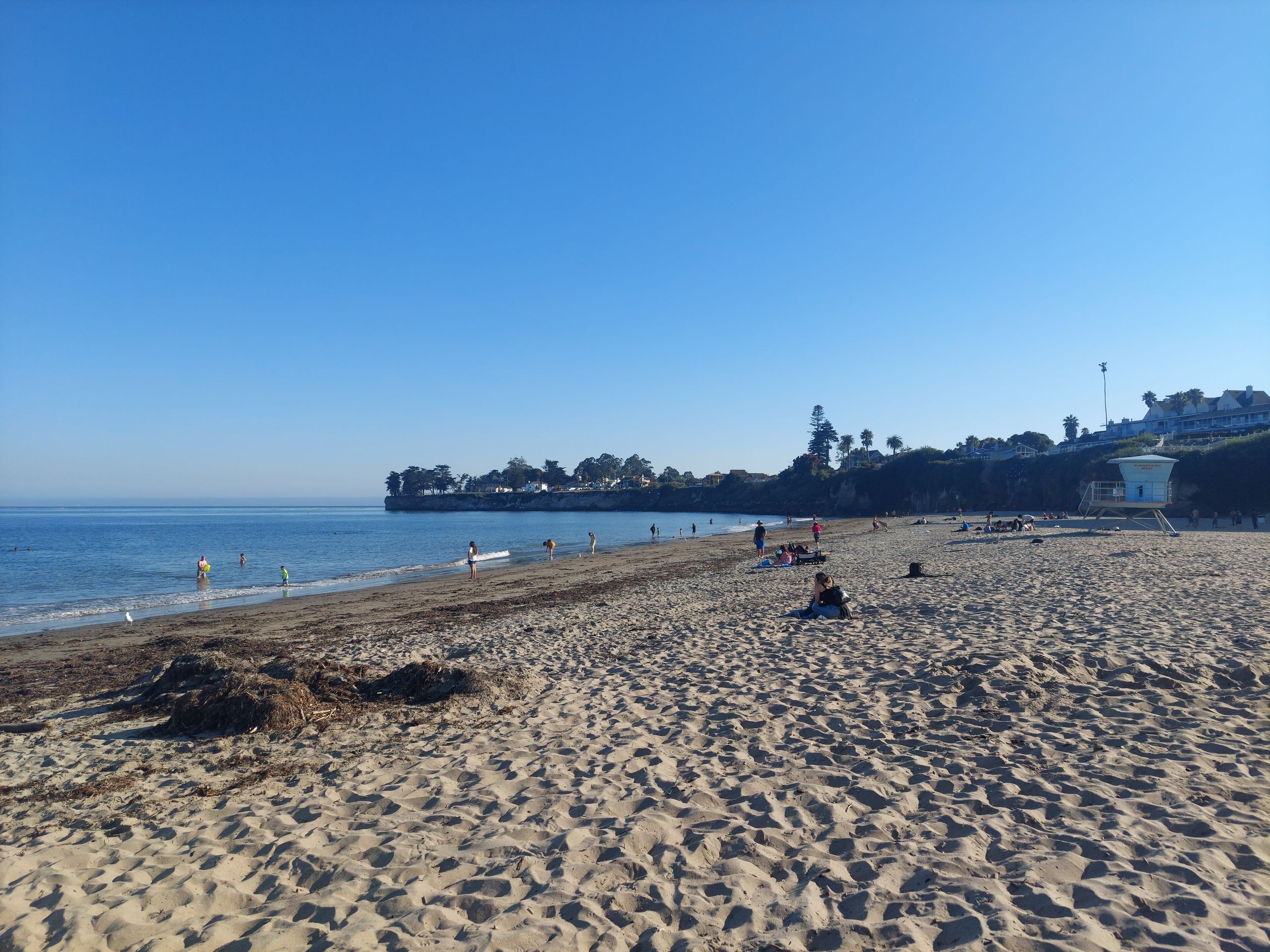
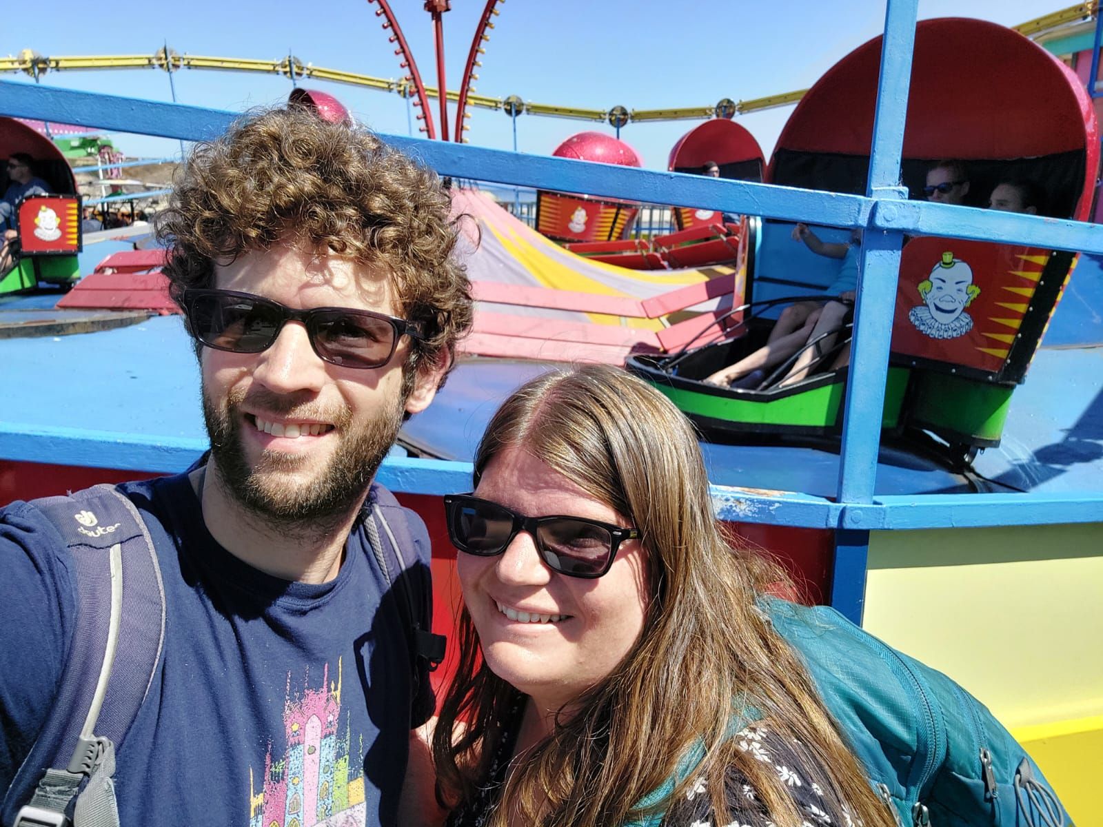
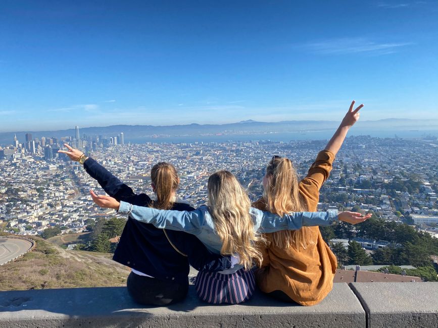
We then drove to the free Land's End Lookout on the edge of San Francisco, from which you should have a view of the sea. There was a clear warning about break-ins at the parking lot, we had just read about the last break-in the evening before in the Google reviews and we could also see splinters of glass from a broken window. Judith had experienced herself having her car broken into and most of her luggage stolen at another lookout point near here a few years ago, and the police and car rental company said at the time that this happened all the time. That's why we preferred to get out one after the other, just walk forward briefly and take photos - the visibility wasn't that good anyway. Afterwards we drove on Highway 1 to Half Moon Bay because a beach was recommended there. Parking there would probably have been safe, but it would have cost $10. While in the Pacific Northwest (as the region with the states of Washington and Oregon is called) parking on the coast was cheap, usually even free, in California it is much more expensive or even unsafe. Because in this case even the beach was closed without this having any impact on the parking fees, we didn't even drive to the parking lot, but went straight on to Santa Cruz, where there was an amusement park right on the beach. Parking directly in front of this so-called boardwalk would have cost $20, but we saved that by parking a little further away next to residential buildings. It seemed safe, it was free and this short distance wasn't too far for us, probably unlike average Americans. There was no entry fee for the boardwalk itself, just the individual rides. We first treated ourselves to a ride on a rotating ride. Afterwards, Sebastian really wanted to ride the Giant Dipper, an old wooden roller coaster, because he had never actually ridden on such a big roller coaster in his life. He had to convince Judith first, but in the end we sat in the front row and we both loved it. Afterwards we ate freshly fried corn dogs, because that's what you do at a fair here, and went to the beach a few steps away. There Judith read a bit and Sebastian went swimming in the Pacific for the second time. After lying on the beach for a while, we went to the car and drove to Monterey, the last town before the coastal road was closed.
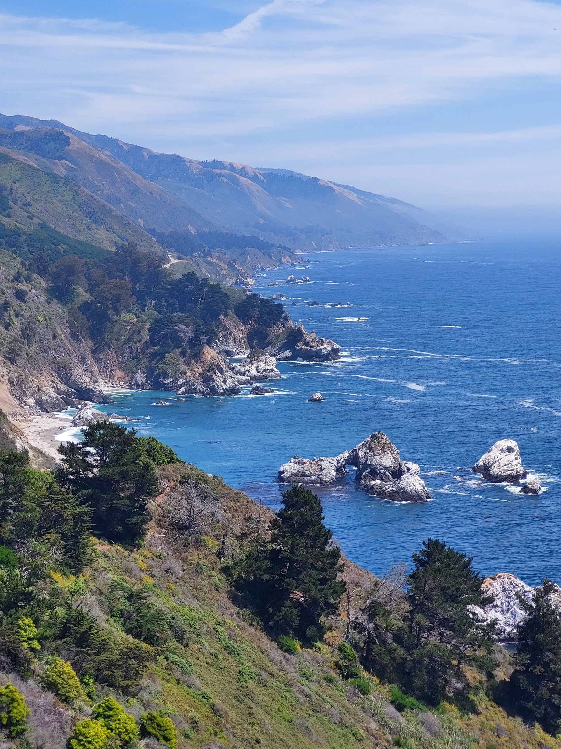
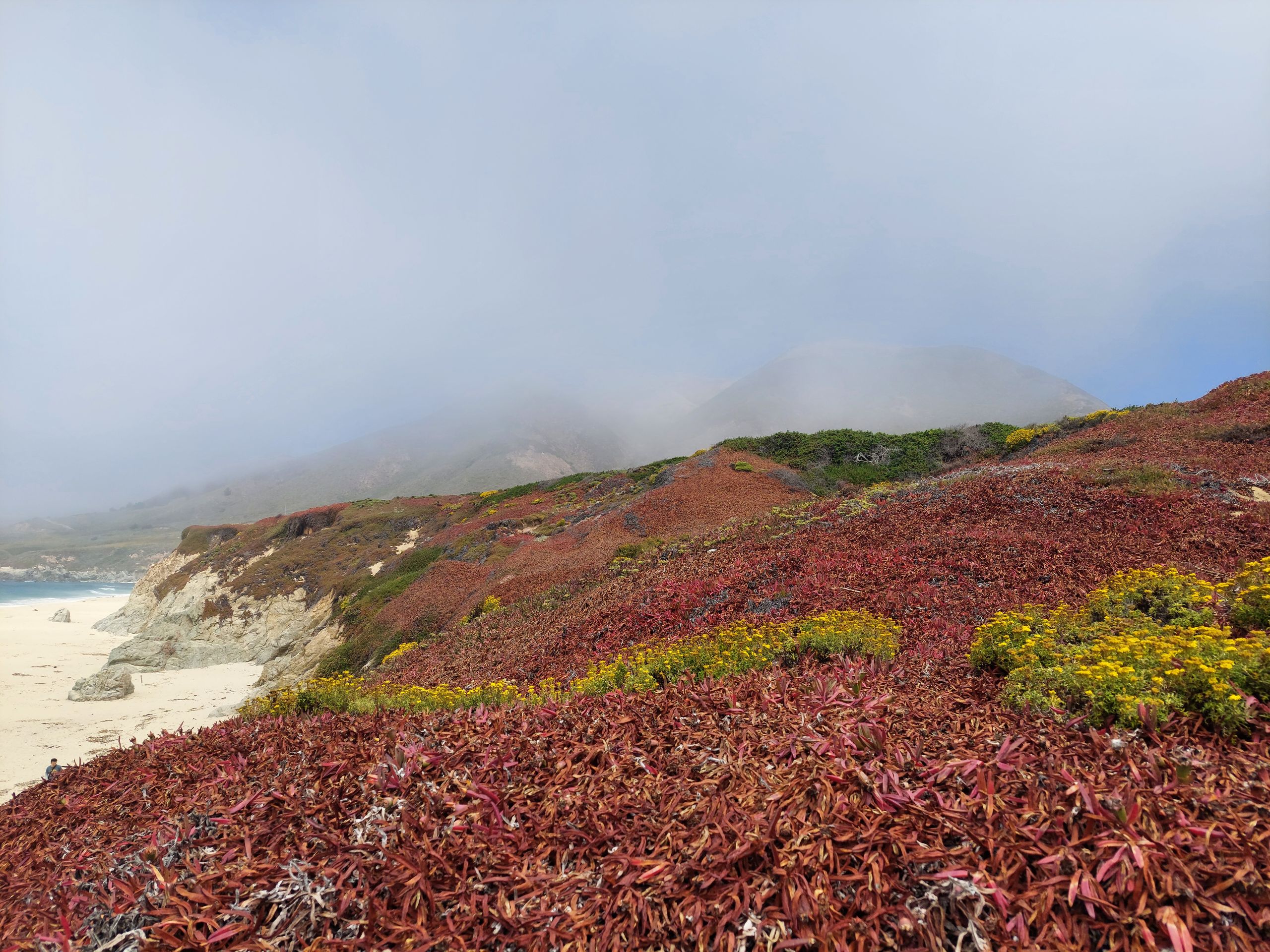
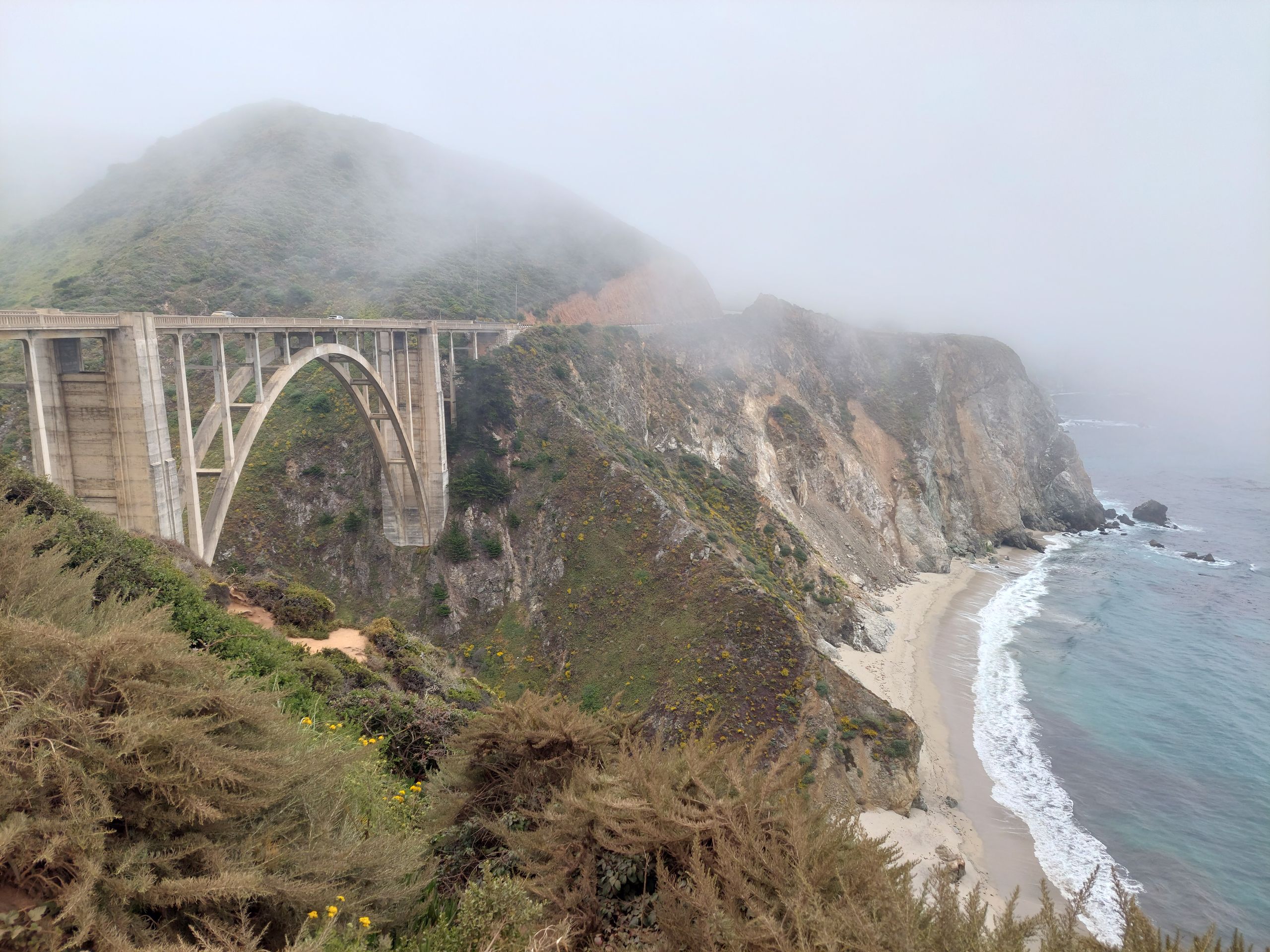
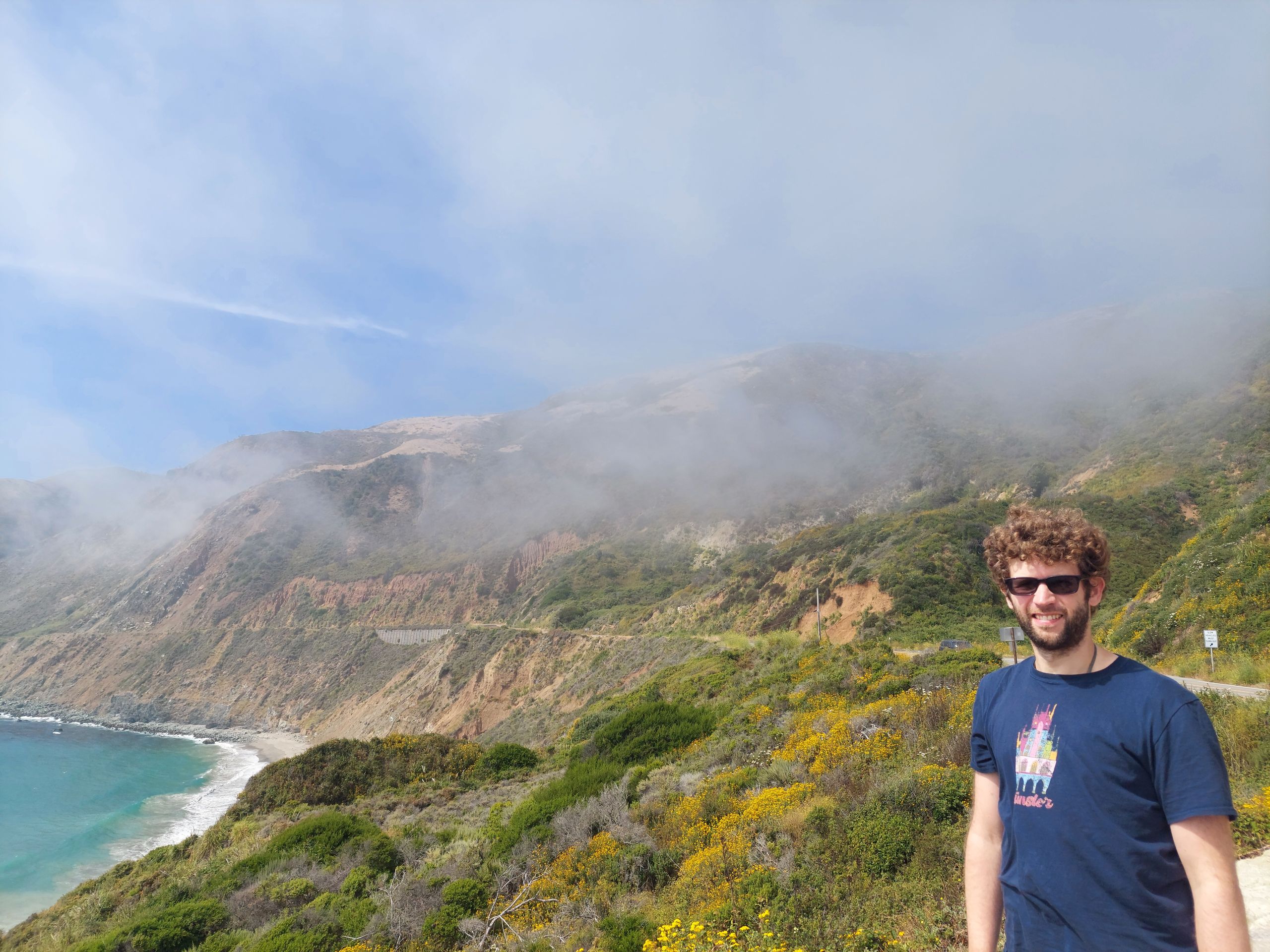
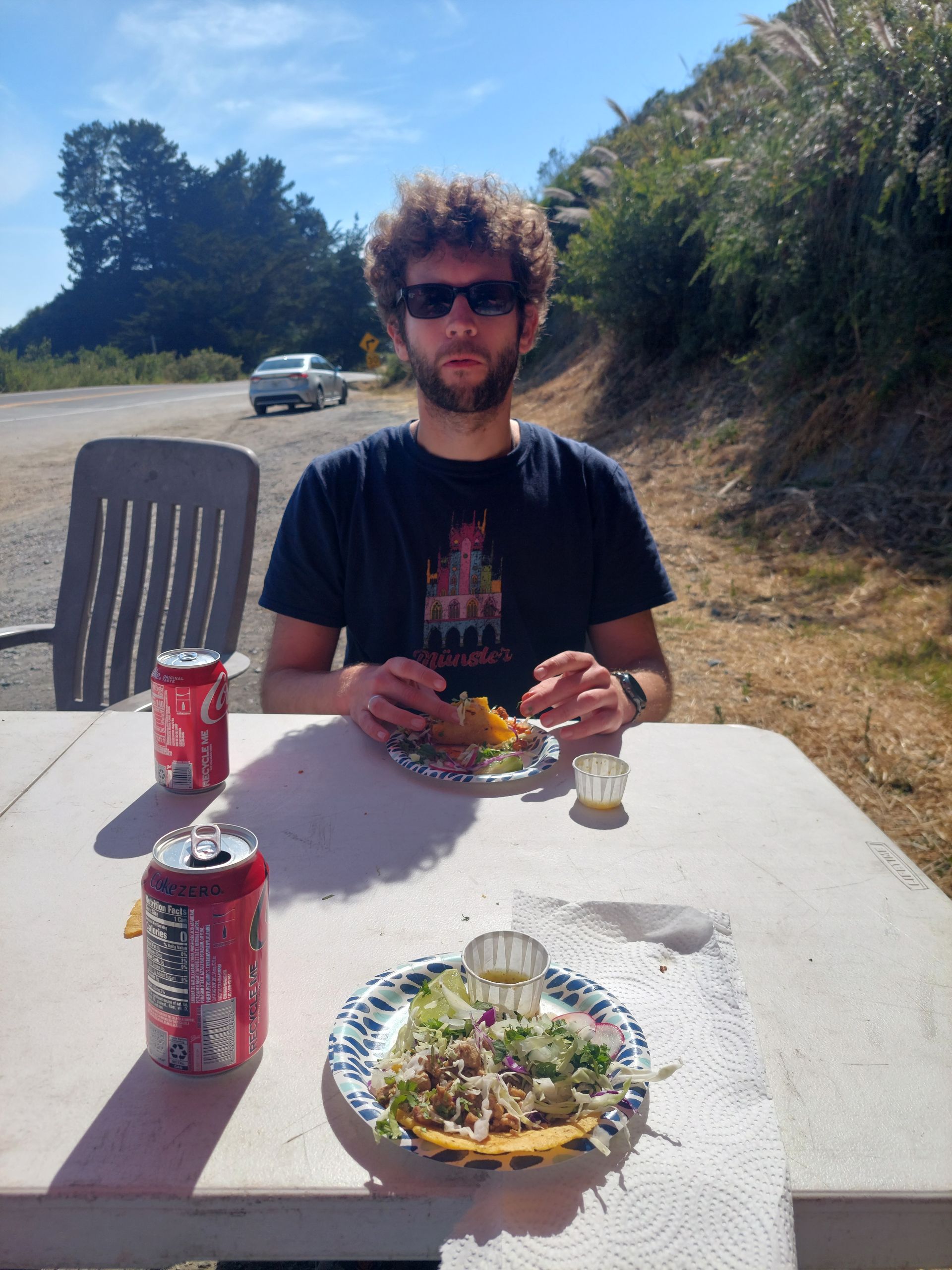
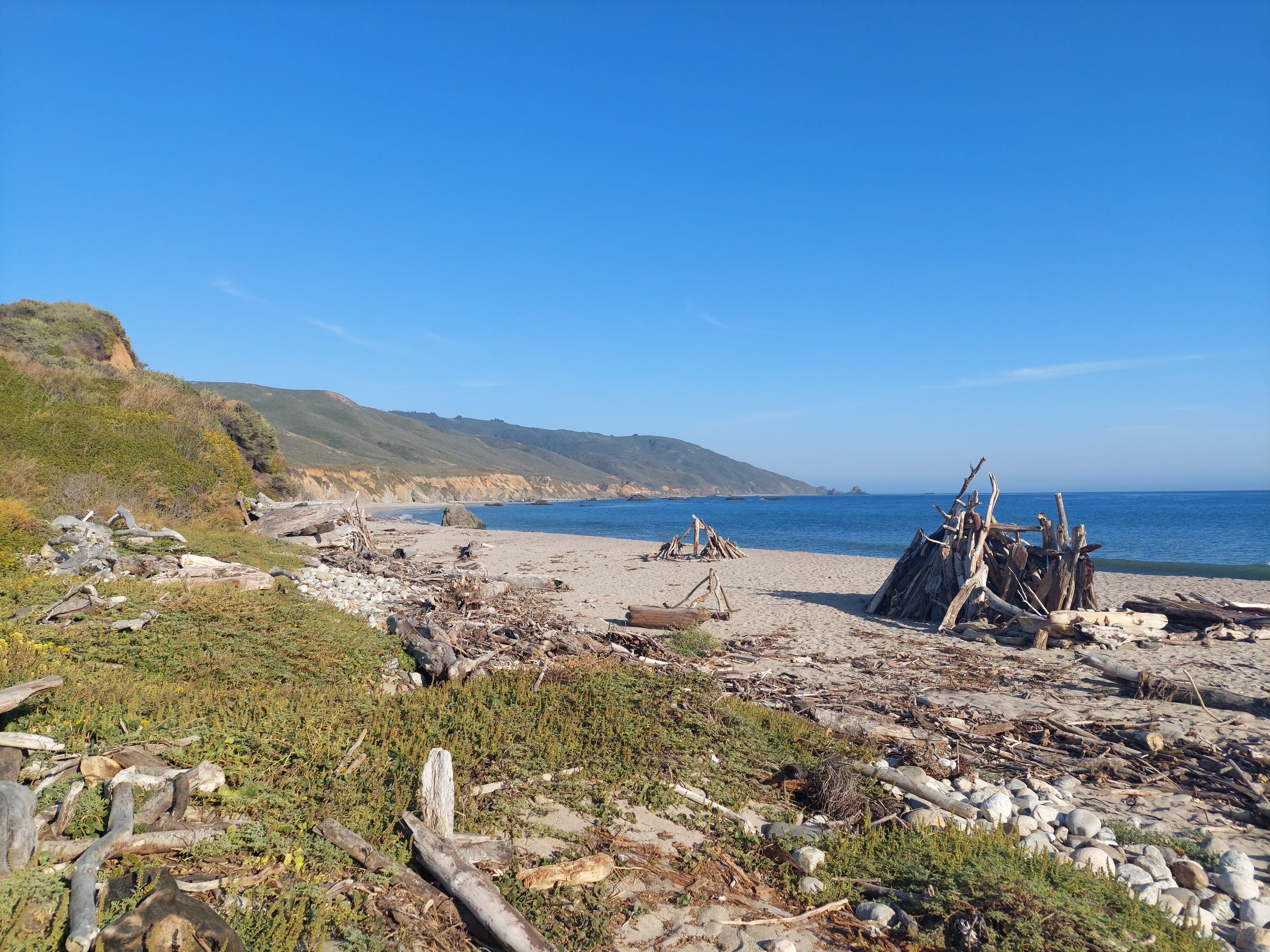
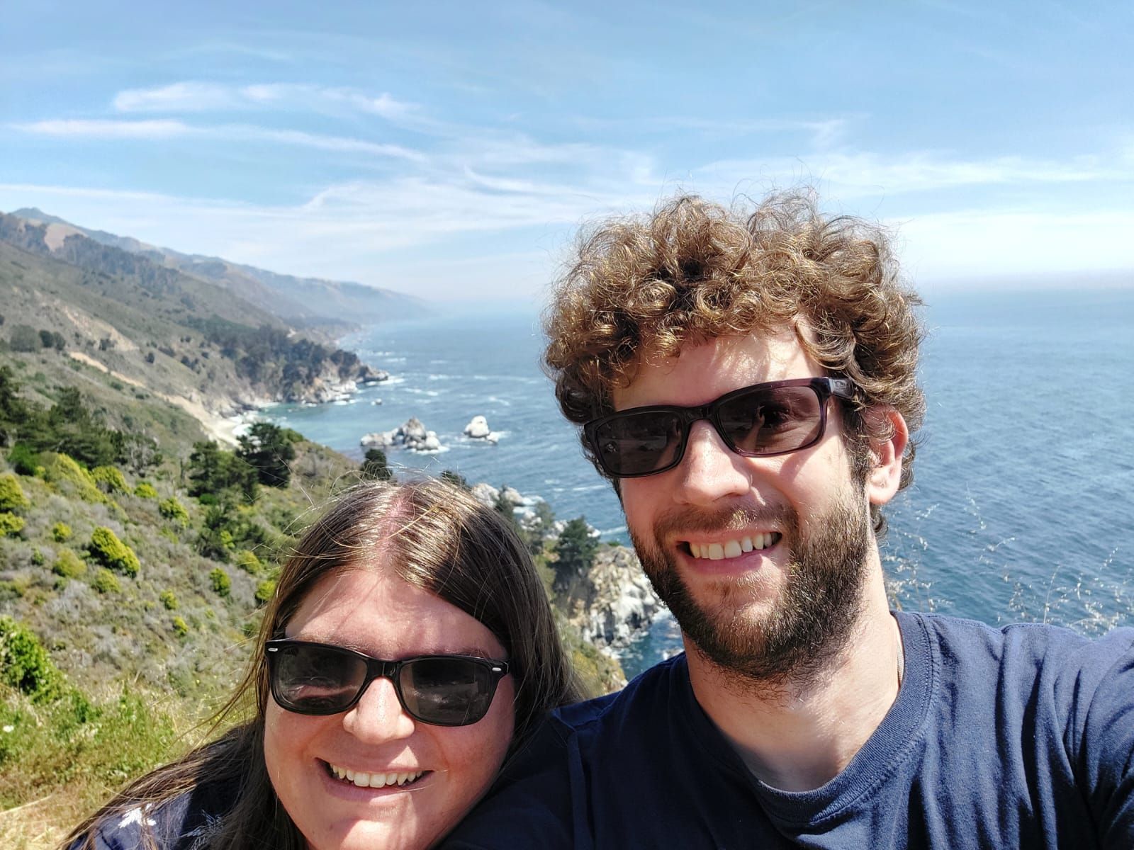
After the first night in Monterey, we drove along Highway 1 to the northernmost point of the closed area. As we got further and further into the region called Big Sur, we made many stops for photos, including at the Bixby Bridge, which is famous from many car commercials, and short hikes. At the ranger station we got information about possible routes and then drove to Julia Pfeiffer Burns State Park. Many paths were closed there, so we only walked a short way to the viewpoint of a much-photographed waterfall ending directly in the sea. We drove more and more towards the current end of the highway, which had fascinated us since we began planning this part of the trip. More and more signs appeared and the tension increased. "Road closed ahead, no departure." What would we expect here? It soon became clear: Unlike at the end of the universe, there is no restaurant at the end of Highway 1, but a taco stand. Whoever put this up must have been a very clever person. We ate tacos and drank drinks (again, getting better in Spanish than English) while watching other cars, apparently out of curiosity, drive past the very obvious and multiple barriers. Some of them came back, others didn't. Sebastian was a bit infected by this curiosity, but Judith didn't feel good about us bypassing the barrier. We met people from Canada who also got tacos and talked to them about this mystery and how to deal with it. Finally they drove past the barrier and we waited a little longer. They came back soon and told us that you really can't go much further and then you come across people working on the road. Glad to have solved the problem in this way, we drove back towards Monterey. However, what happened to the people who didn't come back will forever remain a great mystery. On the way back we stopped at Andrew Molera State Park, where we walked a slightly longer path that ended at a beach. There we suddenly saw two dolphins in the water. That was a foretaste of the next day, for which we had booked another whale watching tour.
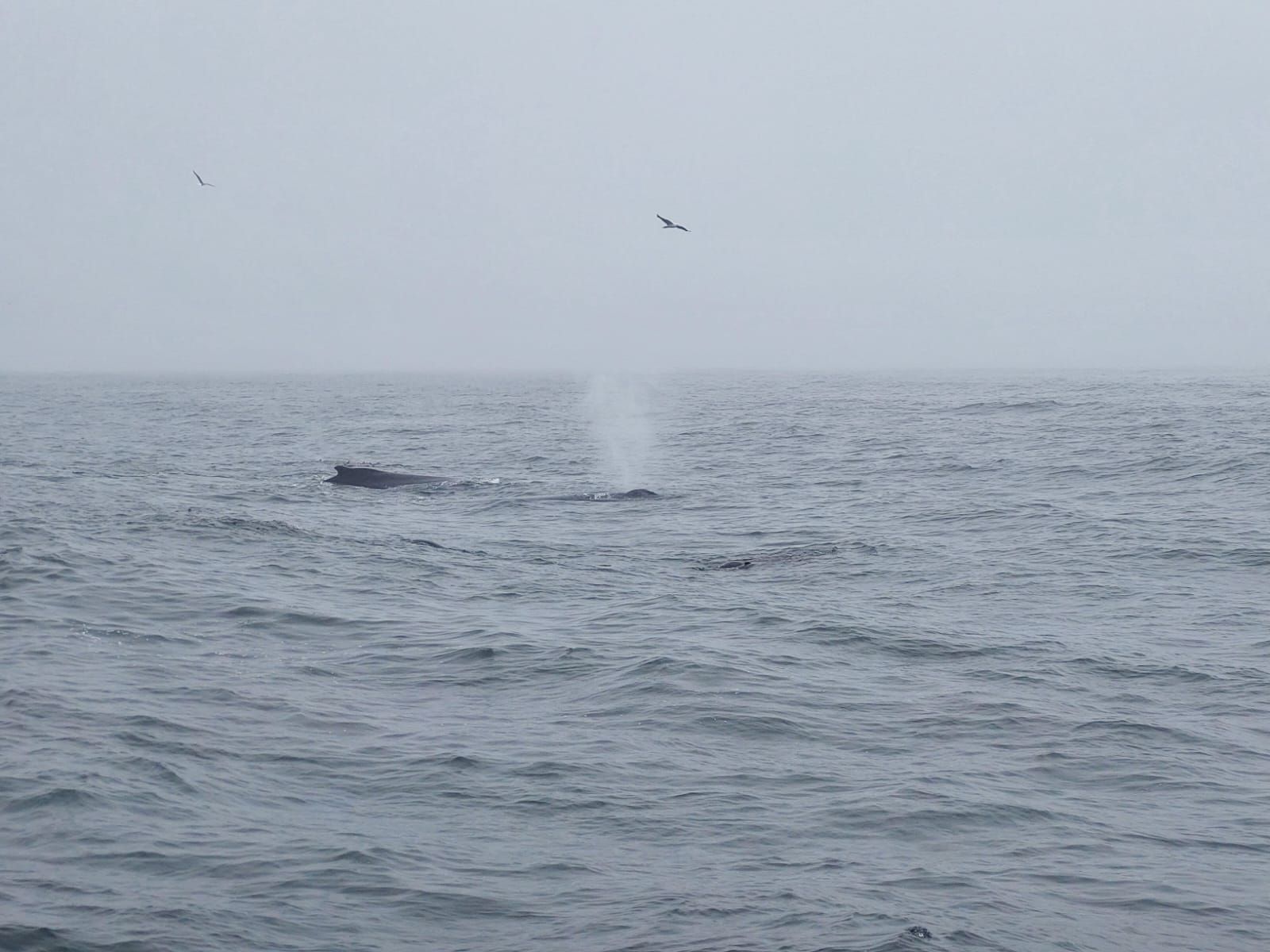
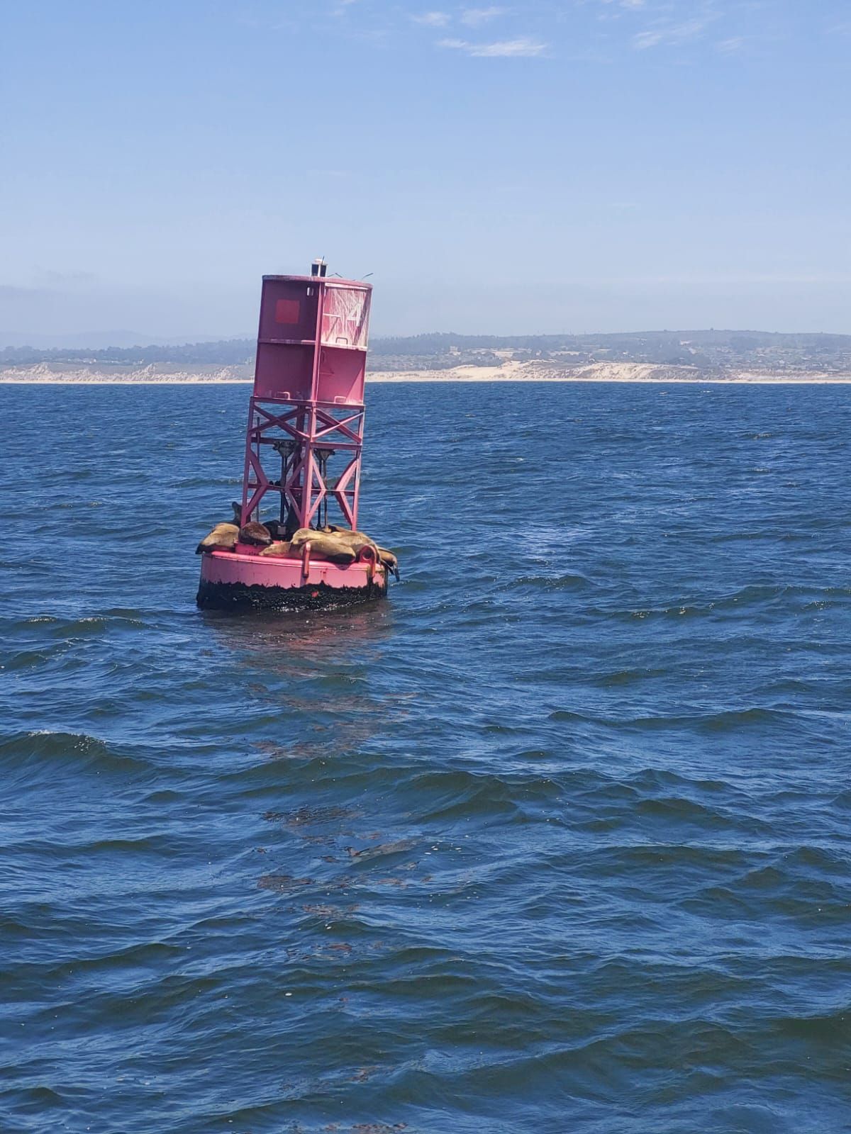
Monterey is a popular starting point for whale watching tours. After we had almost no luck in Iceland two years ago and not very much luck in Chile in May, we wanted to try it again here. We had booked with the provider "Monterey Bay Whale Watch", with whom Judith had already done a very successful tour on her last visit here a few years ago. We boarded a smaller boat and were greeted there by a young woman from France who guided the tour and provided background on the animals. Humpback whales swim in Monterey Bay, in English "humpback whales" and in English with a French accent "ömpback whales". First of all, we saw a sea otter in the harbor and, shortly after setting off, many cormorants. The weather was initially cloudy, but soon after setting off the first humpback whales appeared. We were able to watch them for quite a while. The sea was quite rough and several people were throwing up at the other end of the boat, but we had previously accepted the offer of free (or included in the high price of the tour) pills to prevent seasickness. We saw a mother humpback whale with her baby and humpback whales hunting with seals. Later it cleared up and we saw a few dolphins in the sunshine. Finally we drove back and docked again after a very worthwhile tour and four and a half hours at sea. We spent the rest of the day in town and on the seafront promenade seeing lots of seals and sea lions and learning about the differences between the two. The easiest way for us to tell them apart was when they were moving: sea lions can use their front flippers to support themselves and thus "run forward". Seals, also known as seals, can only seal. In town we went to a candy store, among other things, but there were no prices anywhere. It's a shame, then we didn't buy anything there. In the US, it seems to be more common for some items to not be priced in stores, which would probably not be legally possible in Germany. We had already experienced so much on the high seas that day that we just fell asleep on a bench and when we sat down in a burger restaurant in the evening it was as if everything was still swaying.
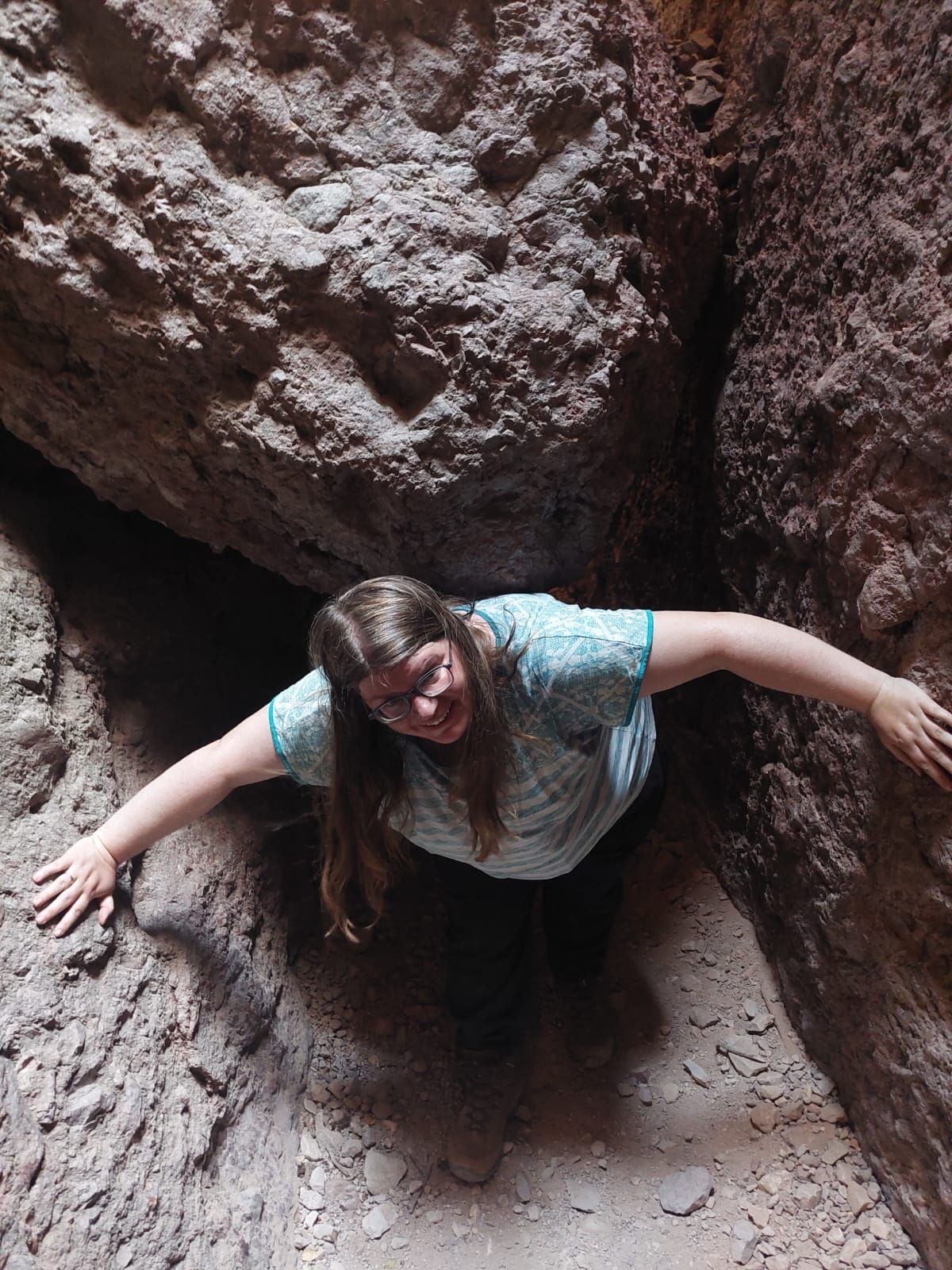
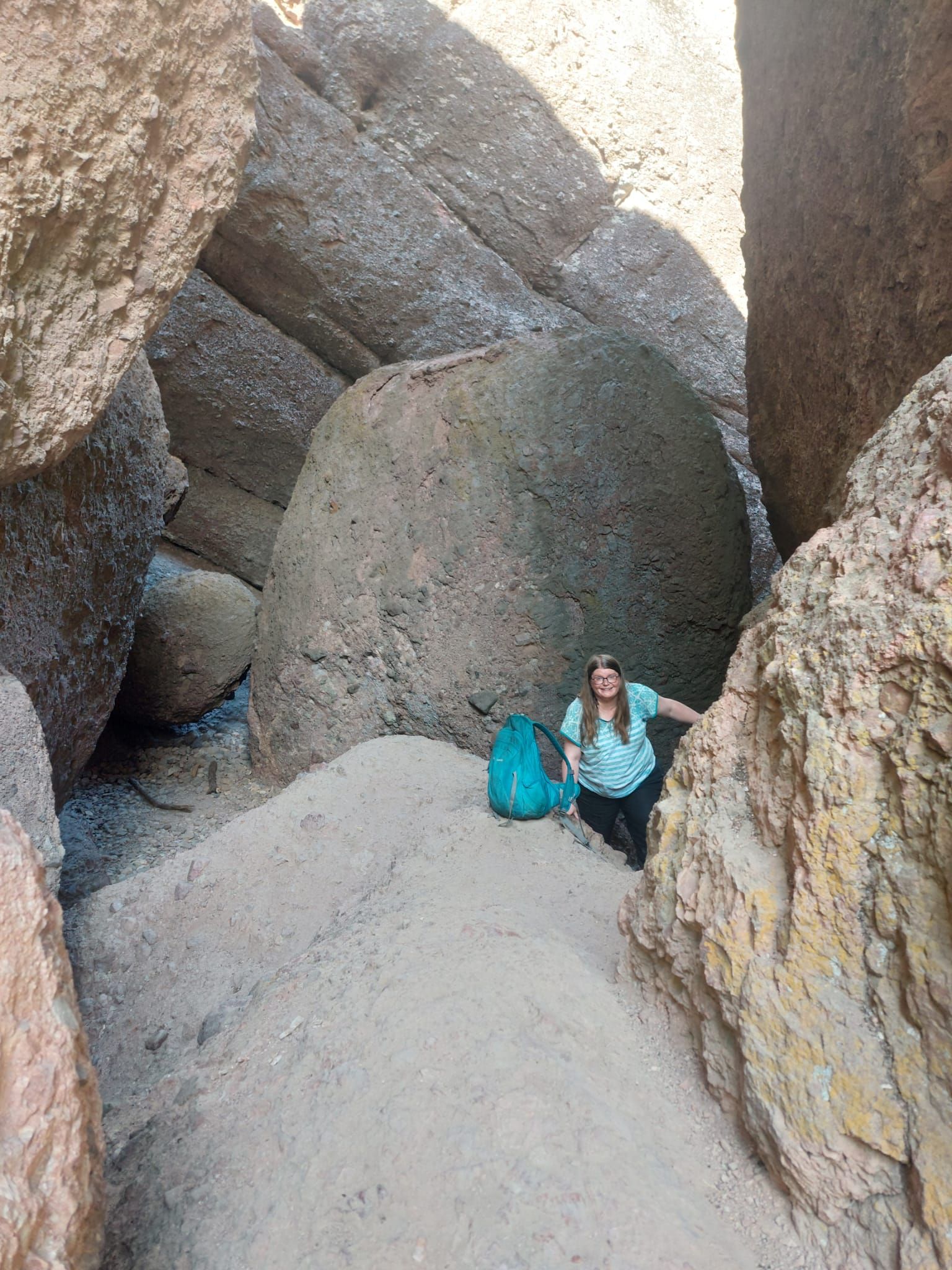
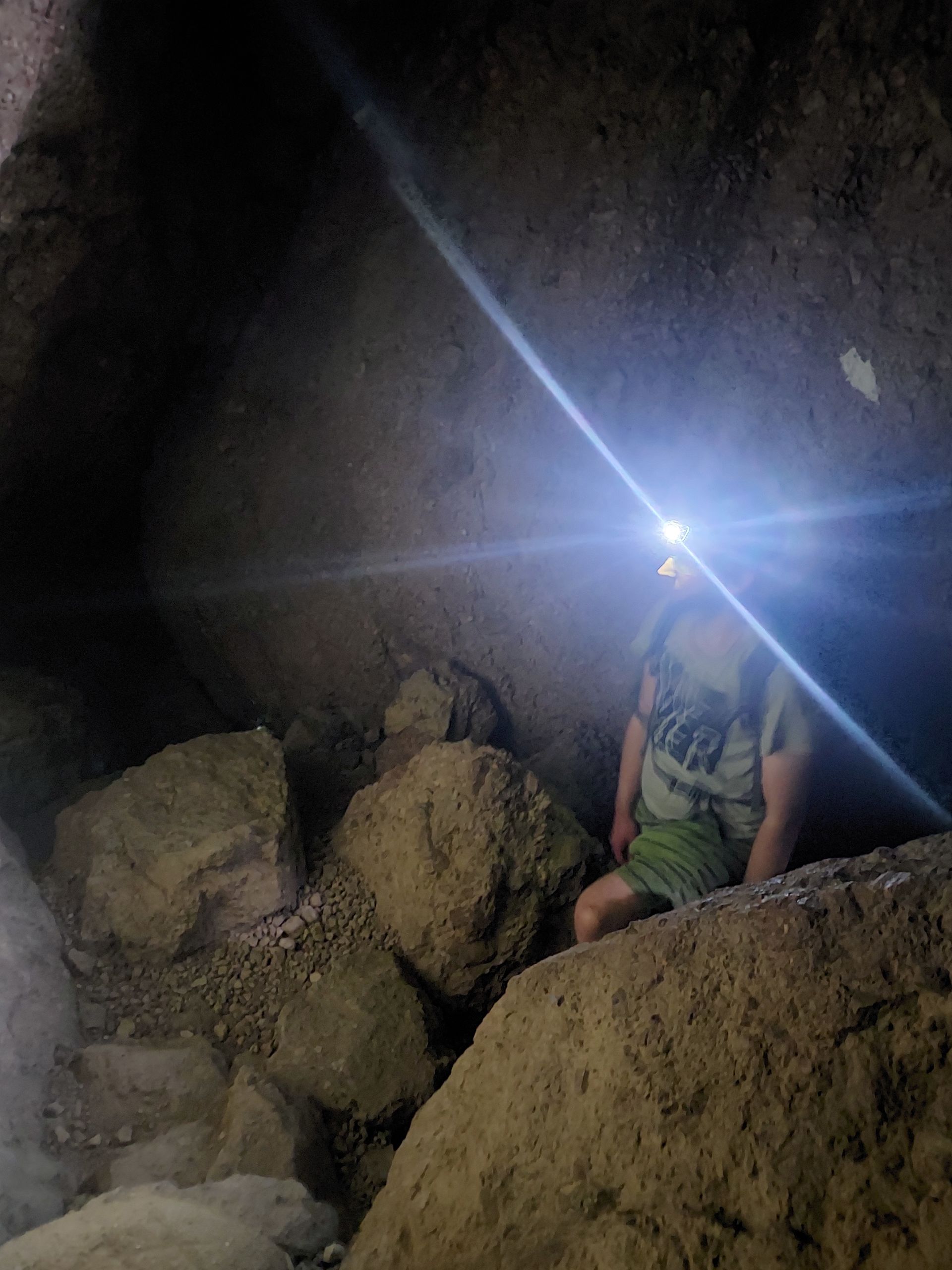
Of course, since we wanted to continue along the coast south of the road closure, we next wanted to get inland to San Luis Obispo, the next place from where you can get back on this road. This had the positive side effect that another national park was close by, which is exactly at the level of the barrier and which we therefore also wanted to take with us: The lesser-known Pinnacles National Park, in which it was supposed to get very hot again. We were able to try out how we would get along after driving the entire coastal road in later national parks in desert regions where it would certainly get hot, even if we hoped that at least the heat bell would have warped. Before we drove to Pinnacles National Park, we bought two large water cans from a supermarket in preparation. We also re-inflated the same tire as before at a gas station because the indicator light had come on again. (In San Francisco the air was still free; here we paid $1.50.) In the national park it was around 100°F, which is 38°C. Quickly converting between these units using the cruel exact formula to understand the weather forecasts is also relatively annoying, but we got into the habit of interpolating between two values that were important to us at the moment and that were easy to remember: 20 °C is 86°F, which is the year we were born, and 30°C is 104°F, which used to be our room number (although of course we can't remember our constantly changing room numbers, but it somehow works). Through this heat we now walked an easy to moderate hiking trail. There were signs on signs telling the Americans who were happy to warn that you shouldn't actually go hiking at this time of day because of the heat. We were careful and took lots of breaks. We first walked up and down the Balconies Cliff Trail and then the Balconies Cave Trail. This led us through a cave, which is why a headlamp was recommended, but we even had it with us. We actually had to use them sometimes to find the way, and in between we had to do a bit of climbing. We didn't see any of the eponymous pinnacles (rock needles), which are supposed to be somewhere in this park, on this path, but the cool cave was of course just right for this weather and it was a bit fun too. We passed our test for the next hot national parks and were able to drive back towards the cooler coast to San Luis Obispo. When we stayed there, we were rewarded with free cookies, free warm apple cider (this refers to non-alcoholic, unfiltered apple juice) and vouchers for a wine tasting in the hotel's own restaurant. Of course we redeemed these and drank red wine, white wine and sparkling wine. A little tipsy, we then went to a nearby pizzeria and started the complicated calculation of the appropriate pizza size. Once we came up with the right area formula, we found that two 8" pizzas were more expensive overall, but still less than half a 14" pizza. Conveniently, there are often half-and-half pizzas here, the halves of which can be ordered with a choice of different toppings. So we ordered a 14'' half-and-half pizza and shared it because that size was recommended for two people at our last pizzeria in San Francisco and actually fit. Despite the extensive considerations, this pizza ended up being too much for us, probably because of the thick topping - so it's well-intentioned that most pizzerias specify the diameter of the different sizes, but basically you can't do anything with it and one It would be better to specify the volume... We packed half of the pizza and put it in the trunk overnight.
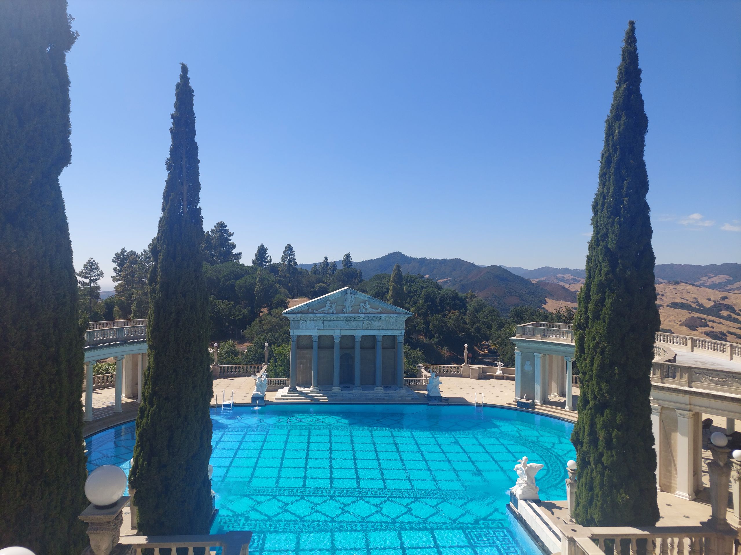
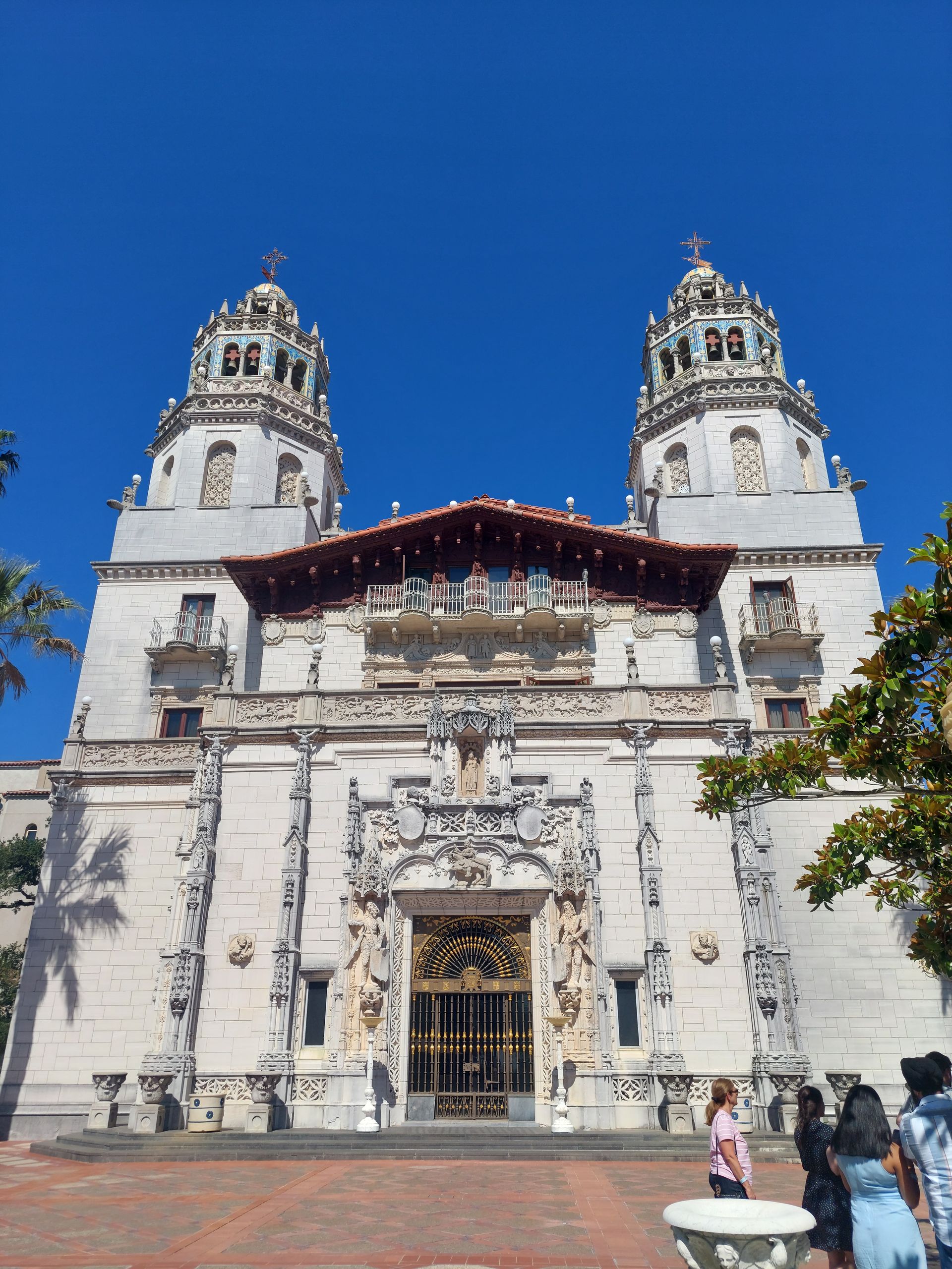
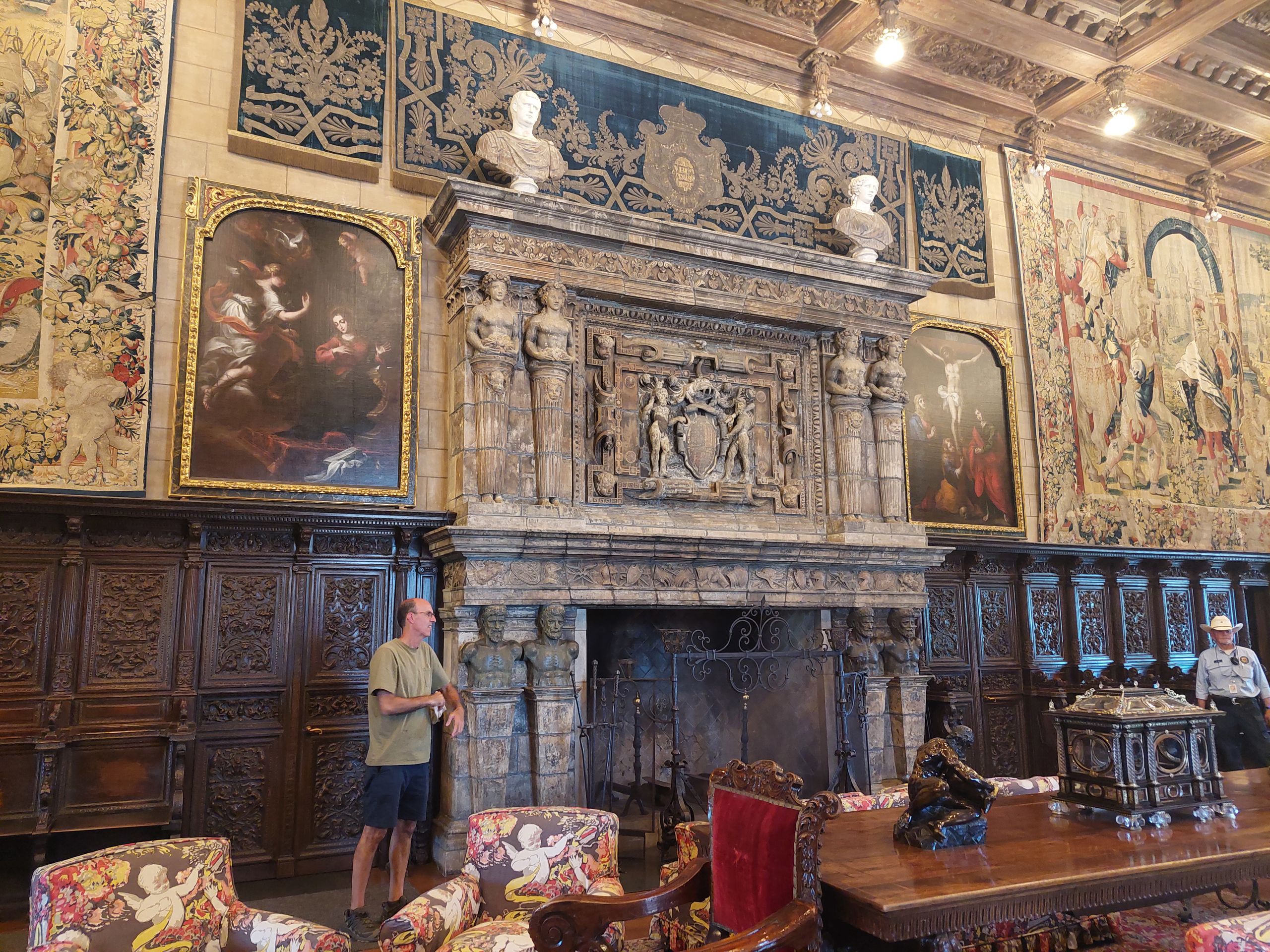
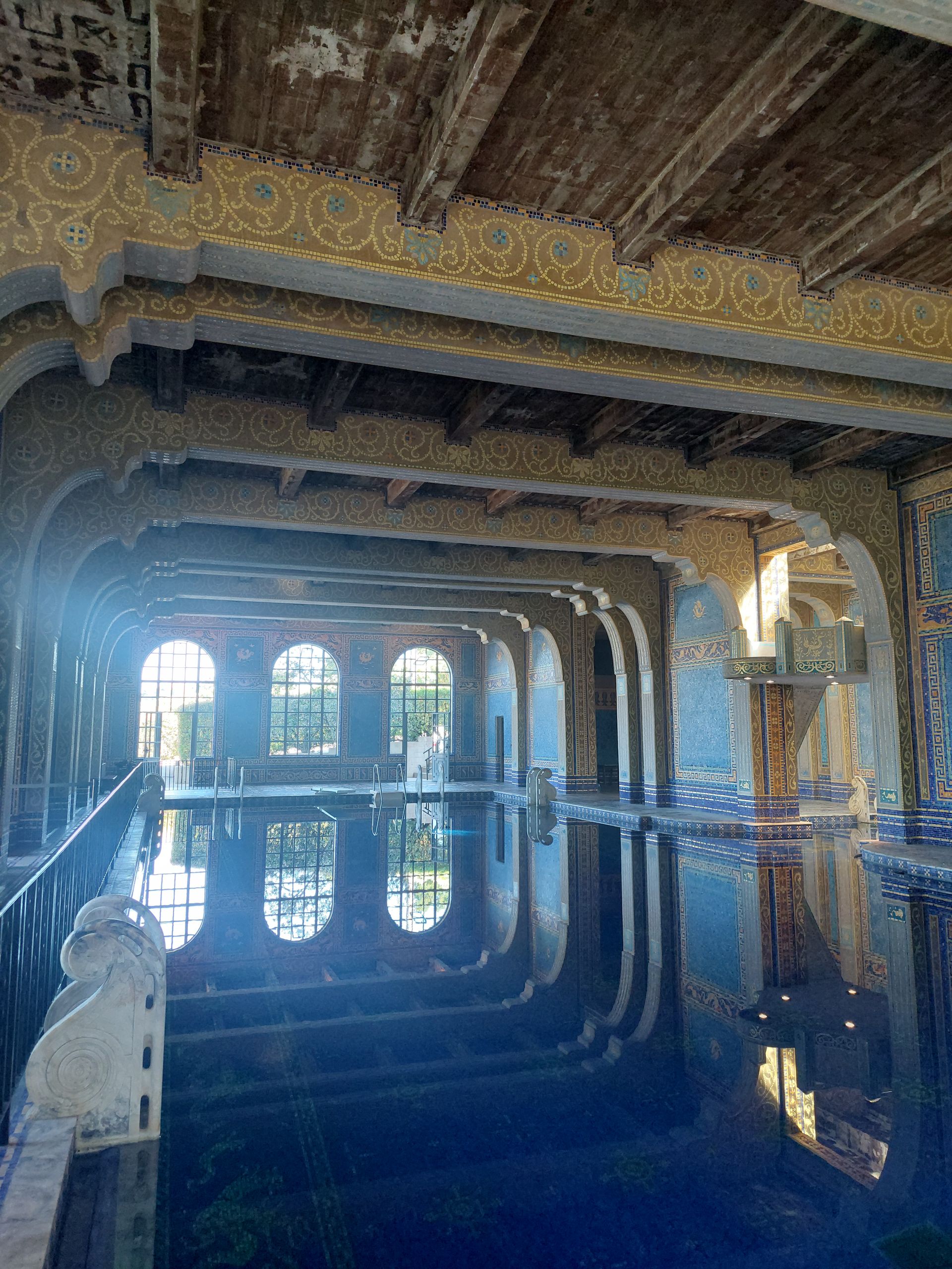
The next day we went to breakfast at the property's restaurant and each ordered a full stack of apple fritter pancakes, which was way too much. That's why we packed up the rest and swapped it in the trunk for the leftover pizza, which we put in the fridge in the room. With all these leftovers we got through the rest of the day. We spent this time driving from San Luis Obispo along the coastal road north to the southern end of the closed area in order to see as much of the road as possible. There was no restaurant or taco stand at this end of Highway 1, but we had some nice views of the ocean beforehand. The most impressive stop, however, was Hearst Castle, a huge sea-view hilltop estate built by one of these ultra-rich Americans in the 1920s, filled with many historic interiors collected throughout Europe, and then regularly used as a leisure and party retreat for invited other rich, famous and beautiful people had used it. There were many different tours available and we only did one tour mainly of the Casa Grande. As we waited for it to begin, people in our group who had heard us speaking German asked us why we were even interested in the Hearst Castle when there are many more and actually old castles in our home . Well, this was a completely different experience. The tour was very well organized, we were taken up the hill in buses and then down again at the end, led by a guide the whole time and were not allowed to explore the area on our own, not to leave the carpets in rooms, not to touch anything except stair handrails and nothing eat and drink except water. Drinking water was also advisable because, interestingly, it was much hotter on the hill than down below. There were several large outdoor and indoor swimming pools and a mix of architecture and art styles from different ancient cultures from Europe, Egypt and Persia. We found it quite strange, as did the antique church pews that were suddenly standing around in some rooms and were definitely never originally intended for this purpose. After the tour, we were shown a 40-minute Hollywood-style, emotionally charged film in a large cinema about the construction of Hearst Castle, which we actually consider to be one of the less important events in world history. We then went into the gift shop, some with tears in our eyes, where we were once again amazed at the huge merchandising, and finally left the area again. We then drove to the nearby Elephant Seal Viewpoint, where we were able to observe over 50 elephant seals. We found them very funny, especially because they mostly lie around lazily on the bank, but sometimes they also seem to argue with each other and throw themselves at each other and often make interesting burping noises. Finally, we drove back to San Luis Obispo and walked through the narrow Bubblegum Alley, which was even nastier and older than Wall Gum in Seattle. Nevertheless, we still enjoyed the leftover pizza later - even cold, because for once we didn't have a microwave in the room.
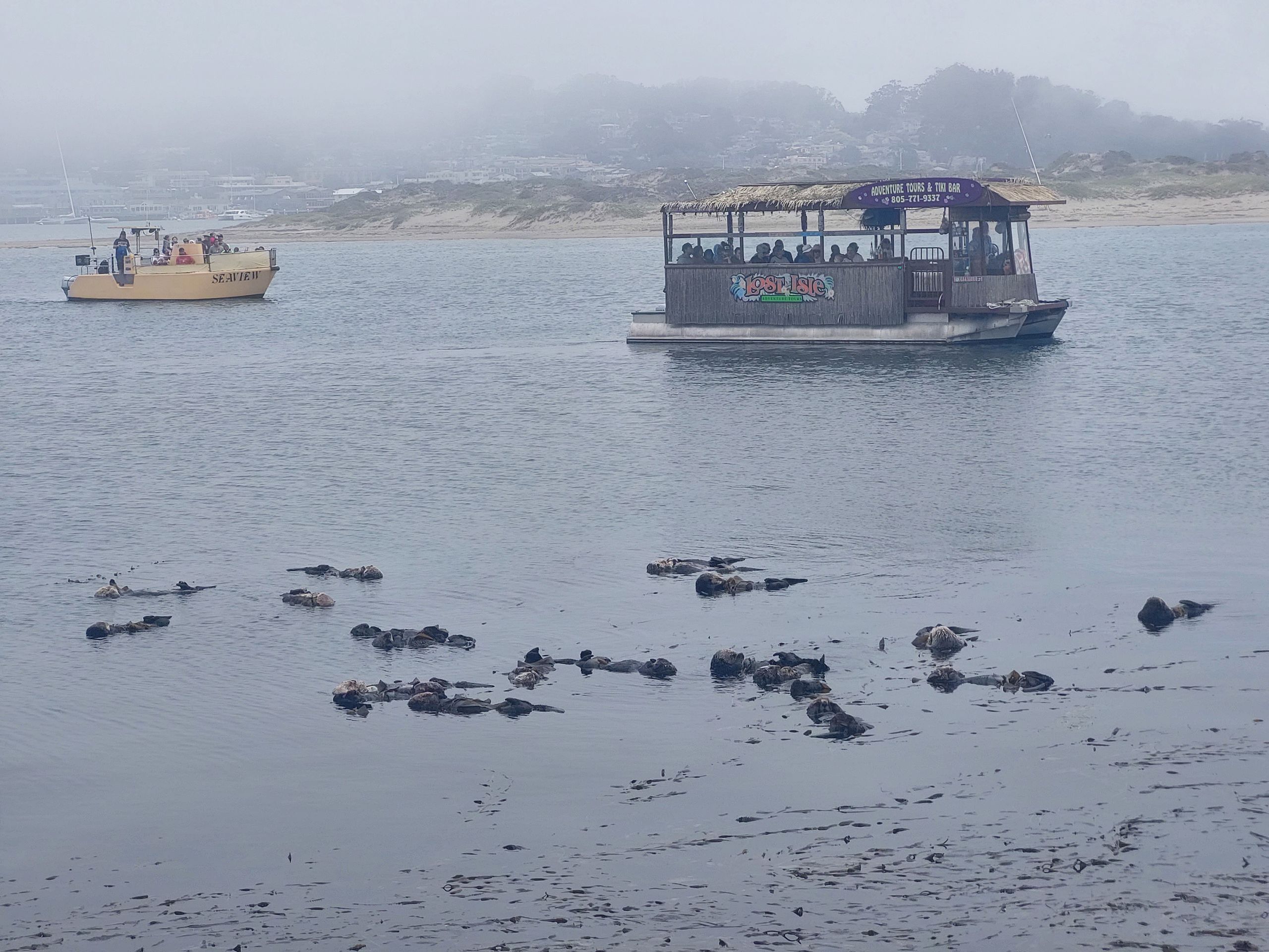
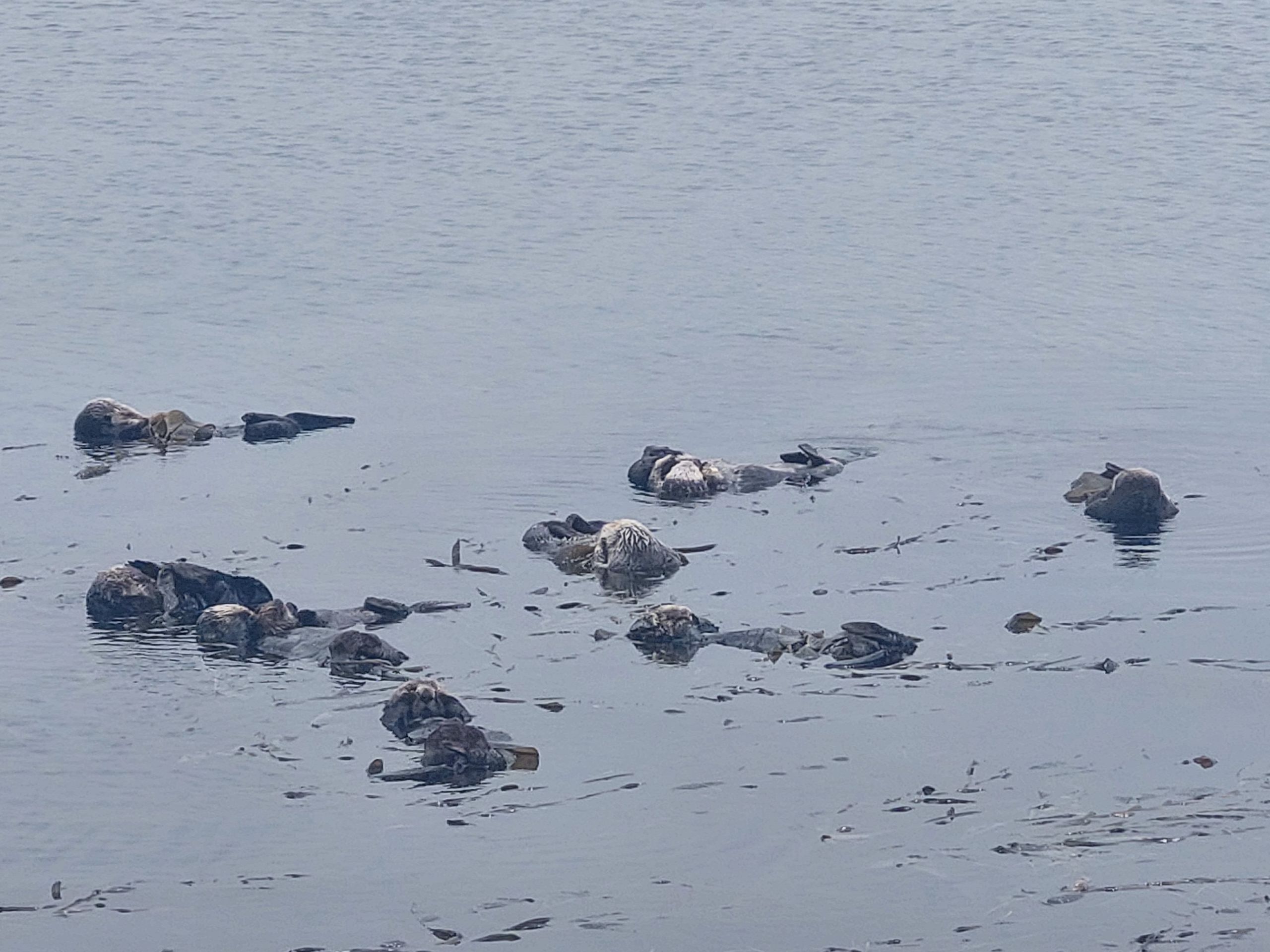
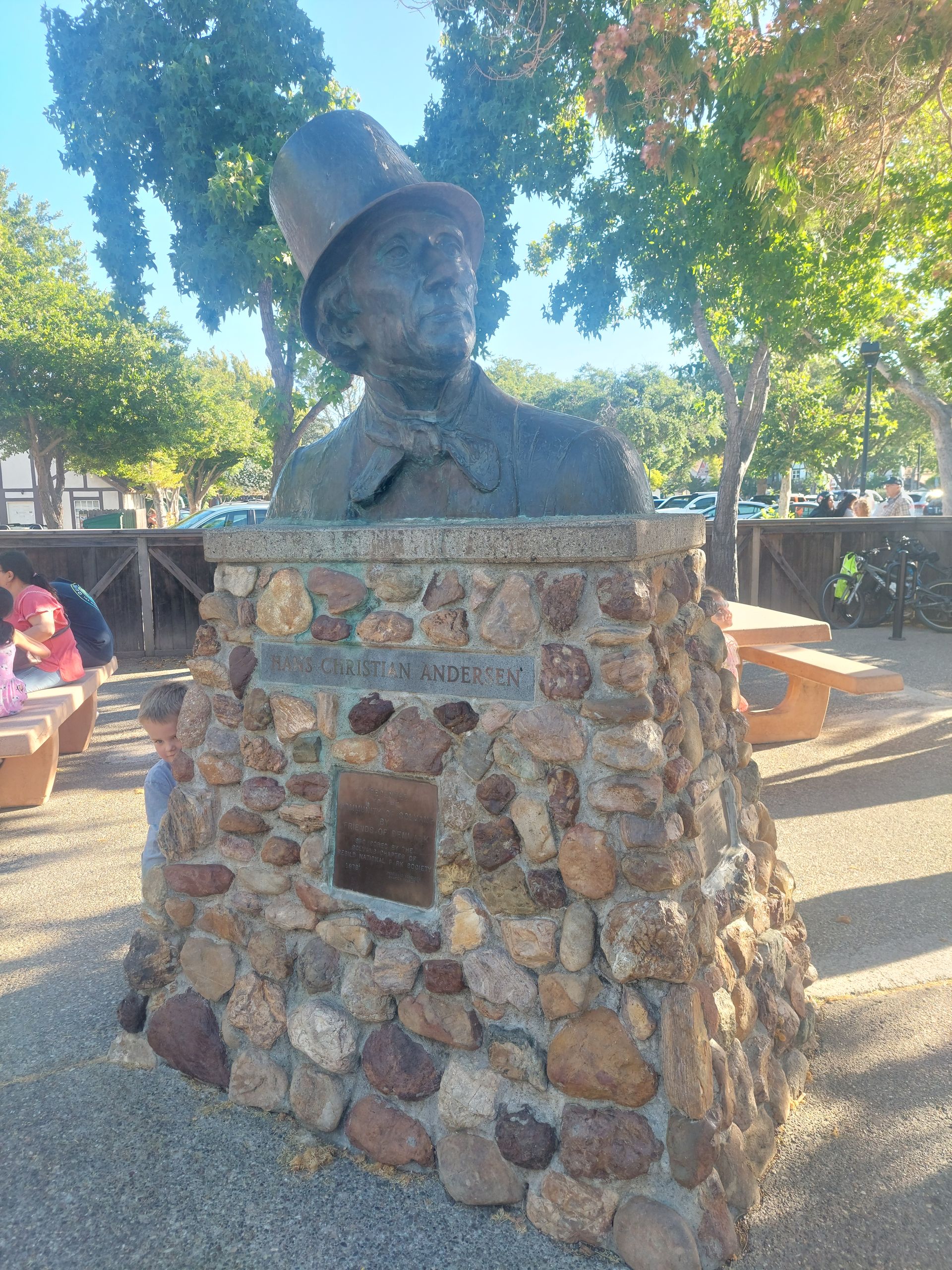
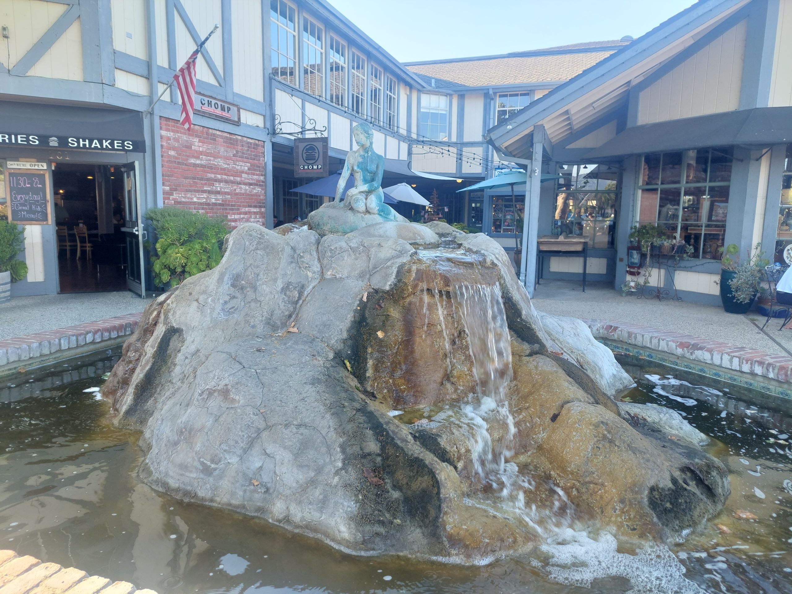
The next day we first went to Cayucos, where we bought cookies from a well-known cookie shop and took them with us and then walked around a bit. We had to be careful not to get tired of the little towns by the sea, because they are pretty nice, but there are a lot of them, especially if you drive a lot along the coast... At least the Cayucos pier was one of them the few pier where there were no cars. Then we drove on to Morro Bay, where we first observed sea otters (unfortunately they are often so far away) and then walked around Morro Rock and along some rocks. The next stop was the village of Solvang, a little further from the coast, where many people from Denmark had probably immigrated. There we went to one of the numerous Danish bakeries and ate more or less Danish pastries. We now had the cookies from Cayucos and leftover pancakes from the lecture in the trunk, but Judith really wanted to try a cinnamon roll. Unfortunately, she had already eaten better food in Denmark. We also saw a sock shop and bought puffin socks there for both of us. We continued walking through the village and also through the gardens of the mission (we would find out exactly what a mission is later). We then drove to our next accommodation in Santa Barbara.
The road we drove further and further south was no longer always a small road with a beautiful view of the sea, but sometimes also a freeway. This is a road that is not connected to other roads by cross traffic, but only via on- and off-ramp lanes, like on a German motorway. The term "highway", on the other hand, which many (we used to) translate as "motorway", can refer to any road on which vehicles drive.
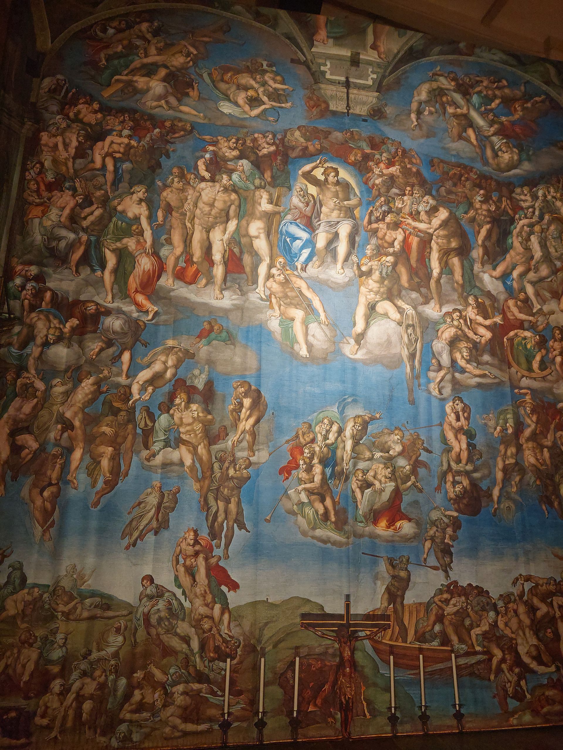
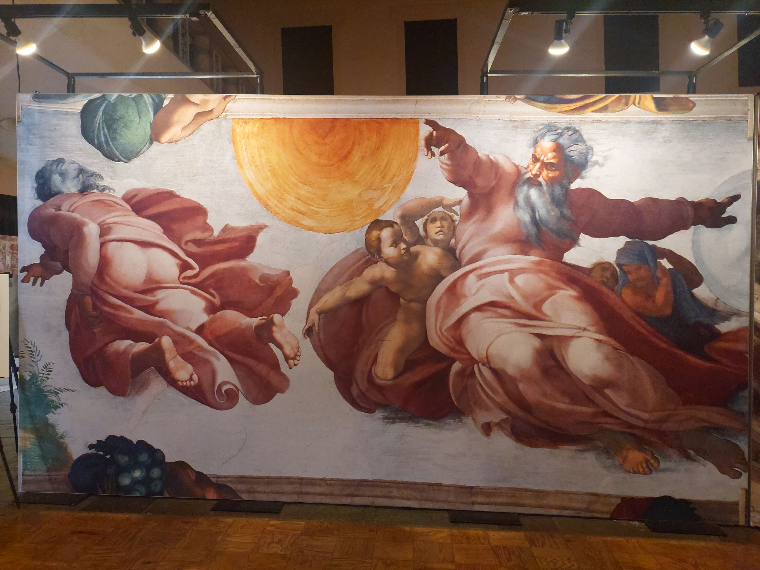
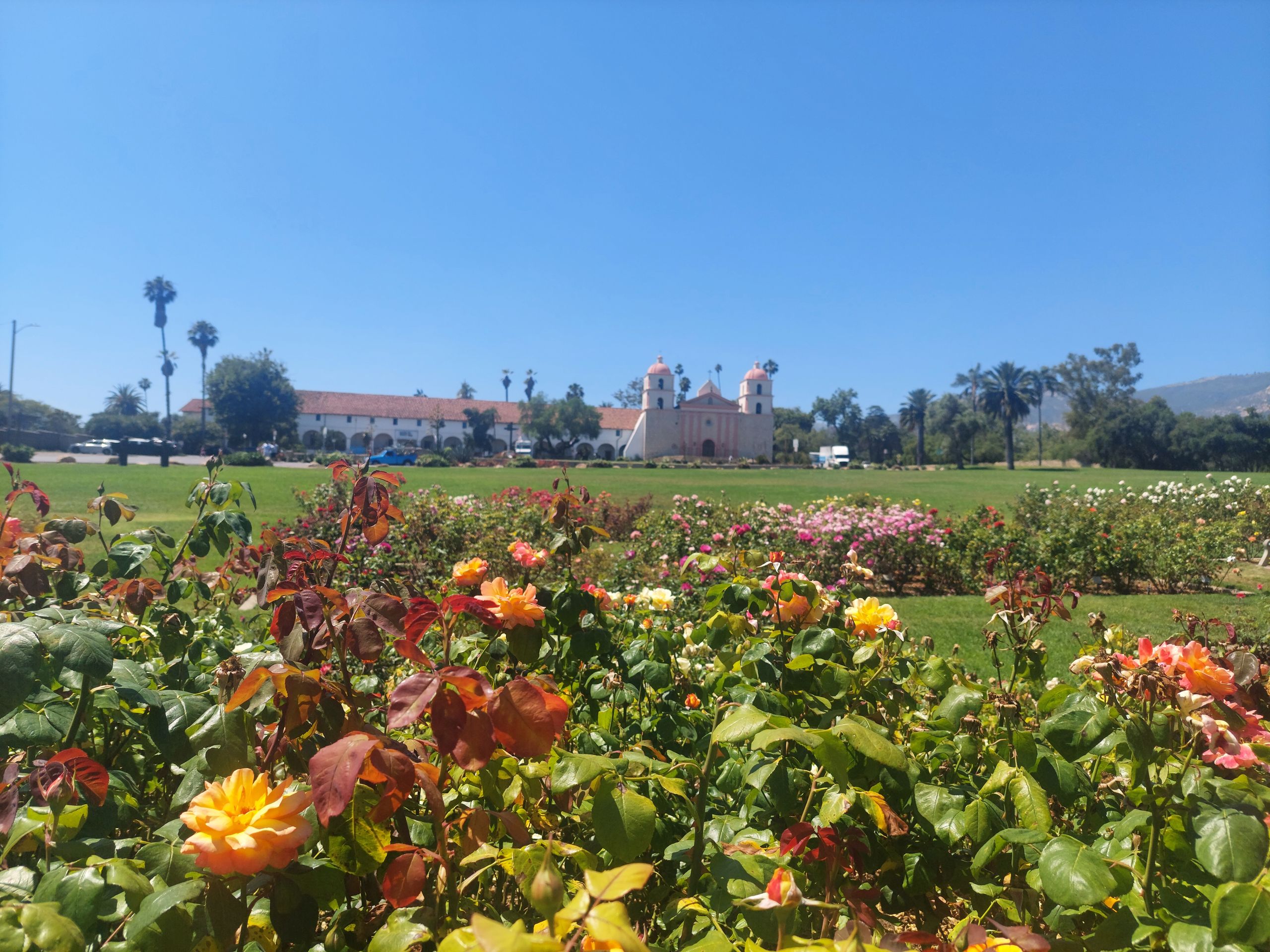
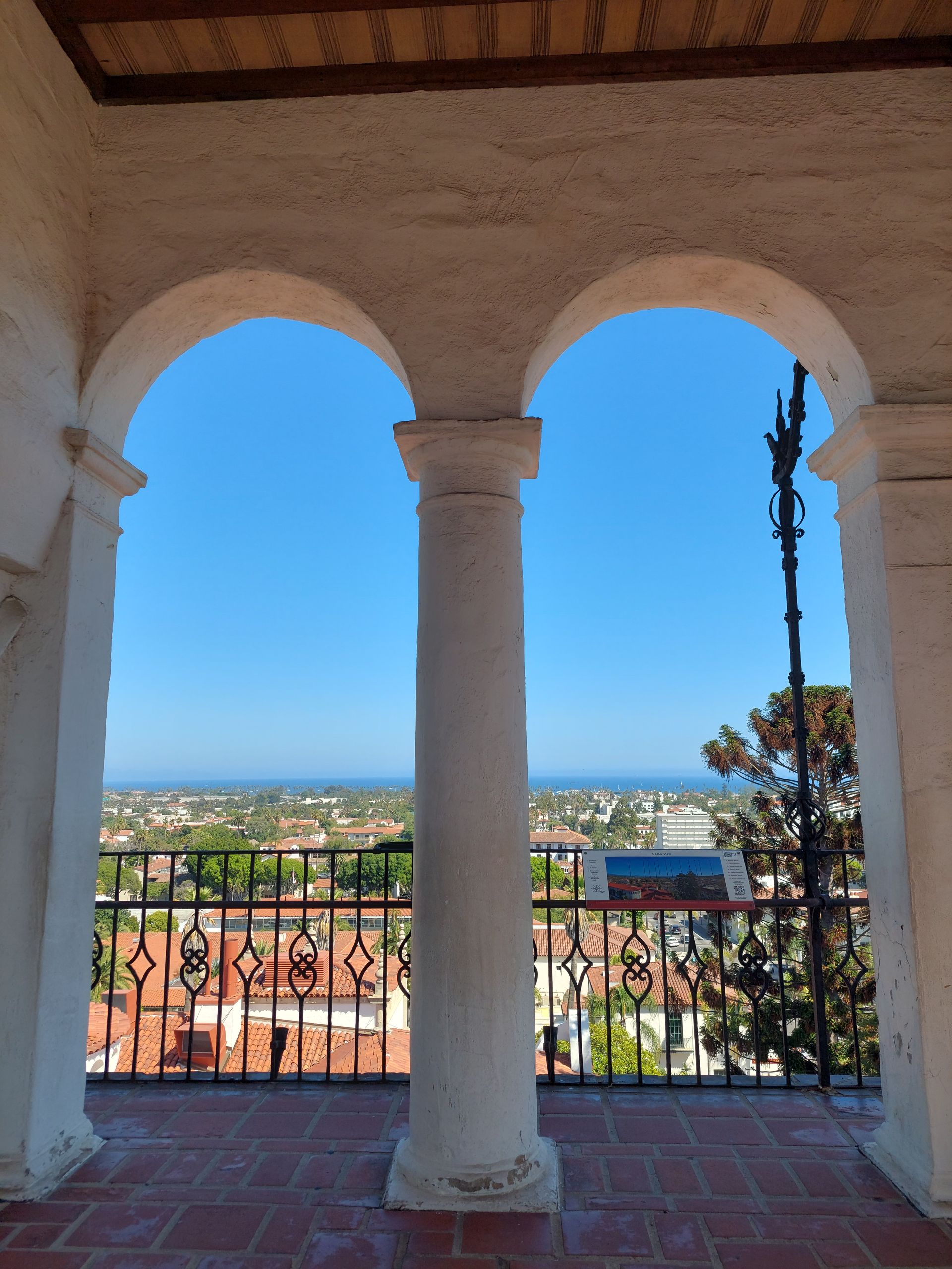
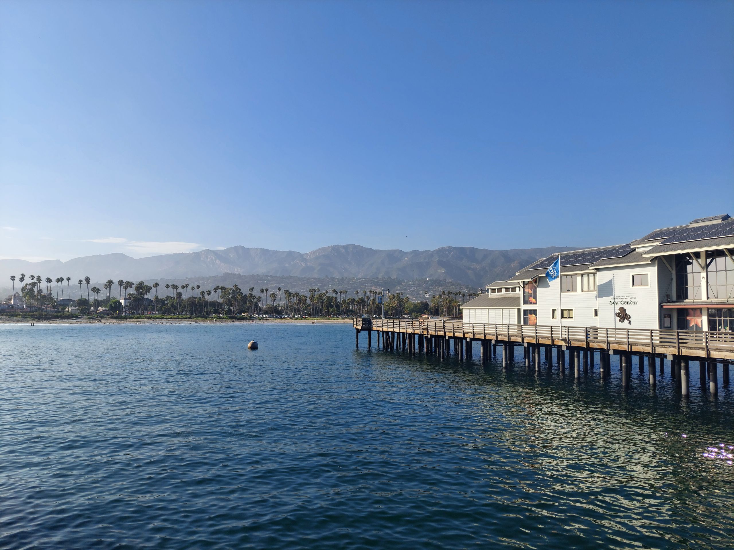
Santa Barbara is not a big city, but it is not small either and is a popular and well-known tourist town in which we spent two full days. On the first day we first walked to the Santa Barbara Mission. There are so many missions here because the first European conquerors in California were Spaniards (which is why California later belonged to Mexico until it fell to the USA in 1848 after the Mexican-American War), whose strategy towards the indigenous population was: to proselytize them instead of killing them (but many still died due to imported diseases). In the mission we first looked at an exhibition about the Sistine Chapel with an audio guide app that showed large photographs of the frescoes there. We had actually only been in the real Sistine Chapel in March, but we found this exhibition quite interesting and practical perhaps precisely because back then you would have had to look up for a long time to see everything. However, we couldn't look at and hear everything here either because that would have been too much for that day. Afterwards we looked at the actual site of the mission with another online audio guide. Afterwards we walked through the mission's rose garden and through a beautiful park with palm trees, a pond and turtles to the center. We wanted to go to the Courthouse Tower because we had read that you had a nice view of the city there. There was a security gate at the entrance. This was by no means the first on our trip, but this time our last bit of sunscreen was taken from us and then Sebastian had to hand over his pocket knife (which doesn't have a particularly long blade) without getting it back afterwards. The security people simply said that it was a US Court House and said that we had to keep it outside the property in order to get it back. Because we didn't have our car with us, Judith hid it in a paper garbage container on the street, which we simply hoped wouldn't be emptied during our visit. We then went up the tower and enjoyed the view. Afterwards we were happy that the pocket knife was still there. Since then, Sebastian has only transported the knife in a large travel backpack. Next we walked through the Paseo Nuevo and the large pedestrian street. There were shops and cafes everywhere, although the large pedestrian zone was apparently a normal street until recently. Among other things, we bought smoothies that contained more vegetables than expected and that we didn't like, but were probably by far the healthiest thing we had ever eaten in the USA. Judith also bought a new pair of trousers from H&M because her linen trousers ultimately didn't take well to the climbing in the last national park. Then we walked further to the sea, where we sat down briefly. But we took the bus to get back to the accommodation. We had to pay in cash on the bus and would have been able to do so by chance, but the machine wouldn't accept our notes and the driver let us ride along. That day we set a new step record for our trip to the USA.
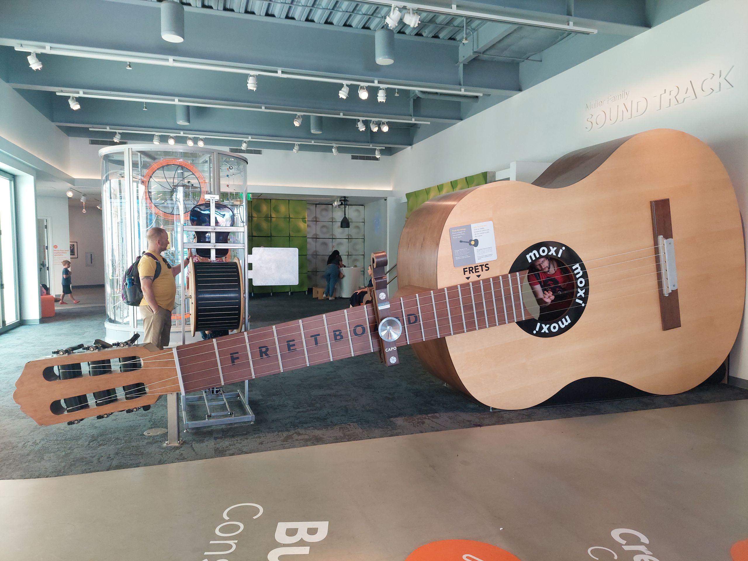
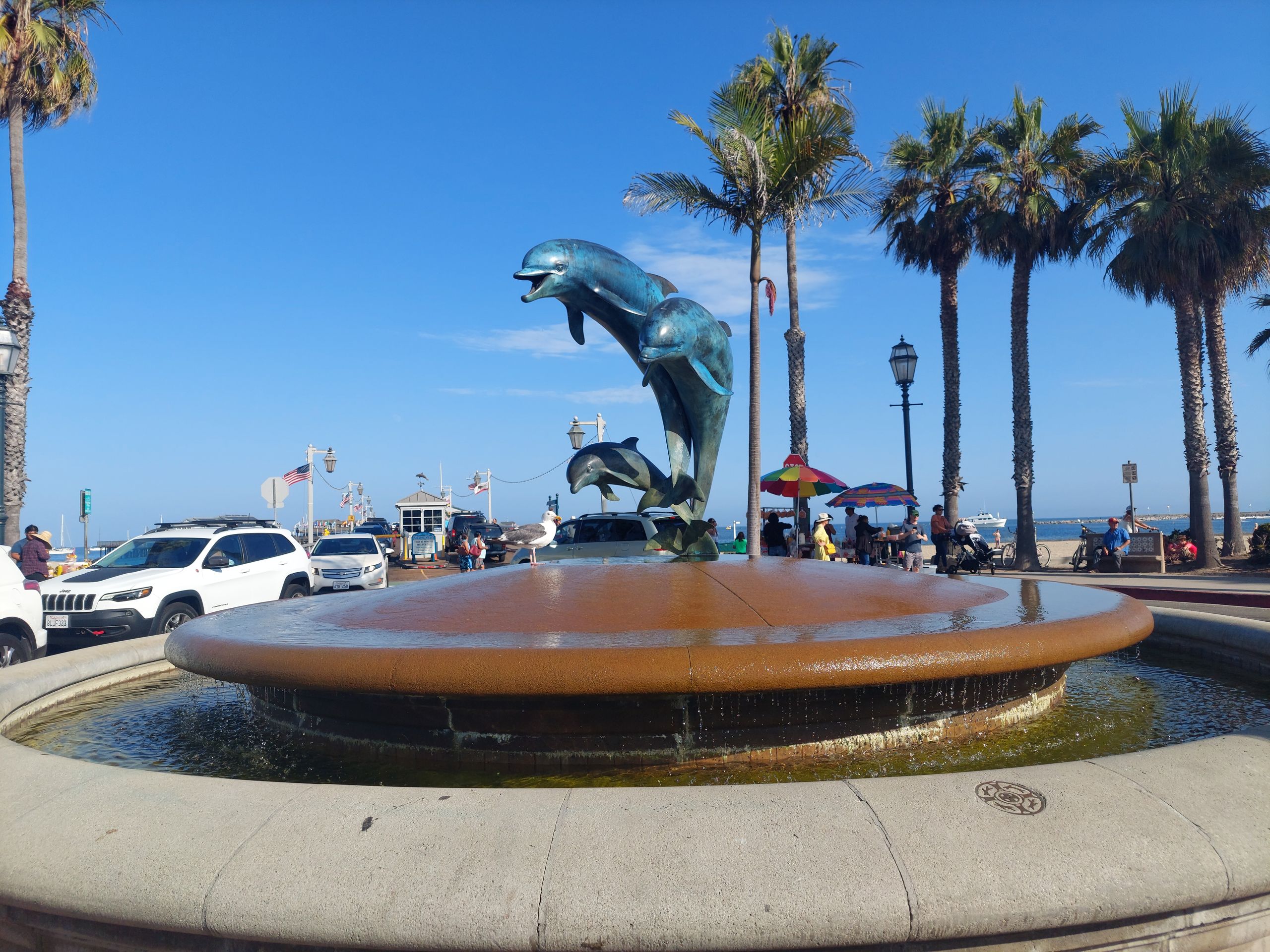
Santa Barbara is so touristy that we were even able to go on a free walking tour there on the second day. We actually wanted to take the bus to the meeting point, but then realized that it was much quicker by car. We drove to a recommended free parking spot while the tire pressure light came back on. We were fed up with that, but now we went on the tour. Apart from us, our group only consisted of a nice couple from Sacramento, the capital of California. Although we didn't think it was a long distance, they had flown here and therefore didn't have a car with them, which is why at least the man made a comment at one point that they would have to walk a long way here. From among several tours, we chose the waterfront tour, which first took us to the roof of the Maritime Museum and then primarily further along the sea towards the city center. We learned exciting things about the history of the city and the harbor. For example, the city decree stipulates that all buildings in the center must be built in the colonial style, which creates a beautiful cityscape. The many beautiful exotic trees and other plants, some of which we had already seen at the lecture in the park, also contribute to the cityscape - a wide range of plants thrive in this climate. However, you shouldn't go swimming in the sea here. The water is no longer as cold as in the north, but there are tar deposits here - natural ones, i.e. not caused by nearby oil drilling. Here, too, we haven't reached the dream swimming region yet... After the tour, we found out that there was an Enterprise branch near the parking lot. We drove there, explained our problem with the tire pressure and were able to swap the car again very easily, this time into a fairly new KIA Forte (not available on the European market) with a Californian license plate. We like it best of our three cars and hope to keep it until New York. The whole event went faster than expected and we still had time for the Maxi-Museum, a scientific experiment museum that is primarily aimed at children, but where adults can also have fun. We had that too, but in contrast to other museums of this kind that we knew in Germany, no scientific background was explained to you here, but you could only fathom the physical connections discussed by experimenting. We thought the phenomena presented were really cool and we were also able to try out a modern musical instrument, the Reactable. Then we went through the Funk Zone, the hip part of the city, but didn't find much that was exciting there. We drove back to the accommodation in our new car and had already taken quite a few steps, but not as many as at the lecture.
Another national park awaited us near Santa Barbara, namely the Channel Islands. But we were actually too late for that, because we would still have gotten ferry tickets for the outward journey to the islands, but not for the return journey, which would have been very inconvenient. Instead we headed to LA.
ସମ୍ବାଦପତ୍ରକୁ ସବସ୍କ୍ରାଇବ କରନ୍ତୁ |
ଉତ୍ତର
ଭ୍ରମଣ ରିପୋର୍ଟ ଯୁକ୍ତରାଷ୍ଟ୍ର