
Tongariro Alpine Crossing - great hike through volcanic landscape
Maxxanfame: 06.04.2017


Barruu Oduu Subscribe godhaa
Whakapapa Village is a good starting point to do one of the most beautiful and spectacular hikes in New Zealand, the 19.4 km long Tongariro Alpine Crossing. Since this is no longer a secret tip, we had pre-booked the campsite for 2 nights - unfortunately not the fancy Hotel Chalet, which is impossible to miss in its majestic location in front of the village on the hill. And the reservation was necessary, the place was fully booked and every square meter was used. Our tent just fit on the camping ground, the motorcycles parked behind the reception next to the garbage bins, as we didn't want to park them on the narrow path because of constantly maneuvering campervans.
The hike is not a circular route, but one-way. Several tour operators drive the hikers to the starting point and pick them up at the end of the day at the endpoint. And it is incredible how many people do this 7 to 10-hour hike every day. I think it's thousands. What may initially sound off-putting, but wasn't so tragic. The people spread out quite well on the trail, of course there was nowhere to be alone. The only annoying thing was the queues in front of the few toilets. We also heard that there is consideration to limit the number of people on this hike through a booking system, similar to how it is handled on the Milford Track, for example.
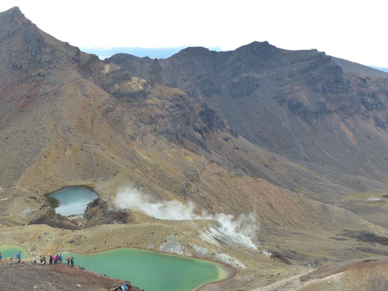
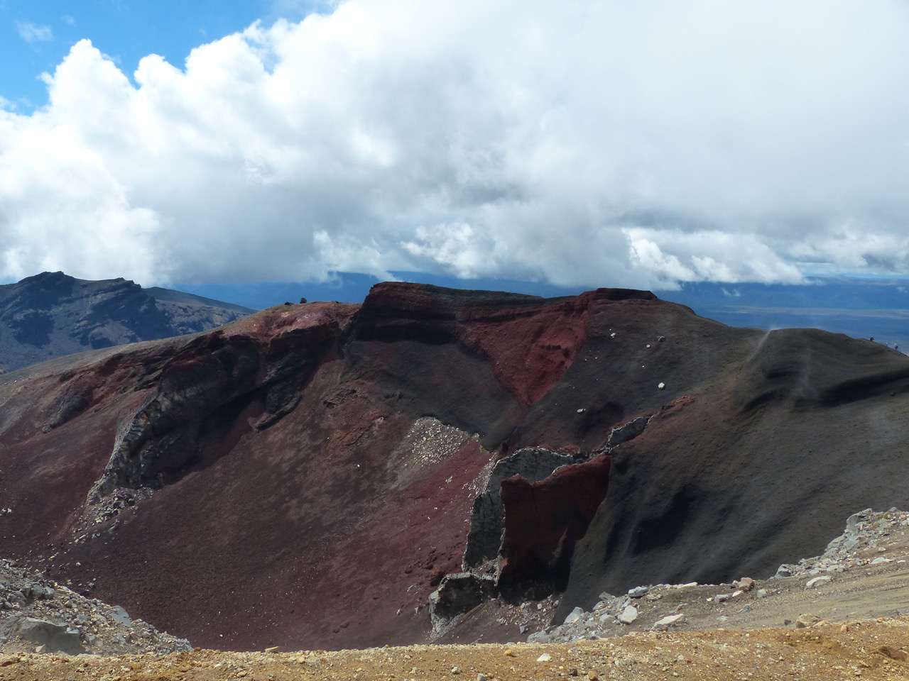
Anyway, these crowds of people are not here for no reason, because this hike is simply overwhelming and certainly one of the best hikes in the world. You walk through breathtaking volcanic landscape between the 2 volcano mountains Mt. Tongariro (just under 2000 m high) and Mt. Ngauruhoe (just under 2300 m high). The latter is certainly known to Lord of the Rings fans as Mt. Doom and with its distinctive shape, which looks like a pyramid with a truncated tip, it is very striking. The volcanoes have shaped a landscape here that is indescribable. Colorful rock formations, lakes, and lava sand create a unique backdrop, and in some places, rising steam is an indication of volcanic activity.
The weather was optimal on this day, cloudy and quite cool in the morning, but the sun came out more and more later. A few clouds still lay in the valleys, which was a bizarre sight. The trails were mostly easy to walk, only the descent shortly after the highest point through deep lava sand was a somewhat adventurous and exhausting slide. The last 2 km with many stairs finally finished off my legs. So I arrived at the endpoint after 9 hours of hiking, pretty exhausted but super happy. After 2 days of muscle soreness, that was taken care of too. And this hike was absolutely worth the effort!
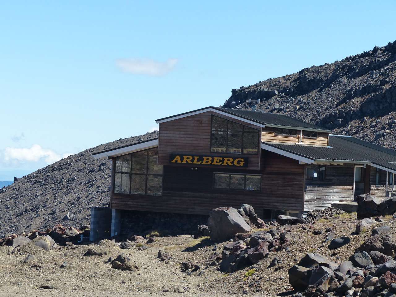
On the day of departure, we drove up the mountain road to the ski resort on Mt. Ruapehu from Whakapapa Village in the morning under a blue sky. The beautiful and well-developed mountain pass road with the snow-capped peaks in the background was a pleasure to ride a motorcycle. Downhill again, a last look at the chalet, and the 2 days here were already over. Now we continued to Lake Taupo, which we could already see in the distance on the hike.
Barruu Oduu Subscribe godhaa
Deebii

Gabaasa imala Niwuu Ziilaand