North Macedonia
Publisert: 13.06.2023


Abonner på nyhetsbrev
ICT Cycling Day 16: Kyustendil - Delcevo 85 km, 1,200 m elevation gain
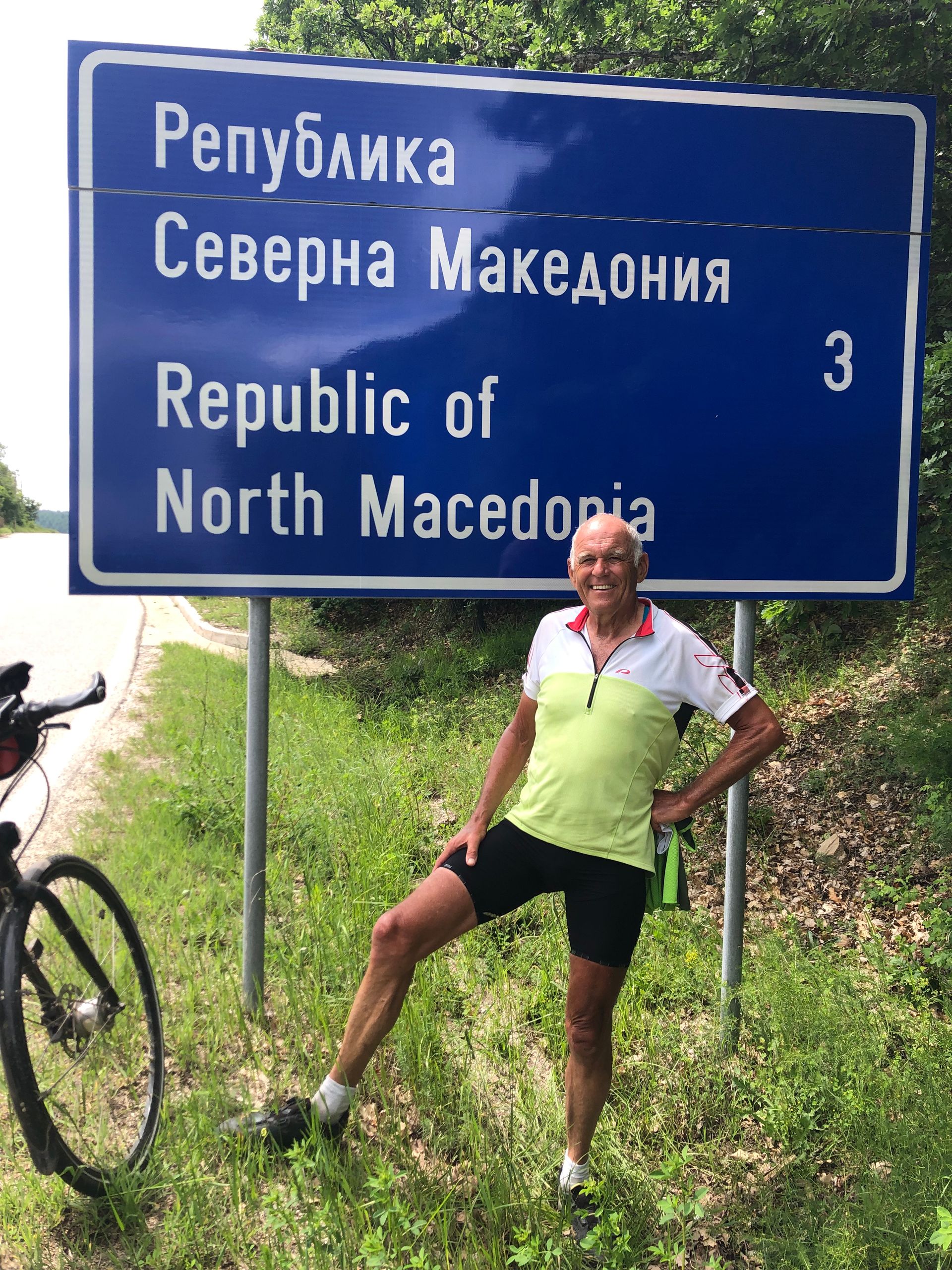
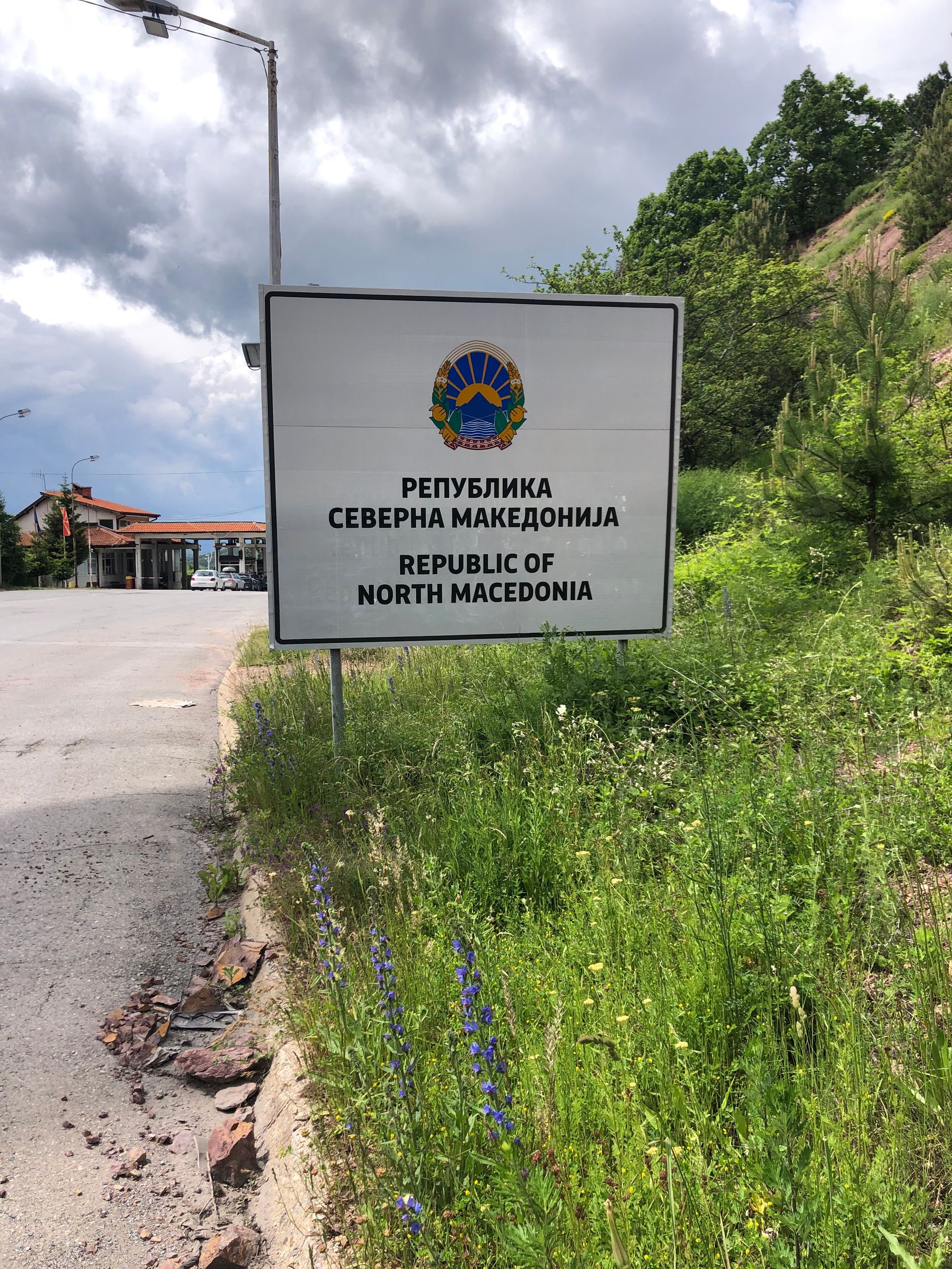
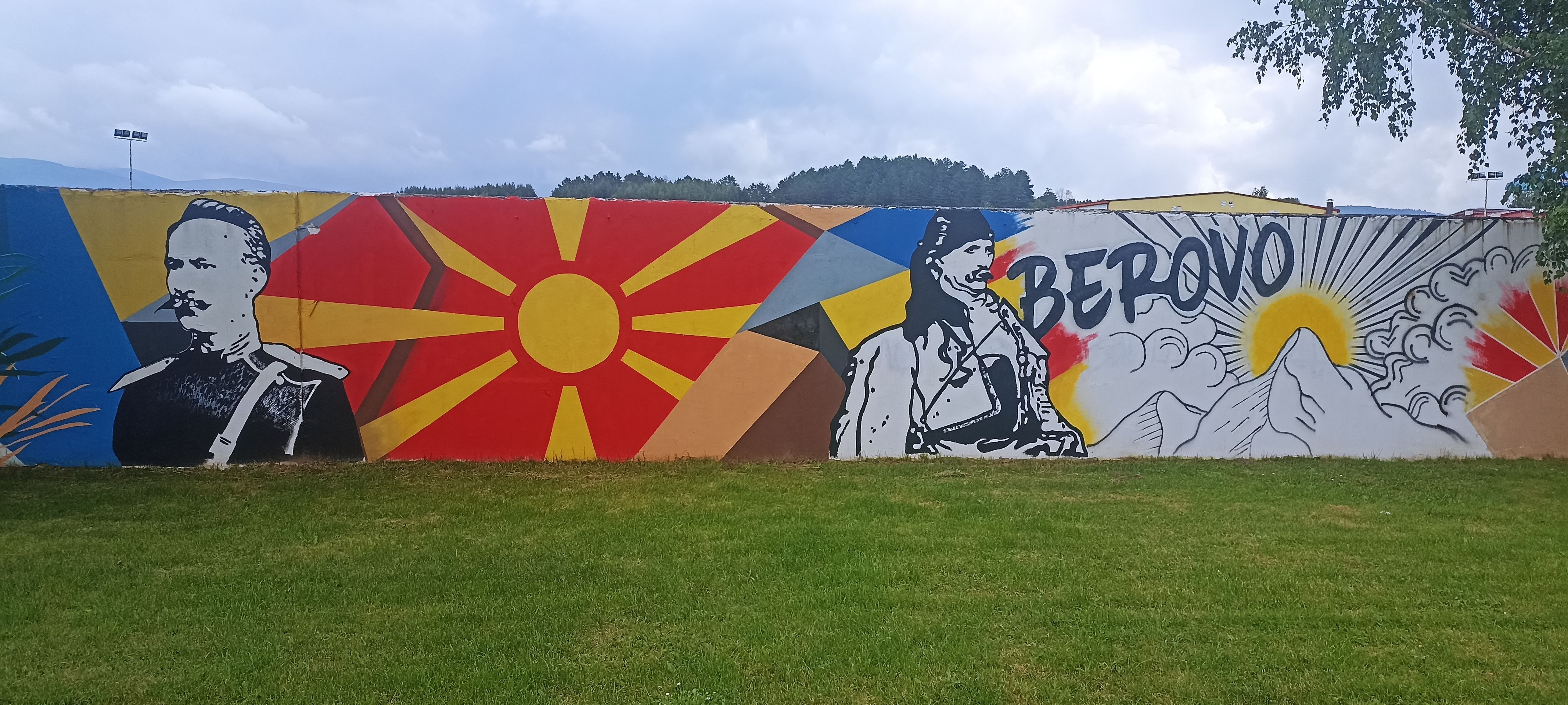
Today we have a long climb ahead of us to the Macedonian border, so we set off early. We continue straight on the lightly trafficked main road for 15 km to the south (once again reminding us of Finland). Then, we turn right and reach the Struma River. In ancient times, the river formed the border between Macedonia and Thrace and was the scene of numerous conflicts. Today, it is calm and peaceful in this section of the river. On the horizon, the rugged Rila Mountains stretch, home to the highest peak in the Balkans, Mount Musala at 2,925 m. However, we don't need to go there, as we turn towards Macedonia just before Blagoevgrad. We have a 20 km climb ahead of us, reaching an altitude of 1,160 m. The start is very steep and demands all our effort, so we're happy to find a village shop where we can get a strong and hot coffee and replenish ourselves with some fruit. The climb becomes less steep, but it remains challenging and solitary. During the communist era, this area belonged to the "forbidden zones," which made up about one-third of the country's territory. They were off-limits to foreigners, and the farmers living in the border area formed a "border security guard." Anyone who betrayed a refugee was rewarded with a "bounty."During short breaks in the long climb, we motivate each other. Around 2 PM, we set our clocks back one hour at the Bulgarian-Macedonian border. We are thrilled as we roll into North Macedonia, the official name after the agreement with the Greeks. For a long time, from the beginning of the 15th century until 1912, the area of present-day Macedonia belonged to the Ottoman Empire. After some back and forth, the communist partisans of Yugoslavia, under Josip Broz Tito, recognized for the first time the existence of an independent Macedonian nation. Thus, Macedonia became a constituent republic of Yugoslavia. Macedonia managed to avoid being caught up in the Balkan conflicts and succeeded in joining the UN and being recognized by most EU countries. After reaching an agreement with Bulgaria and Greece, there are now accession negotiations with the EU. We descend from the border to Delcevo, a less attractive place with several mosques. In 1950, the town was renamed Delčevo in honor of the revolutionary Goce Delčev. Delčev was a leading figure in the Macedonian Revolutionary Organization since 1895 and is still considered a national hero by Macedonians and Bulgarians.ICT Cycling Day 17: Delcevo - Strumica 95 km, 1,100 m elevation gain
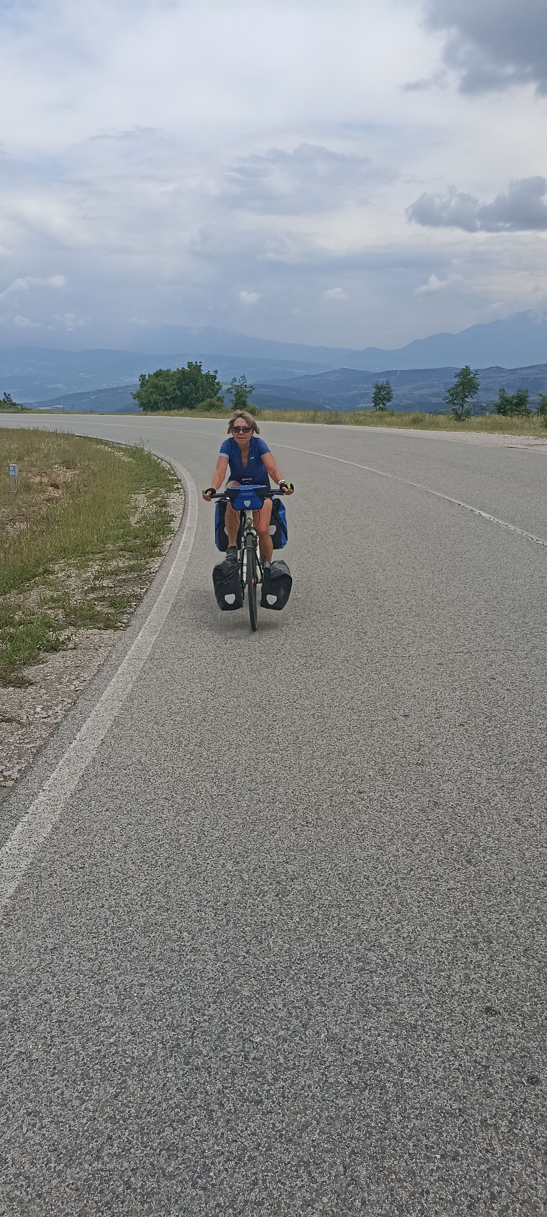
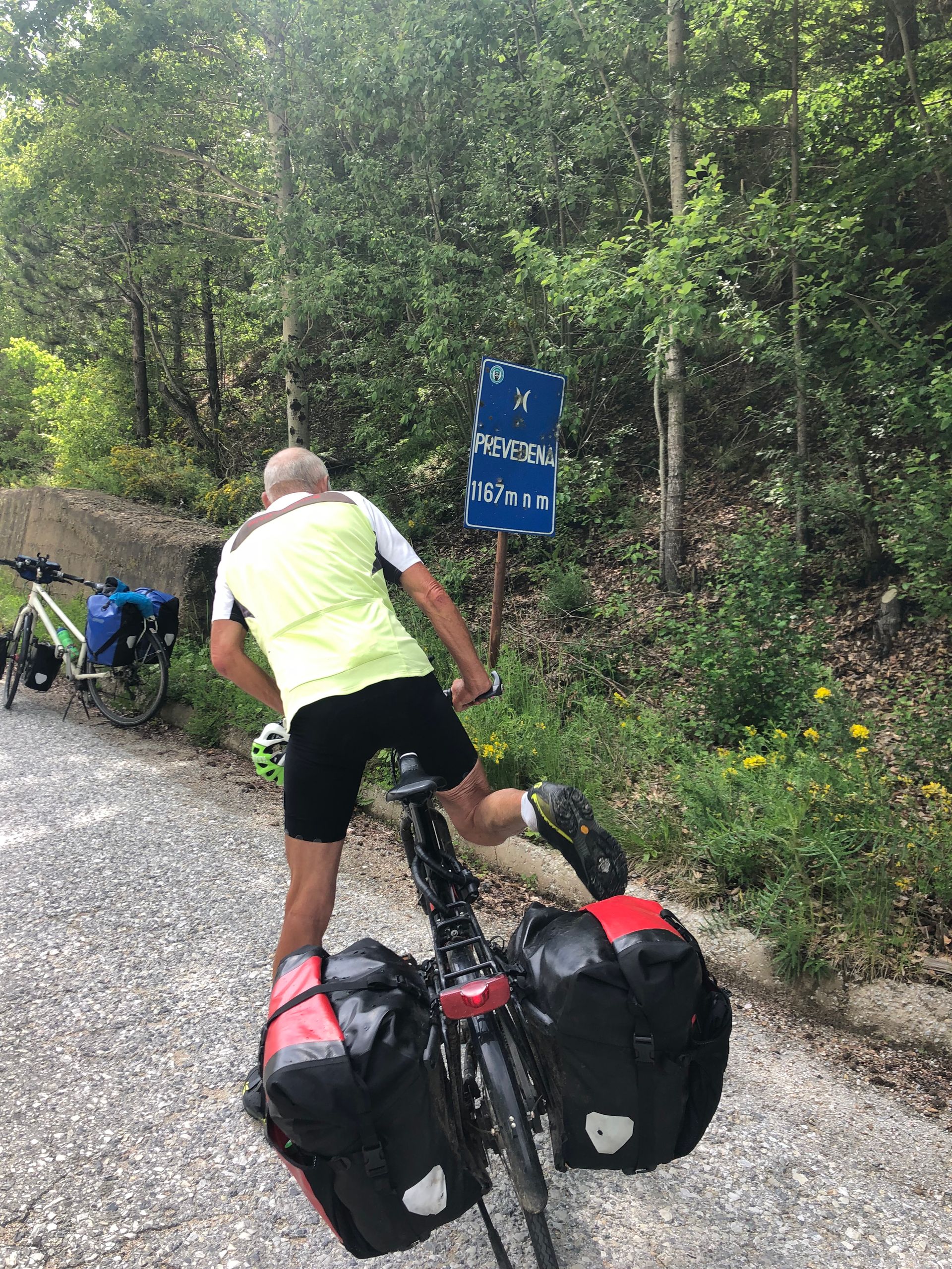
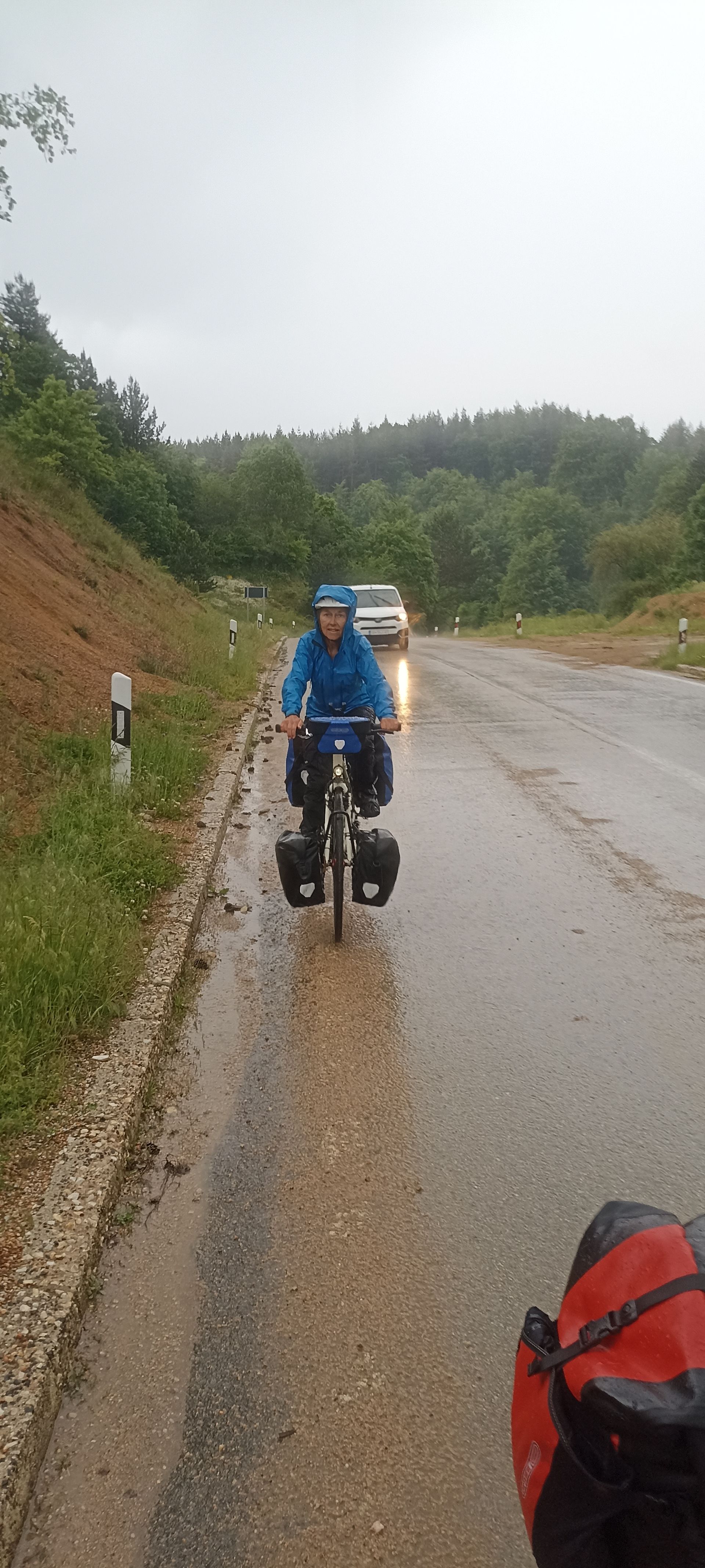
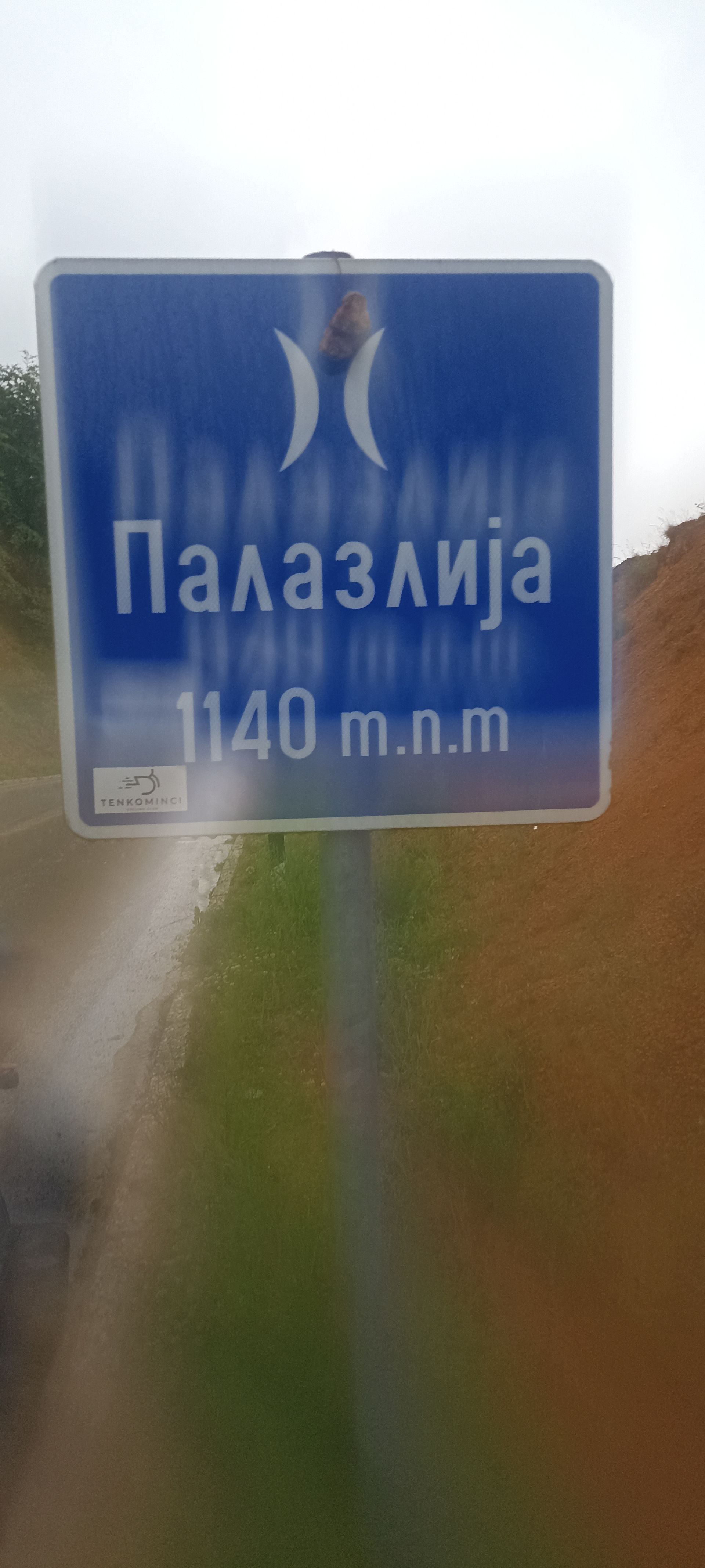
Today, we face two Macedonian passes and, unbeknownst to us, torrential rain. We ride past fields of grain and fruit orchards before a 10 km climb takes us back up to 1,000 m. Along the way, we also see the aftermath of the devastating wildfires of 2021. Large areas are covered in charred tree trunks, while others have been cleared and are already green again. We continue downhill to Berovo, where we take cover from the rain in a lovely café. However, the dark clouds in the sky are still there, and they unleash heavy rain on our continued journey. We initially ride through fields and meadows, steadily climbing to the south. After reaching an altitude of 1,050 m, we think we have conquered the first pass. It starts raining heavily, and we realize that we still have a long descent and a strenuous climb ahead before reaching the Prevedena Pass at 1,169 m. By now, the rain has stopped again, but considering the cool temperatures, we put on our rain jackets for the descent. As we ascend to the Palazilja Pass (1,140 m), the floodgates open, and it pours down. I wait at the pass, but when Dominique doesn't arrive, I go back. She is standing under trees, hoping that the rain will let up. But that could take a while. Together, we brave the elements until we reach the pass and then ride down the water-covered road. By the way, you can view the passes at https://www.quaeldich.de/paesse/prevedena/ if you want to "torture" yourself with some cycling at home. Along the way, we meet a young Englishman who is also facing the challenging climb from Strumica. He has been on the road since March, heading to Georgia and has just had his first flat tire of the trip.As we descend into the valley, the rain stops, and it becomes noticeably warmer. When we arrive in Strumica, only our socks and shoes are wet. Our accommodation not only provides a shower but also a washing machine - what a luxury! In Strumica, too, there is a large monument in a square, commemorating Goce Delčev.ICT Cycling Day 18: Strumica (MKD) - Petrich (BG) - Agkistro (GR) 95 km, 1,100 m elevation gain
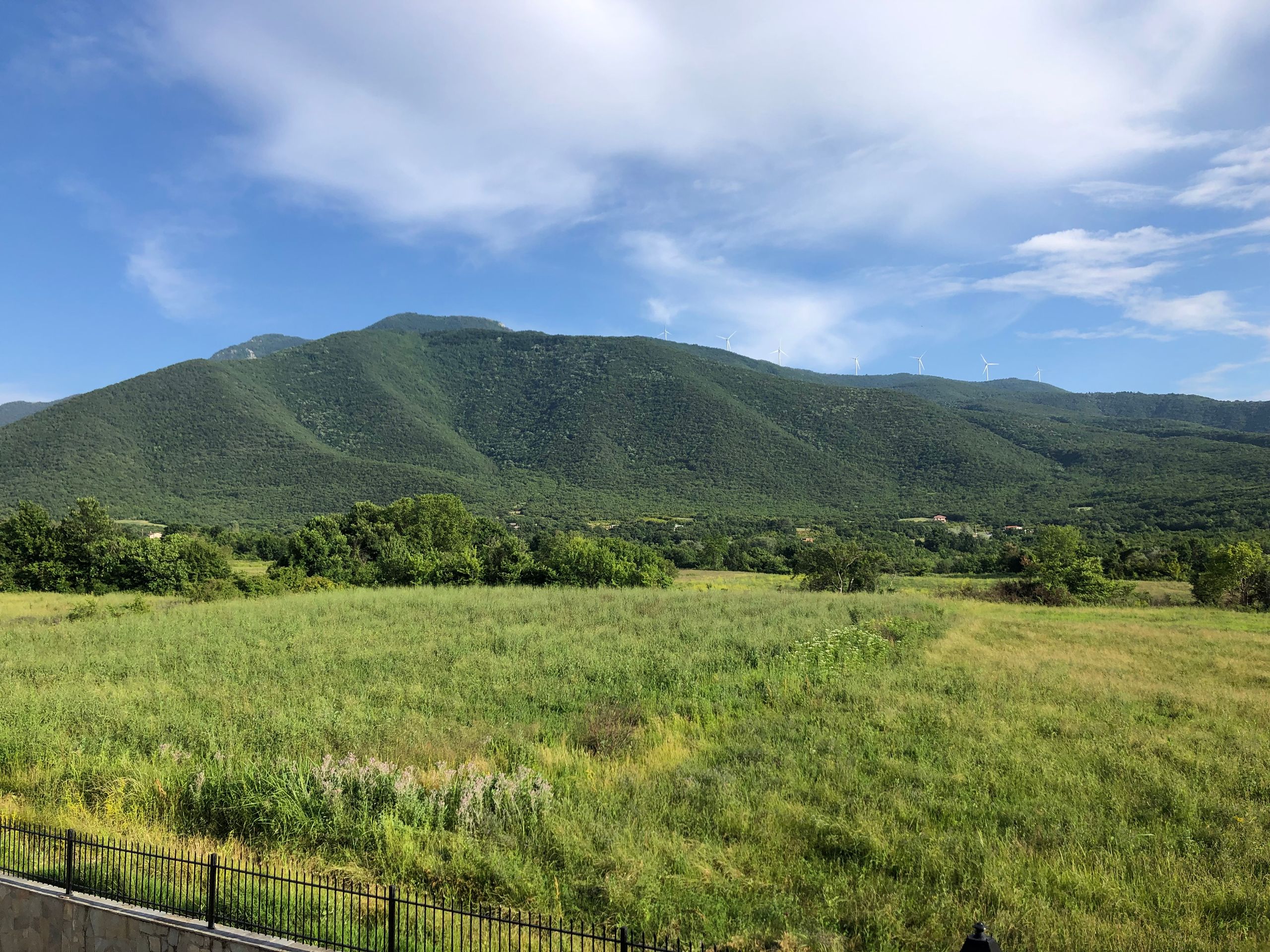
Today, we will pass the 2,000 km mark! But first, we have to muster the courage to set off in pouring rain in the morning in Strumica. The good thing is that we don't have to think twice about our clothing - full rain gear is necessary. We had imagined it quite differently at the southernmost point of the Iron Curtain Trail, which is further south than Rome. It's not just raining, it's also chilly. The main road leading east out of Strumica is flooded, and we're glad that passing trucks don't give us an extra shower. However, after an hour of riding, the rain stops, and it doesn't return for the rest of the day. We cycle through a fertile plain with many fields and greenhouses where bell peppers and tomatoes ripen. Later, we pass large potato fields, and the early potatoes are being washed and sorted into large crates in front of the farmhouses. It's very rural, and at one intersection, we see four horse-drawn carriages crossing paths. After 40 km, we turn and soon reach the Macedonian-Bulgarian border crossing. It's not busy, so we pass quickly. On the Bulgarian side, the road starts to climb steeply, which Dominique tackles energetically, unlike me. We ride along the slopes of the Belasica Nature Park, which offers beautiful scenery, and reach Petrich. On the other side of the valley, the mighty Ograzhden mountain range rises up.From Petrich, it's only about 20 km to the Bulgarian-Greek border. Since it's an EU crossing, we quickly enter Greece. Only 12 km and 250 m of elevation gain separate us from the Greek evening at the tavern in Agkistro. We toast with Mythos beer to the 2,000 km we have left behind.In the past few days, we have discussed our further route frequently and decided to deviate from the EV13 for three days and take a planned rest day in Kavala by the sea. This has also prompted our friend Lothar to come to Kavala by plane with his folding bike and join us for two days. We are thrilled about that.Abonner på nyhetsbrev
Svar (2)
Sawas
Ihr habt es also nach Griechenland geschafft, vorbei an allen mazedonischen Eseln (1979?).
Mein Respekt!
Und trinkt in Griechenland ein Μύθος und einen ούζο für mich mit.
Weiterhin alles Gute und liebe Grüße aus Portugal
SawaLothar
und ich bringe das perfekte Wetter aus The Länd mit !🌞