

More national parks in California
Gepubliceerd: 26.09.2023


Abonneren op de nieuwsbrief
We didn't spend the rest of our time in California in the big cities, but in a few other national parks, which, like the big cities, are numerous in this state. But the first thing we did was shop at Aldi. We previously thought that the Trader Joe's chain bought by the Aldi Nord founder was the American Aldi, but there are also markets that are actually called Aldi and belong to Aldi Süd. Unlike Trader Joe's, we also found really well-known Aldi brands and products made in Germany and then stocked up on strawberry chocolate bars from Choceur.
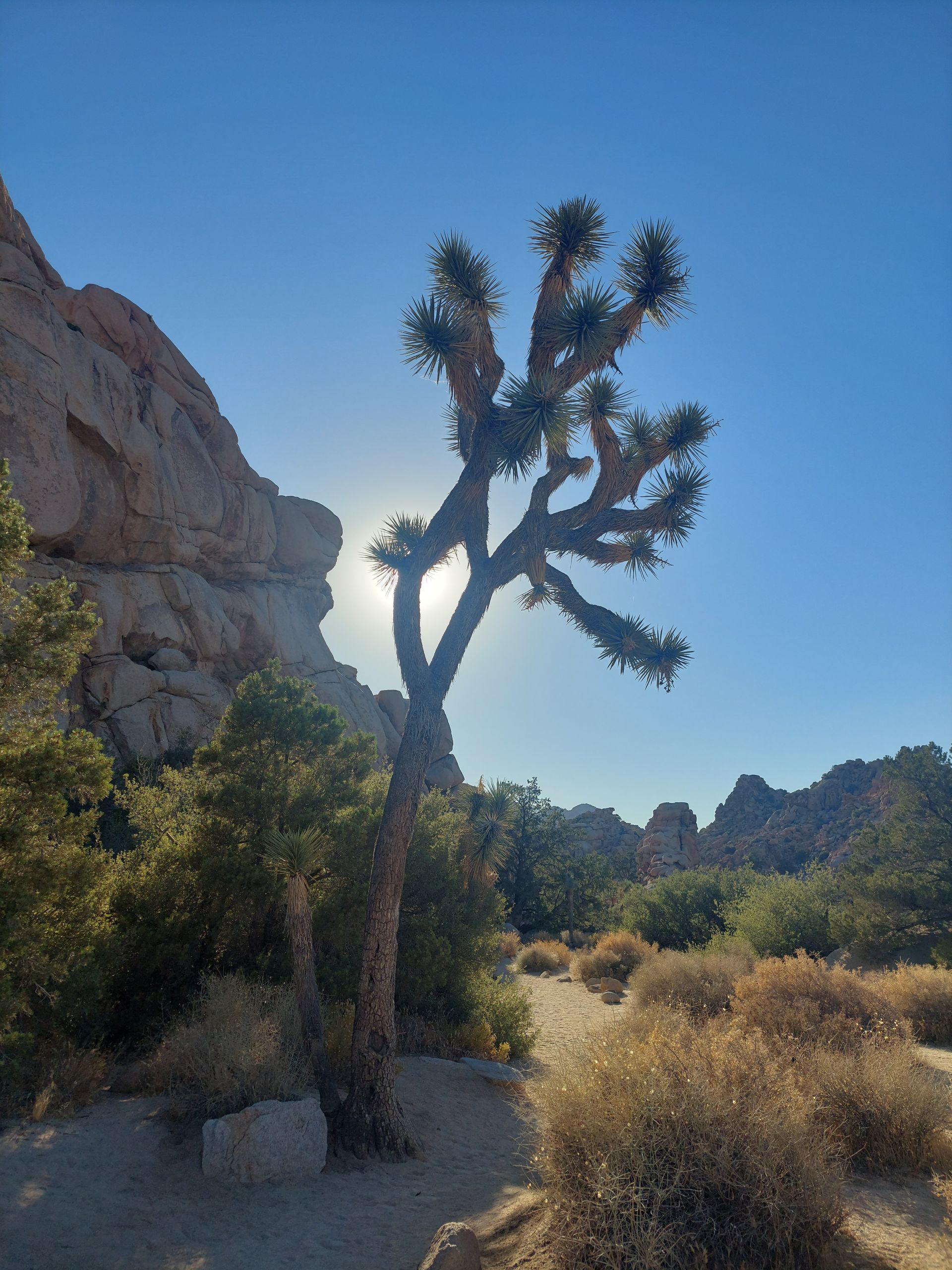
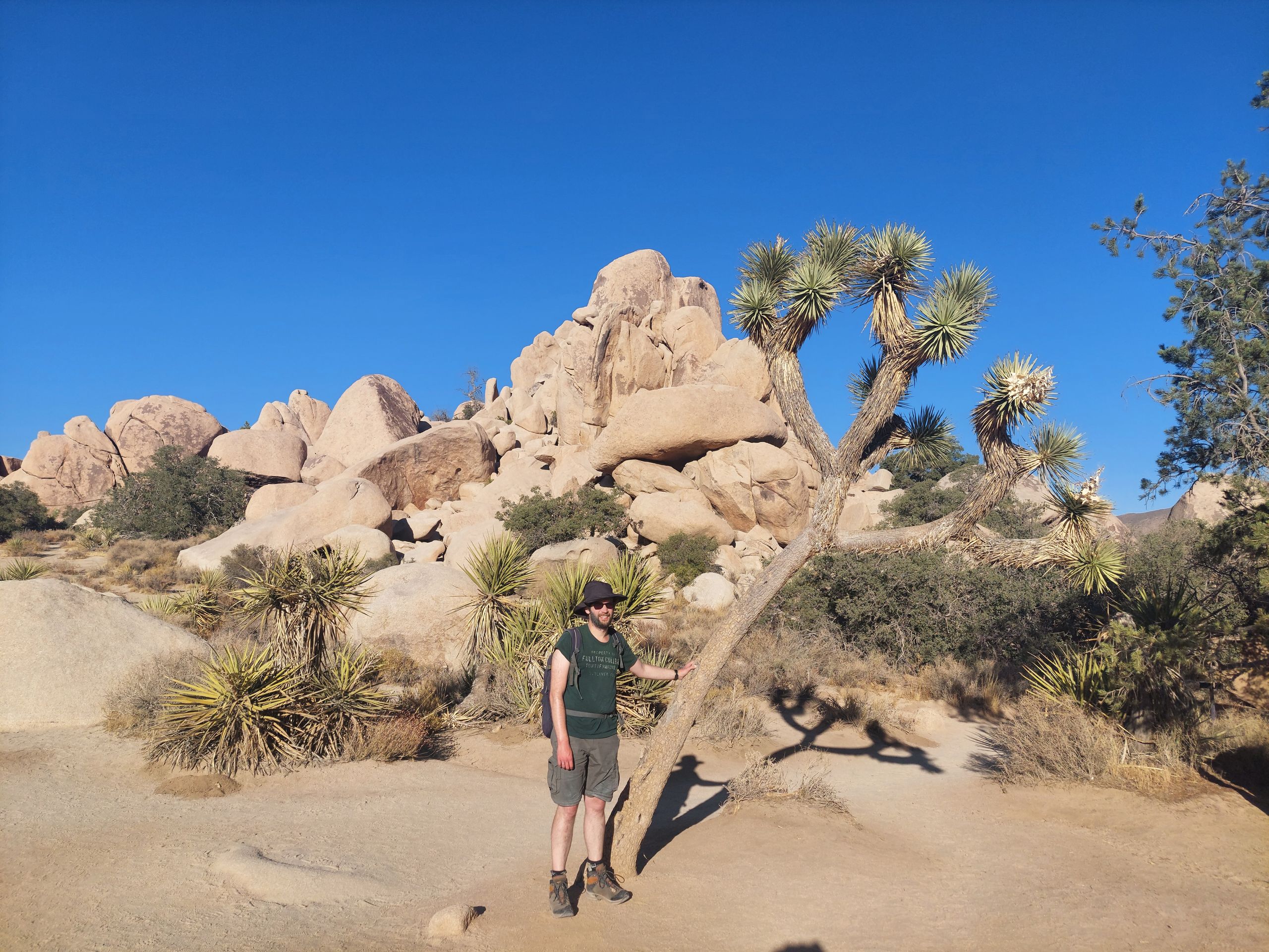
Then we went to Joshua Tree National Park, named after funny little trees that are often found in the Mojave Desert. We walked two loop trails there and made some more stops and saw cholla cacti, lots of Joshua trees, and some cool rocks. This day happened to be a Fee Free Day, when all national parks in the US are free, but that didn't matter to us because we had the national park pass anyway. At 40°C it was a little hotter than when we visited Pinnacles National Park, but because we were now even further south and further inland, it would have been even hotter if the weather had been the same. The dreaded heat that we had wanted to avoid by initially driving south along the coast had now actually passed and we were able to drive north again to the national parks that we had missed.
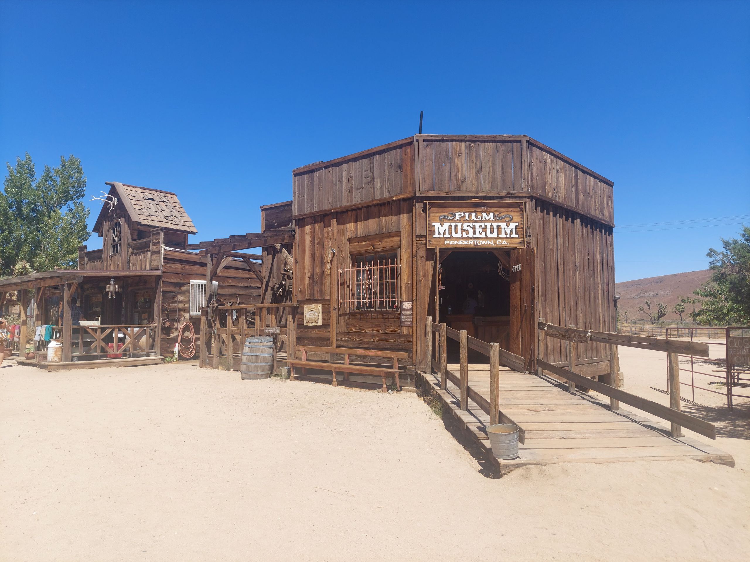
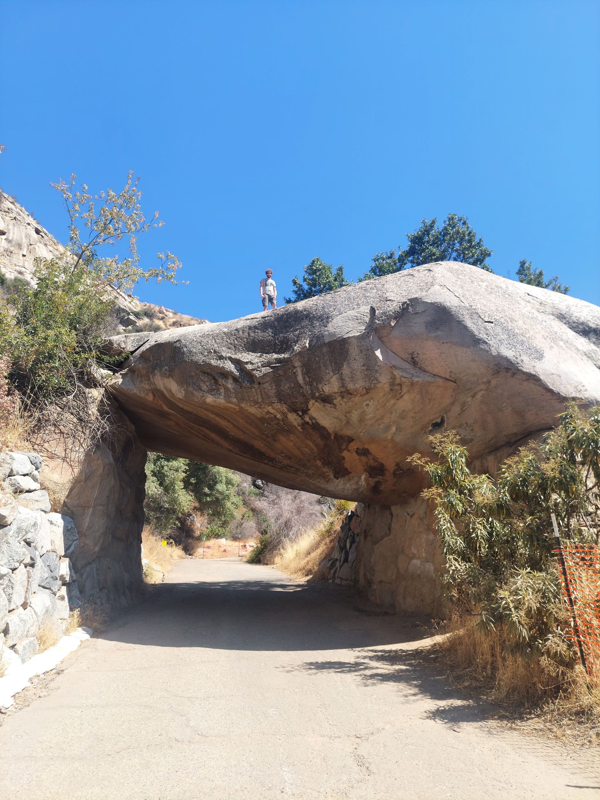
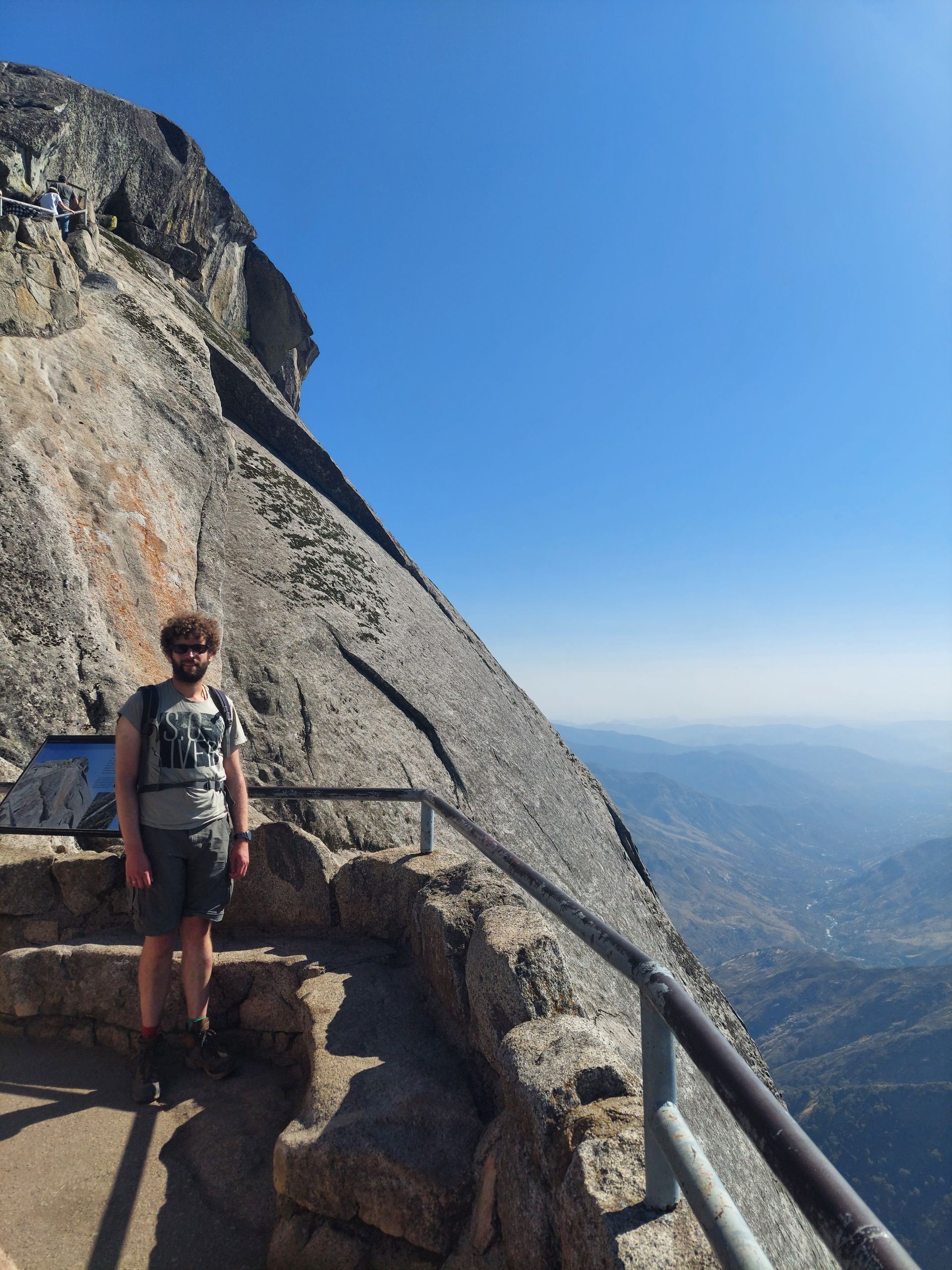
On this way, the first thing we did the next day was a stopover in the small town of Pioneertown, which served as a film set for western films, especially from the 50s and 60s. There we walked a bit through the hot, dusty pedestrian zone and just looked around. In the evening we were able to admire what is said to be the largest olive statue in the world at the next place to stay overnight. This attraction was really hard to top, but the next national park was Sequoia National Park on the edge of the American Sierra Nevada. Sequoias, or rather Giant Sequoias, are called giant sequoias in German and although they are not as tall as the coast redwoods in Northern California, they are particularly wide. They also have reddish wood, whereas the wood of the coast redwoods we saw before was a rather inconspicuous brownish color (even though the national park there was called Redwoods National Park). In Sequoia National Park, after a first stop at Tunnel Rock, we drove to General Sherman, the largest tree in the world by volume. The short hiking trail there wasn't the most beautiful so far, partly because there was a lot going on there (it was a Sunday) and because it was asphalted, because of course everyone wants to see the largest tree in the world and as many people as possible should get the opportunity to do so . The tree itself didn't look that different from many sequoia trees before, but it was particularly large. We then drove to Giant Forest, where we planned to walk along the Big Trees Trail. There was so much going on there that we had to park in the alternate parking lot. That wasn't so bad, because as we discovered, there was a great viewpoint on the way from the alternate parking lot to the Big Trees Trail. Not far from this path we also saw a black bear. We walked past him at a much closer distance than recommended in the warnings everywhere, but that was the way it was, there were other people there, and the bear didn't pay any attention to us. We found the Big Trees Trail more beautiful than the asphalt hiking trail before. It led around a meadow that offers good conditions for growing sequoias on the edge. Afterwards we climbed a staircase to Moro Rock (not to be confused with the Morro Rock that we saw on the coast), from which we had a great view over the national park. Finally, we drove to a Sequoia tree trunk that you could drive through. In Humboldt State Park in Northern California you could also drive through a tree, but we didn't do that because it would have cost money and we didn't think it would be exciting enough. Here it was free, but you had to stand in a line of cars and wait your turn. Judith drove into this line and Sebastian waited until all the people in front had finished taking their photos and no one else was posting on or next to the tree to finally take a photo of Judith driving through the tree himself. As we had already guessed, this generally popular activity wasn't particularly exciting for either of us, and we decided not to go through the same procedure again with the roles reversed.
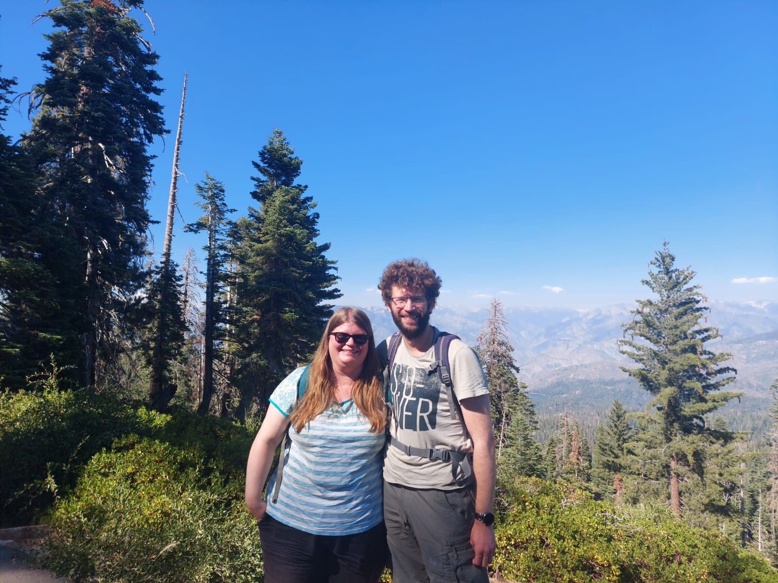
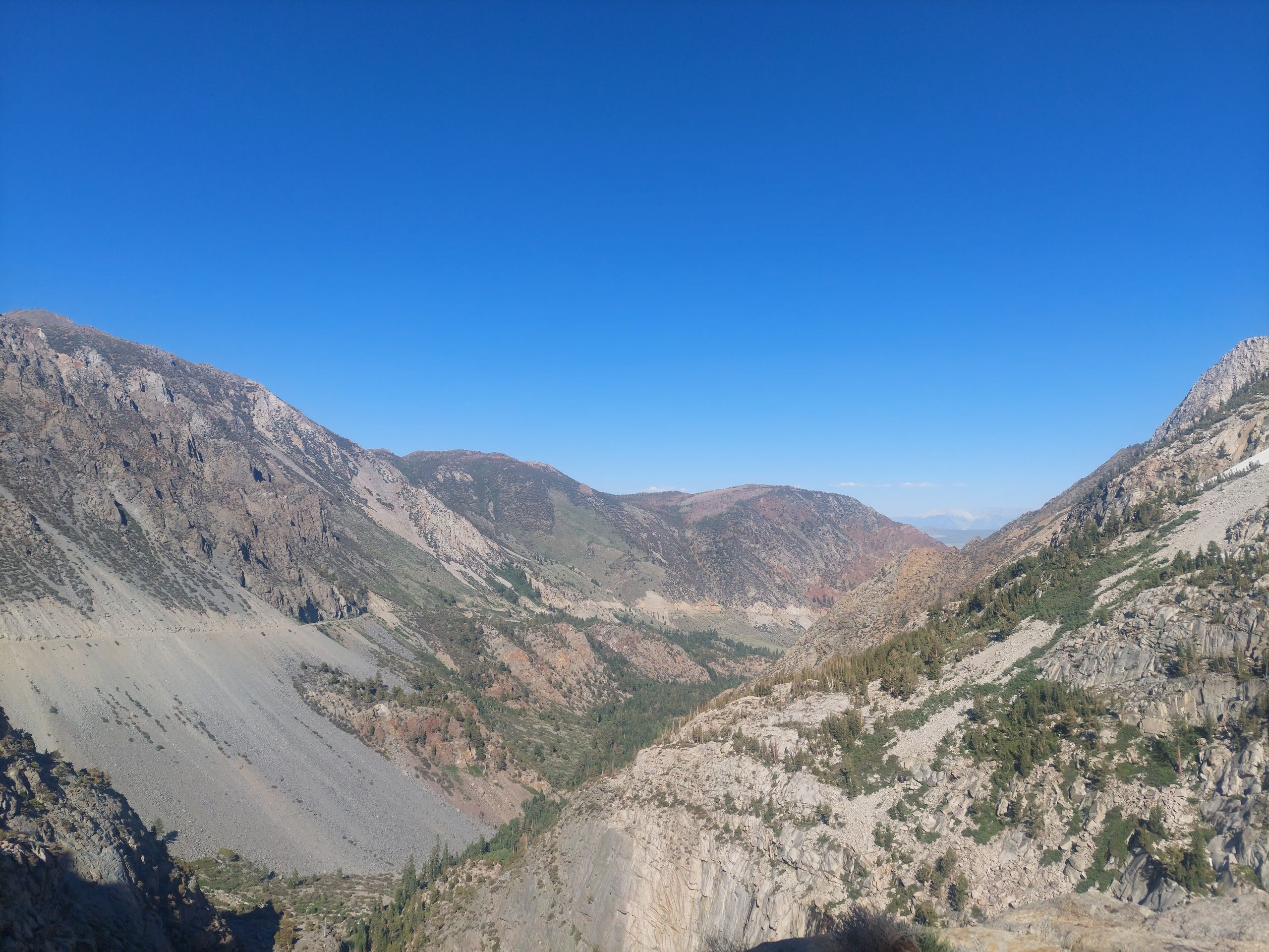
Directly adjacent to Sequoia National Park is Kings Canyon National Park. Unfortunately, the part of this park that includes the actual canyon was closed, so we were only able to visit the other part, which was pretty similar to Sequoia National Park. So we didn't stay there long - we walked at Big Stump Grove on a small but beautiful path with lots of tree stumps and over a broken, fallen Sequoia while taking some fun photos, and had a great one at the Panoramic Point Overlook view, although this time there were only a few other people there. We had now seen enough large trees, whether high or low, whether red or brown, in California, and it was time for completely different national parks.
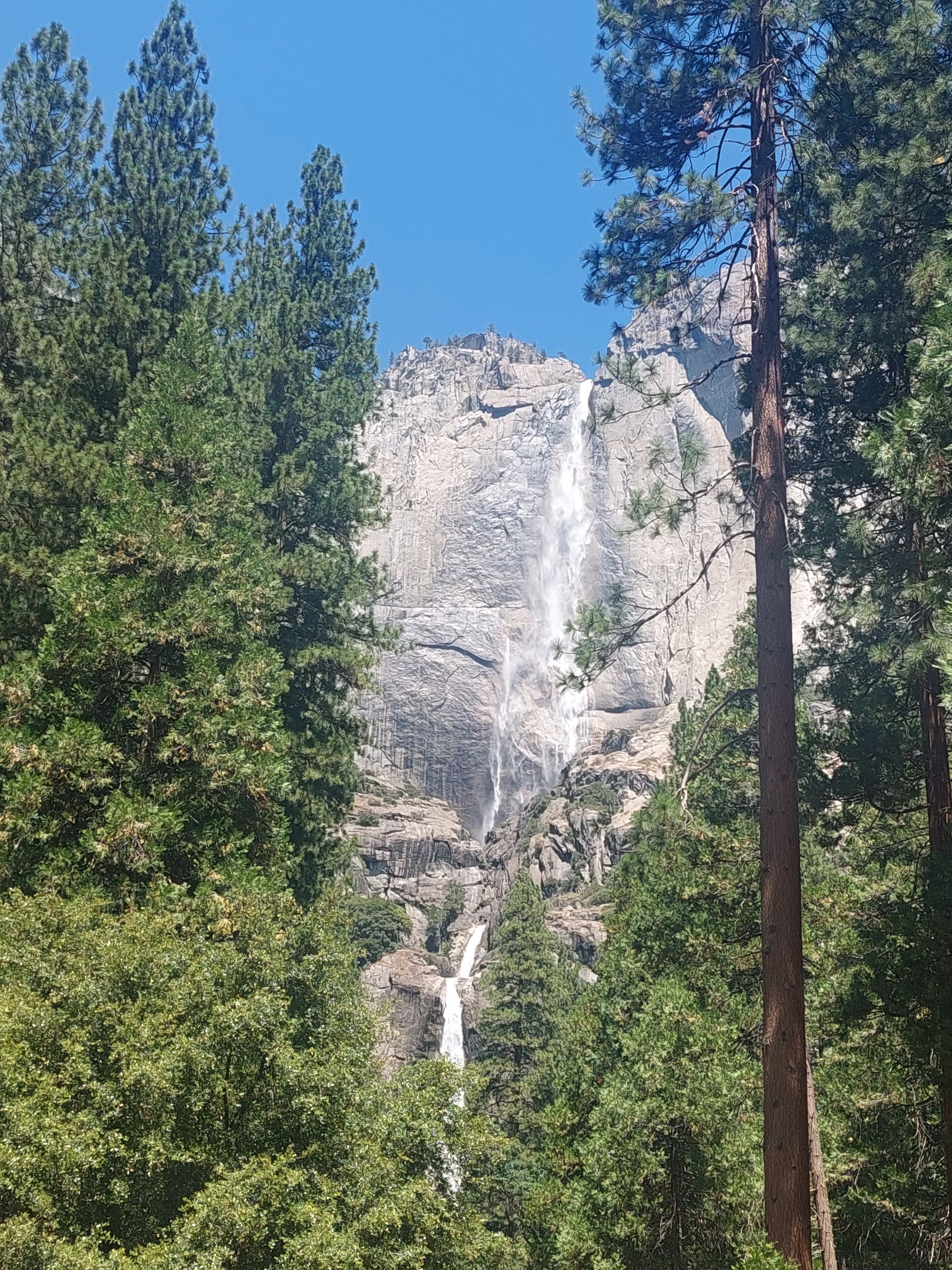
We were particularly excited about Yosemite National Park because we had both heard of it but didn't know much about it. The first thing worth knowing is the pronunciation, which we already knew for a long time: Joßämiti with an emphasis on the ä. There are many opportunities to practice this pronunciation: The heart of the national park is the Yosemite Valley, through which rivers flow and which is surrounded by mountains is from which waterfalls such as Yosemite Falls flow into the rivers. We only found out where the name Yosemite comes from after the visit through internet research. The indigenous tribe that lived in this valley was called that by neighboring tribes at the time. Unlike many other pioneers who came up with new names for their conquered territories, the conqueror who arrived here named the valley after the tribe he may have driven out of their homeland forever, so that at least the name would endure. He said something similar himself back then (https://www.yosemite.ca.us/library/origin_of_word_yosemite.html) and probably felt good about it. By the way, we always write about "indigenous population" or "native people" instead of "Indians" in order to definitely use a politically correct term given the discussions of recent years. It's different in the USA itself: We were initially surprised that "Indians" were mentioned again and again on official information boards and in museums. Incidentally, this means that it is only ever clear from the context whether indigenous or Indian people are meant, which was actually not clear to us at first.
Yosemite National Park is very popular, which was also evident in the nearby town of Oakhurst, where we stayed. At breakfast we not only noted with little enthusiasm that our hotel was a Comfort Inn with the well-known breakfast quality, even though it wasn't called that, but we also had to wait for a table in the busy and densely packed rooms. We really liked the national park itself, despite the many people. We first stopped at the Tunnel Viewpoint, which offered a first look into Yosemite Valley, and then drove into the valley. There is a road that runs partially along the edge of the valley in a circle. Since all the major parking lots were full, we drove around and finally found a spot on the side of the road near a shuttle bus stop, which also runs around the valley and is the recommended mode of transportation for seeing different parts of the valley. First we took the bus to Yosemite Falls. That took a very long time and we once again went one stop too far because the employee who was supposed to announce the stops on the bus last time unfortunately no longer had a voice. Finally we were able to walk the short distance to Yosemite Falls. Sebastian also climbed a bit up to the waterfall - of course there were signs again warning against climbing, and of course a lot of people did it anyway. Afterwards we walked to the end and continued to Yosemite Village. There was, among other things, a cinema where we watched the half-hour film "Spirit of Yosemite". In this film, a sonorous voice told us something meaningful about the park. This was a welcome break for us and we both fell asleep. That's why we ultimately can't say what this Yosemite spirit is really all about. Afterwards we fortified ourselves a bit in the restaurant and then went to the middle of the valley, where we really liked it, also because there was so little going on there. We therefore decided to walk further through the valley back to the car. We ran through green meadows and had a good view of the surrounding mountains, including the well-known mountains El Capitan and Half Dome. We took a break at a river with some easy rapids where people were on the water and dinghies were going by. We didn't have our bathing suits with us, but it wasn't a big deal that Sebastian's pants got wet wading in because it was warm enough. We then walked part of the Yosemite Valley Loop Trail to the car and ended up having a lovely, varied day.
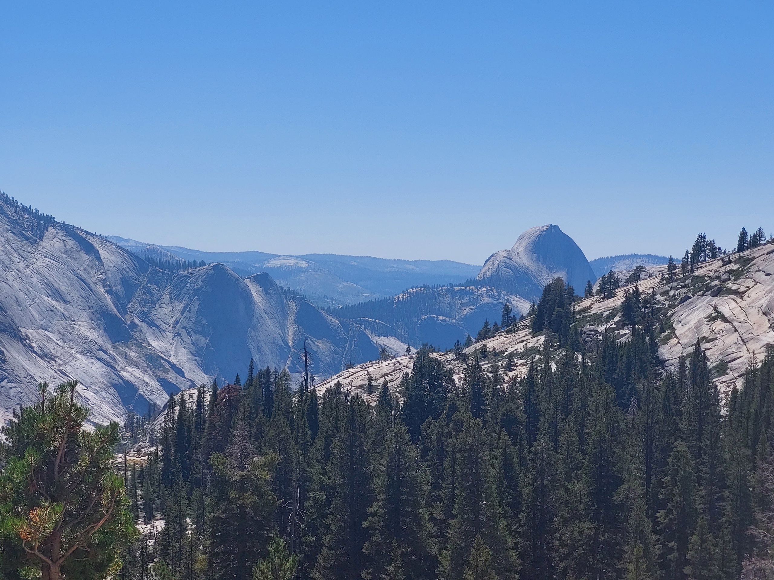
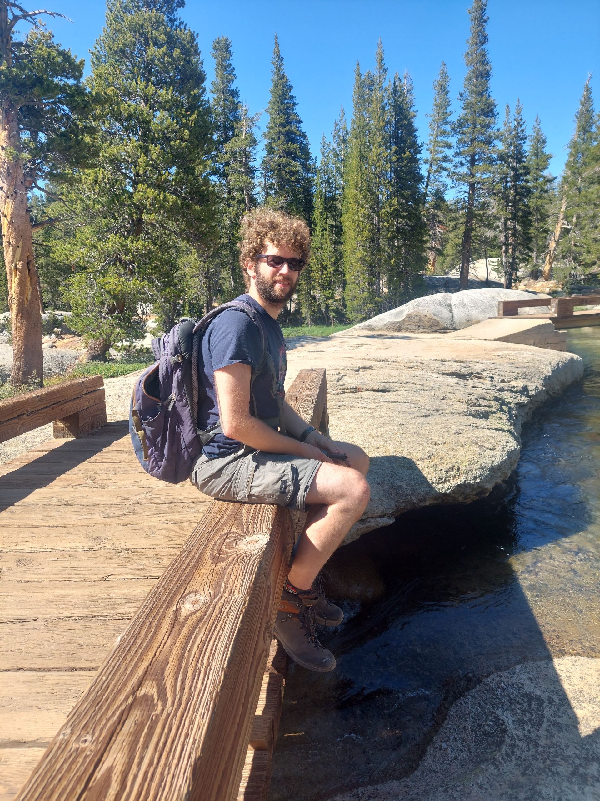
The next day we explored other areas of Yosemite National Park, which is much larger than Yosemite Valley. We drove past the valley towards the Tioga Pass road to Olmsted Point, from which there was a beautiful view of the valley and Half Dome. We walked a small path and over rocks to see all possible viewpoints. We then drove to a less busy part of the park: Toulumne Meadows, which was in the right direction for our onward journey. Since the visitor center there was closed, we just took a short hike next to the river and through a forest to two bridges. We drove out of the park, further over the pass, stopped briefly at another viewpoint, and then drove to our next overnight location, Lone Pine. The only notable thing about Lone Pine is that the best supermarket in town according to Google Maps is very expensive, probably because it's the only one.
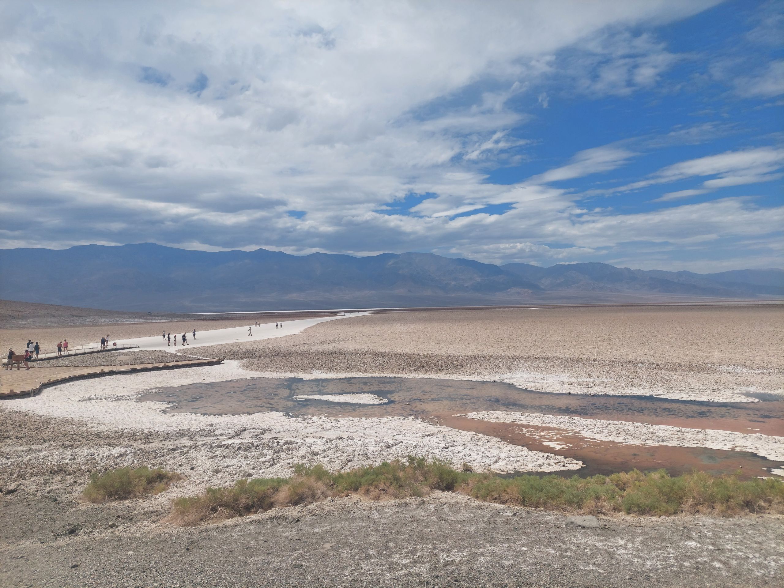
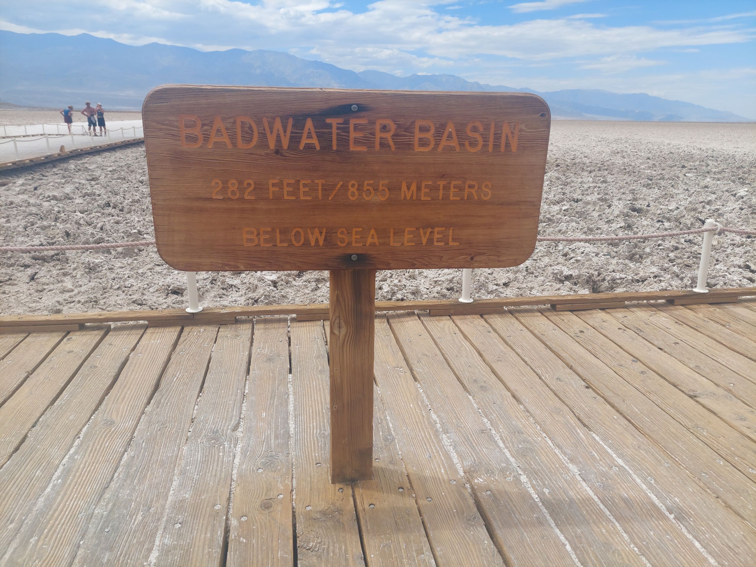
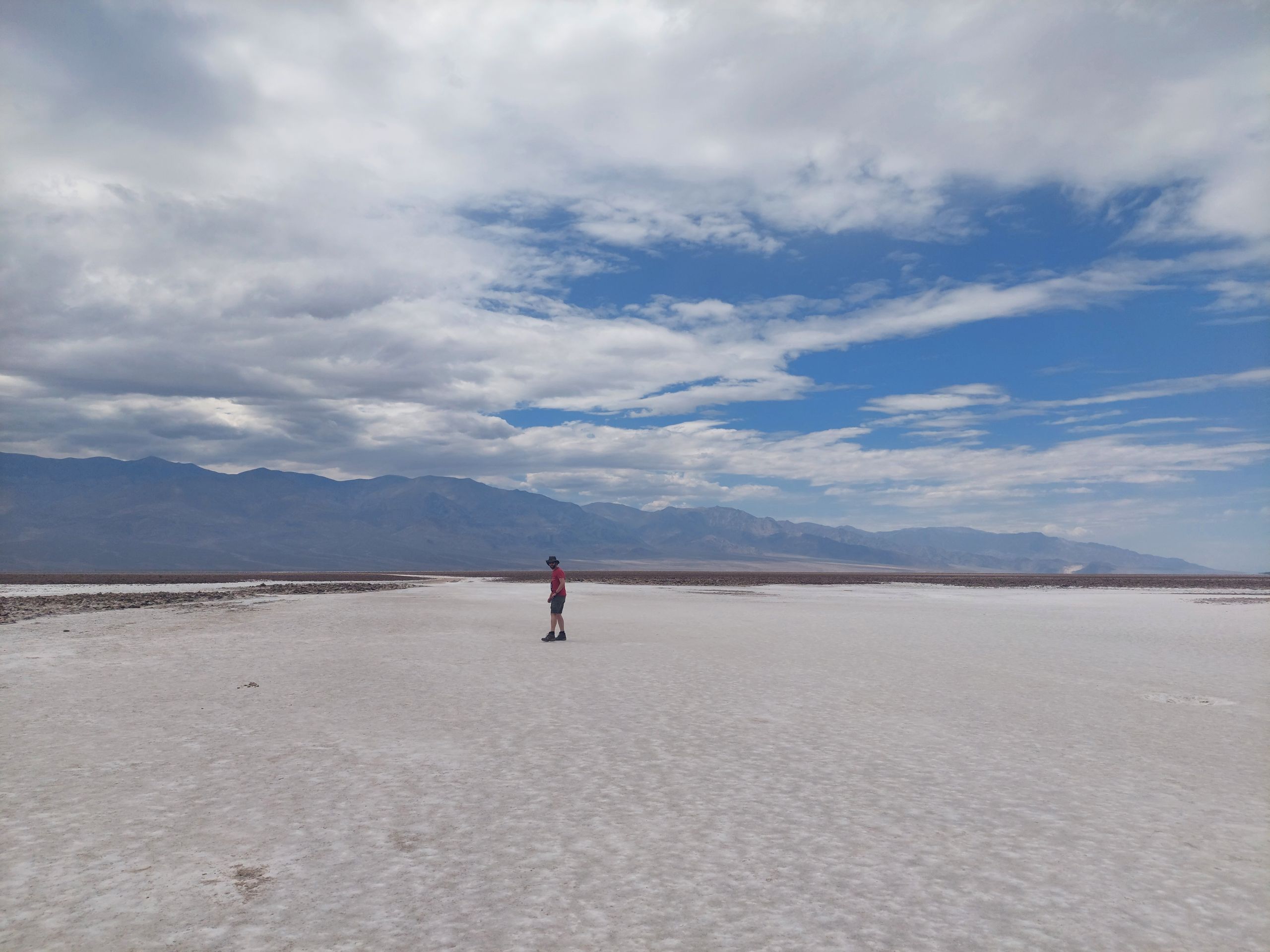
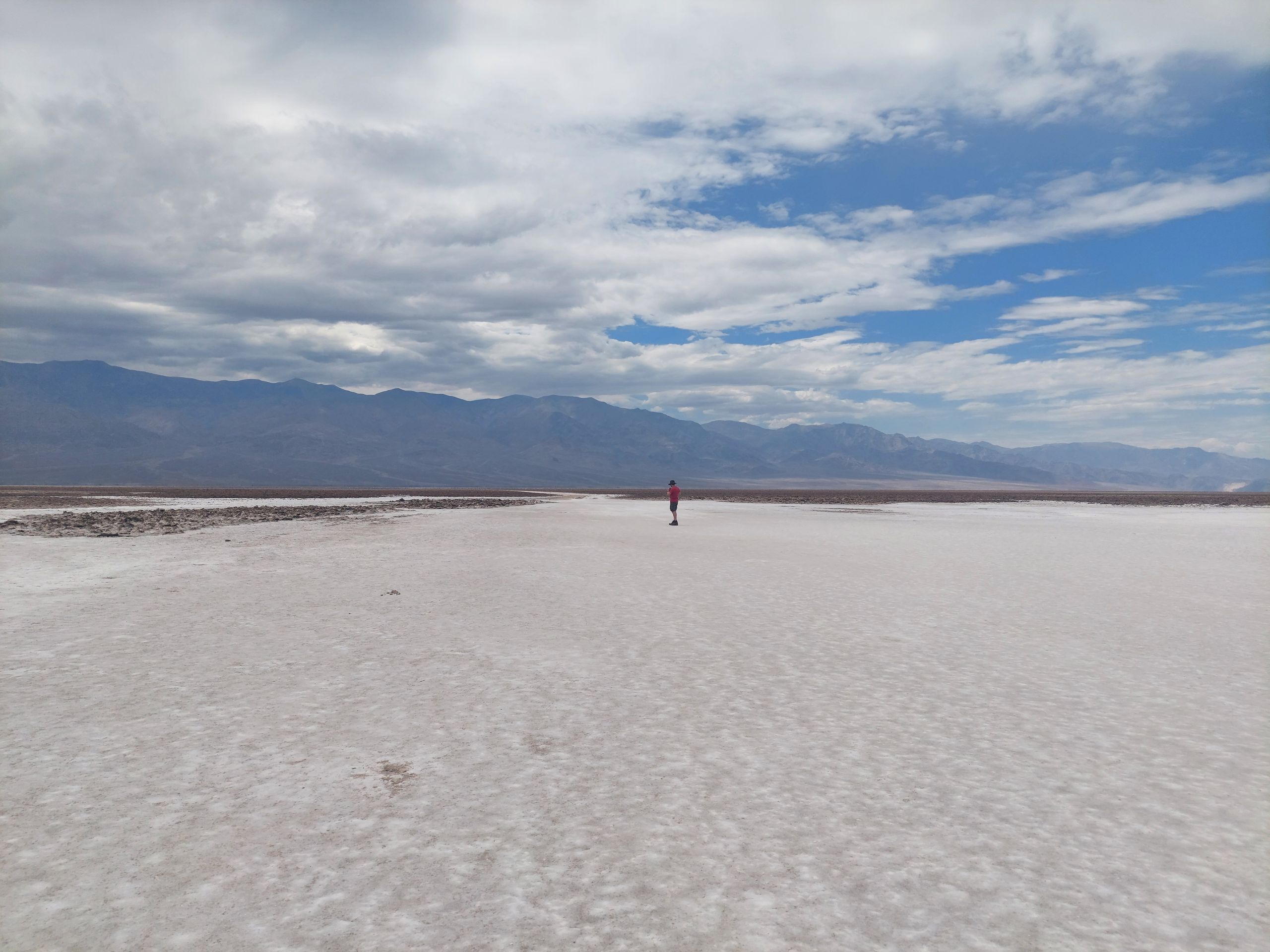
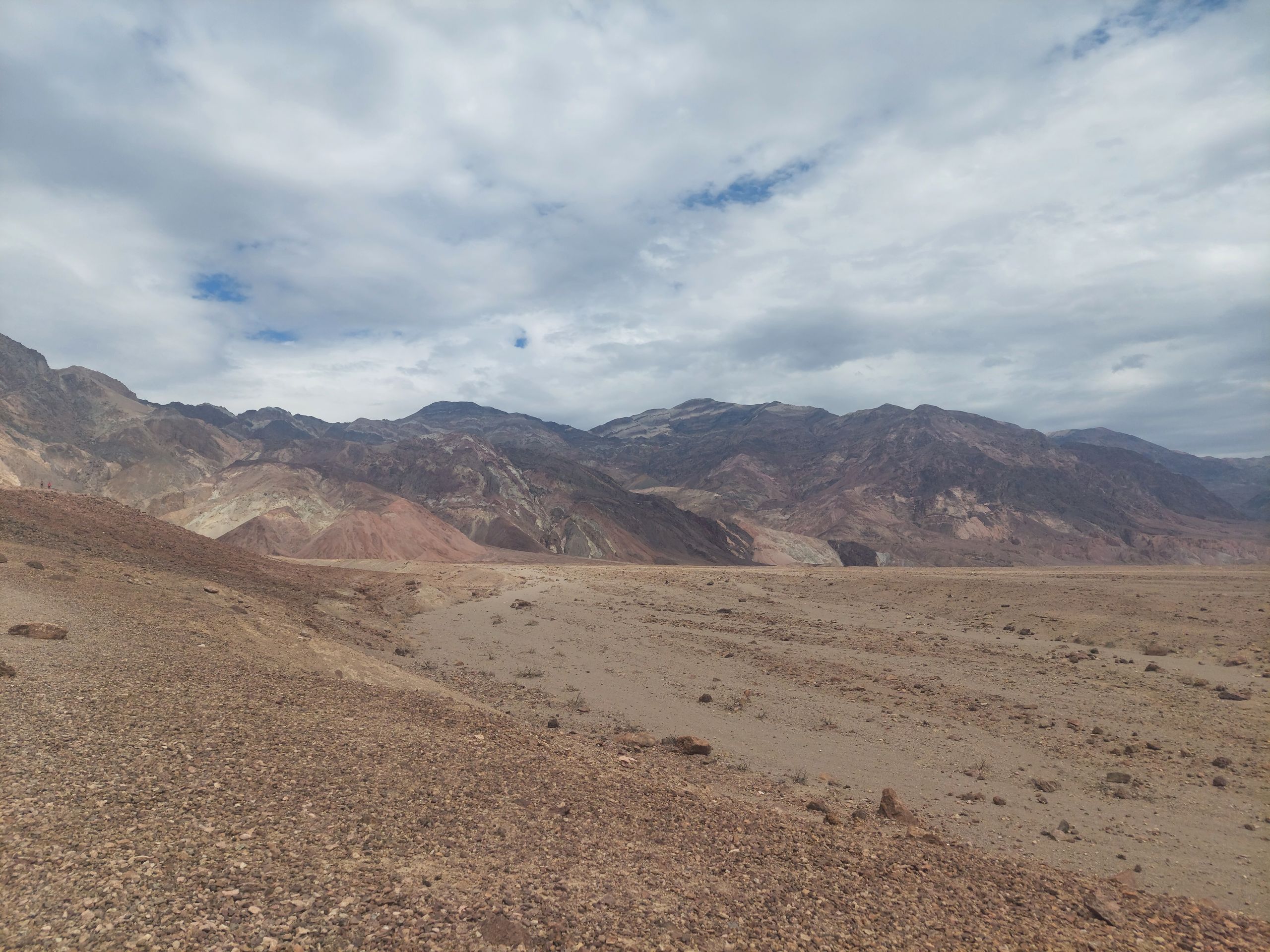
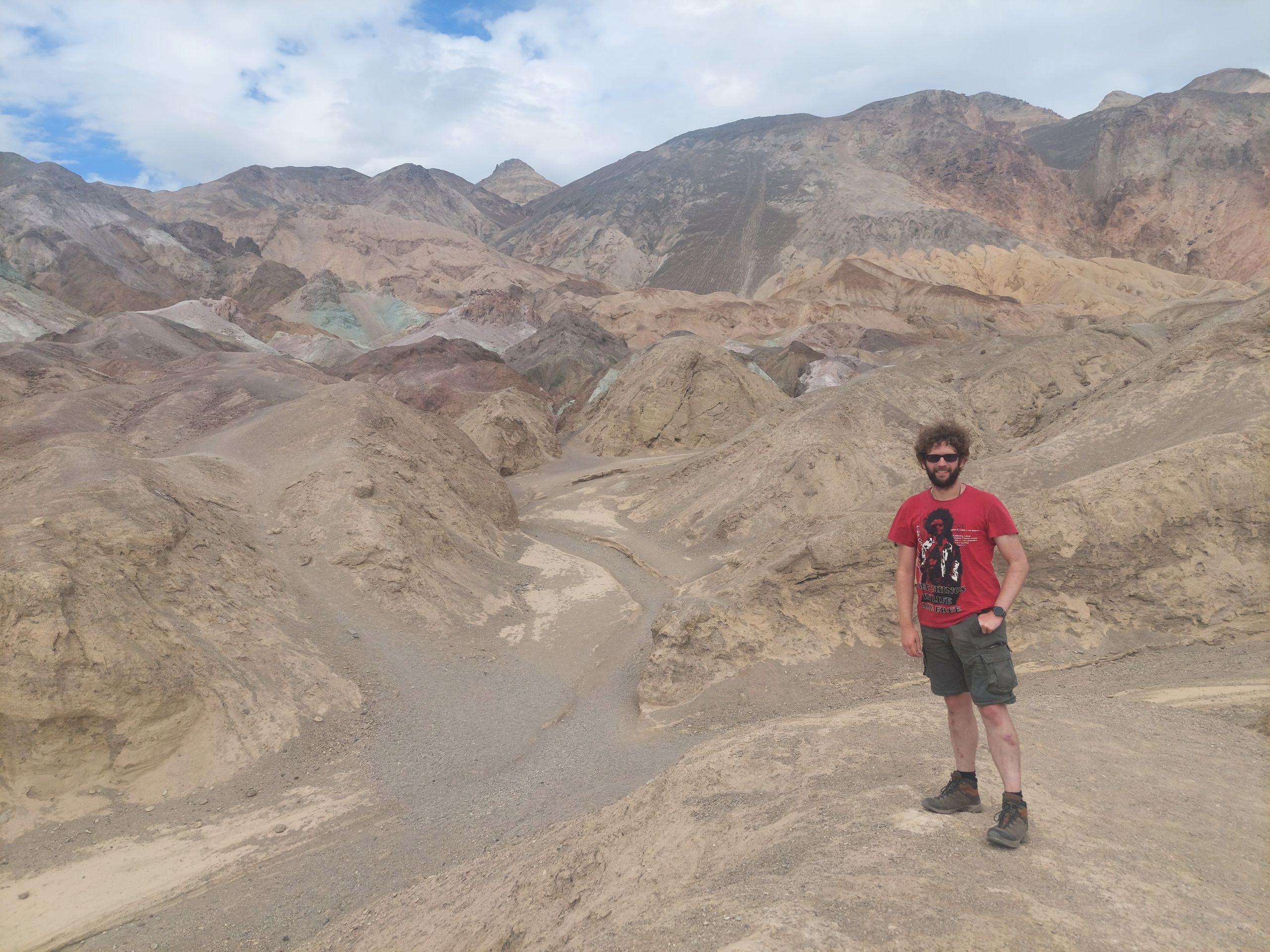
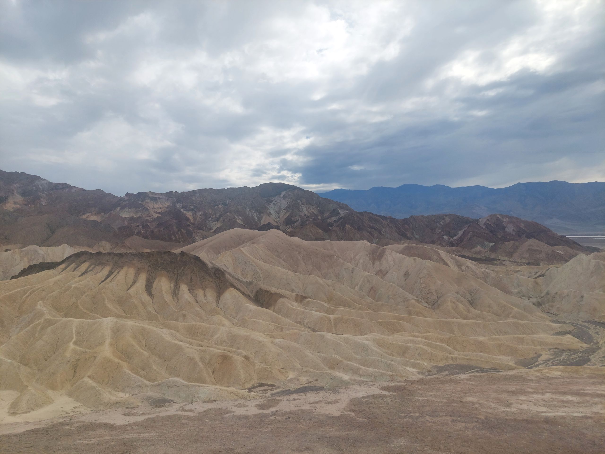
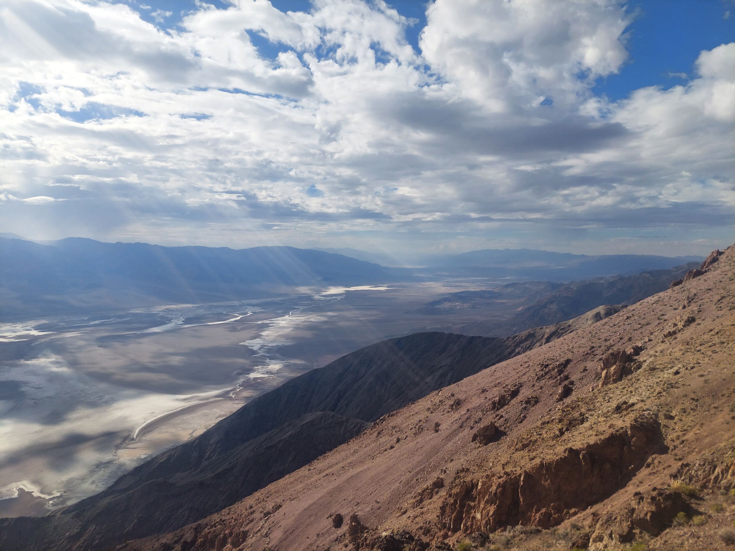
Next we went to Death Valley National Park. We were now further south again, so it was hotter again. For long hikes it is often life-threateningly hot and dry, which gives the valley its name. Just a few weeks earlier, during the heat of the year, the large thermometer at the Visitor Center was a particularly popular selfie motif, probably to show how tough you are. Fortunately, when we were there, this thermometer showed "only" 40°C, and we were able to dare to move around a bit. For example, at Badwater Basin, the lowest point in North America, where we drove first and, despite the obviously clear warning signs, walked a little way onto the salt crust without any incline into a seemingly endless expanse until we were finally completely alone. It was nice and quiet and we were able to talk to each other easily even over a long distance - an experience that you don't get to have often. We then drove through Artists Drive, where we first stopped at a viewing hill that some other people climbed despite the heat. Sebastian wanted to take part and Judith didn't, but we both like compromises and so we ran halfway up the hill together. On our journey there are always situations where you have to ask yourself whether it's worth doing things just because you see others doing them. There are always people who can do it better, and there are also people who are unreasonable. The next stop was at Artists Palette, which had colorful rocks. Then we drove to Zabriskie Point where we saw layered mountains. Here, in the middle of the driest national park in the USA, we experienced the first real rain of our trip to the USA. Luckily it didn't take long, so we were able to drive up a steep road to our last stop, Dante's View. From there we had a beautiful view of the salt flats of Badwater Basin.
We had now seen seven of the nine national parks in the huge California and were ready for a new state. As a contrast to the wide and silent Valley of Death, we next drove to the never-resting City of Sins.
Abonneren op de nieuwsbrief
Antwoord
Reisverslagen VS