
Hasta la Vista, अर्जेन्टिना!
प्रकाशित: 16.06.2019


समाचारपत्रको सदस्यता लिनुहोस्
DEUTSCH
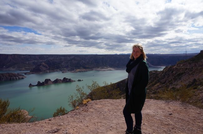
Nach insgesamt 14 Tagen in Buenos Aires, 6 Tagen in Cordoba und Mendoza und 10 Tagen in Patagonien fand der argentinische Teil meiner Reise ein sympathisches und farbenfrohes Ende in Salta und Jujuy.
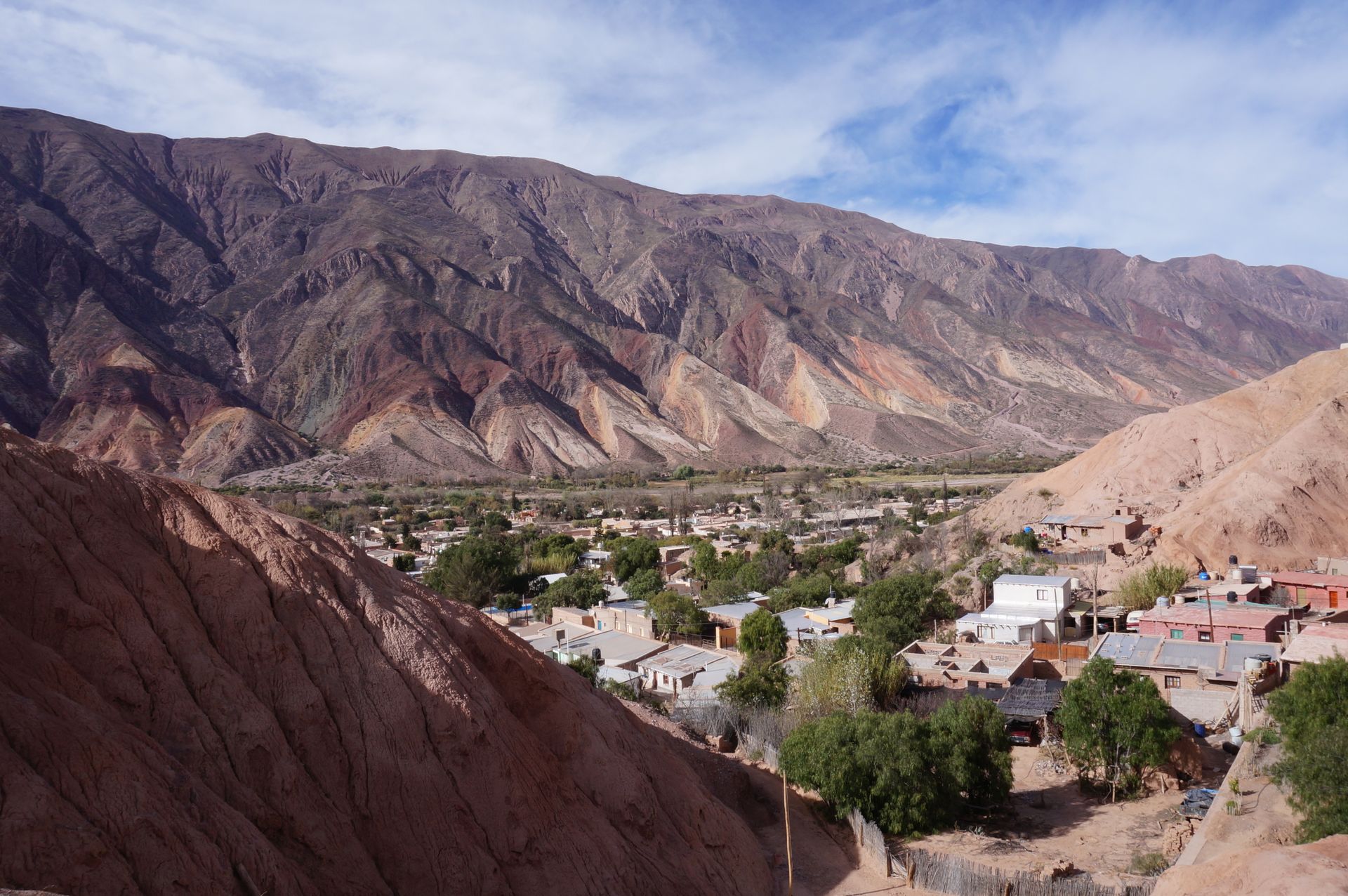
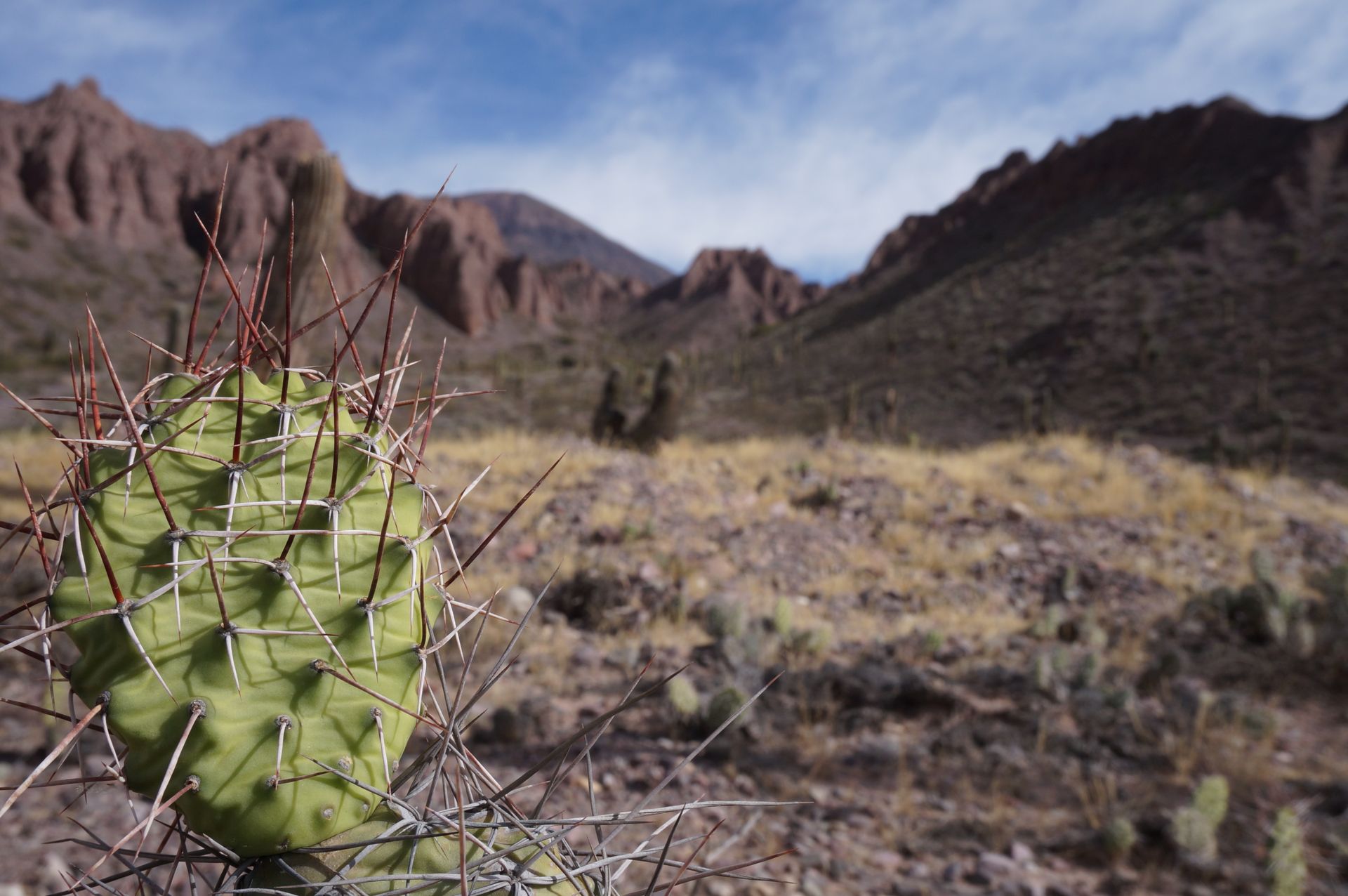
Schon auf dem 36-stündigen Busweg (am Ende 38h) von Puerto Madryn an der Südostküste Argentiniens nach Salta im Nordwesten Argentiniens haben wir mehrere Klimazonen durchquert. Im kalten und trockenen Patagonien besteht die Flora und Fauna hauptsächlich aus Büschen und Lamas. In der nördlichen Region wie Salta geht das Klima in eine dichter bepflanzte fast tropische Vegetation mit felsigen Bergen über. In Jujuy, der Grenzregion zwischen Salta und Bolivien, ist der Kaktus die häufigste Pflanze auf bunten Regenbogenbergen.
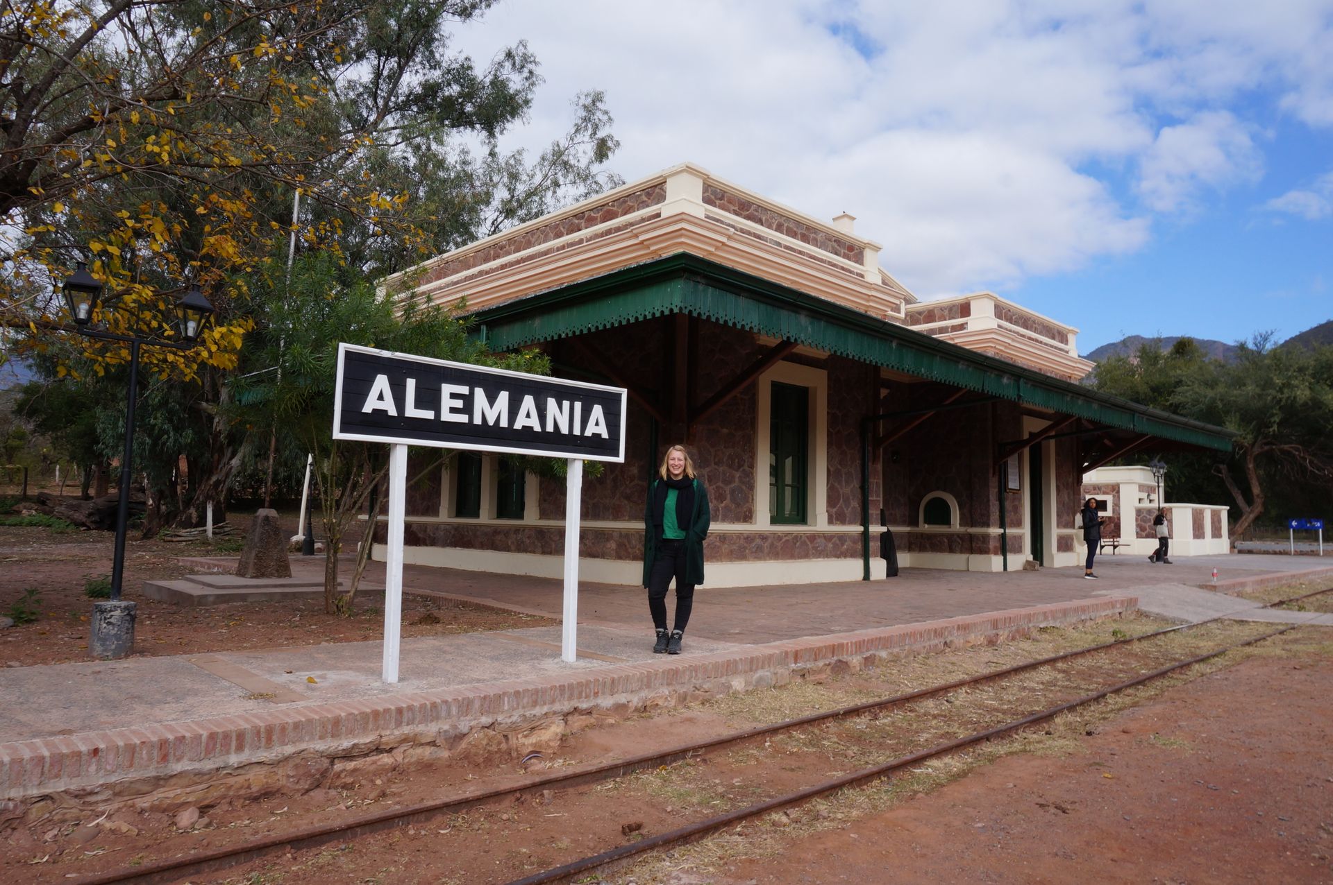
Mit Hilfe von Couchsurfing, Facebook und der Free Walking Tour als Treffpunkt konnten wir Reisende finden, mit denen wir Autos mieten konnten, um die Region drei Tage lang zu erkunden. In unseren beiden Autos waren 6 Nationalitäten vertreten. Ganz nach dem Motto 'Europa unterwegs' fuhren wir von Dorf zu Dorf, deren Namen von Mal zu Mal schwerer auszusprechen wurden. Tilcara. Humahuaca. Hornocal. Purmamarca. Gefolgt von El Cafayate (nicht zu verwechseln mit El Calafate in Patagonien) und einem kleinen Dorf, das tatsächlich Deutschland heißt. Der Name kommt daher, dass hier die Eisenbahn endet, die angeblich von Deutschen erbaut wurde.
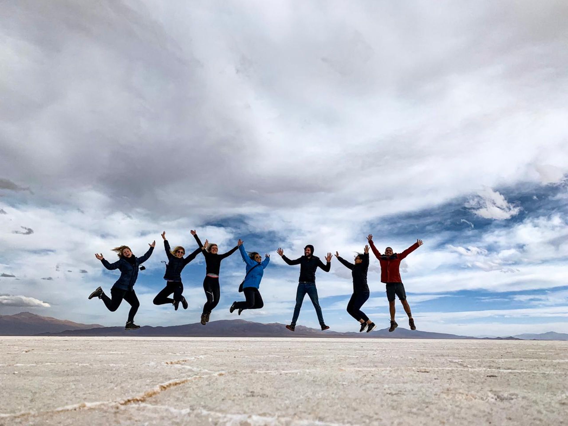
Die Absprache von 7 Leuten mit 2 Autos verlief überraschend problemlos. So setzten wir unsere Reise zu viert nach Uyuni, Bolivien, fort.
Zuletzt noch zwei Nerd-Exkursionen. Ich bin ja eigentlich Chemikerin.
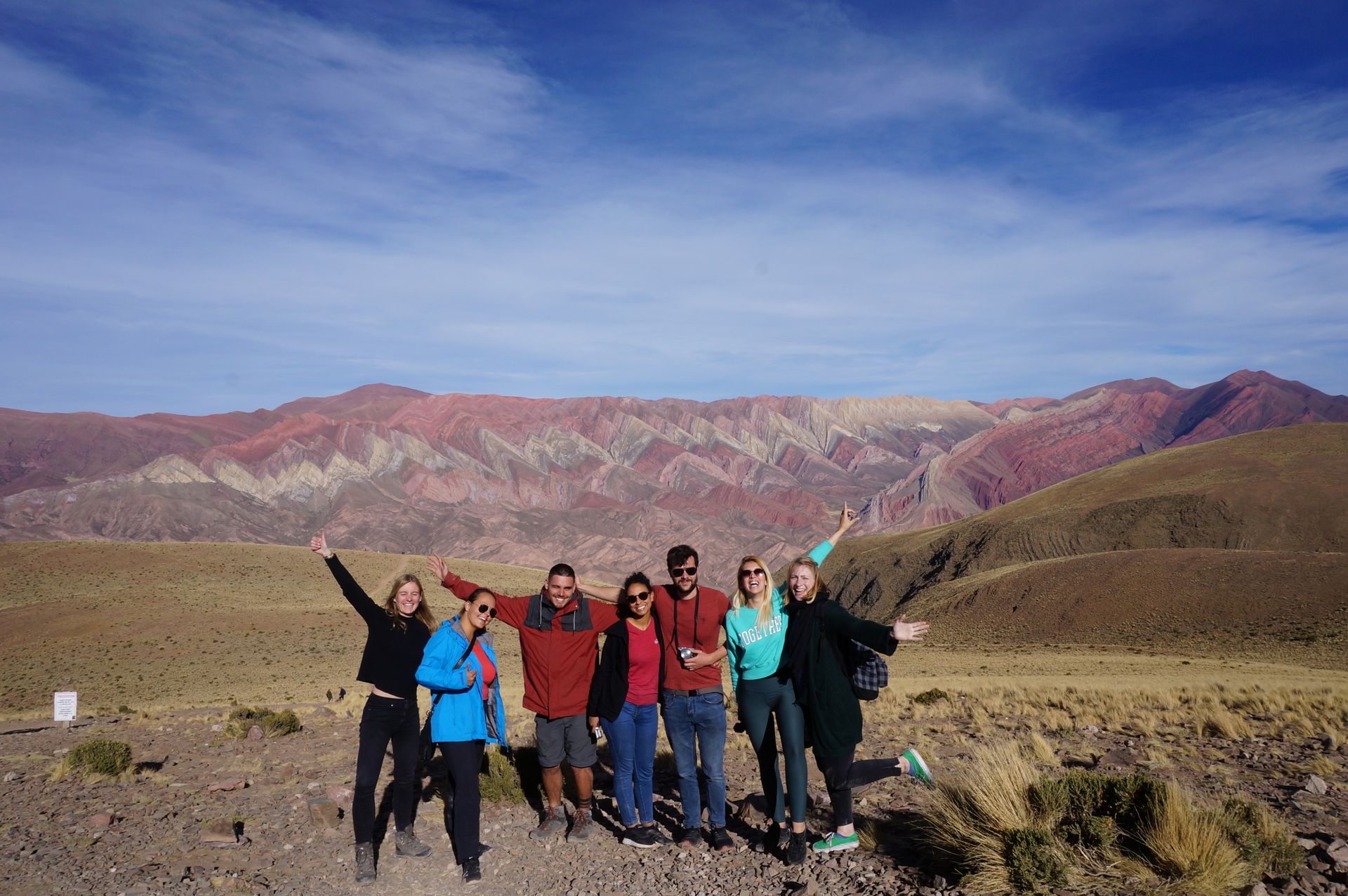
Exkurs #1: Regenbogenberge
Die Quebrada de Humahuaca wurde vor etwa der Zeit gebildet, als Dinosaurier lebten. Die verschiedenen Farben, 7 in Pulmamarca und 12 in Hornocal, können in 33 Töne unterschieden werden. Die Farben entstehen durch die unterschiedlichen Mineraliengehalte in der Sedimentschicht. Rote Töne stammen von Eisenoxiden, Gelb von Schwefel und Silikaten und Grün und Blau von Kupfer.
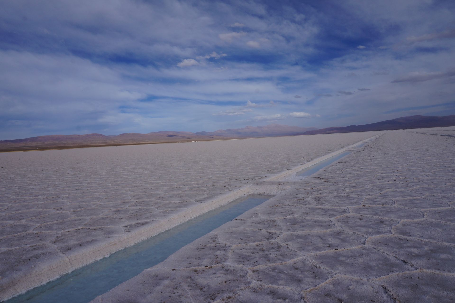
Exkurs #2: Salina Grande
Der Salzsee 'Salina Grande' wurde durch tektonische Bewegungen gebildet. Das entstandene Tal sammelte das salzhaltige Mineralwasser des nahe gelegenen Vulkans. Das Fehlen von Fossilien und Jod im Salz beweist, dass der See nie mit dem Meer verbunden war. Aus Stabilitätsgründen trocknet das Salz in Fünf- und Sechsecken.
Das Salz wird auf drei Arten verwendet. Blöcke können aus dem Eis herausgeschnitten werden, um sie zur Tierernährung oder zum Bau von Häusern zu verwenden. Die zweite Option ist, das Oberflächensalz nach der Regenzeit in der Industrie oder im Winter gegen Eis zu verwenden. Die dritte Option besteht darin, ein kleines Becken zu bilden. Das Wasser darin ist so salzig, dass Kristalle gebildet und nach einem Jahr geerntet werden. Das Salz muss jedoch modifiziert werden, um Jod hinzuzufügen.
Das war's von mir.
Bis später.
Eure Dory
ENGLISH
After a total of 14 days in Buenos Aires, 6 days in Cordoba and Mendoza, and 10 days in Patagonia, the Argentinian part of my trip found a friendly and colorful end in Salta and Jujuy.
On the 36-hour bus journey (ending up being 38 hours) from Puerto Madryn on Argentina's southeast coast to Salta in the northwest, we crossed several climate zones. The cold and dry climate of Patagonia is mainly characterized by bushes and llamas. In the northern region like Salta, the climate becomes denser and almost tropical with rocky mountains. In Jujuy, the border region between Salta and Bolivia, cacti are the most common plants on colorful rainbow mountains.
With the help of Couchsurfing, Facebook, and the Free Walking Tour as a meeting point, we managed to find fellow travelers with whom we could rent cars to explore the region for three days. There were 6 nationalities represented in our two cars. Following the motto 'Europe on tour,' we drove from village to village, with the names becoming increasingly difficult to pronounce. Tilcara. Humahuaca. Hornocal. Purmamarca. Followed by El Cafayate (not to be confused with El Calafate in Patagonia) and a small village that is actually called Germany. The name comes from the fact that the railway ends here, which was allegedly built by Germans.
The coordination of 7 people with 2 cars went surprisingly smoothly. So, the four of us continued our journey to Uyuni, Bolivia.
Finally, two nerd excursions. After all, I am a chemist.
Excursion #1: Rainbow Mountains
The Quebrada de Humahuaca was formed approximately during the time when dinosaurs lived. The different colors, 7 in Pulmamarca and 12 in Hornocal, can be distinguished into 33 tones. The colors are formed by the different mineral contents in the sediment layer. Red tones come from iron oxides, yellow from sulfur and silicates, and green and blue from copper.
Excursion #2: Salina Grande
The salt lake 'Salina Grande' was formed by tectonic movements. The resulting valley collected the salt-containing mineral water from the nearby volcano. The absence of fossils and iodine in the salt proves that the lake was never connected to the sea. For stability, the salt dries in pentagonal and hexagonal patterns.
The salt is used in three ways. Blocks can be cut out from the ice to be used in animal nutrition or to build houses. The second option is to use the surface salt after the rainy season for industry or in winter to combat ice. The third option is to create a small pool. The water inside is so salty that crystals form and can be harvested after a year. However, the salt must be modified to add iodine.
That's all from me.
See you later.
Dory
समाचारपत्रको सदस्यता लिनुहोस्
जवाफ
यात्रा रिपोर्टहरू अर्जेन्टिना