25/08/2018 - Along the Whanganui Rivers
ꯐꯣꯉꯈ꯭ꯔꯦ꯫: 22.09.2018


ꯅꯤꯎꯖꯂꯦꯇꯔꯗꯥ ꯁꯕꯁ꯭ꯛꯔꯥꯏꯕ ꯇꯧꯕꯤꯌꯨ꯫
After our break in "Whanganui", we continued our road trip along the river of the same name. It feels like time has stood still in the "Whanganui River National Park".
Over 800 years ago, isolated Maori tribes settled here. It wasn't until the European immigrants arrived that the area developed and became known. In the mid-1860s, the first of many steamships set sail. 12,000 tourists cruised the "Rhine of the Maori Land" annually, between "Pipiriki" and Whanganui. Today, not much remains of its former glory. With the construction of roads, the cessation of river navigation, and the classification of agriculture as unprofitable, only a few settlements along the riverbank survived.
Nevertheless, it is worth exploring the area in various ways. Canoeing is very popular in the summer - you can paddle along the long river for several days and stay overnight in huts located along the riverbank. Or you can choose to drive up the bumpy country road. Just like us.
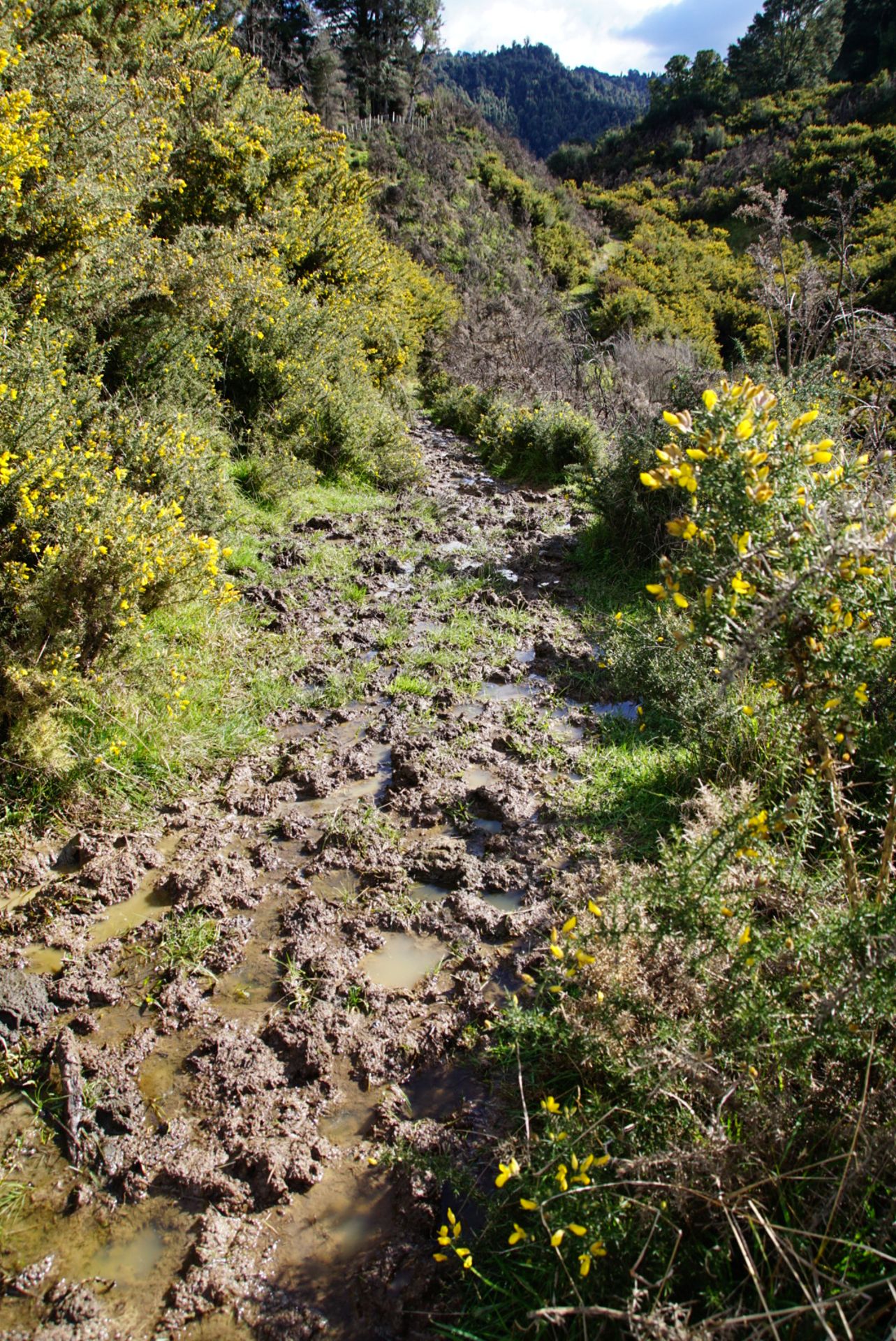
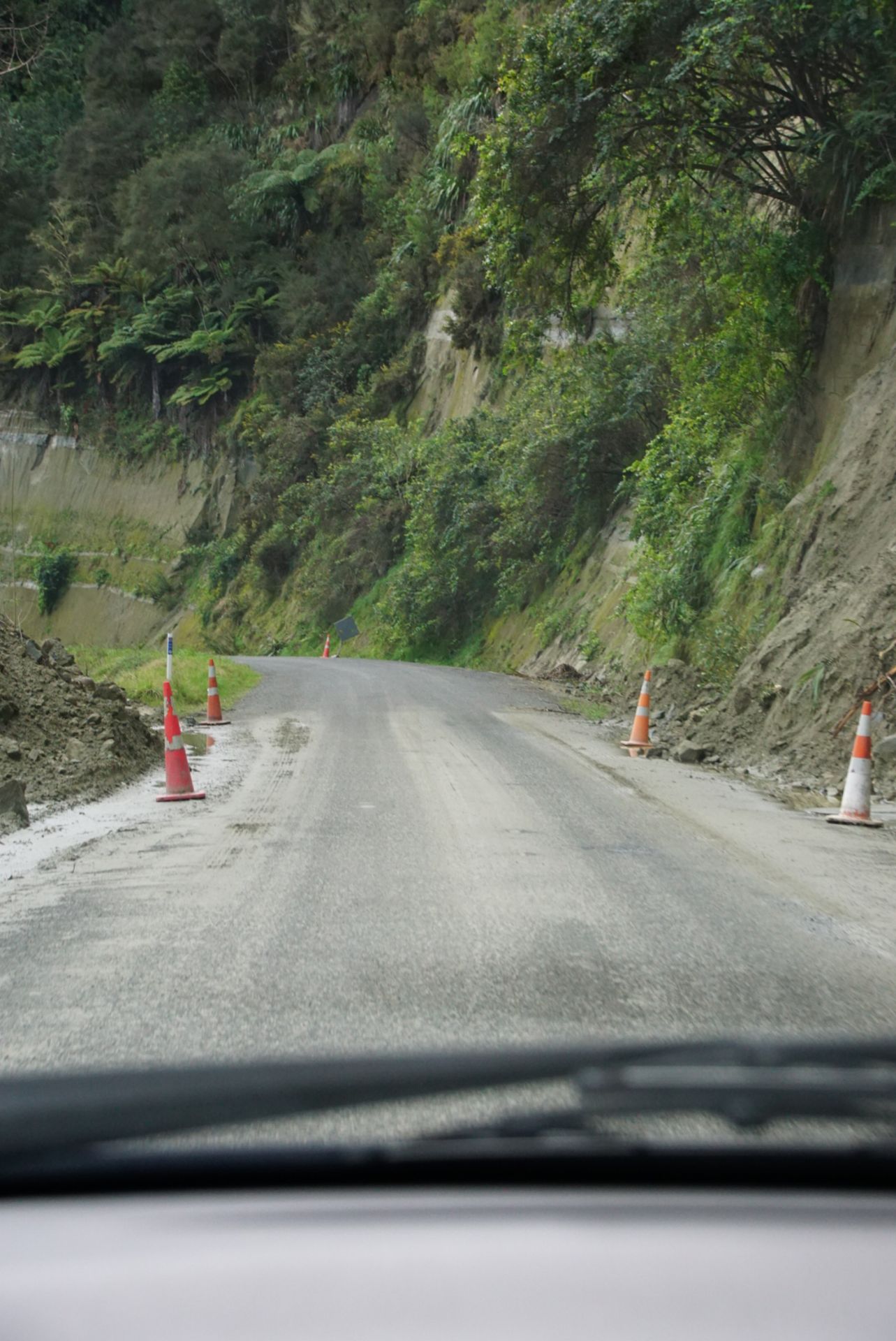
The Whanganui River Road welcomed us with a high mountain. Soon, a beautiful view of the river valley opened up - wooded slopes framed the Whanganui River. From then on, the road followed the river closely. Here and there, there was a meeting house of the Maori, who still live here today. But for the most part, we had to drive to "Atene", 21km away, to reach the first attraction. The goal was a lookout located on the mountain, which should have offered beautiful views of the region... - would have offered? Maybe you notice, unfortunately, we didn't reach it. We had problems from the beginning due to the heavy rain of the last few days. A slippery path is one thing, standing ankle-deep in mud is another. After 25 minutes, the hiking trail left public land and continued through a cow pasture. It was right here that we faced the muddy obstacle. When the search for an alternative route was unsuccessful, we were forced to turn back. Slightly annoyed and disappointed, we started the return journey. We went back down the mountain we had just climbed - through a forest, past clay walls, back to the car.
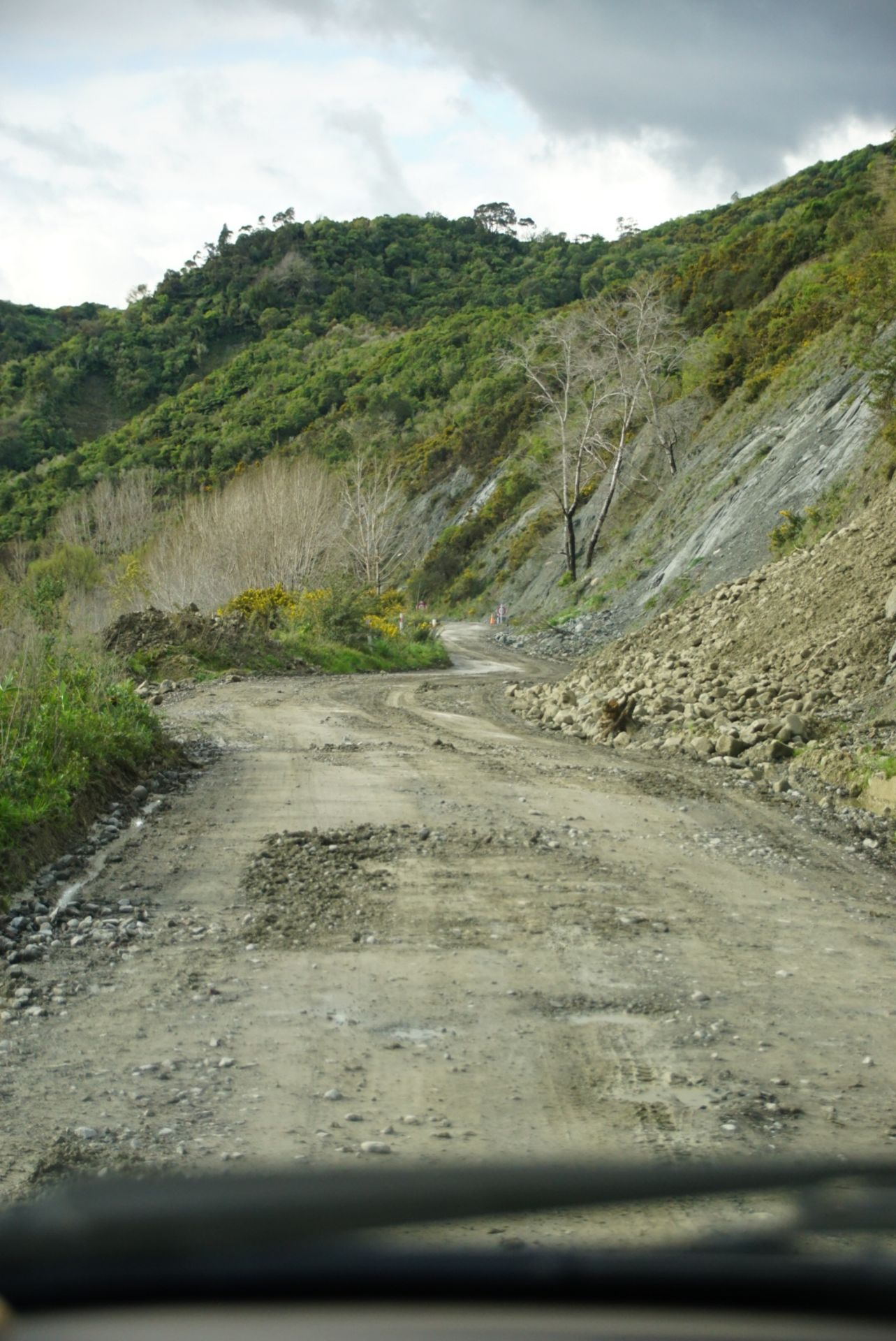
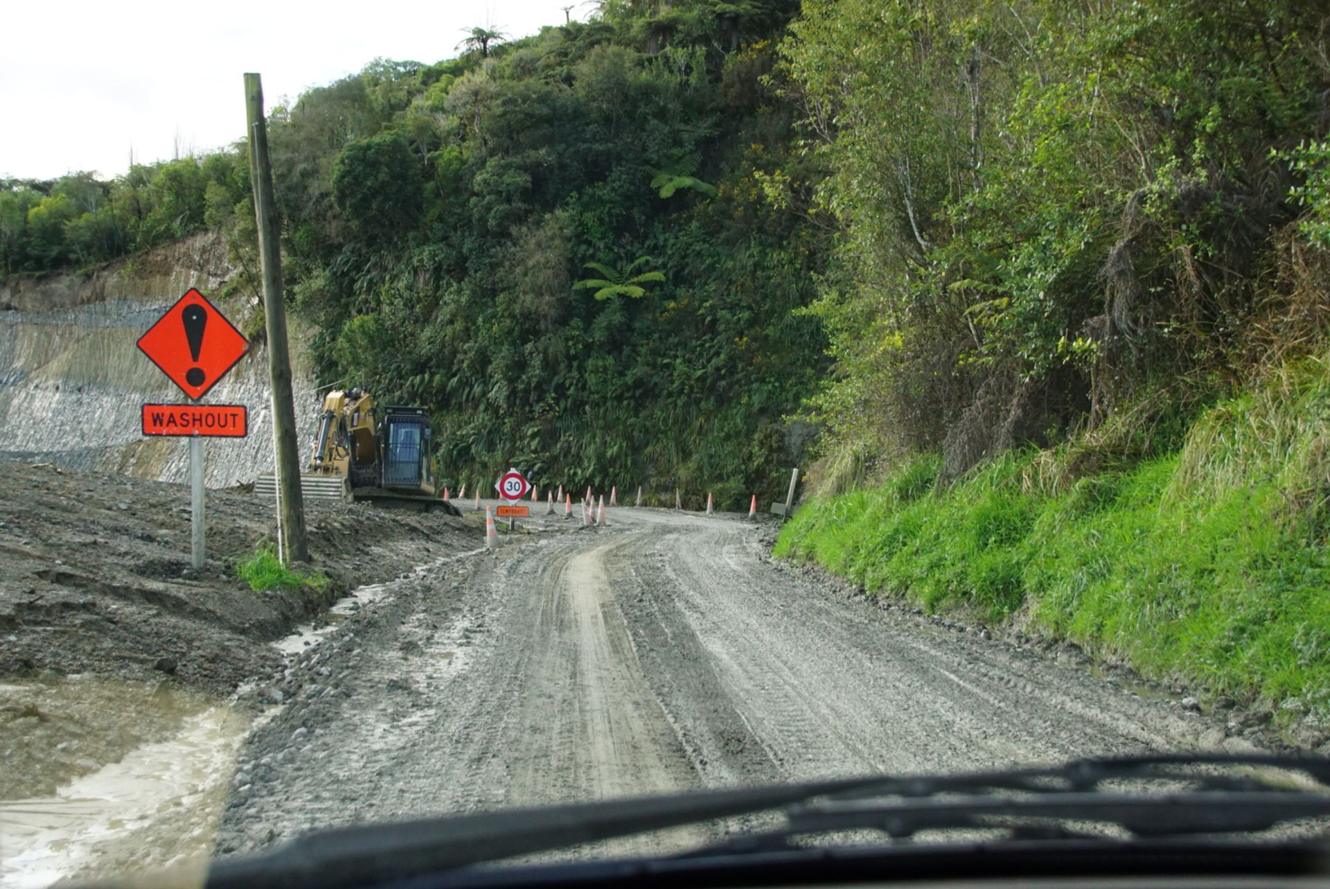
Engine on and off we go. The further upstream we went, the worse the road conditions became. Sometimes there were large rocks in the way, sometimes the road was just loose stones and led through a construction site. Of course, animal encounters were also inevitable. Once, a dog ran towards us, and next time it was mountain goats with their young standing dangerously close to the edge of the road. Even though the surroundings didn't offer much variety, it never got boring.
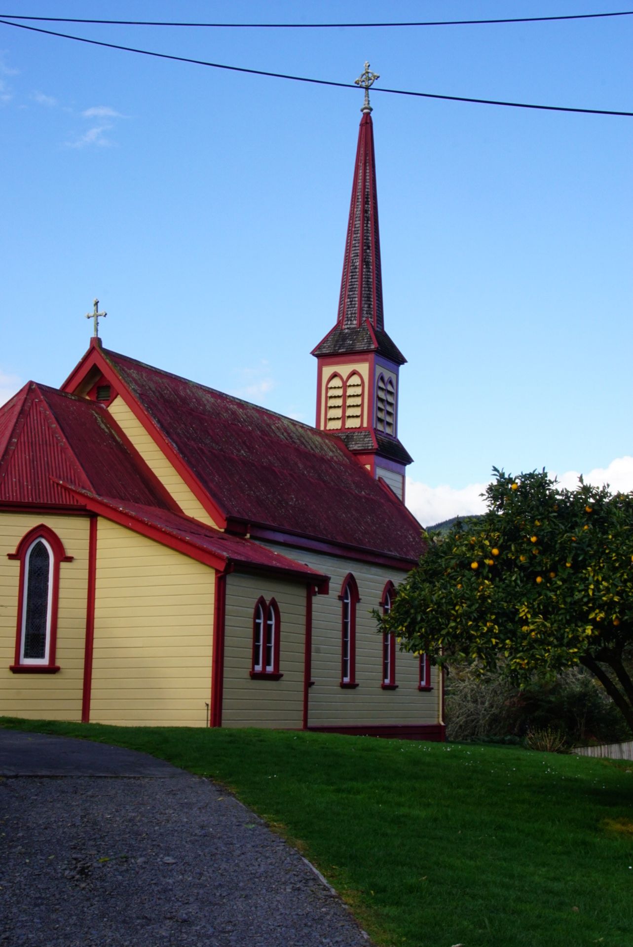
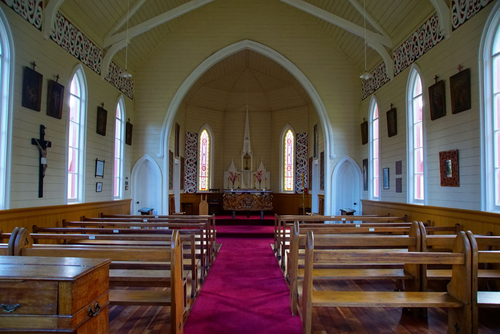
We made our second, longer stop in "Hiruharama". On a hill, the "St Joseph's Catholic Church" was built in the 1890s. We explored the area and discovered many Maori wood carvings in the small, beautiful church, which can only be entered without shoes.
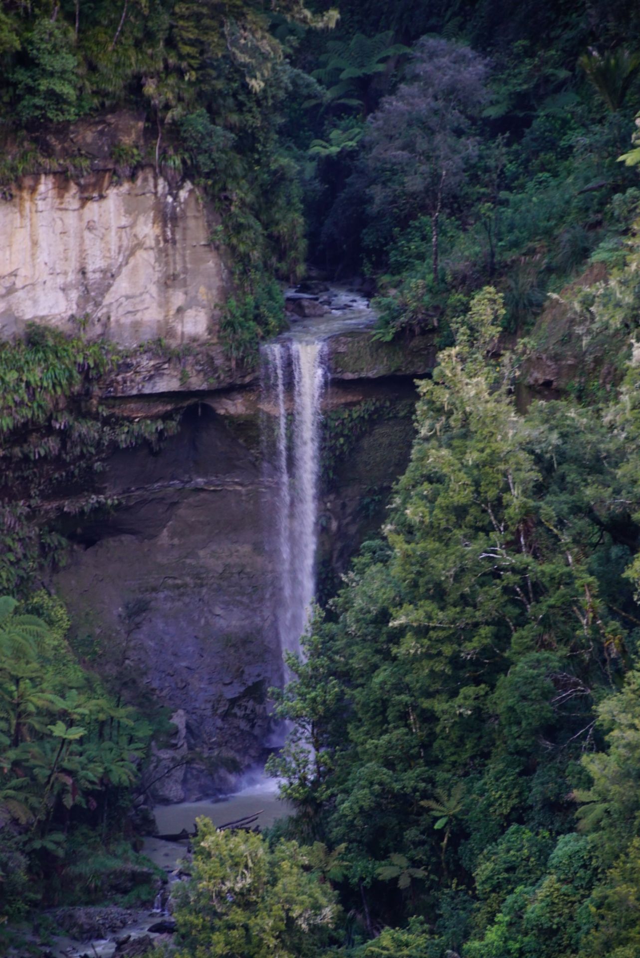
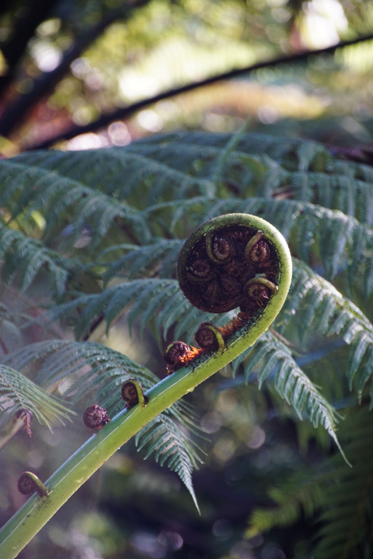
On the remaining 10 kilometers to Pipiriki, we stopped several times at the side of the road. For example, the "Omerehu Fall" could be seen between the bushes. In addition to many other waterfalls, all of which flow into the Whanganui River, this one was particularly visible. We also discovered many ferns preparing for spring by unfurling their branches (=Koru). After 64 kilometers and about three hours, we reached the sleepy village of Pipiriki. However, this was not our final destination for the day. We continued our journey and arrived in "Ohakune" around 5:15 p.m. The town is located at the foot of "Mount Ruapehu", the highest mountain on the North Island (2,797m) - accordingly, it was cool when we arrived.
The next morning, we had some trouble getting going. The low temperatures were uncomfortable, and going to the shower was difficult. However, they turned out to be exceptionally good and luxurious! After a very, very long time, we had the pleasure of using a detachable shower head. For the average household, this may be a matter of course, but it is a rarity and simply not available on 95% of campsites. Furthermore, and the real luxury of the facility, each shower cubicle has a heating lamp and a towel warmer - wow - just perfect for the cold outside temperatures! :)
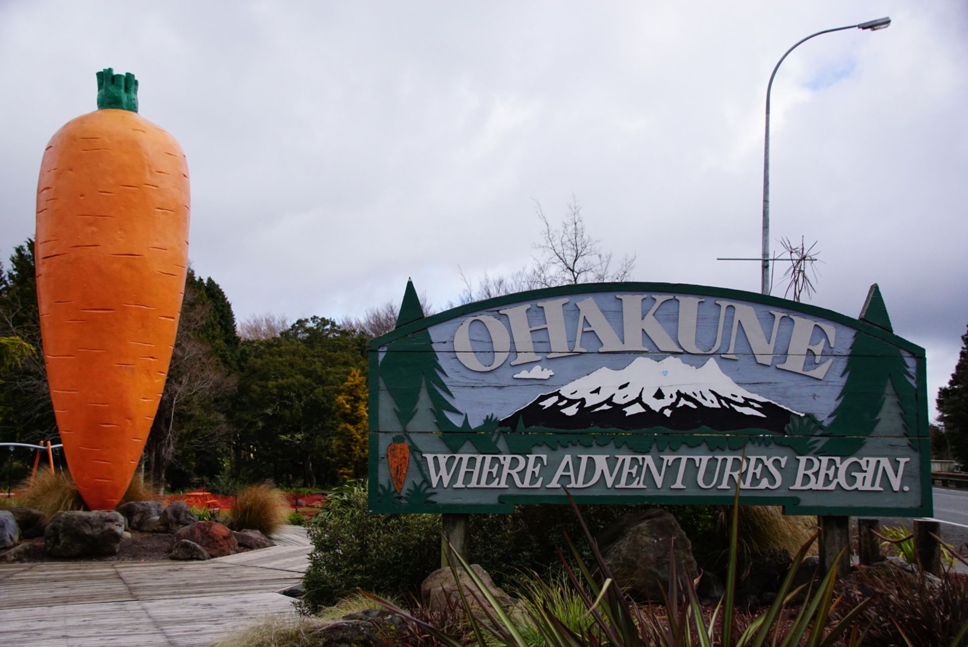
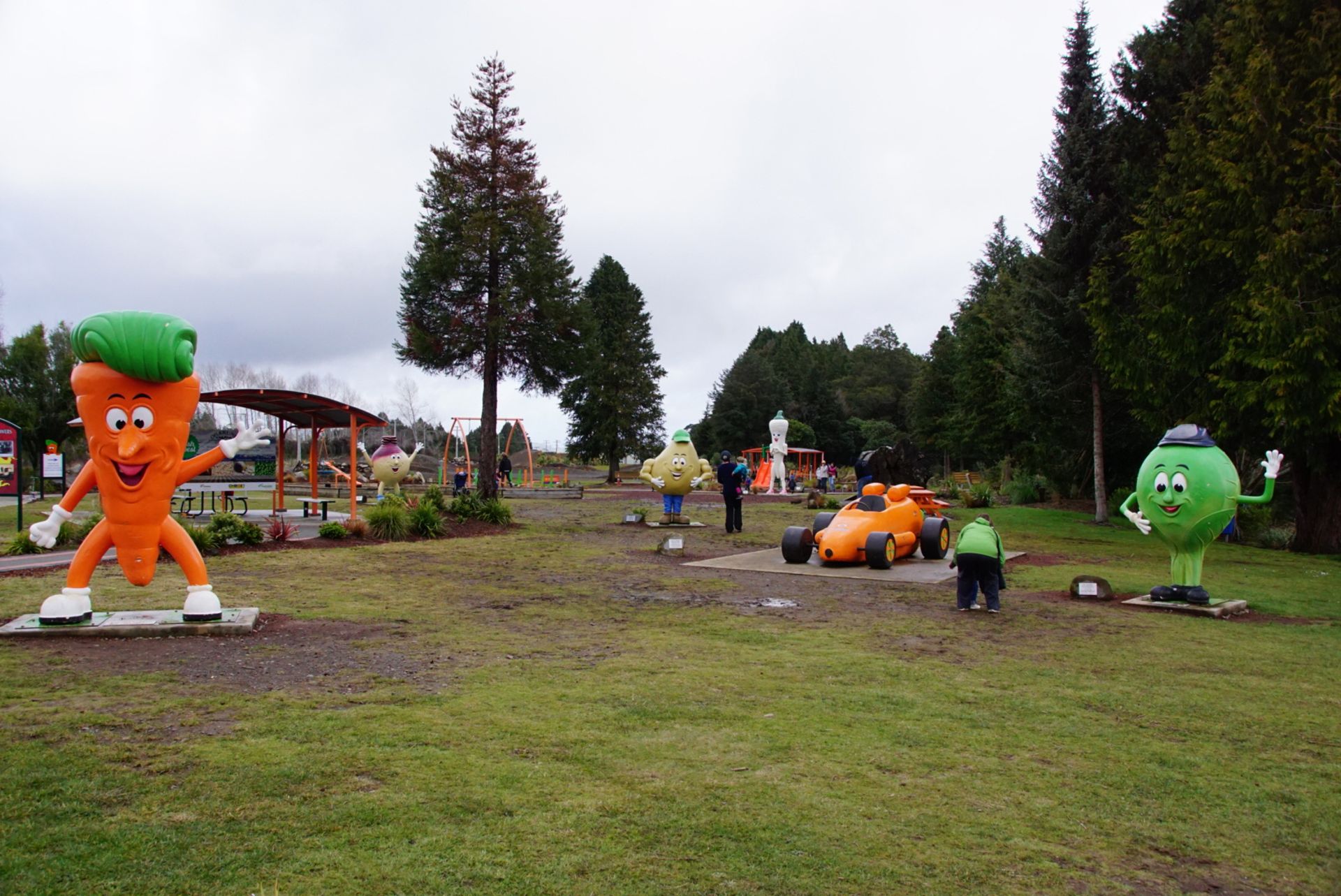
After such an excellent start to the day, the rest could only be good. We started at the city's landmark. Ohakune, also known as the "Carrot Capital" of New Zealand, lives up to its name. Every visitor is welcomed by a huge carrot at the city entrance sign. Right next to it is a themed vegetable-style playground. This one definitely appealed to us! ;)
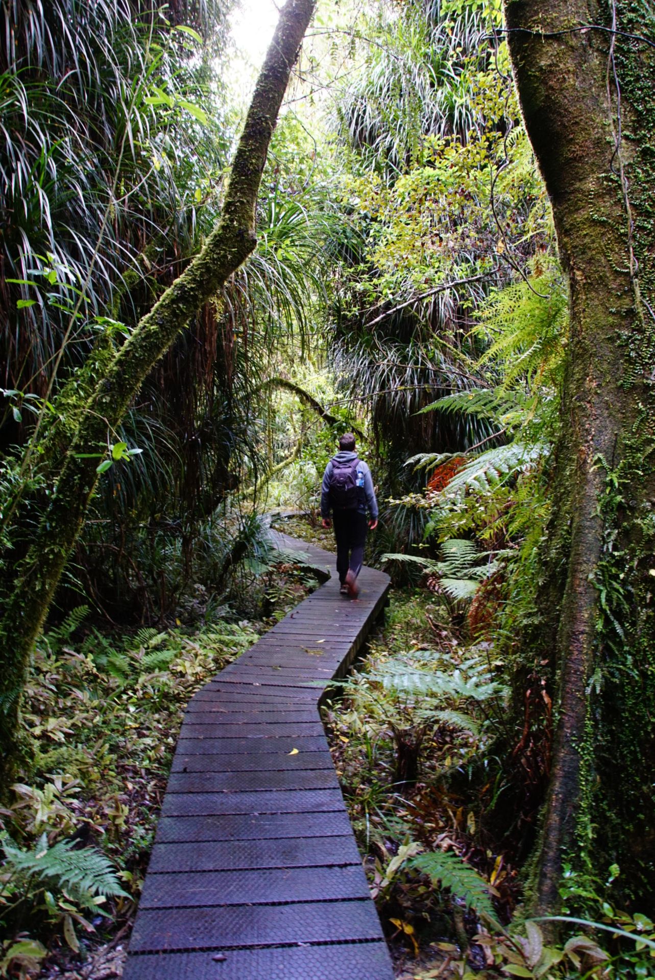
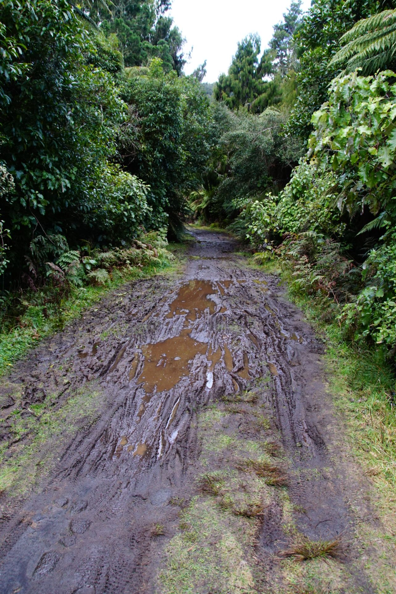
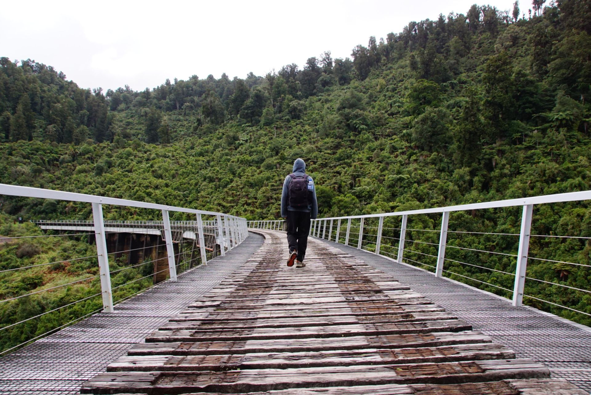
Then we went to the local tourist information. In the current season, snow and ice are always to be expected. So we wanted to make sure which hikes were easily accessible. We were then recommended the track to an old railway viaduct. And that's where we headed. The track is used by both hikers and mountain bikers. So we weren't surprised by the crazy, muddy meadow path. After about 30 minutes, we reached a better-built path, which made it much faster to reach the "Hapuawhenua Viaduct".
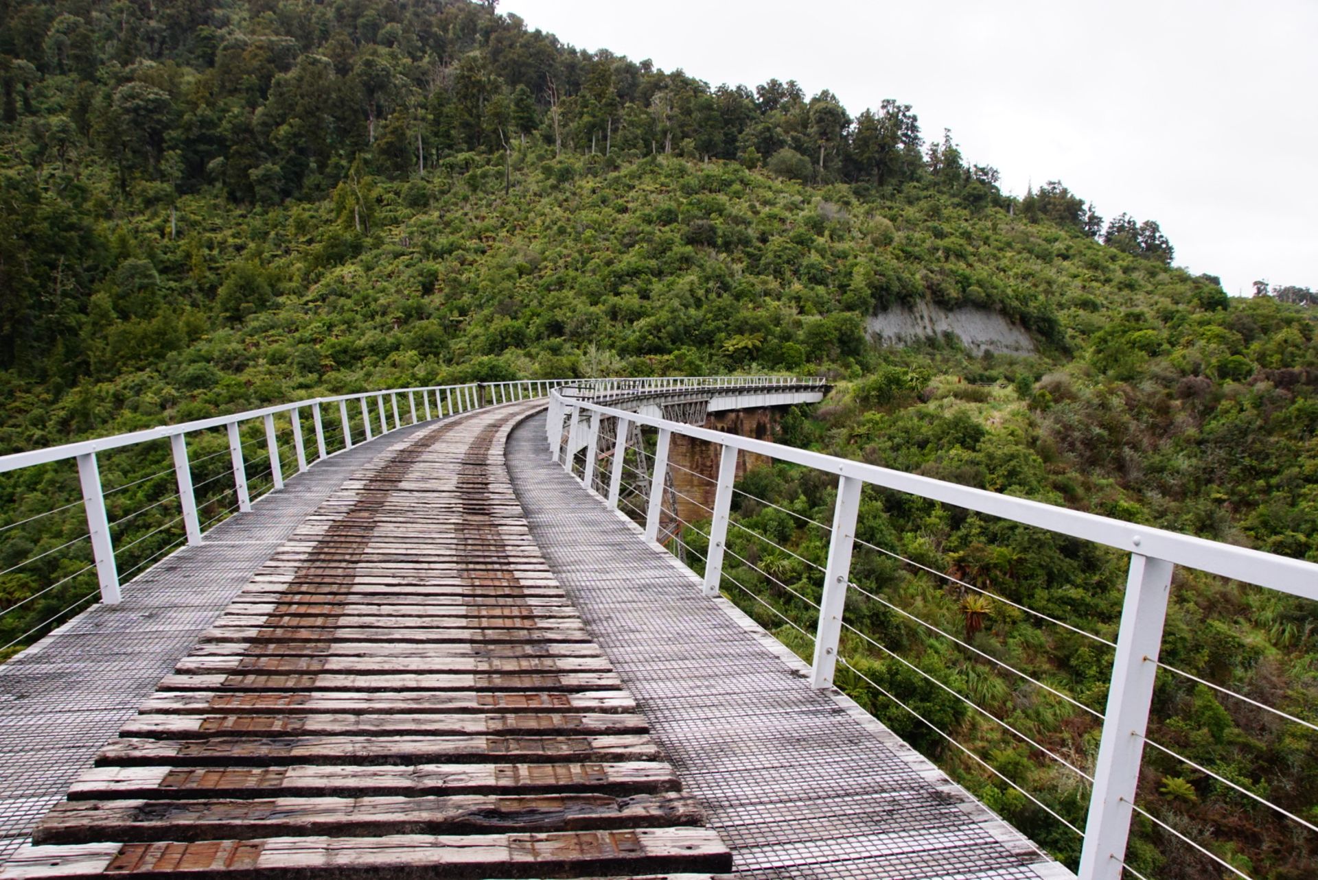
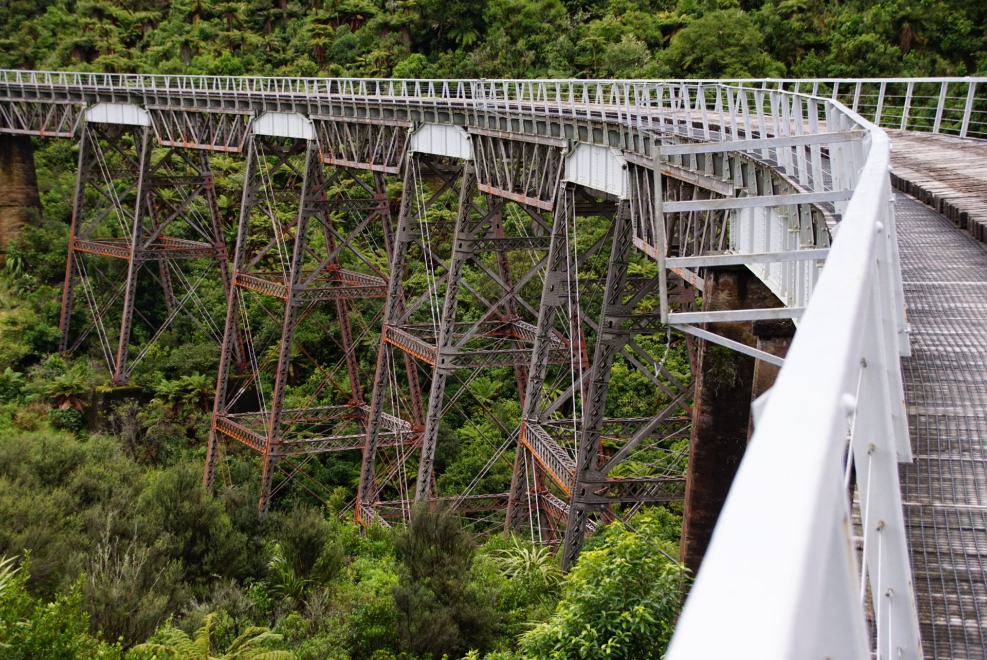
This viaduct was built in 1908 using wood and steel. With a height of 43 meters and a length of 286 meters, it was one of the most outstanding structures of its time. It was gradually assembled over the gorge using tall wooden ladders - without a single human life lost. Impressive!
After almost 80 years, its use as a railway viaduct was discontinued, as a new one made of concrete was built just a few hundred meters away.
However, it did not fall into disrepair - it found a new purpose. It is a meeting point for many excursionists who want to take a closer look at the historic structure. Rightfully so. The Hapuawhenua Viaduct not only looks great, but it is also a lot of fun to walk on the old rails, between which you can look all the way down to the bottom, 43 meters deep.
Unfortunately, our timing today wasn't quite as lucky. We heard trains passing over the new viaduct both on the way there and on the way back. We would have loved to watch them. But even without railway traffic, both structures were definitely worth seeing. :)
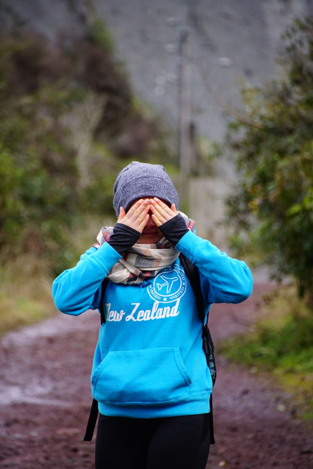
In the afternoon, we had some time left, so we considered going for another hike at the foot of Mt Ruapehu. To get there, we drove to a section of the road that is only accessible to all-wheel-drive vehicles or vehicles equipped with snow chains. Because the road leads to a ski area. However, we didn't have to go that far, and after consulting the i-Site, which assured us that the planned parking lot was not icy or snowed in, we set off. Our brave Sam climbed the mountain meter by meter... When we arrived at the parking lot, the surroundings were covered in white, and the sound of snow chains was impossible to ignore. We felt a little out of place.
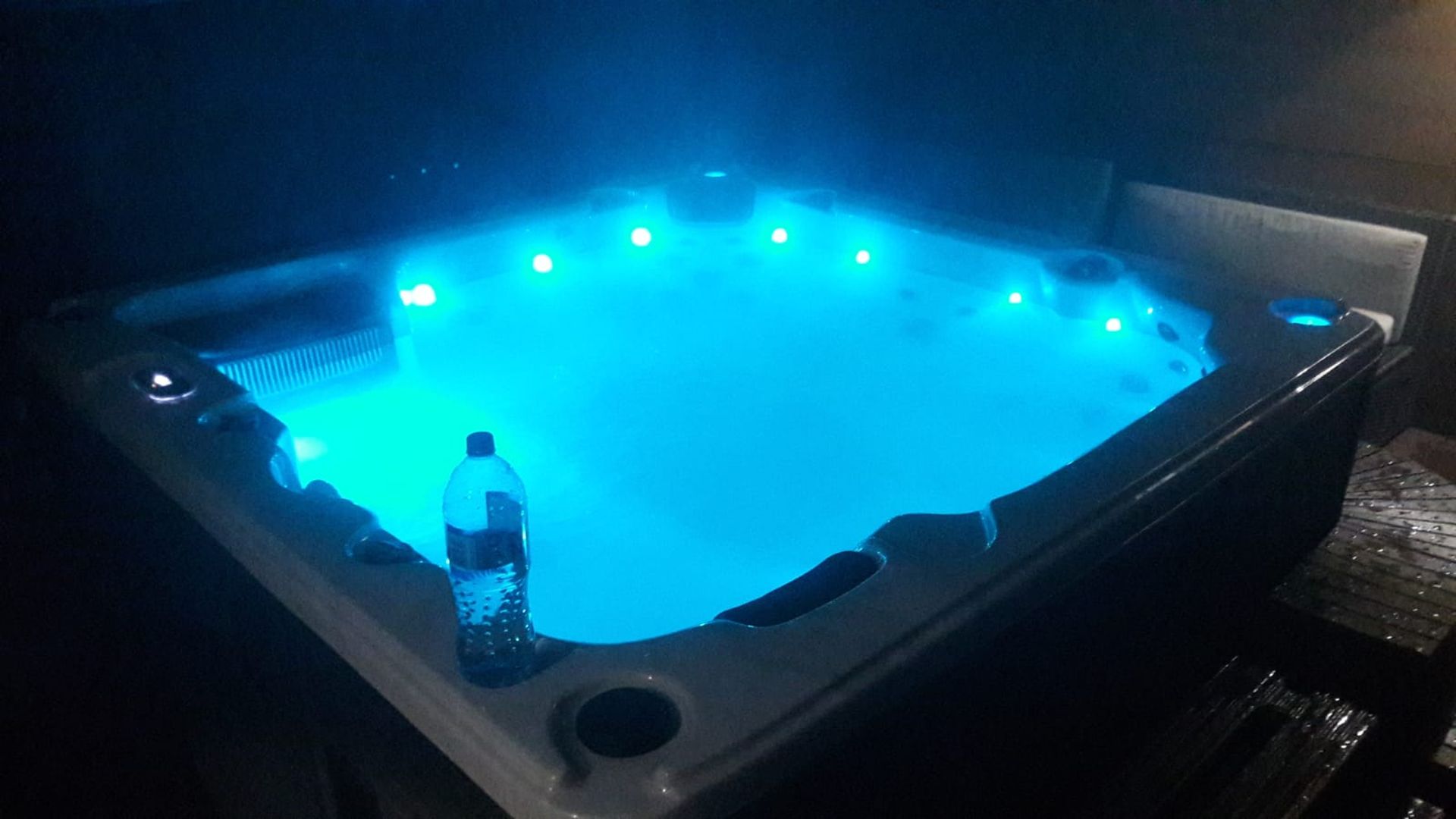
When the car was parked, it started raining... then snowing... no, hailing! So, the hike to the "Waiponga Falls" was canceled. Or rather, we let reason prevail. Because of the newfound time, we left Ohakune and drove to the "National Park Village". The distance of 50 kilometers was covered within an hour, so we were able to jump into the campsite's hot tub in the early evening. This time without any circulation problems, we enjoyed the end of the day in the warm water.
ꯅꯤꯎꯖꯂꯦꯇꯔꯗꯥ ꯁꯕꯁ꯭ꯛꯔꯥꯏꯕ ꯇꯧꯕꯤꯌꯨ꯫
ꯄꯥꯎꯈꯨꯝ

ꯆꯠꯊꯣꯛ-ꯆꯠꯁꯤꯅꯒꯤ ꯔꯤꯄꯣꯔꯇꯁꯤꯡ ꯅ꯭ꯌꯨ ꯖꯤꯂꯦꯟꯗꯗꯥ ꯂꯩꯕꯥ ꯌꯨ.ꯑꯦꯁ