
Ich bin dann mal weg
vakantio.de/ich-bin-dann-mal-weg-2223
New Zealand, the South Island
Нийтэлсэн: 19.01.2023


Мэдээллийн товхимолд бүртгүүлнэ үү
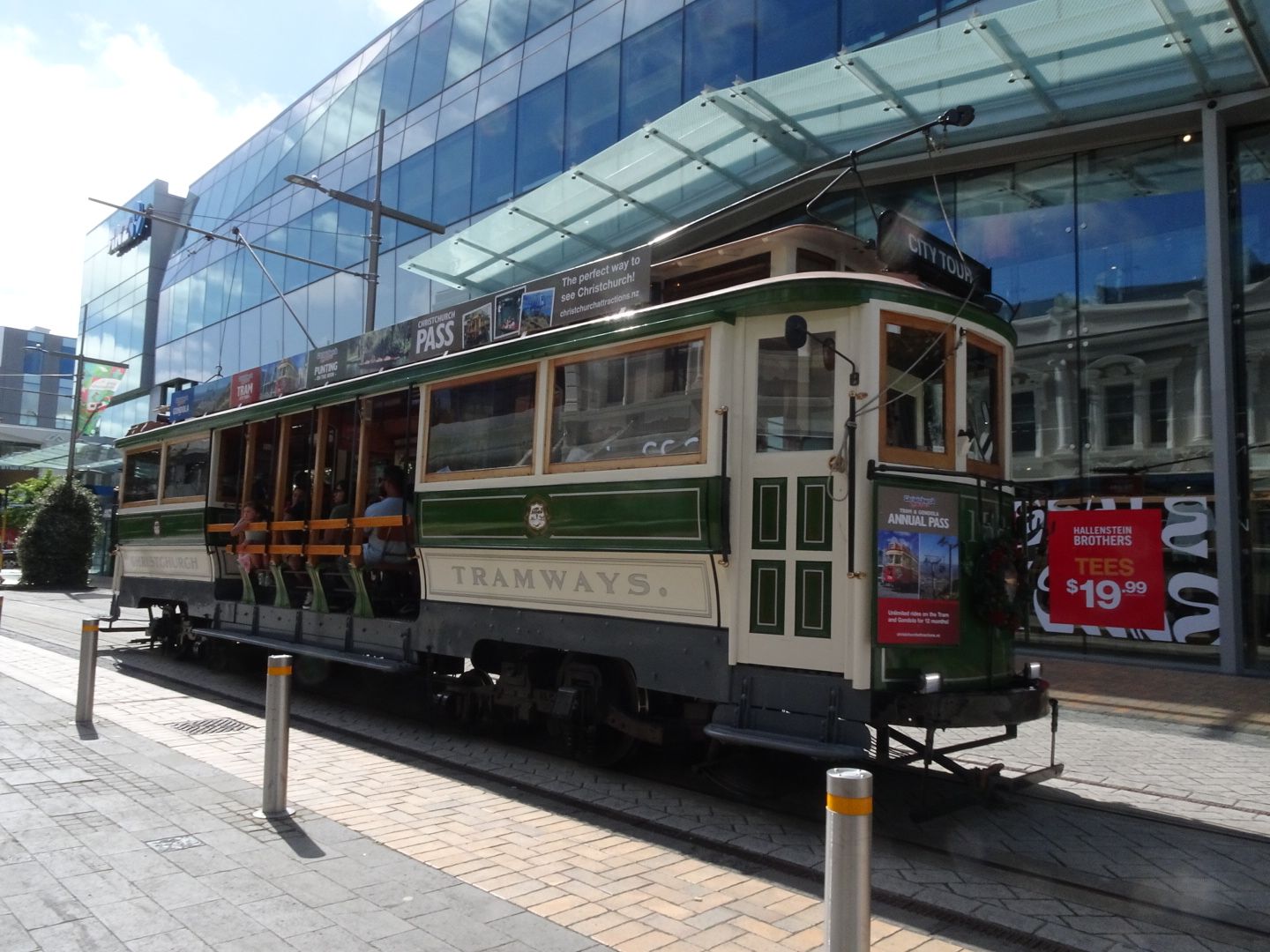
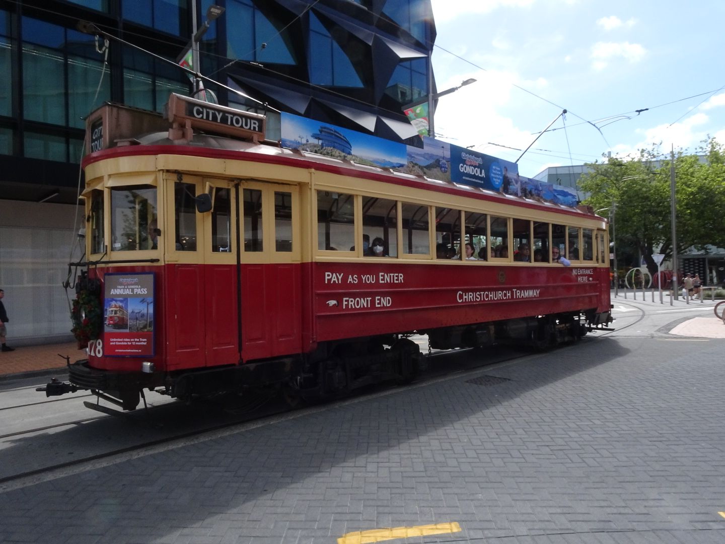
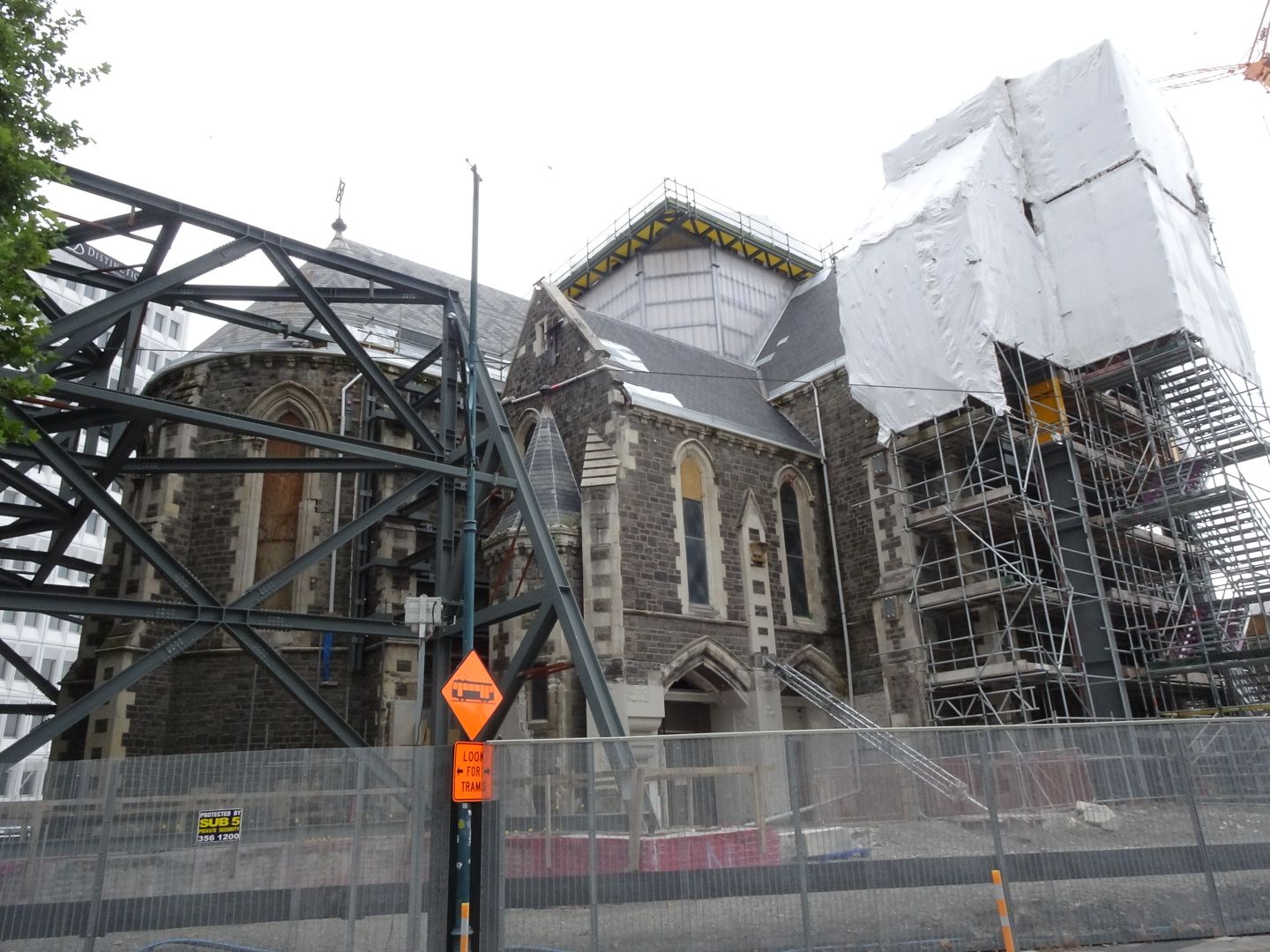
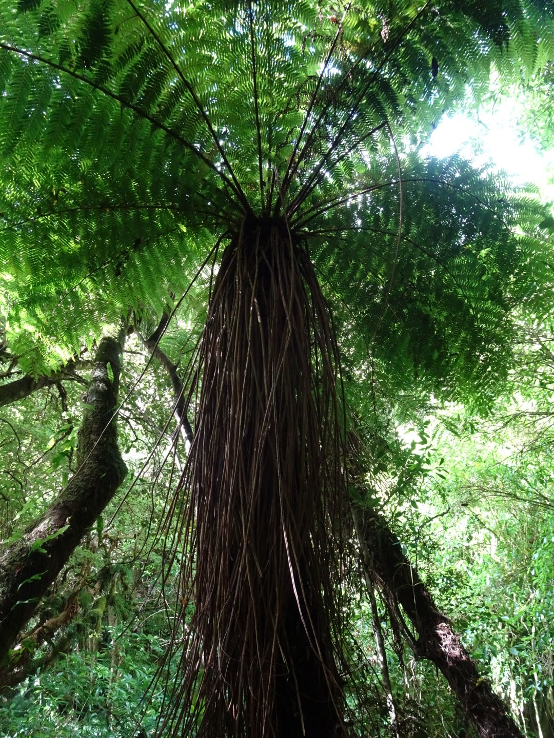
Aotearoa! The land of the long white cloud! That's what the Maori, the indigenous people of New Zealand, call their land. After two long flights, I arrived in Christchurch, the largest city in the South Island of New Zealand and the capital of Canterbury Province, in the early morning of December 26th. Due to the inconvenient flight times, I couldn't sleep during the flights to Melbourne and Christchurch. Although the immigration process took a bit longer, it was only half past six in the morning when I took the bus to the city center of Christchurch. The bus was driven by a female bus driver, in my entire six months in Asia, I had only encountered male bus and taxi drivers. As expected, it was much cooler than in Indonesia, the summer in the South Island of New Zealand is comparable to the summer in Germany. Before the devastating earthquake on February 22, 2011, which claimed 185 lives, Christchurch was not only considered the most beautiful city in New Zealand, but also one of the most beautiful cities in the southern hemisphere. The reconstruction is still ongoing, which can be seen everywhere. There are still many construction sites and open spaces in the city center that are temporarily used as parking lots. I stayed there for three days, one of which I almost overslept, in a centrally located hostel. The differences compared to Asia couldn't be greater: the city is spotlessly clean and everything appears perfectly organized. I was particularly delighted to finally be able to buy decent cheese, sausages, and wine again after all the time in Asia. The New Zealand bread leaves something to be desired, but the baguette is quite good. Unfortunately, prices in the supermarket are significantly higher than in Germany, almost twice as high overall. I walked a lot in the city and visited the Botanic Gardens, the Canterbury Museum, and Quake City, a museum about earthquakes in general and the 2011 earthquake in particular. I skipped the ride on the historic 19th-century tram due to the high price. I also had to give up on restaurant visits, which I had gotten used to in Asia. I knew that I could only afford it occasionally in New Zealand.
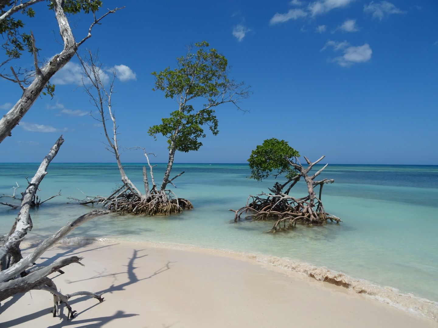
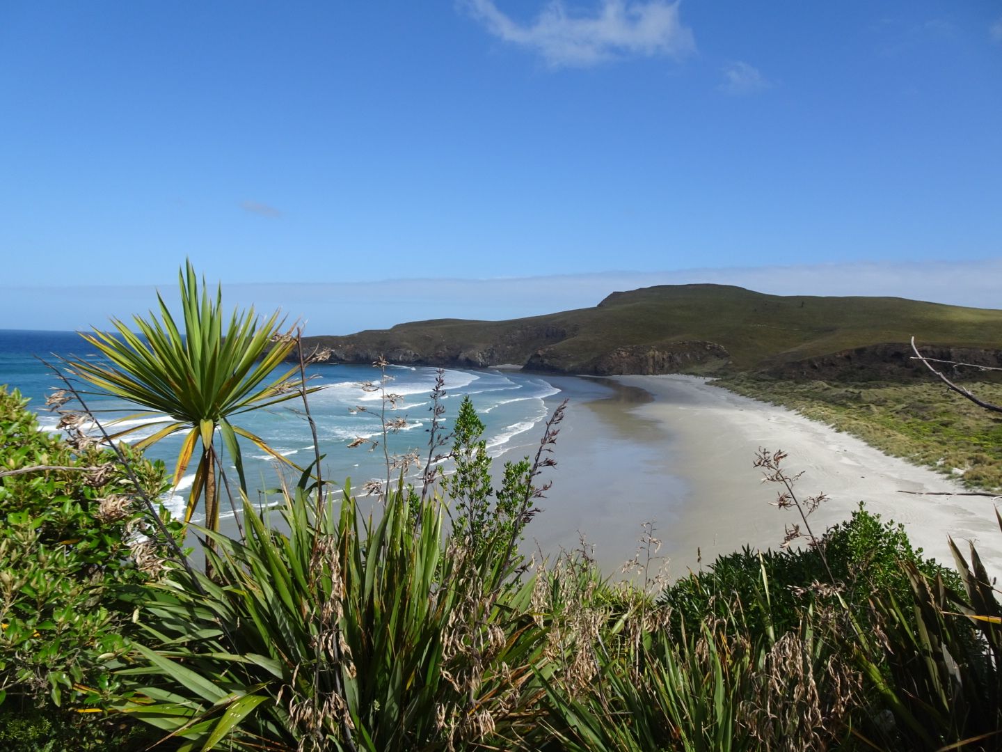
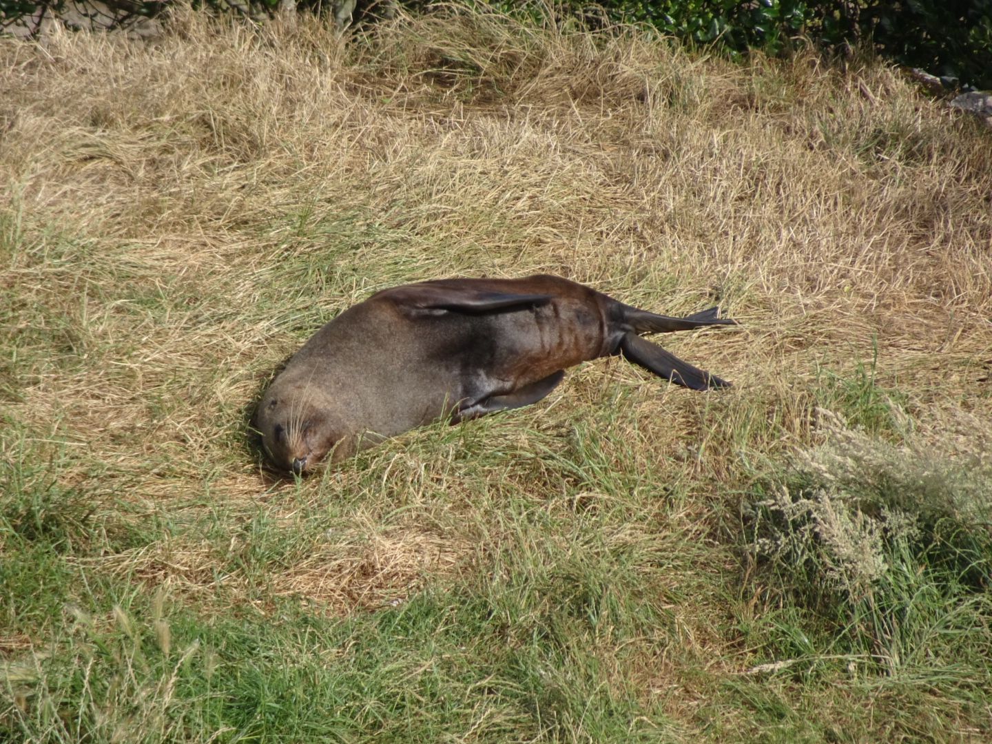
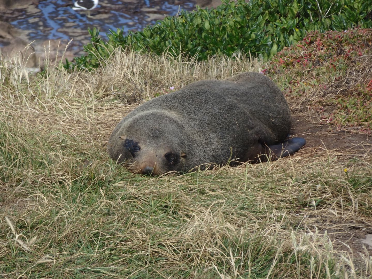
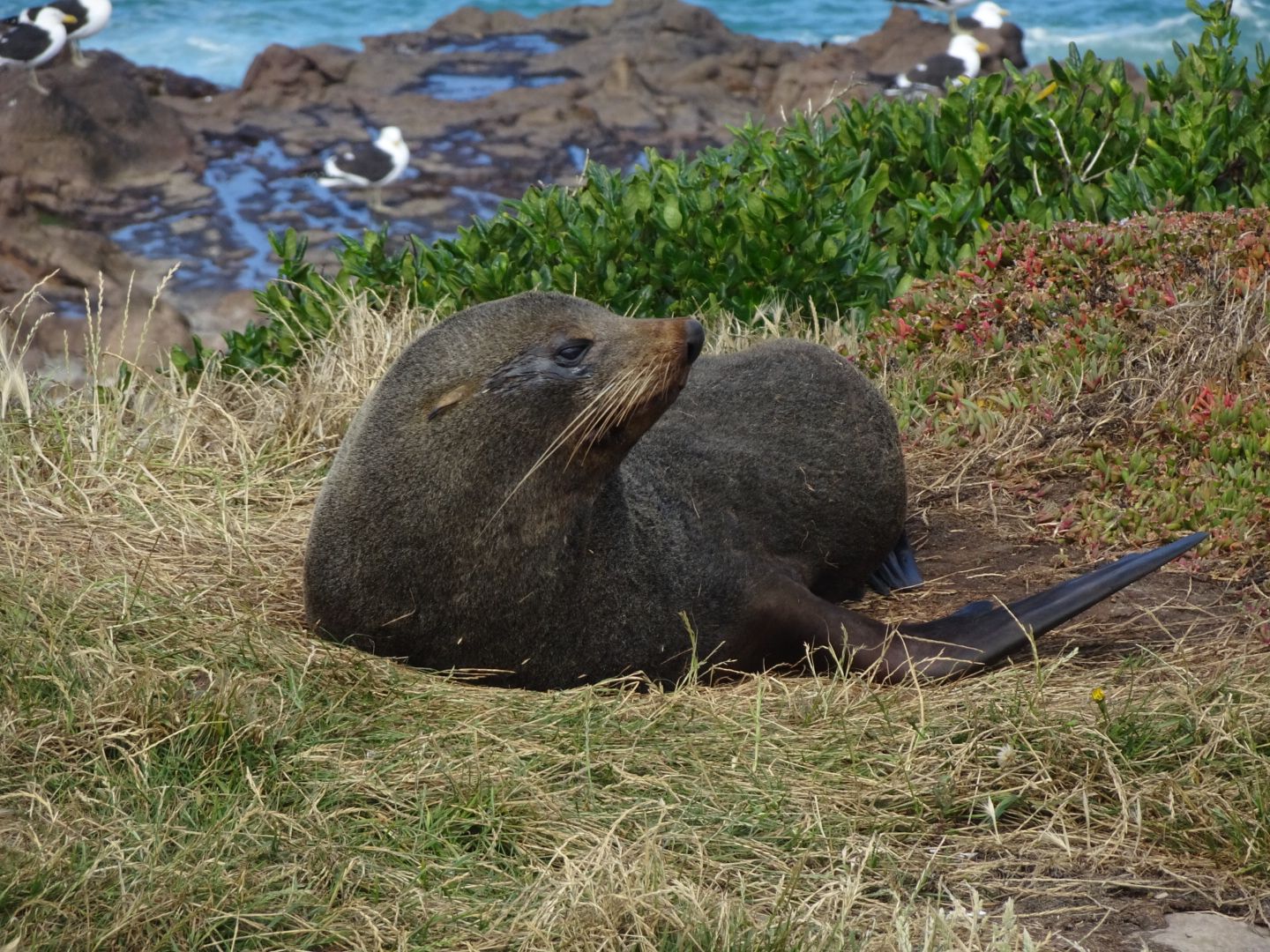
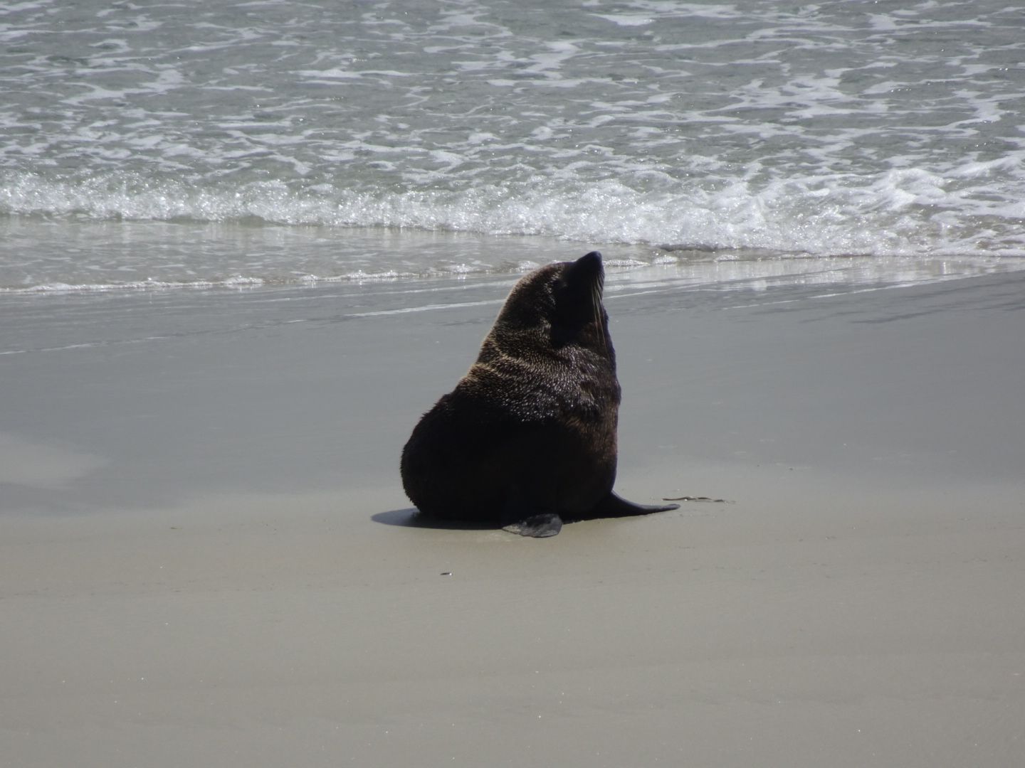
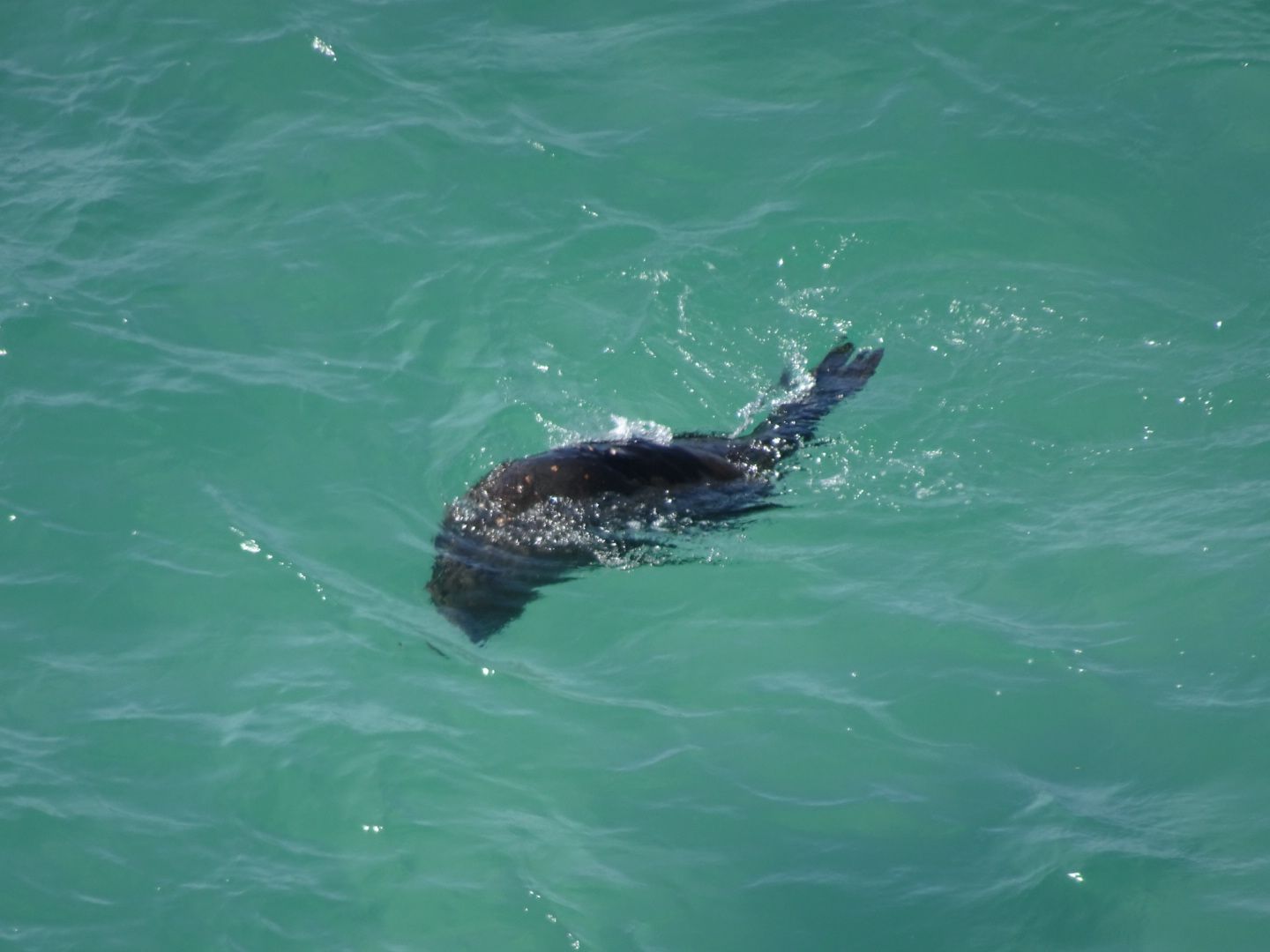
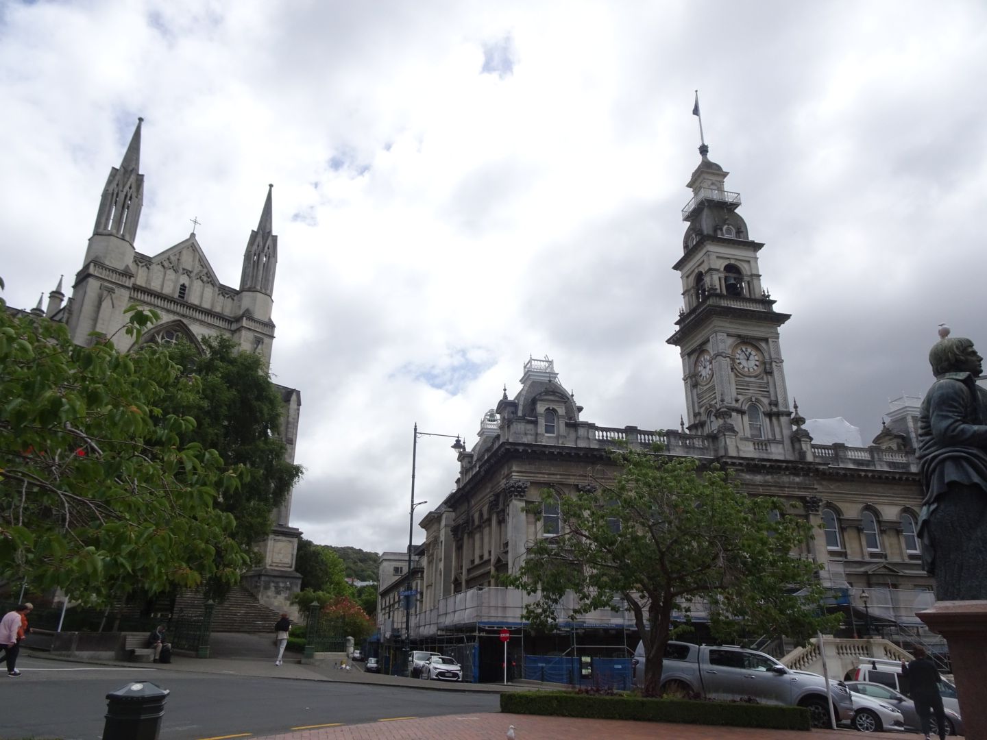
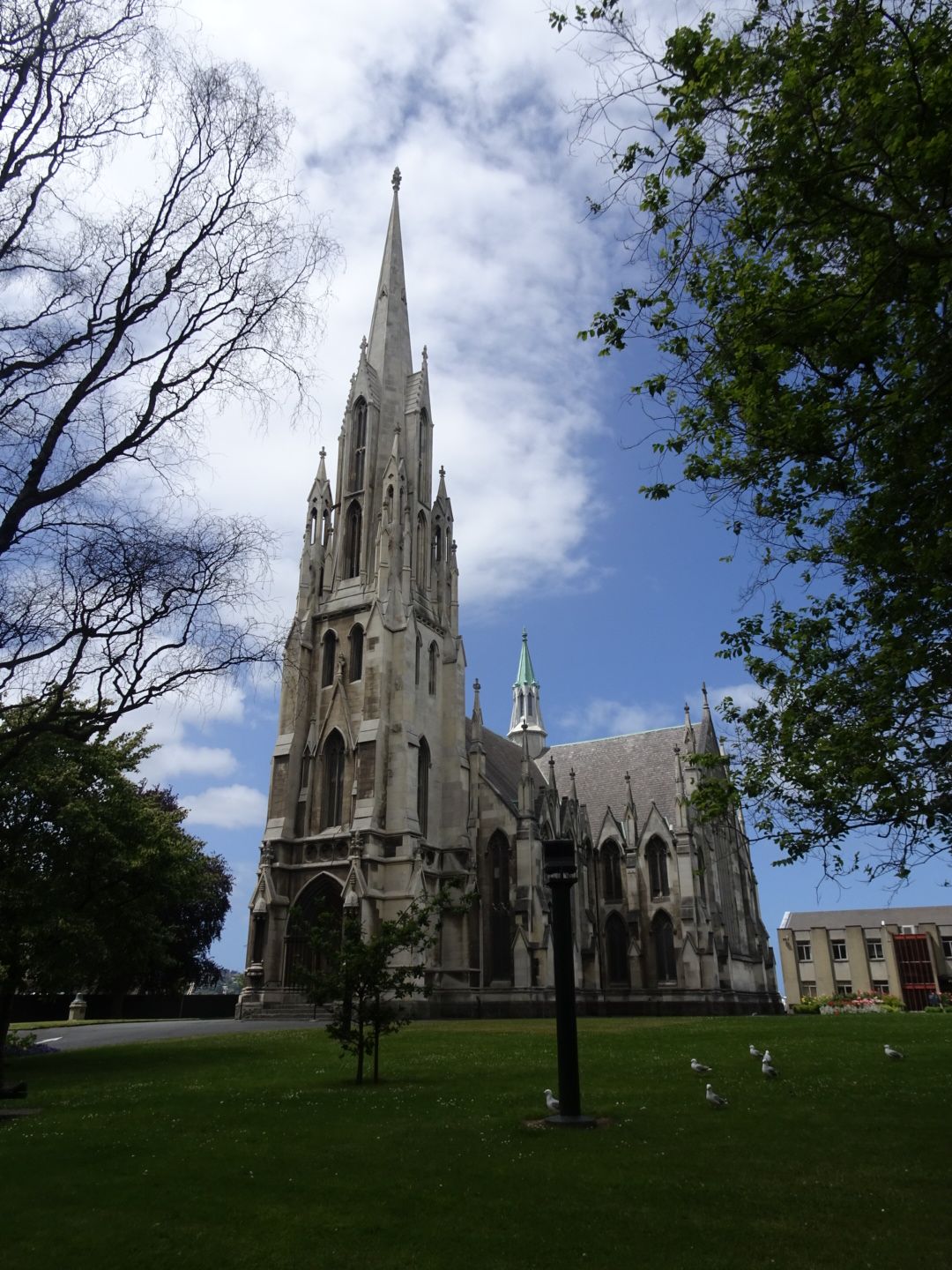
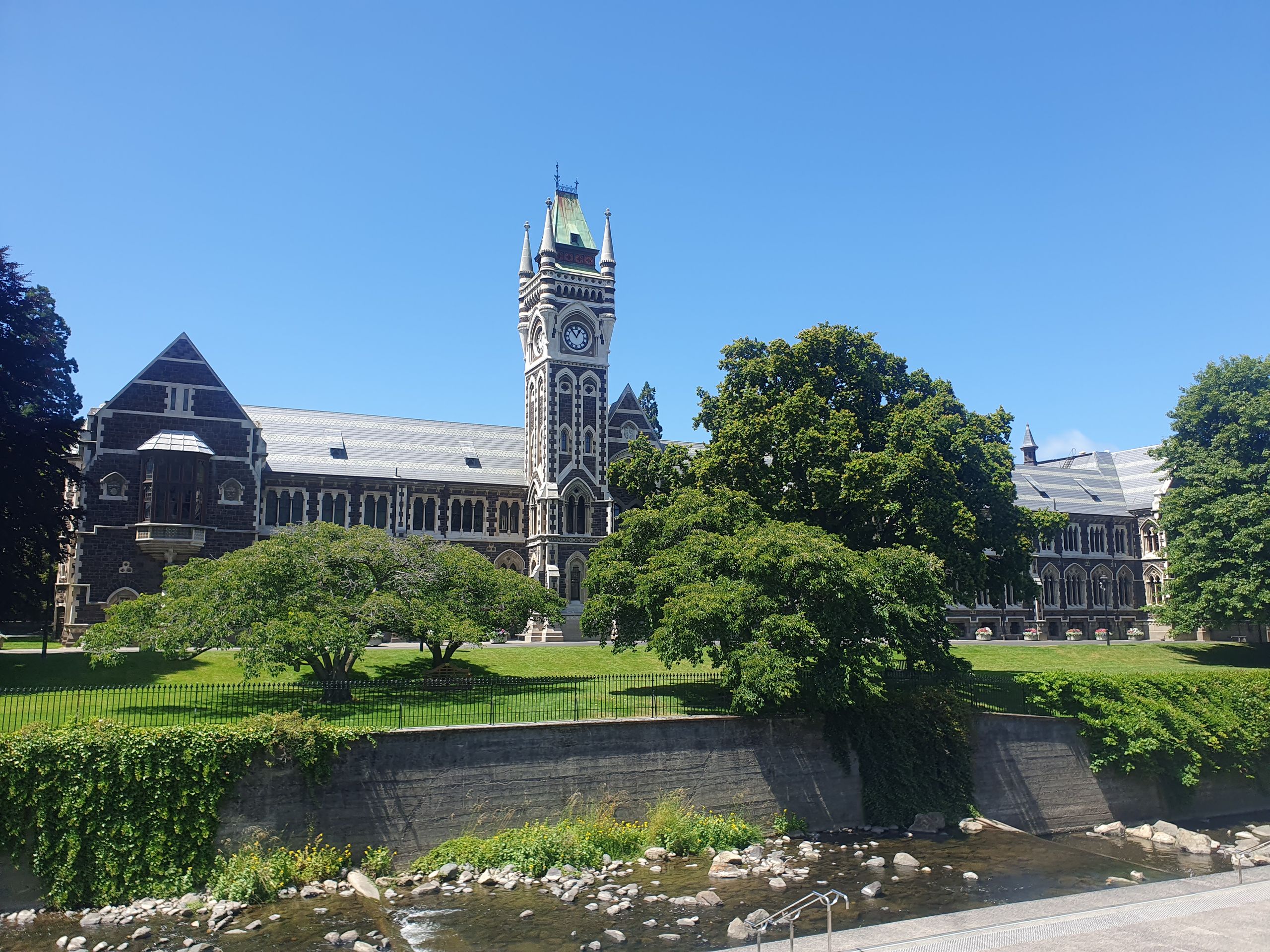
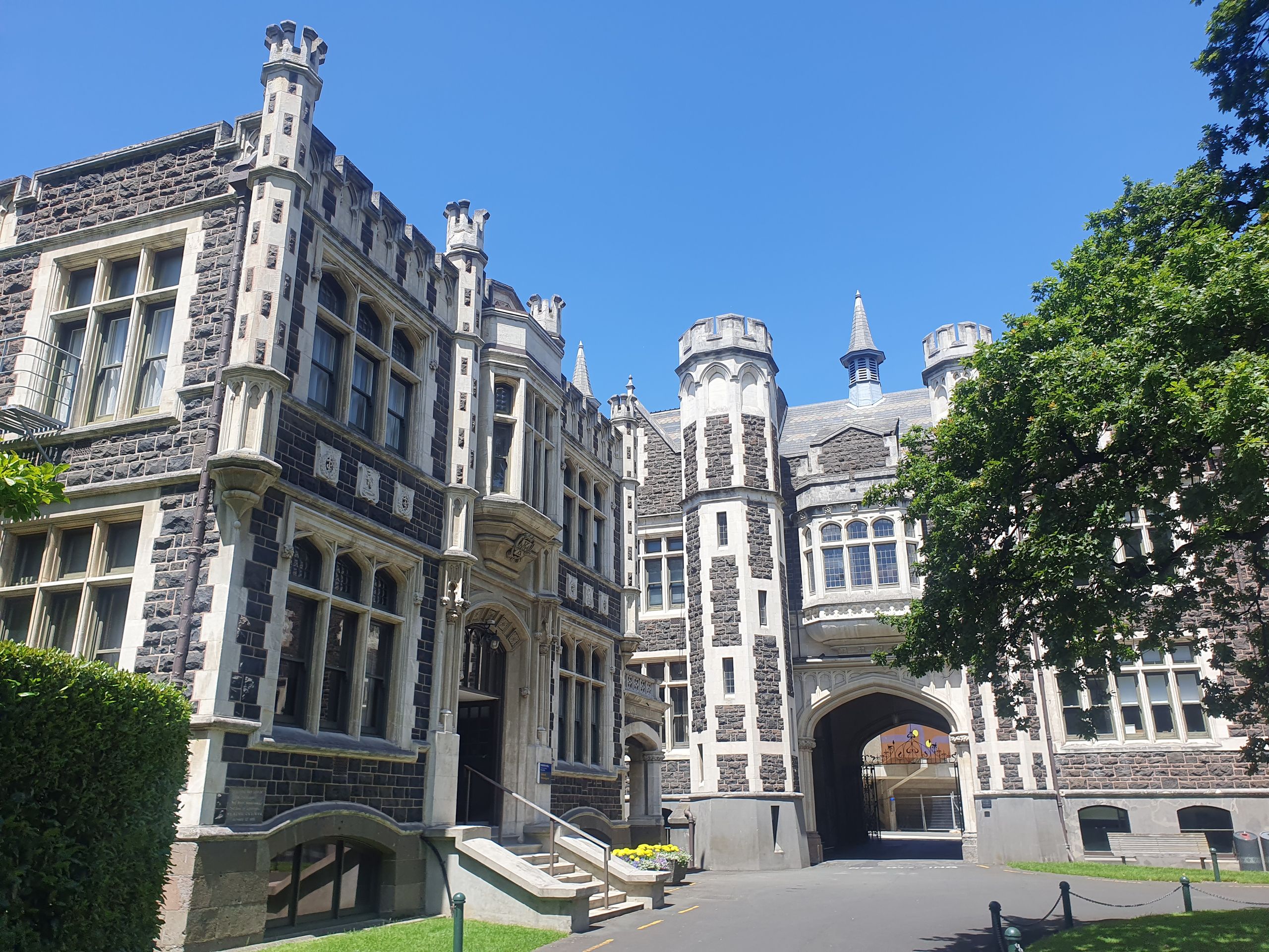
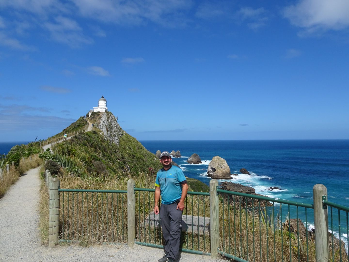
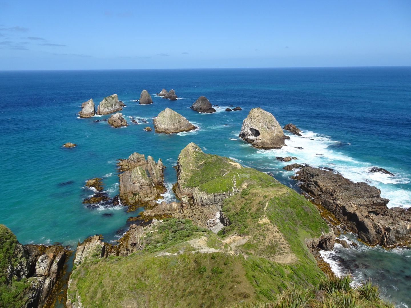
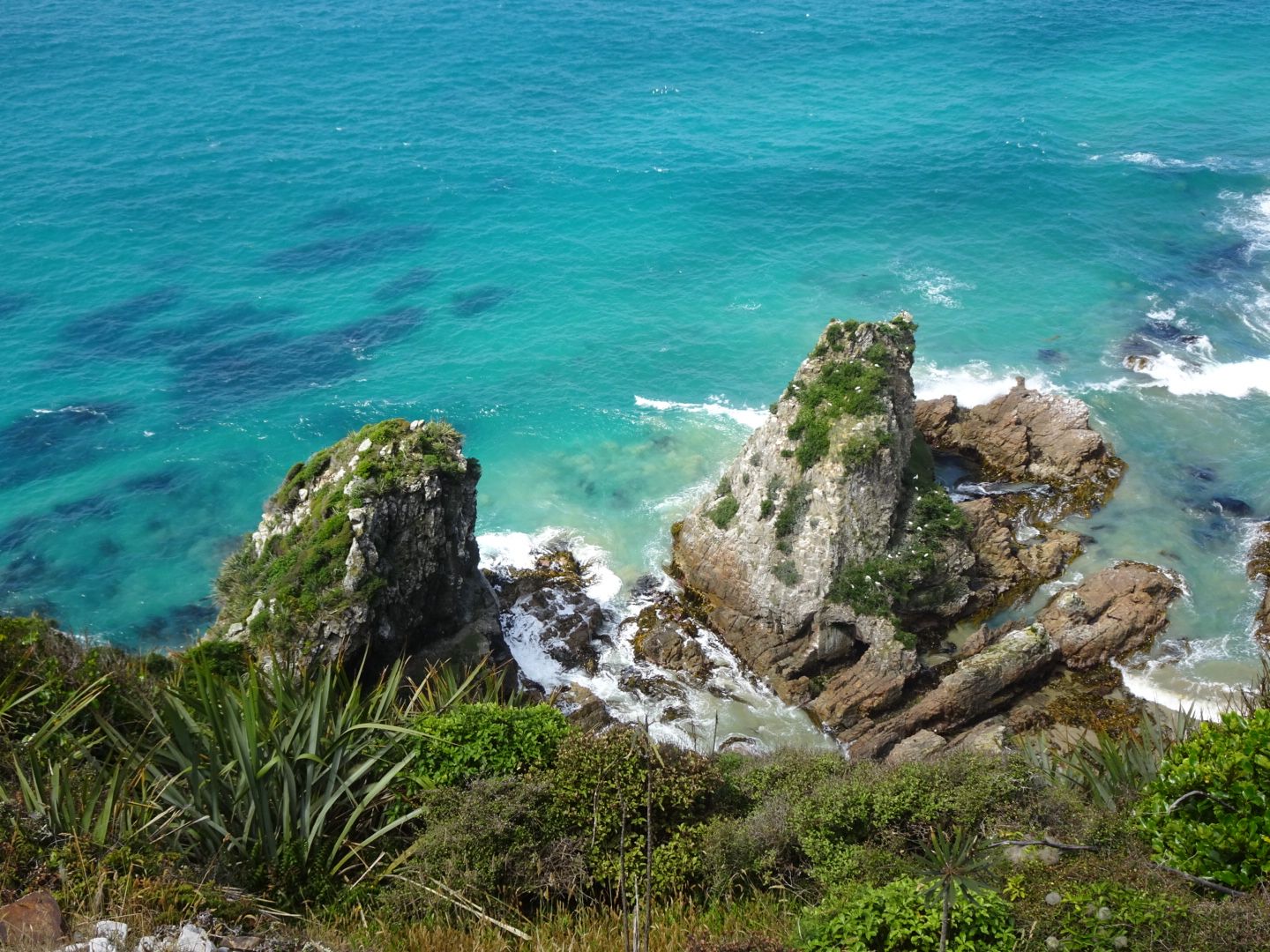
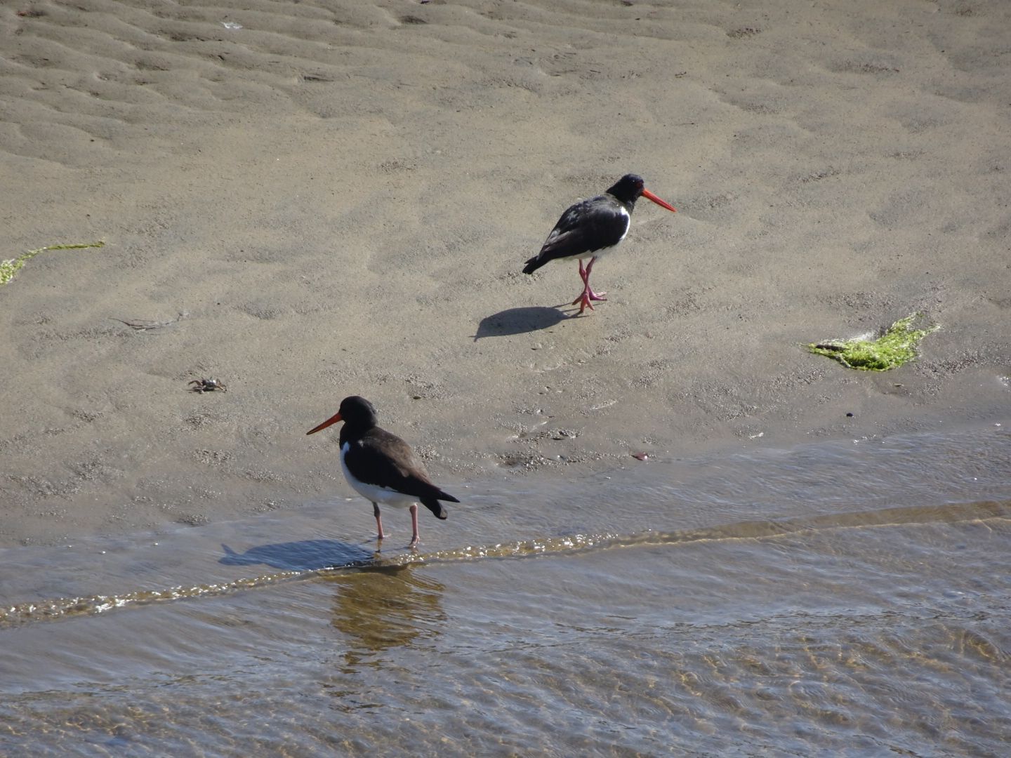
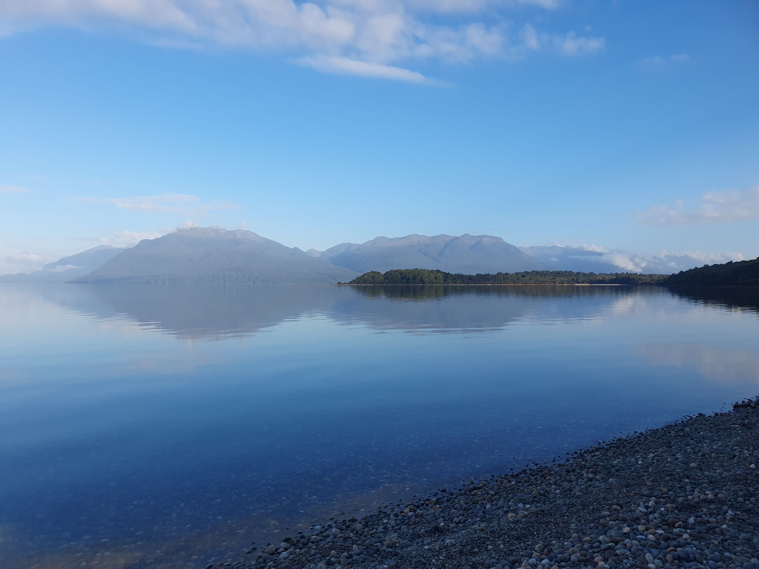
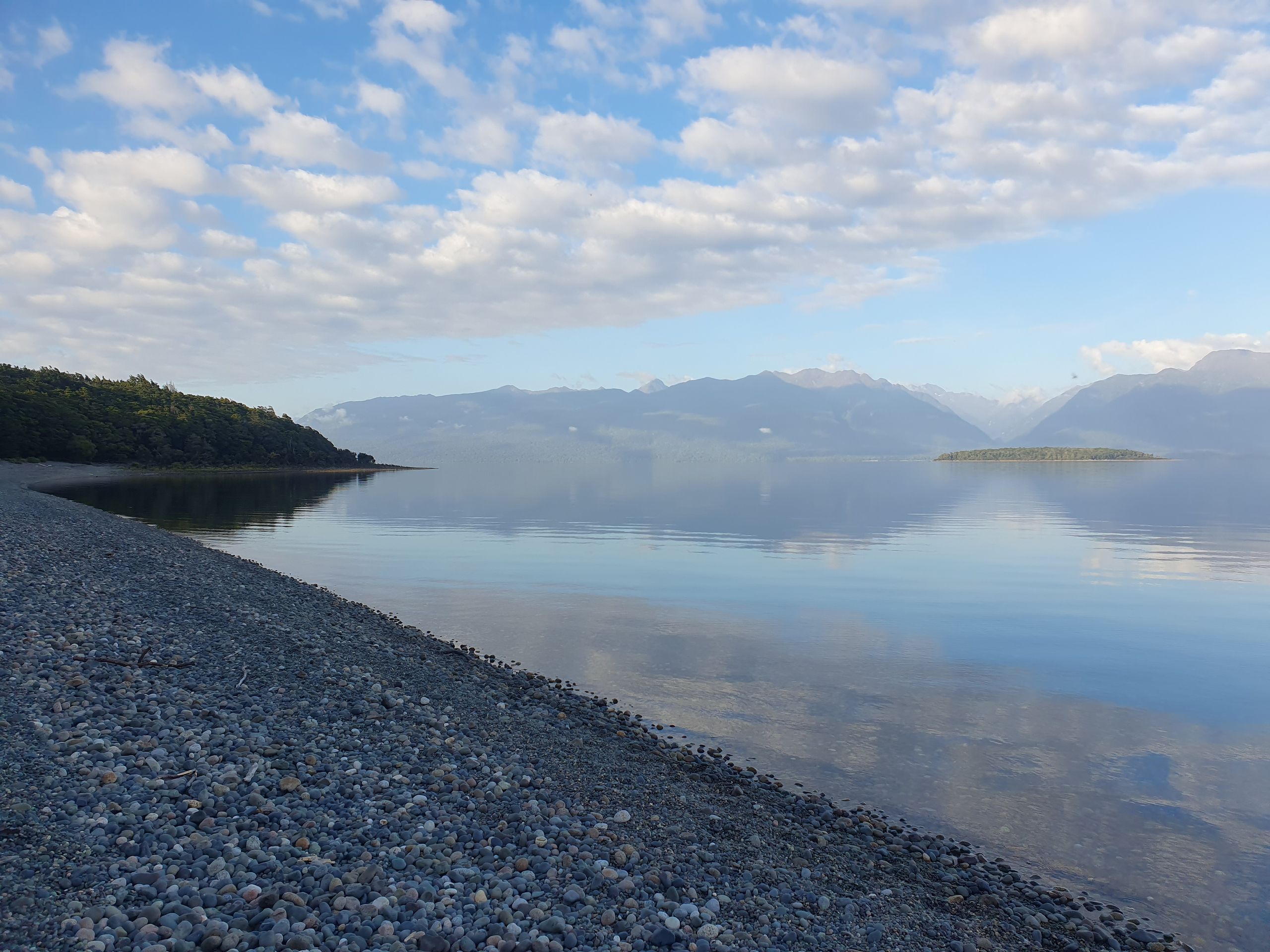
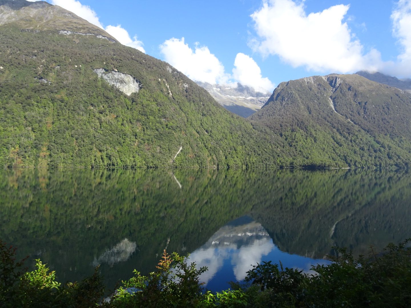
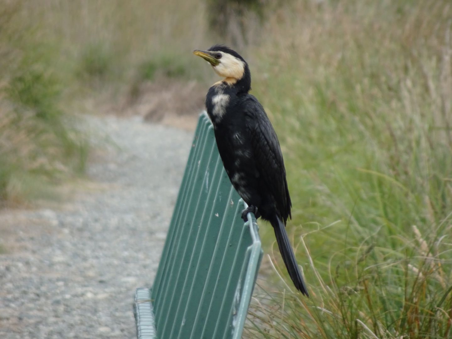
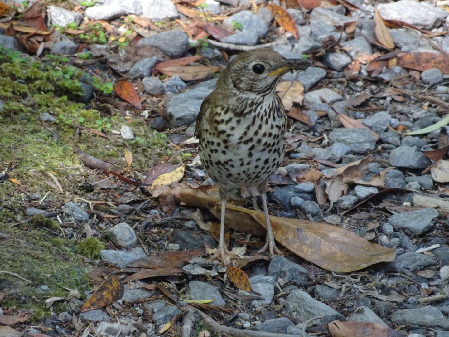
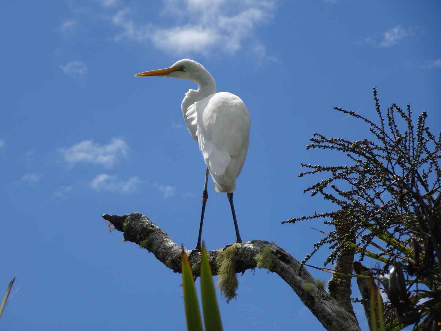
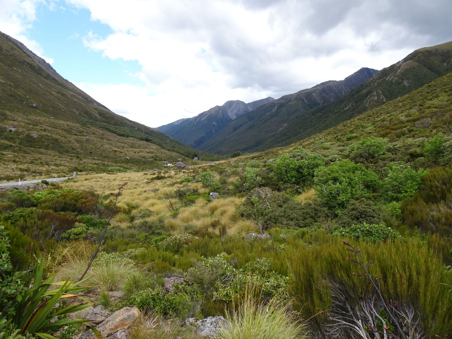
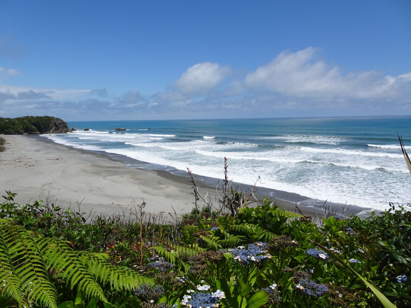
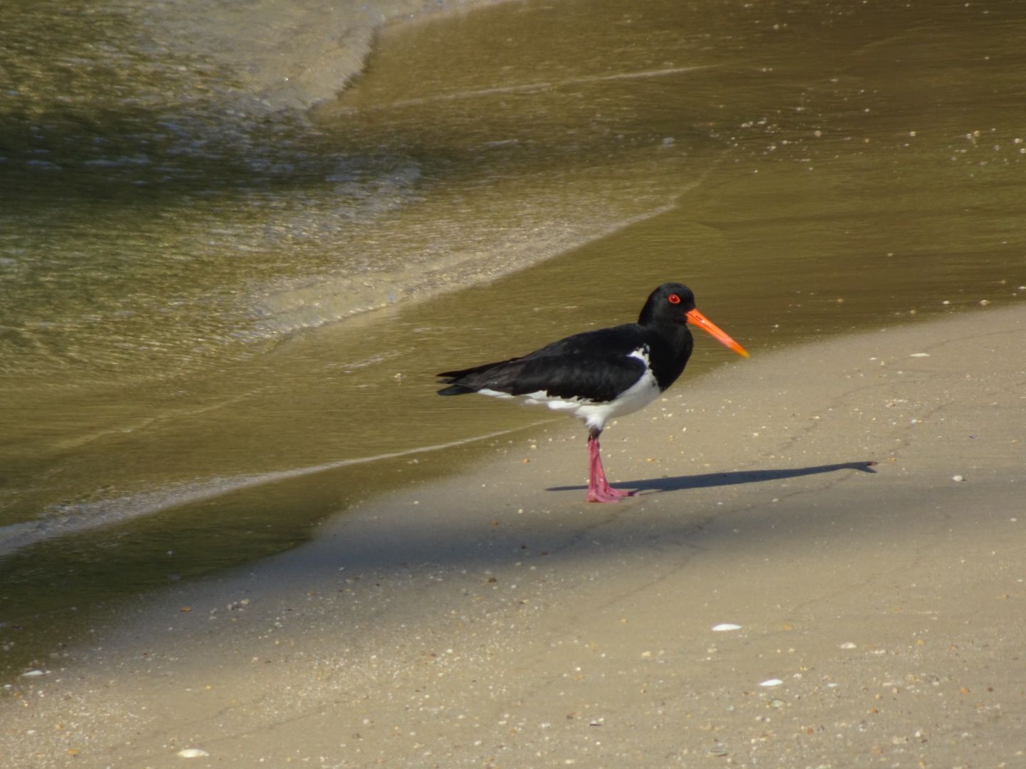
On December 29th, I took the bus back to the airport to pick up my campervan, which I had booked for a total of 30 days. New Zealand is hardly accessible by bus and train, as only the cities are connected to the transportation network. And there are only a few of them, especially on the South Island. On an area of approximately 150,000 square kilometers, which is roughly half the size of Germany, there are only about as many people as in Cologne. On the North Island, on the other hand, there are about as many people as in Berlin on a slightly larger area of just over 110,000 square kilometers. So why have a proper bus and train system for so few people? So I traveled just like the 'Kiwis,' as the New Zealanders like to call themselves, because camping is a national sport there! My campervan was equipped with a gas stove and a refrigerator. The big difference from my previous trip was that I could now drive and stop wherever I wanted. In the first few days, I stayed at a different campsite every day. I drove from Christchurch to Trotter's Gorch, where I stayed for one night and swam in the cool sea for the first time at Katiki Beach, then on to the very interesting city of Dunedin with its museum and the oldest university in New Zealand, and to the Otago Peninsula. There, with some luck, you can see not only seals, other types of seals, and albatrosses, but also the rare yellow-eyed penguins. On a guided tour, we got quite close to the penguins for a brief moment. On December 31st, I continued along the coast, which is one of the most beautiful coasts in the country, the Catlins Coast. Generally, when traveling in New Zealand, the journey is the destination! So you should always plan plenty of time for photo stops or even short hikes. Often, you will also be held up by sheep on small roads, of which there are 35 million in New Zealand. There is so much to discover everywhere. I stopped at both Kaka Point and the beautifully located Nugget Point with its seals, as well as two waterfalls for shorter hikes. In the evening, I finally reached my campsite near the village of Papatowai, where I spent the quietest New Year's night of my life. Unfortunately, it was quite cold that evening as well. I only briefly toasted the new year with my neighbors, and that was it. It was for the best, as on New Year's Day I had a long drive ahead of me: first with a few stops until I reached Curio Bay, almost the southernmost point of the South Island, and then northwest to Fiordland to a campsite near Te Anau, the starting point for the famous Milford Sound. This campsite was beautifully located by Lake Te Anau, which was necessary because there was no electricity or showers there, as is the case with many DOC campsites (DOC stands for 'Department of Conservation'). However, these sites are almost always in a fantastic environment and are very reasonably priced. The lakes and rivers of New Zealand consistently have excellent water quality.
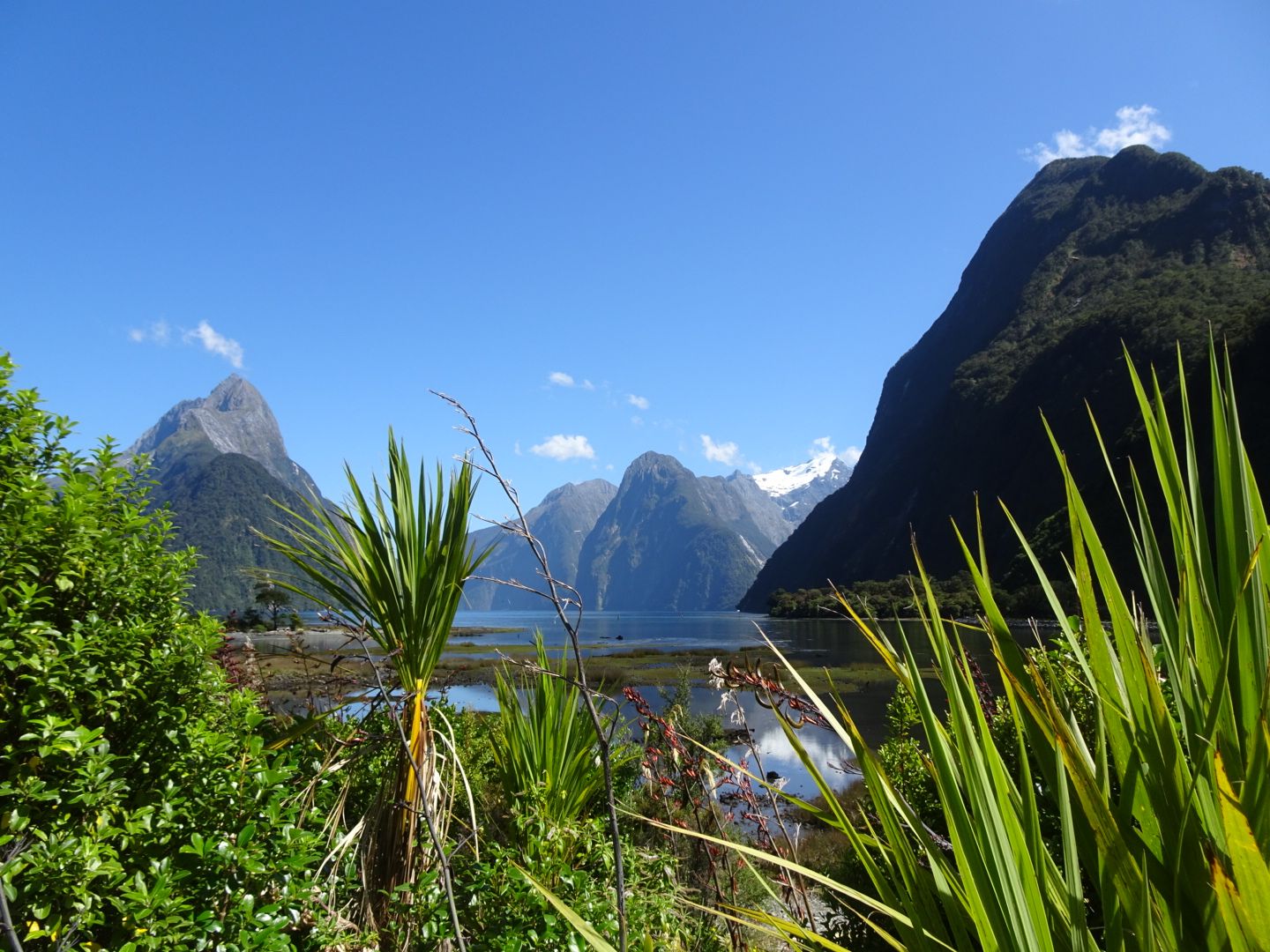
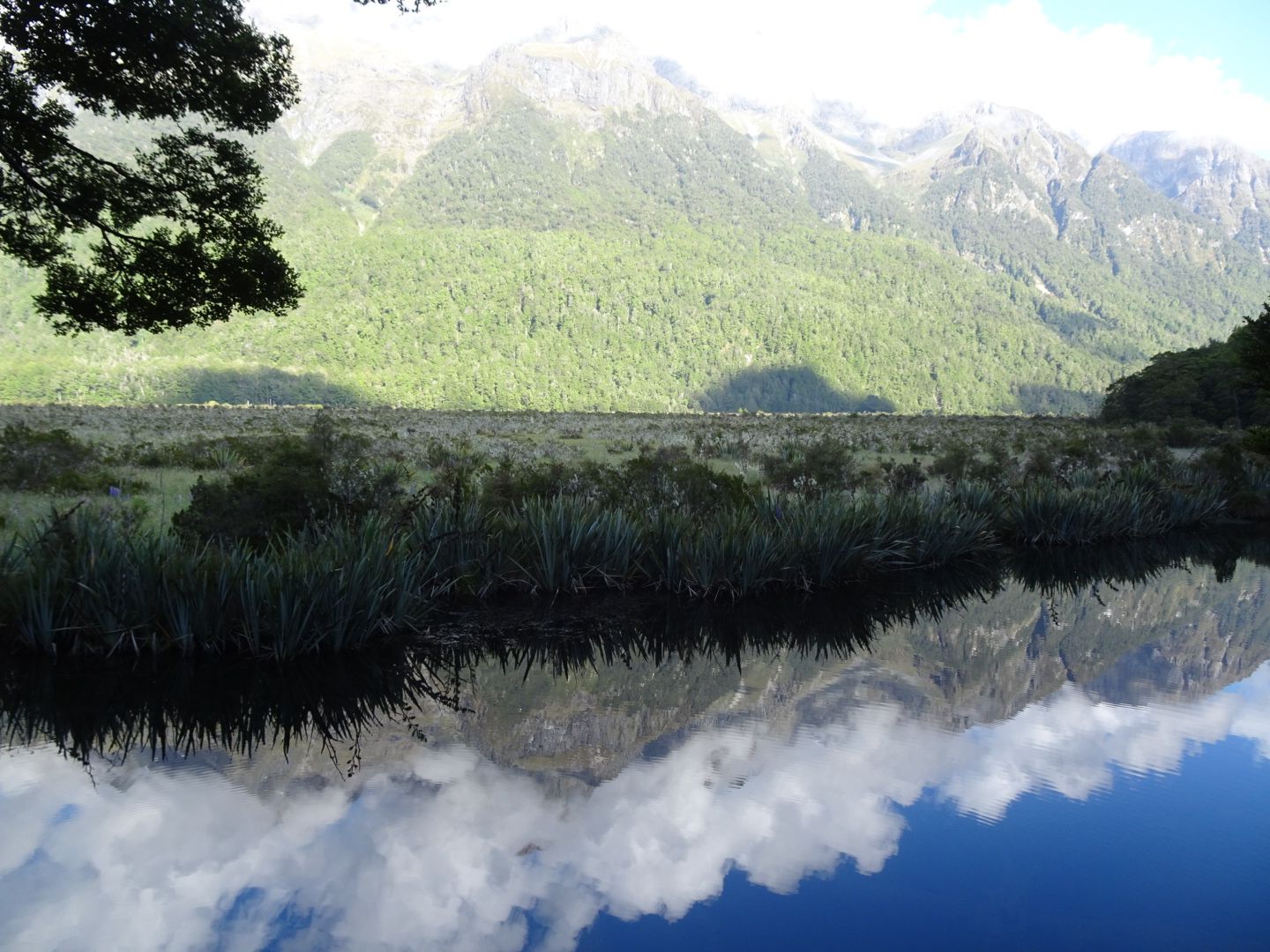
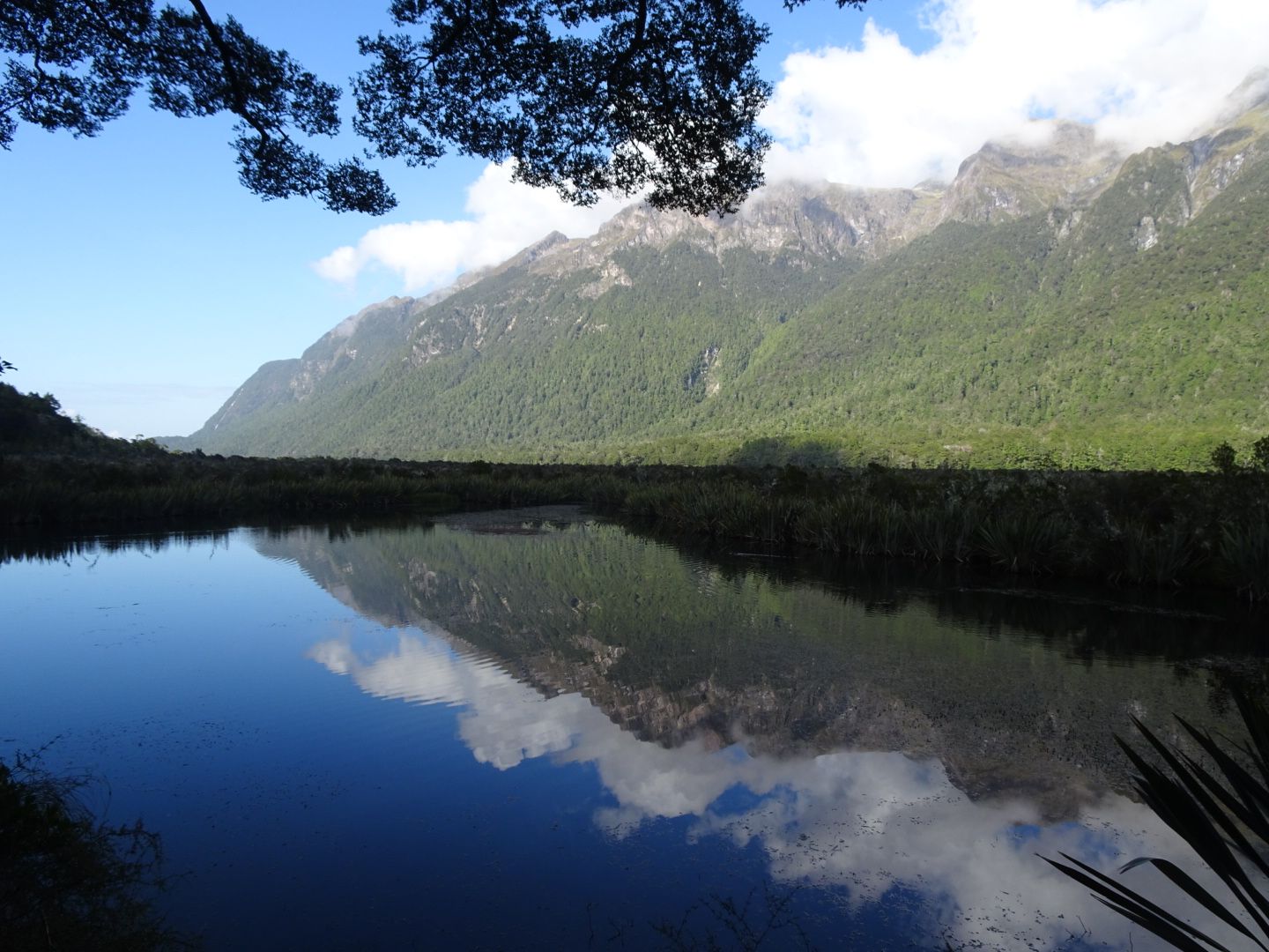
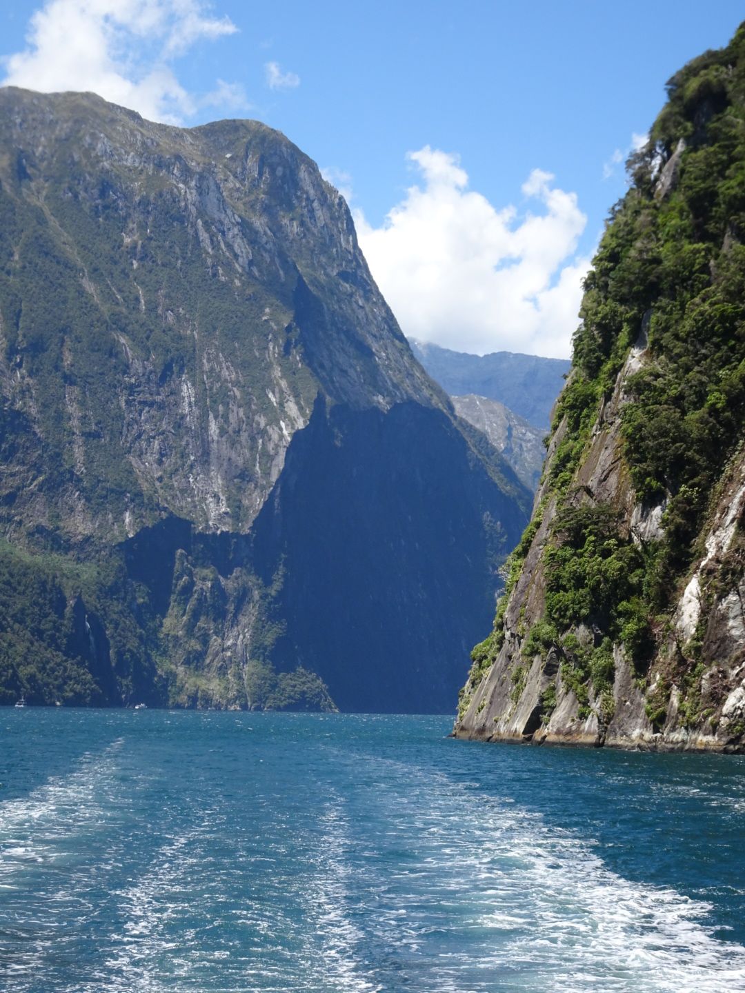
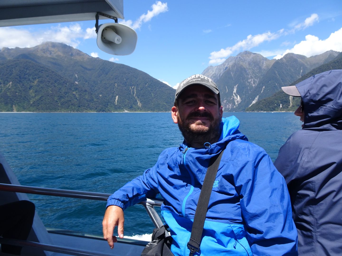
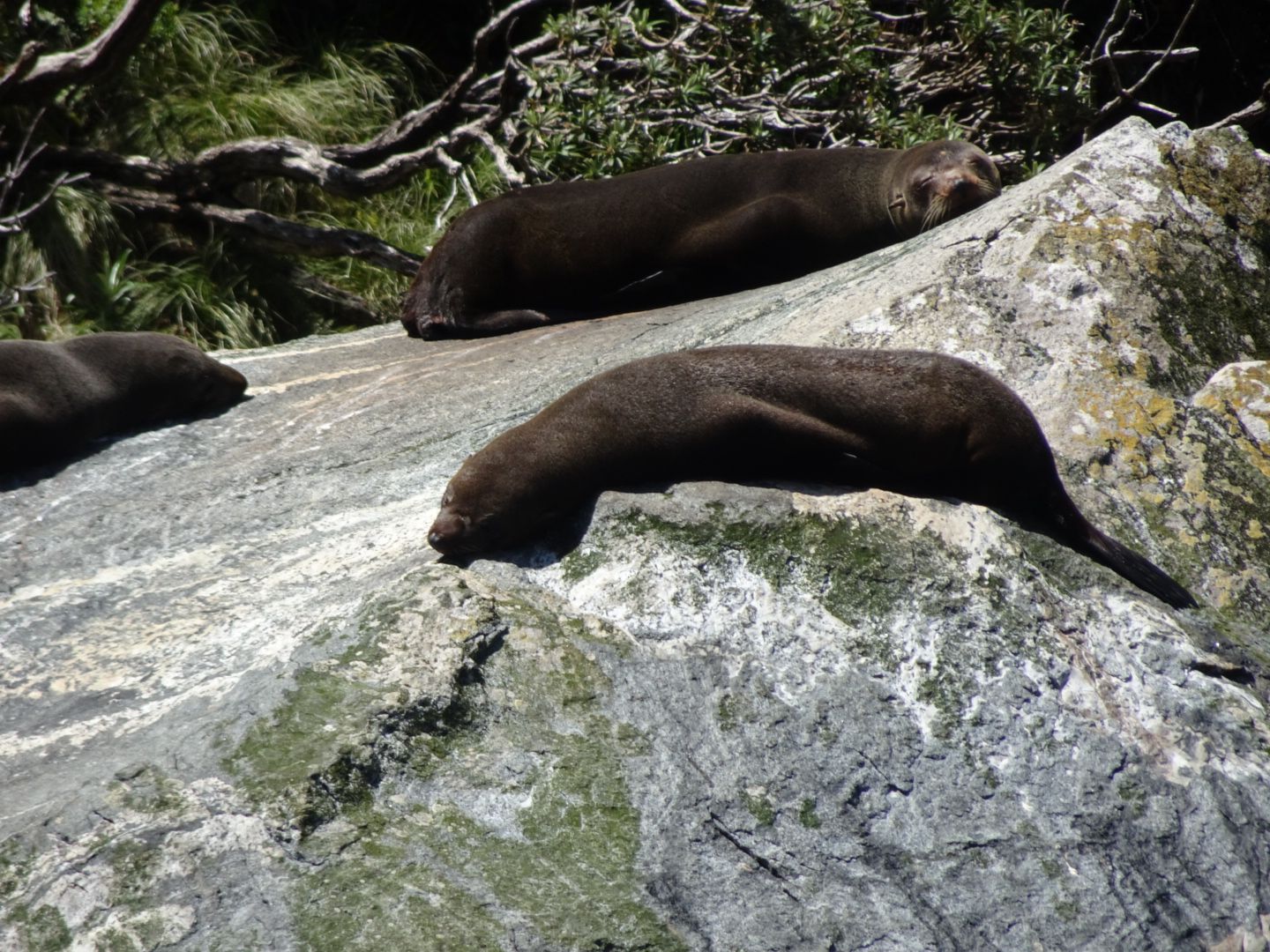
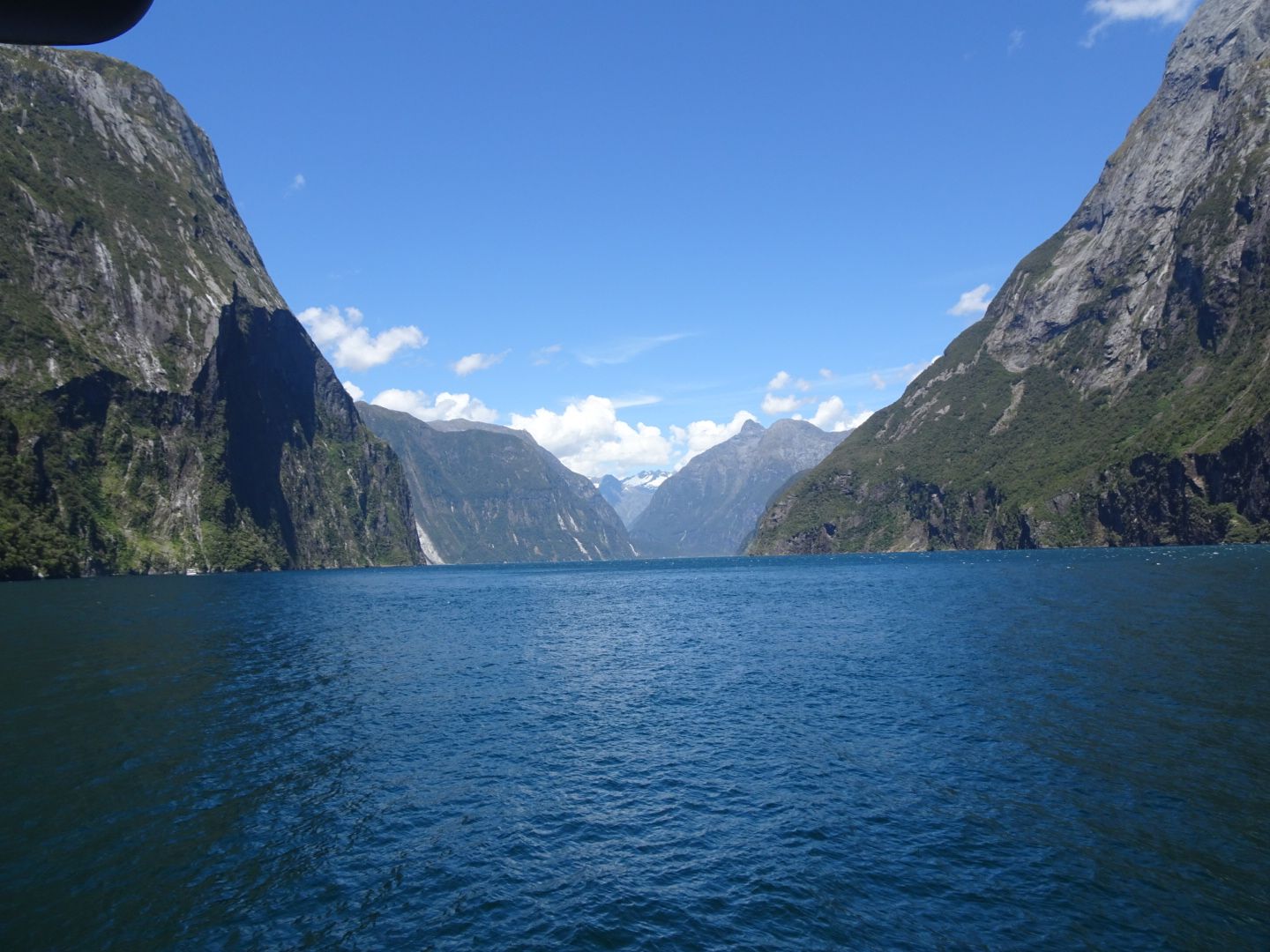
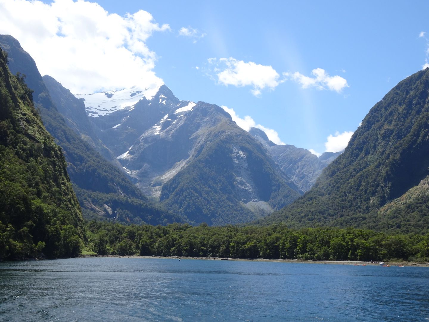
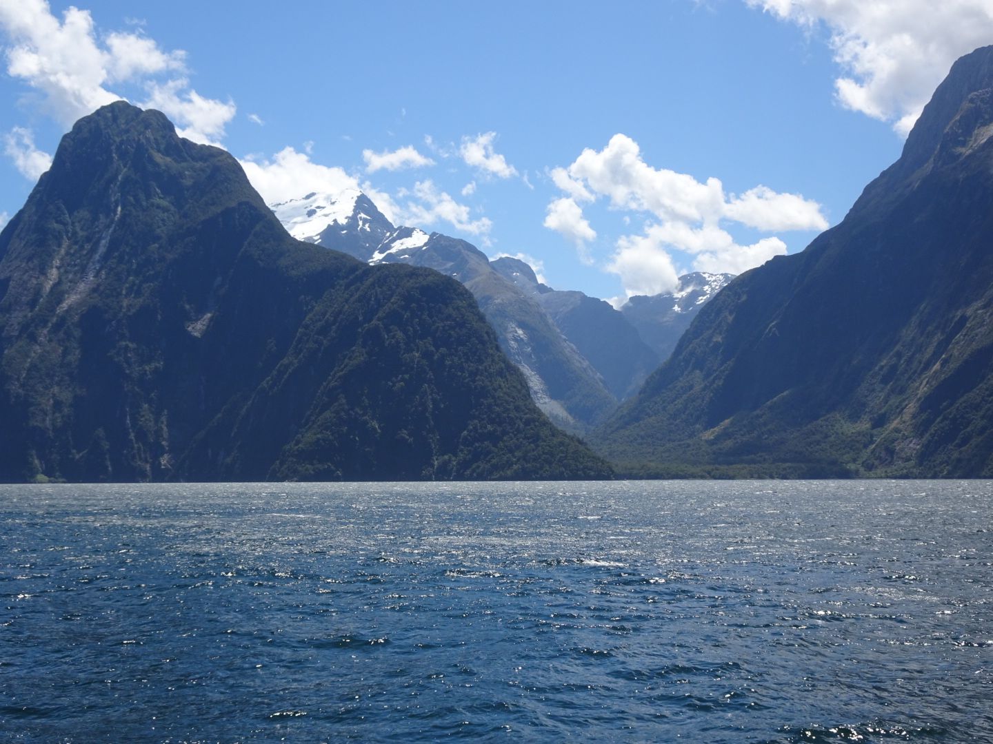
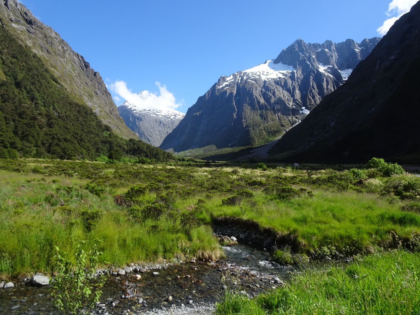
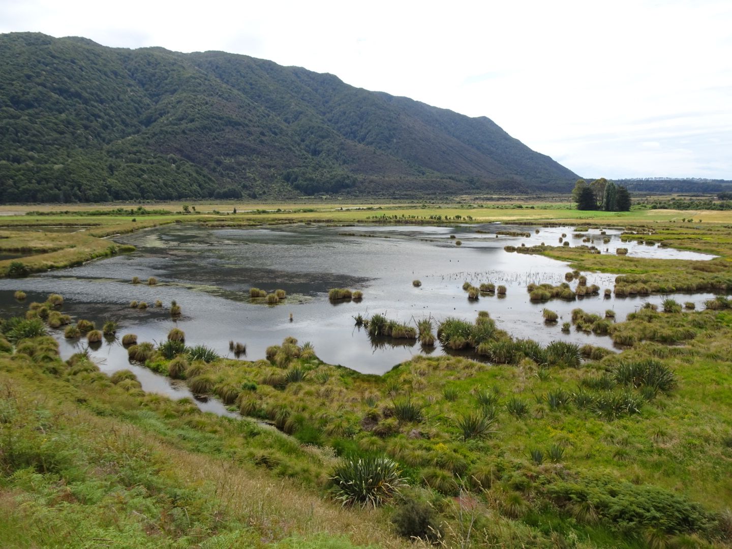
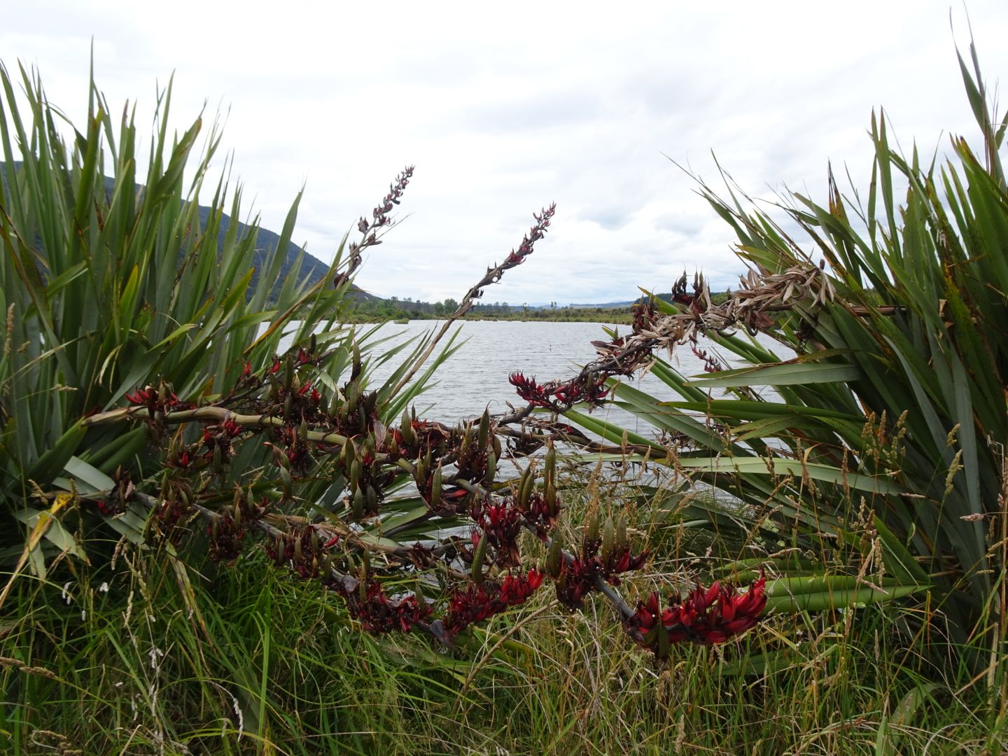
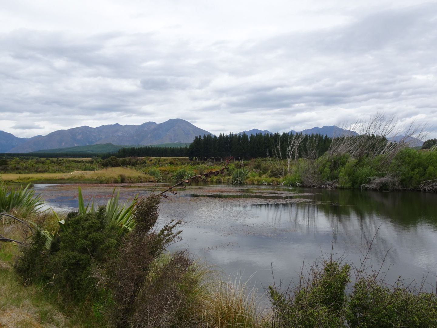
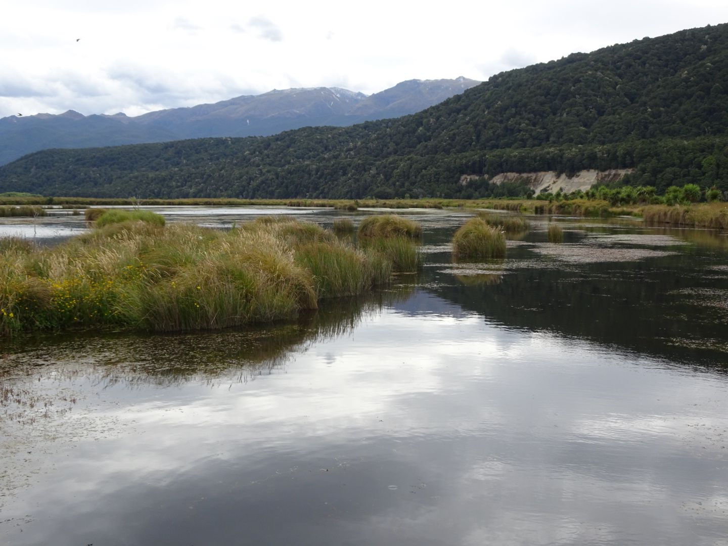
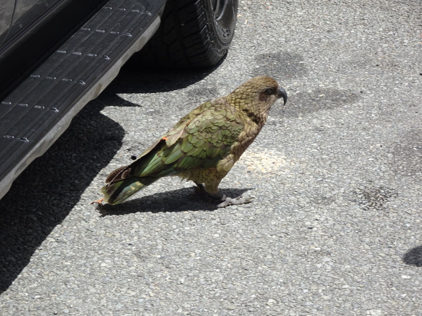
On January 2nd, I drove about 110 km along the Milford Road to Milford Sound, the only fjord in the southwestern South Island that can be reached by road. Along the Milford Road, you could easily spend a whole day as there are so many worthwhile places to visit. In addition to several viewpoints and waterfalls, the Mirror Lakes are particularly worth mentioning. So, both on the way there and on the way back, I stopped several times to take photos and see the rare keas, which are often seen in these places as they want to steal food from tourists. Keas are the only mountain parrots in the world, they have the intelligence of a four-year-old child, and they can only be found on the South Island of New Zealand. They are hardly visible in the forest, but sometimes they come to busy places to get something to eat. Unfortunately, they were already full or had something better to do than entertain tourists on that day. Arriving at Milford Sound, I marveled at the huge fjord and decided to treat myself to a boat trip through the entire bay to the open sea and back. The journey took two and a half hours, and we got to see fantastic landscapes, waterfalls, and sea lions. Some scenes from 'The Lord of the Rings' were filmed at Milford Sound. Despite the price of approximately €68, this excursion was definitely worth it! Afterwards, I drove back to Te Anau, spent one night there, and then drove only 20 km further to Manapouri, where there is a lake with the same name. On the way there, you pass the river that should be familiar to all 'Lord of the Rings' fans, the Anduin. In Manapouri, I spent a relaxed afternoon at the beach, treated myself to a seafood basket and a beer at a restaurant, and the next day, I went for a beautiful hike in a nearby wetland called Rakatu Wetlands, which I discovered by chance.
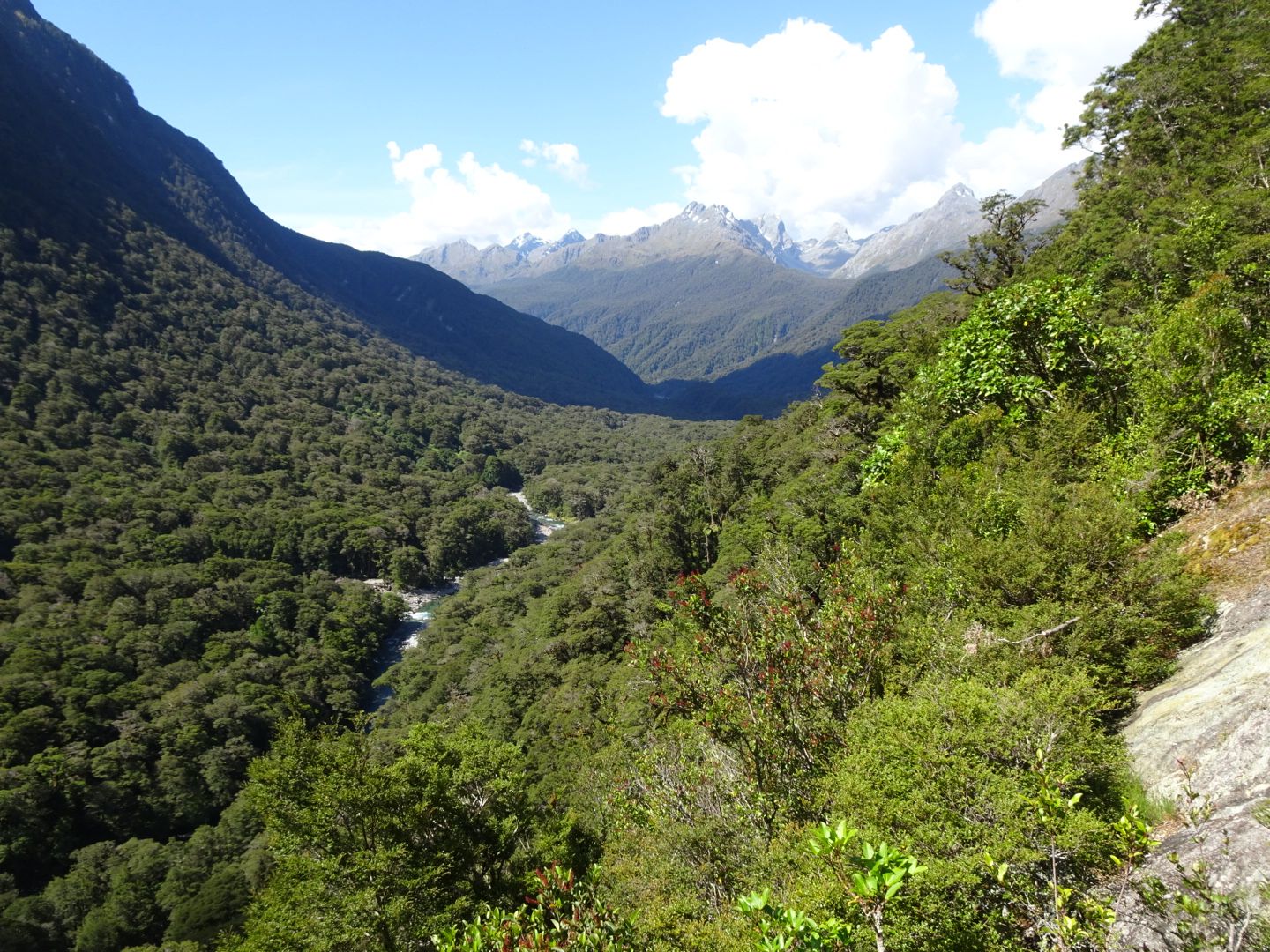
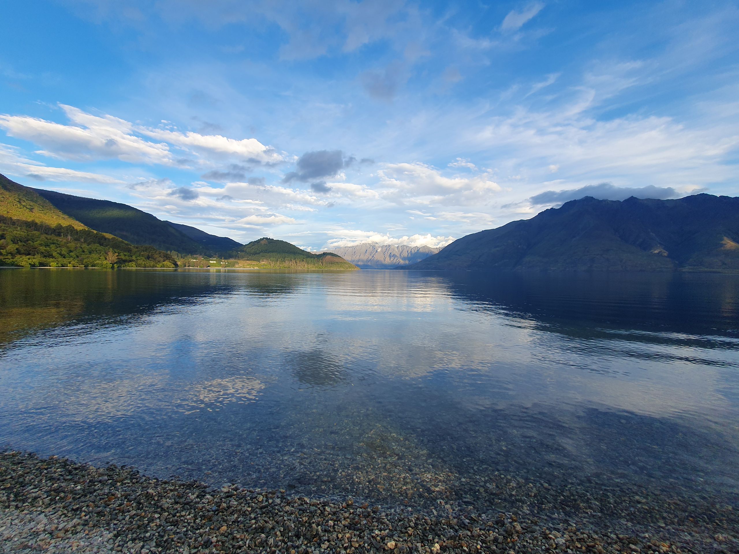
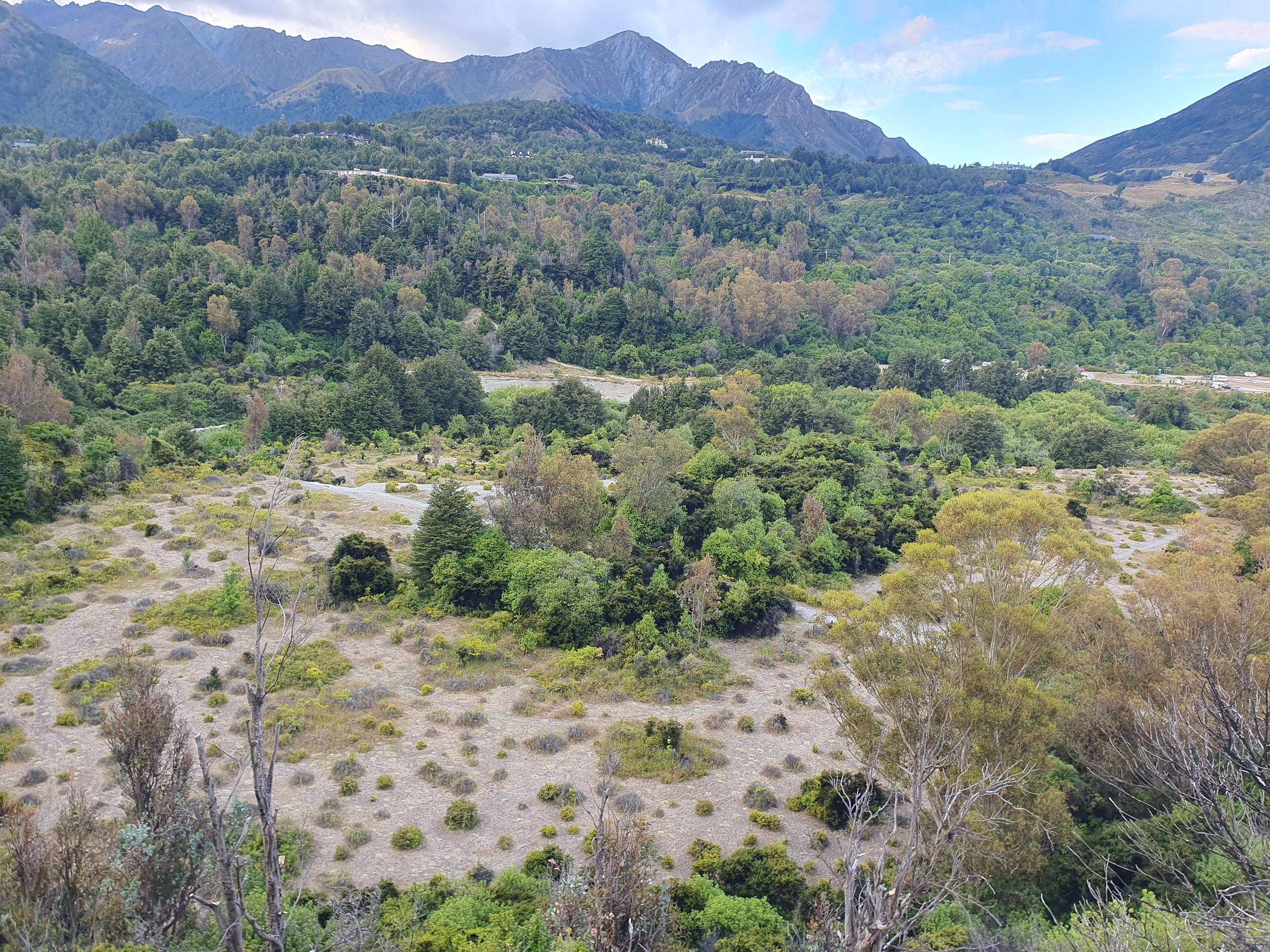
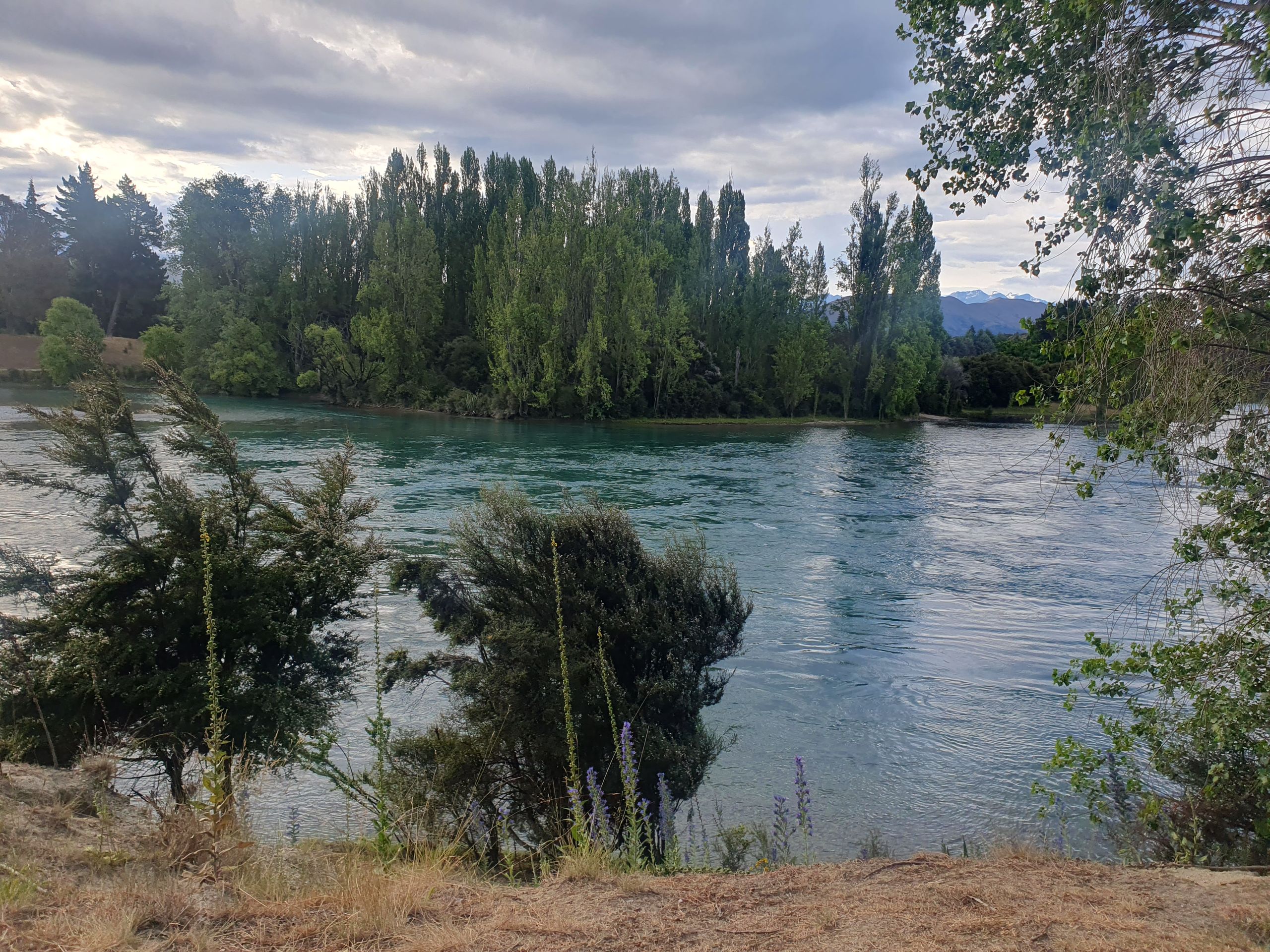
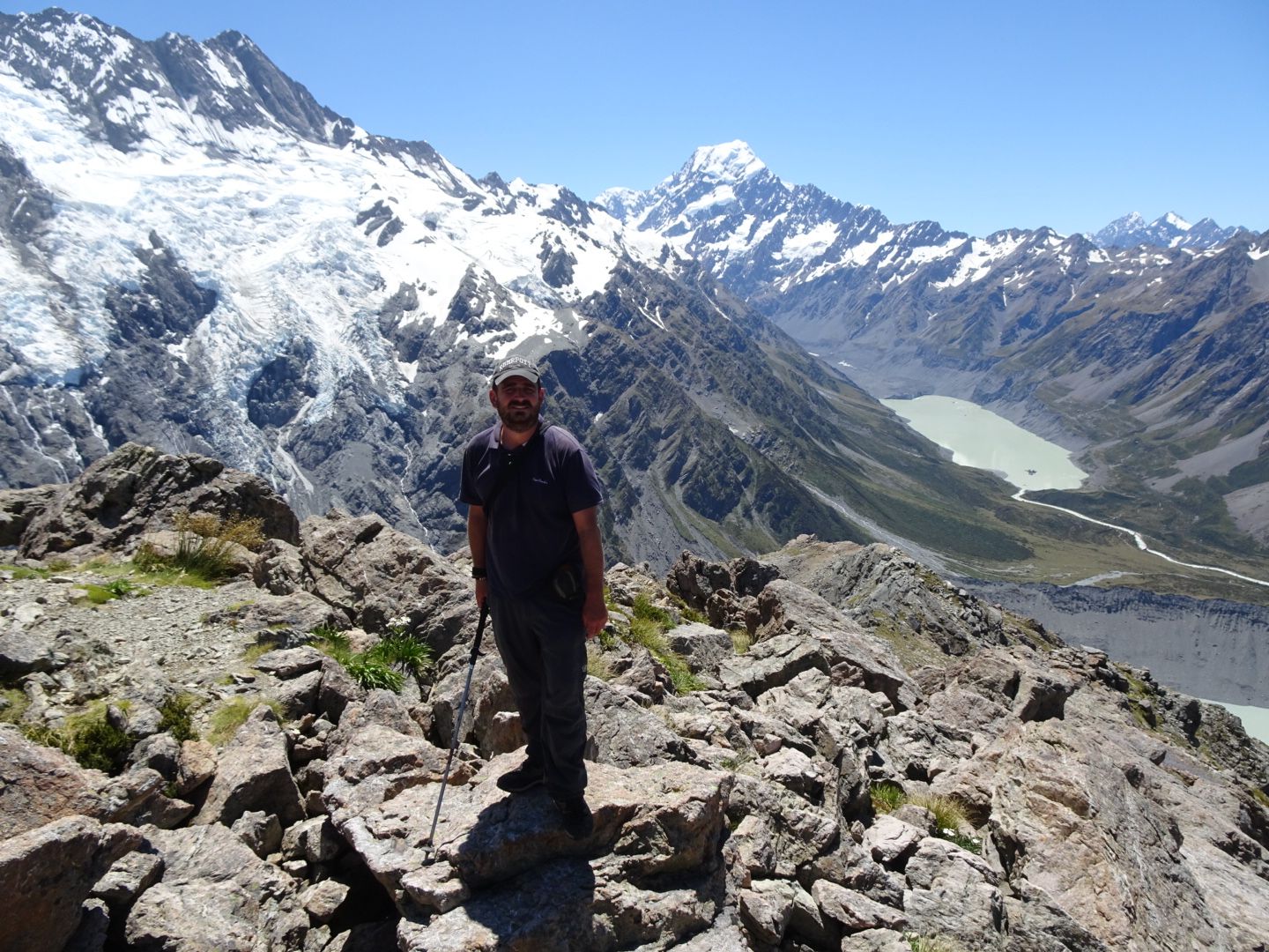
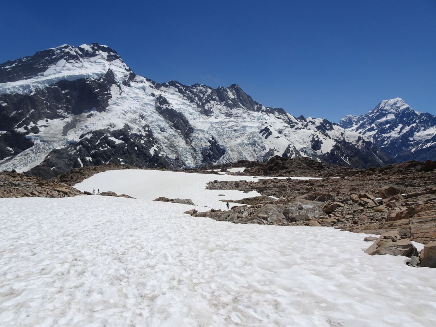
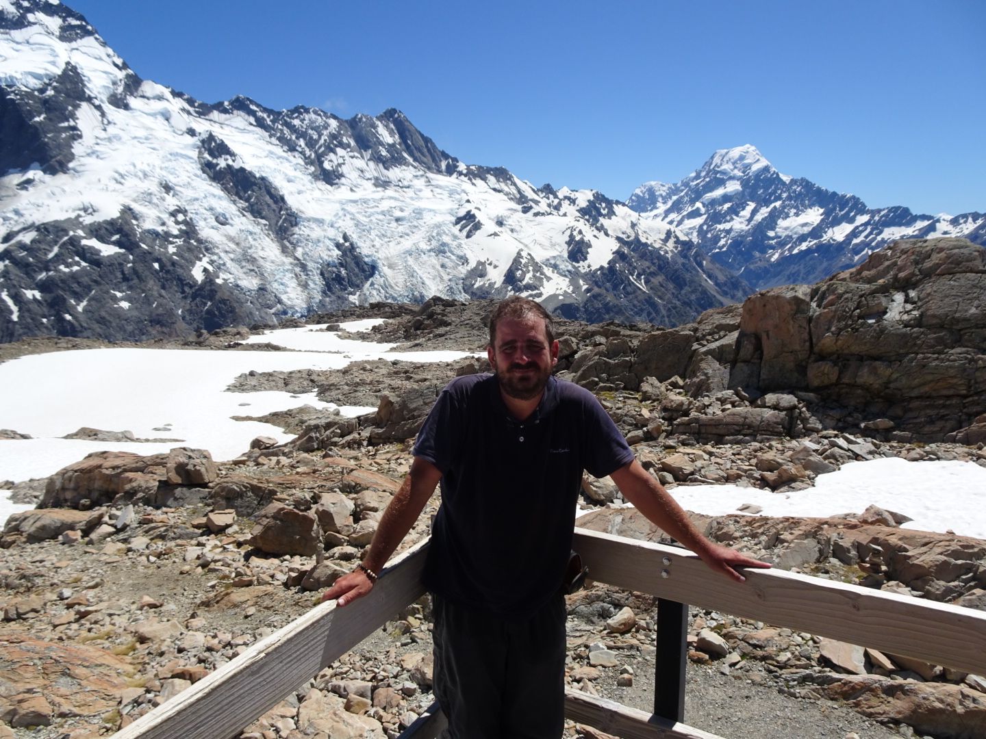
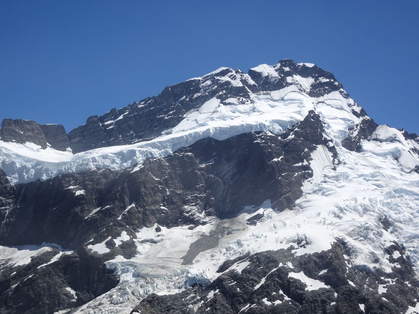
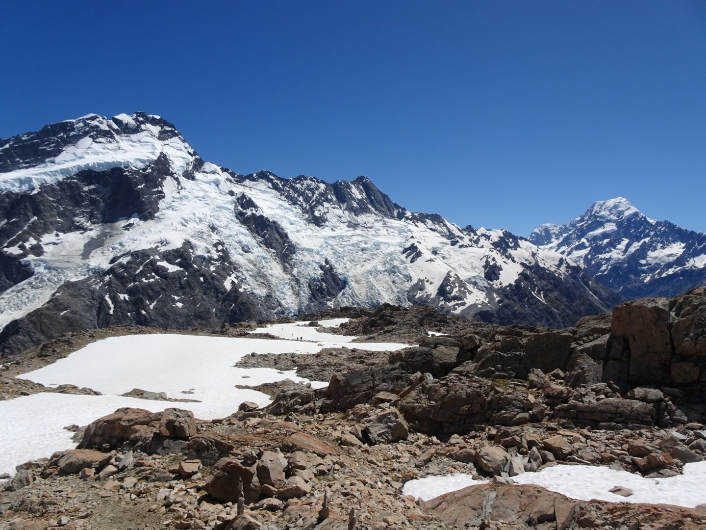
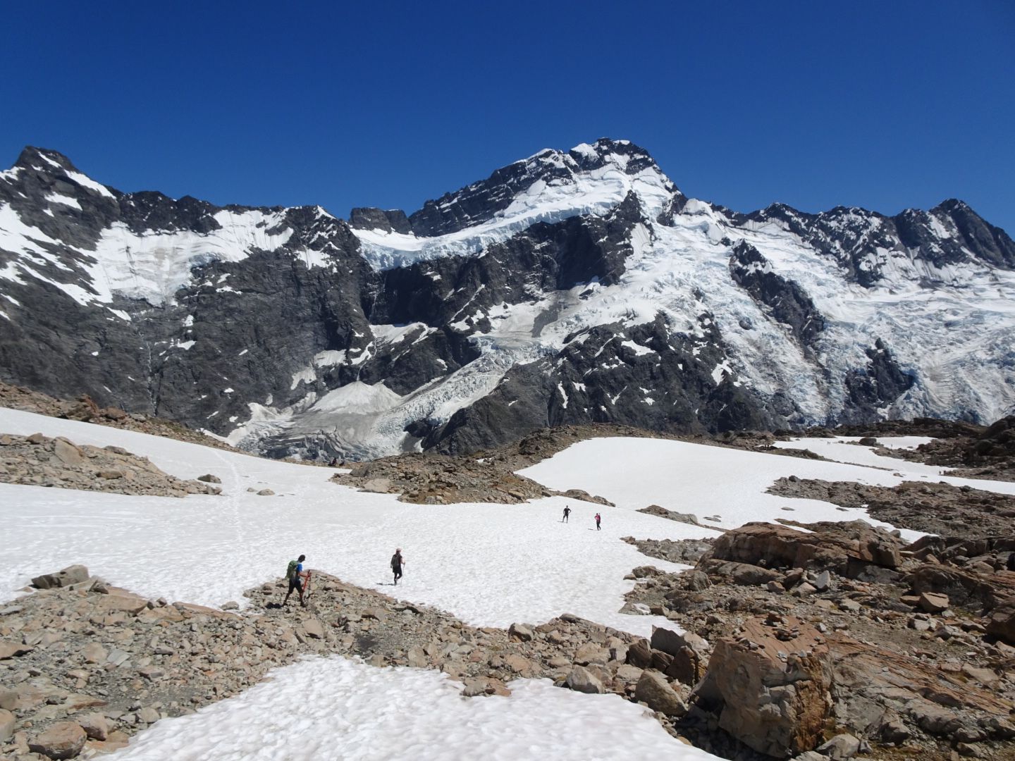
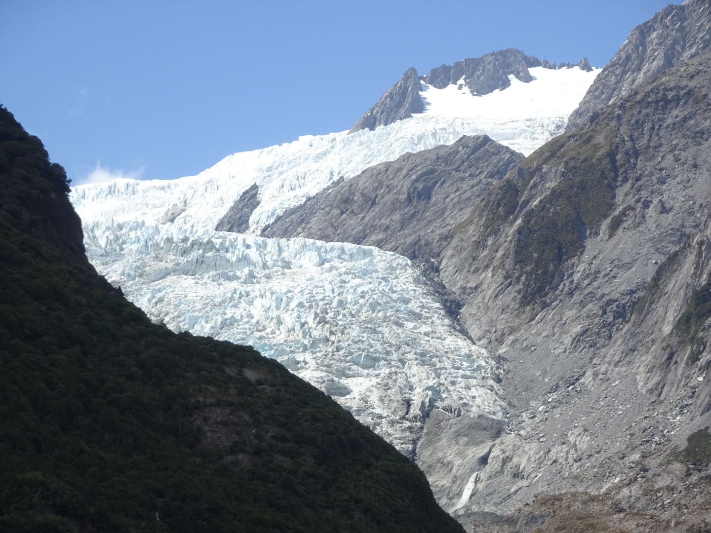
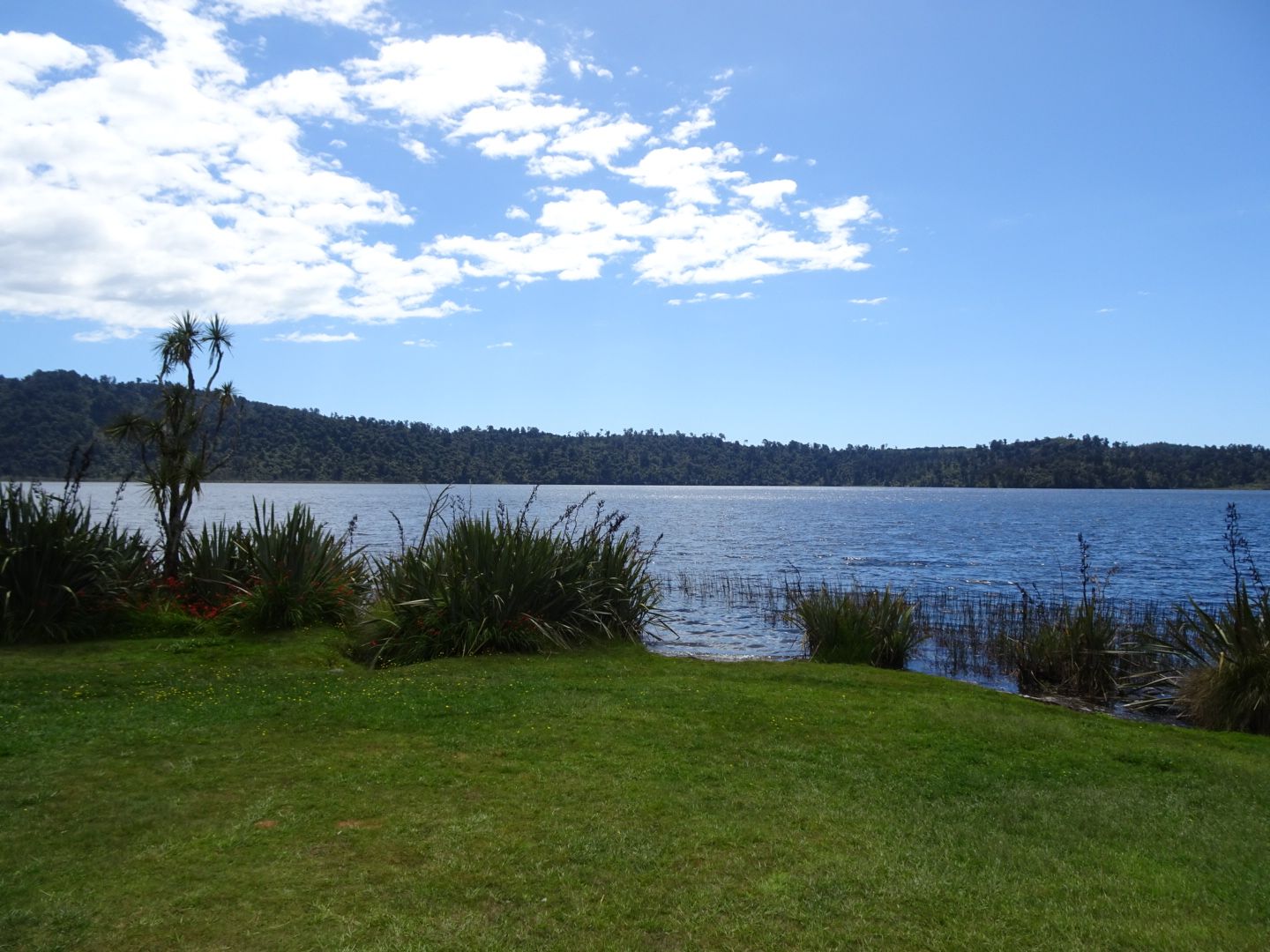
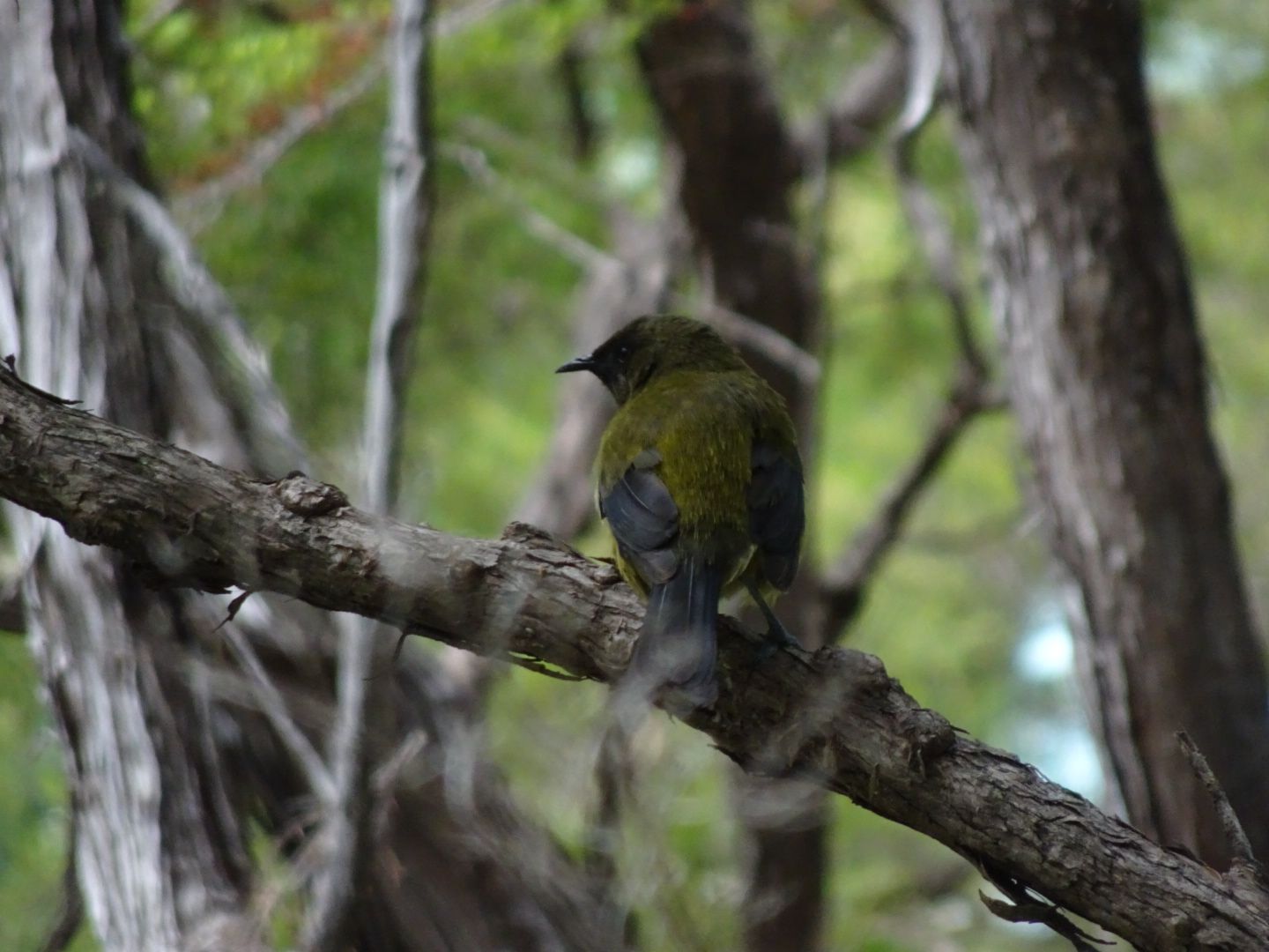
On January 5th, I continued to Queenstown in the rain. The city is wonderfully located on Lake Wakatipu, but it is very touristy and calls itself the 'World Capital of Adventure.' In the city center, there is a provider of skydiving, bungee jumping, paragliding, etc., on every corner. And it is incredibly expensive. Nevertheless, you should at least briefly visit Queenstown to eat the famous Fergburger, which is renowned throughout New Zealand (and rightly so!). Once again, I had a campsite in a perfect location by the lake, right next to another filming location from 'The Lord of the Rings.' However, after just one night at Lake Wakatipu, I continued to Wanaka, which is also located by a lake. In Arrowtown, I made a brief stop to visit a Chinese village from the time of the gold rush over 150 years ago. My campsite in Wanaka, where I stayed for a total of three nights, was beautifully located by a river. The weather was better again by then, so on January 7th, I went on a longer hike in Mount Aspiring National Park on the Rob Roy Glacier Track. Unfortunately, it was mostly cloudy, but the glacier was still visible. After the second night in Wanaka, I decided, also due to the excellent weather again, to drive to Mount Cook National Park, where the highest mountains in New Zealand are located. The DOC campsite there was the most beautiful one so far, located directly below the glacier of Mount Sefton. On a shorter hike, I reached the viewpoint of Mount Sefton and Mount Cook, the highest mountain in New Zealand at 3,721 meters, and its glacier. Afterwards, I took a stroll to 'Kea Point,' but once again, there were no mountain parrots to be found. The next day, January 9th, I went on a longer mountain hike of almost 1,100 meters in altitude to an observation point called 'Mueller Hut.' This hike started off easy but then led through high-alpine terrain to the glaciers, with snowfields to cross. The view was spectacular! After the descent, I drove for three hours, interrupted by a swimming stop in the cool Pukaki Lake, back to Wanaka, where I spent another night at my old campsite.
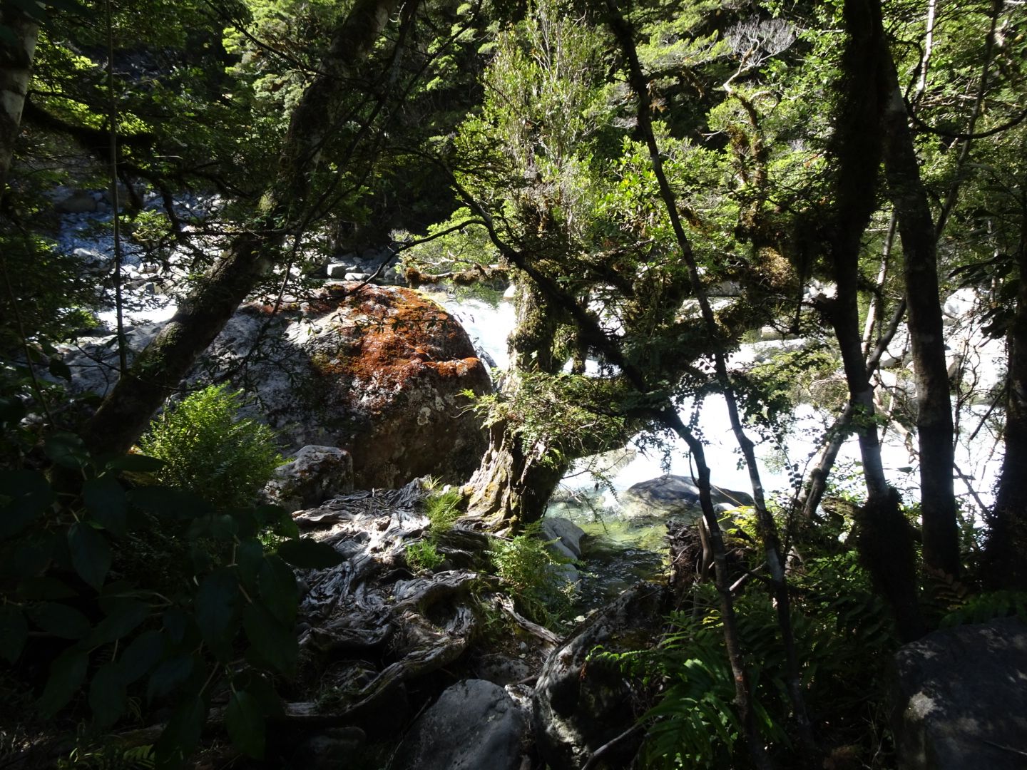
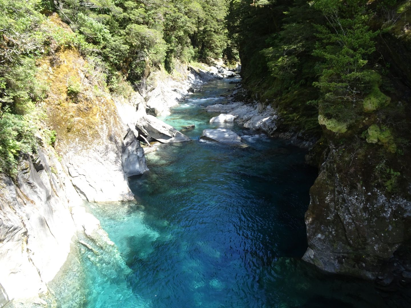
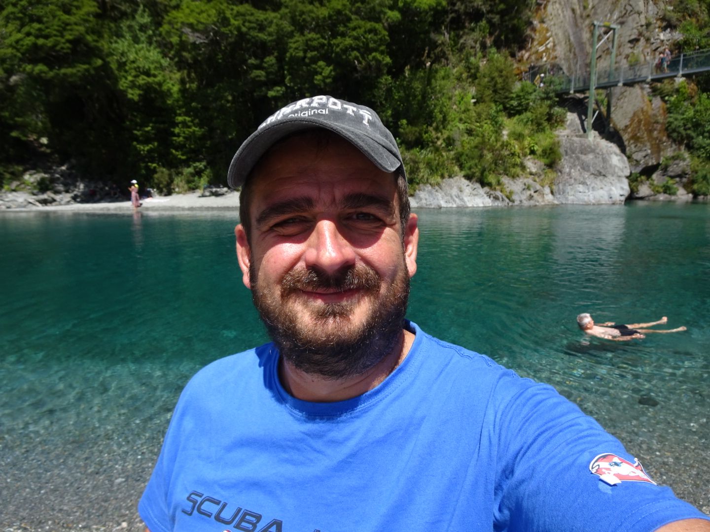
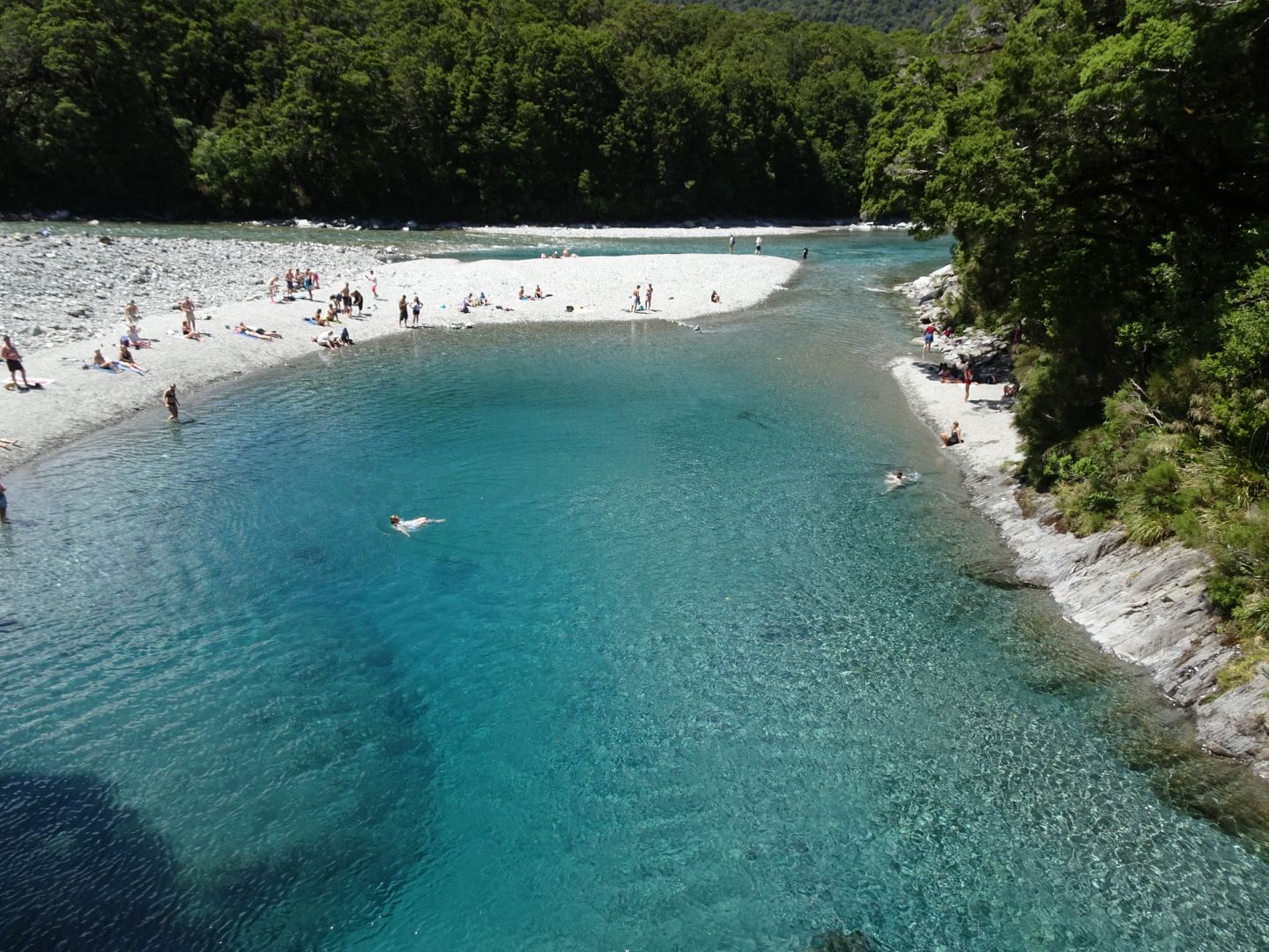
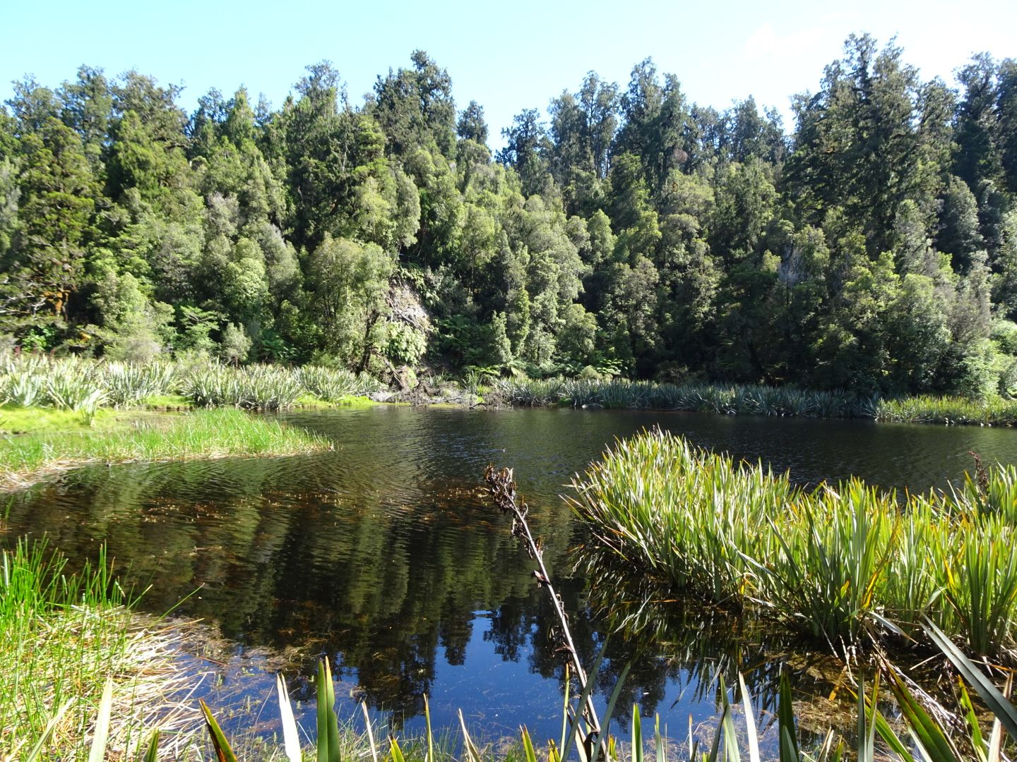
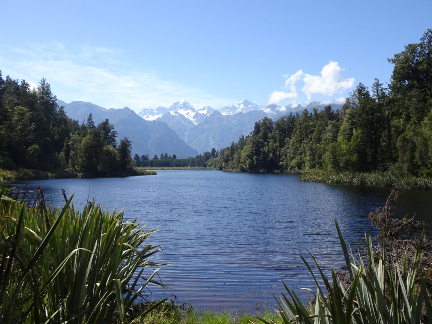
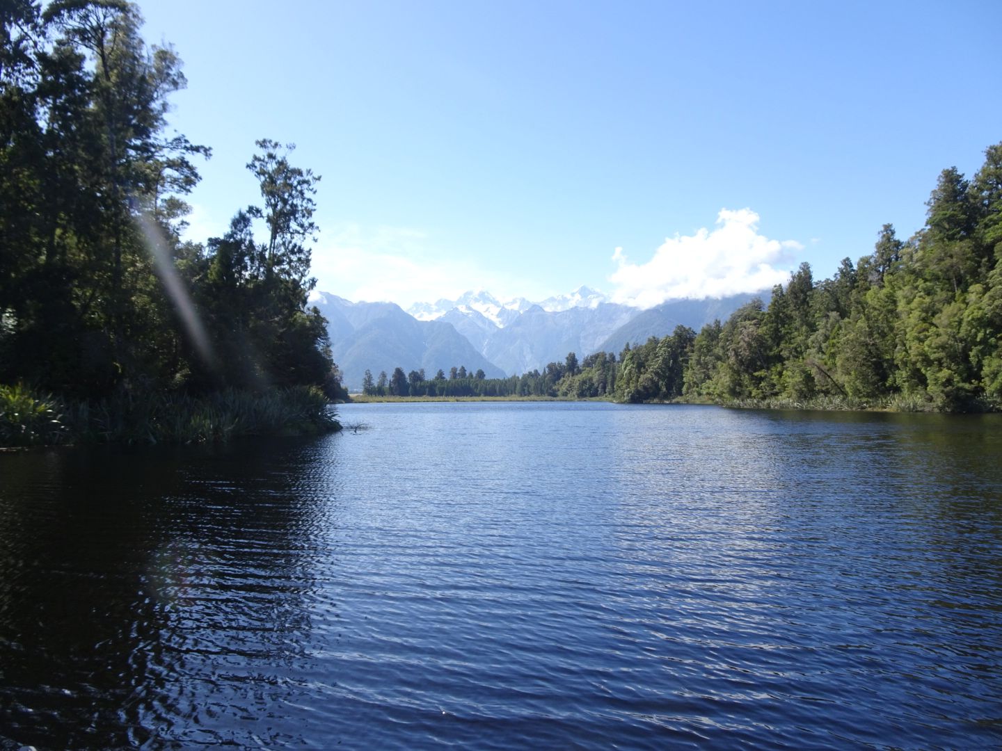
On January 10th, I had a long drive ahead of me to the glaciers of the West Coast via Haast Pass. On the way, I made a stop to visit the Blue Pools and cool off there. However, I was out of the water after a few seconds because it was icy cold. On the coast, after a shopping stop in Haast, I did a short hike to Monro Beach, where you can often see Fiordland penguins. Unfortunately, they weren't there, but the walk was still worth it. My campsite was located in the middle of nowhere, right on Gillespie Beach, and could only be reached via a 20 km long dirt road. The next day, I went on a short hike around Lake Matheson, where, on clear calm days, you can see the reflection of Mount Cook. Yes, I was now on the other side of Mount Cook compared to two days ago. And I drove almost 500 km for that! But there is no shorter way to get to the West Coast. Unfortunately, it wasn't calm enough, and therefore, the mountain did not reflect in the water. Nevertheless, this lake is beautiful and offers fantastic views. There are supposed to be kiwis there too, the shy, nocturnal, flightless national birds of New Zealand. But hardly any local has ever seen a kiwi in the wild in their life! In the afternoon, I walked to a viewpoint to see the Fox Glacier and was somewhat disappointed because the glacier was quite far away. I felt the same way the following day when I hiked to the viewpoint for Franz Josef Glacier. My problem was simply that a few days earlier, I had the glaciers in Mount Cook National Park so close. After the hike at Franz Josef Glacier, I continued along the coast to the north with two longer stops at Okarito Lagoon and Lake Ianthe until I reached Lake Mahinapua, where I stayed for one night.
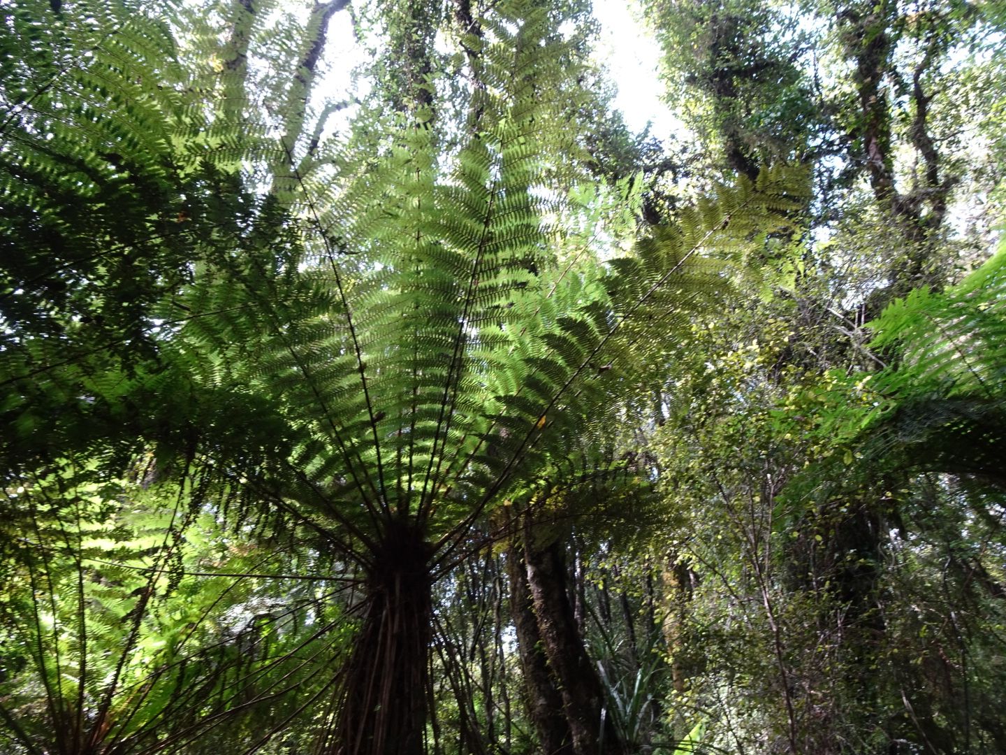
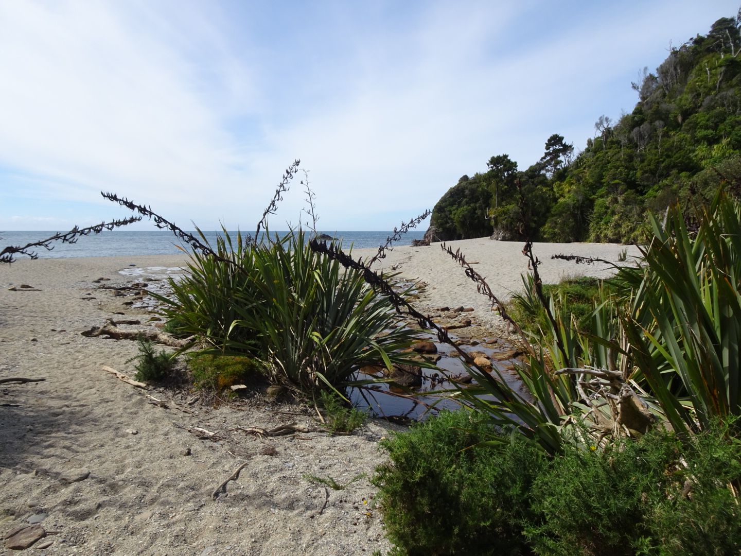
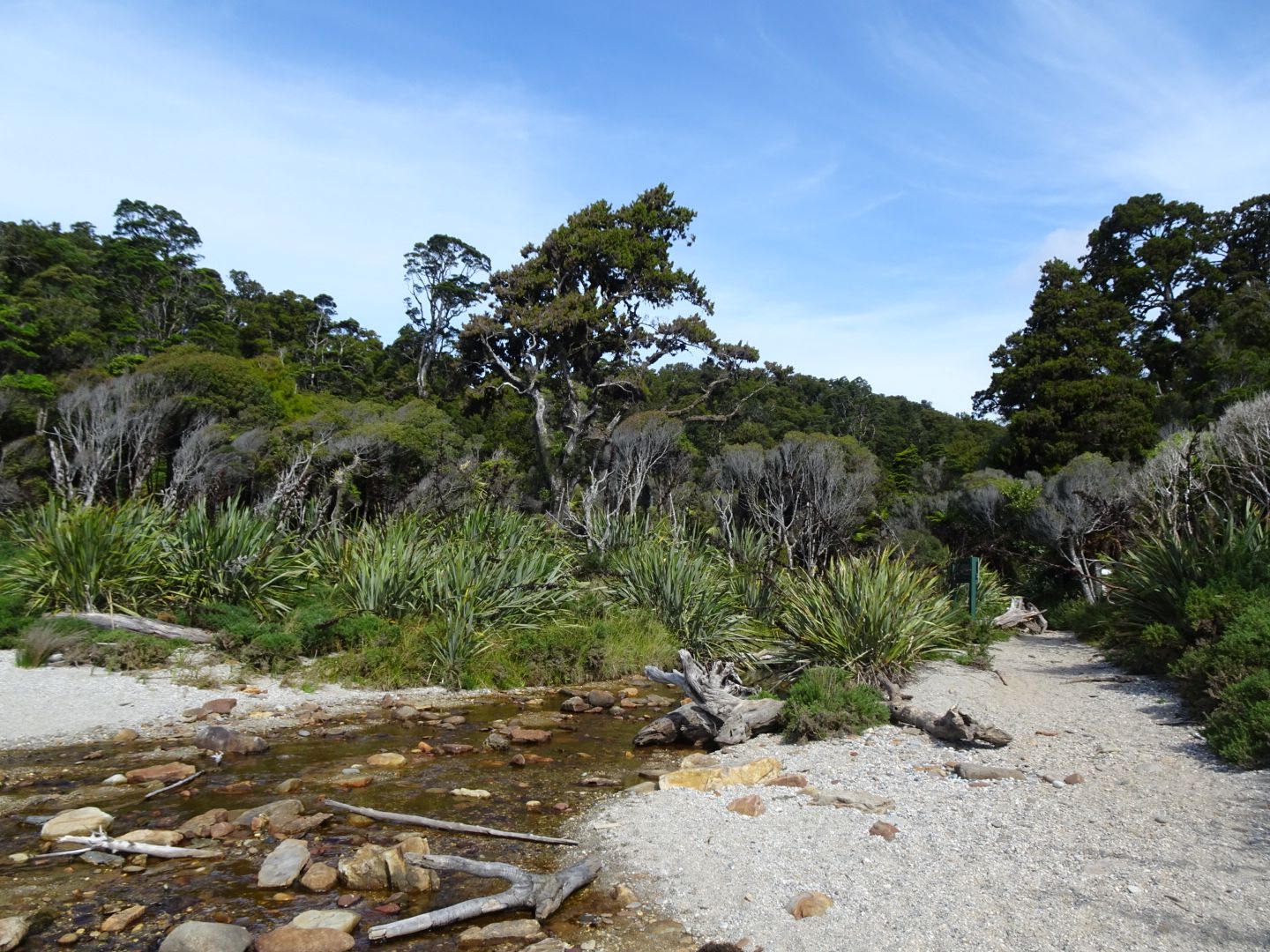
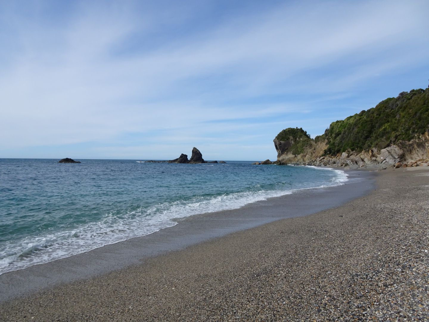
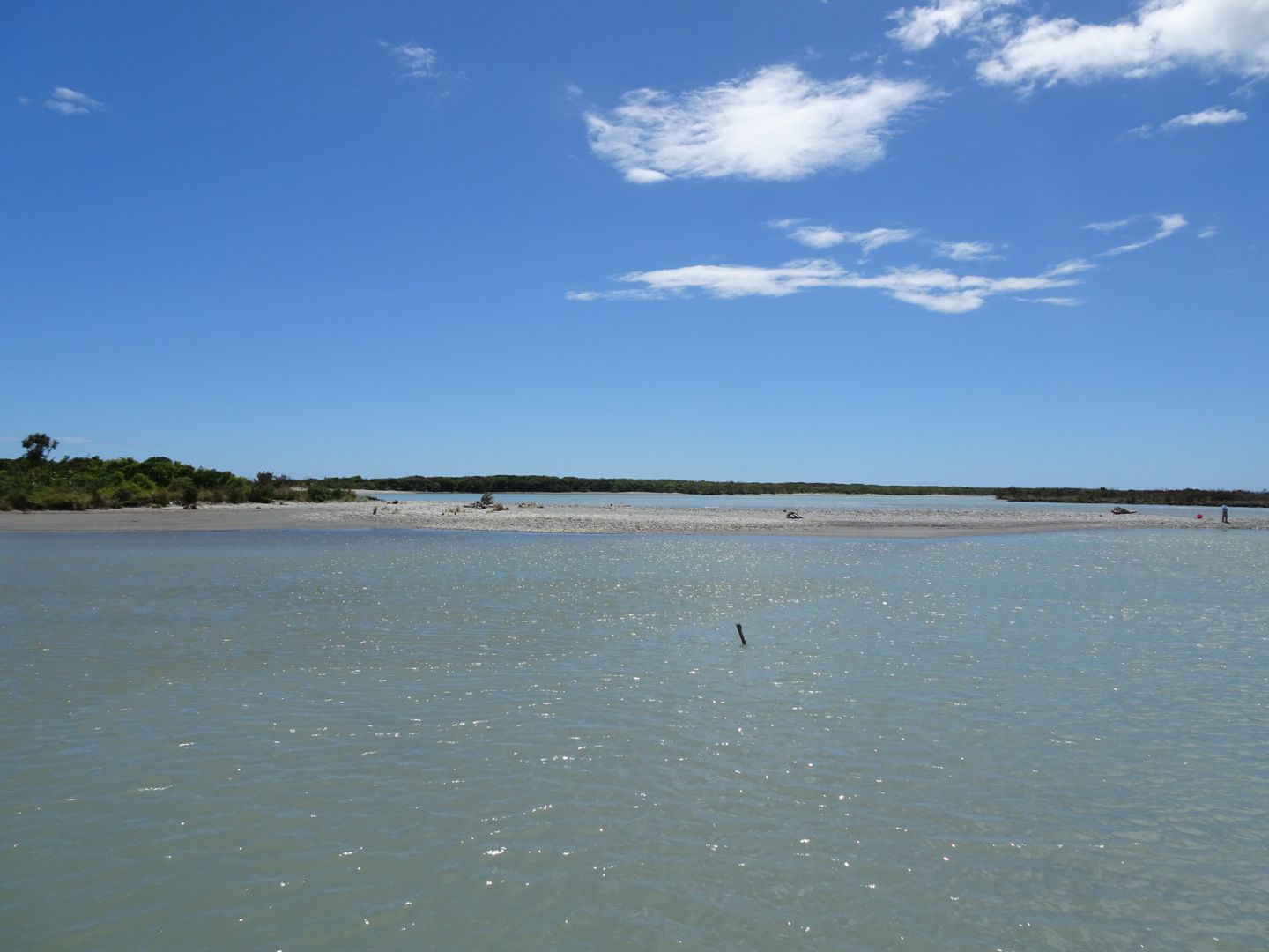
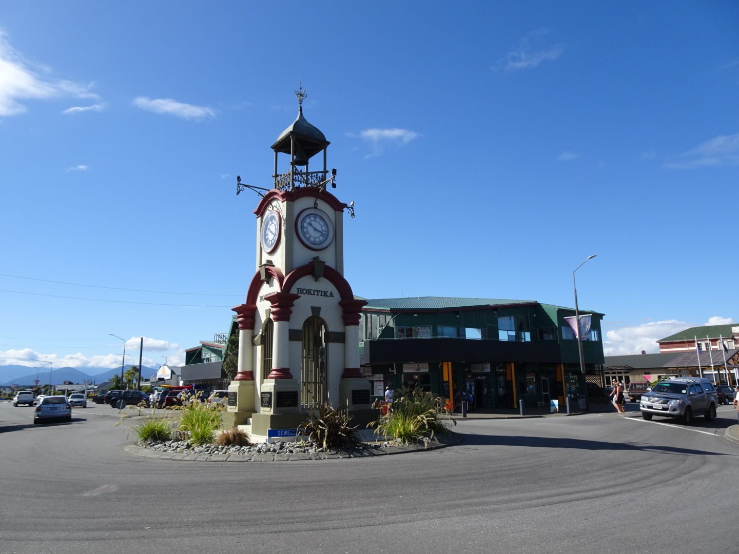
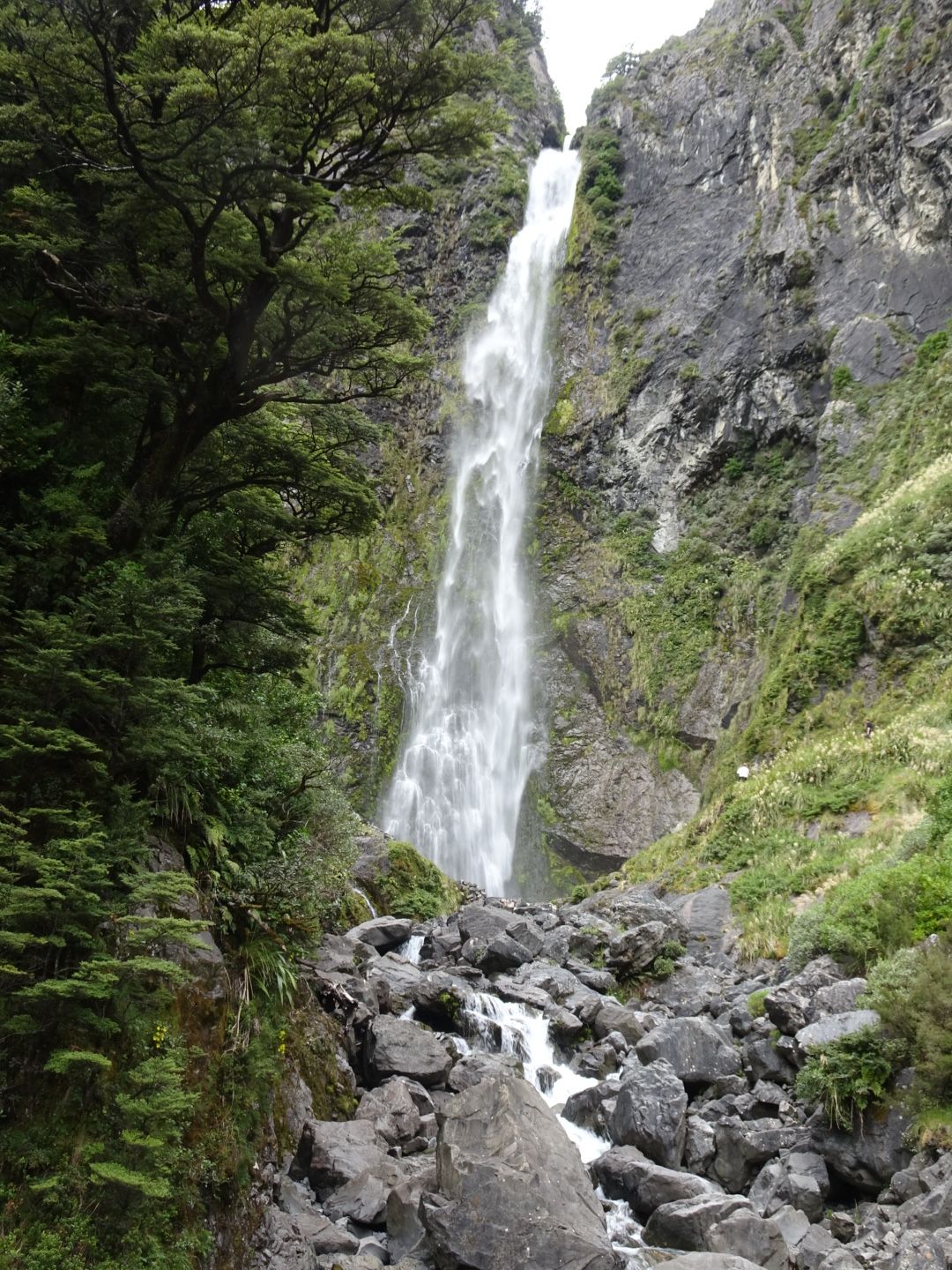
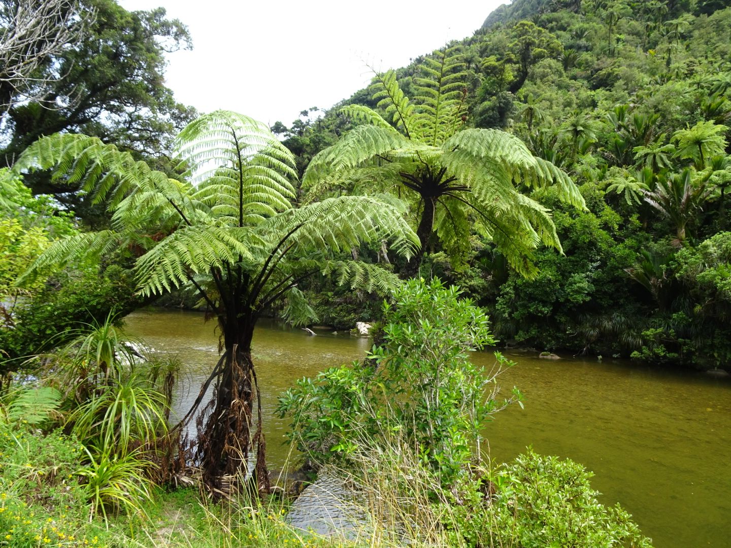
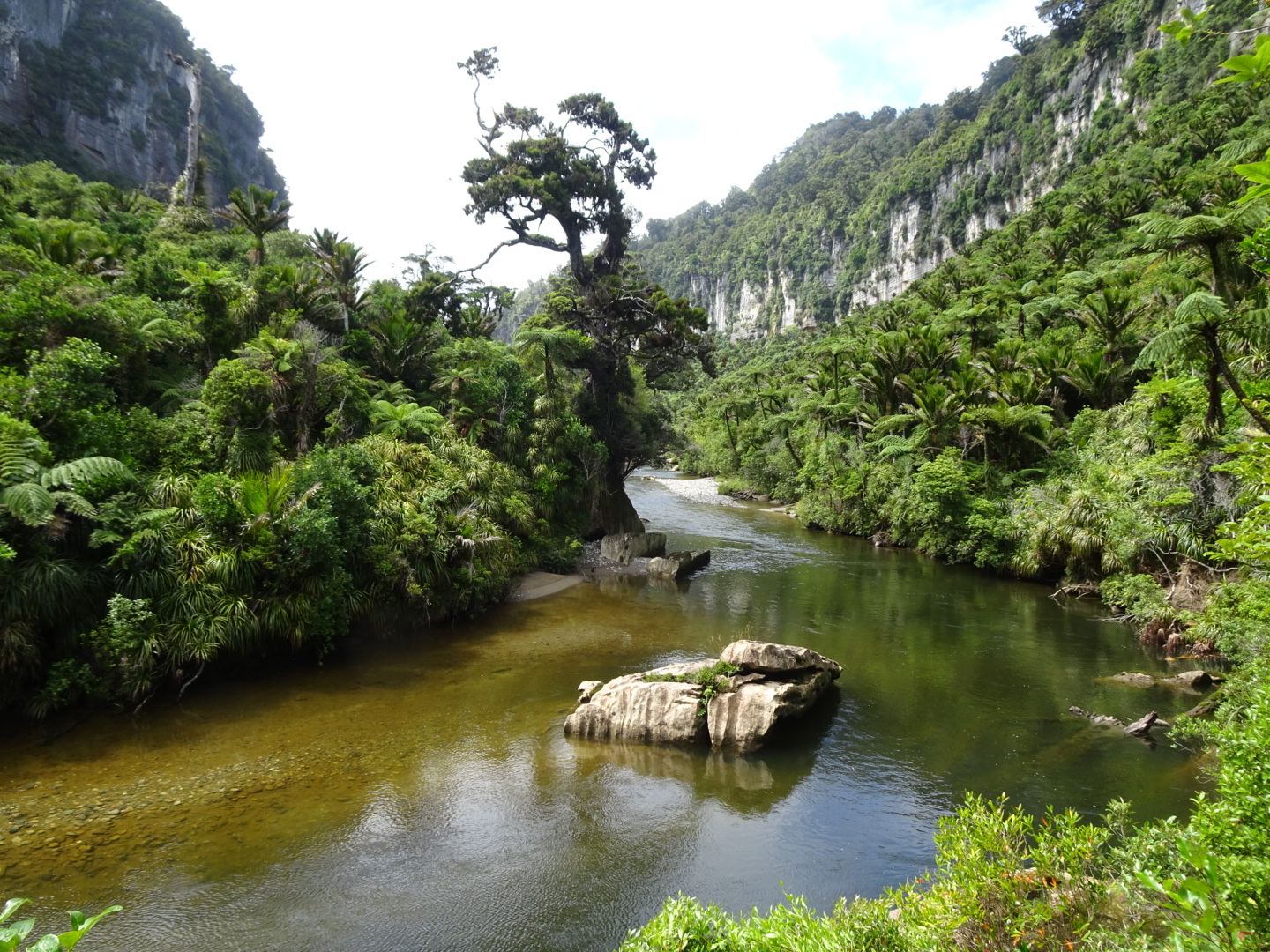
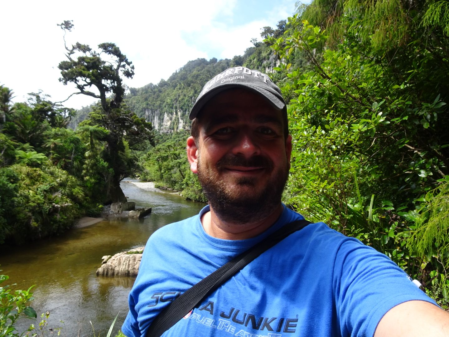
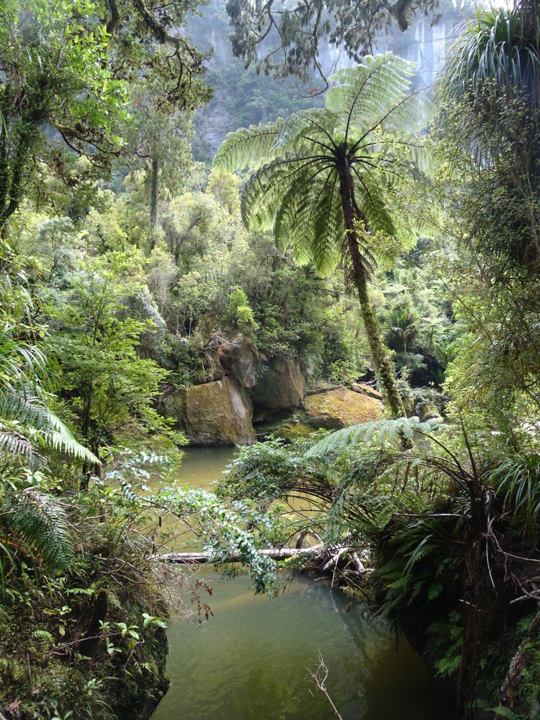
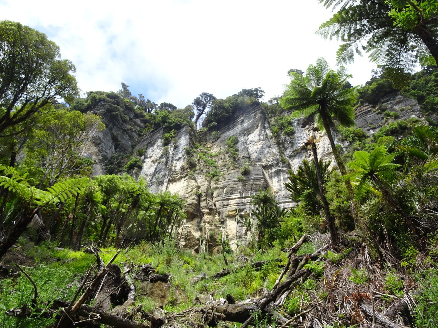
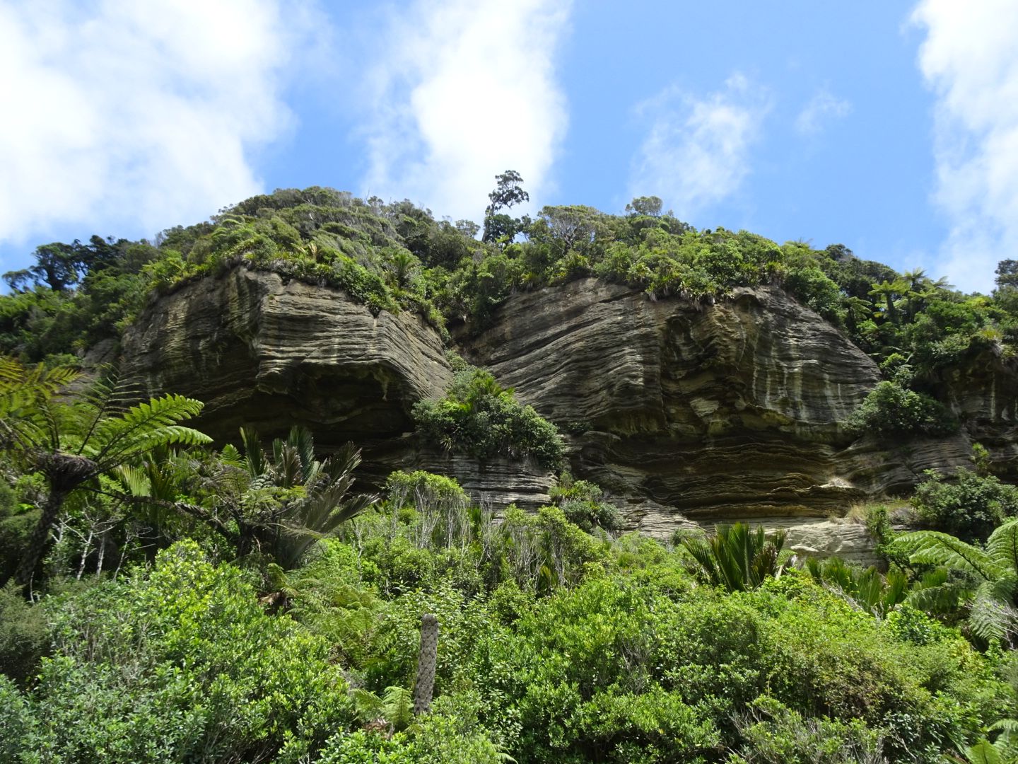
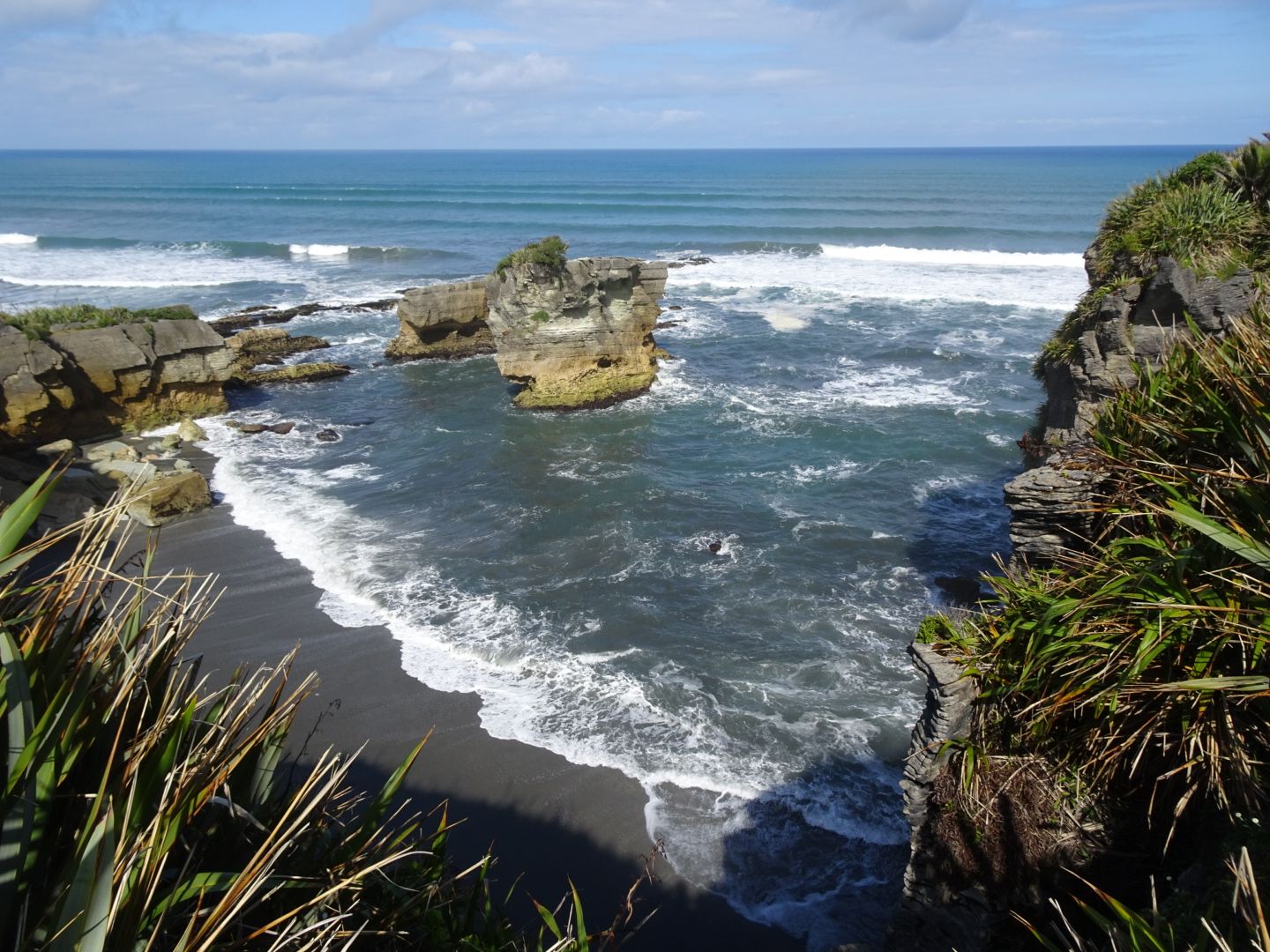
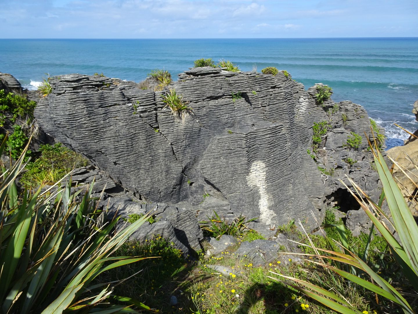
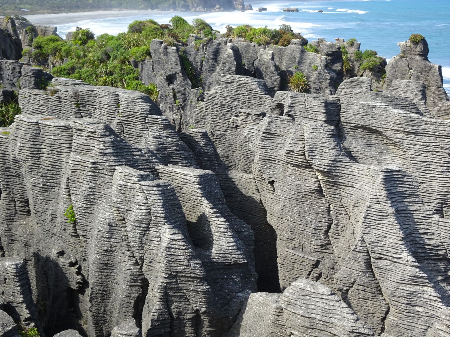
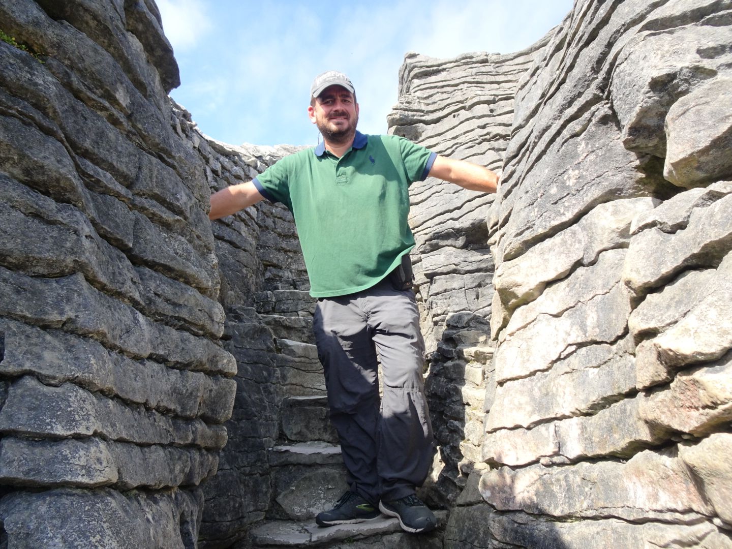
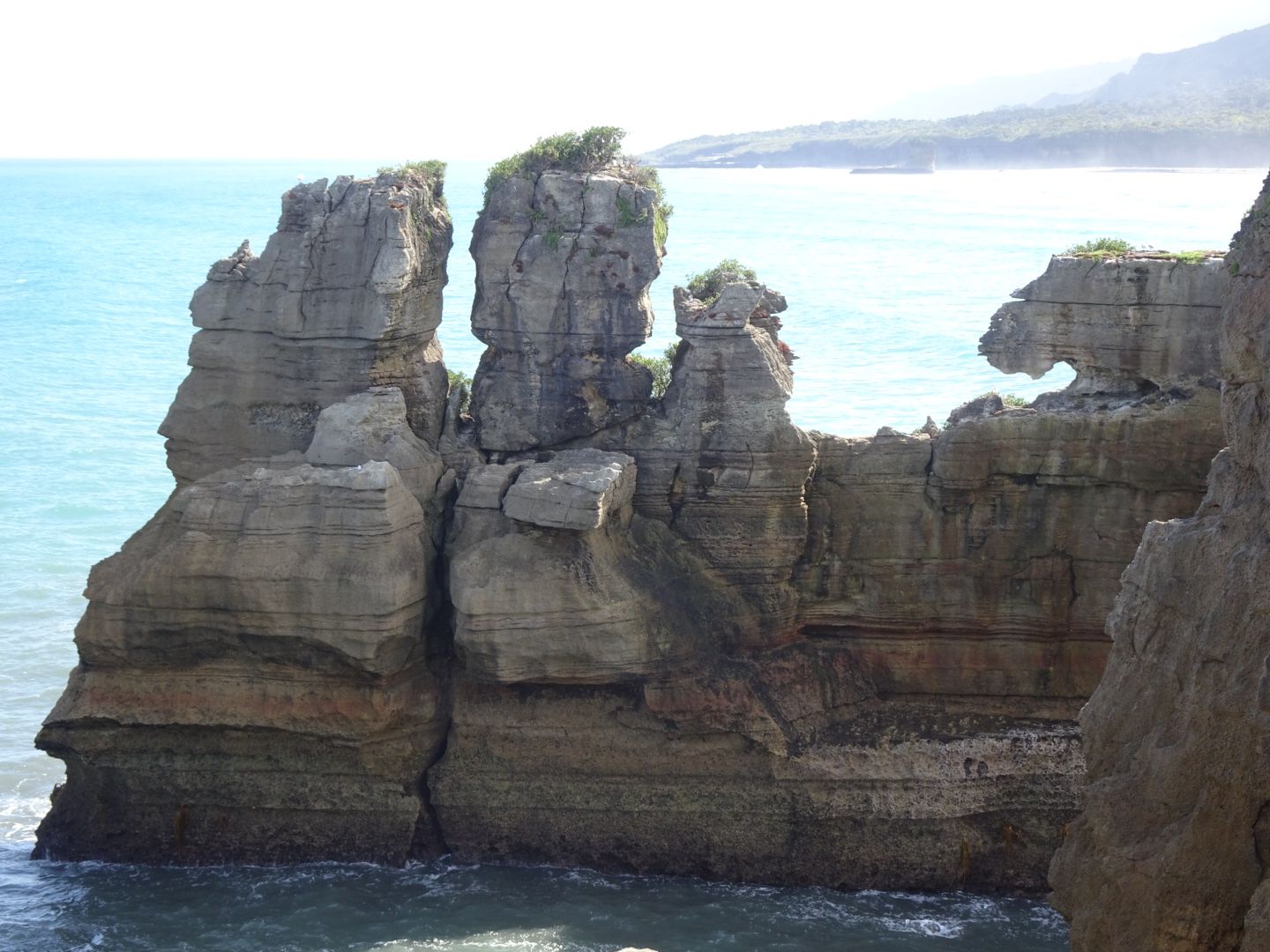
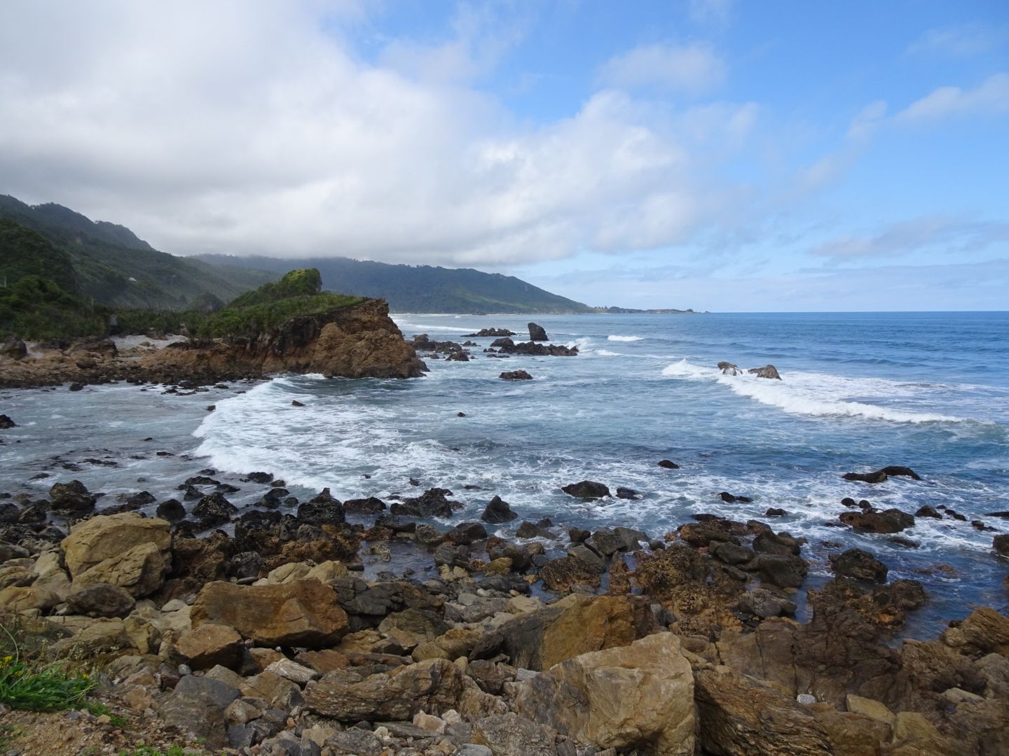
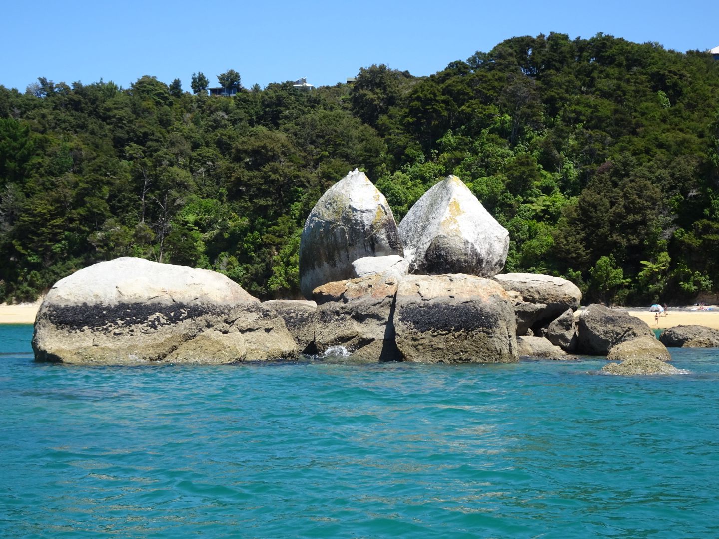
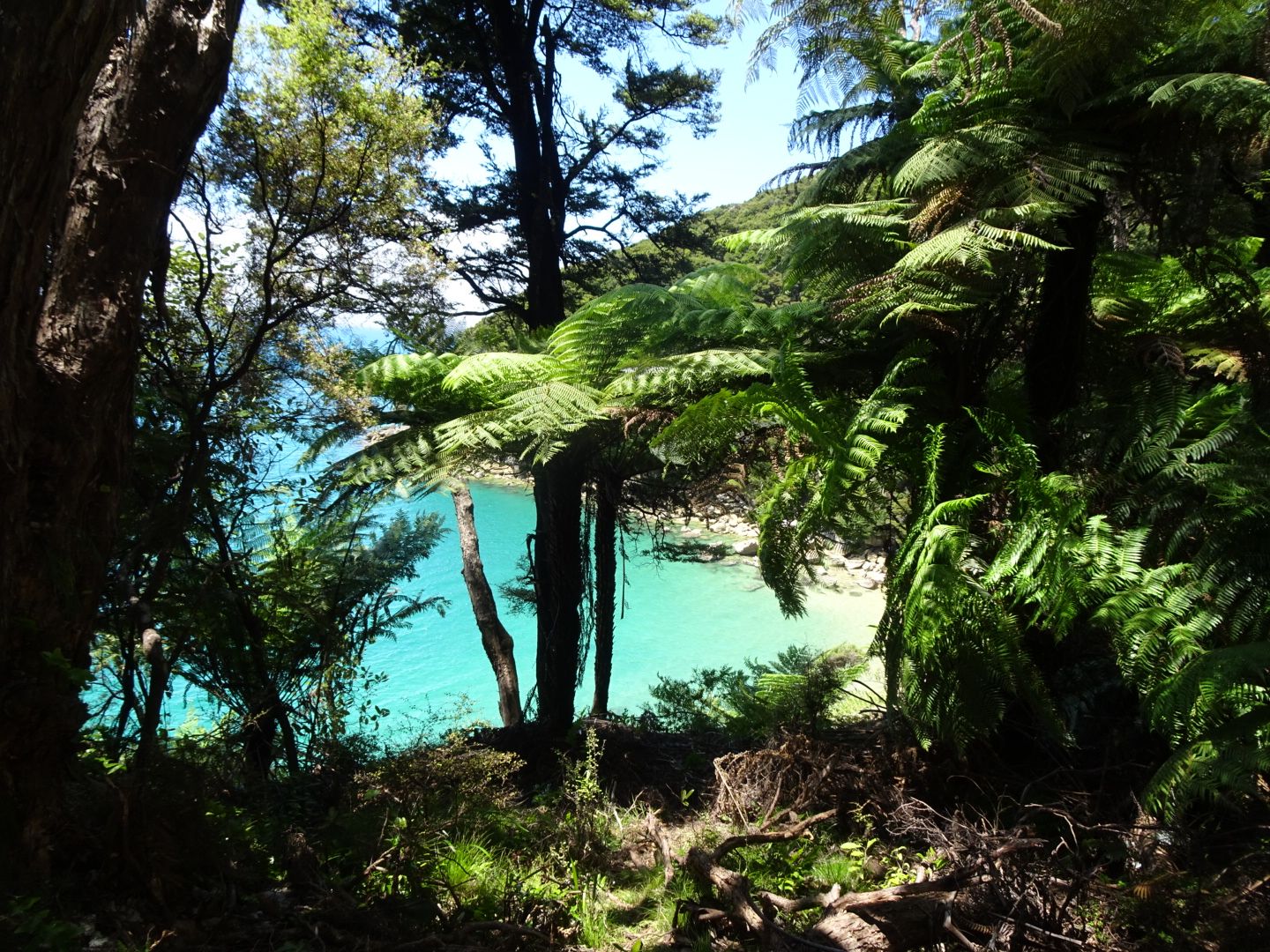
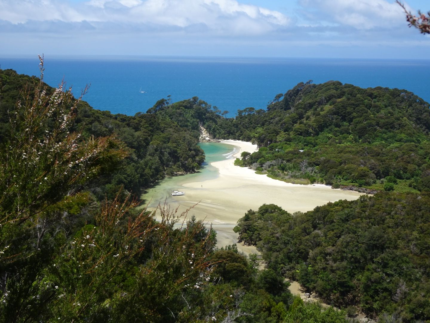
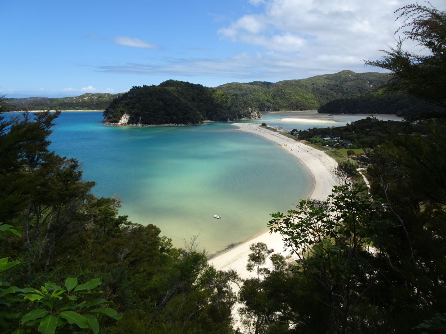
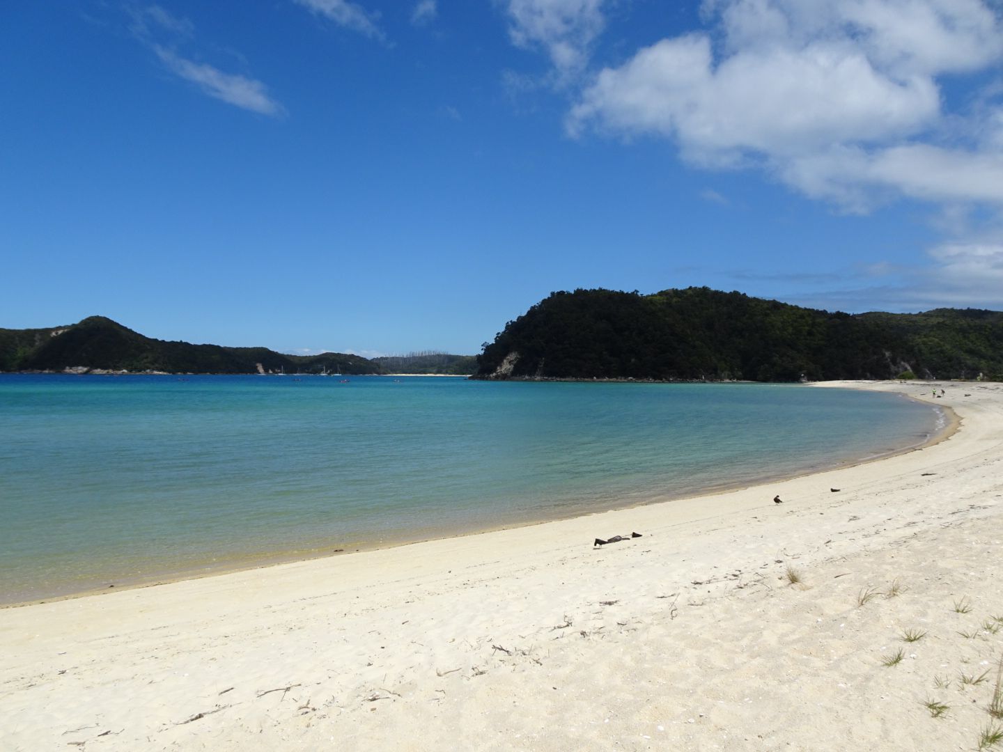
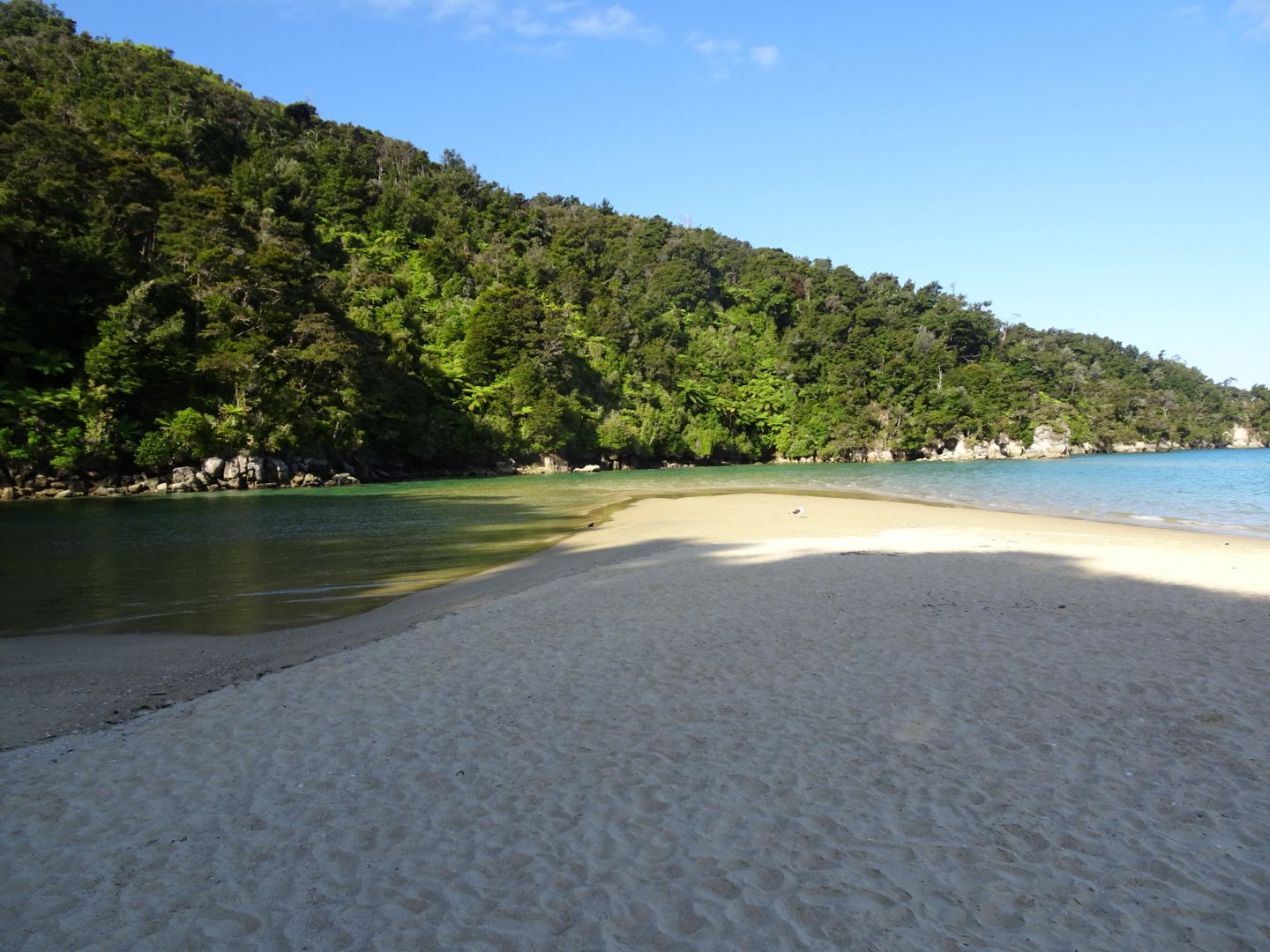
On the next morning, I continued to Hokitika, and after a short stroll through the town, I left the coast to go on a hike at Arthur's Pass. I also hoped to finally see keas there. This was my last chance as I wouldn't be in the mountains for the next few days and would then leave the South Island. This time luck was on my side! There were two keas at a cafe, hoping to steal some food. The hike then led through forests to a waterfall. Afterwards, I drove back to the coast and headed north by the sea until I reached Punakaiki. Unfortunately, it rained almost continuously on this drive, and therefore, I couldn't enjoy the spectacular coastal landscape. Punakaiki is known for the 'Pancake Rocks,' which look like stacked pancakes. In addition, the village is located right next to Paparoa National Park, where there are once again plenty of opportunities for hikes. So I stayed at the campsite there for two nights to have a full day for hiking. The hike was beautiful, only in the afternoon, when I reached the Pancake Rocks, it was cloudy. I spent the evening with a group of much younger travelers, all doing 'work and travel' in New Zealand. So the night was a bit short when I set off early on the morning of January 15th to take another look at the Pancake Rocks in the sun and drive all the way to the northernmost point of the South Island, to Abel Tasman National Park. On the way there, I only took a short detour to the seal colony at Cape Foulwind. Nevertheless, I didn't reach the village of Marahau until around 5 o'clock in the afternoon. At the campsite there, I met François, a Frenchman my age! We decided to hike together in Abel Tasman National Park the next day. In the morning, we took a boat into the national park for a good distance. From there, we hiked back to Marahau in seven hours. The trail was incredibly beautiful and not crowded at all. Unfortunately, we could only see most of the golden sand beaches, which are among the most beautiful in New Zealand, from above. It would have been quite a detour to go to the beaches. So we settled for just one swim stop.
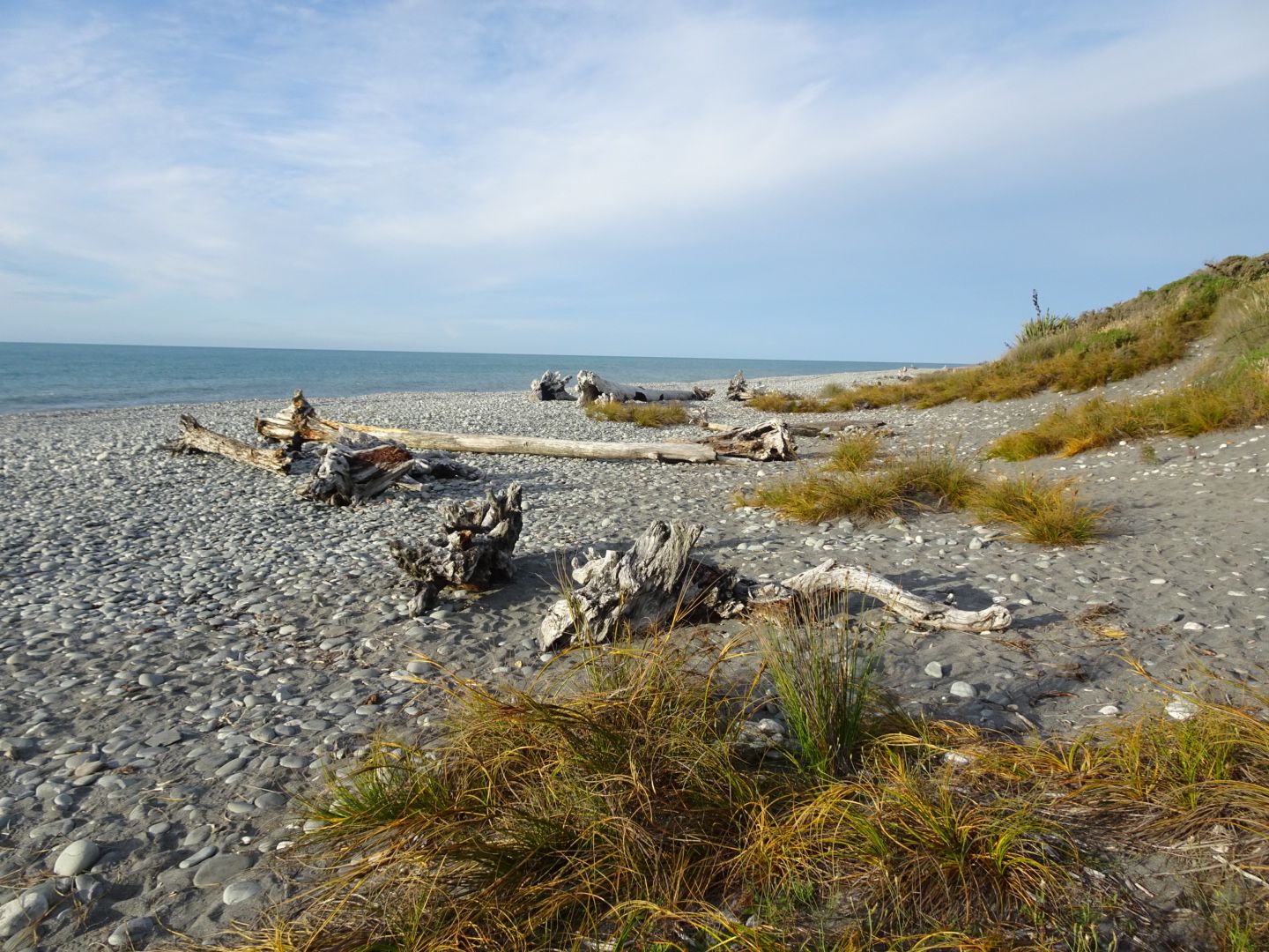
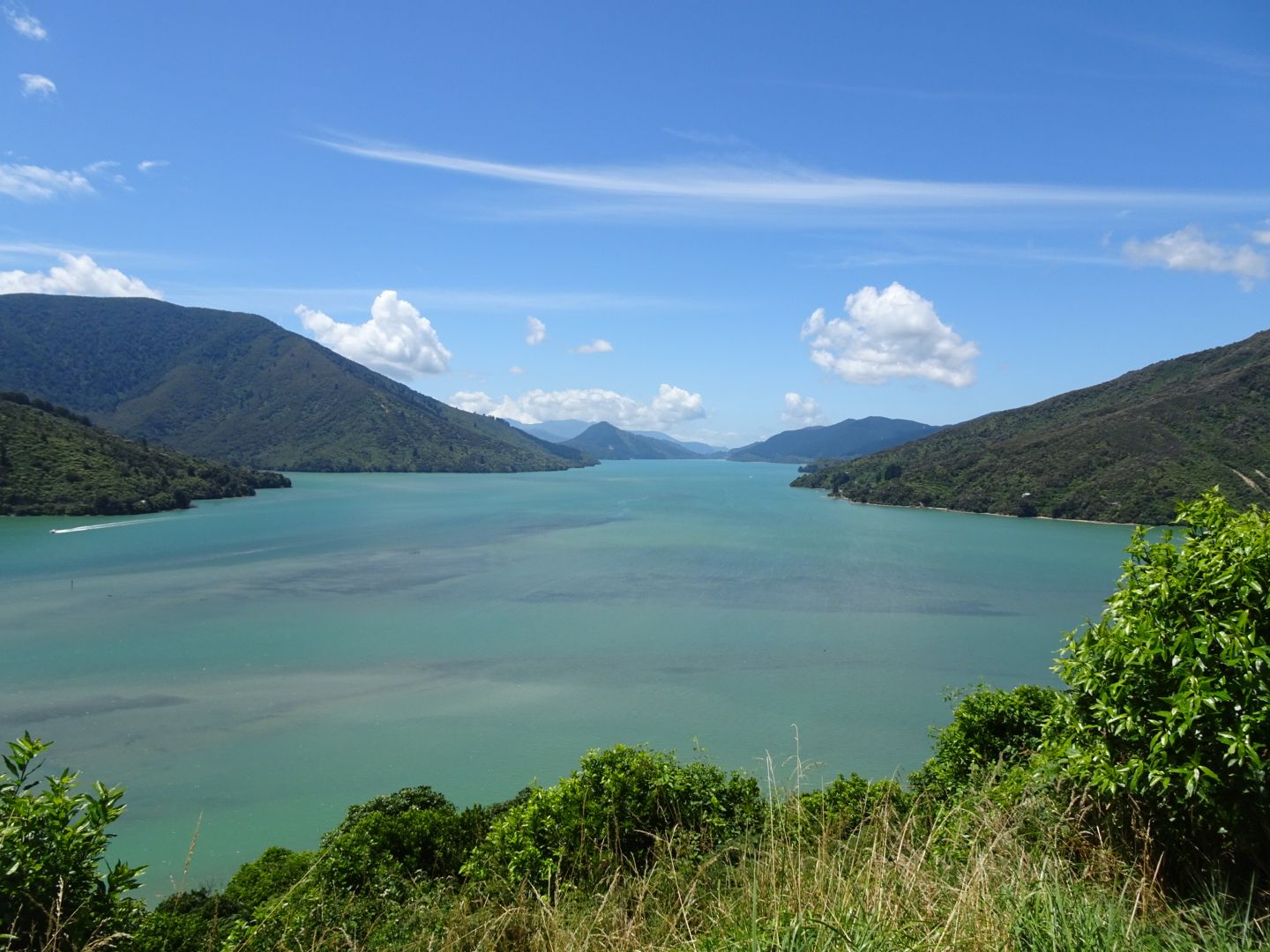
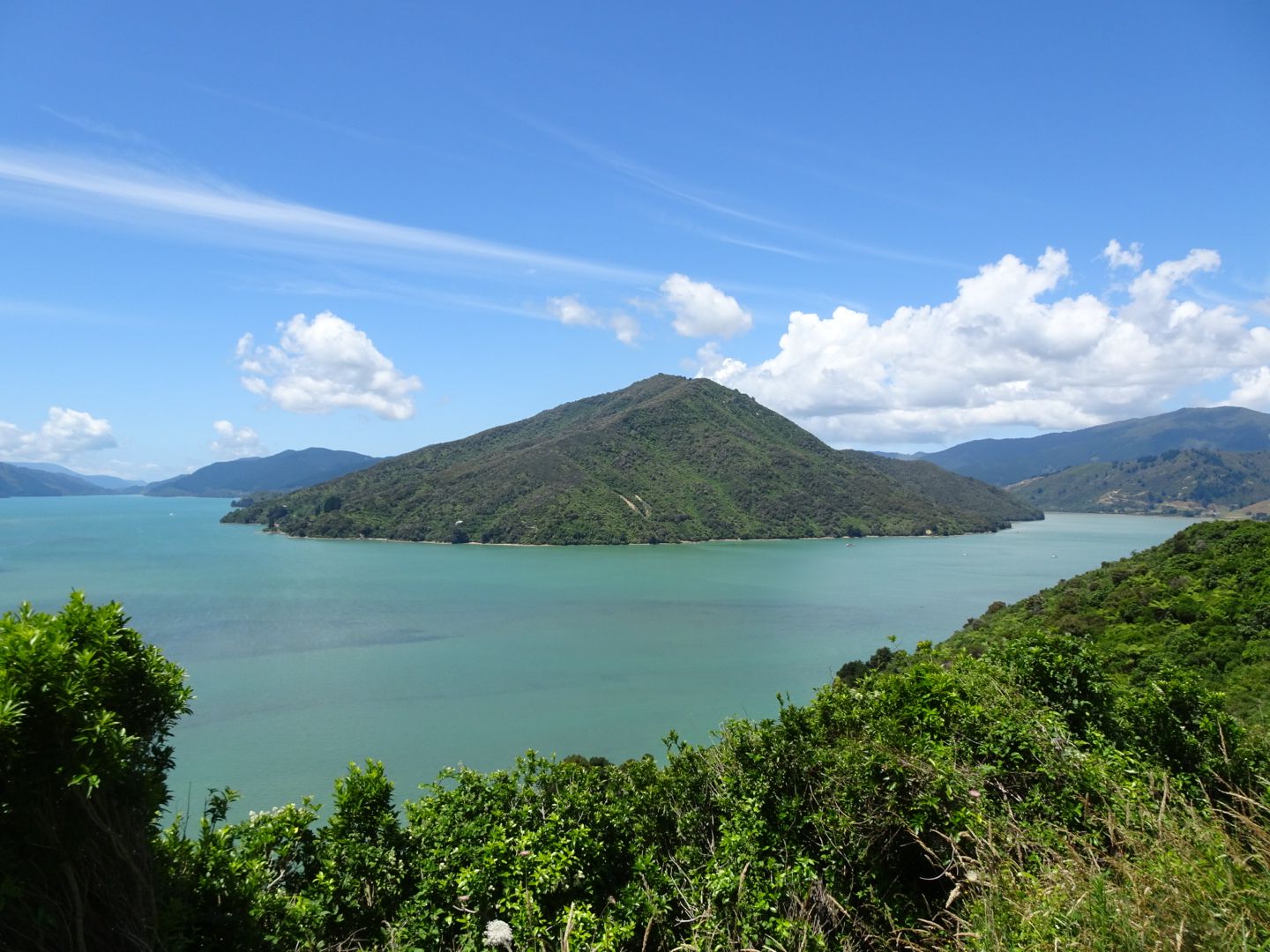
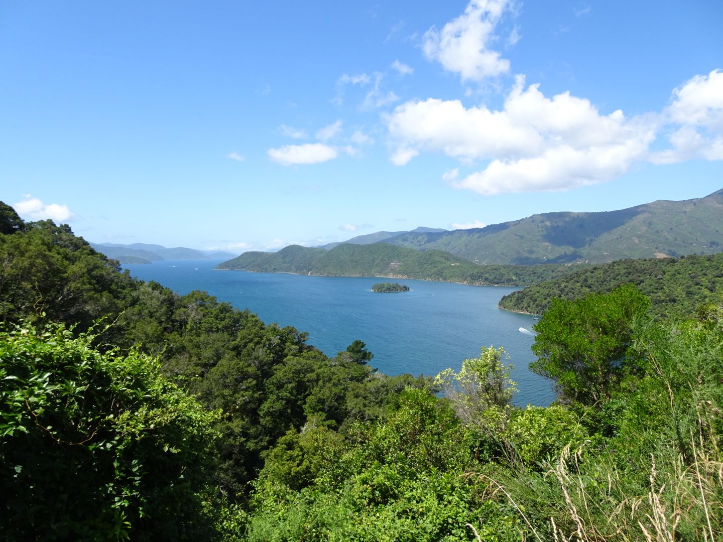
On January 17th, I finally drove towards Picton, where I took the ferry to Wellington on the North Island on the morning of January 18th. At the Marlborough Sounds around Picton, I said goodbye to the South Island, where I had a great time! Fortunately, the weather also cooperated almost all the time, which is not a given. Almost every day, I was in the water somewhere, in lakes, rivers, or the sea. At my campsite 15 km before Picton, I even had the opportunity to swim in a fjord!
Мэдээллийн товхимолд бүртгүүлнэ үү
Хариулт

Шинэ Зеланд аяллын тайлан