
AllgäuerinInNorwegen
vakantio.de/allgaeuerininnorwegen
4th July: Discovery tour in Bremangerland
പ്രസിദ്ധീകരിച്ചു: 22.07.2020


വാർത്താക്കുറിപ്പിലേക്ക് സബ്സ്ക്രൈബ് ചെയ്യുക

In the morning (A)
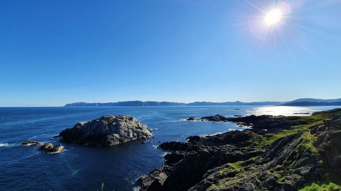
The Hurtigruten ship from the north sometimes meets the ship from the south at Cape Hornelen. Usually, this is between 6:15 and 6:45, so I got up extra early because I wanted to witness this spectacle. When at 7:15 there was still nothing to see except a military ship in camouflage, we speculated that the Hurtigruten ships were not operating due to a lack of tourists. In the past, the ships transported mail and other goods to remote places and were vital for survival. Today, they still do parts of that, but they have become particularly popular among cruise tourists. By the way, Hurtigruten translates to "the fast route".
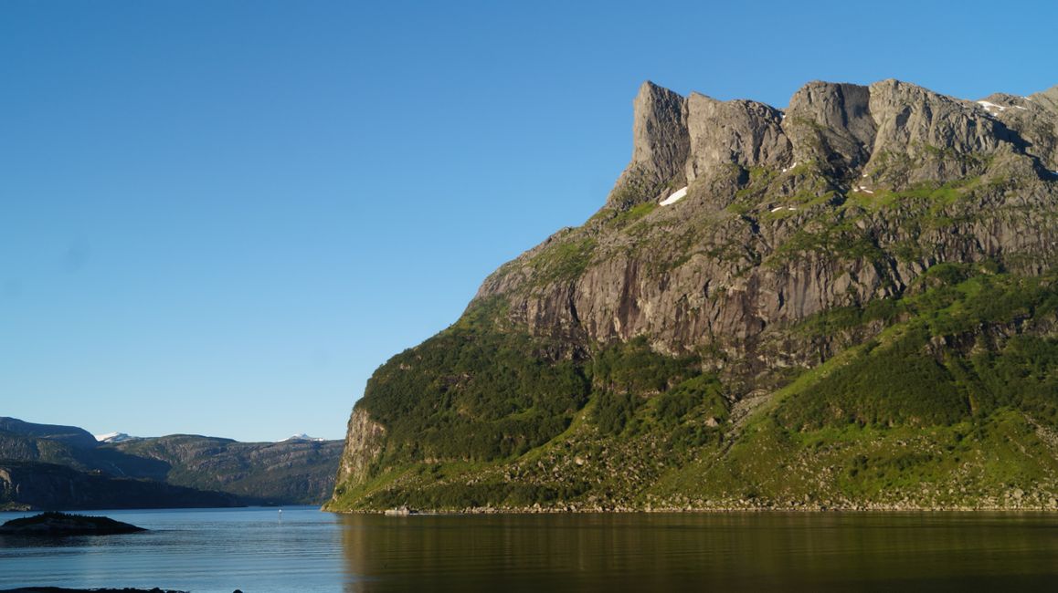
After a small breakfast, we set off at 7 o'clock. Since the first ferry didn't leave until 7:30, we made a small stop at the Hundskår cemetery. At the foot of Hornelen, where the hike begins, there was a small chapel, which we can also see from the house on the other side. The island where the Gros House is located is connected to the mainland by an underwater tunnel that is up to 80 meters below sea level. A few years ago, there was a fire in this tunnel, and the sight of thick black smoke billowing from the ends was indescribable. There was little traffic on the ferry, as well as in Måløy - who voluntarily gets up so early on a Saturday?
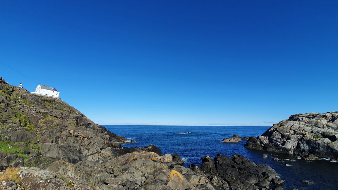
Kråkenes (B)
We drove up and then down the steep switchback roads. The landscape was impressively rugged yet green.
On the drive, we saw a hungry, almost black fox crossing the road.
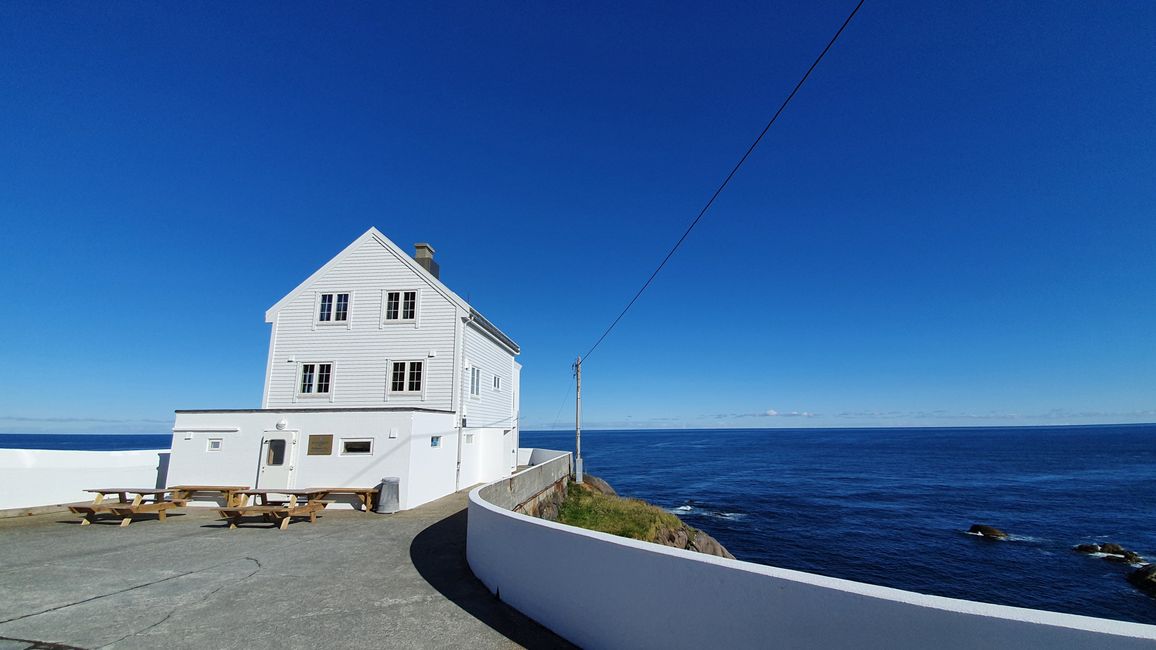
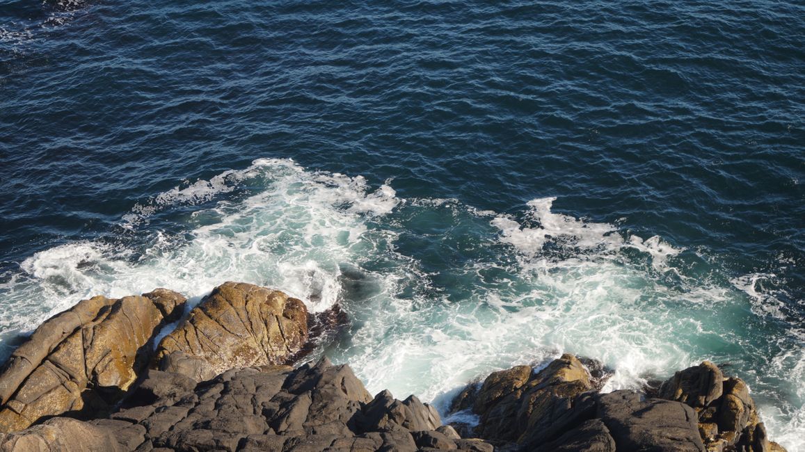
We had to walk the last part to the Kråkenes lighthouse. The lighthouse is not the classic type one imagines. It is a white house, with everything around it concrete, and the tower with the light is just placed on top. Considering the fierce storms that rage here, that can be easily accepted. The breaking waves with their white foam were exciting, and when we wanted to go down to the edge, it became steep and the grass slippery.
Refviksanden (C)
Our next stop was Refviksanden. There were high mountains on the left and right that dropped steeply into the bay. The sandy beach was very clean and bright. The water was unbelievably clear and shimmered in a bright blue with a hint of turquoise.
I took off my shoes and waded into the icy water. It was about 12°C at that time. After the waves reached my rolled-up pants several times, I gathered some sand for Mom and walked barefoot back to the warmed-up road.
Kannesteinen (D)
On the way to the next attraction, we briefly passed through Måløy. The "Kannesteinen" is a mushroom-shaped stone that owes its shape to the waves.
Måløy (E)
We still had about an hour until the next ferry, so we sunbathed at the beach quay in Måløy, admired the beautiful graffiti in the city, and bought flowers for the graves.
On the ferry to Oldeide, we met former students of Gro, and she talked to them. It was just after noon, so we decided to go to Kålvag.
Kålvag (F)
Gro wanted to visit her aunt in the nursing home there and take a walk with her. On the way there, we drove through a landscape characterized by turquoise-colored water and numerous skerries, giving it a Caribbean flair.
In Kålvag itself, it looked more like the Lofoten Islands, with the rows of red houses. I took a short hike up wooden stairs to the highest point in the area (98 m). From there, you had a beautiful view of the harbor, the red houses, and the Knutholmen restaurant, which is famous throughout Norway. Accordingly, there were many tourists present.
In the local supermarket, I bought freezer bags to better store the sand I collected. In front of the nursing home, where I waited for them, I met Ragna, her aunt.
Grotlesanden (G)
We passed through the village of Bremanger, where Astrup was born, to the place where my second bag filled with sand: Grotlesanden. The sand was again bright and clean, but in comparison, there were dune-like rocks here that divided the beach into individual bays. It was 19°C, and if we had brought swimsuits, we would have gone into the water as well. But instead, we just took a short walk and looked around in a boutique.
Back on the island
On the way back, Gro showed me a barracks on the island. After that, I gathered the dried grass while Gro cleared out the shed and found tons of 50-year-old sheep wool, which was once a reserve that could be sold for money.
Later in the evening, we went down to the cemetery on the other side of the water. Driven by mosquitoes, we worked at top speed and replanted the graves with the flowers we bought.
വാർത്താക്കുറിപ്പിലേക്ക് സബ്സ്ക്രൈബ് ചെയ്യുക
ഉത്തരം
യാത്രാ റിപ്പോർട്ടുകൾ നോർവേ