

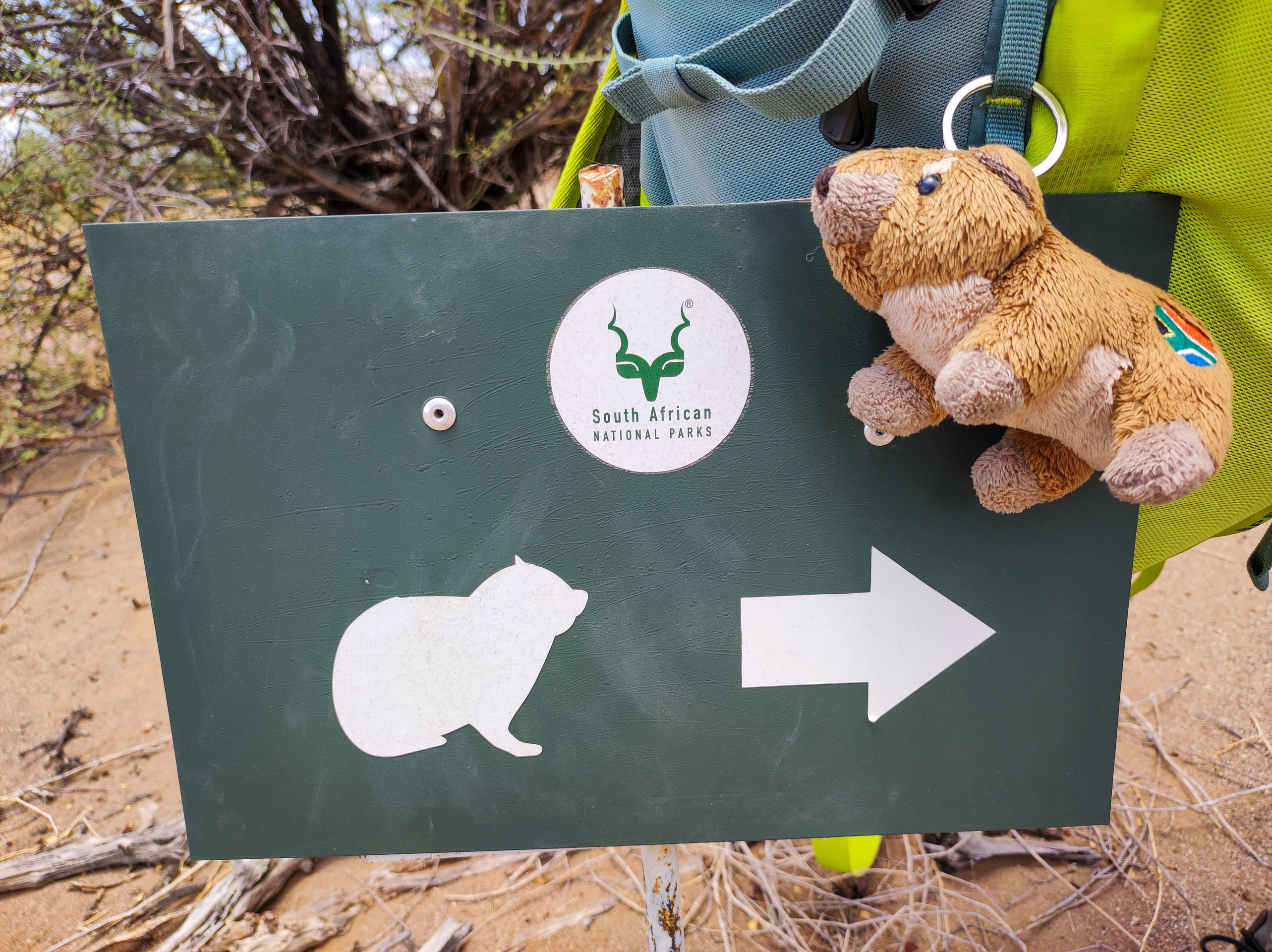
Dassie Trail
प्रकाशित: 15.02.2023


न्यूजलेटर के सब्सक्राइब करू
Day 27, 23.01.23, Augrabies Falls
As we already know in the morning that this area is something special, we decide to stay one more night and quickly organize the accommodation. Our room is already fully booked, but we get the family lodge for the same price.
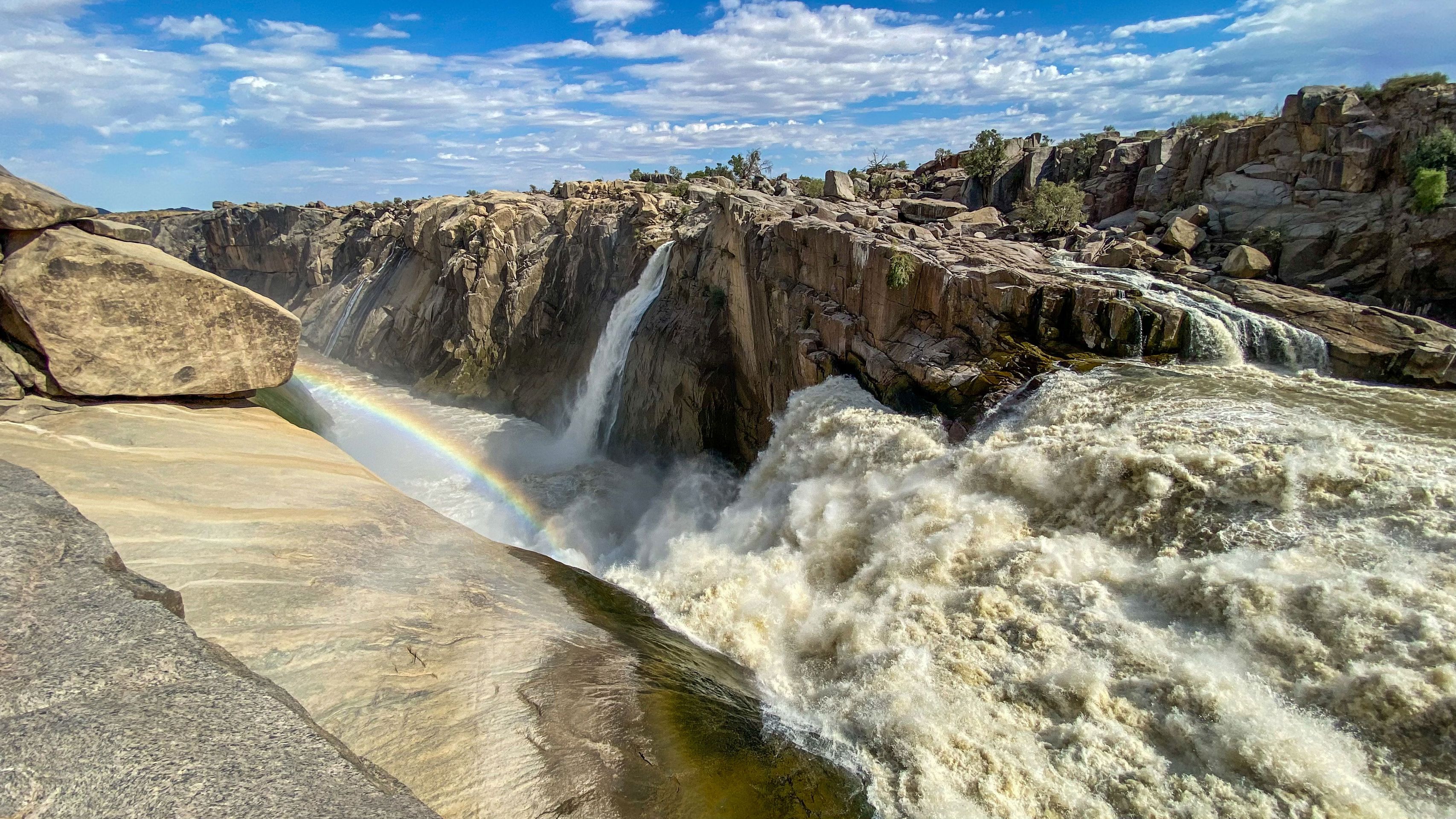
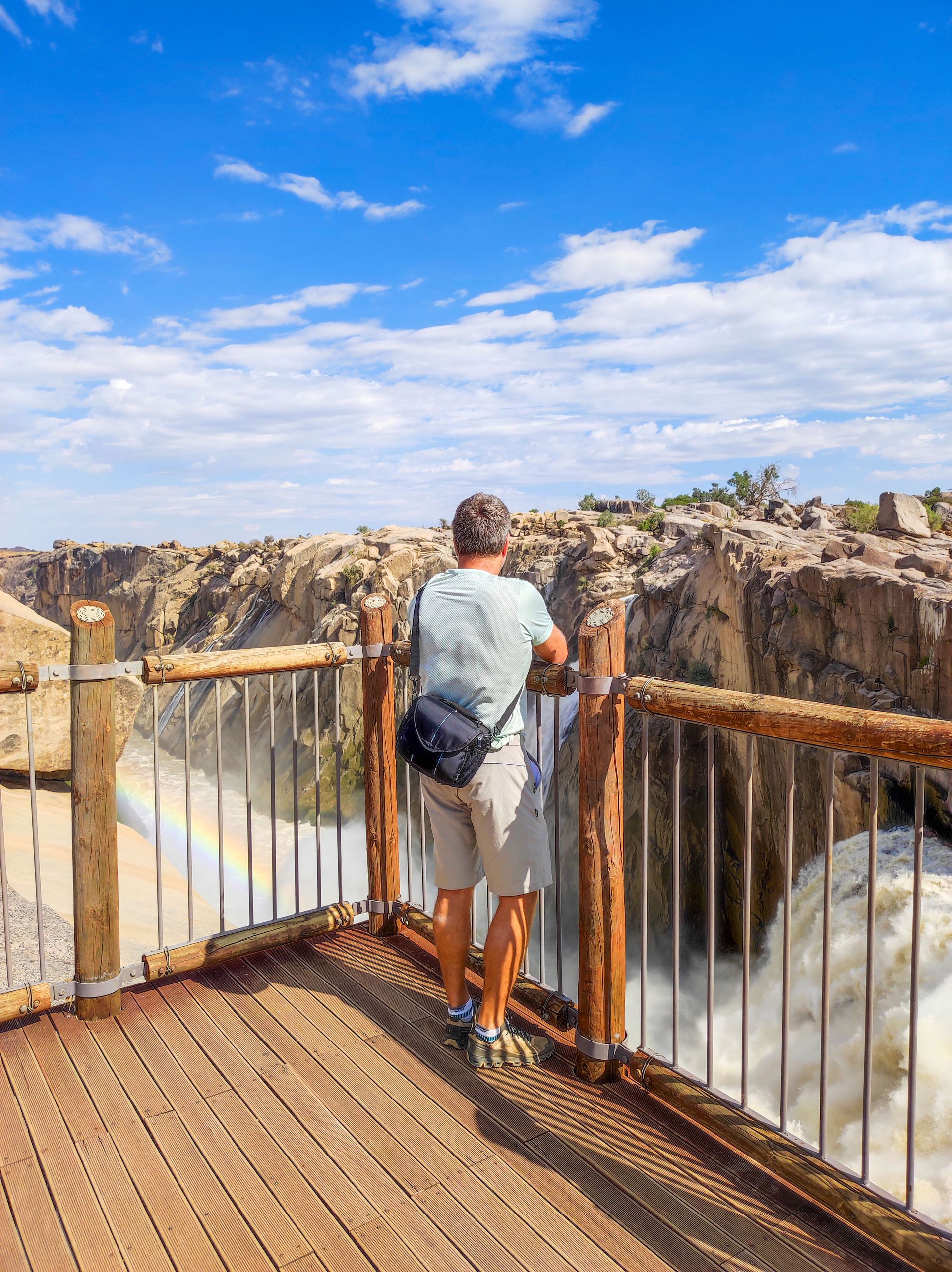
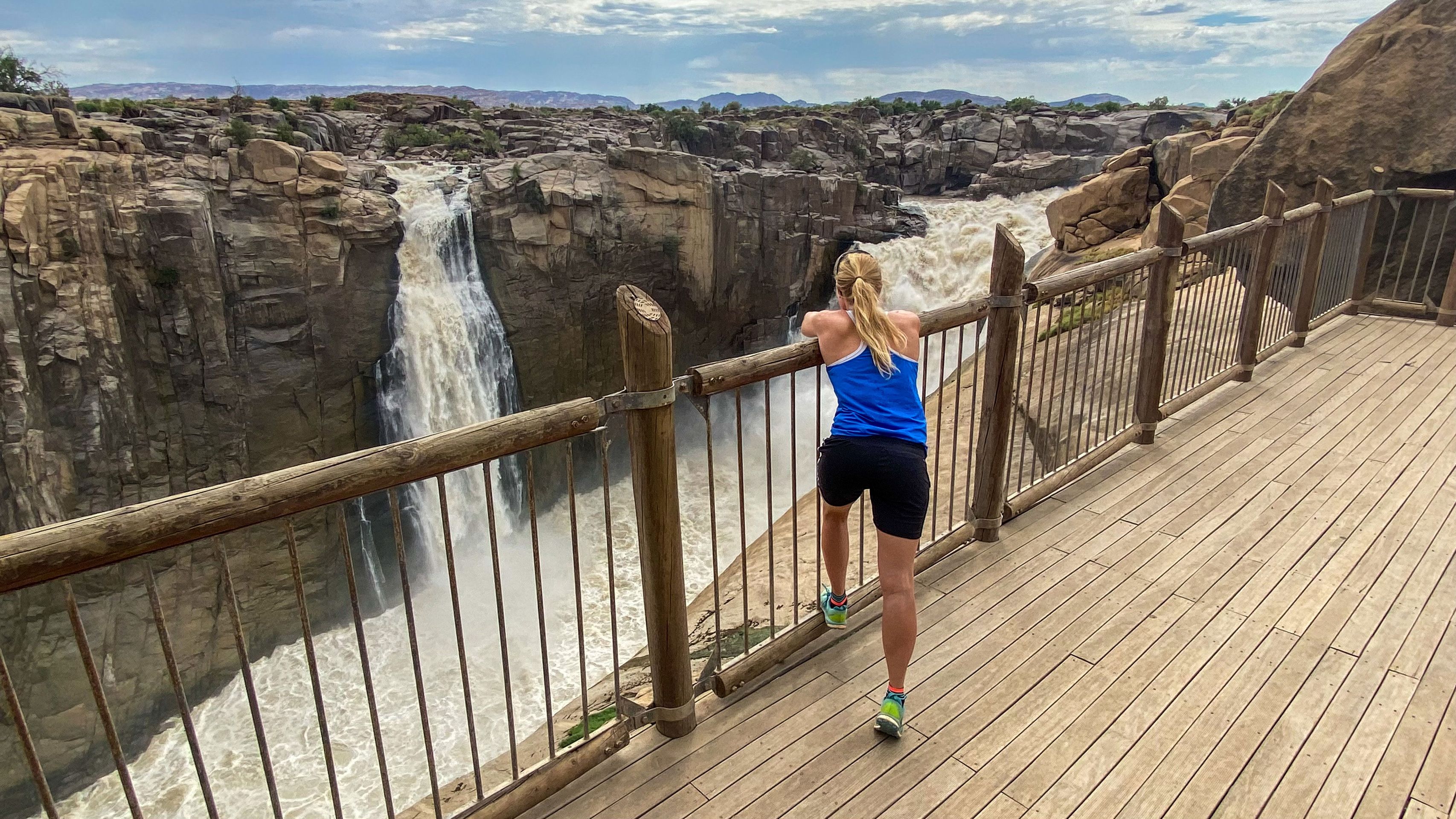
Before breakfast, we take a short walk to the waterfalls. From a distance, you can already hear the rushing sound, and after just a few minutes, the roaring Augrabies Falls appear before our eyes. A breathtaking sight.
The Augrabies Falls National Park, established in 1966, is a national park that surrounds the Augrabies Falls, about 120 km west of Upington in the Northern Cape province. It covers an area of 820 km² and stretches along the Orange River.
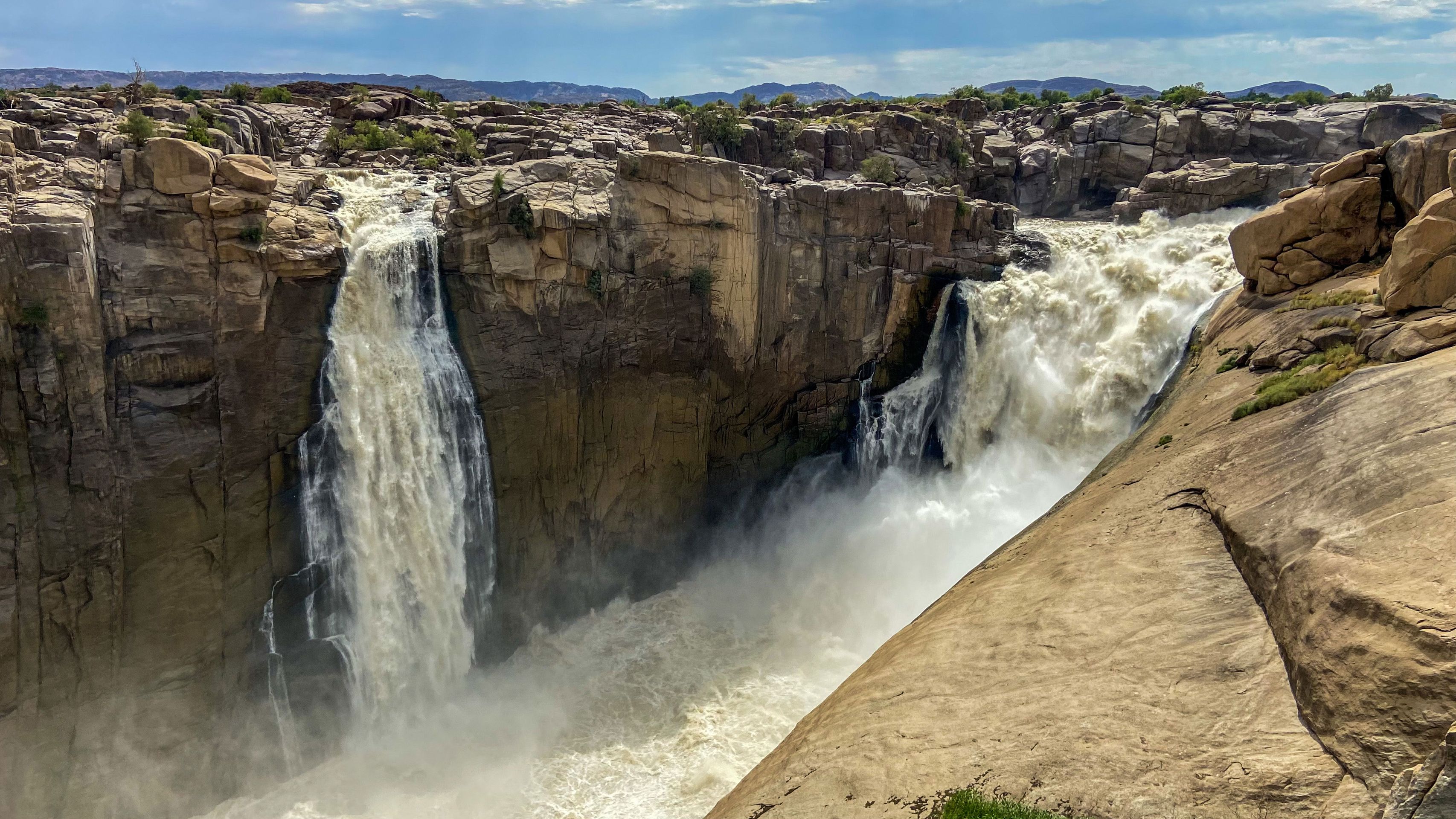
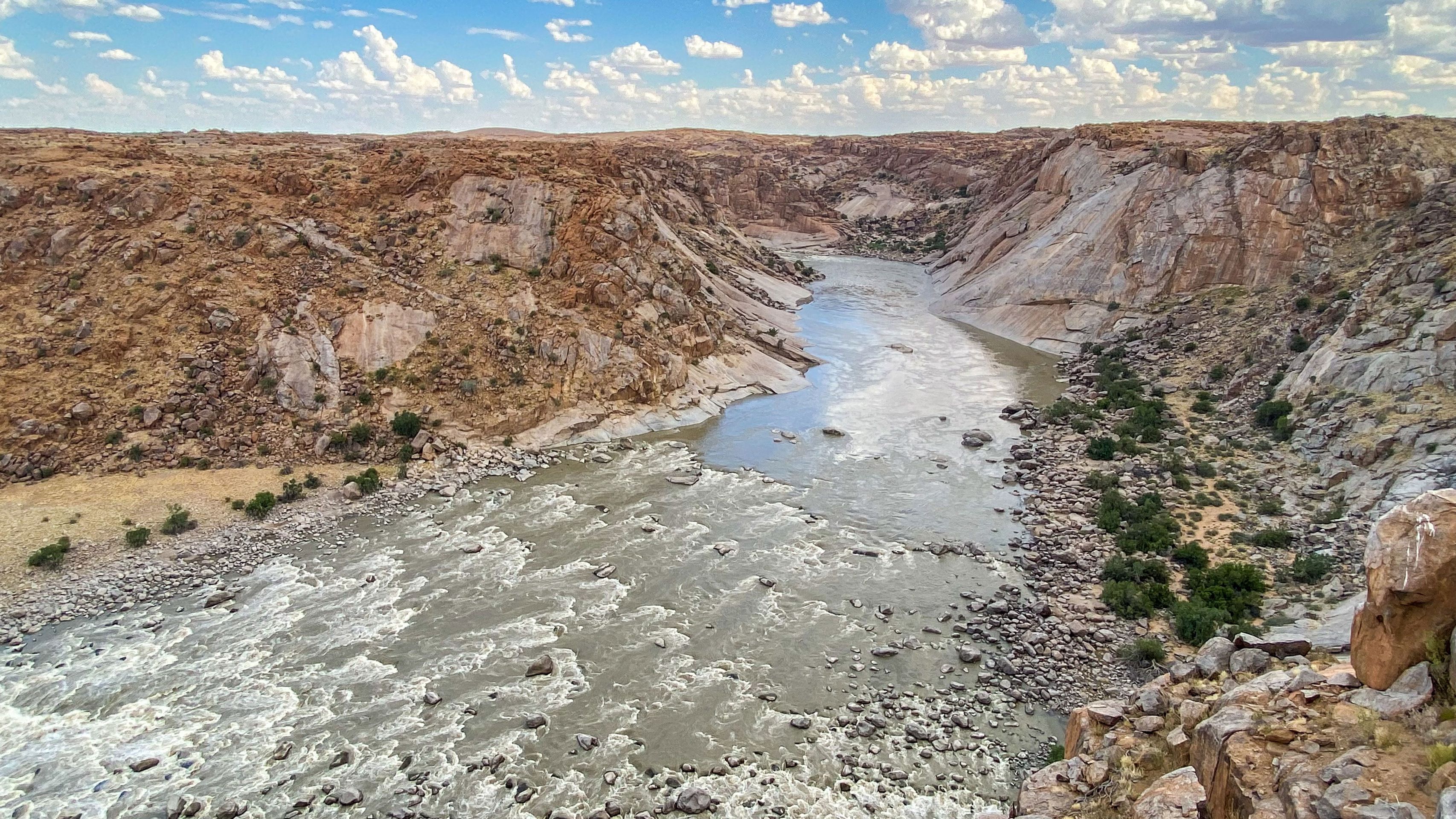
There are few sights as impressive as this view, accompanied by the deafening sound of the water rushing down the mighty Augrabies Waterfall when the Orange River is in flood.
The waterfall is approximately 60 meters high, and the gorge extends over 18 kilometers. It is a stunning example of the erosion of a granitic basement and is on average about 240 m deep.
Picturesque names such as Moon Rock, Ararat, and Echo Corner describe this rocky region, which is characterized by the abyss of the Orange River Gorge.
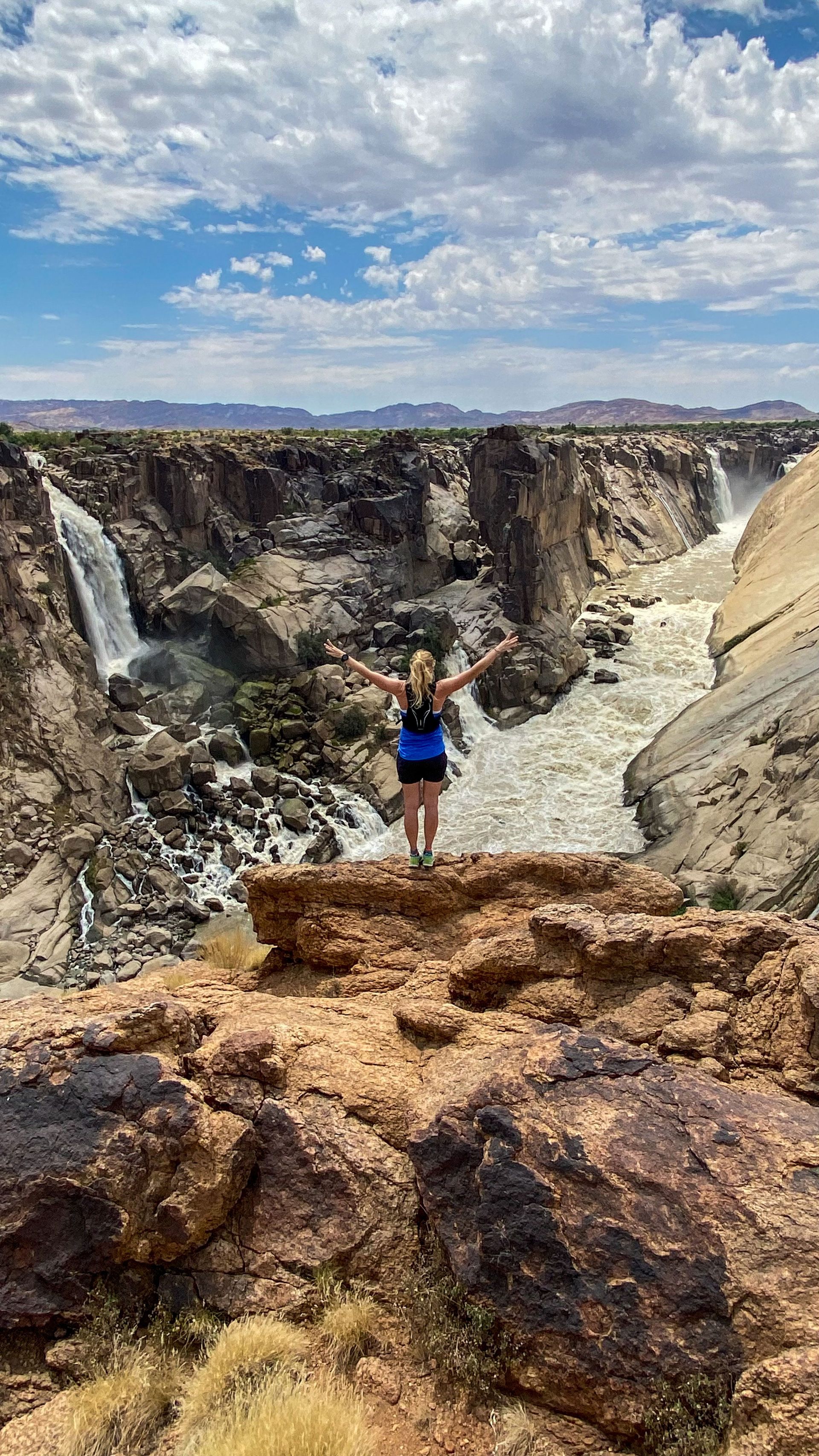
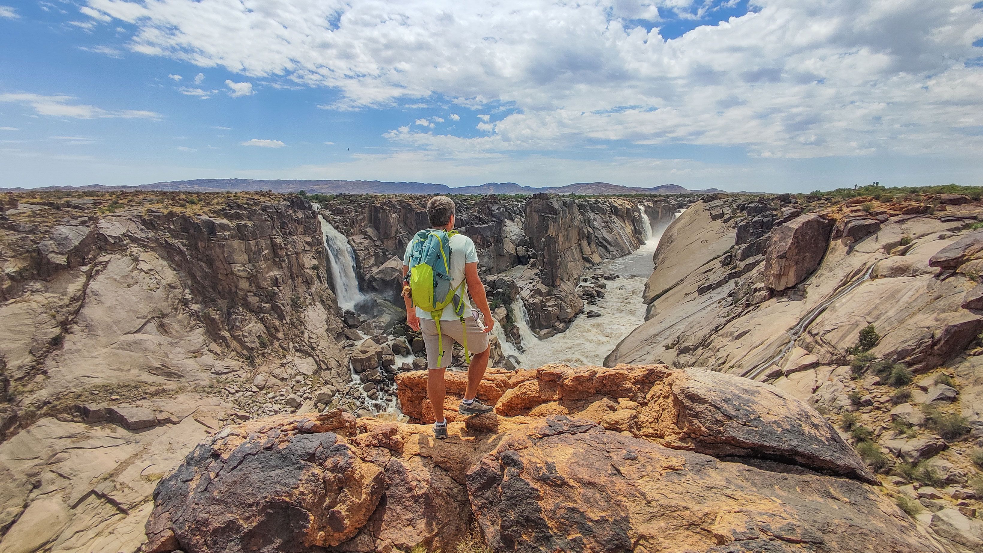
We visit various viewpoints and enjoy a new and special view of the falls each time. It is fascinating how the Orange River has carved its way through the mountains over millions of years.
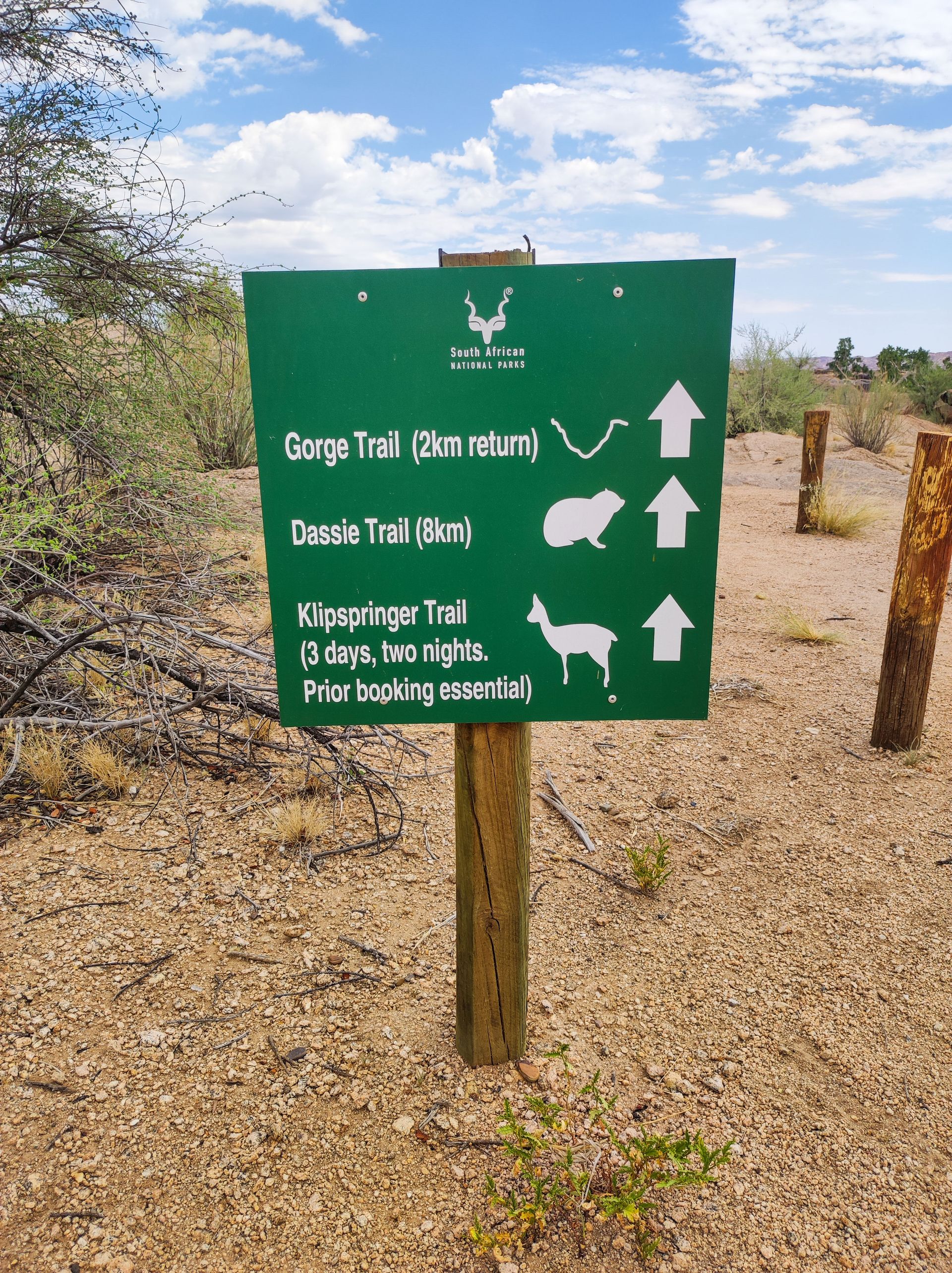
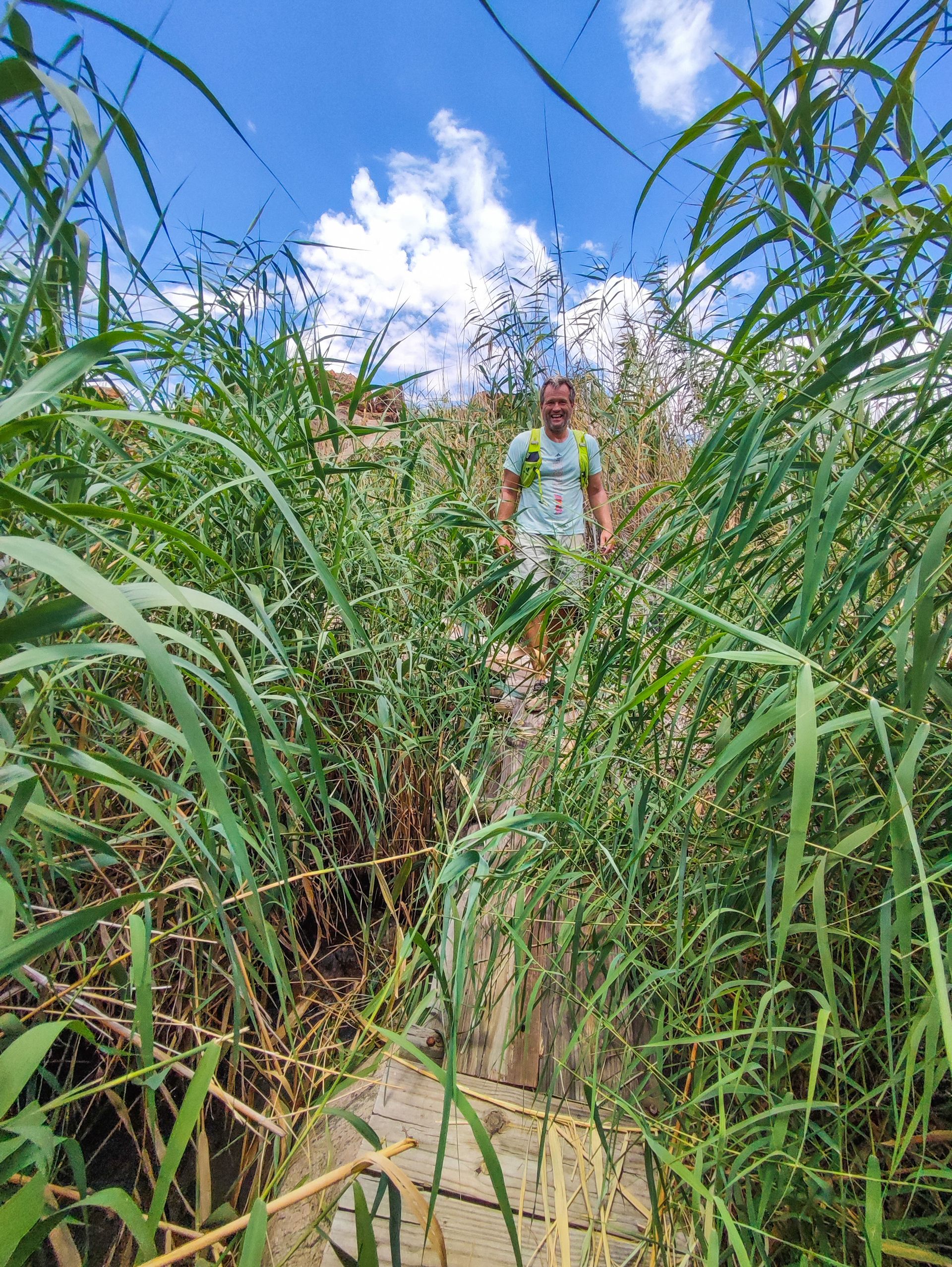
After breakfast, we immediately embark on the next highlight: the Dassie Trail (which particularly delights my small Dassie keychain on my backpack). This trail is an 8 km long and varied circular route. At first, it follows the Orange River directly, then turns inland. We explore the area, partly off the beaten track, find our own viewpoints, and experience new perspectives of the river.
We first pass by reeds, which have the ability to efficiently filter water. This proves to be useful at the Augrabies Falls, as it naturally filters the wastewater from the facilities in the national park before it flows back into the Orange River.
At Arrow Point, we see a stream capture. Water flows from the side gorge into the Orange River. In the past, this side gorge used to carry more water, but it was "stolen" by the deeper and faster Orange River.
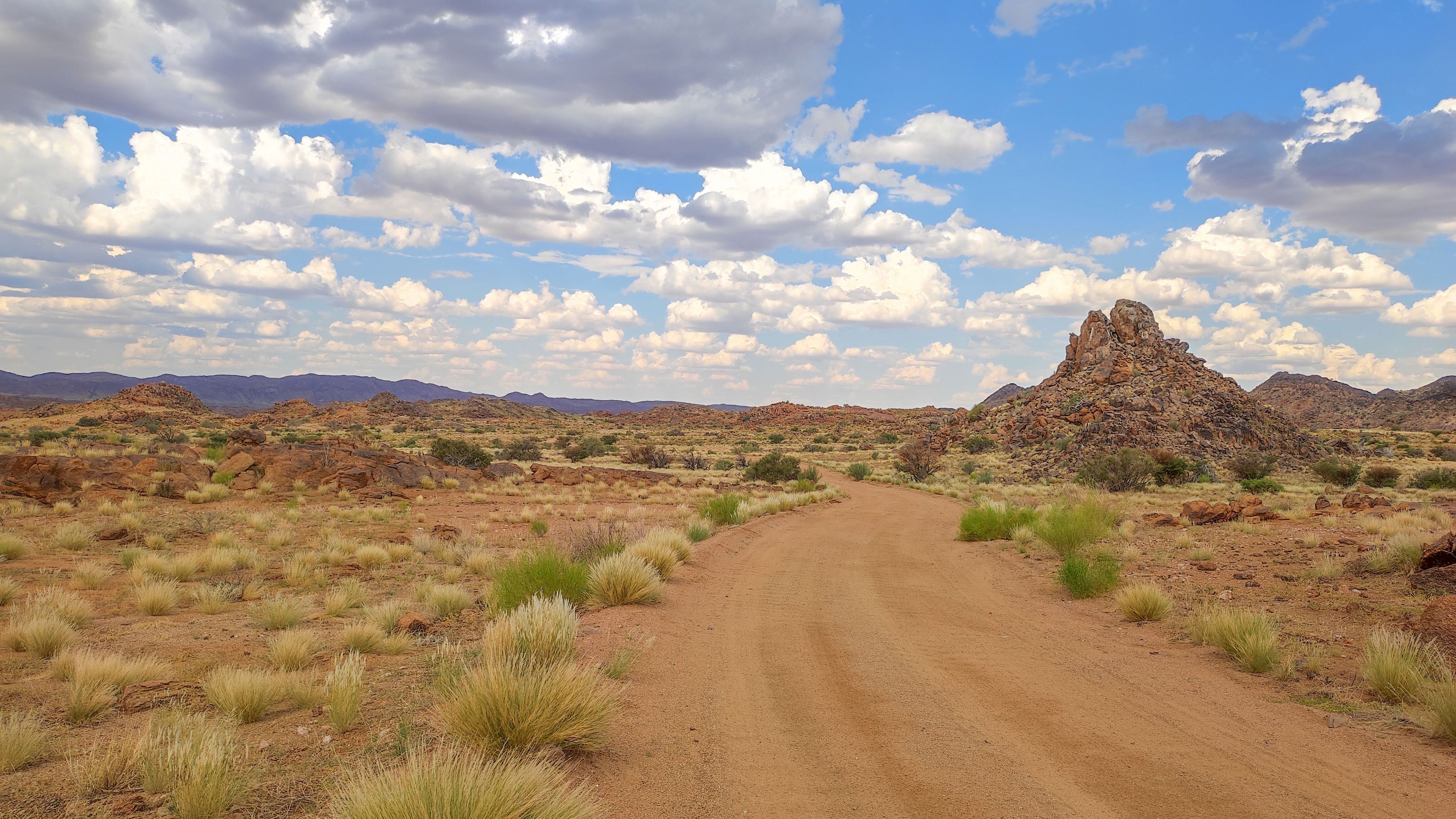
We continue walking across the "Swart Rante," an intrusive dike complex made of volcanic rock, and pass by shepherd trees. These are sturdy trees found in dry, open woodlands. Here, they are called the "tree of life" because they provide food for humans and animals.
Next, we "climb" the "Moon Rock," a huge peeling dome made of Augrabies Gneiss. The most interesting features of this rock type are "A-frames" or "pop-ups". They are the result of internal stresses in the dome, causing the uppermost layer of rock to detach along a sub-horizontal fracture, split in the process, and collapse and lean against each other.
We continue hiking over a few potholes to a Namaqua fig tree. This species is widespread in the dry, rocky deserts of the Northern Cape. The roots of these trees are so strong that they can literally break rocks apart. Known as the "rock breaker," their leaves are evergreen, so the tree does not waste energy shedding leaves and growing new ones.
After nearly 2 hours in 40-degree heat, the trail leads us back to the base. An area marked for day visitors with a pool invites us to cool off. Surprisingly, we don't encounter a dassie on "his" trail, but we see some during lunch while we make plans for the rest of the day.
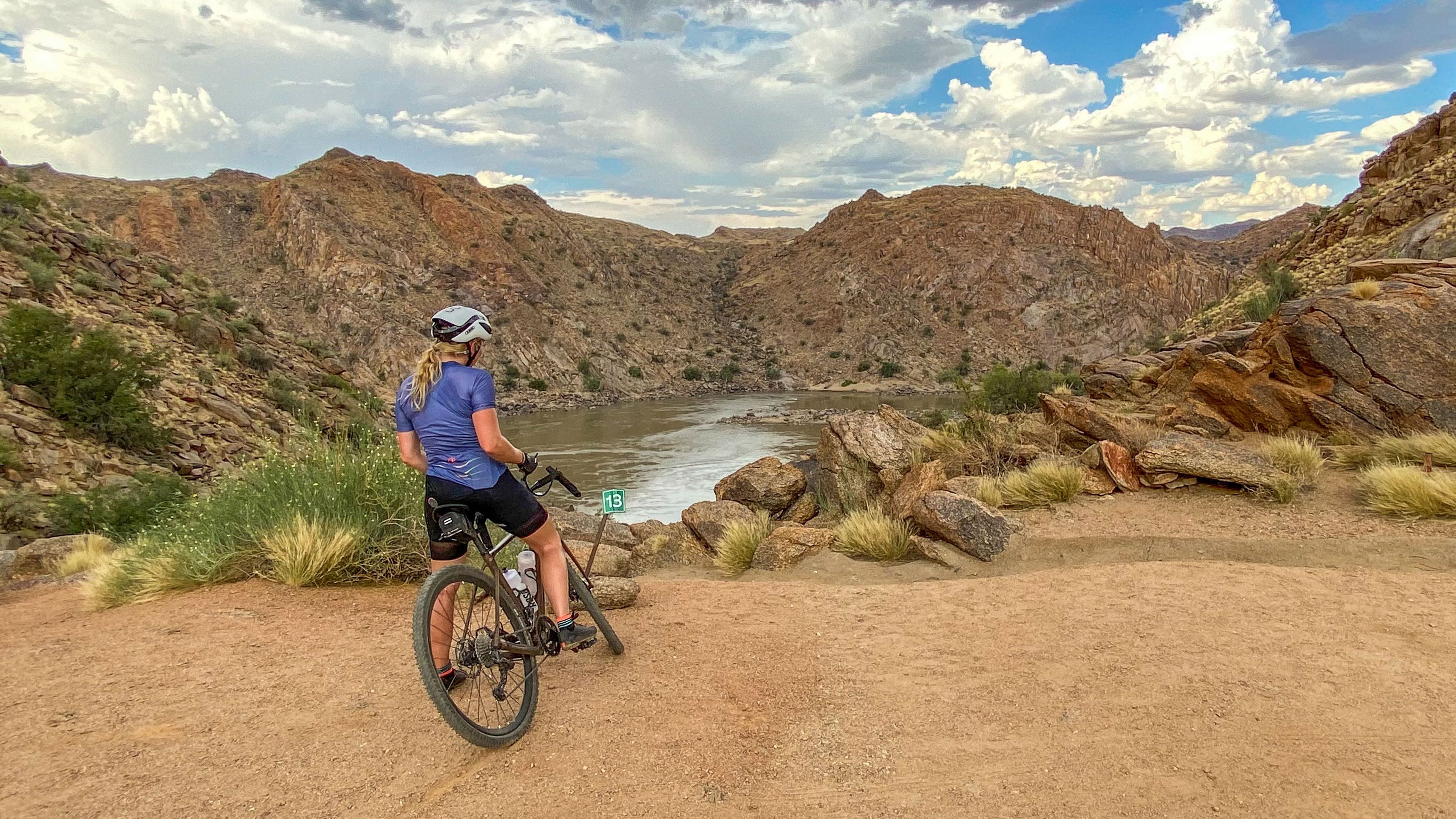
Since a very long jeep track leads through the game area of the Augrabies Park, Cindy feels obliged to explore part of it with her gravel bike. I decide to use the four wheels to visit the three viewpoints we want to see.
During the preparation, we meet an engineer from Bavaria. He tells us that the Augrabies Camp is a base camp for BMW's heat tests, and the road to Pufadder is one of the testing tracks. There are worse places to practice your profession.
Cindy takes off in front of me, and within a few minutes, a tortoise and four giraffes cross her path. So it really is a game drive. Shortly afterward, we meet at a flooded pothole, where I give her a lift.
We then meet again at the first viewpoint, the "Ararat Viewpoint," and watch the river move through the mountains.
The second viewpoint, the "Oranjekom Viewpoint," is interestingly located directly above a lodge that can be rented. We can only imagine waking up to the sound of the river and having a direct view of the Orange River.
We continue uphill and then downhill to the third point, the "Echo Corner." Here, the river is very calm, creating an almost reverential atmosphere. A gentle breeze blows, fluffy clouds in the sky, only marred by a few darker spots.
Unfortunately, we have to leave the park at 6 p.m. So we head back, and I give Cindy a few minutes head start. When I catch up with her at the end of the ascent, I notice a few raindrops on the windshield. At the same time, Cindy signals to me that it's probably better to load the bike as it looks like a thunderstorm is approaching. I stop, and we both look up briefly, as it is only a smaller, dark cloud. But after 30 seconds, it starts to hail heavily on us. The rain hammers down on our skin and feels like needle pricks. The gusts of wind reach 10 or more and press so heavily against the doors that we struggle to load the bike and then ourselves. The problem is that we can't load the bike as a whole; we have to remove the front wheel and saddle beforehand. Everything that is in the car's way is thrown somewhere to make room for the bike.
Completely soaked, we jump into the front seats, close the doors, and start laughing out loud. We have never experienced anything like this. And neither has the car, because there is a light drip at the top of the rearview mirror, probably due to the immense pressure of the rain on the windshield.
We can only move slowly, sometimes having to stop because we can't see anything anymore. Within minutes, the gravel road becomes muddy, and smaller torrents meet us on steeper sections. Around us, lightning flashes, and thunder rumbles, and the rain pours down on the car. On the side of the road, we see a smaller tree that must have been struck by lightning as it looks freshly burned.
We know from the mountains and the lake that weather changes can happen quickly. But how a thunderstorm like this can develop within minutes from a small dark spot framed by clouds and sun is a realization and a special experience.
When the rain subsides a bit, we spot our four giraffes in the distance and ask ourselves: do giraffes get struck by lightning more often than other animals? After all, they are the highest point almost everywhere in the savannah. In fact, there is no concrete answer to this question because there is no data on lightning strikes on giraffes. However, their behavior may reduce the risk, aided by evolution's gift of long necks: according to eyewitnesses, they lower their heads during storms, trying to outdo each other in height. In addition, animals in the wild generally know how to behave during bad weather, such as severe thunderstorms. They seek shelter in protected areas, such as within a larger group of trees.
Drenched and a little chilly, we return to our guesthouse. Our first thought: into the warm shower... but no, no electricity, no hot water! Welcome back to South Africa and load shedding. And since there is no internet either, we take the time to have a long conversation in the evening about this very interesting and exciting day. At the same time, we make plans for the next day, which will take us closer to Cape Town. We decide on the Rocklands, just under 30 km east of Clanwilliam. So early to bed, as we have a journey of over 600 km ahead of us, including gravel roads.
न्यूजलेटर के सब्सक्राइब करू
उत्तर
यात्रा रिपोर्ट दक्षिण अफ्रीका