Neuseeland: 8000km solo durch das schönste Ende der Welt
vakantio.de/8000km_durch_neuseeland
Day 36 - From Glaciers to Pancake Rocks (Franz Josef-Punakaiki)
प्रकाशित: 09.08.2019


न्यूजलेटर के सब्सक्राइब करू
19.01.2015
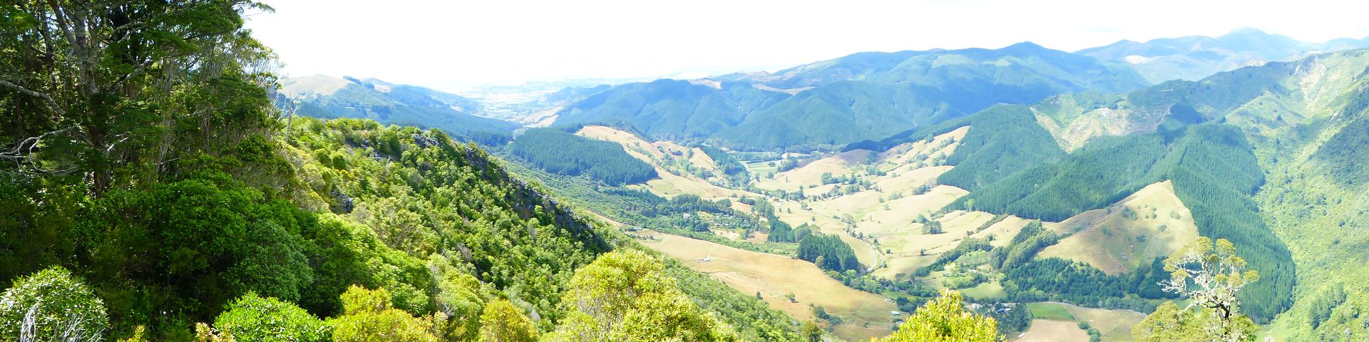
It looks gloomy when I wake up at half past eight. Today, the 3-day-old bread and the remaining Brie have to go. I leave shortly before 10:00 am, the clouds are hanging low. I briefly considered driving towards Fox Glacier and then to Lake Matheson to see the panorama if the weather is better, but I don't need to do that. The drive takes me through the usual dense bush of the West Coast until I reach an endless plain with livestock farming and grain cultivation.


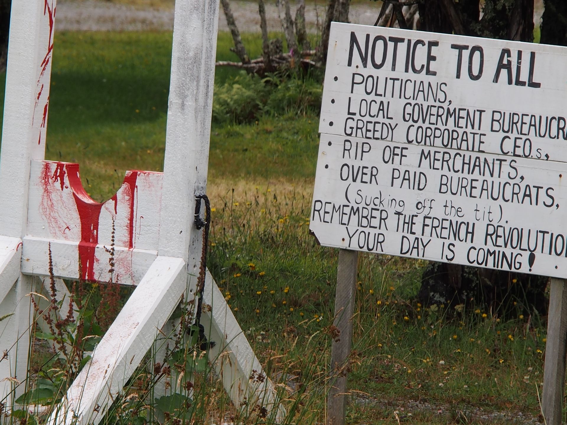
A few small towns and all framed by high mountains - a panorama that is fantastic with sunshine. At least that's how it was last year. But back then, in one day, I drove from Haast over Fox Glacier, including the hike up there, through Franz Josef to Hokitika. Hokitika is about 150km from Franz Josef. Last year, I covered long distances in a day - but I saw a lot that I still cherish. In the cow-village Pukekura, which has 2 inhabitants and a pub where you can apparently eat excellent possum, someone has set up a scaffold at the roadside with martial threats to all rulers and those in power, reminding them of the French Revolution.
Today, I briefly stop in Ross, an old gold mining town. But now it starts to rain heavily, so I only make a detour to the old prison and take a look at a pond that was created in the pit of a gold mining operation. Gold is still being mined here today, as well as gold ore, and it is believed that there is a gold vein beneath the town - but to reach it, the town would have to be torn down. Apart from Ross, there is not much life along the route.

Ross
On this route that I'm taking, gas stations are more than 100km apart, and if you want to exchange money here, you won't find a bank. There is no bank between Haast and Greymouth - that's a stretch of more than 500km. But in Franz Josef, there is the only ATM on the route... Considering that gold was found here in the mid-19th century and is still being mined today, it is surprising that there are not more settlements here.
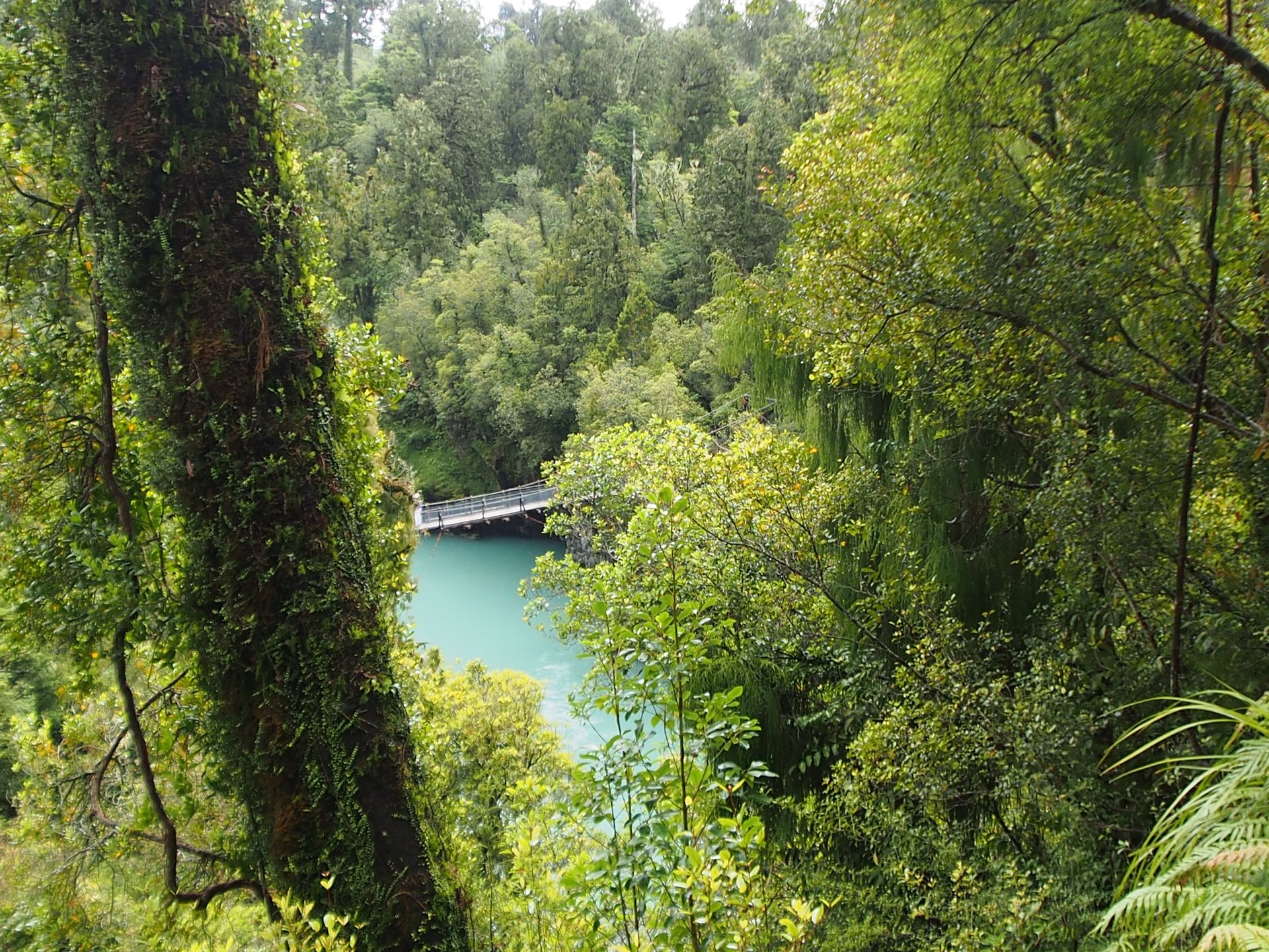
Before I turn right off Highway 6 - about 20km south of Hokitika - I am hit by a heavy downpour, and I briefly consider whether I should even drive to Hokitika Gorge. It has turquoise water and supposed to be great. But with this weather? Well, the path to the gorge itself should not be far from the associated parking lot and it surely leads through a rainforest infested with sand flies, where you might not get so wet. So off I go. The detour is not without its challenges, it's about 30km on winding paths through some spots of 3 houses and many fields.

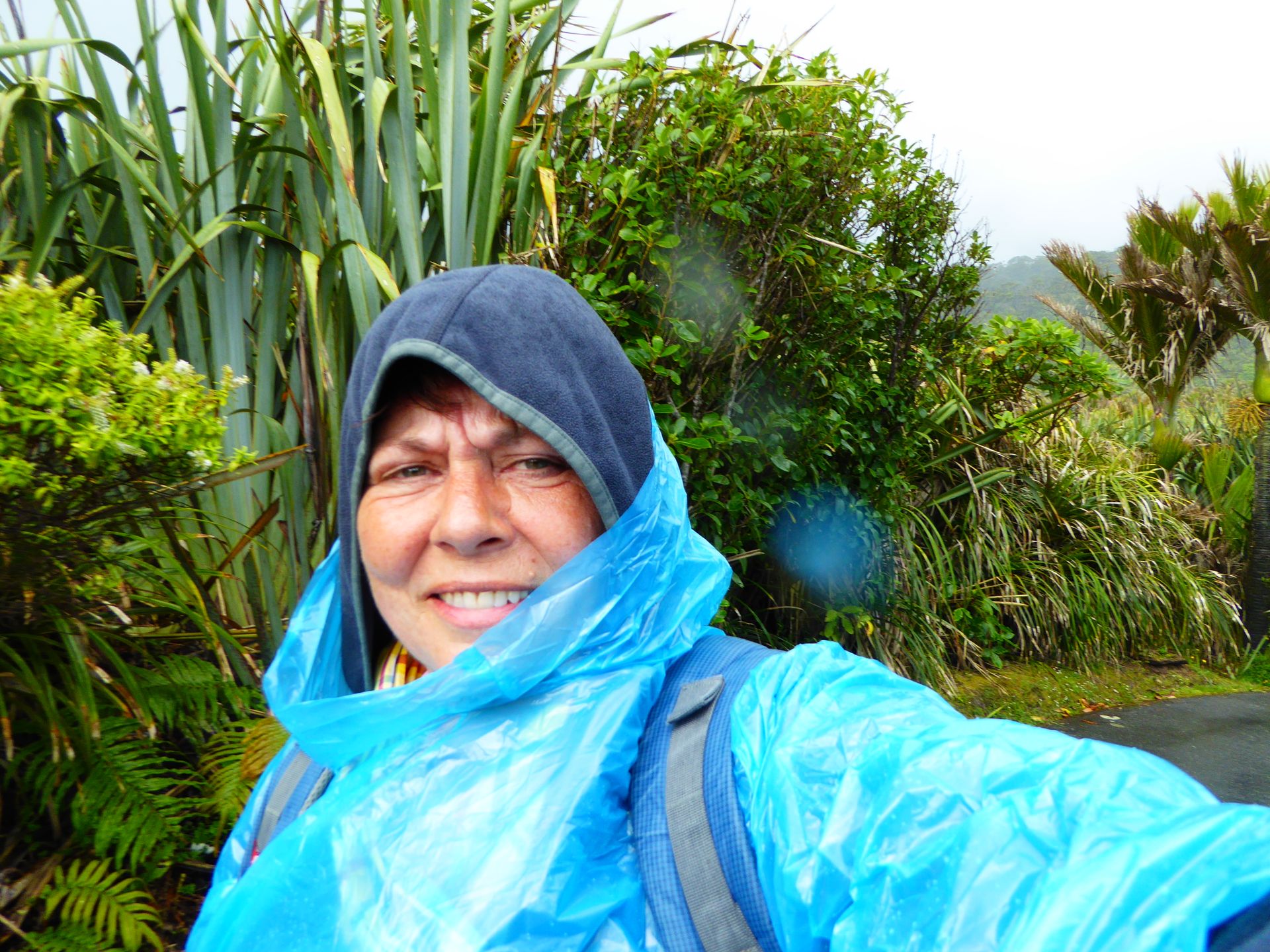
While it slowly gets brighter behind me, the rain is still hanging in the mountains in front of me, but it is dry for now. When I reach the parking lot, it looks pretty good, and I grab my usual equipment from my backpack - rain cover and cover for the backpack - and start walking.
As expected, I walk through rainforest and as expected, sand flies lurk for defenseless tourists. The worst thing is to stop and take pictures. As soon as you stop moving, they pounce on you. Although I am completely covered, my hands are not... In the end, I not only have bites on my hands but also one in my ear.

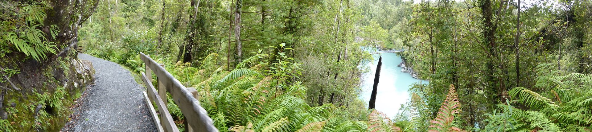
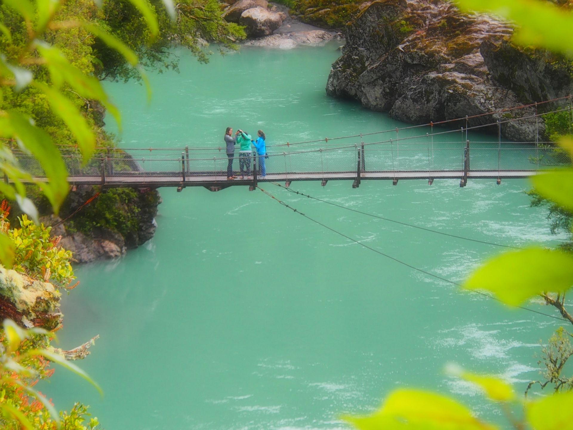
Hokitika Gorge
The best view of the gorge is from the suspension bridge, which can only carry a maximum of 6 people. The water is milky turquoise, and with an effect filter, the pictures look pretty good.
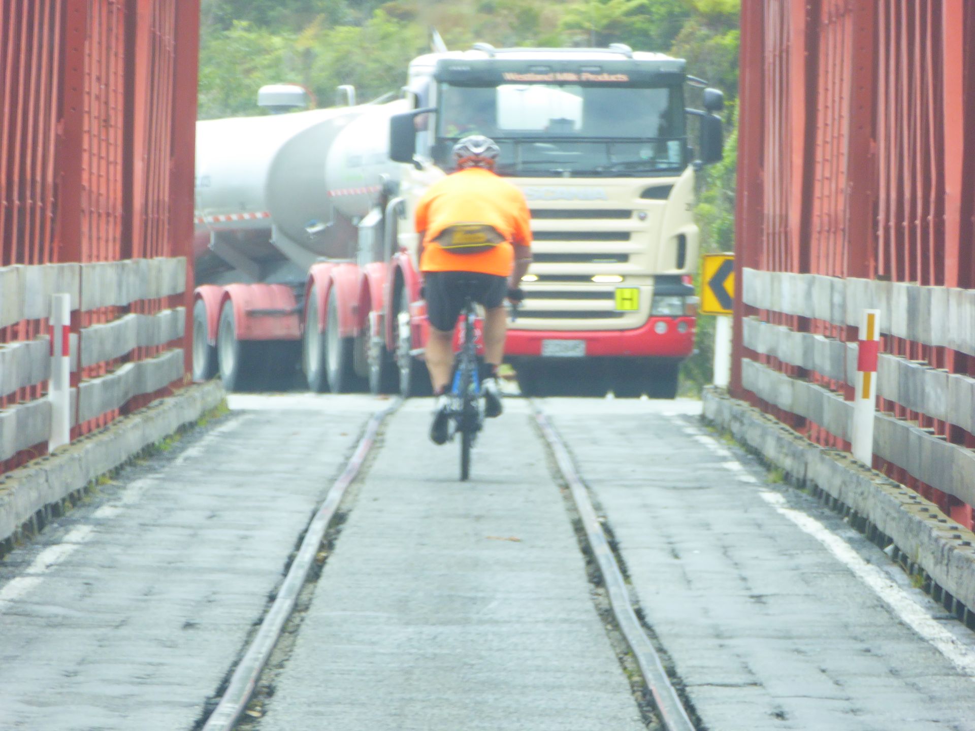
The sky is starting to cloud up again, and I start my way back. Then another 30km to the highway, and it's still about an hour from Hokitika to Punakaiki and the Pancake Rocks. Above Hokitika, at Kumara Junction, I come across another peculiarity: there is a railway bridge over a river, and this bridge is also a road and a cycle path. There is a cyclist in front of me, and on the other side, there is a big truck waiting because the bridge is only single lane. It's a good thing no train was coming. Trains have the right of way, but due to the age of the bridge, they can only cross very slowly, which regularly leads to endless traffic jams on both sides of the bridge. It's funny, of course. The cyclist is visibly having trouble maintaining balance on the extended asphalt between the rails.
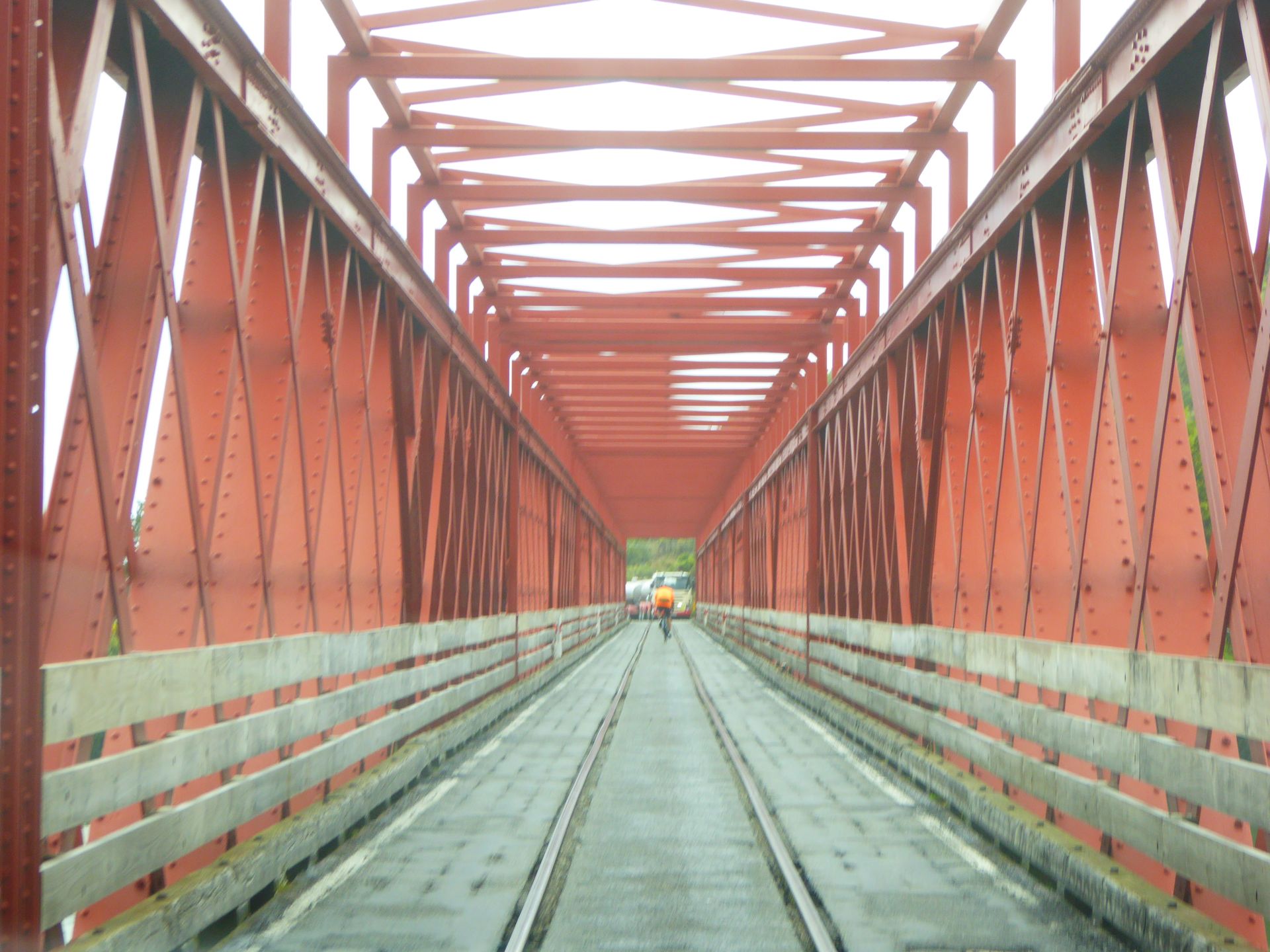
The bridge of Kumara Junction
Greymouth is not far now. I don't stop at Shantytown, another gold mining town, because I've already seen quite a bit of that in Alaska in September, and it won't be any different here than in Ross.
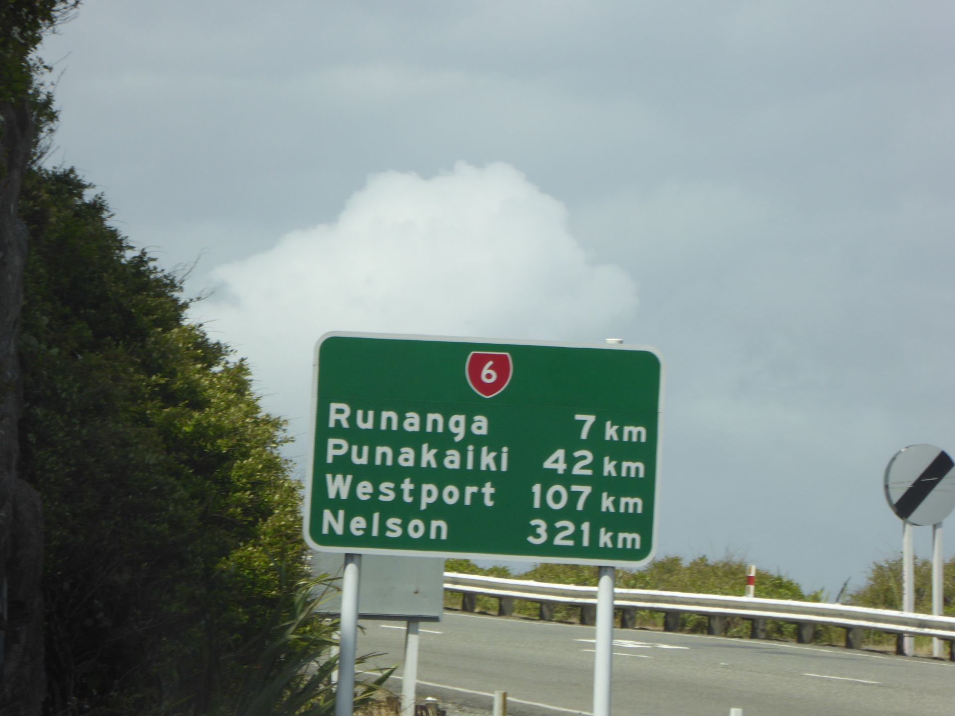
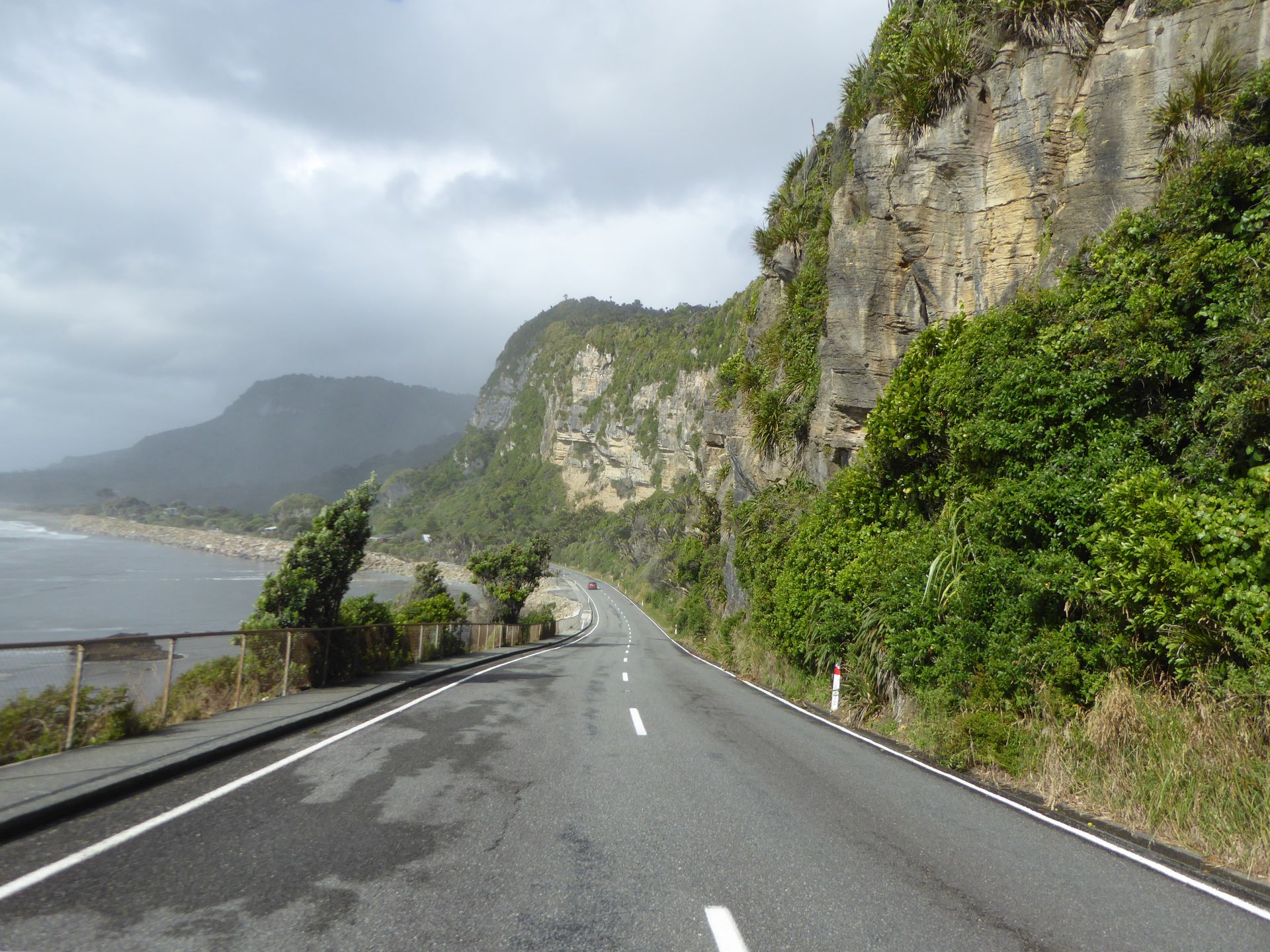
Greymouth has the cheapest fuel so far at 1.749, and I fill up completely. Otherwise, I take a small detour through the old town with nice old houses before continuing my tour. I would really like to have a coffee now, but I don't want to take a real break because the weather is still quite good and I still want to go to the Pancake Rocks. After Greymouth, the highway runs directly along the steep slope of a mountain - a great route. Waterfalls cascade down next to you from the mountain, and you continue to curve and have a gigantic view of the sea!
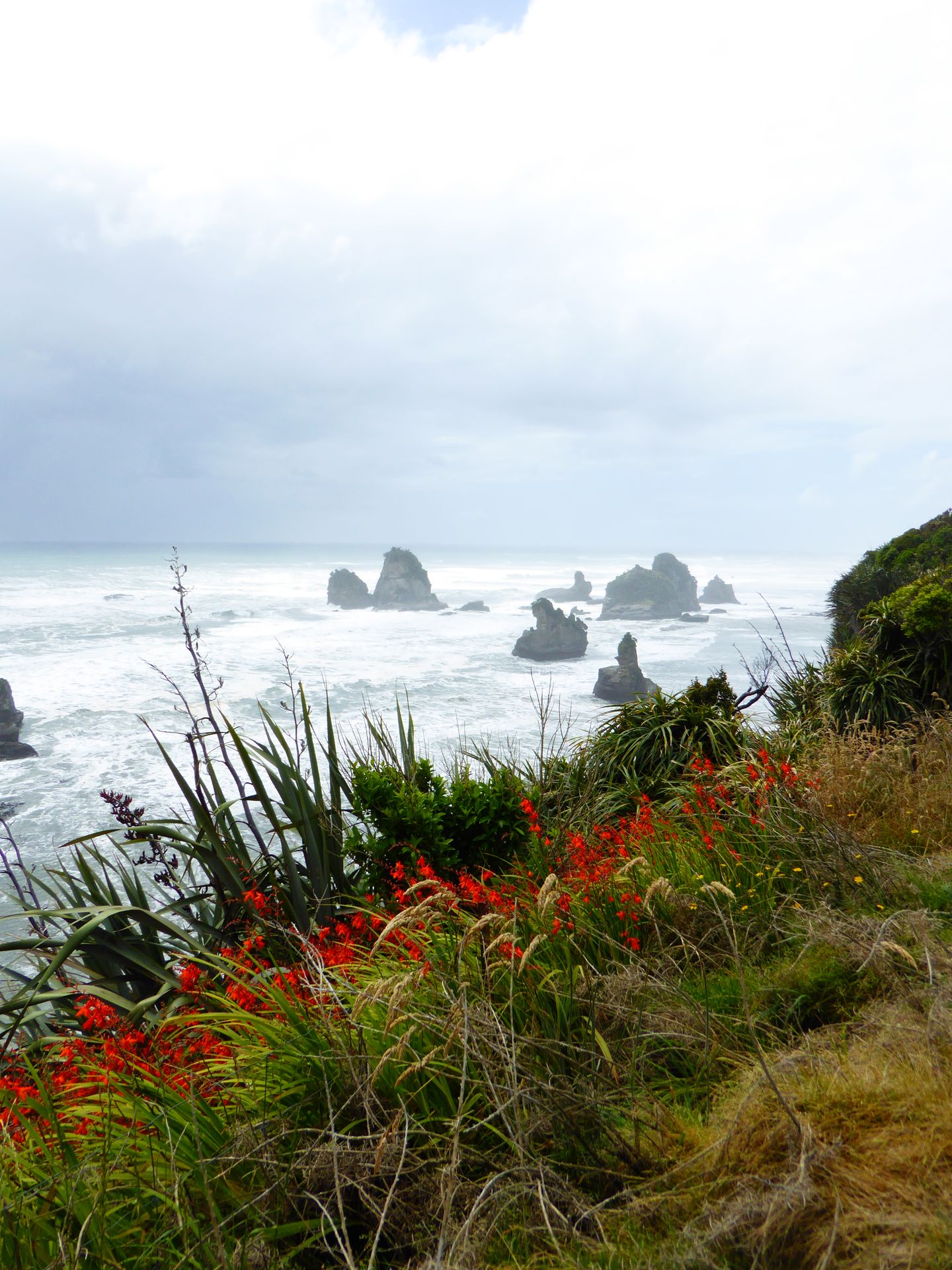
What a surf. But now you can also see the moisture steaming from the rainforest and simultaneously the spray, both of which envelop the view in fog. And then it starts raining again. I just parked my car at the Pancake Rocks when a downpour breaks over the tourists, which is quite impressive. I take refuge in a cafe and end up here for a forced break. I'm not exactly sure where I'm going to stay tonight. Actually, I'm so tired of this weather on the West Coast that I just want to go as far north as possible, which would mean Westport. That's one hour north of here. From there, I have to drive east to eventually get to Nelson or the surrounding area and reach the Abel Tasman National Park. Given the current weather, this might be a rather short tour. Maybe I'll stay nearby after all and start again tomorrow morning with better weather.
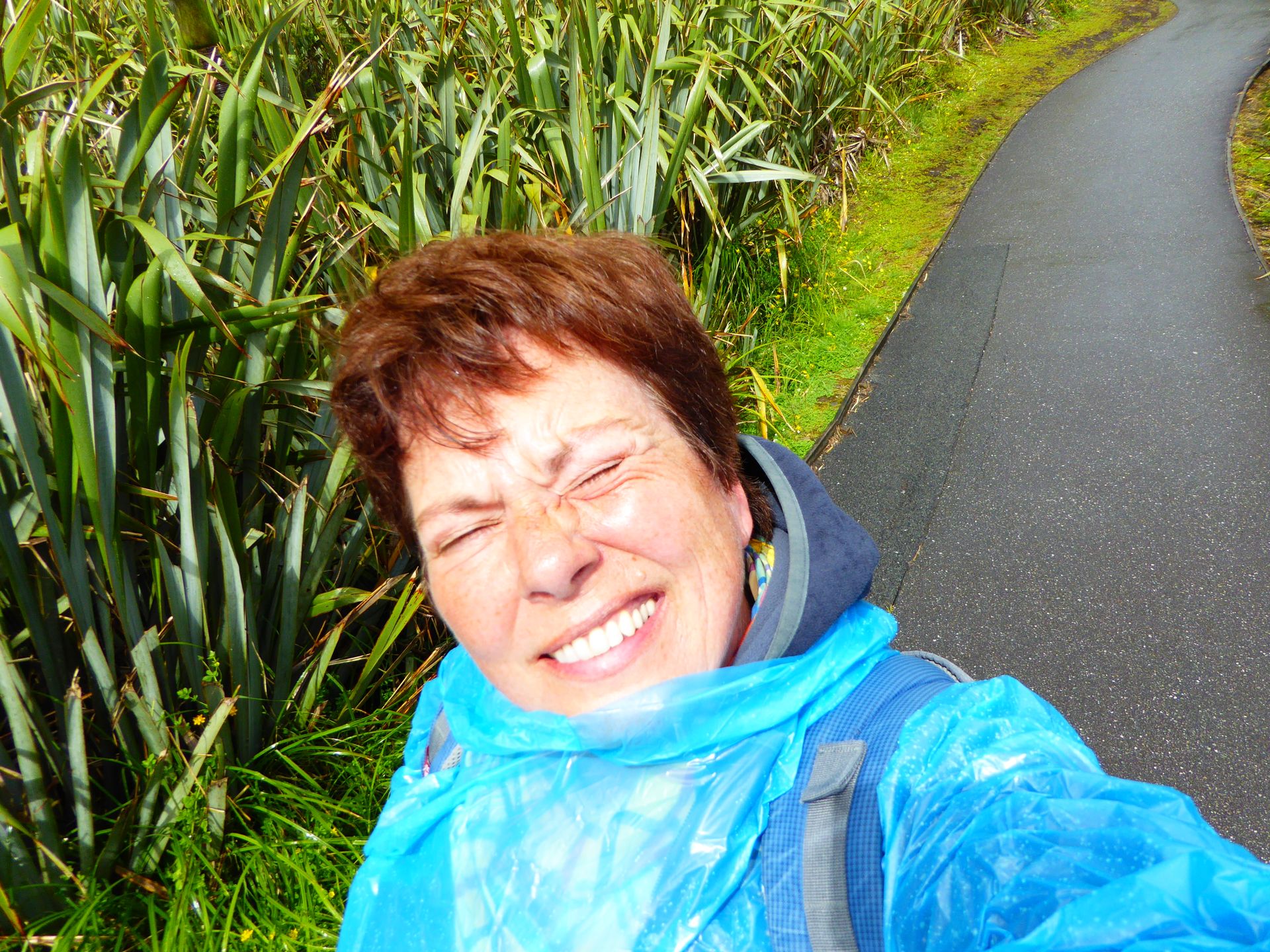
When the rain stops, I start walking. There is a circular path that should take about 20 minutes. I haven't even gone 30 meters, and the rain returns. So I take out the rain cover and the backpack cover from my backpack and pack myself and my vehicle. With the waterproof Olympus camera, I take a few pictures of the first Pancake Rocks, which look like they are in an aquarium.


Not even 5 minutes later, I start sweating, the rain is over - the sun is shining. So I take everything off again and tie the wet rain cover somewhere. The 1 euro investment in the Euroshop in Berlin has already paid off now. I've worn that thing 3 times in the last 3 days.
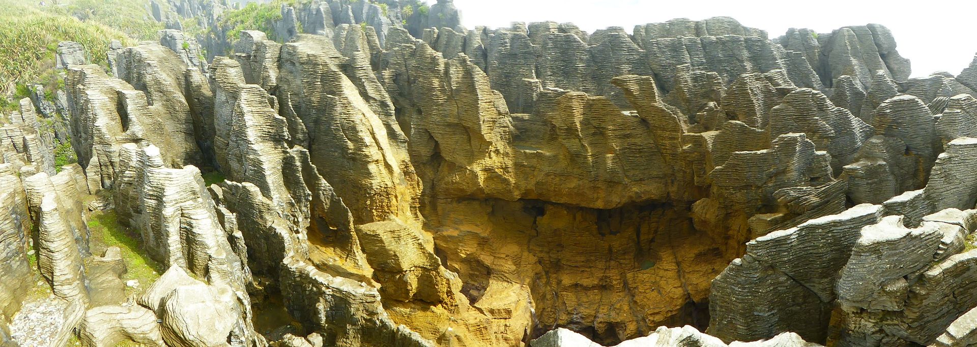
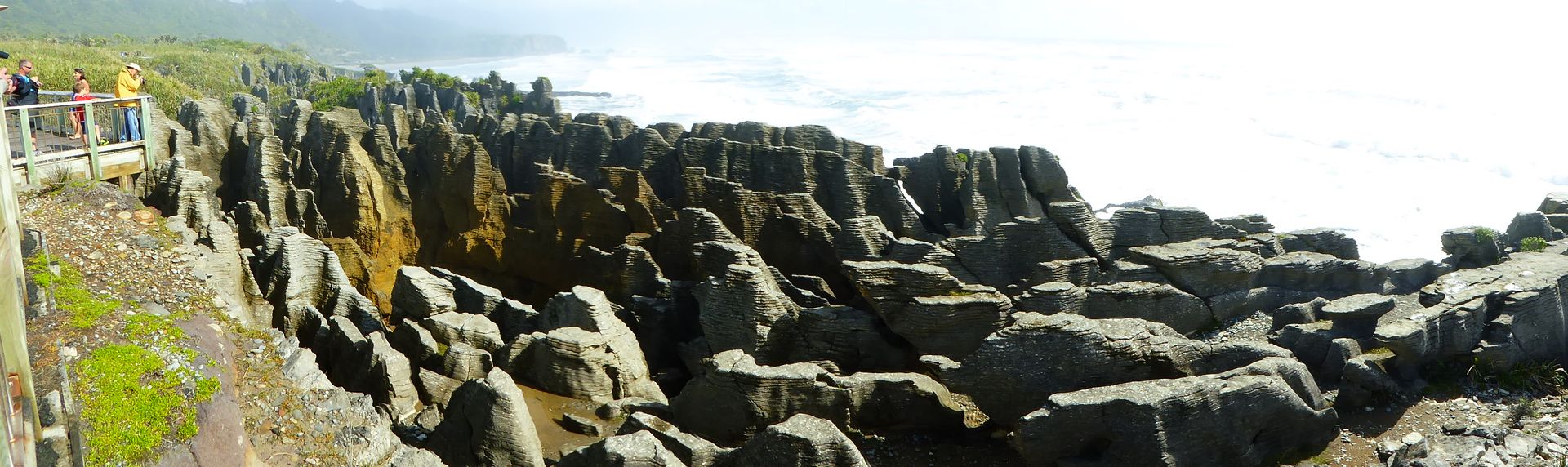
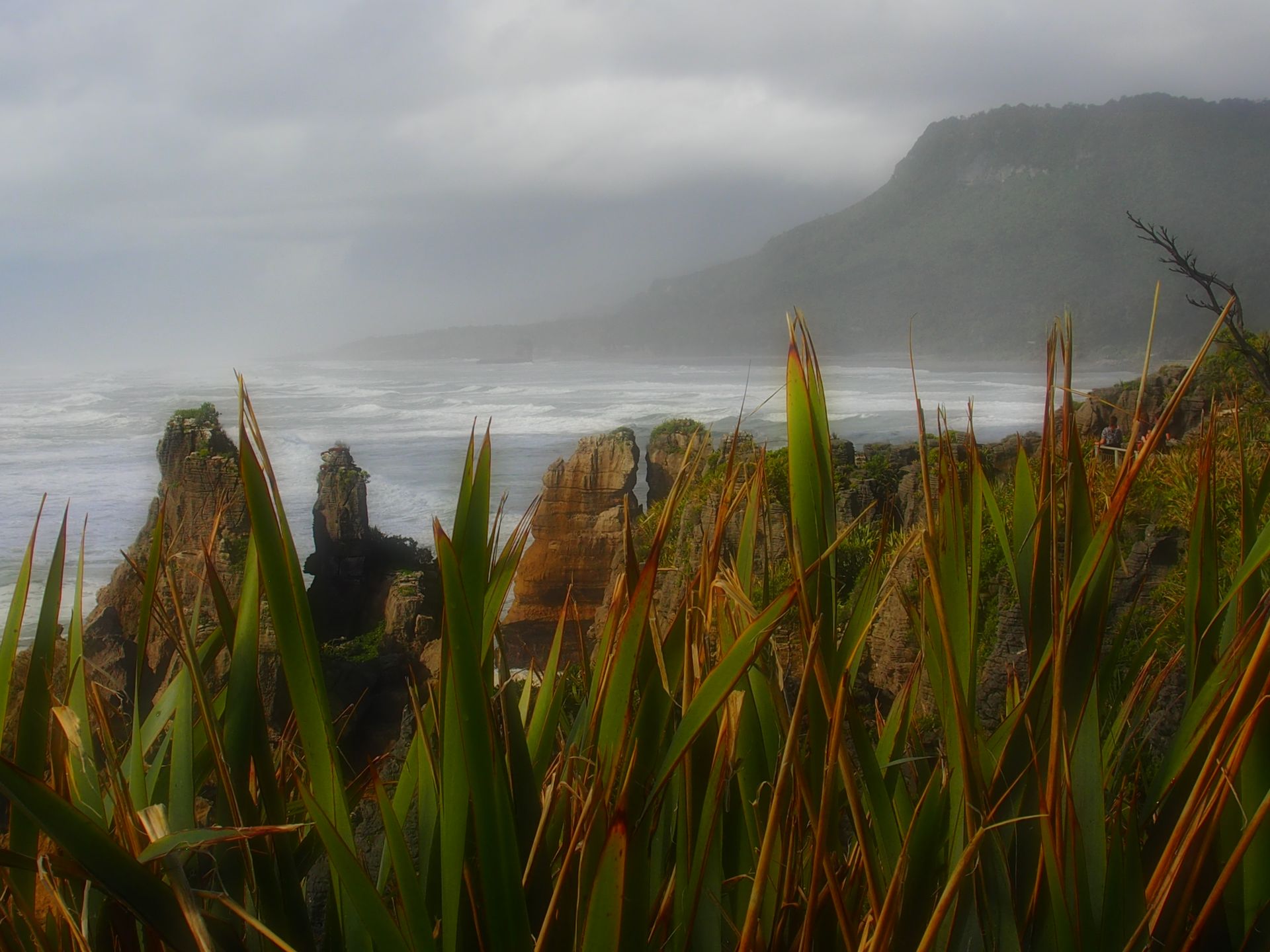
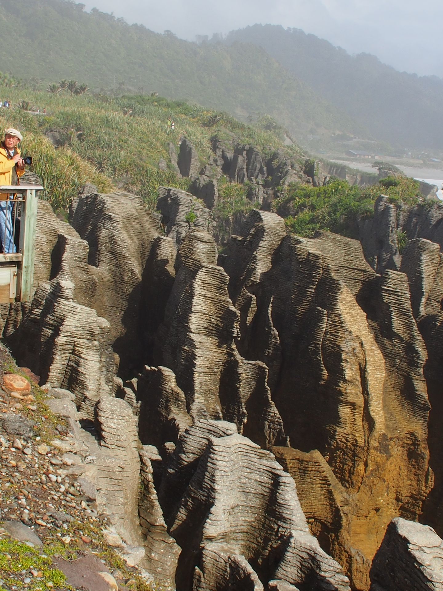
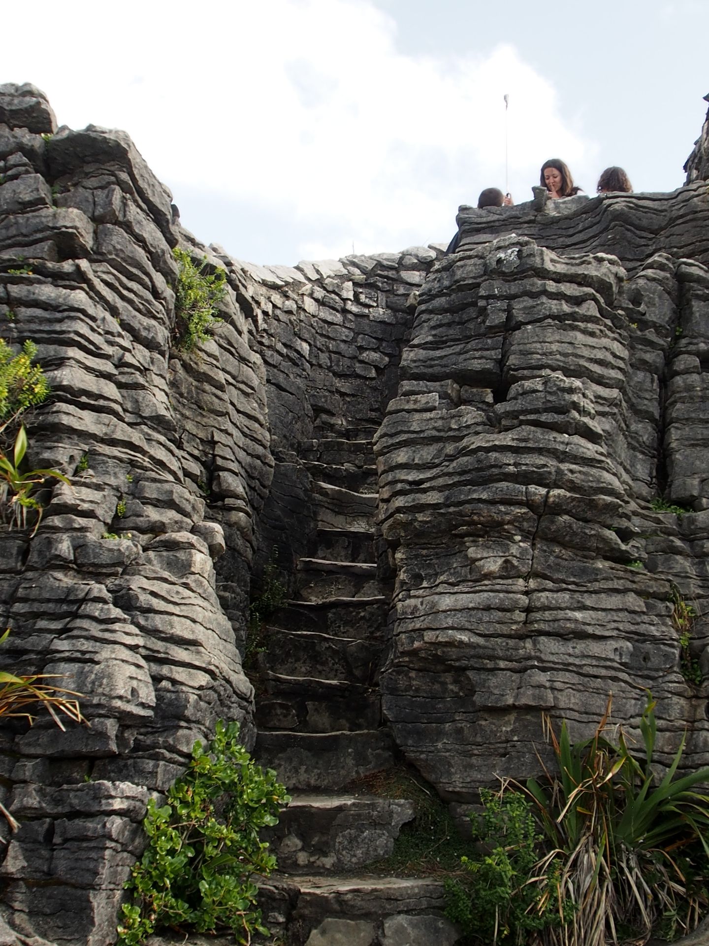
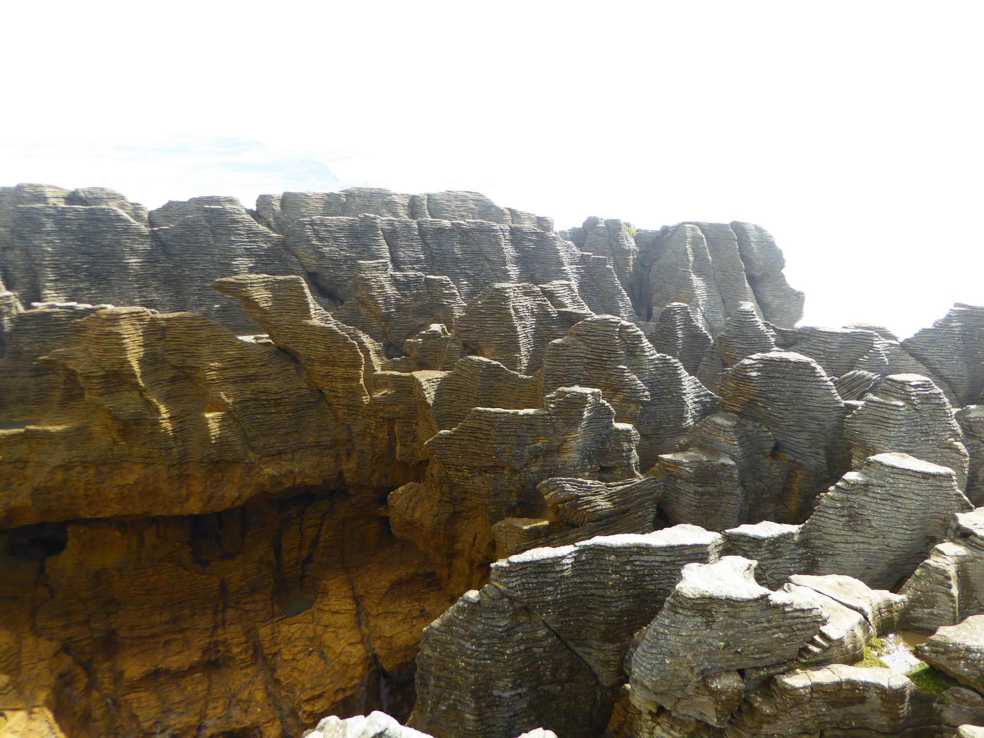
The sun alternates with clouds, and the scenery of these layered rocks is fantastic. There are towers, rocks, rocky outcrops, and in between there are also blowholes from which water shoots up during high waves. Now, however, it's more of an incoming tide. At high tide, it should be even more dramatic. The Pancake Rocks are erosion remnants of ancient sediment deposits of limestone and clay minerals. They are estimated to be about 30 million years old. The Pancake Rocks belong to the Paparoa National Park, one of the 14 national parks in New Zealand (10 of which are located on the South Island).


By the time I have taken pictures in bad, good, and very good light from ever new perspectives, it's already half past five, and I consider looking for the next motel now because it will be more difficult later as the route above Punakaiki looks quite empty.
Coastal road above the Punakaiki Visitor Center
Just one kilometer from the visitor center is the Punakaiki Tavern, which also rents motel-like rooms. 130 dollars is a proud price. But now I'm driving further to maybe save 20 dollars, that's too much trouble for me.

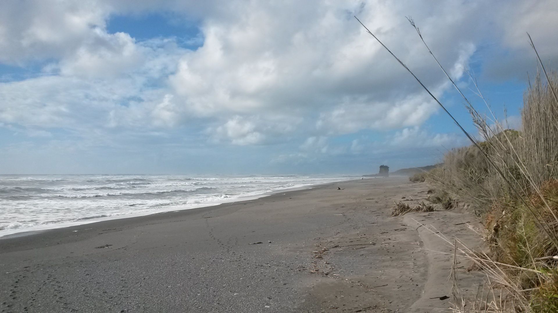
The room is cramped, and I'm heading to the beach, which starts about 100 meters behind the hotel. I sit on a stone in the evening sun until it gets a bit chilly, and then I go to the tavern of my hotel to have something to eat, have a beer, write postcards and my diary - there is no telephone network here. Consequently, no internet either. The hotel apparently has Wi-Fi for purchase, but tomorrow I'll just have to make sure to reserve a hotel at Abel Tasman from somewhere on the way for the next 3 nights. I would have liked to do that today, but it will work tomorrow as well.
The beach behind the Punakaiki Tavern
Trip distance: 280km
न्यूजलेटर के सब्सक्राइब करू
उत्तर

यात्रा रिपोर्ट न्यूजीलैंड