die_labis_on_tour
vakantio.de/die_labis_wollen_baeren_sehen
Day 5: Smoke Jumper Fire Base, Dry Falls, and Streamboat Park
Dɛn dɔn pablish am: 08.06.2018


Sabskrip to Nyusleta
After a short visit to the lake, of course with a fishing rod, our path leads to the Smoke Jumper Fire Base near Winthrop. On the way there, we already spot a fire in the region. The staff member says that it's not in the forest but on the meadow in the valley behind. The fire department can reach it by car. The staff is very nice and we get a tour. James, our guide, explains that the first Smoke Jumper Fire Base in the USA was established here in 1939. A Smoke Jumper is a firefighter who jumps out of an airplane with a parachute during a forest fire and fights the fire on-site. He doesn't have water to extinguish, but a chainsaw and an axe. This prevents the fire from spreading. The guide shows us his equipment like a tent, food, and drinking water. Each plane has 2 pilots, 2 spotters, and 8 jumpers. The firefighters jump near the fire, and the plane circles again and the spotters drop equipment boxes. After their work, which can take 2-3 days, they pack up all their things and carry them to the nearest road, which is usually several kilometers away. James says it's the toughest job of all because they have to carry everything back, weighing over 50kg. Very impressive what those guys achieve. We buy a t-shirt and a patch for our collection and continue driving.
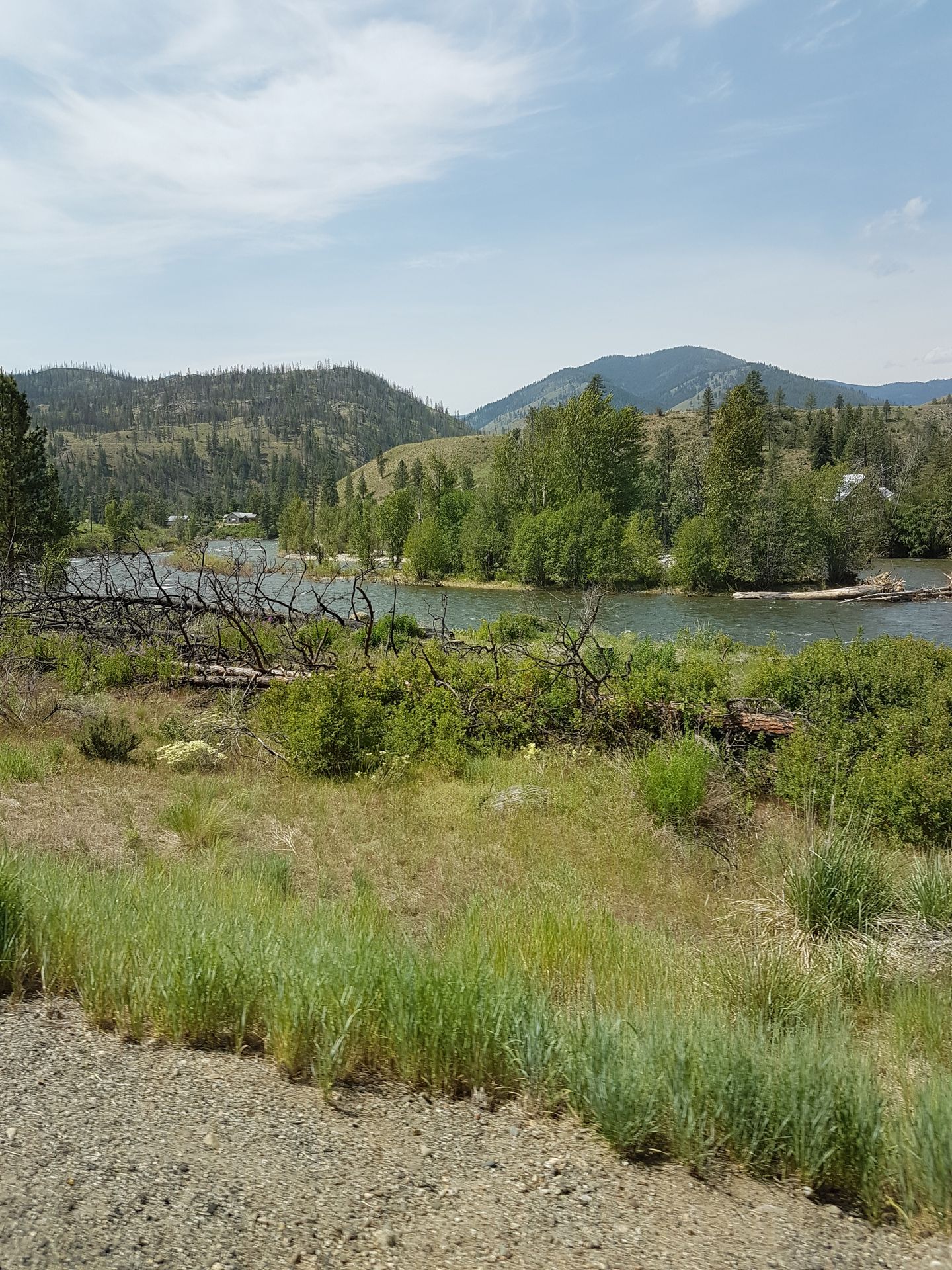
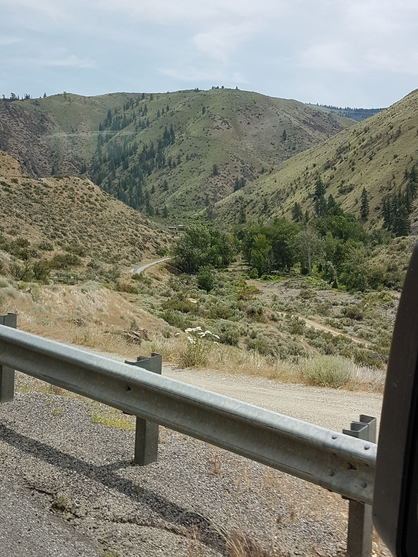
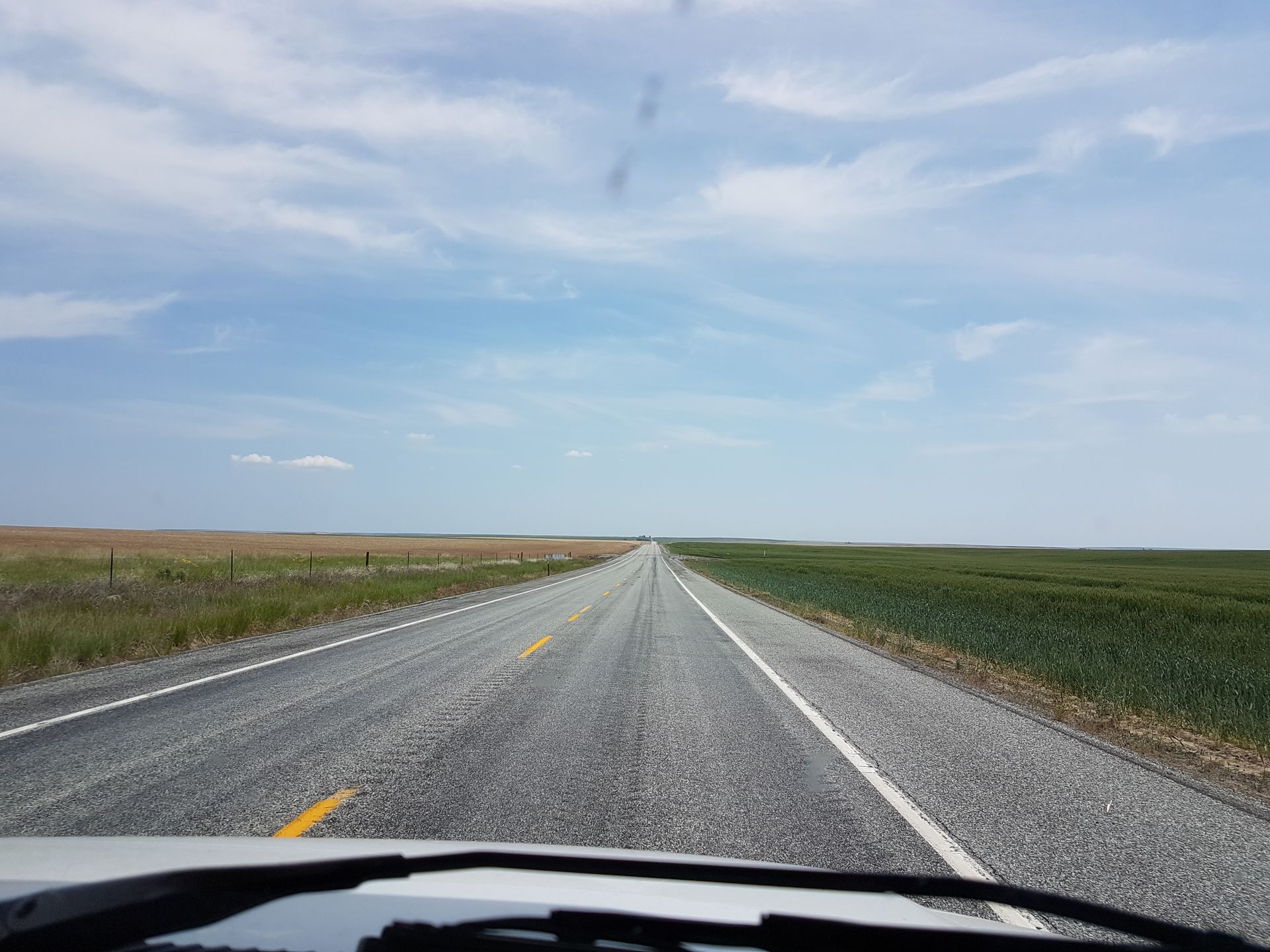
We follow the Methow River, a river with a strong current. The road and the river intertwine like a braid, and the landscape is beautiful to see. There is a touch of Tuscany over the hills, but it's not because of the cypresses, but because of the sagebrush. Again, we see burnt trees. After an hour's drive, the Methow River meets the Columbia River. The river is completely different, flowing much more calmly and is three times wider than the Methow.
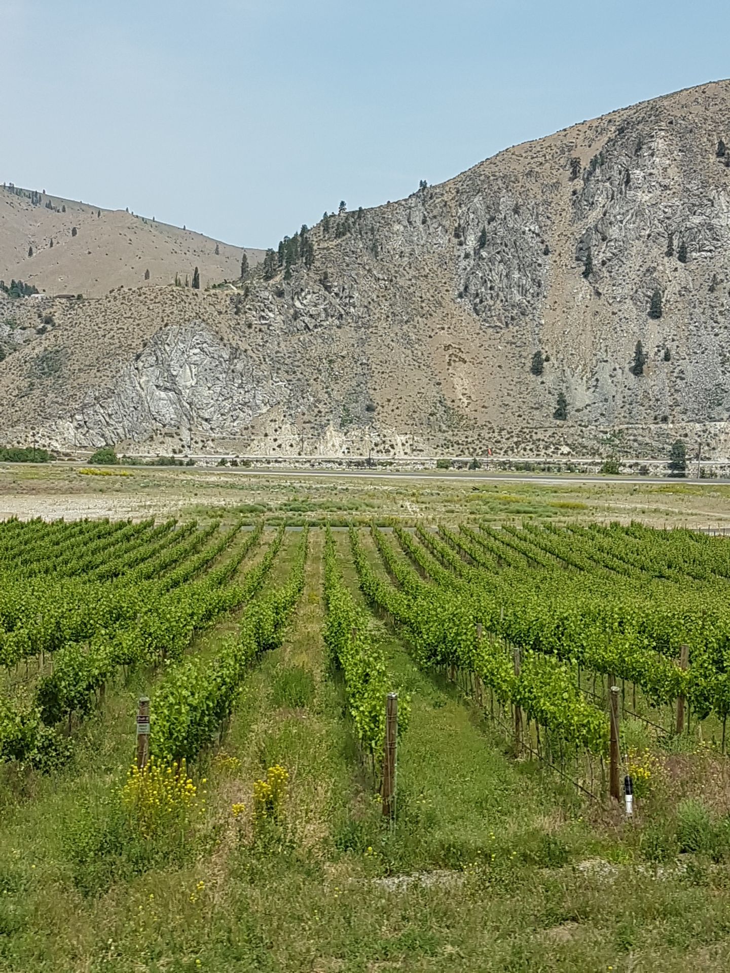
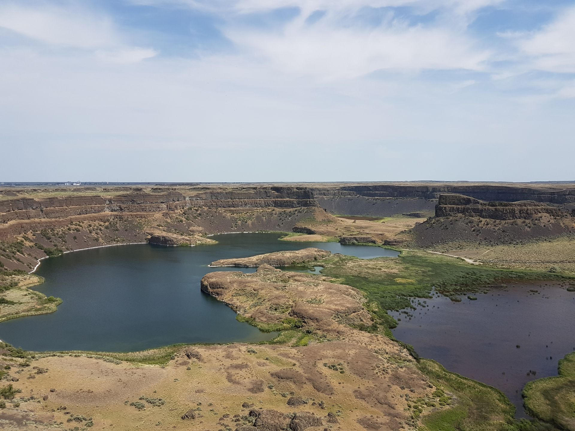
Between the road and the river, there are orchards. Apples and cherries dominate the scenery. Further south, the Orondo Canyon cuts into the high plateau of the Waterville Plateau for 6 miles with a constant gradient. Up there, there are wheat fields cultivated by dry farming methods. The place is called Waterville because a productive well was drilled here in 1886, otherwise, the plateau is waterless. The path leads straight ahead and we reach Moses Coulee. This dry valley with its steep basalt walls is the work of ice-age floods. Water is still missing. Further southeast, the mystery is solved. The Dry Falls, a mighty waterfall of bygone times. There was said to be a powerful flood wave with enormous force and size that shaped the Grand Coulee and the falls. Its current semicircular shape is five kilometers wide and 120 meters deep (Niagara: 50 meters). The sight is impressive. From the visitor center, you have a great view of the entire formation. We have lunch and visit the small exhibition. The ranger even speaks German, and we enjoy the change. The Dry Falls is accessible by car. In the valley, there is a recreation area directly by the lake with swimming options, a playground, a campsite, etc. We spend some time there, Erik puts his feet in the cold water, and then we go for a short walk, despite protests. There are ground squirrels on the lawns and in the rocks. They sunbathe, but when you get too close, they run away.
Around 5 pm, we reach Streamboat Rock State Park. We look for our reserved spot, but someone is already there. Talking to the other visitors, we realize that I entered the wrong date when making the reservation. Clarification is not possible today, so we can only pay for a new pitch. $53 down the drain, annoying, but nothing can be done about it.
The park is beautiful, it's an island in the Grand Coulee. The Steamboat Rock, the 200-meter-high basalt rock on the edge of the island, looks enormous.
Climbing is possible, but 1.5 miles uphill in the blazing sun with 2 children is not desirable.
We go for a quick swim. Erik and David splash around in the cool water. It's too cold for me, so I just refresh my feet. After dinner, we drive to the Grand Coulee Dam. Construction began in 1933 and was completed in 1941. It is one of the longest concrete structures in the world and is 1.5 km long and 167 meters high. It provides electricity for 2.3 million households annually and is the most important energy supplier for the USA. You may be wondering why we are still out with the children so late! Every evening, a laser show is offered at the dam. We still have some time before it starts, so we explore the visitor center about the history of the dam. Small circuit boards can be assembled using drawings. I feel like I'm back in school, everything has to be connected correctly for the light to come on. Erik joins in the tinkering. David takes a while to fall asleep, but he dreams in his stroller during the big show. The show showcases the impacts on nature, how the salmon disappeared because their path was blocked, and the Indians lost their food source. Then they explain the construction with benefits for the region like jobs and power supply. After 35 minutes, the laser show is over and we are tired. Now we have to go back to the campground. We reach it at 11 pm, both children have fallen asleep, and we also fall exhausted into our nest.
Sabskrip to Nyusleta
Ansa (3)
Susanne
Und wäre der Smoke Jumper als nächstes Level mit erhöhter Schwierigkeit was für Rene?Regina
Die Geschichte mit den Smoke Jumper`s finde ich auch interessant. Haben die Behörden auch Leute abgestellt, um die Bevölkerung zu informieren? Das haben wir z. B. in Kalifornien erlebt, Anna-Katharina
Nein für Rene ist das Nichts. Das mit dem Fallschirm springen ist nicht so seins.
Keine Ahnung ob die da Leute abgestellt haben. Wollen noch mal zu den Smoke Jumpers im Yellowstonepark, die Flugzeuge waren nämlich nicht da. 
Travul ripɔt USA