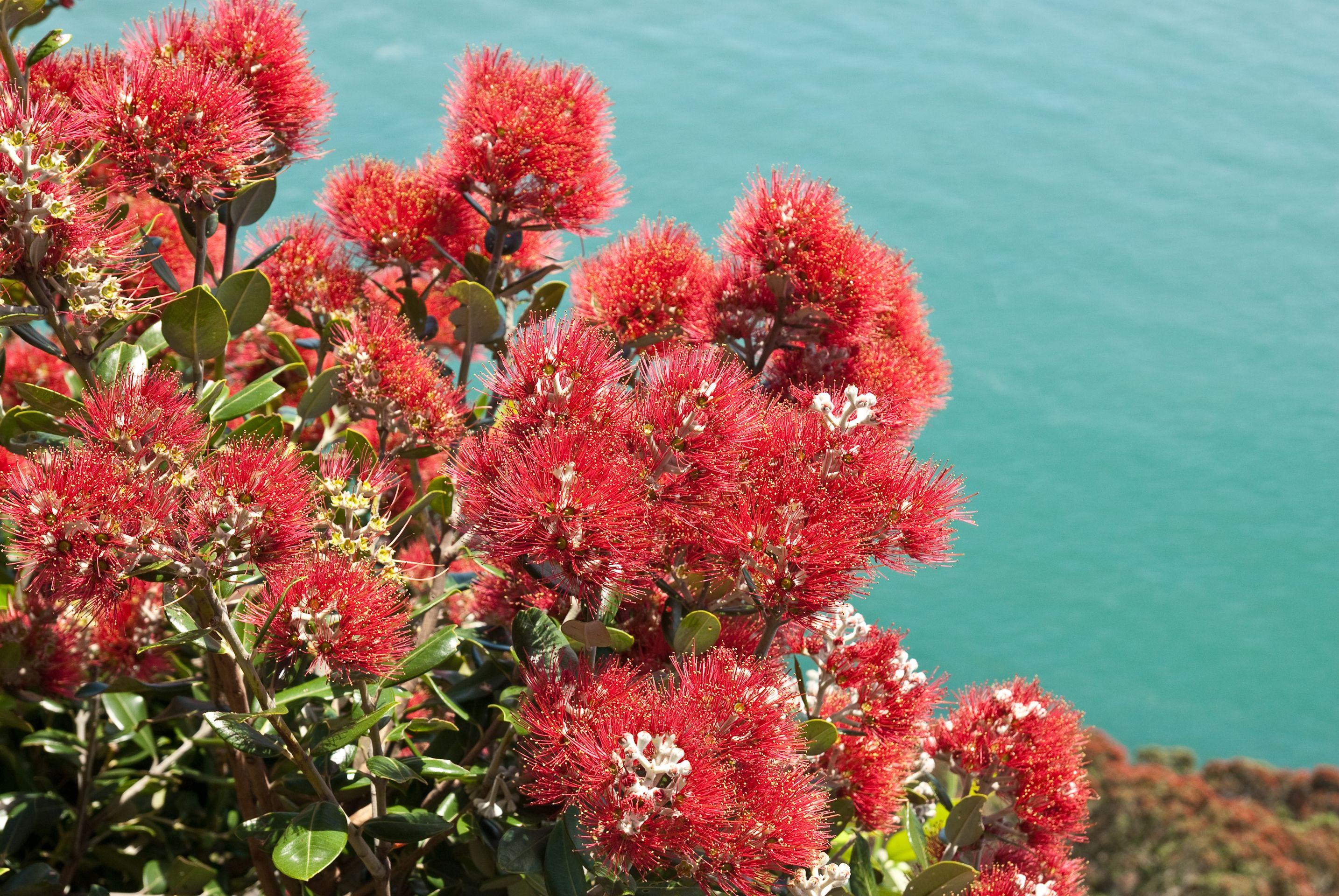
Arrival in New Zealand and 1st stop: Tongariro National Park
ಪ್ರಕಟಿಸಲಾಗಿದೆ: 01.03.2023

ಸುದ್ದಿಪತ್ರಕ್ಕೆ ಚಂದಾದಾರರಾಗಿ
After 5 eventful and very impressive weeks on the ship, we were supposed to get back to solid ground with our arrival in Bluff (which was not entirely unpleasant...).
However, on the ship we had already heard from one of the guides (a New Zealander) that the North Island had been severely hit by a cyclone. So we already knew that our first task after disembarking would be to find out where we can go and what we can do there. However, this turned out to be more complicated than expected...
But let's start from the beginning: After arriving in Bluff, we were taken to our hotel in Invercargill by bus and started our necessary research. However, there was not much to find out, as apparently there was not much overview of the damage and the like, and a national state of emergency had even been declared. Since we read that even the tourist information centers - the most important (and often only) sources of information for all tourist matters in New Zealand - would be closed for the whole week, we had no choice but to make decisions blindly.
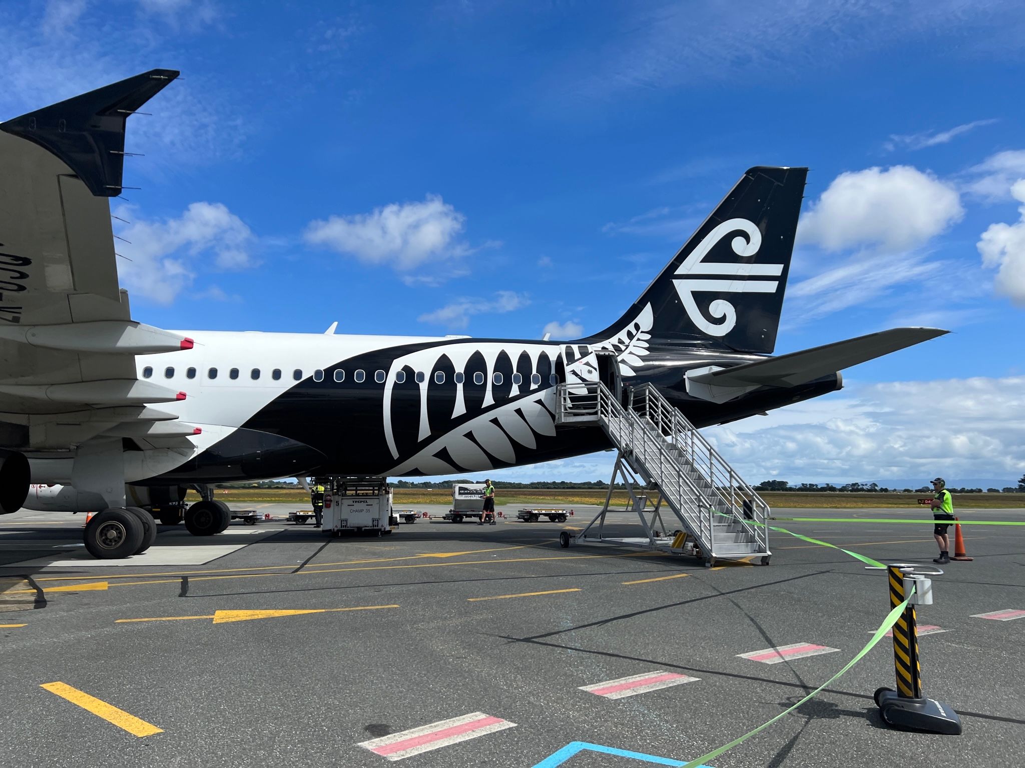
We would have preferred to stay on the South Island, but we had to pick up our rental car in Auckland, so it was clear that we would have to fly to the North Island as planned. However, we wanted to immediately return to the South Island by car, contrary to our original plans, so we canceled the two pre-booked accommodations. Next, we wanted to arrange a ferry crossing... and then we encountered the next problem, because the ferry had been canceled for several days - also a consequence of the cyclone - and was now fully booked for weeks. We were lucky and managed to get a last-minute spot in 10 days.
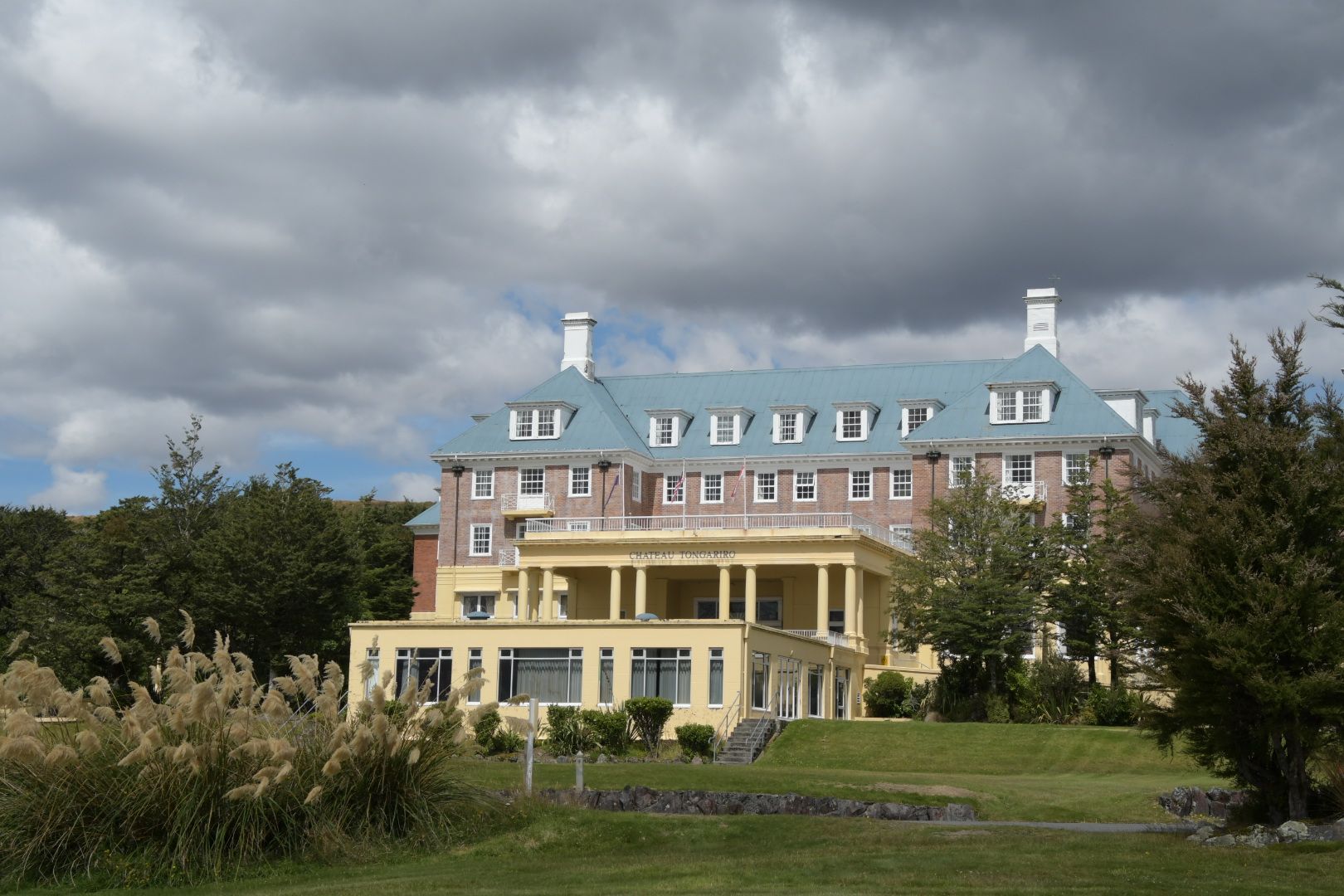
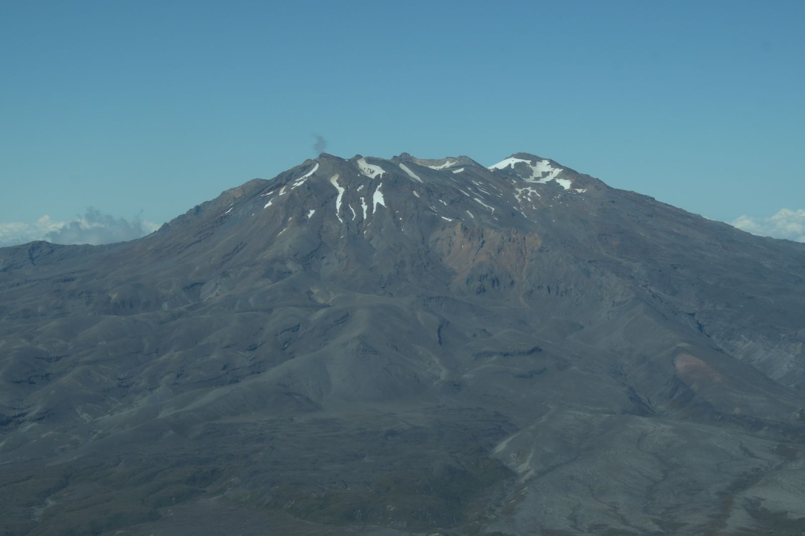
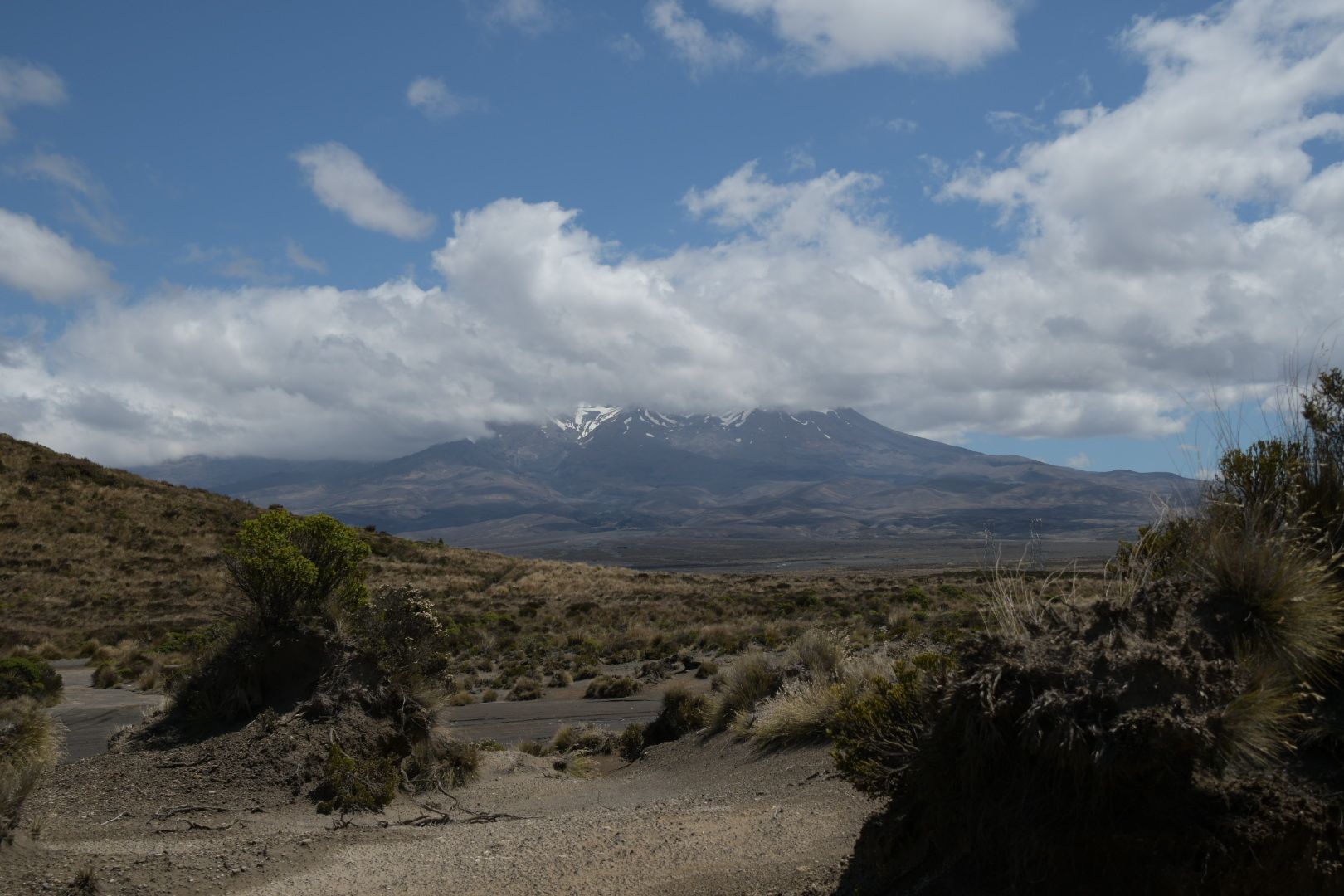
The next day, we flew to Auckland, picked up the rental car and drove from there southwards to see what the situation was like south of Tongariro NP and what we could do with our remaining 9 days until the ferry ride. Since the national park had apparently been almost unaffected by the storm, we decided to follow at least part of the original plan and booked a place to stay near the park for 4 nights.
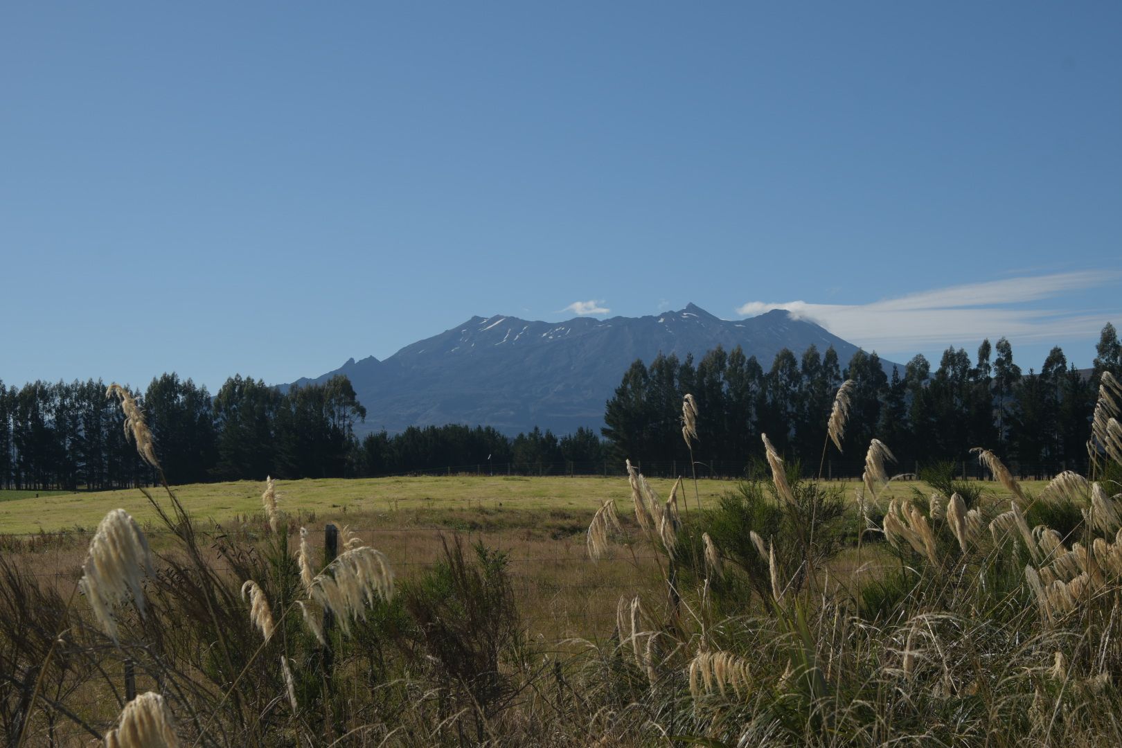
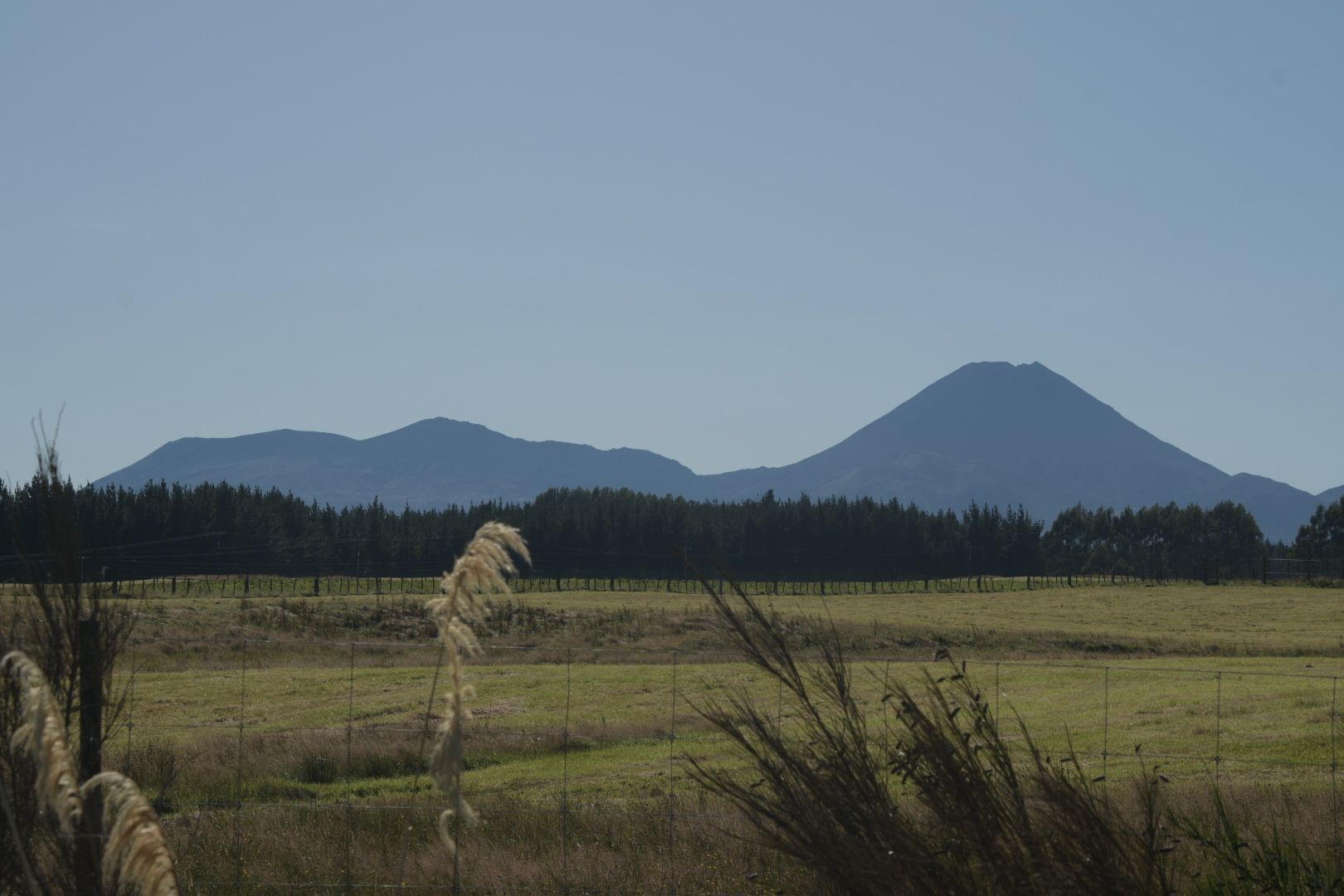
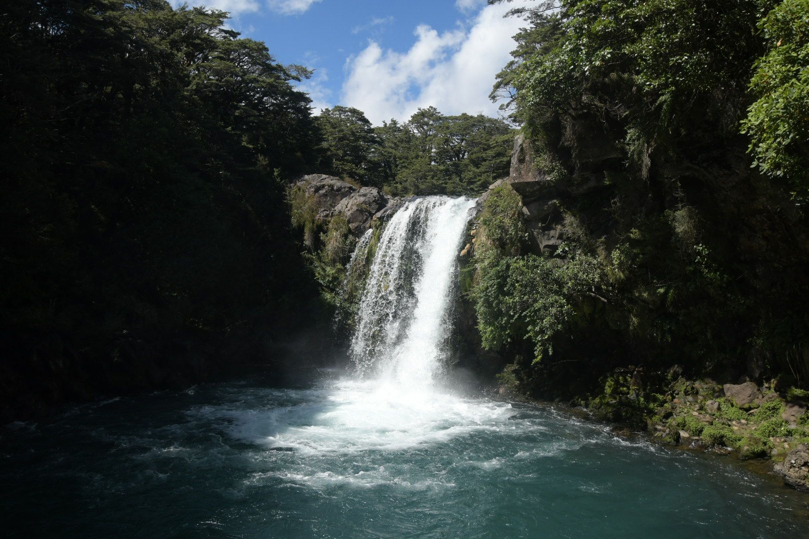
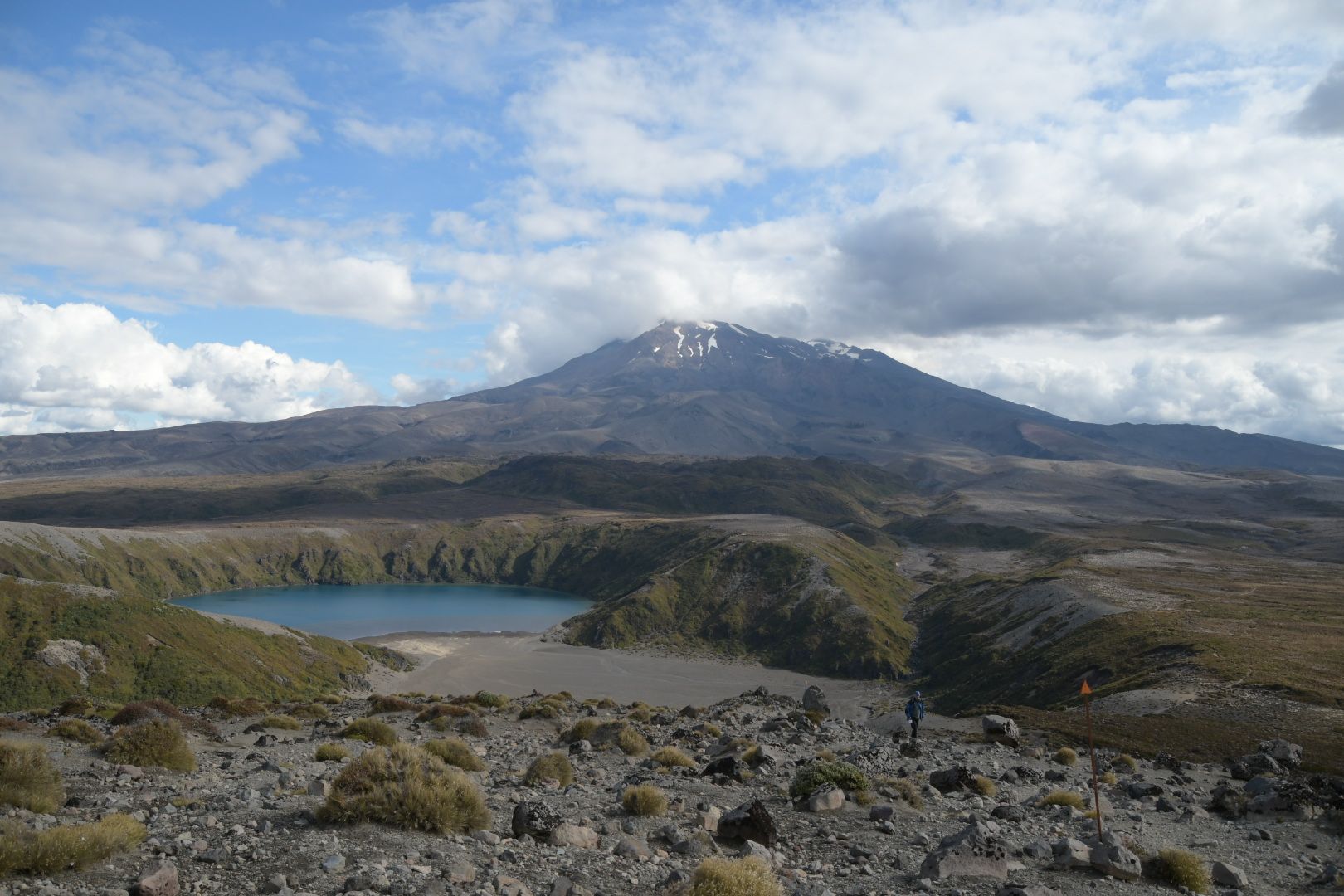
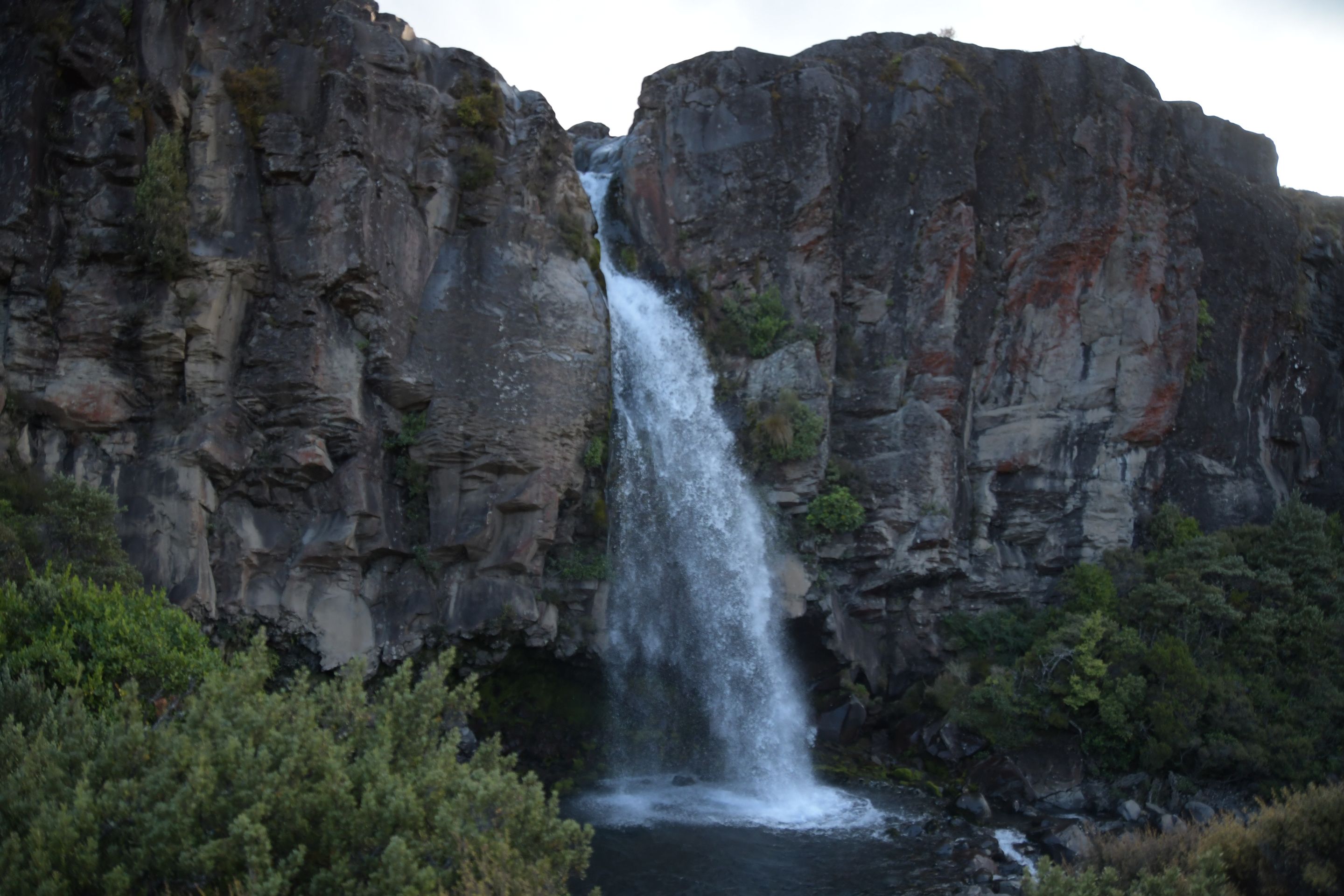
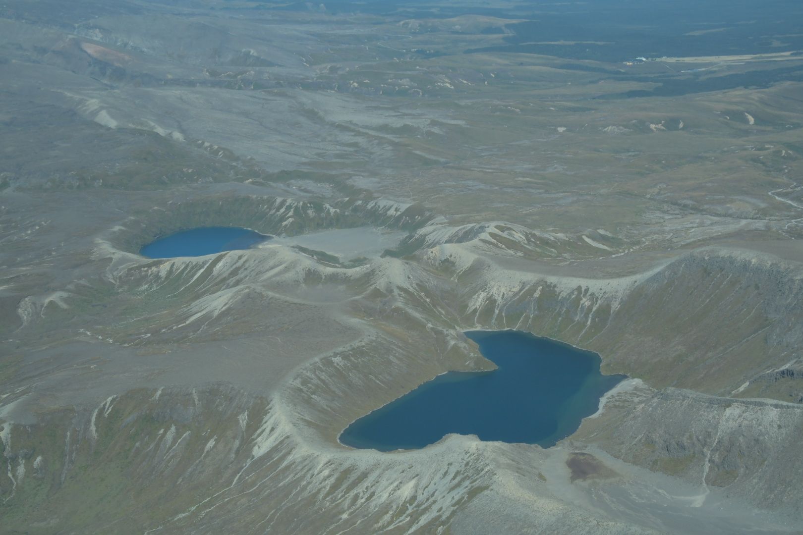
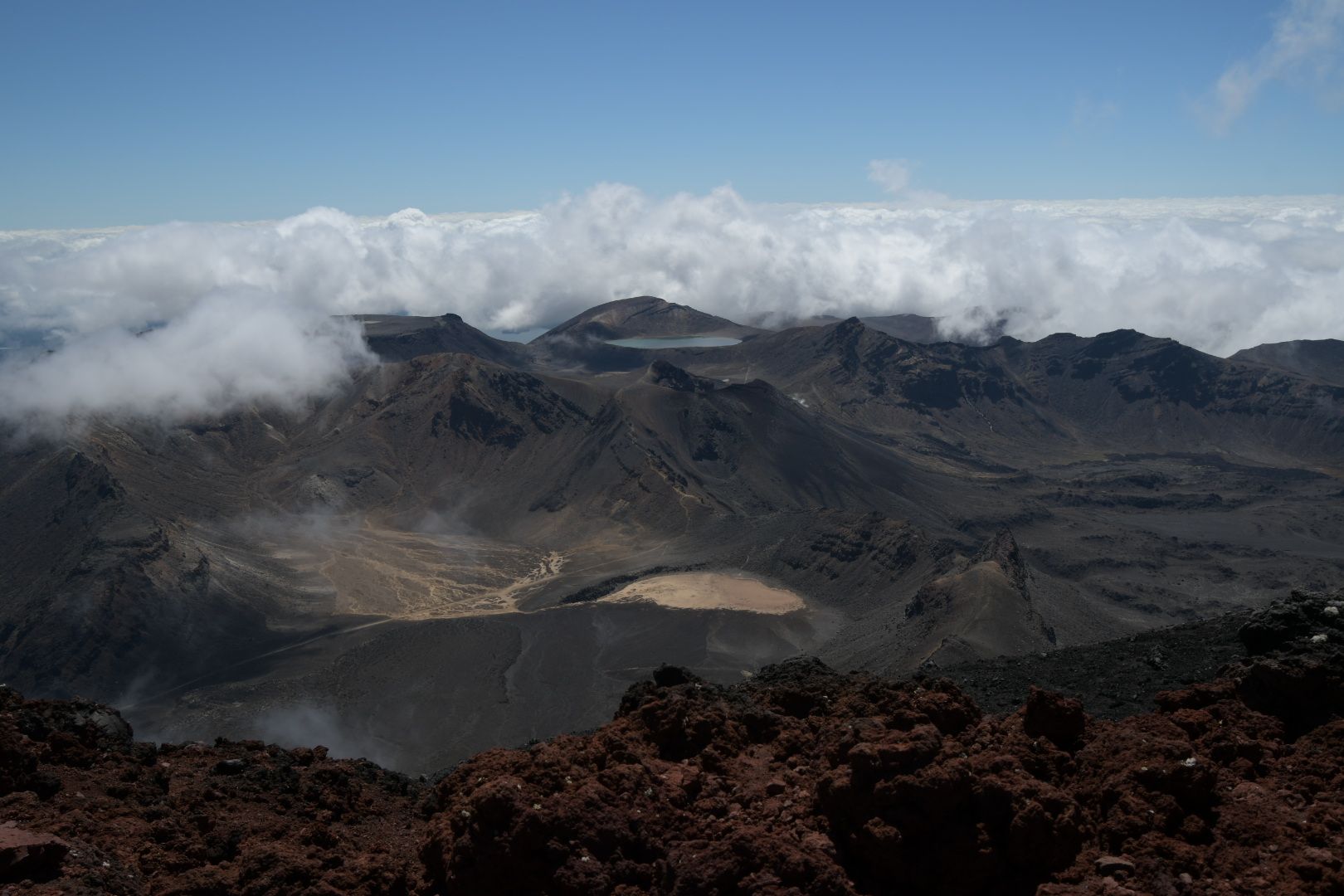
Here - in Tongariro NP - we wanted to go on two major hikes: the trail to the crater lake of Mount Ruapehu (which we had tried once on our previous 5 trips to NZ, but failed) and the quite well-known Tongariro Crossing with a side trip to Ngauruhoe (our son had never been on Mt. Doom). However, since we could hardly move on the ship for 5 weeks, we decided to practice with some shorter hikes on the first day. A 5 km walk to a beautiful waterfall in the morning and a 10 km hike to another waterfall in the afternoon. However, the afternoon event turned out to be typical for us: at the farthest point of the hike, there was a junction with two lakes that we knew from scenic flights we had taken in previous vacations, and we always liked them. So we decided to take the 'small' detour. The views were great, so the efforts were definitely worth it, but in the end we had about 20 km and 5 hours of hiking through high mountain terrain in our legs, which is especially nice when you have a very long and challenging hike ahead the next day...
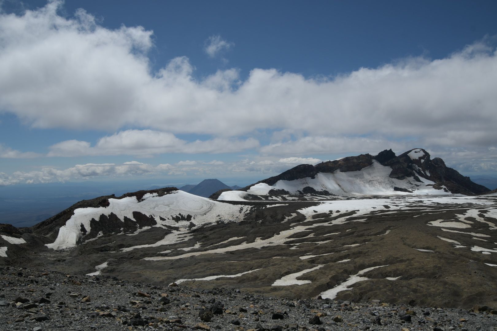
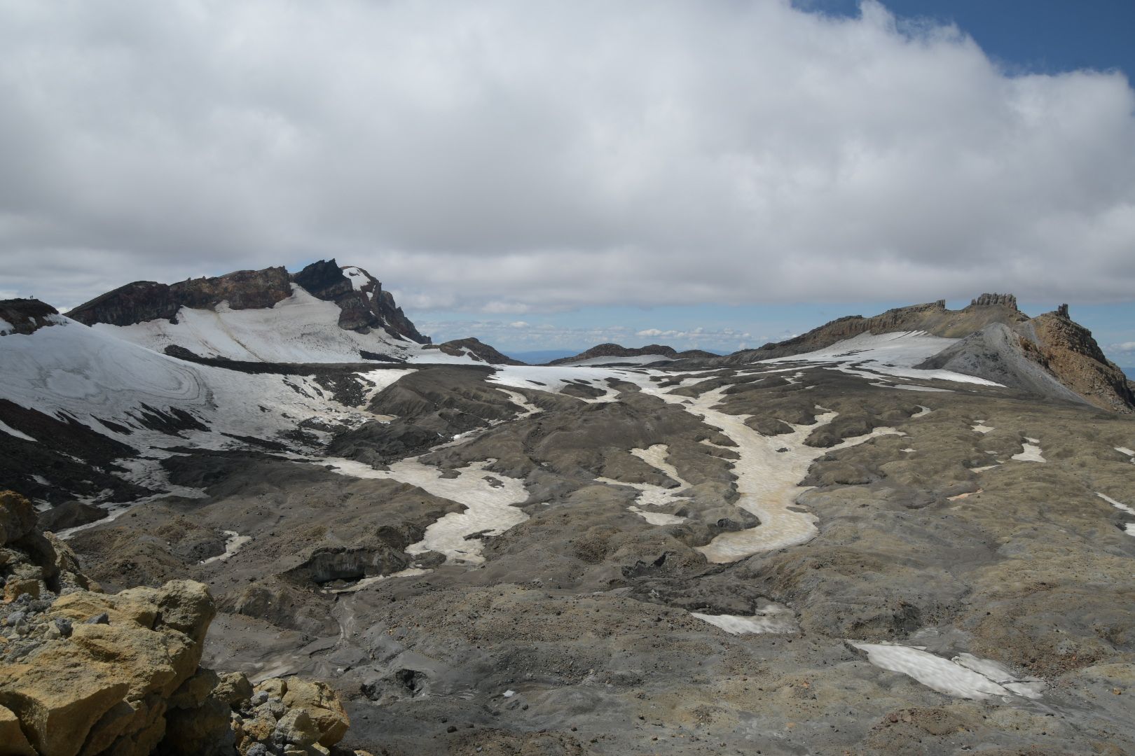
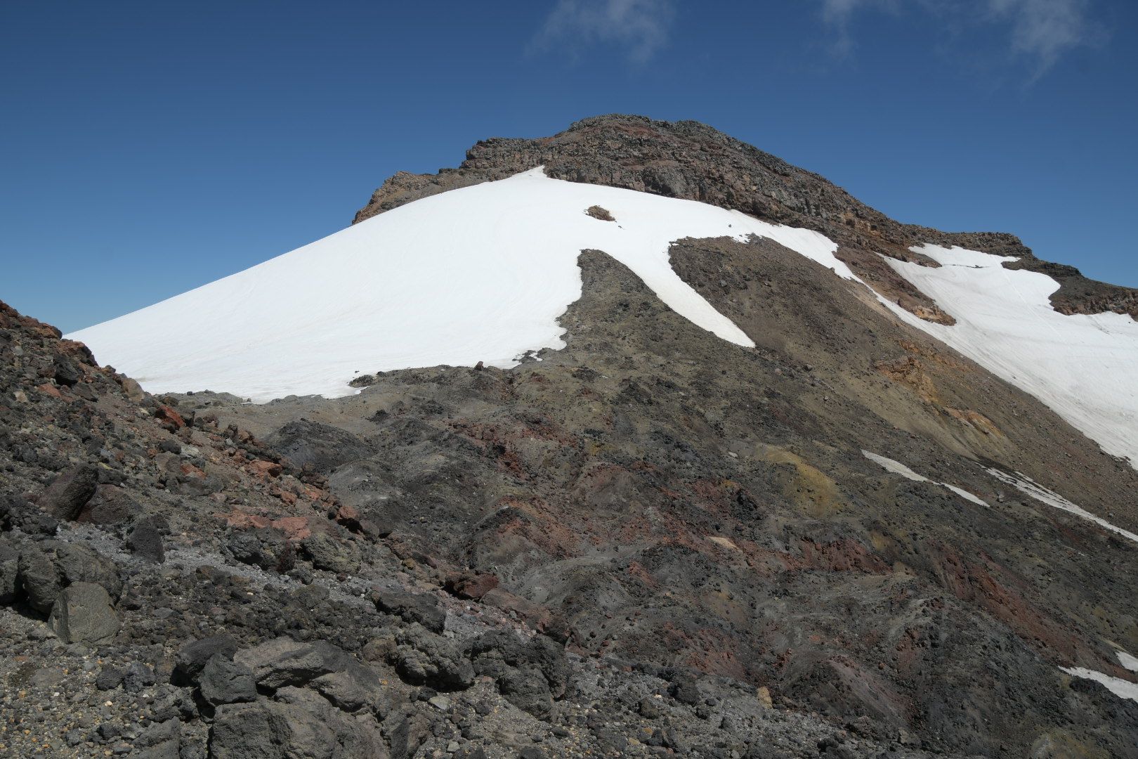
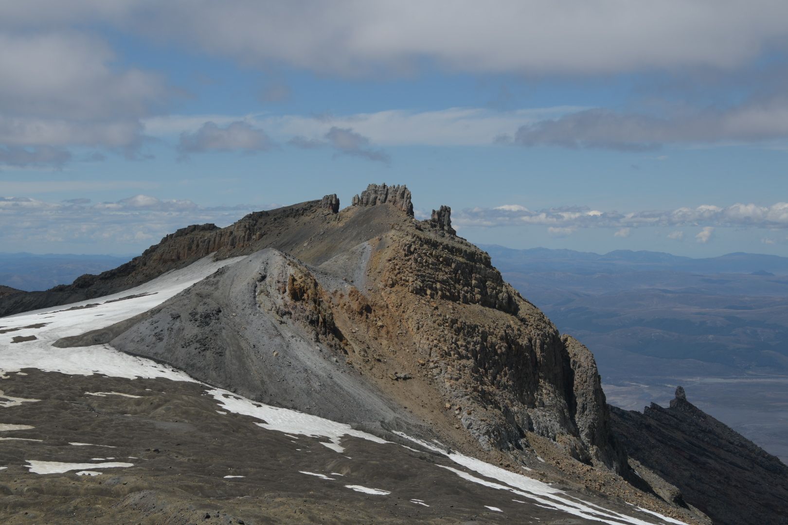
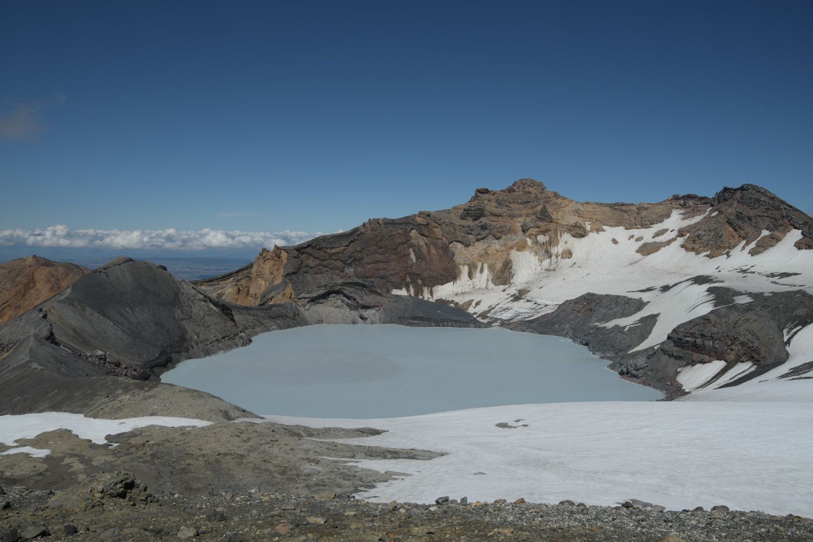
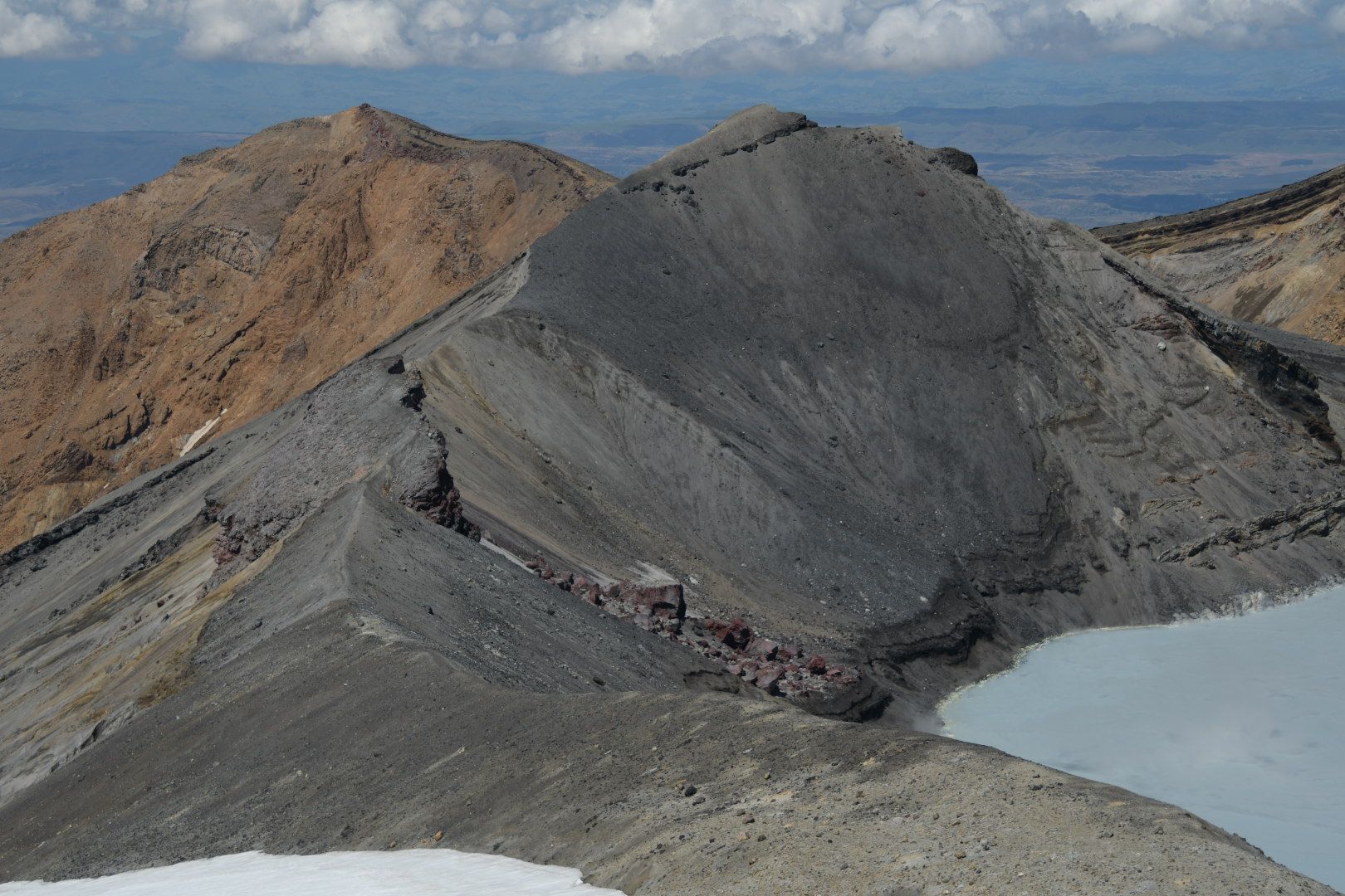
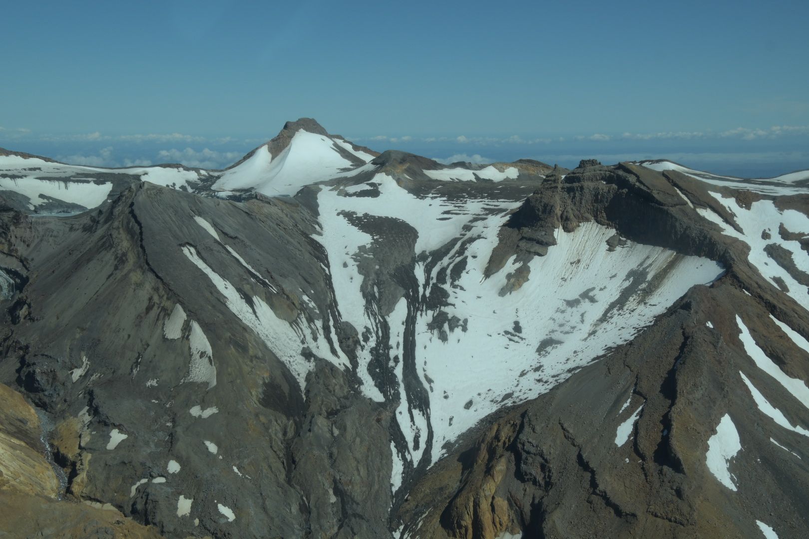
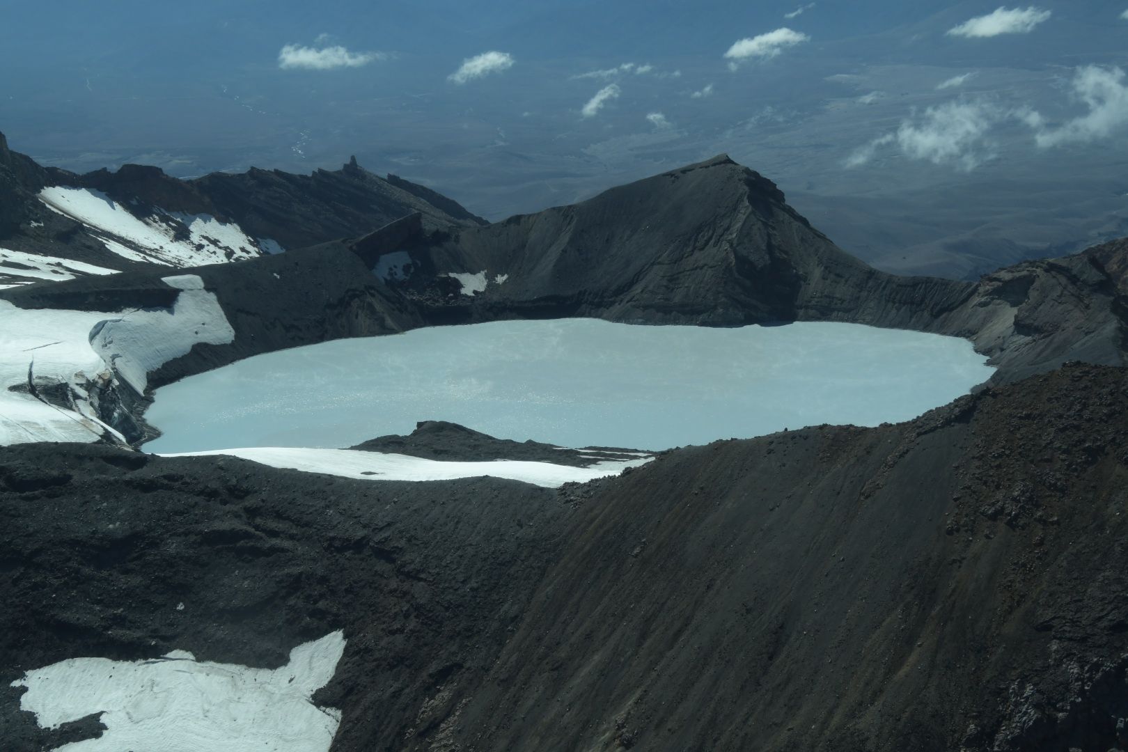
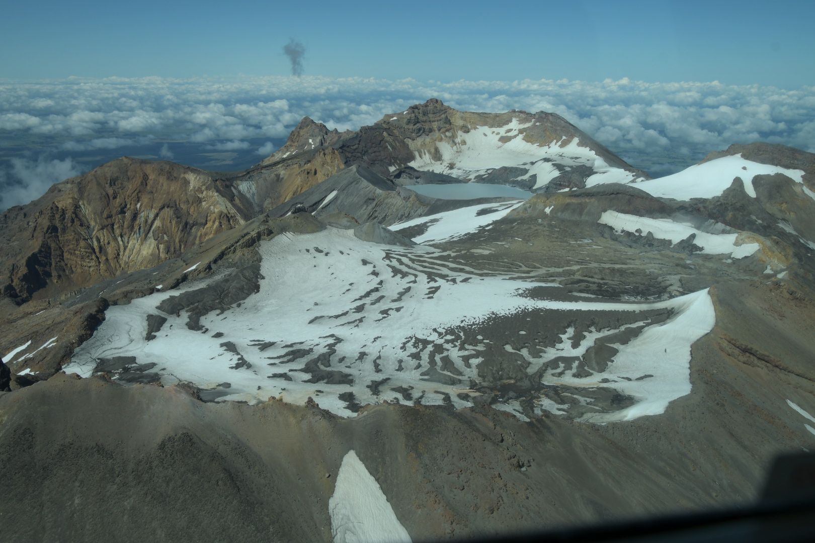
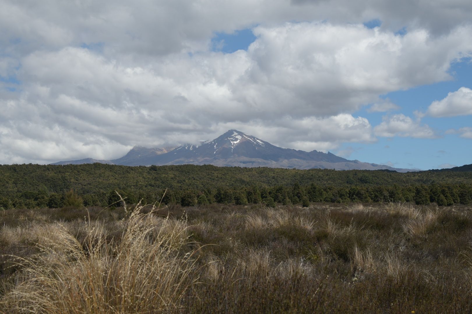
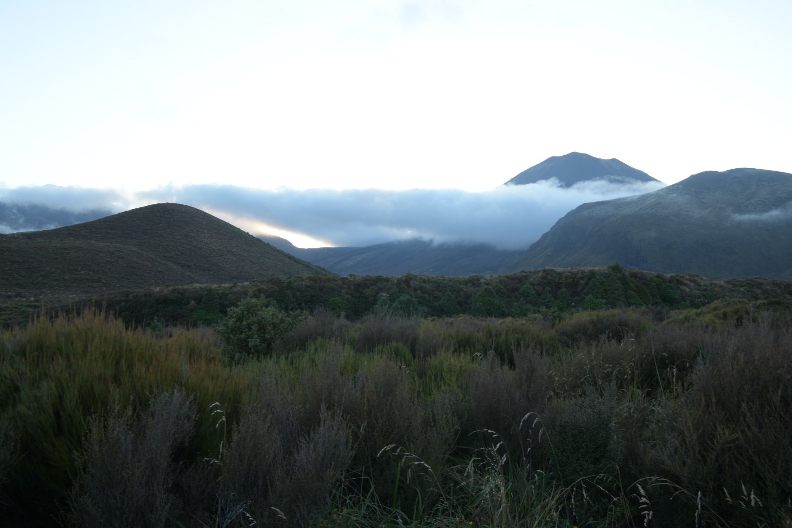
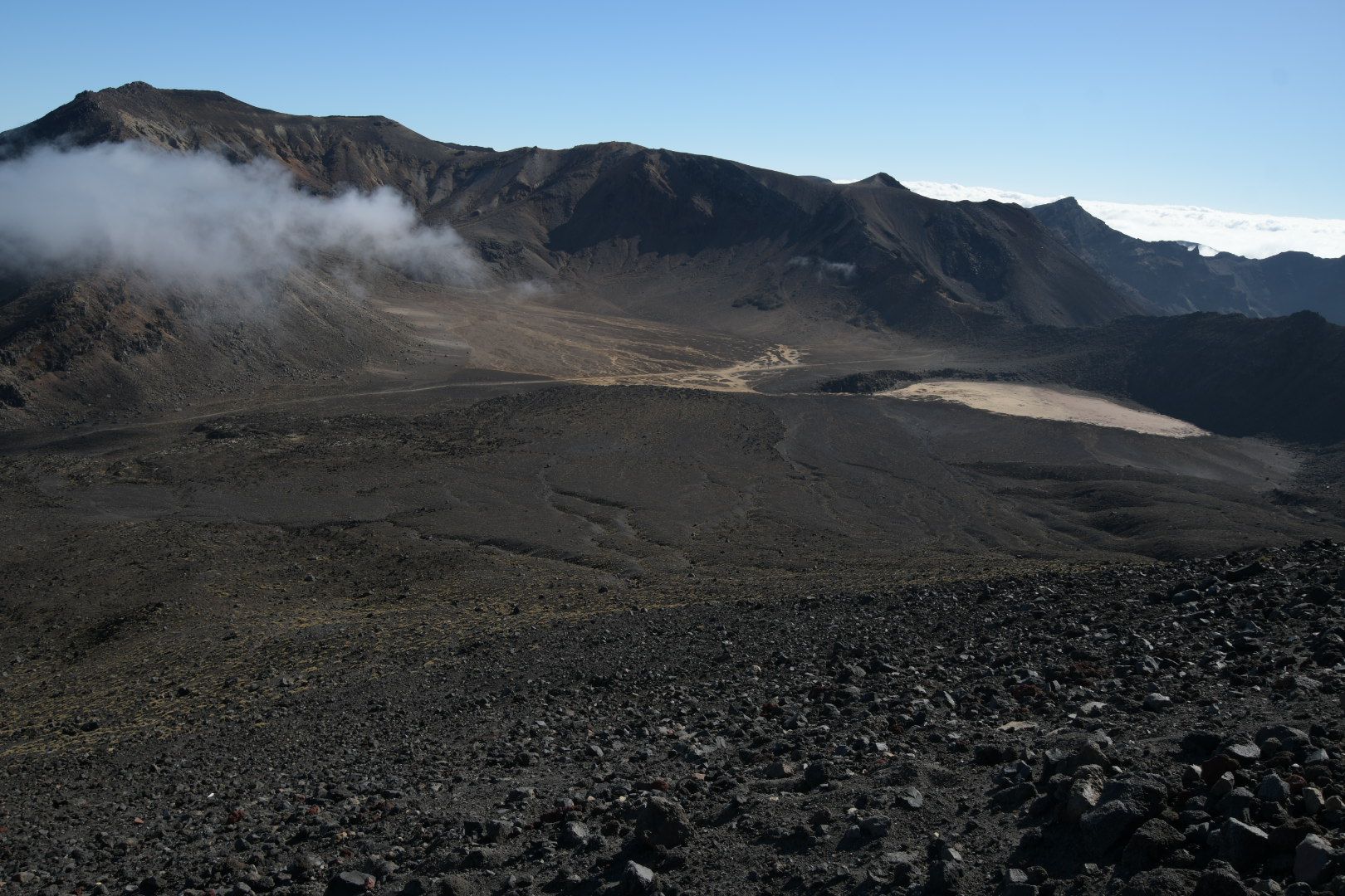
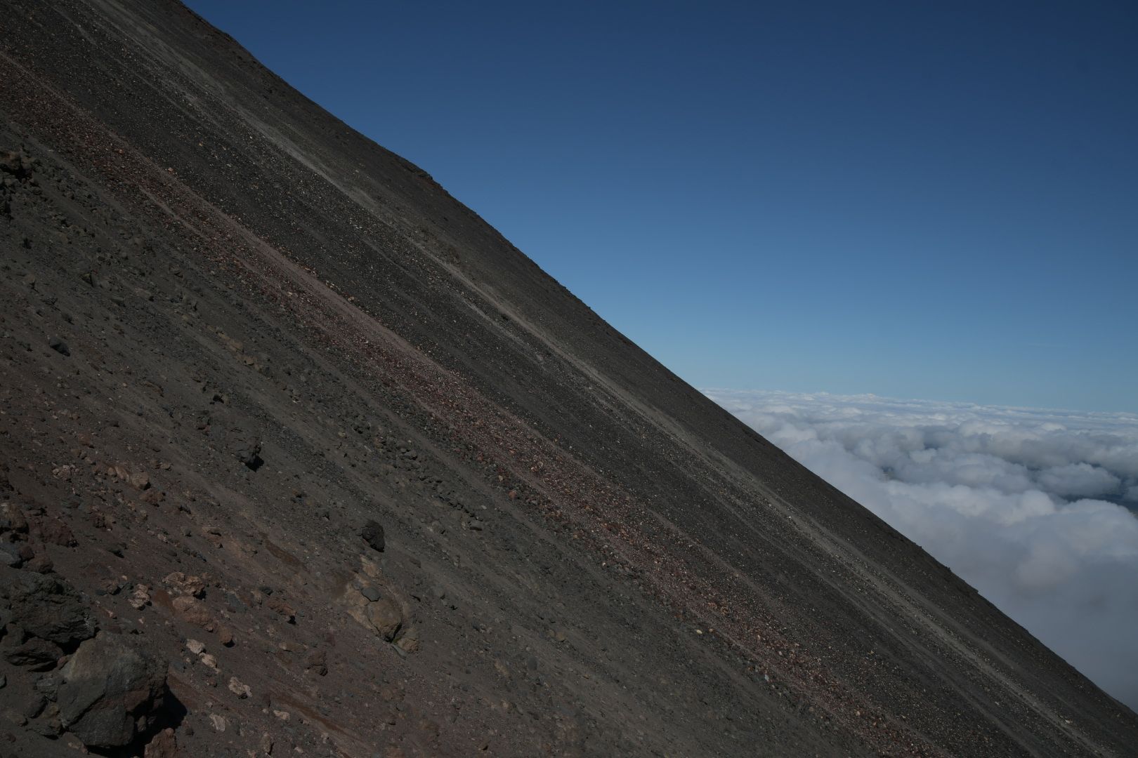
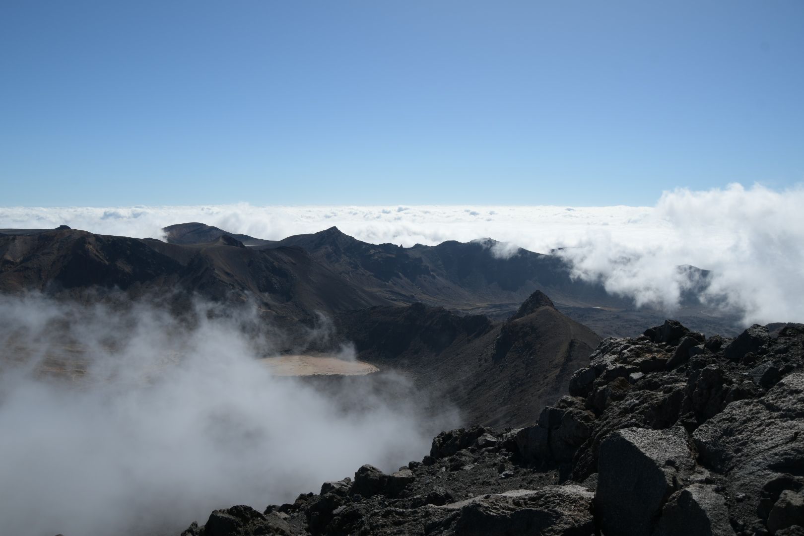
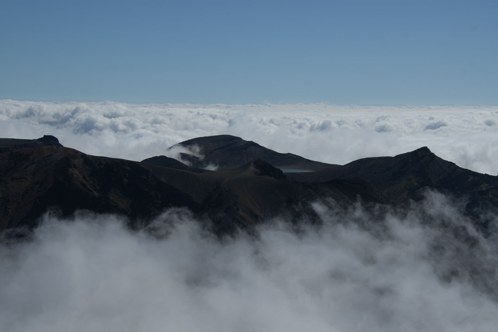
With some aftermath of the previous day, we set off the next morning to Ruapehu. We took the first gondola (unfortunately only at 10 am) up to the starting point. There is no marked trail to the crater lake, but we had a description from the internet that initially led us (for the first hour) on a fairly well-maintained trail that was part of another hike. What followed was a 2-hour tough scrambling - felt vertically up, over scree or loose ground that often unintentionally propelled you downward rather than upward. When we reached what we thought was the top, we found that there was no crater lake there. However, we saw people sitting on a slope three peaks away. The path there was also challenging, but easier to walk on, so after another hour we actually reached the crater lake. Wow! What a sight! We spent some time there and found it hard to leave, but the way back promised to be long, as we had to expect to miss the last gondola (at 4 pm) down and thus extend the way by about 1.5 hours. Although there were also some very difficult sections downhill, we apparently chose a more favorable route than uphill, and actually arrived at the gondola totally exhausted but in time at 3:40 pm.
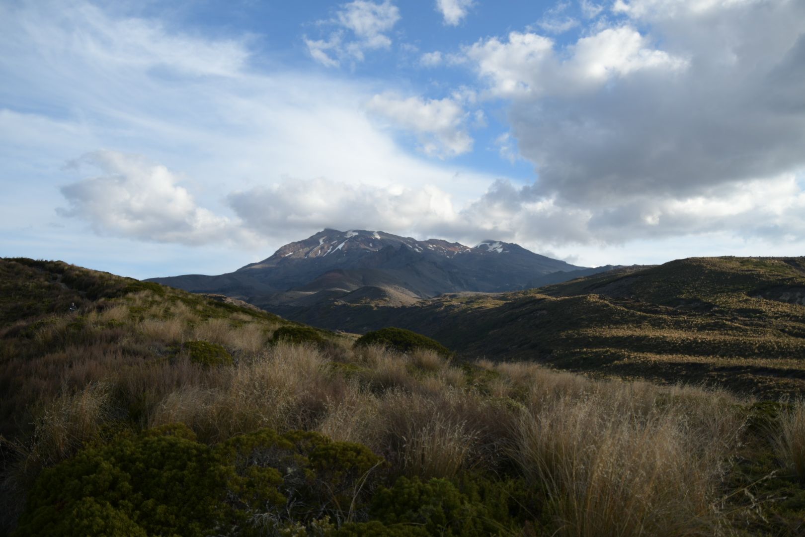
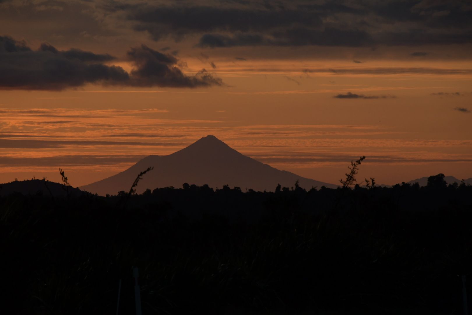
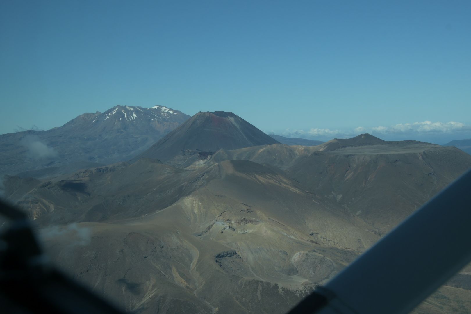
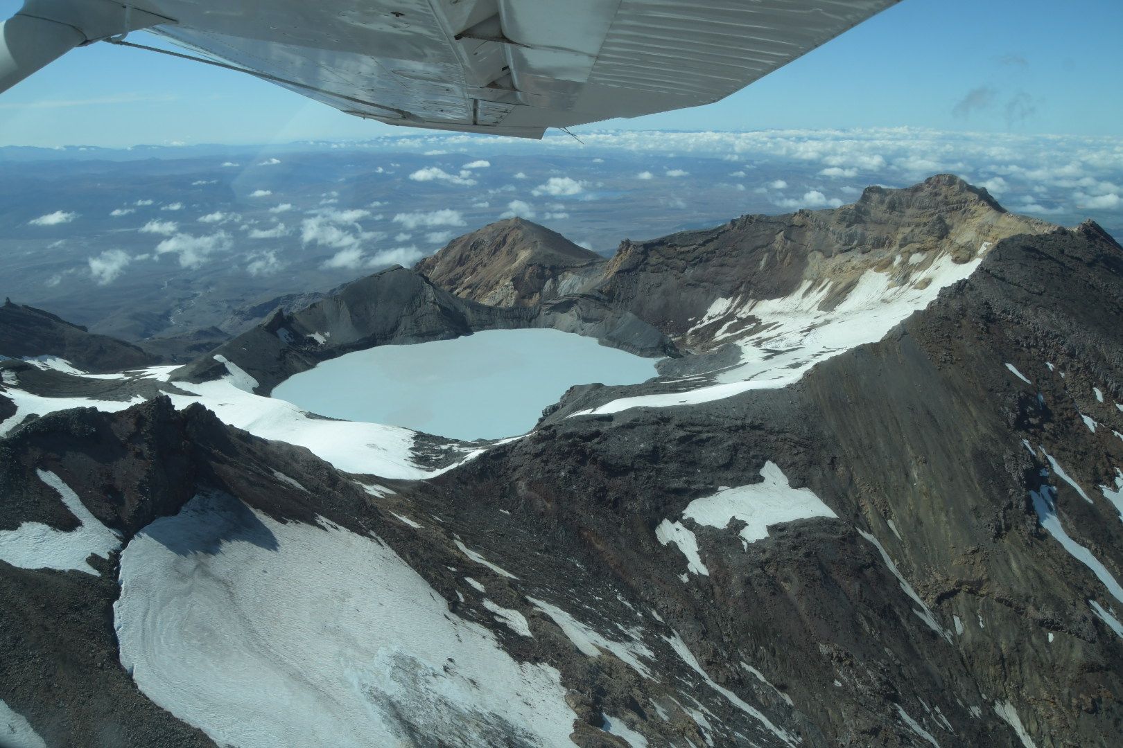
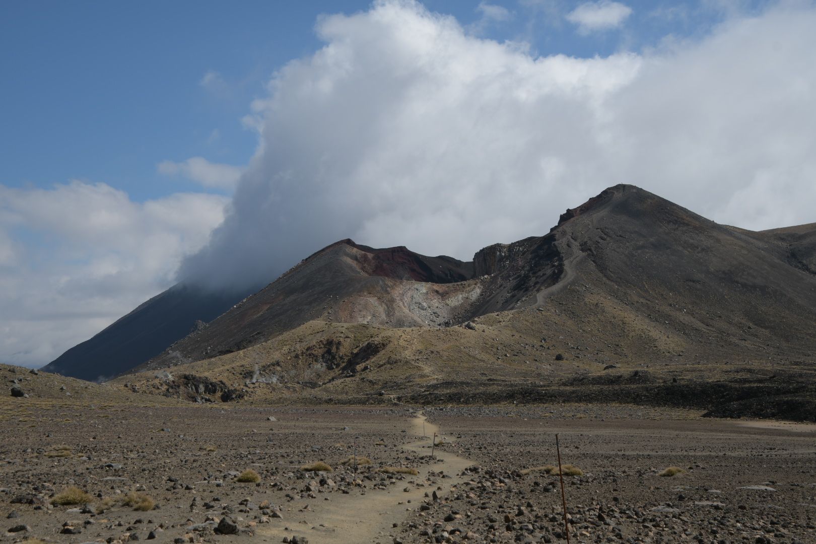
After these exertions, we spent one day driving around in the car. First to Taupo (located to the north), where we took a scenic flight over Tongariro NP from Lake Taupo with a seaplane. Then on the other side of the volcanic massif back southwards via the so-called 'Desert Road', then westwards and a little way back north to the accommodation.
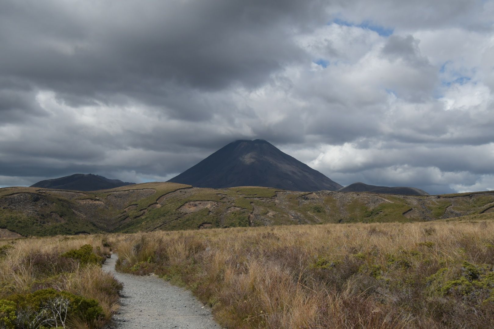
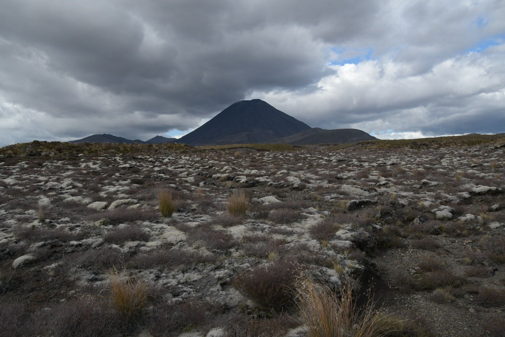
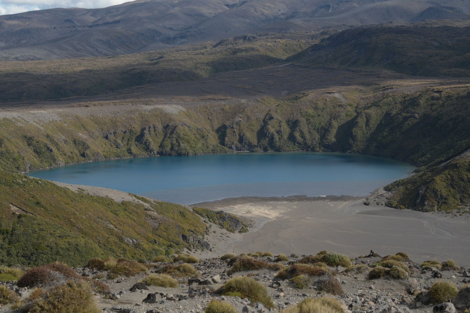
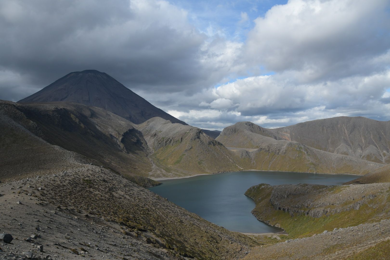
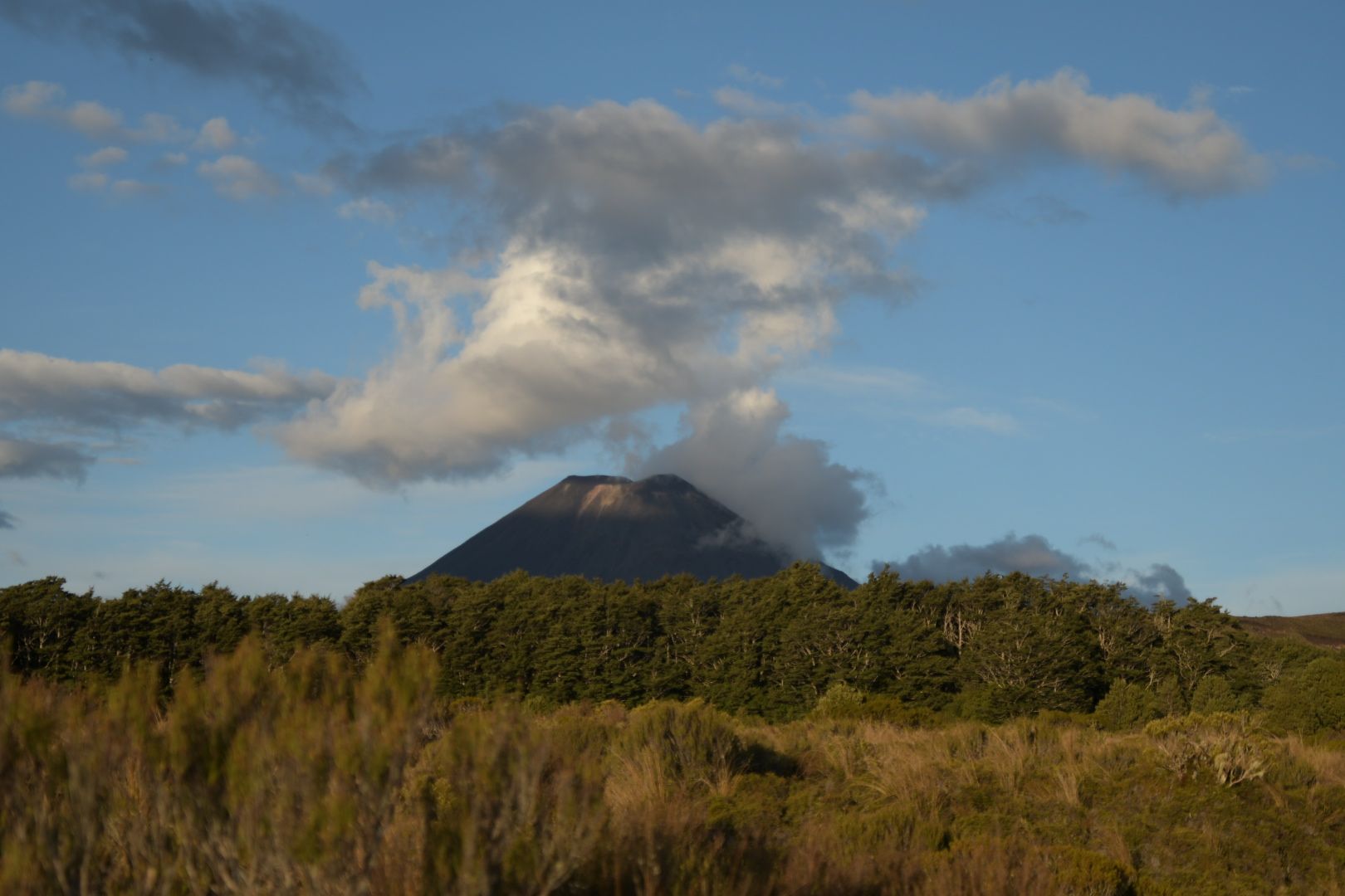
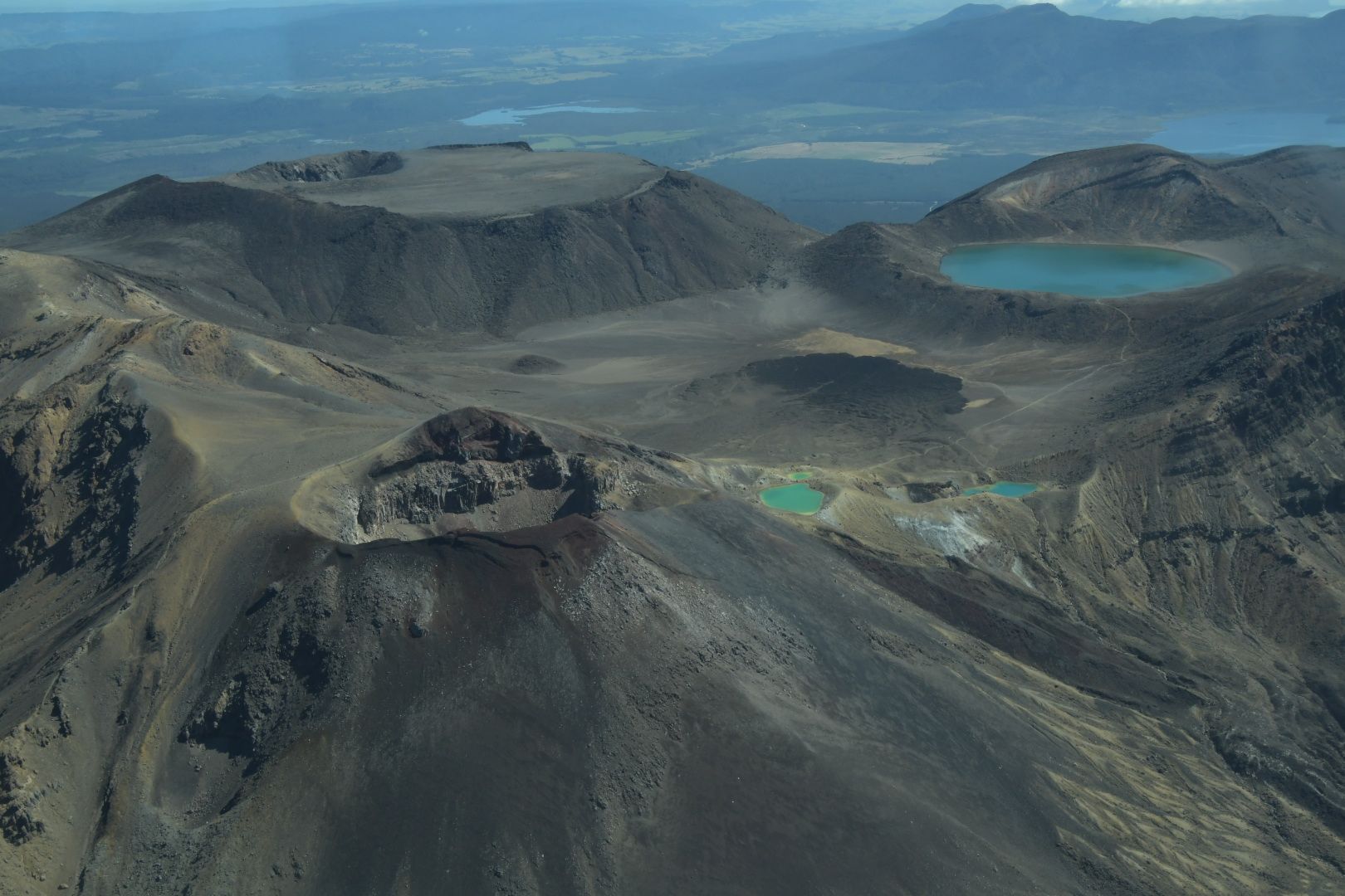
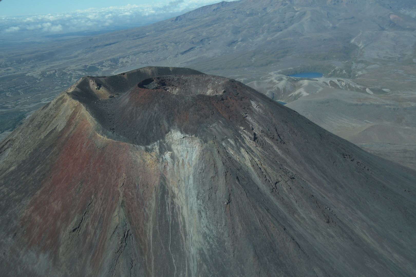
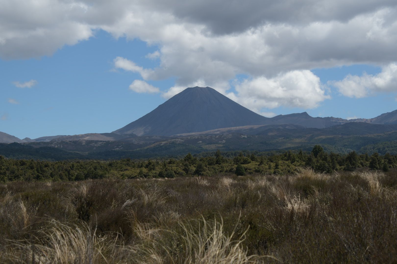
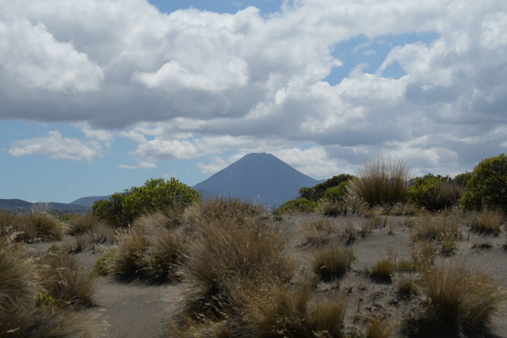
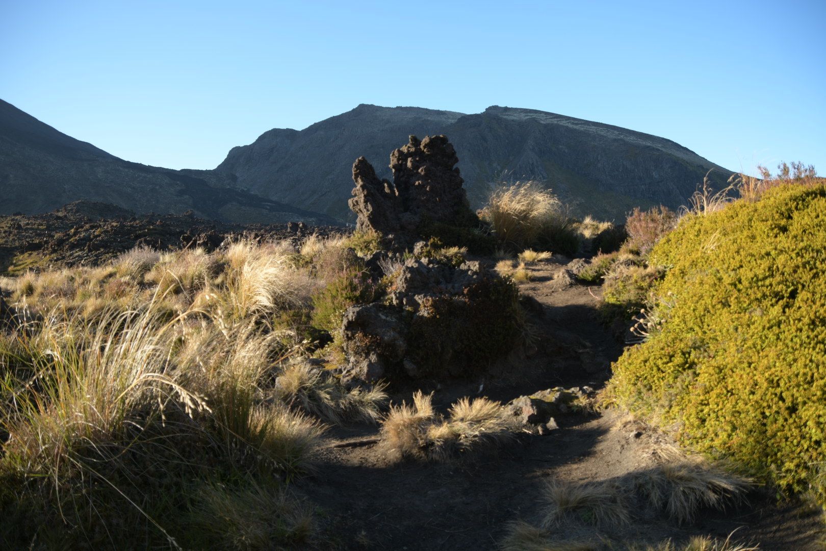
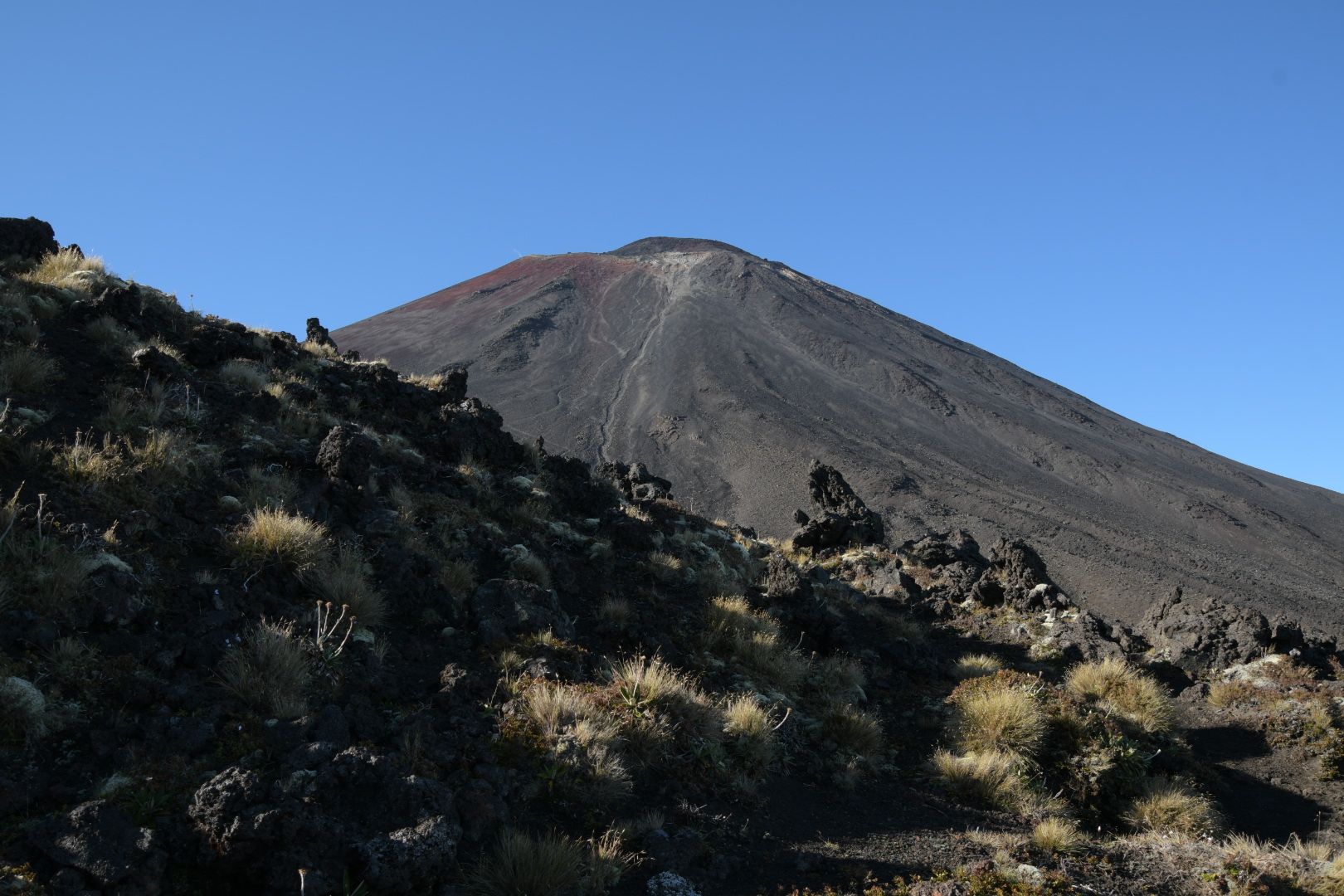
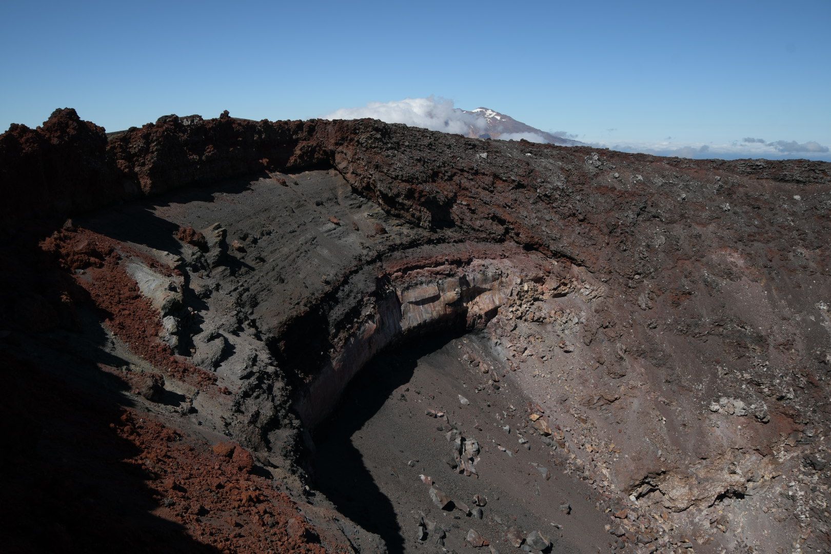
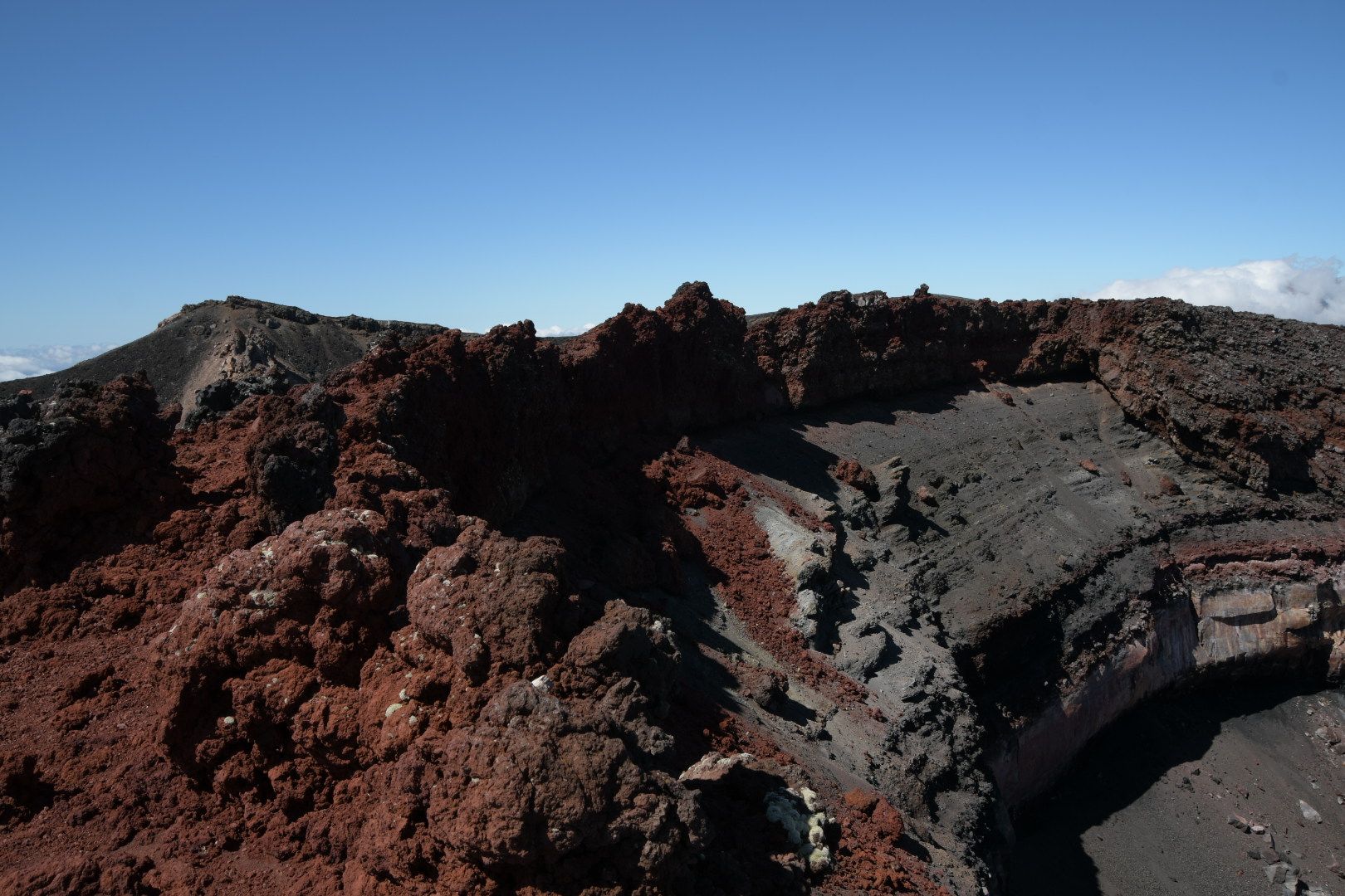
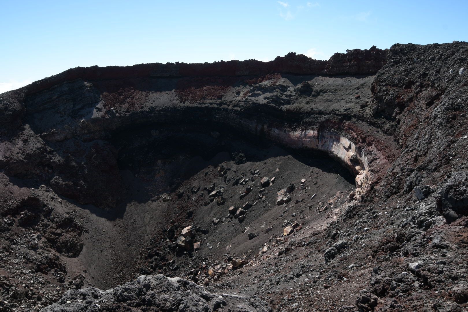
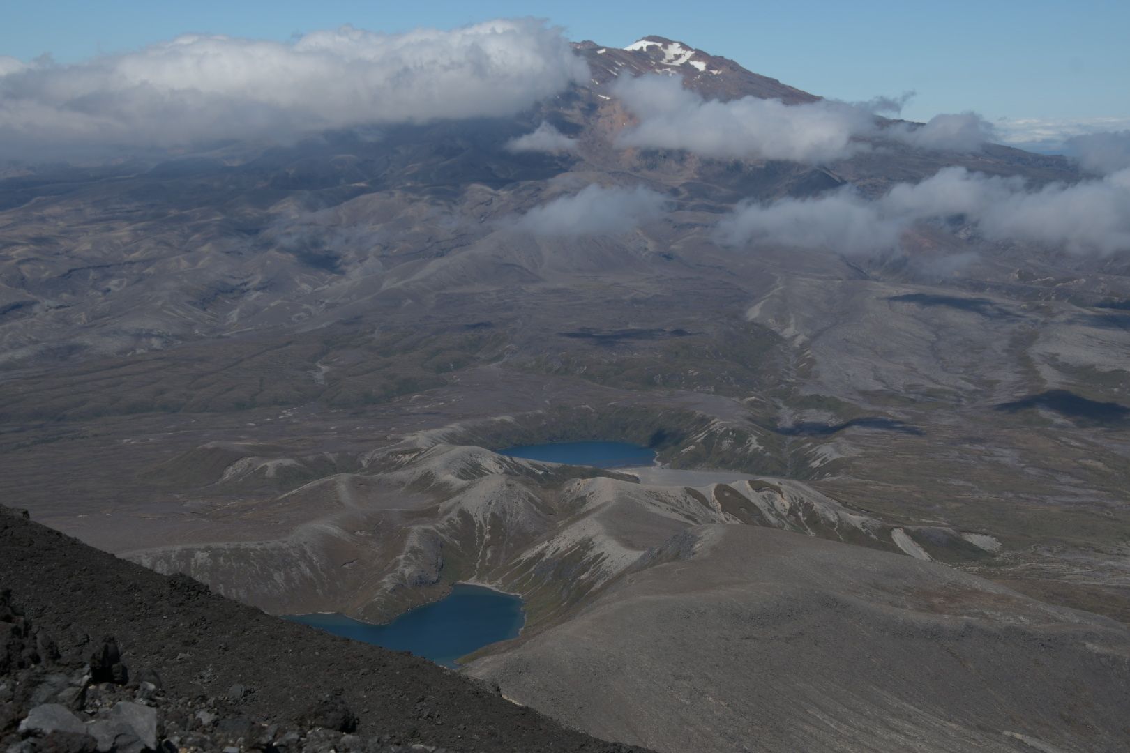
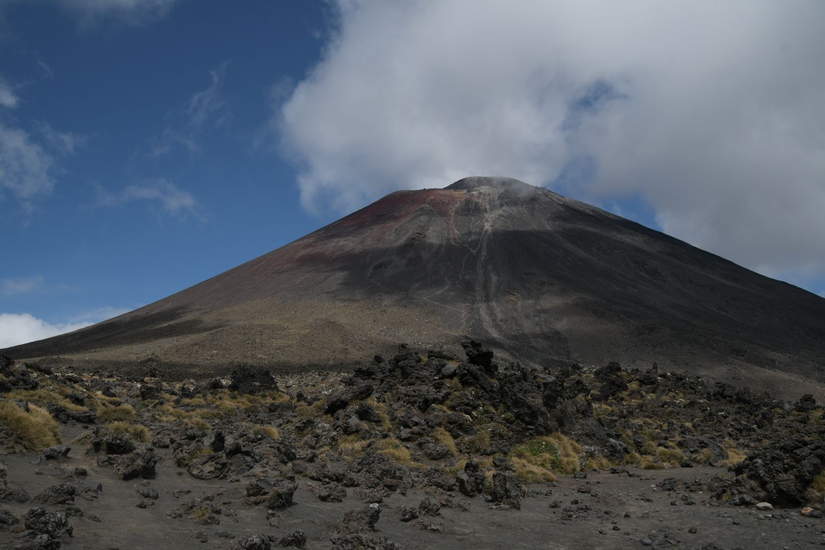
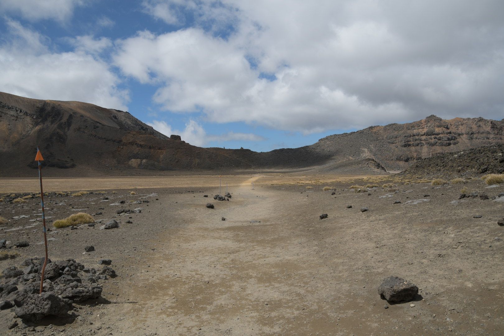
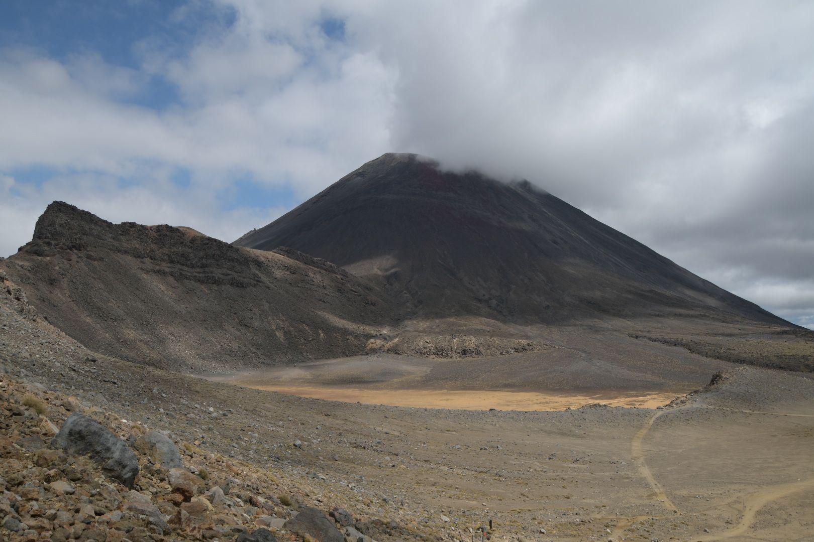
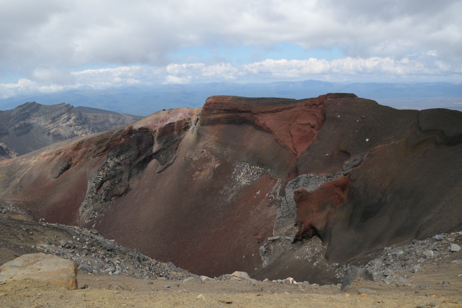
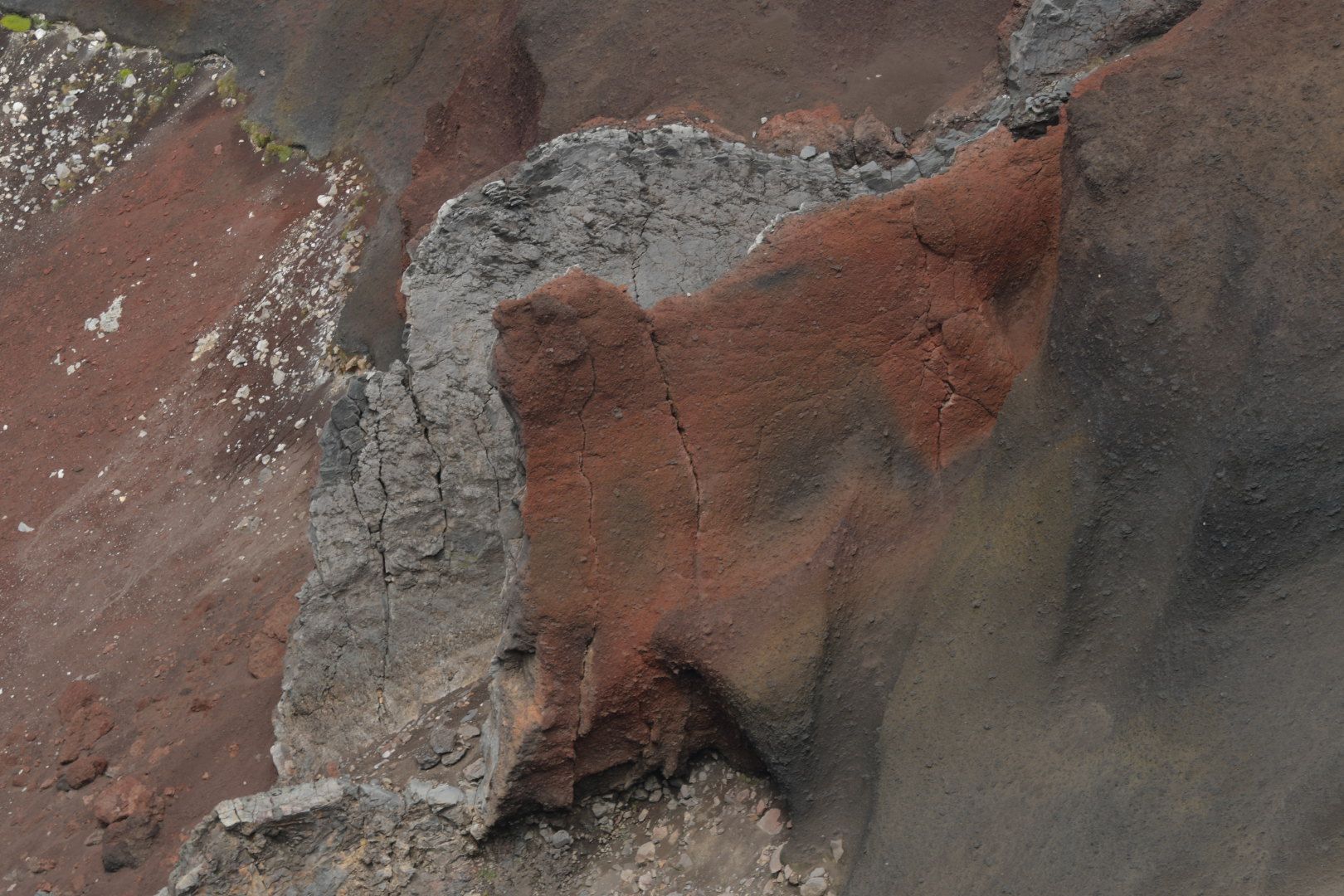
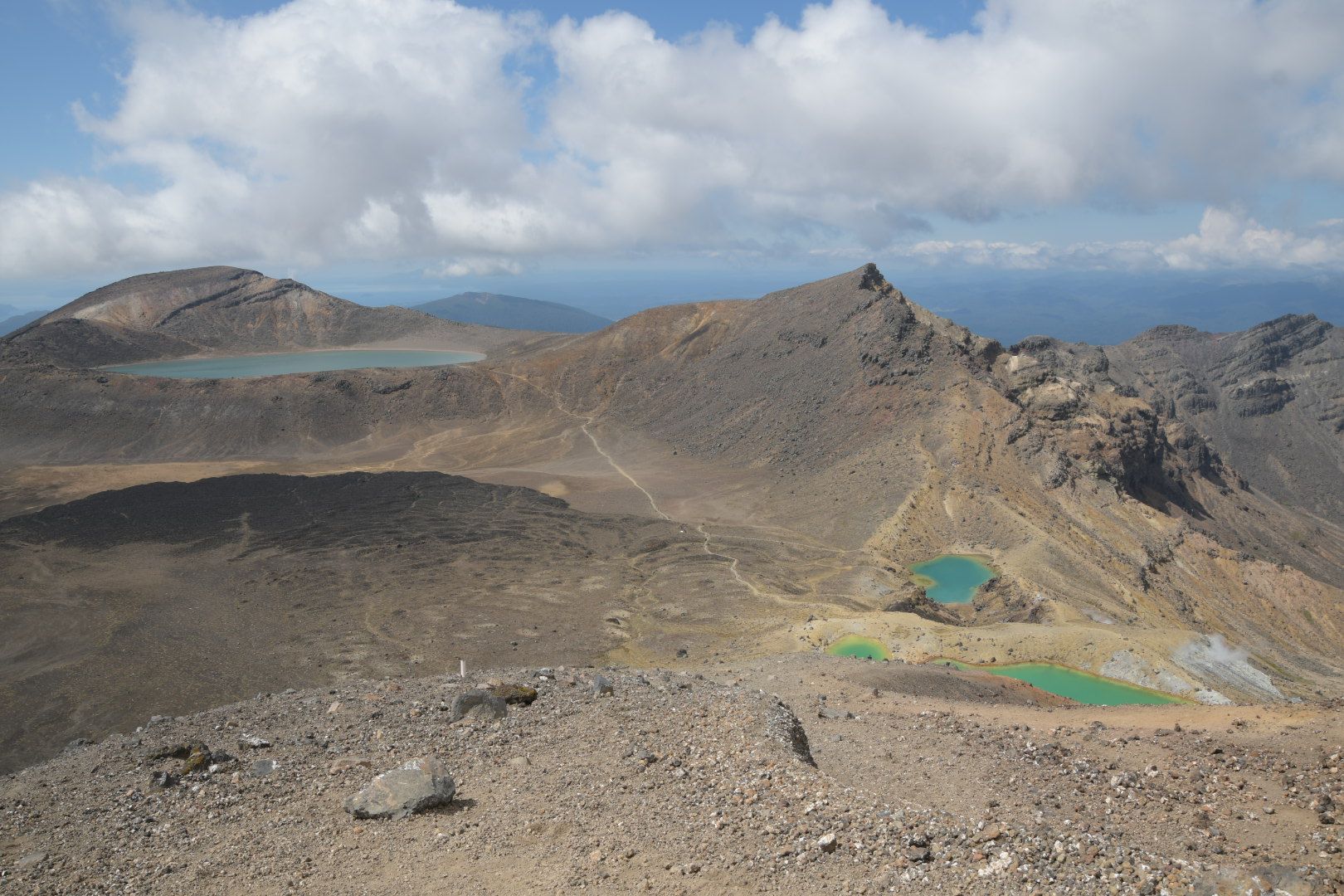
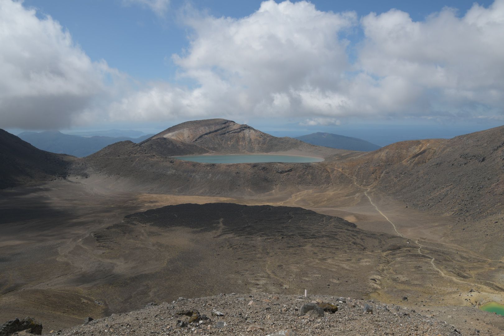
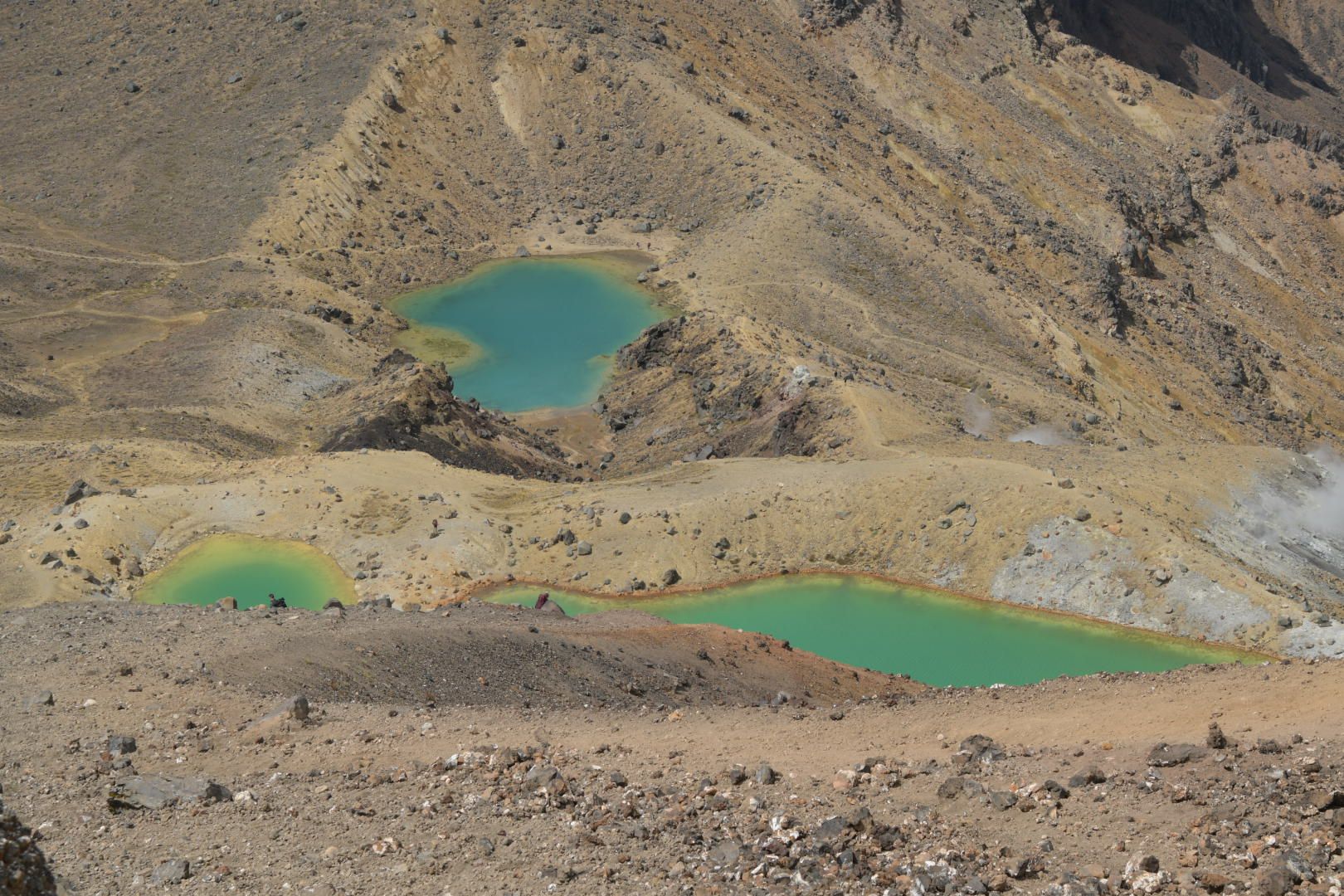
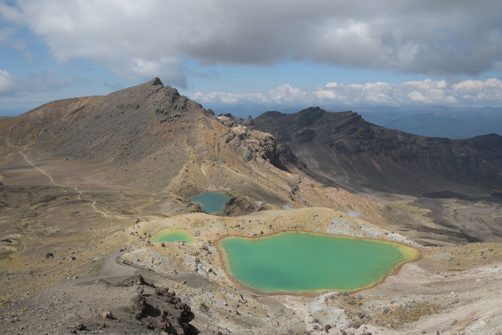
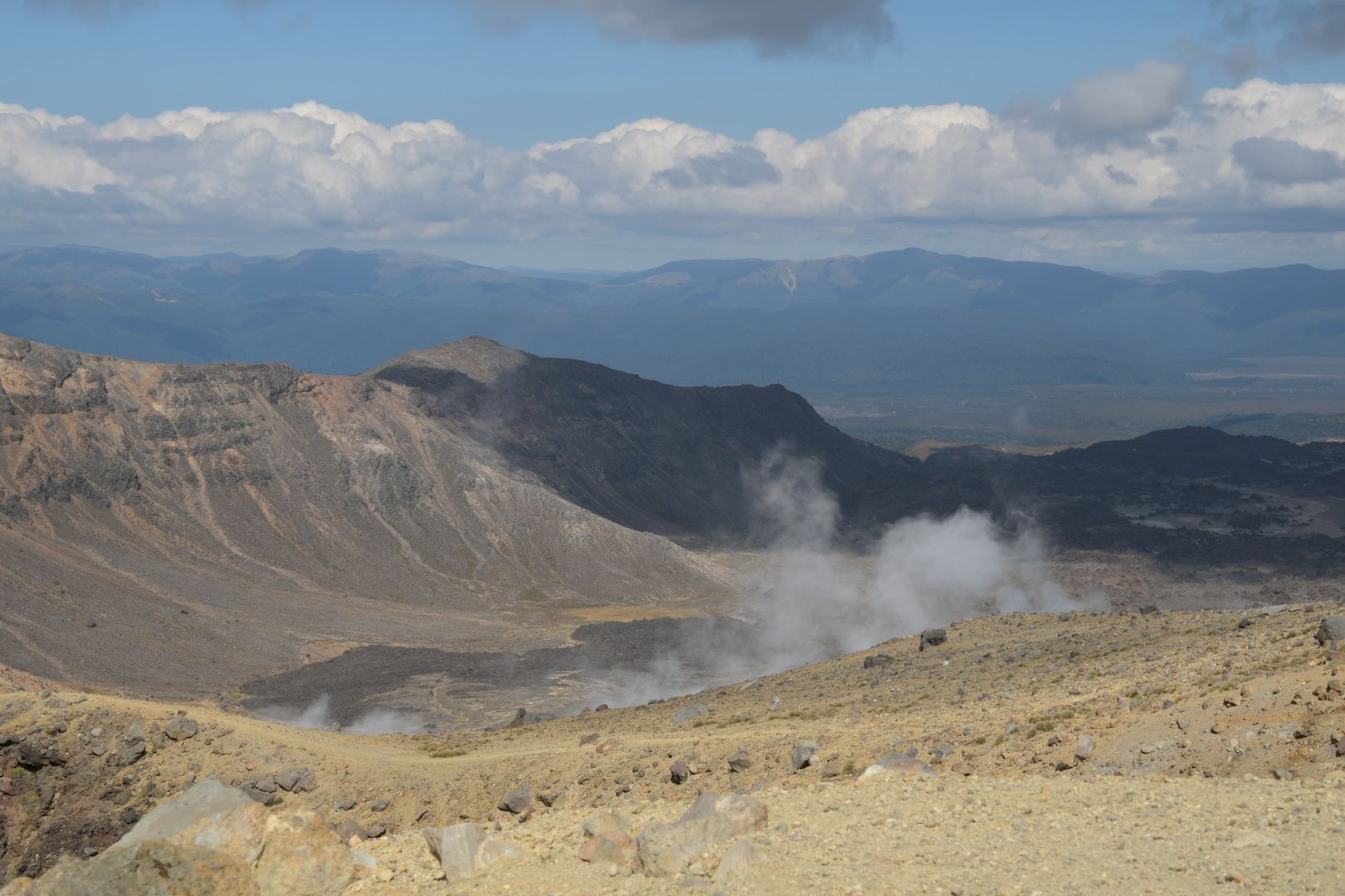
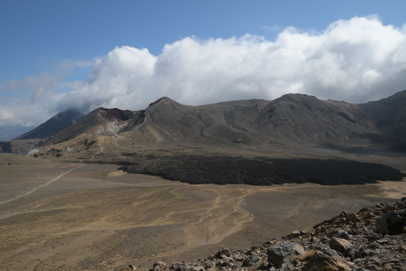
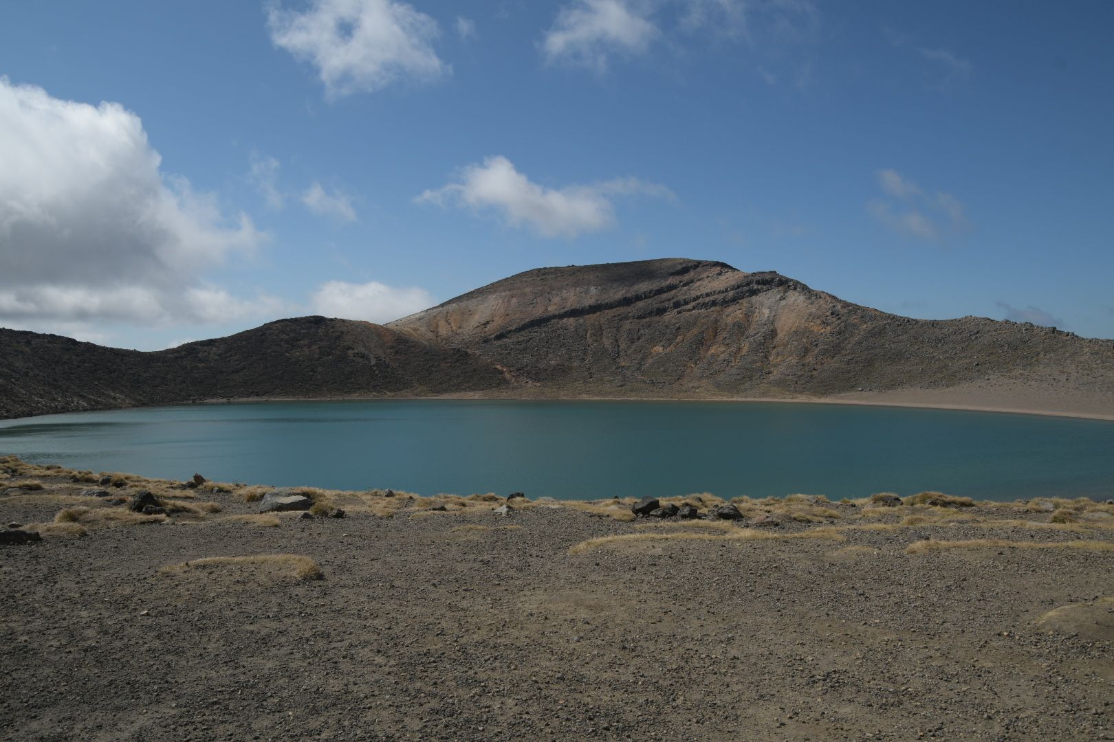
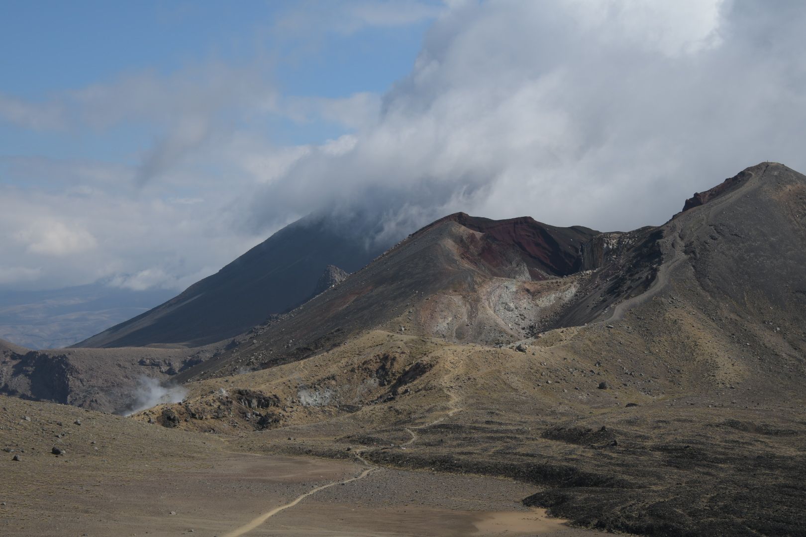
And then the time had come: THE highlight of the vacation was on the agenda: The Tongariro Crossing with a side trip to the famous Mt. Doom, which actually bears the beautiful name Mount Ngauruhoe (pronounced: Nah-re-hau-i). So we drove to the parking lot at the end of the hike at 6 am, took the pre-booked shuttle from there to the starting point, and started the (19.4 + x, for us: x=4) km at 7:15 am. The route deviated slightly from previous years in the first few kilometers, but otherwise everything was the same (except for additional toilets): Accordingly, we reached the Mangatepopo Saddle in less than 2 hours, from where we looked for the (no longer signposted) path to the summit of Ngauruhoe. It was quite strenuous, but mostly easier to walk on than two days ago on Ruapehu. The final section to the summit was still similar to Ruapehu, but fortunately not as long. From the saddle, it took us about 2:15 hours to climb up. When we reached the top, we were standing directly on the rim of the crater. We circled the crater once and admired the views in all directions. Simply absolutely gigantic! Since we were not pressed for time, we stayed up there for a long time, it was just so beautiful! We then descended (duration: 0:25 hours, you can 'simply' slide down the volcano ash) and then continued on the path (no problem, only 15 km to go...), which offered great views especially at the Red Crater, the Emerald Lakes, and the Blue Lake, and was still quite strenuous. The 9 km of descent after the Blue Lake felt like chewing gum, as usual (small hint for connoisseurs: the Ketetahi Hut no longer exists, it was apparently destroyed during the eruption of the new crater on the northern flank in 2012), and we were relieved when we finally reached our car again at around 6:50 pm (after a total of about 11:30 hours).
ಸುದ್ದಿಪತ್ರಕ್ಕೆ ಚಂದಾದಾರರಾಗಿ
ಉತ್ತರ

ಪ್ರಯಾಣ ವರದಿಗಳು ನ್ಯೂಜಿಲ್ಯಾಂಡ್