Neuseeland: 8000km solo durch das schönste Ende der Welt
vakantio.de/8000km_durch_neuseeland
Day 14 - Tongariro, Mordor, Ruapehu - it's smoking!
Გამოქვეყნდა: 08.08.2019


Გამოიწერეთ Newsletter
28.12.2014
After the fire siren went off at 4 o'clock in the morning and several fire engines were dispatched, I couldn't fall back asleep. I get out of bed shortly after 8. I have nothing left for breakfast except a banana. But there is coffee here for a mini Bodum pot, and it tastes a thousand times better than the instant coffee that is usually served.
It is thickly cloudy outside and I actually want to go to Mount Ruapehu, which is the tallest of the three volcanoes in Tongariro National Park. So I take my time, write some emails, and watch German news on the internet, which has super strength here.
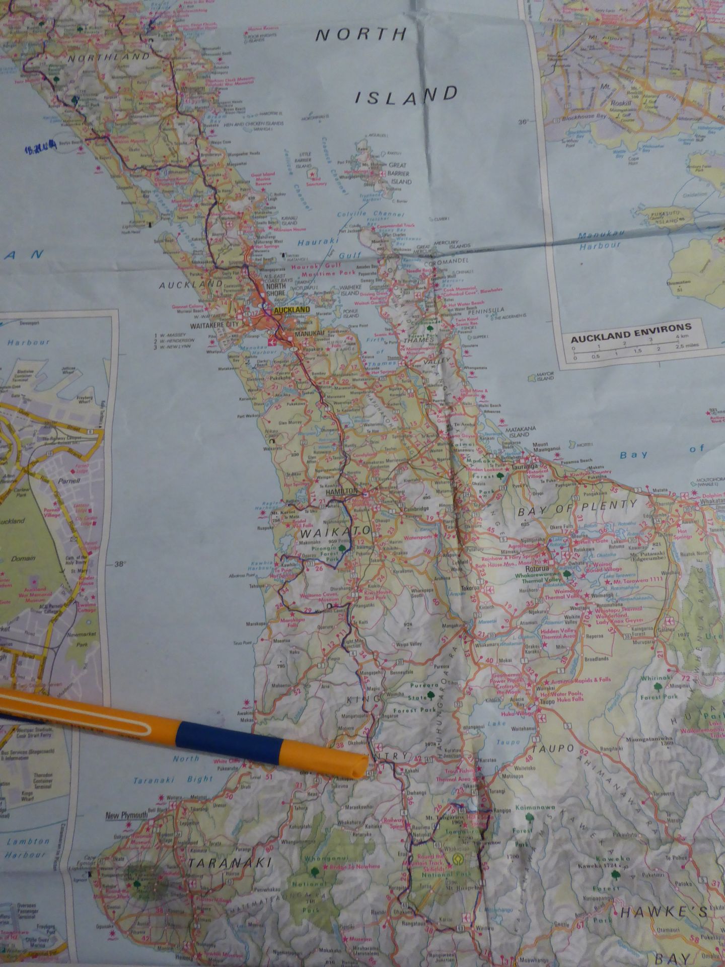
I have decided to stay another night in Taumarunui and finish my tour to the national park here again today, because from here I can start heading west tomorrow to get to Mount Taranaki. I am not sure yet how extensive my trip will be today, because it's a bit annoying if the weather stays like this.
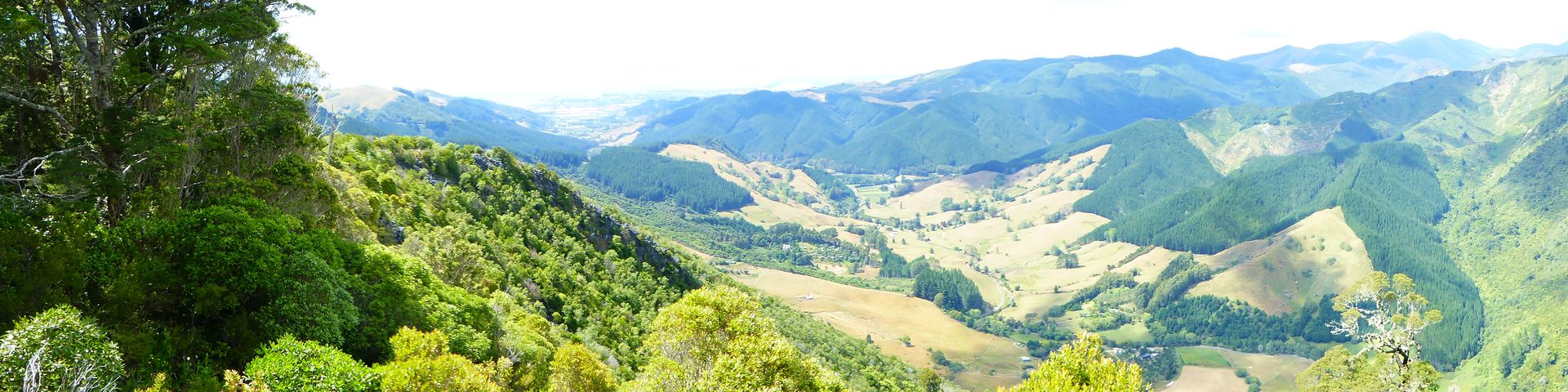
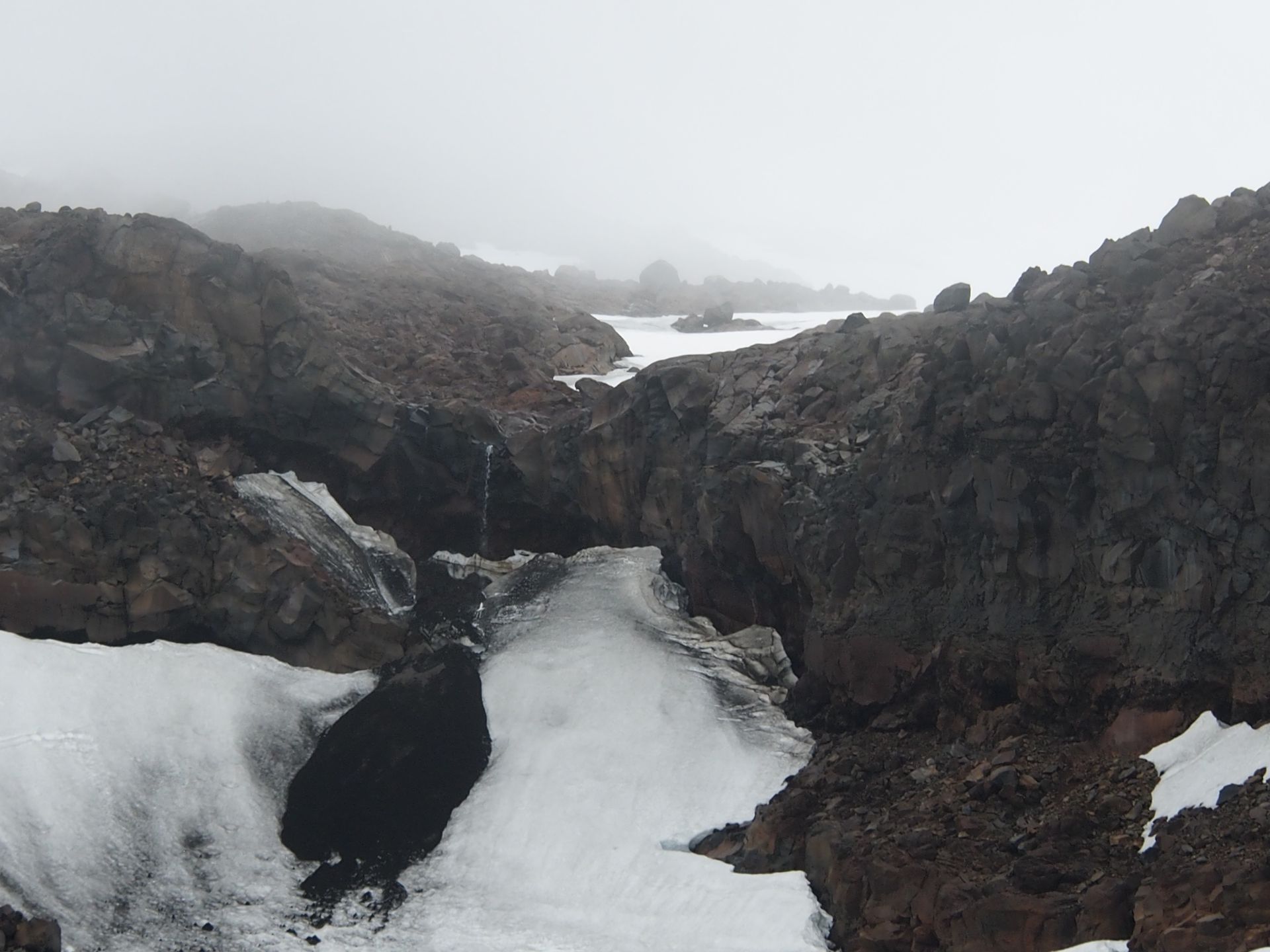
When I start driving, it starts raining soon and the clouds hang so low that you practically can't see anything of the surroundings. I follow Highway 4 about 40 km south to the ski resort National Park (what a stupid name!) and turn there onto Highway 47, which runs west of the volcanoes. After about 7 kilometers, you turn east onto a short highway that leads directly over the Central Plateau to Whakapapa, which is the main winter sports resort in this area (in a national park!). From here, you drive through suddenly completely barren landscape in a few curves, where only flat shrubs grow, like in the high mountains. Just now lush pastures, now already a lunar landscape. Impressive!
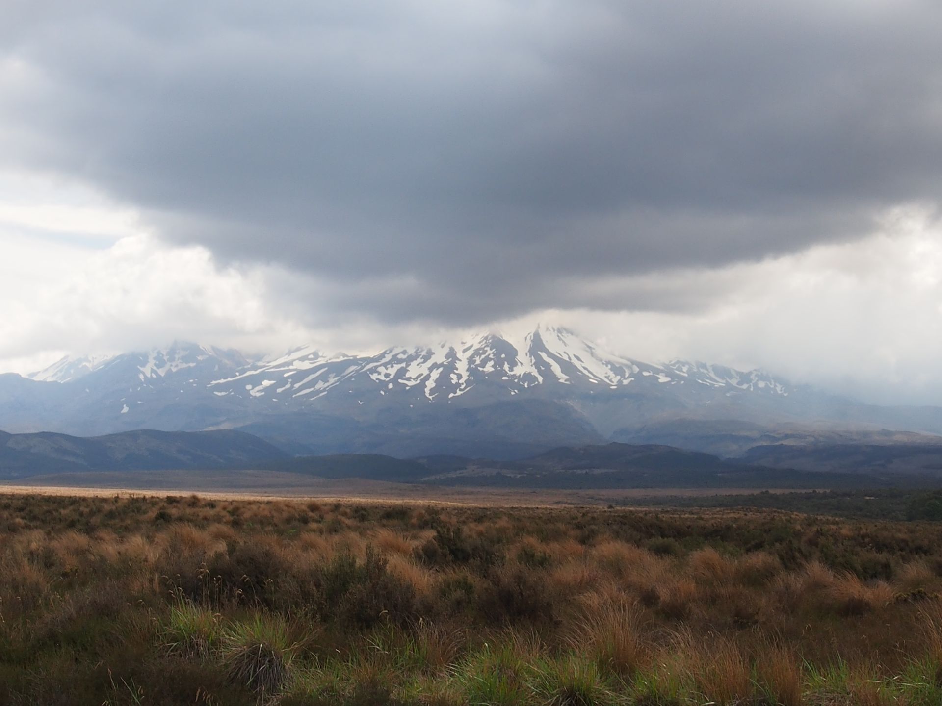
In front of me - unfortunately soon in the clouds - is the tallest of the three active volcanoes in the national park: Mount Ruapehu, which is also the tallest mountain on the North Island at 2,797 meters. The last eruption was in 2007. Lahar apparently are now channeled through dams to avoid causing similar damage as in 1953 when a lahar hit a railway line that the Wellington-Auckland express train was traveling on and carried it away for 8 km. Over 150 people died in the process.
To the north of Mount Ruapehu lies the smaller Mount Ngauruhoe, which remains relatively inconspicuous, except for its almost perfect cone shape. I can't see anything of it yet because the clouds prevent long-distance vision. Even further north is the namesake of this first and oldest national park in New Zealand: Mount Tongariro. It is just under 2,000 meters high, but the most active of the three volcanoes.
The entire area surrounding these volcanoes is sacred to the Maori. A far-sighted, but presumably also somewhat resigned Maori chief gave the area to the British Crown, with the condition of turning it into a national park. He saw no other way to secure the land from the hunger for land of the Europeans (known as Paheka). The entire area was later expanded more and more and now covers almost 800 sq km and has been a UNESCO World Heritage site for both cultural and natural properties since 1991. There are only 23 such combinations of protection in UNESCO sites worldwide.
In 'The Lord of the Rings', the national park served as the dark land of Mordor, and Mount Ngauruhoe was the so-called Mount Doom.
The Chateau Tongariro Hotel is suddenly a somewhat inappropriate sight amidst this stony nature.
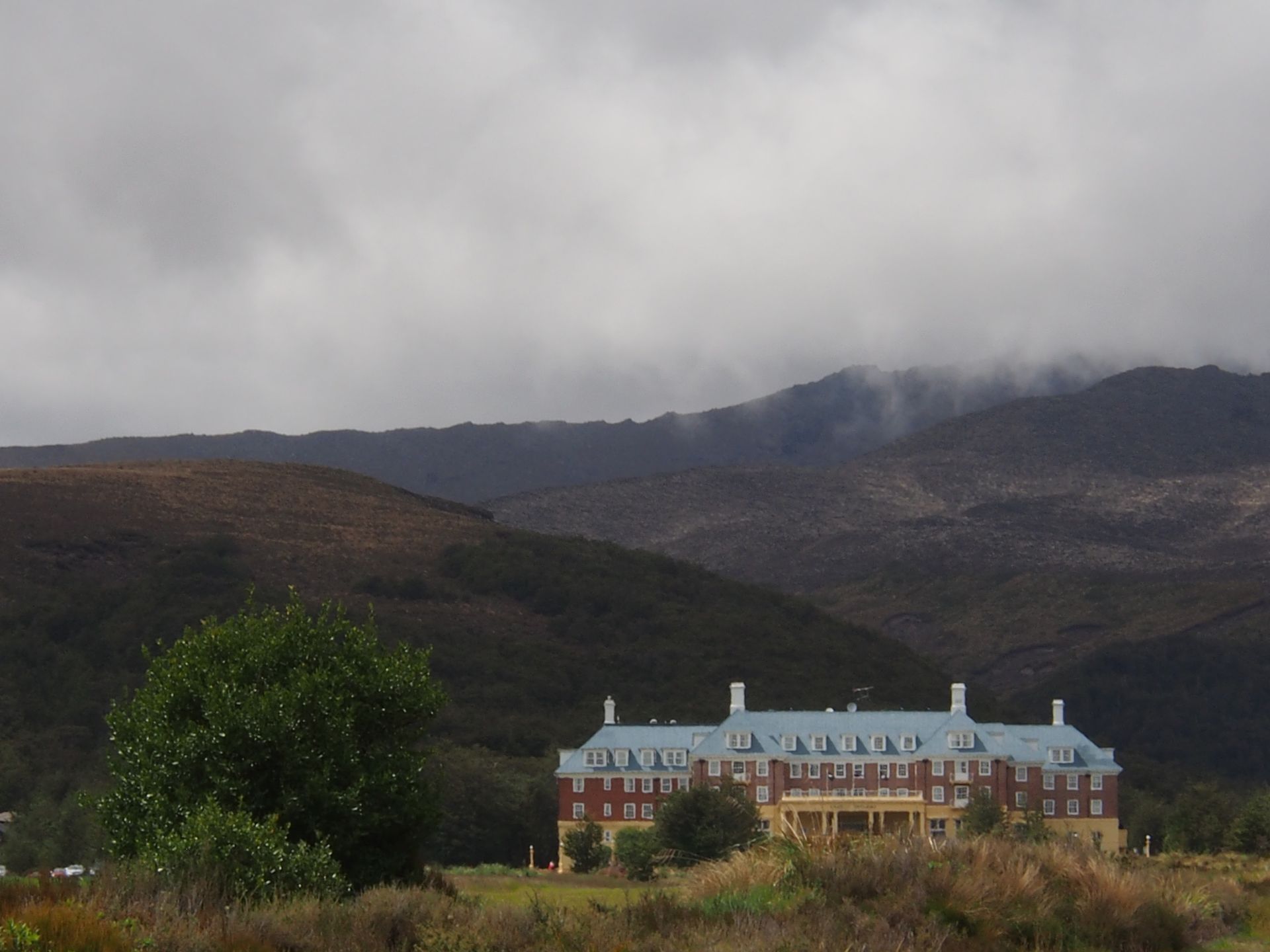
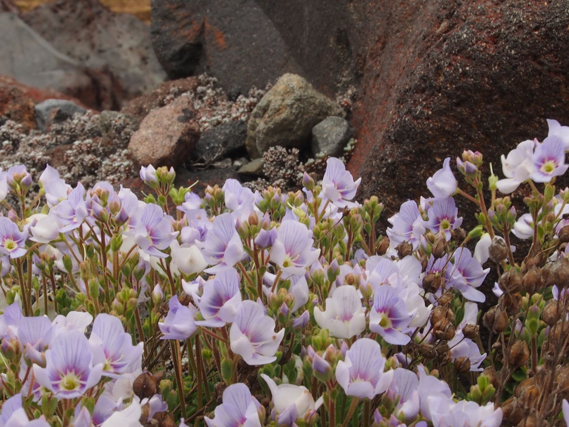
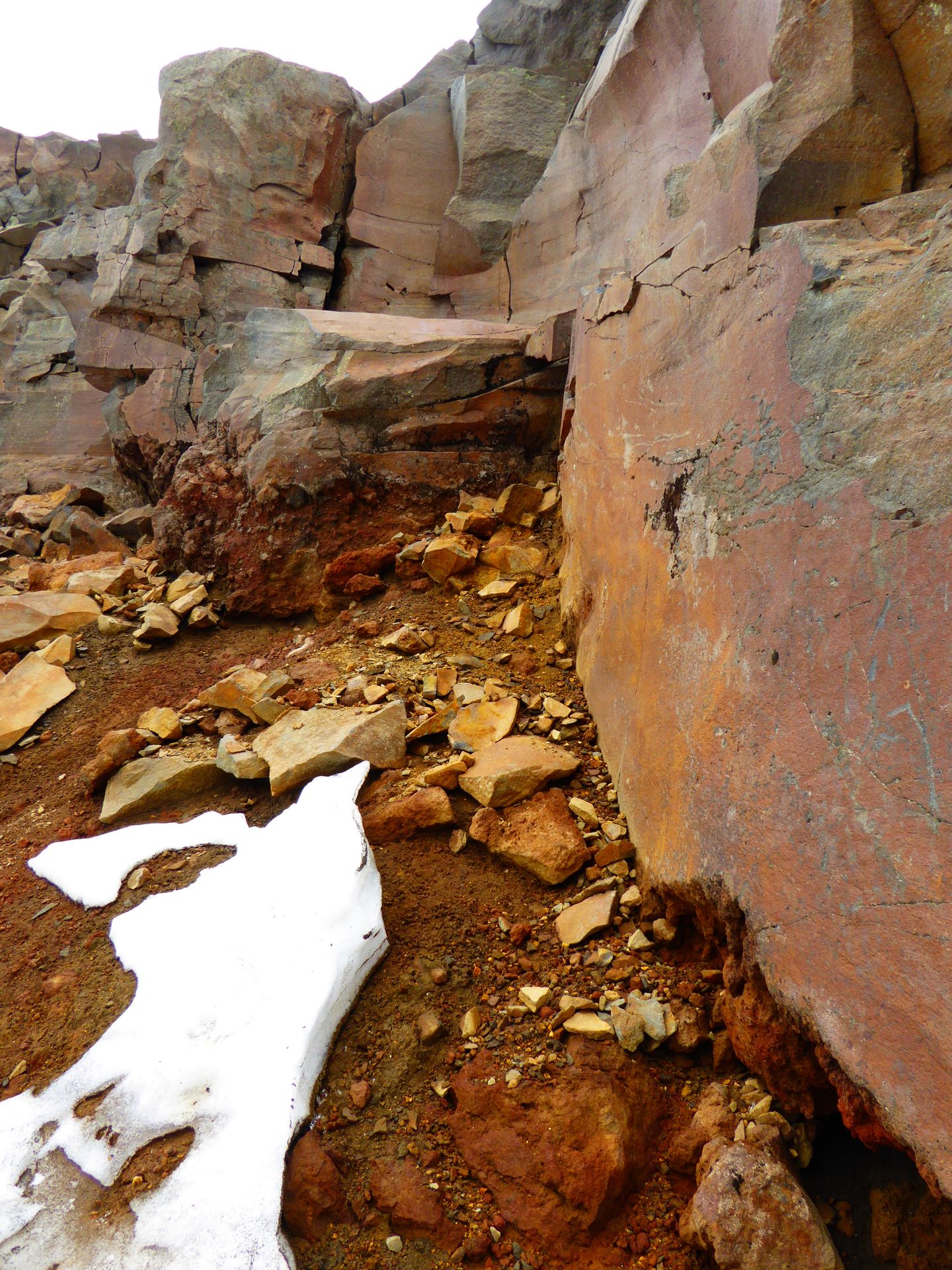
It does remind me of hotels that you also see at Lake Louise in Alberta or other places. This hotel, too, is from the 1920s and apparently maintains a certain level of luxury. The view from the rooms must be amazing. I drive past it and find myself somehow on the moon. I am surrounded only by huge black-red rocks. Apart from tiny flowers, there is no more life growing here.
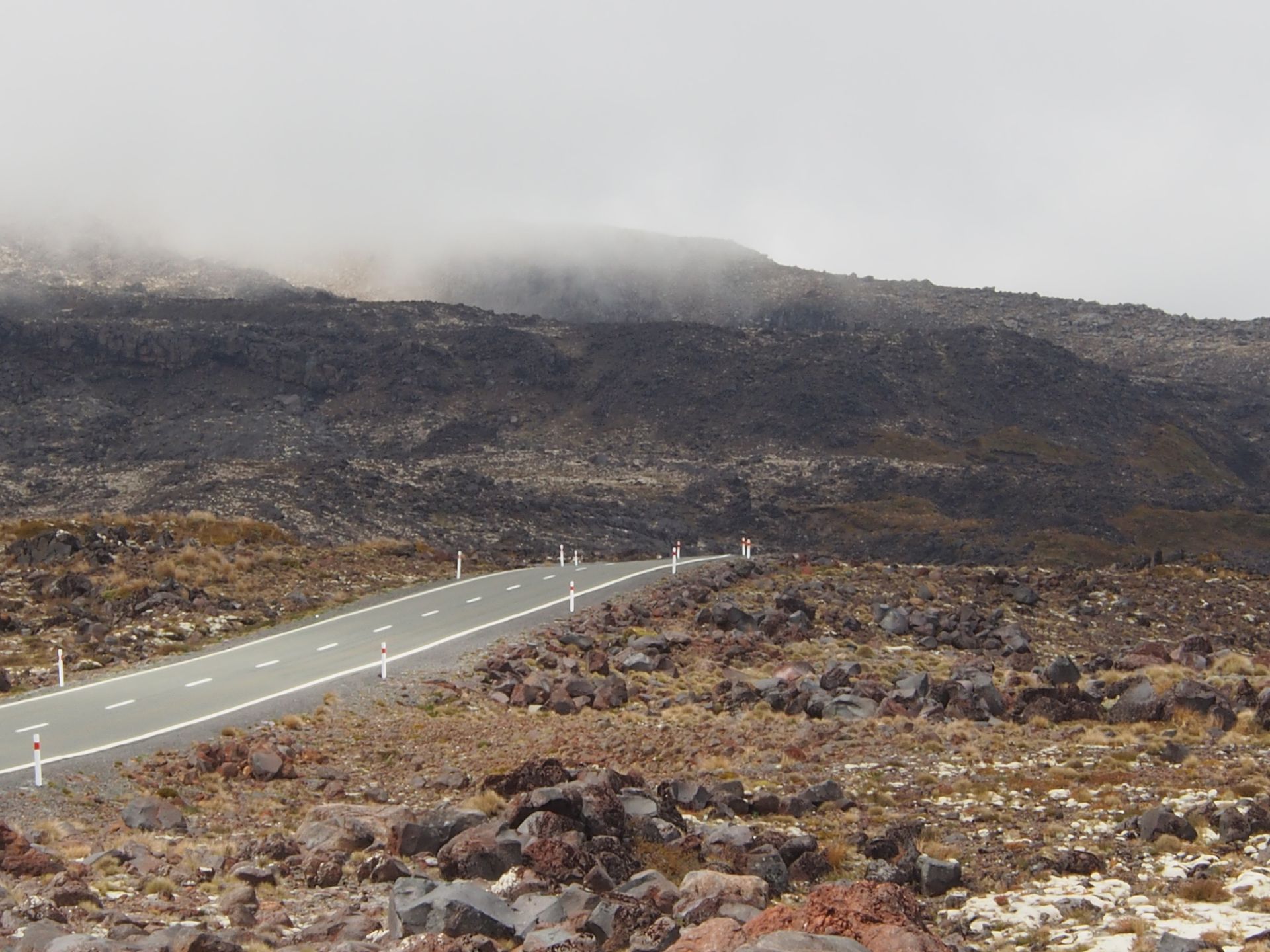
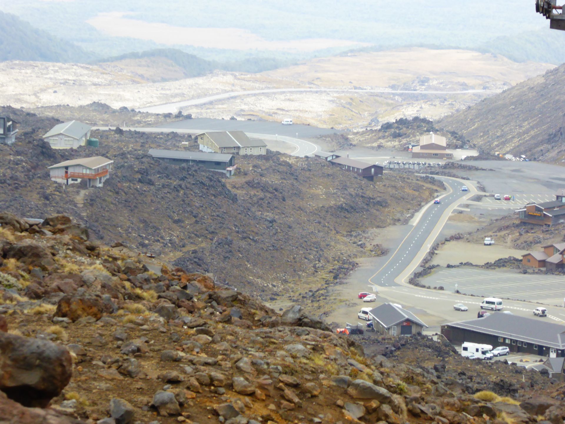
After 6 km, I have reached an altitude of 1,600 meters in Iwikau Village and have arrived in a completely barren rock landscape, where several holiday homes are located.
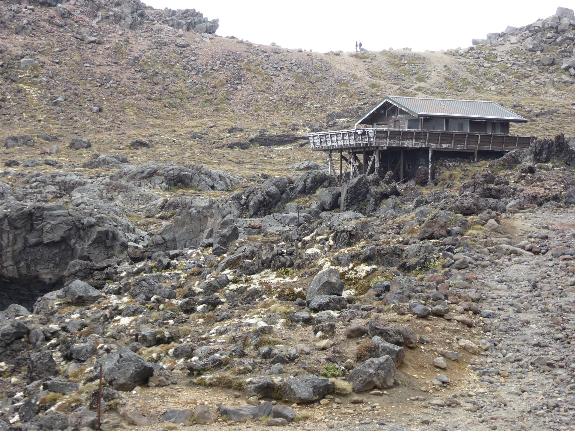
How much snow must there be in winter for these rocks not to be in the way? In any case, several scenes from the Lord of the Rings movies were shot here. It's imaginable with this scenery.
The chairlift is actually in operation and takes me to the mountaintop within 20 minutes (1 transfer) for $30. I took off my sandals, put on socks and hiking shoes in the parking lot, put on two t-shirts, a fleece jacket, and my foldable down jacket from Alaska. Scarf around my neck, and off I go. Because the lift goes up to 2,200 meters, and at this 1,600-meter altitude, it's only 13 degrees.
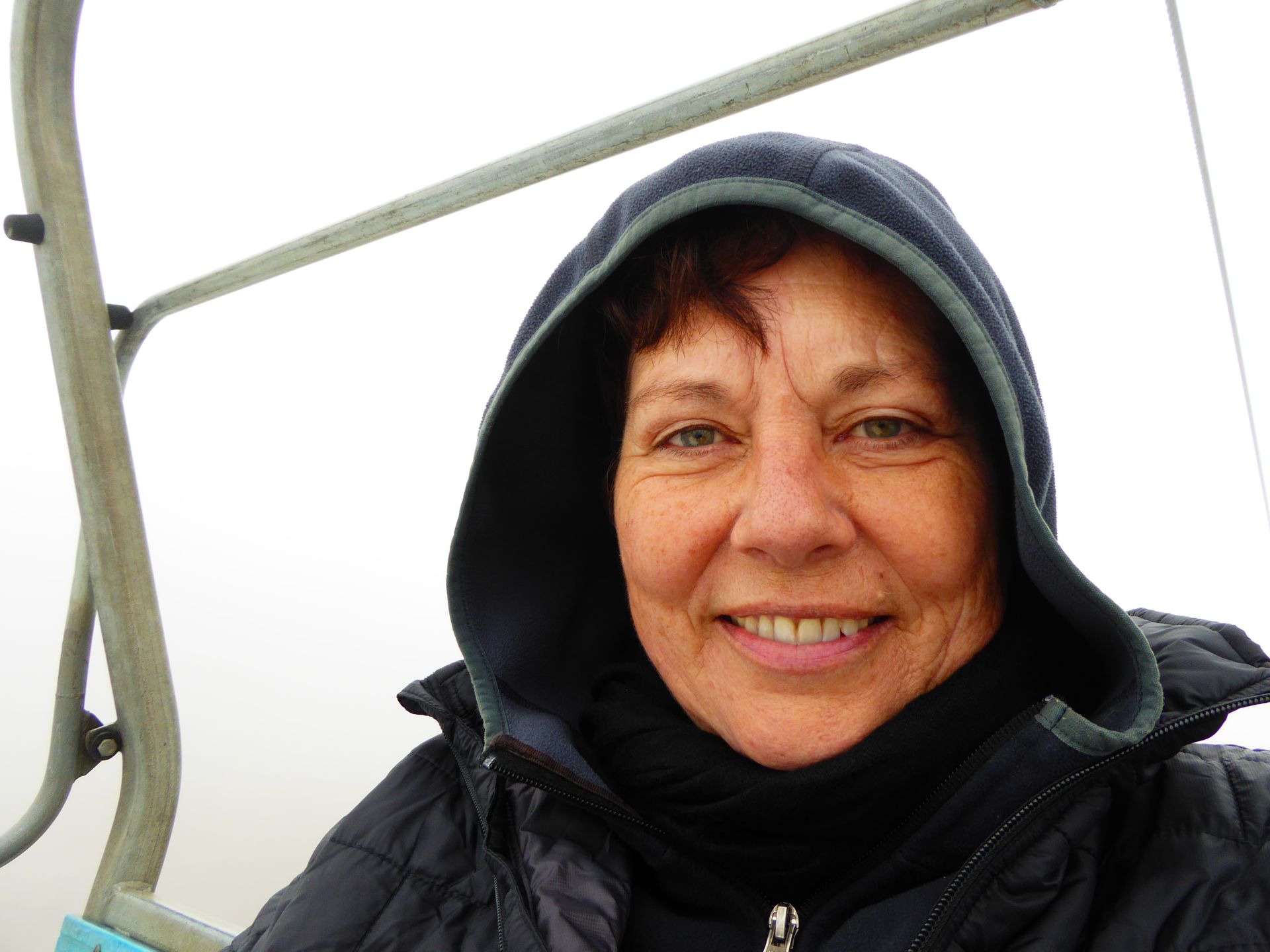
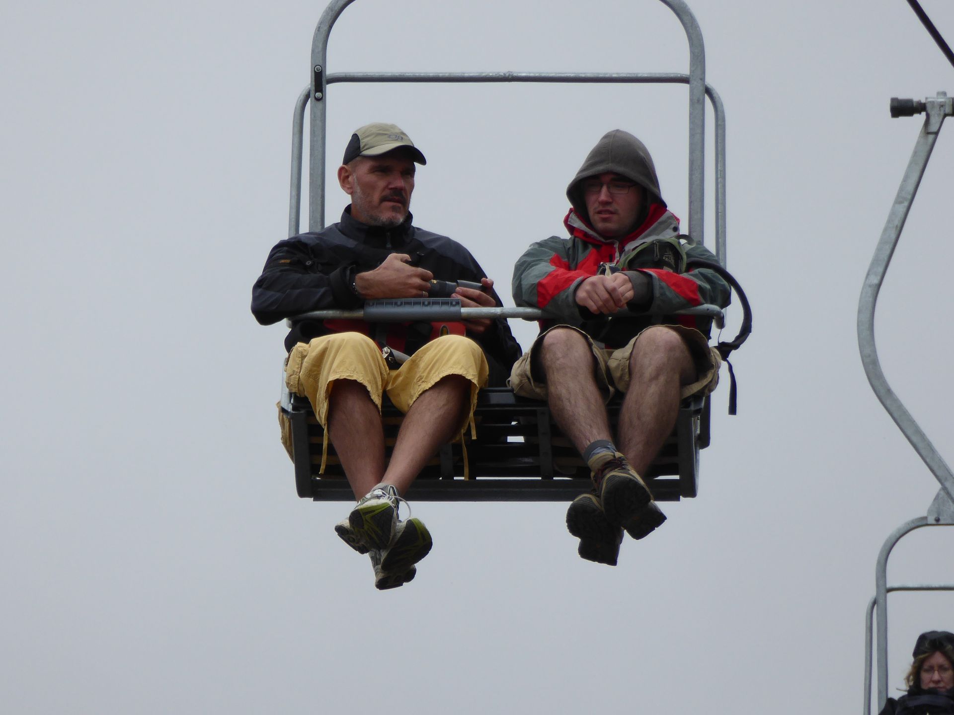
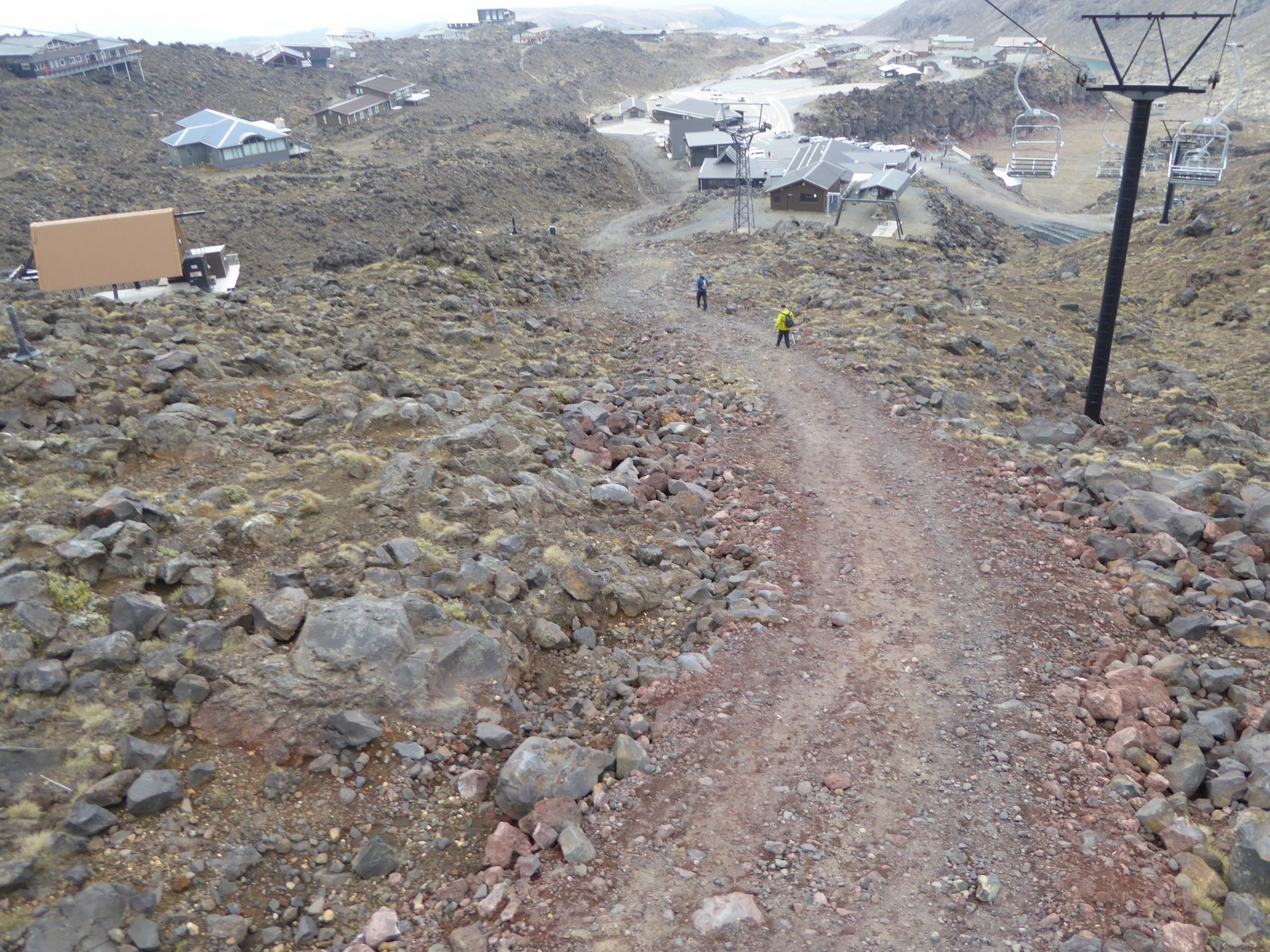
The ride in the open chairlift is nice, although the view is a bit missing. But it's nice and quiet. Up there, I'm practically standing in the clouds. Considering that I haven't had breakfast and it's now 12:30 p.m., I order a pretty delicious panini and a coffee and have patience. For the first time, I found postcards and am now writing the first 9 cards. When I come out, it clears up a bit. I walk towards one of the hiking trails, but they are in such poor condition that you don't get to enjoy the scenery when hiking because you constantly stumble over large stones and the path continues on snow after 100 meters.
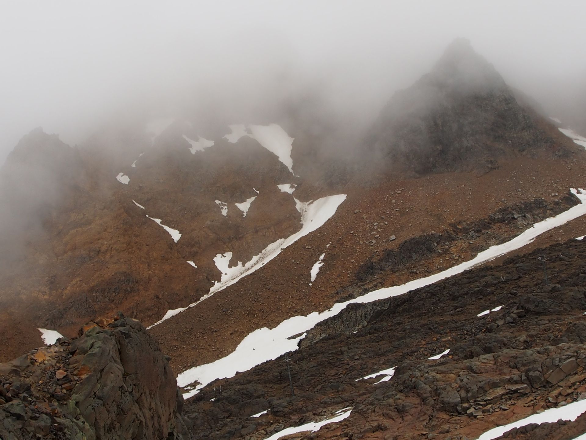
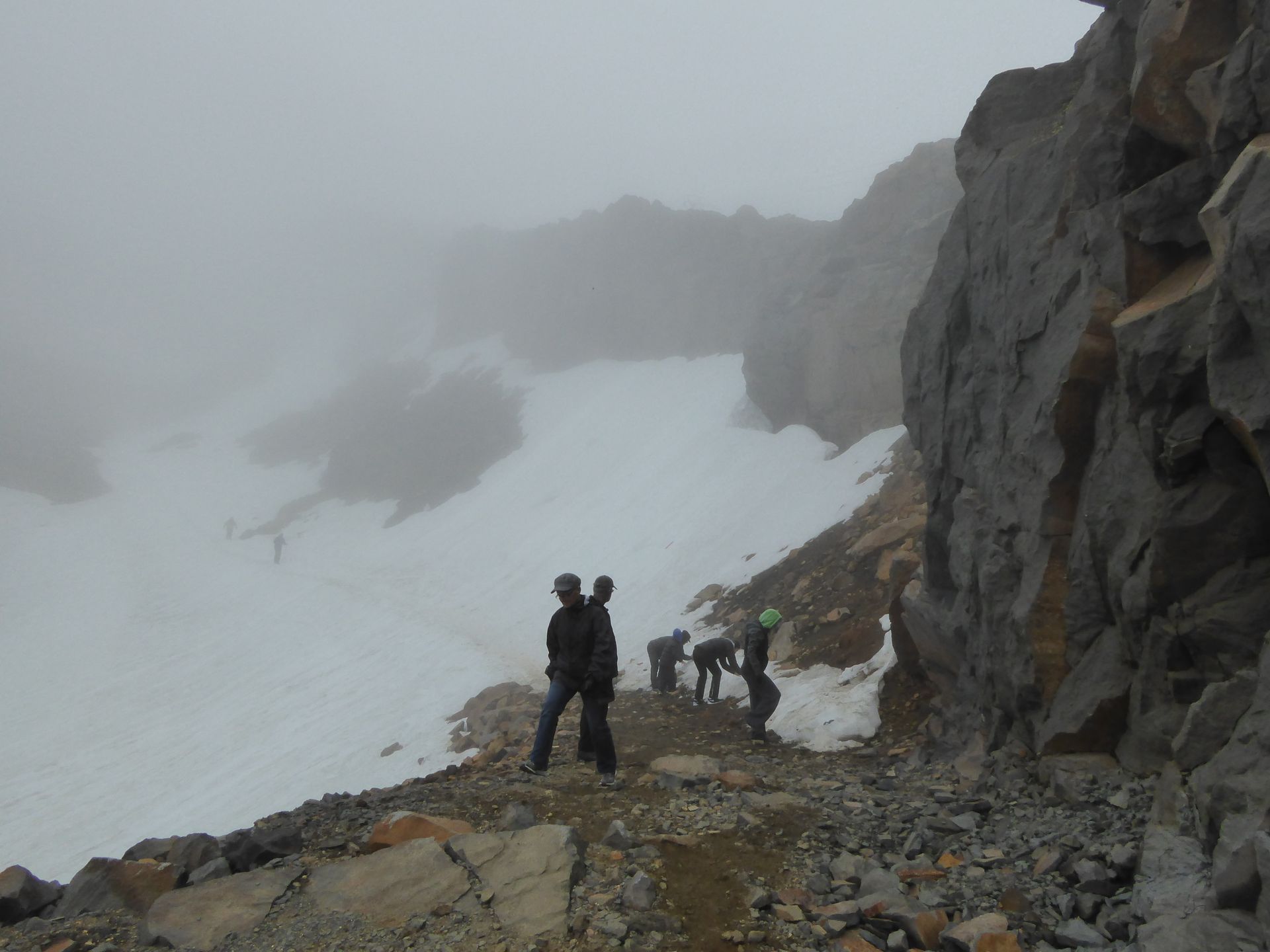
While I'm still stumbling around there, it keeps clearing up more and more, and I suddenly see very rugged, black peaks all around me, and in the distance, you can now see another volcano. While I'm still walking around, the lift attendant suddenly shouts that the last lift is in 15 minutes. Well then, better get on board!
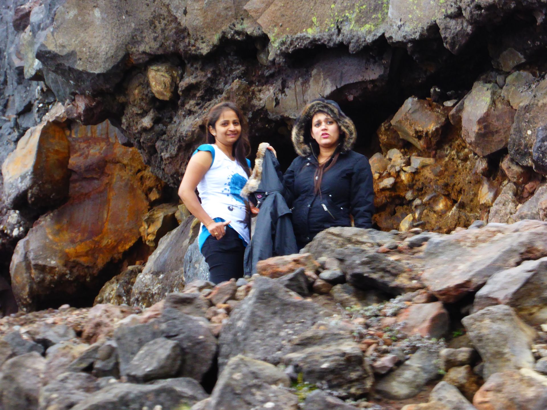
Just above the middle station, two girls, about 20 years old, suddenly run next to the cable car, apparently both Indians. One of them is wearing sandals or flip-flops.
They shout at me, asking if it's still far to the top, and I shout back that they should go down to the middle station because it's too far up and the lift stops in 10 minutes for today. What madness, such climbing with such shoes and at these temperatures with t-shirts! I don't know if they ever made it safely to the middle station. In any case, I inform the lift guy at the bottom and also the people in the store that sell the tickets. The girls have already called and said they got lost... The lady at the ticket counter just rolls her eyes, and the girls will have no choice but to follow the path back down.
I grab my car and drive back on this dead-end road and now enjoy the view of the surroundings behind all the moon rocks, which are surely stones thrown out of the craters during eruptions.
Since the moist weather comes from the west, from the Tasman Sea, and I am traveling in the west, I decide to take a look at the presumably drier and less cloudy eastern side of the mountains, even if it means driving 53 km to Rangipo at first. There, the highway runs directly along the eastern flank of the volcanoes to the south. Let's see what the weather is like over there. At worst, I'll drive all the way around the national park. Let's see how the roads are.
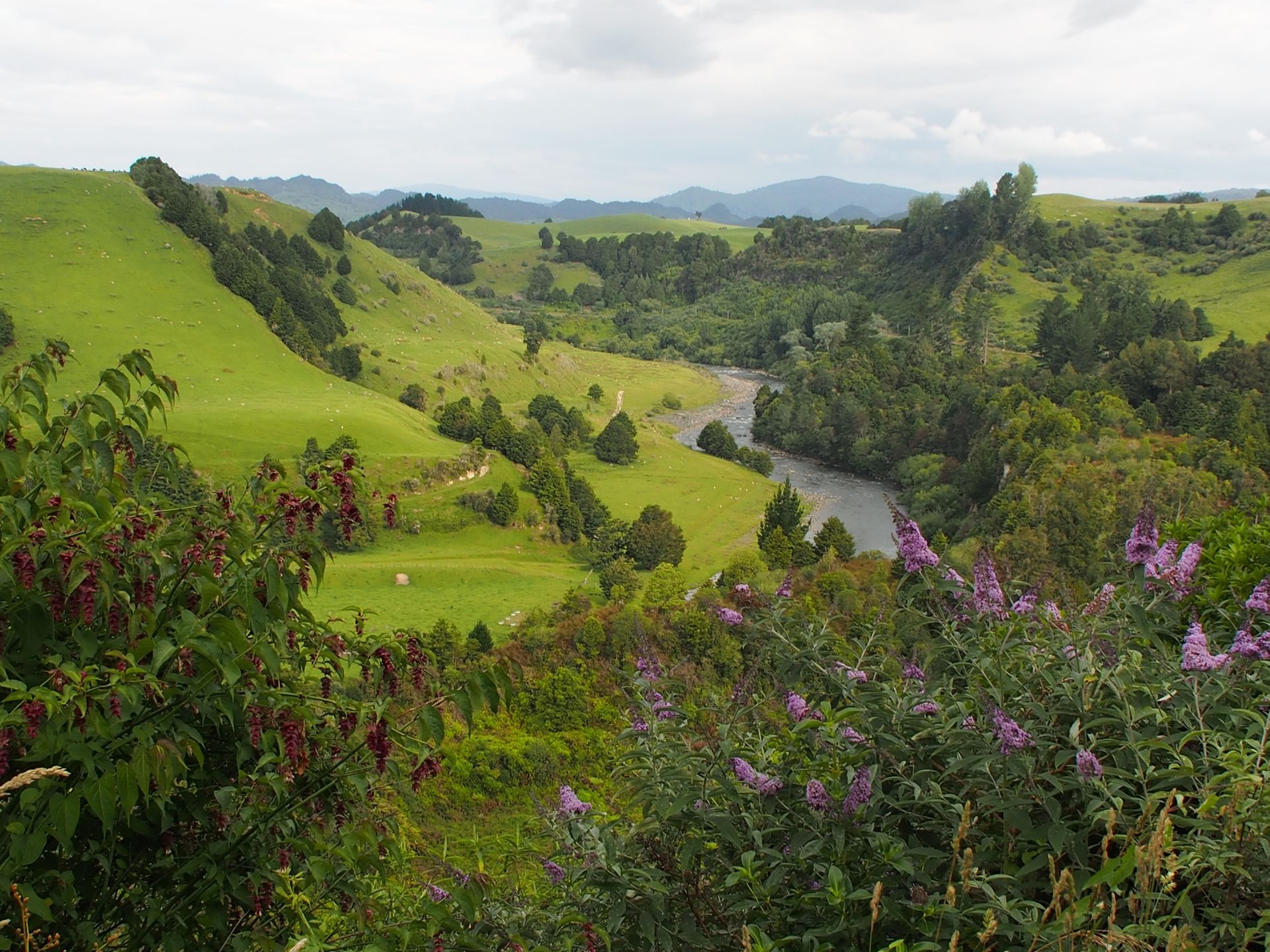
The drive is smooth, and the landscape alternates between cow and sheep pastures and forests. Then, next to me, I can clearly see the east side of Mount Tongariro, and several side craters are smoking heavily.
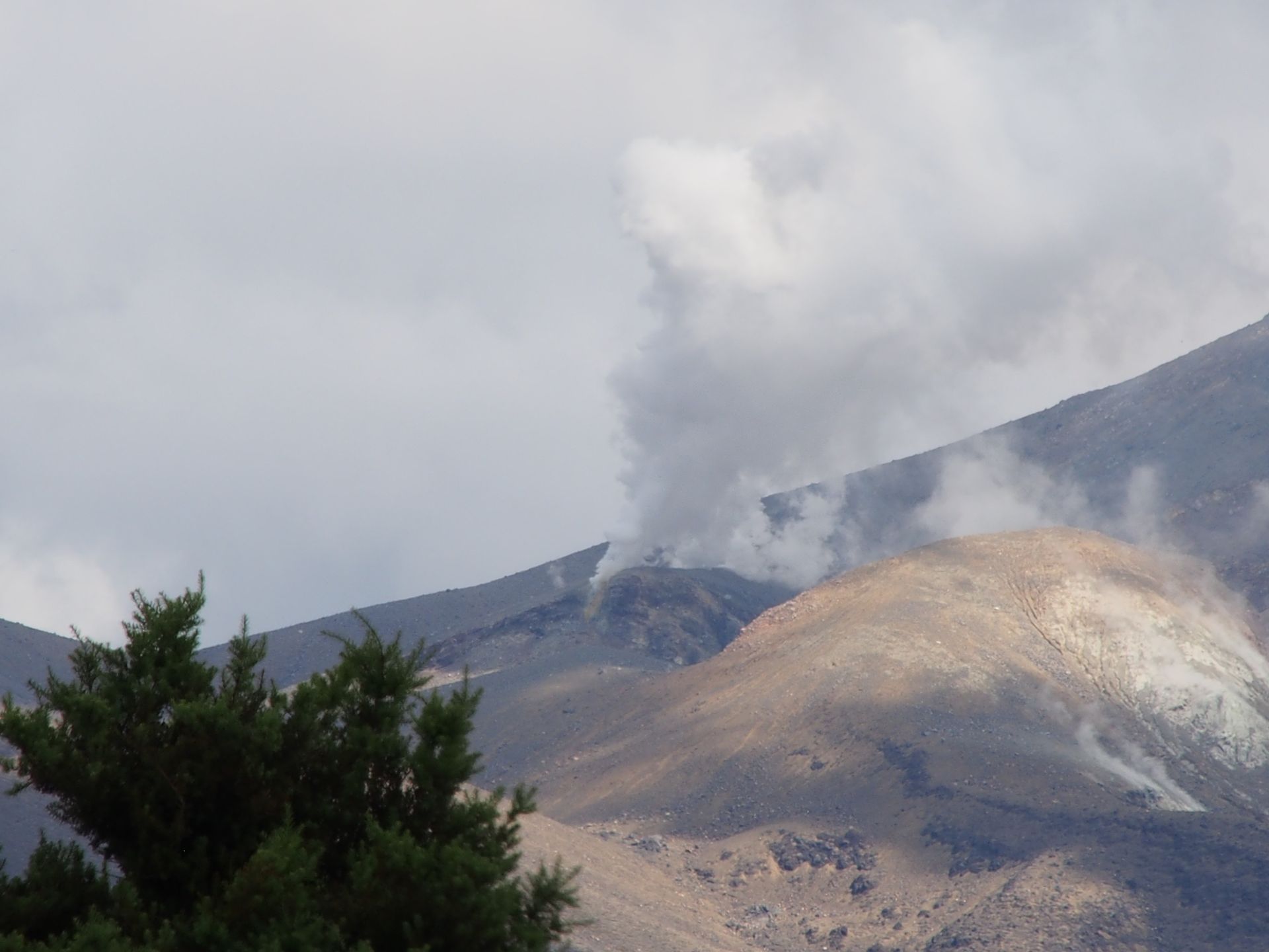
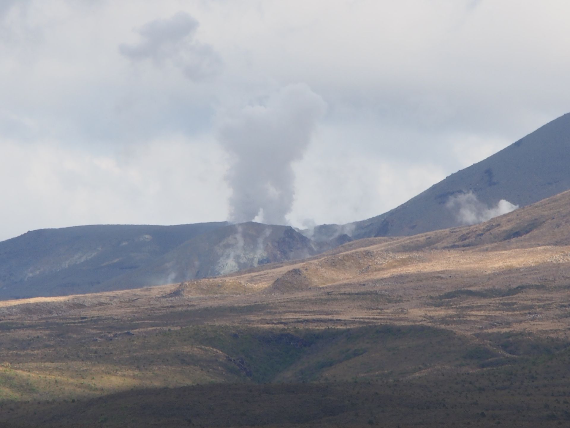
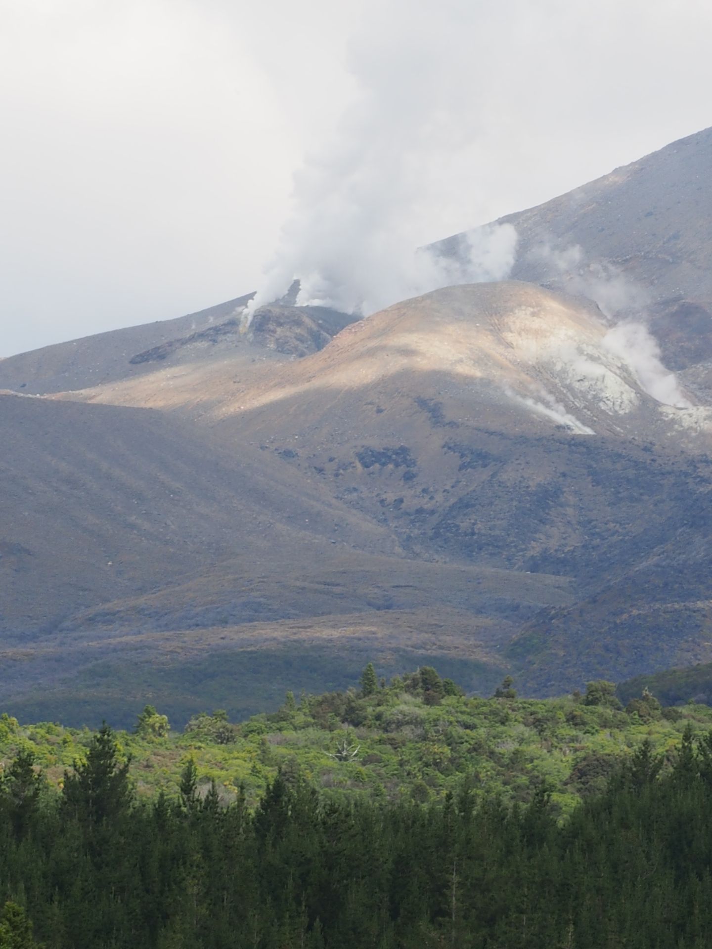
Although Tongariro is the lowest of the three volcanoes here, it is a huge massif that stretches over quite a distance next to my route and repeatedly reveals views of steaming openings. There are some farmhouses right next to the road. I wouldn't want to live here!
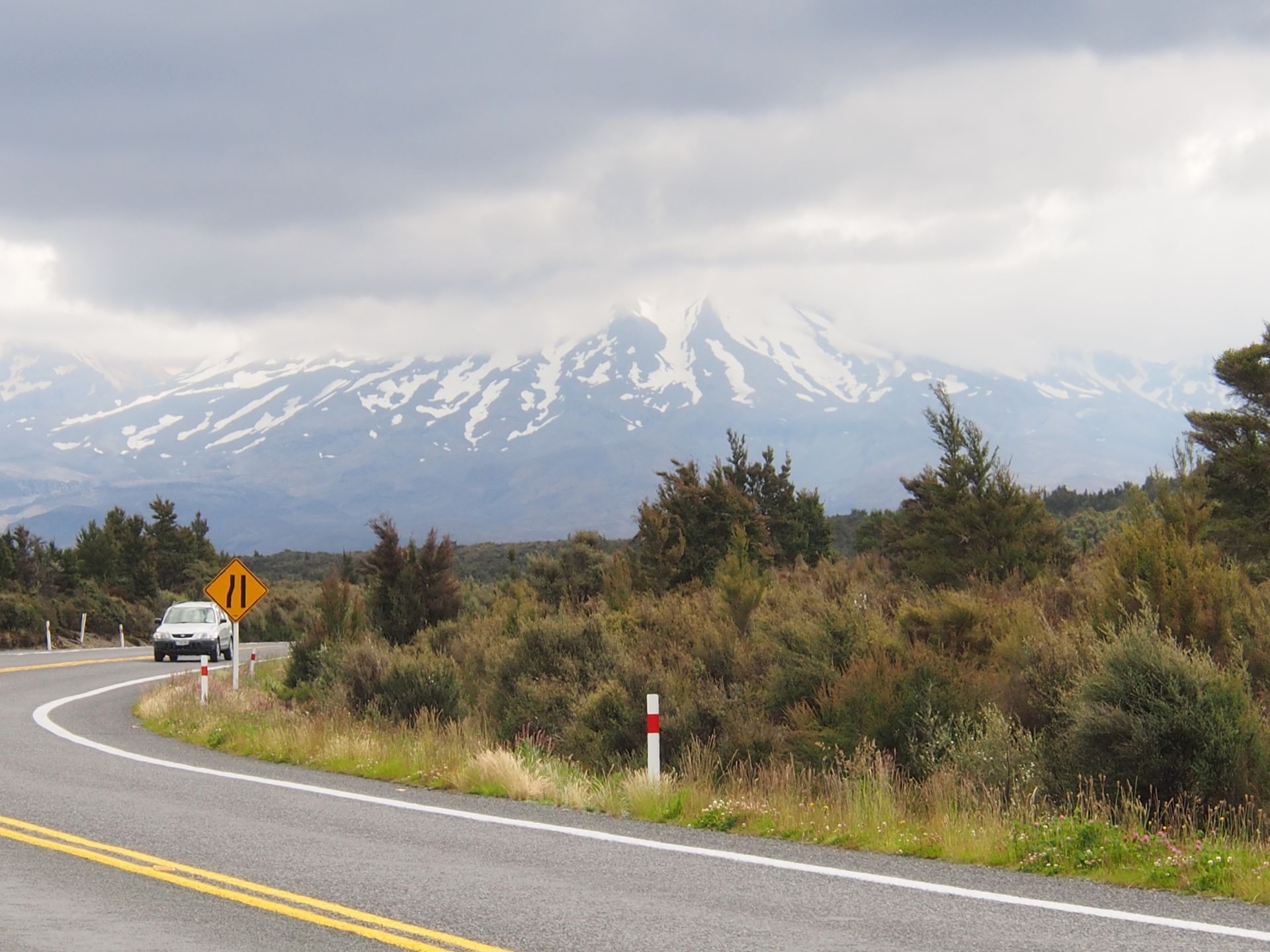
As I drive around the national park in the south, the landscape becomes lunar again. I am now between 1,000 and 1,300 meters high, and on this high plateau, the road has refreshingly few curves, so I make good progress and have already decided to drive all the way around. There are fantastic views of the volcanoes, including Mount Ruapehu, where I was at noon today. The drive is very fast and with very few curves by local standards. There are no real towns here, except for Okahune in the south. These are all real ski resorts with pubs and hotels that have 'Alps...' in their names. Now, in summer, there's not much going on here, of course.
At 6:45 p.m., I'm back at my motel in Taumarunui and go to the supermarket across the street to buy something to eat. I don't want to go to the Thai place again, and McDonald's is not on my radar yet. Alaska and its mostly one-sided burger menu haven't been gone long enough. But the supermarket has prices like KaDeWe. 4 packaged bagels for toasting: $5.29! I buy English muffins instead, which only cost $3.29, and treat myself to potato salad and a salad of red beets and spinach for dinner. Total cost: 11 dollars. Normal people live here too, and I wonder what people earn here. Recently, someone told me that there are many people, mostly Maori, along the coast who don't want to work. They collect shells on the beach or fish in the sea and sell the items to the stores. More like pastime with earning money. But what do you do here in the middle of nowhere?
I write in my diary, enjoy some leftover wine, and upload my photos. Today, a lot of Mordor and a few nice sheep and views. Fascinating country, always a completely different landscape every day!
Daily distance: 272 km
Გამოიწერეთ Newsletter
Უპასუხე

Მოგზაურობის ანგარიშები Ახალი ზელანდია