
Tongariro Alpine Crossing
Naipablaak: 04.04.2023
Agsubscribe iti Newsletter
You go up, up and up. And when you think you’re almost there, then you go up, up and up again.“
This describes our journey through the landscape of the Tongariro volcano quite well.
But let's start from the beginning. Our day started at 6 am in the morning. Luckily, our phones knew that there is a time change here in New Zealand. We didn't know it and would probably have missed our shuttle bus. Well, at least we would have been spared the effort.
No, seriously. The hike and the associated effort were totally worth it!
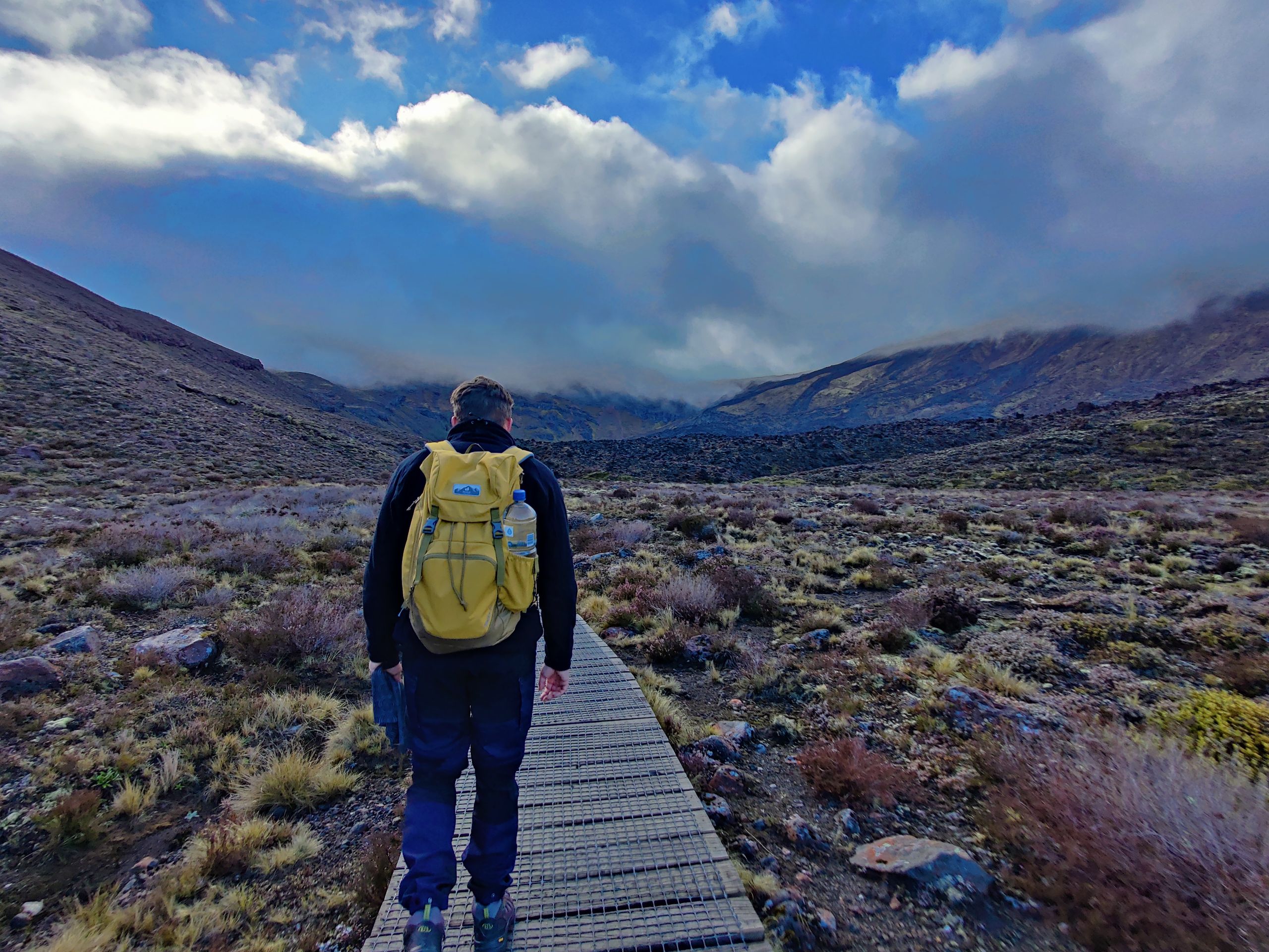
So at 6 am we got out of bed. We were driven to the start of the track by a shuttle bus, to get back to the car park later. Where our Hapi was eagerly waiting for us. Or we were waiting for him 😄
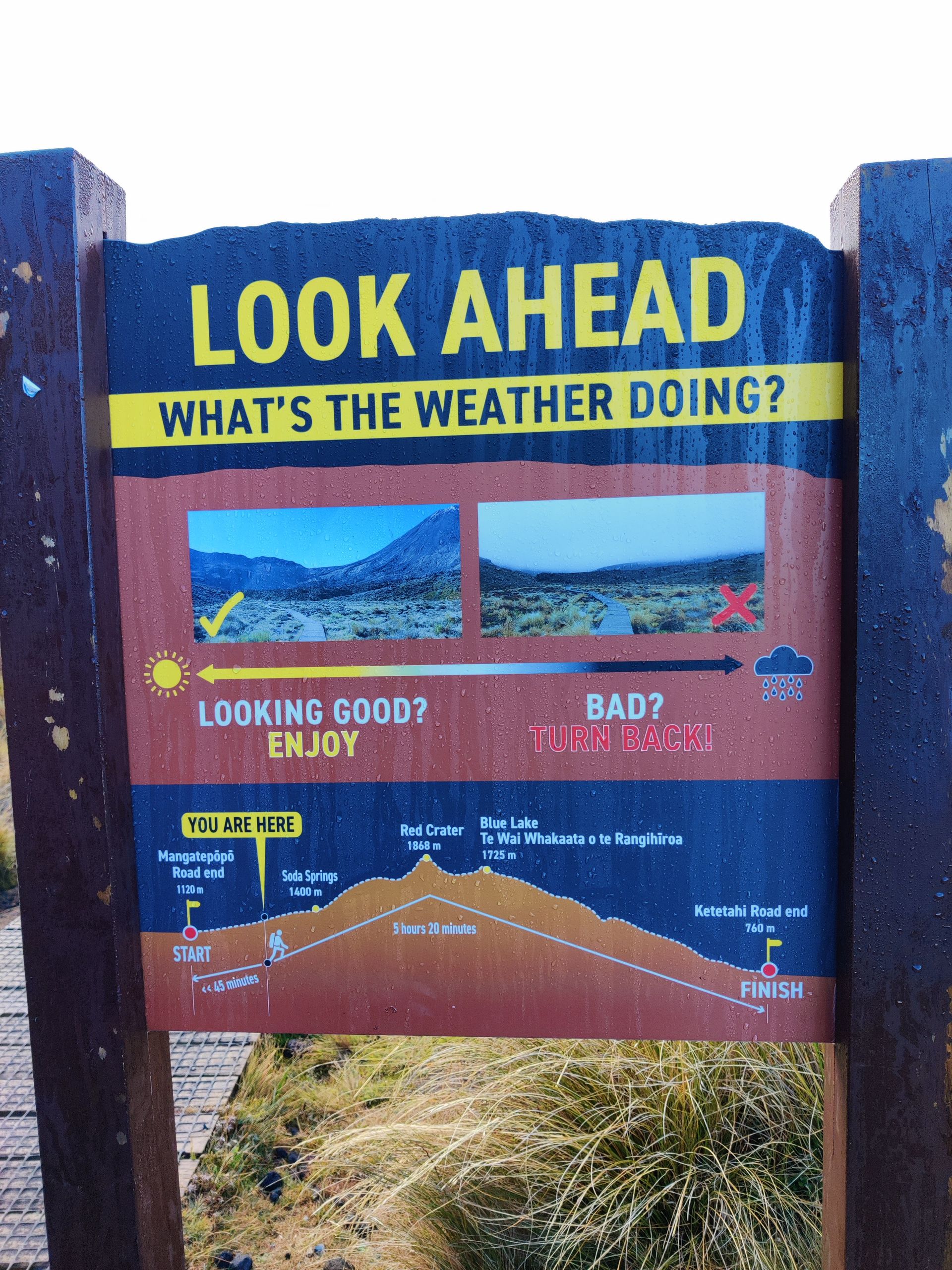
You hike 19.4 km on the Tongariro Alpine Crossing in the national park across volcanic landscapes. Past active volcanoes, craters, mountains, and lakes. If you hike here, you must be aware that the danger of a volcanic eruption is always present.
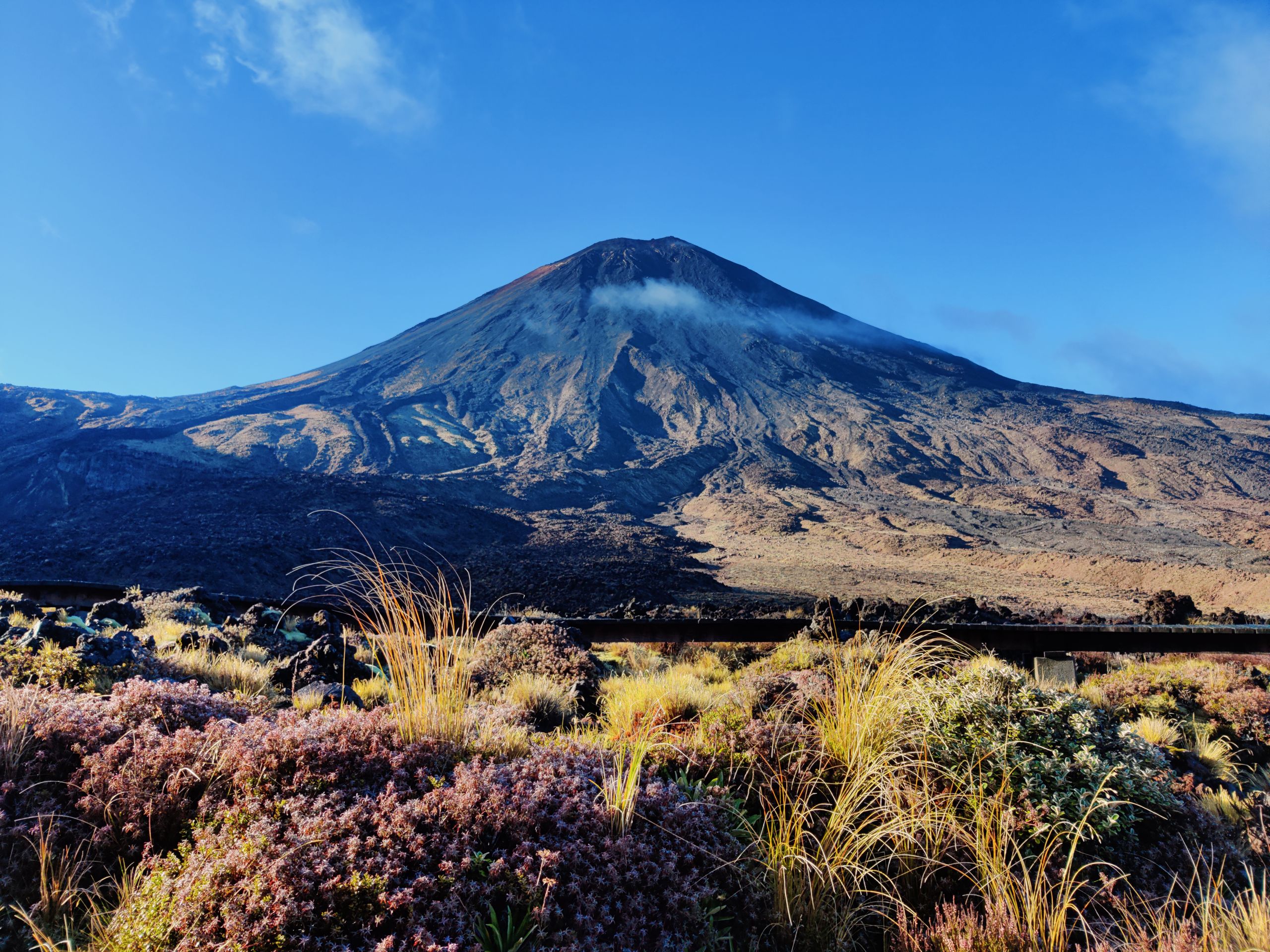
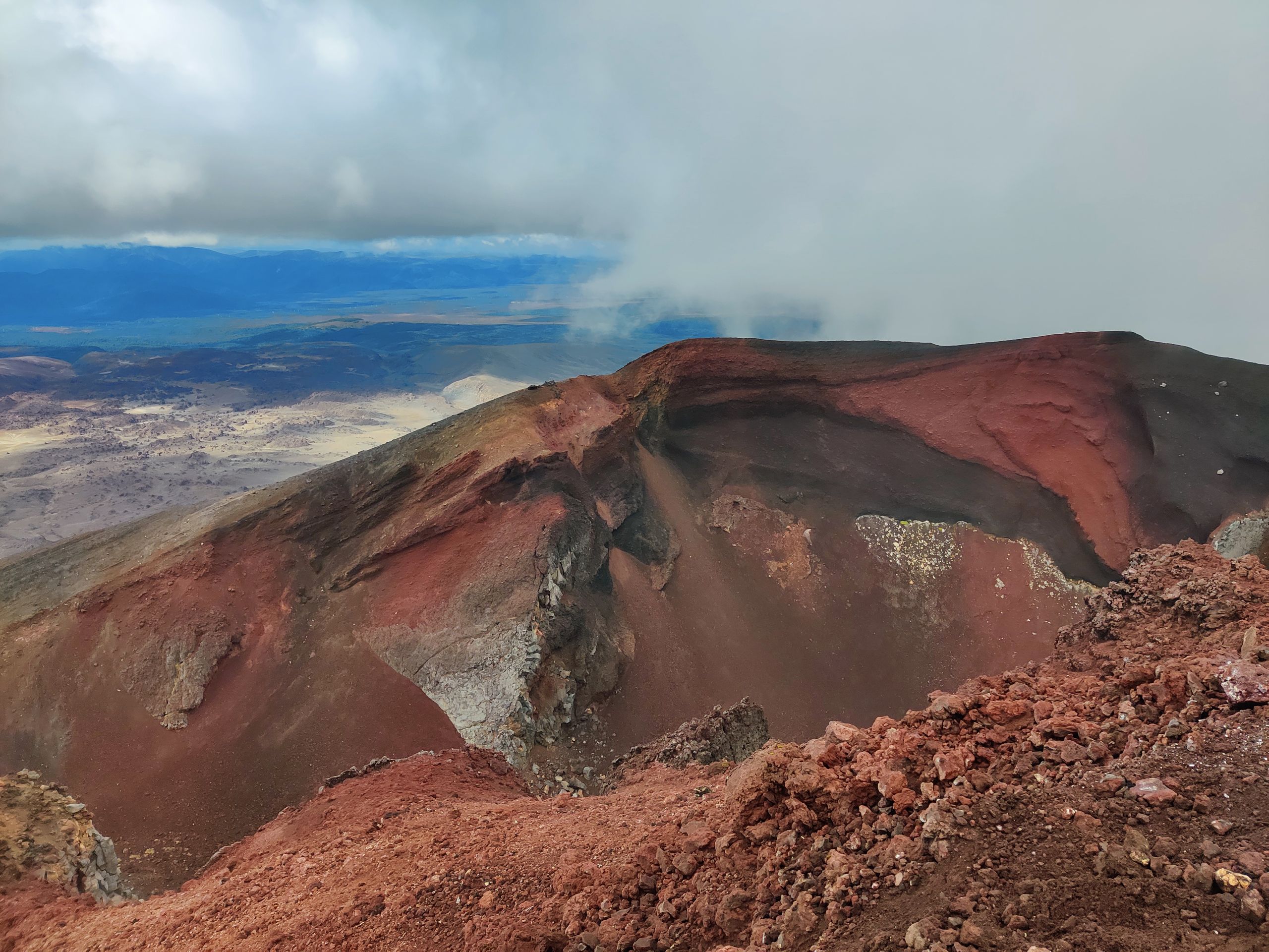
The beginning of the hike is harmless, but unique! After about 4 km we arrive at Mount Ngauruhoe. Known as Mount Doom in Lord of the Rings. We were lucky to have a good view of the mountain at that moment. Which is not always the case, as the weather in the national park constantly changes. Then it's on to the challenging part. We climb up to 1870m to Red Crater. A steep ascent with stairs and volcanic rocks awaits us. And here we come back to the topic. Just when you think you can't go any higher, you quickly realize otherwise. But it was worth it. Maybe not at first, because the first thing I said to David was, 'Huh, you can't see anything there!' You climb up so steeply, almost have a heart attack, and then you just see nothing. Great!
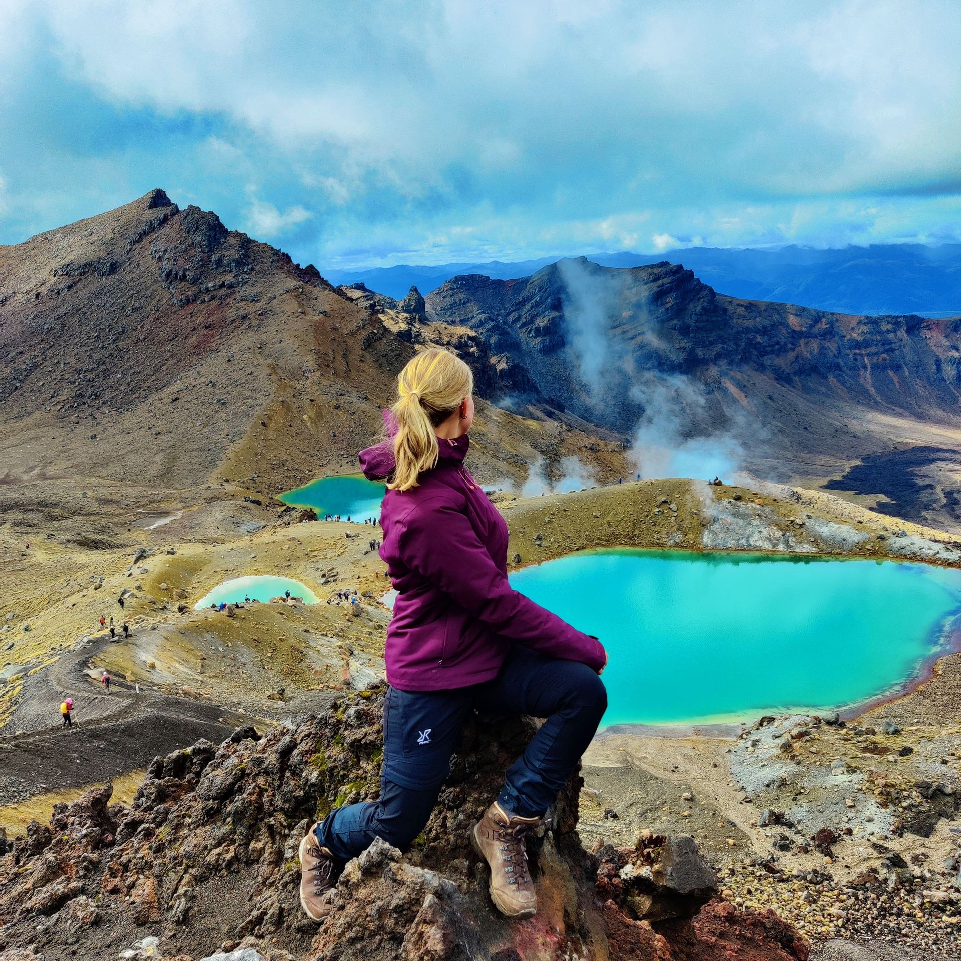
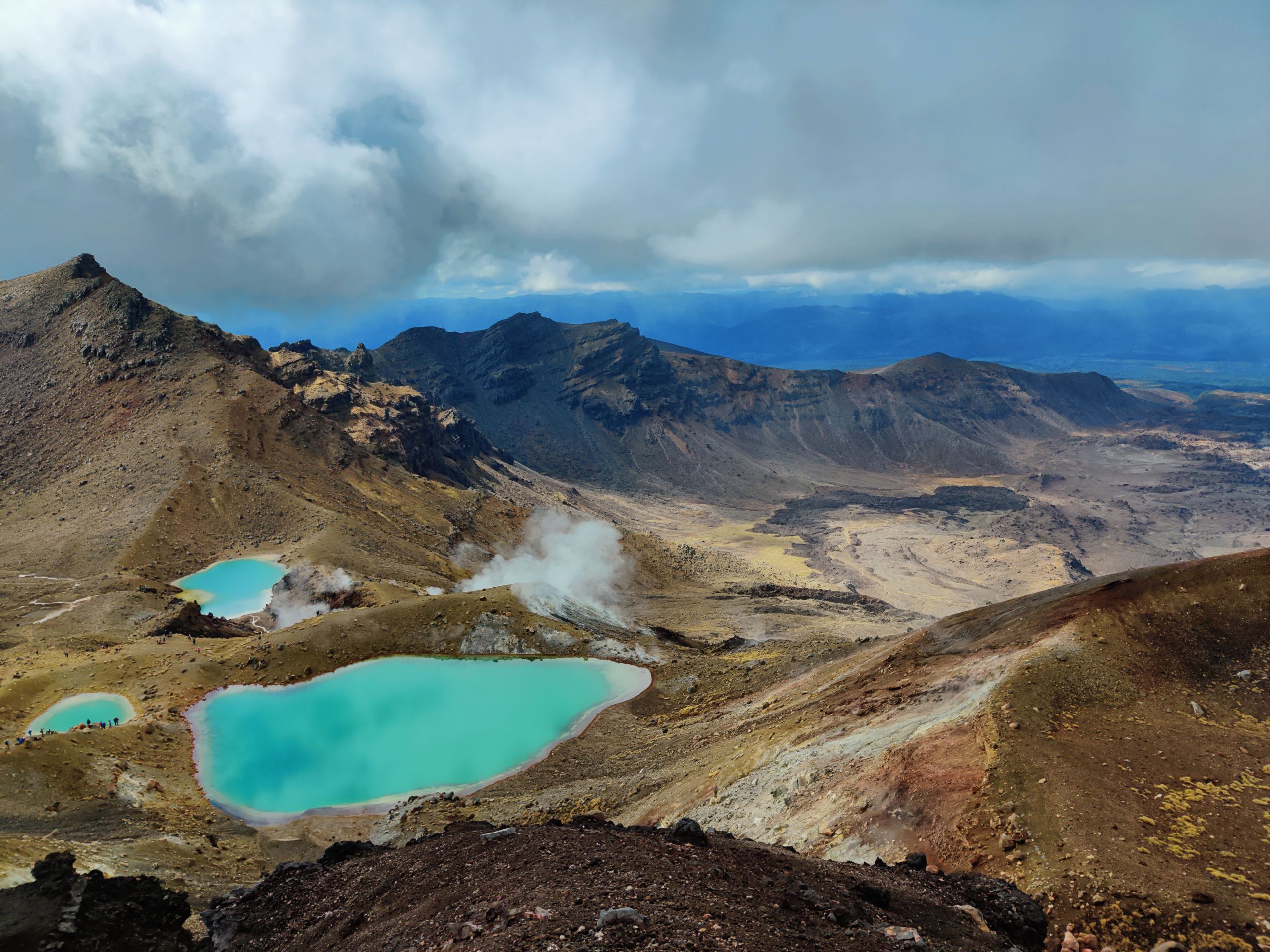
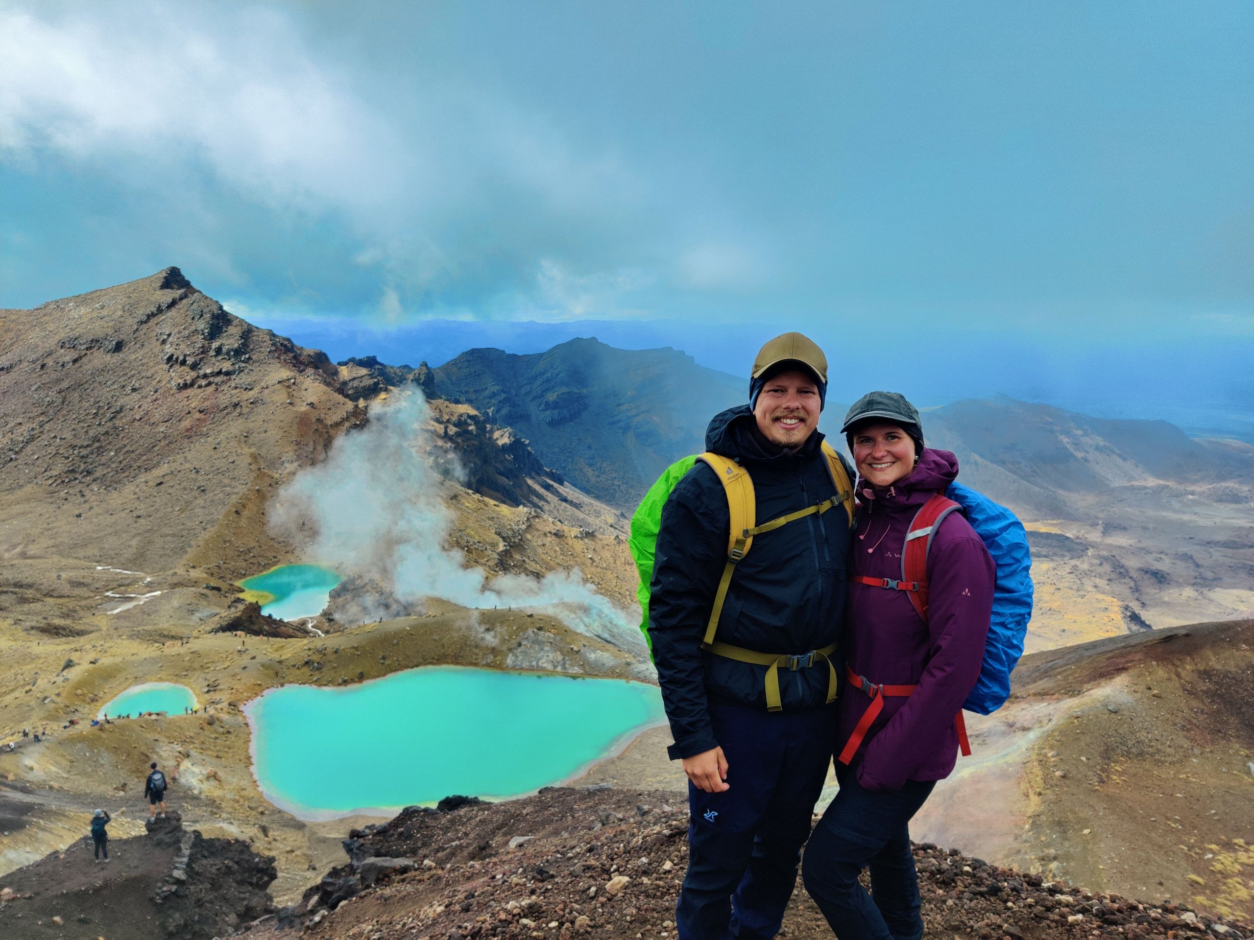
But patience pays off here too. The view gradually became clearer and finally the Red Crater appeared. Fantastic! So you stand in front of the crater of Mount Tongariro and have to become aware of its power.
Oh by the way, a crater from which lava can erupt at any time. Sometimes you have to wonder if people still have all their marbles 😂.
But back to the facts. After reading reports on the internet, the most difficult part of the route came. The first descent to 1725m. So let's be honest, if I were to make this descent in those, as Fabi&Timo always say, 'Samba sneaks', then I would also describe it as the most difficult part of the hike. Some people have already fallen on their butts there. The reason for this is that you have to descend on pretty slippery scree and lava rocks. But if you think of hiking without good footwear, then you have to feel it and suffer accordingly.
Anyway, we arrived safely and had a fantastic view of the Blue lakes. And now you have to imagine this: you look out over a huge volcanic landscape, it feels almost like being on the moon, next to you a large, dark red crater, in front of you several turquoise blue crater lakes, and sulfur vapors rising from the ground everywhere. I'll spare you the smells for now. It's just incredible! You can even forget about the cold and icy wind (-degrees) for a while and just enjoy the pure nature.
People, all the effort is worth it when you can see something like this. It's one of those things you'll never forget!
After spending some more time up there, it was time to descend again. We walked another 10 km on volcanic rocks. Then in the distance appears Lake Taupo and in the end, you walk again in the rainforest. The descent was a bit drawn out, but still very beautiful. And finally, after 20 km, there he stands, our Hapi.
Never before have his cushions felt so comfortable!
Agsubscribe iti Newsletter
Sungbat

Dagiti report ti panagbiahe Baro a Selanda