5.1.20 Kauris, Waterfalls and Ruapekapeka Pa
उजवाडाक आयलां: 15.01.2020


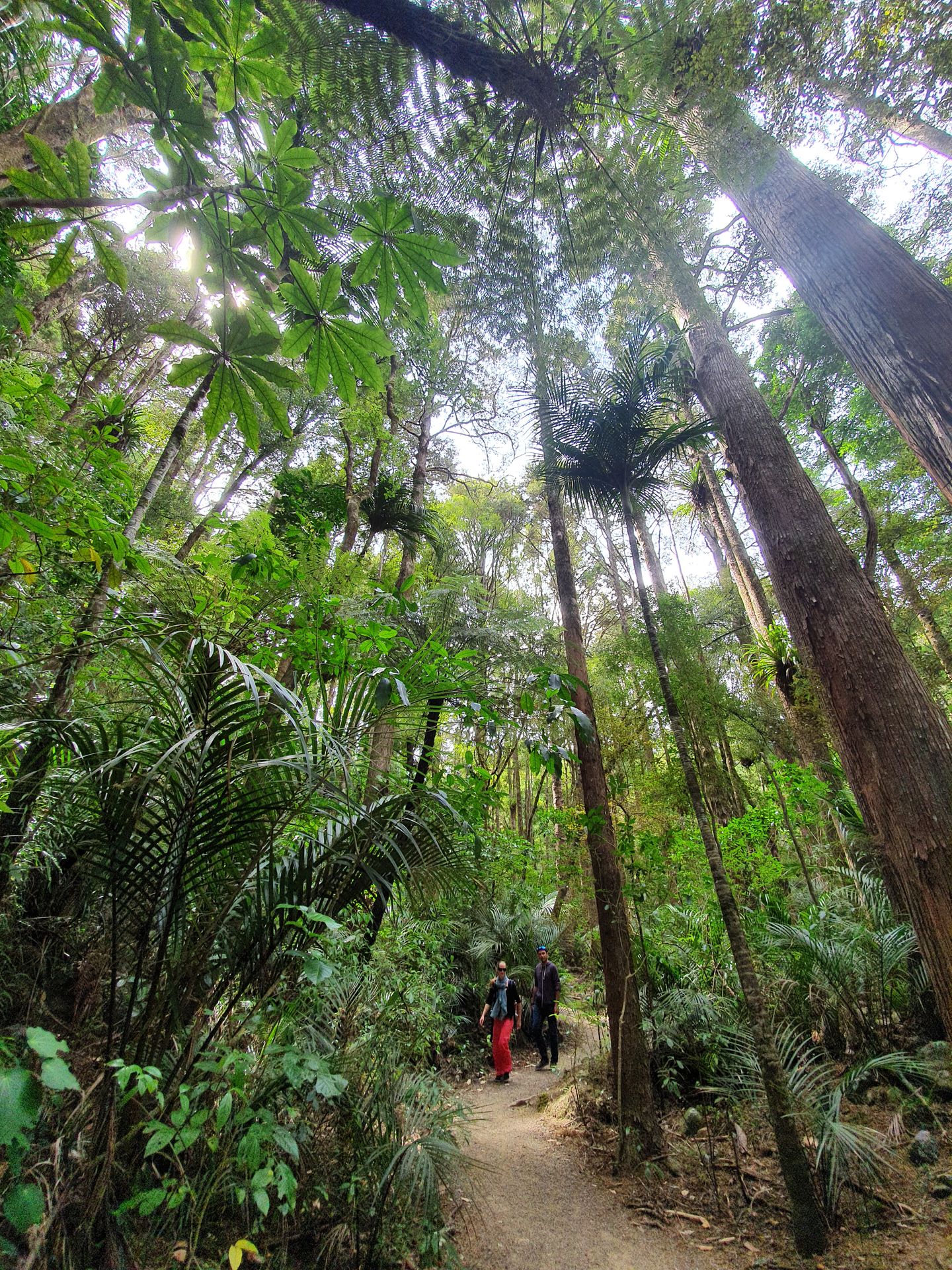
I dedicate the morning to nearby attractions. First, I drive to A H Reed Memorial Park, a publicly accessible area with three trails, which run almost at treetop level, if it weren't for the tall and ancient Kauri trees here.
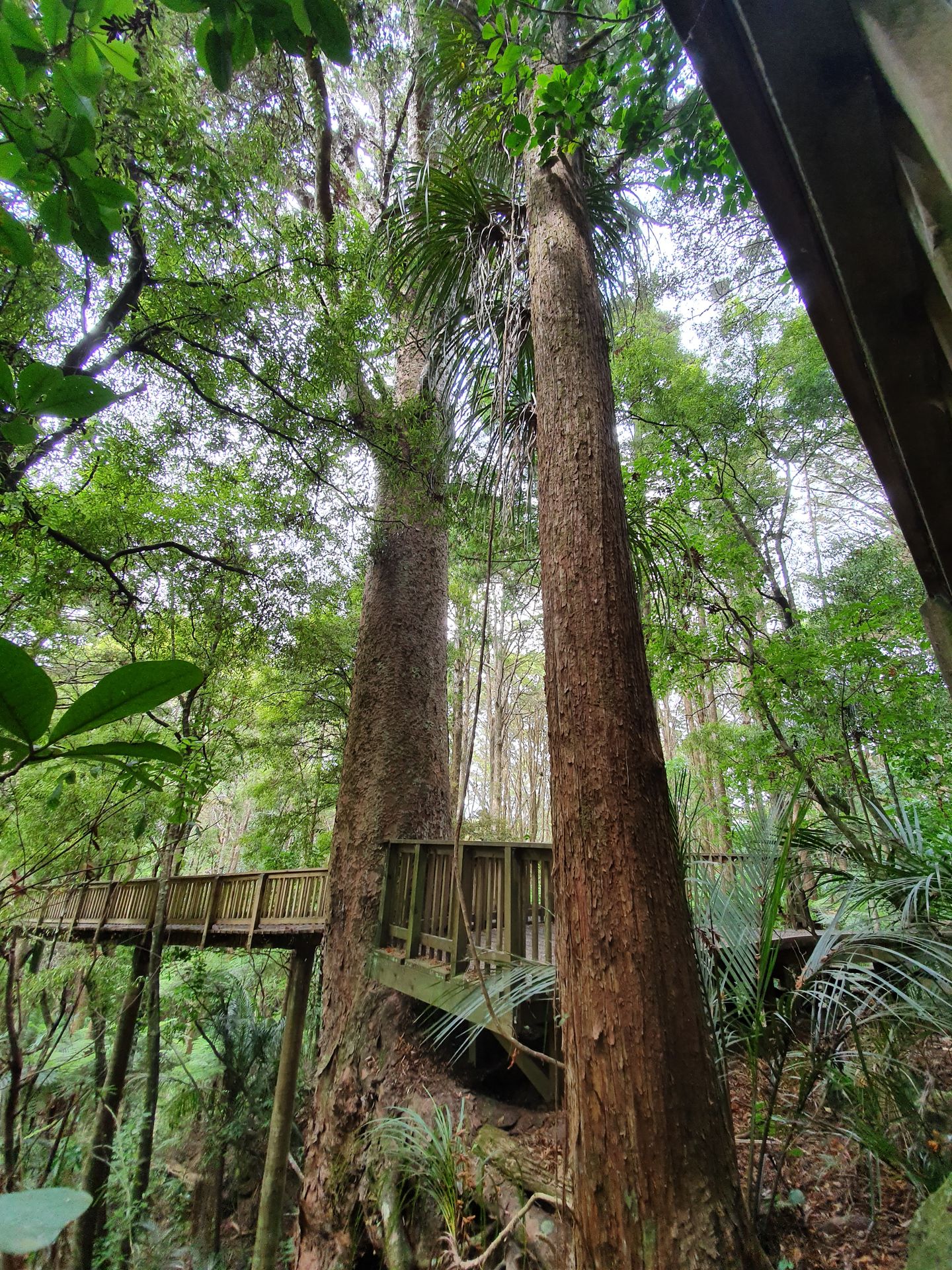
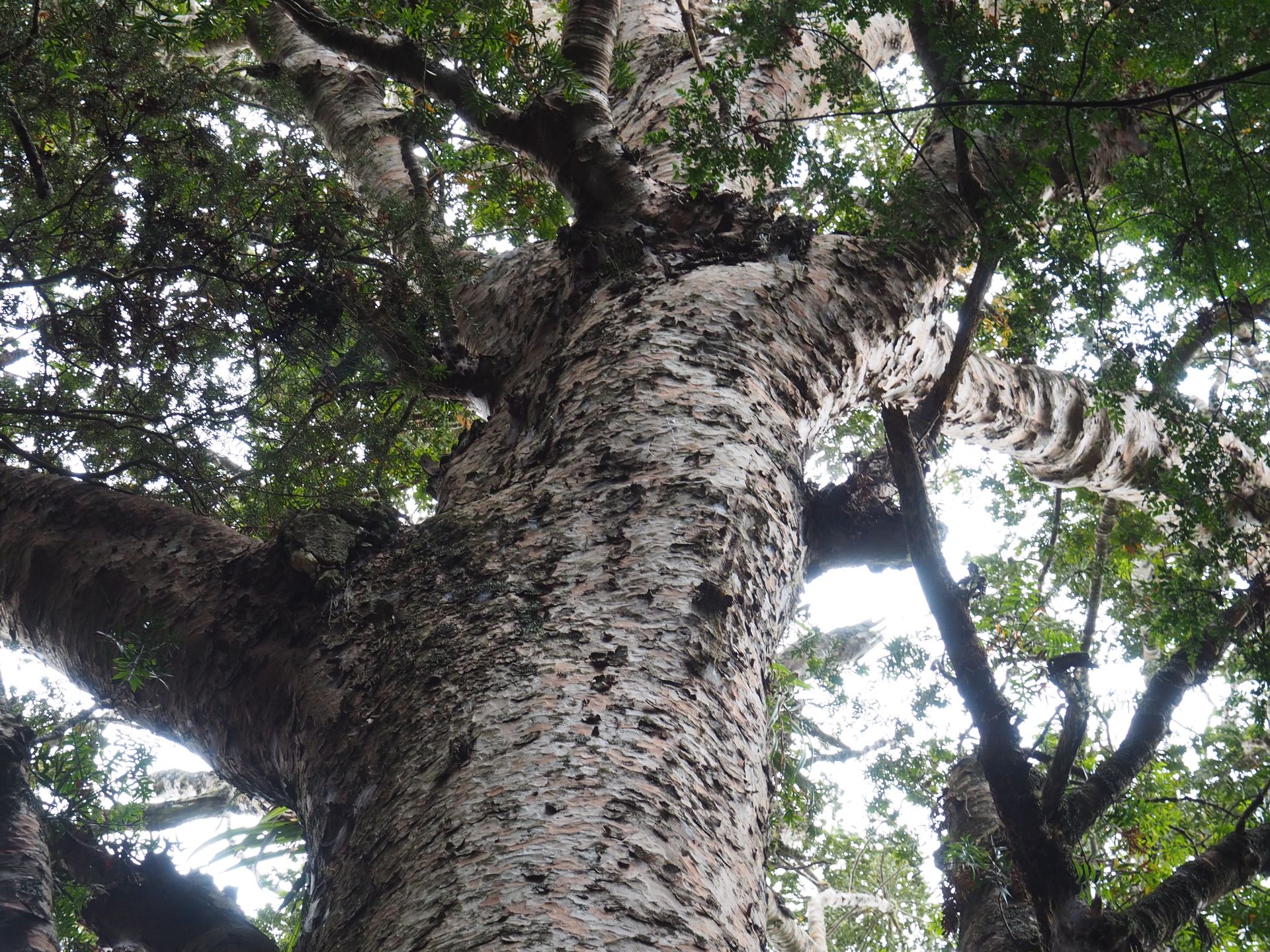
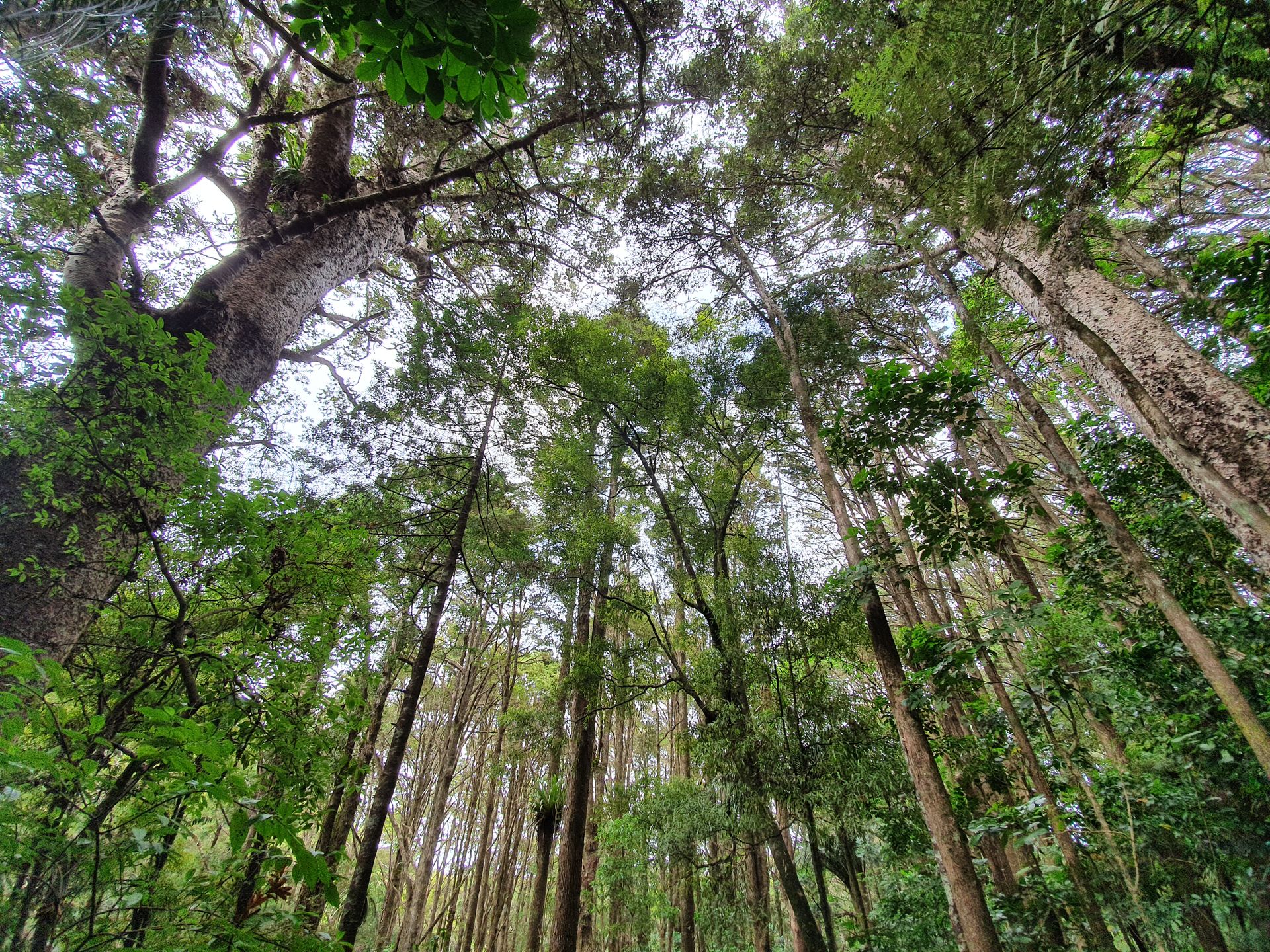
Their treetops remain unreachable. A Kauri is quite a delicate creature. I had already dealt with them 5 years ago when I was headed towards Cape Reinga. The Kauri is an endemic plant found only in New Zealand, specifically on the North Island. It cannot be found in the South Island with its rougher and colder climate.
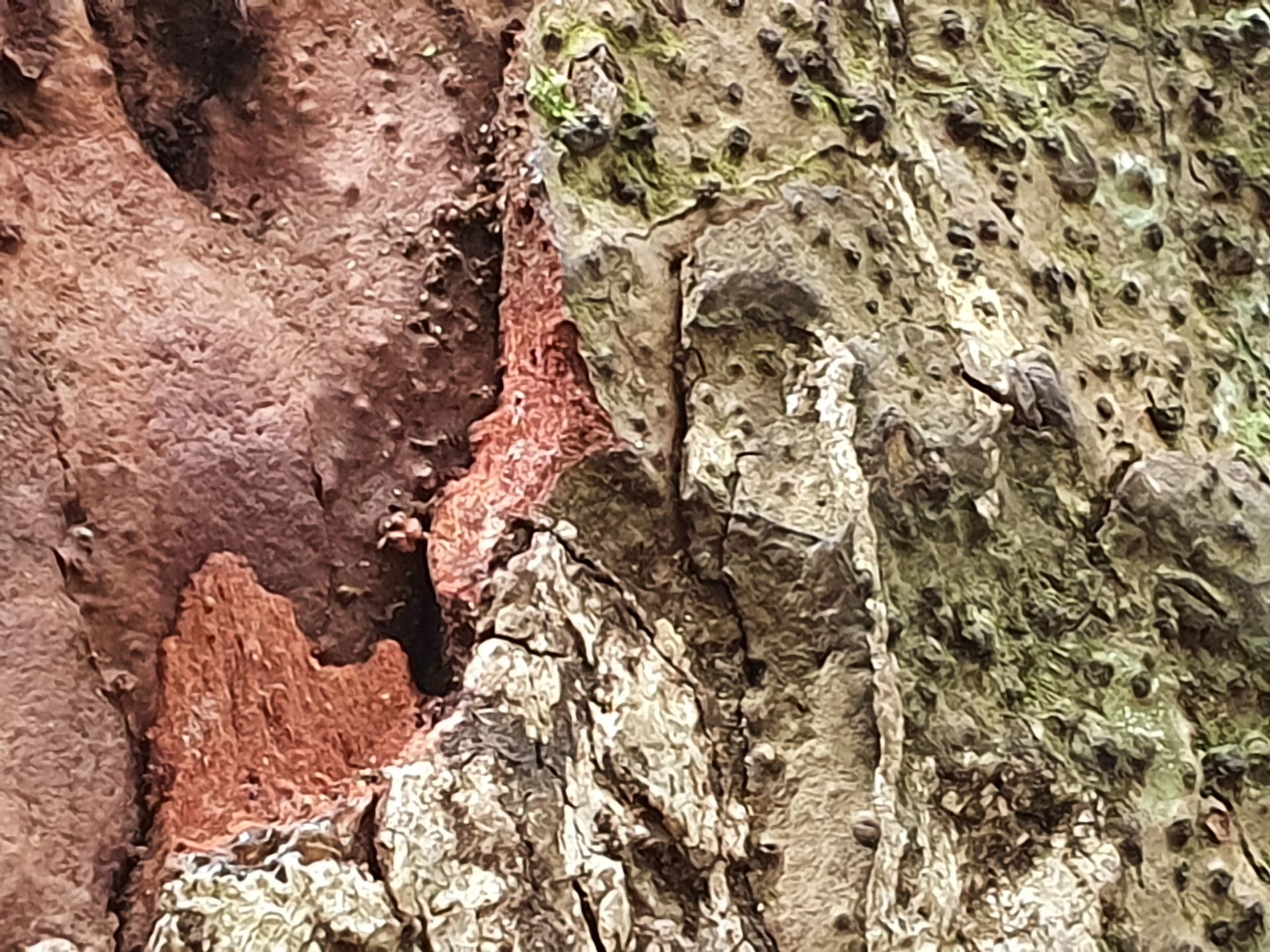
The oldest and largest Kauris are located on the West Coast and are around 2000 years old. Tane Mahuta was an extremely awe-inspiring tree of enormous size. The Kauris here are only around 500 years old, but that's enough to strain your neck if you want to see the crown. I remember that Kauris initially have quite slender trunks, more like a small birch, and diligently grow towards the light for about 100 years. Only when they surpass the treetops of the surrounding trees do they begin to develop a broad crown. Kauris are often recognizable in forests from a distance because they are always the tallest trees. Here in A H Reed Memorial Park, I see the thick trunks and the crowns from below. As is the case wherever Kauris are accessible, meticulous shoe cleaning is done before entering the forest floor.
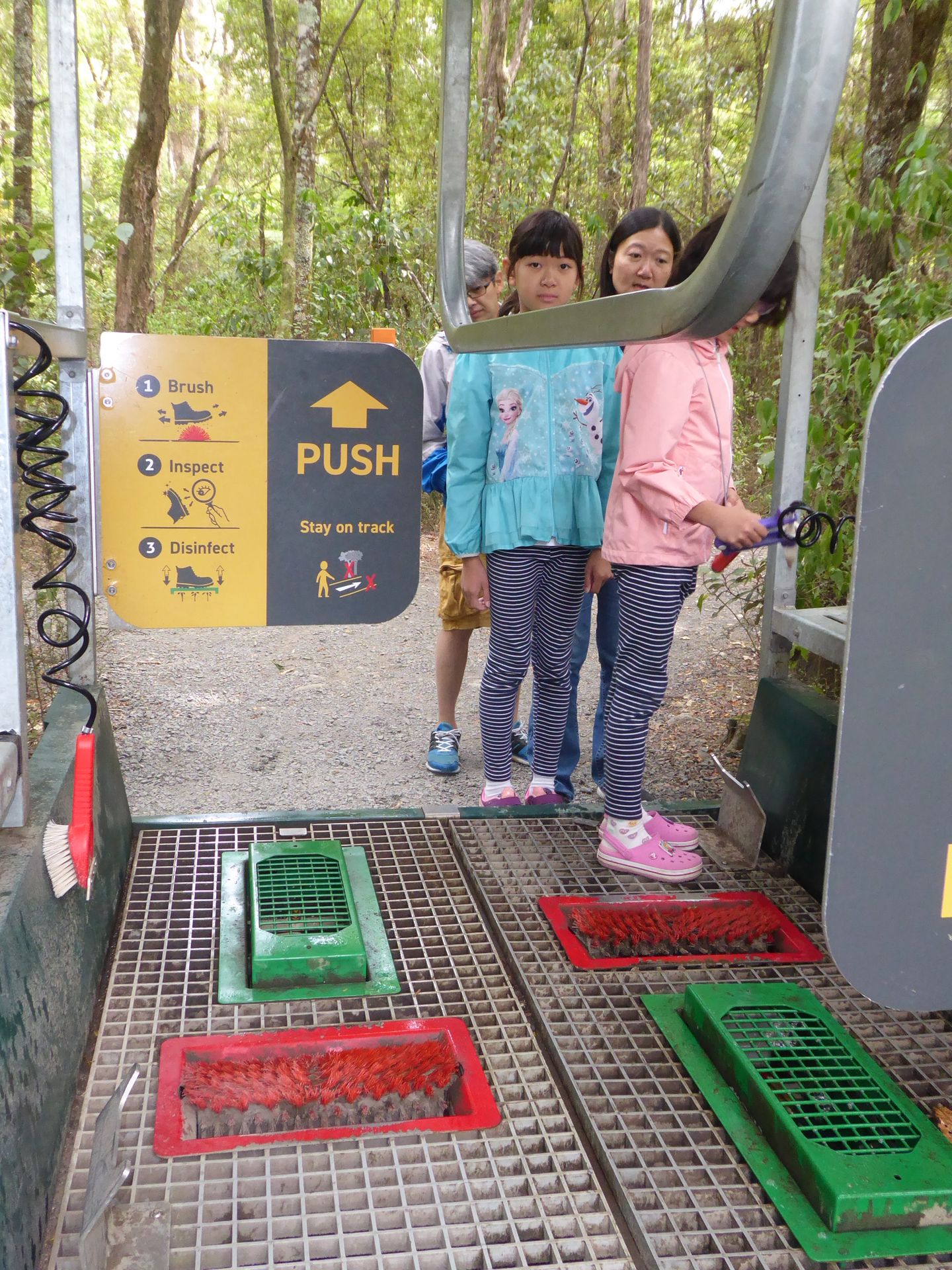
Not only do you have to brush off and, if necessary, clean the soles of your shoes with water pressure, but you also walk through a disinfection bath that sprays up as you enter. So I get wet feet when I start walking.
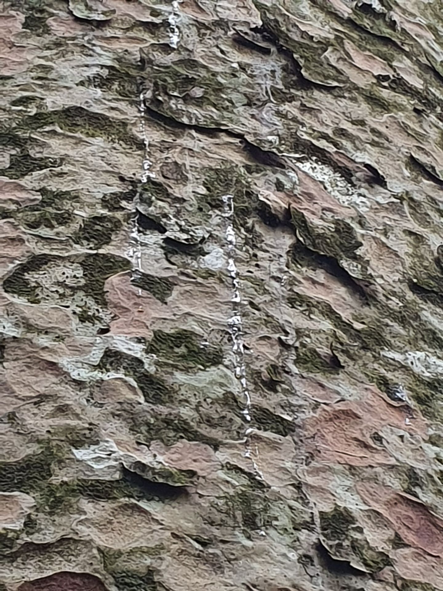
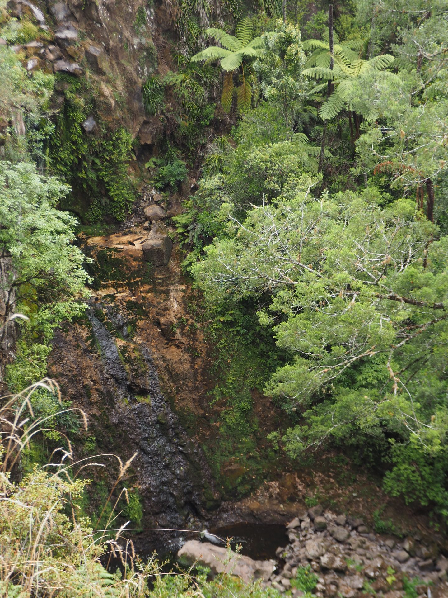
The Kauris always impress me. A little further up the forest floor, you can theoretically see a 24-meter high waterfall. The Paranui Falls have become a meager trickle because it hasn't rained here since December. The waterfall is fed by the surrounding rivers, which are also tapped for agriculture, etc. So there isn't much left this year...
A H Reed Memorial Park is definitely a great option for a short and enjoyable trip.
Admission is free, but the parking lot is only designed for a maximum of 10-12 cars. I had to wait a bit before I could park there. You can also do freedom camping there. Three spots are provided for this purpose, and the public toilets at the parking lot are good.
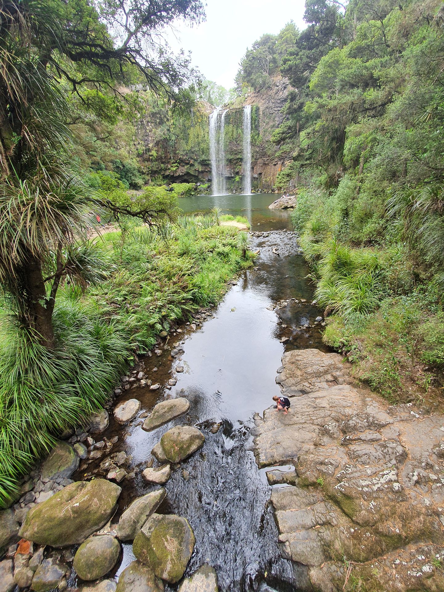
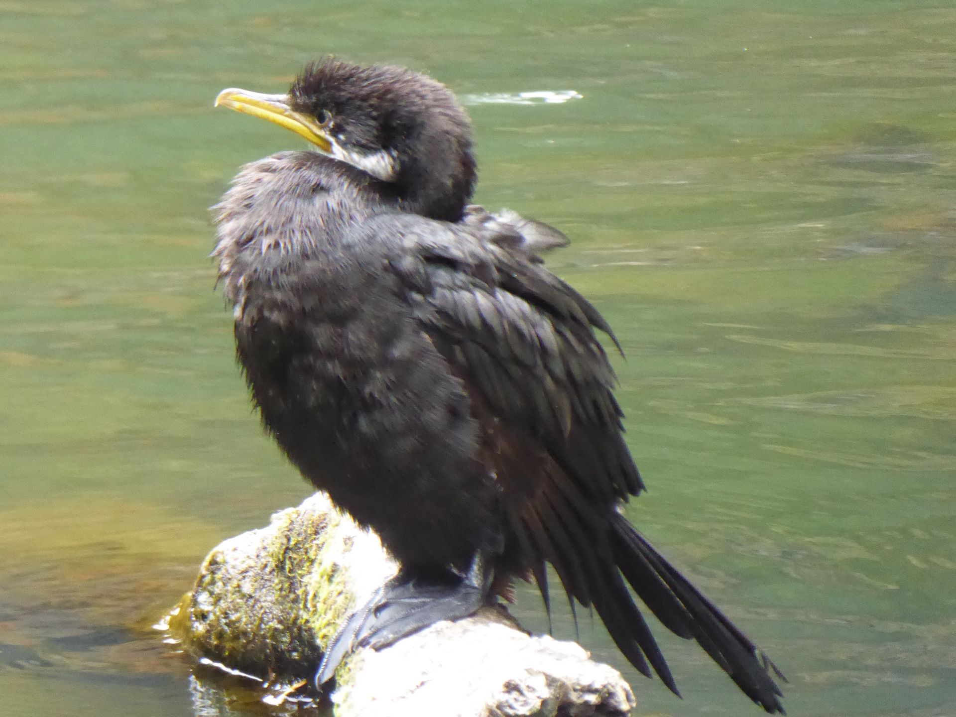
I continue to the more well-known Whangarei Falls, where the parking lot is also already full. Here you can walk around these falls on a 30-40 minute loop trail. They are truly beautiful, but there is definitely a lack of water compared to photos or postcards depicting them. A cormorant suns itself on a branch that extends picturesquely out of the water at the base of the falls. Above the falls, a memorial has been created: a lawn with 53 trees planted here in memory of the victims of the mosque shooting in Christchurch in March 2019. One tree for each victim.
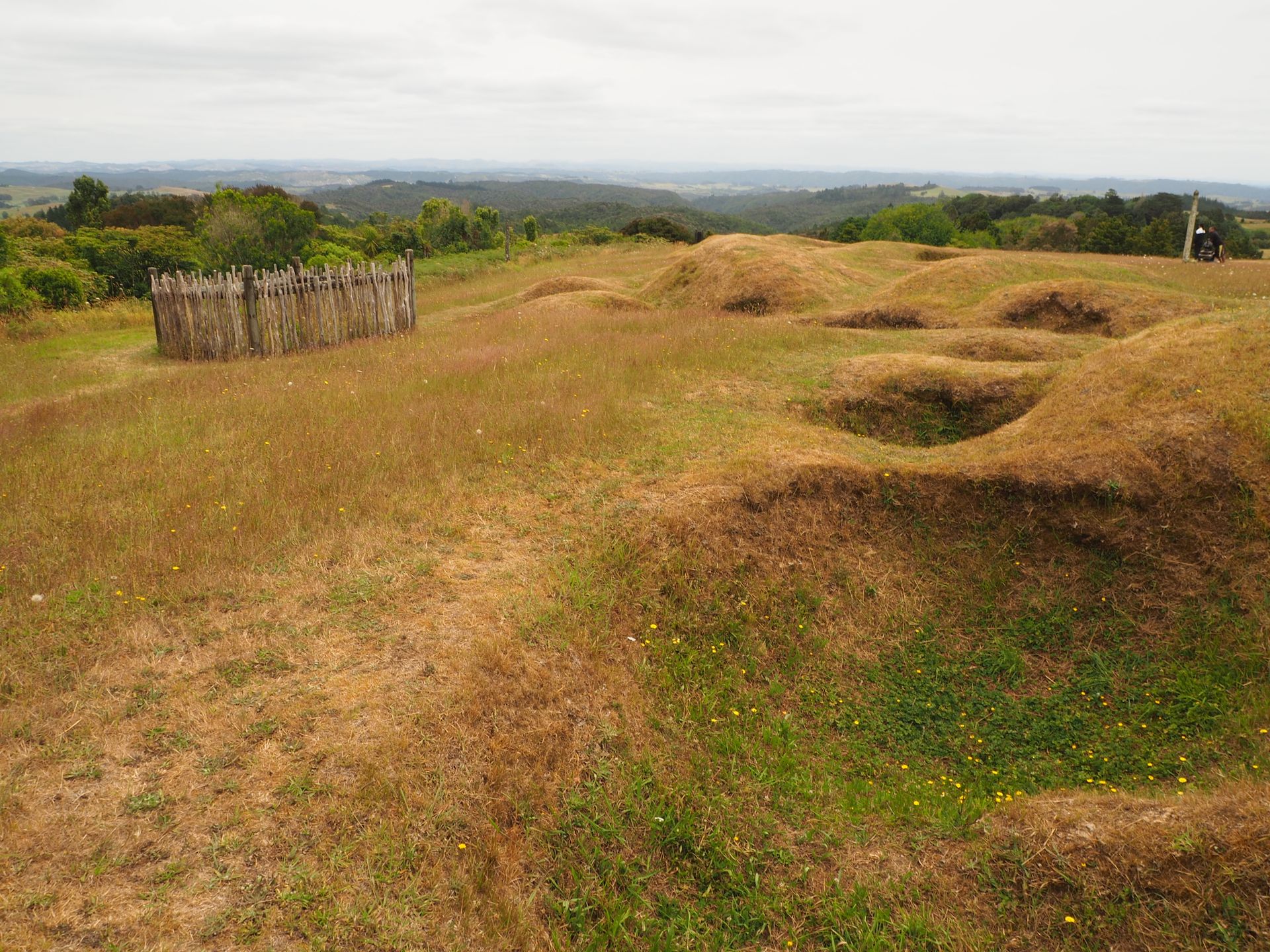
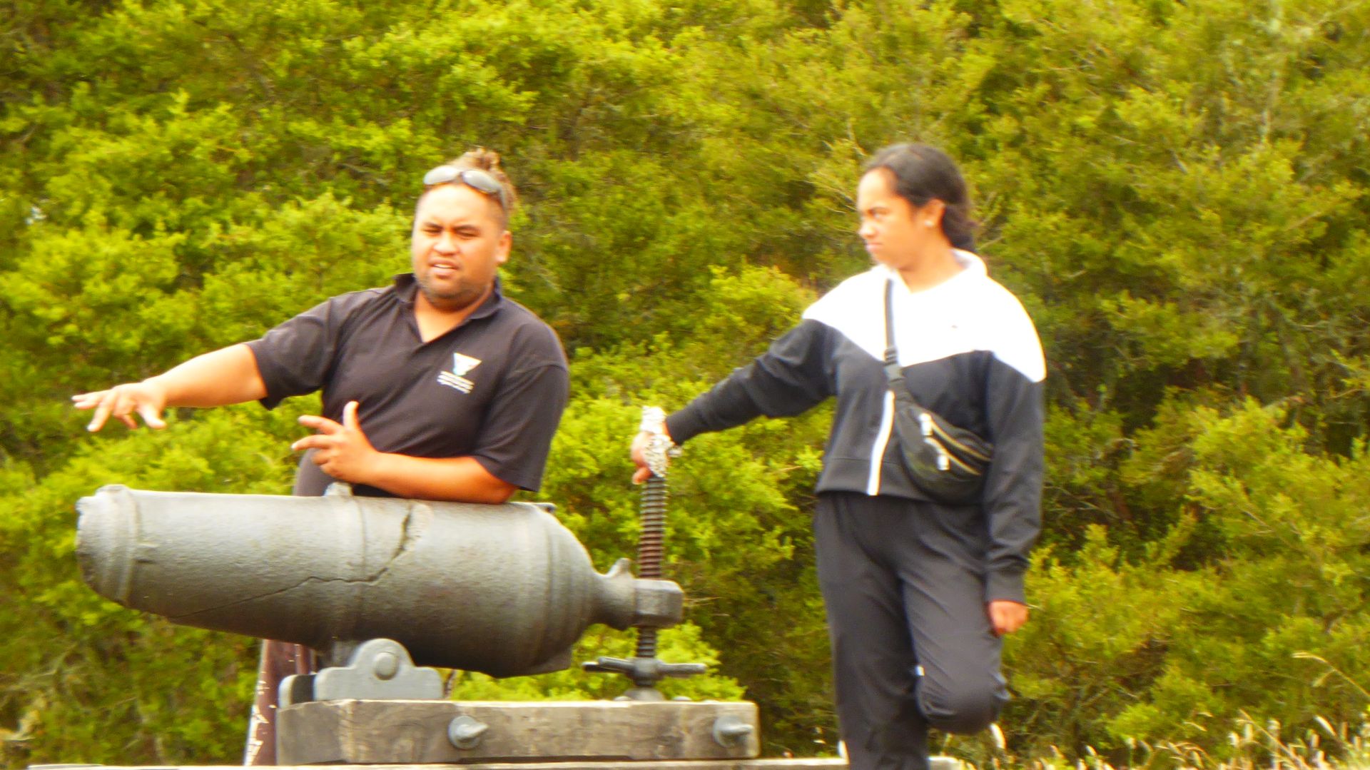
Since I am already north of Whangarei, I will now drive to Ruapekapeka Pa today. This is actually a battlefield from the time of the Northern Wars, which took place here between several Maori tribes and the English in 1845-1846. The Pa (a kind of fort/defensive structure) was an extraordinarily impressive construction.
The Maori built a kind of fort here on an inland hill where they had some logistical advantages. The English had to bring all their stuff here through difficult terrain while the Maori, who were still outnumbered, were able to withstand some heavy fighting here initially.
The reason for the conflict were the Waitangi Treaties. These treaties made New Zealand a colony of the British Crown. Due to translation errors (intentional or not), the paragraphs were interpreted differently, and certain interpretations allowed the colonial power to confiscate land from Maori, seize their land, and completely crush them economically and culturally. It's basically the same story everywhere you look, whether you're in Canada, the US, Africa, or India - colonial powers have practically taken everything away from the native population.
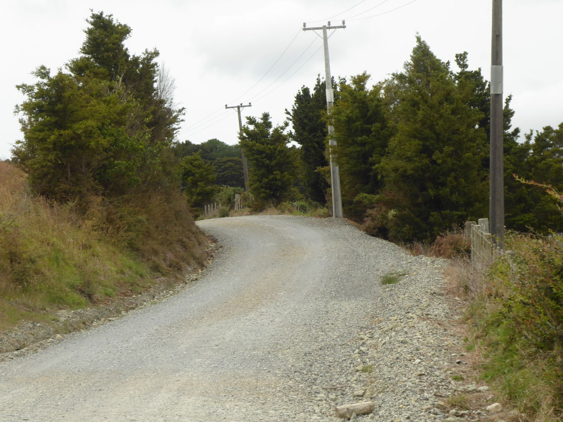
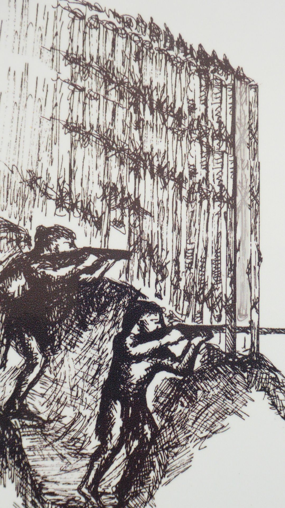
After Ruapekapeka Pa, I will now drive about 40 km, the last 5 km of which are gravel road. I drive alone through the area in stormy winds and have a great view, although it is a bit cloudy today. Ruapekapeka means 'cave of the bats' and describes the fact that the Maori built an underground facility for themselves here, which was also built above ground with palisades and deep trenches and caves.
The palisades are no longer standing, and the area of the structure is 'tapu', or sacred. So you walk around these grass-covered hollows and can hardly imagine that such a battle took place in this barren land.
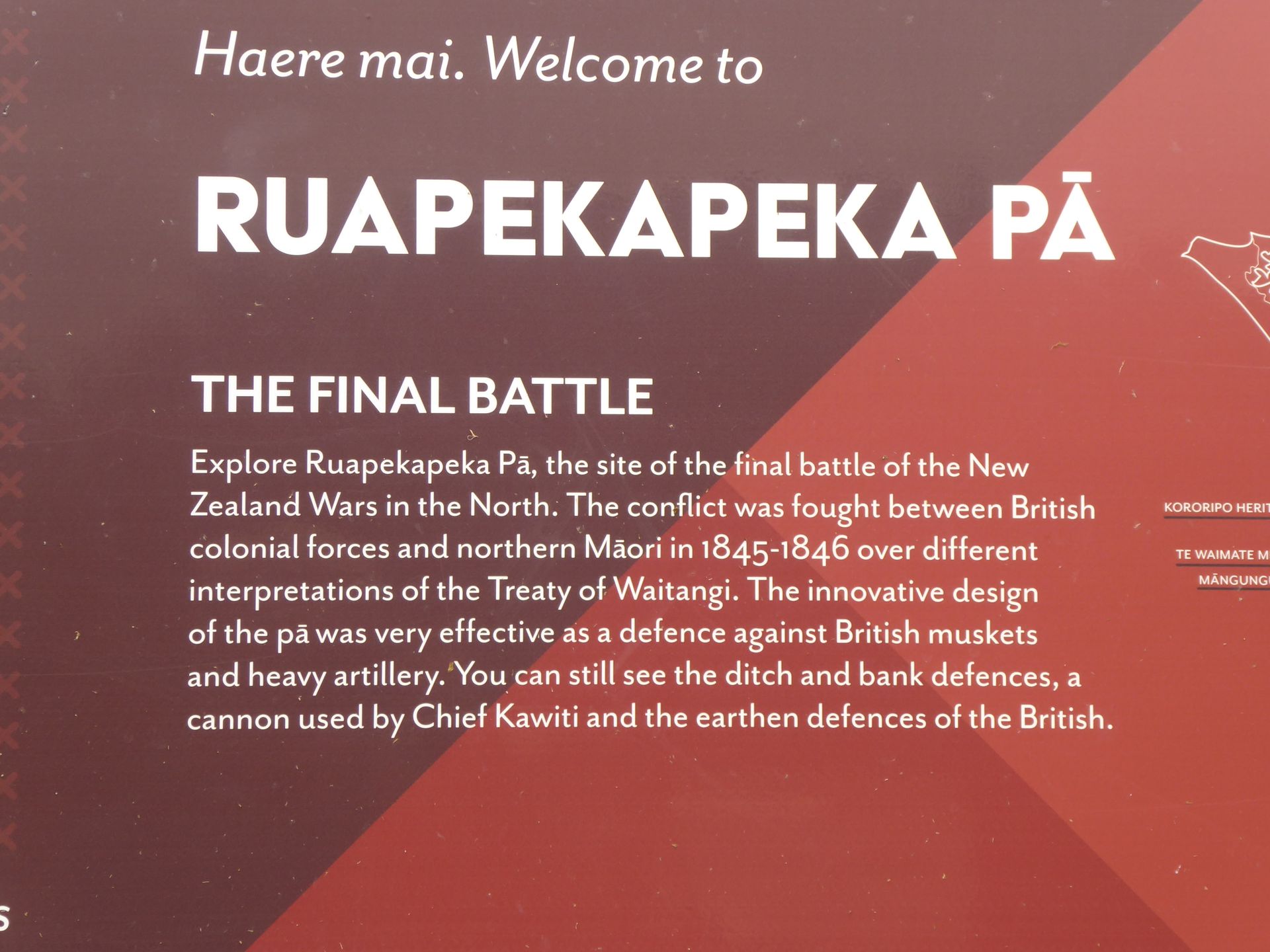
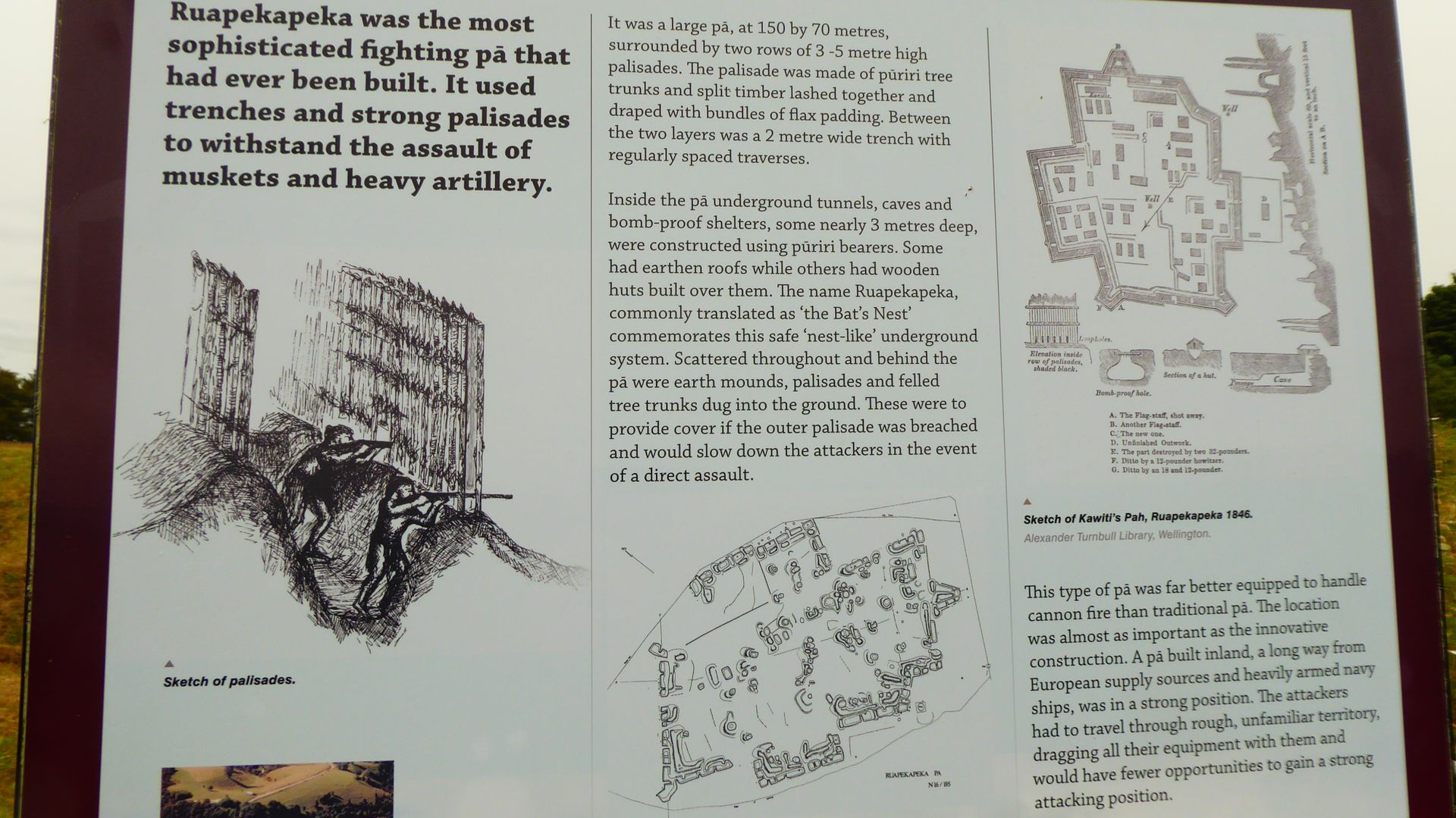
The chief who led the attack here had repeatedly cut down a British flagpole in a nearby settlement, which made him an enemy of the crown. For him, this was a sign of non-acceptance of the Waitangi Treaty - but of course, the British could not tolerate this. The treaties were signed in 1840 by the British and 45 Maori chiefs, but discontent simmered until armed conflicts broke out between some tribes and the British four years later. Other tribes, in turn, sided with the British and fought against their own people. Ruapekapeka Pa is famous and well-known because it was one of the largest and most complex Pas in New Zealand. It was designed to defend against cannons as well. The British appeared here in a force three times larger than the Maori. Hone Heke, the leader of this Maori tribe called Nhapuhi, led the first major armed conflict between the Maori and the British Crown. The British had previously taken over two weeks to transport material and people from their camp to the vicinity of the Pa. On December 27, 1845, they began bombarding the Pa. The British were unable to completely besiege the Pa because its outer dimensions were too large for their manpower. About 450 Maori with three cannons were facing almost 1200 British soldiers with several guns. When the British tried to capture the fort after two weeks of siege, they found that the Maori were practically all gone without them noticing. As soon as the Maori were inside the fort, they attacked and a bloody battle ensued, causing several casualties on both sides.
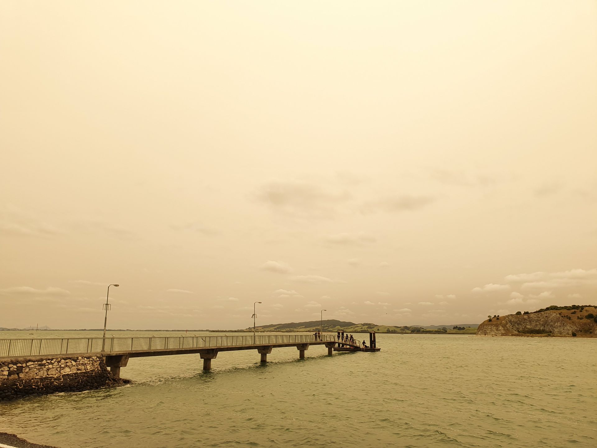
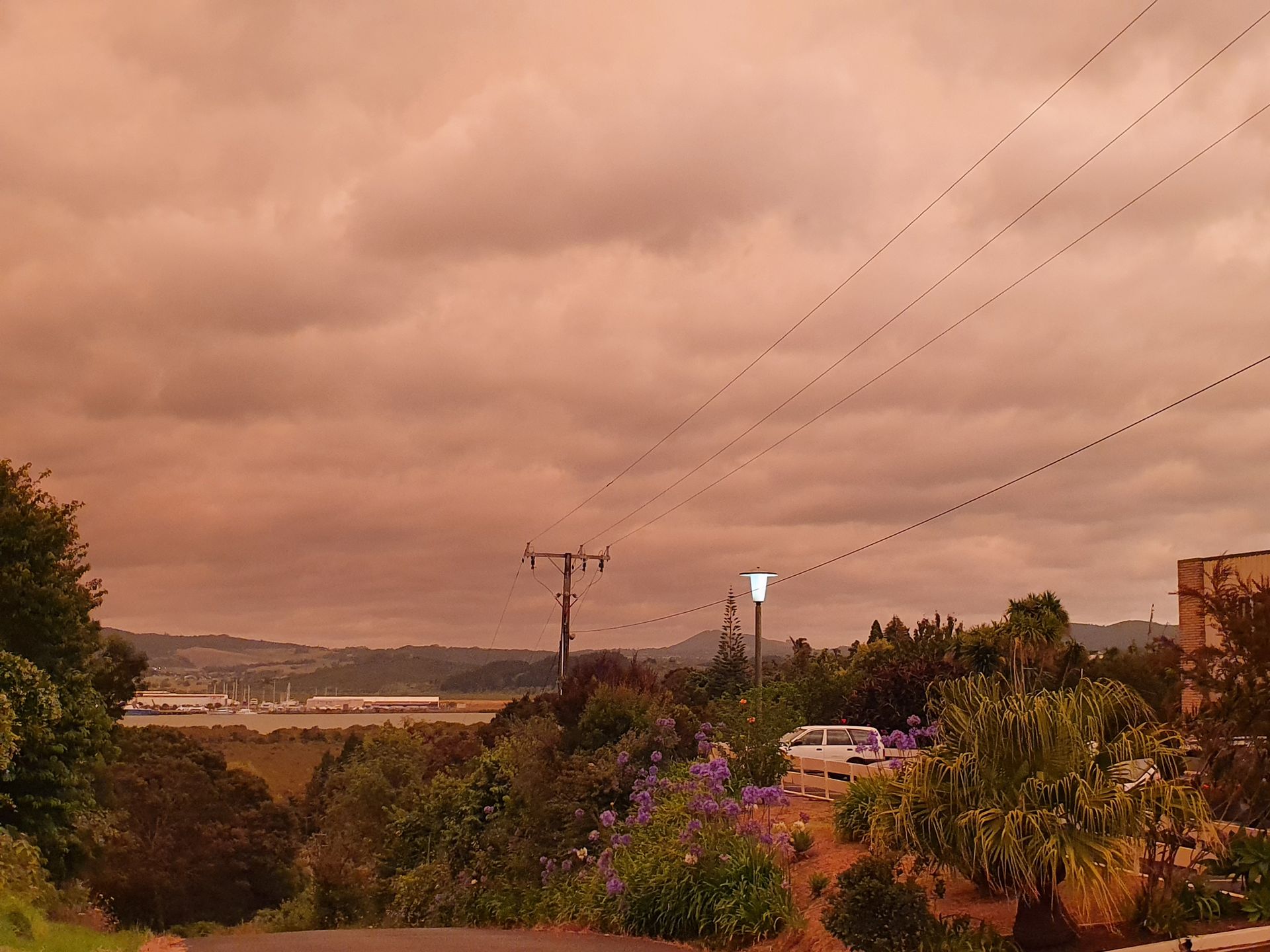
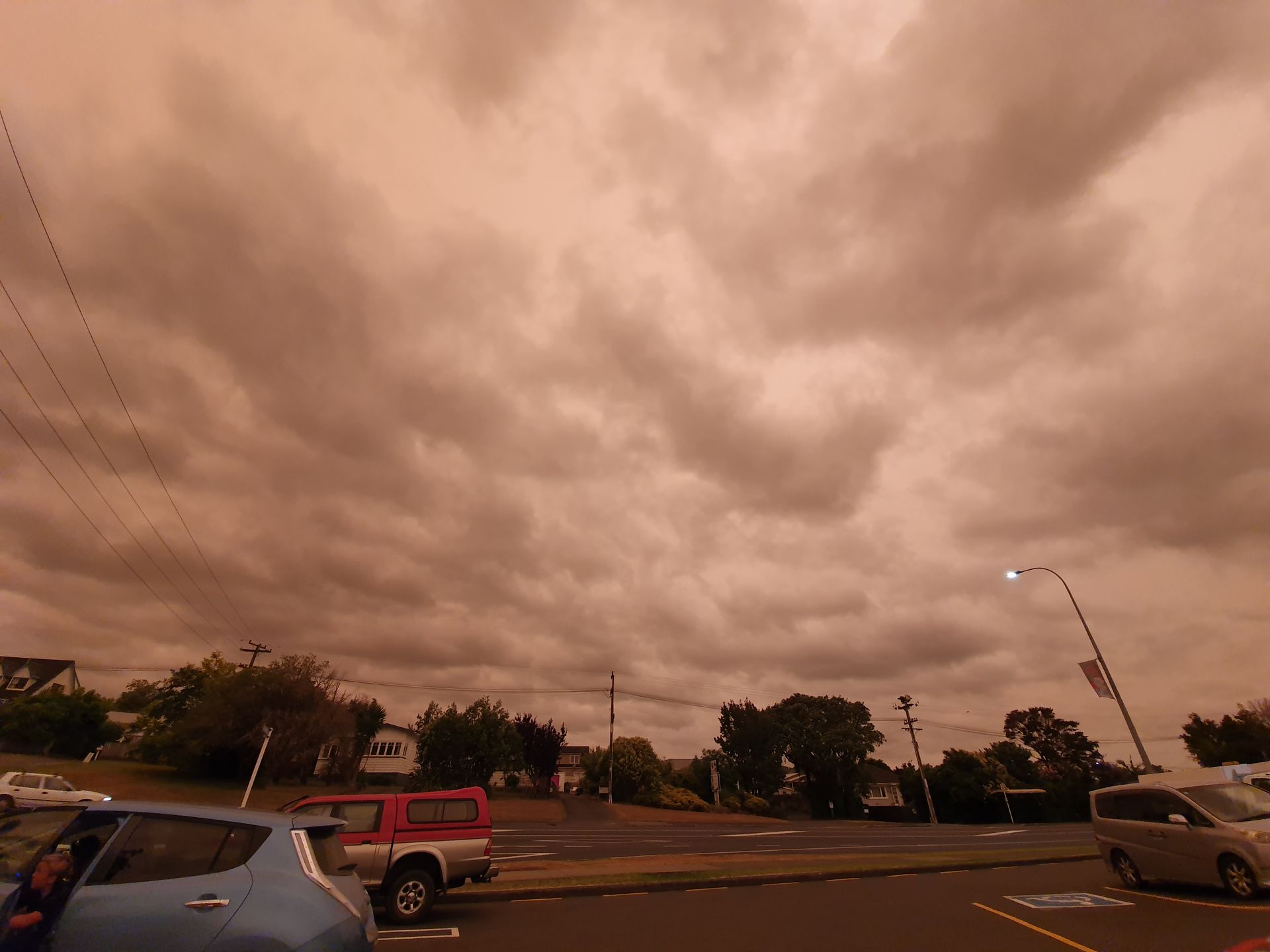
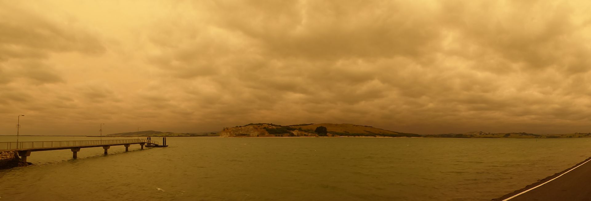
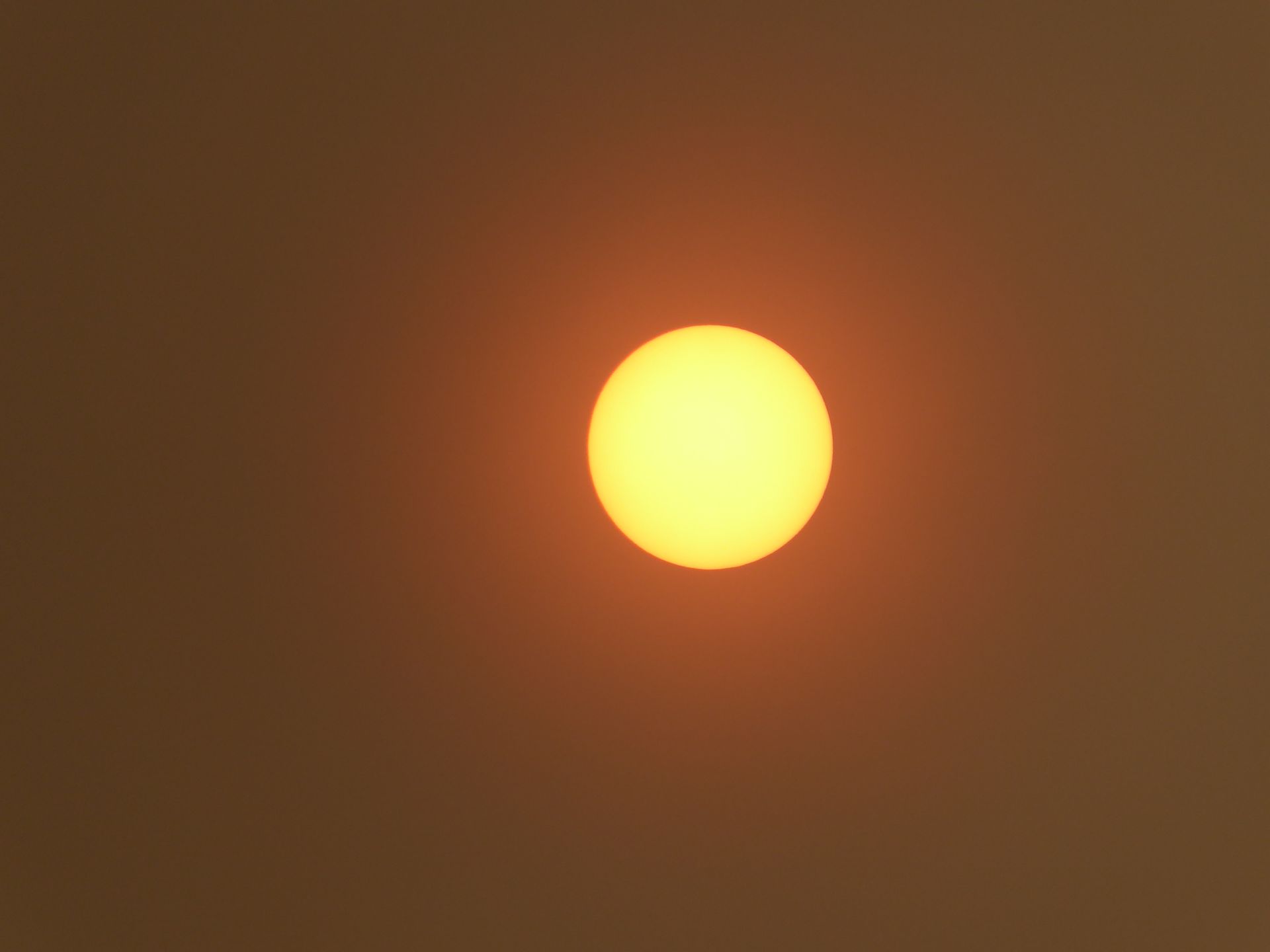
After all this education and insights into this sad phase of New Zealand's colonial history, I head towards the Whangarei Heads. A rock peninsula behind Whangarei. But while I'm still 30 km away, yellow-orange clouds move in front of the sun, creating a completely apocalyptic light, and I decide to make a short detour to Onerahi, a peninsula south of Whangarei, which is only a 10-minute drive away.
With a view of the turbulent water, I sit in my camper and make myself a coffee. The sky looks bad - it's the effects of the bushfires in Australia, which are 2500 km away.
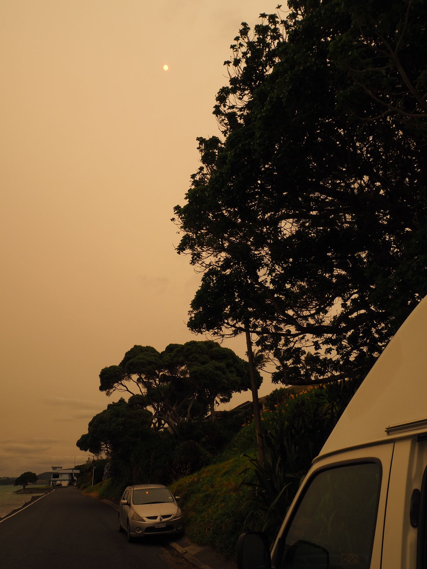
The temperatures noticeably drop, and as I drive back to the campground at 4 PM, everyone has their lights on, and the streetlights are turned on. Yesterday at this time, I was walking in the sun in Whangarei, but today that's not possible.
I make myself a salad, write in my diary (which is what I'm doing here), decide to stay here for a third night until the day after tomorrow, and then continue further north to do a night walk on Aroha Island with the hope of seeing kiwis. Tomorrow, I hope for clearer weather to make another attempt at the Whangarei Heads.
जाप

प्रवास अहवाल न्यूझीलंडांत