Thurids KEAdventure
vakantio.de/thurids_keadventure
Cape Reinga Day Trip
Oñemoherakuãva: 20.09.2018


Ejesuscribi Boletín de Noticias-pe
There wasn't better weather. Well, maybe a little bit. It didn't rain, but it was still very windy and cloudy.
For Wednesday afternoon, I had booked a ticket for a boat trip to the Hole in the Rock, which promised a glimpse of dolphins. However, due to the bad conditions, the ferry didn't go to the Hole, but only to a few islands in the Bay of Island. On the morning tour, a few people actually passed out out there.
I was not amused, so I changed my ticket to Friday. The weather is supposed to be great then. It better be.
But suddenly, I had a free afternoon that I had to spend somehow. Duncan would only pick me up at 5 pm.
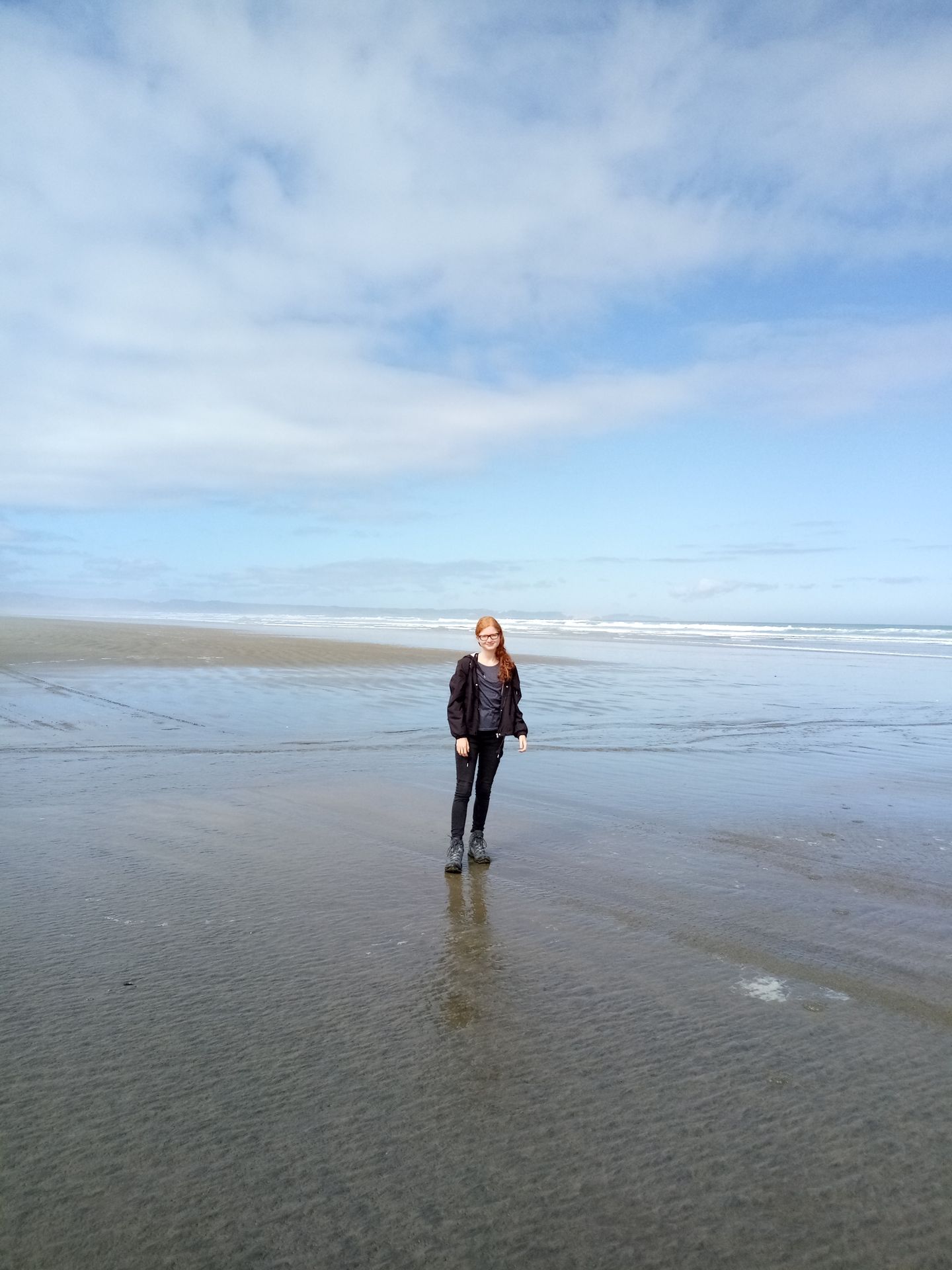
And as nice as Paihia is - it doesn't offer any entertainment in bad weather. So I went hiking, out of pure desperation. The path to the Haruru Falls went through a forest, which provided shelter from the wind and rain.
But the stones and roots were very slippery, and when I wasn't paying attention for a moment, I ended up on the ground faster than I would have liked. Nothing serious, my jeans and hoodie are now dirty, and I have a few bruises on my left hip. Shit happens.
But I still managed to get to the waterfalls, and it was nice to see everything at high tide. The mangroves were underwater, and the waterfall was definitely more massive (and dirtier).
At 5 pm, I moved from the hostel to Opua to Duncan's place. Now I get to live in my own room with a clean bathroom. I still don't know how to thank him for everything.
In the evening, we had pizza and watched a New Zealand film. But I went to bed relatively early because I had to start early the next day.
I had to wake up at 6 am, and I really don't know how I put up with it for so many years. It was terrible, but after four huge cups of water and coffee, I could start the day.
What for? Today, the day trip to Cape Reinga was on the agenda. The weather wasn't particularly convincing in the morning in Paihia, but the forecast promised a significant improvement.
As a rough orientation for you: over the Puketi Forest, the route follows Highway 1 to the West Coast, up to Cape Reinga via the Ninety-Mile Beach, and then back to the East Coast to Paihia.
The trip is part of my Stray Bus ticket, but the bus is from a different tourist company, Greatsight. The fabulous Fly was behind the wheel, and it was really fun to ride with her. I slouched into the bus with about 30 other backpackers. At least half of them fell asleep after the first half an hour, but I was awake. My problem was more the four cups of liquid that were happily gurgling away.
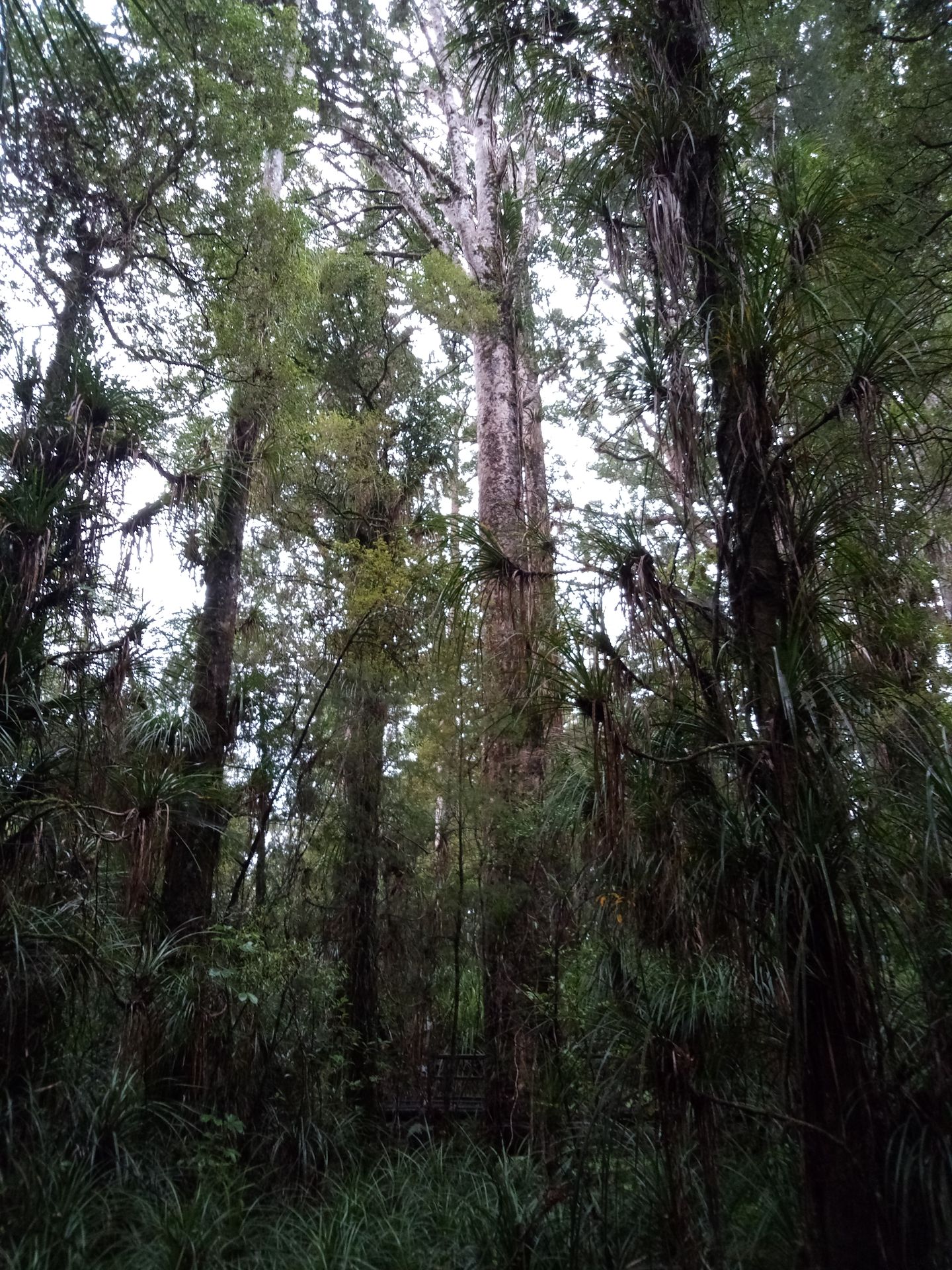
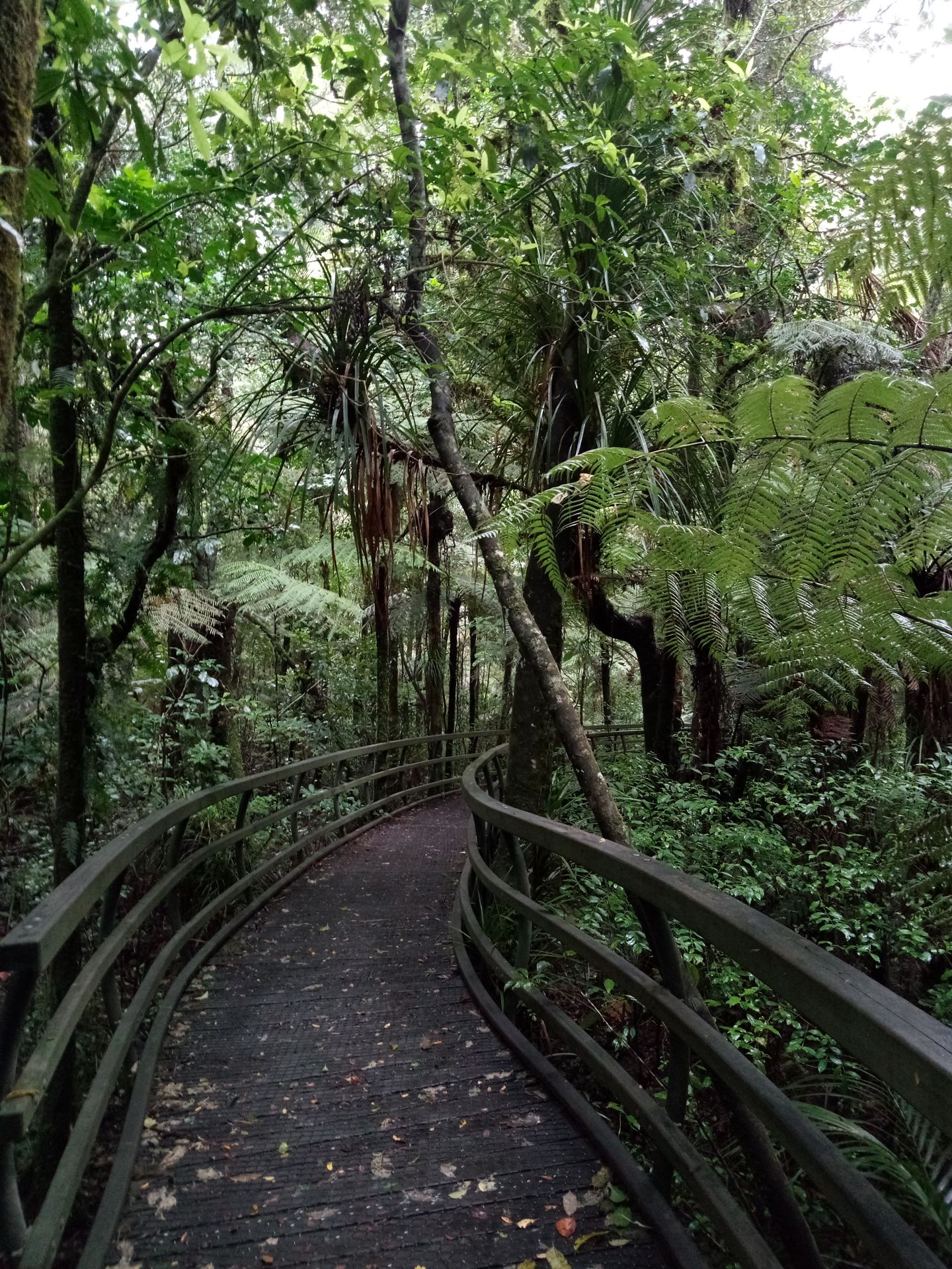
So I was glad when we stopped after a good half an hour. While everyone else impressively stomped into the forest, I initially went in the other direction. The plank path was built specifically for the Queen when she visited New Zealand in the 90s. It's hard to walk on forest floor with high heels...
After all the rain in the previous days, the forest was quite swampy, creating just the right rainforest atmosphere. But at some point, I had seen enough Kauri. So I won't visit the tallest one, Tane Mahuta, with its 54m, on the West Coast. Our fabulous bus driver found a suitable comparison for the Kauri: ancient massive broccoli in the landscape.
After the forest, we continued to the West Coast through Northland. I had already described the numerous green hills, which are actually volcanoes. There are a total of 60,000 inhabitants, just as many as in Whangarei. In Northland, up to 85% of people identify as Maori, more than anywhere else in New Zealand. The highways cannot be compared to German autobahns; they are single-lane and partly gravelly, making the journey quite rough and tough.
On the West Coast, we passed through numerous smaller villages. One historically significant village is Taipa - according to Maori legends, Kupe, the first discoverer of New Zealand, landed there. He is said to have followed birds from Eastern Polynesia over the ocean, which he saw fly year after year. And tadaa: big green land.
The first European to discover New Zealand was the Dutchman Tasman (yes, he also discovered Tasmania, where he happened to be in the area). His ship anchored between the two islands off Wellington, but it got into a conflict with the Maori. After fleeing, he no longer dared to set foot on that land.
The first European to actually set foot on the islands was once again Cook. He created very accurate maps of New Zealand, could communicate with the Maori, and named many parts of the country. This led to names such as Cambridge or New Plymouth.
Then the missionaries followed, then the settlers - the usual stuff. What was new to me was that there was a gold rush in New Zealand. The government offered a hefty reward to anyone who could show them the way to gold. A very clever guy set out from Australia with a chunk of gold, named a place in Coromandel, and collected a bunch of gold. But there actually was gold in Coromandel, and so the gold rush began. Diggers from Asia, Europe, and the States flocked to New Zealand.
The Americans mainly settled in Northland, so there is even a tiny village called California.
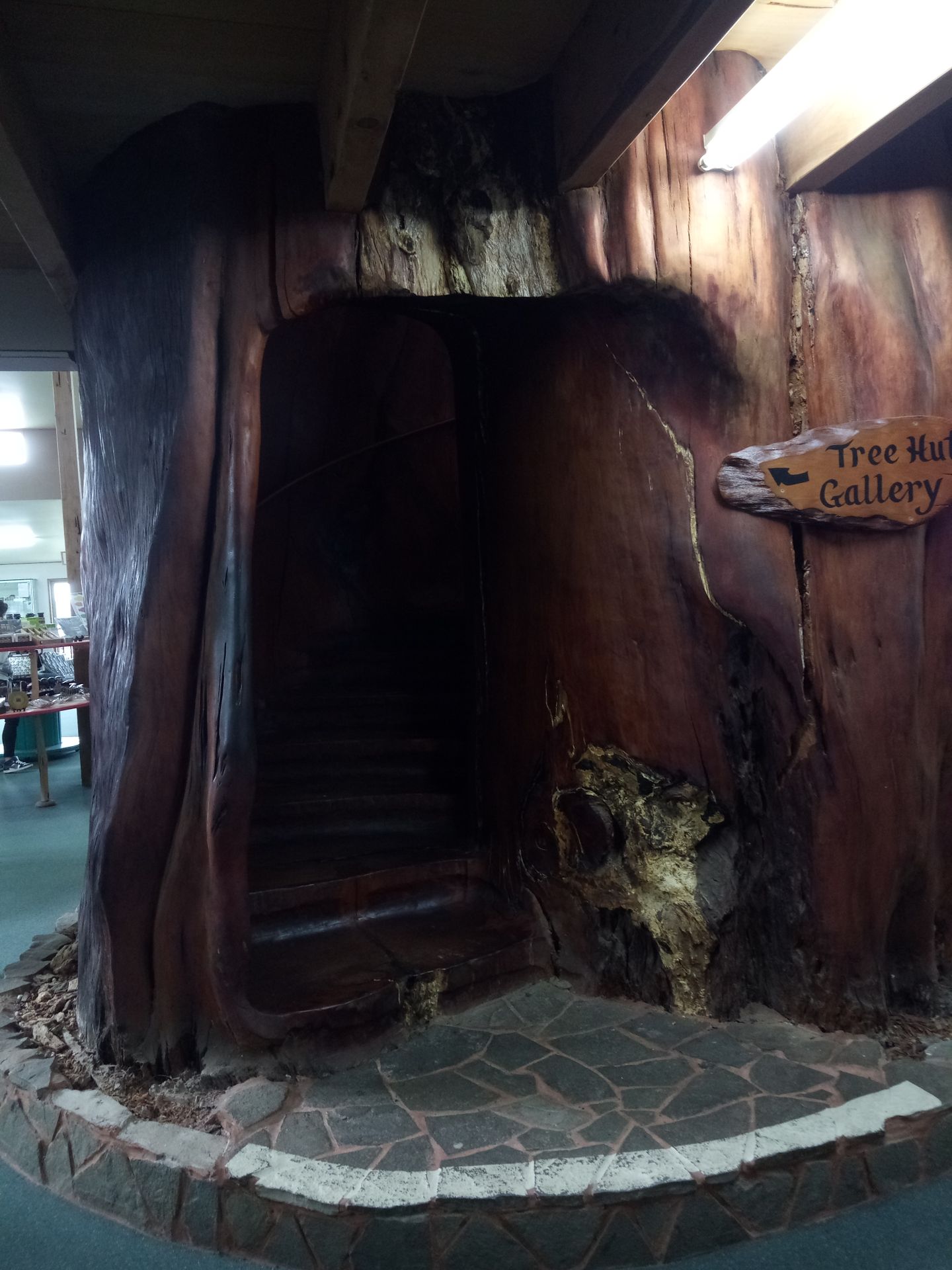
But what was more valuable than gold once again has to do with Kauri. In the soil of Northland, numerous tree trunks of the trees are hidden. Between 80,000 and 45,000 years ago, a strong wind knocked down all the trees (there are different theories, from earthquakes to tsunamis) that had been lying in the ground for millennia. Only the Kauri does not rot. The wood is still used today because living Kauri trees may no longer be felled. Some pieces are so large that an artist was able to carve a staircase into them.
The Kauri also produce a type of resin called Kauri gum. It is mainly used in the construction industry and was even more valuable than gold. The ash of the gum is used for the Maori tattoos and gives them their greenish color.
We continued past brightly colored houses (the colors were on sale back then) and former military bases that have been converted into pubs.
You may notice that it was a long journey with lots of information.
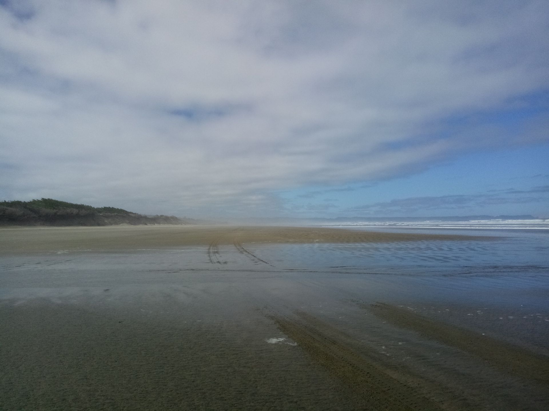
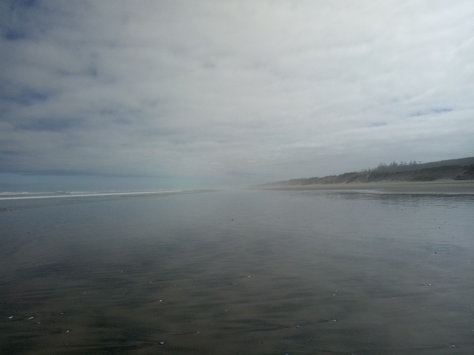
At some point, we reached Ninety-Mile Beach on the coast. The bus had special wheels, so we could drive on it, but normal cars should avoid the beach. Quite a few cars have actually sunk in the numerous dunes.
The beach used to be the only connection to the north when the highway didn't exist yet. Because the traders would take 30 miles a day and three days for the beach... Now it's getting mathematical, but that's how the name came about. Actually, the beach is only about 80 km long because you make slower progress in the sand.
So what can you expect on Ninety-Mile Beach? A really long beach. Don't get me wrong, it was beautiful, but that was it. You got a good impression of the wildness of the Tasman Sea and could take beautiful Instagram photos. Later, we even saw some exhausted seals resting on the beach.
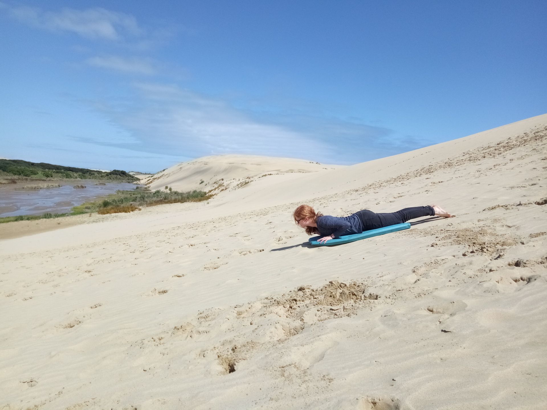
We continued northward, passing avocado and olive farms. We reached the sand dunes around noon, and the weather became really nice: sunshine and a few light clouds. Perfect for sandboarding.
It was so much fun! You really just lie on the board and off you go. The ride lasted about 20 seconds. The problem was that afterwards, you had to climb a huge dune with a bulky board, which took about 20 minutes and was hard on your calves. I was able to go down four times in total, and then the time was up. Only 30 minutes were scheduled for it. Too bad. But me and another backpacker were able to take some photos.
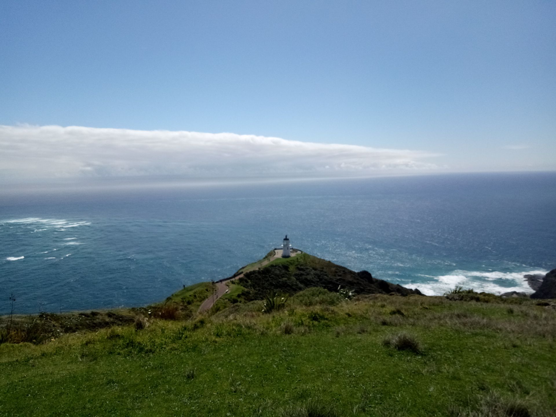
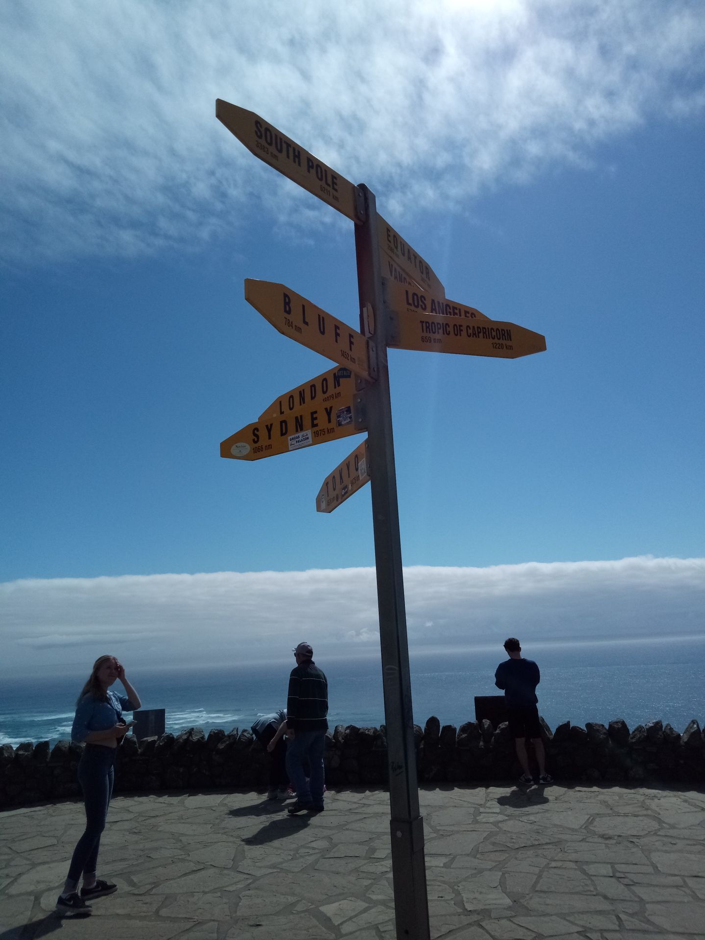
It only took 10 minutes to drive as far north as possible. Cape Reinga is not the tip, Cape North is 140m further north, but not accessible.
Cape Reinga is a sacred place for the Maori, so eating and drinking are forbidden. The Maori believe that the souls of the deceased fly to the cape and descend into the underworld there.
In any case, there is a lighthouse at Cape Reinga. Originally located elsewhere, it was moved there because ships were running aground near the cape.
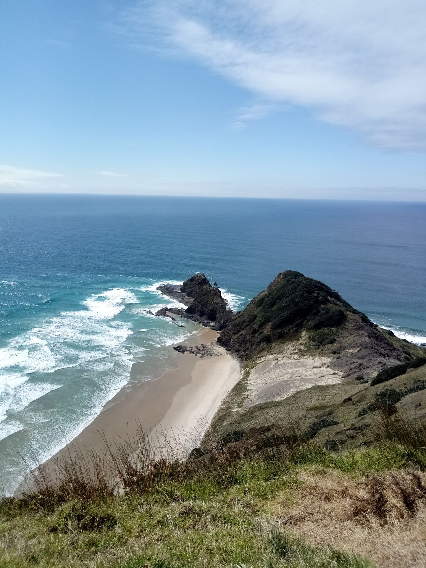
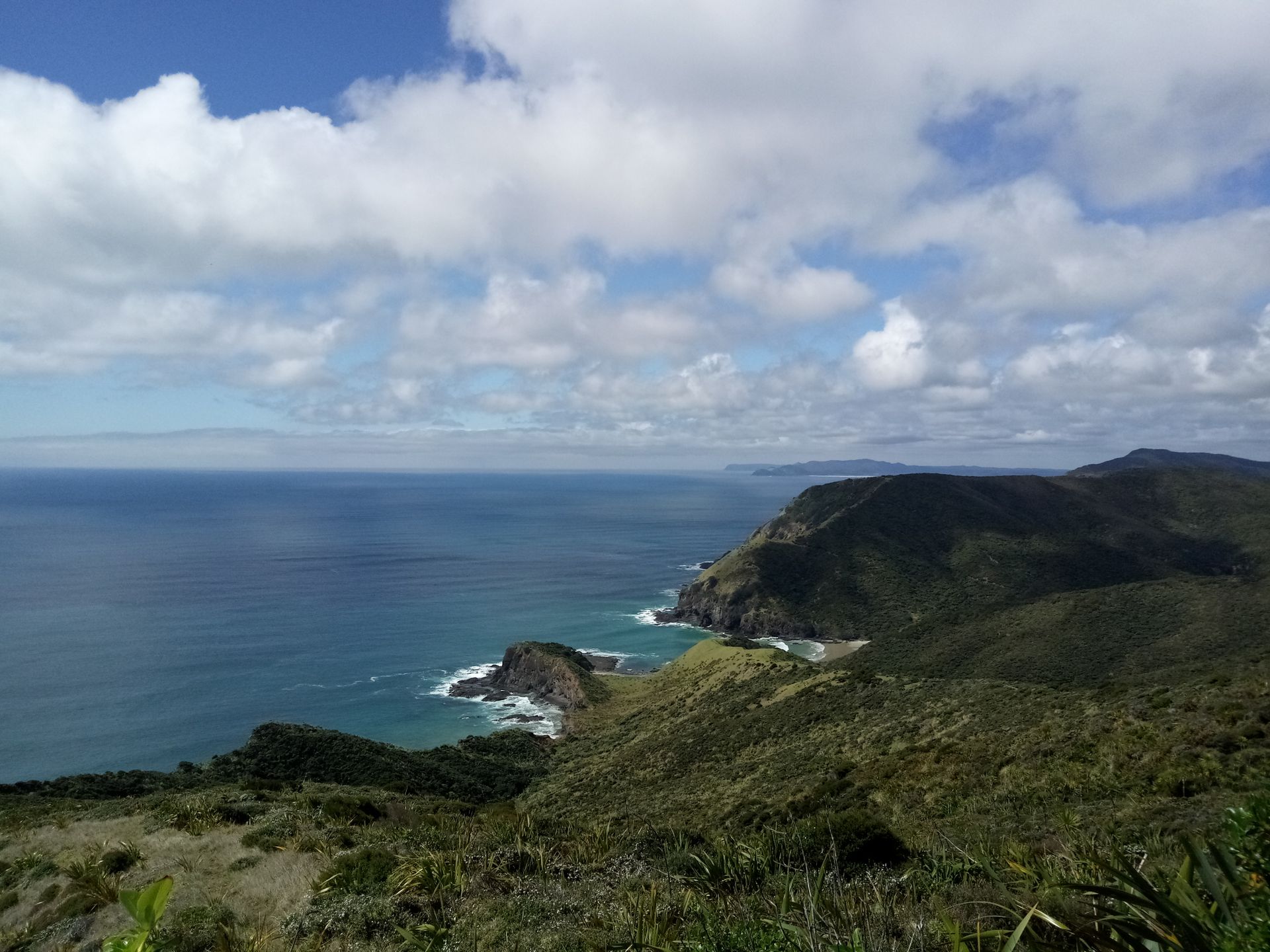
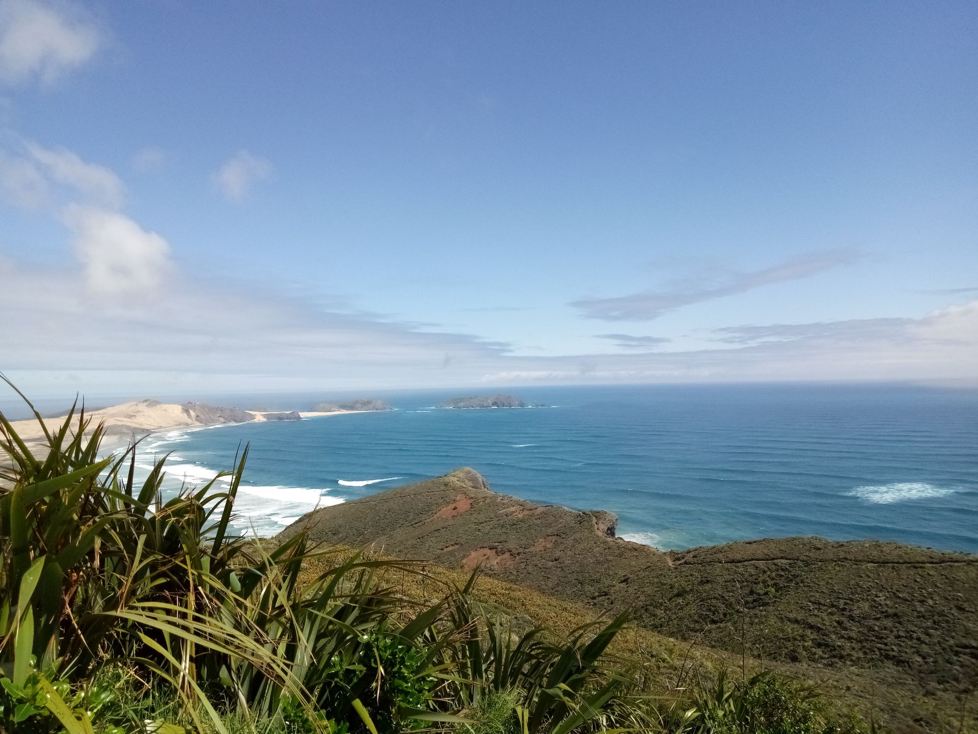
A ten-minute walk led down to the lighthouse past a fabulous view. The backpacker and I couldn't resist taking photos of ourselves (with poses, etc.), which put us in a real time crunch, even though we had 50 minutes. But the views of the surrounding cliffs and beaches were simply stunning. I couldn't get enough.
In addition, the Tasman Sea and the Pacific Ocean meet at Cape Reinga. You could really see a straight line between the two bodies of water. Where they mix, dirty eddies are formed. For the Maori, the Tasman Sea (very wild) represents masculinity, the Pacific Ocean (rather calm) represents femininity, and the mixing of the two signifies the creation of life. So it's a very spiritual place.
Although we had been sitting on the bus all day, general fatigue began to set in. Thank goodness, only the return journey was left now.
The only stop we made was at a fish and chips shop in Manganoui. Afterward, the whole bus smelled of greasy fish. Yuck.
There were once again numerous beautiful views of the landscape and the coastline, but the closer we came to Paihia, the more cloudy it became again.
Tired, Duncan kindly picked me up. We had delicious quiche and later even ice cream. I hadn't been so satisfied in a long time.
You know what's coming tomorrow - the long-awaited boat tour with great weather. I'll also come up with something nice for the afternoon so that you have something nice to read on Friday evening. And the plans for the weekend are already made - cliffhanger ;)
Ejesuscribi Boletín de Noticias-pe
Mbohovái

Marandu jeguata rehegua Nueva Zelanda