

Westcoast
Foillsichte: 25.02.2024


Subscribe to Newsletter
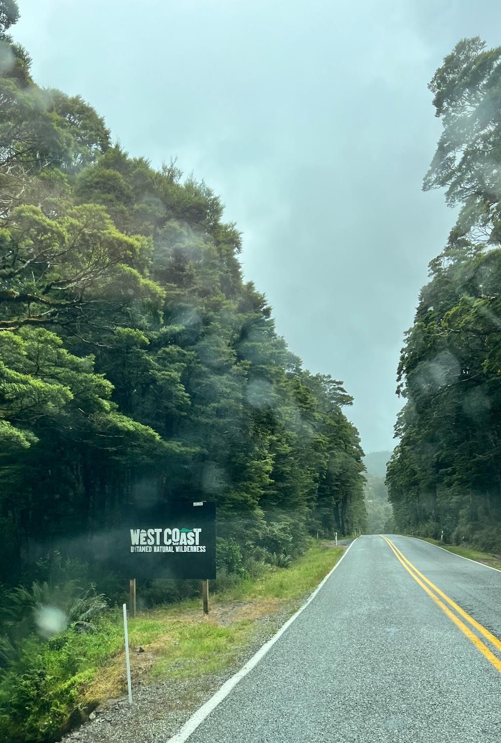
The West Coast of the South Island is known for its rainforests, hundreds of kilometers without civilization, its beautiful coastline and of course the changeable weather, which is probably the basic requirement for the rainforest. We reached the West Coast via the Haast Pass, which leads from Wanaka to Haast. The pass winds through the Southern Alps and has a lot to offer: lots of beautiful views and even more waterfalls. In keeping with the West Coast, the rain started right on the Haast Pass. As the name suggests, the pass ends in Haast. We thought Haast would be a slightly larger town with a supermarket etc., but luckily we checked again before we left Wanaka to see where the nearest supermarket was. This is in Franz Josef, which is another 150 km further north of Haast. Haast actually only has a small cafe, a gas station, a corner shop and a hotel. So we quickly noticed that there are few people living on the west coast and in the southern part (between Haast and Franz Josef) there seem to be none at all.
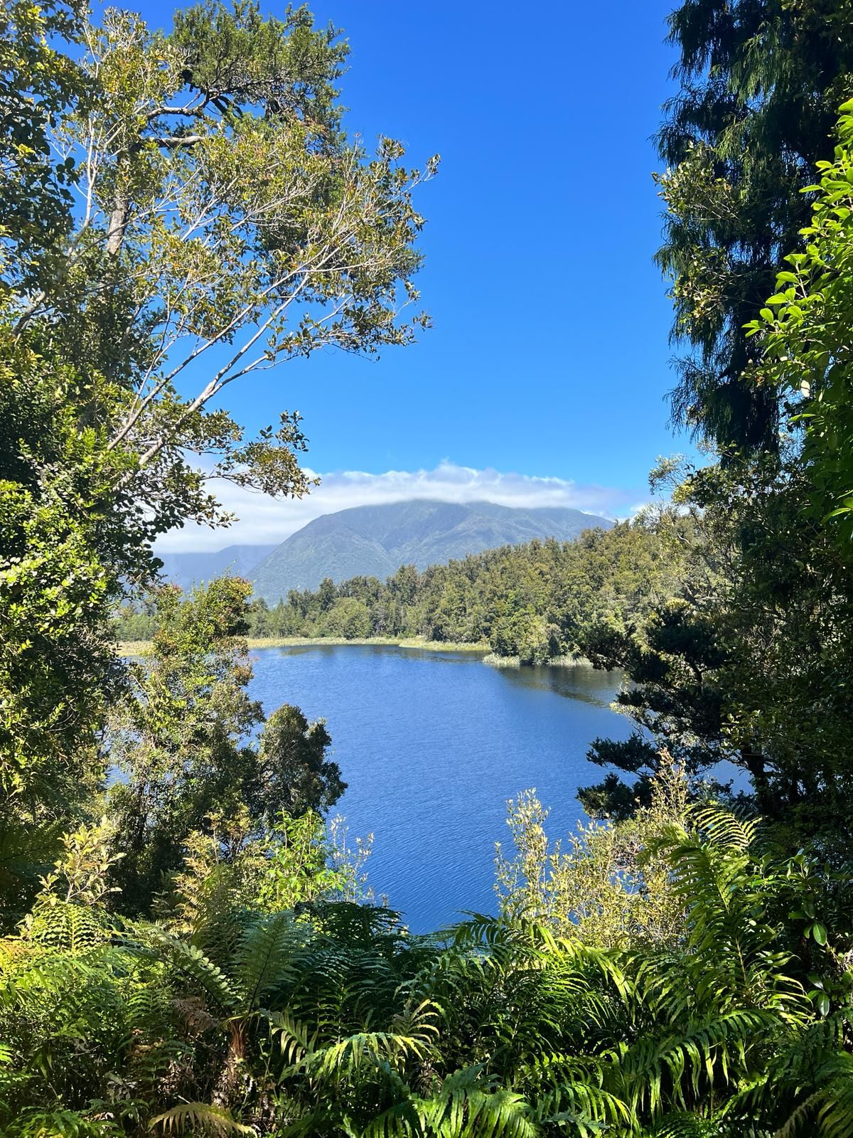
We spent the first two nights at a beautiful campsite on a lake between Haast and Fox Glacier. We sat out a rainy day here. Many people are probably wondering: What do you do in a small camper if it rains for a day or two. Good question, unfortunately we don't really know ourselves. So it's mostly just a bit of boredom and a bit of travel planning. Sometimes you're lucky and even have cell phone reception, so you can hang out on Instagram for a bit or watch a few series until your laptop battery runs out. Cell phone reception brings us to the next topic on the West Coast... you hardly ever have cell phone reception here.
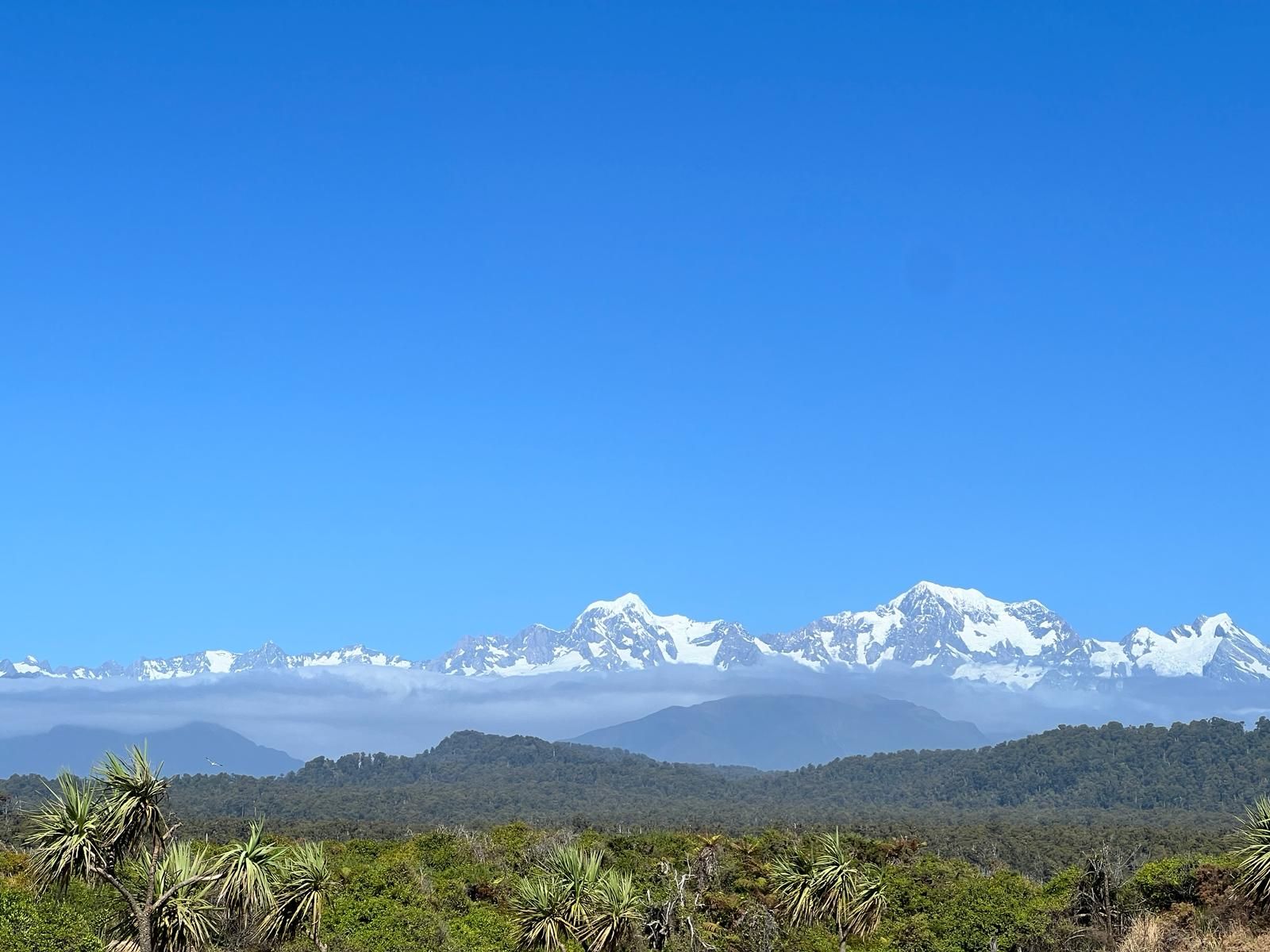
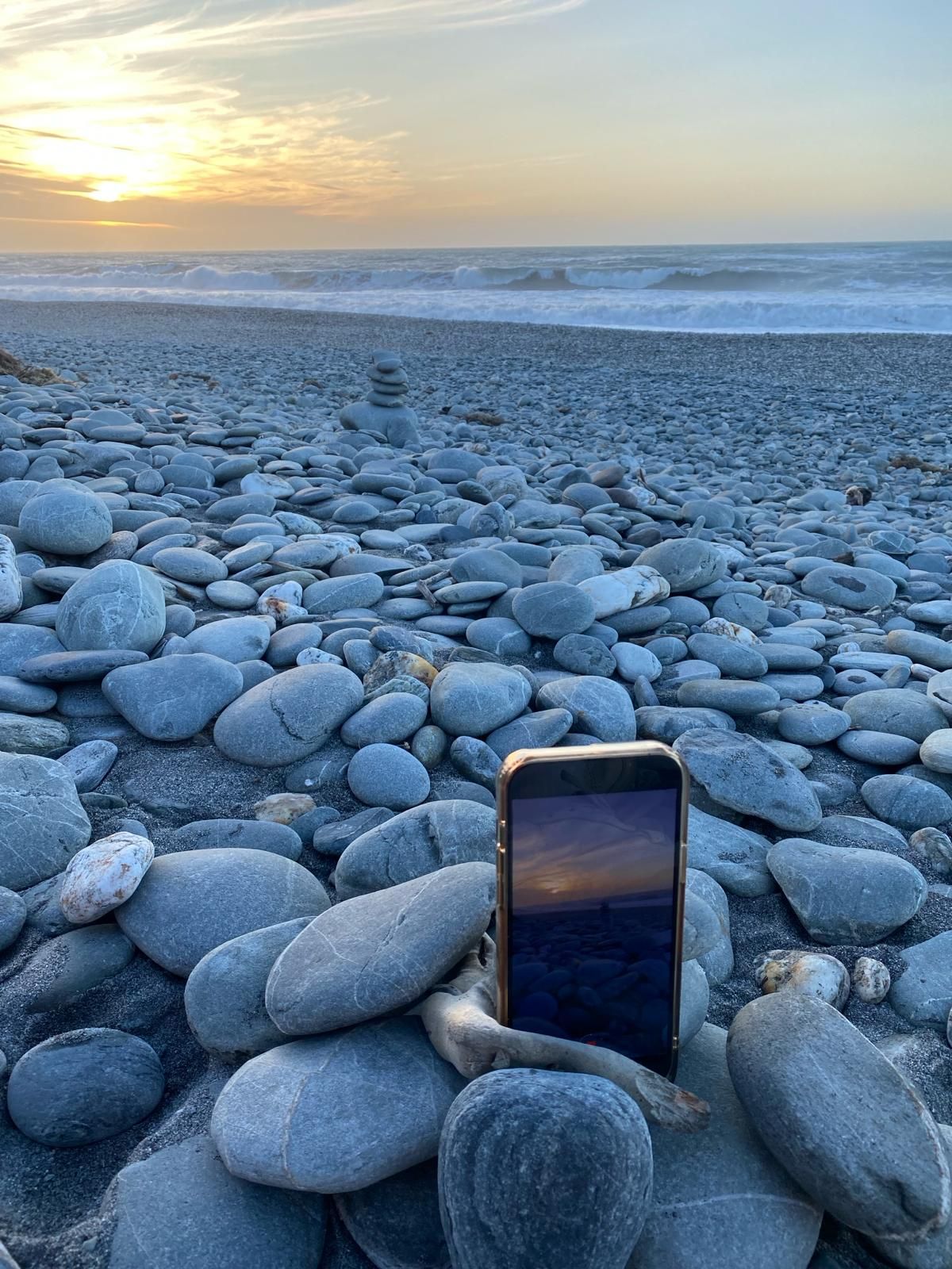
After the two nights in the pampas we went to Fox Glacier. This is located 20 km south of the Franz Josef Glacier and together the two glaciers form "Glacier Country", which is quite a tourist magnet. Helicopters fly onto the glaciers every minute. The two glaciers lie at the foot of Mount Cook (highest mountain in NZ). The Fox Glacier didn't even greet us at first because it was so cloudy that we could only see 100m away. So we first slept in a parking lot for a while and then the cloud cover actually opened up (as reported in the weather report). Weather forecasting is more of a lottery here, sometimes it's right, but most of the time it's not. With only a few clouds left, we went to the lookout point and looked at the Fox Glacier. We then went to Lake Matheson, where we did a short hike around the lake. From there, when the weather is really good, you can see Mount Cook and its reflection in the lake. Unfortunately for us, Mount Cook was still hidden behind clouds. As soon as we drove from Lake Matheson to our campsite on the beach, Mount Cook and all the other mountains around it appeared in all their glory. The pitch for the night was on a very nice beach near Fox Glacier. Here we had a very beautiful sunset and were able to look at the mountains again in the evening sun.
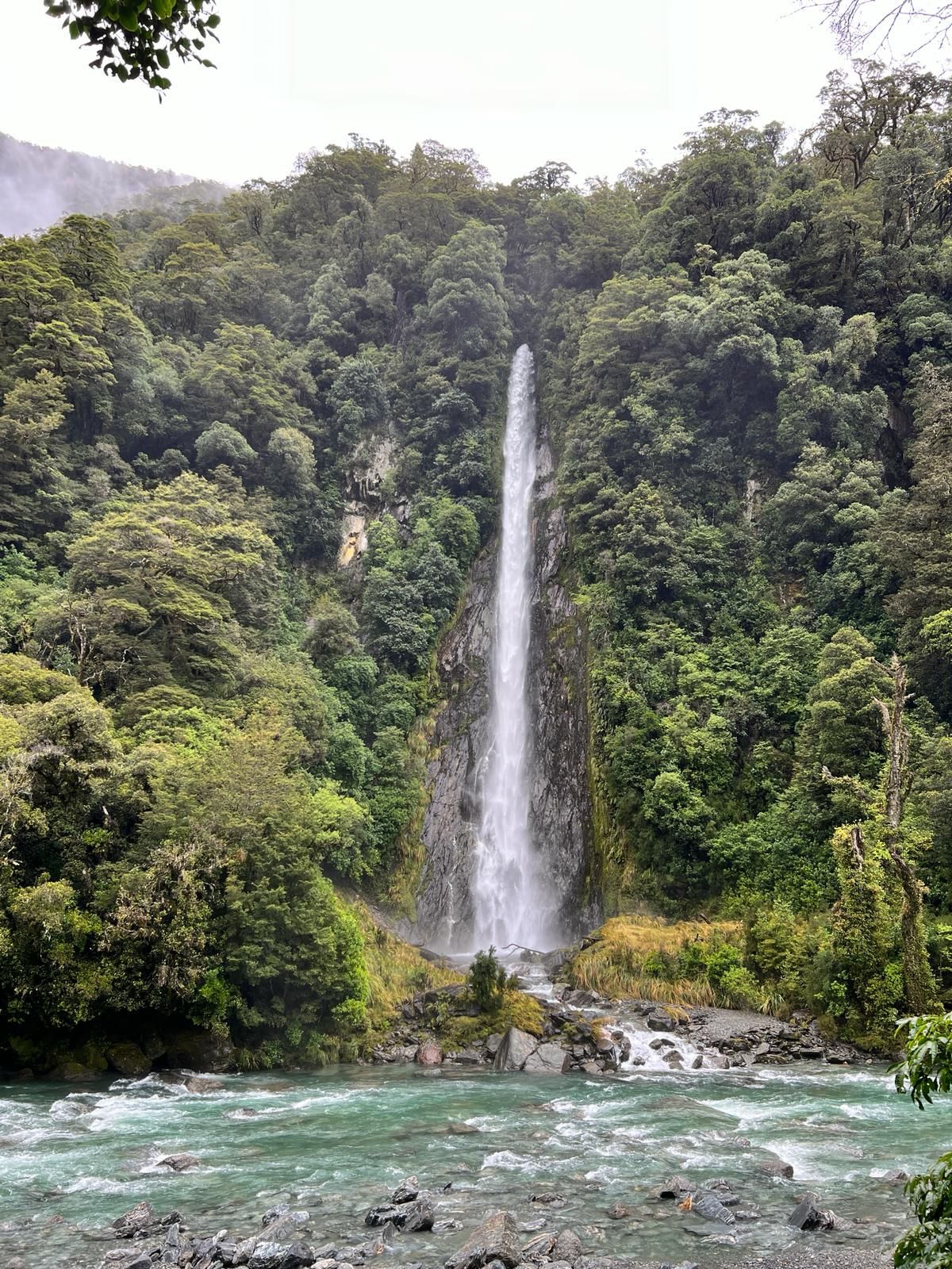
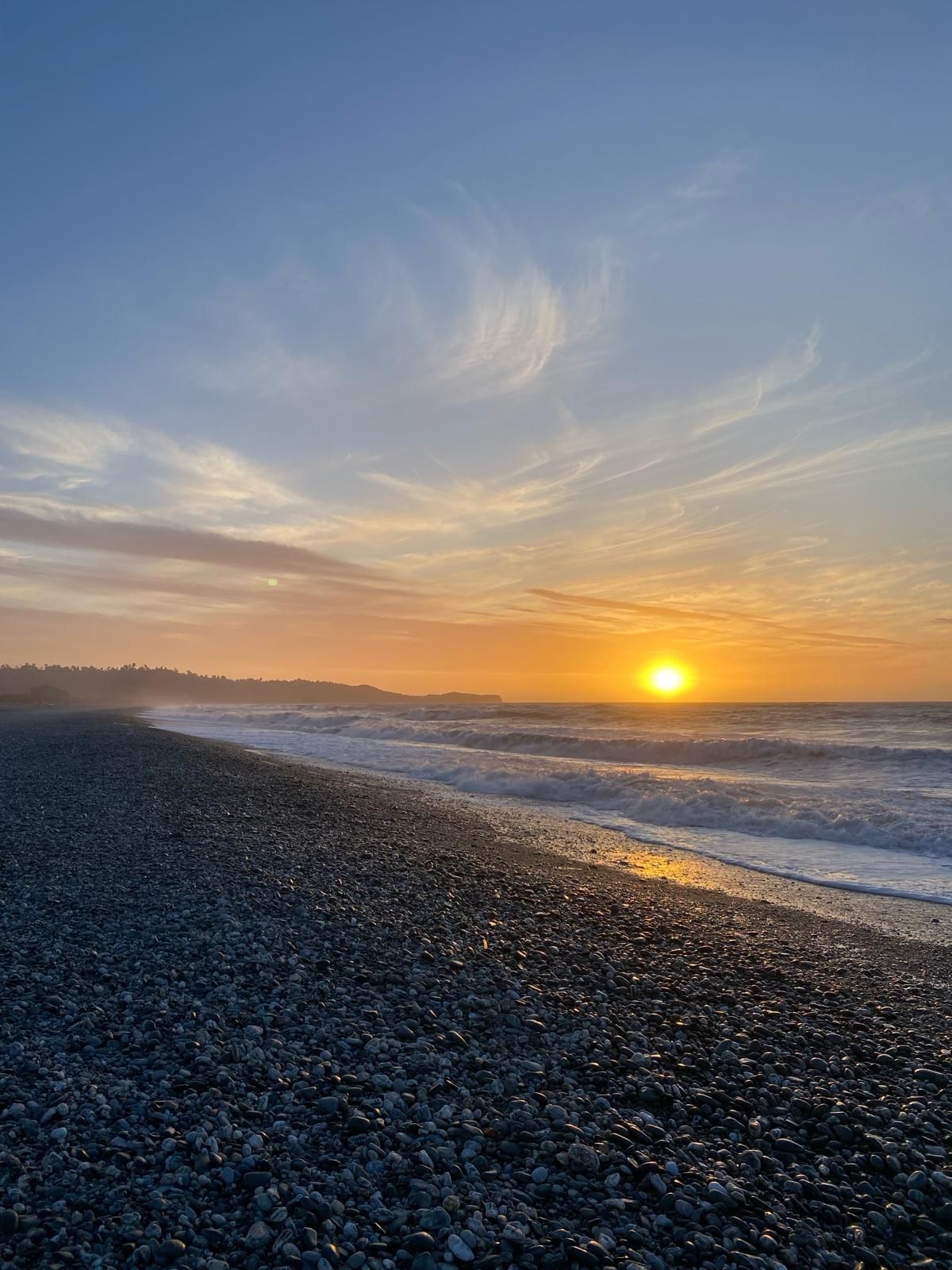
The next morning the alarm went off at 5 a.m. because we wanted to continue to Franz Josef and good weather was only reported in the morning. The advantage of this was that we could see a beautiful sunrise behind the mountains and that we saw possums for the first time. 3 or 4 of them were sitting on the street and didn't really bother to move. Possums are considered a pest in NZ because they eat kiwi eggs. That's why traps are set up everywhere to hunt them. In Franz Josef we then went on a slightly more demanding hike (approx. 3-4 hours). The highlight of the hike was a viewing platform from which you can enjoy a great view of the Franz Josef Glacier. During the hike, Tobi almost had a nervous breakdown because shortly before the viewing plan everything suddenly became covered in clouds (it wasn't reported in the weather report) and we got up at 5 a.m. specifically to see the glacier. In the end we were lucky and the clouds cleared again and we had a beautiful view. In Franz Josef we went to a real campsite for two more days, the reason for this was... who could guess?... another rainy day. At least we had WiFi, a kitchen, showers, etc. at the campsite, so it was bearable there.
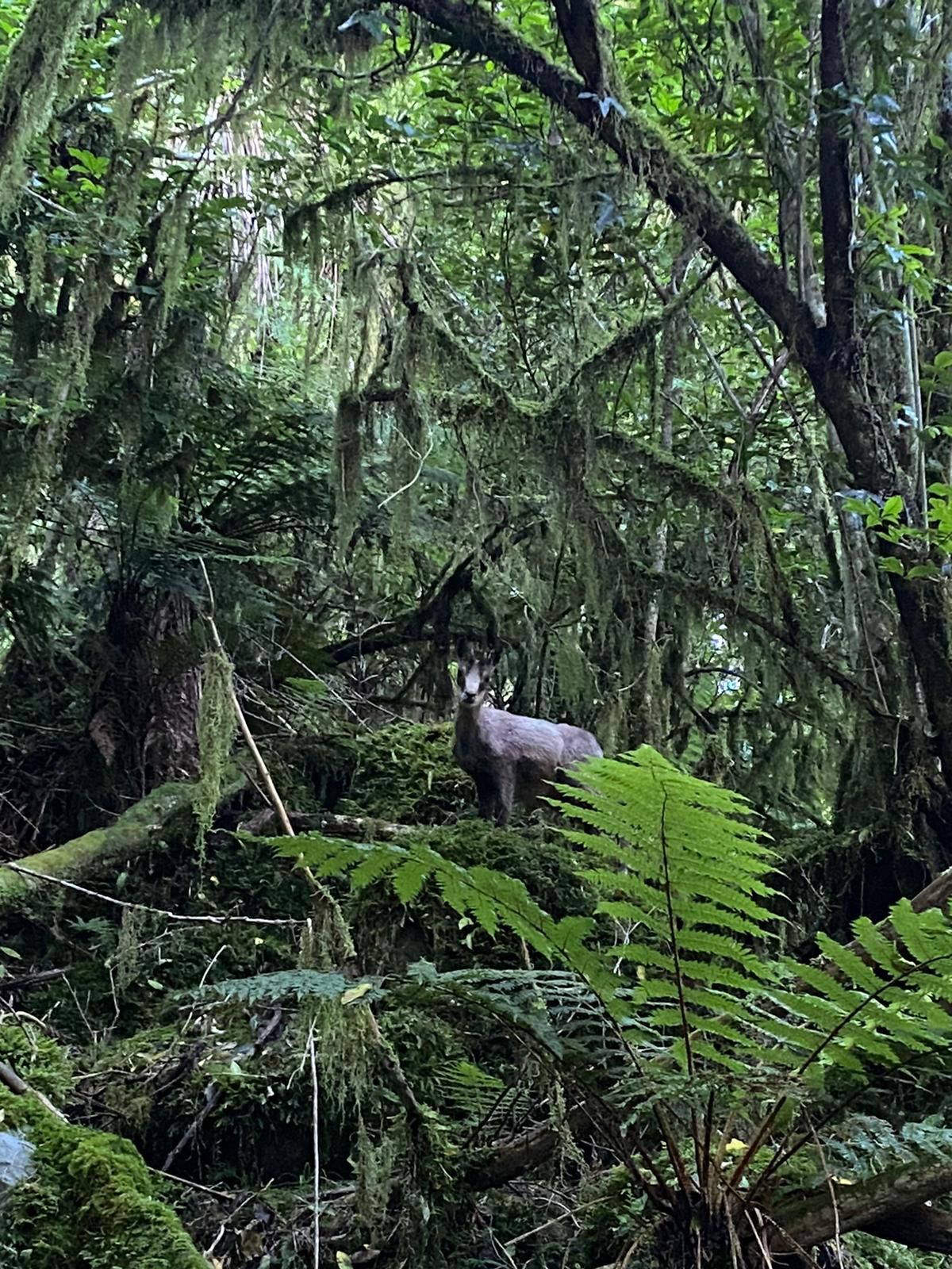
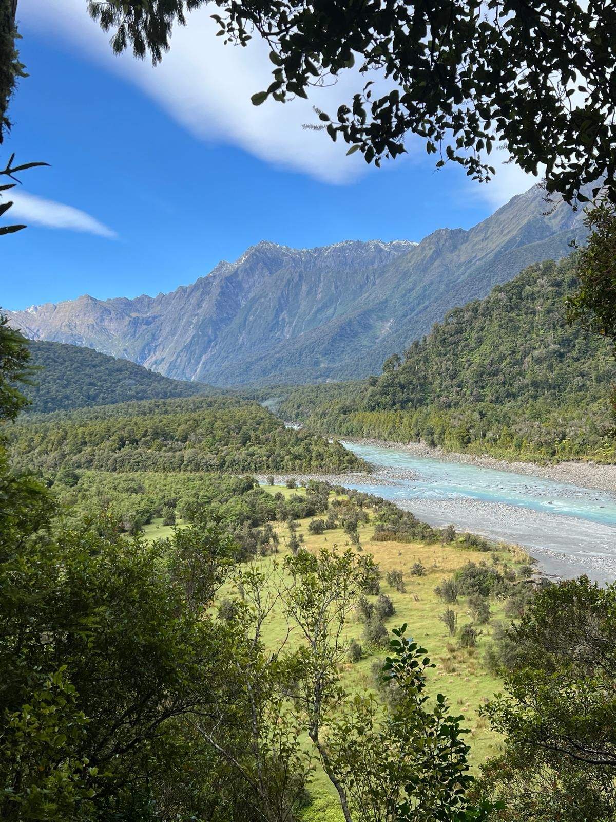
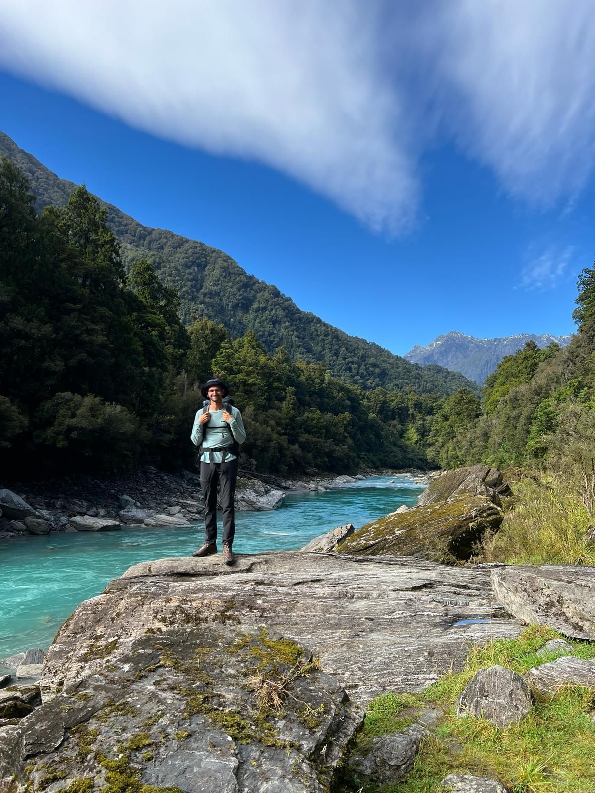
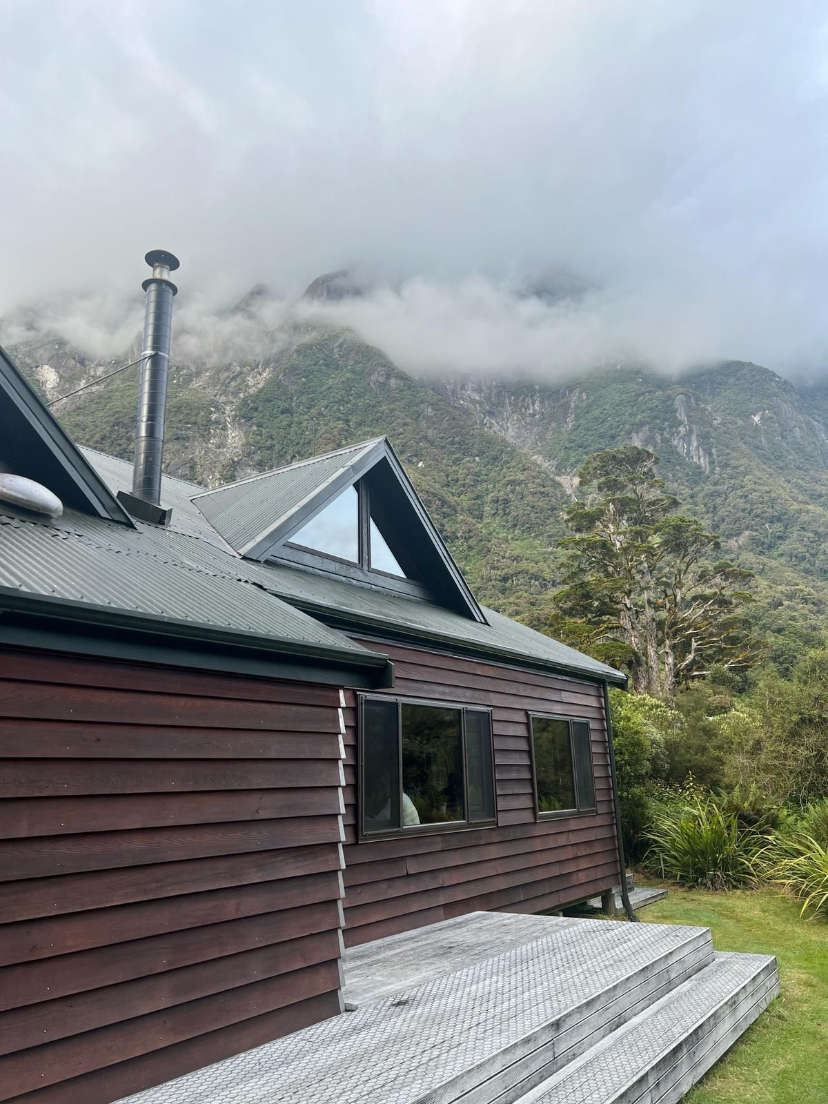
We then went back from Franz Josef in good weather, because a few kilometers before Fox Glacier is the Copland Track, a two-day hike through the rainforest to a beautiful hut with natural hot springs. Our biggest fear here were the keas (parrots that only exist in the Alps on the South Island of New Zealand and are critically endangered). Not because they are aggressive towards people, but because they love plastic and rubber and therefore like to attack parking spaces and tear out the rubber seals on the car windows. If you don't believe it, you can enter "Copland Track Carpark" into Google Maps and read the reviews including pictures. The hike itself was very beautiful, but also quite long. It was about 20 km to the Welcome Flat Hut and it took about 6 hours. Of course, you have to take all your own food, camping stove, sleeping bag, etc. with you, which means the backpack isn't particularly light. Once there, we thoroughly enjoyed the hot springs (with an incredible number of sandflies/mosquitoes) and then let the evening end. The next day we took the same route back to the parking lot and luckily our car was spared from the keas.
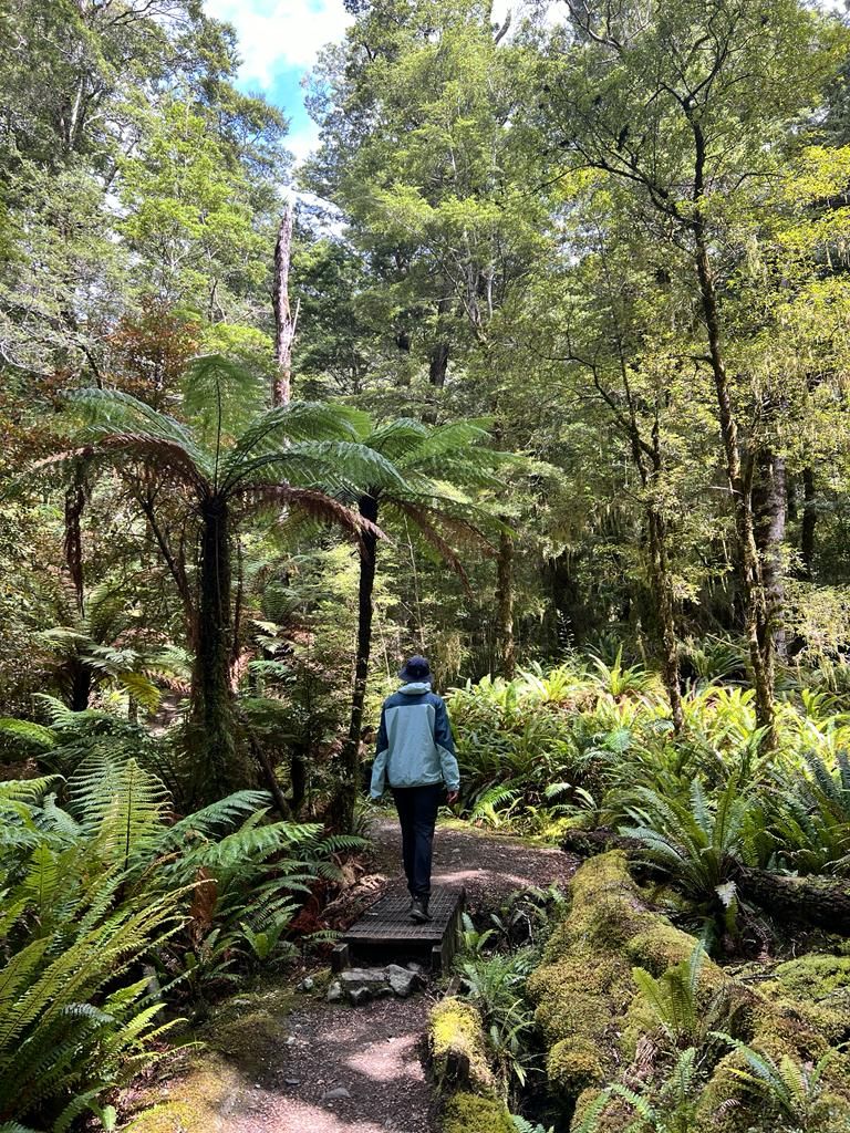
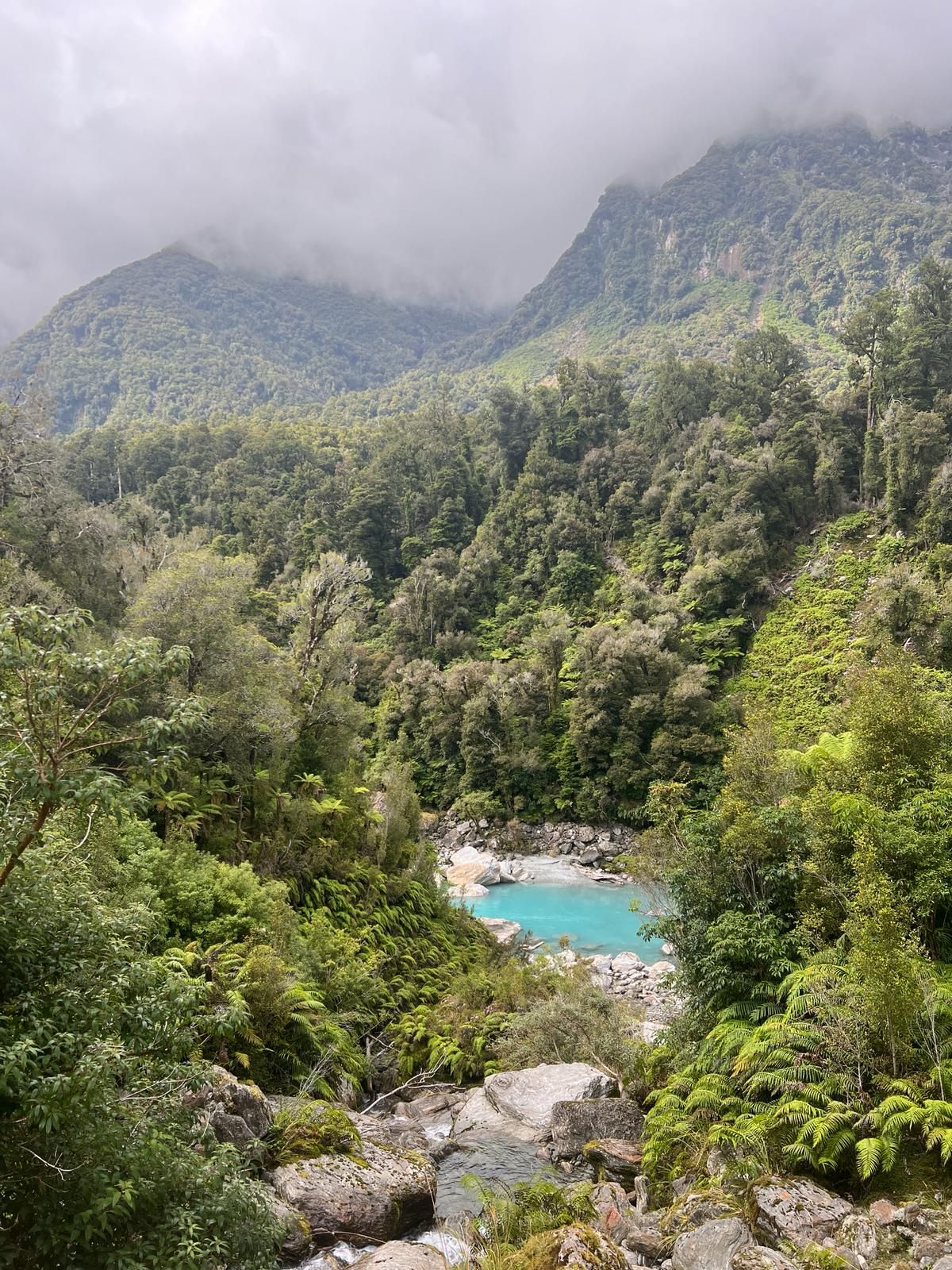
The next destination was Hokitika, the first really major town on the West Coast (both Franz Josef and Fox Glacier are only tourist towns) after almost 300 km. We stood there for two days at a beautiful, larger campsite by a lake. Here we walked a treetop path, looked at what is probably the most turquoise river in NZ and visited a grotto with glowworms at night. From Hokitika we continued to Greymouth. Here we spent another rainy day in the indoor pool with sauna and whirlpool. Greymouth isn't called Greymouth for nothing, you never actually see the sun here. Despite this, Greymouth is the largest city on the West Coast.
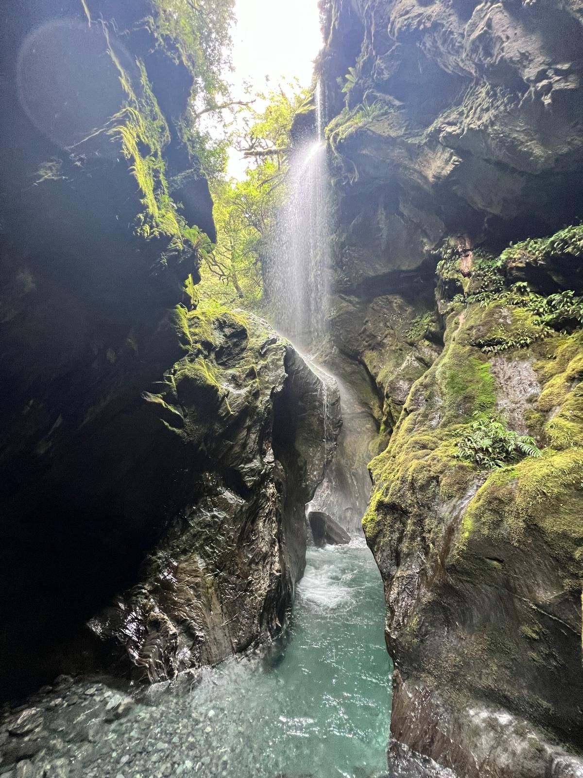
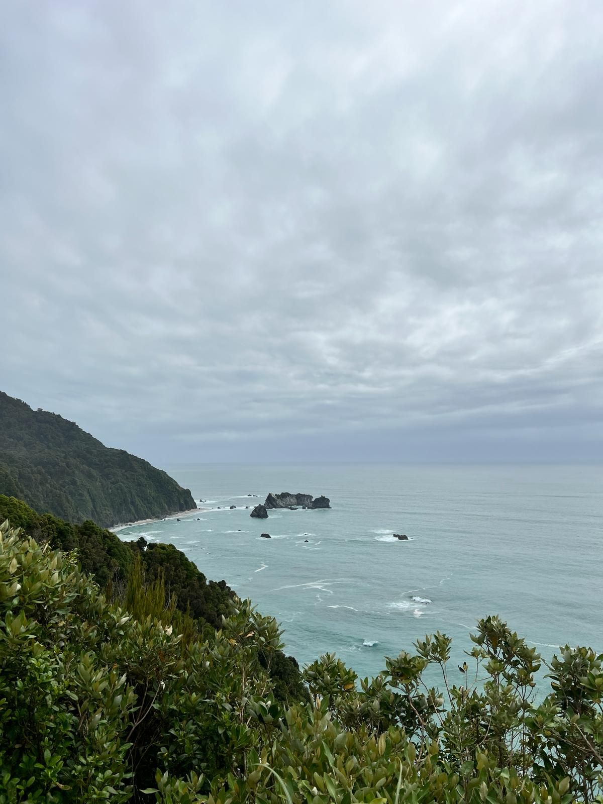
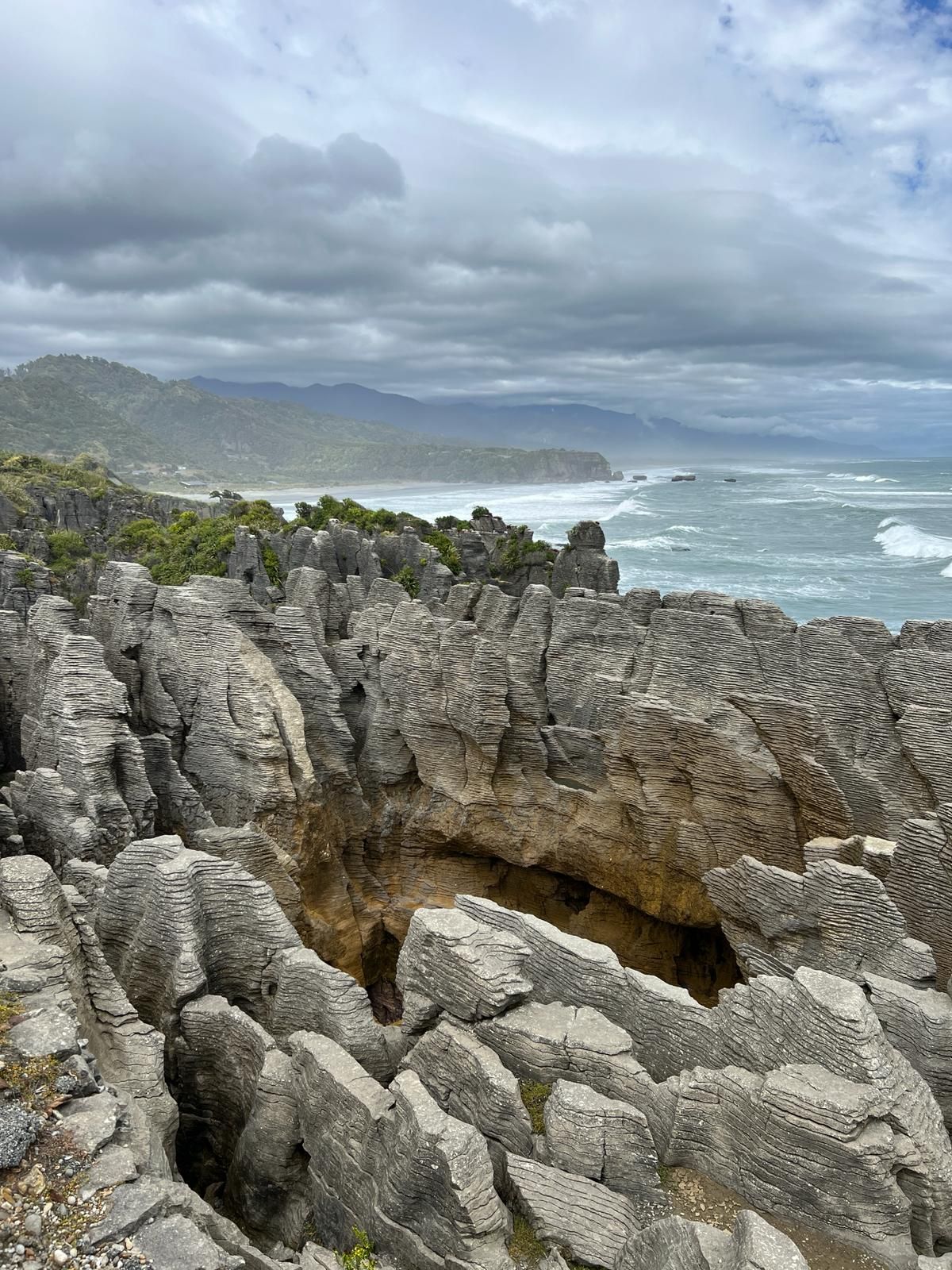
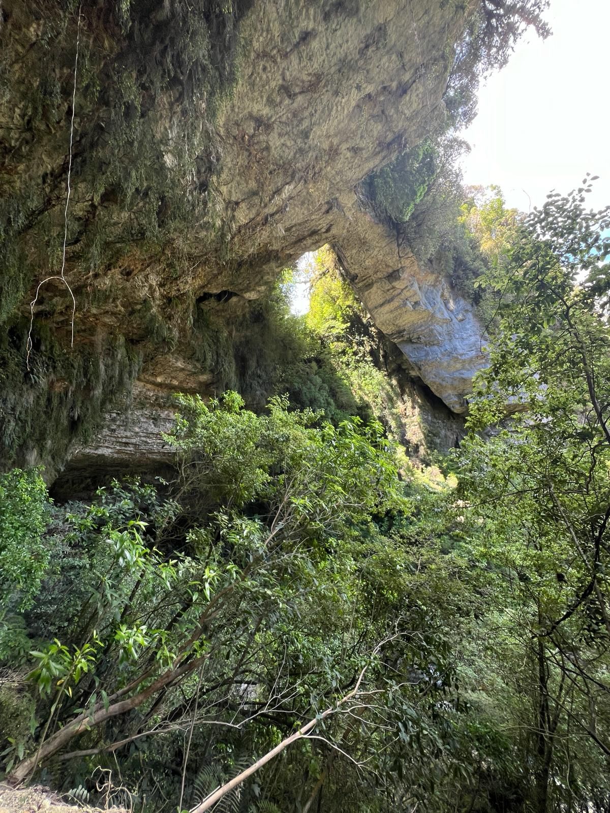
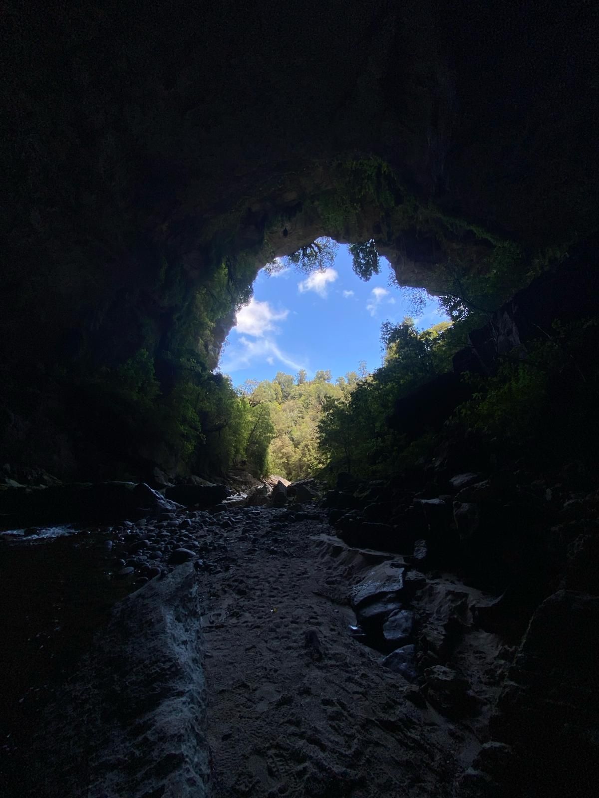
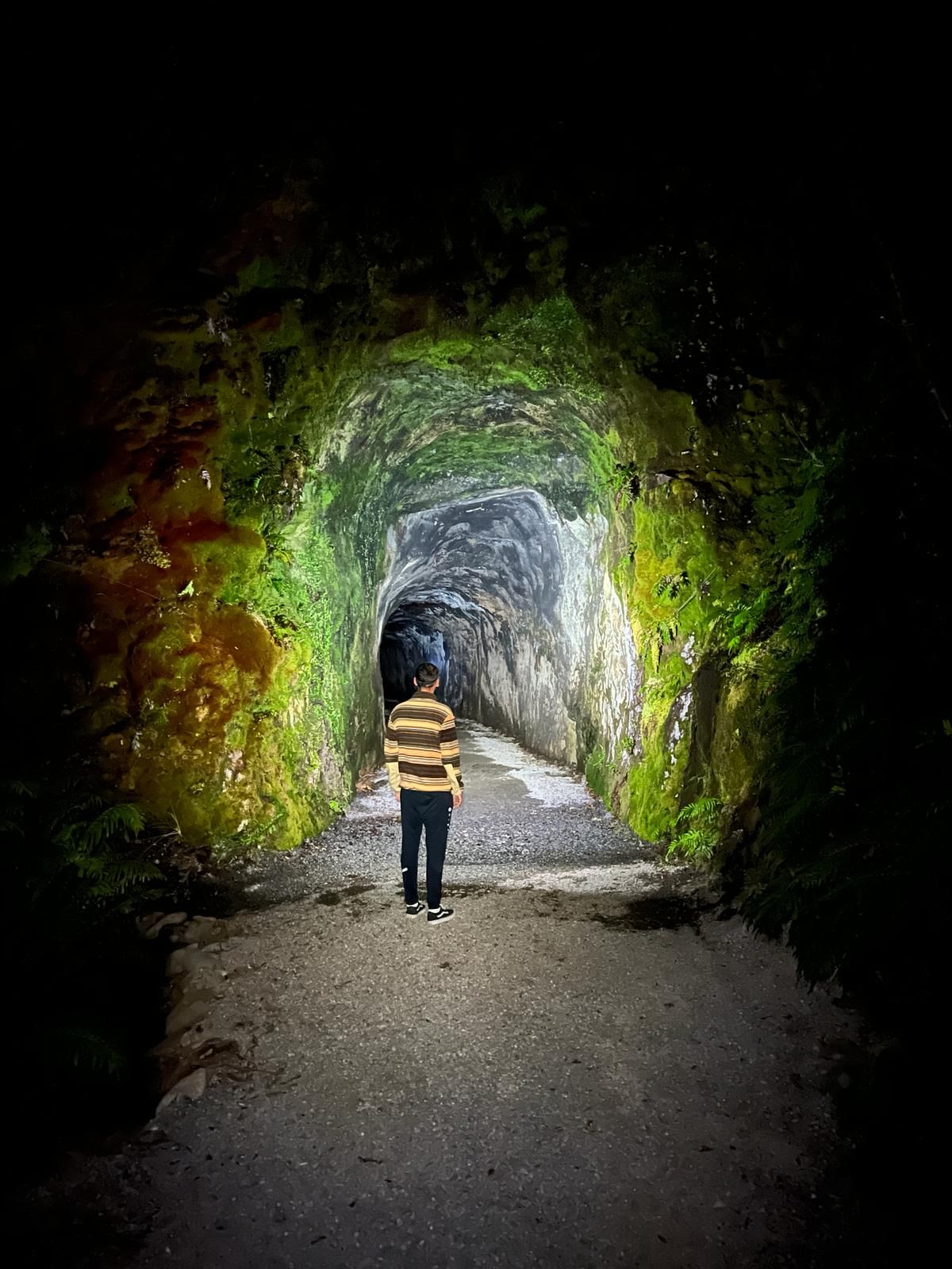
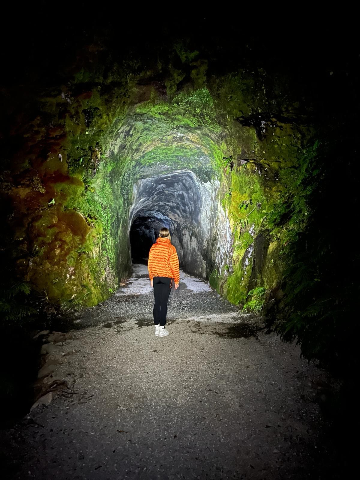
Because there isn't much to see in Greymouth, we went straight to the northern end of the West Coast the next day. On the way we made several stops at beautiful bays and the Pancake Rocks. The Pancake Rocks are rocks that, with a lot of imagination, are supposed to be reminiscent of pancakes. It's quite a tourist attraction...no idea why if you ask us. About an hour north of Westport we went to a very nice and somewhat better-known campsite. This is located on a beautiful beach and even has a wood oven to make your own pizza. We stayed at the campsite for 3 nights. Of course we made pizza and also took a trip to the Opara Basin Arches. To be honest, we didn't know what to expect at the Opara Basin Arches because we didn't really do our research. We just heard about it many times and saw it recommended everywhere. So we drove 1:45 hours and 78 km there. When we saw the time and the kilometers, we already knew what was in store for us... 20 km on an unpaved gravel road through the rainforest. At the end of the gravel road you will find a parking lot, from which you can walk about 20 minutes to the Opara Basin Arches. These are an arch made of natural rock through which a stream flows. We then explored a cave nearby and returned to the campsite. In the evening we went to an old abandoned railway line where you can look at fireflies in a tunnel. Otherwise we spent the time on the beach in the best weather.
The campsite was also the end of the West Coast for us. The next destinations are Nelson Lakes, Nelson and Golden Bay.
Subscribe to Newsletter
Freagairt

Aithisgean siubhail Na Seulan Nuadh