South Coast Track
Δημοσίευσε: 20.03.2019


Εγγραφείτε στο Newsletter
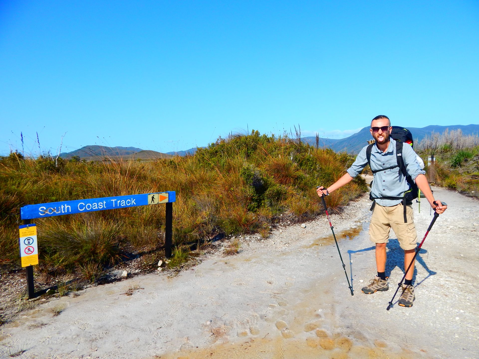
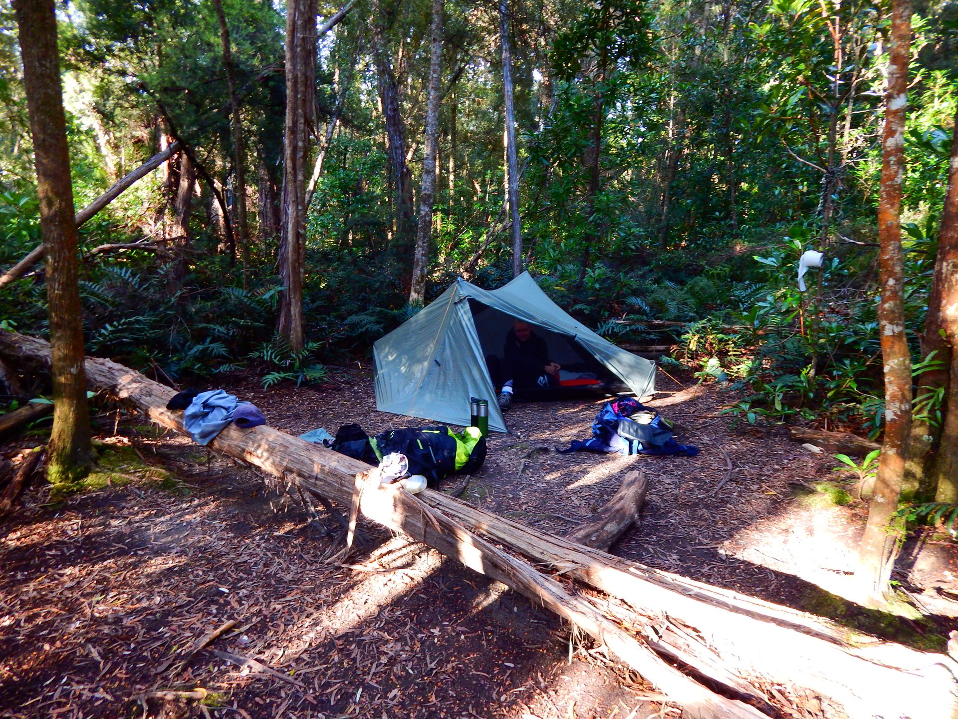
On the morning of February 23, we pack our few things for the South Coast Track. Each person has an outfit for running, a clean and warm outfit for the evening, rain jackets, socks, and hiking shoes. For breakfast, we have planned rice cakes and other crackers with peanut butter. For lunch, we will have wraps filled with canned corn/beans/peas/beets (etc.) and mayonnaise. For dinner, we have dry ready meals and simple meals like couscous and lentils. For snacks, we have a big bag filled with nuts, raisins, and other dried fruits. Of course, we also have Flo's great tent and our sleeping bags and sleeping mats. In the end, we each carry a proud 17 kilos on our backs!
At 12 noon, we stand by the road in Huonville to hitchhike. An older woman quickly picks us up. She is an open and very friendly person. She even offers to take us to the airport. In Cambridge, we stop and have coffee together. Then she takes us to a smaller airport used by the company Paravion. We say goodbye and thank her!
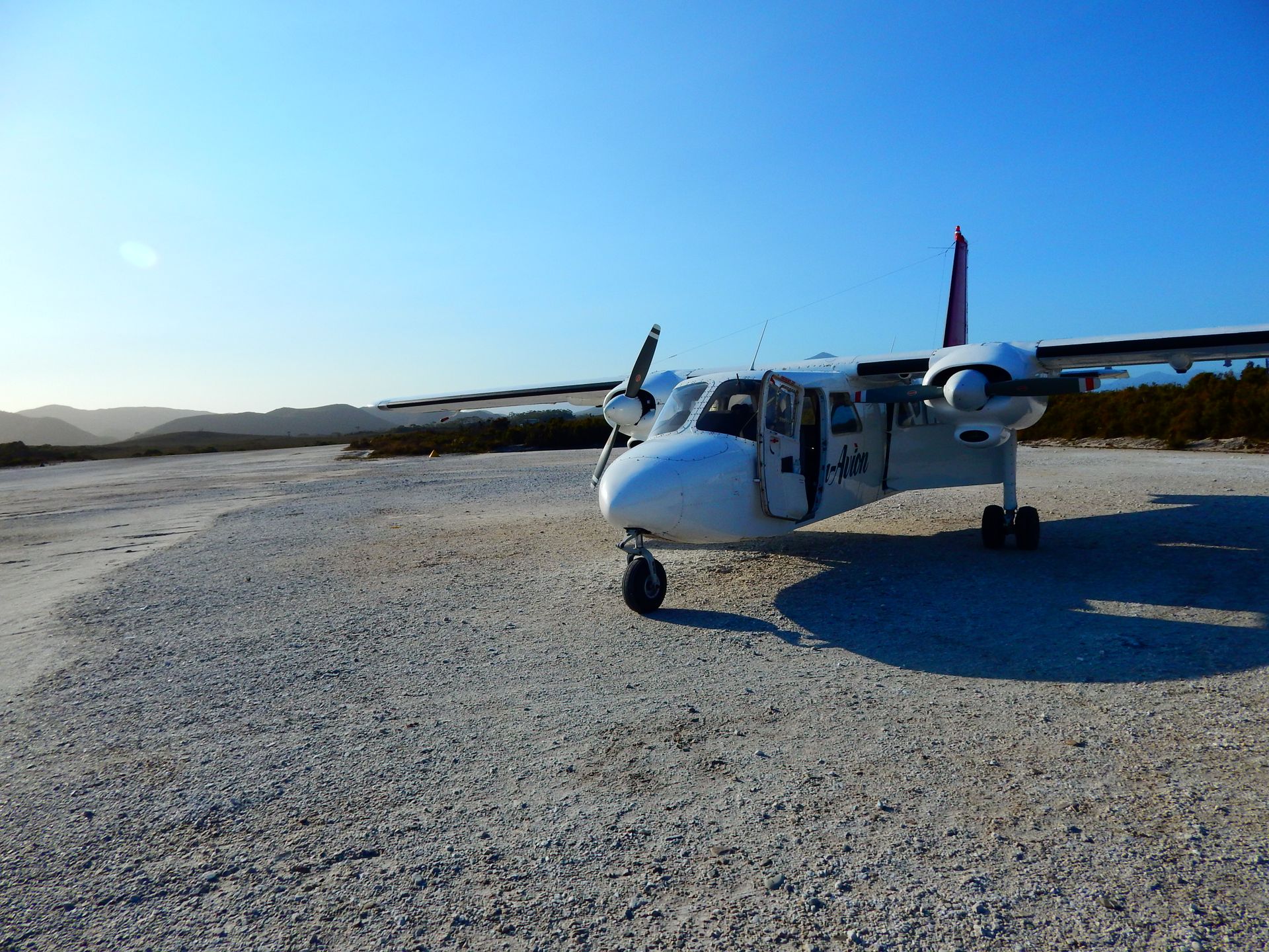
Then we wait for our flight that will take us to nowhere. Unfortunately, we have to wait for almost three hours because we are too early and our flight is delayed.
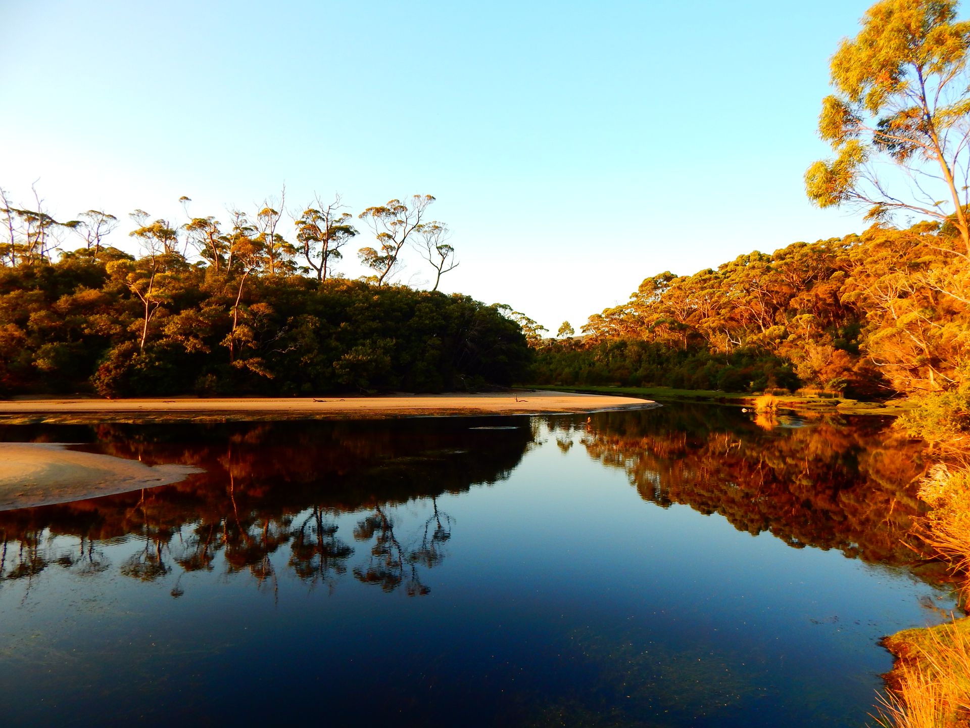
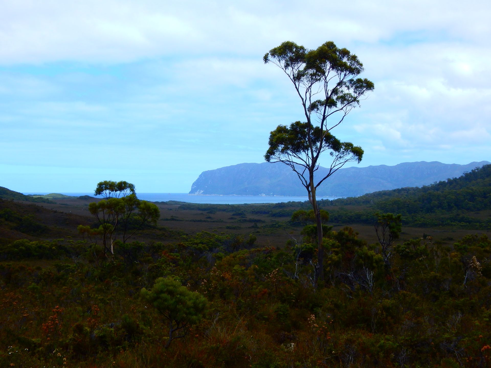
We take off in a small eight-seater plane. It is a spectacular journey! The two engines on either side of us make so much noise that conversations are impossible. The whole plane vibrates and we can feel every little air pocket. But the pilot skillfully navigates us over the mountains of the South West National Parks. From above, we admire the vastness of the sea, the rugged cliffs, and the forested mountains. It is breathtaking but not easy to relax and enjoy the view. After about 50 minutes, we land on a gravel runway surrounded by wide green-brown meadows. The pilot retrieves two gas cylinders for us from a container and then leaves us alone with our backpacks.
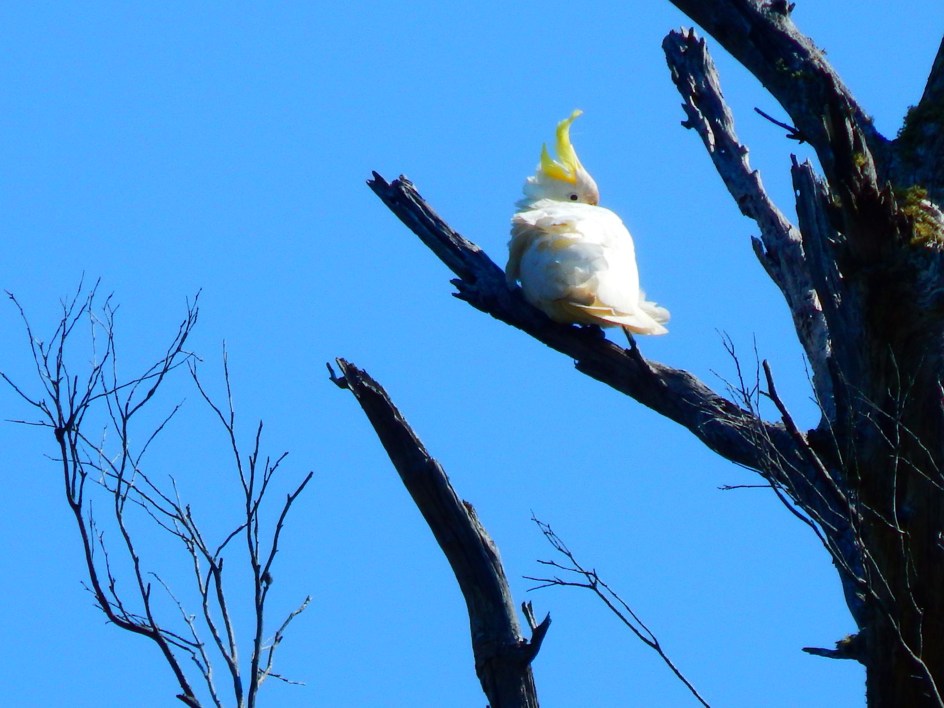
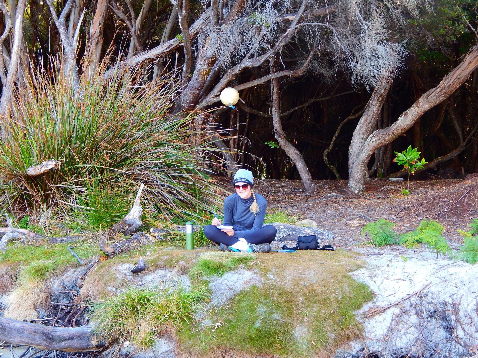
The campsite is not far. We set up the tent and explore the surroundings. There is a bird observation house that also serves as a small museum for the people who used to live here. Melaleuca was settled in the early 20th century. Deny King established Melaleuca. He was a naturalist, artist, birdwatcher, environmentalist, and tin miner. He and his family lived here for 55 years. Together, they made this place something special, and after them, other families kept it alive.
Sunday, February 24, 2019
Melaleuca -> New Harbour Bay 15km
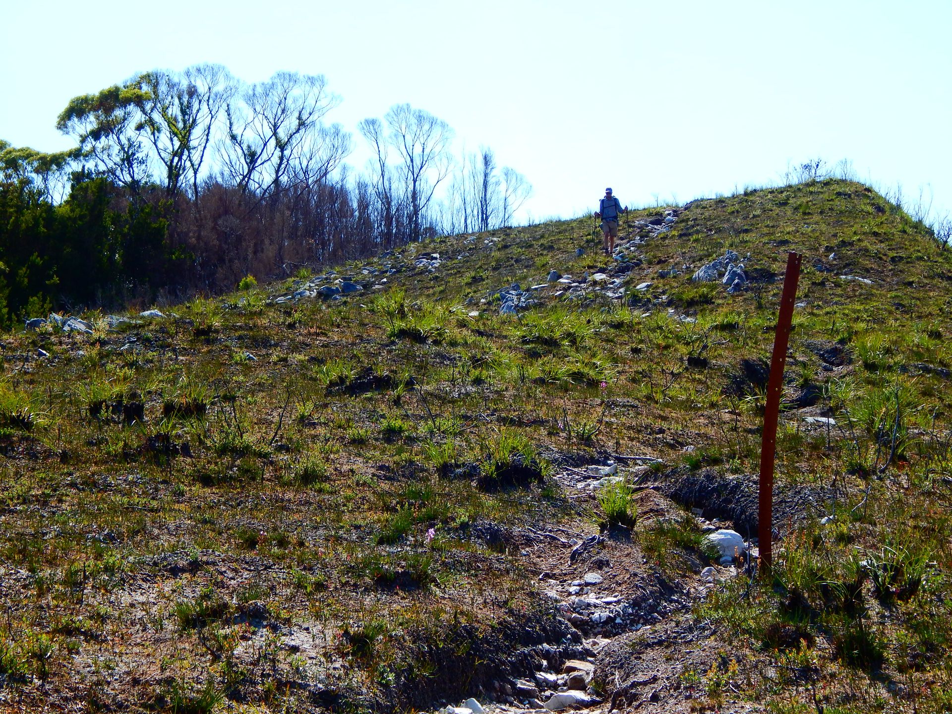
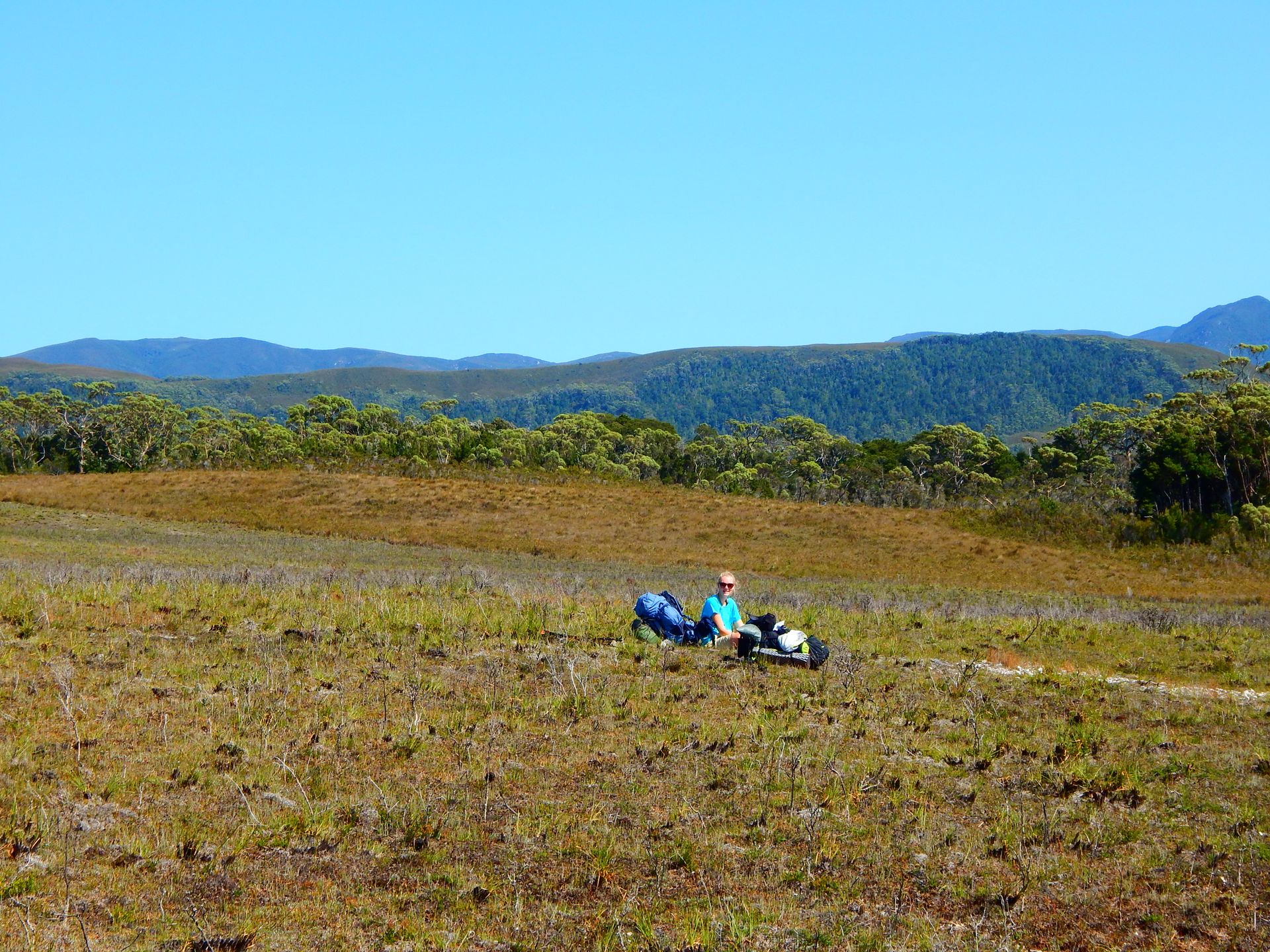
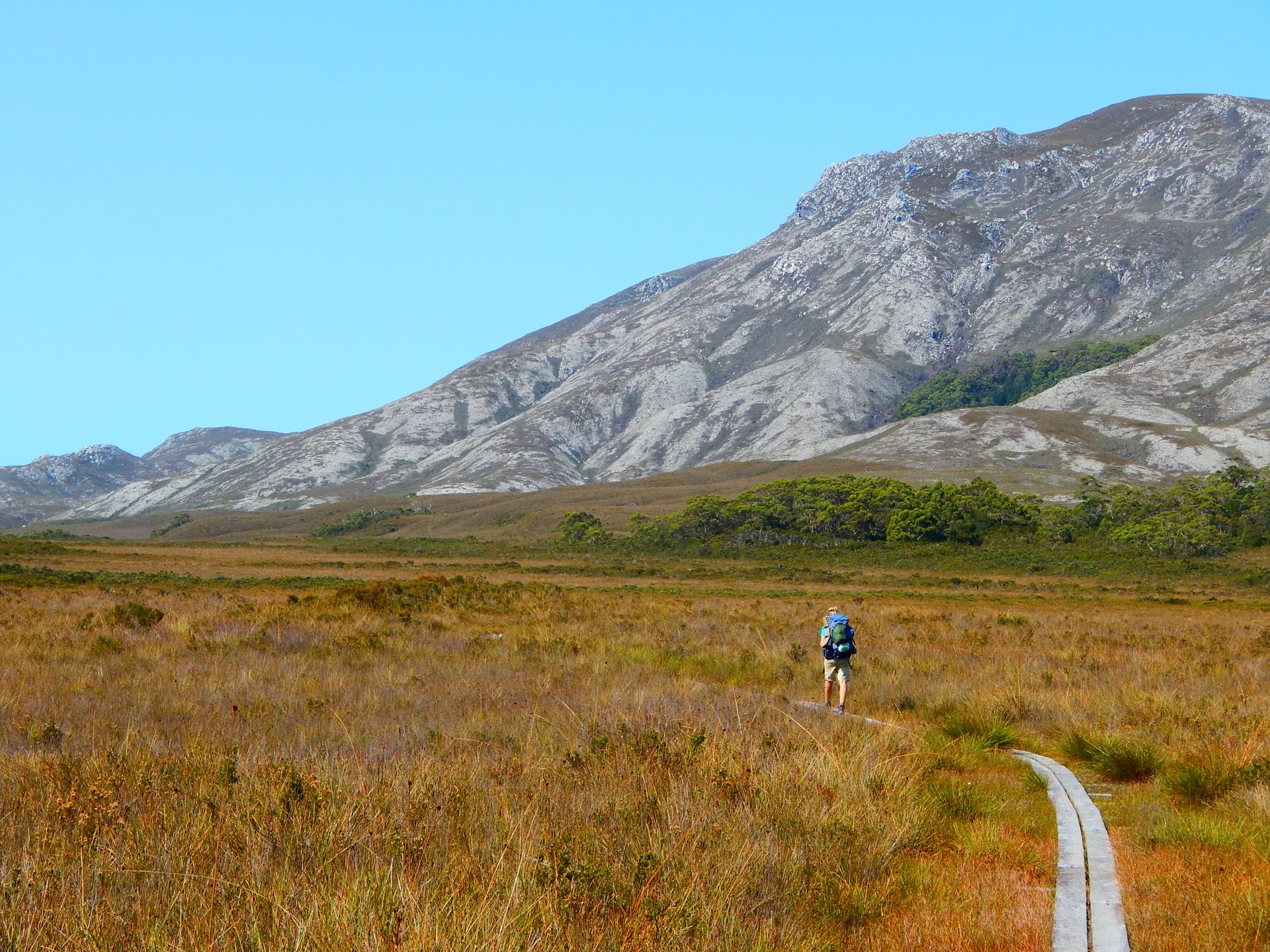
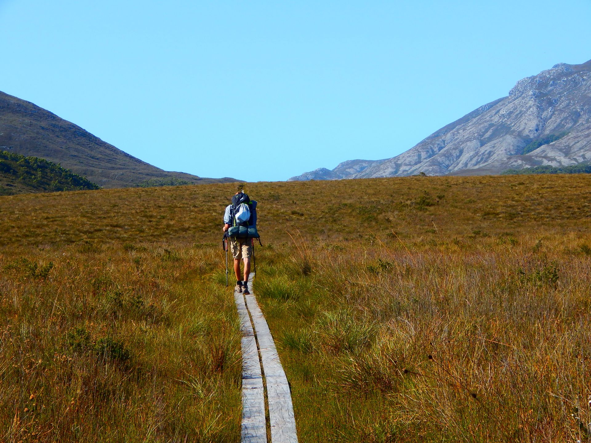
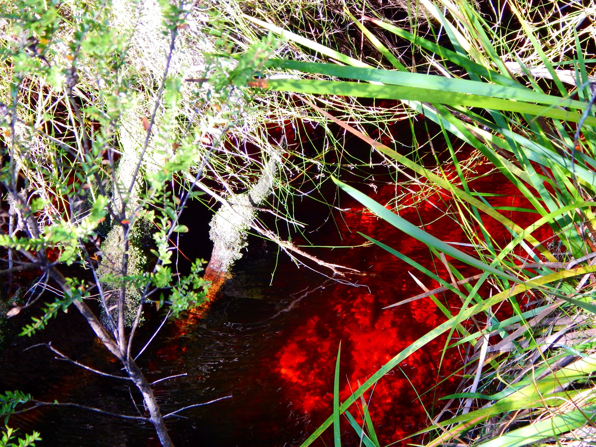
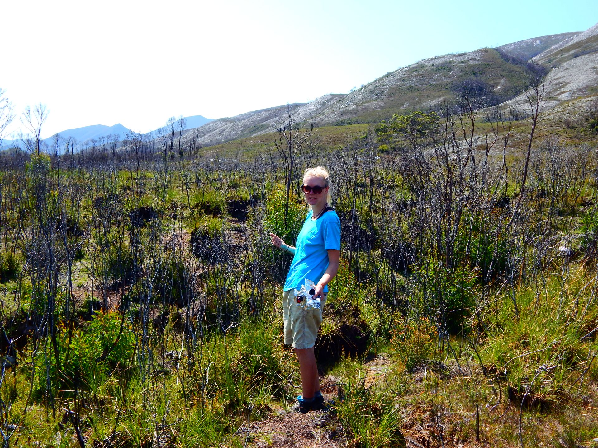
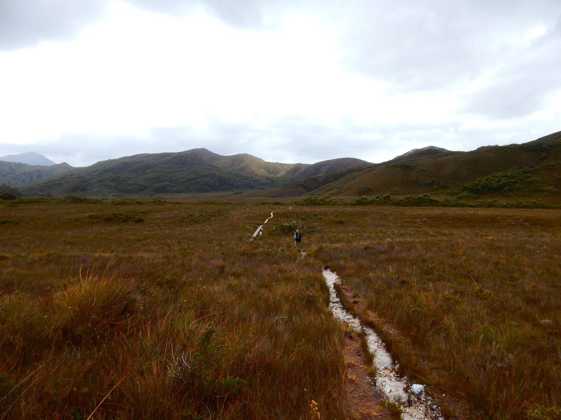
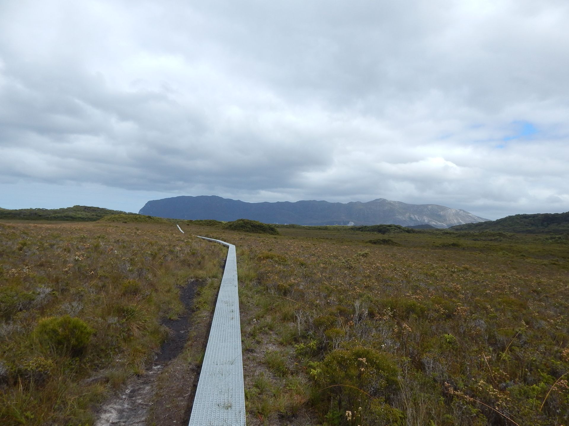
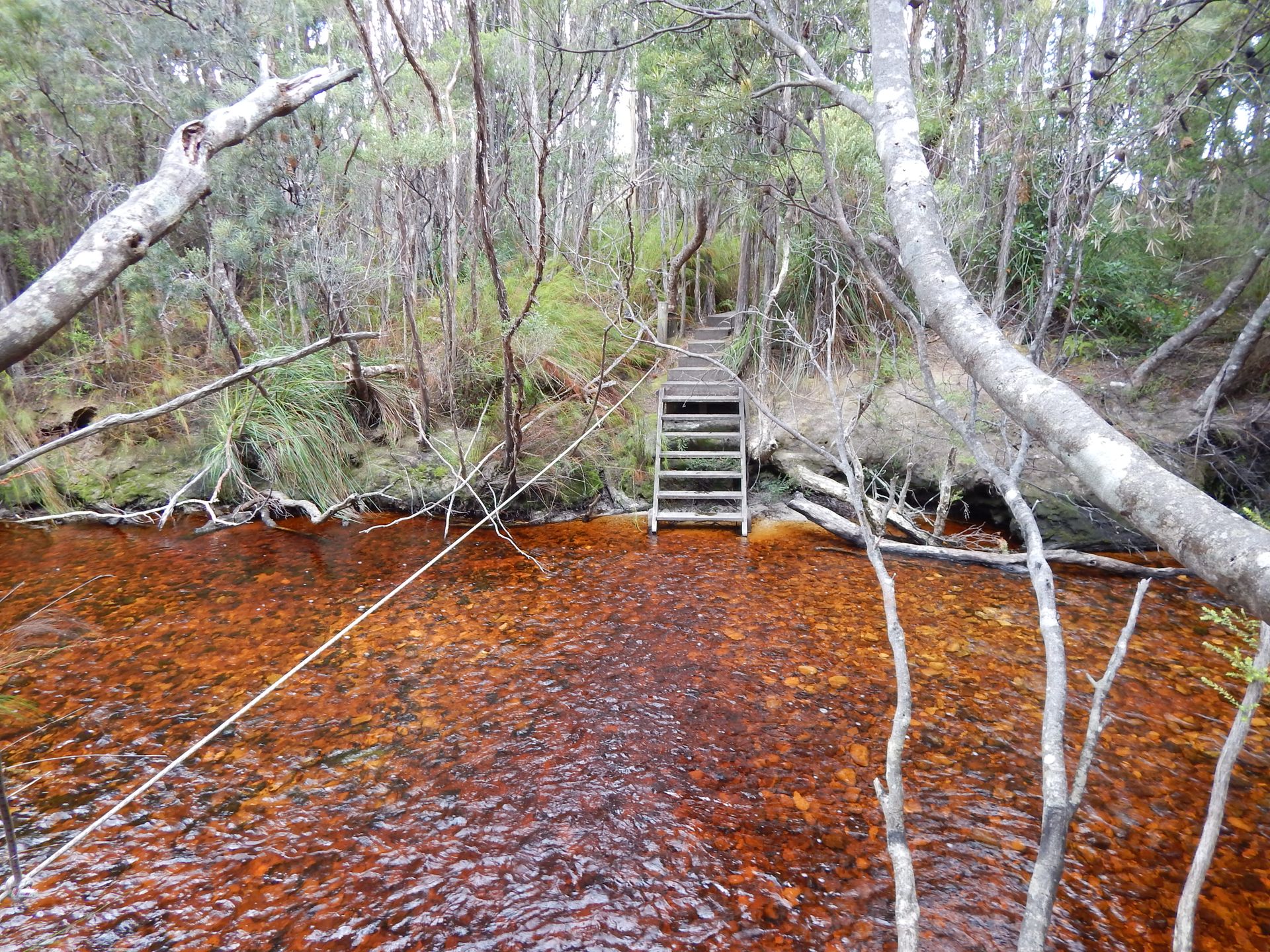
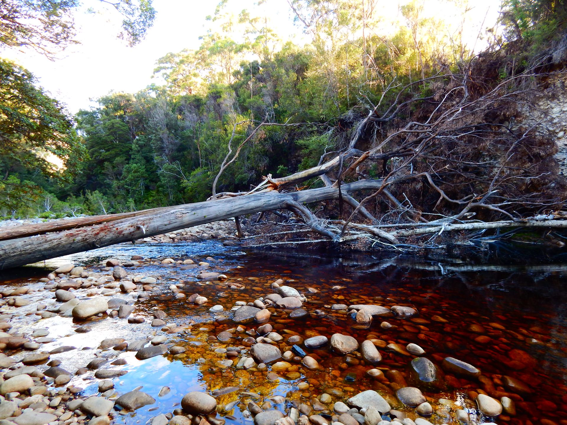
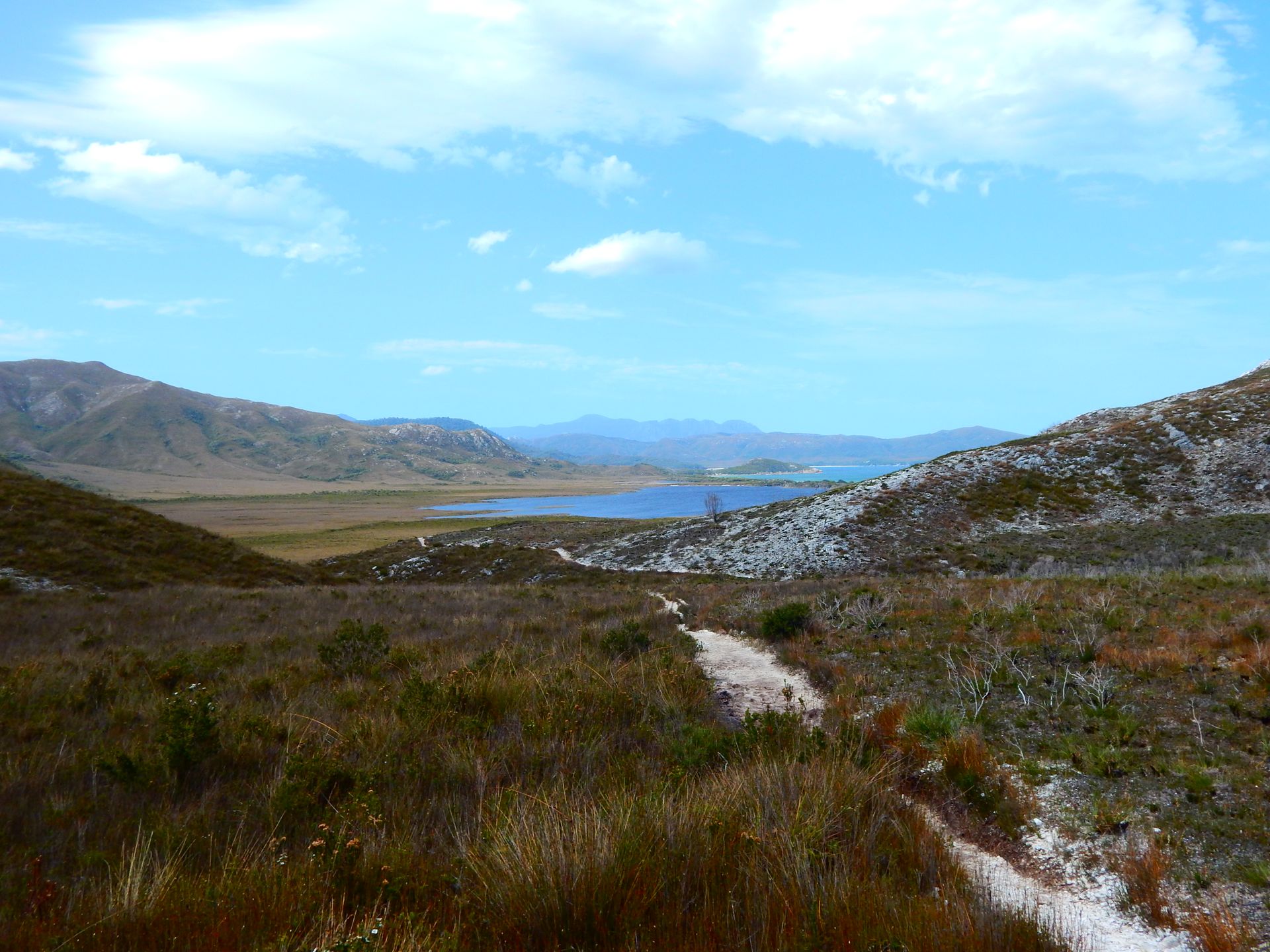
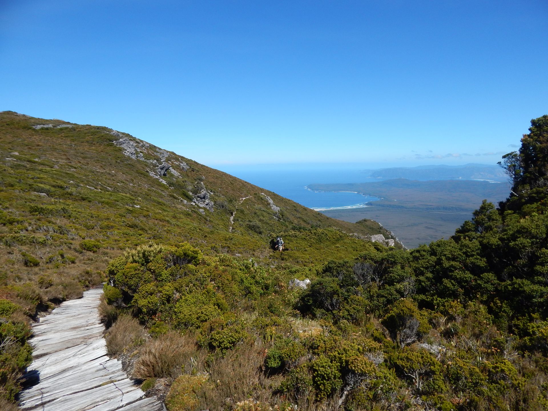
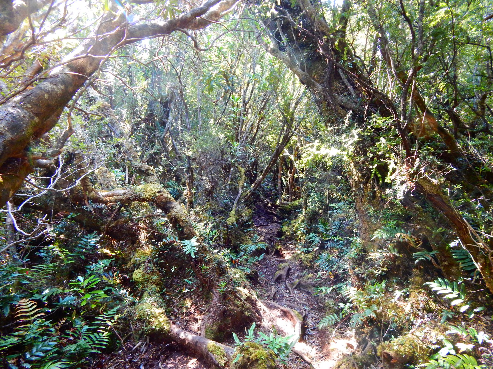
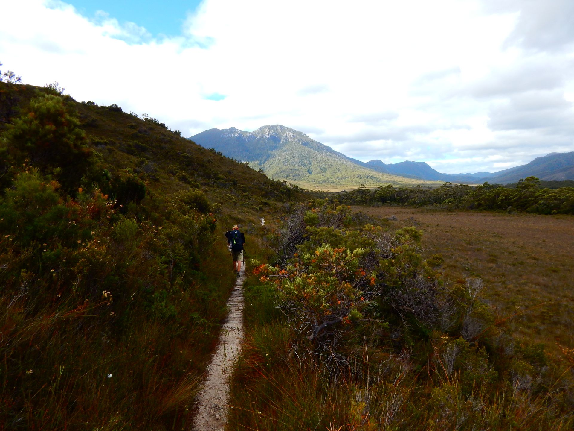
After a cold night with little sleep, we head south from Melaleuca. We hike on well-maintained boardwalks. The boardwalk leads us over wide meadows. The sky is wide and takes up most of our field of vision. Then, before the New Harbour Range (mountain), the South Coast Track and the Wilson Bight Track separate. We head west on the Wilson Bight Track because many people have recommended visiting the beautiful beaches. The trail becomes muddy and indistinct. There are more or less large swamps along the way. It becomes difficult to walk, and the 17 kilos weigh heavily on our shoulders. We have to cross smaller rivers again and again, a good opportunity to refill our water bottles. Because of the tree roots on the banks, the water has a reddish-brown tea color. Many hikers drink the water untreated, but it is recommended to boil the water for three minutes to kill any possible bacteria. We bought Aquatabs, which purify the water. One tablet is added to one liter of water, then shaken well, and it is ready to drink after half an hour. Unfortunately, it sometimes tastes a bit like chlorine, but it is still better than taking the risk of a stomach upset.
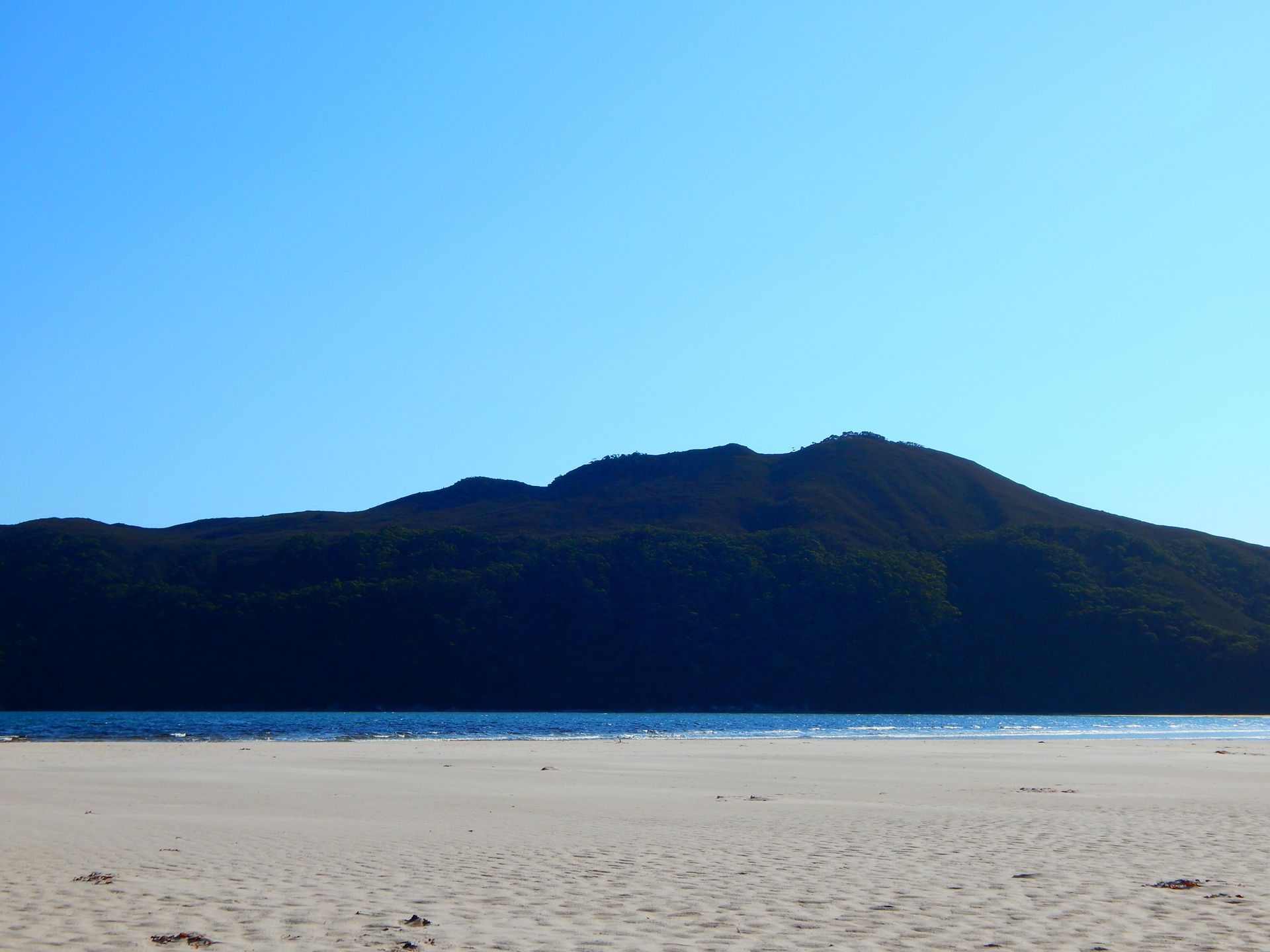
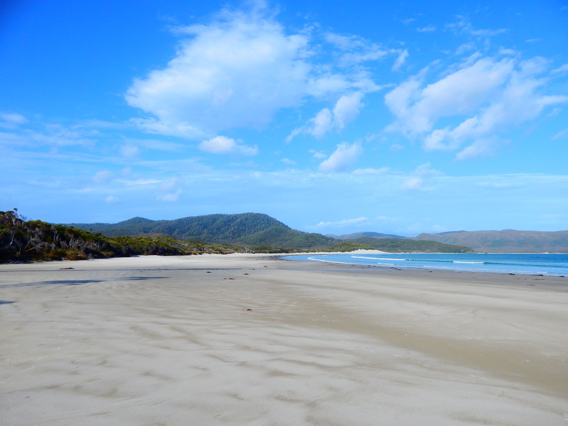
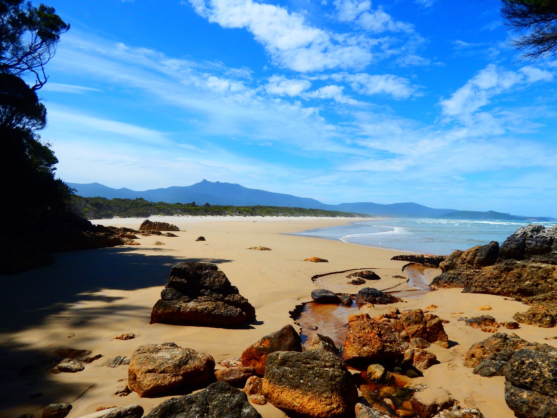
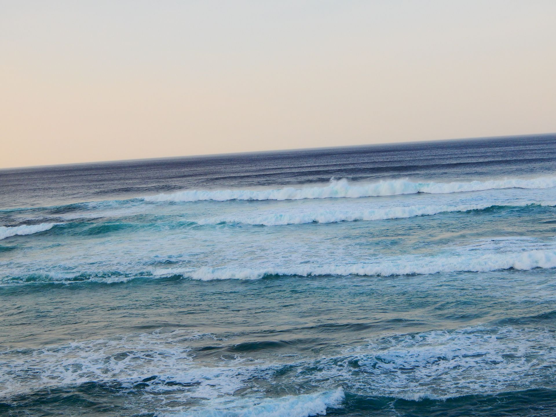
Finally, at 4 p.m., we reach the coast. We are exhausted! New Harbour Bay is beautiful. There is only one boat on the coast, otherwise the beach is empty and untouched. We enjoy the peace and quickly fall asleep in the evening.
Monday, February 25, 2019
New Harbour -> Point Eric 18km
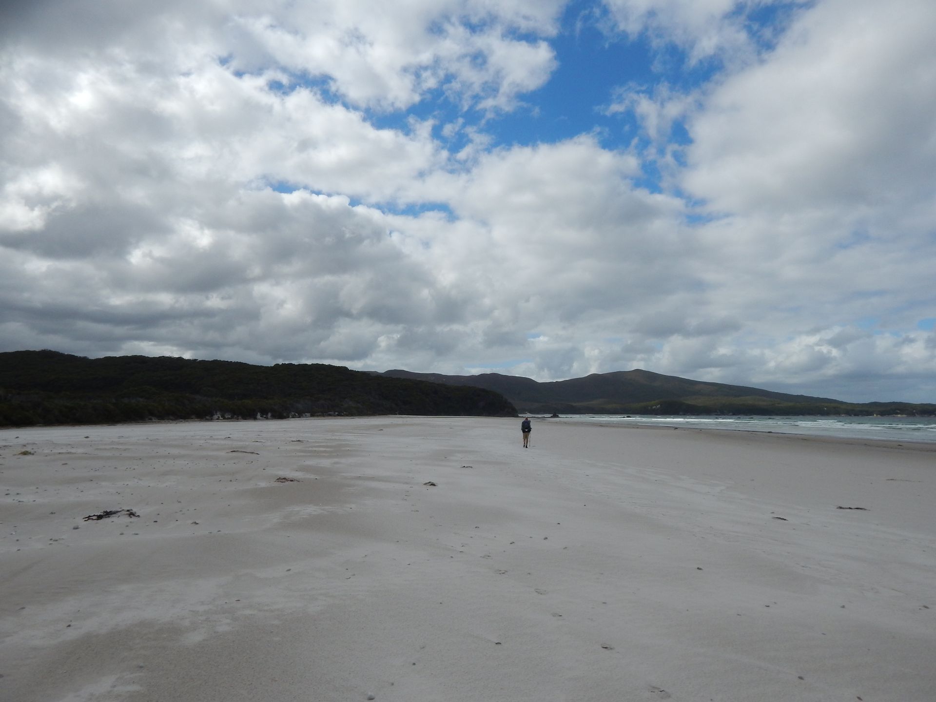
The night is difficult. I sweat in my new sleeping bag, we both have a restless sleep, and accordingly, the morning goes. We walk the same path we came yesterday. Fortunately, it did not rain, so the conditions have not worsened. The second time, the time seems faster and the path shorter. Then we return to the South Coast Track and immediately notice the difference: boardwalks lead over the swamps, and small bridges cross the streams. We make faster progress, and walking is no longer so difficult for me. We have lunch with a view of the sea. The remaining kilometers again lead over boardwalks and along the beach. The beach is empty, but footprints tell us that we are not alone. With each kilometer, the backpacks become heavier again, and we are happy when we arrive at Point Eric. A father and his son camp with us, two Kiwis from Auckland. It briefly rains, but warm sunshine quickly makes up for it.
Tuesday, February 26, 2019
Point Eric -> Louisa River 17km
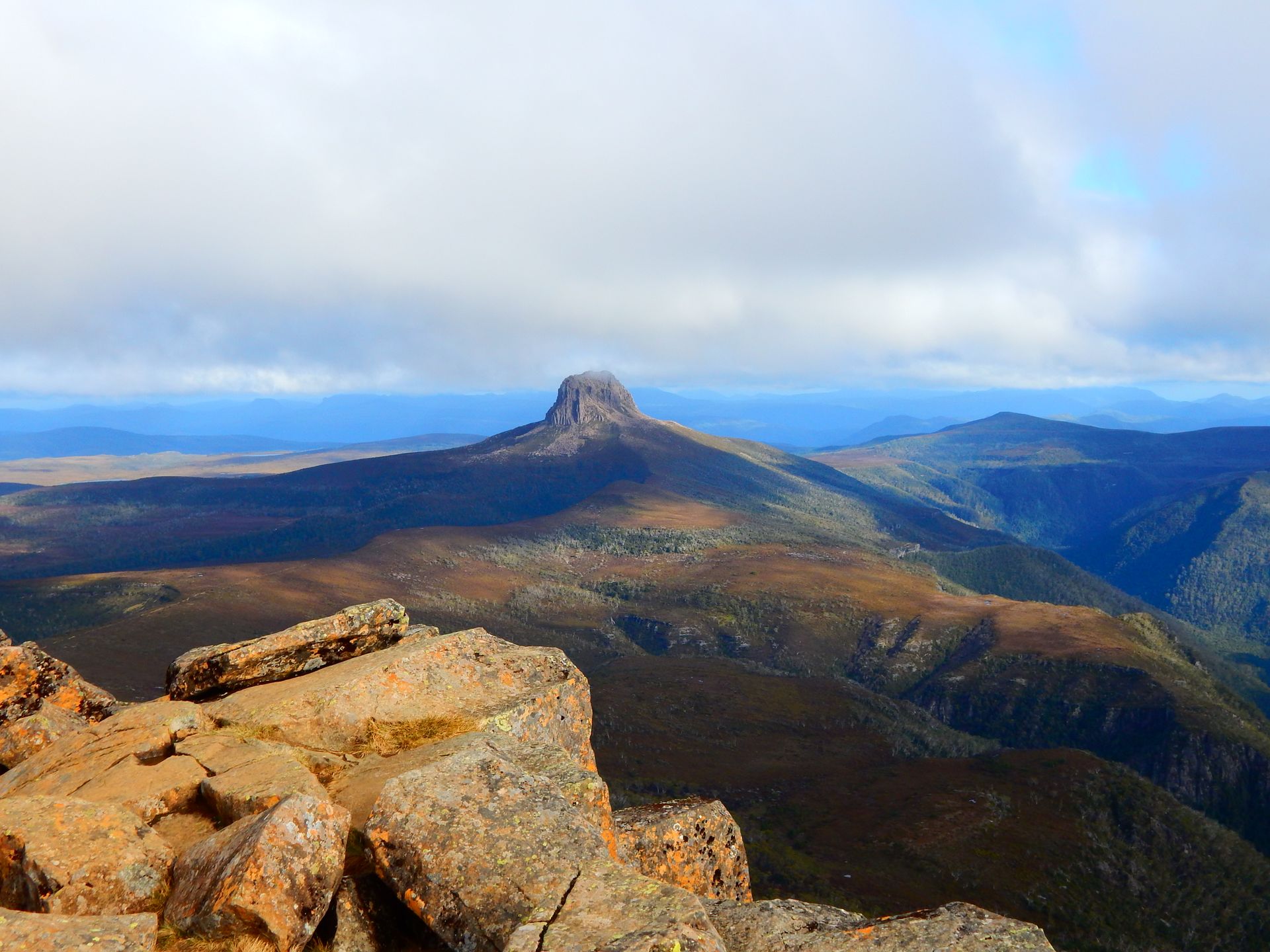
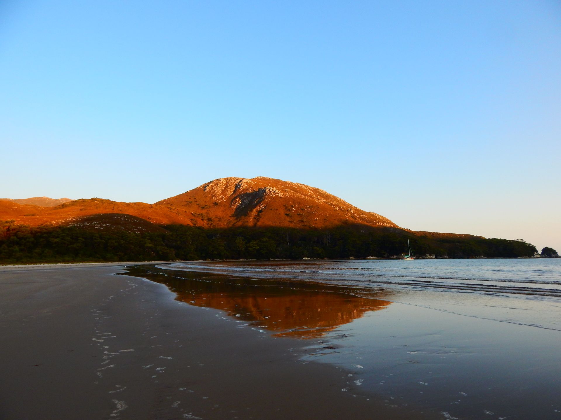
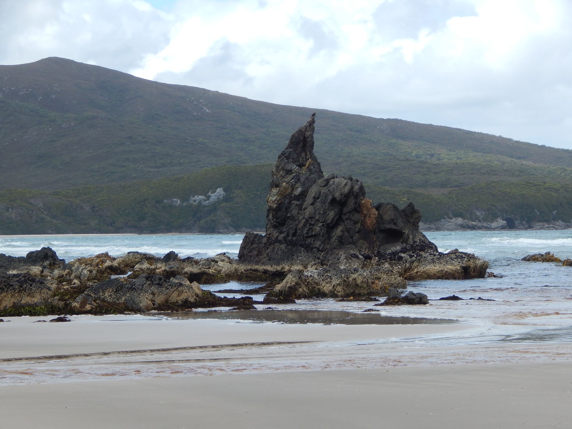
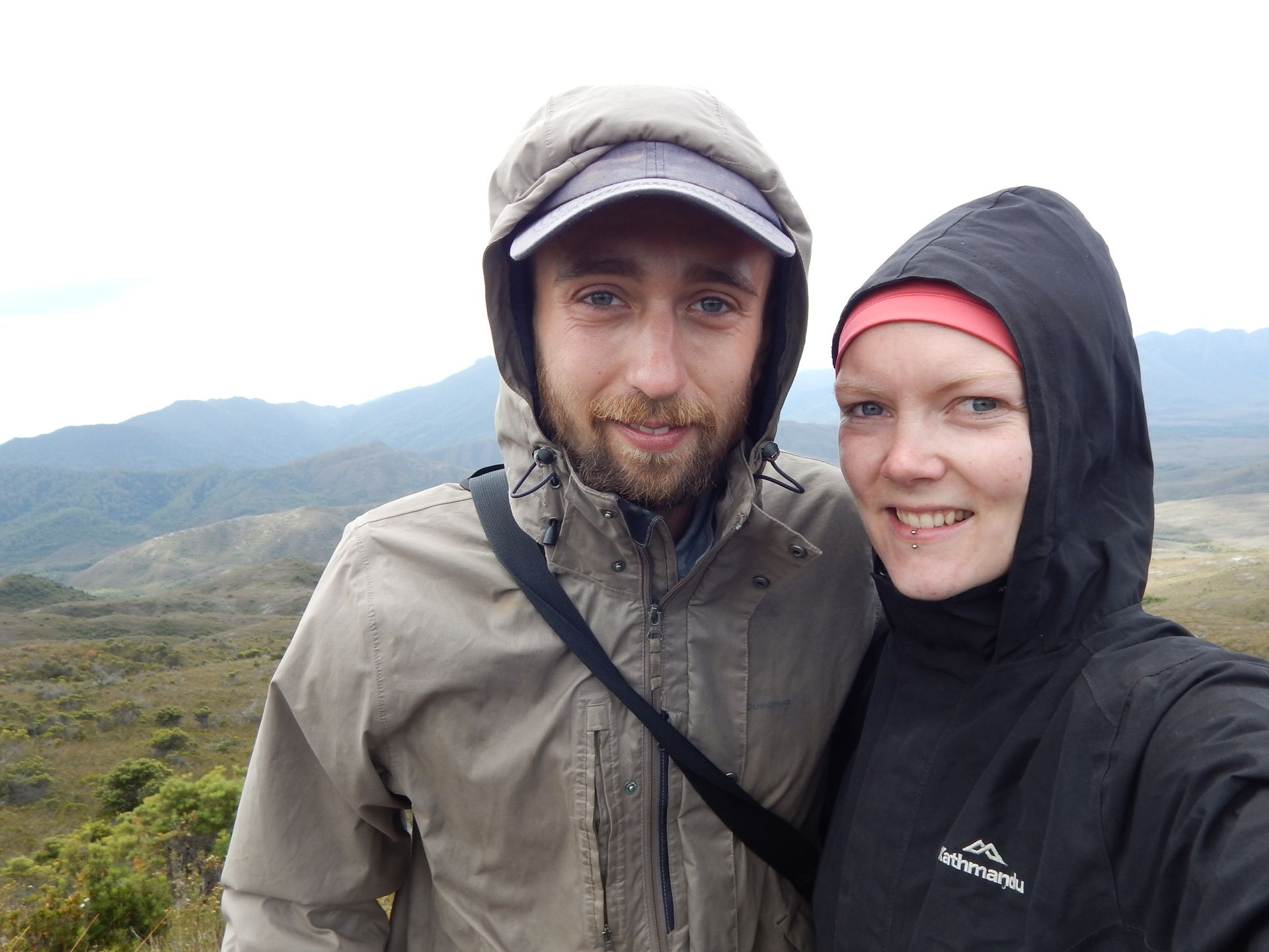
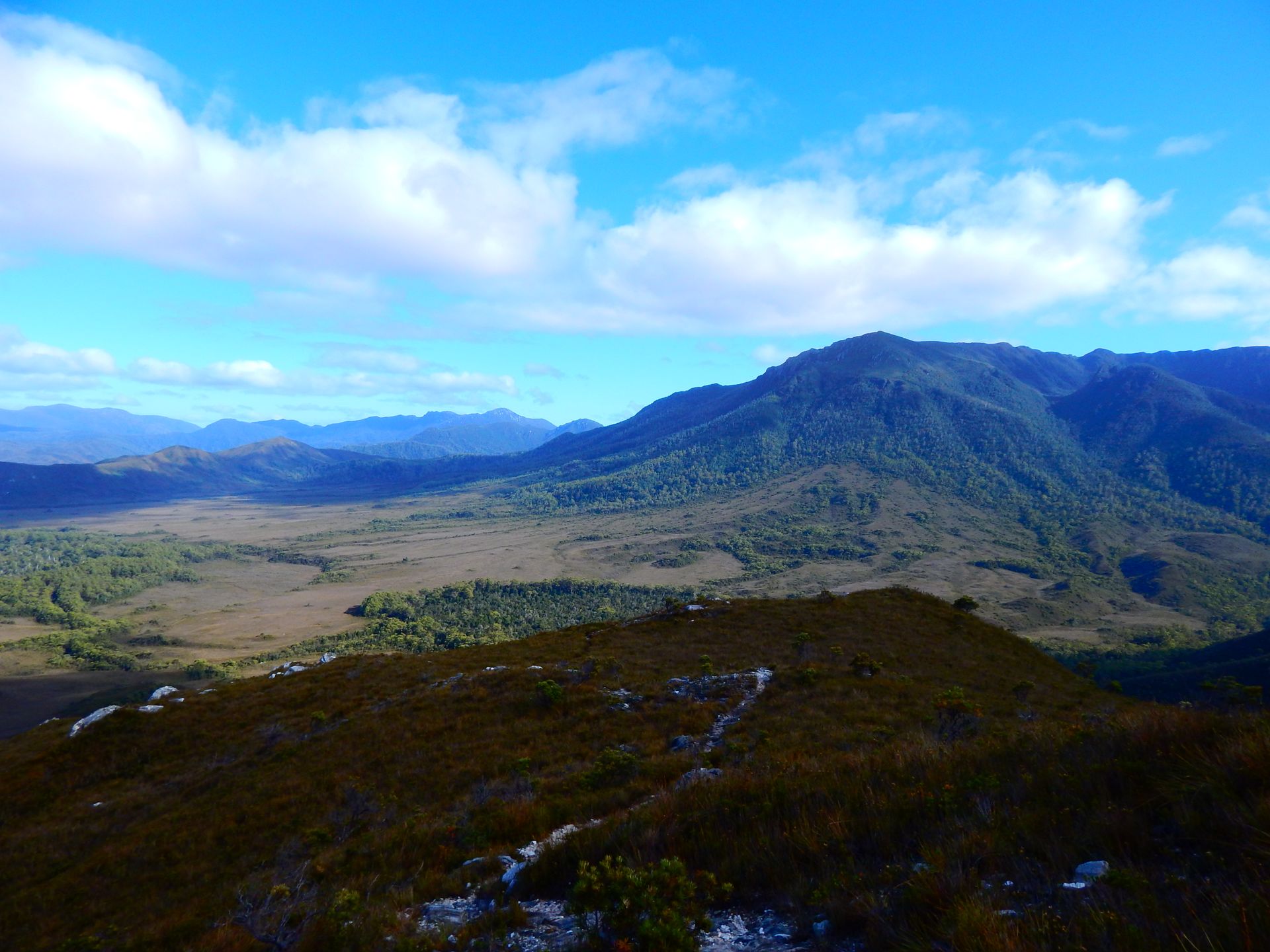
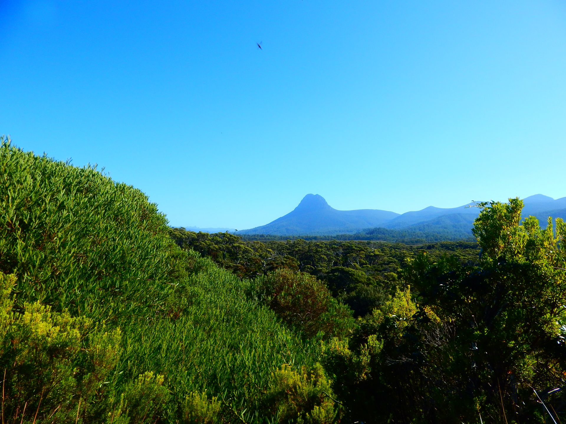
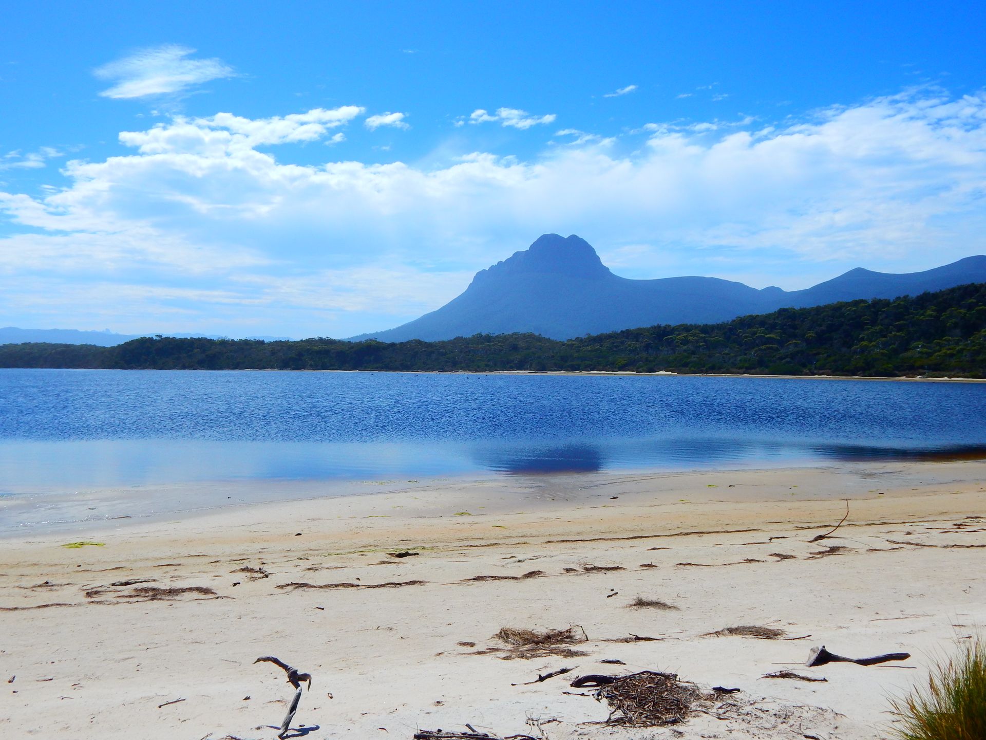
From Point Eric, we walk along the beach towards the east. It rained a bit last night, but the sun comes out again late in the morning. The path leads us through the forest and later up a small mountain. We have to climb 400 meters. It is exhausting, and I take the time I need. Flo, on the other hand, climbs like a champion and is in his element! Once we reach the top, we have a beautiful view. Mount Louisa rises before me, and to our right, we can see Louisa Bay.
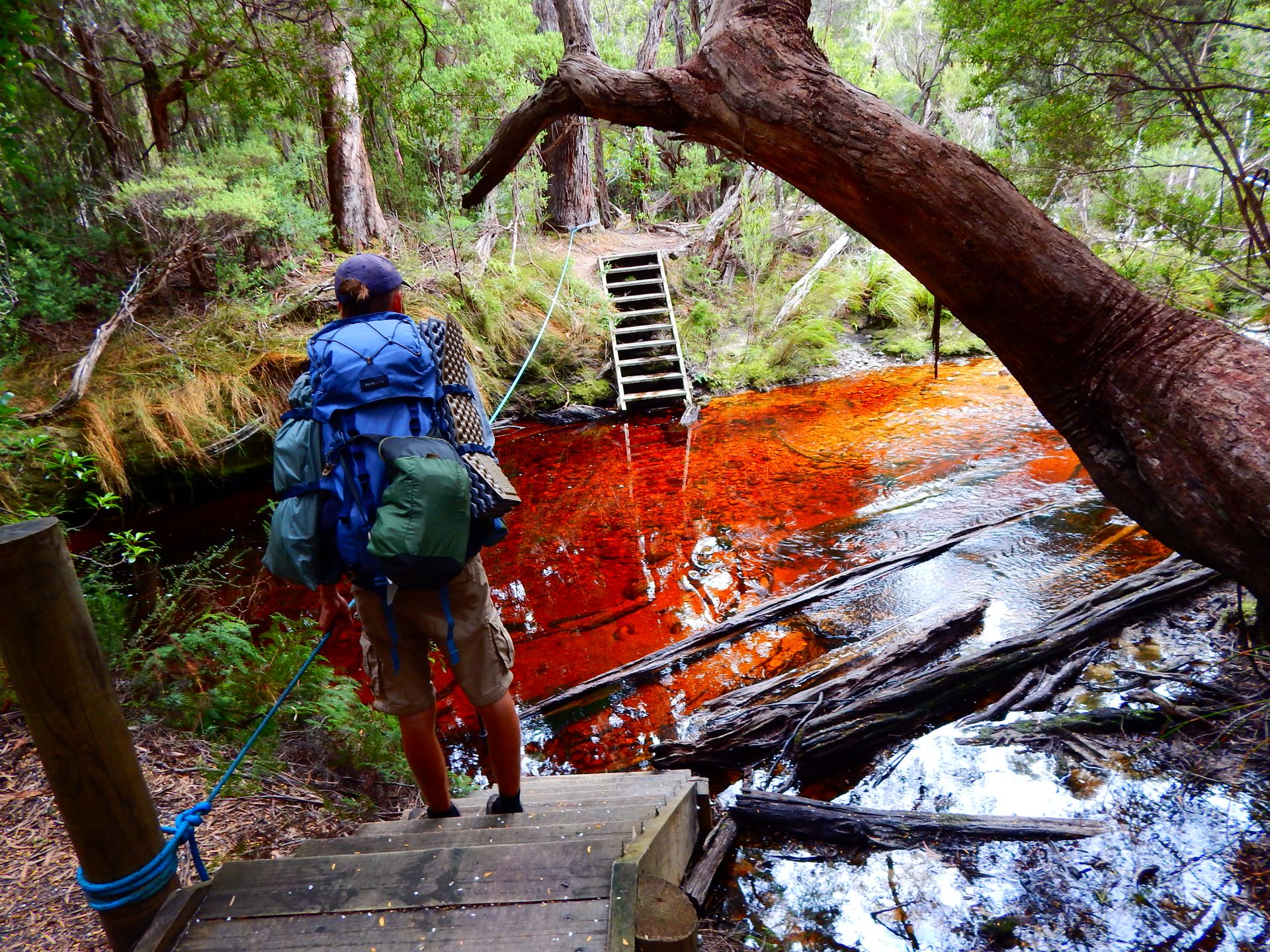
We start the descent and have lunch at the foot of the mountain. Then boardwalks guide us through the swamps. We walk through forests, and suddenly, a slightly larger river crosses our path. A single rope leads us across. So we take off our shoes, wade through it. The water is cold and doesn't even reach our knees. It's fun to have a different challenge than just walking. Shortly thereafter, a man appears behind us on the other side of the bank! "The crazy guy" started in Melaleuca early this morning at 11 a.m. and wants to be at Cockle Creek tomorrow evening! He has a small backpack, two water bottles strapped to his shoulders, two walking poles, and running shoes. We let him pass us and marvel at his motivation! The last part is very long. Lost in thought, I drag myself the last kilometers to the Louisa River. Finally there, we bathe in the ice-cold river and get to know the other bushwalkers. A young man from the Czech Republic, whom we will not see again as he is very fast, a couple from Australia, and again our Kiwis.
Wednesday, February 27, 2019
Louisa River -> Deadmans Bay 13km
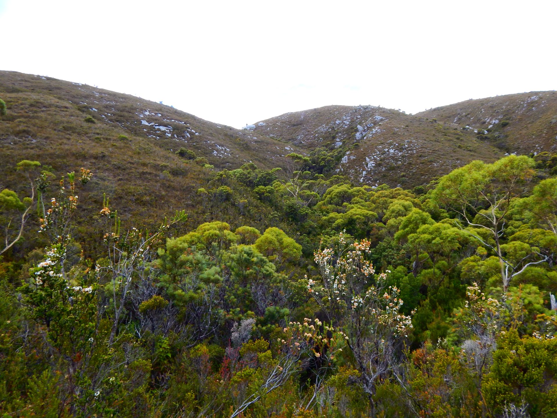
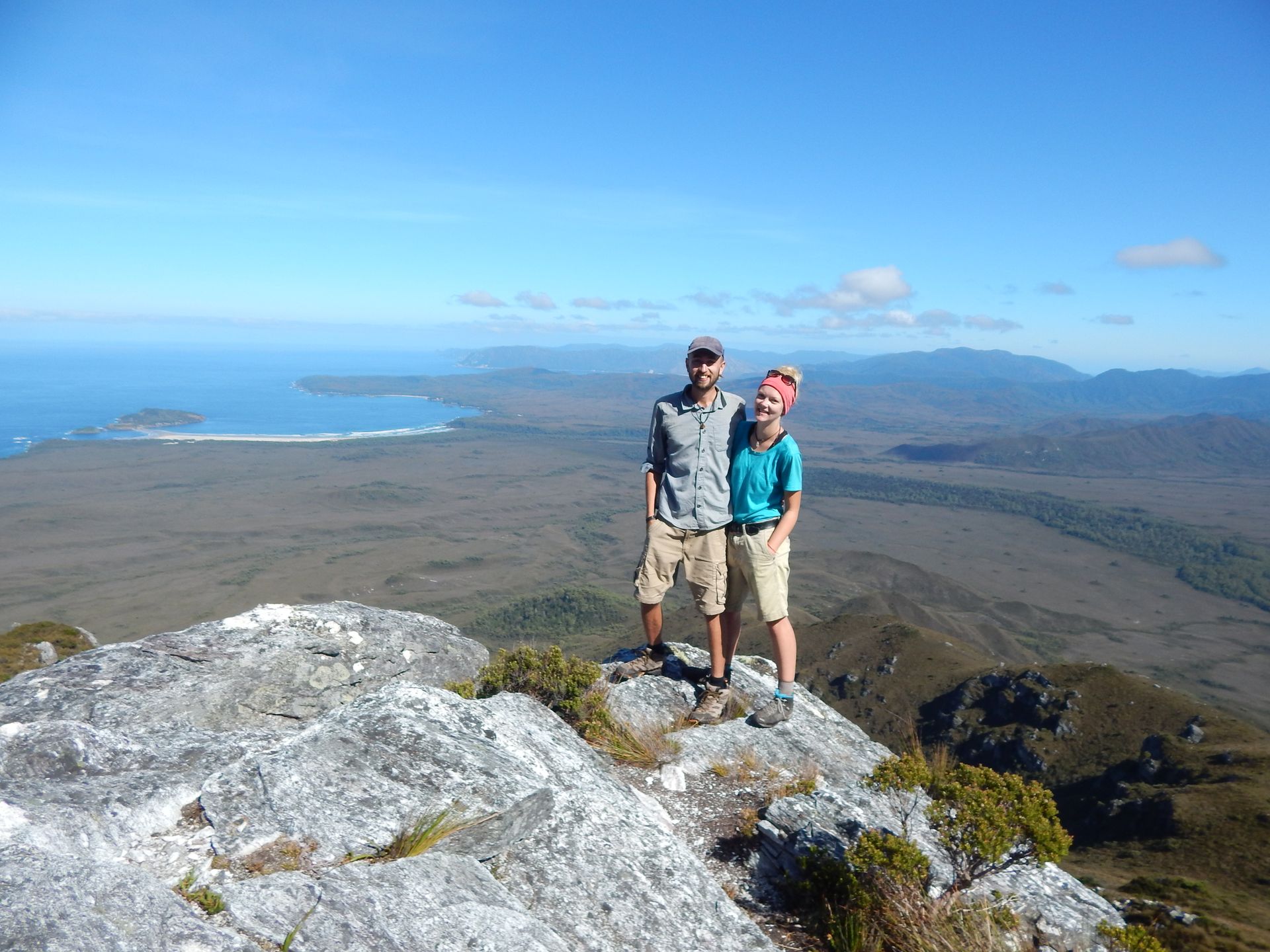
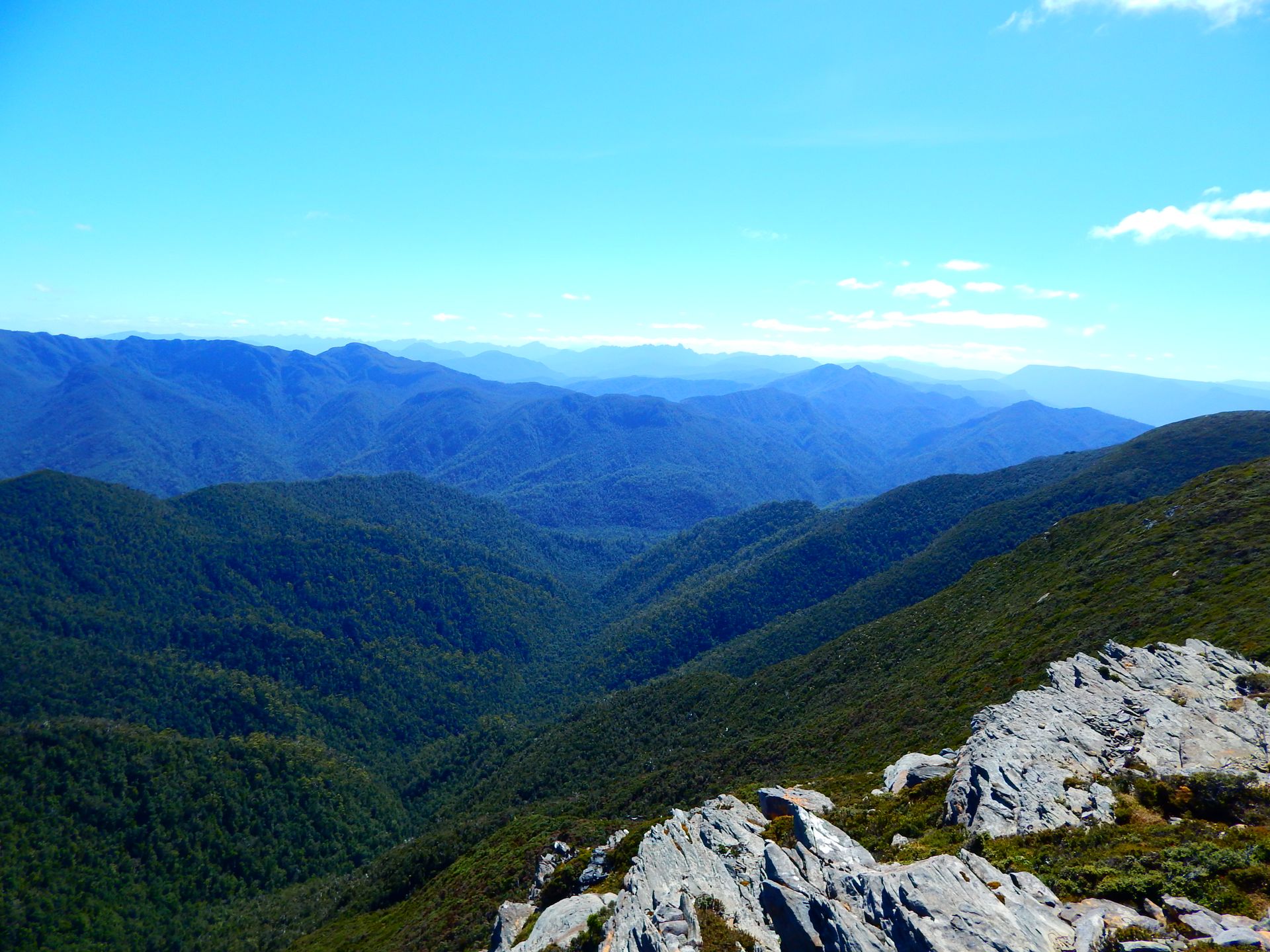
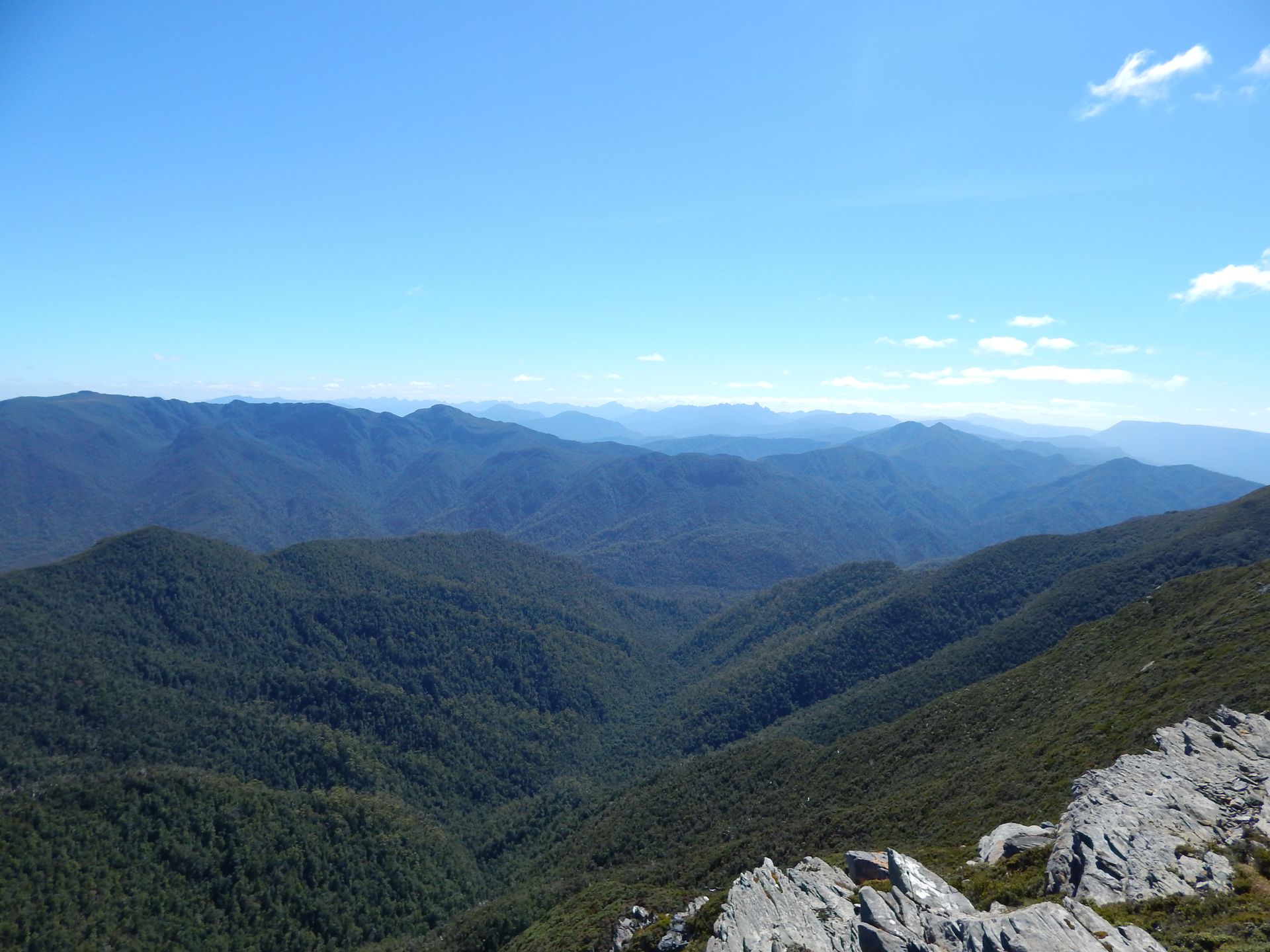
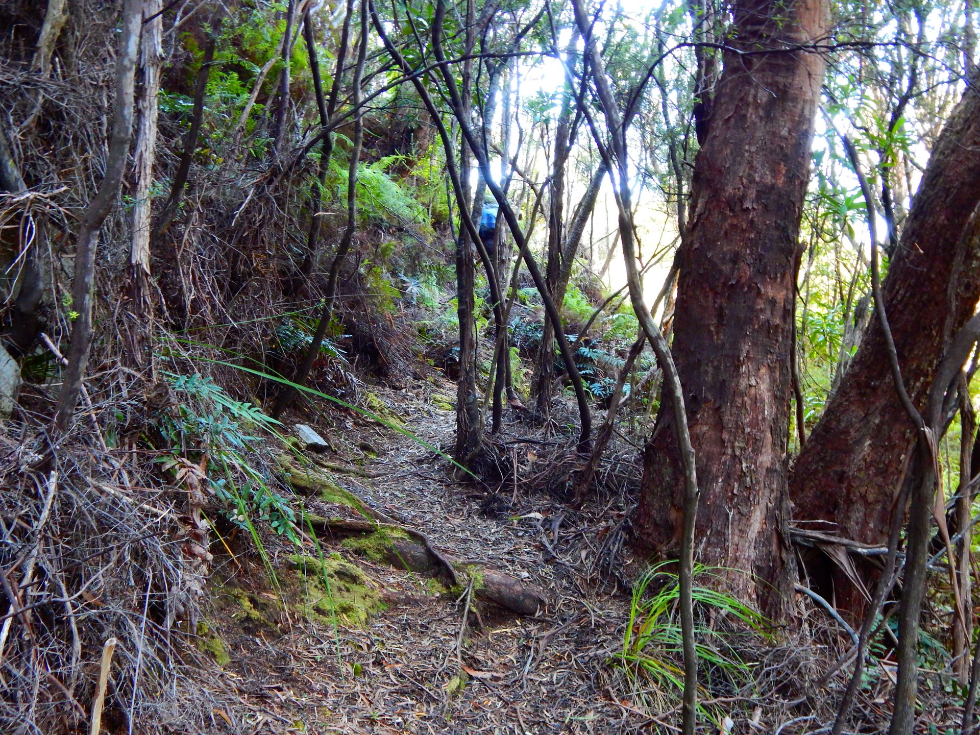
Yesterday, we already saw the path ahead of us. A lonely, steep, and rocky path leads up the mountain. Many steps have to be climbed. Every time you think you're at the top, you realize that it still goes further up. The Ironbound Range demands all my strength! Sweat drips from my nose, and the view ahead does not bode well. Steeper, further, higher, seem to be the path. Flo took the tent and a few other things. I am very grateful for that and marvel at his strength. He climbs much faster than me but waits for me again and again. When we finally reach the top, we take a short break and once again enjoy the view over Louisa Bay and Mount Louisa. If we look closely, we can see the path we walked yesterday. Ahead of us, the entire coast we have been walking along for a few days unfolds. It feels good to see everything so compactly! Then we continue climbing. The view is breathtaking! The mountains on the horizon are clearly visible but shrouded in a mystical mist. They remind me of the Alps, even though they look completely different. The sun shines and burns on the rugged rocks. Once at the top, we walk maybe one kilometer straight before suddenly going down again. Steeply down through the jungle. The path is muddy and often very difficult to master. Roots become stumbling blocks, and small streams turn the stones into slippery slides covered in wet moss. The descent takes just as long as the ascent. Our calves and knees are put to the test, and with every step, we can feel all the muscles in our legs protesting. In the middle of the rainforest, we have lunch. Then we can finally see the coast through the woods, with big waves crashing against the rocks. In the afternoon, we finally arrive at the campsite, exhausted. While washing in the river, Flo slips off a rock and hits both his knees, and shortly after, he even finds a tick on his leg. He is a bit down, but I manage to cheer him up, and we have a nice evening. We drink our bottle of wine by the sea and have deep conversations. We are proud of what we have achieved today!
Thursday, February 28, 2019
Deadmans Bay -> New River Lagoon 9km
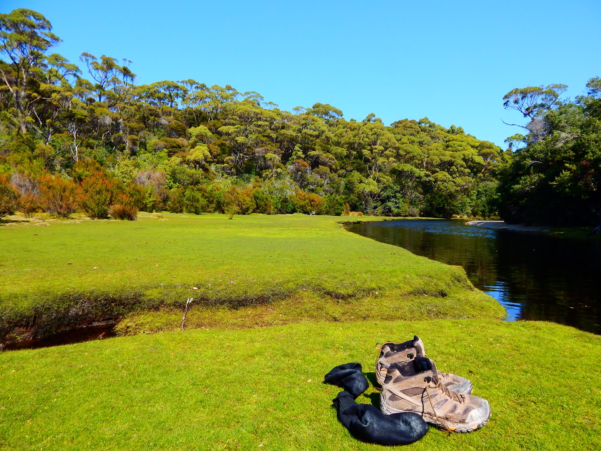
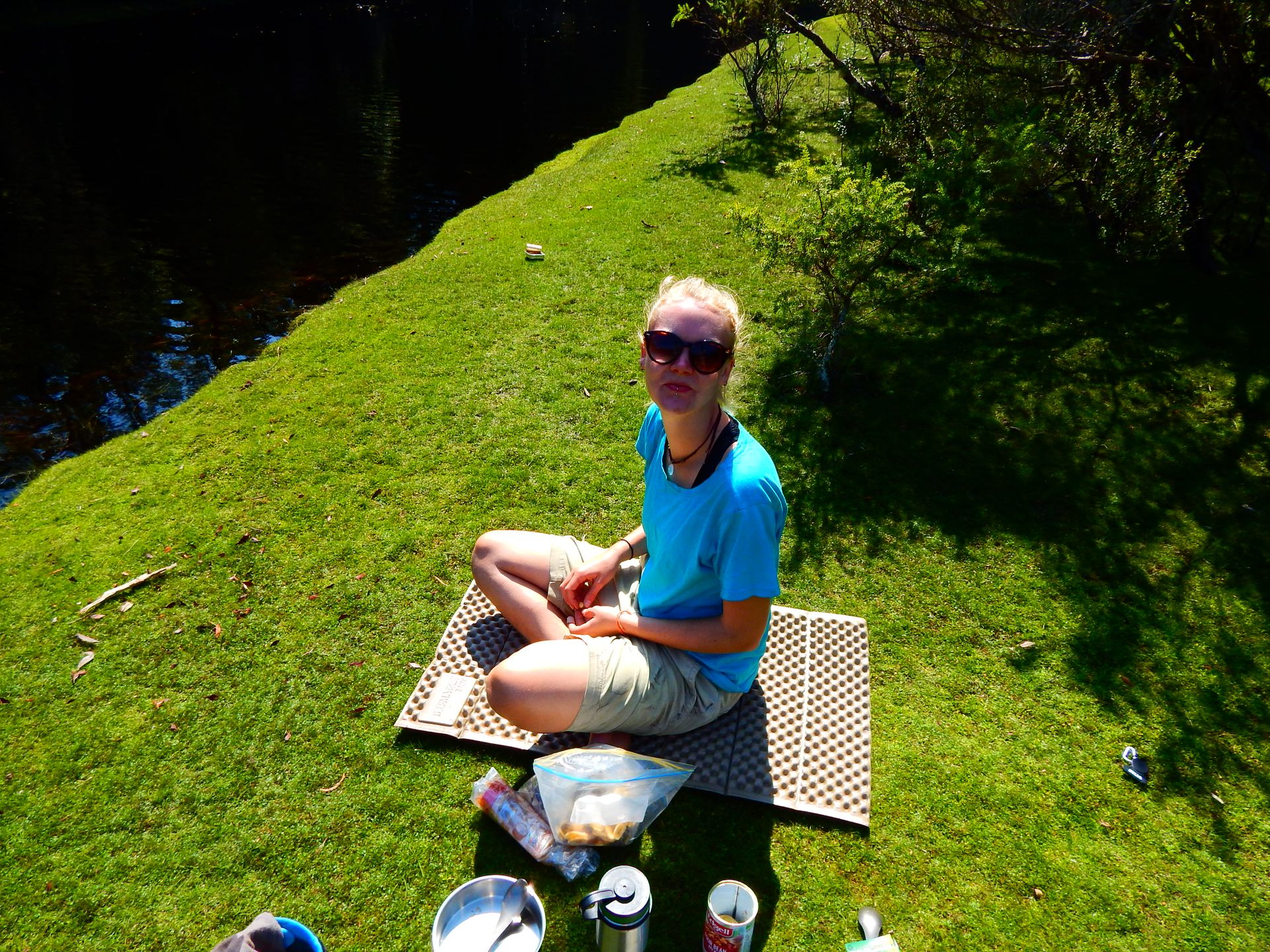
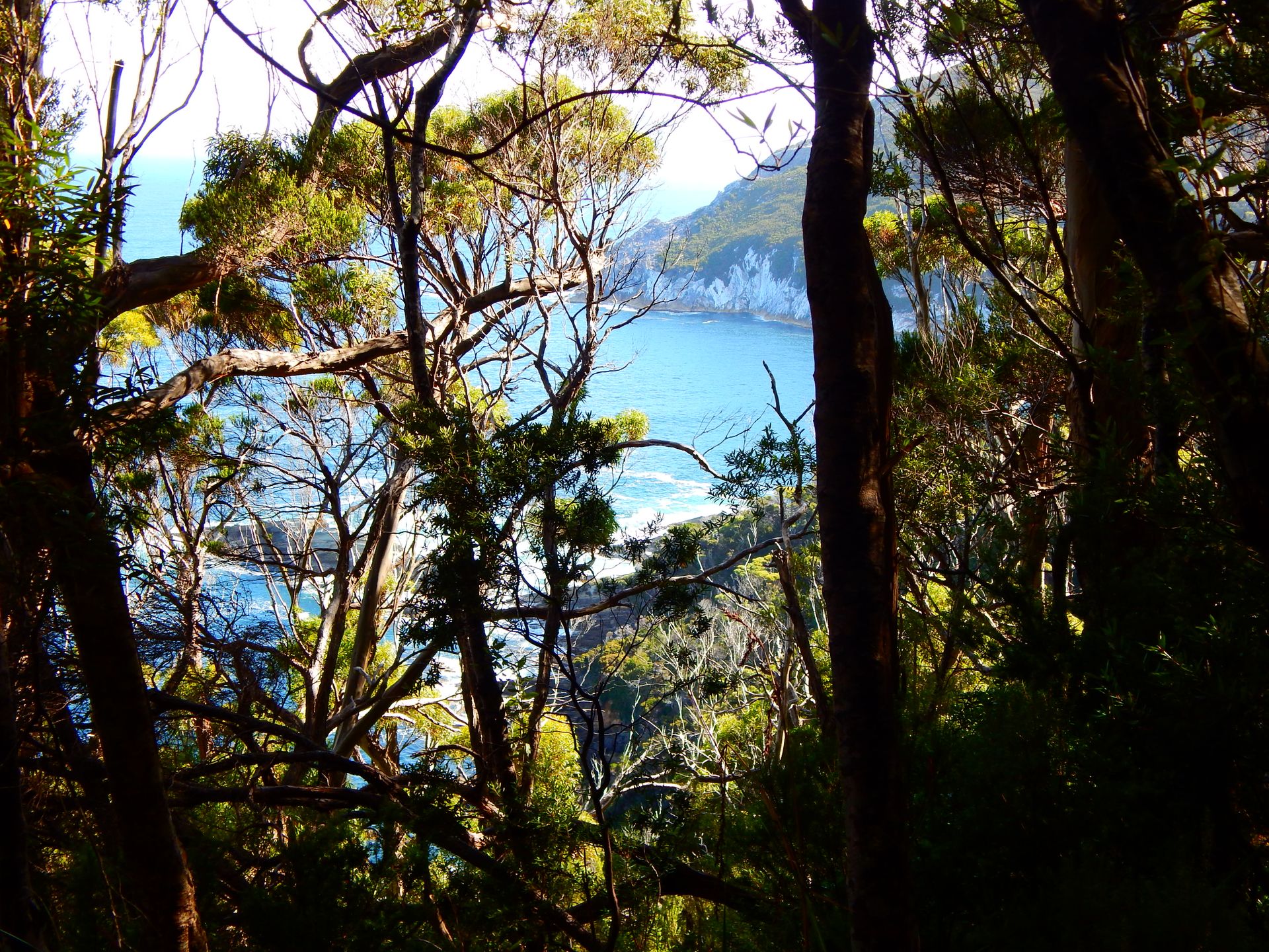
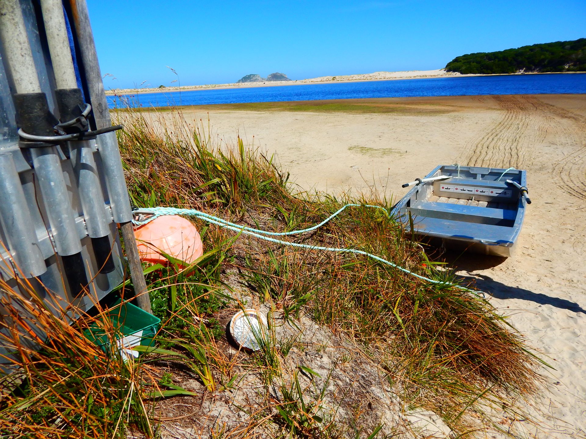
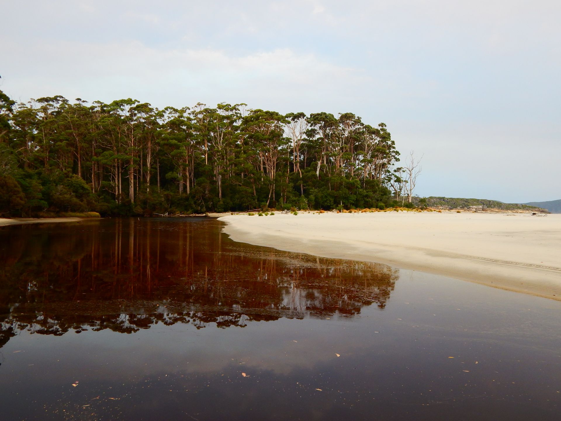
The wine brought good sleep and a challenging morning. Hundreds of mosquitoes are waiting for us between the inner net and the outer layer of the tent as soon as we get up. After a quick breakfast, we continue walking. Our legs ache from the previous day. Every small hill becomes a challenge, and I have to take many breaks. Flo then takes the weight off me to make it easier for me to carry. His knees also hurt, but seeing me suffer hurts him more (sweet). The path leads us through a forest with many stumbling blocks and slippery leaves on the ground. Suddenly, it releases us onto the beach. We walk along a long beach, and at the end, we turn north towards New River Lagoon. The view is fantastic! We both stand with our mouths open and marvel. The water glistens in the sun, and behind it stands an impressive mountain! On each bank, a rowboat is moored, ready to safely transport all hikers across. In total, everyone has to cross the salty river three times so that there is a boat on each side in the end. Rowing is fun, and we enjoy using different muscles in our bodies again. On the other shore is already our camp. We are happy about the short day and enjoy the afternoon by the river. We observe a wallaby mother with her little one, they are not afraid of us and come very close to our tent. The end of the track is slowly within reach and brings mixed emotions.
Friday, March 1, 2019
New River Lagoon -> Granite Beach 12km
The path repeatedly leads us steeply uphill and just as steeply downhill through the forest. It is very exhausting to walk, and it is very hot. Sweat drips. Flo stumbles and twists his ankle. It hurts a lot, so we take more time to walk, but we still make progress. We have lunch at Surprise Bay. His ankle gets cold water, good cream, and some rest before we climb steeply uphill again. I reach my limits... and we go beyond them! We climb steeper and higher, but we reach the top and have to go down again as usual. We realize that we are not a bad team. Flo is the support and the motivation when going uphill, and I help him find the best path downhill.
The path is muddy, roots and leaves make it more difficult for us. Then we finally reach Granite Beach. We have to drag ourselves all the way to the end and climb over many big rocks, much to Flo's horror. At the end, there is a small waterfall that serves as our well-deserved shower. Once again, we climb steeply uphill to the camp, and then this stage is also completed.
Saturday, March 2, 2019
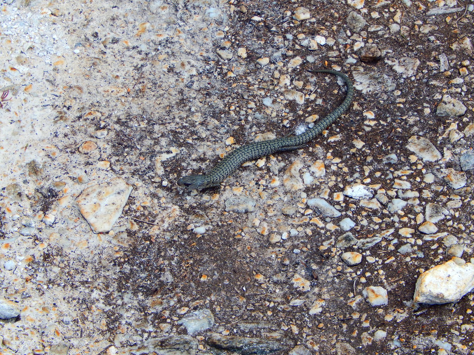
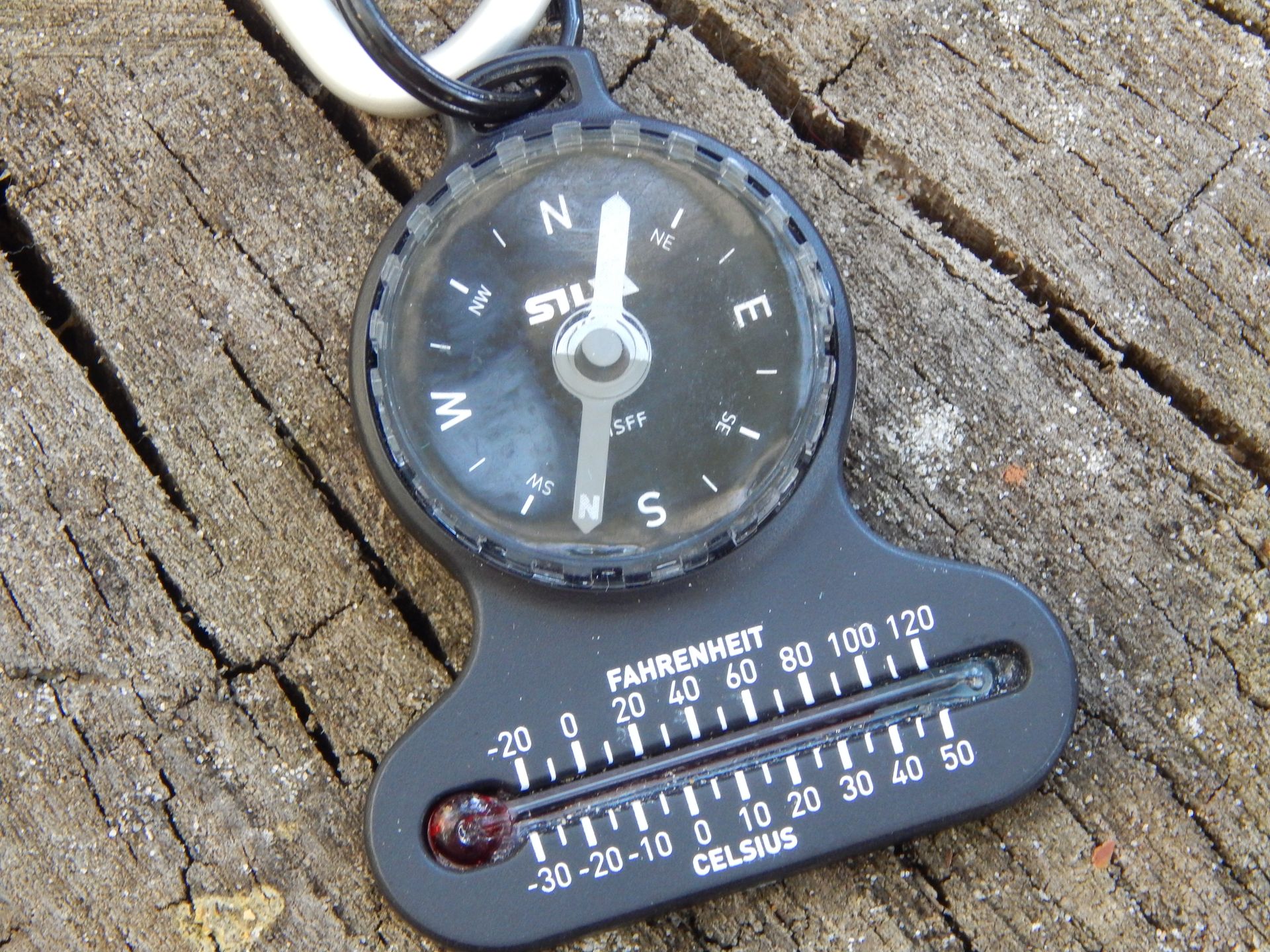
Granite Beach -> South Cape Rivulet 9km
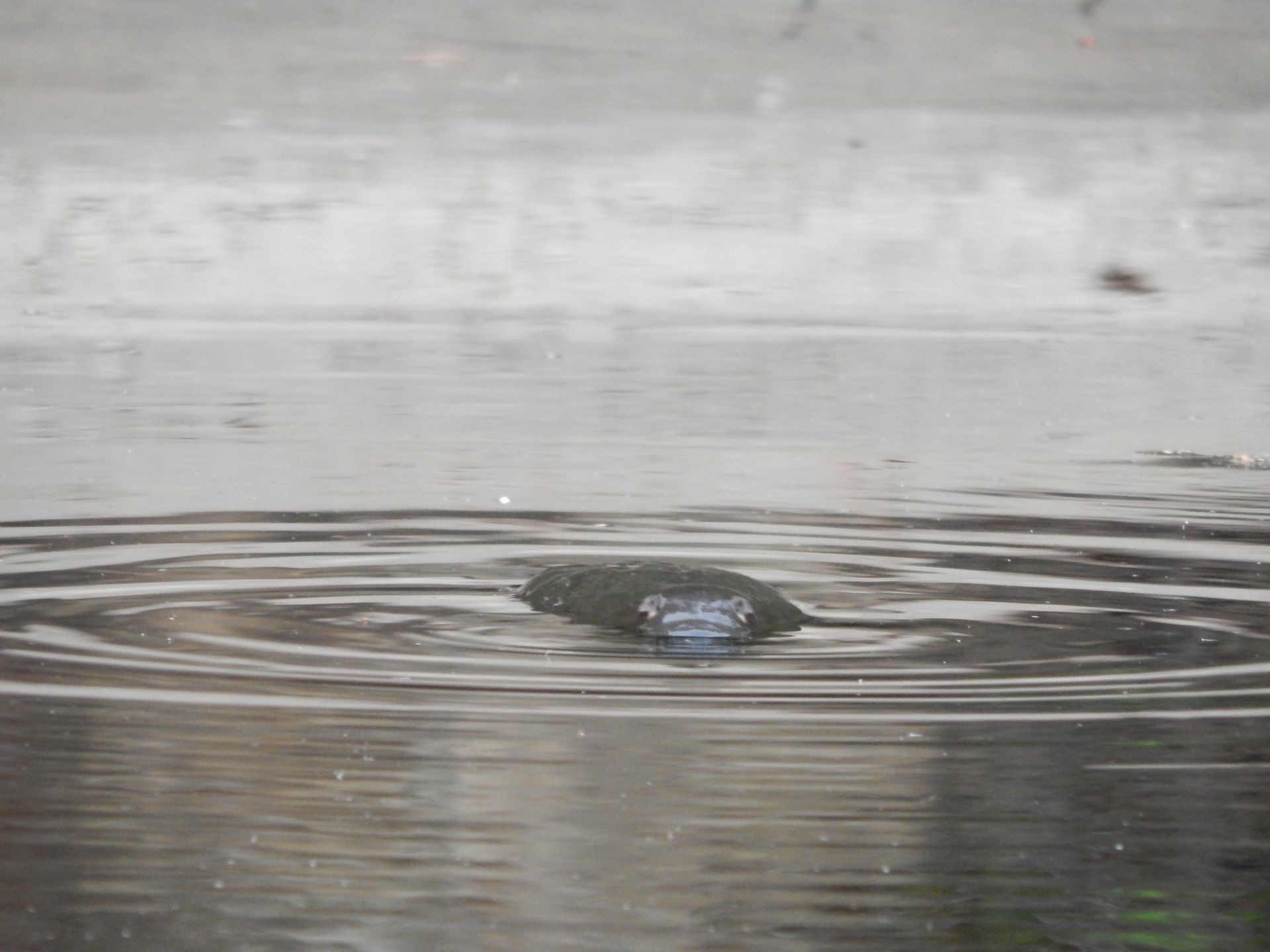
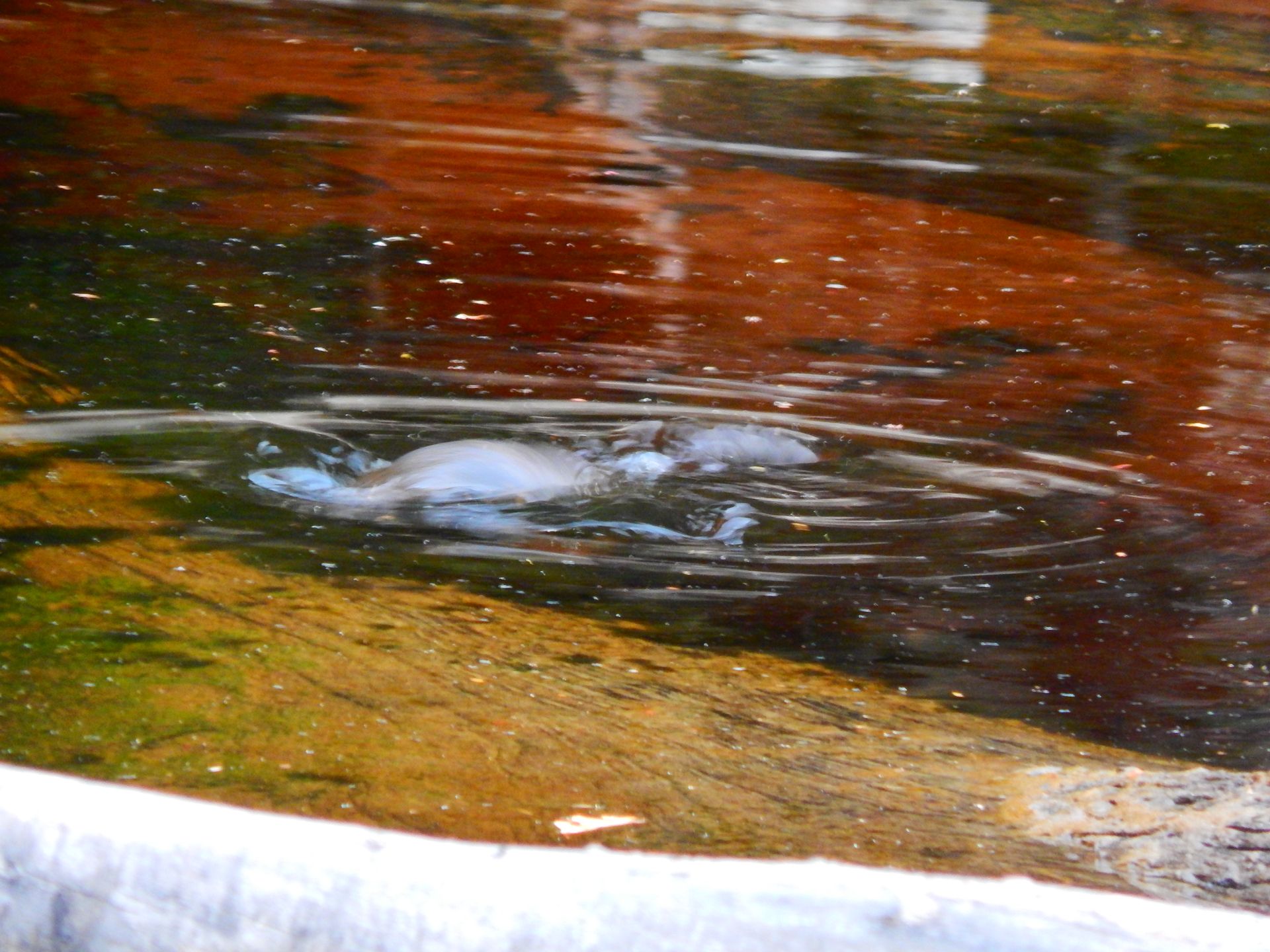
At 6 a.m., a hot wind is already blowing around our ears. We have to climb steeply uphill again and look down on the coast one last time before going through the rainforest. The path is strenuous because it is very muddy, and Flo sinks in up to his knee once, but luckily he can hold on and doesn't fall flat on his back. The path leads us over a hill again, as usual, steep uphill and steep downhill, over fallen trees and almost dried-up rivers. Fortunately, we are in the forest all day because it is very hot. Our thermometer even indicates 35 degrees Celsius in the shade. We are very careful while walking; after all, we don't want to surprise any snakes. Flo sees two big black snakes, but fortunately, they disappear quickly, and I don't even see them. We quickly get out of the forest unexpectedly and find that we have already reached the last campground. A river provides fresh water, a shower, and water for washing clothes. In the afternoon, we swim in the sea and enjoy the beautiful beach. It feels strange that it will be over tomorrow. Just before dinner, our Kiwi track friend comes to us and tells us that he found a platypus. Of course, we immediately set off and are allowed to observe the platypus in its natural habitat. We are both excited like little children. The platypus only lives in Tasmania, and we were lucky enough to observe one; it feels very special and is a fitting highlight for our last evening.
Sunday, March 3, 2019
South Cape Rivulet -> Cockle Creek 12km
The last day begins. We walk calmly and without stress. The path leads us across three beaches, each separated by small hills. Then we climb a steep platform with few steps that shows us the view of the entire South Cape one last time. The rest of the path is much better maintained, with boardwalks leading over difficult sections, and sometimes even handrails are installed. We meet many people who are doing a day hike and they all ask us many curious questions. Some talk nonstop, and we joke that we will go back into the bush and live there from now on. The last kilometers are very easy to walk; our backpacks are lighter than ever, and the sky is overcast. Just before Cockle Creek, it starts to drizzle, and we realize how lucky we were with the weather.
Suddenly, the South Coast Track ends. A small wooden house with a book in which we sign congratulates us at the end. We say goodbye to our Kiwi friends and hitchhike towards Huonville. A couple from Queensland picks us up. They love to travel and tell us that they have fallen in love with the small village of Southport in Tasmania. They might even buy a house there today. They bring us back from the wilderness to civilization, and luckily, Antoine and Flo, our two friends with whom we explored the West Coast, pick us up next.
The South Coast Track is an incredible, incomparable experience for both of us. We enjoyed being in nature so much and having so few people around us. I enjoyed washing in the river, feeling my body, and pushing my limits. It is nice to see how happy we can be with so little comfort.
Εγγραφείτε στο Newsletter
Απάντηση
Ταξιδιωτικές αναφορές Αυστραλία