About Adishi to Iprari
Publikováno: 24.08.2018


Odebírat novinky
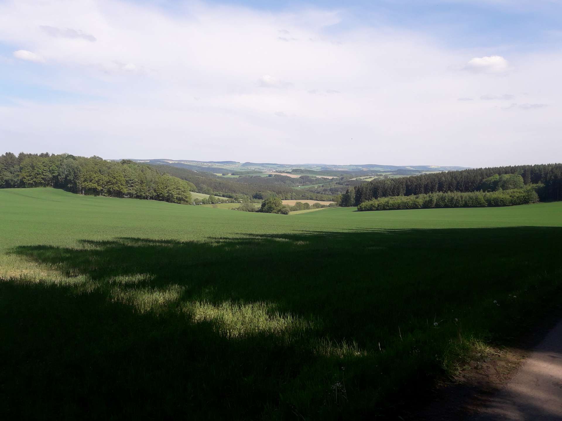
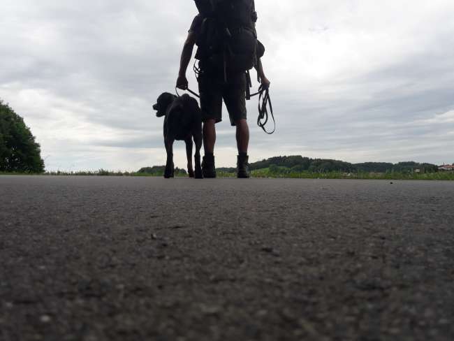
On Wednesday, August 22, 2018, it's time to move on. Rango's breakfast has gone missing overnight. Someone was happy about 2 large chicken thighs. For the Big Guy, that means dry food. My hosts give me a jar of homemade yogurt before we leave the campsite around eleven. We have to walk a bit into Mestia, cross the Enguri River, and then we can start the ascent of the southern hills. After about 3 km, we reach a larger road that we would have to walk along for at least 3 more kilometers. The sun has had plenty of time to heat up the concrete slabs, so it's not an ideal hiking trail for Rango. I also have to get used to the weight of my backpack again, so I take advantage of the first opportunity for a ride. In the minibus, we come to Hatsvali, the base station of a chairlift. There is no path on my map from here to the 2200 m high mountain, so a lift ride is the way to go. According to the ticket seller, I can take Rango with me, although I'm not quite sure how that can work. The first attempt fails, the Big Guy refuses to jump into the seat and I have to jump off before the lift gains too much height. With the backpack, it was absurd. On the second try, I make the decision for Rango and lift him onto the four-seater chair before taking my own seat, and we glide up the mountain quite comfortably. Now it turns out that there could have been an option to climb on foot, but I'm still not mad about the lift ride. When we arrive at the top, I leave Rango and my luggage and enjoy the view. A cup of coffee in the restaurant with its magnificent panoramic terrace is too expensive for me, so we set off along the mountain range to the east. Fortunately, we are not yet completely above the tree line and can partly walk in the shade. The next 2.5 km, the trail is well built and there is a radio or listening post on a 2473 m high summit. After that, we descend a steep and narrow path for quite a while before tackling the final ascent to 2332 m shortly after four o'clock. Just before the summit, I put Rango and the backpack back in the shade and make my way alone to the summit chapel and a viewpoint. Both are not as interesting as I had hoped. The stage ends at a small body of water around five o'clock. Despite walking only about ten kilometers, I am quite exhausted.
Shortly after eight o'clock on Thursday morning, the first rays of sunlight wake me up. The night was cold, so I enjoy the slowly spreading warmth in the tent. By the time I have finished my morning routine, it's around eleven and we start the descent to Tsvirimi. After an hour, we stop briefly at a church and I have a conversation with the priest. He would like to buy Rango from me and asks if maybe one of his children could be sent to Georgia. Of course, that's not possible. We continue hiking through Tsvirimi down to Bogreschi, where we stop for a coffee at the first small market around one o'clock. Then we march along a well-built road. I'm a bit annoyed by the many tourists who are being driven from village to village, as it spoils the hiking experience for me. After about three quarters of an hour, I take a look at my map and realize that I'm on the road to Usghuli, so I have taken the wrong turn at the last village. The road is also the only connection between Upper Svaneti and the rest of Georgia, which justifies a certain level of development. So I laugh at myself and my frustration because the road is not really made for hiking. I walk back until I finally find the right way to Adishi in Bogreschi. It's much more pleasant to walk with less car traffic. Around five o'clock, we call it a day after covering a distance of about 17 kilometers. I set up the tent on a sunny meadow and enjoy the evening.
Even on Friday, August 24, 2018, we don't get moving much before eleven o'clock and we stop at the entrance of Adishi at the Tetnuldi Cafe shortly after twelve o'clock. I have a conversation with the young hostess and she treats me to a coffee. So I order a salad for lunch and request a bread to take away, I want to leave some money behind. The salad arrives promptly, the bread is still being baked. In the meantime, I take a walk around the village and replenish our food supplies as much as possible. In this nest, there are countless guest houses and just as many ruins of houses, some of which are easy to confuse. Back at the Tetnuldi Cafe, the bread is still not ready, so I order another coffee and use the good wifi to upload pictures. Around half past three, it's finally time and I can continue with a fresh bread. We hike for about another hour and a half through the valley of the Adishchala River until a crossing would be necessary at its upper course. Along the way, I have already been offered a horseback ride, 10 lari in the morning, 25 lari in the evening, due to the higher water level. After looking at the situation, I decide to try crossing on foot the next morning. I find a place to camp and end the day.
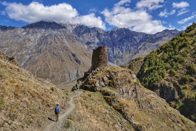
It's around seven o'clock on Saturday morning when I am woken up by bustling activity in my neighborhood. The first hikers are getting ready to cross the river. So I venture out of the tent into the cool mountain morning around half past seven to check it out. The first adventurers have already reached the other bank, and the dog that accompanied us from Adishi to here is already jumping around on the other side. So Rango should be able to overcome the small obstacle as well. I slowly pack our things, enjoy the first rays of sunlight reaching the campsite, and finally, shortly before nine o'clock, easily cross the Adishchala River. Rango is also briefly impressed by the strong current and follows me quite quickly. On the other bank, I find a sunny spot for breakfast, as we have a climb of about 500 meters ahead of us. At half past ten, well fortified, we start our ascent. I take several small breaks, partly to catch my breath, partly to take advantage of the abundant supply of blueberries. The view of the surrounding mountain landscape justifies every moment of pause. After a climb of about 2 hours, we reach the 2722 m high Chkhunderi Pass. Now we have to descend the same 500 meters before hiking back towards the Enguri Valley along another glacier stream. Around half past two, I stop at a small restaurant for a coffee and some cake. Here, the three girls from Vienna join us, with whom we have been walking parts of the way together since our stay at the Tetnuldi Cafe. After about half an hour, we continue downhill. The weather continues to be good, although a thunderstorm seems to be brewing in the northeast. In the late afternoon, we reach the first of the three mini-villages that make up the settlement of Iprari / Ipraal. While passing through the settlements, we are confronted with a few ill-behaved four-legged creatures, but we can handle them without any major problems. I set up the tent a bit away and use the last rays of sunshine to do some laundry and take a very short bath in the mountain stream.
Odebírat novinky
Odpovědět
Cestovní přehledy Gruzie