Karijini National Park
Publikováno: 11.03.2020


Odebírat novinky
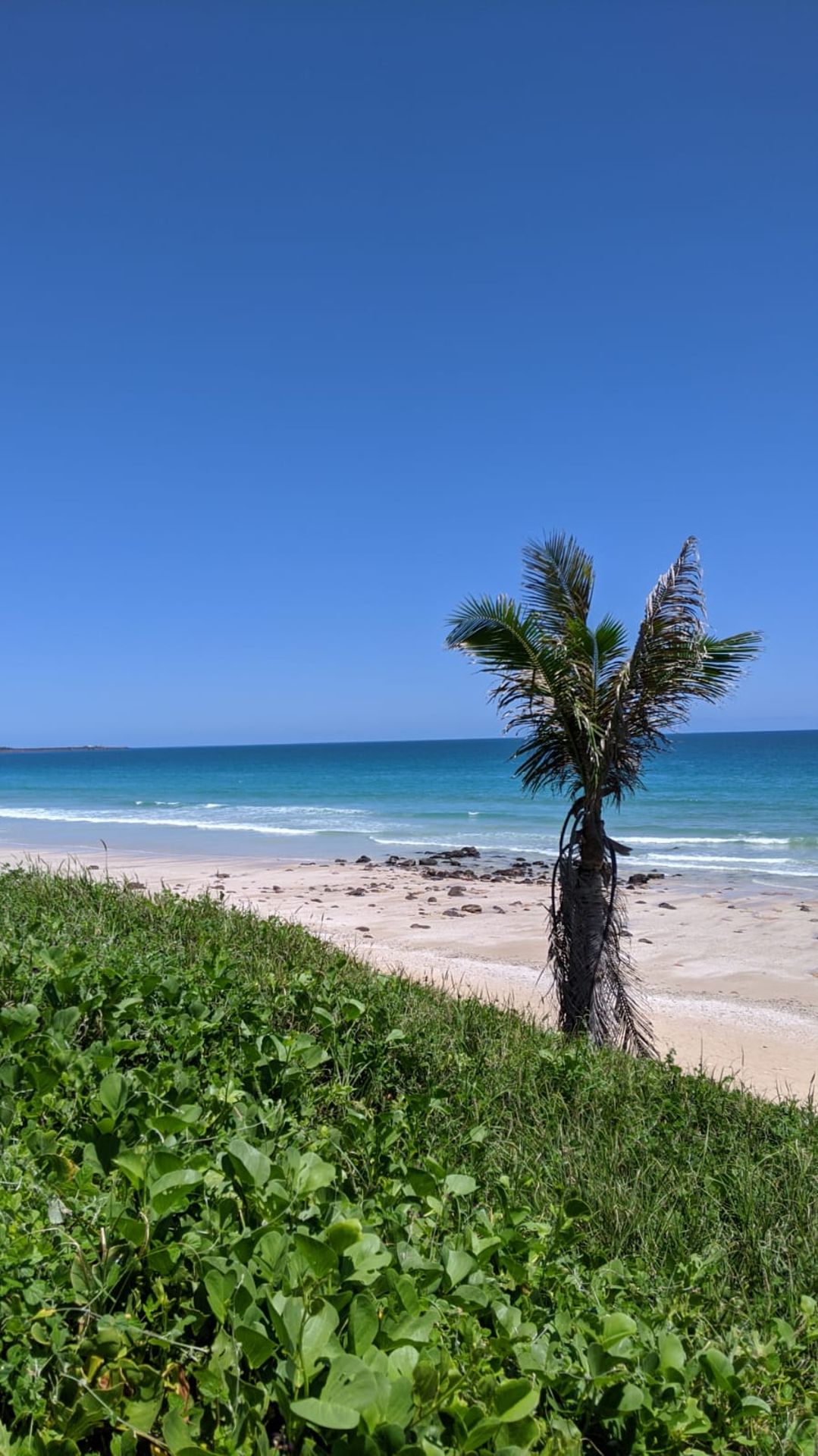
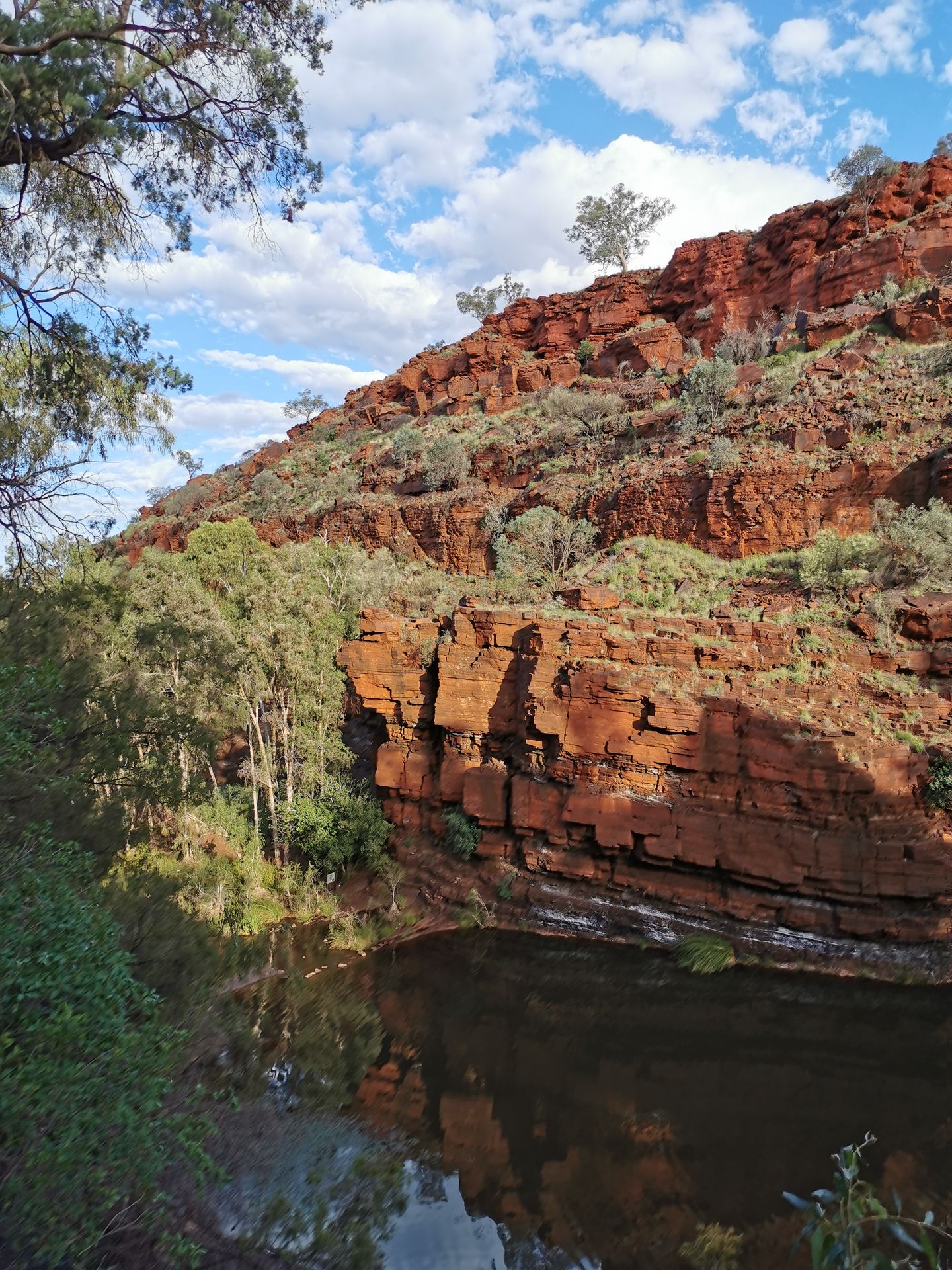
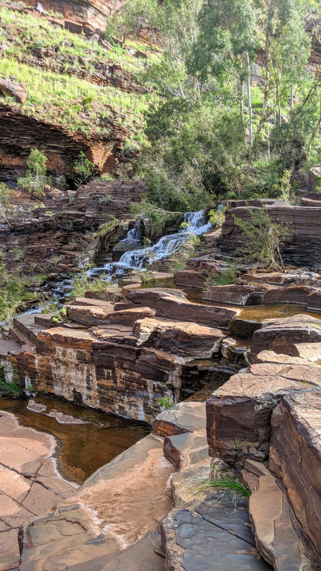
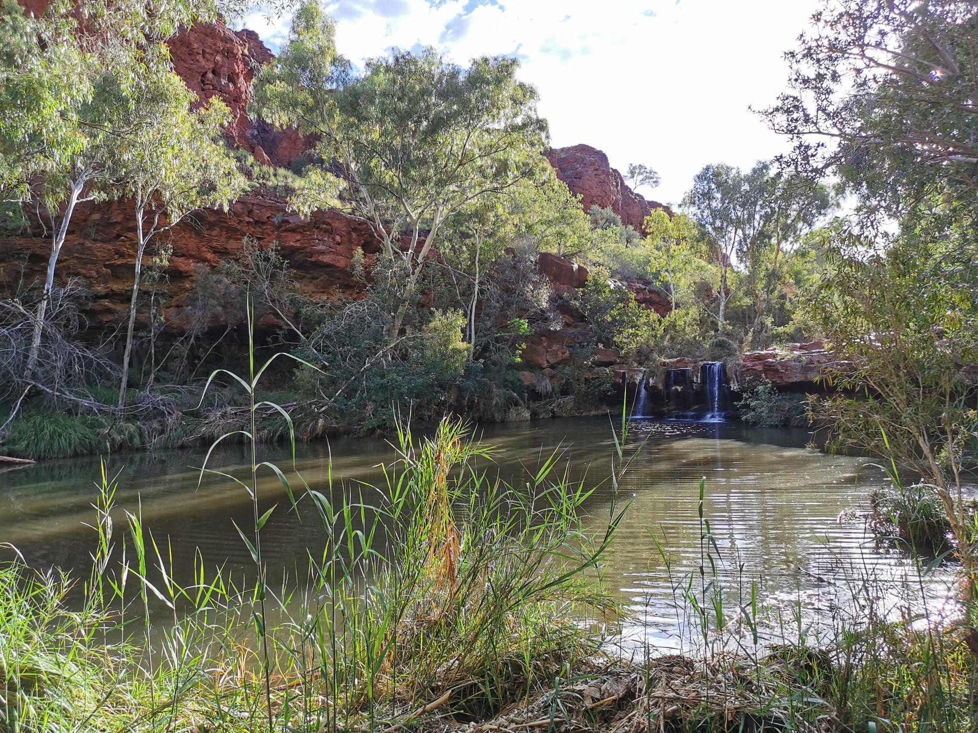
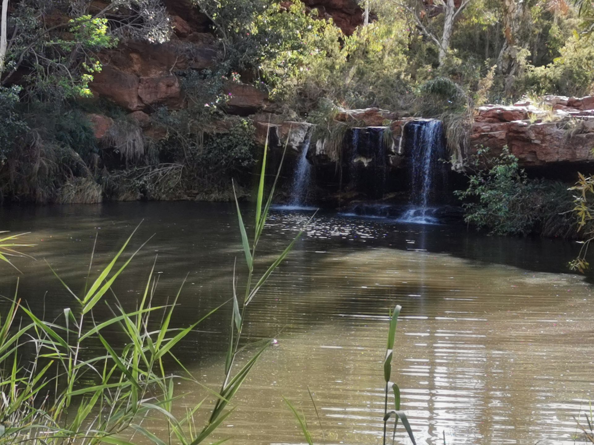
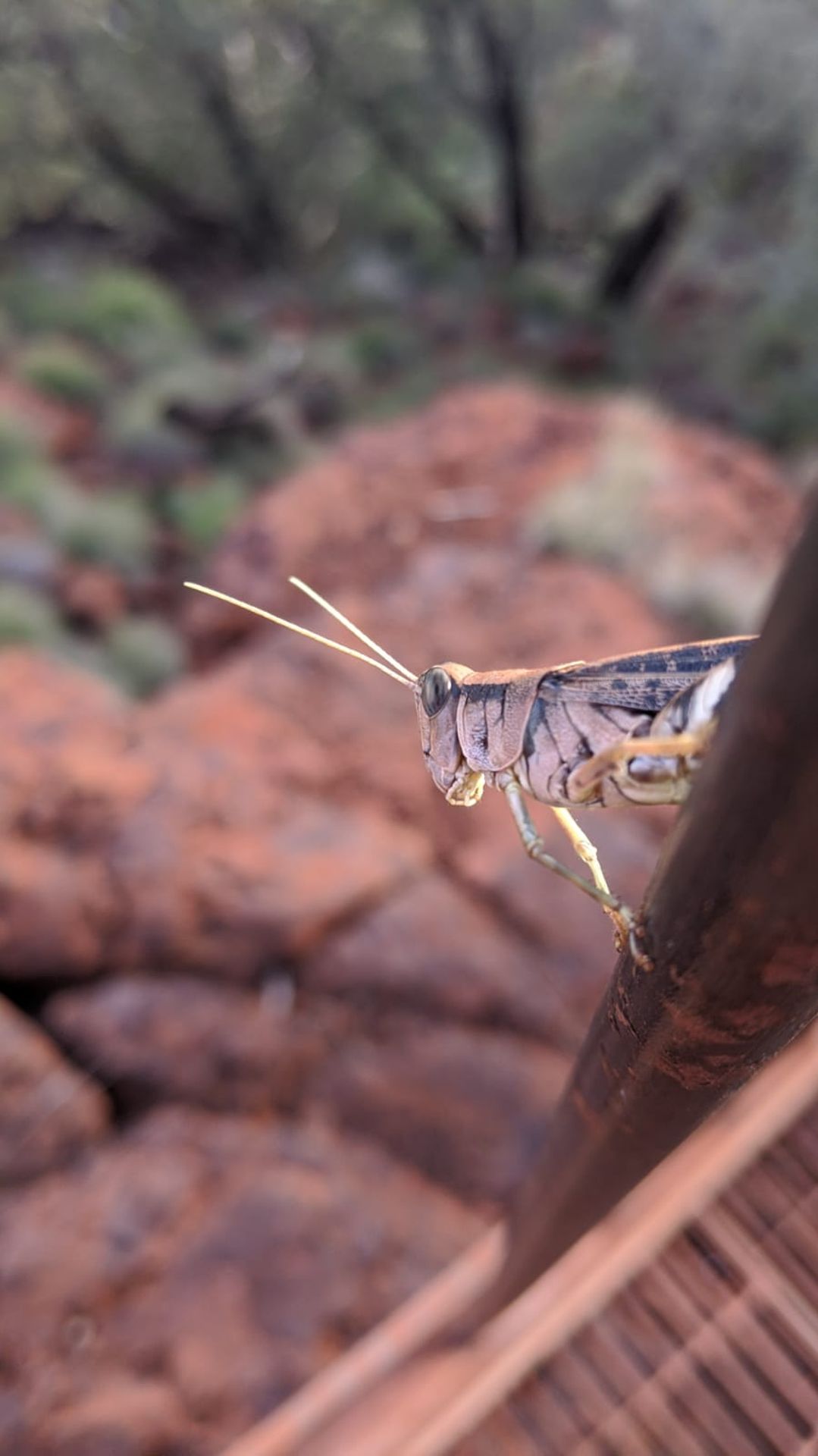
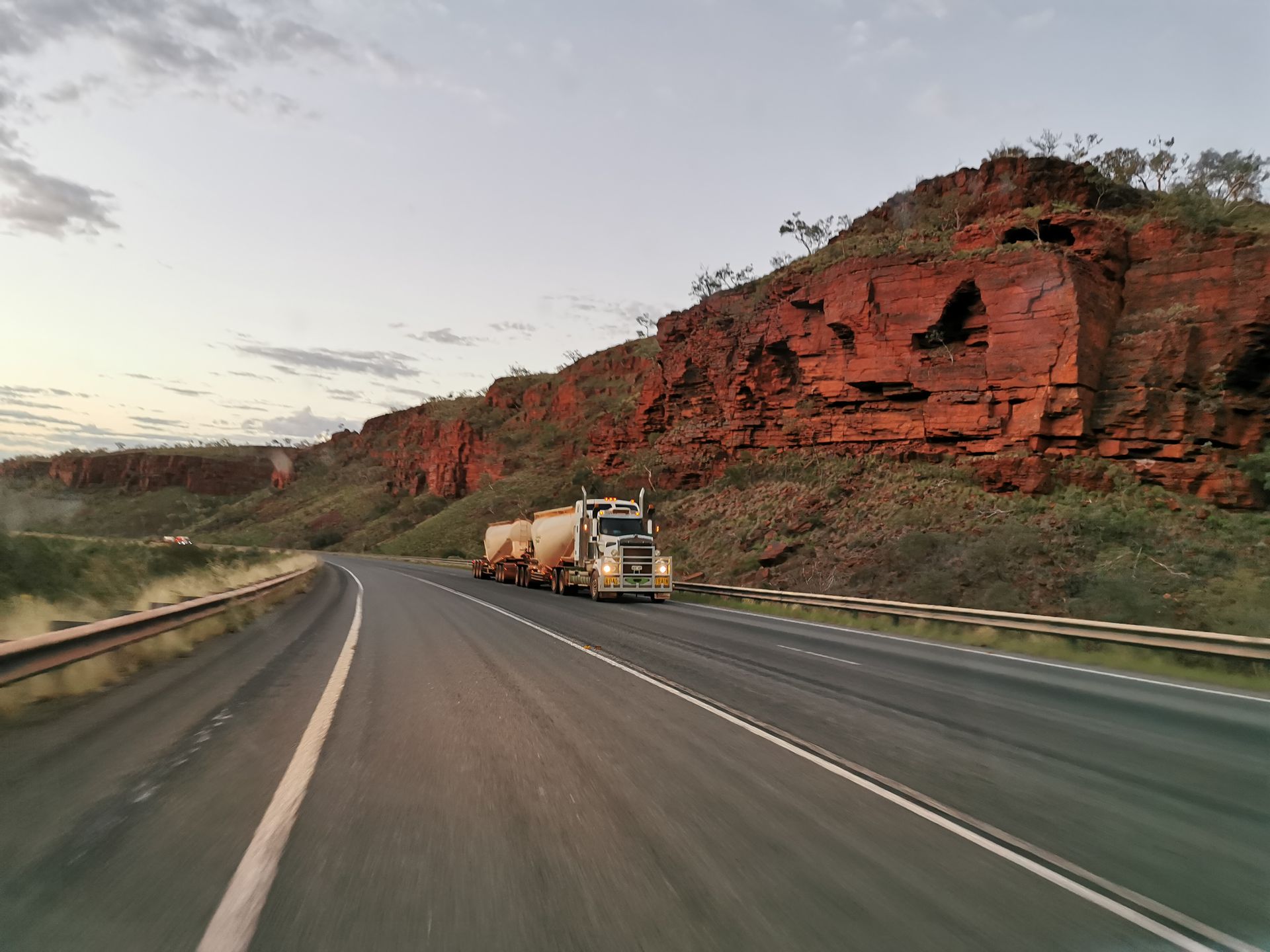
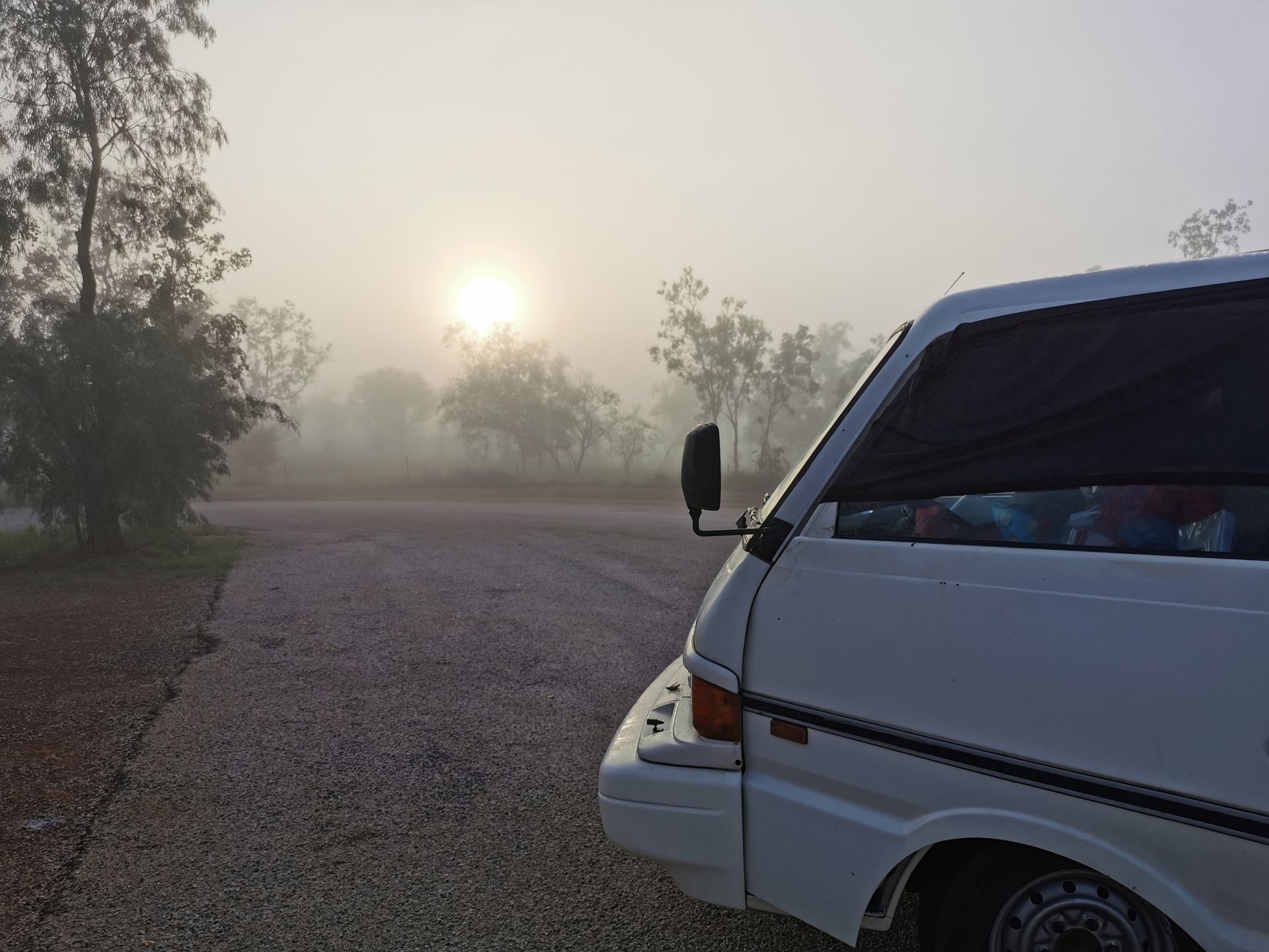
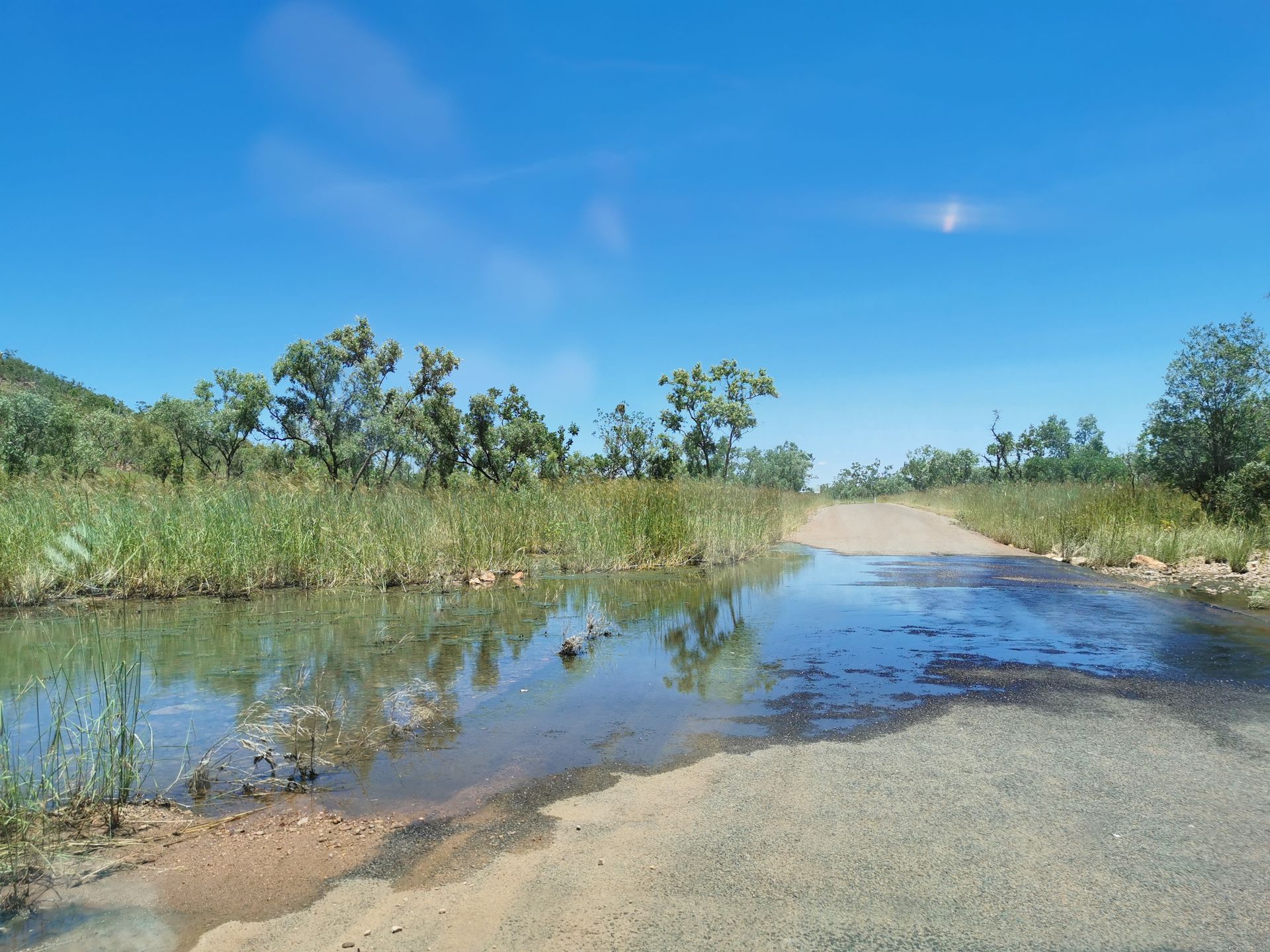
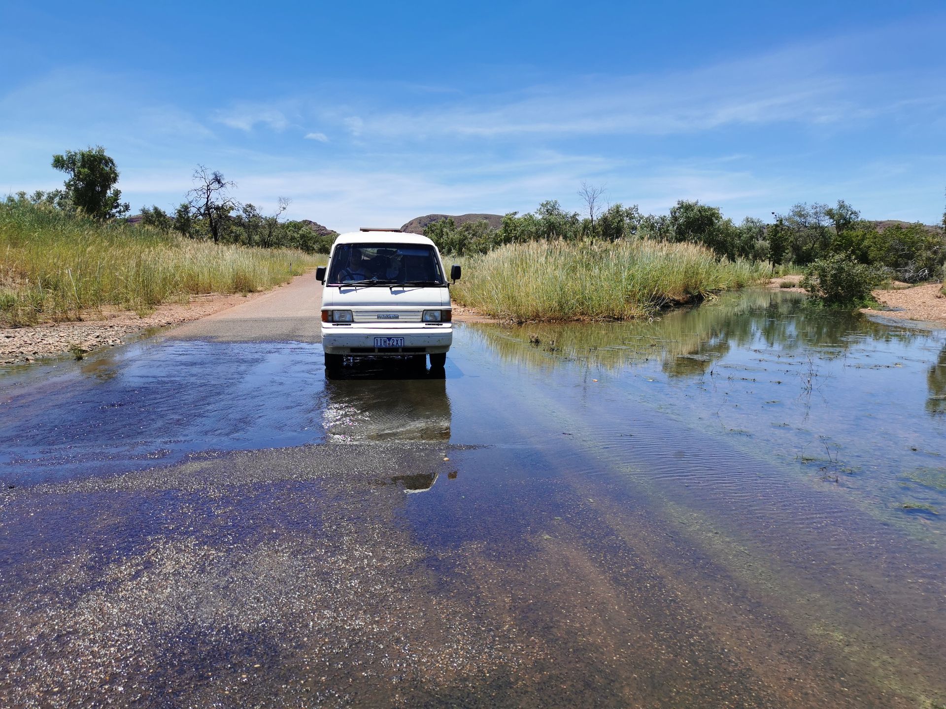
We start at 6 am for the sunrise from a small overnight parking lot on the highway from Karijini National Park. This is the second largest in Australia and is still about 400 km inland. We drive for 6 hours (without air conditioning) in the increasingly strong sun and notice that the surroundings are getting greener. Lush green bushes, trees, and even entire meadows. A feast for the eyes after the long dry outback. After the long drive, we are looking forward to being able to take a shower in the small town of Tom Price. After a small lunch, we continue another 100 km. Since the cyclone 'Damien' raged a few weeks ago, the access roads to some spots are unfortunately closed. However, we can visit the 'Fern Pool' and the 'Fortescue Falls'. We go down 300 steps into a canyon with red rocks to a natural pool. Again, a very welcome cooling off at almost 40 degrees in the shade. Just a short walk away, we find the 'Fern Pool'. The path leads us over stones and logs, and the loud sounds of the animals make us feel like we are in the middle of nature. Finger-sized grasshoppers fly around and we have to be careful where we step, as they look like fluttering leaves on the ground and in the air. High up in the trees, we see hundreds of bats hanging upside down and the birds flying around screeching. The waterfall of the 'Fern Pool' looks even more beautiful, but the water is a bit cloudier, which is probably why no one swims there. We walk back to the van and make our way to the campsite. The next morning, we get up early again for the sunrise because there are still several kilometers ahead. It is still 600 km to the city of Broome. These are the usual Western Australian distances here. We cool off in between with a cold drink from our cooler until we finally arrive at Cable Beach in Broome. The parking lot was empty and we found a nice shady spot. But in general, there was nothing going on there. Is it because we are there 'early'? Or maybe you're not allowed to park here? Is there a fee? We get out and explore the area. The cafes and restaurants are still closed. Hmm, strange. A few meters further, we finally find out the reason. With big signs, we are warned about strong currents, poisonous jellyfish, and even crocodiles before entering the beautiful beach. Swimming is only possible from April to October in a designated area. Very disappointed, we lay our picnic blanket on a meadow to spend the day there in the shade of a palm tree. Not bad either 😄 It was our last opportunity for a beach day before leaving the coastal region and heading towards farm work. Well, that's how it is in Australia. The animals rule the land. If it's not the sharks, the annoying flies, or mosquitoes, it's the crocodiles and jellyfish. In addition, the heat reigns. It is unfortunately too hot to drive without air conditioning during the day, which is why we decide to drive through the night. It's actually too dangerous. Exactly, also because of the animals. It's kangaroos and cows that often stand by the roadside and suddenly want to cross the road. Yes, really, big fat cows!😃 Some bulls even have horns and probably weigh a whole ton. Unimaginable such an impact. We don't want to imagine that either and only drive at 40 - 60 km/h. While the famous road trains (large trucks that can be up to 50 meters long) regularly overtake us at a rapid 100 km/h. They probably can't be stopped. It became dark and the visibility is already quite limited despite the high beam. Again and again, we encounter the sign 'Floodway' (flood drainage). So far, there have often been a hollow that was quite low, but it had never been flooded. But since Karijini National Park, we have noticed that we are in a different climate zone. There is much higher humidity here and nature is greener than ever before on our trip. It's tropical. On our long night drive, we finally experienced the meaning of 'Floodway'. At first, you could only see how the trees and bushes were underwater at the roadside. But then we were very startled. The road suddenly became wet and you couldn't see how much water it was. We hadn't expected that. We drove through slowly and regretted not checking the weather forecast before. There was unfortunately no network here. Before we got on the highway, we saw a big road sign with the next four cities listed. Between the cities, the word 'open' was displayed in red digital letters everywhere. So we shouldn't really worry. But that might just mean that the roads are not impassable or completely flooded. If they were only flooded up to a meter, we would probably have a problem. Fortunately, this was not the case and we were able to stop at a campsite at quarter to 2 and go to sleep.
Odebírat novinky
Odpovědět
Cestovní přehledy Austrálie