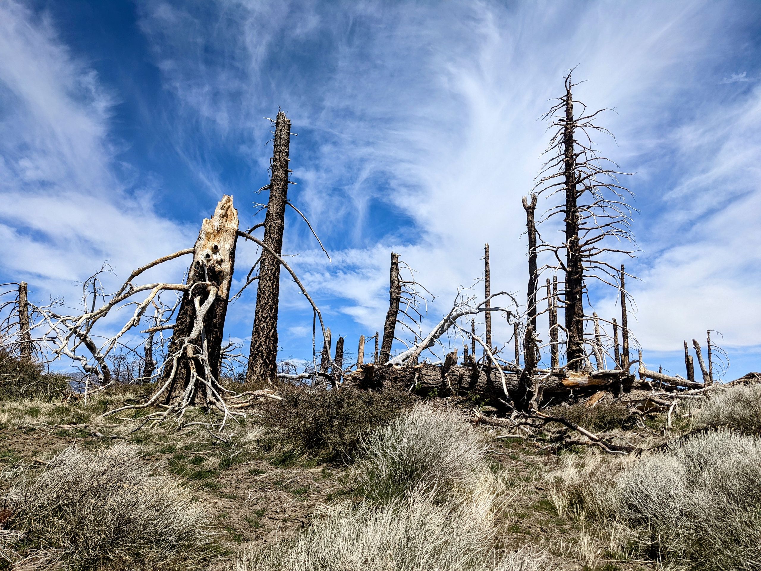
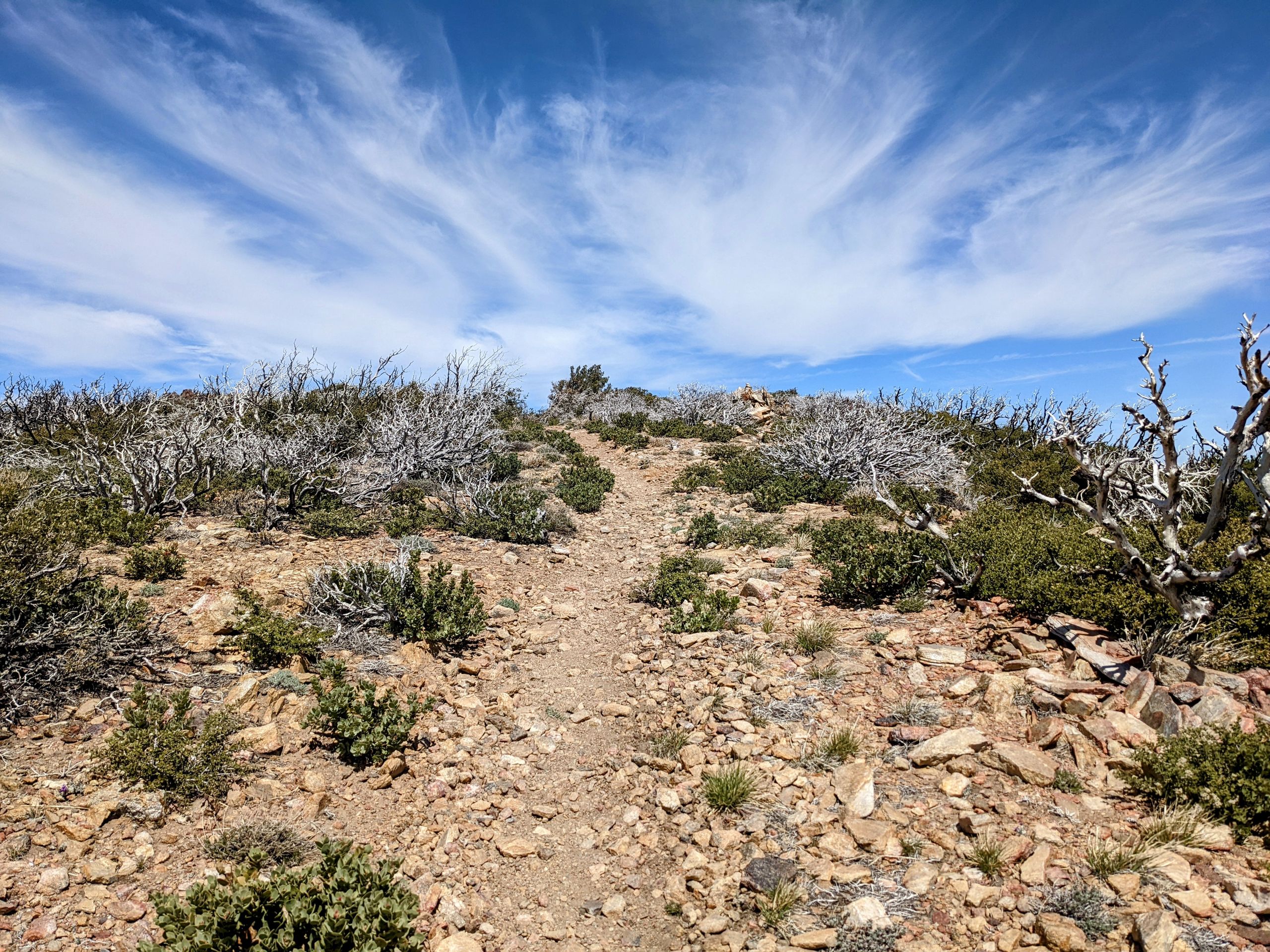
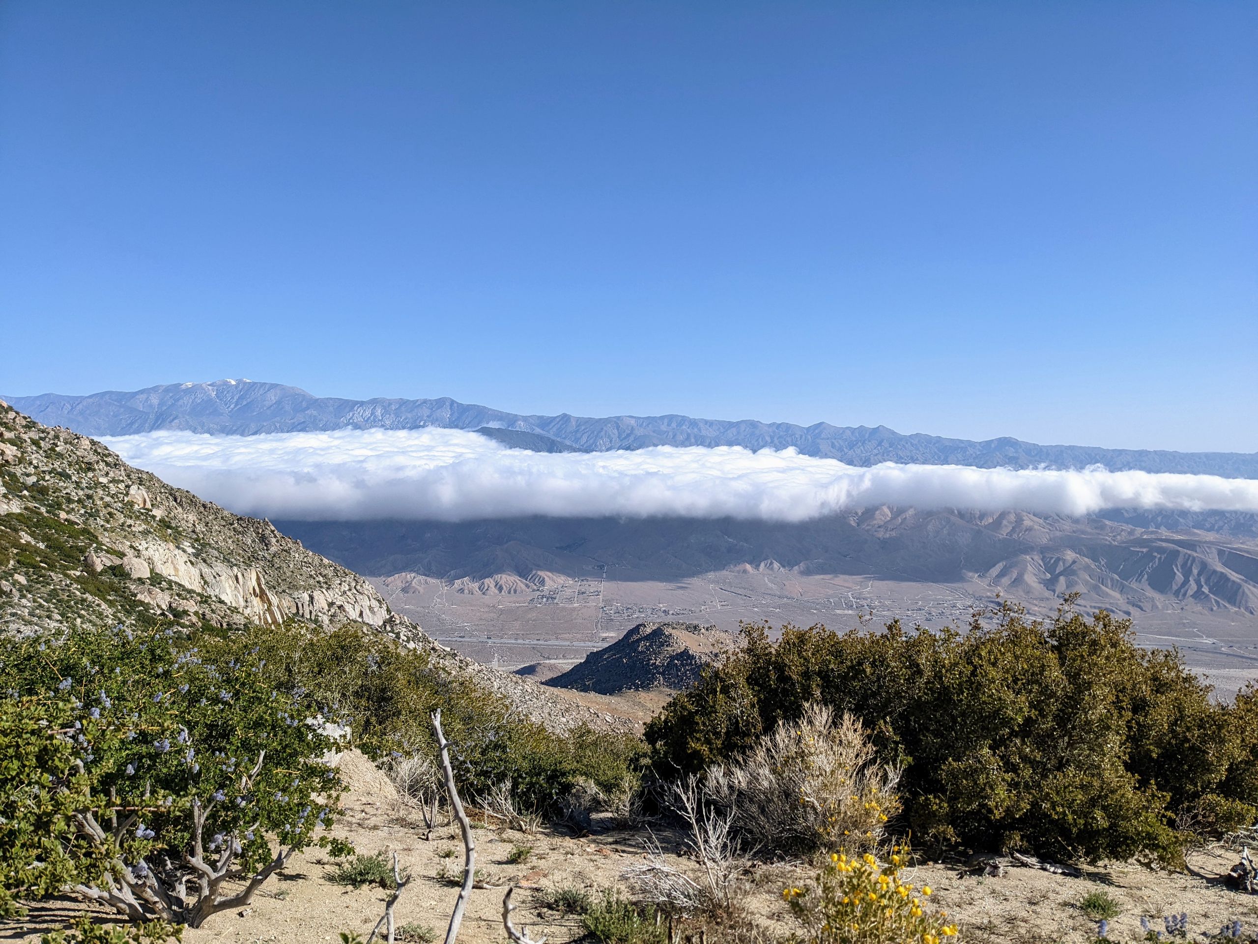
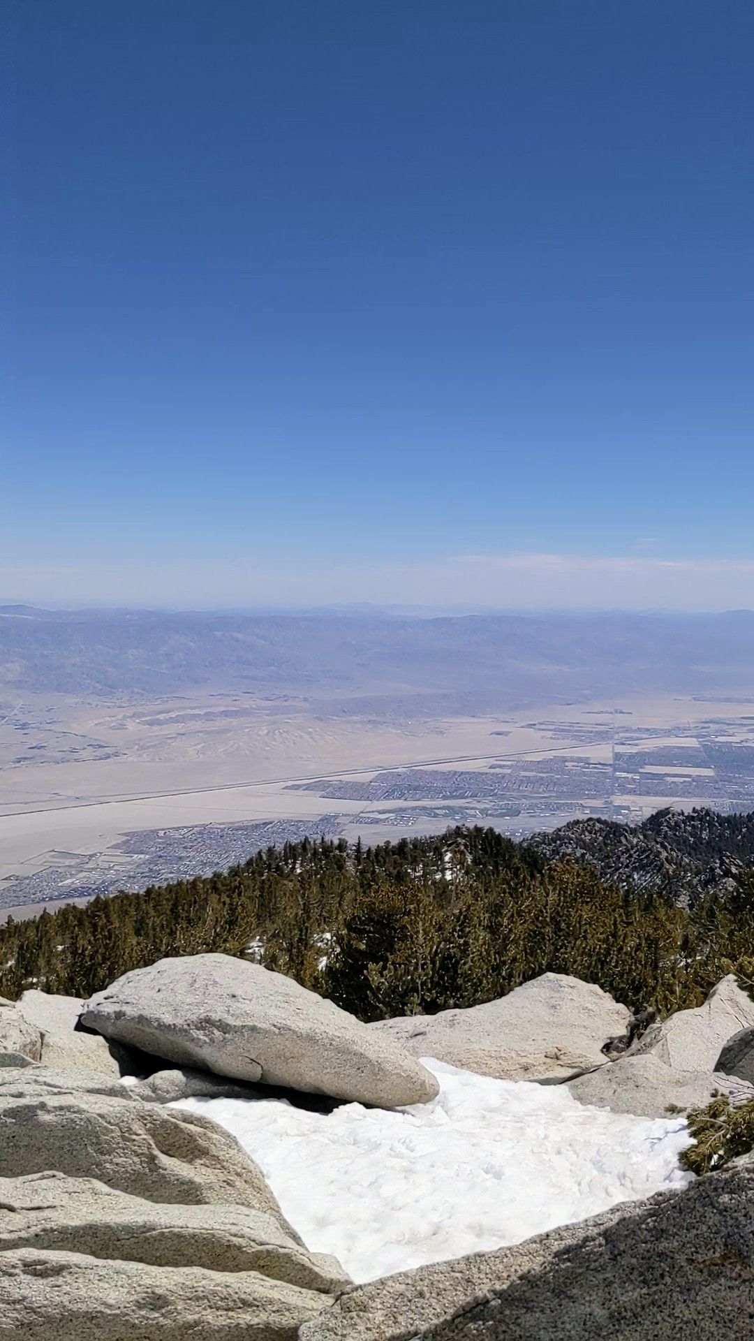
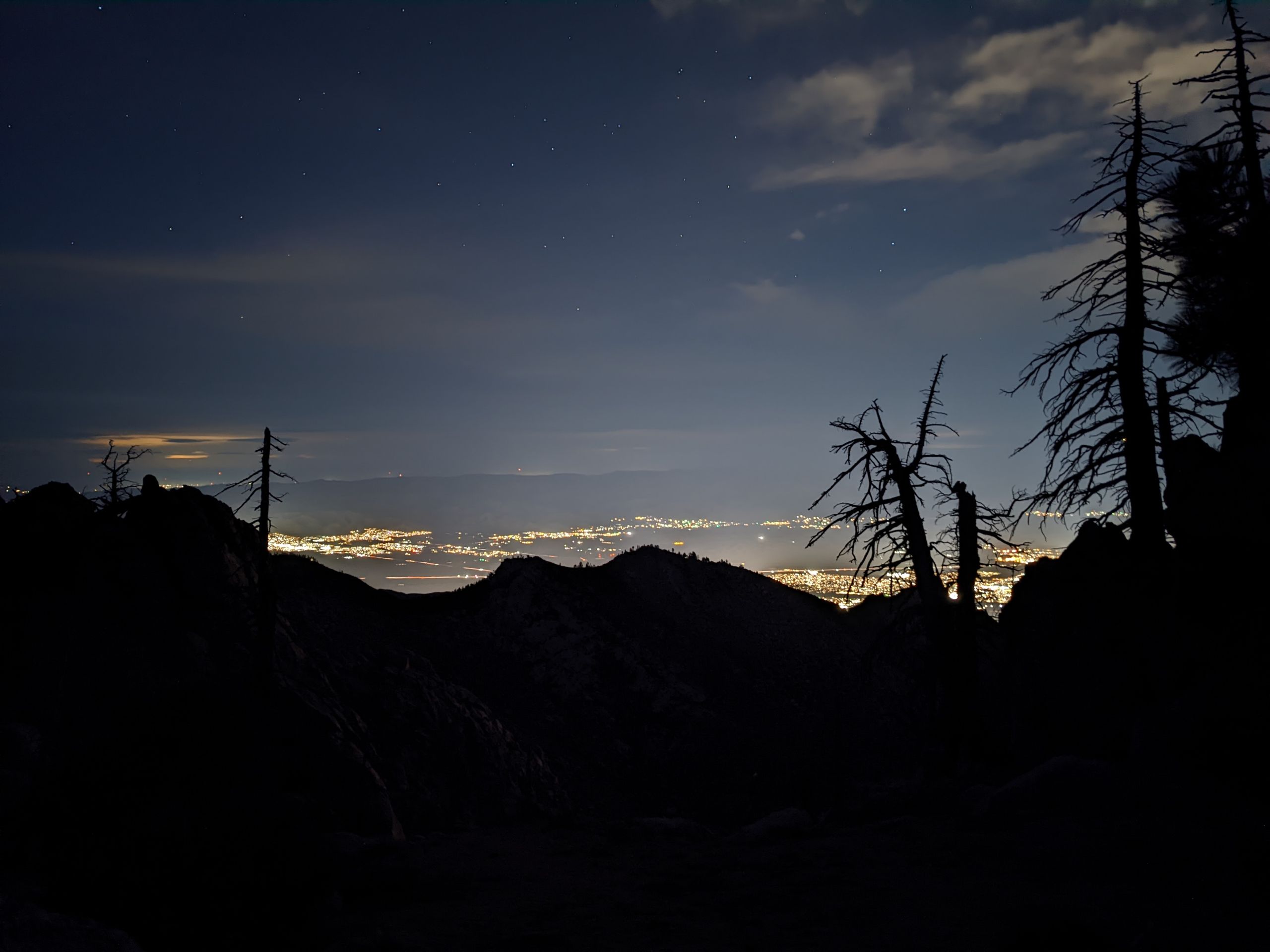
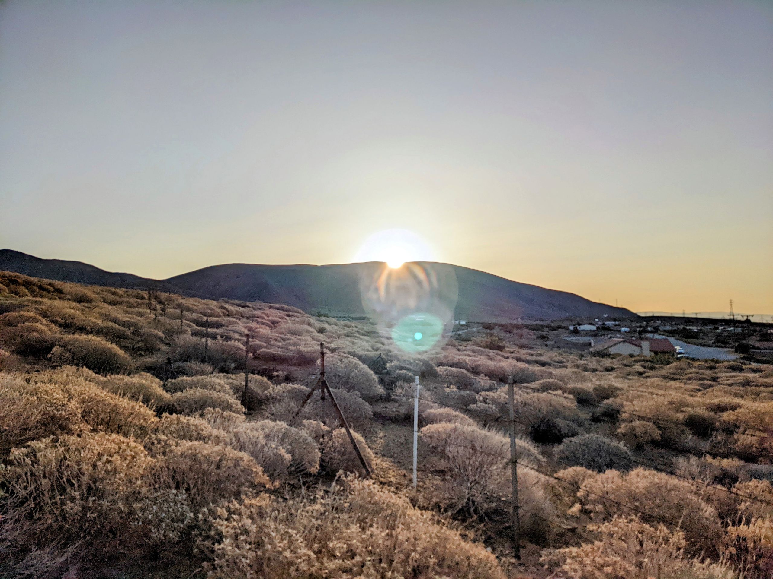
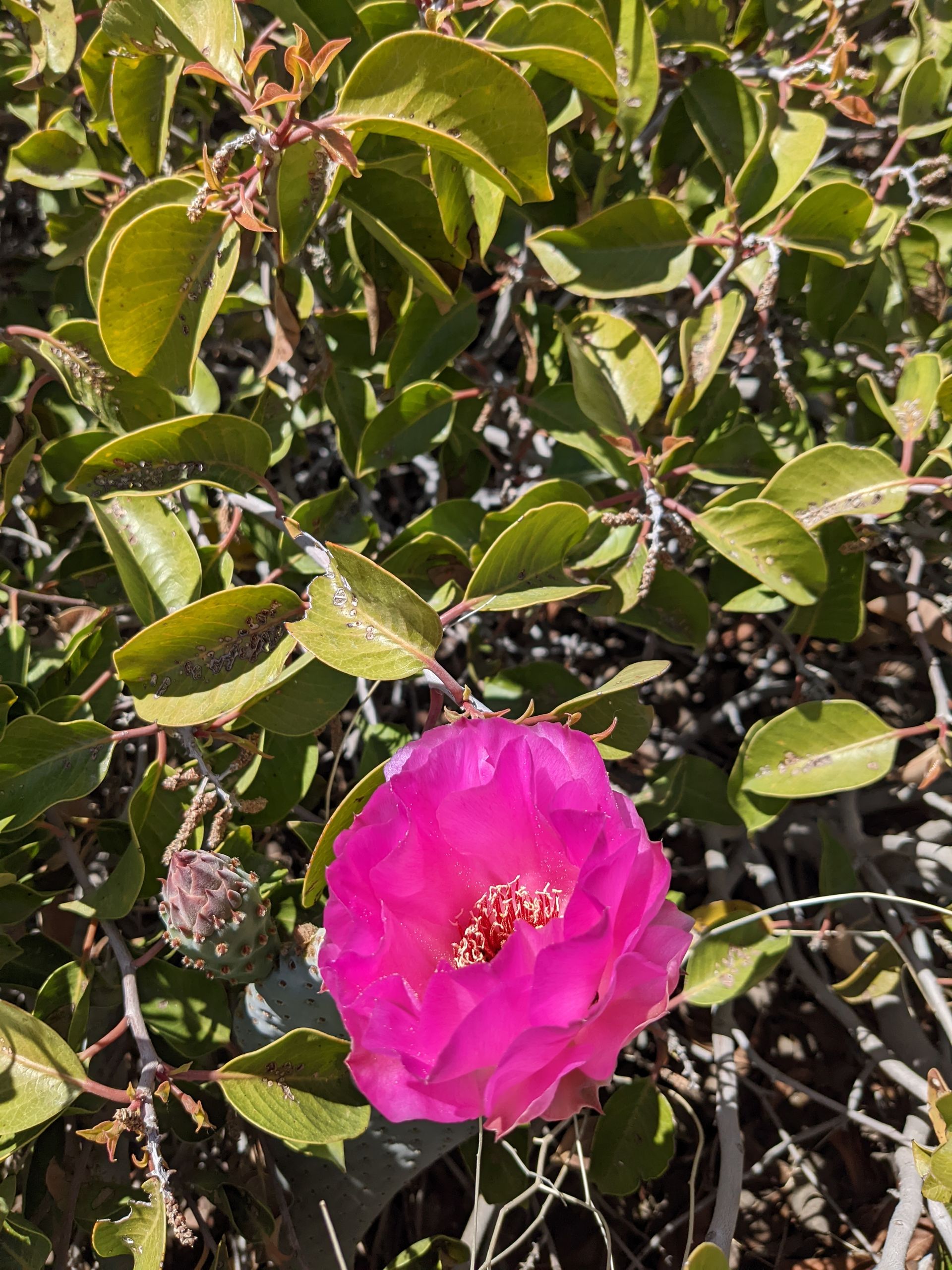
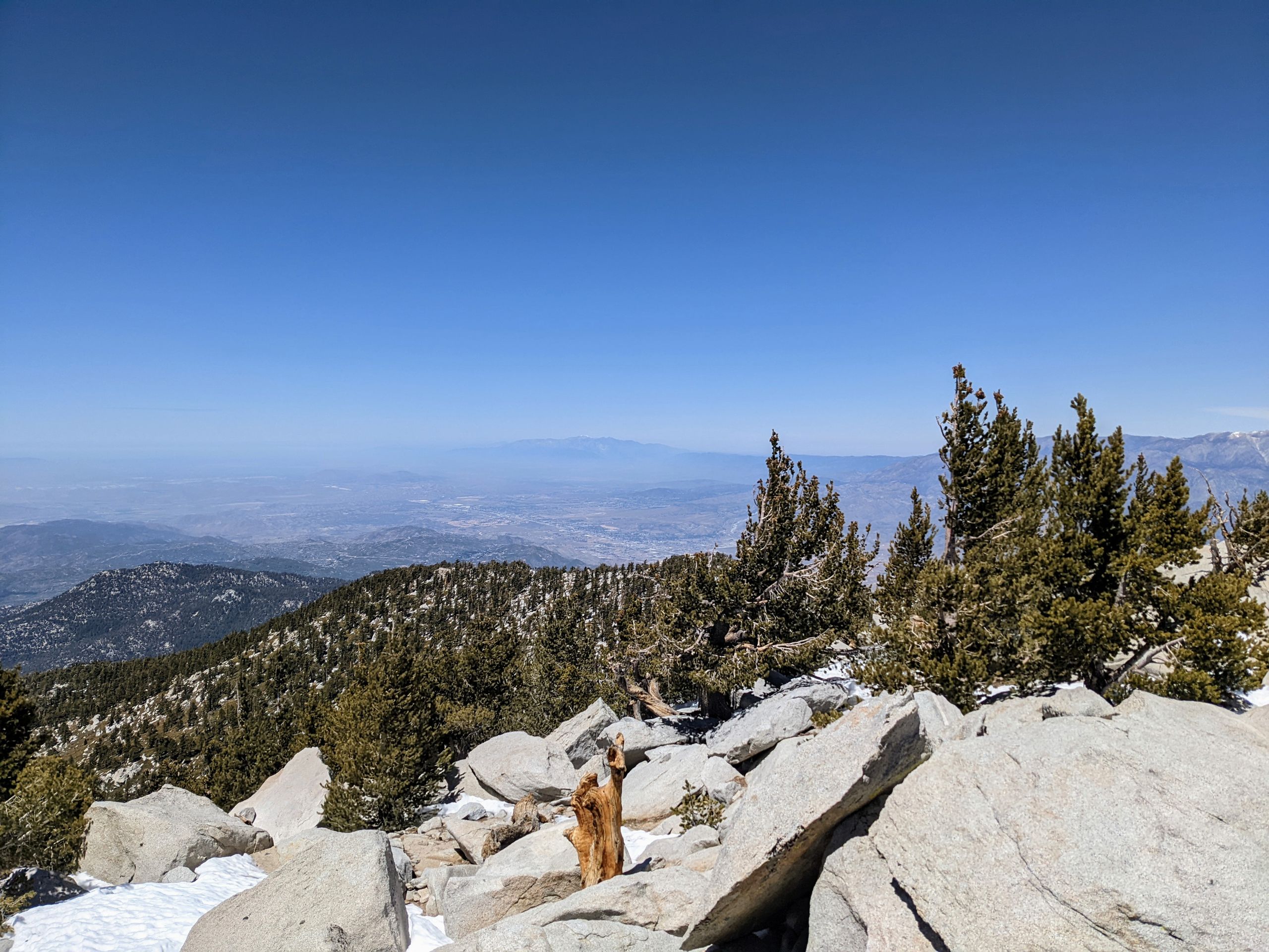
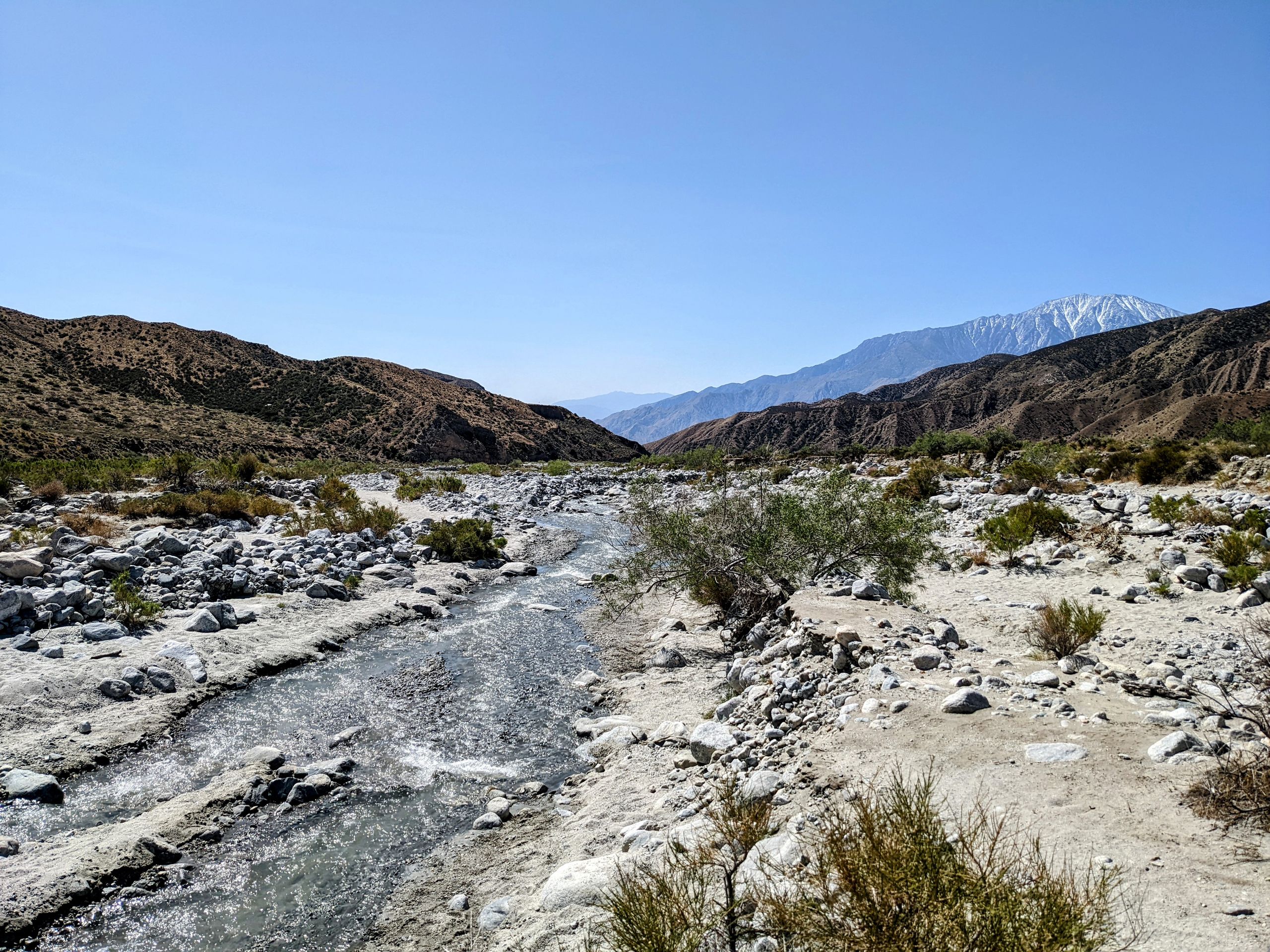
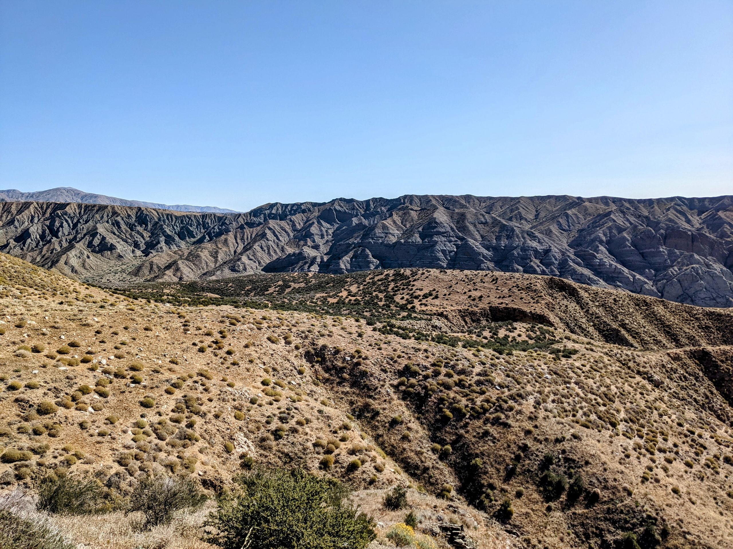
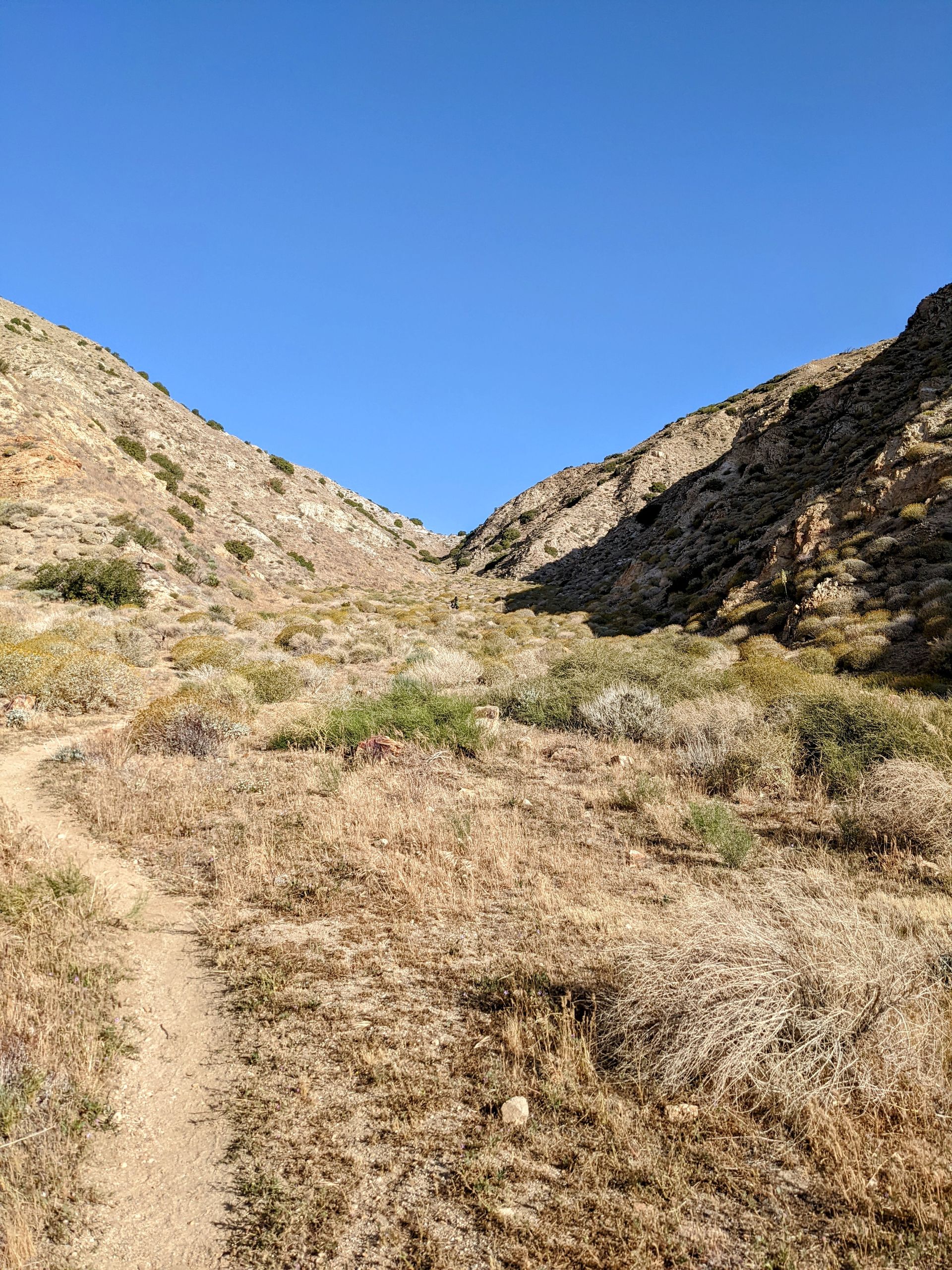
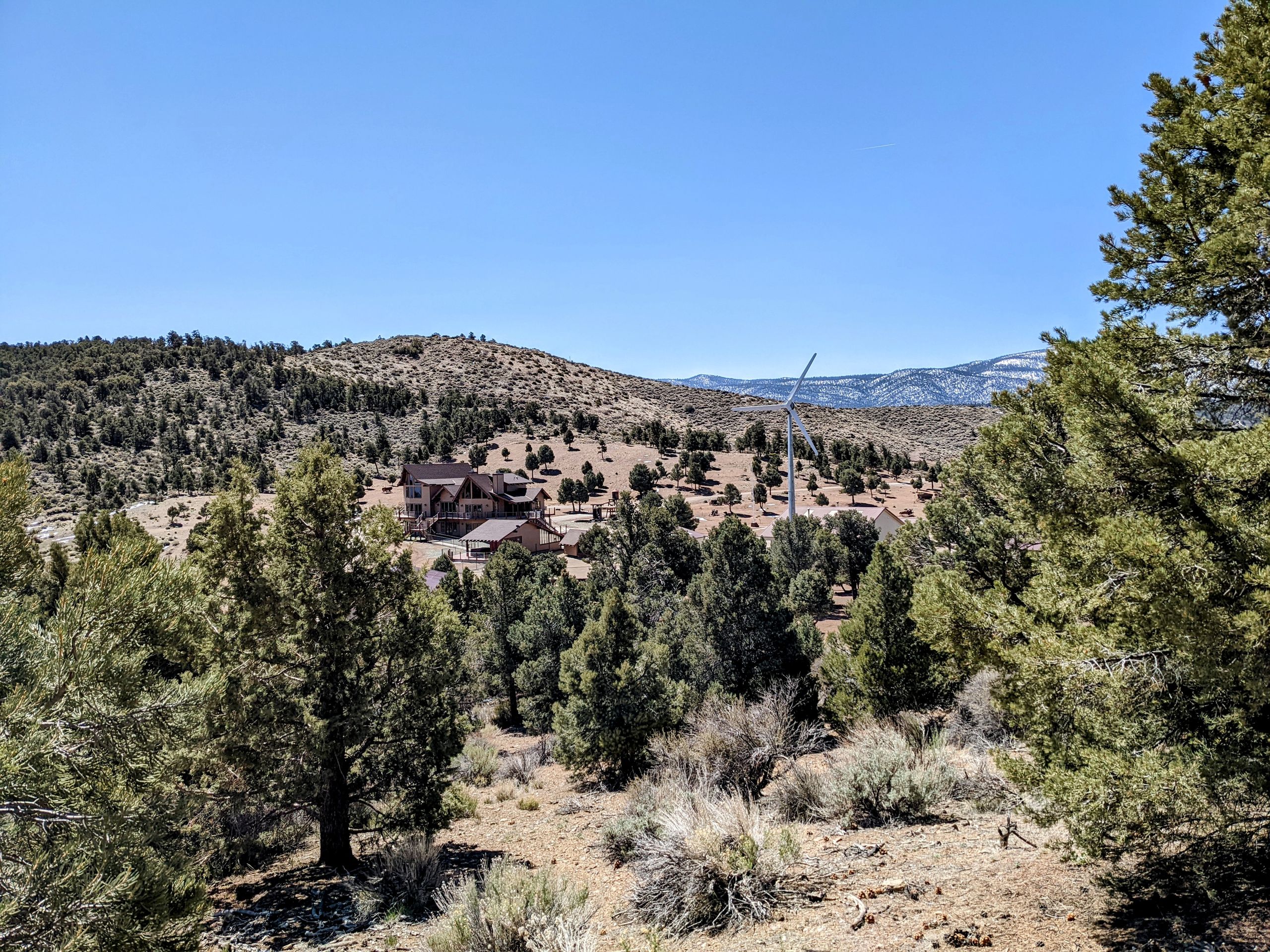
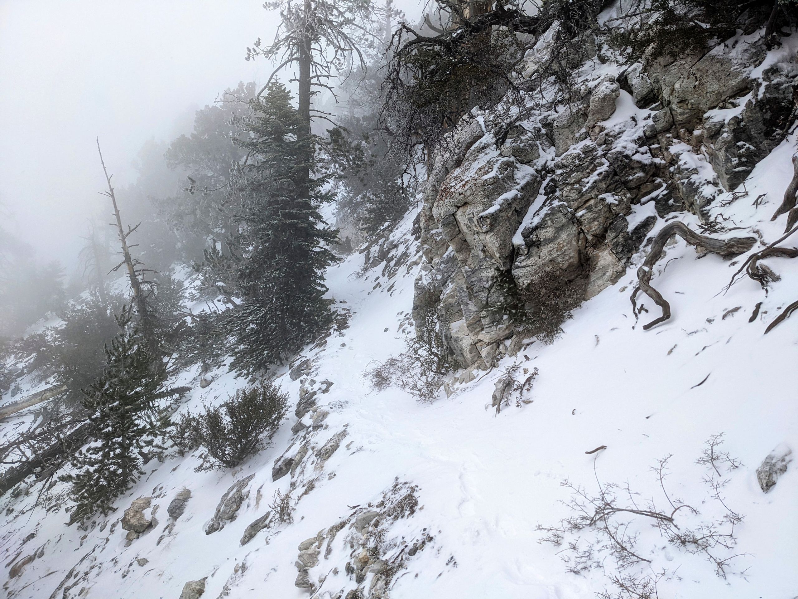
Day 12: We are back on Highway 74 at 07:30 and head into the San Jacinto Mountains. The trail initially goes uphill and I make good progress. It goes through small canyons until we reach the ridge of the mountain, where it goes up and down. It's incredibly windy again. I leapfrog with Alex multiple times, meaning we pass each other when one takes a break. I don't see the rest of the group anymore. The terrain becomes more challenging over time, but I continue to make good progress. Butterfly, who only took two 'nero' days (nearly zero) with Barry in Idyllwild, wrote to us yesterday saying they want to be on the summit of Mount San Jacinto at sunrise. I don't think they will make it with this terrain, and I discard the idea. I am now walking through former wildfire areas, and there are a lot of fallen trees that I have to climb over or crawl under, sometimes with my backpack off. I am a bit paranoid. On Saturday, I met Pop-Rock and Tiger during lunch. The two have already hiked this section of the trail and came to Idyllwild via a side trail. They told me that they passed by Poodle-Dog Bush multiple times, an extremely poisonous plant. If you come into contact with it, you have no choice but to call for help. I look at pictures and know that the plant smells strongly of grass. But so far, I haven't been able to find it. Later, as I check the map on my phone, it suddenly smells like a Dutch coffee shop. I look around, and indeed, there is a Poodle-Dog Bush about a meter off the trail. It reassures me to have seen the plant in real life, and it actually grows partially on the trail, so I need to stay alert. As I continue walking, I find a pair of red Crocs under a tree that I have to crawl under again. Since only one person passed me the whole day, and I wasn't overtaken, the Crocs must belong to someone ahead of me. So I hang them on my backpack and keep going. After just five minutes, I catch up to two hikers, Weed and Valkyrie. The Crocs actually belong to Valkyrie, who hasn't even noticed that she lost them. She thanks me and asks if she can take a photo and use it for her YouTube channel. So now there are two YouTube channels where I will probably be seen sooner or later. After hiking 23.6 miles (38km) and gaining 2003 meters of elevation, I finally pitch my tent at trail mile 175.4, somewhat sheltered from the wind by a large rock. The day was extremely exhausting, but the most beautiful on the trail so far in terms of the views. Finally, I went up high. From my campsite, I can see the lights of the cities in the valley. I am looking forward to standing on the summit of Mount San Jacinto tomorrow. Day 13: The wind last night was terrible, it can probably be called a storm. I am camping with six others, and my tent is the only one that remains standing and doesn't collapse. Therefore, I am not well rested as we start the next very challenging day. There are again many blowdowns to overcome, and I constantly lose the trail and have to search for it using my phone and GPS. The wind is still strong, making it sometimes difficult to progress against it. But eventually, I reach the junction for the summit ascent. The summit is not on the PCT but is climbed via a side trail. I wait for Alex, and together we start the ascent. It is challenging but nothing I haven't encountered in the Alps. There are a few snow fields to cross, and I am glad to have the microspikes. After about two hours, we reach the summit of Mount San Jacinto, which is 3302 meters high. The view definitely rewards us for the effort of the ascent, but due to the strong wind, we quickly start the descent again. Along the way, we encounter Will. Will is the second hiker who helped me on the first day. He tells us that Hillary injured her ankle and won't be able to hike for five months. I met Hillary at the beginning in CLEEF, we met again and camped together. She is the first person I really knew and who had to leave the trail. And although I knew this would happen and we won't all reach Canada, the thought is now much more real and alarming. Especially since she didn't make a mistake but just stepped awkwardly and had bad luck. That's exactly what I'm most worried about. With a heavy heart from this news, we continue the descent. At this point, I'm extremely grateful for the microspikes because the descent would have become much more dangerous without them as we encounter snow again. The wind is not as strong as yesterday, but still strong. It's getting colder, and when we reach the campsite around 5 pm, we set up our tents and spend the evening separately to recover from the past two challenging days.Day 14: We chose our campsite very well and could sleep excellently. Today, we will descend the entire elevation we gained in the last two days within 20 miles. Only to then climb almost the same height in the San Gorgonio Mountains in the next few days. During the descent, we have a continuous and excellent view into the valley. After all, we make use of the wind that we have been battling since the beginning; there is a large wind farm set up. At one point, the wind almost blew me off the trail, which would not have been advisable at that point. We also cross the 200-mile mark.
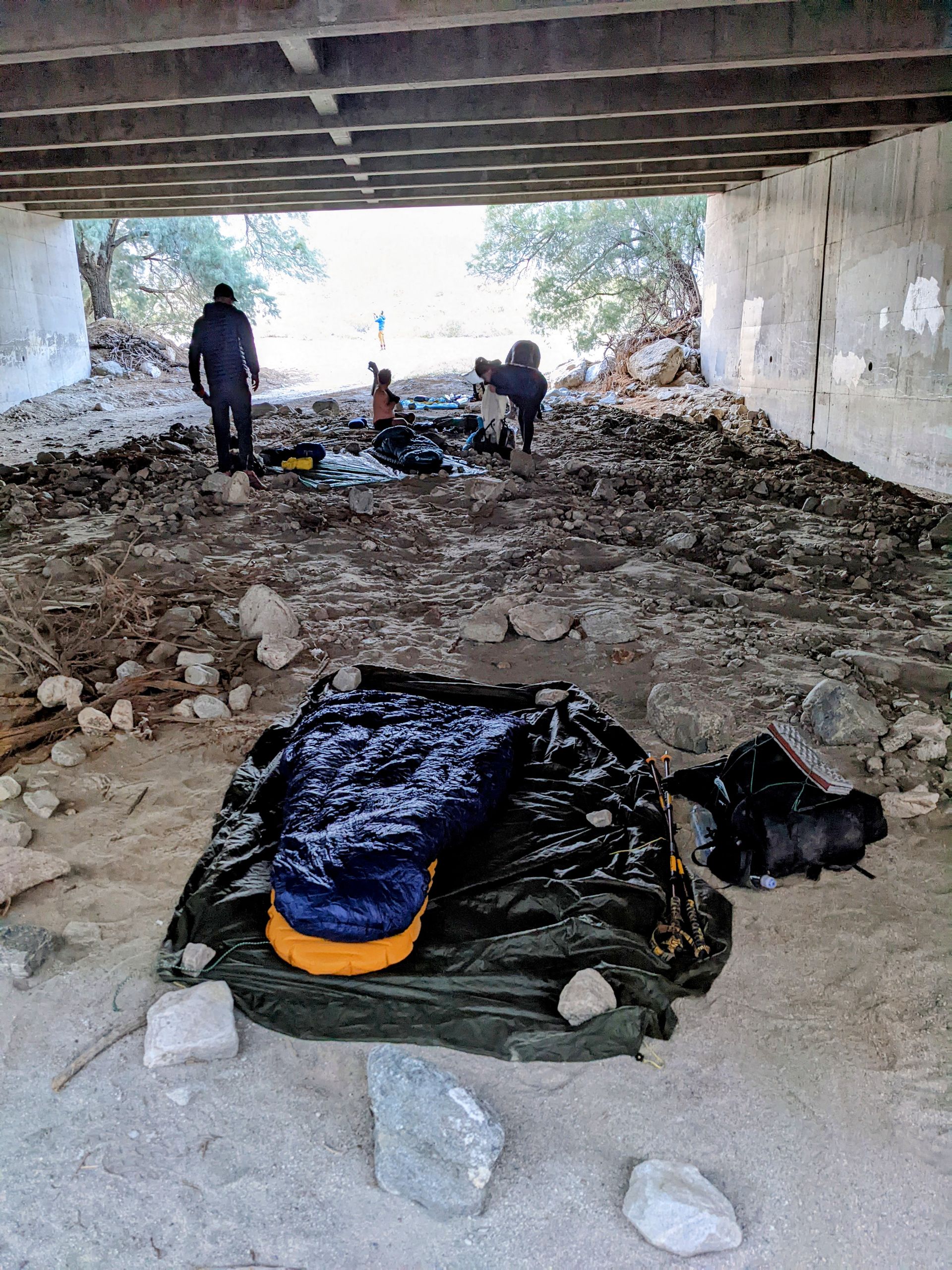
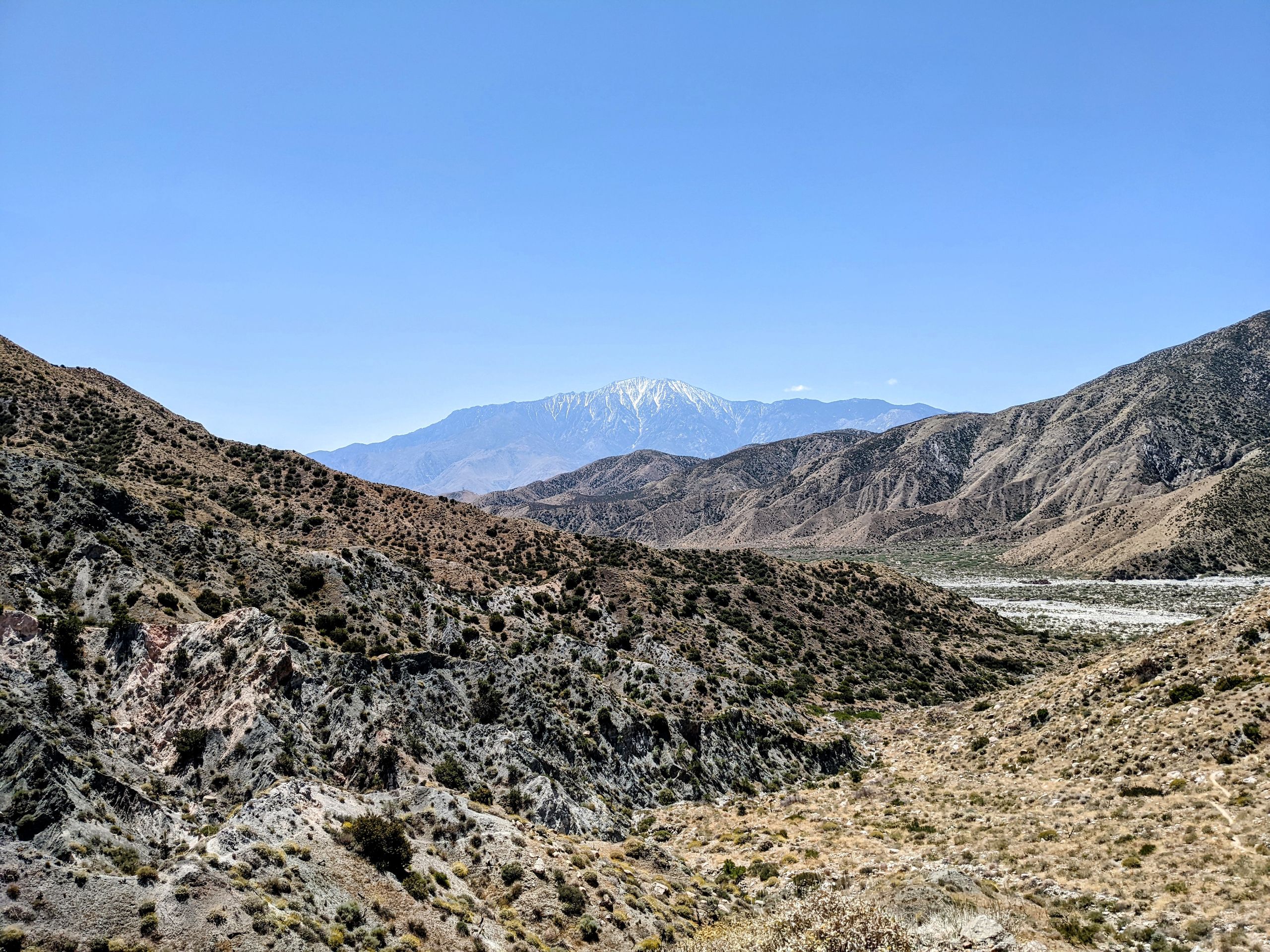
At the foot of the mountain, we reach Interstate 10. On the last three miles, the wind is directly in front of us, and I have to exert myself to make progress. And I get a free full-body sand scrub. Arriving at the interstate, we hitchhike to Cabazon to resupply for the next few days to Big Bear City. And in Cabazon, there is the only In 'n' Out Burger on the trail, which of course we visit. By now, I have definitely developed a hiker hunger and could eat endlessly. In Cabazon, we also meet Natalie and Beans again, and later Cheese joins us under the interstate bridge. It's lovely to see everyone again. Beans and Cheese will have visitors in Big Bear, so they have already booked accommodation and invite us to join them. It seems that especially Cheese wants to introduce his 'tramily' (trail + family) to his daughter. And that's what we have actually become, a small tramily, so we gladly accept the invitation. Since the nearest suitable campsite is nine miles away, and it is sheltered under the bridge, we cowboycamp with a total of about 18 hikers. We will get used to the traffic noise. Cowboycamping actually means sleeping under the open sky without a tent. Without a tent, but under a bridge is cheating a bit, but it's not a bad start.
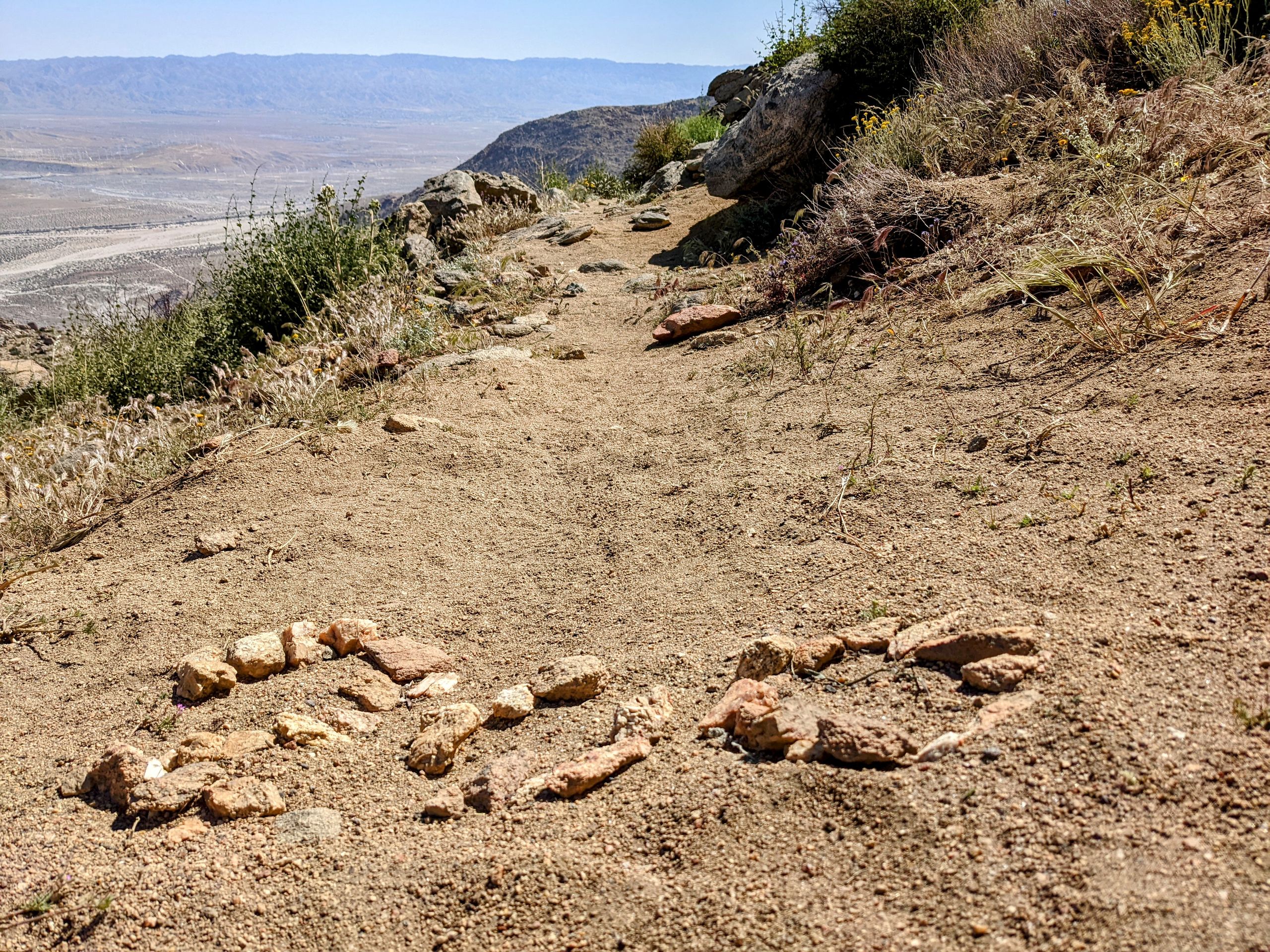
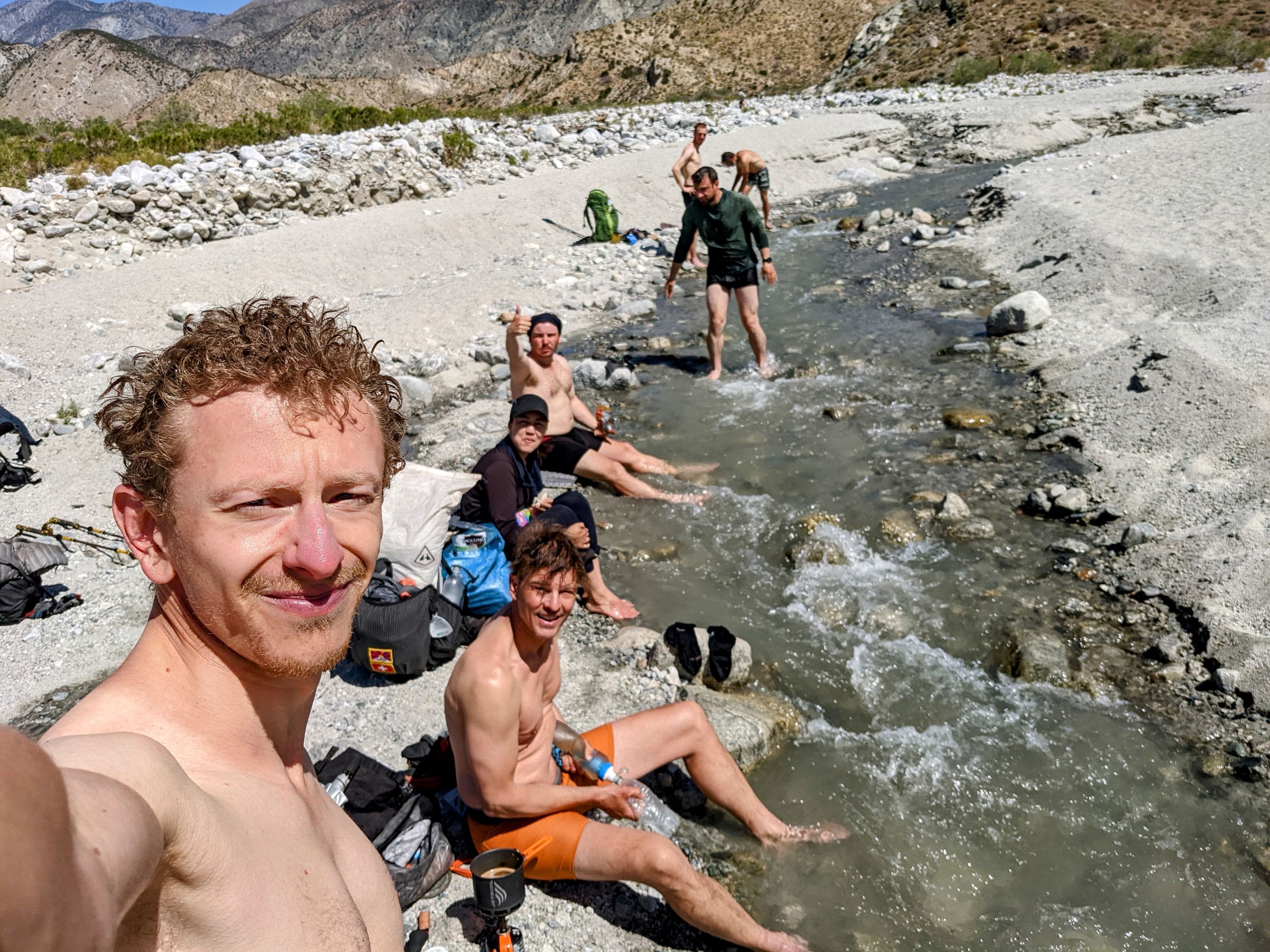
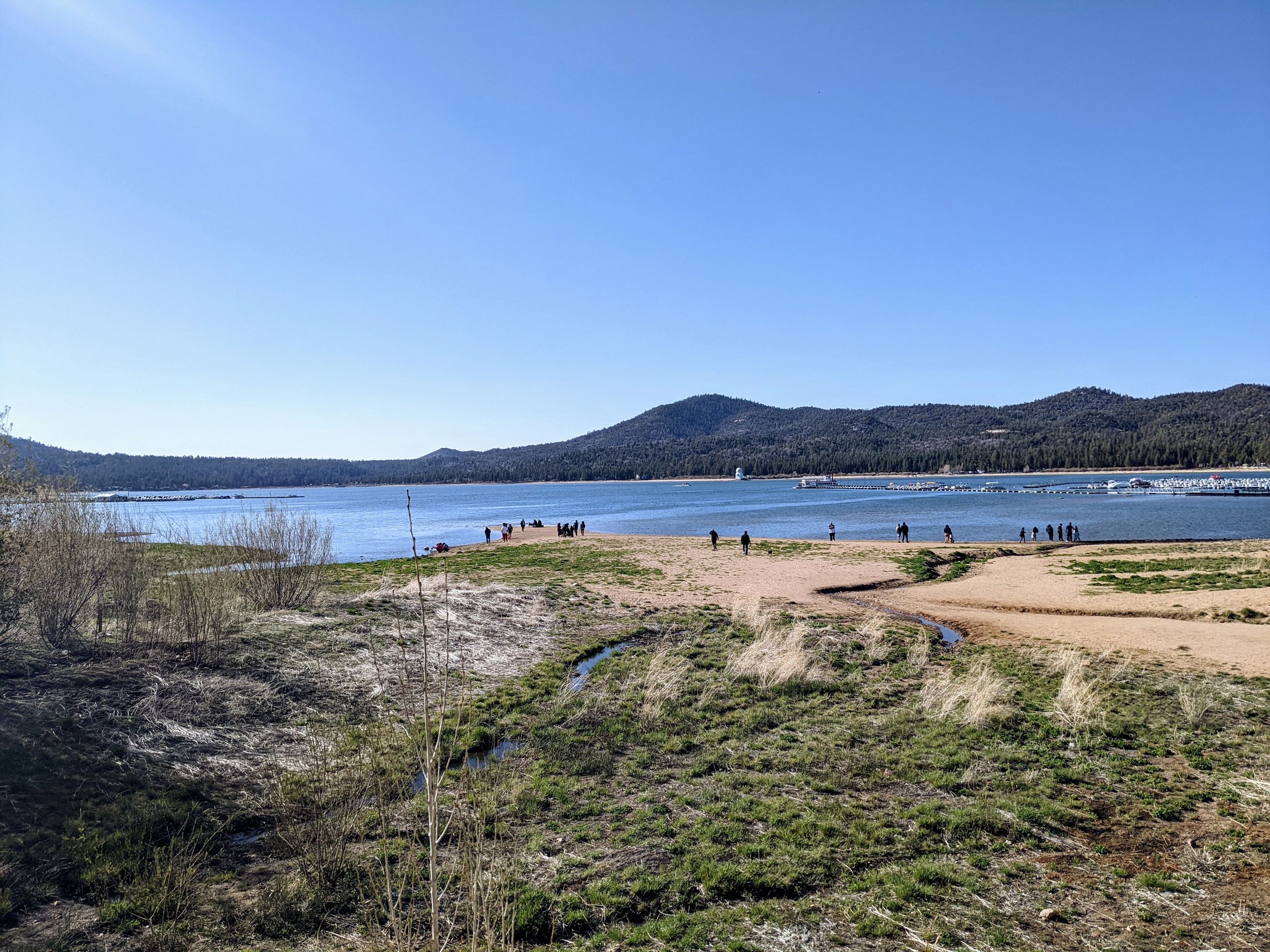
Cowboycamping under the interstateDay 15: You actually get used to the sounds of cars quickly, and I can sleep quite well. I hike the first part with Natalie. When others are around, we also speak English together, so it is nice to speak German again for a while. Conversations in English work surprisingly well, better than expected, and increasingly better. However, I still can't express myself as detailed and nuanced, so I sometimes feel a bit stupid. We talk about German, Swiss, and general politics, as well as our previous impressions and future expectations of the trail. It was a very good conversation, and the first miles go by quickly. Then we have to overcome a ridge, and then we descend to Whitewater River. It is the first real river since the beginning, and we couldn't be happier. We take a long break, swim, wash, and eat. Since we have already completed 10 miles and it's only half-past ten, we have no rush.Bathing with the tramily
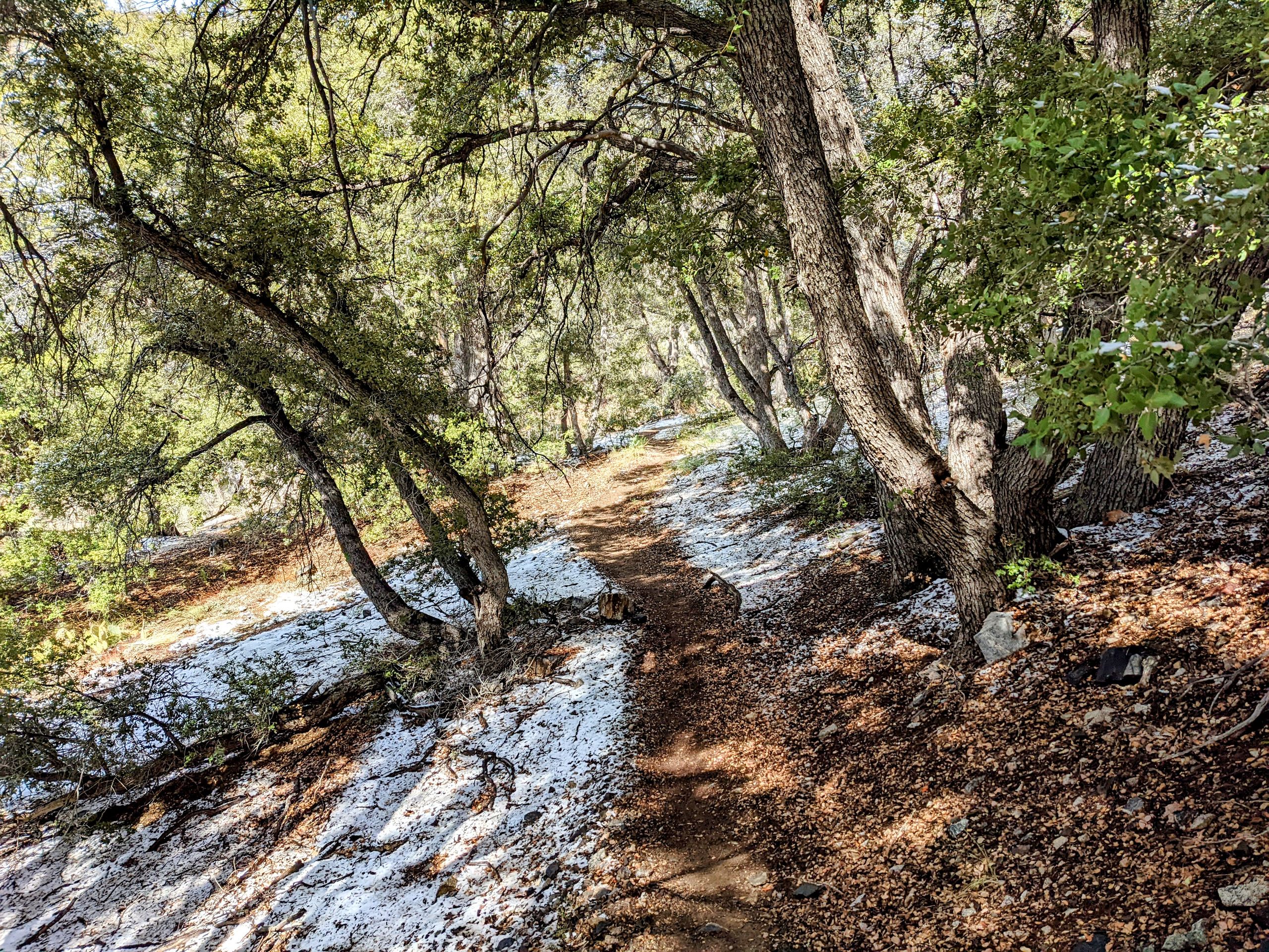
At some point, we continue on our way. We cross the next ridge and descend to Mission Creek. We follow it for several miles, which means we don't have to carry several liters of water for once. And camping with water nearby is much more pleasant than dry camping. As I set up my tent, a stone suddenly falls in front of my feet. I have no idea how I didn't notice it, but apparently, I wrapped one of the stones I used to weigh down the tent as a base while cowboycamping and carried it with me. I'll consider it as training. For dinner, I have 'Mystery Powder,' a homemade meal from a hiker box that you don't know exactly what's in it. You can find hiker boxes in every trail town, either in a hostel, a store, or a similar gathering point for hikers. In the boxes, you leave equipment you don't need anymore or food you're not interested in or have too much of. I'm lucky; the food is excellent. Couscous with roasted garlic, lentils, raisins, and almond slivers. After dinner, we chat a little, and Beans leads us through a meditation. Also, Alex got his trail name today: 'Gumby.' Apparently, a clay animation character, but I don't know it. There seems to be a certain resemblance between the two. Alex and Beans came up with it. I'll take a look at the character at the next opportunity. Now it's time to go to bed; due to the proximity to the water, we can hear frogs. Much more pleasant than the traffic noise from last night.
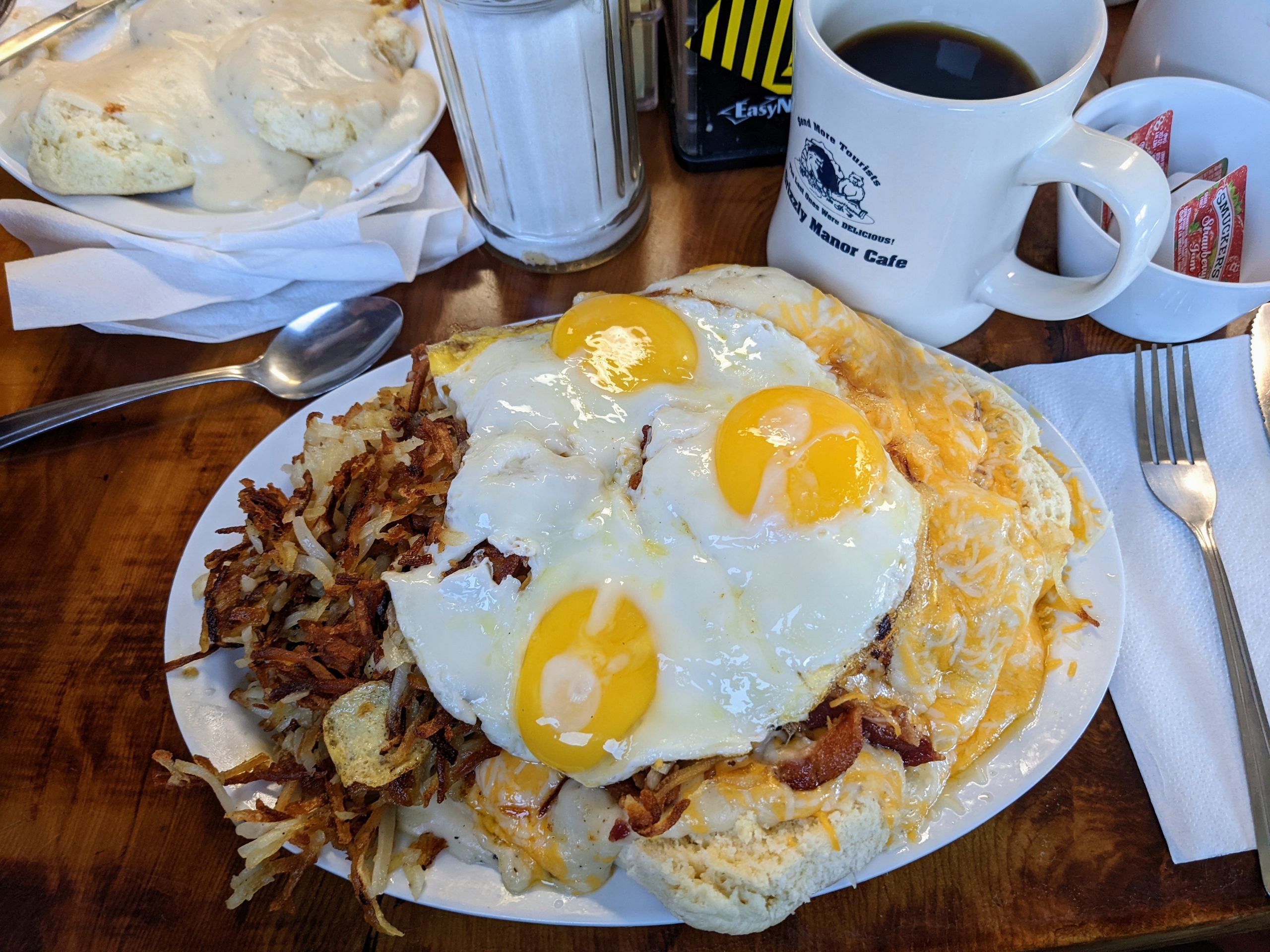
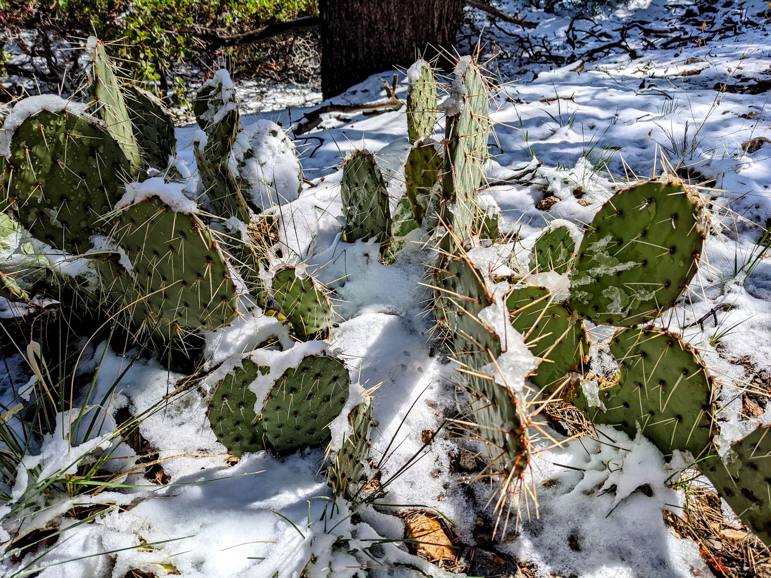
Day 16: It rained for the first time on the trail last night, but I like the sound of rain on the tent. We start around 6:30. Since we are following the course of Mission Creek and there are some washouts, we lose the trail again and again and have to push through bushes and slopes up and down. It takes time and is exhausting. For me, this morning is the most physically demanding part of the trail so far, not so much psychologically but mentally. Although I'm not much slower than usual, I feel like I'm running with the handbrake on. Fortunately, the feeling subsides after a few hours. We ascend into the San Gorgonio Mountains up to 2660 meters in elevation. It snowed here last night, and we walk through snow-covered forests, and in some sections, the snow is almost ankle-deep. It is also snowing intermittently throughout the day. And sometimes, it's damn cold. It's hard to imagine that just 24 hours ago, we were bathing in the river at 30 degrees Celsius. Once again, I am amazed by the diversity of the trail, and we have only completed 250 miles. We sleep at an elevation of 2550 meters. I'm curious how cold it will be tonight. So far, it's very comfortable in the tent, and there is no wind, so I'm not worried. I can't wait to reach Big Bear City tomorrow.Day 17: I wake up and turn on my flashlight. The entire inside of my tent glistens as it is covered in frost. It was -5 degrees Celsius tonight, and there is ice floating in my water bottles. Nevertheless, it is reassuring because I didn't wear everything I could have put on, and still, I didn't freeze. So if it gets even colder, I won't have any problems. Since we want to arrive in Big Bear as early as possible, we start at 6 am and fly over the trail. It's a 15.1-mile (24km) hike to the road, which we complete in five hours. As we have no luck hitchhiking, we call a taxi, which should arrive in 15 minutes. Forty-five minutes later, we are still standing at the road. But then we're lucky, a man from the area takes his brother back to the trail, who is also hiking the PCT and took the opportunity to spend a night at home. On the way back, he gives us a ride to the town. There, we have breakfast/lunch first, and I must say, I love American breakfast. The selection is great, hashbrowns are absolutely fantastic, and the coffee refill has its own charm. Just like the free water you get in every restaurant as a standard. Breakfast
After breakfast, we meet Barry and Butterfly again, who arrived here yesterday and are taking a zero day. Since we can't yet check into our Airbnb, we go to have some beers and get to our accommodation as soon as possible. It's a great place; there is even a washing machine and a dryer, and a hot tub that we naturally use. For dinner, we have homemade tacos, mainly prepared by a friend of Cheese with her daughter, and they turn out to be excellent. We have quite a large group, including Beans, Cheese, and his daughter, Cheese's girlfriend with daughter, a friend of Beans, Gumby, Natalie, Will, Barry, Butterfly, and me. It's a lovely and sociable evening that I will fondly remember. Tomorrow, after breakfast, we plan to go shopping and be back on the trail around 1 pm. For the next 150 miles, we will be heading west before turning north again towards our ultimate goal, Canada. And with 266 miles completed today, we have done 10 percent of the entire trail.