Tasmania's Wonder

Uñt’ayata: 08.06.2019

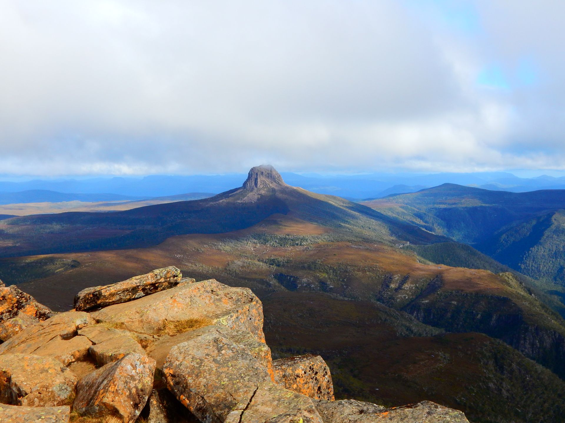
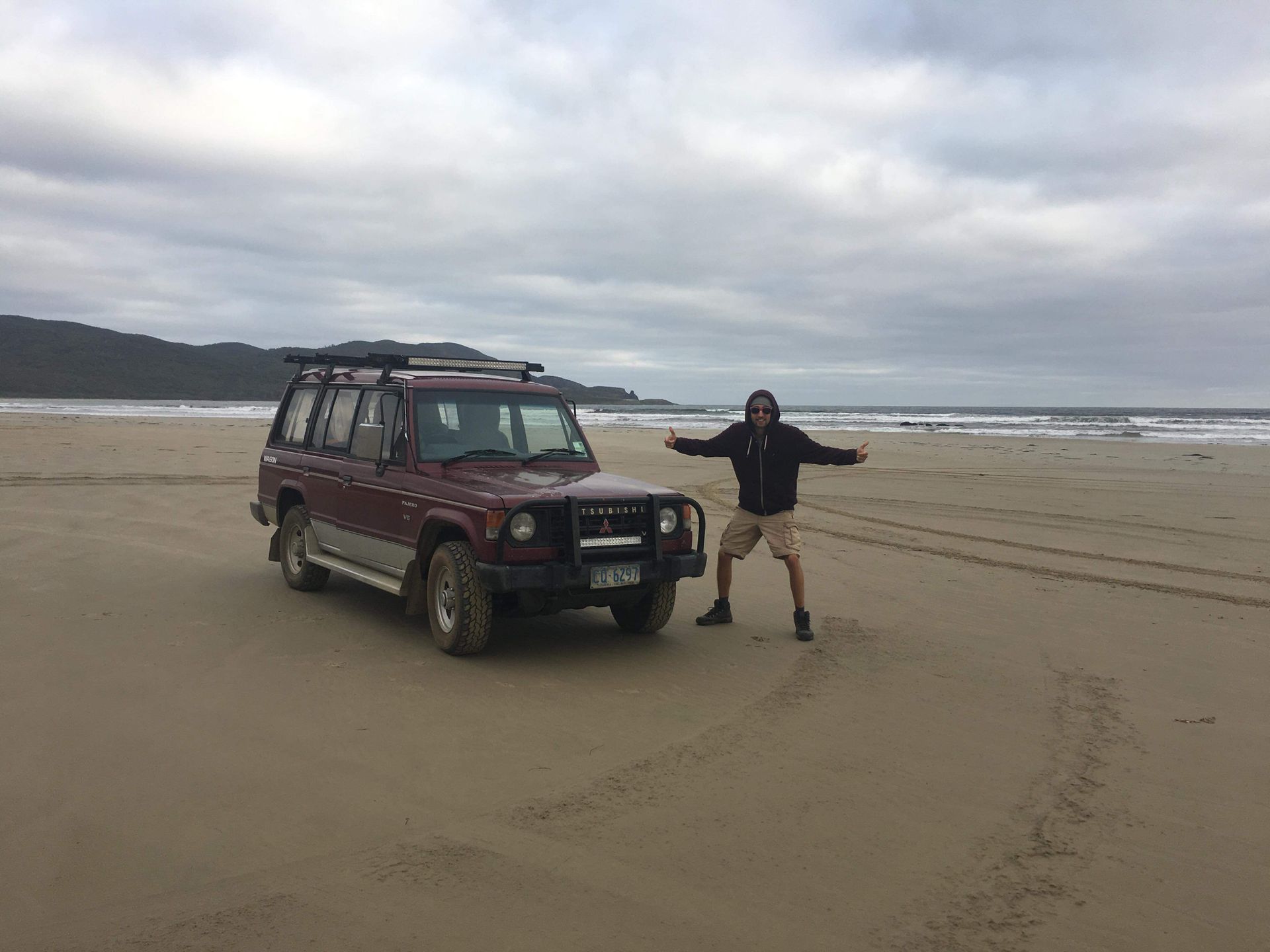
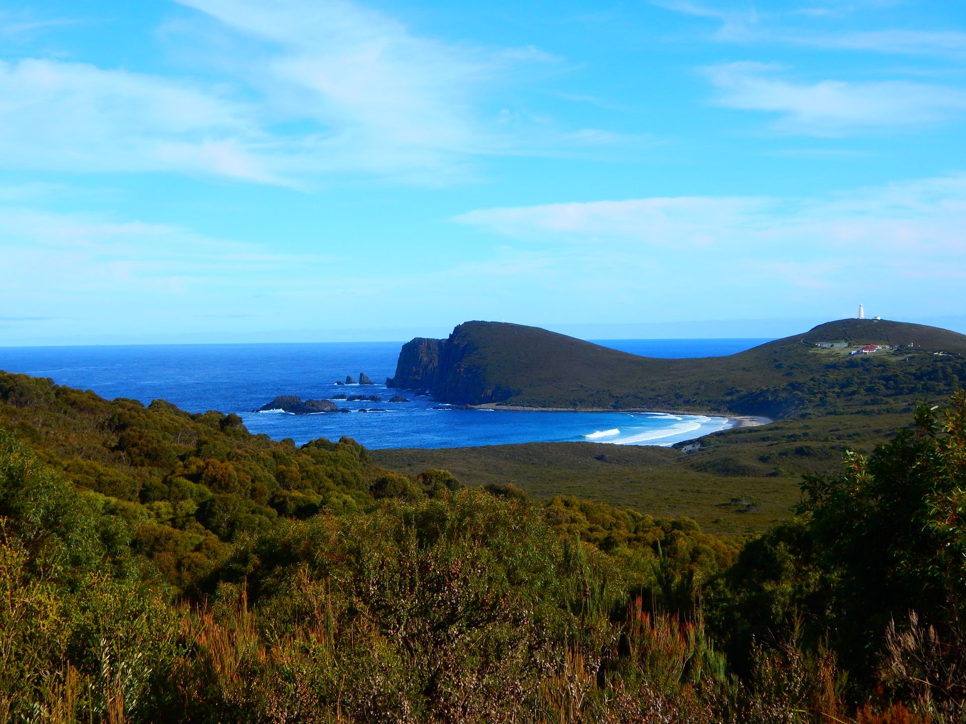
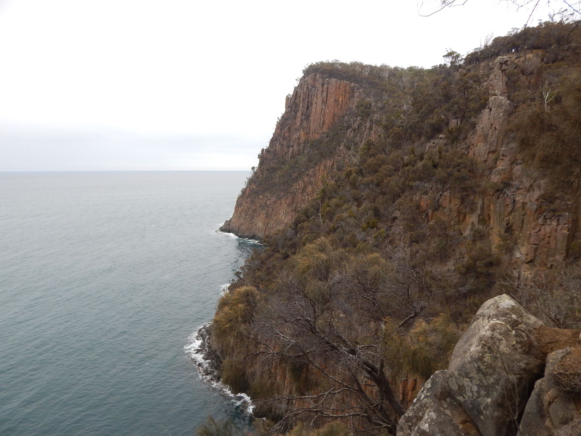
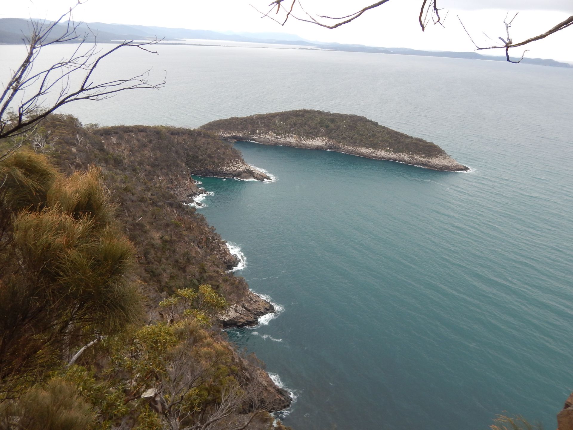
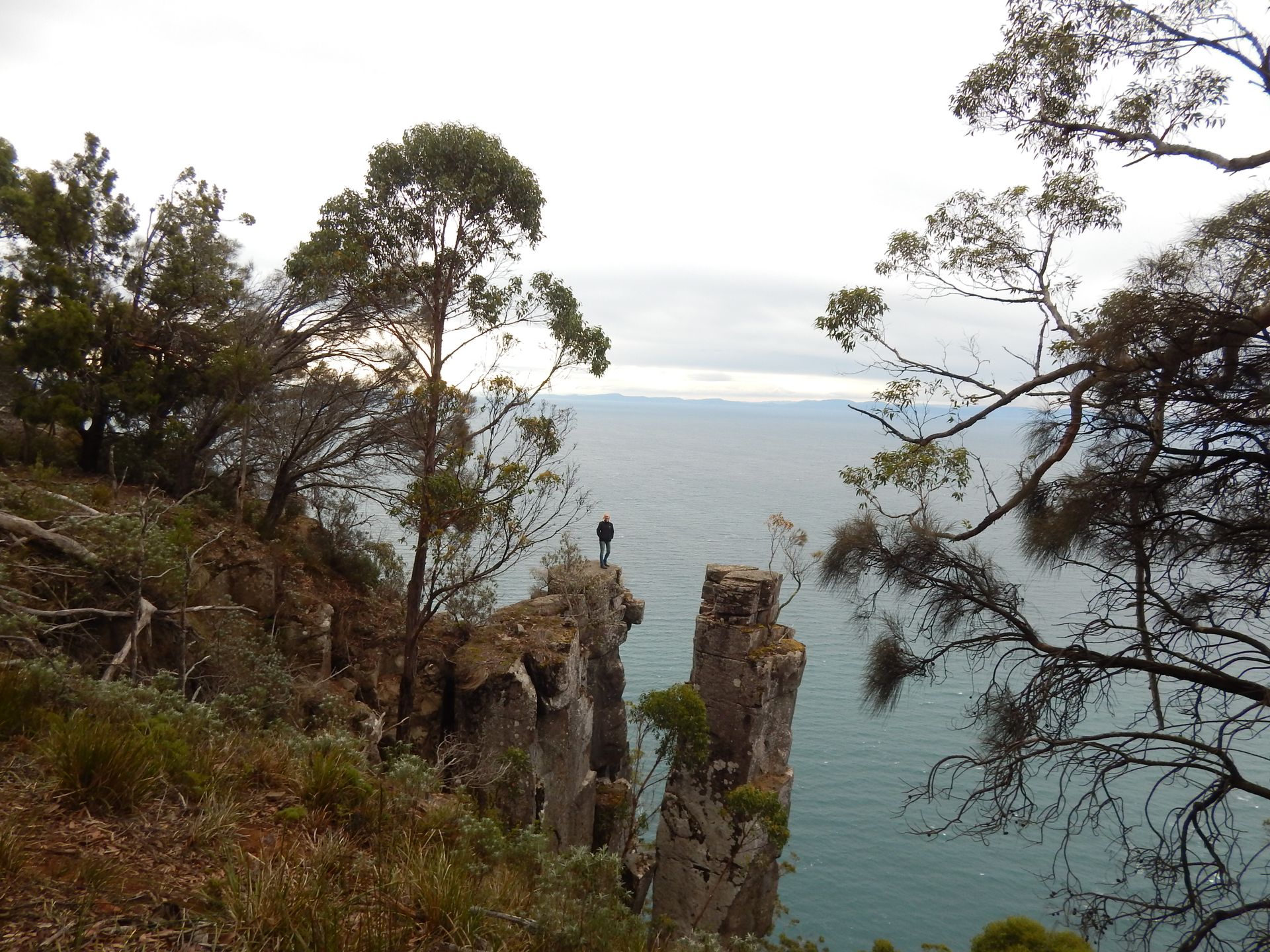
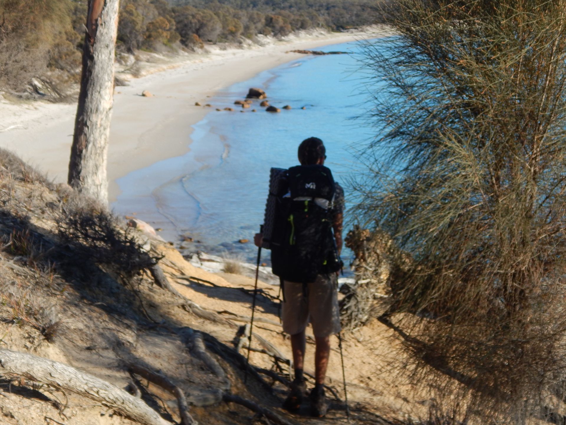
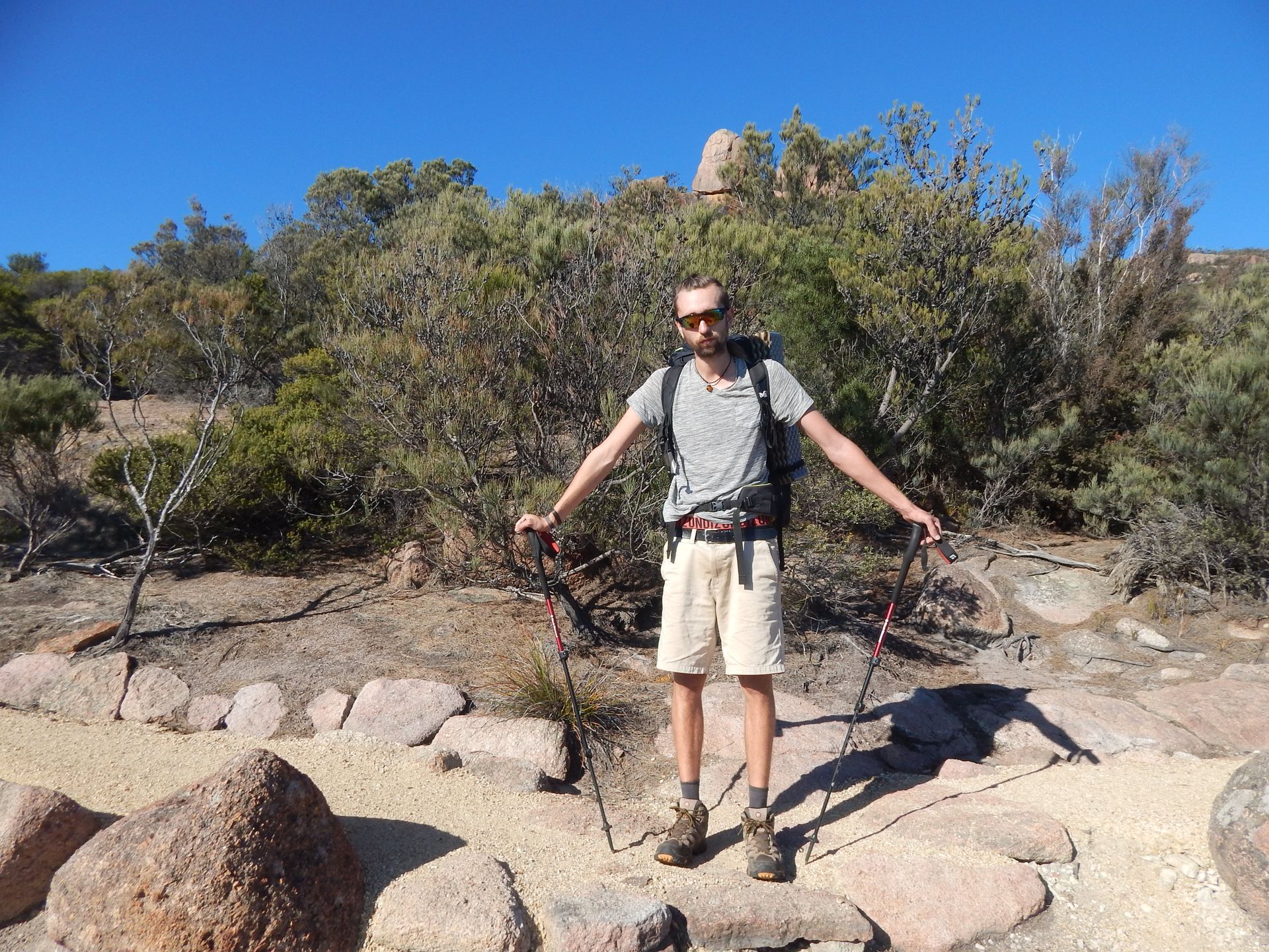
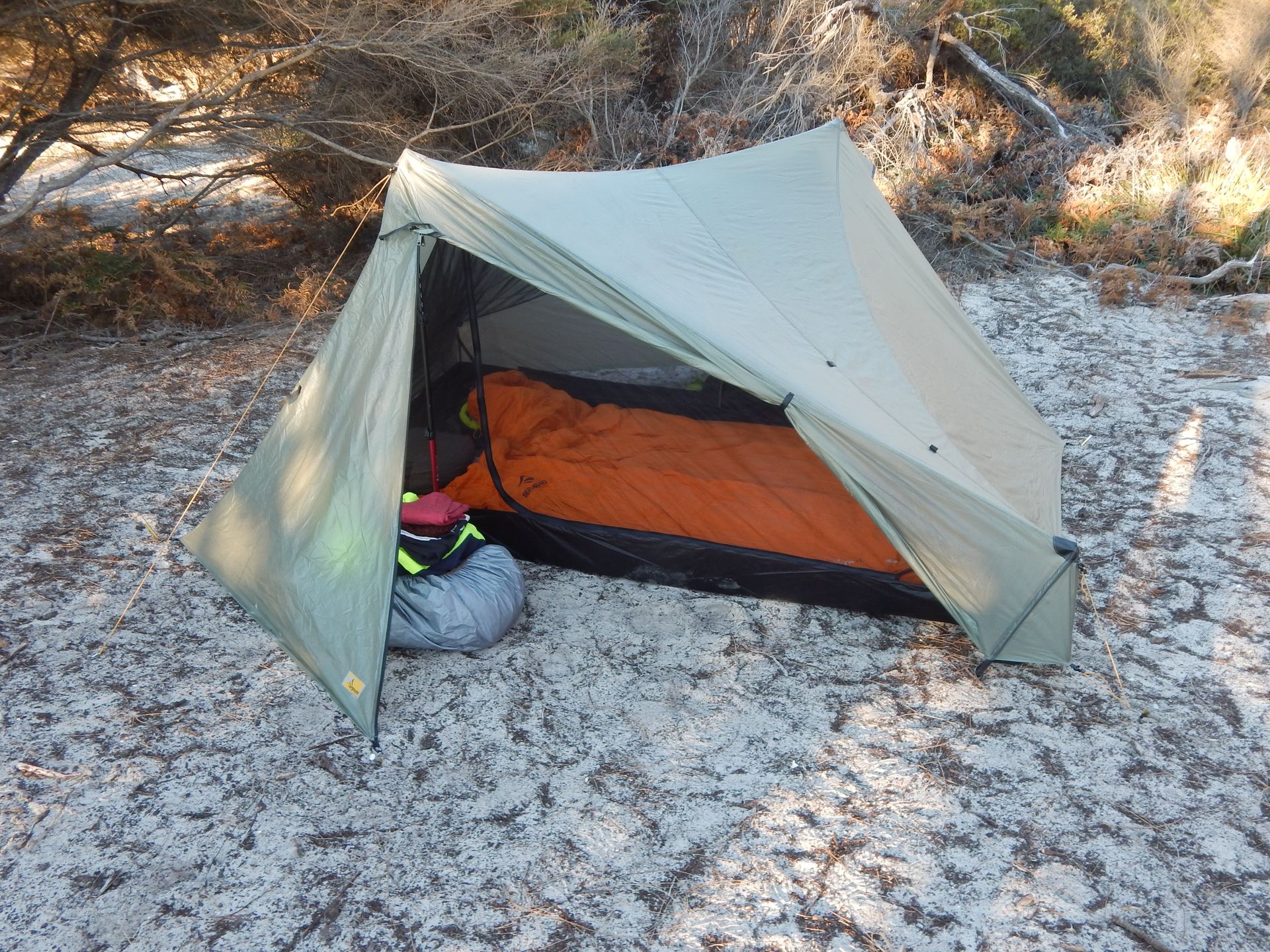
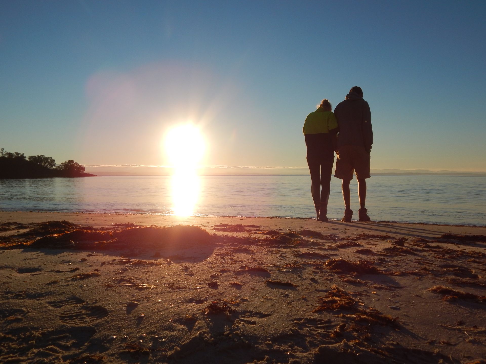
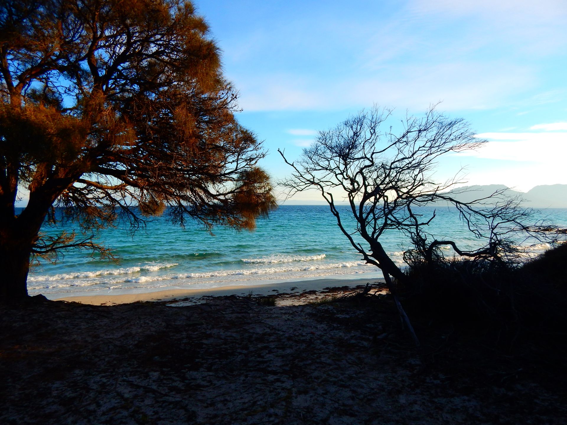
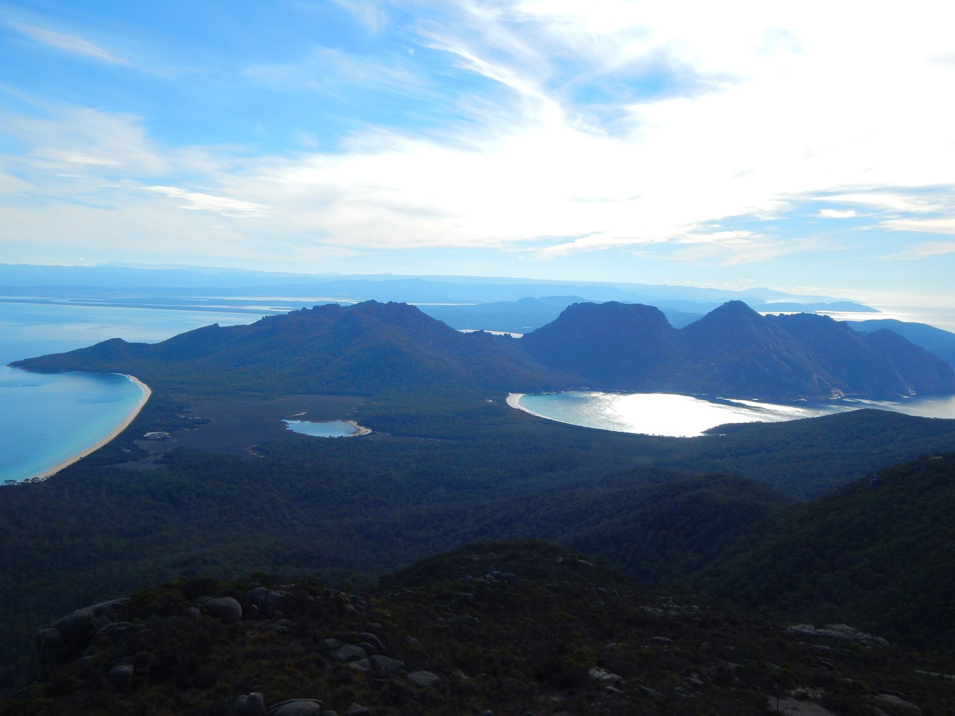
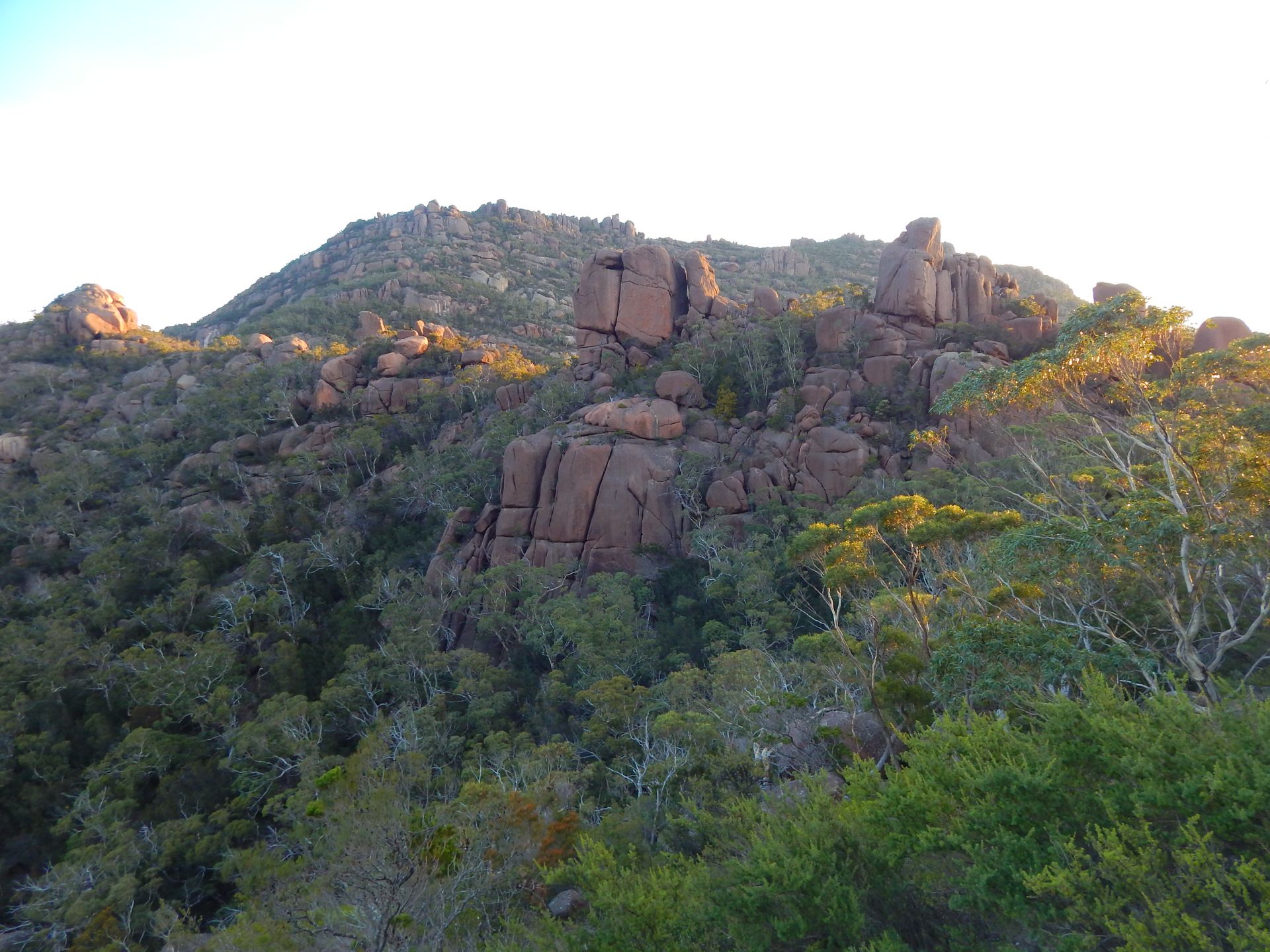
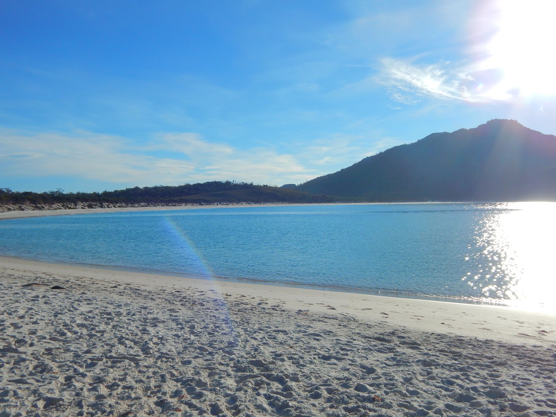
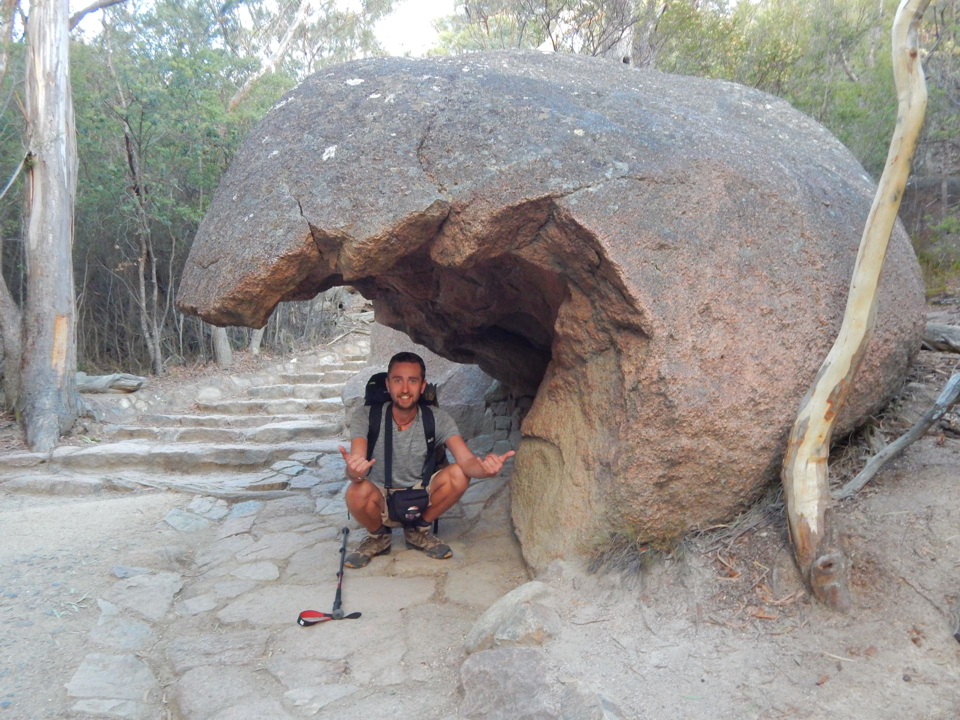
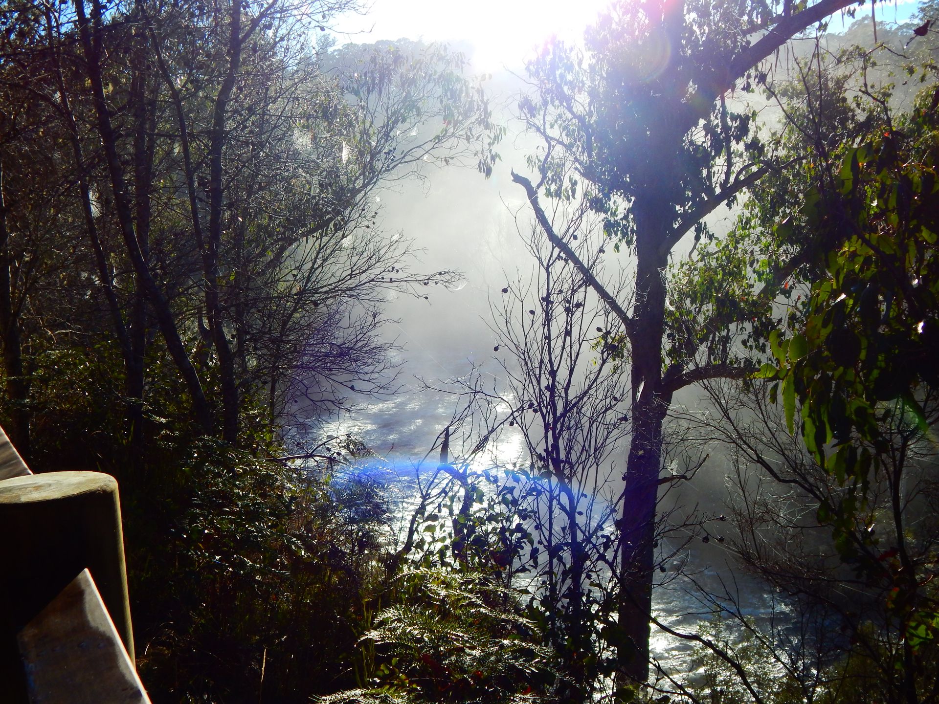
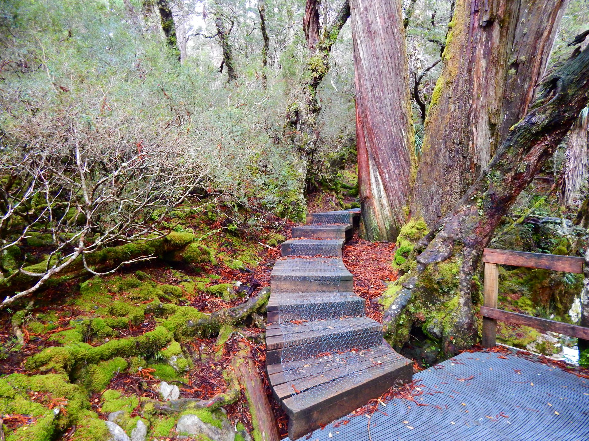
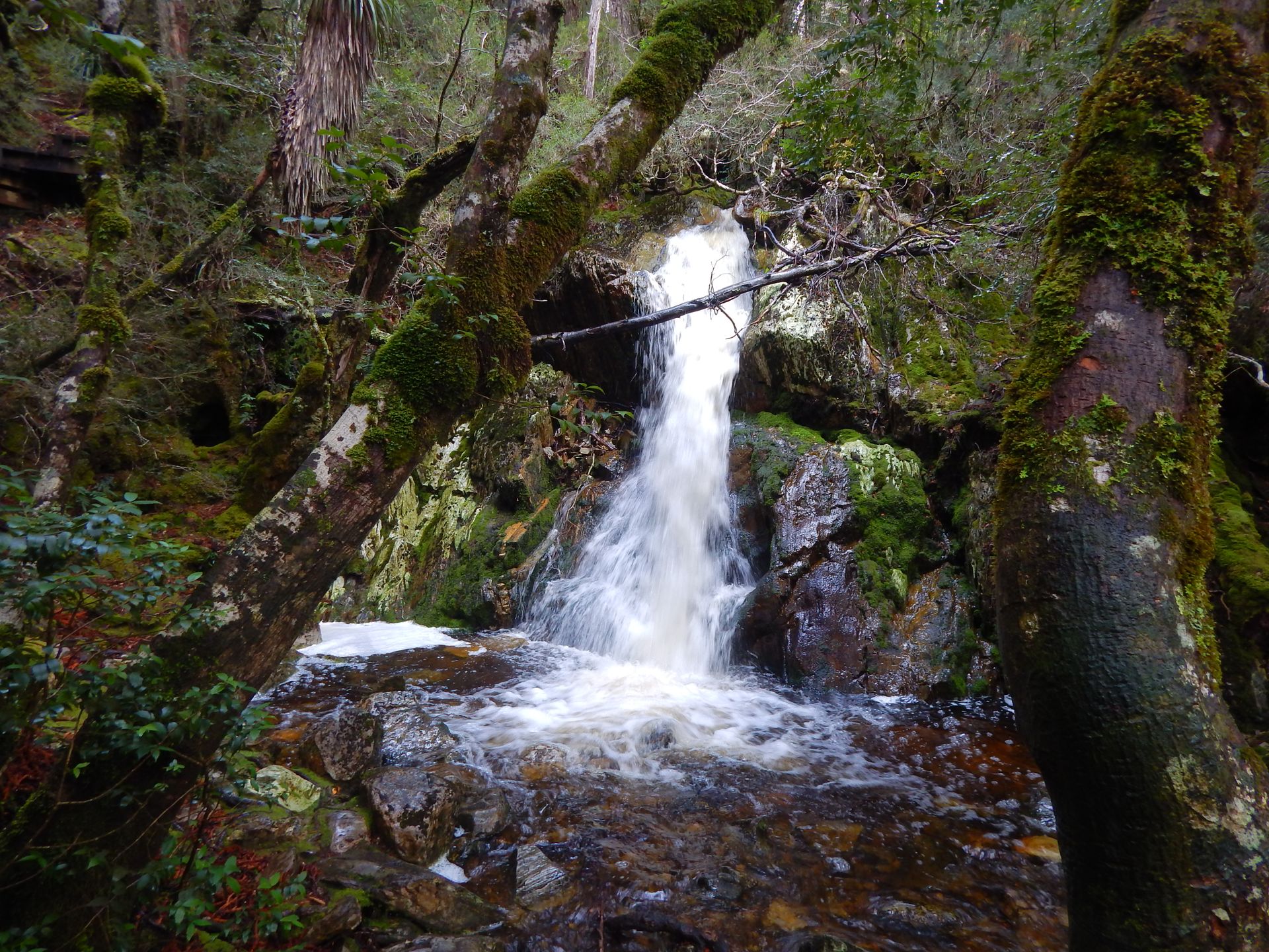
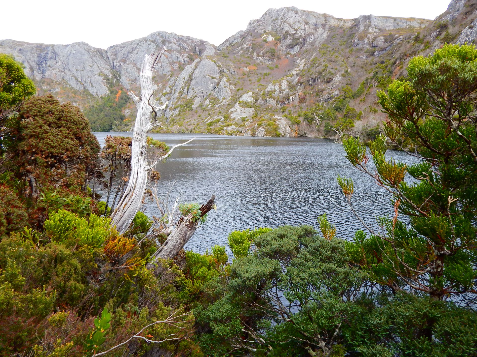
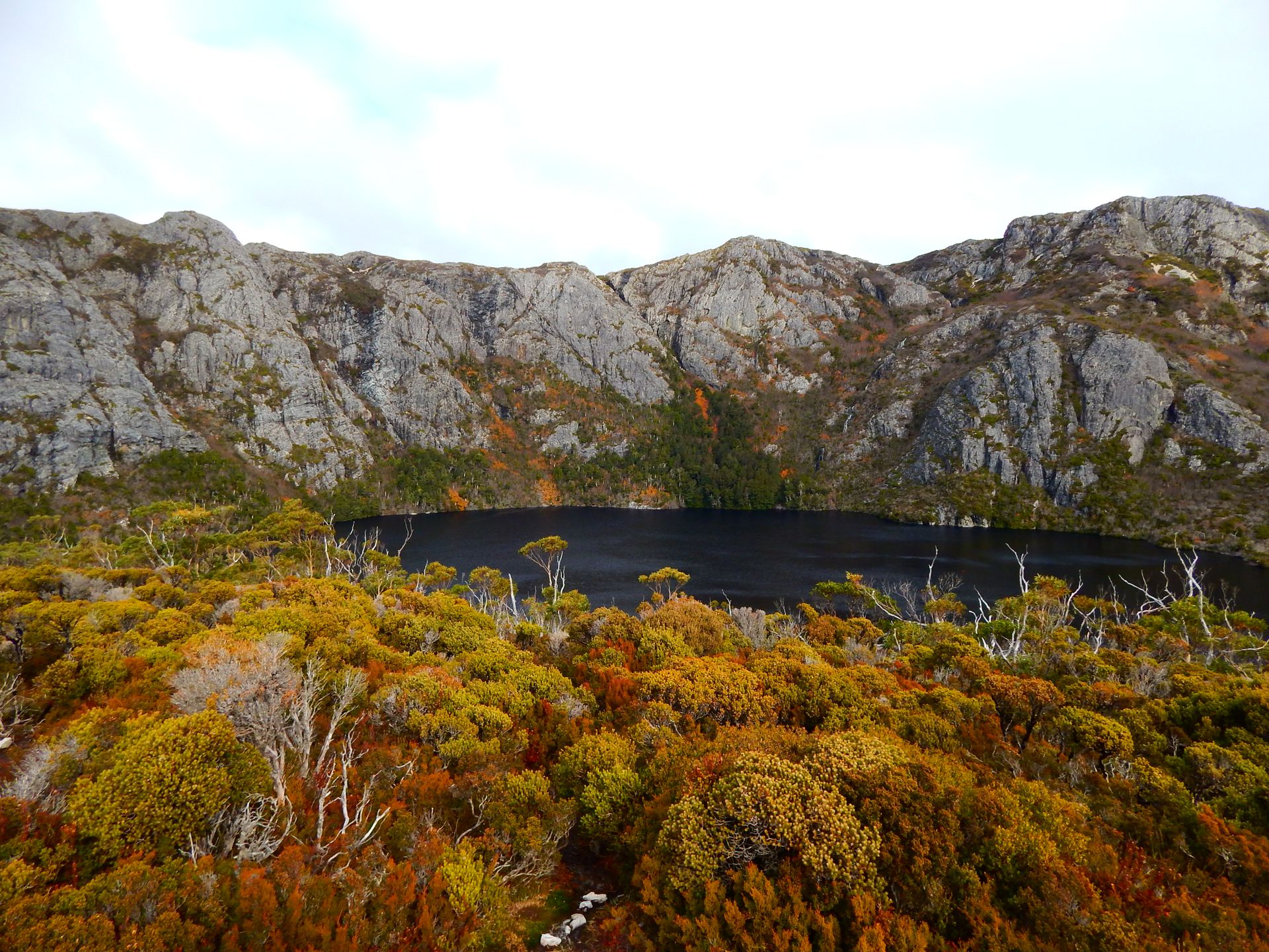
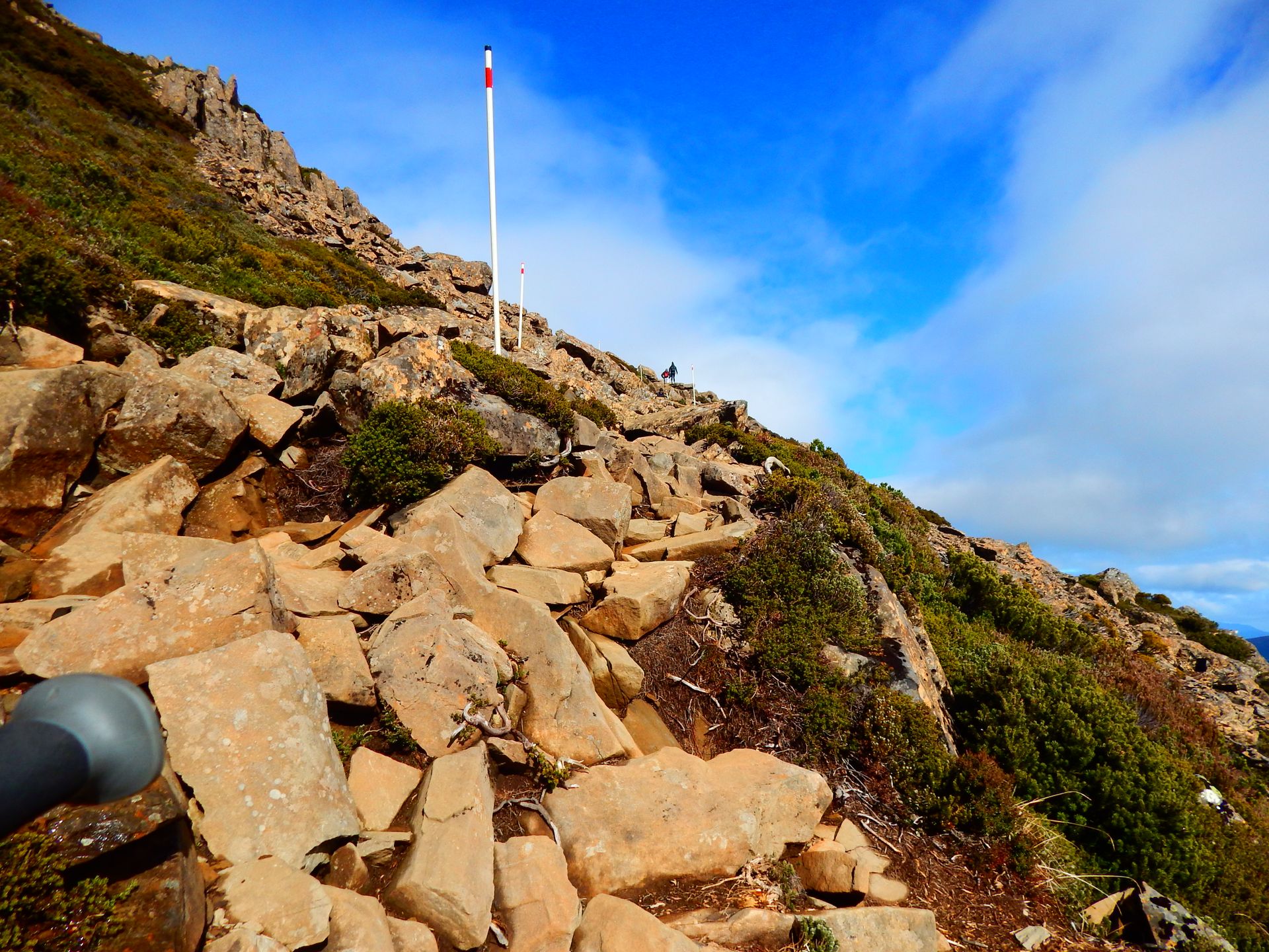
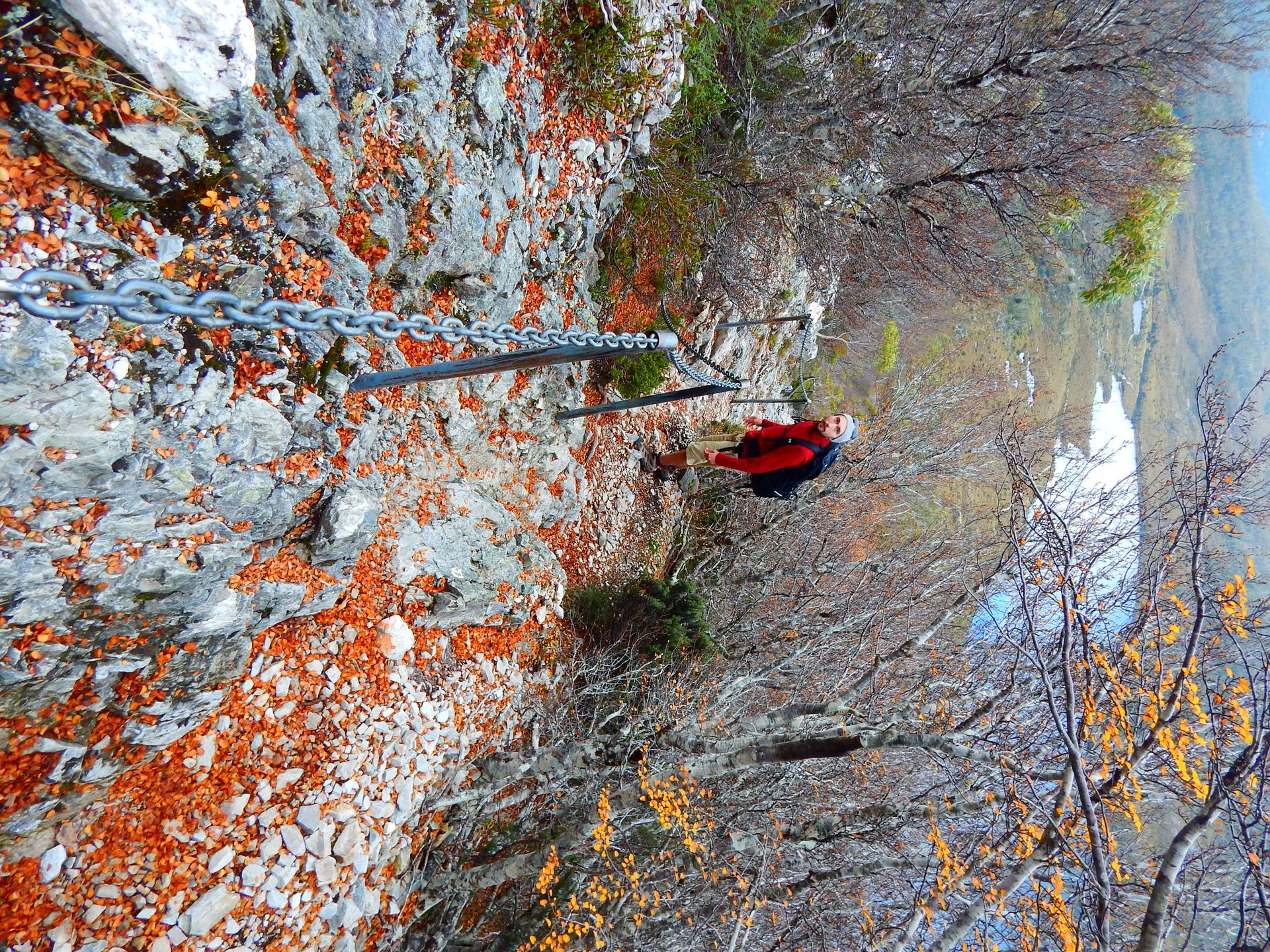
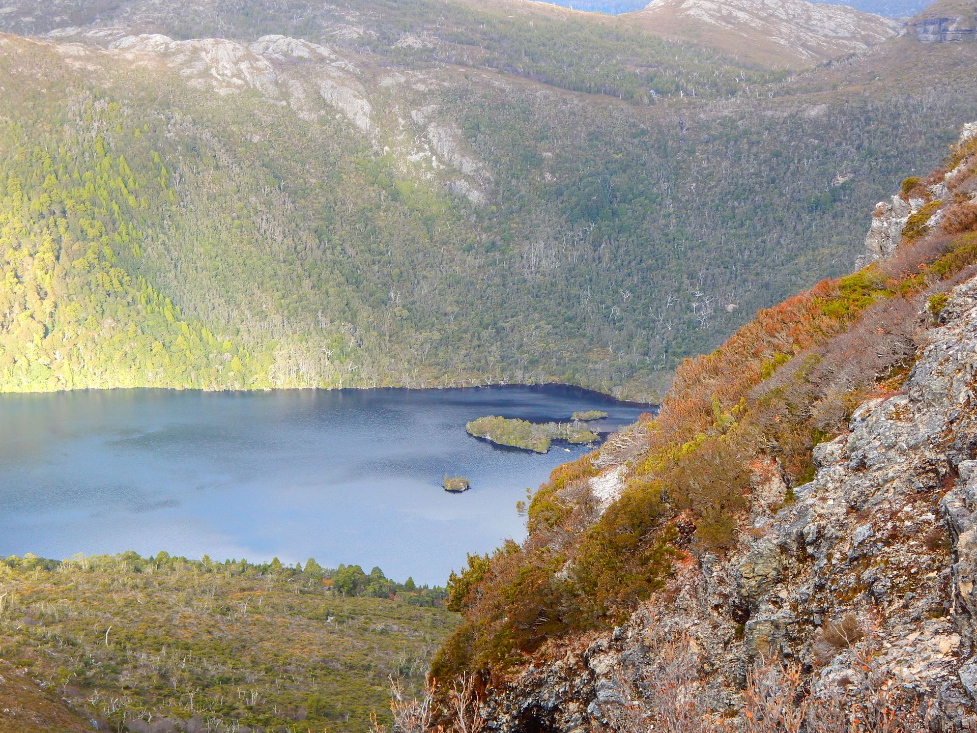
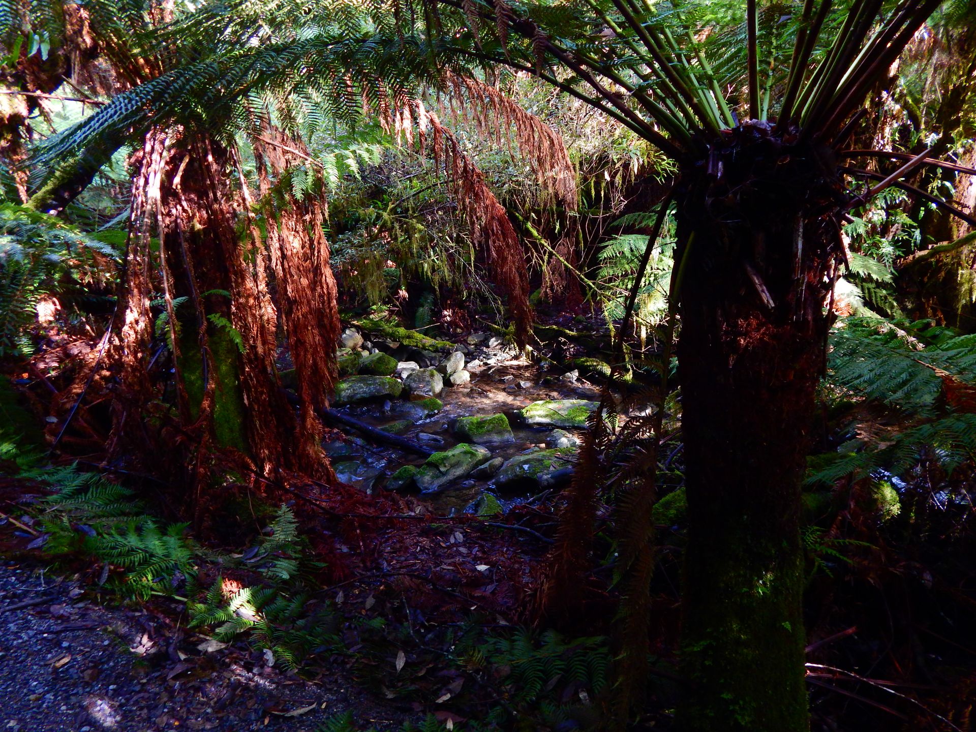
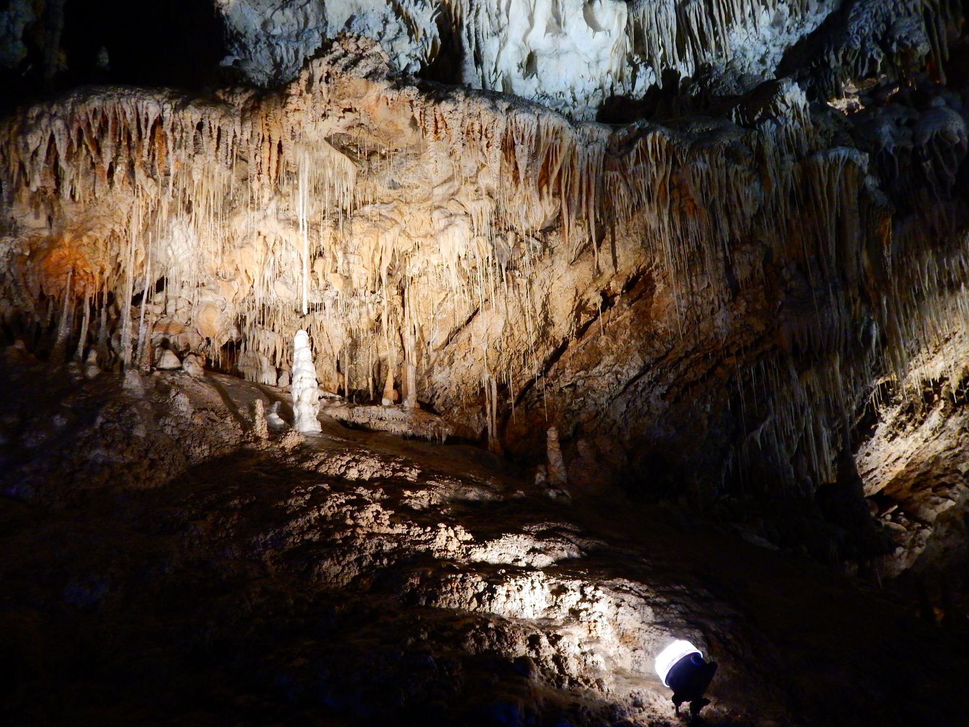
After the walnut harvest, we have another good three weeks left in Tasmania. We have used the time to explore the East Coast. Since the time change (winter time), the sun sets around 5 p.m. and by 6 p.m. it is dark and cold. It sometimes rains during the day, and when the sun is shining, it doesn't get much warmer than 15 degrees. It is always a challenge to find a good campsite where we can make a fire to survive, but see for yourself :)


Bruny Island (Lunnawana Alonnah)


Bruny Island is located in the southeast of Tasmania. We take the easiest ferry ride ever. After fifteen minutes, we are on North Bruny. Bruny Island consists of two islands, North and South Bruny, which are connected by a long, narrow strip of land (the neck), with a beach on both sides. The whole island is about 50 km long and offers spectacular nature and a unique wildlife. Bruny is mostly wooded with large, dry eucalyptus trees, and almost all of South Bruny is protected by a large national park. As the cherry on the cake, there are albino wallabies only on Bruny Island, which we searched for but unfortunately did not find. After the ferry, we drove straight to the south. We visit the lighthouse of South Bruny and take a 14 km hike in the west of the island. First, we climb smaller mountains and admire the view of Tasmania. From here, we can see Cockle Creek, which reminds us of the South Coast Track. Then we go back down and through dry, brown forest along the coast back to the starting point. It felt good to walk, even if we didn't like it that much. The next day, we explore a short great walk that takes our breath away. In Adventure Bay, we climb a wooded mountain to the rugged coastline, which forms a distinct boundary to the blue, endless sea with steep cliffs. We walk along the coast and then back down. We make our way to "The Neck," which connects both islands. A few steps lead to a platform that allows us to admire North and South Bruny. There are penguins on the beaches that go hunting in the sea during the day and return to land in the evening. We waited for a long time in the cold on the beach, and when another Frenchman showed up and started talking to Flo in French, I went back to the car and waited there for him. When he comes back, he tells me that he saw some baby penguins waiting for their parents on the beach, but they just didn't want to come out of the water. After three hours, we also give up and drive to our camp. We drive around North Bruny and see smaller villages, wooded mountains, and stony beaches. Most of the Bruny population (about 600 people) live here, and there are many hotels and restaurants that testify to the flourishing tourism.


MONA, Hobart


Museum of Old and New Art (MONA) is the largest privately funded museum in the southern hemisphere. David Walsh, a Tasmanian millionaire, opened the museum to the public in 2011. MONA is known for its themes of sex and death. It took us about three hours to explore the three floors of the museum. We saw impressive paintings, water writings falling from the sky, and a machine that converts food into excrement. All in all, it was an interesting museum, with a lot of art that is hard to understand. Sometimes there is clever kinetic art to see, and around the corner, there is dull humorless art. In the end, we were both glad that we didn't have to pay admission (Tasmanian residents get free admission, and we count as residents because we are living here right now).


Freycinet National Park


Freycinet National Park, named after Louis de Freycinet (French, of course), is a peninsula and, together with Mount Field National Park, Tasmania's oldest protected parks since 1916. We set up camp and visit another lighthouse. A short walk takes us on a wooden path high above the coast to the lighthouse. The blue of the sea reflects different colors in the sun; everything seems peaceful and impressive. We decide to do a shorter hike to explore one of the most beautiful national parks on earth. It is a loop walk that can be completed in two to three days. On the first day, we walk 14 km. It is easy to walk; it goes along the coast and always slightly downhill. The backpacks are light, the sun is shining, life is good. The sun sparkles on the water, the path leads us to beaches with white sand, clear water, and shells in incredible colors. Throughout the day, we meet many tourists who have chosen the shorter loop walk, but as soon as it goes on the longer route, we are alone. In the afternoon, we arrive at our camp, the eucalyptus trees grow out of the sand, and we are alone right on a small beach. We see the north side of the peninsula, and in the west lies Tassie. It is wonderfully beautiful, paradise on earth. In the morning, we enjoy the sight of the setting sun until it finally disappears behind Tasmania, bringing the cold with it. We make a small fire to keep warm and have noodles with sour cream and chives for dinner.

Our alarm clock rings at four o'clock in the morning. I venture out into the cold, the internet promised us northern lights tonight from the west of Tasmania - unfortunately, I can't spot any, but the clear starry sky makes up for the early awakening. However, I prefer to snuggle back into my sleeping bag and sleep for a few more hours. The tent is packed again, and after some porridge for breakfast, we put on our backpacks again. It goes straight uphill! It is not particularly steep but steadily uphill. We walk through forests over roots and stones, we walk around Mount Freycinet towards the east. We decide not to climb Mount Freycinet; after all, we still have Mount Graham ahead of us. We walk through a green, fresh forest. Many large blocks of rock are scattered like building blocks on the mountain. It is strenuous, but as always, the view from the top is rewarding! We can overlook the entire peninsula, see the infinite sea, and the mountains of Tasmania on the horizon. However, the huge rocks are what I remember most. They stand, lie, or hang, and you can see the force with which the tectonic plates pushed them upward. From the summit, we go back down to Wineglass Bay, a beautiful beach that stretches along the bay, and behind it are the three mountains that are the symbol of Freycinet National Park. They stand in a straight line and are impressive from both sides. From Wineglass Bay, 1000 (!!!!!) steps lead up to a platform from which we can overlook the entire park again. We see Mount Graham and can imagine where we spent the last night. It feels good to have arrived at the top; I already felt the few kilos on my back at the steps.


St. Helen


In St. Helen, we stay at a campground for three nights. I have a strong desire to thoroughly clean the car, our belongings, and ourselves. We really liked the campground. The showers and toilets were very clean, the staff polite, and there were many great extra features that we naturally made use of. We enjoyed cooking good food in a fully equipped kitchen, and behind the same building is a beautifully designed garden with a huge fire pit and firewood that we can use as we please. As an extra bonus, there was also a wood-fired pizza oven which we also used, of course. Since we were the only guests besides a group of friendly retirees, we basically had the entire holiday park to ourselves. From here, we also visit Bay of Fires, the alleged most beautiful beaches in the world. Unfortunately, we did not have a sunny day, so the sea, the beach, and the sky are somewhat gray, but it is still beautiful. There are several large rocks on the beach that are covered in orange from time and the sea. Such a strong color is rare to see in nature. On a sunny day, it is certainly a wonderful play of colors with the blue sky and the white sand.


Cradle Mountain


After almost six months, we finally managed to visit Tasmania's main attraction. Cradle Mountain is located in the centrally located Cradle Mountain - Lake St Clair National Park. For the first time in months, the coast and the sea are not just around the corner. We are in the mountains, and I love it. We are not allowed to drive into the park with our own car. There are several shuttle buses that go in and out. In winter, five buses run daily between the different stations. In summer, there are 25 buses and 3,000 visitors daily. We are glad not to be here during peak times; nature is still more beautiful without people. We decide to walk separately and meet again at the summit, so we can both walk at our own pace. I put headphones in my ears and walk alone. On well-constructed wooden walkways, I enter a green forest. I walk along a creek with small waterfalls. Slowly and pleasantly, the path leads me up until I finally stand in front of Crater Lake, which, as the name suggests, is located in a crater. I like the view of the high cliffs in front of me. I am motivated and climb the Cradle Plateau as fast as I rarely do. Here, there is Marion's Lookout, which is located at 1,223 meters. The landscape is beautiful; I feel very comfortable with the mountain ranges on the horizon around me. It is rocky at the lookout, and the unpaved path leads me up another small hill - then suddenly, it stands before me, Cradle Mountain! The mountain consists of rugged rocks pointing straight up into the sky. I wasn't sure if I wanted to go to the summit today, but when I saw Cradle Mountain in front of me, an unknown force pushed me; I wanted to be at the top and feel the wind on my face. A narrow path leads straight up the mountain, and then it descends into rocky cliffs. Individual steel bars driven into the rocks show me the direction I have to climb. I feel strong, climb quickly, and don't need a break. After 30 minutes, I am at 1,545 meters and admire the view and my strength. Then I start looking for Flo. After about five minutes, he also arrives at the top; he tells me that he simply climbed straight up and only noticed on top that the actual summit is a little further west. We laugh together and start the descent together. Clouds gather in the sky, and the spectacle of nature begins. The further we move away from the mountain, the less we can see. In the end, it is completely surrounded by clouds, and we are glad to have enjoyed the view just a short while ago. We take the shortest and steepest route down from Marion's Lookout. Then we walk along Dove Lake and board the last bus that takes us back to the Visitor Center.


Marakoopa Cave


Marakoopa Cave is located in Mole Creek, slightly north but quite central in Tasmania. A nice lady with long braided hair leads us and a couple from Singapore through the cave. The cave was discovered by two brothers at the beginning of the 20th century, and they didn't reveal it at first but used it as their personal retreat for three years. A small creek that has had high water twice in the last ten years, but fortunately didn't destroy anything, runs through the cave. Right at the beginning, the lady shows us a cave spider. It is small, has long legs, and can only be found in Tasmania and Antarctica. In the cave, there are many small crystals and long thin stalactites hanging from the ceiling. The layers of rock can be seen on the walls, but even with them, it is difficult to say how old the cave is, she explains to us. In the end, she shows us the glow worms. Glow worms hang from the ceiling and produce their own light. They can create up to 70 thin threads with which they catch insects attracted by the light. The cave was very beautiful, and we both enjoyed the tour.


Trowunna Wildlife Park


Trowunna Wildlife Park is not far from Marakoopa Cave, and there is even a discount because we have already been in the cave. Tro wun na (definition: i. heart-shaped island home ii. a wildlife sanctuary) is a privately funded sanctuary for Tasmanian animals since 1979. All animals in the wildlife park have been saved from certain death, and the staff takes care of their wards with love. We get to experience a guided tour in which a young woman tells us a lot about the fascinating Tasmanian wildlife. First, she shows us a female wombat (two years old) who has been living at Trowunna for a year. They rescued her from her mother's pouch, which was hit by a car. Wombats have a strong connection to their mother; they stay by her side for three years before they can survive on their own. Furthermore, she tells us that young wombats are polite; we can even stroke them. Once they get older, they like to have their own space and cannot be used for tourist purposes anymore. Next, she shows us the four different species of quolls (marsupial carnivores) that are native to Australia and New Guinea. Since the Europeans came to Australia, a large part of the quolls has become extinct. The eastern quoll is no longer found in Australia and is now protected in Tasmania. Then we come to the highlight of the short tour: the Tasmanian devil. The Tasmanian devil is also a marsupial, which got its name from the screams it makes. Since it is nocturnal, it caused great terror in the darkness for Europeans; they called it the devil. In the last five years, Tasmania has lost 90 percent of its devils to a facial tumor. They are now protected, and the population is afraid of losing them, just like the Tasmanian tiger. Fortunately, the devils at Trowunna have not contracted the disease, and the staff feels responsible for helping the Tasmanian devil survive. Trowunna has various projects in which Tasmanian devils are released again; some survive, others unfortunately do not. The Tasmanian devil is a carnivore, and it is the only animal in the world that eats its entire prey, including organs, bones, and fur. The devils in Trowunna are well-fed, and their fur is soft. It is nice to see the relationship between the ranger and the Tasmanian devil; it looks very cuddly. A little later, we are taught otherwise when we get to watch the feeding. Six devils share a dead wallaby, and they get quite wild, hissing and fighting over the best pieces. In the end, nothing is left of the wallaby. We spend the whole afternoon at the sanctuary and cuddle with the kangaroos and wallabies. We also saw large eagles and colorful parrots. We liked Trowunna; the people were nice and thankful for our support. I felt like being in a honest, strong, and important place.


Short excursion:

The Tasmanian tiger (Thylacine) is/was the largest carnivorous marsupial in the Australian continent. The last known thylacine died in 1936 in the Hobart Zoo. During our time in Tasmania, we often heard about it and talked a lot about it. The Tasmanian tiger was hunted and killed by white men until none were found anymore. Many people in Australia do not believe that it is extinct; hikers and hunters claim to have seen tracks or even the animal itself, and that also in Australia. The Tasmanian tiger is very similar to the wolf and the dog, and it is remarkable that it can open its lower jaw very wide, according to reports up to 90 degrees. The extent to which it hunted sheep and other grazing animals after the arrival of Europeans is controversial because many sheep kills attributed to the Tasmanian tiger were actually due to feral dogs. In addition, researchers from the University of New South Wales, who conducted a simulation with a 3D model of the thylacine's jaw, believe that it was too weak to kill sheep. We have heard many stories from Tasmanian residents and travelers and believe or hope together that it is still hiding somewhere in vast Australia.


Devonport


We spend the last weekend in Tasmania in Devonport. It is raining and storming both days, so we have rented a cabin at a campground with a private spa in the bathroom. After two days filled with good food and luxurious bathing, we finally make our way to the ferry that will take us to Australia. We are excited about the adventures that the mainland holds for us.
Jaysawi

Australia markanxa
Viajes ukan yatiyawinakapa Australia markanxa