
Day 3 - Trip to Lake Bled
প্ৰকাশিত: 30.08.2024


নিউজলেটাৰ চাবস্ক্ৰাইব কৰক
Since it was supposed to storm all morning, I stayed in the hostel until 12:00. When the storm front passed, I was able to buy a bus ticket to Bled online. Bled is a town about 50km from Ljubljana, known for its lake.
The bus station in Ljubljana was a bit chaotic, but after a few targeted questions, I found the right bus. An hour later, I arrived in Bled, which has 6,800 inhabitants. At the tourist information center, I gathered enough hiking maps and walked less than five minutes until I could see Lake Bled for the first time.
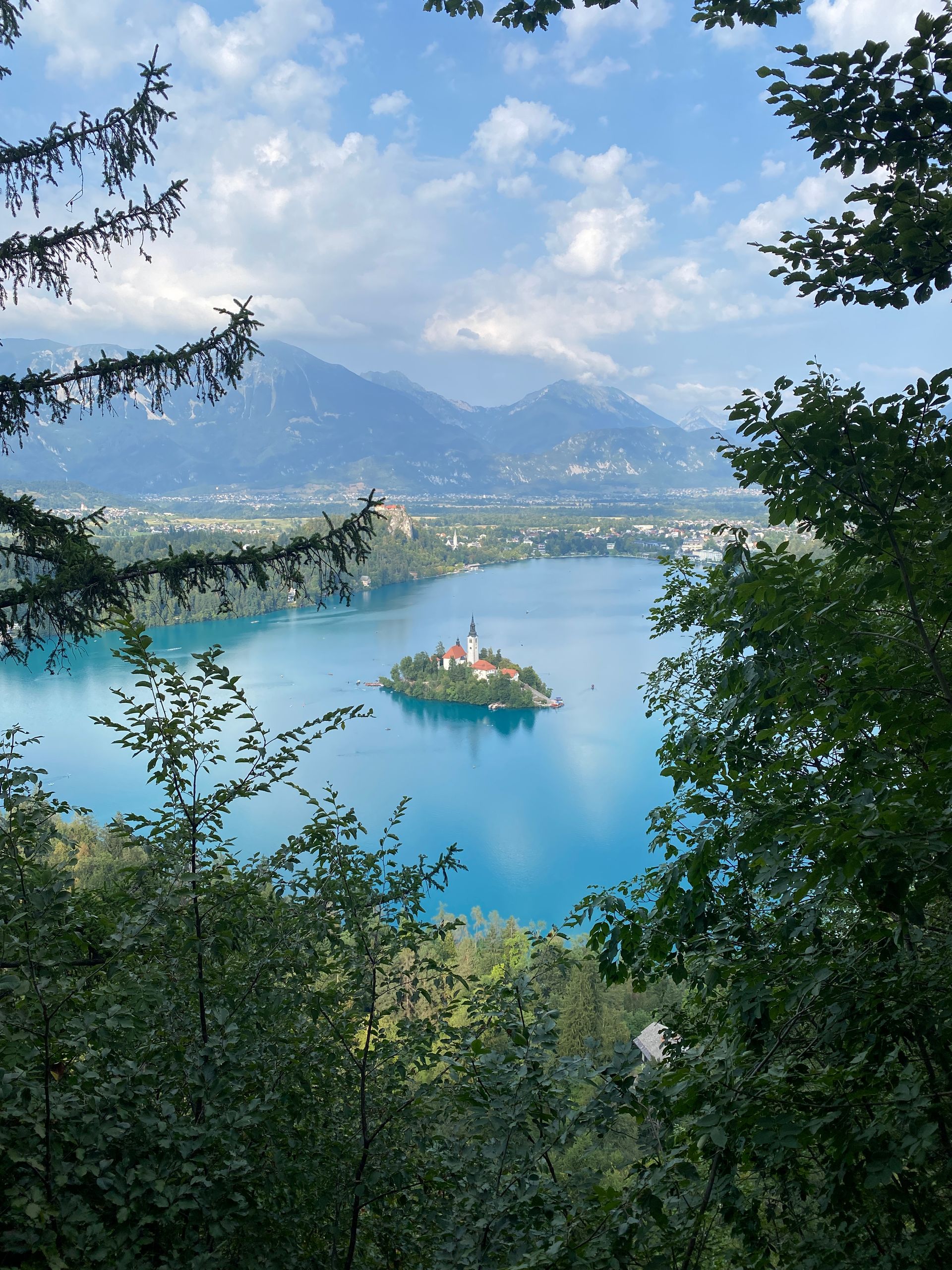
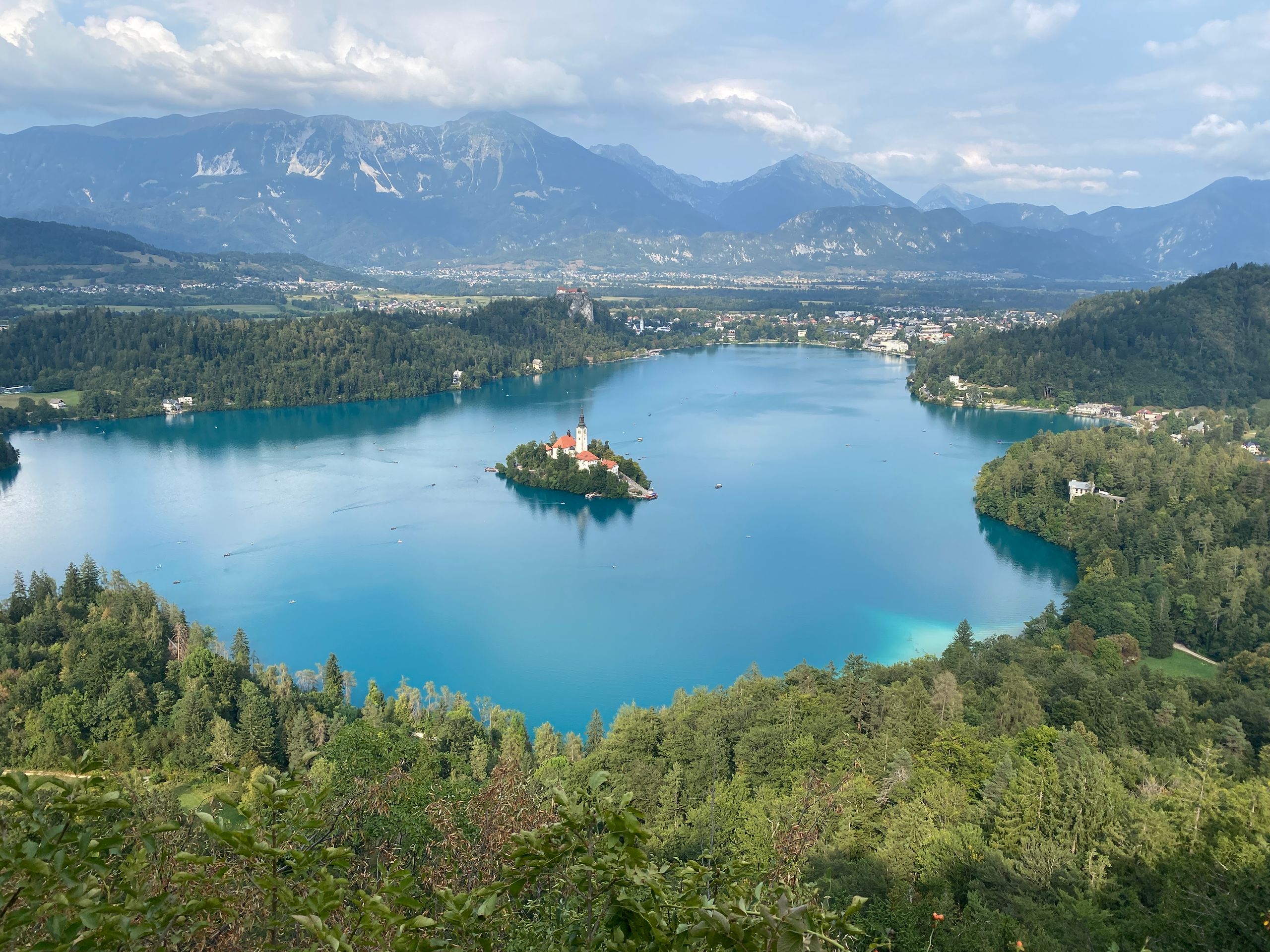
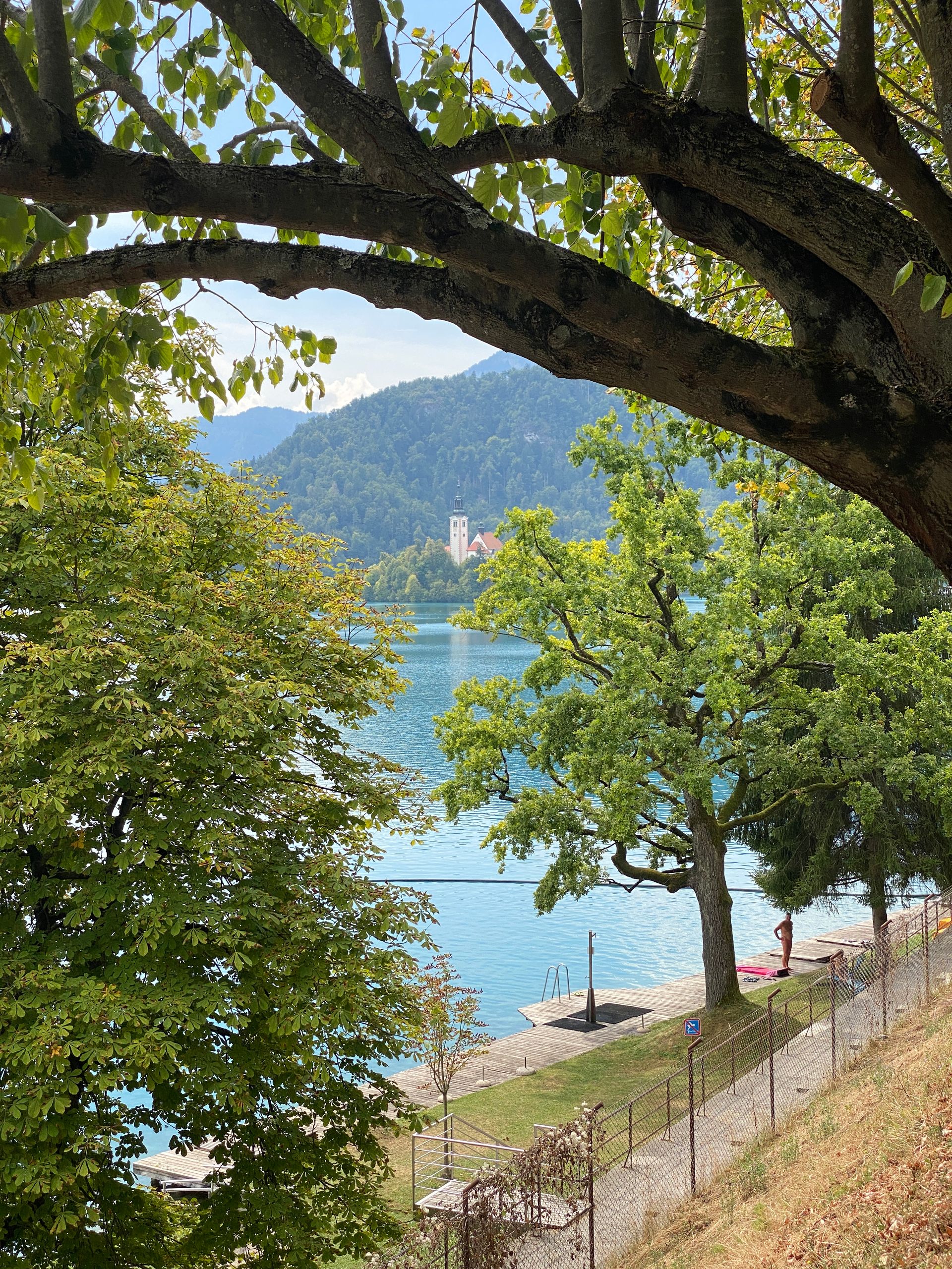
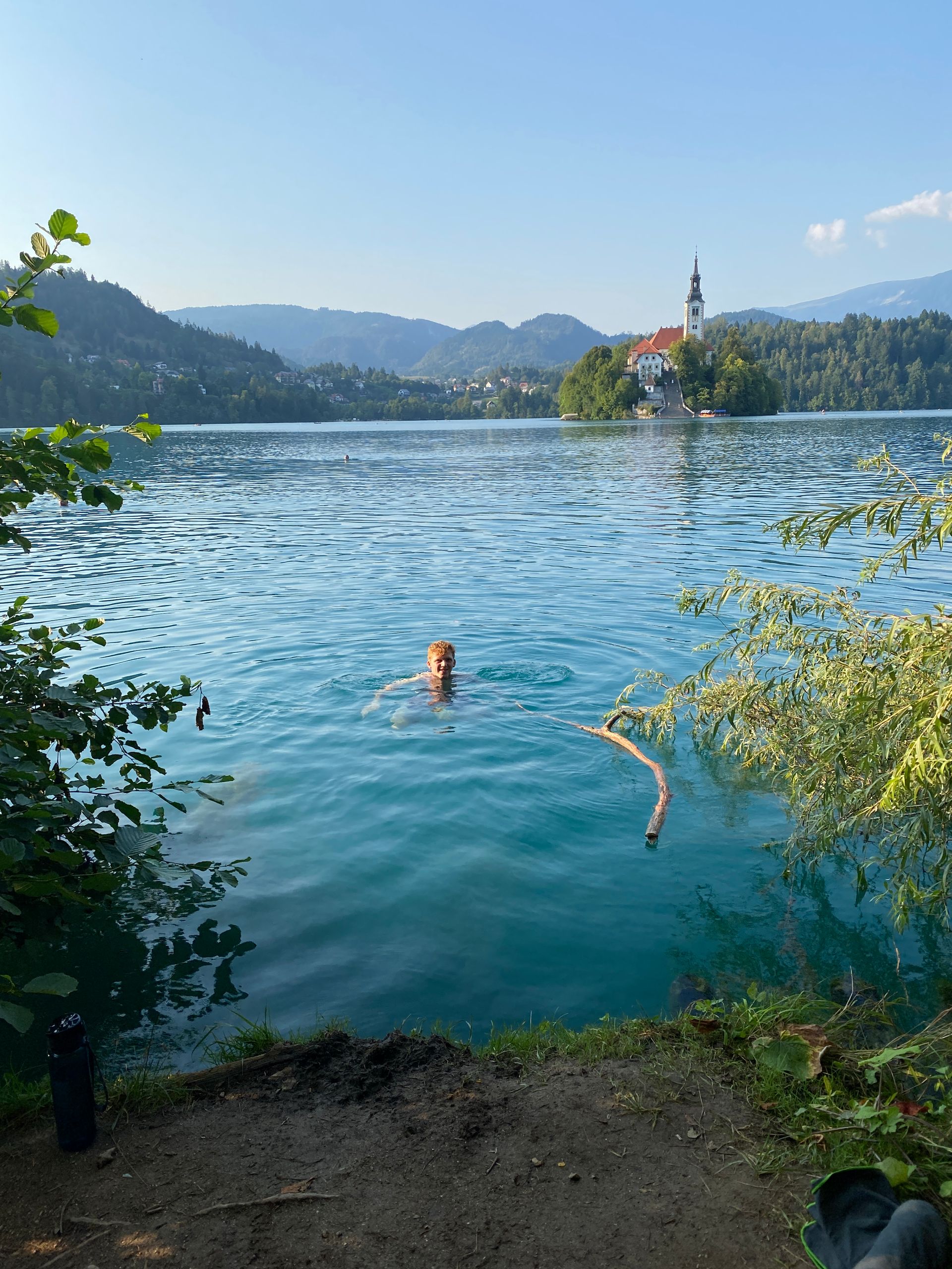
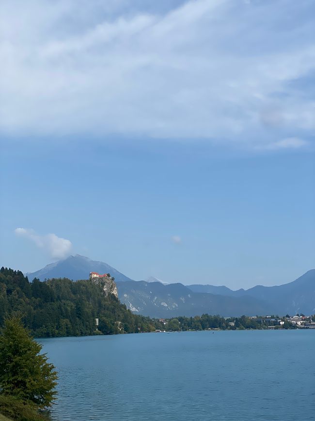
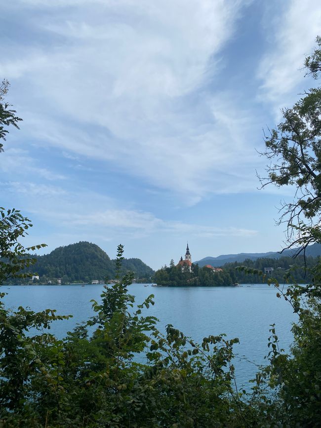
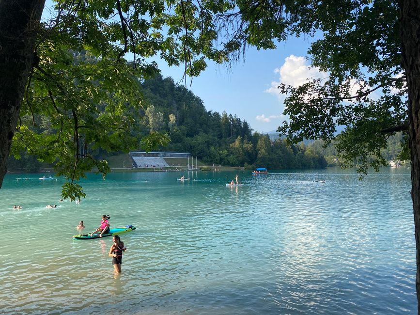
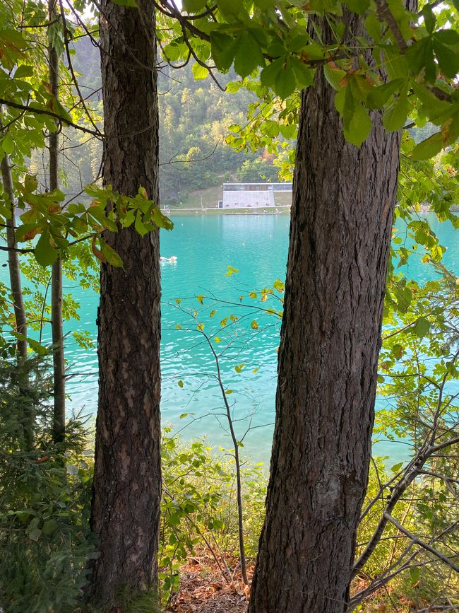
The lake is surrounded by a mountain panorama. On a mountain to the north stands Bled Castle. In the middle of the lake is a small island with a church. The island is surrounded by crystal-clear, turquoise water. In addition to its beauty, the lake is known for the numerous thermal springs that emerge on the eastern side.
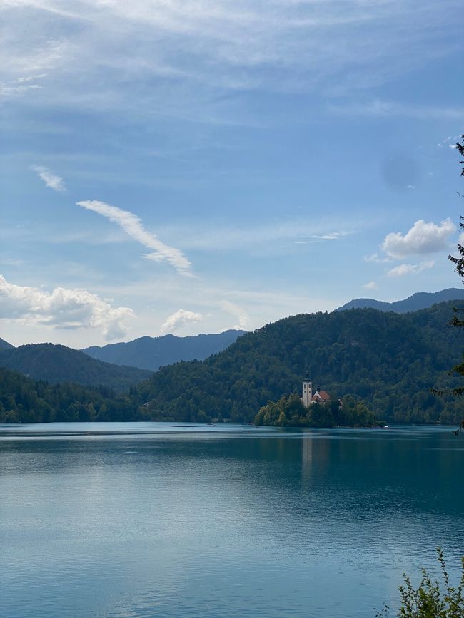
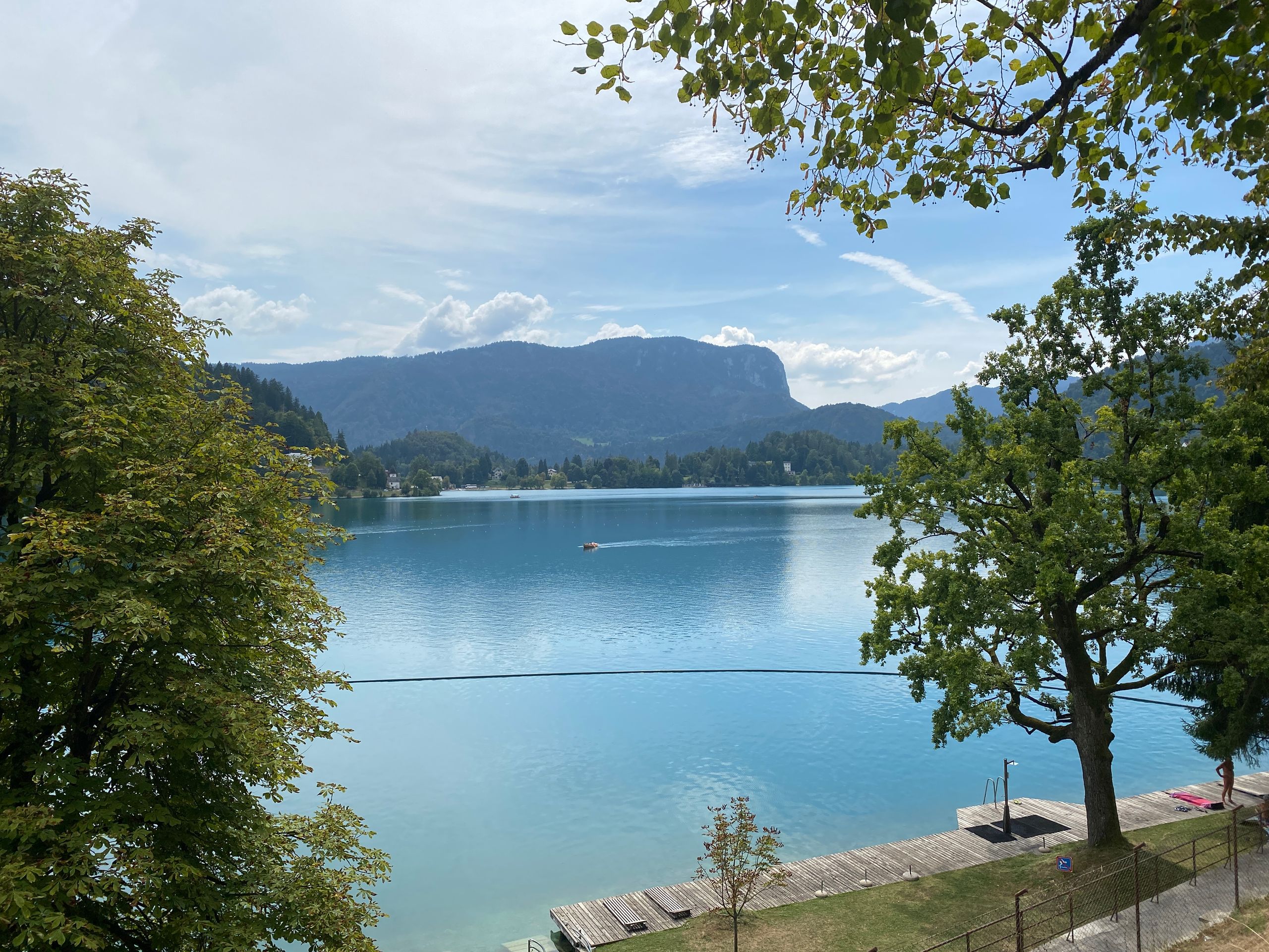
My tour began counterclockwise along a well-maintained path that I shared with several other tourists. From the edge of the lake, the church island was visible from picturesque perspectives several times.
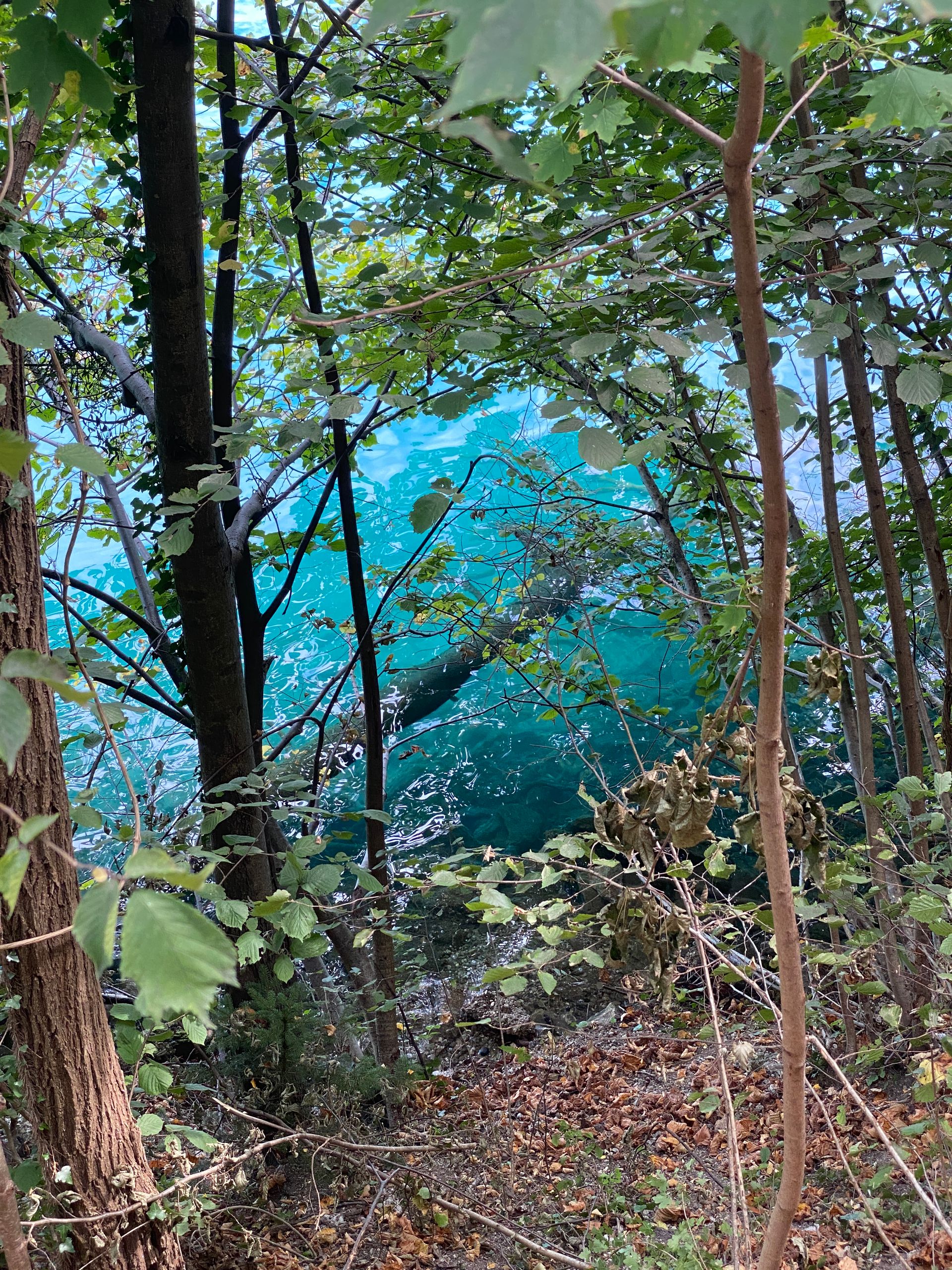
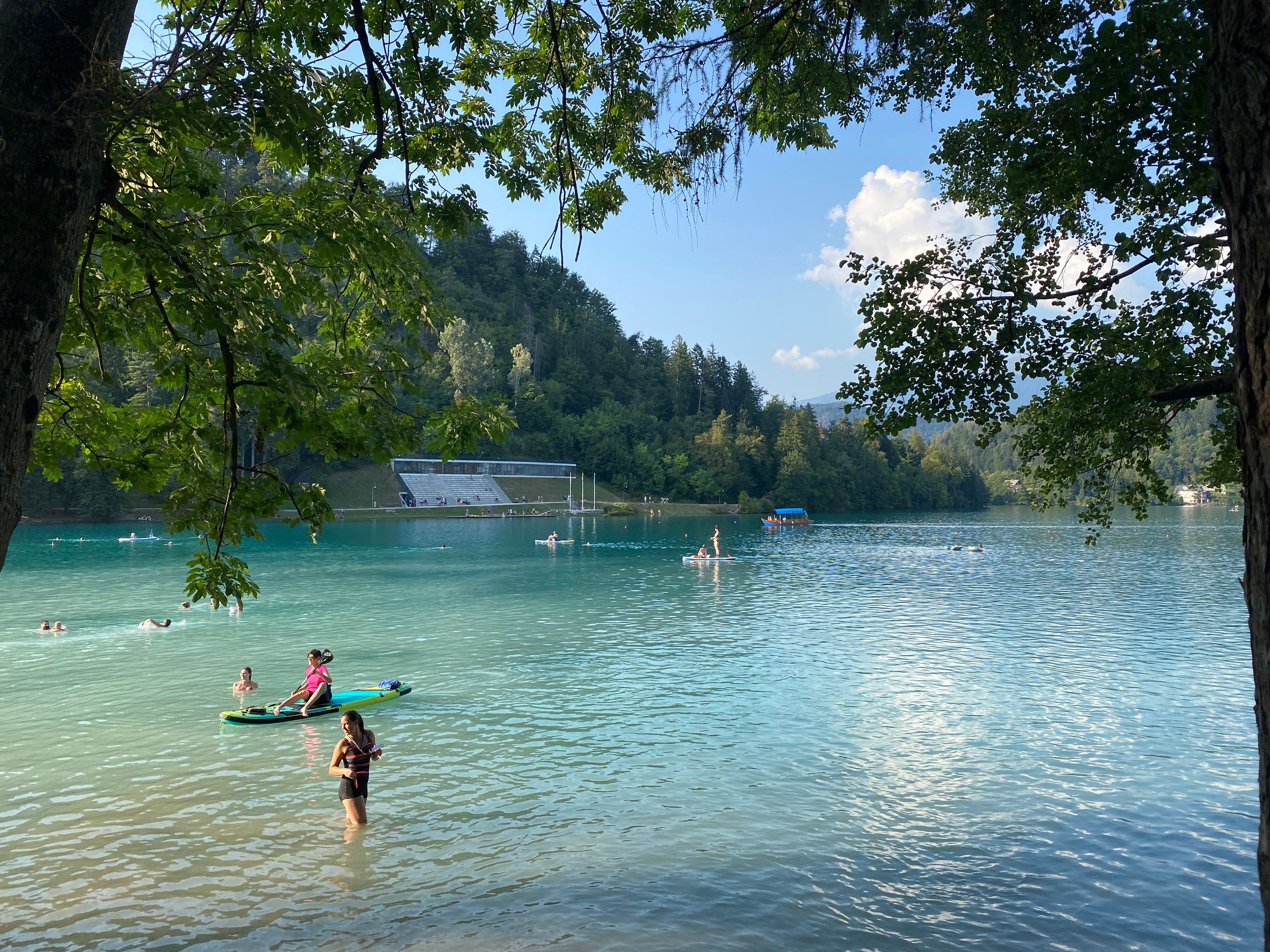
When I reached about halfway through the route, I went for a swim in the lake off the path. The water was a delightful 23°C warm, and since I was just a few hundred meters from the official bathing area, I swam in complete tranquility in front of the breathtaking backdrop.
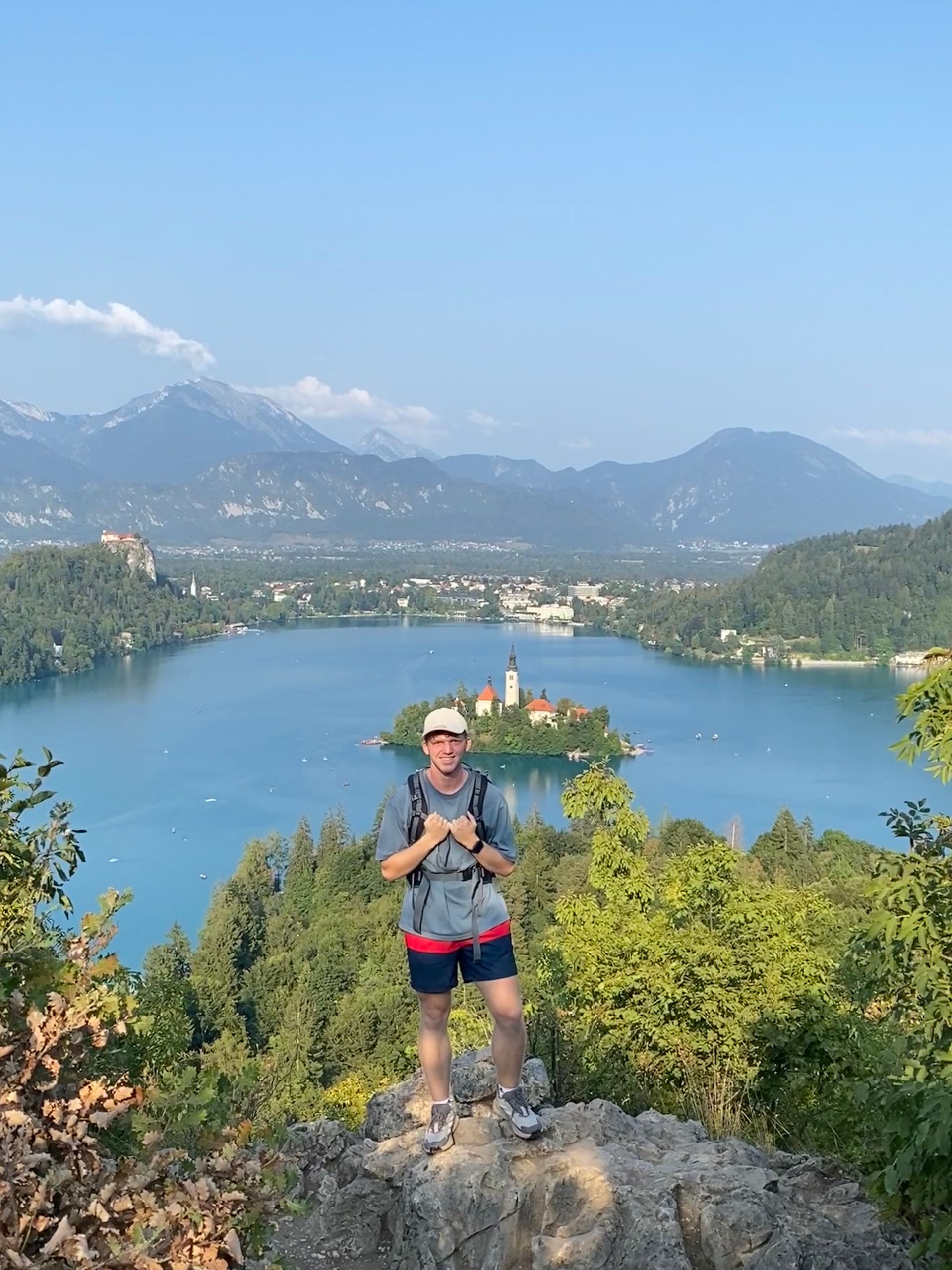
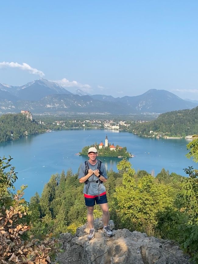
After the relaxing swimming break, the more strenuous part was to follow. As I saw on my hiking map, there was a mountain from which one could see the entire lake from above. The 685m high Osojnica was reachable via a short, thus very steep hiking path.
I arrived at the top completely sweaty, and a beautiful view over the lake opened up to me, which was definitely worth the effort.

However, since I saw another viewpoint in my travel guide with small rocks in the foreground, I was not completely satisfied and asked some hikers on my way down. Finally, at the foot of the mountain, someone was able to help me. This, however, meant that I had to undertake the same steep climb a second time. So when I was at the top for the second time, this time on a different hill of the mountain, the few clouds that had been there earlier had mostly cleared, and the island shone amidst the turquoise water.
There are two explanations for the formation of the island along with the lake: The first, scientifically proven, states that the lake was formed by a glacier. A rock is said to have stood in its way, which was worn down until only the present island remained. The ice melted and filled the lake with water.
The legend, however, states that the lake was once a green valley. In the middle stood a rock, where mountain fairies danced at night. In the valley, shepherds tended their sheep, which grazed the area around the rock. The fairies asked the shepherds to fence their rock so that they would have some soft grass left. However, the shepherds did not do this, causing the youngest fairy to break her leg. Therefore, the angry fairies summoned the springs and brooks from the surrounding mountains, so the valley filled with water, leaving only the island for the fairies.
In my view, the second version is the more accurate one for this fairytale landscape.
After my quite strenuous ascent, I was ready to jump into the water again. I watched individual swimmers who swam to the island, which was very tempting for me as well. However, since I was already quite exhausted and hadn't eaten anything substantial for a long time, I remained only near the shore for refreshment.

I started my way back to the bus stop and was able to take one last look at the lake as the sun was setting behind the mountains.
It was back to the accommodation by bus. In the hostel, I made the remaining spaghetti from the previous day for dinner.
নিউজলেটাৰ চাবস্ক্ৰাইব কৰক
উত্তৰ
ভ্ৰমণৰ প্ৰতিবেদন স্লোভেনিয়া